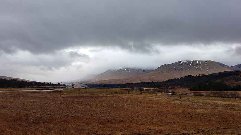
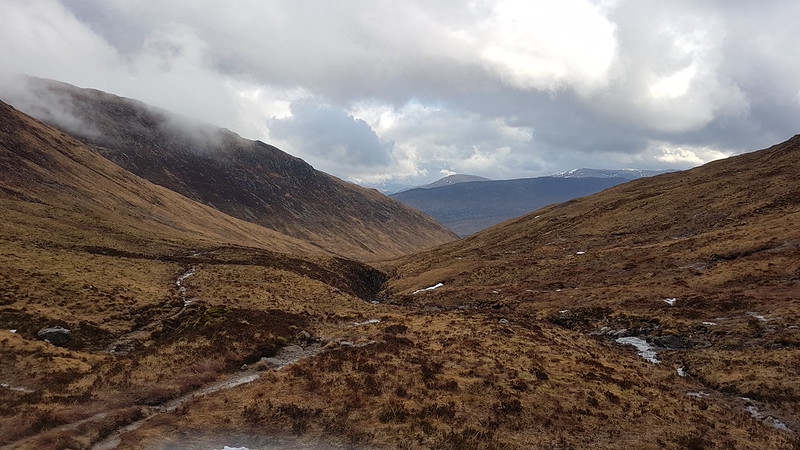
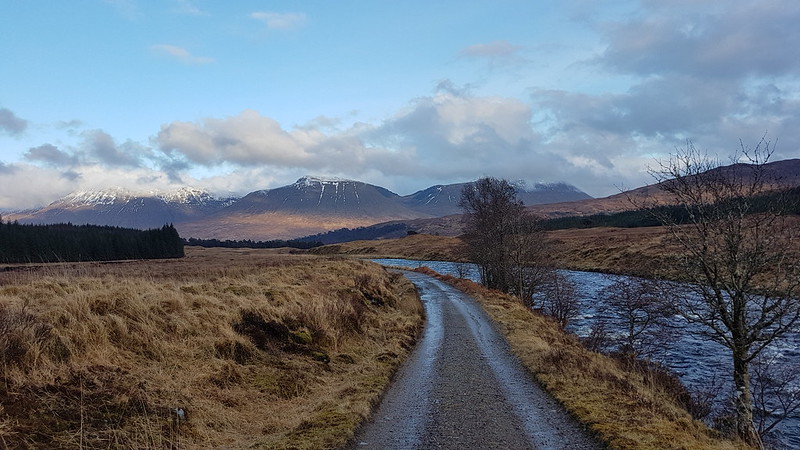
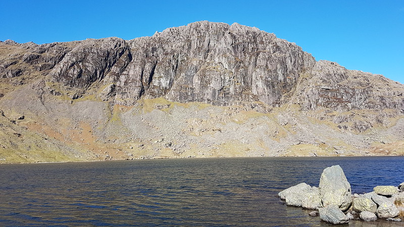
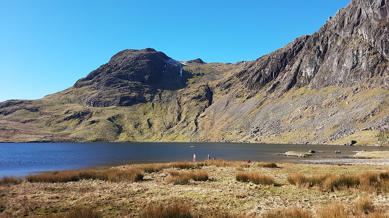
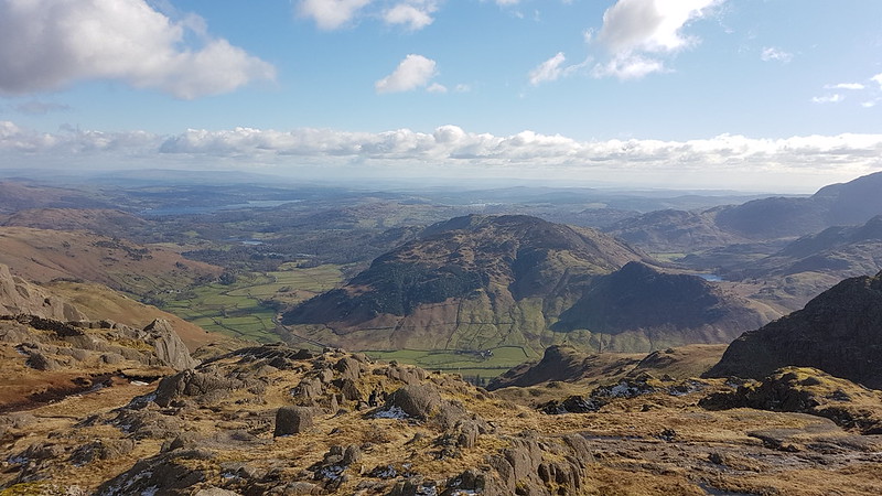
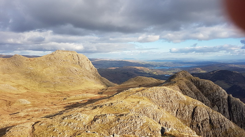
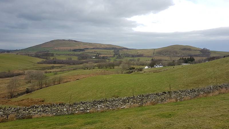
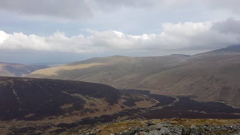
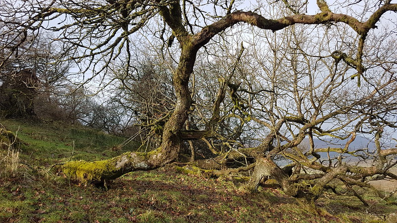
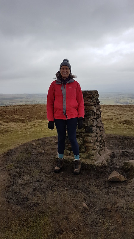
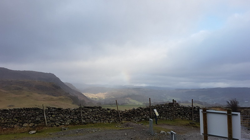
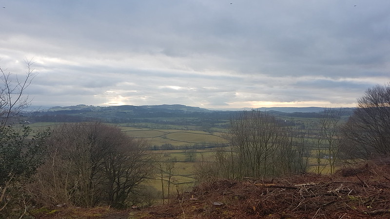
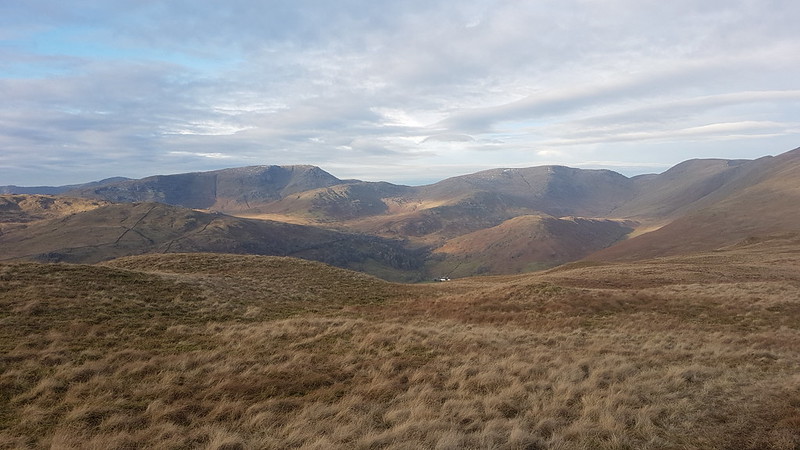
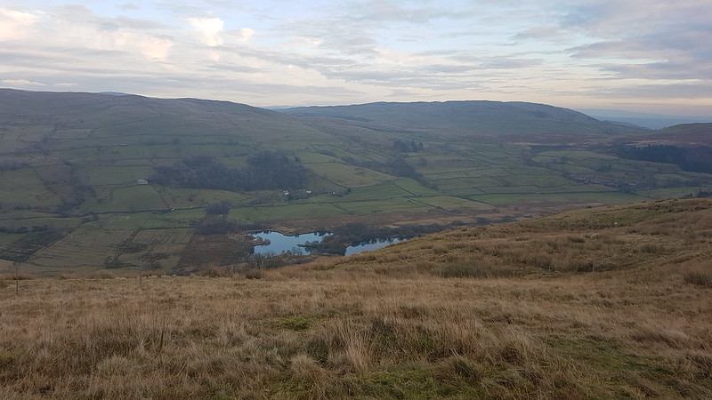
Loch Tulla, Beinn Achaladair and Beinn an Dothaidh.
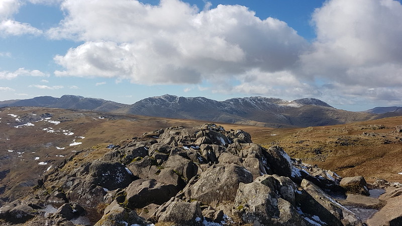
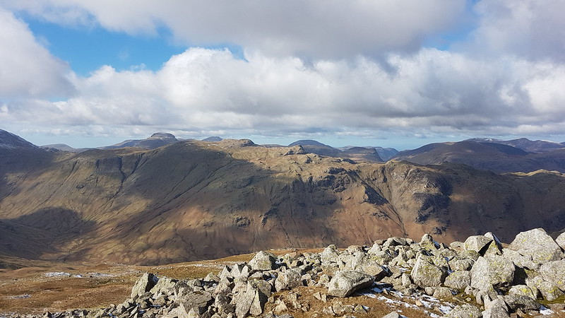
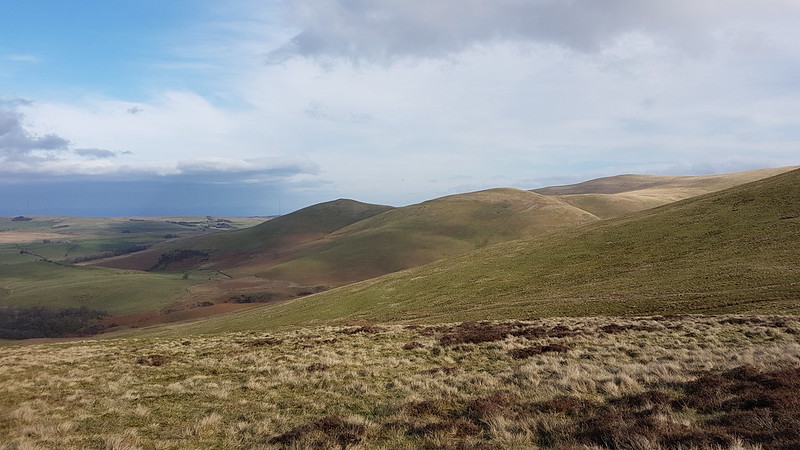
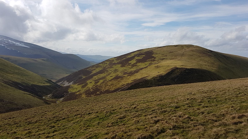
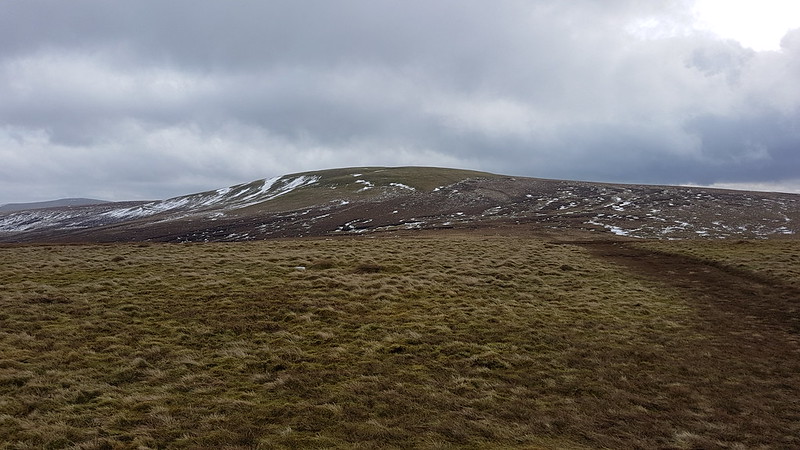
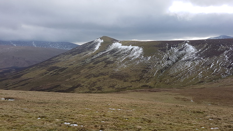
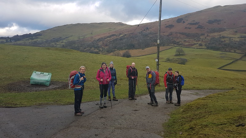
Our annual walking weekend in Scotland was back on the menu, after a Covid absence last year. On the Saturday, with a mixed forecast, but with the potential for clearing skies later in the day, most of the party were heading for Beinn Dorain and Beinn an Dothaidh, opposite our accommodation at the Bridge of Orchy Hotel. The Tower Captain and I had ticked those off on a previous visit, and he was keen for fresh ‘bags’, so instead, we parked down by Loch Tulla, intending to climb Stob a’ Choire Odhair and Stob Ghabhar.
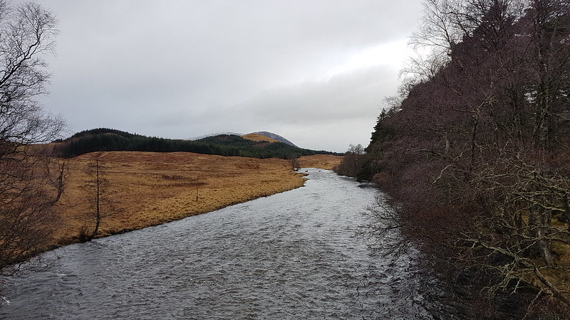
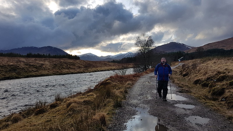
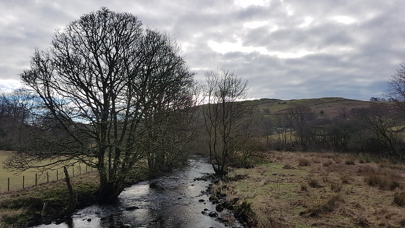
Abhainn Shira
As we were on the bridge over the Abhainn Shira, four Red Deer stags waded across up stream – you can just about see them in the photo.
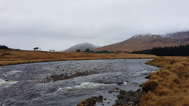
Abhainn Shiraand Araich
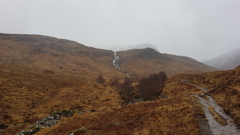
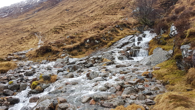
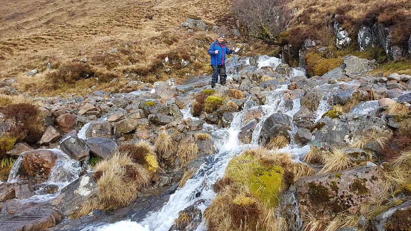
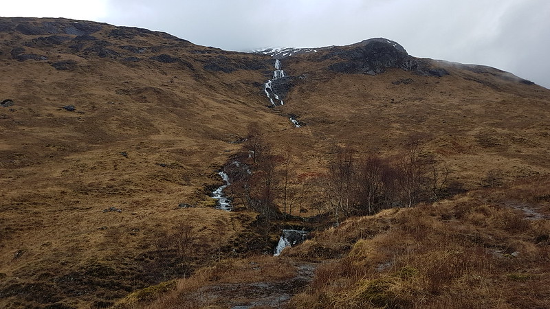
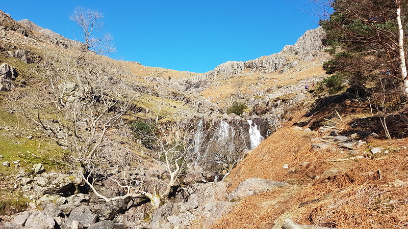
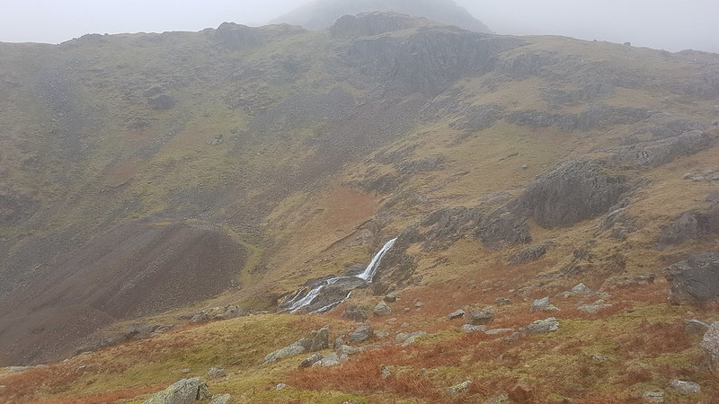
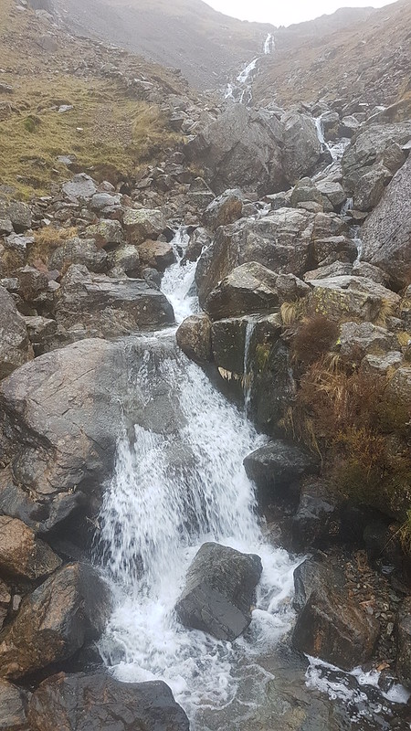
We started out in a light rain which quickly became a bit of a downpour. Not to worry, the scenery was still pretty spectacular despite the weather. Particularly the waterfalls…
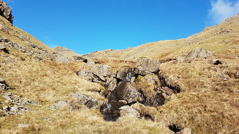
Allt Coire na Muic and Creag an Steallaire.
…of the Allt Coire na Muic.
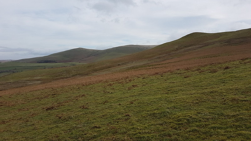
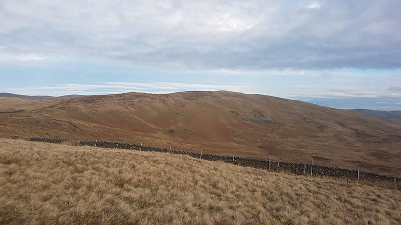
Aonach Eagach and Allt Toaig.
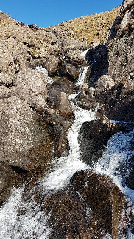
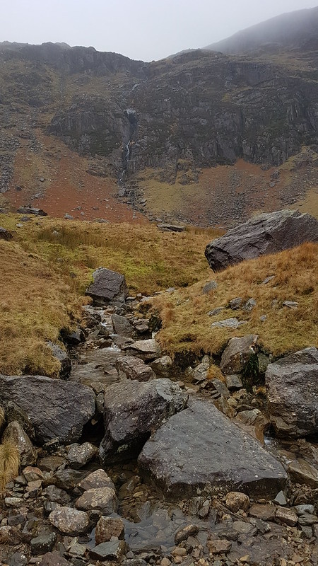
All of the streams seemed to be running pretty high, including the ones we had to cross…
Allt Caolain Duibh.
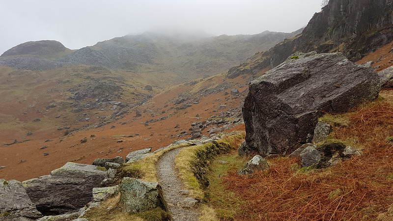
The ascent route has some excellent zig-zags, which took some of the sting out of a steep slope. The rain desisted, but we soon into the cloud and a fairly strong wind.
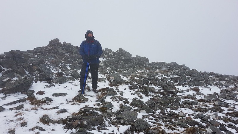
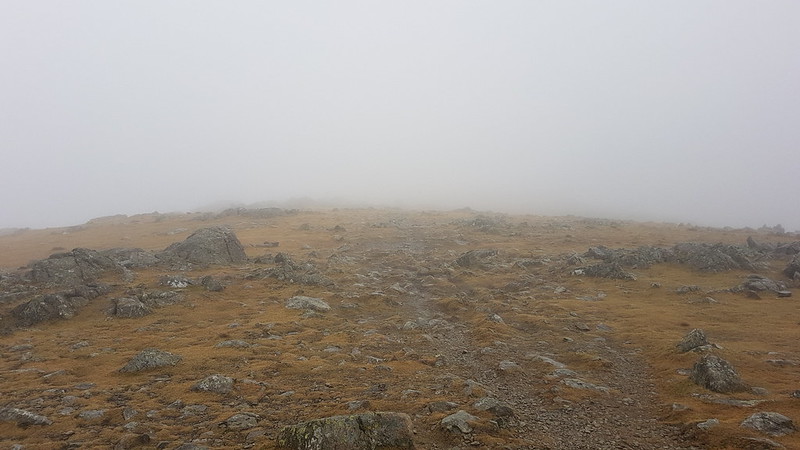
By the time we reached the top of Stob a’ Choire Odhair it was extremely windy, the sort of wind which has you staggering about, and the wind was driving icy precipitation – either soft hailstones or hard snowflakes – into every nook and cranny of our clothing.
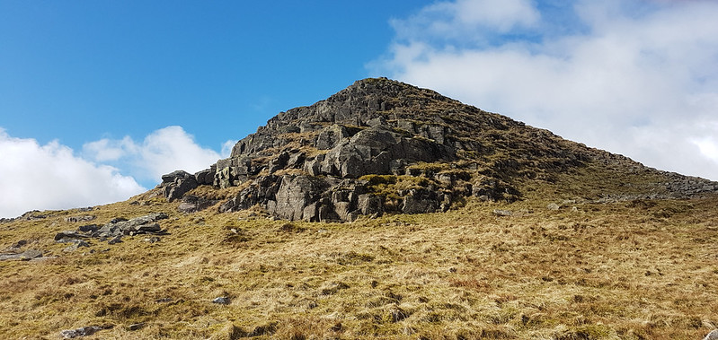
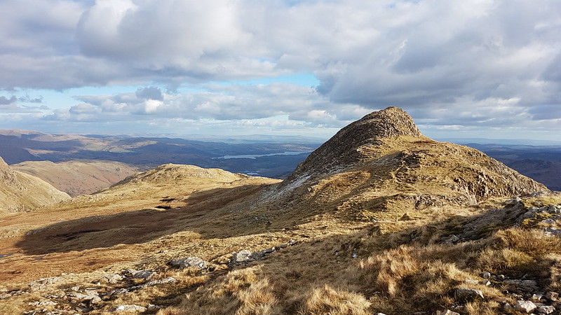
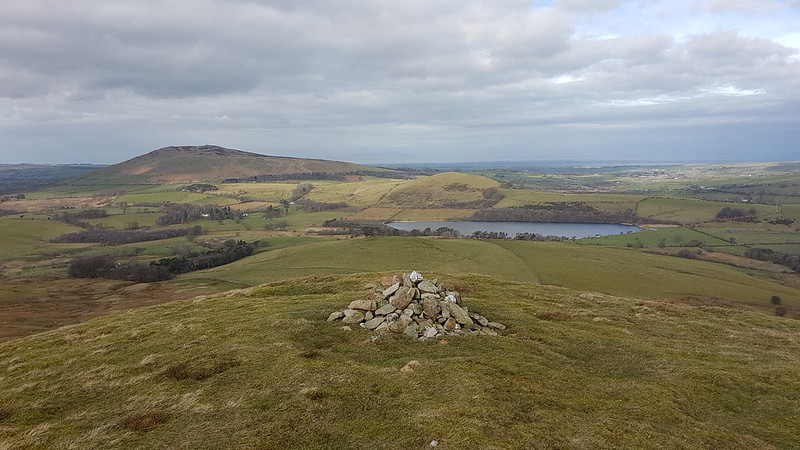
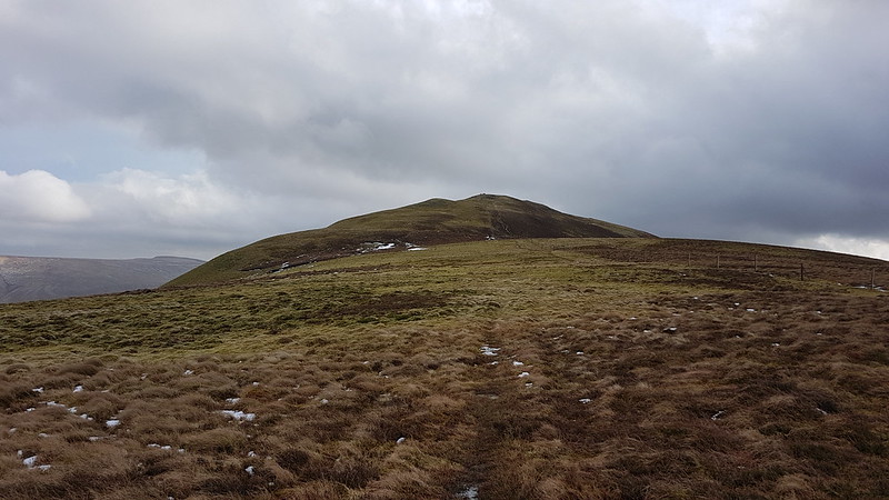
Stob a’ Choire Odhair.
It was pretty fierce, and given that our ascent had taken rather a long time, I wasn’t at all keen on continuing to Stob Ghabhar. I was quite surprised, when I mentioned this, that TC immediately acquiesced.
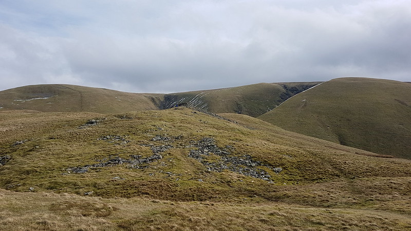
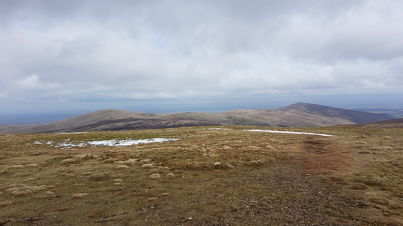
We decided to drop down the ridge towards Stob Ghabhar, giving us a slightly different descent route. At one point, we dropped down a fairly steep, rocky section of path and suddenly the howling gale was stilled. The absence of the noise and the buffeting felt quite odd. We took advantage of this sheltered haven and stopped for hot drinks and butties.
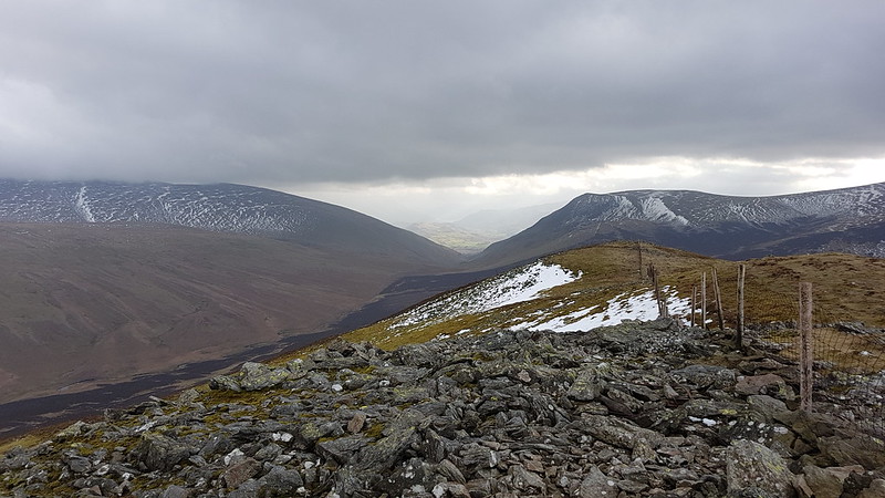
The bealach between Stob a’ Choire Odhairand Stob Ghabhar. TC mid-stagger.The onward ridge?
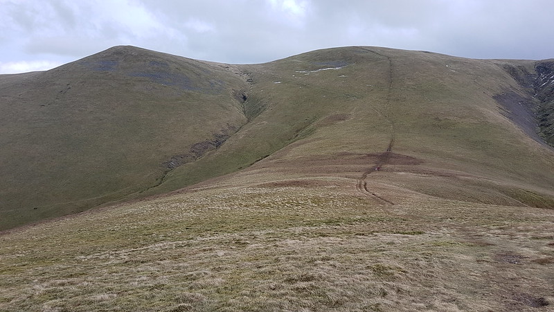
The respite was short lived however, as soon as we resumed our descent we were back in the powerful hold of the storm and staggering about again.
Allt Coirein Lochain.
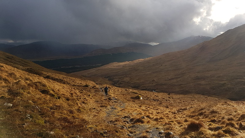
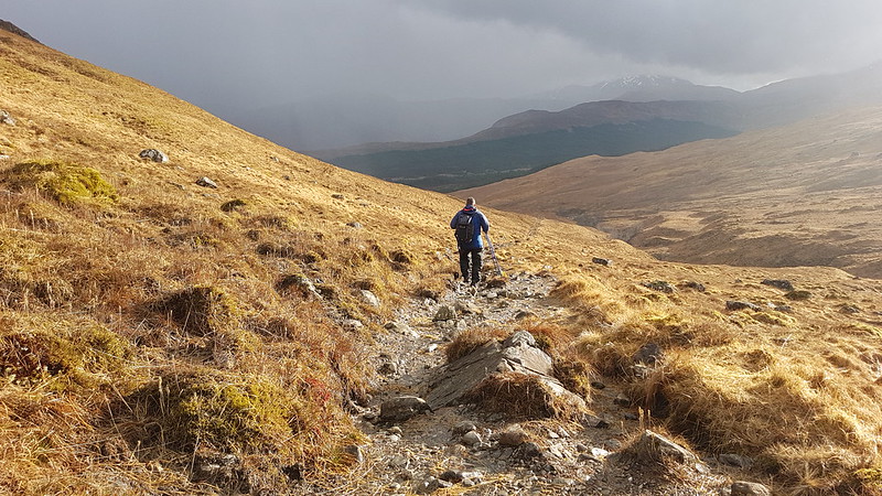
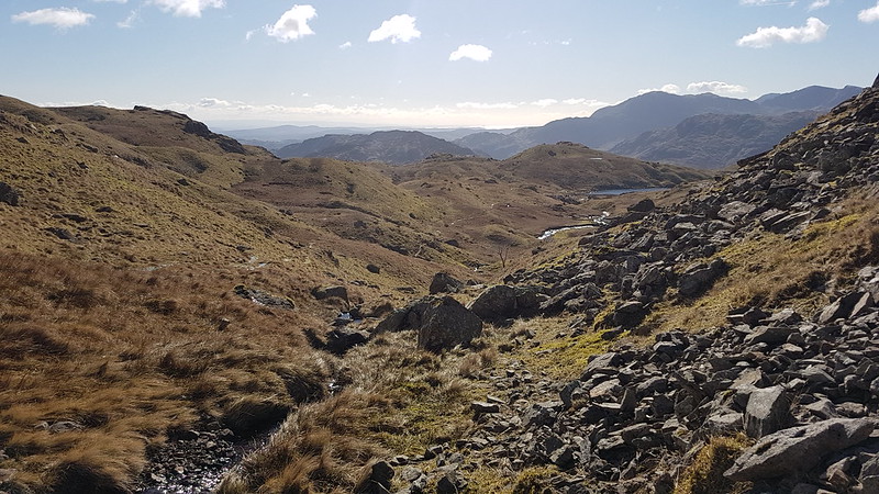
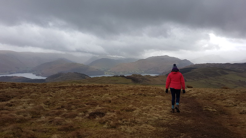
And then we dropped slightly below the bealach into Coire Toaig and relative peace and calm…
Coire Toaig.Aonach Eagach and Allt Toaig, again.The Tower Captain recrosses the Allt Caolain Duibh.Sunshining, but more weather to come.
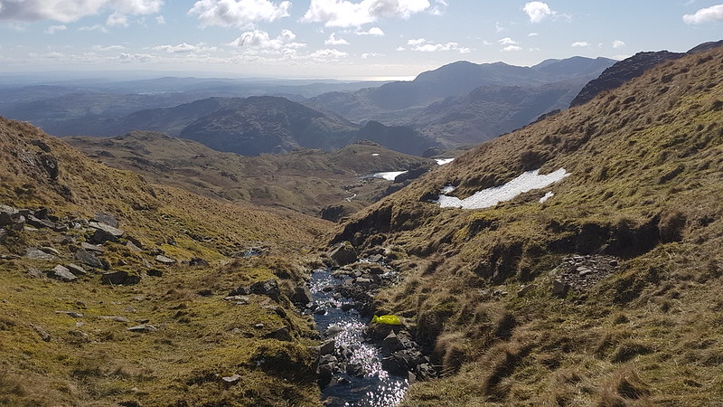
Despite the fact that we had a couple more showers, the descent was delightful.
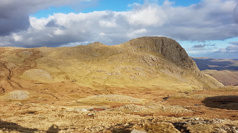
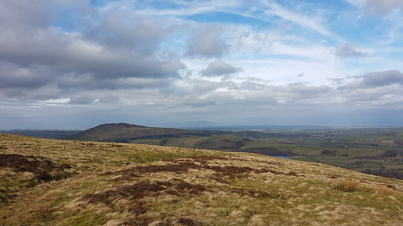
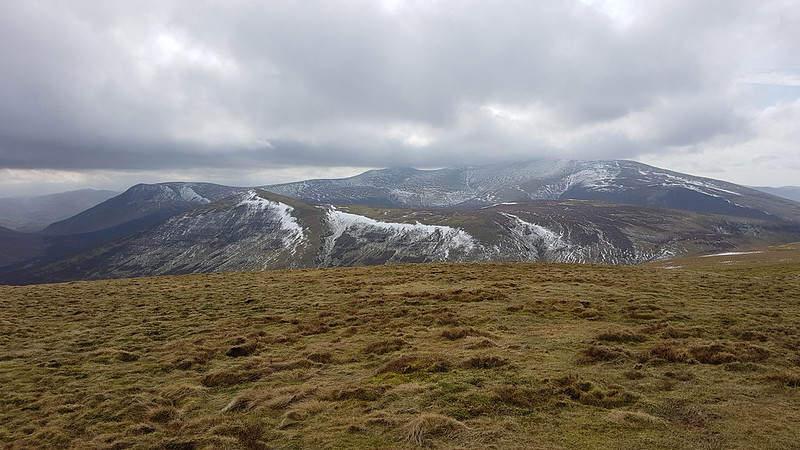
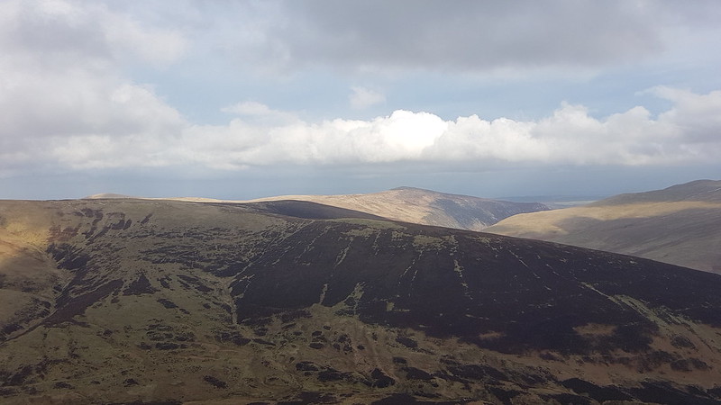
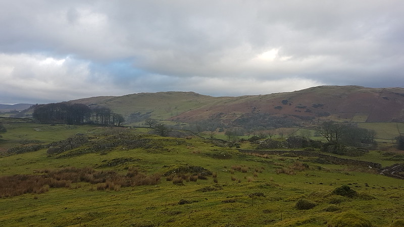
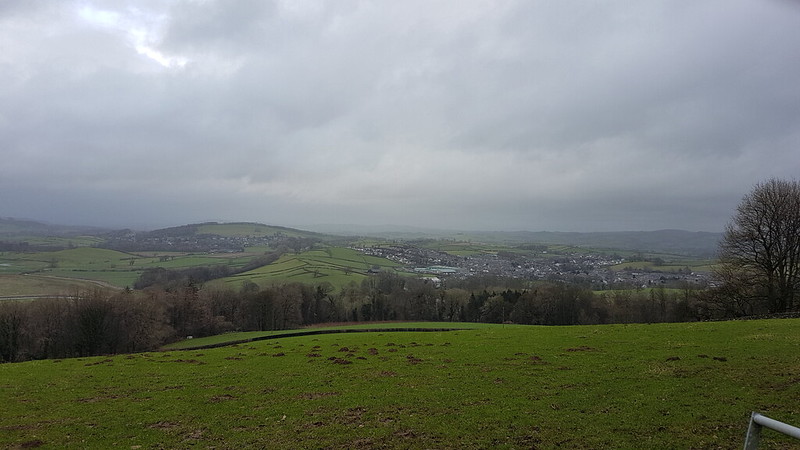
Allt Coire na Muic and Creag an Steallaire again.Beinn Achaladair, Beinn an Dothaidh and Beinn Dorain.
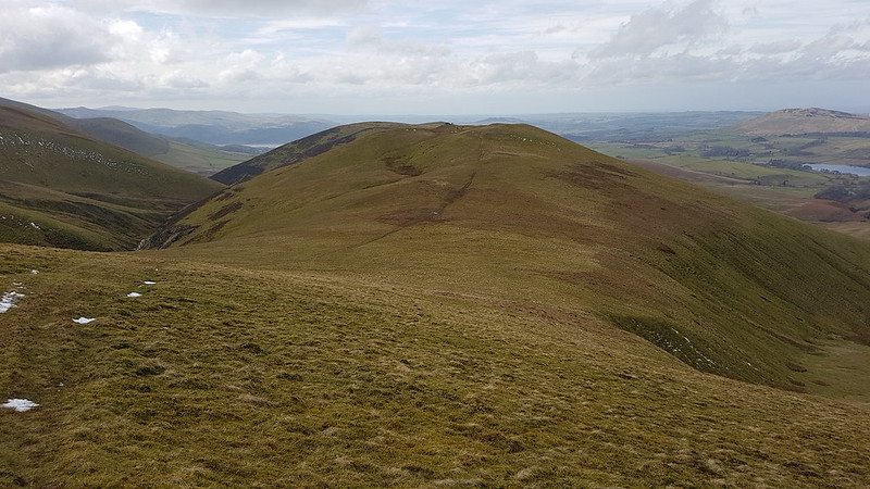
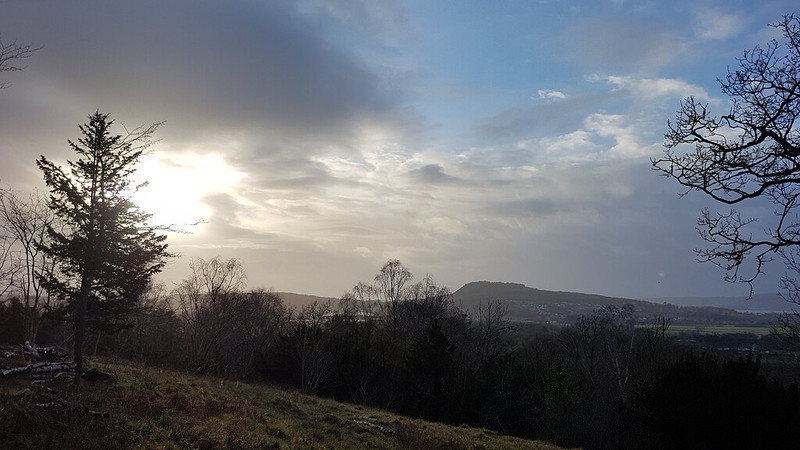
Our enjoyment was only tempered by the realisation that the others were probably enjoying superb views from their chosen hills, which had cleared and were bathed in sunshine, whilst our own route, or at least the higher part of it, remained stubbornly in the cloud…
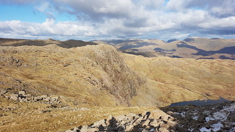
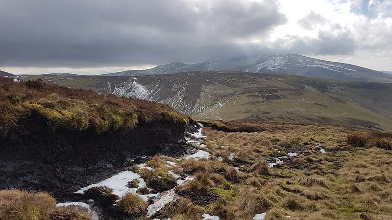
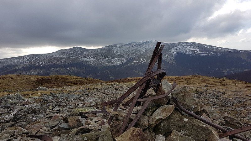
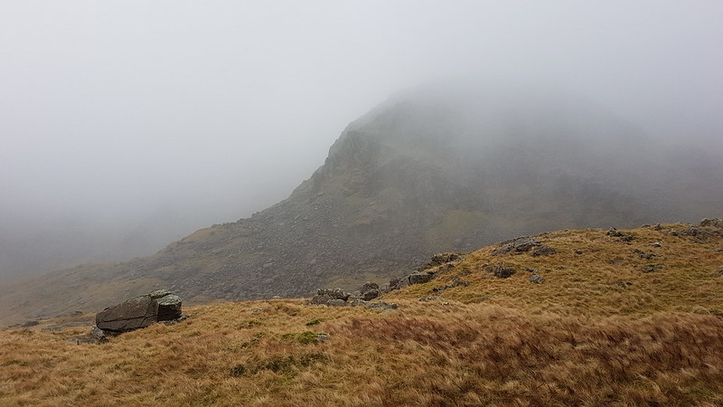
Stob Ghabhar – still in the cloud.
What’s the opposite of schadenfreude? Rather than pleasure found in the misfortune of others, pain occasioned by another’s good luck? Of course, the Germans have a word for it – Gluckschmerz, literally luck-pain. You can see that TC is upset by it here…
The Tower Captain following the Abhainn Shira.
Actually, I think we were both enjoying this part of the walk, now that it wasn’t raining and the views and scenery were rather good.
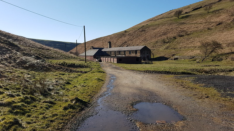
The shed behind TC is the Clashgour Hut, a corrugated iron monstrosity which belongs to Glasgow University Mountaineering Club. It’s bookable. Maybe it’s much more comfortable on the inside than the exterior suggested, but, frankly: rather you than me.
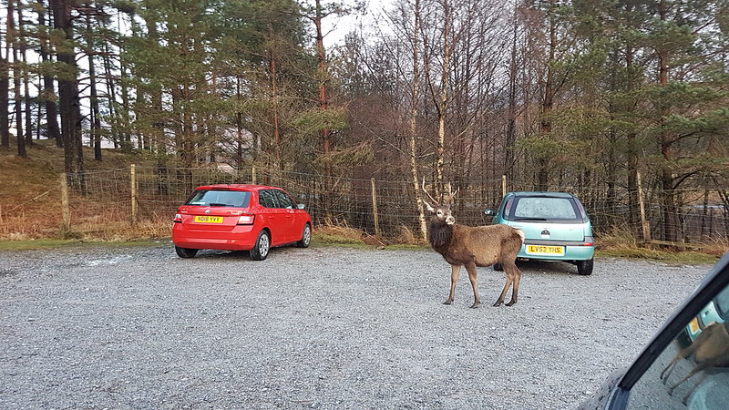
We saw a number of Red Deer stags as we neared the end of our walk, including one in the garden of one of the remote houses we passed.
Then, as we sat in the car gently steaming and finishing off the contents of our flasks, one wandered through the car park…
New Dungeon Ghyll Hotel – Stickle Ghyll – Stickle Tarn – Sergeant Man – High Raise – Thunacar Knott – Pavey Ark – Harrison Stickle – Loft Crag – Pike of Stickle – Mark Gate – New Dungeon Ghyll Hotel.
Stickle Ghyll
March arrived and brought with it some clear, blue skies. Time to get back to the Lakes! I didn’t get off particularly early, I can’t remember why, and was lucky to squeeze into a space in the National Trust’s New Dungeon Ghyll carpark at around ten. (Does everyone refer to the two Langdale pubs as the ODG and the NDG?)
Of course, Langdale is always going to be popular, especially with a good forecast, and there were a few people ahead of me on the path heading up Stickle Ghyll. Somewhat to my surprise, I gradually overhauled several groups and we leap-frogged each other up the path. Just in case I was getting ideas above my station however, a group of younger walkers caught up with me just short of Stickle Tarn and flew past as if I were barely moving.
Stickle Ghyll.Pavey Ark and Stickle Tarn.
Although the air was quite cold, in the sunshine I had warmed up well during the climb and was down to a t-shirt. Time to shove a few layers back on at Stickle Ghyll where, as well as a new, splendid view, we were exposed to a biting wind.
Harrison Stickle across Stickle Tarn.
Despite that very icy wind, a couple of people had changed into bathing costumes and were wading out into the tarn. One of them was protesting loudly and I’m not sure whether either of them actually swam. I’m sure it would have been extremely bracing.
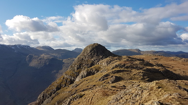
Pavey Ark again. Jack’s Rake fairly prominent.
I think the last time I did Jack’s Rake was on my first hike with TBH, so over 20 years ago. It looked popular today, as did the alternative route on the path up the eastern shoulder of Pavey Ark. I had been considering the latter as one possible onward route, but decided to head for Sergeant Man instead, since it looked like I would have the path to myself.
I did, and it was a marvellous route, a fairly faint path following a small stream above the valley of Bright Beck, not one of the paths on the map, which all head further east onto the Blea Rigg ridge. I think you can see the stream I followed on the map below, enclosed by a rocky rib on its western side. Eventually the path left that stream and headed across and up to meet the stream which drains the cluster of small tarns between Sergeant Man and Codale Head.
Anyway, I’m getting a bit ahead of myself: this….
…is the first of those becks. You can just see Sergeant Man left of centre. It was pleasantly sheltered here and I took advantage of that fact and stopped for a hot drink.
Looking back down to Stickle Ghyll from my brew stop.
The path kept splitting and got steadily fainter and harder to follow.
Approaching Sergeant Man.
Eventually, I lost the path and followed the stream which I presume flows out of the tarns.
Looking down the stream. Forest of Bowland and Morecambe Bay on the horizon. Gummer How quite distinctive in the distance. Lingmoor and Side Pike in the foreground. Wetherlam and the Coniston Fells on the right.Sergeant Man.
Eventually, I left the stream and the shelter that its banks offered, and took a direct route to the top. The crags are broken, but I enjoyed stringing a route together which stayed on the rock as much as possible and offered some easy scrambling.
Codale Head. Snow-capped Fairfield right of Codale Head.From Sergeant Man: Scafells, Bowfell, Esk Pike, Great End.Codale Head.Helvellyn ridge on the left, Fairfield to the right.
Codale Head is not a Wainwright, but is a Birkett. A bit like Sergeant Man, it isn’t exactly a prominent summit, but it is well worth a visit.
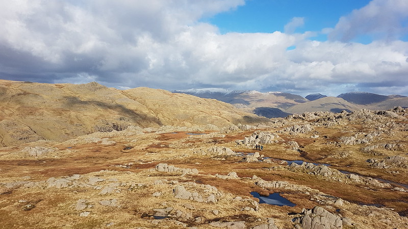
Eastern Fells from the slopes of High Raise. Esk Pike, The Scafells, Great End, Gable and Pillar from High Raise.
I know that High Raise is essentially a big lump, but it has a rocky top and always feels to me like its very central in the lakes. You can certainly see a lot of the area’s more distinctive hills from there.
High Raise summit cairn. Glaramara, Dale Head and the North-western Fells behind.Another High Raise view – North-western Fells, Bassenthwaite, Skiddaw, Blencathra.Crinkle Crags, Bowfell, Esk Pike, Scafell Pike, Great End, Great Gable. The ridge extending towards the camera is the Rossett Pike, Buck Pike, Black Crags ridge. You can pick out Lining Crag on the right of the ridge too.Glaramara.Looking back to Sergeant Man.And again, from futher away.Harrison Stickle from Thunacar Knott.Sergeant Man again from close to Pavey Ark. St. Sunday Crag prominent through Grisedale Pass.
After leaving Sergeant Man there was very little opportunity to find any shelter on High Raise or Thunacar Knott, but I had high hopes for Pavey Ark – well justified high hopes as it turned out. I dropped just a little way below the top, on the Langdale side, and was soon out of the cold wind and enjoying the sunshine, the views, a hot drink and possibly even a moment’s snooze. I think I sat there for almost an hour. A very peaceful hour.
Langdale, Lingmoor and Side Pike. Blea Tarn just visible on the right. Windermere in the distance.
It felt quite warm out of the wind, but just after finally setting-off again I slipped on verglas and found myself sitting in a puddle. One sleeve and the seat of my pants were wet, but fortunately only my pride was hurt. There was a fair bit of ice about and I ought to have payed more attention to this slip.
Harrison Stickle.Looking back to Pavey Ark.
There seemed to be several paths between Pavey Ark and Harrison Stickle, weaving their way through the craggy terrain. I chose to stick close to the rocky edge and then found myself on a good path which contoured around on to the south facing side of Harrison Stickle, i.e. the steep face. When that path seemed to be losing height, I looked up to the crags on my right and spotted a small chimney which seemed to offer an easy route upwards. I climbed up to a wide ledge and then started to shin up the chimney. My legs aren’t as flexible as they once were, and in trying to lift my right boot just a little higher to reach a toehold, I shifted my weight and ….off I went. I didn’t fall far and landed on my feet, back on the broad ledge. I wasn’t hurt, but I was a bit shaken. Now I had to choose between two unpalatable options – backtrack down to the path, or have another go at the chimney. The chimney still looked very easy, especially now that I had rehearsed my moves, and in the end I decided to give that a second try, with a bit more circumspection. In fact, it was very easy. What’s-more, once up the chimney I was very nearly on the summit.
On the summit I met a party of three ladies whom I’d been following up the Stickle Ghyll path. They’d been walking faster than me, but stopping more often, which meant that I kept catching-up with them, whereupon they would set-off again. If they’d overheard my colourful response to slipping off the crag just below, they didn’t show any signs of disapproval!
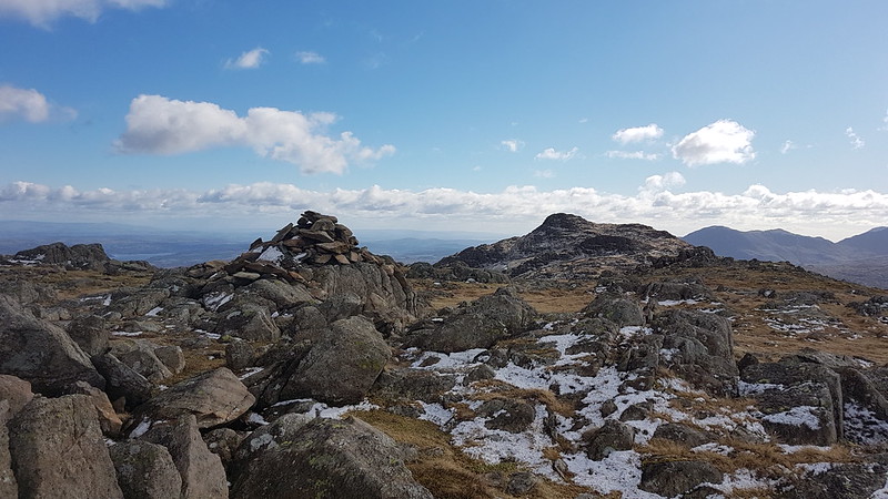
Harrison Stickle from the west.Pike O’Blisco. Coniston Fells behind.Pike O’Stickle from Loft Crag.Harrison Stickle, Loft Crag and Windermere from Pike O’Stickle. With intruding finger.Loft Crag.Harrison Stickle.
Some hike stats: MapMyWalk gives a little under 7 miles (before my phone ran out of juice), and 830 metres of ascent.
More importantly, seven more Wainwrights ticked off: Sergeant Man, High Raise, Thunacar Knott, Pavey Ark, Harrison Stickle, Loft Crag, Pike O’Stickle.
Even more importantly – an absolutely cracking day out.
(I had planned to extend the round to take in Rossett Pike, but by the time I got to Loft Crag, with clouds accumulating overhead, that seemed like a long way away, and I took a more direct route back to my car instead.)
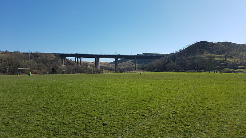
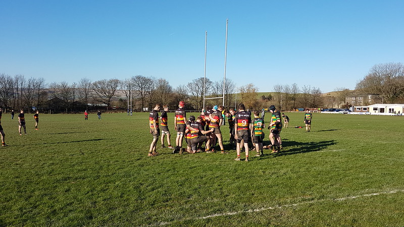
When we used to drive to Cockermouth or Penrith or Giggleswick or Grassington for B’s rugby matches, I thought that it was sometimes a bit far to go for a game – your average local football league, for instance, would have plenty of teams within spitting distance, but rugby seems to be a bit different. Now, however, the fixtures are nearly always even further afield, so it’s good that the club provide a coach.
This fixture was at Littleborough, which is appended to the north-east of Rochdale, which is, in turn, appended to the north-east of Manchester. To get to the ground we’d driven around Hollingworth Lake, which on this gloriously sunny February Sunday was thronged with day-trippers. The coach driver had done a sterling job getting along the very minor road and especially across an awkward bridge into the car-park.
The team always need to be there early, for phsyio and strapping, a warm up, presumably a team talk, so there’s always time to kill before kick-off. I try to get out for a wander if I can.
M62 bridge.Longden End Brook.
Once under the motorway, I climbed alongside Dick Hill until I met a track which sloped back down into the valley.
Looking back to the motorway. Hollingworth Lake visible behind.Looking up the valley again – I’m heading down towards the buildings in the middle of the picture.M62 again.
The area is criss-crossed by paths (including one right through the pitches at the rugby club!) There were lots of people out walking, running or cycling. The bridge looked very handsome, the pennine hills and valleys looked very handsome, it was all rather lovely. I think the sunshine helped a lot!
An old mill? Now a farm house or farm building.
Blackstone Edge, on the Pennine Way, is nearby and I’d hoped we would get to Littleborough early enough for me to get up there for a nostalgic visit, but it wasn’t to be. Never mind, I enjoyed my short stroll immensely.
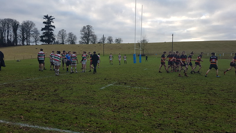
And the match? The lads won again, which took them one step closer to winning the league.
That’s B, about to pack down at tight-head (Kirkby are in the red, black and yellow). Like walking, watching rugby is much more pleasant when the sun shines!
After my great start in January, February had almost sneaked past without so much as a single tick. Time for some rearguard action, and some hills to the north of Skiddaw which were all new territory to me. I parked near Peter House Farm, having failed to find somewhere closer to the village of Orthwaite. That meant that my route started with a bit of a road walk, but it was a very quiet lane, so not really a hardship.
Little Calva and Bakestall. Whitewater Dash just about visible between.Fantastic display of Snowdrops at Horsemoor Hills.Skiddaw massif. Ullock Pike in the centre, North-Western Fells on the right.Binsey and Latrigg.
Binsey is another Wainwright which I’ve never climbed. It dominated the view for much of the early part of the walk and looked, I thought, well worth a visit.
Longlands Fell, Lowthwaite Fell, Little Cockup.
After Orthwaite Bank (a Birkett), I diverted to take in Little Cockup – another Birkett and one of those on his list which look totally underwhelming on the map, but which turn out to be great viewpoints.
Bakestall, Skiddaw, Ullock Pike.Little Cockup ‘summit’ cairn. Binsey, Latrigg, Over Water.Great Cockup from Little Cockup.Longlands Fell, Lowthwaite Fell, Brae Fell.Binsey. Criffel beyond the Solway Firth behind. Skiddaw – briefly out of the clouds.From Great Cockup – Meal Fell with Little Sca Fell and Great Sca Fell behind.
Between Great Cockup and Meal Fell is the steep-sided pass of Trusmadoor, where I was hoping to find some shelter from the strong winds. I did, to a certain extent, and stopped for a drink a bite to eat.
Looking back to Great Cockup.The summit shelter on Meal Fell.
A party huddled in the summit shelter were very welcoming and offered to make room for me, but since it wasn’t long since I’d stopped I was keen to keep going.
Great Cockup from Meal Fell.Little Sca Fell and Great Sca Fell.
Little Sca Fell is another Birkett, so I took the path which cut up to the left to include that in my round.
Looking back to Meal Fell and Great Cockup.Skiddaw from Great Sca Fell.
I’d been a bit surprised and impressed with how dry the ground had been to this point, but that was all to change from Great Sca Fell onwards, with a lot of fairly boggy going to come. Having said that, although it was very windy and wet underfoot, I was below the clouds, it wasn’t raining and after Great Sca Fell I only met one other walker. I was enjoying the wide open spaces and the seclusion.
Knott.High Pike and Carrock Fell.Lonscale Fell, Great Calva, Skiddaw, Little Calva.
From Knott, there was the potential to take a path down towards the car, which had been one possibility I’d contemplated, but once I’d seen Great Calva, my mind was made up: I was smitten and definitely for continuing.
Hoping to find a bit of shelter from the wind I struck away from the path, with the wind at my back and found a steep and quite high peat hag which offered pretty good protection from the breeze for another drink and butty stop.
Peat Hag shelter.Great Calva.Great Calva.Skiddaw from Great Calva.
Great Calva didn’t disappoint with a rocky summit and great views over the empty spaces of Skiddaw Forest.
Blencathra in the cloud, Lonscale Fell. Bowscale Fell across Skiddaw Forest.Carrock Fell.Looking back to Knott.
The less said about Little Calva, however, the better. It was bogtastic.
Somewhere in the vicinity of the top of the Whitewater Dash waterfall my phone’s battery conked out. So I have no photographs of that highly impressive falls. Also none from my journey home, when the skies cleared and the light was glorious.
The battery running out of steam also means that MapMyWalk didn’t complete my loop. I will guestimate that the full distance was around 18km, so between 11 and 12 miles. It also gives about 760m metres of ascent, which I think checks out pretty accurately.
To complete the hike stats:
Five Wainwrights: Great Cockup, Meal Fell, Great Sca Fell, Knott, Great Calva
Nine Birketts: Orthwaite Bank, Little Cockup, Great Cockup, Meal Fell, Little Sca Fell, Great Sca Fell, Knott, Great Calva, Little Calva.
If I’d been a bit more thorough with my planning in advance I might easily have included Frozen Fell and Burn Tod for two more Birketts, but not to worry, I’ll just have to go back at some point.
Not sure what happened during the first half of February. Rain probably; by the bucketload. The most significant thing to happen over half-term is that my parents came to visit, which was terrific – it had been a long while since we had seen them.
I think we had some mixed weather that week, but I managed to get out for several local walks and even saw some blue skies and sunshine.
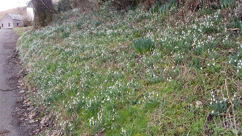
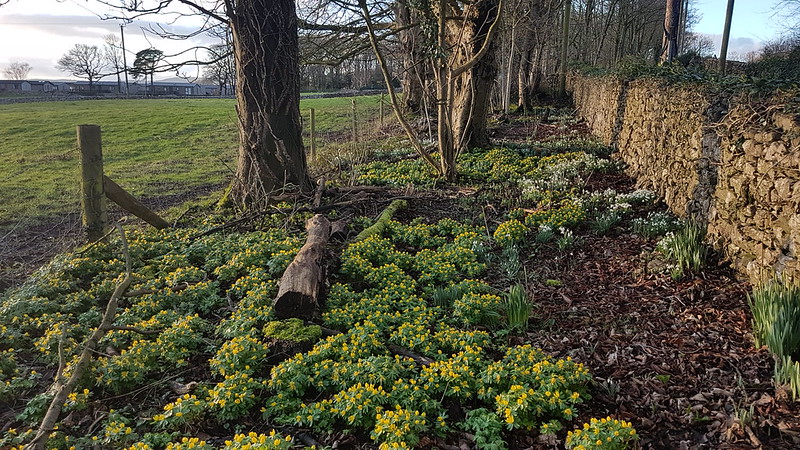
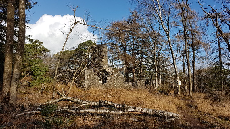
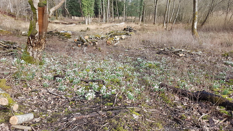
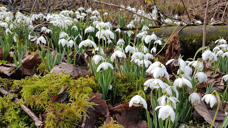
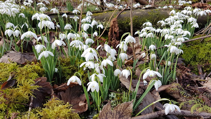
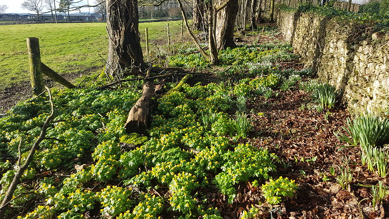
View from Castlebarrow.Winter Aconites and Snowdrops.Snowdrops in Eaves Wood.Eaves Wood.The ruined cottage in Eaves Wood.Hawes Water.
I wondered whether all the tree-felling by Hawes Water would affect the Snowdrops there, but fortunately it doesn’t seem to have had any impact.
Snowdrops.
I know this second photo looks much the same as the first, but there’s an insect on one of the flowers in the centre of the photo. Perhaps a drone fly. I thought it was pretty unusual to see a fly outside in the middle of February.
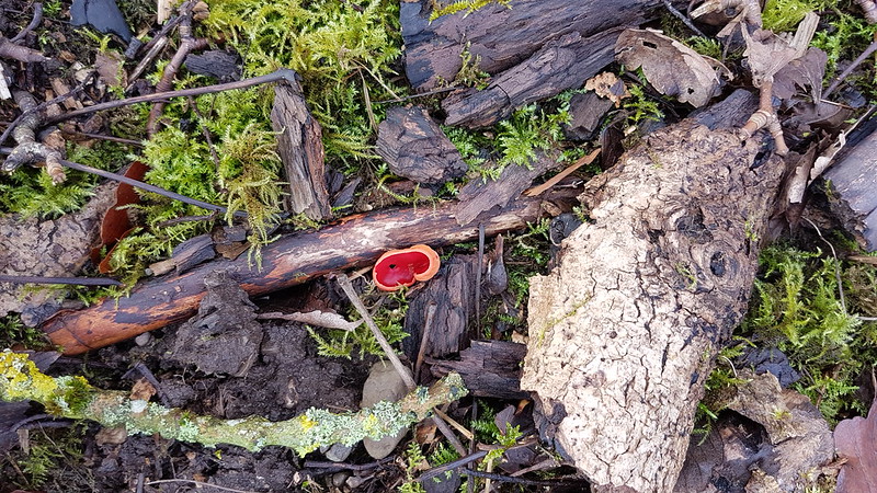
Scarlet Elf Cup.New rustic picket fence around the restored summer house by Hawes Water.
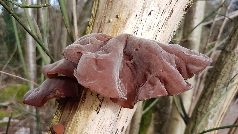
This is Jelly Ear Fungus or Wood Fungus. It’s allegedly edible – I have eaten it, in a restaurant years ago and I can’t say I was impressed.
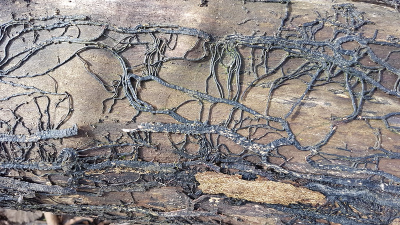
These black cords, called rhizomorphs, are how Honey, or Bootlace, fungus spreads. They grow beneath the bark of an infected tree, but can also spread beneath the soil to reach new trees. Honey fungus will kill its host tree. I think it’s quite common in this area.
Honey Fungus mushrooms are bioluminescent (the gills glow in the dark), although their ghostly greenish light emissions are usually far too weak to be visible to the human eye in a normal woodland environment, even on a moonless night. To see this effect it is necessary to sit close to some of the mushrooms in total darkness (in a windowless room) until your eyes have become accustomed to the dark and your pupils are fully dilated.
A rash of fungus appears along Inman’s Road, the path along the bottom edge of Eaves Wood, every autumn. I think it’s Honey Fungus. It’s never occurred to me before to bring some home to test the bioluminescence, but I think this year I will.
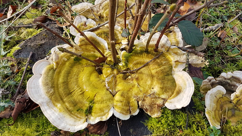
Lumpy Bracket fungus?
I think that this might be Lumpy Bracket fungus, partly because in the same way that Jelly Ear fungus usually grows on Elder, this fungus typically grows on Beech, especially stumps, which is exactly what was happening here. Where a large number of Beeches have been (controversially) felled by Hawes Water, many of the stumps now host this fungus.
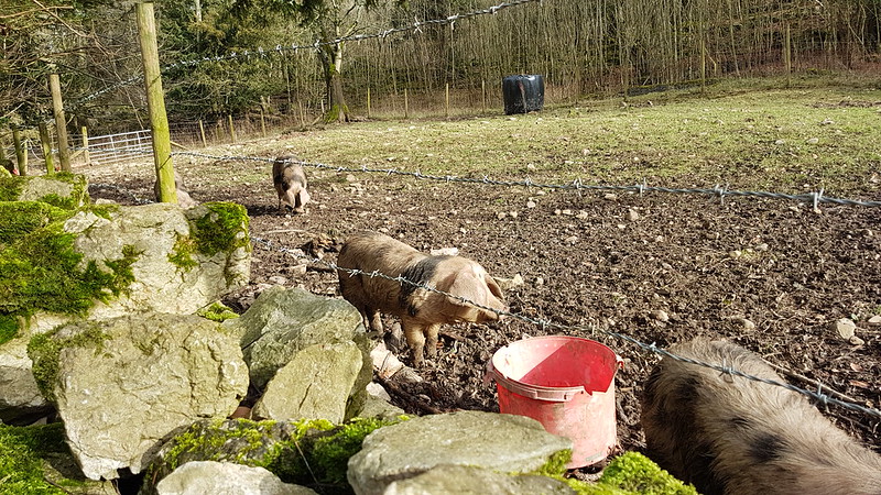
Gloucester Old Spot piglets at Hawes Villa farm.
I thought, obviously mistakenly, that Hawes Villa had stopped keeping pigs. Happily, I’m wrong.
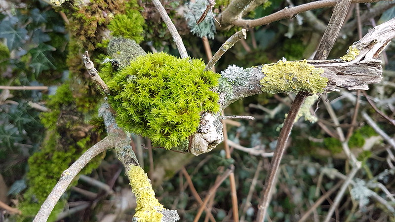
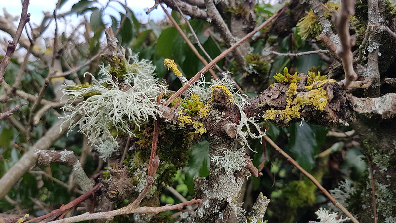
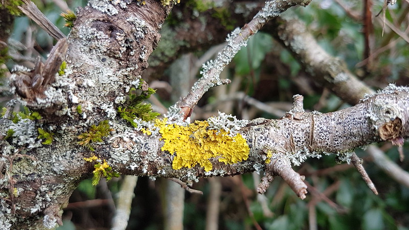
Walking along Bottoms Lane I was struck by the abundance and diversity of the mosses and lichens living in the hedge.
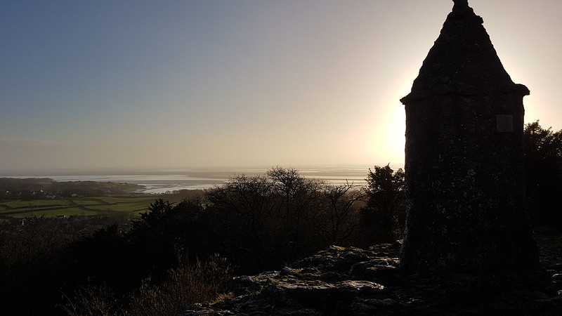
How many different species here?Back in Eaves Wood again.By the Pepper Pot.
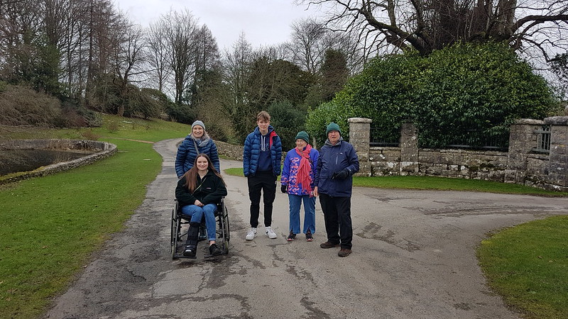
Because there were cold winds blowing all week, my Dad, who really suffers with the cold, was understandably reluctant to venture out. TBH had the bright idea that the gardens at Sizergh Castle might be relatively sheltered. She was right.
Family photo – I took several, but none in which everybody managed to look at the camera simultaneously.
A is in a wheelchair – lent to us by the National Trust for our visit – because she had broken a bone in her ankle whilst dancing. Little S (you can see here how diminutive he is!) delighted in pushing her around at great speed and alarming her with his ‘driving’ skills.
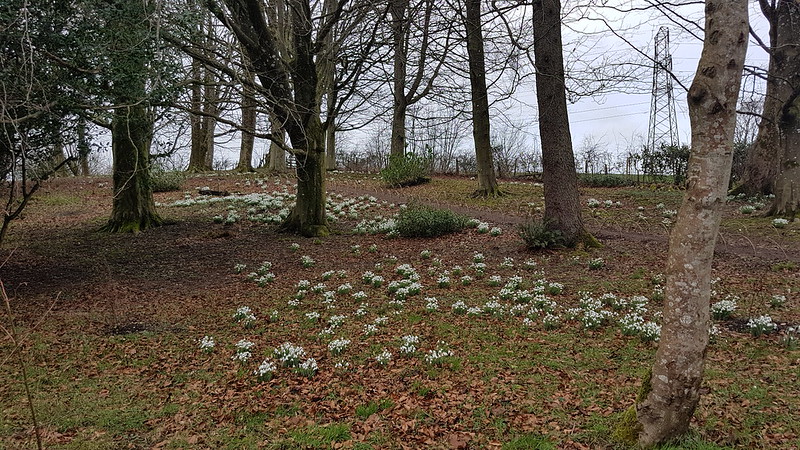
More Snowdrops in the grounds of Sizergh.The Winter Aconites again.
Four fields between Holgates and Far Arnside had been seeded with what looks to me like Ribwort Plantain. A bit of lazy internet research reveals that it can be used as fodder. Certainly, when we’ve been back to the fields, after stock have been introduced, the leaves have been pretty thoroughly stripped off. I read that growing plantain can improve soil structure. And also, more surprisingly, that its seeds are used as a thickening agent in ice-cream and cosmetics.
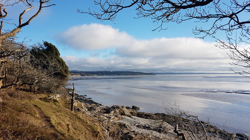
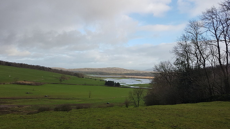
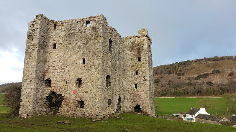
Far Arnside.Looking to Knowe Point.The Bay.Grange. Hampsfell behind with a dusting of snow.Turning the corner into the Kent Estuary.
The weather le me down a bit here. I walked around the coast in glorious sunshine, but by the time I’d climbed the Knott from White Creek, not the longest of ascents, it had completely clouded over.
Bit of snow on Arnside Knott too.
And finally, on a very damp final day of the break, the flocks of Starlings which roost at Leighton Moss briefly gathered above the field behind our house, so that we had a grandstand view from our garden.
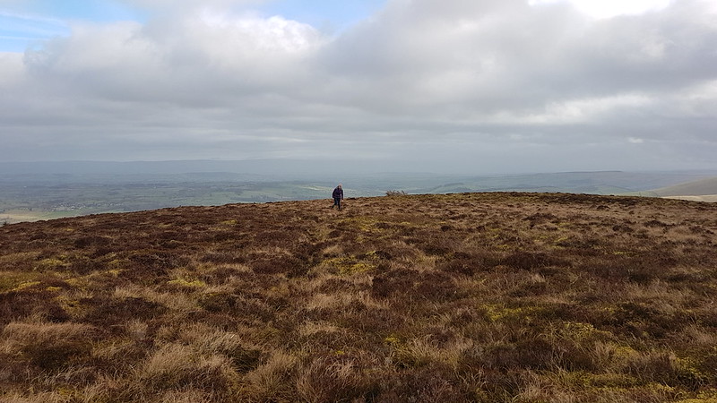
Despite what I’d said to TBH about having climbed ‘most’ of the Wainwrights, there are actually quite a few I’ve never been up; Great and Little Mell Fell being a case in point. Although they aren’t particularly high, they really stand out from anywhere in the north-eastern Lakes, so they’ve been on my ‘to do’ list for years. On this Saturday, at the end of January, the forecast wasn’t very promising, so they seemed like an ideal target.
From the lane to the east of Great Mell Fell there’s a path which heads directly for the summit and I guess that most people go straight up and down by the same route, but Aileen and Brian Evans’ ‘Northern Lakeland’ book (Short Walks in Lakeland Volume 2) has a circular route which follows the edge of the woods before ascending the shoulder on the North-East side of the hill. There’s a path, seemingly quite well used, quite boggy in places.
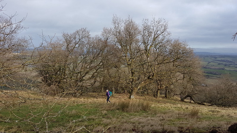
On the shoulder we didn’t find much of a path, but it was pleasant enough winding up through the trees, it helped that the weather was unexpectedly brightening up, there was even the odd shaft of sunlight getting through.
Some of the trees were twisted and gnarly – I guess they are very exposed to the winds.
As we cleared the trees, and the gradient eased, the going became very tussocky. Quite hard going. TBH hates this kind of thing. There is actually a path – we just missed it somehow.
TBH on the top – Blencathra in the cloud behind.
It was pretty windy on the top, but we thought we’d find a sheltered spot on the way down. TBH had bought me an insulated mug, similar to one she has herself. It was full of hot tea and stowed away safely in the outside pocket of my rucksack. Except it wasn’t, I discovered when we stopped: it must have fallen out when I took my bag off near the summit. TBH went to look for shelter and I went back up. Couldn’t find it, so I retraced our steps, part of the way down our ascent route, with no luck. That was how I found that there was actually a path just a few yards across the hill from where we had come up. In all then, I ‘topped out’ on Great Mell Fell three times that day – can I count that as three separate ticks?
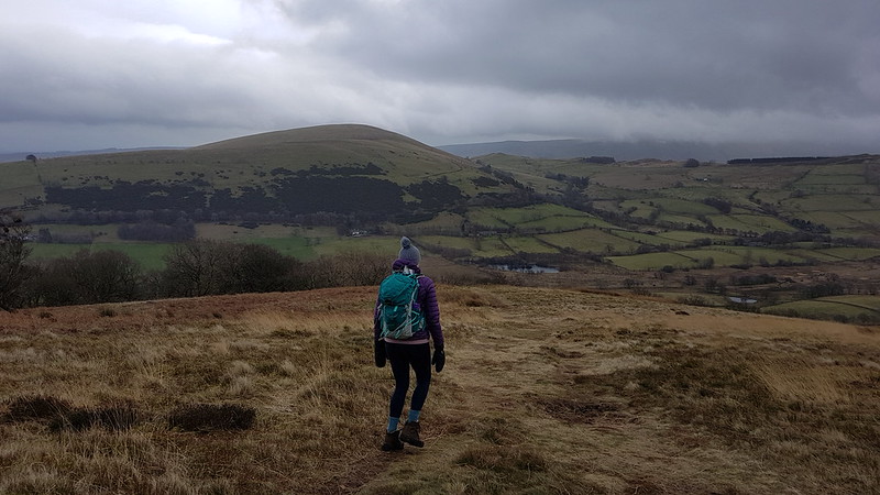
I’m a bit confused by this low ridge – I think, by a process of elimination, that it must be Great Meldrum and Gowbarrow Fell.Descending towards Little Mell Fell.
TBH had found ‘a lovely sheltered spot’ but had also got cold waiting for me, so we returned to the car and ate our lunches there.
The weather was clearly worsening, but we decided to risk an ascent of Little Mell Fell. Lazily, we drove around to The Hause, where there’s a lay-by with room for a few cars, and from where there’s a short, sharp climb to the top.
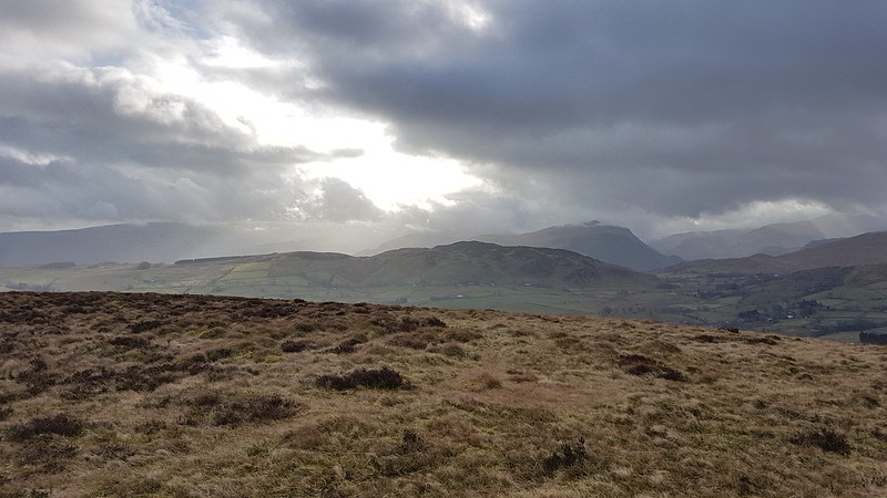
Great Mell Fell – Blencathra seems to have cleared.Hallin Fell and Place Fell across Haweswater.
We made it back to the cars just as it started to rain in earnest.
So, two more ticked off, making seven Wainwrights for January, which I thought was a reasonable start, could I maintain that pace?
The forecast was promising: ‘Low cloud, with a strong chance of cloud inversions on larger fells, particularly in the South.’ I was hooked (line and sinker!) and was out early and parked up in the car park at the top of the metalled part of the Walna Scar road. Despite the early hour, not long after eight, the car park was already pretty busy and filling up fast.
The OS map shows a path climbing the southern slopes of The Old Man, skirting the quarry and joining the more popular route above Low Water. In fact, there are lots of minor paths and if you pick one which heads further west you can keep plodding up through interesting terrain to Old Man Breast and then the top.
Limestone Haws.
I was suspicious of what seemed like quite high cloud for an inversion, but continued to climb hopefully.
The view begins to disappear.
Once entered, the mist turned out to be the sort of mist which has you soaked through before you’ve fully realised just how wet it is. Still, it remained quite pleasant. I sat by the enormous summit cairn on the Old Man, looking at the lack of view and willing the cloud to clear, whilst I supped a couple of cups of cordial from my flask.
Then I set off along the ridge, over Brim Fell to Swirl How. The weather gradually deteriorated. Not only did the fine mist turn to a heavy downpour, but the wind picked up too so that the freezing cold rain was driven horizontally across the ridge.
The cairn on Swirl How.
It was all a bit horrible. In different circumstances, I might have done an out-and-back to Great Carrs, and I originally intended to include Wetherlam, but now I just wanted to get off the hill.
The ‘view’ along the ridge.
Fortunately, once I started to descend Prison Band I dropped out of the worst of the wind, and although it continued to rain, on and off, without the driving wind it didn’t seem so bad.
I chatted to a couple of chaps who asked if they were on Prison Band (I’m not sure where else they could have been?).
“What’s it like on the ridge?”
“Wild.”
“Yep, it was pretty foul on Wetherlam,” they chuckled, before continuing on up.
Re-emerging from the mist.
From that point, I enjoyed the rest of the walk, rain or no rain. Showers kept sweeping through, but they were less and less frequent.
Levers Water.
The sharp showers made patterns on the surface of Levers Water and I watched them being driven across the tarn.
No swimming! No difficulty complying with that injunction on this occasion.Levers Water Beck.Levers Water Beckagain.I love these constructed paths, associated with the mine-workings. I followed this one around to Low Water Beck and the Pudding Stone.Low Water Beck.
Stepping off the path by Low Water Beck, to let a couple past who were coming the other way and who seemed a bit nervous of the uneven and slippery surface, I skidded on the wet grass and went arse-over-tit. They seemed quite concerned about me, I’m not sure whether that was despite or because of the fact that I was laughing at my own clumsiness.
Another mine track.Sod’s Law in operation – as I sat in my car finishing my flask and eating my lunch, sunshineappeareddown in the valley, bringing a feeble rainbow with it.
A surprisingly enjoyable outing, all told. And the fact that I shall need to go back to pick up Dow Crag, Grey Friar etc is not a hardship at all.
The day after my Sour Howes and Sallows walk, and I’m going back to Kentmere, this time parked in Staveley. A get-together has been organised, TBH is joining the group. B has a rugby match, but the Colts kick-offs are generally in the afternoon, so I decide that I can join for at least part of the walk.
Hugill Fell, Millrigg Knott, Brunt Knott and Potter Fell, this time from the South. The prominent top on Hugill Fell is Black Crag. Click on the picture to see a larger version.
After much faffing in Staveley, we didn’t get all that far before I had to reluctantly leave the group and head back for the car.
Timber! There had evidently been a lot of felling in Craggy Wood so I assume that the wood had come from there.
Craggy Wood was purchased, relatively recently I think, by Cumbria Wildlife Trust. I’ve had my eye on a visit there for many years, having seen it so often from Staveley.
Scout Scar from Craggy Wood.
The path initially climbs steeply through a felled area – the felling I suspect to remove non-native conifers – then rocks-up on the top edge of the wood, giving views over Spy Crag.
Looking North across Spy Crag.Brunt Knott and Potter Fell from Spy Crag.In Craggy Wood.
The path weaves its way through the trees and along the edges of some small crags. Now I need to go back in the summer, when the trees are in leaf and, of course, in the autumn when no doubt the colours will be magnificent.
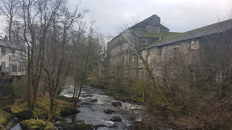
Reston Scar and Black Crag on Hugill Fell.River Kent weir on the outskirts of Staveley.An old mill? by the Kent.
More by luck than good judgement, I arrived home at almost exactly the time I’d told B I would. True to form, however, he wasn’t ready anyway. Still, we made it in plenty of time for the match.
The aftermath of a Kirkby try.
Andy’s account of the rest of the group’s longer walk is here.
River Kent from Ullthwaite Bridge. The monument on Hugill Fell visible on the skyline.
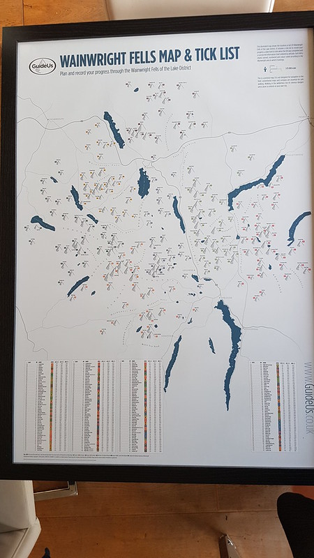
For Christmas, TBH bought me a Wainwright Map:
“But I’ve done most of them,” I protested, “several times.”
“I know, I thought you might like to start again.”
A map, a ticklist, and a project – an irresistible combination!
Meanwhile, Little S has become highly engaged in his BJJ and trains several times a week, but has decided that the Saturday morning class, which he has regularly attended for years, is no longer appropriate since most of the participants are genuinely little, unlike the rangy Little S.
So, spurred on by TBH and with my calendar suddenly blank every Saturday, I’ve been getting out on the hills much more frequently than I have for a while.
Croft Head.
Having said that, this walk, from mid-January, started late, after midday – I can’t remember what had kept me occupied in the morning, so a shortish route was required. I was very lucky, at that time of day, to get a parking spot in Kentmere, conveniently next to Ullthwaite Bridge.
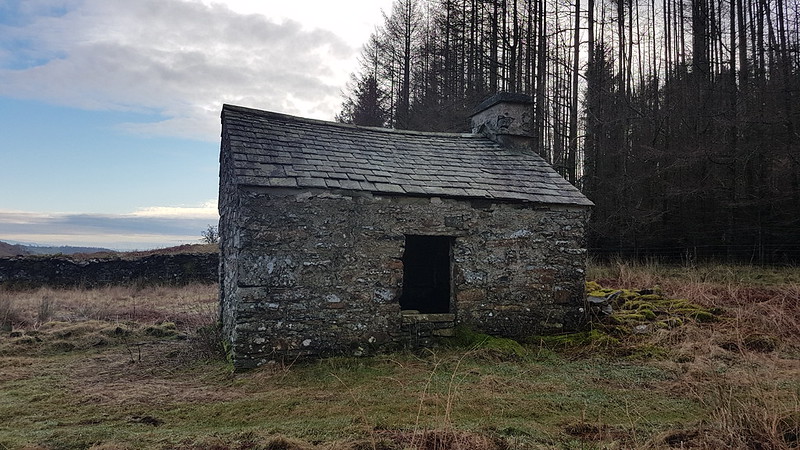
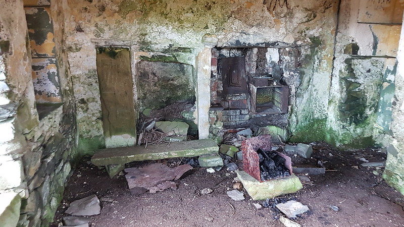
Bothy? by Acretarn Plantation.
We used to tease our friend UF for his obsession with seeking out small buildings which he had identified on the map as potential ‘secret’ bothies. This building looks relatively salubrious compared to some of his hopefuls: the glazing and interior decor are a bit lacking and the ceiling was falling in, but it looks like somebody has used the fireplace, so maybe it’s ripe for adoption by the MBA?
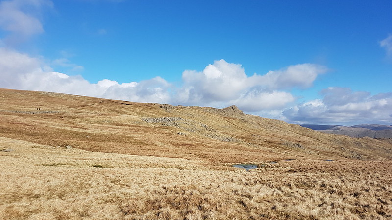
If there’s been a common theme to my days on the hills to date this year it has been wind, wind and more wind. Cold and often very strong winds.
“Oh, you’ve caught the sun!” People will say.
“No, I’ve been wind-blasted.”
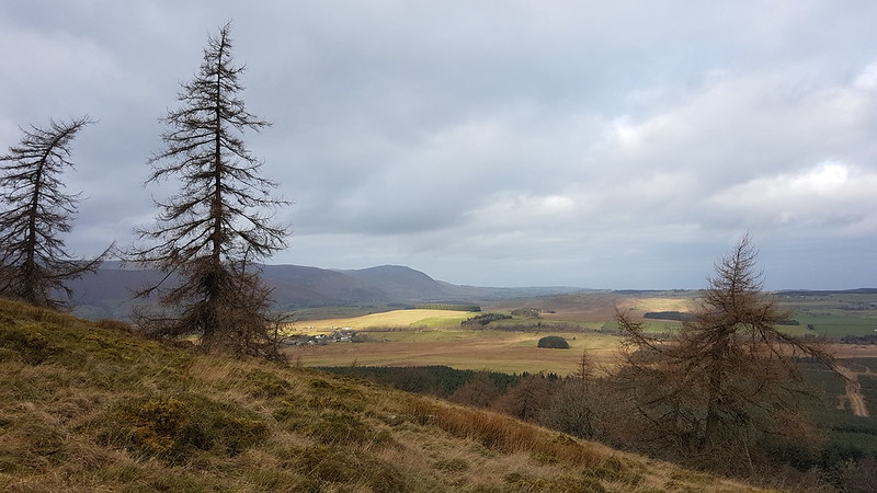
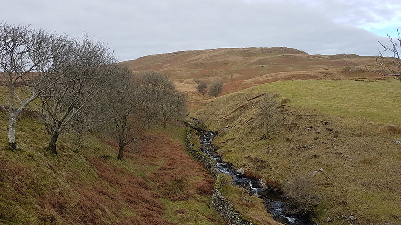
This afternoon was the single exception so far, a fairly mild day, especially for January. A faint path ascends alongside Park Beck, a really pleasant route.
Park Beck. Sallows behind.Brunt Knott, Millrigg Knott, Spy Crag, Hugill Fell.And Mackerel sky?Pano. The humps and hollows of Sour Howes on the left. Moor Head, the broad ridge in the middle and Sallows on the right.View down Windermere.
It’s a long while since I was last on these hills and I’d forgotten what great views they have, Sour Howes in particular.
Sour Howes pano.
I parked myself just off the top and enjoyed a late lunch and some hot cordial.
Looking down into Troutbeck. Wansfell Pike behind. Scafells and Great Gable on the skyline.
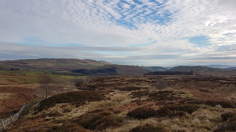
The cloud was breaking up, and the sunlight began to alternately pick out different patches of hillside, which was wonderful to watch.
Red Screes and Stony Cove Pike.Sallows.Howgills catching the sun.Stony Cove Pike, Thornthwaite Crag, Ill Bell, Yoke.
It looked like it would be the easiest thing in the world just to romp up onto the western ridge of the Kentmere Horseshoe, but that will have to wait for another day (and almost certainly won’t be ‘ the easiest thing in the world’ when that day comes!)
Scour Rigg.
On the way down, I found a path and rather heedlessly followed it, which serendipitously brought me to the curious knolls of Scour Rigg. Then I wandered around Mould Rigg. The OS maps app was an invaluable aid in locating my position and guiding me down Whiteside End and onto the track which would take me back to my car.
Kentmere Tarn.
MapMyWalk gives a smidgen under 7 miles and close to 400m of ascent (I reckon 420 from the map, so that’s not a bad figure, I don’t think). Not bad for a short winter afternoon. I was also thinking that these hills would be ideal for a summer evening stroll.
So, two down (and Capple Howe is a Birkett), just two hundred and twelve to go!
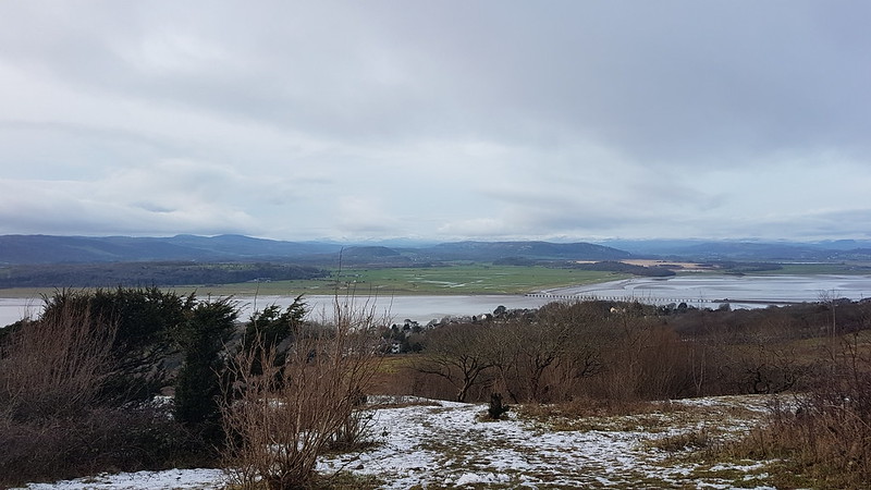
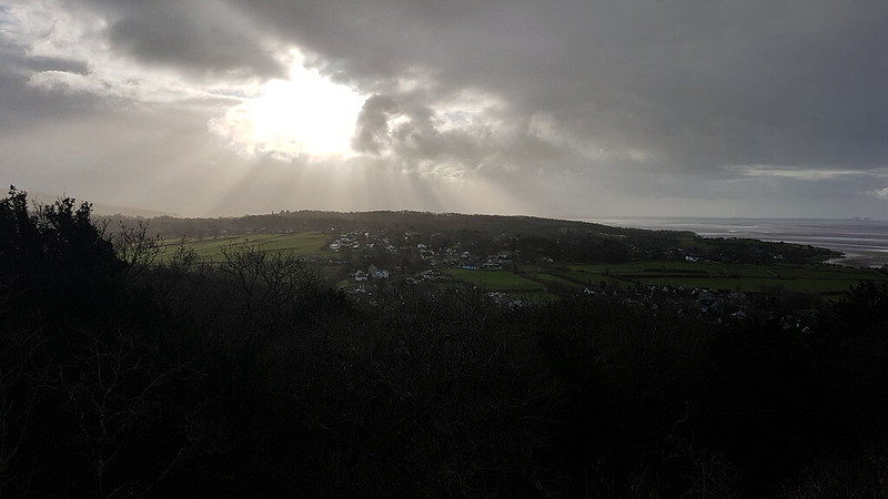
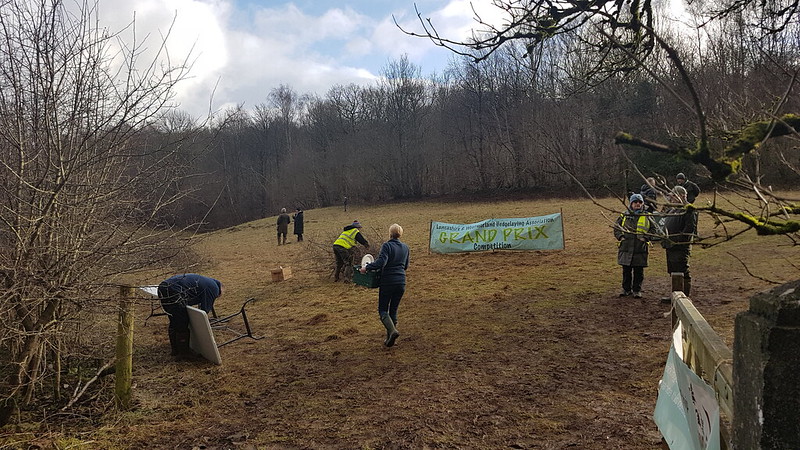
Crepuscular Rays over Silverdale from Castlebarrow.Flooded fields, Silverdale Moss and Beetham Fell from by Arnside Tower.Arnside Tower, Arnside Tower Farm and Arnside Knott.A view over the Kent Estuary from Red Hills Pasture.A hedge-laying competition in Dobshall Wood.Gummer How, Yewbarrow and Whitbarrow behind the Kent Viaduct.Patches of sunlight picking out Cartmell Fell and Yewbarrow.Here it’s Whitbarrow catching the light.Whitbarrow and the Kent Estuary from Haverbrack.Heversham Head and Milnthorpe from Haverbrack.Arnside Knott and blue skies after a shower from Beetham Fell.
The day after my late afternoon walk from Yealand and another walk involving a lift. This was a longer local walk on a day of very changeable weather. After I’d passed Hazelslack Farm, the weather took a turn for the worse and seemed set-in, so I took the easy option and called TBH to come and pick me up, which saved me a couple of miles in pouring rain.