River Rawthey and Uldale Force

P7090243

Perhaps I should say something about the meticulous planning which goes into my post-work, evening walks; indeed into all of my walks. Since it was almost two months ago, I can’t recall this in exact detail but it goes a little something like this:

Me: “Oh, none of the kids need ferrying around tomorrow do they, I could go for a walk after work.”

TBH: “You could.”

Since we will have been either already in bed at this point, or on the way there, I won’t have done anything about this nascent plan. The following morning, on my way out of the door, possibly even on time for once, I remembered the projected walk and hastily grabbed a few bits and pieces – a pair of shorts and a t-shirt, some shoes, my rucksack which hopefully would have my waterproofs in it, my camera, a water bottle, maybe a packet of nuts and a collection of maps. The maps are a constant – OL7, OL2, OL19 and OL41 – my way of keeping my options open, or, to put it another way, of putting off making a decision.

On this particular occasion, I still hadn’t made up my mind when work finished. I asked a colleague in the staffroom, who I know to be a keen walker herself:

“Where should I go for a walk this evening: Lakes, Dales, Howgills or Bowland?”

P7090246 

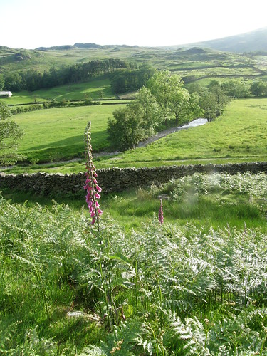
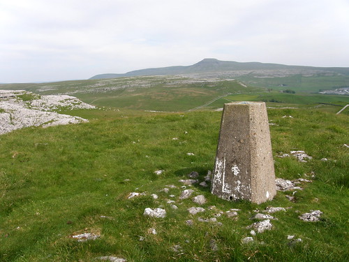
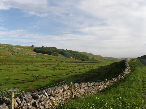
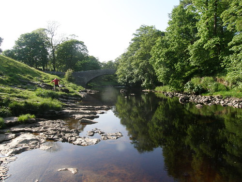
So it was that I found myself pulling into the the little car-park near Rawthey Bridge on the eastern side of the Howgills, with the intention of having a walk up to Cautley Spout, but when it dawned on me that the east facing slopes of the Howgills had already seen the last of the sun for the day, I decided to head the other way instead.

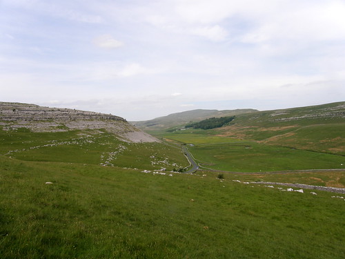
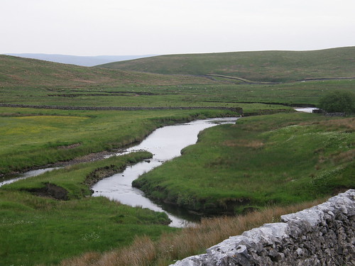
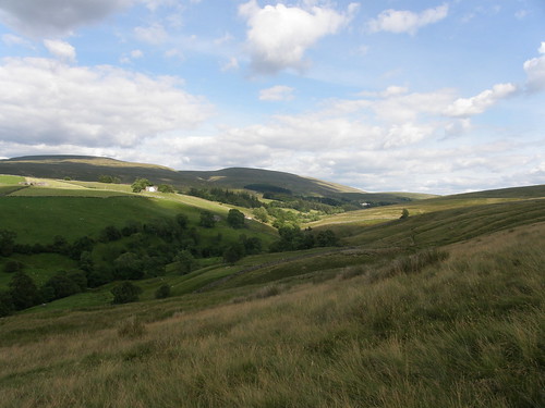
I took the old road (seen above), above the River Rawthey, across the slopes of Bluecaster and into Uldale.

P7090248 

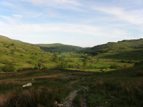
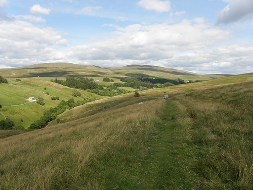
I had the idea that I would follow the river all the way up onto Baugh Fell, which I’ve never climbed before. But my plans are always fluid – I’d also wondered whether it might be possible to divert into Whin Stone Gill and follow that up towards Swarth Fell.

P7090253 

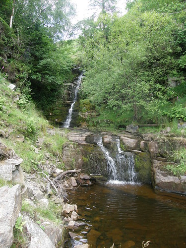
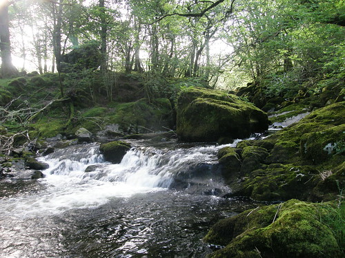
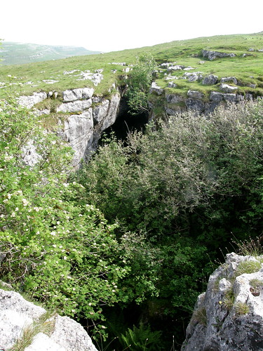
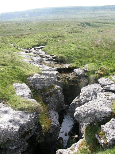
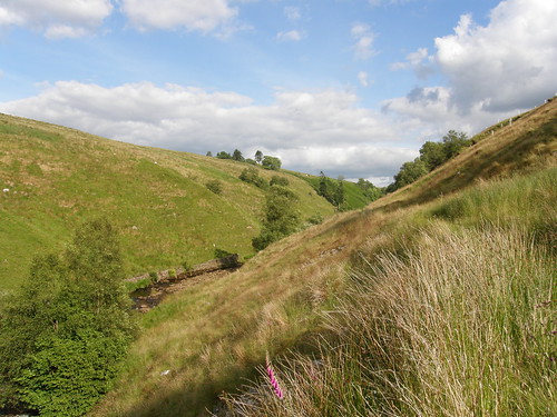
These waterfalls put me off that plan however. That second fall could probably be scrambled, but it looked wet and vegetated and not the least bit inviting.

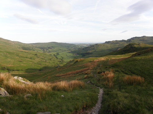
So: carry on up the Rawthey. This little fall….

P7090256 

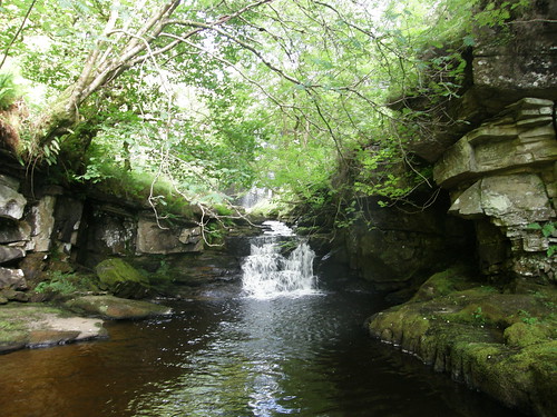
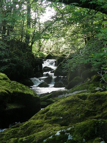
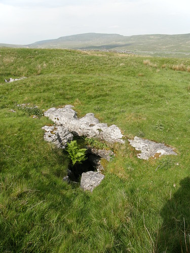
…looks like it might be a bit off an impasse, but in fact there’s a well used path which goes around to the right here, just above the rocks on the edge of the photo.

P7090259 

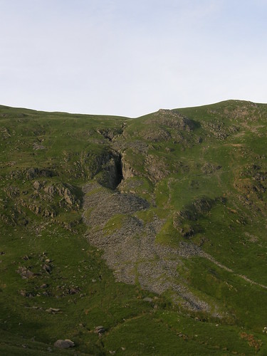
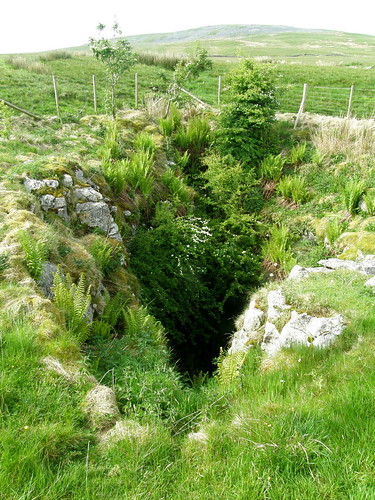
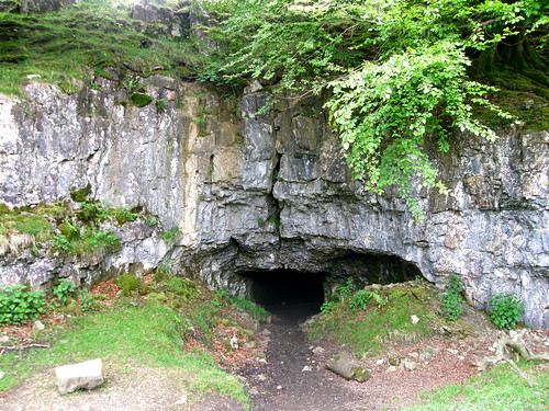
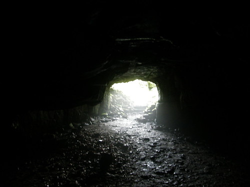
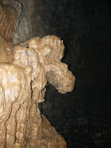
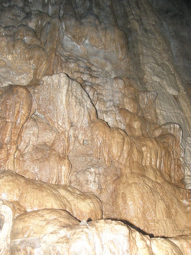
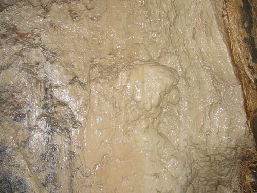
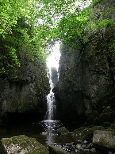
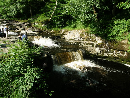
Just above there is Uldale Force, which deserves to be better known than I suspect it is. It’s a fair sized waterfall, and the cliff curves around to either side for quite a way. I’m not sure that my photos really do it justice. I used to come this way up onto Wild Boar Fell quite often and I always wondered whether this was a collapsed cave.

P7090267

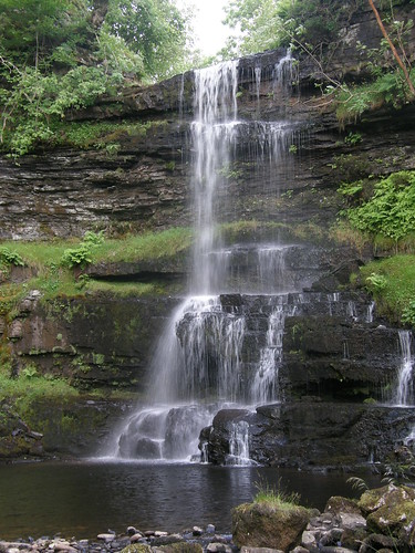
Again, this can be circumvented on the right, although the ground is very steep, and if I had the kids with me I would go back first and then up, if that makes sense.

I followed the Rawthey a little further but the sky had clouded over and my enthusiasm was waning: perhaps a 10 mile round trip on Baugh Fell was a bit ambitious for an evening? Besides – Holland were playing Argentina in the semi-final. I climbed up to the path which would take me down past Uldale House and to the minor road which I don’t seem to have entirely squeezed into the map below.

image

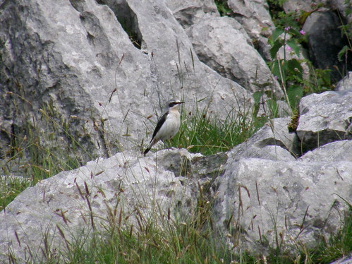
I was home in time for the second half, despite dithering for a good 15 minutes on the way down, trying fruitlessly in the poor light to photograph a pair of grey wagtails.

River Rawthey and Uldale Force

Blakeney Point Boat Trip

The North Norfolk Coast Path

I’ve been at this blogging malarkey for quite some time now, and though I get frustrated sometimes when it seems that I’ll never catch up with myself, I must enjoy it, or I wouldn’t still be at it, six and a half years and six hundred and seventy posts down the line. I’ve written before about the benefits of keeping a record and of being aware that you intend to do so. Then there’s the Social Media side of things, although I’m only too aware that I often fall down badly on that front. There have been a few freebies along the way too – bits of gear, a few books and, most notably, a trip to Jersey. But here’s a new and totally unexpected development: an old school friend tracked me down via this blog and invited me to a reunion of our A-level maths class.

A mallow - common mallow? 

A mallow. Common mallow, possibly.

The weekend get-together took place in Norwich at the beginning of July. Norwich is a bit of a long way from just about anywhere, but it’s a particularly long way from Silverdale. Having abandoned my original, deranged plan of driving down on the Friday evening (it’s a good job I did, the M62 was shut at Junction 25 and I spent an hour or two queuing through Huddersfield), I arranged to meet the others on the coast on the Saturday Morning. I’d left my half-way stopover in Blyth, just off the A1, very early, and arrived with some time to spare and so had a little wander along the North Norfolk Coast Path.

Woolly thistle 

Very nice it was too, despite the grim weather. I’ve subsequently done a bit of lazy internet research and I have to say, this looks like a very attractive path. This section, at Morston, was resplendent with unfamiliar flowers.

Woolly thistle flower 

I think that this (and the photo above) is woolly thistle.

The others arrived in plenty of time for the boat trip we’d booked. Boats go out from Morston Creek and round to Blakeney Point.

Blakeney Point

Here we are on the boat…..

On the boat 

…well, not me, I was taking the photo. Needless to say, they haven’t changed in the thirty years since we left school. Well not much. None of us live in Leicestershire anymore, but I’m not sure what that tells us. Although it’s certainly not thirty years since we last met, it could easily be twenty, at least for me, and so we had a lot of catching-up to do. But what’s germane to this blog is the boat trip itself:

Black skies over Morston Creek 

Morston Creek

Sandwich Terns 

The beaches, and the skies above them, were busy with terns. These are sandwich terns, and juveniles (note the black beaks and legs and the tufted hairdos).

Sandwich Terns II 

And again. All of the photos were taken from a moving boat, which didn’t help with the quality. That’s my excuse anyway. The out-of-focus bird in the air had a fish in its beak.

Common Terns 

I think that these are common terns, with yellow beaks and legs.

Common terns and little terns? 

The two smaller birds here are little terns. You can’t see it without zooming in, but the little tern has a distinguishing black eye-stripe which is the telling detail.

Common Seals

The other highlight was the seals.

Seal 

Common seals pup in the summer, so the opinion offered was that the seals on the beach were common seals, and the seals in the water would be grey seals, which give birth in the winter. I’m not sure it was that simple however.

Seal II 

And, whilst it’s meant to be easy to tell the difference, I’m not confident, so I shan’t venture an opinion.

Seals on the beach 

We had a bit of a walk on the spit of land which forms the point, visiting the old coastguard station….

The old lifeboat station Blakeney Point 

There were also a couple of old lifeboats moored in the channel. I was intrigued by the fact that they apparently had a wooden shed constructed on the deck.

Old lifeboat 

Not sure if that’s part of the original design or a more recent attempt to emulate the Skylark.


After the excellent boat trip we drove a little down the coast to Cley.

Cley Windmill 

Unfortunately, the windmill was closed. Fortunately, the pub wasn’t.

Nice George and the Dragon Window - oh and DP supping a beer 

Long-suffering readers will now that I’m quite partial to a stained-glass window. Especially if it depicts St. George dispensing with the poor old dragon. Not sure why D is looking so guilty and/or furtive about his beer.

D and J

I shan’t attempt to summarise the remainder of the weekend, except to say that it was thoroughly enjoyable.

I will however, mention the campsite where I stayed, at Whitlingham Broad. It’s a cracker. Quiet, well-organised, cheap. If you need or want to stay in Norwich I can heartily recommend it. (Yes, everybody else stayed in hotels, but I like camping. And I’m a  skinflint)

Blakeney Point Boat Trip

Andy Goldsworthy Sculpture, Clougha Pike

Goldsworthy sculpture, Clougha Pike

When I was up on Clougha last year with my friend Tony, we passed close by these three regular stone constructions and I wondered what they were (but not enough to walk over and take a look). Back at home, a bit of searching revealed that they are in fact an Andy Goldsworthy Sculpture and I resolved to come back at some point to have a proper look.

Goldsworthy Sculpture, Clougha Pike II 

Another pleasant day frittered away at work had clouded over slightly now that I was free to enjoy it. The the wind had picked-up too. Through the walk, the hills of the Dales and the Lakes would disappear from view behind some sullen black clouds, and when I a was just a few hundred yards short of getting back to the car, a little light rain fell.

Goldsworthy Sculpture, Clougha Pike III 

But I’m getting ahead of myself. I’d parked in the car park off the Littledale Road, took the path past the sizable Skelbow Barn and then the permission path which follows Sweet Beck and leads to the intake wall and access land. The OS map shows one of those hesitant black dotted lines which indicate a path rather then a right-of-way. I’d tried to find the top of the same path last year, but missed it. It turned out to be a nice route up the hill – a small path following a line of grouse shooter’s butts. (They’re simply ‘Grouse Butts’ on the map of course, but that’s pretty useless as a name – makes it sound like they might be somewhere for the Grouse to live, or possibly to hide whilst they take pot shots at startled tweedy types.)

Goldsworthy Sculpture, Clougha Pike IV 

I was impressed with the sculptures. Nice to think that they were paid for by the Duke of Westminster who, in the past, has so jealously guarded his privacy on this land, and that the Right to Roam legislation makes it available to us all.

In the photo above you can see that below the hollow space…

Looking into a 'hollow'

…in each sculpture there’s a sturdy step. Rather inviting I thought, so I stepped into one of them. I know, I know, I’m a Big Kid at heart.

Looking out from a 'hollow'. 

I think our kids would appreciate this – another walk I shall have to share with them, maybe when there’s some snow on the fells.

Goldsworthy Sculpture, Clougha Pike V 

The sculptures sit in an area of spoil heaps from former quarrying, some of which are so regular that I wondered if there had been buildings here at one time too.

Quarry....remains, Clougha Pike 

There’s a small circular enclosure which I sheltered behind to enjoy the view and take a drink and a snack.

Goldsworthy Sculpture and Caton Moor Wind Farm 

I continued up on to Grit Fell and contemplated heading on to Ward’s Stone, the highest point in the Bowland Fells, but after finishing virtually in the dark last year when doing that, I decided against it this time.

Lancaster, The Lune and Morecambe from Clougha Pike 

So I ambled down to Clougha Pike ‘summit’ and found a sheltered spot amongst the rocks of the edge there for another drink and snack and contemplative pause. The fast moving clouds were providing a bit of a light show – crepuscular rays sweeping silvery patterns across Morecambe Bay, or picking out the Lune as it snakes through Lancaster, or Langthwaite and Blea Tarn reservoirs on the south-western edge of the city.

Clougha Pike 

It’s a particularly fine place to sit.

Clougha Pike II

I returned by the large bulldozed track which drops down to the Littledale Road, but then skirted the top edge of Cragg Wood to rejoin my outward route. It had been a great walk for birds, nothing too unusual, but lots of them. From Cragg Wood I saw surprisingly large flocks of wood pigeon – it seemed almost exotic, from my elevated position, to see so many flying above the tree-canopy, like something from a wildlife programme about distant jungles.

Having spotted a nicely patterned feather on the path early in the walk, I’d kept my eyes peeled and had managed to gather a fine collection, including one of around two feet in length with beautiful bands of colour.

Andy Goldsworthy Sculpture, Clougha Pike

Kentmere: Force Jump and Almost the Ullstone

River Kent 

Another post-work walk from back in June. I didn’t quite get away when I intended to, but arrived in Kentmere at around six and was delighted to find that there were parking spaces by the church. I’ve been thwarted on several recent occasions, when all of the limited spaces here have been full.

It was a gorgeous evening, they were ten-a-penny this June: it must be the best month of the year for weather and therefore for walking.

If recent posts about walks have been a little Wainwright dominated here’s some relief, although I was still guidebook inspired – my original intent was to follow ‘Walk 44: Upper Kentmere and the Ullstone’ from Aileen and Brian Evans ‘Short Walk In Lakeland Book 1: South Lakeland’. However, I parked in the village, rather than at Green Quarter as suggested, so as to take in Force Jump, a waterfall in the River Kent. Again, a guidebook was at least partially to blame: Mary Welsh’s ‘A Third Naturalist’s Guide to Lakeland Waterfalls throughout the the year’.

Force Jump 

Strictly speaking, there’s no access to Force Jump, but a there is a bit of a path down through trees to the river from where the fall above is visible. Is that it? I’m not sure. It doesn’t look particularly like the drawing in the book. Not to worry – a tree by the river was festooned with….

Liverwort? 

…liverworts? Worth the detour on their own I thought.

With regard to the guide books – I’ve had all three of the Evans’ series of books (as well as their definitive scramble guides) for many years and they are superb, and have been very well used. They are ideal for when time is short, or the weather is unpleasant, or when you fancy something a little off the beaten track.

Mary Welsh’s books are a more recent acquisition. I have two of them them, but will pick up the others when I see them second-hand. I like their quirkiness – whilst they do give ‘turn right at the gate’ type instructions, they also describe a particular walk, and it’s weather, flowers and wildlife, at a particular season. Each book, in common with the Evans’ books, claims to cover a section of Lakeland, but unlike the Evans’ books the regional aspect is extremely loose and there is considerable overlap between the two books I own.

Kentmere 

Two paths skirt the Eastern edge of the Kentmere valley, for some time they are only yards apart. I took the slightly higher one. The views were great, but what I really remember was the teeming bird life in the hedgerow trees here. In particular, I came through one gate and turned to see the bright breast of a redstart in the top of a nearby sapling. I was thrilled – what a stunning bird –  but sadly not quick enough with my camera. One day.

River Kent 

Eventually the higher path climbs away from the valley, heading ultimately for the Nan Bield.

Looking back down Kentmere 

I was entertained by meadow pipits in the bracken and by the expanding view behind.

Looking back down Kentmere II 

Also by the substantial looking quarry workings on the slopes of ridge above….

Kentmere Ridge 

Quarry (disused) 

When I reached the shoulder below Smallthwaite Knott I stopped to ponder my options. The Evans’ route leaves the path to visit a huge boulder called the Ullstone…..

The Ullstone

…but that wasn’t in the sun. Then it drops down into the valley to pick up the other of the two paths – but by now that also wouldn’t be in the sun.

I chose instead to sit for a while and admire the edge on Rainsborrow Crag which I climbed in the fog a while ago, and when the midges had begun to drive me to distraction I headed back the way I came, figuring that it would keep me in the sunlight that bit longer than a more direct descent.

So: no summits ticked-off, didn’t quite make it to the Ullstone, not sure whether I found Force Jump, failed to photograph the elusive redstart. Bit of a let-down all-round?

Didn’t feel like it.

Kentmere Map

Kentmere: Force Jump and Almost the Ullstone

Turbary Road – another walk with caves.

Keld Head Scar

The window for significant post work walks is a short one – for most of May I’m far too busy, so it’s generally June and then part of July before we head off on our annual pilgrimage to the Llyn Peninsula. This season, then, was exceptional – the weather was kind and I managed to squeeze in several good strolls despite the competing attractions of the World Cup.

This is the first of those walks, another route from Wainwright’s ‘Walks In Limestone Country’ (Which might otherwise be known as ‘Walks from the A65’ and since we live not too far from the A65, that makes it ideal). This is walk number 5: ‘The Turbary Road, Rowten Pot and Yordas Cave’, or more precisely, about a half of that route, since Wainwright has it starting and finishing in Ingleton and walking up along the lane into Kingsdale and down via Swilla Glen and the Waterfalls Walk which we did back in December, when the falls were in spate.

Small hut marks the start of the walk 

I cheated and drove along the lane to a point (692 756 ish) where it’s possible for half a dozen cars to pull onto the verge and park. If you’re at the right spot, you’ll see this neat little hut and an old limekiln just nearby where you’ve parked.

From there a good track climbs gently with good views of Ingleborough….

Twistleton Scar End, Ingleborough 

…and of Keld Head Scar, Kingsdale and Whernside….

Keld Head Scar, Kingsdale, Ingleborough II 

Eventually I left the track, looking for the trig pillar on Tow Scar. I was pleased that I did, because otherwise I might not have seen the pansies….

Pansy 

‘The Wildflower Key’ tells me that there are Wild Pansies and there are Mountain Pansies, and how to distinguish between them.

Pansy 

And these are….. drum roll…..probably one of those. If only I’d had the forethought to take pictures of the leaves, I might have more idea. They didn’t seem to be particularly widespread, but they were locally quite abundant…

Pansies 

Now that my attention had been drawn to the ground around my feet, I found that there was plenty more to see.

Heath Speedwell? 

I was pleased that I knew these for a speedwell, but beyond that I’m not very confident. Heath speedwell is my best guess.

P6060019 

I shan’t even hazard a guess for these last two. A yellow flower and some white flowers!

Abundant white flowers 

These tiny white flowers were particularly abundant and starred the sward in a very cheerful fashion.

Tow Scar  - looking towards Gragareth 

Tow Scar is not an especially prominent spot, but it has good views out over the Lune Valley and looking up to Gragareth, and across Twistleton Scar End to Ingleborough….

Ingleborough from Tow Scar 

The walk was further enlivened by a number of butterflies and, once again, by wheatears posing for shots…

Wheatear 

The Turbary Road is a track once used by peat-cutters. It traverses a kind of plateau between Kingsdale below and Gragareth above, and the land around is fissured with potholes and caves.

This is Kail Pot….

Kail Pot 

Somewhere above the track is Swinsto Hole, which my old friend Andy could tell all about, from a trip we made many moons ago. I chickened out at the first, short, but committing, abseil. 

Turbary Road and Whernside 

Hard by the track is Rowten Pot….

Rowten Pot 

Quite large and impressive, but hard to do justice to in a photo. Incidentally, the tree on the right here was liberally coated with webs, presumably from some kind of tent moth, although I couldn’t see the moths. The water flowing through the pot was very audible and could also just about be seen below.

Looking down into Rowten Pot 

There are several openings hereabouts. This stream flows into Rowten Cave and then eventually down into Rowten Pot. Wainwright says that it’s easy, if a little uncomfortable, to follow it down, past a side stream flowing in from Jingling Pot to the bottom of Rowten Pot. It would have been a very wet trip, and I decided to save it for another occasion. There’s also a passage off to the left, which Wainwright says is ‘dry’. It wasn’t.

Rowten Cave 

I found it’s far end and then followed a narrow winding passage down to the confluence, before turning back to this alternative, drier exit:

Rowten Cave 

After Rowten Pot I managed to wander off the track, but serendipitously, found this narrow, deep pothole which doesn’t seem to appear on my OS map.

Another Cave? 

Of all my post-work walks this year, this was by far and away the most populous. I met several dog-walkers near the start and again close to the finish, one fell-runner on the Turbary Road and two mountain bikers at Rowten Pot. As I wandered down towards Yordas Pot, on access land but well away from any right-of-way, a farmer on a quad-bike with a long-barrelled rifle casually slung across his back, made a bee-line for me. Fortunately, he was just after a friendly chat.

Where the Turbary Road meets the metalled lane, a rocky dell hides the entrance to Yordas cave.

Yordas Cave 

The main cave is huge. This was a show cave once upon a time, but is now quiet, and free, and can be explored at will. It took my eyes ages to adjust to the gloom and at first I stumbled around, cursing my ‘useless’ headtorch.

The entrance from the inside 

But, once my eyes had tuned in, I found that there was plenty to admire and examine.

Rock feature - some kind of dinosaur? 

I was surprised that my camera and its flash coped reasonably well with my snaps of the walls of the cave.

Curtain 

More cave featuers 

Even more cave features 

It coped less well with the lovely chapter house waterfall at one end of the cavern….

Waterfall 

There’s a better photograph of the waterfall, and a much more detailed write-up of the cave here.

Back outside the slight haze had cleared and the final leg of the walk, back along the valley on the lane, was accompanied by lovely evening sunshine.

Kingsdale 

Kingsdale had one more surprise for me: a dry streambed….

Kingsdale - dry river bed 

Which at Keld Head suddenly fills with water….

Keld Head 

…..which becomes the River Twist and flows over Thorton Force and the Pecca Falls on the famous Waterfalls Walk.

Twistleton Scar End and the River Twist

A terrific evening out and about, and a walk I think my kids will love. I had intended to have shared it with them by now, but somehow I haven’t got around to it yet. Soon…..

Oh, almost forgot…..some folks appreciate a map….

Kingsdale Map

Turbary Road – another walk with caves.

Broad-bodied Chaser

Broad-bodied chaser (female)

As our guests (see previous posts) were preparing to leave and enjoying lunch in our garden, in some proper sunshine at last, we were joined by another guest, perched on a bare branch of a shrub growing right beside the patio where we sat.

This is a broad-bodied chaser. It’s a very large dragonfly and it’s shape is very distinctive -quite unmistakeable. It’s also unmistakeably a female: the male broad-bodied chaser is blue.

Broad-bodied chaser (female) II 

Andy and I snapped away, but she didn’t seem at all bothered. She must have posed for quite some time – I took no end of photos.

‘Britain’s Dragonflies’ (Smallshire and Swash), says: “often the first colonist of new ponds” and “try digging a pond – then just stand back and wait!”

Well, I didn’t dig a pond – it seems that I didn’t need to in the end – but I have been waiting for some time. I took some photos of a male broad-bodied chaser….

P6120650

…during a close encounter in the woods near Haweswater back in June 2010 and I’ve been hoping to have a similarly good chance to snap a female ever since. I’ve seen females on several occasions – at Leighton Moss and down by Quaker’s Stang on the salt-marsh spring to mind – but never managed to take any satisfactory pictures, so I was very chuffed with this chance.

Broad-bodied Chaser

Sizergh Castle

Sizergh Castle

On the last day of our friends visit, we took them to Sizergh Castle, a National Trust property which has the enormous advantage of being fairly close to home. I’d promised them sightings of the enormous fish (koi carp?) which we’ve often seen in this pond, but they had to settle for coot chicks….

Juvenile coot 

I’m really impressed with the National Trust – I’ve posted before about their ‘50 things to do before you’re 11¾’ campaign, and I like that – but also, whenever we’ve visited properties recently it’s been abundantly clear that a real effort is being made to engage visitors, particularly younger ones:

Period costume II 

At Sizergh, as well as dressing-up in the old barn, there was (and still is) a ‘Woollen Woods’ exhibition, and a  new trail through the woods with things for the children (young and old) to balance on etc.

Here’s J enjoying the rope swing…

The kids don't monopolise the fun.

Sizergh Castle

Catrigg Force and Stainforth Force

Catrigg Force

The day after our island-hopping excursion brought more promising looking skies, with the odd hint of blue, but by the time we’d driven to Stainforth in the Dales, it was gloomy again. Positively threatening in fact. We lunched in an odd little picnic area, near to the car park in Stainforth and then set-off up-hill out of the village in search of Catrigg Force, a waterfall in Stainforth Beck.

It was dark and atmospheric down in the ravine, making it hard to do justice to the force in a photo: you’ll have to take my word for it that it was impressive.

Catrigg Force with B and S 

The Dangerous Brothers liked it anyway.

I shan’t bore you with details of our route. I don’t need to. There’s a lovely map below with the route marked on and everything. I haven’t shakily drawn on an approximation with a mouse-driven drawing tool, like I have occasionally in the past, or shelled-out my hard-earned for a GPS. Didn’t need to. I’ve stolen Andy’s map! Genius. Can’t believe I didn’t think of that before.

Shhhhh! Don’t tell him.

Anyway, we crossed some fields, many of them resplendent with buttercups.

The Beach Funsters crossing a buttercup field 

And the final portion followed the river Ribble.

Ribble-side meadow 

As you can see, it had begun to brighten up. The sun was shining!

What’s to be done in those circumstances?

Chilling-out

Have a snooze, obviously!

Well, not obvious to our kids, who decided that since everyone else was lying down, they would do the same, but on a slope….

Rolling down the hill 

….so that they could roll down the hill. I think little S is giving his Sister an encouraging shove. Probably.

More simple pleasures on view at Stainforth Force where some lads were using a rope-swing to fling themselves into the river.

Stainforth Force 

It looked like great fun, if maybe a bit too invigorating.

There are several cascades here. Very fine.

Stainforth Force III 

My friend the Proper Birder tells me that it’s a very good place to see salmon leaping, so I think that we might come back this way in the autumn.

Bridge over the Ribble

Andy’s map:

Nice eh? Expect more high quality maps in these parts in the future. Just not regularly.

Andy’s post about our get-together is here. Well worth a read. I can recommend the map, in particular!

This was another walk from…

…and another cracker to boot.

More to come….

Catrigg Force and Stainforth Force

Aldingham, Roa Island and Piel Island

We’ve spent our last couple of Whit weeks visiting with our good friends down in Herefordshire, so it seemed only right to invite them for a reciprocal visit. It was a much anticipated staycation for us: having been treated to a wide variety of days-out in their neck of the woods, we were excited to share the delights on our own doorstep and there had been long-running debates about which of our favourite outings we would choose.

High in the children’s top five was a trip to Mega Zone in Morecambe: essentially, running around in a dark room shooting each other with ‘lasers’. For some reason they seemed to think that, in particular, our friend Andy would be thrilled with the prospect of playing at soldiers. It was almost as if they think he’s a big kid at heart*.

Anyway, we’d been a couple of times this year already and I think our kids were hoping for a rainy day as an excuse to go again. They were duly rewarded on the first day of the visit (wet Wednesdays being something of a tradition for these ‘exchange’ weeks). All was going well until Little S ran around a corner into his sister’s ‘laser’ and split his lip rather badly. The cut crossed his vermillion border (the edge of his lip – something I learned from the whole sorry episode) which meant plastic surgery in Preston for Little S on the Thursday. I went with him and it was a very long day, but – they did do a terrific job and you have to look to find the scar now.

P5300001

All of which meant that, for me, it felt like the holiday only really got started in earnest on the Friday. It was another rather gloomy day, but a bit of a cracker none the less. We went to Aldingham first. I’ve since found a list of Cumbria’s Top Ten Beaches, in which Aldingham comes in at Number 8. Mind you, Arnside is number 5 and Grange Over Sands is number 9, and neither of those places has any discernable beach. You can see that Cumbria is hardly blessed with miles of golden strands. The picture gives a reasonable impression of what Aldingham beach is like: a strip of pebbles and then miles of Morecambe Bay mud, with a distant view of Heysham Nuclear Power Station. We enjoyed it even so: building towers with the larger pebbles, having a brew and a picnic and making several feeble attempts to start a fire with driftwood and dried seaweed.

Next stop was Roa island, to catch the small ferry across the channel to Piel Island.

P5300005 

TBF is caught looking at the camera….

P5300006 

…but everyone else seems to be practising their Synchronised Looking-Away.

P5300007

But the Dangerous Brothers** can be relied upon for a thumbs up!

We walked around the island. It doesn’t take long. There were eider ducks just off the shore and oystercatchers picking around in the pebbles.

There was a grim tide line of bleached crab shells and limbs…

P5300010 

We wondered for a while about the cause of this phenomenon, but decided in the end that, rather than some mass extinction event, this was the result of the sheer numbers of crabs in the sea hereabouts and the lightness of the hollow remains which would all float up to mark the limit of the highest recent tide.

P5300012 

I’m always impressed by plants I haven’t seen before. I thought these very large leaved cabbagey  clumps might be sea kale, because they look a bit like kale and they’re growing in a shingle beach. Having consulted the ‘Wildflower Key’, I’m pretty confident that I was right.

P5300016 

In ‘Food for Free’, Richard Mabey suggests eating young shoots, or stems which have been growing underground (they will push up through three feet of shingle apparently). He suggests cooking the stems for 20 minutes, which perhaps explains why I found Kale so unappetising when I tried it a while back, since I didn’t cook it for anything like that long, and it was as tough as old boots – or, actually, a great deal tougher than your average modern hiking boot. (Whinge, moan etc etc…) (To be fair my current pair are still doing well, although some of the stitching is looking a bit tatty. I’m told that I have very wide feet and that’s why I destroy boots.)

Piel Island is a bit of a miniature classic. It’s tiny, but it has a pub, you can camp there, and there’s a castle:

P5300025 

That bit of handrail visible on the Keep is a tease since it hints that it might be possible to get up there, but the stairs are locked and barred. There are many more photos of the castle (and some of its history) from our last visit here.

P5300029 

On the return journey, the boys win the ‘Looking Away’ competition. The Junior Sherpa makes a silent prayer for safe passage.

P5300032 

The Beach Funsters return on a separate sailing, no doubt discussing the optimum number of fleeces to pack for our seaside camp in July. Thirty-seven.

We returned to Aldingham for a barbecue on the beach and then yoyoed back to Roa Island for low tide, because the rock-pooling at Roa Island on a sufficiently low tide is second to none.

If Andy wasn’t in his element at Mega Zone, he certainly was now. To some people ‘Crabman’ is a character in the hit US comedy ‘My Name Is Earl’, but for me, it’s an ideal alternative nickname for The Shandy Sherpa.

P5300066

If there are crabs to be found on a beach, Andy will find them, catch them, play with their pincers in an all too cavalier fashion and stockpile them in a bucket. On Roa Island, you don’t turn over rocks wondering whether there will be a crab underneath, but how many there will be. And the answer is always: ‘Lots’.

P5300067

An edible crab. I think that this is the, apparently docile, crab which, when placed in a container with numerous shore crabs, proceeded to crush and splinter their carapaces with its claws. Oops.

There were hundreds of shore crabs. Also this gorgeous butterfish….

P5300044 

….starfish and brittle stars….

P5300055 

It had finally begun to brighten up a little.

P5300057

Piel Island.

P5300080

A hermit crab bathed in a late evening glow.

P5300089

The ferry.

P5300100

I think that this is a three-bearded rockling, because it was ‘pinkish orange’ and its head has three barbels as you can see in the picture, and just as the field guide specifies. If I’m right, we were lucky to find it as it is ‘Mostly sub-littoral but sometimes found in pools on lower shore.’ It can grow to 50cm in length, but this was much smaller than that.

P5300101 

We’ll just turn over one more rock – who knows what we might find?’

P5300105

We’ve already planned our next visit to Roa Island. And it’s not at all unlikely that we’ll be back at Piel Island and/or Aldingham again this summer.

Pictures from our last rock-pooling visit to Roa Island here.

*A Big Kid

He is. So am I. Is there any other way to be? Mega Zone was fantastic. Was, sadly, since it has subsequently had a large fire.

Slideshow here, courtesy of The Lancaster Guardian, of fire-fighters tackling the blaze.

**The Dangerous Brothers

This is Andy’s sobriquet for our boys, but, alarmingly, they have begun to refer to themselves this way too.

Aldingham, Roa Island and Piel Island