Birkett Bagging Mania

Or My Favourite Christmas Present VII
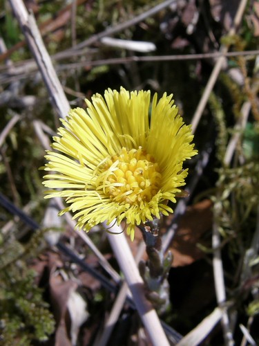
Bog asphodel.

Yet another cracking day, in a sequence of clear blue sunny sky days and unalloyed joy which has lasted so long that I’m actually beginning to feel paranoid – what kind of a fall is this building up to? Bog asphodel was to be a feature of the walk, which yes meant that bog was quite a feature too. When I parked near to Cockley Beck there was cloud down obscuring all of the higher fells, but I was bathed in sunshine.

This slowworm was enjoying the sun too – basking in it on the path not far from the road.

It’s not a snake, but a legless lizard (which sounds like the definition of a snake to me….?). We used to find them in our compost heap in our old garden (about half a mile from where we live now). I never found one quite as big as this one though.

Another feature of the walk…

…were small heath butterflies, which like boggy ground and feed on cotton grass and other sedges. (Can you see a pattern emerging here yet?) I saw them throughout the walk even high up where the wind seemed to be making life very difficult for them.

I took a path into Mosedale but soon left the path, crossed the stream and contoured across a fairly boggy area…

Bog. Note hills capped with cloud and white dots of cotton grass. 

….to the base of a scramble onto Little Stand.

The scramble heads up here somewhere. I had ‘More Scrambles in the Lake District’ by R. Brian Evans with me and the sketch in there is so good that route finding proved to be no problem. The route takes in the craglet on the right, but the guidebook offers an easy route round to the right. I looked at the main route. I wandered round and looked at the easy alternative. Then I walked around the side. It’s a long time since I did this sort of thing and what little bottle I had seemed to have deserted me. Higher up however where the rock was at an easier angle and the crags were wider and offered more options, I did eventually get into the swing of things and really began to enjoy myself.

It helped that as I climbed a great view was opening up down the Duddon Valley.

Duddon Valley – Harter Fell on the right.

It also helped that the weather seemed to be improving as I climbed. Little peaty tarns like this were another feature of the day – you can see the bog cotton again here. By now the guide book was permanently back in my rucksack and I just picked a route that looked good – in this case from the left hand side of the tarn diagonally across the picture to the high point on the right.

From Little Stand.

Summit of Little Stand. Pike-a-Blisco in shade in middleground, Eastern Fells beyond.

You can see a couple in the photo above – they had come up the same way as me, I had had occasional glimpses of them ahead of me, but they were the first people I had met to speak to since I left the car two hours before. Along the ridge, Crinkle Crags was partially in cloud, but even so it was clear that there were lots of people on it.

Before the Crinkles  I had to traverse Stonesty Pike though – a level area with several low hummocks which may have the dubious accolade of least distinguished Birkett to date. In the true spirit of bagging however I did zig-zag wildly taking in all of hummocks before deciding that the first one was highest after all.

The crinkles were busy. Birkett seems to have got carried away here, bestowing Birkett status on five separate Crinkles and Shelter Crag, so I was intent on climbing every knobble in sight just in case. Since the path skirts around many of the ups and downs I still felt like I had the hill largely to myself. At the ‘bad step’ – a small scramble where a gully is blocked by a large jammed boulder – I watched one descending party hang over the edge of the small drop and then choose discretion and turn back for the top, but the man ahead of me made climbing it look easy so I followed suit.

Long Top – the highest of the plethora of tops hereabouts – was busy, so I continued and had the third crinkle, which is slightly off the path, entirely to myself whilst I had a cup of tea.

Long Top Crinkle Crags from the third crinkle.

The descent to Three Tarns, over more Crinkles and Shelter Crag, seemed to be interminable, but eventually I was climbing again, this time on to Bowfell…

The obvious path on the right was fairly busy and I opted to pick a route out amongst the crags to the right of that path. Very good it was too. (And when I got home I found that R. Brian Evans suggested the same thing in ‘Scrambles in the Lake District.’)

From the top of Bowfell I eschewed the main path to Esk Pike and traversed the ridge to the North top which inexplicably isn’t a Birkett. (Nor is Adam-a-Crag on Crinkle Crags which is a fairly prominent knobble – like many of the Crinkles, but well below the top on the Lingcove Beck side so quite remote and awkward to climb.)

Scafell and Scafell Pike from the north top of Bowfell. The prominent nipple in front of Scafell is Pike de Bield.

I was very tired on the short climb to Esk Pike but it was at least very short and not remotely steep. Although I’ve started with a clean slate in terms of Birkett Bagging, most of this walk was in fairly familiar territory, although I don’t think that I’ve ever climbed Little Stand by that scramble before. The descent ridge was completely new to me and for me this is where the bagging thing can really pay off: Pike De Bield – an insignificant nipple with just one contour of it’s own – is a real gem.  It’s perched above Upper Eskdale on the one side and Lingcove on the other – two of the remotest valleys in the Lakes, and it has grandstand views of the huge crags of the Scafells and good views the other way too of Bowfell and Crinkle Crags.

Looking back to Esk Pike from Pike de Bield.

Summit cairn on Pike de Bield with Scafells behind.

Upper Eskdale from Pike de Bield.

Looking back up the ridge – Esk Pike, Pike de Bield and Yeastyrigg Crags.

High Gait Crags on the other hand is another inexplicable one as far as I’m concerned. Crossing Pike de Bield Moss to get to it meant that my feet, which had dried out nicely after early boggy ground, got a thorough soaking again. Why Low Gait Crags, or Long Crag or Pianet Knott don’t deserve equal recognition I don’t know. I bypassed the first two but thought the latter might be an excellent vantage point – which it was.

Lingcove Beck and Bowfell.

Another stream crossing, a short climb to the watershed and then lots of bog asphodel and cotton grass on the extremely boggy Mosedale brought me back to the car. It was 7.30pm and as warm and sunny as it had been all day.

Shortly before I got back, I encountered this monster….

…which sadly I can’t seem to find in my ‘Complete British Insects’. I had seen several dor beetles during the day, but this was giant by comparison.

Once again I can give walk stats thanks to Birkett:

Distance: 8.5 miles (felt much further), up and down: 3345 feet.

He says 5.5 hours, but I took over 8.

12 Birketts some of which are undoubtedly Wainwrights, but I haven’t checked yet.

Birkett Bagging Mania

My Favourite Christmas Present

Friday’s walk was a stunner, and may have to be split over several posts – we’ll see how it goes. Regular readers (hah!) may have noticed that I managed to get out for far more longer walks last year than I did the year before, although that activity dwindled in the second half of the year. There have been many reasons for that, but to try to ensure that I get out regularly, TBH has penciled in dates on our 2010 calendar, one a month, set aside for me (or sometimes both of us) to get out for  a longer leg-stretcher. The first of these was meant to be on Saturday, but with the weather perfect on Friday morning, I decided to strike whilst the iron was hot and set off then. With the roads still dodgy, and having not started as early as I might have, it seemed sensible to walk locally. And since I am off work recuperating something moderate, with plenty of gawking as well as walking seemed appropriate. I’m conscious of the fact that I haven’t continued my exploration of the Kent recently, and with one nearby stretch not walked since I declared my intent to walk it all from sea to source, I decided to head that way.

I didn’t take long for a first distraction to appear – setting the tone for the rest of the walk. A solitary Fieldfare on a shrub in a garden on Elmslack Lane. I got some photos, but only after the bird had unhelpfully moved from a nearby perch to one at the far end of the garden. Elmslack Lane becomes Castle Bank, a cul-de-sac which climbs steeply with houses on the left and Eaves Wood on the right. In a fairly open part of the wood I stopped to watch quite a number of Fieldfares hopping about in the grass, flying from tree to tree and generally entertaining me, whilst consistently evading my camera. After a while however four of them settled in a tree across the road in a garden. This time it was the garden of a good friend so I decided that it would be OK to intrude a little to get a little closer for photographs.


Two of the birds were perched together, initially both facing away from me. Note also how puffed up and spherical they are. I waited and….

…one of the birds both turned and, for want of a better term, ‘deflated’…

Here,their shapes are so different that they could be different species!

Castle Bank took me into Eaves Wood and through a stile to Holgates Caravan Park. The park has lots of woodland. There are information boards up about thinning and clearing of the trees. I could hear chainsaws and the air was full of the rather sharp smell of green wood burning. I could see neat piles of birch logs, but not where the felling was taking place.

I took a photo of Arnside Tower with a dog walker passing, mainly for Evelyn, the Castle Lady. Who wanted to see people with it.


The sprinkling of dots in the sky to the right of the tower are the Jackdaws which always seem to be about.

In the fields the farmers have been busy muck-spreading…

I passed Arnside Tower Farm and climbed into the woods on Arnside Knot on Saul’s Drive…

The woods here were absolutely thronging with birds in a way which I haven’t quite seen before. In the patches of exposed leaf litter, some of which you can see here, birds were busy fussing about, searching for titbits, occasionally squabbling. I tried to get photos. Against the leaves the birds – Fieldfares, Redwings, Balckbirds, I even saw a Wren looking dwarfed by the others – were incredibly well disguised, but the longer I looked the more I became aware of just how many there were.

None of the pictures were particularly good – the best being this Blackbird…


…and this Redwing glimpsed through branches, apparently with snow on its beak…

… – but I enjoyed taking them enormously. Eventually another walker arrived from the opposite direction and the spell was broken – the birds made themselves scarce. The walker was carrying binoculars and guessed what I was about – ‘They’re fabulous aren’t they? The woods are full of them.’ Which turned out to be spot on.

Climbing up towards the Knot I saw a couple of Bullfinches and a solitary Long-Tailed Tit (there must surely have been others, but I only saw the one). I was over-hauled by a couple of other walkers, one of whom turned out to be an old colleague. Then on open ground close to the top, I encountered more Redwings…

Doesn’t leap out does it?

Here’s a cropped version of another photo…

From the top I could see large pieces of ice floating in the Kent near New Barns. I also had some pretty fabulous views. At this moment, my camera informed me that its batteries were low. I’d only changed them two days before so I can only assume that the batteries were effected by the extremely cold weather we were having. I did manage to take a few views…

Looking South to the Bay.

East to the Howgills.

North to Dow Crag, Coniston Old Man, Swirl How and Wetherlam.

Whilst I was taking these photos something flew close over my shoulder and landed at my feet. Another tame robin, Somebody had put food out on the wall around the topograph, but this bird seemed to expect something of me. Sadly I had nothing to give it. None the less it followed me down the hill, repeatedly swooping close to my shoulder and landing on bushes or trees nearby. On one occasion it landed on a tree almost directly in front of my face. This photo was taken on the widest angle of my zoom…

I considered heading down to New Barns, but decided to go more directly into the village to enable me to get new batteries. I saw more bullfinches on the way down into the village. From the promenade…

I watched a curlew poking about on the margins of the river…

…and then found a cafe for a pasty, some tiffin and a pot of tea for lunch.

And now TBH wants the computer, so there ends part I. To find out what happened after lunch….same bat time, same bat channel….

My Favourite Christmas Present

Glowing Angel Hair

A sunny Sunday stroll with A (and her baby doll). As you can see here, the snow had mostly gone except where it had been compacted down to sheets of ice. Principally our driveway. It was still very cold however with plenty of frost and ice. Any walk with A inevitably involves a great deal of conversation, but this was also a walk of distant views to places where the snow lingered: the Howgills from the field near home…

..,Ward’s Stone and Clougha Pike across Carnforth salt marsh from Heald Brow…

…, and Dow Crag and Coniston Old Man as we turned towards home…

It was also, from my point of view at least, another opportunity to attempt to capture the effects of the low winter sunshine, with varying degrees of success. I was particularly struck by the way the light was catching the ‘angel hair’ on traveller’s joy in a hedge.

It was difficult to get quite the shot that I wanted since the seedheads which were lit-up were high in the hedge and reaching up to get a photo from the right angle involved doing battle with a vicious bramble.

Still – backlit seedheads – another totem for the alphabet, and something else to be on the look out for.

Ash buds

And in my search for images of ‘leaves and stuff’ perhaps I shall make more of an effort to include seedheads, buds, bark, cones….

Glowing Angel Hair

…And Back

During our wander round to Arnside, it struck me that over of the last year or so, some of our most memorable days have been spent walking to, from or in the vicinity of Arnside. I was thinking of the time that we were briefly marooned at New Barns by a very high tide, around a year ago. Or the bright cold walk along the estuary which kick started 2009, or my weekend hostelling trip last summer. The common factors of these outings, apart from location, are sunny weather and my daughter A. On our present trip she had early decided that she wanted to walk home from Arnside even though that was not part of our original plan. I had told her that she could, expecting that she would tire, or that her resolve would crumble when she saw others setting off in the car, but I underestimated her. I was doubly surprised that she stuck to her guns when everybody else decided to take the easy option. So just the two of us for the return journey then…

We climbed up through the Ashmeadow estates grounds. There are permission paths around the grounds which we haven’t explored properly – we must come back for a better look soon. A was very impressed with the information board about the wooded grounds and praised the detail and colour of the map on the board. She had clearly taken careful note because as we passed picnic tables and a wooden arch she said: “They were on the map Dad, it’s like the map is coming to life.”

A steep climb up Redhill Road was rewarded with excellent views and cowslips on the verge. We climbed through Redhill Wood and onward across the open field on the north side of Arnside Knot, A talking ten to the dozen, me saving my breath for the climb.

As I have said before, Arnside Knot is an Insignificant Hill with Disproportionately Magnificent Views. Hills that we had glimpsed form the estuary could now be seen in their place and be more easily identified. In particular, a hill seen quite prominently from near White Creek, which I had thought might be Fairfield, I could now see was Stoney Cove Pike, with Wansfell below it.

Looking over the Kent Estuary and Cartmel Fell to the Coniston Fells

Over the viaduct. Stoney Cove Pike above Whitbarrow on the right. Fairfield very prominent right of centre. Hellvelyn in the centre. Distant Skiddaw, just visible through Dunmail Raise left of centre.

Howgill Fells

I have a hare-brained scheme for an Arnside Knot Skyline long distance route taking in all of the hills which create a horizon from the Knot. It would be pretty challenging and very eccentric – Black Combe, Caw, all of Lakelands higher fells, the Howgills, the hills along the fringes of the Dales including Ingleborough, the Forest of Bowlands northern rim, but then taking in Snowdonia somehow too, since I have seen the hills of North Wales from here (but only once).

Maybe A will walk it with me one day. She does enjoy reaching a summit…

She also has an amazing memory and wanted to pose on these exposed beech tree roots for the simple reason that she did the same when we passed this way last summer.

As we emerged from the woods on the Knot it was evident that big changes are afoot in Middlebarrow wood…

Where all of the alien conifers have been felled…

Leaving some very tall and spindly trees, mostly birches, and some more substantial yews. Hopefully, this is the first step in a process of restoring more natural woodland.

We passed Arnside Tower Farm, where a very growly dog upset A.

And then Arnside Tower itself…

The blackthorn has been flowering for a while, but climbing through the wooded fringes of Holgates we were passed through a tunnel of spiky bushes and were struck by the very strong scent of the flowers…

In a small open glade a peacock butterfly fluttered past. I’m not generally very successful in photographing butterflies and this one was too fast for me. We waited a while and two or three more passed through. Eventually one sat still long enough…

“You can’t beat a butterfly Dad”

Nope. Nor can you beat a sunny day and a walk in good company.

…And Back

Not Peak-Bagging I

River Fillan

Just back after a two day pass out to do some walking and catch up with some old friends. So how many peaks did I ‘bag’? Well….none.

We were based, for the fourth year running, at the Ben More Lodge. After a few sunny days last week, Saturday morning was bright and clear and full of promise. By the time we had taken a hefty ballast of fried pork for breakfast however, the cloud had moved in, obscuring both the blue sky and the tops of the surrounding mountains. We drove a little further north and parked in Strath Fillan. As we crossed the river Fillan at White Bridge, a dipper skimmed low across the water.

A track took us to the Allt Gleann Auchreoch, where a decrepit bridge, not marked on my map, led us across the river…

…for a confab with the map…

Rather unusually, we were in an area of native woodland, with lots of Scots Pines, which made for very pleasant walking, although it was very soggy underfoot.

We climbed past the skeletal remnants of a dead tree, still towering over the birches surrounding it…

And were soon out of the woods and climbing beside the waterfalls of the Allt Coire Dubhchraig…

When we crested the rise at the top of the falls we were in the clouds. The boggy path we were following struck westward towards the broad northern shoulder of Beinn Dubhcraig. I was finding the going a little tough, and having left the stream and the woods and entered the clouds, found the prospect of slogging the rest of the way up a featureless hillside pretty unappetising. So I didn’t. I rationalised the decision by making the excuse that I’ve climbed these hills before. Uncle Fester is usually on the look out for company for a tactical withdrawal and has a dicky knee at the moment, so leaving the rest to carry-on we turned tail and after a short descent picked up a forest track dropping down into Gleann Auchreoch.

Naturally, Sod’s law was in full effect and by the time we stopped on a rocky knoll for a breezy lunch, it was clear that the cloud was beginning to lift. Soon after all the tops were clear, including Beinn Dubhcraig and Ben Oss where our friends would now be enjoying panoramic views. We found a sheltered, sunny spot on a bridge in the forestry and a photo stop…

Cloud clearing from Beinn Dorain and Beinn Odhar

…became a sit down, then a lie down, then a nap. (Uncle Fester reports that he was only resting his eyes, but I was definitely snoring – I kept waking myself up)

In fact we had a very pleasant afternoon exploring the woodland around the rivers Fillan and Cononish, spotting frogs in path side pools and ditches and taking advantage of the sunshine to take lots of photos.

Hillside Birches


Scots Pines

Ben More, Stob Binnein and Cruach Ardrain

White Bridge and the River Fillan

One of the sculptures in the Tyndrum Community Forest

Backlit birch bark

Coltsfoot by the Car Park

Not Peak-Bagging I

The Height of Bliss

Those who have not tasted the delights, the adventure, the discomfort, the challenge, and sometimes the tragedy of the high hills, can never understand. But the utmost height of bliss is stepping along some sharp ridge in sunshine, wrapped around with a great blue sky, after climbing up out of that care-ridden fleapit of earth thousands of feet down there in the purple depths.

John Wyatt The Shining Levels


This blog is not often about high hills, nor is it likely to be. But reading this passage recently has had me daydreaming. The book that it comes from is not about hills either. John Wyatt was head of the Lake District National Park ranger service for many years. The Shining Levels is an account of a year spent living and working in a wood on the slopes above Windermere. It tells of his relationships with his neighbours and co-workers and with the nature around him, particularly with a roe deer buck that he adopted. I’ve had it on my shelf for a while, but only just got round to reading it. In parts it is fascinating and informative, whilst some sections of the book are hilarious.

The photograph shows a panorama looking across the Chamonix valley to the Mont Blanc Massif. It was originally five photos which have been cunningly melded by Autostitch free downloadable software which I was put onto by BG and Martin of Summit and Valley.

This photo, taken on the same trip, is from the summit of the Aiguille du Tour looking, I think, towards Monte Rosa.

The Height of Bliss