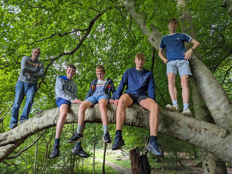
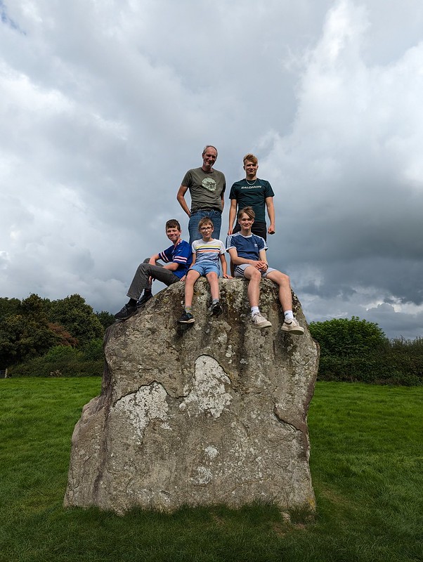
Dr A, W, M, B and S on the Balancing Tree in the Ring of Beeches.
Our Peak District trip was timed to fit in with a visit from my brother-in-law, Dr A and his family. We didn’t have them for long and were keen to pack a lot in. First of all, a walk in Eaves Wood.
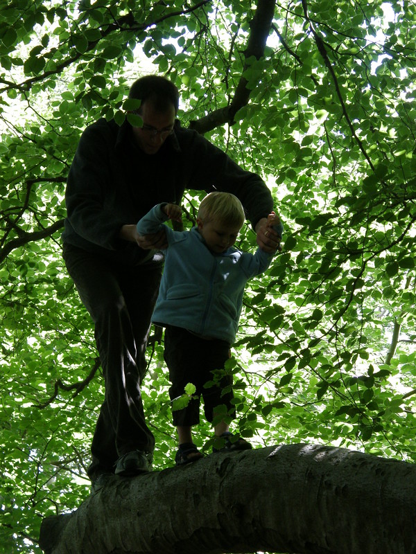
DrA and B on the same branch in 2008. Silverdale from Castlebarrow.TBH and Dr S at The Cove.W has been clambering on the rocks, and swimming in the mud.
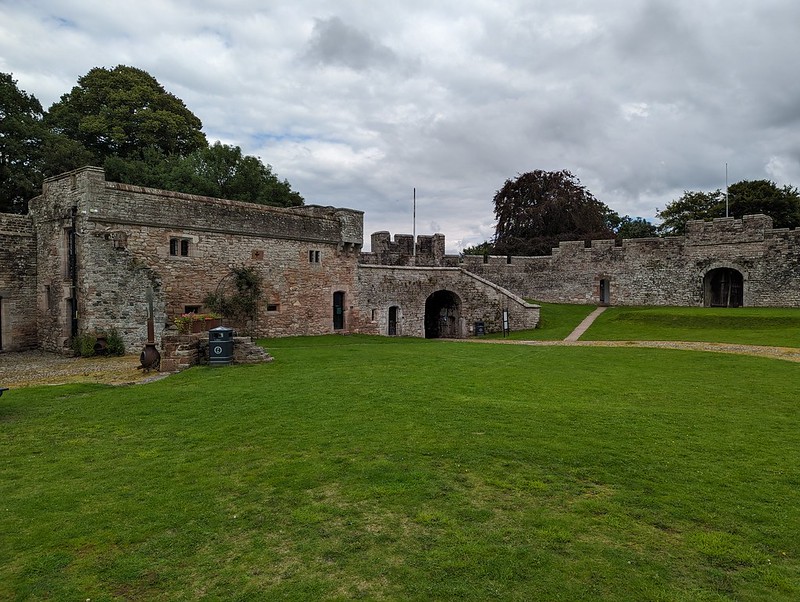
Since our American relatives needed to be back in County Durham, we decided to head that way and to rendezvous by Brougham Castle. Now, note: Brougham Castle, not Brough Castle which is nearby. Since I’d been very careful to point out the similarity of names and locations, we knew as we waited near Brougham Castle that they couldn’t possibly have made the mistake of going to Brough instead. After all, maps are pretty much Dr A’s area of professional expertise.
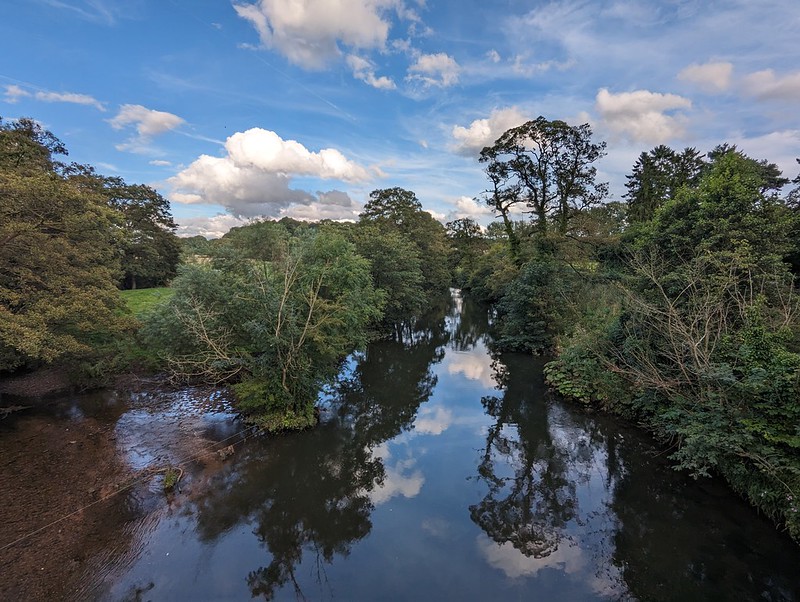
Brougham Castle and the River Eamont.
With a little time to kill whilst Dr A drove his family the short distance back from Brough to Brougham, we decided to detour slightly to have a peek around Brougham Hall, which is free and always worth a gander.
Brougham Hall.Brougham Hall.Brougham Hall, the Chancellor’s Den.
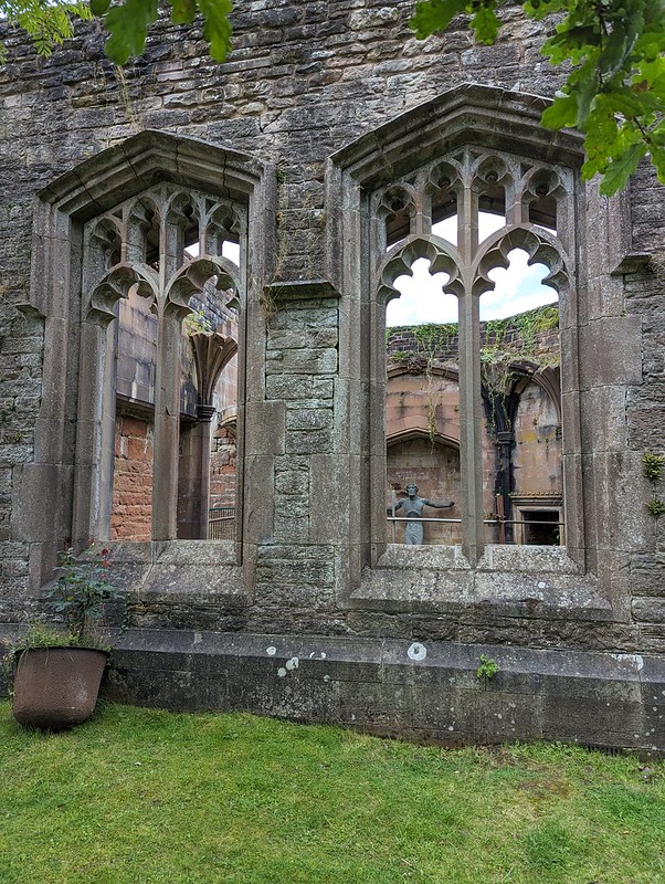
There’s more about the Hall and the Castle, and cute photos of the kids when they were little, from a previous visit here.
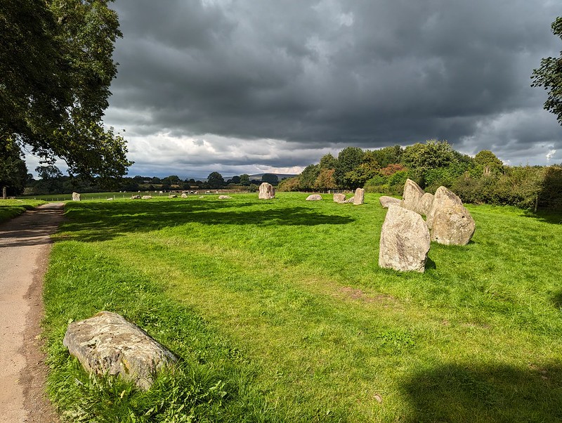
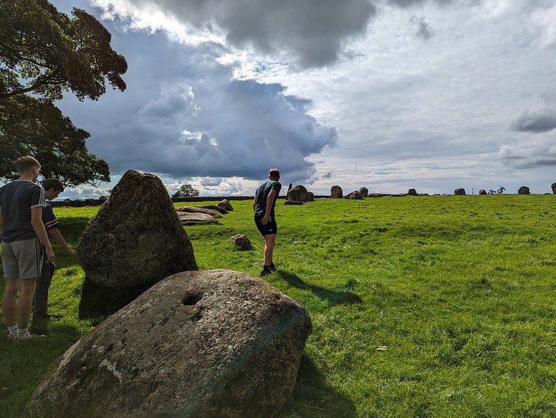
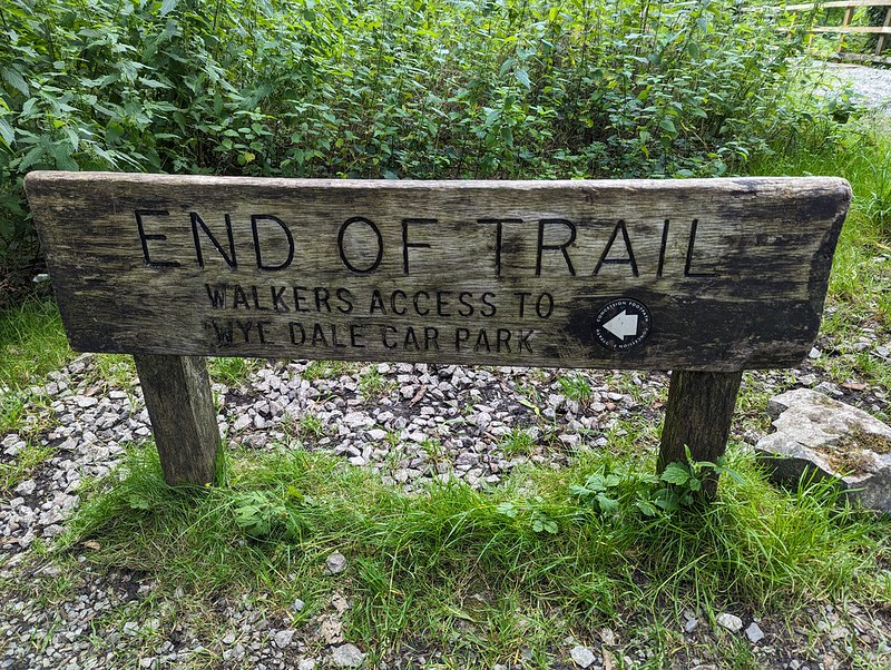
Once we were reunited, we drove to Little Salkeld, intending to have a walk to Lacy’s Caves. The path has been officially closed when we’ve done that walk in the past (one of those walks here). It still is. But now there’s a big sign displayed to that effect, rather than a scrappy bit of paper tacked to a telegraph pole. We decided to head up the road a little way to Long Meg stone circle instead.
Looking to the Lake District from the new car park by Long Meg and her Sisters.A short walk to the stones.
There may be a new, and quite substantial, car park, but we still had the circle almost to ourselves.
Some of the Sisters.
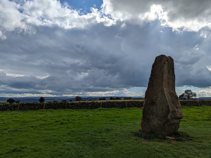
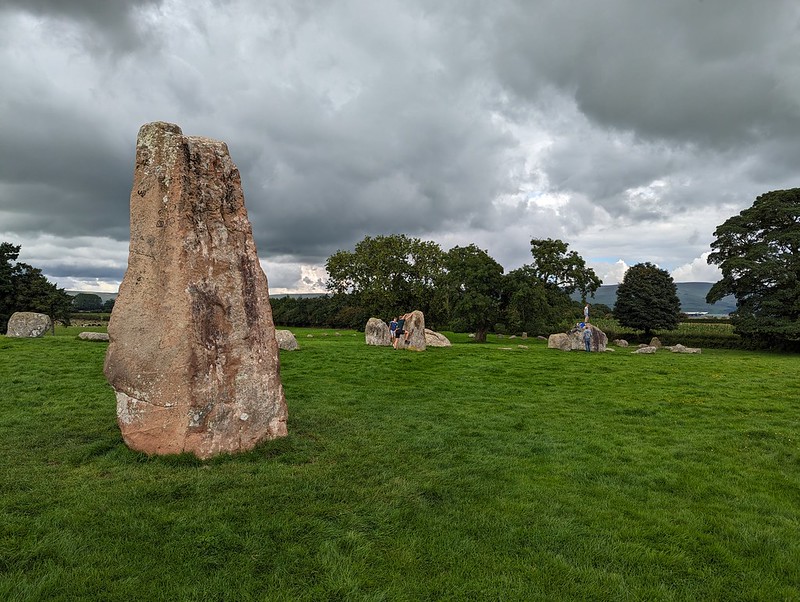
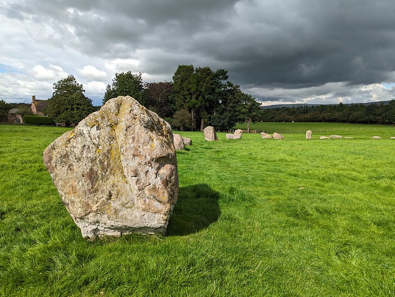
It’s an amazing place and it astonishes me that it’s not more well known. (There’s more details about the stones in this post from our first visit in 2011.)
More of the stones...…which clearly need to be climbed on.Long Meg.Cup and ring mark. I think.Long Meg, with her sisters behind.More stones.And more.Dark skies over the Pennines.Another view of the stones.TBH chilling out.Family pose.Heald Brow.
Later, when we were home again, and since it was a nice evening, I was out for a local stroll.
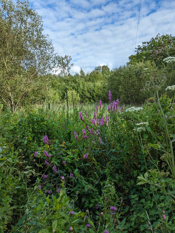
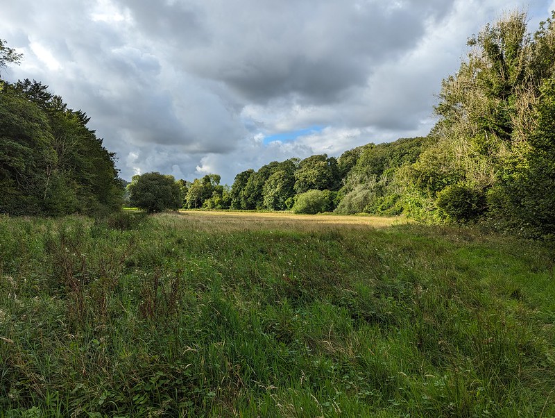
After a fairly wet drive home and unpacking etc, I had a late mooch around home. Where to go? Lambert’s Meadow of course, via The Row and Bank Well before strolling back through the village.
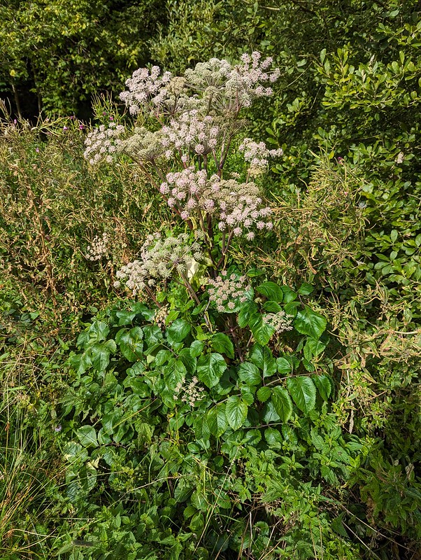
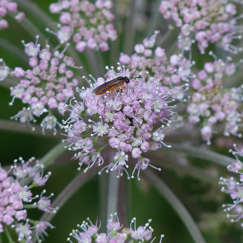
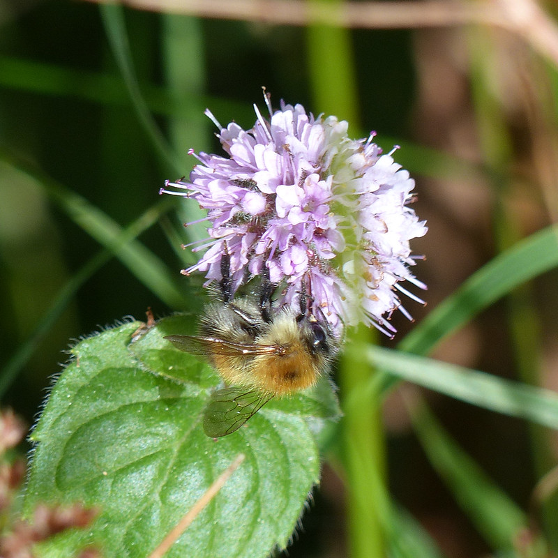
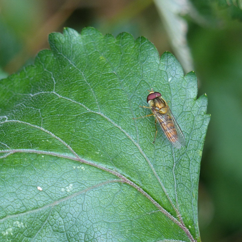
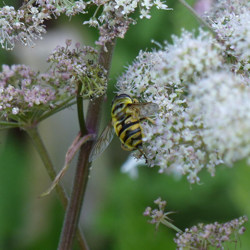
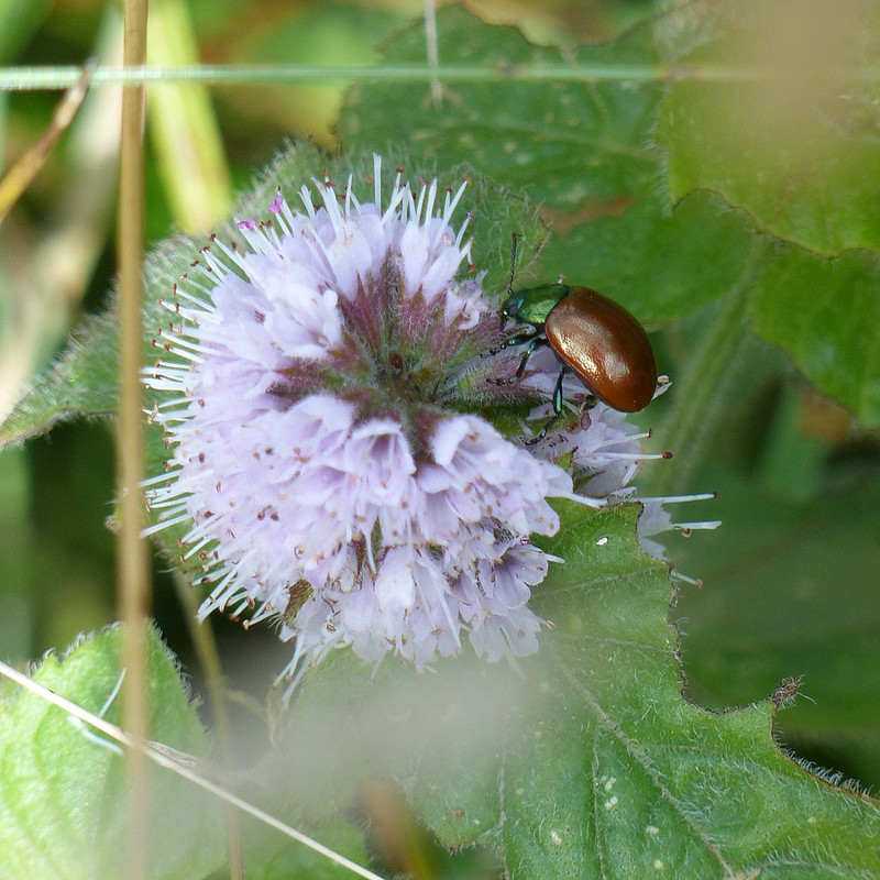
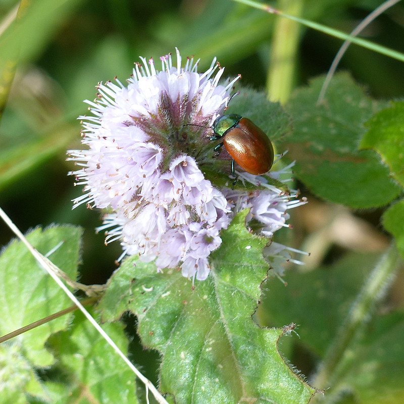
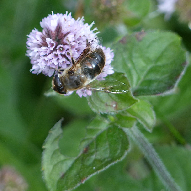
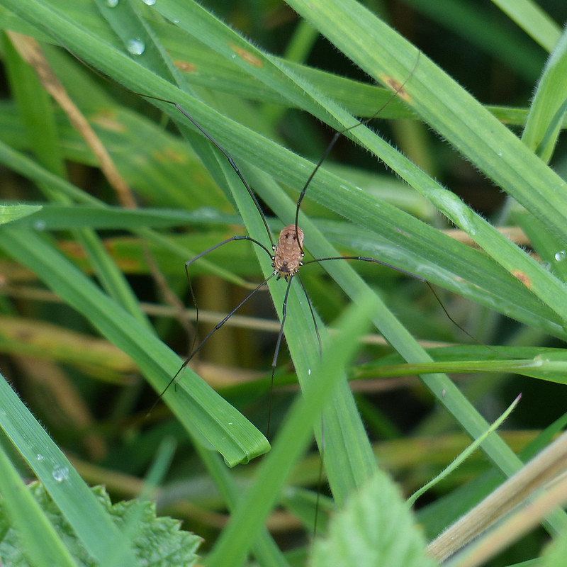
Purple Loosestrife by Bank Well.Lambert’s Meadow.Wild Angelica.Drone Fly.Honey Bee.Turnip Sawfly, I think – note the orange thorax, abdomen and legs contrasted with black head and ‘shoulder pads’. It also has an obvious black front edge to its wings. Common Carder Bee.Marmalade Hoverfly.Hoverfly – possibly Helophilus trivittatus.Drone Fly.Social wasp and hoverfly – possibly Leucozona glaucia, a new species for me.Hoverfly – possibly Myathropa florea, the ‘Batman’ fly.Chrysolina polita.Chrysolina politaA very dark Drone Fly……possibly Eristalis Pertinax.Mamalade Hoverfly.Hoverfly, possibly Meliscaeva cinctella.Harvestman.Twirly seeds.
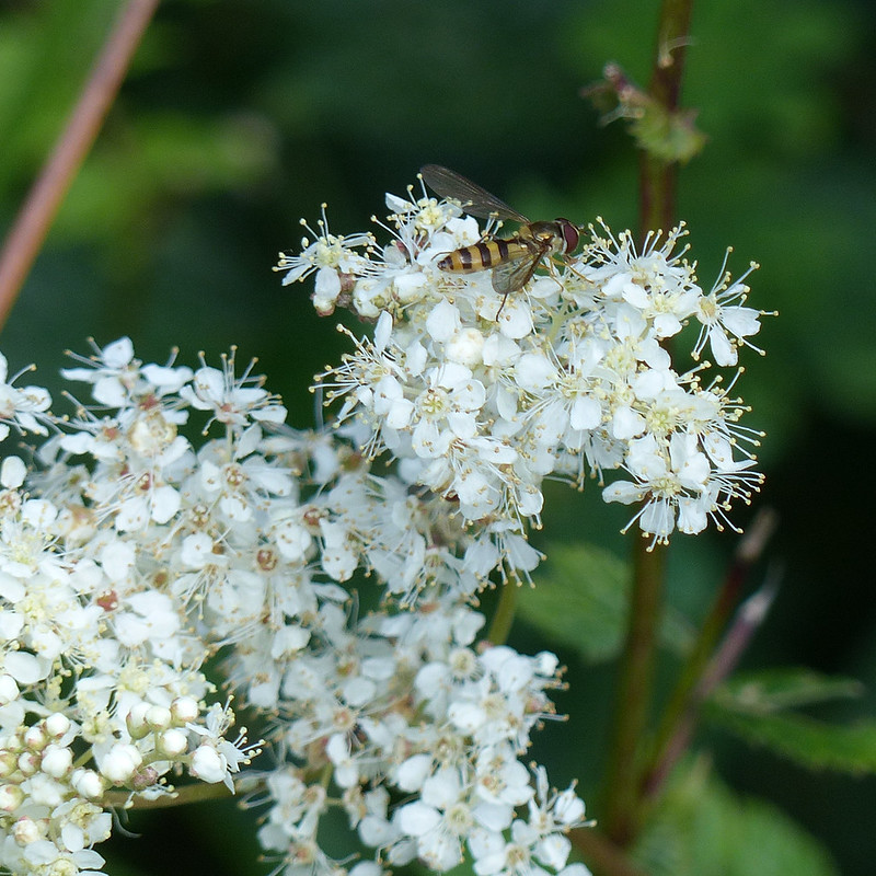
The light was very variable, but that didn’t stop me taking a huge glut of photos. The best was saved for last however, after I’d left the meadow and was walking around Silverdale Green…
We had one more day in our little cottage in Staffordshire, but Little S was under the weather and B needed a lift to Uttoxeter to catch a train to Manchester where he was meeting friends. Unfortunately, the main road was closed due to an accident, which meant that trip took a lot longer than it ought to have done.
Calwich Park.
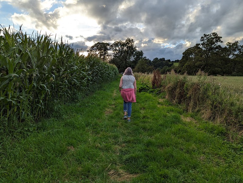
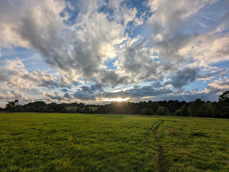
So TBH and I finished off our short trip with a wander in the vicinity of the cottage. The countryside was green and rolling and very pleasant.
I’d noticed Calwich Abbey on the map and was keen to take a peek. According to the Historic England website the house is Victorian, but in a Tudor style, and is built on the site of a medieval abbey. It was derelict when the listing was made, in 1984, but was sold in 2015, so hopefully it will be restored?
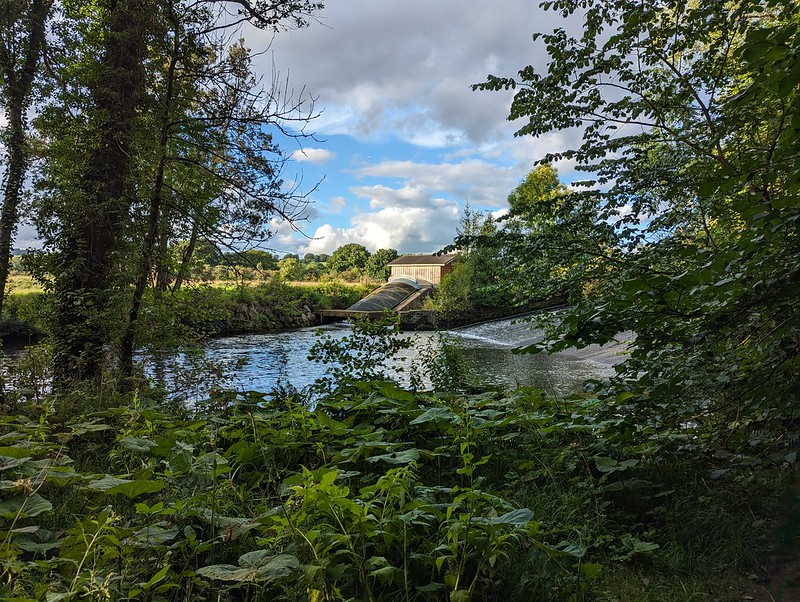
Calwich Abbey, otherwise known as The House of Usher.Another Ground Beetle. Maybe a Pterostichusspecies?Buzzard, I think.River Dove.TBH by the River Dovenear Norbury.Small scale hydro scheme?
The path through the woods near Norbury were overgrown from the off – nettles, brambles etc; all the obstacles to pleasant country walking in the summer. As we progressed it became more and more impenetrable. We should really have turned back. By the end, a machete was needed, and my habitual choice of shorts had turned out to be a very poor decision. Then it was spitting with rain as we walked along a minor lane for a while.
TBH heading towards the Dove.
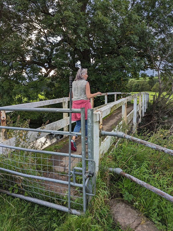
At least the last section, over the Dove via the charmingly named Toadhole Footbridge was much more pleasant.
TBH on Toadhole Footbridge.
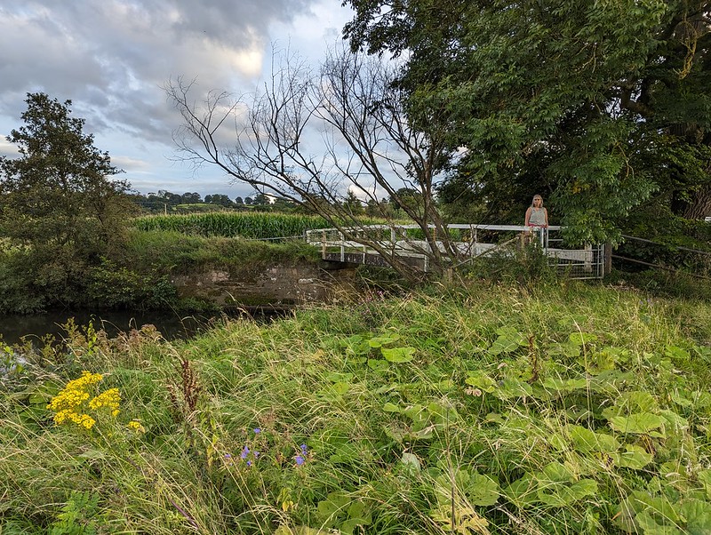
As we crossed the bridge, we were lucky enough to catch sight of a Kingfisher, my first for some time.
River Dove.TBH on Toadhole Footbridge.Almost back to our accommodation.
Looking at the map, after our walk, it struck me that there is probably quite a bit of scope for decent walks in this area, just outside the National Park. The wooded valley of Ordley Brook looks particularly worth exploring. Another time perhaps. I certainly hope it’s not too long before we come back to the Peak District for another visit – perhaps a slightly longer one next time.
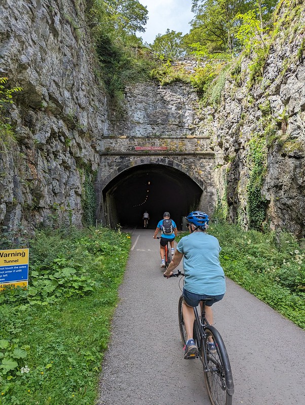
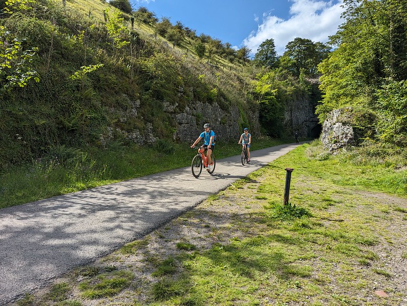
I’ve always considered the view from Monsal Head of the Headstone Viaduct to be one of the iconic scenes in the Peak District. Since the days when I was a regular visitor to the area, the old railway line has been converted into a walking and cycling track, a fact which Andy alerted me to on his blog. We’d brought the DBs bikes with us, and hired bikes at Hassop Station for TBH and myself. I remember that my bike was a Raleigh, but not which model, which is a shame, because it was very comfortable and a pleasure to ride.
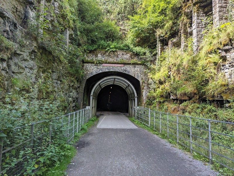
Headstone Tunnel
Hassop is near, but not at, one end of the line. We set-off west to tackle the larger portion of the trail first. There are six tunnels on the route and I seem to have taken photos either of, or in, most of them. I’m not sure why I was so chuffed to be cycling through tunnels, perhaps because I’m still essentially a big kid at heart.
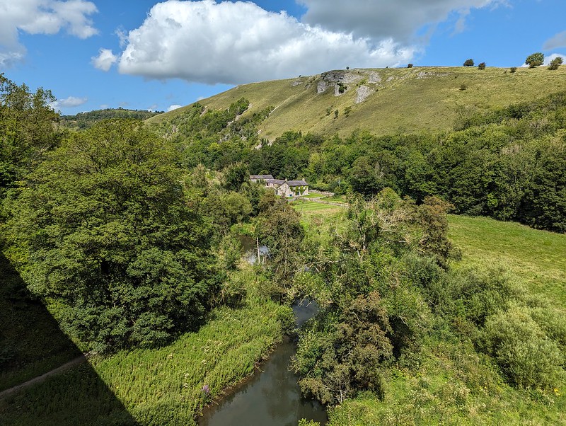
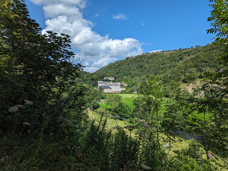
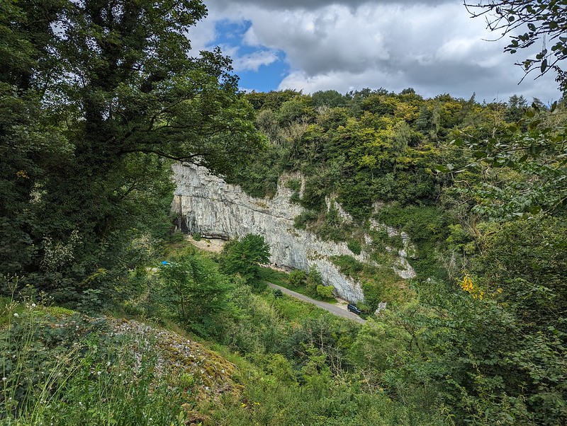
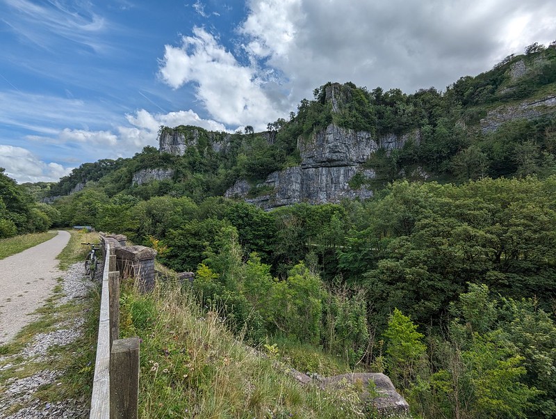
View from the Headstone Viaduct.View the other way from the Headstone Viaduct.Cressbrook Mill.Gorge-ous scenery.One of the dales.
The trail generally follows the valley of the River Wye, but, confusingly, the name of the dale changes along its length: Monsal Dale, Water-cum-Jolly Dale, Millers Dale, Chee Dale, Wye Dale. It’s hard to know where the transitions occur and also hard to remember where each of the photos was taken, so I can’t say which dale each one shows!
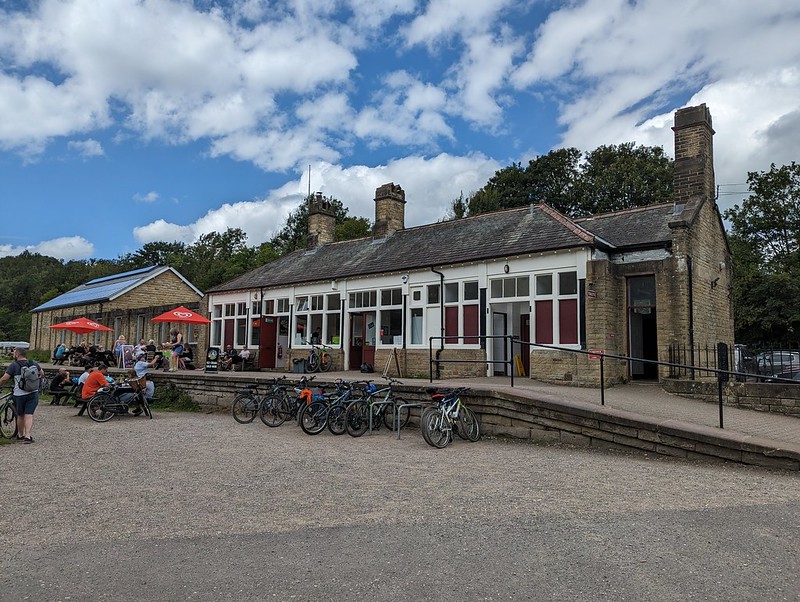
Happy bikers.Looking down on the road.Two viaducts near Miller’s Dale Station.Miller’s Dale Station.
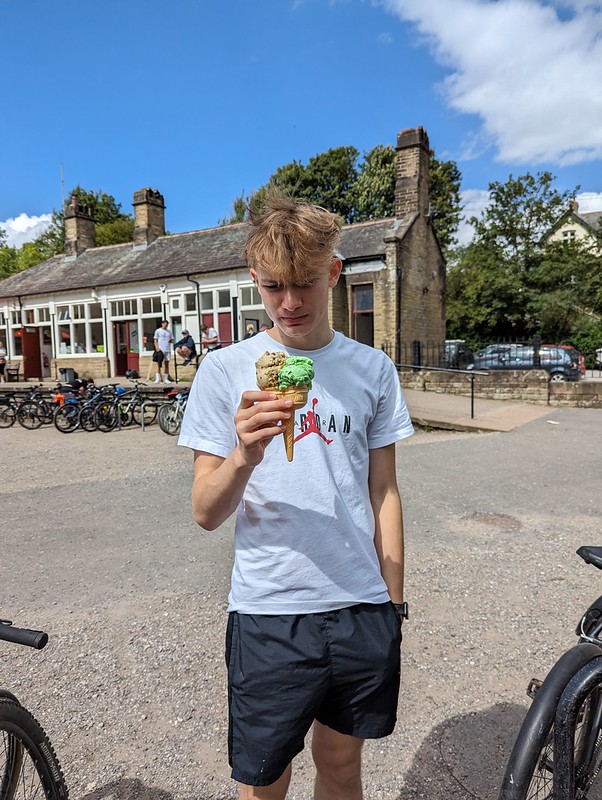
The cafe at Millers Dale station was popular and we probably should have got some lunch there. Little S did get an ice-cream, which for some reason seems to have caused some consternation on his part…
Little S with a suspicious ice-cream.Huge limekiln.Possibly the last of the tunnels.End of the line.
We’d been planning to eat at the cafe at Blackwell Mill, at the western end of the trail, but didn’t, I think it was closed. Either that, or it didn’t have any vegan options, I can’t remember.
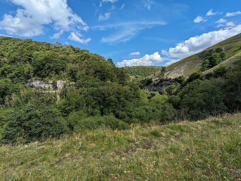
Chee Dale.
I’d chosen to start near the Bakewell end because I’d read online that it would be uphill from there. It must be a very gentle gradient: it hadn’t seemed uphill, but now that we turned around, the difference was really obvious and going the other way was much faster and could be free-wheeled.
Chee Dale from the little spur.
I had noticed a short spur here coming post and took a detour now to have a nose. It was well worth it for the view.
Free-wheeling.One of the Dales!
Back at Hassop station we had a very late lunch in the excellent cafe there, which is highly recommended.
We were running short of time on our bike rentals, so I asked in the shop whether we were okay to cycle to the other end of the line near Bakewell. I was told that it was fine, so long as we were back before closing, but that the return part was uphill and that many people found it challenging.
The other end of the line.Bakewell Station.Hassop Station.
Actually, it was fine and I’m pleased that we managed to fit in the entire route. I was hoping for a view over Bakewell, but whilst we did get some, they were partial and didn’t yield very good photos. The whole trail is 8½ miles, so there and back is only 17, not a very long cycle ride I know, but immensely enjoyable and pretty much flat which is a big selling point as far as I’m concerned.
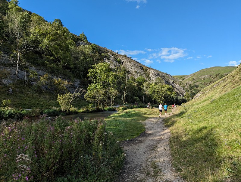
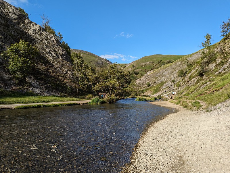
Dove Dale.
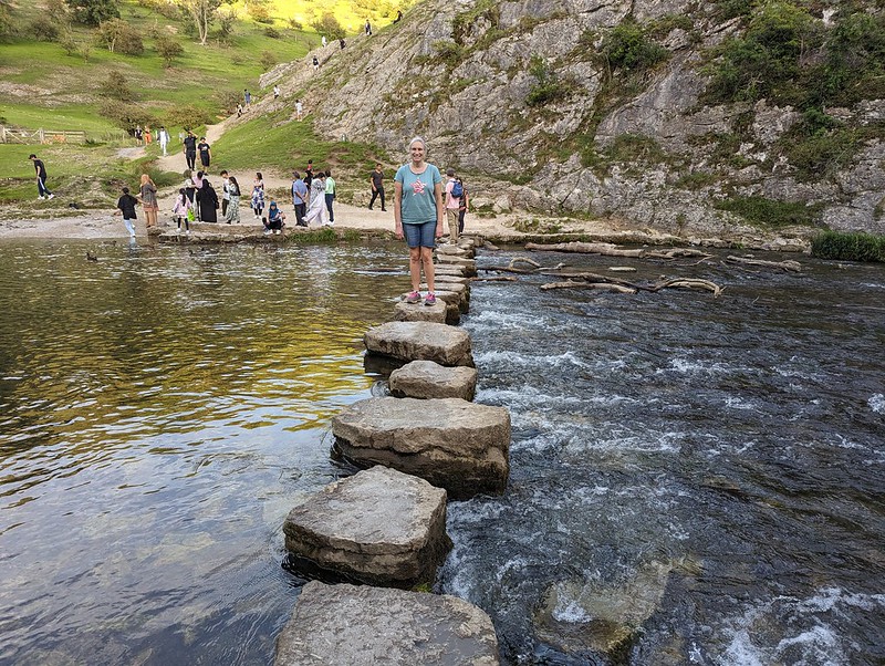
From my childhood visits to the Peak District I think three memories stand out: the show caves around Castleton; steaming, overheated cars pulled over on the roadside up Winnats Pass; and the stepping stones and rock scenery of Dove Dale. Since Dove Dale wasn’t far from where we staying, I was determined to fit in a visit whilst we were there and although it was late in the day, we managed to get into the National Trust car park before the entrance was closed for the evening.
River Dove.
Even though it was early evening, the area around the stepping stones was still very busy, with lots of large family groups enjoying picnics. We didn’t have to go far though before it became much quieter.
The Twelve Apostles, well some of them.
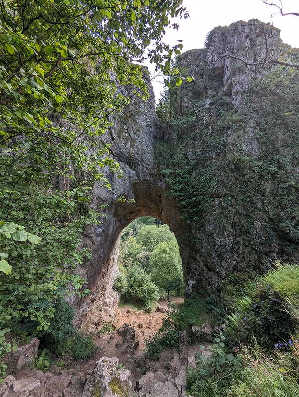
I remember, on those early visits, being awed by the natural rock arch above the path, and that it was close to Reynard’s Cave, but I don’t think we ever climbed up to the arch or the cave.
Natural Arch.
Judging by the heavily eroded path, that’s now a very popular activity. It’s pretty steep, more so than this photo suggests.
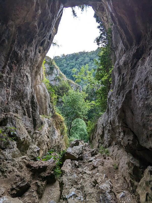
And from above.And from Reynard’s Cave.TBH in Reynard’s Cave.
Like Thor’s Cave, there’s archeological evidence showing that Reynard’s Cave was occupied, at least sporadically, during the Neolithic through to the Medieval period.
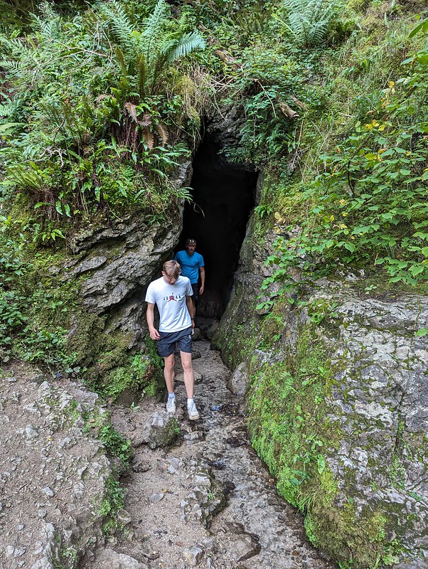
Another cave.
We found another, smaller cave just around the corner from Reynard’s and then an alternative route back to the river which was a little less steep.
Descending from Reynard’s Cave.
Before heading for home we walked a little further upstream so that the DBs could investigate this rather wet cave which had a stream flowing out of it…
Another cave down by the river.The famous stepping stones.
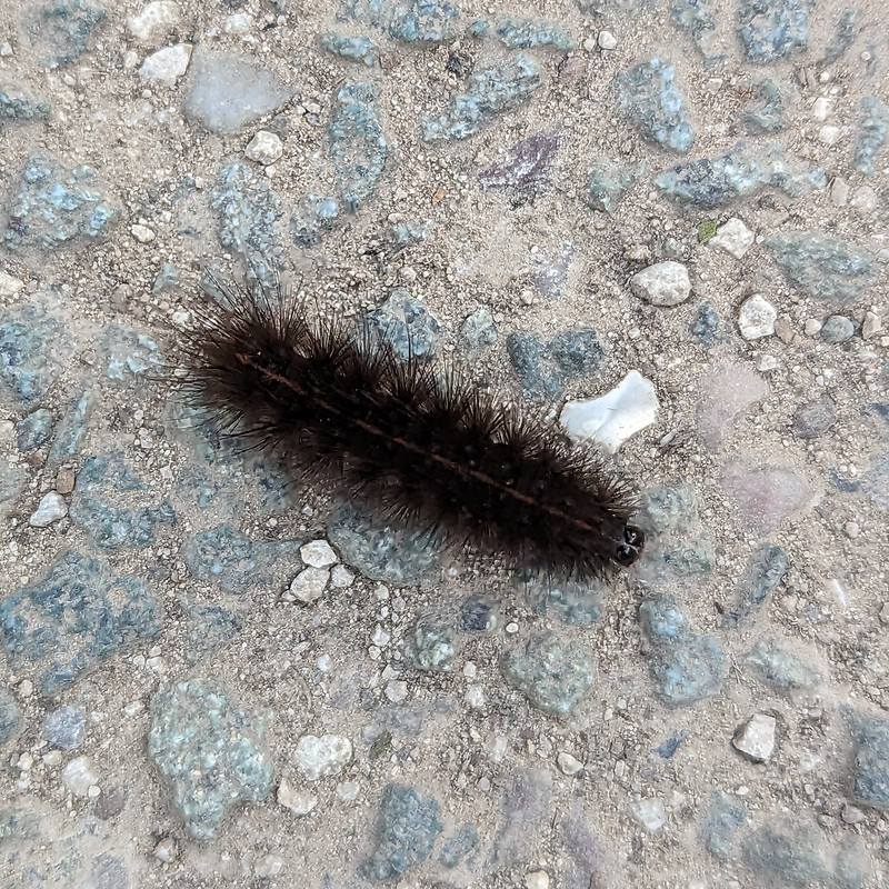
And finally, on the path back to the car park, a couple of interesting insect encounters…
Lesser Stag Beetle (I think).A White Ermine Moth Caterpillar (I think).
This was the last full day of our flying visit to the Midlands. Our trip was short, but packed with interest and I hope it’s not too long before we’re back in the area.
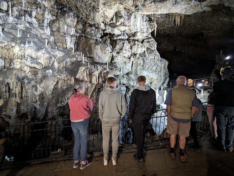
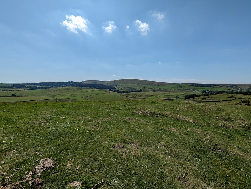
When I was a nipper, trips to the limestone caverns around Castleton where a regular treat, at least that’s how I remember it and we certainly visited all of the show caves in that area. But I don’t think we ever visited Poole’s Cavern near Buxton. So, we’d booked online the night before to put that right. Driving up, Google maps took us on a high level route, coming into Buxton from Axe Edge Moor, which I very much enjoyed because of the fantastic views.
One of the resident Buzzards near our accommodation.
Actually, I’m getting ahead of myself. There were a pair of Buzzards evidently resident in the trees near to our rental property and I took every opportunity to try to get photos of them. Here’s one I took whilst I was waiting for everybody to be ready to set off for Buxton.
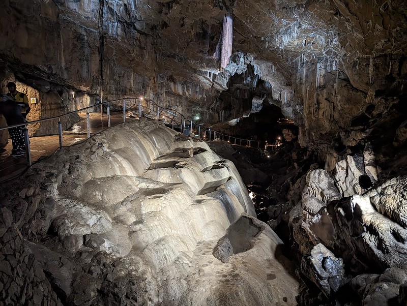
Flowstone features Poole cavern.
I thoroughly enjoyed Poole’s Cavern. There was an interesting little museum in the visitor’s centre too. Apparently there’s evidence that the cave was occupied from the Bronze Age onwards. One of the occupants was an outlaw called Poole, hence the name.
Flowstone features Poole cavern.
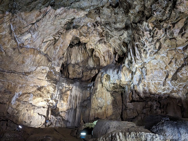
The large and broken stalactite in the centre is called The Flitch of Bacon. I was more impressed with the pools in the flowstone beneath.
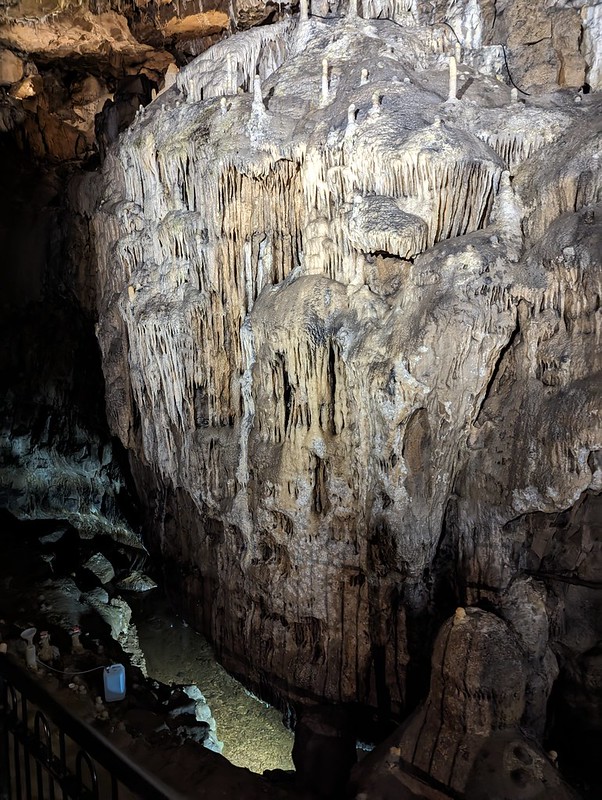
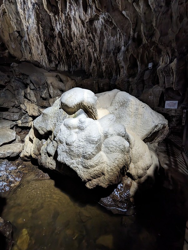
An abundance of stalagmites and stalactites.
Quarrying in the hillside above the cavern has caused the stalactites and stalagmites to grow at an increased rate. Research is ongoing into this accelerated growth.
Stalagmites and stalactitesPoached Egg Stalagmites.More flowstone features.And more (or a backdrop from a scene in Alien?)And more.Flowstone coated boulder at the furthest point of the tour.
Seasoned cavers have apparently been working for years to dig a way through the stonefall at the end of the passage to find a way through to potential caverns beyond. It sounds like a dangerous and thankless task.
Poole’s Cavern is part of Buxton Country Park. There’s a Go Ape there too, and so I booked the DBs in for an afternoon session, we lunched at the cafe in the visitor centre, and then while the boys were doing their Tarzan thing, TBH and I went for a wander through Grin Low Woods and up to the top of the hill, where there’s a folly and a fine view over Buxton.
Grin Low.Grinlow Tower (Solomon’s Temple).
Grinlow Tower was apparently commissioned by the splendidly named Solomon Mycock to provide work for the unemployed in the town.
Buxton from the top of the tower.Looking towards Axe Edge Moor.
Back in 1983, my dad, his friend John and myself completed a challenge event called the Bullocky Smithy Hike. It’s an annual thing, still running if you fancy a go, organised by Hazel Grove Scouts. It’s advertised as 56 miles, but whilst there are checkpoints there’s no fixed route. We did a bit of road walking to avoid stumbling down Miller’s Dale in the dark, so I’ve always claimed that we walked 60. To be honest, it’s mainly the checkpoints (and the pain in my left knee for the last few miles) which I remember. At the checkpoints volunteers offered friendly encouragement, lavish quantities of food, hot sweet tea and (I think) treatment for blisters and muscle aches. I think we crossed Axe Edge Moor at about three in the morning. I was exhausted and very, very cold at this point. The checkpoint was in a barn close to the Cat and Fiddle Pub, I think, and the warmth and the tea and soup on offer, cheered me up no end. A couple of years later, in my first year at University, a fellow resident of the tiny Halls I lived in, an ultra-runner, won the event in a ridiculous, record time of around 9 hours. We took 22 I think. I don’t think I’d even realised it was a race. There’s a fuller, more detailed, account of a more recent completion here, which I enjoyed reading.
We took a different route down through the woods and found lots of heavily laden raspberry canes.
Sculpture of a Lime Burner, Grin Low Woods.
Although tucking into the raspberries slowed us down somewhat, we still had time to kill before the DBs were done swinging through the trees, so we had a wander down into Buxton.
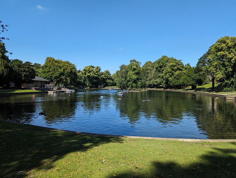
Boating Lake, Pavilion Gardens.Buxton Pavilion.
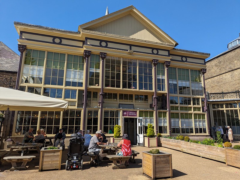
Back in University Hiking Club days I think we held at least one post-hike Meal and Barn Dance (we’d call it a Ceilidh these days I suspect) in Buxton, I think in the Pavilion, although I could easily be wrong. I also ran the Buxton half-marathon years ago, a very hilly affair with a brutal first few miles up on to Axe Edge Moor. Anyway, it’s a handsome spa town and a lovely place to visit, so I was glad to be back.
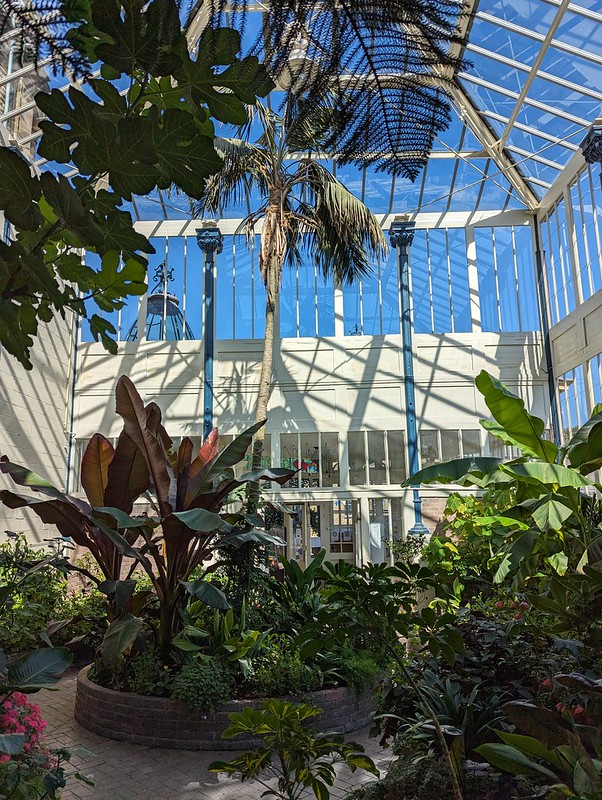
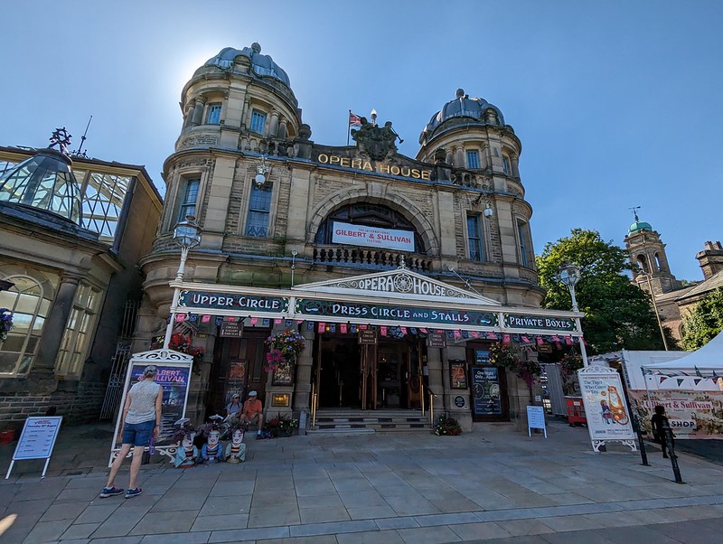
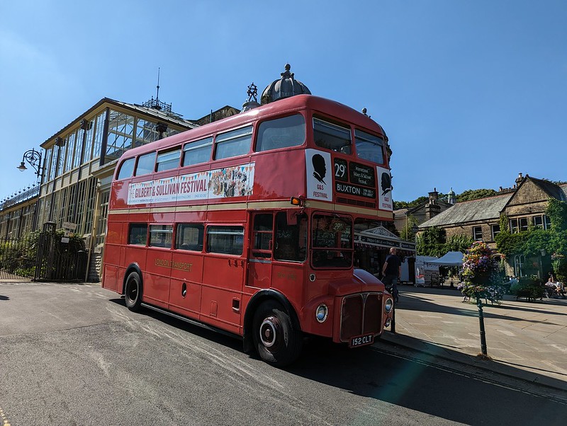
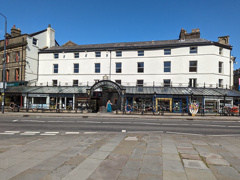
Buxton Pavilion.Pavilion Tea Rooms.Pavilion Interior.Buxton Opera House.London Transport Bus – a bit lost?Buxton CrescentGrove Hotel.Cafe at the Green Pavilion.
We popped into the Cafe at the Green Pavilion for a drink. It was hot by now, so I settled on a locally brewed beer. Very nice too. The menu looked enticing, so we were disappointed that the staff were in the process of closing up, and we couldn’t come back for tea. In fact, I can’t remember what we did by way of an evening meal – maybe this was the night we had late fish and chips from the chippy on the Market Square in Ashbourne? Also very nice.
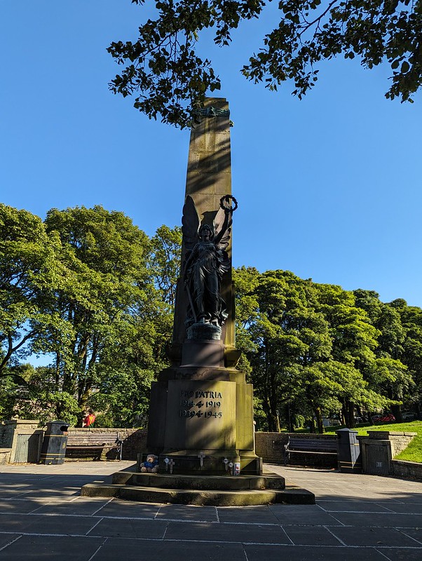
War Memorial.
There were a group filming by the War Memorial, but whether film or TV, drama or documentary, I’ve no idea.
The Crescent and the Pump Room Roof.
I did dip into the Pump Room, now a visitor centre and cafe, but my photos of the interior are not very impressive.
Danebower Colliery Ventilation Chimney.
We weren’t done yet. I’d taken a leaf out of Andy’s book and been scouring satellite images looking for a suitable layby to give us access to the River Dane, because I’d also been scouring the internet for wild-swimming spots in the Peak District. There don’t seem to be many likely venues.
River Dane
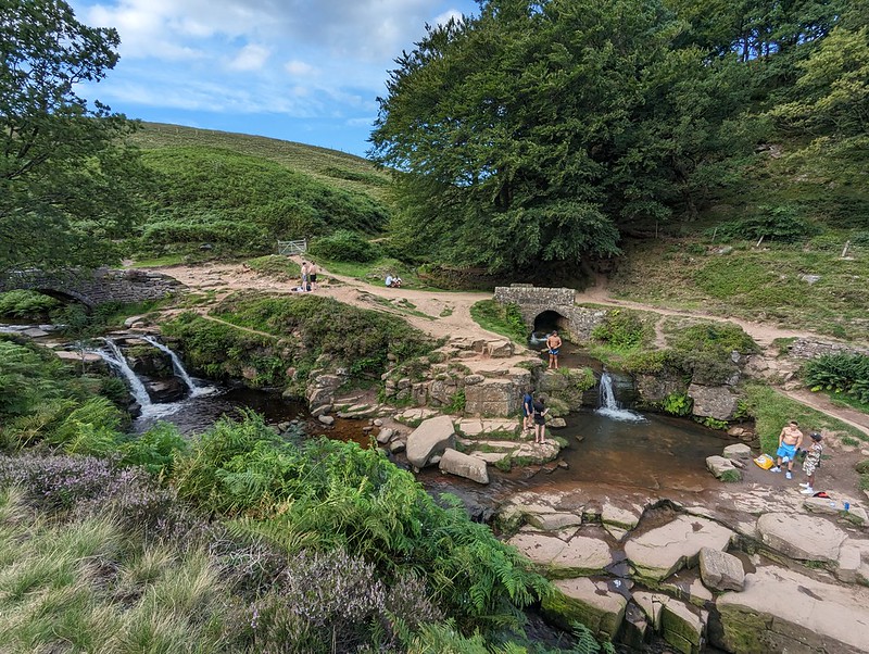
Which probably explains why, even though it was getting quite late, the pools at Three Shires Head were very busy. It’s nice to see people enjoying the outdoors, but, as much as I enjoy loud music, in the right circumstances, I prefer it when other people don’t subject me to their execrable taste in modern pop. (Heh, heh, I sound like my dad: ‘It just goes thump, thump, thump’). In fact, the pools are not ideal for swimming. Well, you can manage a couple of strokes in the pool on the left in the photo below, but neither is very deep.
Three Shires Head.
We consoled ourselves by ducking under each of the waterfalls, a bracing experience, which seemed to start a bit of a trend.
It’s a long time since I last visited Three Shires Head and I was trying to remember whether the paths were as eroded then as they are now. I remember it as quite an isolated, quiet spot, although, since it’s not far from a major road, I suppose that I might be guilty of looking back through rose-tinted spectacles.
Advancing shadows. The Roaches on the skyline.
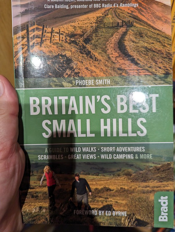
All-in-all, a really enjoyable day. And, Grin Low, which was new to me, might be one for our forthcoming book ‘Small Hills with Disproportionately Good Views’. Talking of which, we have a competitor…
Our idea made flesh!
I saw this in Waterstones in Lancaster and then, fortuitously, also found it in the Oxfam bookshop, so I now have a copy. Some of our favourites are in there, but many are not, so we may be in the clear. Phew! Unless Phoebe Smith has a volume two on the way? Oh no!
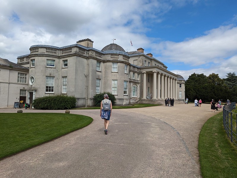
Our accommodation was very close to Alton Towers, it would have been churlish not to offer the DBs a day out there, but it’s not really my speed these days, so having dropped them off there, we went instead to the National Trust’s Shugborough Hall Estate, where we had a great day out.
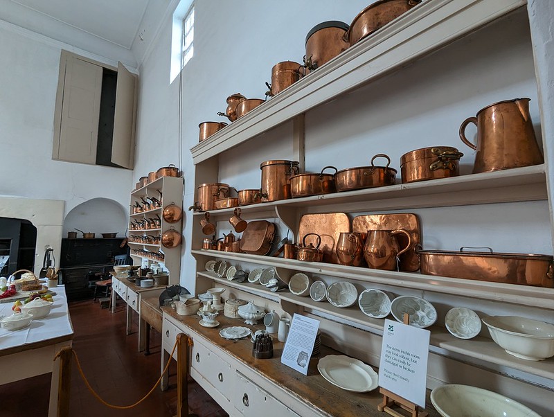
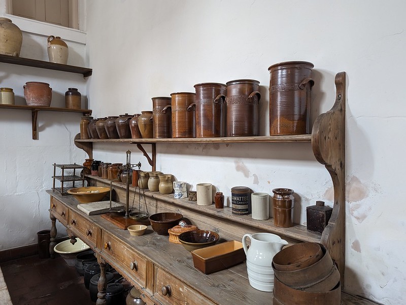
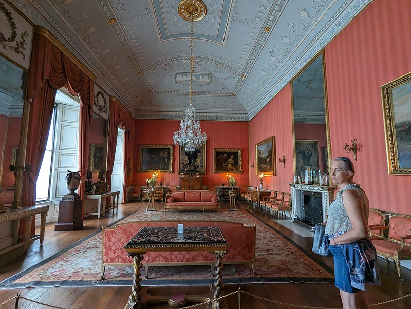
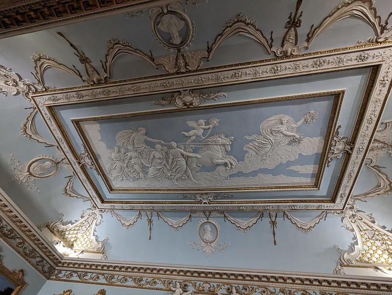
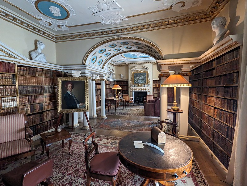
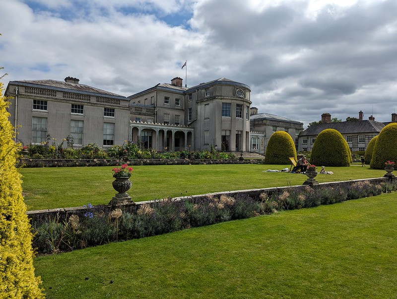
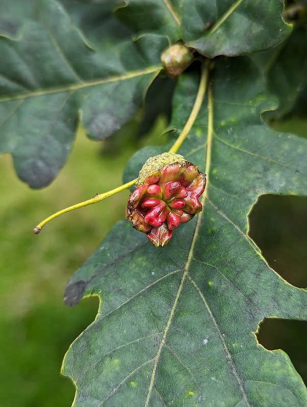
Shiny pots and pans.Crockery.Shugborough Hall interior.A fancy ceiling.Books galore – my favourite room, obviously.Library ceiling.In the garden.Reverse of the house.The River Sow.Knopper Gall.
The arboretum in the grounds is home to 150 species of oaks from all around the world, which was fascinating. Some of the acorns were malformed in this way. I think this is a Knopper Gall. Knopper from the German word ‘Knoppe’ for a 17th century felt hat. The gall is caused by a tiny gall wasp Andricus quercuscalicis, which only arrived in the UK in the 1960s. Curiously, it has two different alternating generations one of which makes these galls, whilst the other lives on Turkey Oaks, an introduced species usually found in the parks of stately homes. I took several photos of different galls but have used this one because it was more colourful and more knobbly than the others. Apparently, the very distorted and folded appearance means that there are lots of wasps present, although I have no idea what sort of number constitutes ‘lots’.
A distant view of the house.The Chinese House.Europe’s widest Yew(and TBH for scale!)Essex Bridge.
A document from 1679 mentions this bridge, which is just outside Shugborough’s grounds, replacing an older wooden bridge and having 43 arches. Since it now has 14 either it has been significantly reduced in size or somebody was exaggerating. Has the Trent shrunk since the 17th Century?
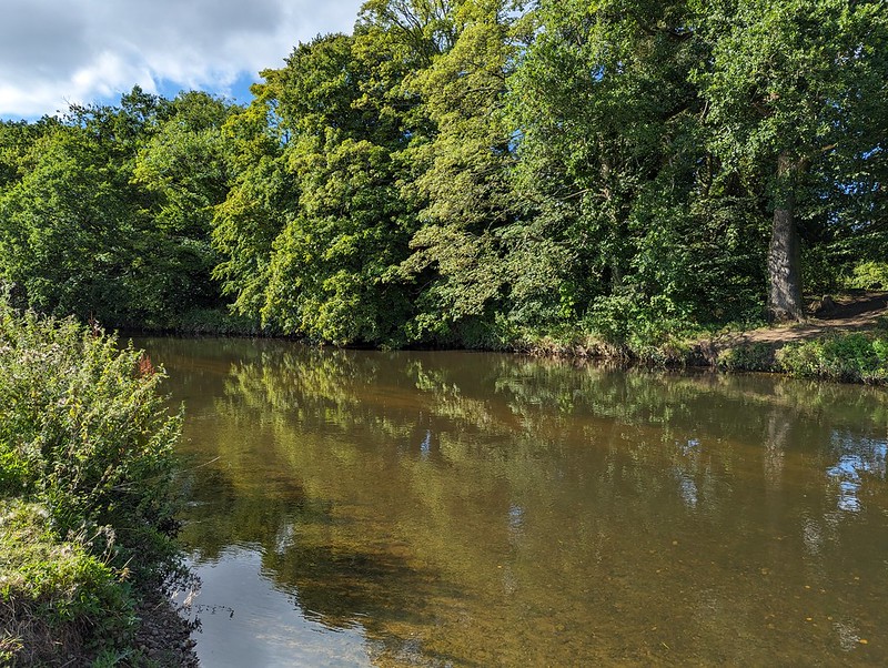
Essex Bridge.River Trent.
It was a lovely spot and there were a number of kids making the most of it and paddling in the river here.
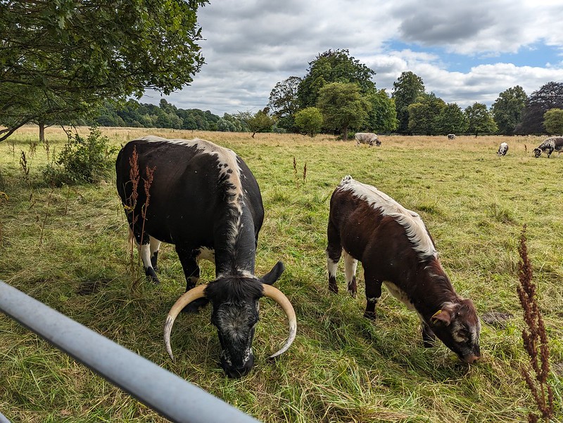
English Longhorn Cows.
I was very taken with the English Longhorn cattle at Shugborough. Apparently, despite the fearsome looking horns, they are docile.
English Longhorn Cows.
I’ve read that they’re very good mothers too.
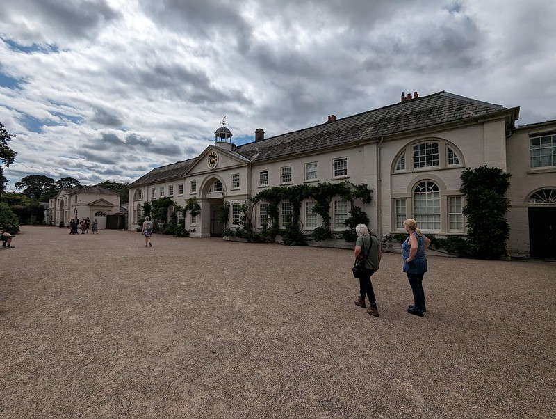
The stables – I think.
There’s a cafe and a secondhand bookshop tucked away in a courtyard hereabouts. We patronised both. TBH was impressed with her vegan lunch but my ploughman’s was thoroughly underwhelming.
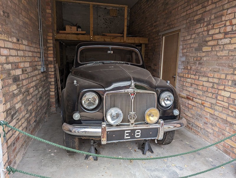
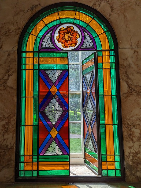
1955 Rover 75.Tower of the Winds.Tower if the Winds – leaded window.The Orangery in the Walled Garden.
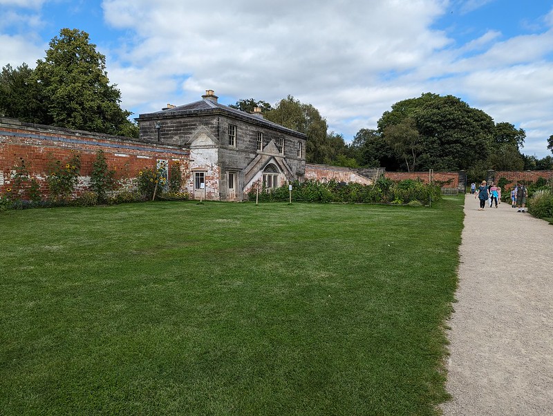
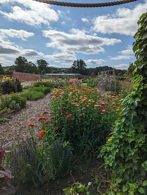
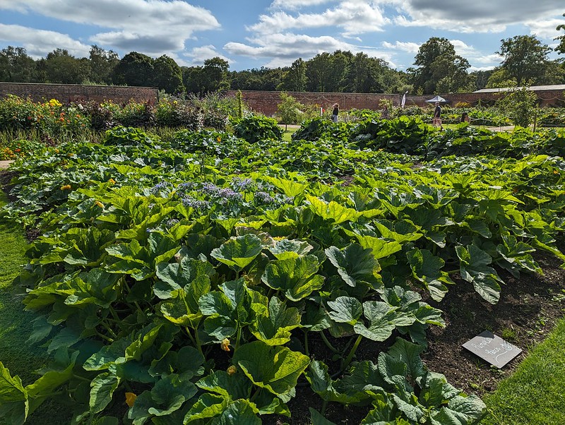
Much as I enjoyed the house and the grounds, for some reason it was the walled garden which appealed most of all. I’m not much of a gardener, but I really appreciate other people’s efforts.
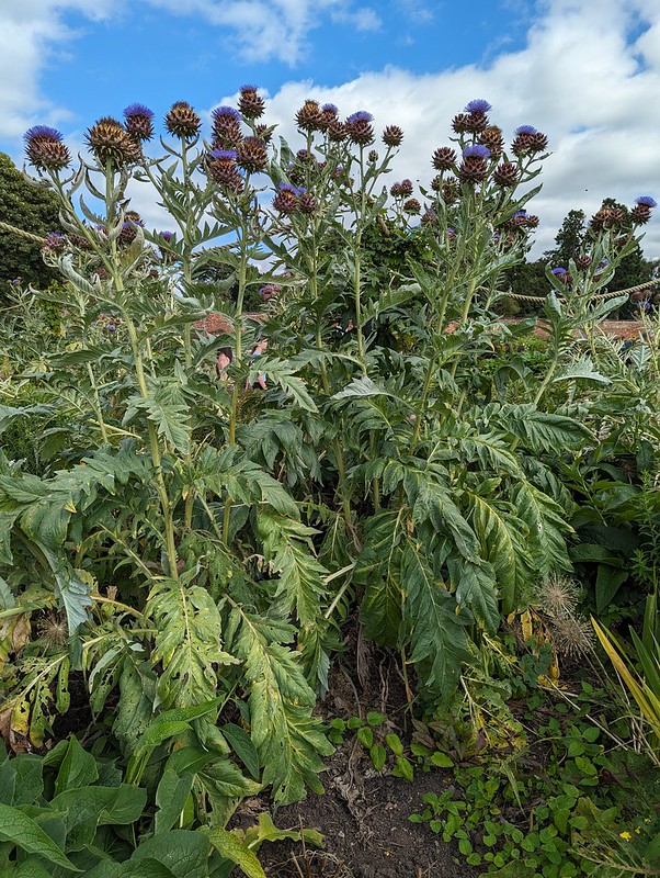
Artichokes?
Only part of the garden has been restored – if they get around to fixing it all it will be huge.
Honey Bees.
I like tall flowering plants, and I love to eat artichokes – we really ought to have some in our garden. My Dad used to grow them on his allotment, I’m pretty sure.
In the Walled Garden.
It had been a partly cloudy day, but by this point it had actually become quite hot, not something we experienced very often this summer.
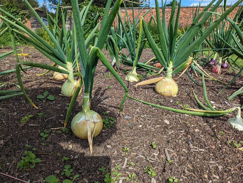
In the Walled Garden.Sweet-Scented Joe-Pye Weed?In the Walled Garden.How ’bout them onions?Courgettes.The River Trent at the Wolseley Centre.
Alton Towers was open quite late, and we knew the boys would want to milk it to the full, so en route we stopped at the Staffordshire Wildlife Trust’s headquarters at the Wolseley Centre. We actually arrived after closing time, but were told that there was an event on there, so we were okay to stroll around the site before braving the traffic chaos at Alton Towers.
Purple Loosestrife at the Wolseley Centre.
Shugborough is very close to Cannock Chase, which had me very excited because of fondly remembered childhood visits. We didn’t find time to go exploring there on this occasion, so I’ve added it to my ever expanding ‘to do’ list.