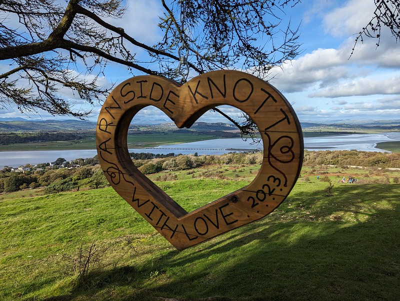
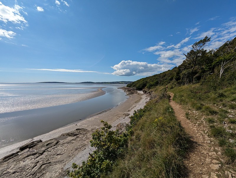
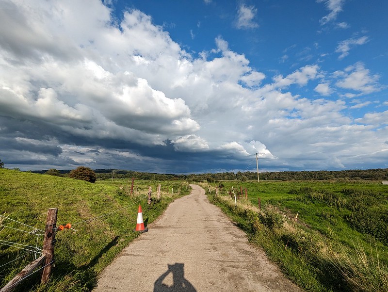
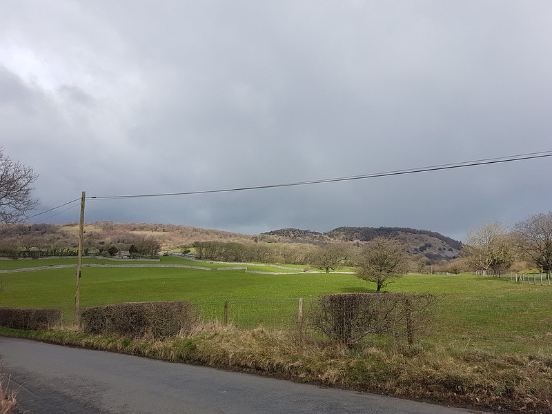
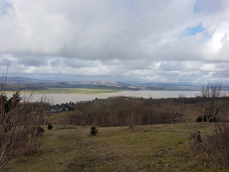
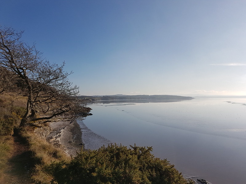
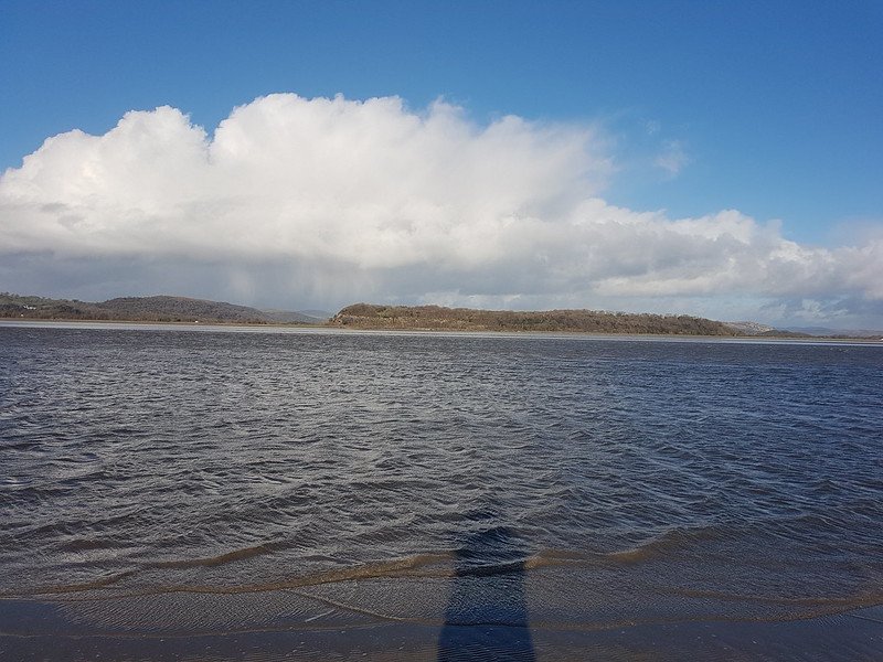
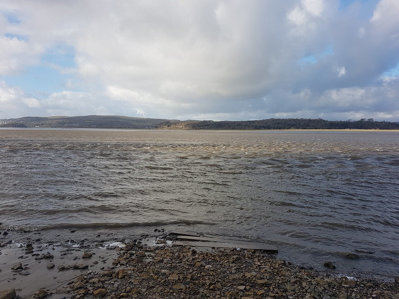
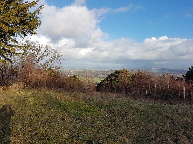
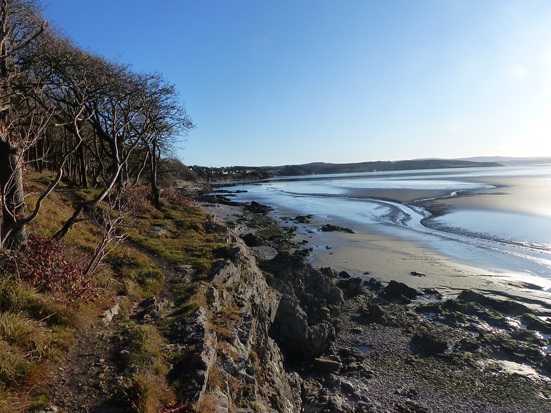
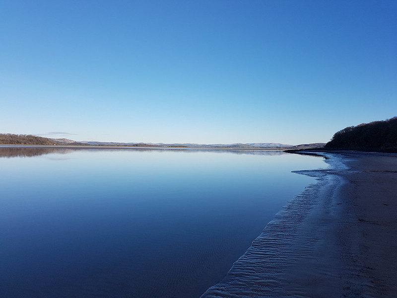
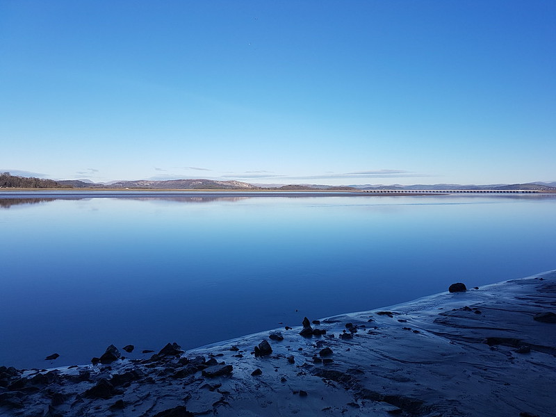
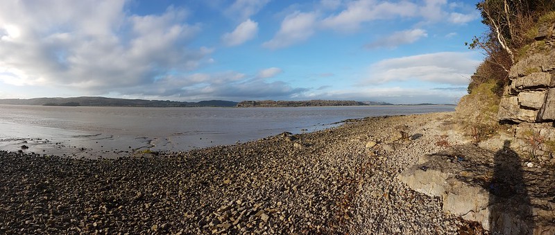
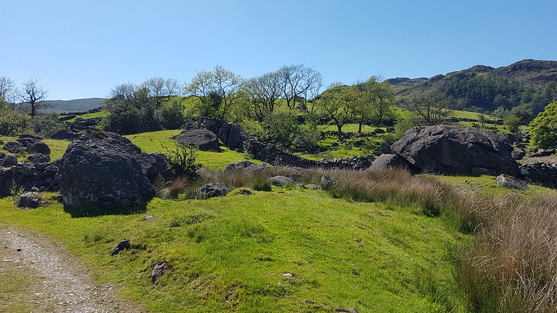
By the Sunday of the music festival weekend, we are usually ready for a change and a walk. Last year was no exception, so we opted for the classic local route, around the coast to Arnside and back via the Knot. (Except for UF who will have made one of his standard lame excuses around playing snap or utilising his season ticket at Man City, or having a bone in his leg).
Around the coast.
It’s always a good walk, but throw in some clear blue skies, some sunshine and a few old friends and you can’t go wrong.
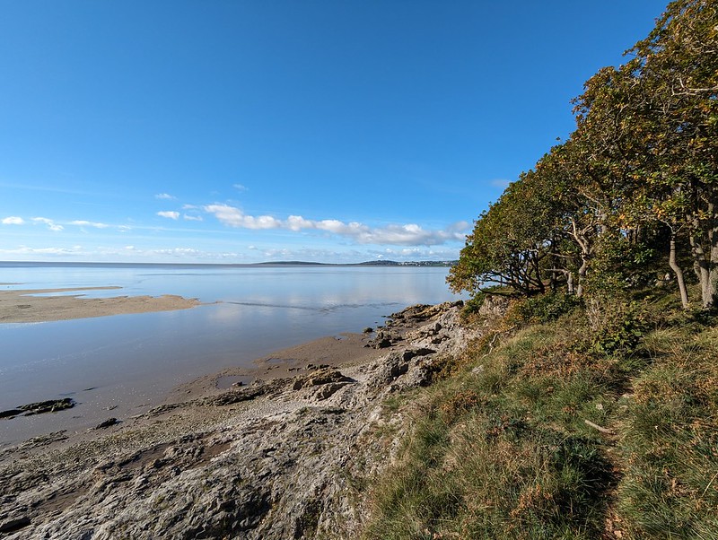
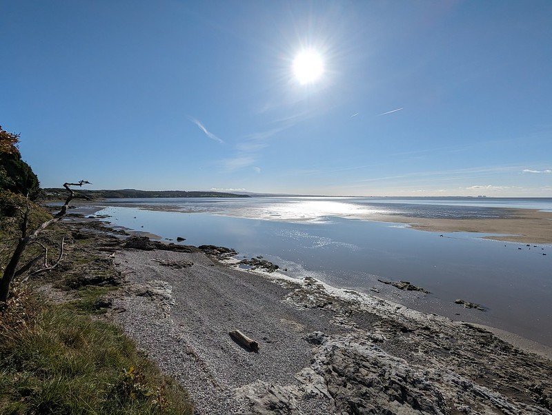
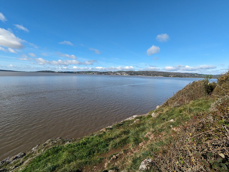
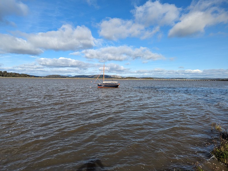
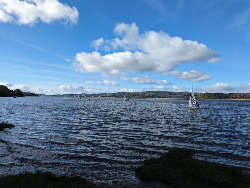
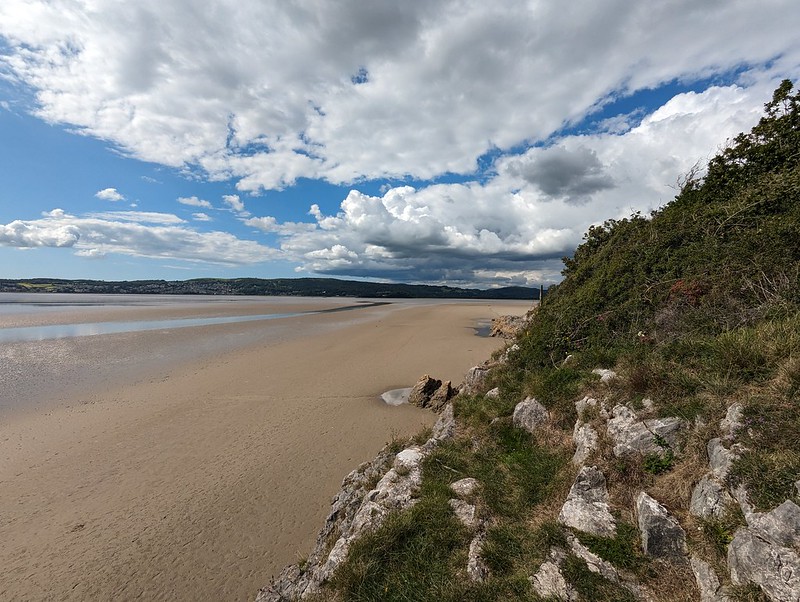
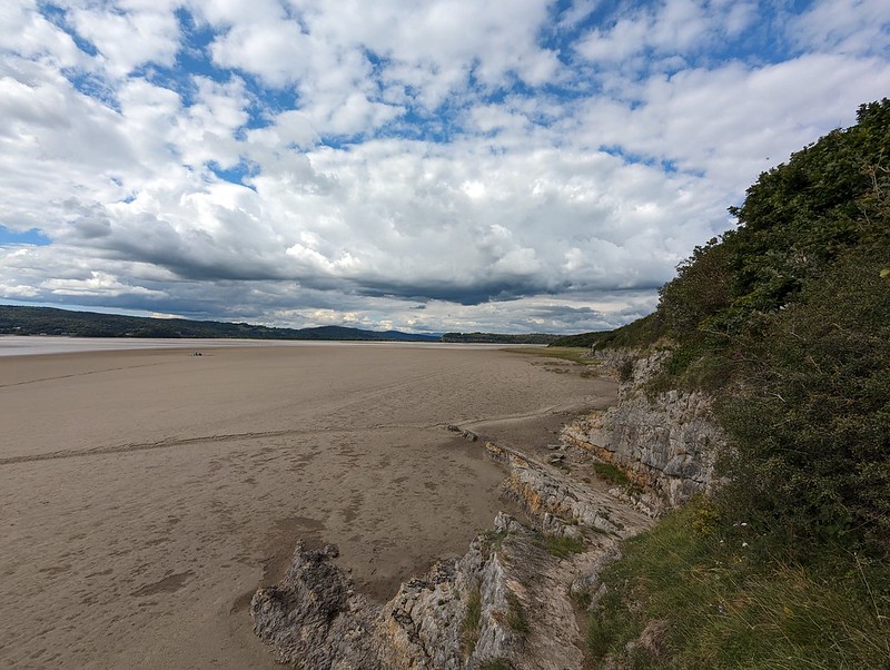
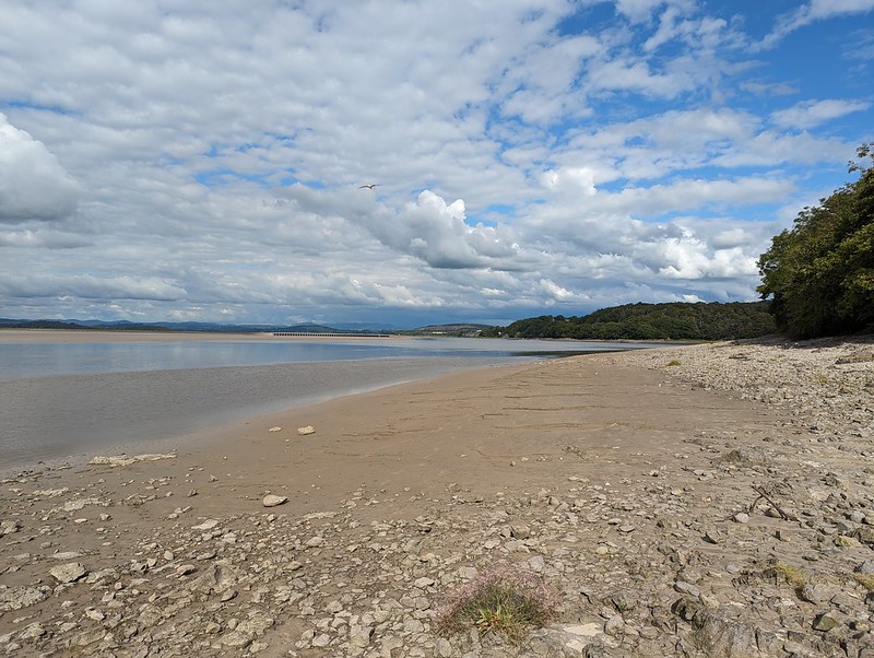
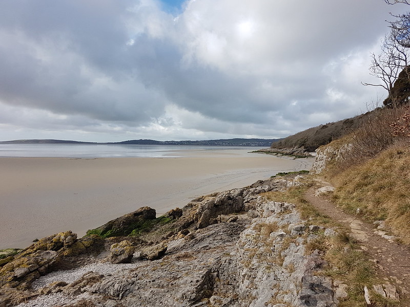
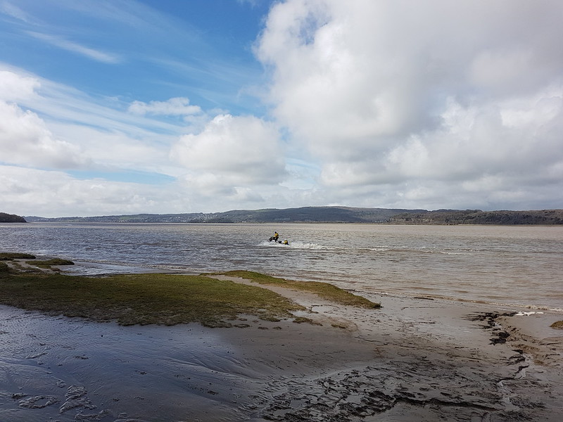
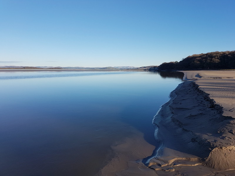
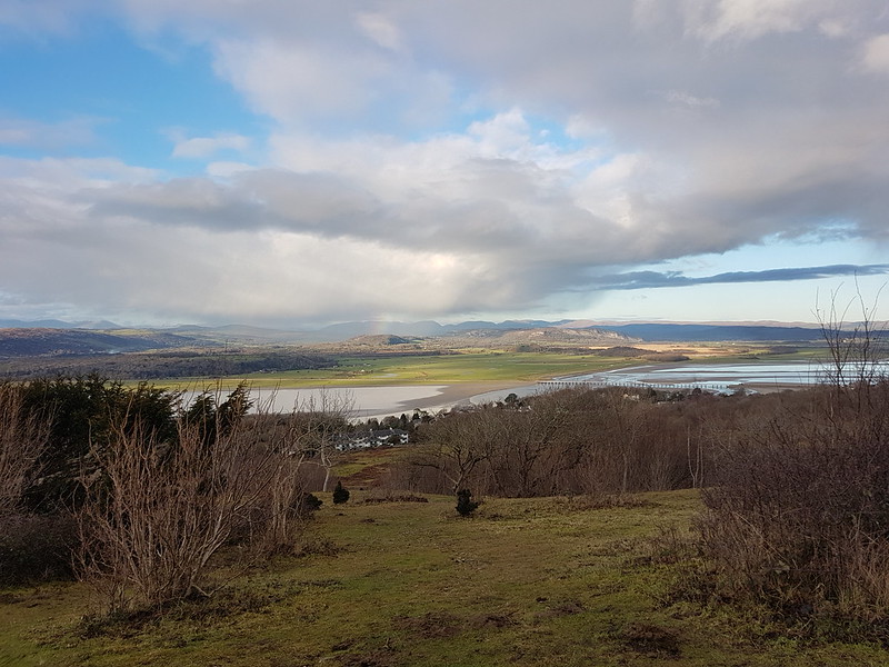
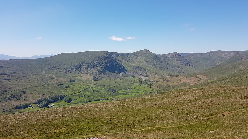
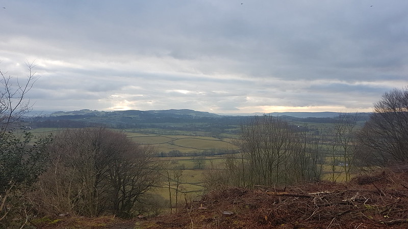
Looking south to Know Point and Clougha Pike.Grange-over-Sands.Turning the corner into the estuary.High tide at New Barns.Old dinghy moored near Arnside.Racing dinghies on the Kent.
I keep saying that I should join the sailing club at Arnside, but then I never get around to it. But I really should. It must have been pretty windy that day, some of these yachtsmen are really leaning out to counteract their boats heeling.
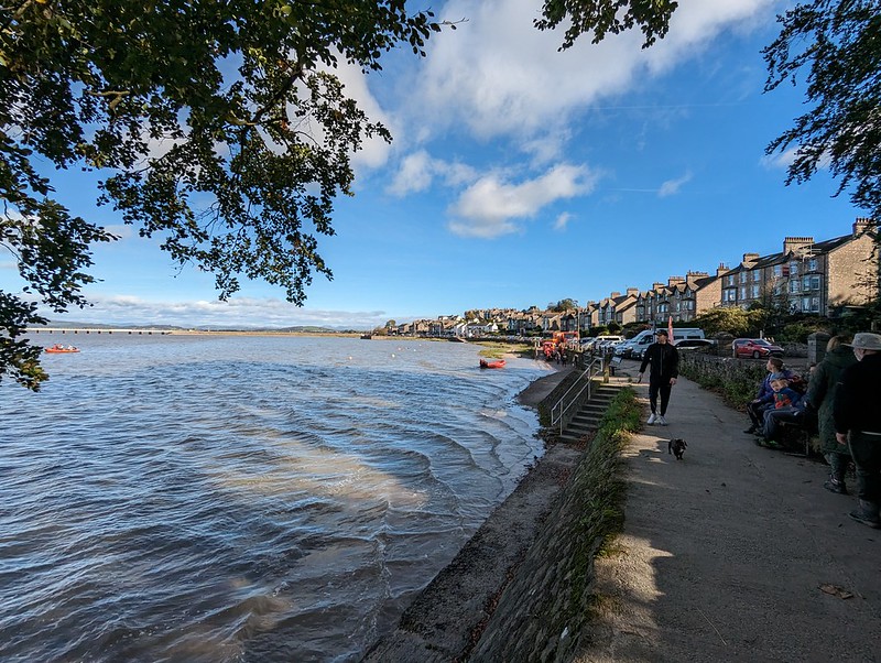
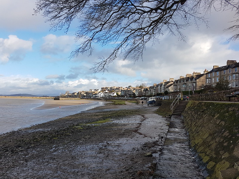
Arriving on the prom.
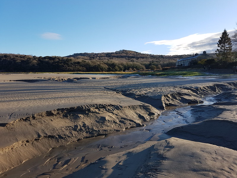
I suppose we probably purchased pasties or the like for a lunch in Arnside, we usually do.
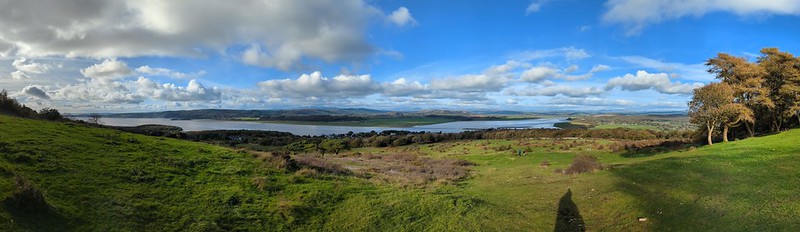
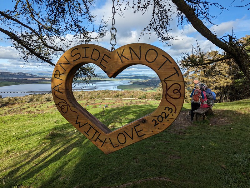
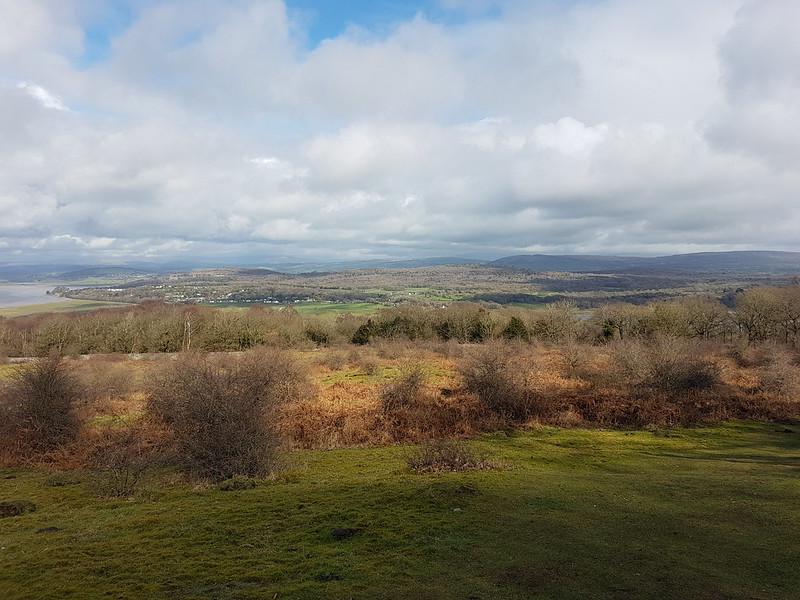
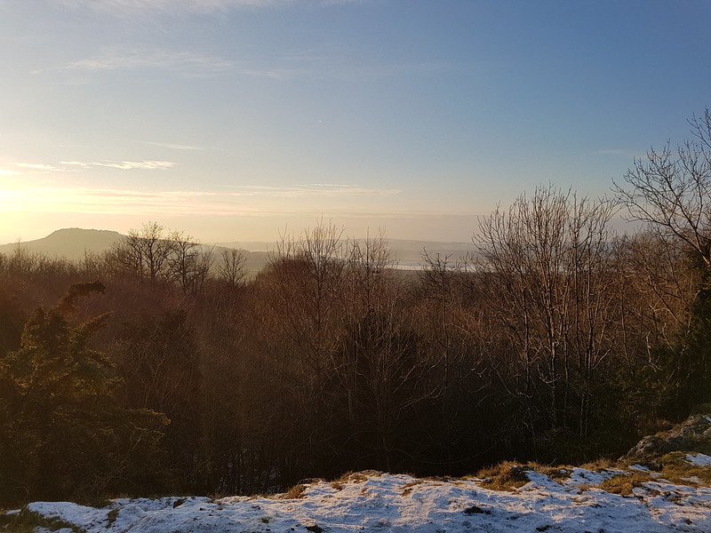
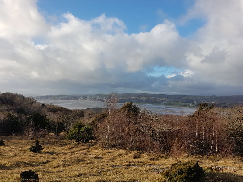
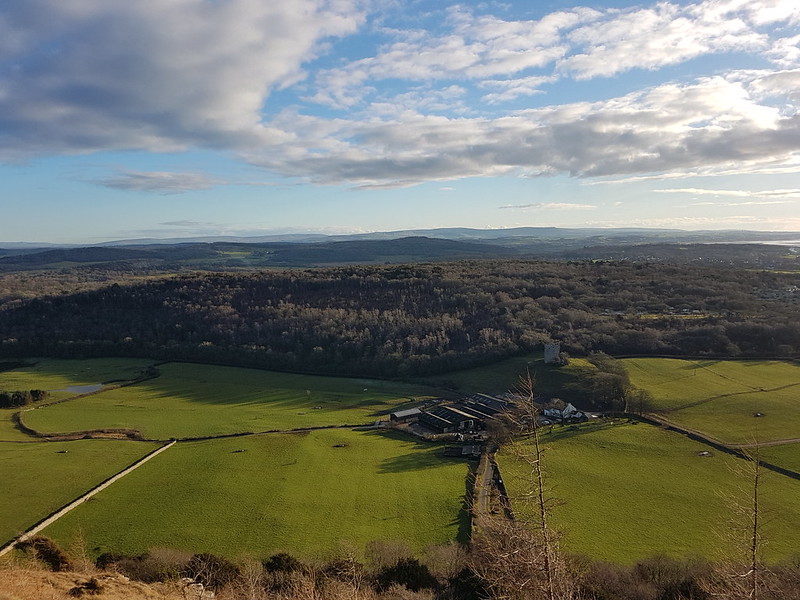
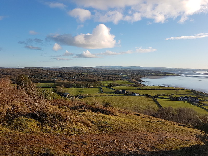
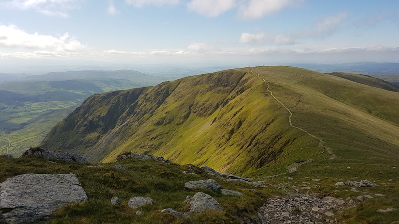
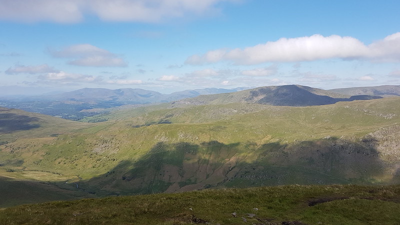
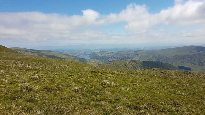
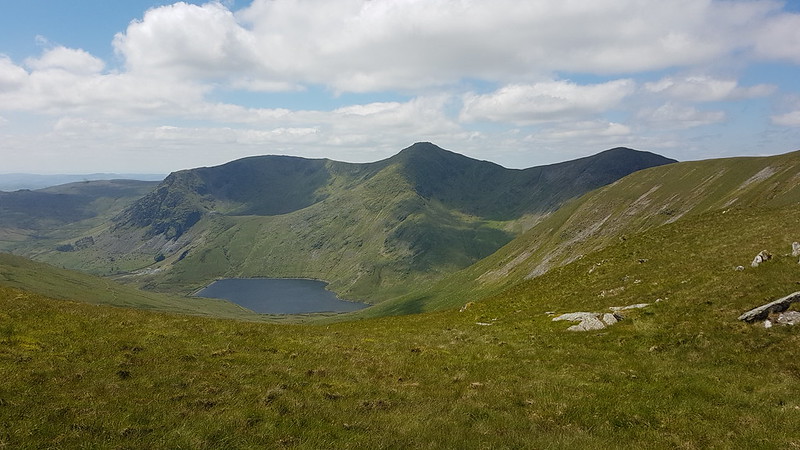
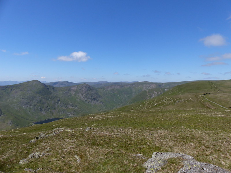
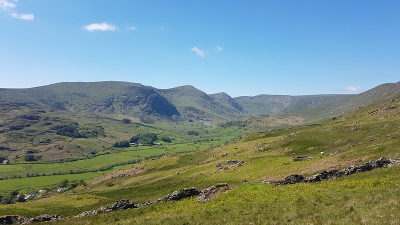
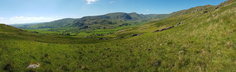
The Kent estuary, Whitbarrow and the Lakeland fells beyond from Arnside Knot.Arnside Knot pano.The sculpture again – this time with some people in.The view south – Ingleborough, Arnside Tower Farm, Middlebarrow, Warton Crag and the Bowland Fells. Descending from the Knot.
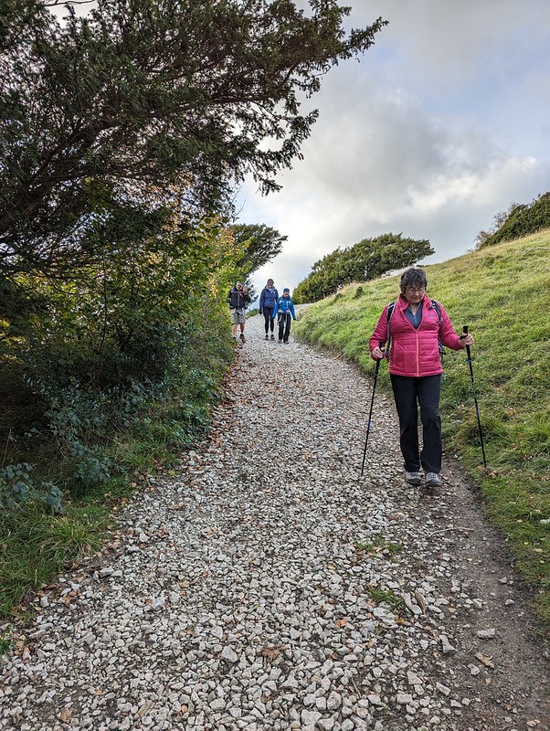
As usual, I was a bit rubbish at taking any team photos. I did get this one on the last leg of the walk which makes TBH look preposterously tall. J meanwhile seems to be taking extra special care over where she is placing her feet.
Anyway, after that, all back to ours for tea. Another fab weekend.
Cove Road – Holgates – Far Arnside – Park Point– Arnside Point – White Creek – Blackstone Point – New Barns – Arnside – Black Dyke Road – Silverdale Moss – Challan Hall Allotment – Hawes Water – The Row – Hagg Wood
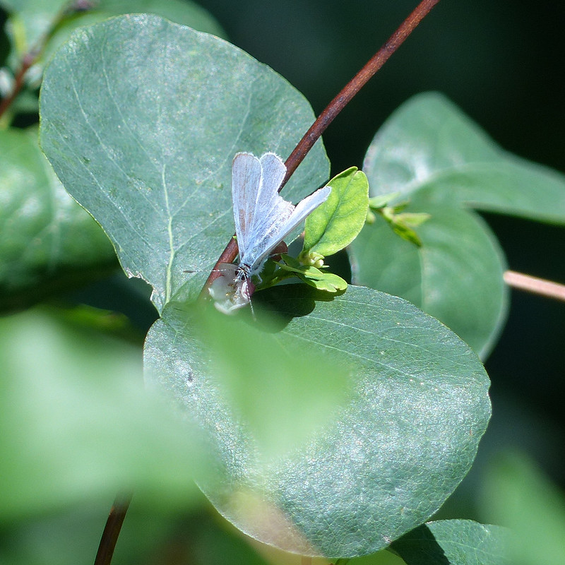
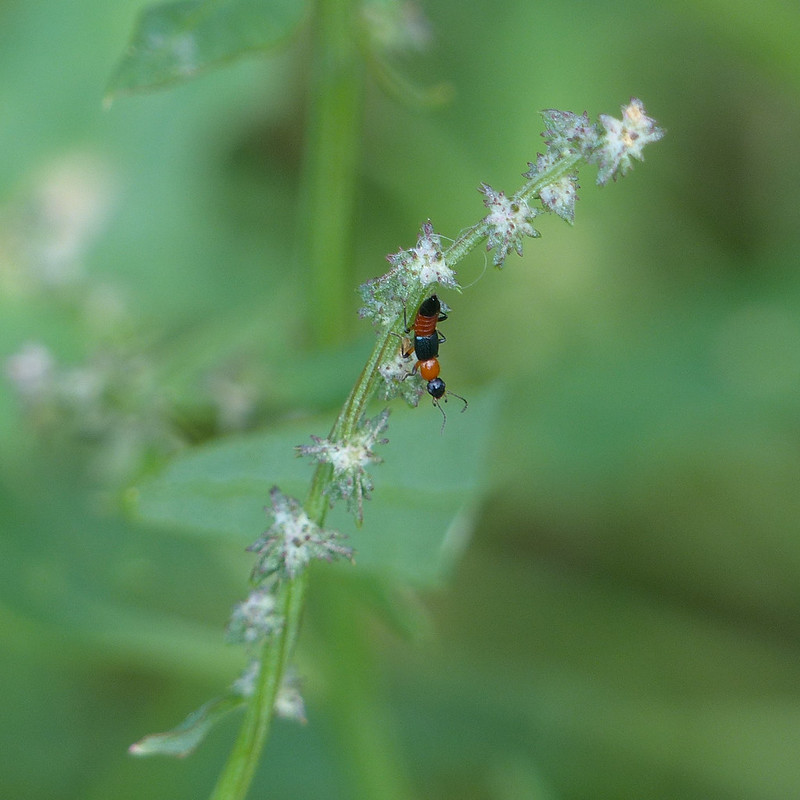
Holly Blue Butterfly.
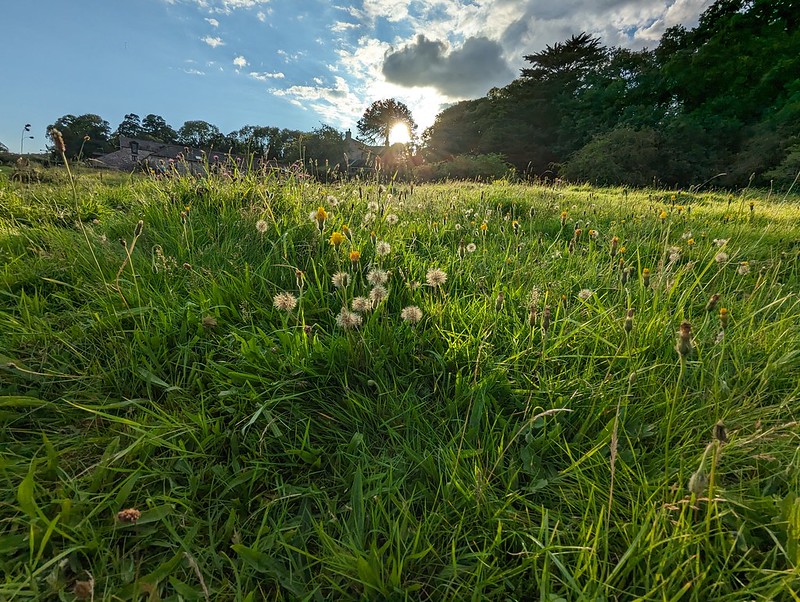
Home again and a familiar walk around the coast to Arnside and then back via Silverdale Moss and Hawes Water. It was a walk which involved a lot of stopping and gawking, and during which I took nearly four hundred photos (I’ve edited them down a bit for this post!). It was a good day for butterflies, spiders, harvestmen, grasshoppers and various other things.
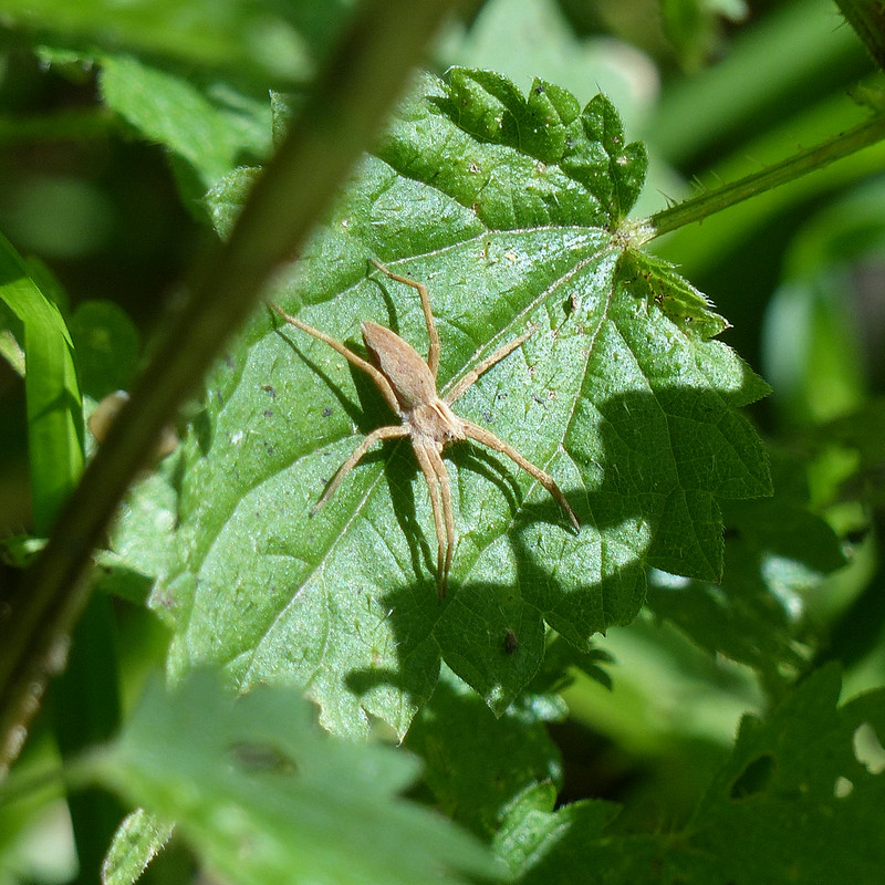
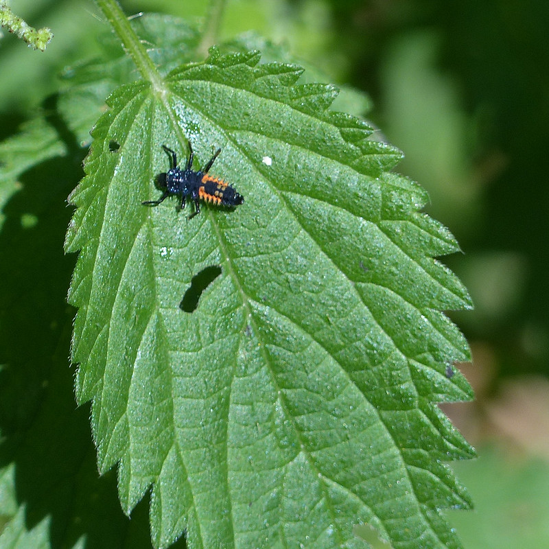
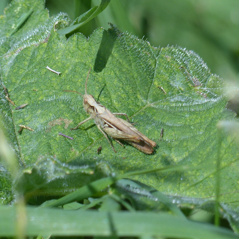
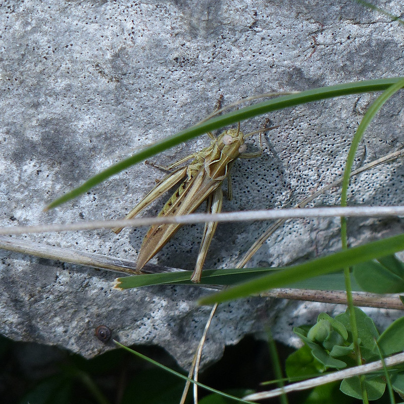
Harvestman.Nursery Web Spider.HarlequinLadybird nymph.Field Grasshopper?
I find Grasshoppers very tricky to identify. I found this guide useful, if not conclusive.
Harvestman.Brimstone Butterfly.
I spent a long time by a Buddleia at the edge of the caravan park at Far Arnside – it was very popular with the butterflies, with quite a few bees and hoverflies visiting too.
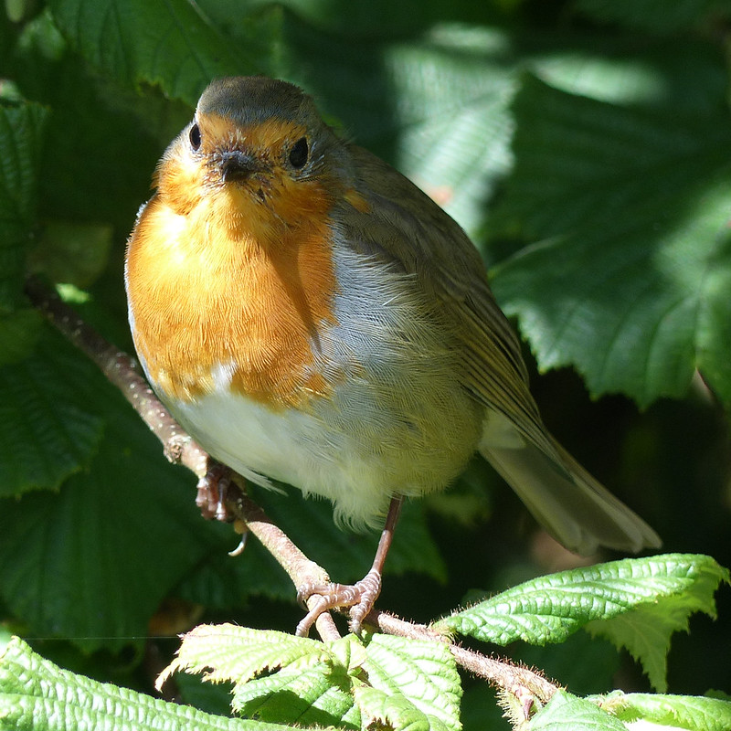
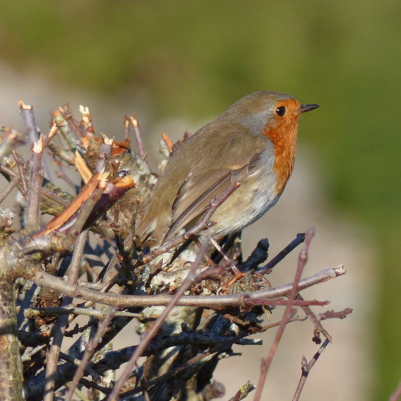
Peacock Butterfly.Large White Butterfly.A curious Robin.
Whilst I was snapping away, a Robin appeared close by in the hedge and watched me for quite some time.
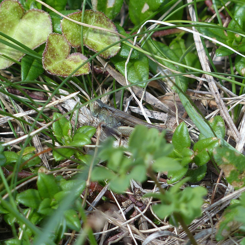
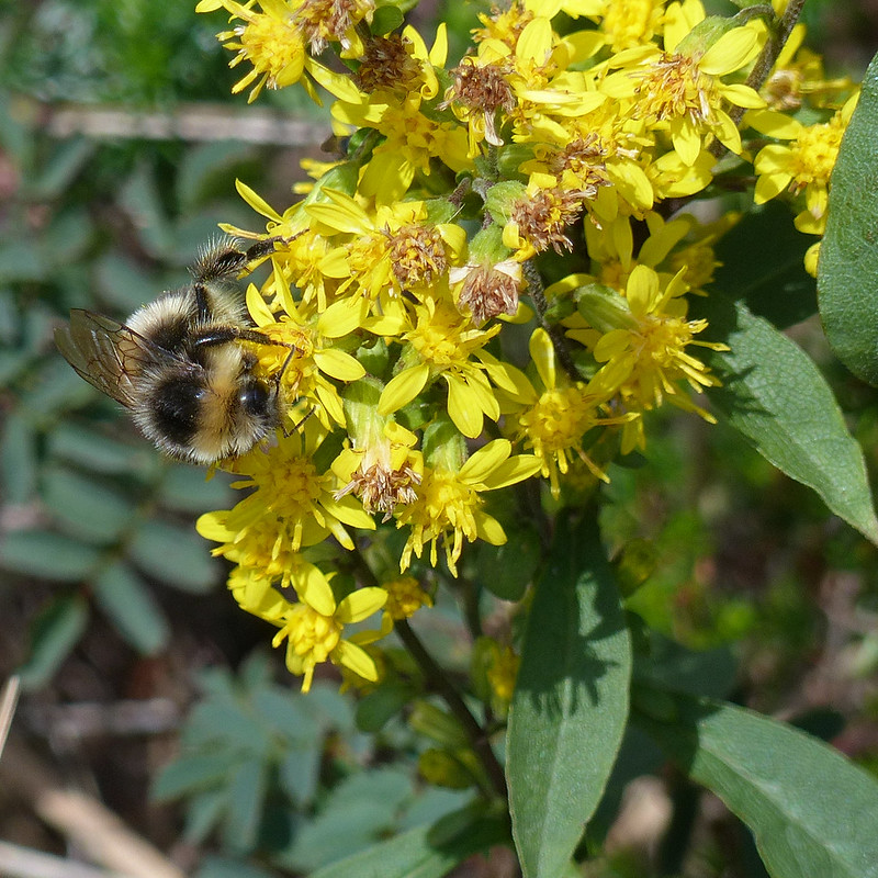
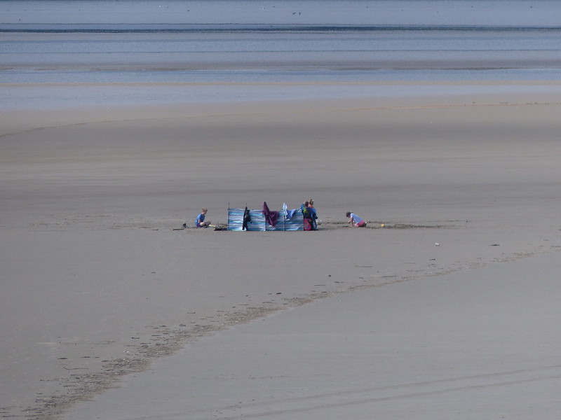
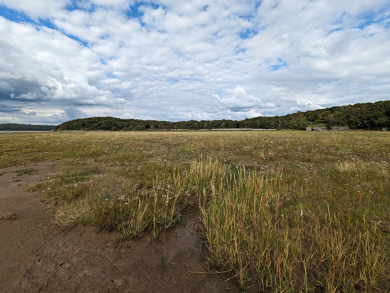
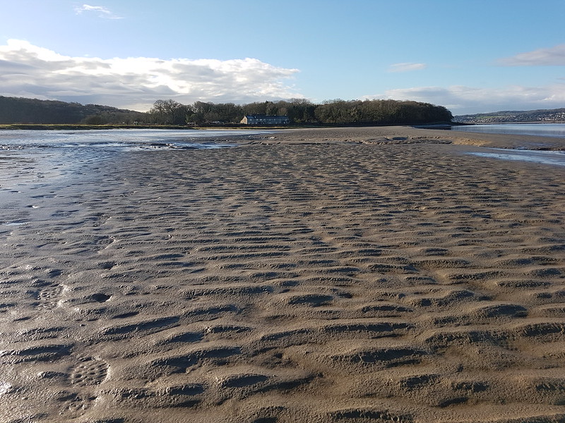
Common Blue Butterfly (female).Field Grasshopper?Common Green Grasshopper?Bumblebee on a St. John’s Wort.Dropwort.Tiny orb web Spider.Looking south along the coast to Clougha Pike.Looking North to Grange-Over-Sands.Holidaymakers enjoying the mud.
I was surprised to see a few family groups dotted about on the mud of the Bay, with a full collection, by the looks of it, of beach paraphernalia. Of course, I love the area myself, so I shouldn’t be surprised at all that other people want to enjoy it too.
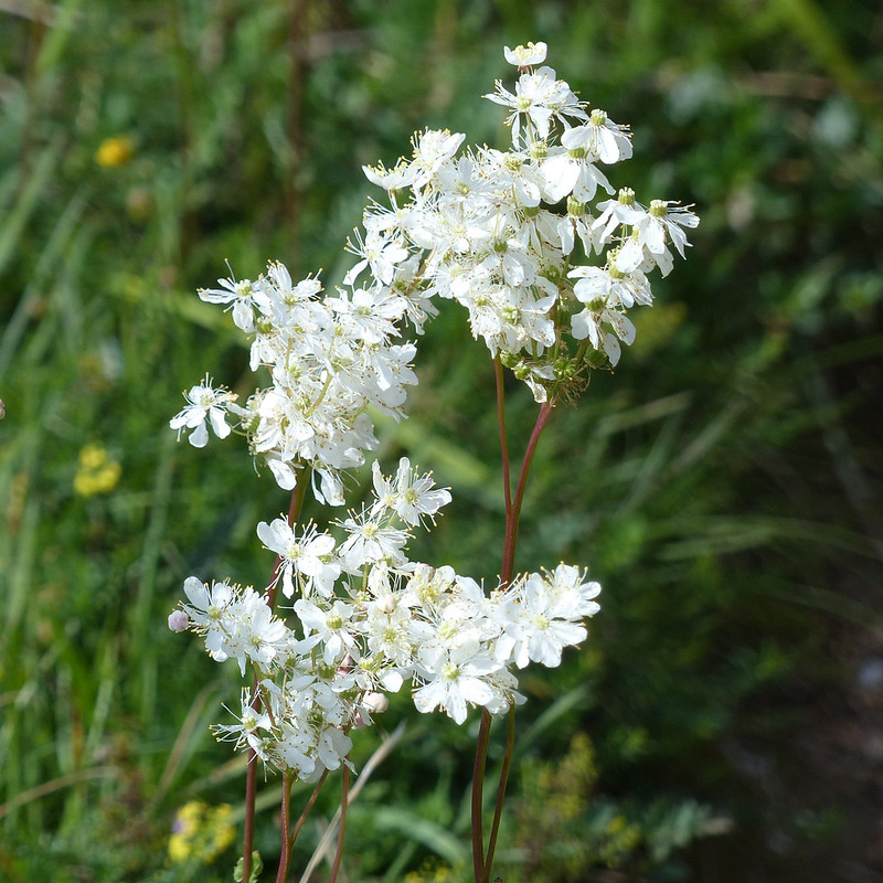
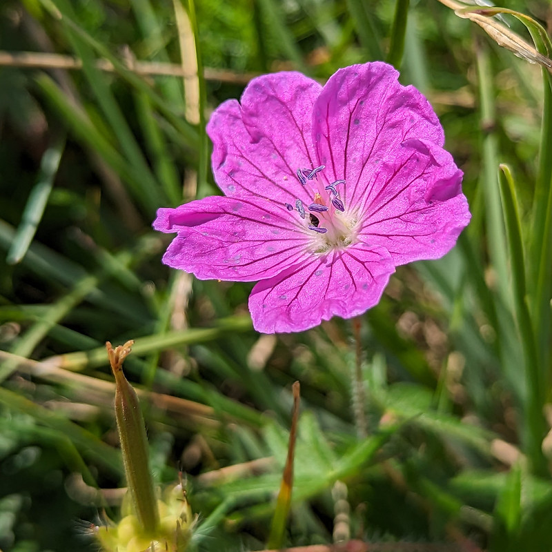
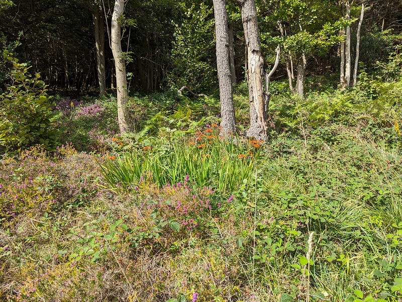
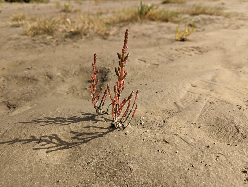
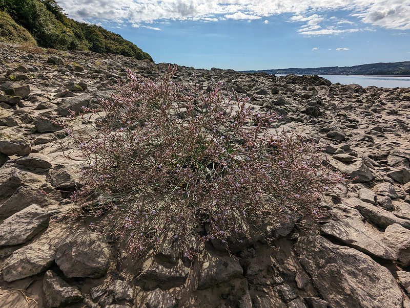
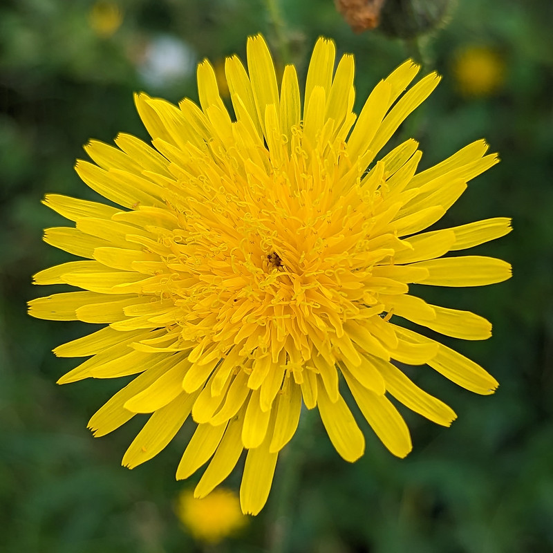
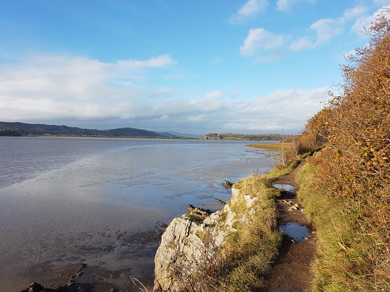
Heather on the clifftop.Bloody Crane’s-bill.Naturalised Montbresia.Approaching Park Point.And around the point looking up the Kent Estuary.Marsh Samphire.The foreshore at White Creek with lots of…Sea Asters.The estuary near New Barns.Lax-flowered Sea-lavender.Lax-flowered Sea-lavender.Approaching New Barns.At New Barns.A yellow composite (which is to say, I don’t know what it is!).Common Darter.Common Carder Bee (possibly) on Marsh Woundwort.I think that this is an Orache, possibly Spear-leaved Orache.A Rove Beetle, on the Orache, – one of the Paederus species.
Paederus species are widespread across the world and I was surprised to discover that one (or possibly more) of them can cause severe skin reactions.
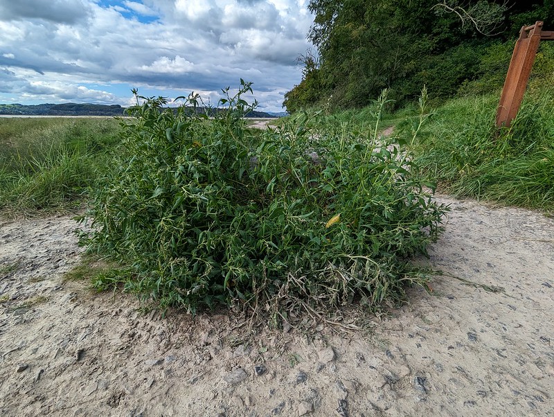
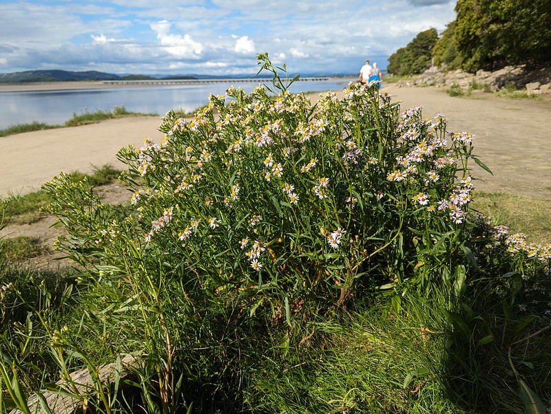
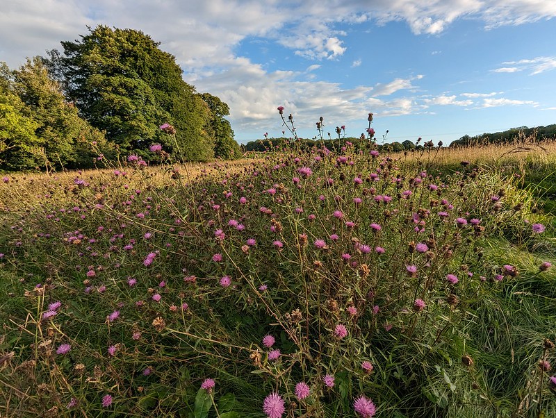
The Kent near Anside.Another boat on the Kent.A particularly vigorous clump of Sea Aster.
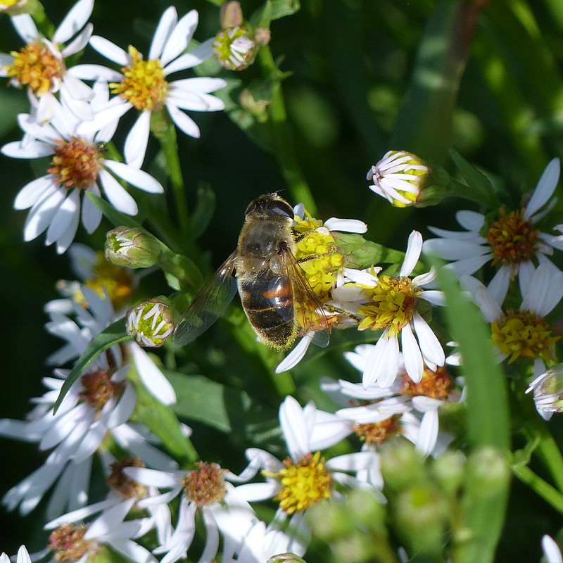
This tall clump of Sea Asters was thronged with bees and hoverflies, particularly Drone Flies.
A Drone Fly on the Sea Aster.Gatekeeper.
A sixth species of butterfly for the day, not bad going.
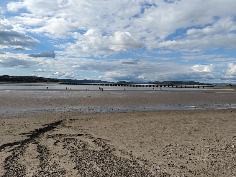
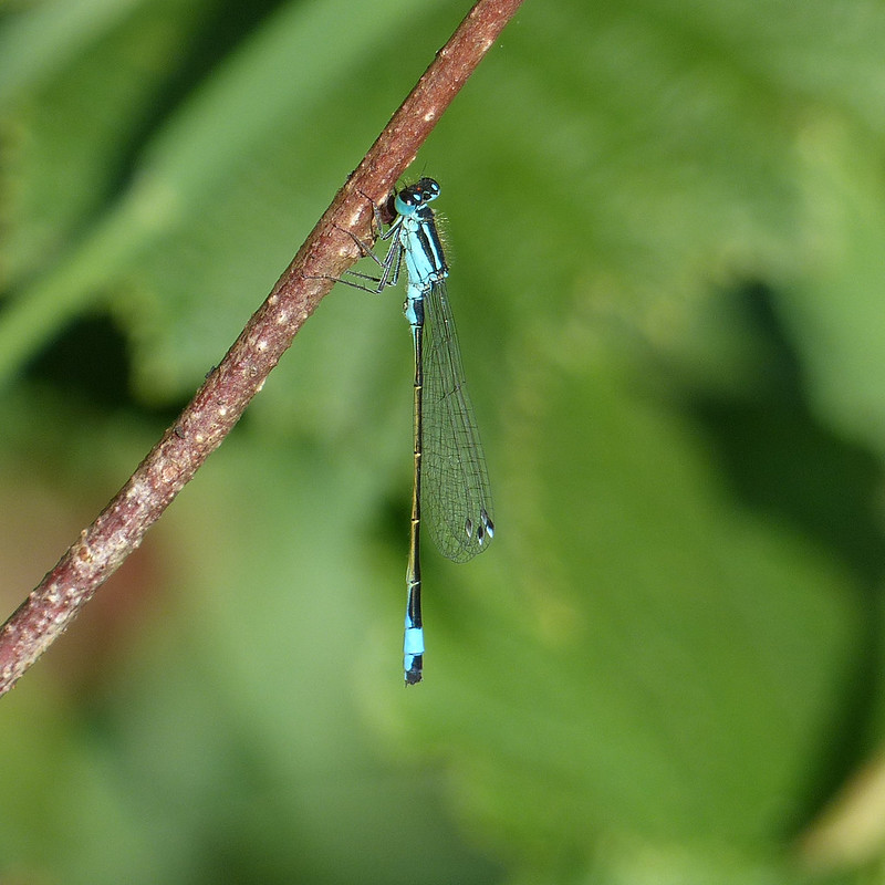
People paddling in the Kent at Arnside.Blue-tailed Damselfly.
Over the years, I’ve taken countless photos of Blue-tailed Damselflies, but curiously, I don’t recall noticing the rather gorgeous two-toned wing-spots which are characteristic of the species before.
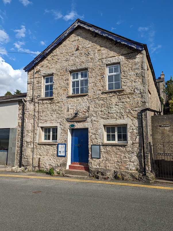
Former Custom House Arnside – now home to the Sailing Club.
I’ve walked past the Sailing Club in Arnside many, many times. I’ve often thought of joining – I’ll no doubt get around to it at some point – but I’d never been inside their clubhouse. I have now. But I’m getting ahead of myself – that post is still some way off.
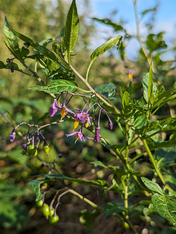
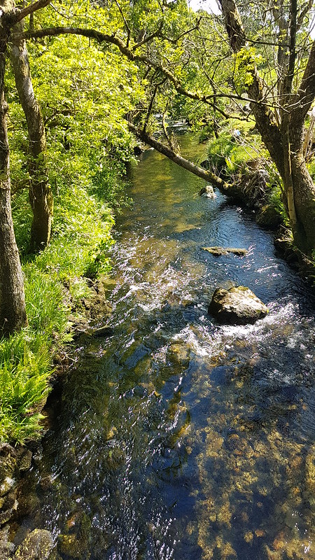
Bittersweet.The footpath beside Black Dyke.
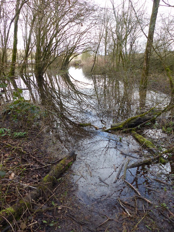
I’d only set-off from home mid-afternoon, so it was getting quite late. I’d originally intended to follow the path beside Black Dyke, but as you can perhaps tell, it was pretty water-logged, testament to what a wet year 2023 was. So instead, I turned left and headed East…
A drier alternative, heading East.
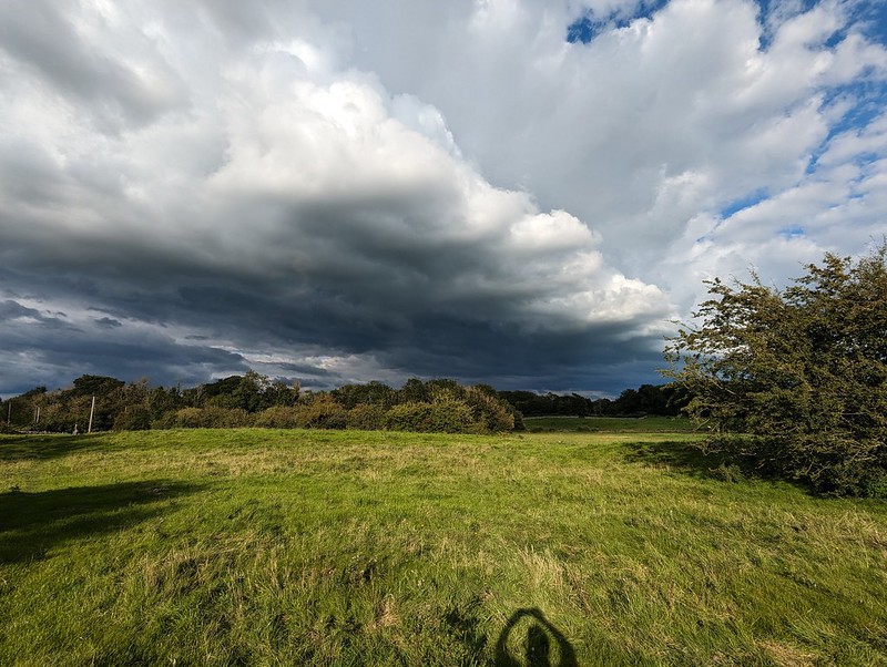
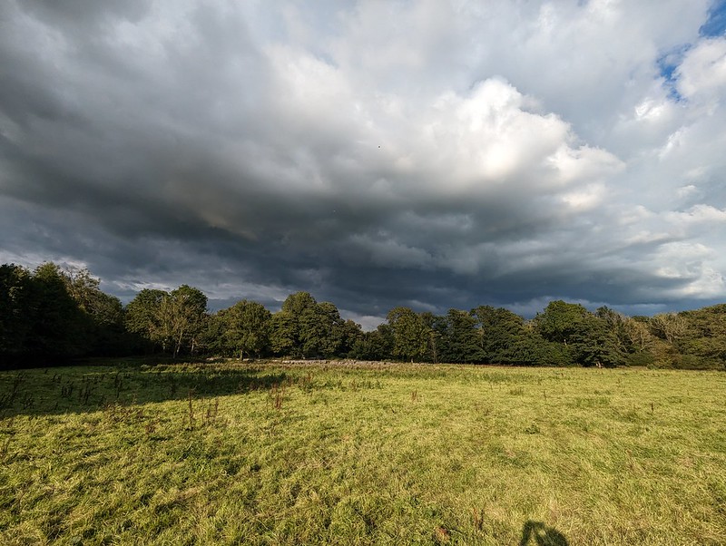
…towards some very dark looking skies.
Ominous clouds.Blue skies back the way I’ve just come.
Long-suffering readers might know that I love to be on the edge of a weather front like this with strongly contrasting weather evident in different directions.
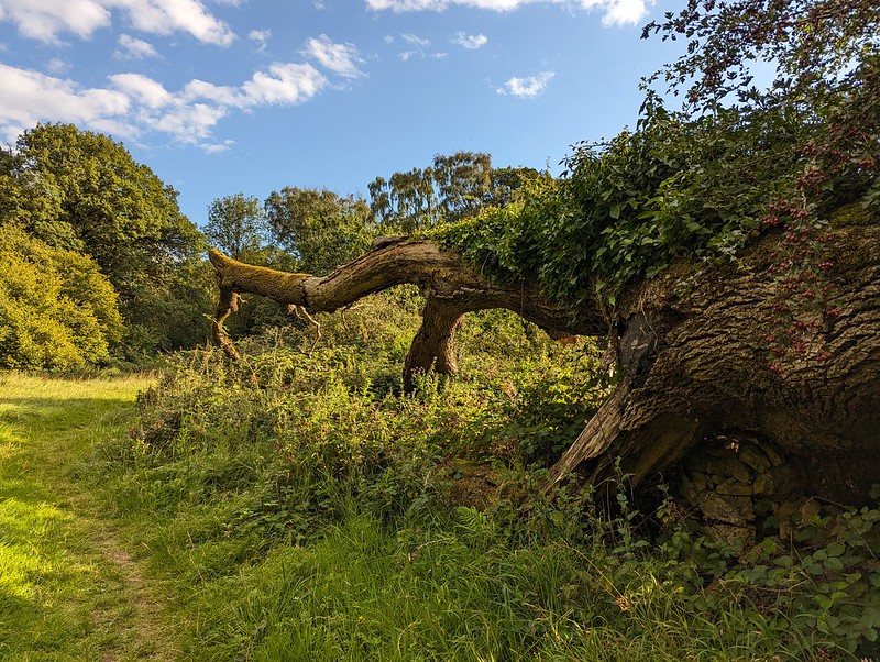
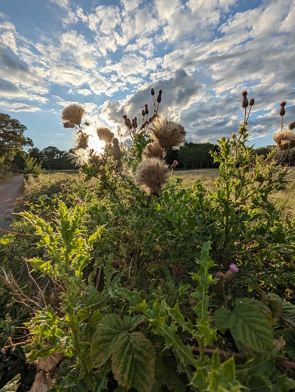
Silverdale Moss and Middlebarrow.More threatening clouds.The remnants of the Cloven Ash.Hawes Water.Dandelion clocks.Common Knapweed.Thistleheads.Inman Oaks – nearly home.
You may have noticed that no Skylarks appear in this post. The fact is, that I was listening to Horace Andy’s marvellous 1972 debut album ‘Skylarking’ whilst I was choosing the pictures for this post. Now that I’m almost done, my soundtrack is the similarly laidback reggae of John Holt’s ‘1000 Volts of Holt’.
A really delightful walk and a precursor to another family get together the following day.
What’s this, some grass, some mud and a large foot in a scruffy none-too-clean shoe? Not my most artistic composition, I’ll admit, but I should also add that this is arguably the most exciting photo in this lengthy post, in as much as, it’s unique; I’m sure I haven’t ever shared another picture quite like this one, which can’t be said for any of the many images which follow. You have been warned!
The outsize trotter is mine and is there for scale. On this particular Saturday morning in late March, before I set-off for my walk – around the coast to Arnside and back over the Knott, for the umpteenth time, you’ll be completely unsurprised to hear – before I set-off, I traipsed down to the bottom of our back garden, probably to dump some vegetable peel and the like in the compost bin. In the lawn, I discovered five large bald patches, with some indistinct paw prints in them and some pretty impressive claw-marks. I know that there were five, because I took photos of them all – of course I did. In addition, there were a number of small holes, with swirls of grass and moss around them, as if they had been made by a twisting motion. I have a couple of books on animal tracks and signs, and between them and a bit of lazy internet research it seems that the most likely culprits are badgers. The small holes are made by them sticking their snouts into the ground in search of their favourite food: earthworms.
They came back and did it again a few nights later, but, sadly, I’ve never seen them and they don’t seem to have been back since. TBH is not quite as devastated as I am, by the fact that our lawn is not being ripped up on a regular basis. She’s already fed-up with the Roe Deer consuming many flowers, particularly, but not exclusively, tulips, and would like to erect a tall mesh fence with a roll of barbed wire along the top and probably towers manned by sharpshooters.
Robin.
And so, leaving our garden; around the coast to Arnside and over the Knott, episode three hundred and fifty-seven (or thereabouts). Other local walks are available, obviously, but I seem to be in the grip of a monomania and, recently at least, only a walk to Arnside and back will do me.
Hazel Catkins.
At least spring was well and truly underway and so there were new things to see relative to other walks this way from earlier in the year.
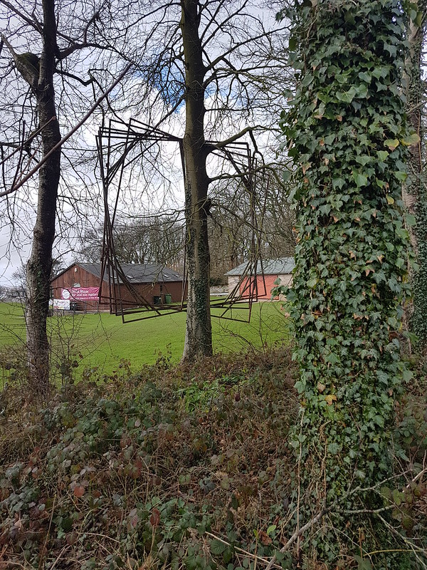
Sculpture?
I’m assuming that these large metal squares serve some purpose at the cricket ground and weren’t just hung in the tree as a piece of modern art, although I think they pass muster as an example of the latter. I really ought to ask Little S what he thinks!
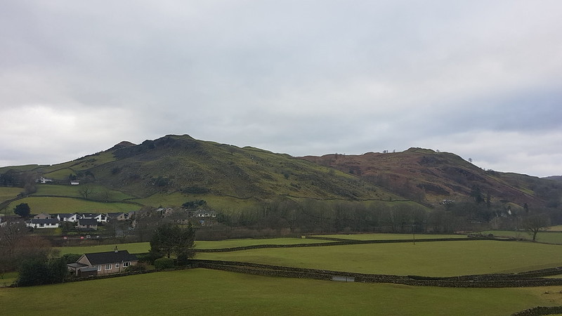
Louring skies over Arnside Knott.
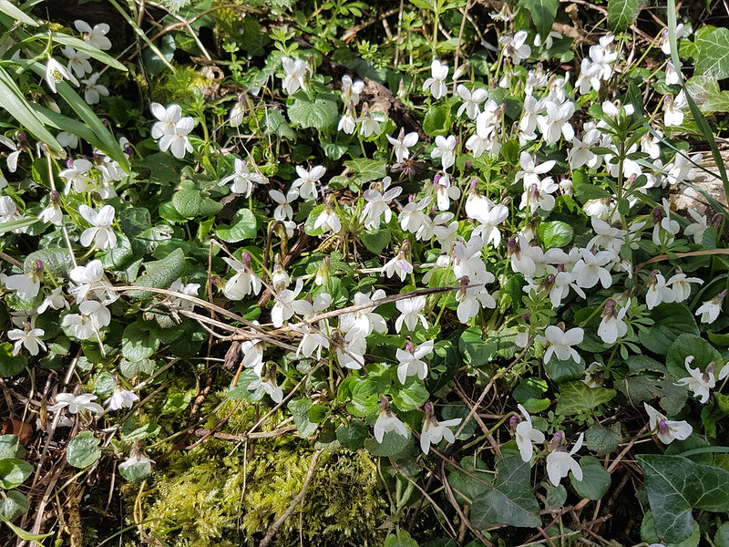
Rather than walking across the fields towards Far Arnside, as I usually do, I took the road by the shore, hoping to walk on the sand from the little cove known locally as ‘the dip’. However, when I reached the dip, the sand was wet and and not at all firm and so not a very enticing prospect, and I stuck with the road.
A display of white violets on the verge.
I’m glad that I did, otherwise I might have missed a superb display of white Violets on the verge which stretched out over several yards. It was a gloomy morning, but the sun came out just at that moment, just as I was photographing the violets.
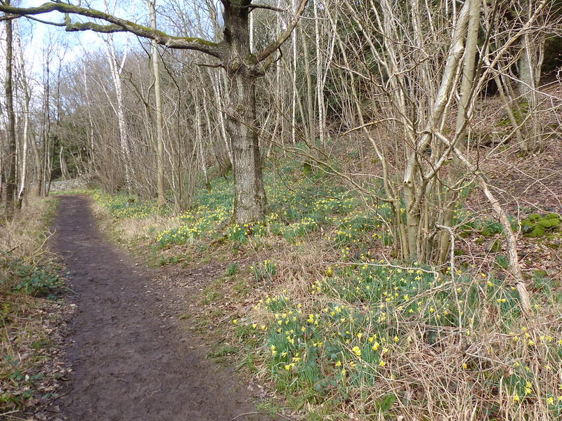
Far Arnside Daffs.
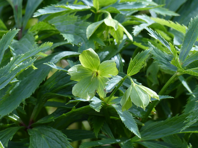
If the violets were a somewhat unexpected bonus, the daffodils in the woods at Far Arnside were totally anticipated and half the reason I had been drawn this way. And when the daffs are on display, I also know that I will find Green Hellebores flowering too…
Green Hellebore among the daffs.Green Hellebore.Around the coast again!Gorse flowering.Hampsfell and Grange-over-Sands.The Kent Estuary.
Not only do I love the view that is revealed when I turn a slight corner here into the Kent Estuary, I also like to drop down on to the sands here, where there’s a handy ramp down across the small limestone cliffs…
The slabs which lead down to the ‘beach’.
I hadn’t been doing that of late, because the beach had always been very wet and muddy, and often slightly submerged. It was no different on this occasion, everything was under an inch of water or more, but for some reason I abandoned caution and decided to head down anyway.
Lichened rocks.Seaweed – Spiral Wrack, I think.
Looking back towards Grange, it looked distinctly like it was raining over there. I thought: “Oh look, it’s raining in Grange”. I didn’t make the obvious inference: “Oh dear, it’s about to rain on me”.
Which of course, it did. Quite heavily, but fortunately not for too long.
A heavy shower.
It was quite odd to be walking in an inch or two of water whilst it was also pelting down.
Seaweed – possibly Bladder Wrack, or a mixture of Bladder Wrack and Spiral Wrack?
Jumping forward to the here and now, June, where we are possibly going to get our first rain in weeks today: I went to a talk about plants this week which was organised by the local Horticultural Society. It was a fascinating presentation, and one of the things I took away from it was the fact that seaweeds are not regarded as plants, but rather as multicellular algae.
A muddy path and a faint rainbow over Whitbarrow Scar.River Kent, light catching a corner of Whitbarrow, and the viaduct. Coastguards training.
By the Coastguard Station on the outskirts of Arnside, some of the coastguard officers were busy training. With hindsight, how I knew that’s who they were, and that they weren’t just thrill-seekers having fun, I can’t remember. It did look like fun, although maybe a little bit on the chilly side.
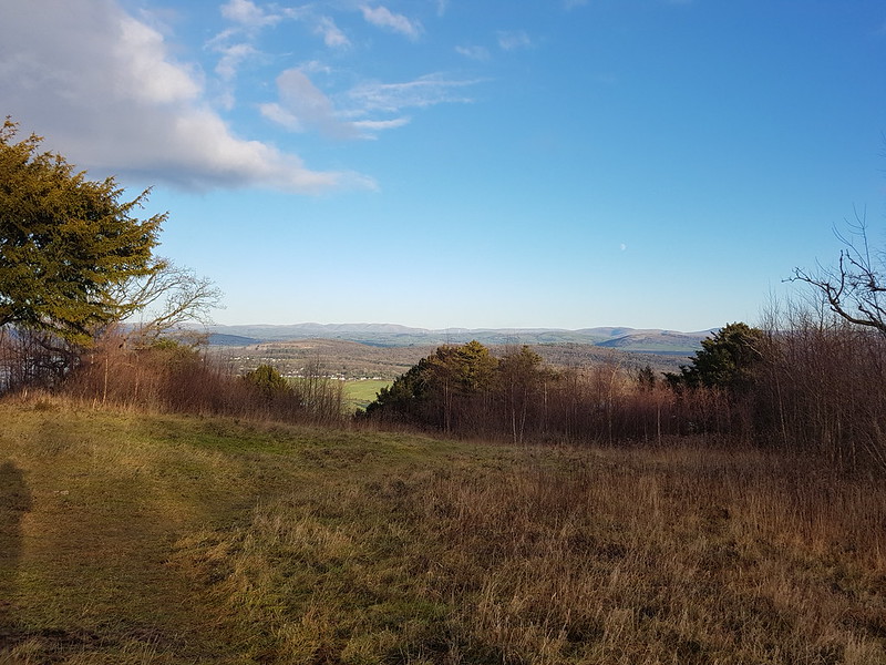
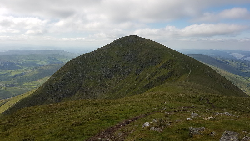
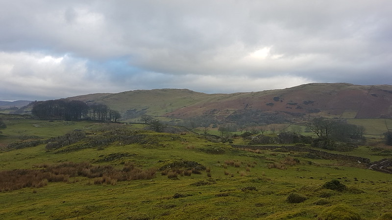
Haverbrack, Beetham Fell, Farleton Fell.
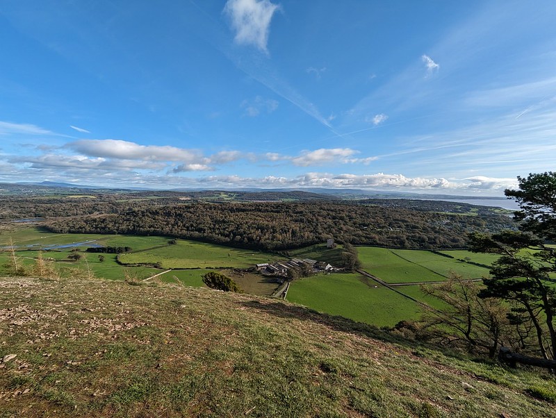
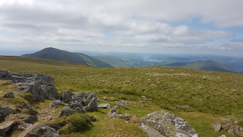
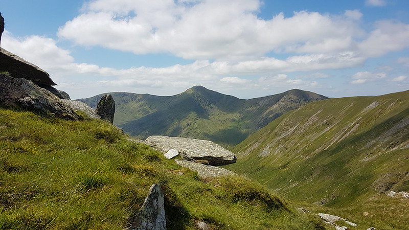
The views from the Knott were rather limited, since many of the Lakeland Fells were smothered by clouds. Still worth the climb however.
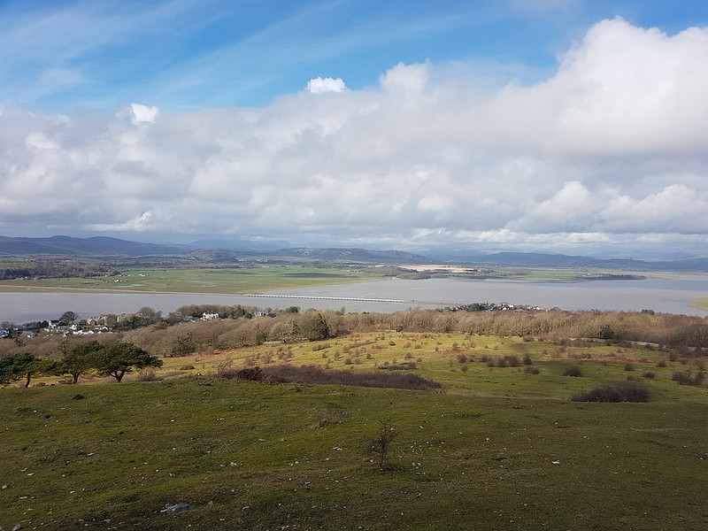
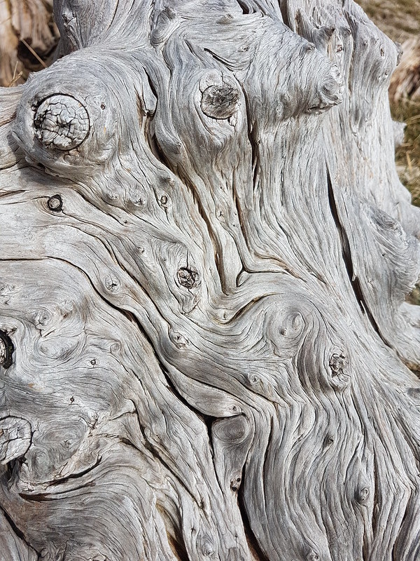
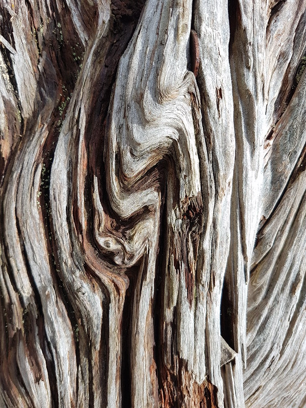
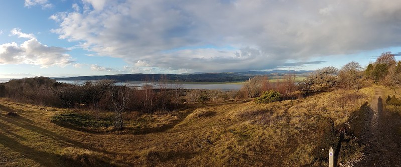
River Kent and Gummer How from the Knott.River Kent pano.Gummer How, Whitbarrow Scar, Foulshaw Moss, Scout Scar, River Kent.Silverdale Moss and Hutton Roof beyond.Morecambe Bay.Whitbarrow Scar again.Knotty tree trunk.
I walk past these couple of old, gnarly tree-stumps almost every time I climb the Knott; what possessed me to take lots of photos of their whorled and fissured surfaces on this occasion rather than any other, I couldn’t say.
Fissured tree trunk.Saul’s Road.Arnside Tower Farm and Middlebarrow Wood.
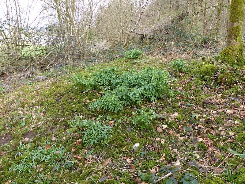
There are Hellebores to be found along the edge of Middlebarrow Wood – to the right they are scattered along the perimeter of Holgates Caravan Park, to the left there’s a single spot where a large clump and several smaller outlying clumps always appear. I chose to head to the left.
Silverdale Moss and Beetham Fell.Green Hellebore – a sizeable patch.
Every spring, I worry that this little clearing, just by the footpath, will have been swamped by the brambles which seem to dominate everywhere else. So far, my fears have been misfounded.
Lots of flowers this year.Rather shy and retiring blooms.Perhaps, a bit nondescript – but I like them.
I’ve limited myself to a handful of the host of photos I took. The flowers are green and rather nondescript, and I’ve posted inumerable photos of them over the years, since I first stumbled upon them flowering, but I like them and I’m afraid I shan’t tire of them anytime soon.
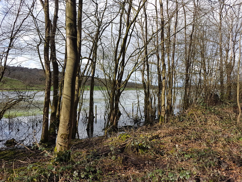
Flooded fields by Middlebarrow Wood.The path along Black Dyke to Arnside – waders required.
Rather astonishingly, I was able to walk this path shortly after this photo was taken, without getting my feet wet. At the time, however, it was very flooded.
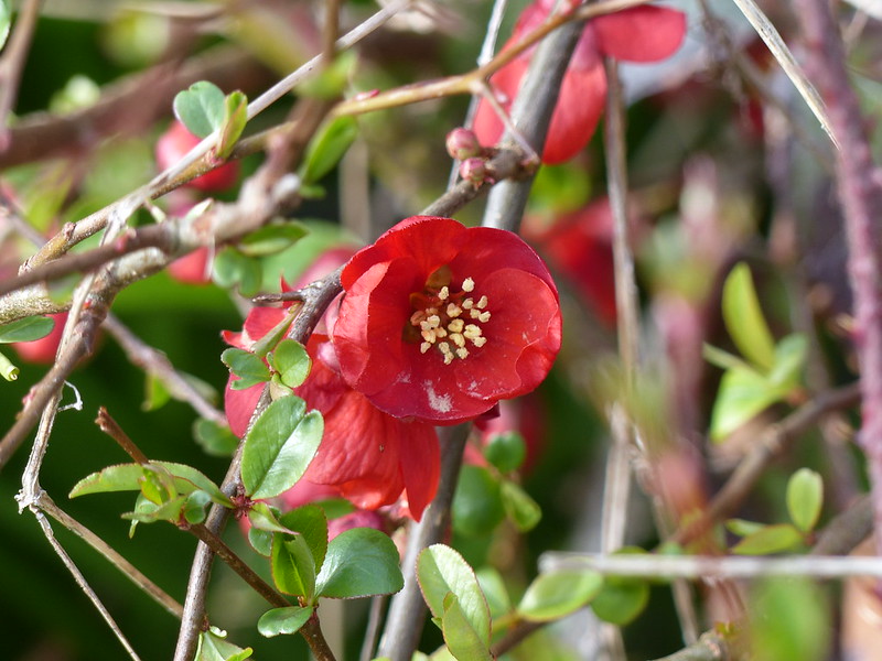
Willow catkins.Quince flowerbuds.…and flowering.
The thicket of Quince at the corner of Elmslack and Cove Road wasn’t really flowering in earnest yet, which given that one year it burst into flower at New Year, seemed quite late. The Quince bushes here, and the hedge opposite are one of the many places around the village, including our own garden, where you can reliably hear the incessant chatter of Sparrows pretty much all year round. Despite being called House Sparrows, they are definitely fond of a nice dense hedgerow. Ours nest under our eaves, but seem to spend much of the day hidden in our Beech hedge, chattering away.
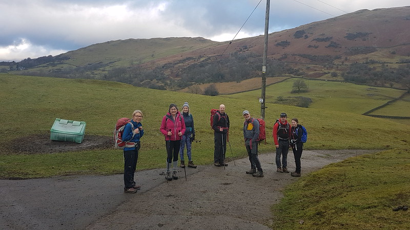
Jump forward a week to the penultimate weekend in January. We were in the middle of a cold snap. We had a minor leak in a pipe on an outside wall of our house and, over several days, a huge stalagmite of ice had formed on the wall.
Round the coast yet again.
I can’t remember what excuse I’d invented for myself as to why I didn’t go a little further and climb a hill. I do know that I didn’t leave the house until almost lunchtime, so maybe I was busy that morning.
Looking back along the coast.
Anyway, with blue skies and glorious sunshine, a local walk was not a hardship at all.
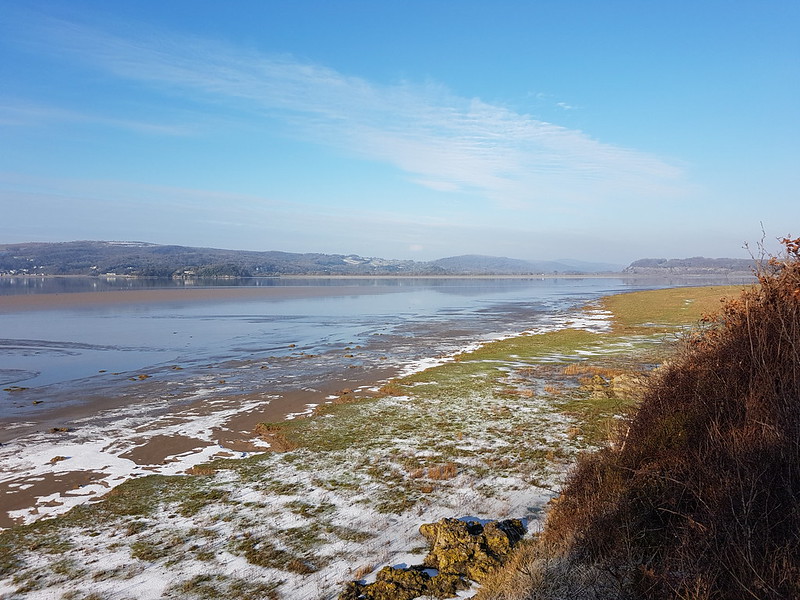
Grange-over-Sands and Hampsfell.Hampsfell, Gummer How and Meathop Fell across the salt-marsh at White Creek.
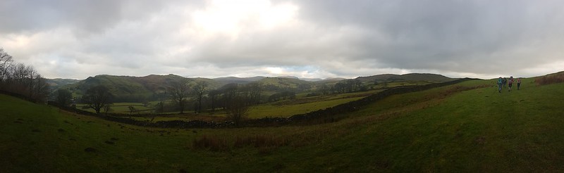
Given that it was a relatively lengthy walk, for one of my local wanders, a little over thirteen miles, I didn’t take all that many photographs, partly, I think, because there was a lot of ice about and I was concentrating on not falling on my a**e.
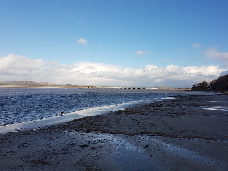
Frozen salt-marsh at White Creek.A lone fisherman near New Barns.Whitbarrow and the Kent Viaduct.A slippery path into Arnside.
In Arnside, I bought a sausage roll and a cup of tea from the Old Bakery and sat on the jetty to enjoy the sunshine and the view. It was a windless day and surprisingly comfortable for sitting out.
Are you leaving that?
I had the company of a Black-headed Gull and a Pigeon for at least as long as my sausage roll lasted.
The Kent Viaduct from the jetty.
From Arnside I followed the route of the old railway track along the Estuary shore to Storth and then to Sandside. It was in the shade and coated in a thick layer of ice most of the way to Storth. I shuffled along it very slowly, feeling certain that I would slip and tumble. I did have a handful of dicey moments, but somehow managed to stay upright.
Whitbarrow Scar from near Sandside.Looking along the Kent, Scout Scar and Heversham Head on the skyline.
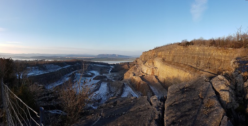
I took the path which skirts the edge of the huge quarry at Sandside. It’s not a right-of-way, but I met several couples coming down the path, so it is clearly fairly well-known and well-used.
Sandside Quarry.
By the time I reached Beetham Fell…
The Fairy Steps, Beetham Fell.
…the sun was already rapidly dropping towards the horizon…
Arnside Knott and the Kent from Beetham Fell.The sun dropping behind Arnside Knott.
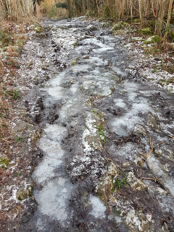
The path which heads from the Fairy steps down towards Hazelslack Farm is usually very wet, with water flowing over the surface, but on this occasion all of the water was frozen into a deep layer of ice.
Verglass on the path from Beetham Fell to Hazelslack.The last of the light.
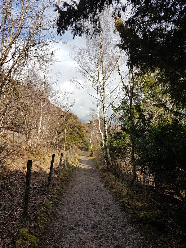
My route back alongside Silverdale Moss and through Challan Hall Allotment to Gait Barrows was completed in gathering gloom, with the final section through Eaves Wood in near darkness.
And that’s January’s walks logged. I’ll be up to date before you know it!
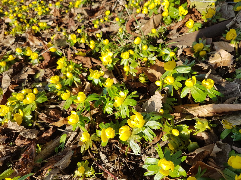
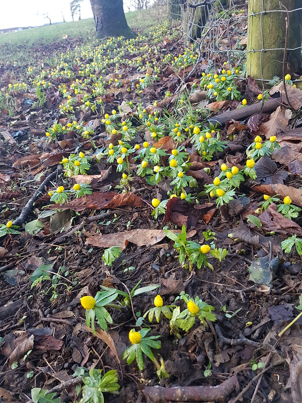
Winter Aconites – not quite flowering, but almost there.
Mid-January. It’s a whole fortnight (and two posts) since I walked around the coast to Arnside and back over the Knott. Better do it again! What’s-more, I was back to it the following day. You have been warned!
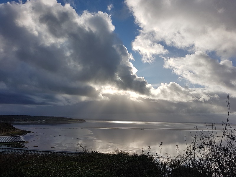
Looking back, the first photo I took that day, from almost outside my own front door, had me puzzled for a moment. Then I remembered – it shows a thin strip of blue along the northern skyline – the weather had suddenly and somewhat unexpectedly improved, and the photo was an aide memoire to remind me of that happy change. To the south the skies were still black. Later, I took a picture of a dark, shadowed Arnside Knott with completely blue skies behind it.
Fortunately, rents began to appear in the massed clouds, giving some prospect of sunshine to go with the blue…
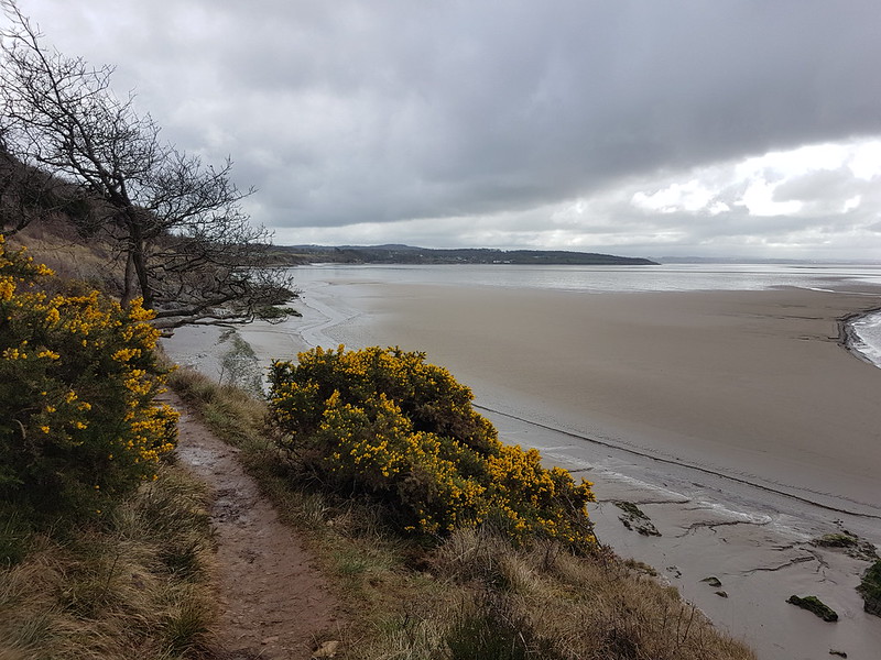
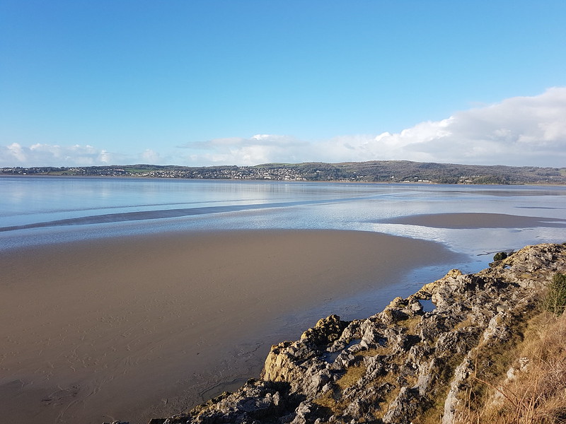
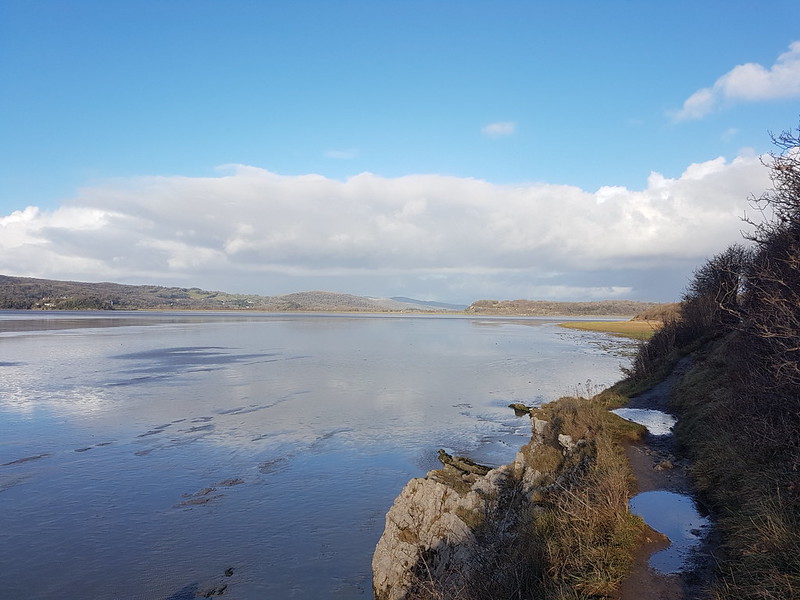
Light show off Know End Point.Round the coast again!Grange-Over-Sands and Hampsfell.Turning the corner into the Kent Estuary.
I like to drop down on to the sands at this point, if not before, but the tide had clearly been high and it looked far too wet to take that option. Which was a shame, because the cliff path itself was extremely muddy and puddled.
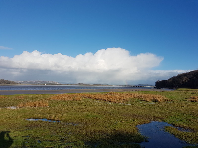
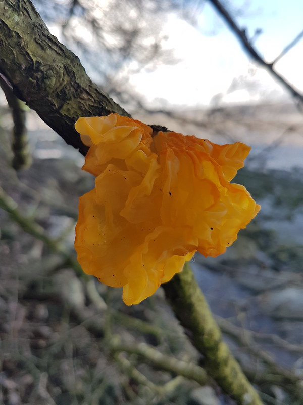
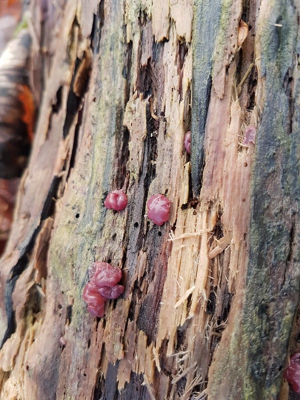
The Salt Marsh at White Creek – inundated.Meathop Fell across the Kent – showers beyond?From New Barns – Whitbarrow Scar catching the light, hint of a rainbow behind the viaduct.Witches Butter – another gelatinous fungi.A train crossing the viaduct.
I’m no trainspotter, but a train crossing this, or any viaduct, always has me scrabbling for my phone to take pictures. I can’t explain my disproportionate excitement. Having said that, I also love crossing the viaduct on the train, but I think that’s mostly to do with the views it affords. I really hope the proposed footbridge along the viaduct becomes a reality, but I don’t know how likely that is.
Whitbarrow still basking in the sun. Yewbarrow in a black shadow.
The Lakeland Fells were mostly missing in the views, hidden in cloud, and it was clear that there were plenty of showers about, and the occasional attendant rainbows. I never tire of watching the play of light and shadows across the landscape on showery days like this one. It helps if the showers are falling elsewhere, on someone else!
A vicious looking cross-current in the river.
The photo doesn’t really do it justice, but the river here was highly agitated, with waves apparently surging in opposing directions, upstream and down. Maybe the tide was on the turn?
Now Whitbarrow has lost the sun and it’s the viaduct which is lit-up.Arriving on Arnside Promenade.A rainbow from High Knott Road.
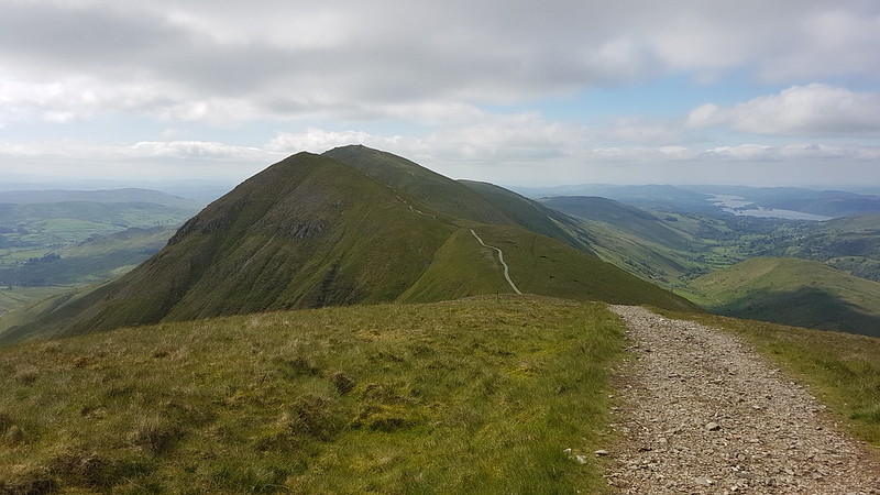
There are lots of paths up the Knott, but I’ve definitely found a favourite, the path which climbs up from Redhill Woods to the bench on the south side of the summit, on which I don’t think I’ve ever met another walker.
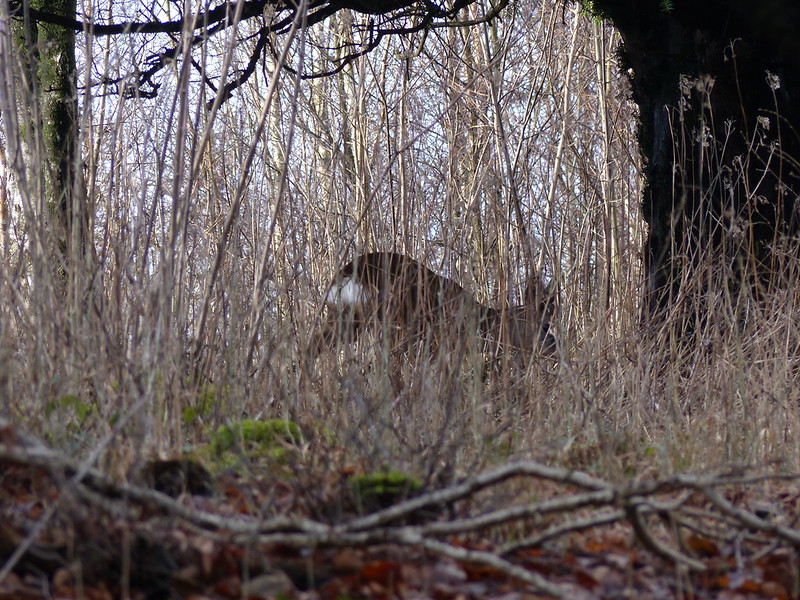
I had company, however, on this occasion – two pairs of Roe Deer which I could see on the slopes below me, but which then darted across the path ahead of me, making their way into the trees towards the trig pillar. Although we often have deer in the garden – there are two there now – I still enjoy seeing them whilst out walking. It’s a bit harder to get good photos in the woods though!
Roe Deer – one of a group of four.Winter flooding and Silverdale Moss – Ingleborough just about visible.Beetham Fell and Farleton Fell from Arnside Knott.Reclining Beech.
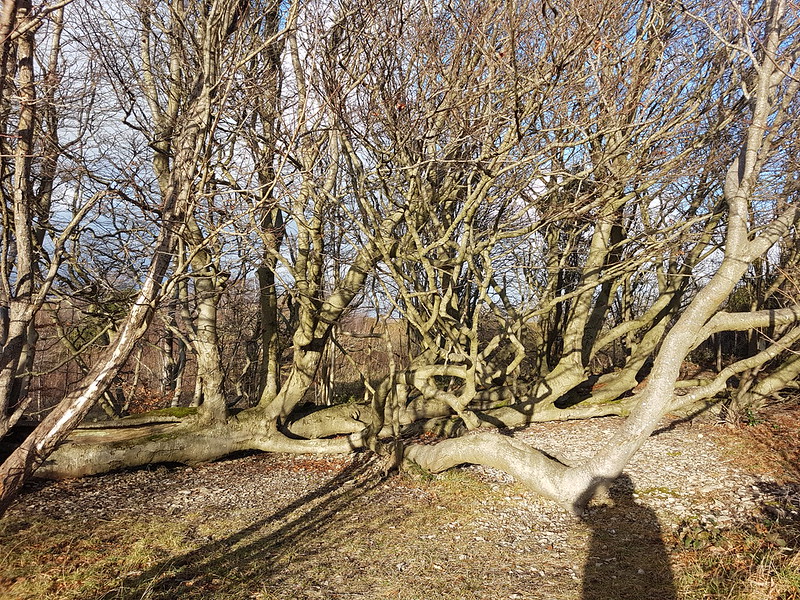
I wonder how long ago this tree fell into its current position? Before I moved to the area, so quite a while ago. It’s sent up a thicket of branches, each like a separate trunk. Is it the resilience of fallen trees which live on like this which I admire?
I’ve recently finished reading ‘Wild Fell’ by Lee Schofield about the RSPB management of two farms in the Lake District at Haweswater and Swindale, and which I can thoroughly recommend. One astonishing fact I gleaned from it is that there’s a single Aspen in Utah, called Pando for some reason, which occupies over a hundred acres, has 40,000 trunks, is estimated to weigh 6,000 tons and is thought to be several thousand years old. Aspen spread by sending up suckers, so all of the trunks are genetically identical and are thought to share a vast root system. It is, of course, under threat, probably due to overgrazing.
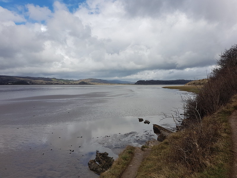
Looking along the Kent.Gummer How – the Fells beyond noticeably absent from the view. Grange-Over-Sands and Hampsfell.Another free light-show over the Bay.Arnside Knott.
I was heading home via Far Arnside and Holgates Caravan Park – using the same paths I had set out along. In stark contrast to earlier, Arnside Knott was now brightly illumined by the sun, but the skies behind were heavily clouded and rather ominous. I could see that a shower was coming, could I beat it home?
Caught in a sharp shower when almost home.
No! Still, a brief drenching seems a small price to pay for what preceded it.
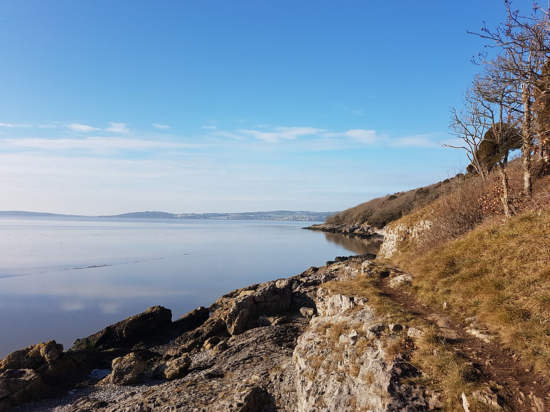
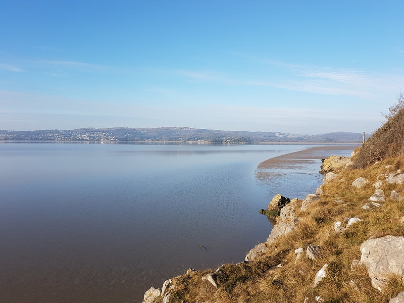
Humphrey Head and Grange from the coastal path to Arnside.
Taking advantage of some much improved weather, and the fact that my covid-inflicted fatigue seemed to be wearing-off, I got out for a longish local wander, around 11 miles, on the second of January. These days, I’m increasingly drawn to the route around the coast to Arnside with a return over the Knott.
And again.
There are lots of other great walks in the area, but the appeals of this one are hard to match.
Looking out into the Bay.Looking back towards Silverdale.
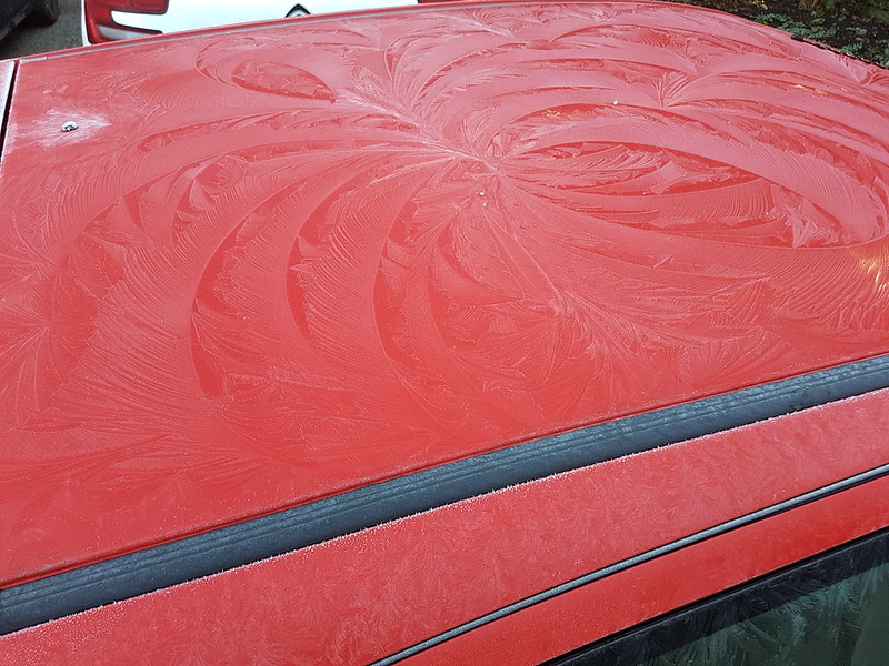
Just in case the sunshine is making you think it might have been a warm, balmy day, this is the first sight that greeted me when I left the house…
Car bonnet frost flowers.A car roof frost spiral.
On the way to the coast at Far Arnside I indulged myself with some old favourite obsessions, which perhaps haven’t appeared on the blog as often recently as they once did…
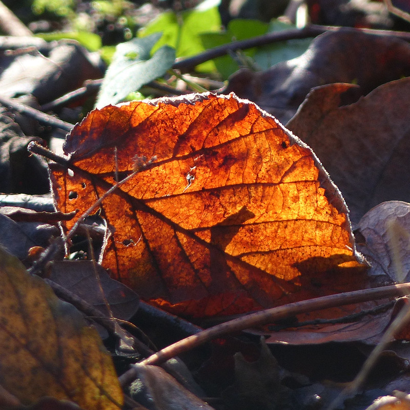
Robin.Back-lit leaves.Back-lit leaf.Almost seasonal holly berries.Back-lit Bramble leaves.Back-lit Oak leaves.
Leaves, berries and Robins and the like.
Grange and Hampsfell.Turning in to the Kent Estuary.
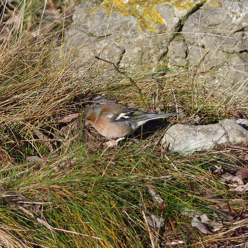
At the far end of the White Creek shingle beach there must have been rich pickings in an area of rough grass just above the high-tide line; several Chaffinches, a couple of Robins, and a Blackbird were darting to and fro from the low trees nearby to the turf.
Chaffinch.
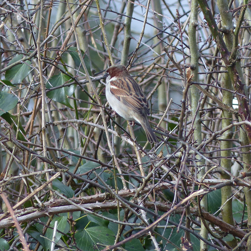
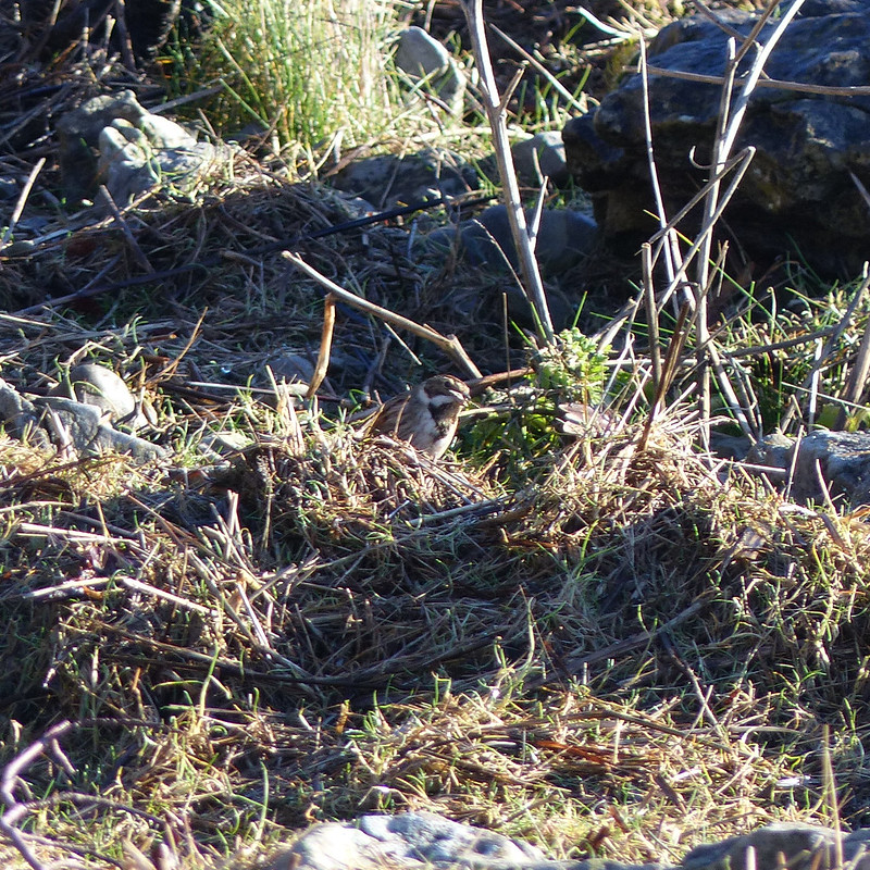
In amongst the others was a bird I didn’t recognise, and I got overly excited thinking that it was something exotic. In my defence, I did assume that it was a bunting of some kind. It is: a Reed Bunting, which I’ve seen in lots of places locally, but never down on the coast before.
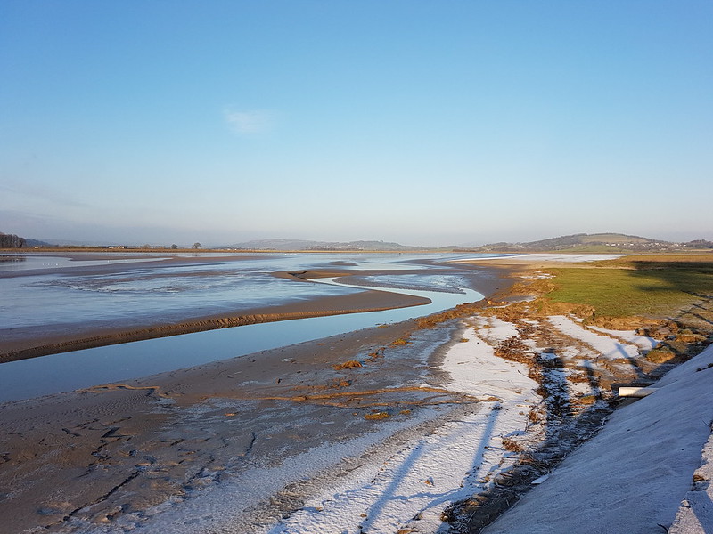
Reed Bunting.The River Kent and Grange.Across the Kent to Meathop Fell.Along the Kent to the Howgills.River Kent pano.Arnside Knott from New Barns.The river, the viaduct and the Howgills from New Barns.Complex channels at New Barns.Looking back to New Barns.Close to Arnside – it was busy.Whitbarrow Scar and the viaduct.Clouds reflected in the Kent.Another Robin.Fungi.
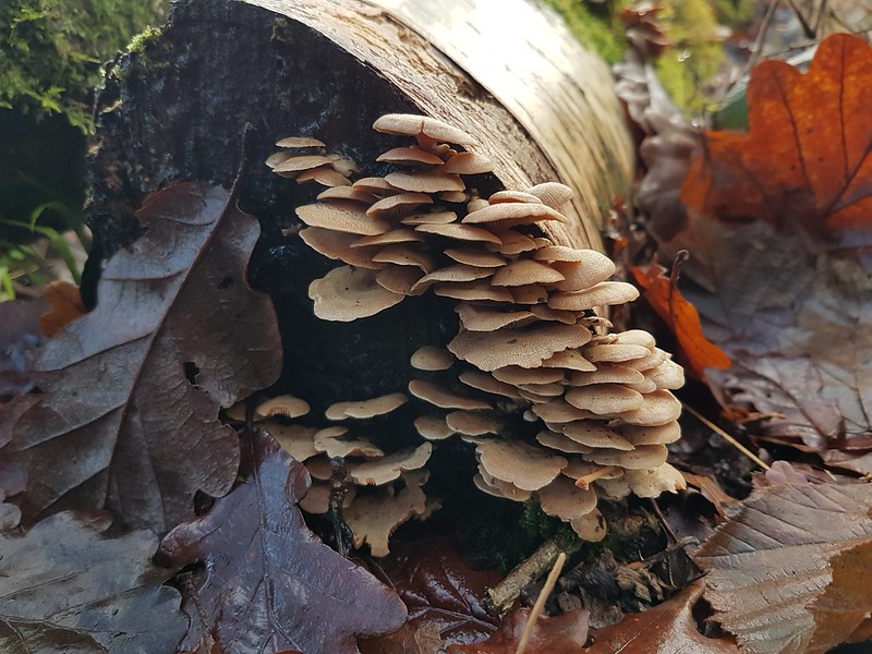
I’ve joined a Facebook group, Fungi of the World, and the weird and wonderful photos which are posted there have inspired me to pay more attention to the varied forms of fungi in our local woods. On my way up on to the Knott, I took a circuitous route, including a wander around Redhill Woods to have a gander at the fungi there.
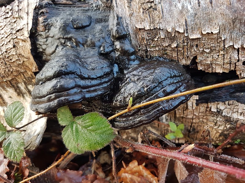
Tiny, tiny fungi – Ear Fungus fruiting bodies just appearing?Shiny, black bracket fungus.More fungus.Even more fungus.
I found many kinds, but not all of them are here as some of the photos came out a little blurred.
Warty excrescences on a Birch log.
I don’t think these are fungi, but I think that it might be the case that the trees produces these odd growths in response to the promptings of a fungi.
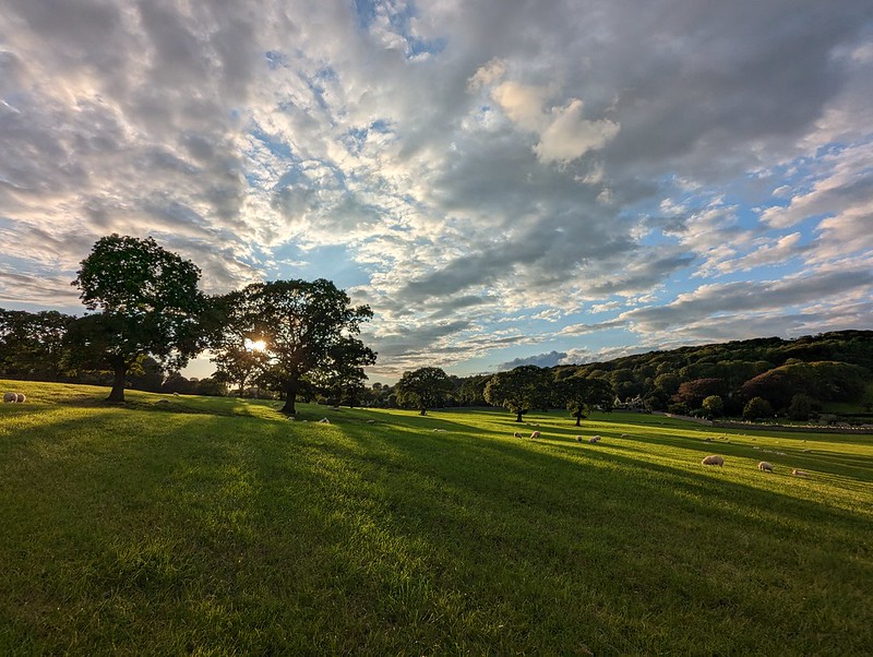
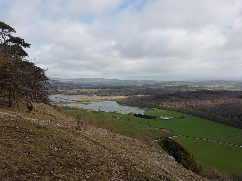
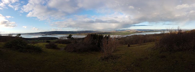
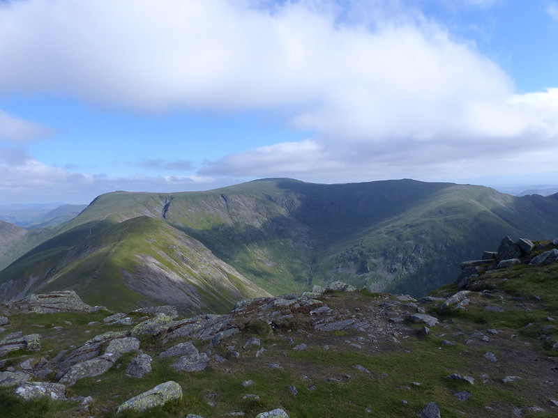
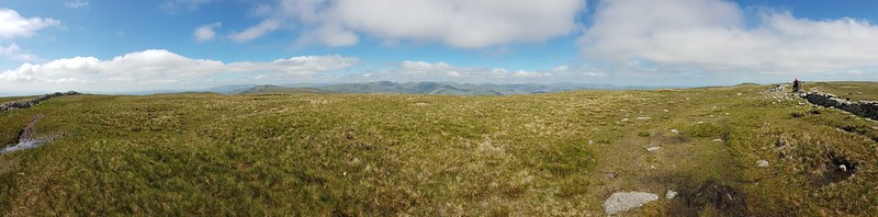
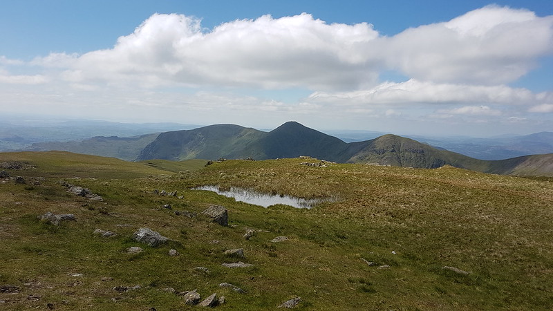
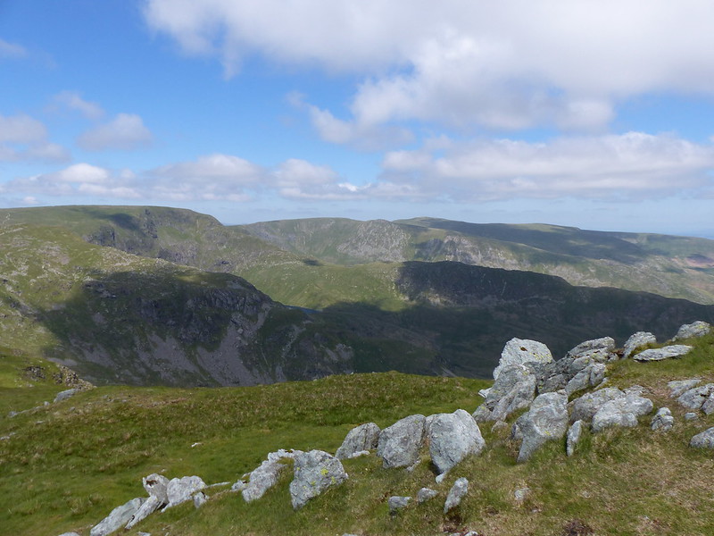
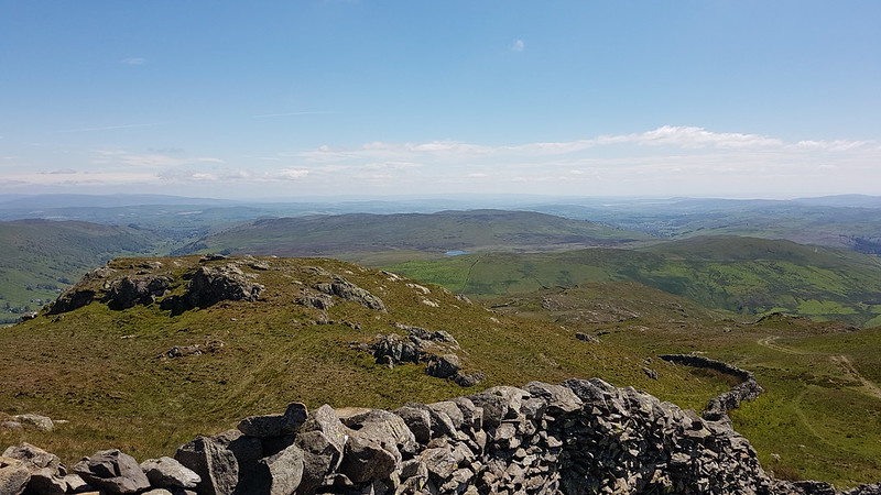
Ingleborough and Silverdale Moss from Arnside Knott.Arnside Tower, Arnside Tower Farm, Middlebarrow, Warton Crag and the Forest of Bowland Fells from Arnside Knott.The Howgill Fells and Middleton Fells from Arnside Knott.Rain in the Lake District pano.
As I often seem to do, I looked at the clouds obscuring the Cumbrian fells and felt vindicated in choosing a wander straight from my door rather than going further afield, but usually this weather based justification is superfluous – in reality I’m looking for excuses for doing just what I wanted to do anyway.
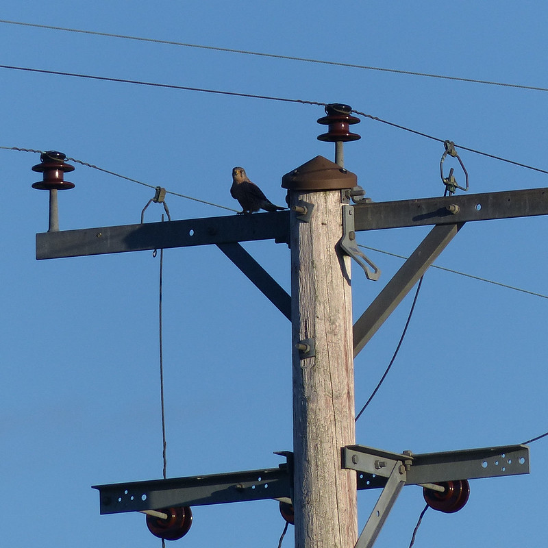
Starting to clear pano.Very short, faint rainbow over Yewbarrow and Whitbarrow.Clougha Pike from Heathwaite.Ingleborough from Heathwaite.Male Kestrel.
Near Far Arnside I spotted this male Kestrel perched on a telegraph pole.
Male Kestrel in flight.
It didn’t seem too happy with my attention and flew from pole to pole, with me following and taking lots of pictures. Of course, after all that effort, it was the first two that I took which came out best. A great way to finish a really terrific start to the new year.
On the coast path: the Kent Estuary and Meathop Fell.
The final day of October half-term, and for reasons I can’t remember, I only set-off for my favourite stroll around the coast to Arnside and back over the Knott at around three in the afternoon.
The foreshore at White Creek.
When I moved to the area, around thirty years ago, there was no salt-marsh at White Creek and none at Grange either, but you could walk on the grass from Knowe Point to Far Arnside. Now the situation is reversed, testament to the way the river channel changes and so keeps the Bay in constant flux.
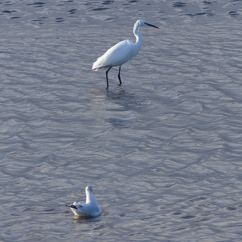
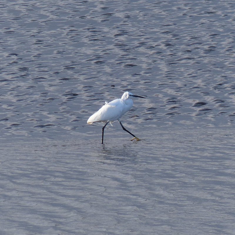
Little Egret.
Likewise, thirty years ago, I wouldn’t have expected to see any Little Egrets in the area, but now they are relatively common, and Great Egrets are also beginning to establish themselves.
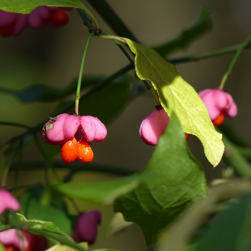
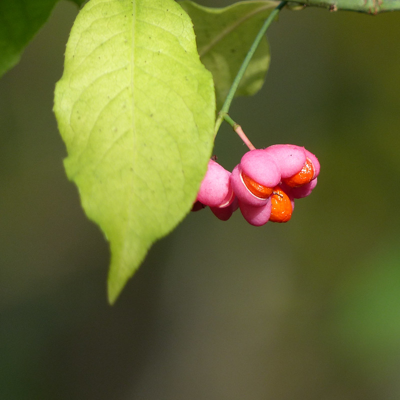
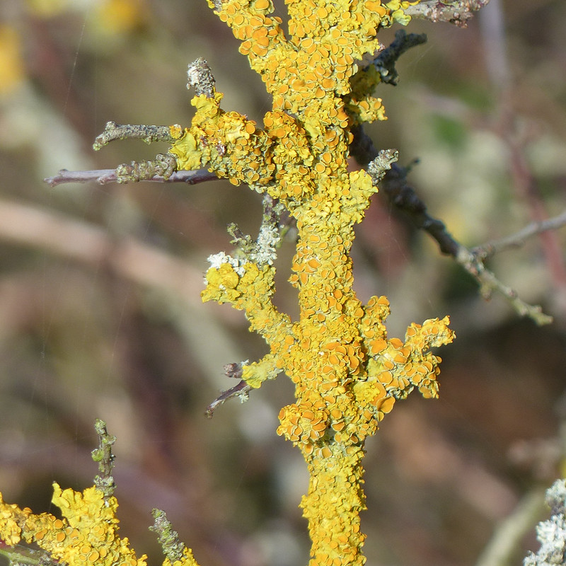
The Kent Estuary and Meathop Fell again from a little further around the coast.Spindle berries.Spindle berries.Xanthoria parientina.Possibly.
If I’ve identified this lichen correctly, and it is Xanthoria parientina, then it’s a common lichen which produces a yellow chemical, xanthorin “thought to be produced as a defence against UV radiation” (source), when the lichen is shaded it doesn’t produce the chemical and is then green.
Lichens are famously a symbiosis between a fungi and a photosynthesising partner, either an algae or a cyanobacteria (blue-green algae). I’ve been reading ‘Entangled Life’ by Merlin Sheldrake, which TBH bought me for Christmas, and apparently many lichens are now known to be multi-species symbiosis, that is, to have three or more species living in partnership.
I didn’t study Biology at school, even to O-level standard, but with hindsight that seems like a crazy decision; the more I learn the more unlikely and astonishing almost every aspect of life seems to be. For example, also gleaned from “Entangled Life’, did you know that are own mitochondrial cells might have started life, in evolutionary terms, as independent bacterial cells? I think I’ve got that right, although, as I said, I’m no biologist!
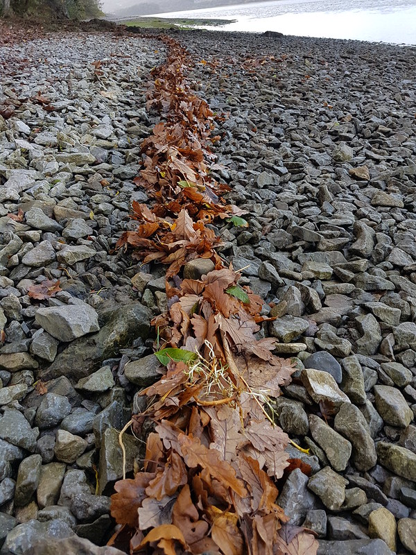
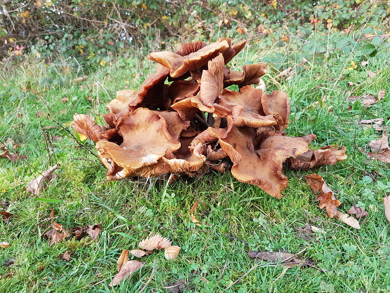
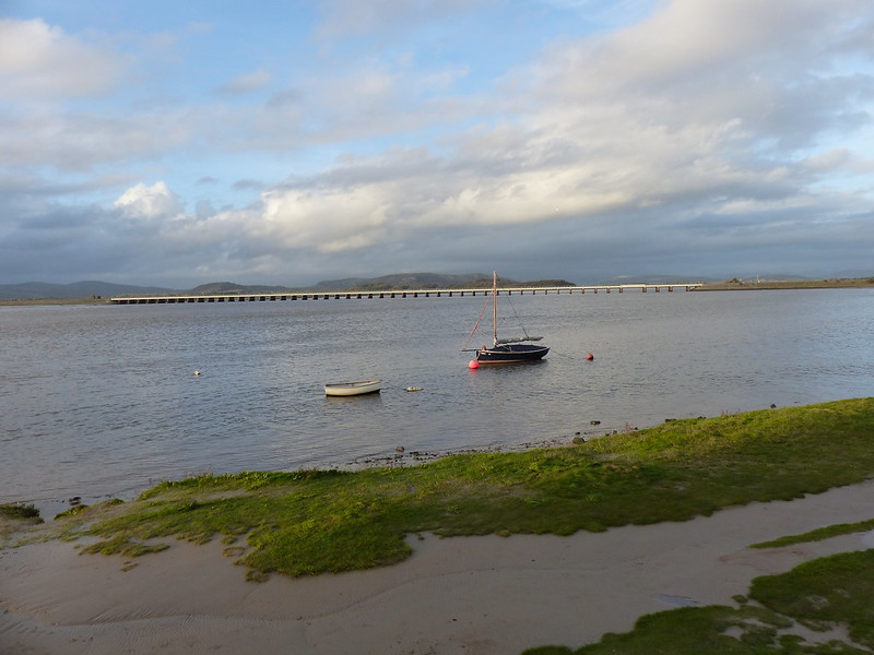
Andy Goldsworthy leaf sculpture. Or the tideline. More fungi.Waxcaps. Possibly Orange Waxcap.Distant view of the viaduct and the sun catching Heversham Head.Looking back along the Kent Estuary.The viaduct, Whitbarrow Scar and a couple of boats.Little Egret in the Kent at Arnside.
There were four Little Egrets stalking the shallows just off the promenade in Arnside. They fish by stirring up the riverbed with their feet, and look pretty comical doing it, a sort of avian ‘Ministry of Funny Walks’.
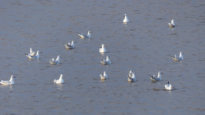
And another – note the characteristic yellow foot.Black-headed Gulls on the Kent.
I know: they don’t have black heads, but their name is a bit misleading, because that’s breeding plumage, which, by autumn, they’d just about lost.
If you are reading in the UK, and haven’t got around to watching ‘Wild Isles’ yet, and, to be honest, I’ve only just started myself, there’s some amazing footage in the first episode of Black-headed Gulls trying to steal Sand Eels from Puffins.
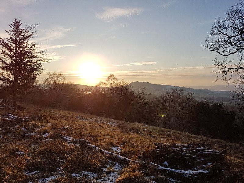
Sunset from the Knott.
One advantage of a late start!
*If you were expecting at least a passing reference to the John Wyndham novel, my apologies**. I like his novels, this one included, but haven’t read it, or any of his others, for a very long time. Fifteen years in to blogging, when most of your posts consist of photos of leaves and butterflies, and the same three walks repeated ad infinitum, it’s sometimes hard to come up with titles you haven’t used before. That’s my excuse, and I’m sticking to it.
**Although, now, of course, you’ve had it. What are you complaining about?
Whilst my weekend Dad’s-taxi-driving duties have diminished, during the week I’ve been busier than ever. My ‘little and often’ routine and my spring and summer evening hill-walks have both been casualties of the change, but I haven’t minded, what with all the great weekend outings I’ve managed to fit in. I have still occasionally squeezed in some short walks here and there. This post rounds up a few photos from some of those wanders during June and July.
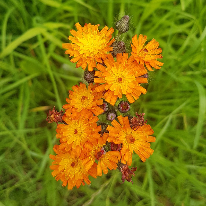
Fox and cubs.
Fox and cubs is a naturalised plant, originally from North America. I was able to photograph it in its home range this summer (of which, more to come!).
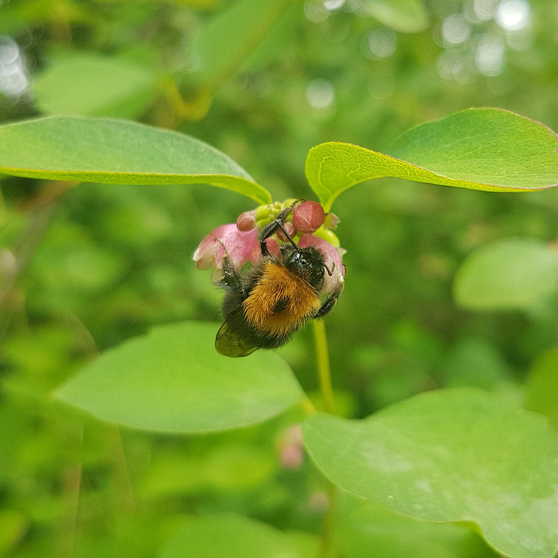
Tree Bumblebee on Snowberry flower.
I know that I’ve mentioned before my phone’s newfound ability to take sharp close-up photos. Here’s another example. On a fairly cold day, a thicket of Snowberry was swarming with Tree Bumblebees, but several of the bees were clinging to flowers, apparently motionless and marooned, probably exhausted by the low temperature.
Snowberry is another non-native, naturalised plant. I had it in a hedge in a previous garden. Although the flowers are hardly showy, I admired the handsome white berries which give it its name, and was happy to have it in my garden. Until, that is, it sent suckers underneath the flagged path it edged and tried to takeover the rest of the garden, from which point I ended up fighting a running battle with it.
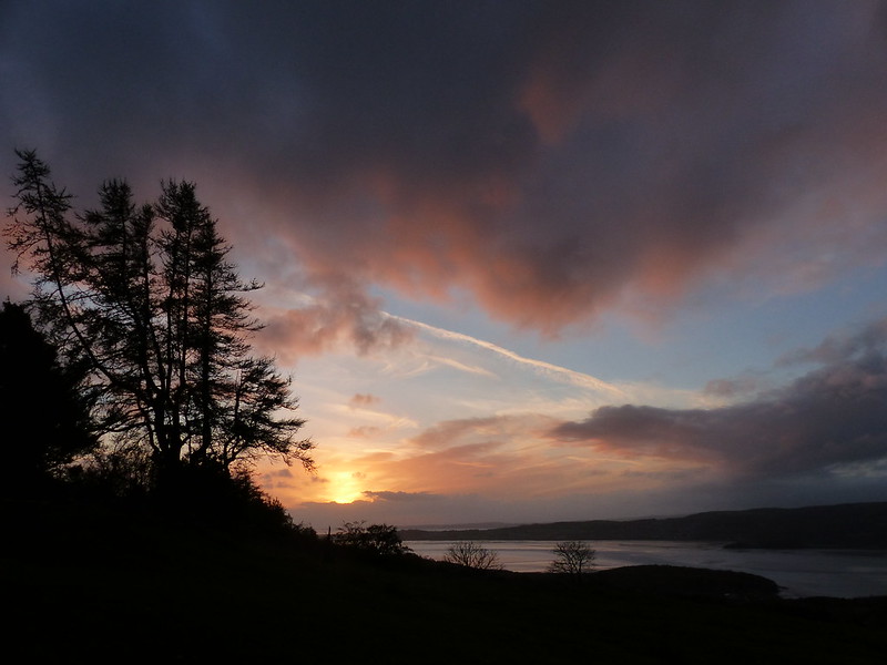
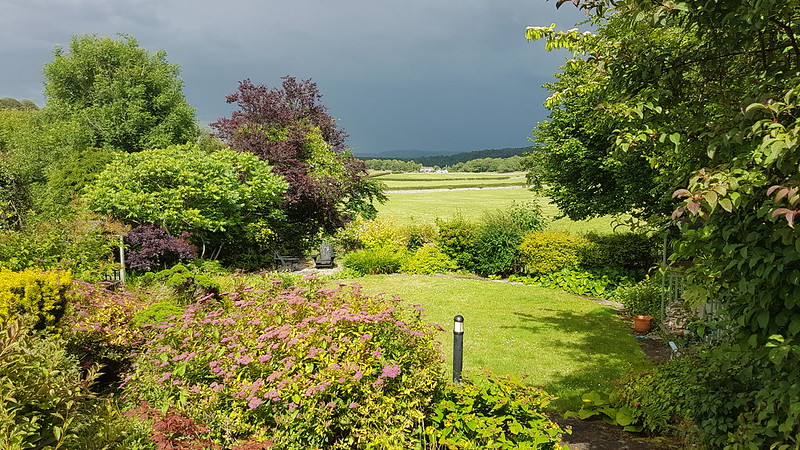
Dark skies.
There’s something irresistible about sunshine backed by threatening dark skies. This photo, and the three which follow, are from the last weekend in June. The annual Art Trail, which had to be cancelled two years ago, and delayed last year, was back to its usual weekend. TBH and I had already seen the exhibition in the Gaskell Hall of the work of the Silverdale Art Group, which was brilliant, as ever, and had visited a few other venues. Then we drove to Storth to take a look at the exhibitions there.
Whitbarrow across the Kent Estuary.
The weather looked a bit brighter across the Kent Estuary, but to the east…
Heversham Head, Sizergh Fell and Kentmere Fells across the Kent Estuary.
…still very murky. By the time we’d toured the Village Hall and looked at some amazing abstract paintings, by an artist whose name, unfortunately, I can’t remember, things had actually, properly brightened up…
Heversham Head, Sizergh Fell and Kentmere Fells across the Kent Estuary.Garden Roe Deer.Williamson Park folly.
After what seemed like a very short break, B’s rugby training recommenced. One evening it was shifted from Kirkby to Williamson’s park in Lancaster, where the players did lots of steep hill-sprints. It looked like extremely hard work.
I took a book to sit in this little folly. Much more relaxing.
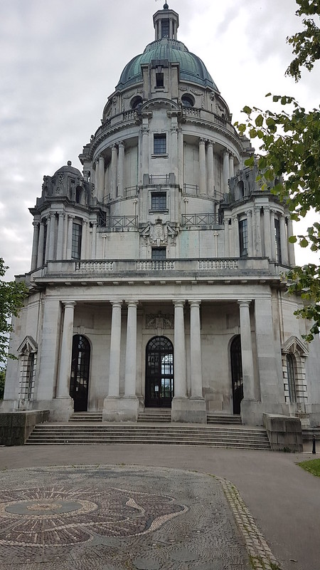
Ashton Memorial.Ashton Memorial.Across Morecambe to the Lakes.
These last two photos are from a very sunny lunch-time escape from work, when the weather had turned really hot.
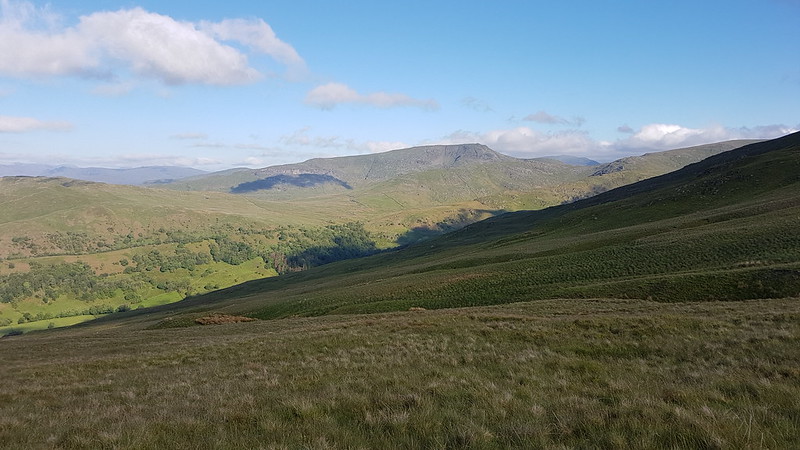
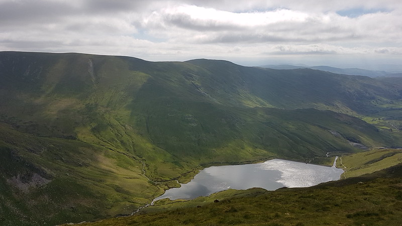
Looking back down towards Kentmere from near the top of the Garburn Pass.
An early start to get one of the few parking spaces by the church in Kentmere. It had been raining, but was clearing rapidly.
Red Screes.
It was another windy day, but sunny, and warm if you could get out of the wind.
Troutbeck and Wansfell. Coniston Fells beyond.
These days I rarely take my camera with me, but with less warm gear in my bag, regrettably as it turned out, I could fit it in on this occasion. I’m beginning to think I shouldn’t bother. The photos I took of Butterwort flowers weren’t in focus, and I prefer my phone’s camera’s pictures of the scenery. So where possible that’s what I’ve used here.
Yoke. Ill Bell ahead.
The problem with using both is that that seems to confuse Flickr so that the pictures end up out of sequence. I’ve tried to put these in order, but I’m not sure I have it completely right.
Looking back to Yoke.
Anyway, it’s a cracking route, which I’ve done many times before, although I think the last time I did the route in its entirety would be over twenty years ago when I was preparing for the London Marathon and I ran it, in about three and a half hours if memory serves me right. I didn’t include Thornthwaite Crag or High Street back then. This time it took me more than twice as long, but I wasn’t in a hurry.
The head of Kentmere from Ill Bell. Froswick, Thornthwaite Crag, High Street, Mardale Ill Bell.
I was very taken by the top of Ill Bell with its many tidy cairns and superb views. Ill Bell has a steep north-east ridge which I keep promising myself I will climb. Next time.
Windermere from Ill Bell.Looking back to Ill Bell.Thornthwaite Crag from Froswick.High Street and Mardale Ill Bell. The headwaters of the River Kent.Kentmere Reservoir.Looking across the Fairfield Horseshoe ridges to the Coniston Fells.Troutbeck Tongue, Wansfell, Windermere.Froswick and Ill Bell.Thornthwaite Beacon.
I have a real affection for Thornthwaite Crag, I think it’s at least partly to do with the huge architectural cairn. The view’s pretty good too…
Froswick, Ill Bell, Windermere and Wansfell from Thornthwaite Beacon.
I sat here for quite some time, whilst a few parties came through from various directions.
Grey Crag, Hayeswater, Rest Dodd, The Knott, Rampsgill Head.
Once you’ve made it to Thornthwaite Crag all of the hard work is behind you. Its a long, steady plod up to High Street and then it’s nearly all downhill. Well, aside from the steady climb onto Harter Fell.
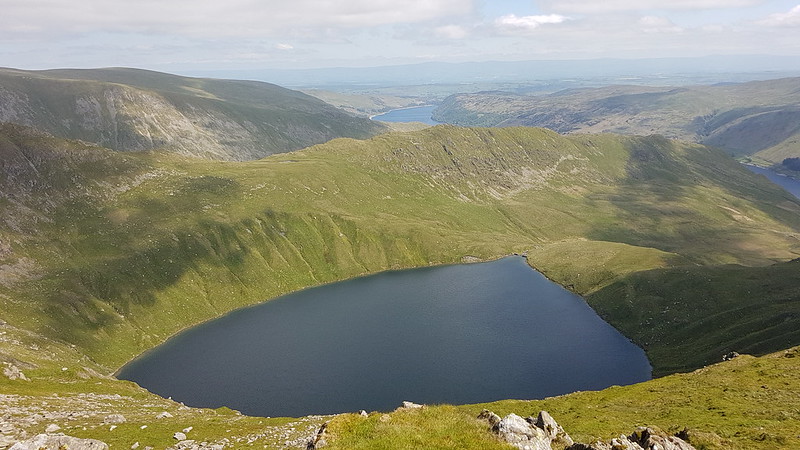
The path up High Street.High Street pano.Haweswater and Selside Pike. The Pennines across the Eden Valley.Rough Crag, Blea Water and Kidsty Pike.Blea Water.
Unlike nearby Small Water, I’ve yet to swim in Blea Water, something I shall have to rectify. The crags at the back of the tarns are renowned for the alpine species which cling on in that remote, inaccessible locality.
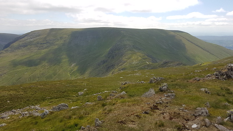
Yoke, Ill Bell, Froswick.
I should warn you that most of the remaining photos, well, a lot of them anyway, are of Yoke, Ill Bell and Froswick from various vantage points. I make no apologies, I think they looked magnificent.
Looking across the Nan Bield Pass to Harter FellYoke, Ill Bell, Froswickacross Kentmere Reservoir.Piot Crag, Rough Crag and Kidsty Pike.Looking back to Mardale Ill Bell, Thornthwaite Crag and High Street.Yoke, Ill Bell, Froswick.Yoke, Ill Bell, Froswick, and my gradual descent route.Pano.Looking down towards Kentmere Pike. Long Sleddale ahead. The Kent Estuary just about visible in the haze on the right. Forest of Bowland also seen in the haze.Looking down into Kentmere. Windermere on the right. Kent Estuary much clearer now. Arnside Knott stands out.Cocklaw Fell, Green Quarter Fell, Skeggles Water. Brunt Knott and Potter Fell beyond. Forest of Bowland on the horizon.Yoke, Ill Bell, Froswick.Yoke, Ill Bell, Froswick.
Somewhere on the way down I lost the path completely. I thought for a while I would end up traipsing through acres of bracken, but actually my route worked out well and I just cut a corner.
Yoke, Ill Bell, Froswick.Pano.
As I got down towards the valley it was actually quite hot, a novelty after a very cold spring.
Now, I just needed to cross some flower-filled and boulder-strewn meadows back to the village and my car.
Kentmere Farmhouse.Kentmere Church.
MapMyWalk gives about 13½ miles and 1074m of ascent. Previous experience would suggest that the latter will be an underestimate, but I can’t be bothered to check!
The day after my Sour Howes and Sallows walk, and I’m going back to Kentmere, this time parked in Staveley. A get-together has been organised, TBH is joining the group. B has a rugby match, but the Colts kick-offs are generally in the afternoon, so I decide that I can join for at least part of the walk.
Hugill Fell, Millrigg Knott, Brunt Knott and Potter Fell, this time from the South. The prominent top on Hugill Fell is Black Crag. Click on the picture to see a larger version.
After much faffing in Staveley, we didn’t get all that far before I had to reluctantly leave the group and head back for the car.
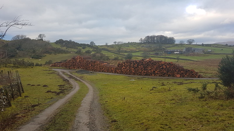
Timber! There had evidently been a lot of felling in Craggy Wood so I assume that the wood had come from there.
Craggy Wood was purchased, relatively recently I think, by Cumbria Wildlife Trust. I’ve had my eye on a visit there for many years, having seen it so often from Staveley.
Scout Scar from Craggy Wood.
The path initially climbs steeply through a felled area – the felling I suspect to remove non-native conifers – then rocks-up on the top edge of the wood, giving views over Spy Crag.
Looking North across Spy Crag.Brunt Knott and Potter Fell from Spy Crag.In Craggy Wood.
The path weaves its way through the trees and along the edges of some small crags. Now I need to go back in the summer, when the trees are in leaf and, of course, in the autumn when no doubt the colours will be magnificent.
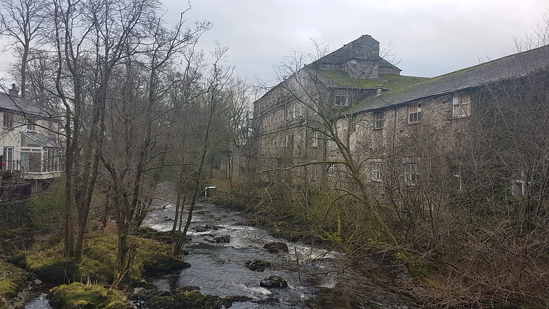
Reston Scar and Black Crag on Hugill Fell.River Kent weir on the outskirts of Staveley.An old mill? by the Kent.
More by luck than good judgement, I arrived home at almost exactly the time I’d told B I would. True to form, however, he wasn’t ready anyway. Still, we made it in plenty of time for the match.
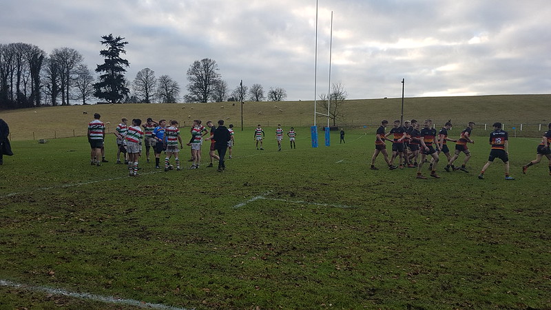
The aftermath of a Kirkby try.
Andy’s account of the rest of the group’s longer walk is here.