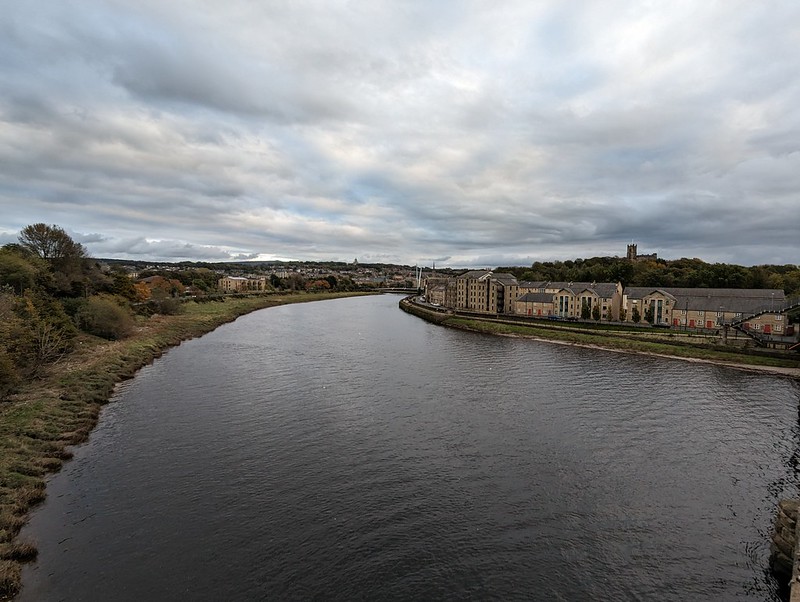
October half-term. On the Saturday I was in Lancaster for some reason. Whatever the reason, I crossed Carlisle bridge, which takes the railway lines over the Lune, but also has a footbridge attached. I like the view of Lancaster from there…
Lancaster from Carlisle Bridge.
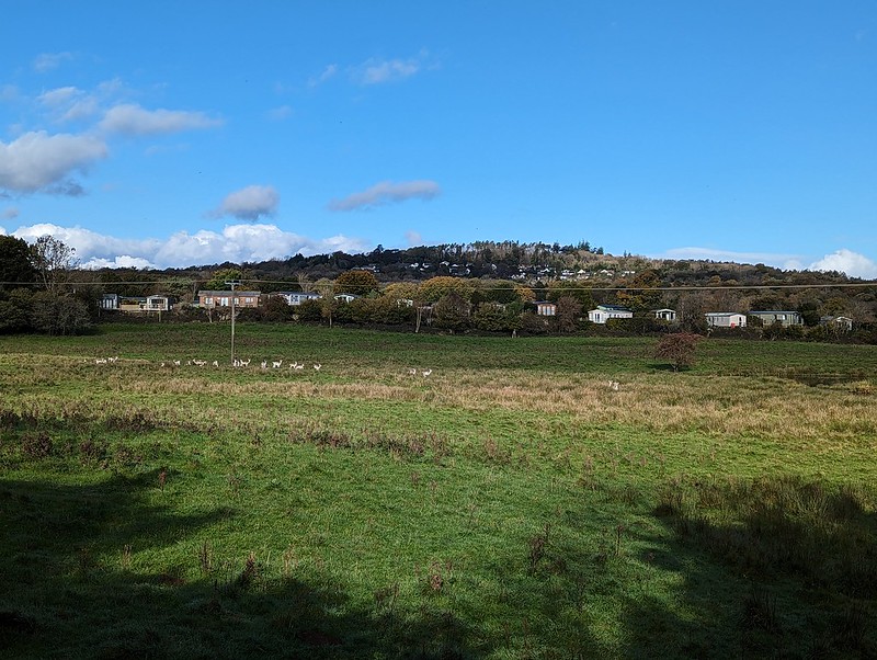
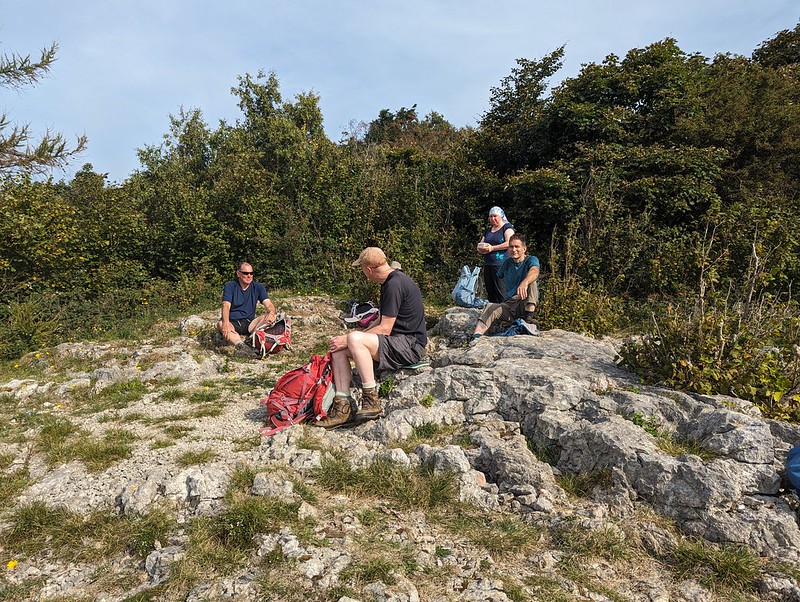
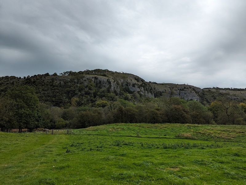
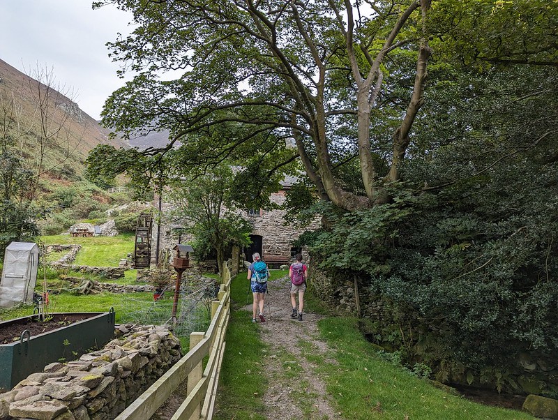
On the Sunday, our old neighbour from when we lived on The Row, MM, was visiting his daughter and her family, who are now our neighbours (are you following?) We got chatting and he asked if I’d ever had a wander around Fell End Nature Reserve. Not only had I never visited, I didn’t even know it was there, which, given that it’s pretty close to home is a bit of a surprise.
MM offered to introduce me, drove us over there, lent me a pair of binos and gave me a guided tour. What a star!
Part of the herd of Fallow Deer at Fell End.
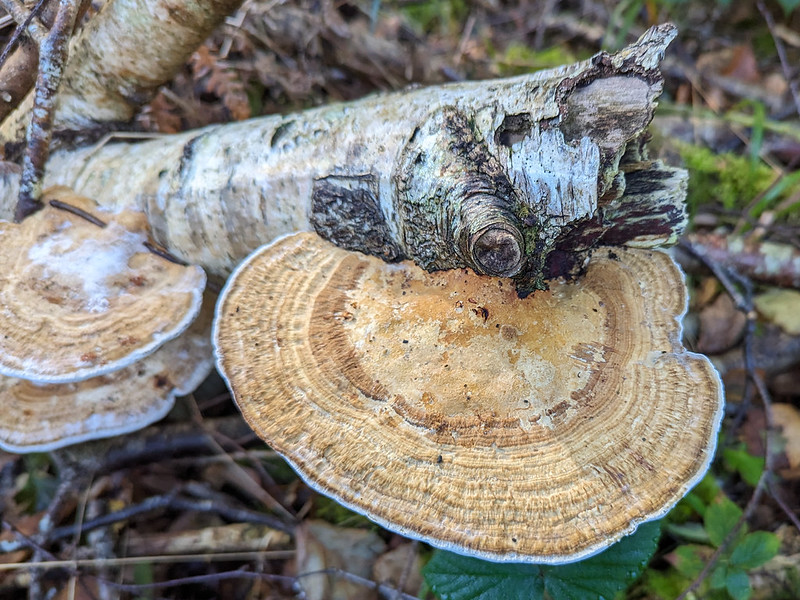
When we’d almost completed our circuit, we bumped into first one, then a second fungi expert, both of whom MM knew, and we set-off together for another turn around the reserve.
Honey fungus?
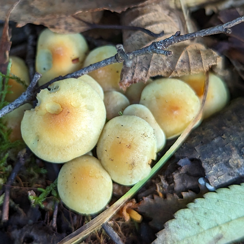
MM had been disappointed by the paucity of the fungi on display, but with a couple of knowledgeable tour guides, there was a fair bit to see after-all.
Hinge and Bracket fungus.
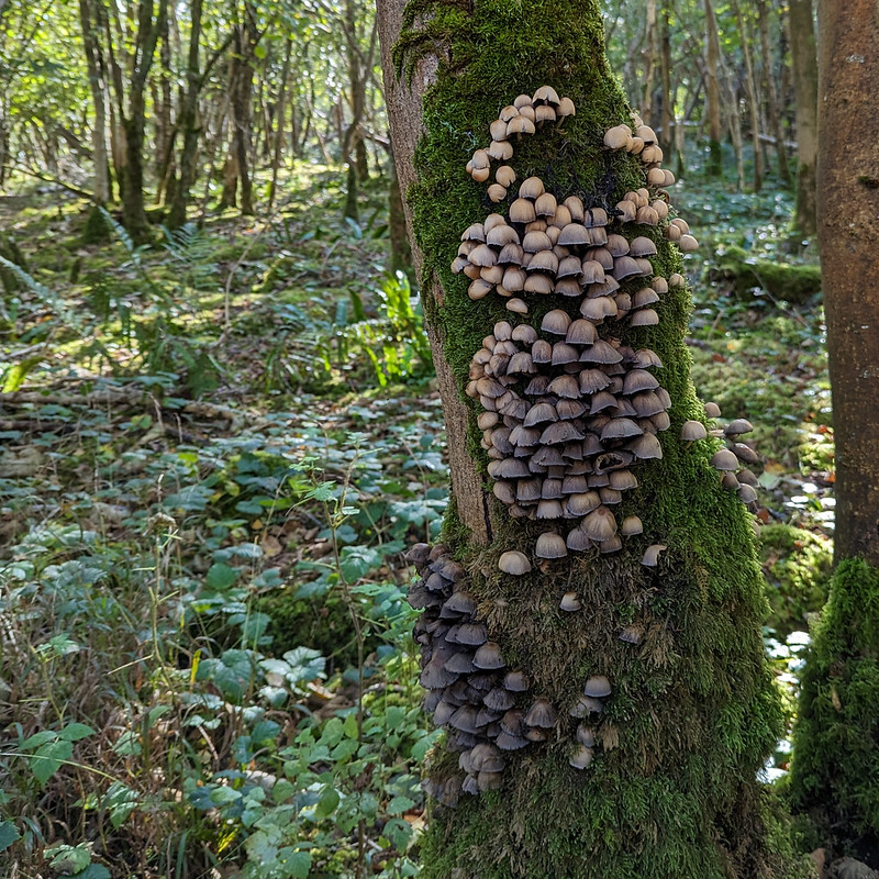
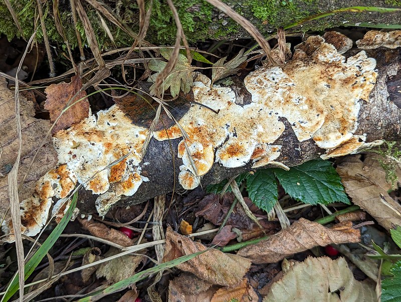
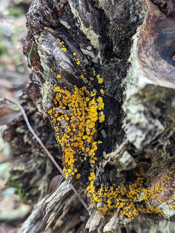
You’ll notice that I’ve pretty much given up on any attempt to identify the various brackets and toadstools. Fungi seem incredibly difficult to get to grips with.
Erm..slightly red looking fungus.
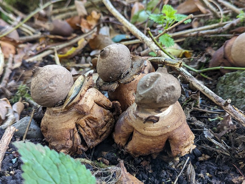
My favourites by far with the little cluster of Earthstars which MM and I had missed the first time around.
Tree-climbing social fungus.Manky pancake fungus.Yellow disco dot fungus.Teasel seeds sprouting from a teasel seedhead.
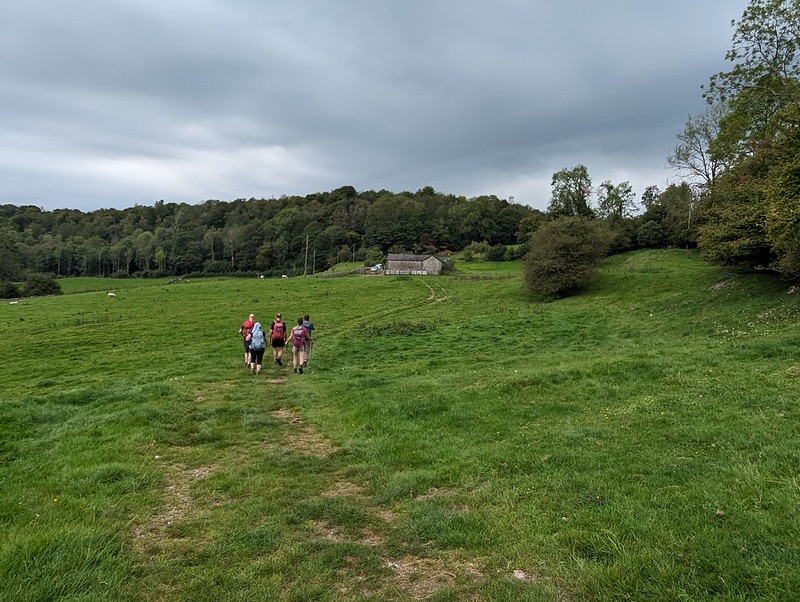
Anyway, it was a lovely way to spend a couple of hours and both another visit to the reserve and another walk with MM are long overdue.
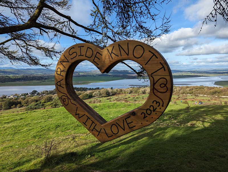
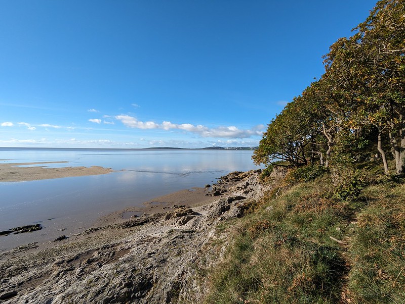
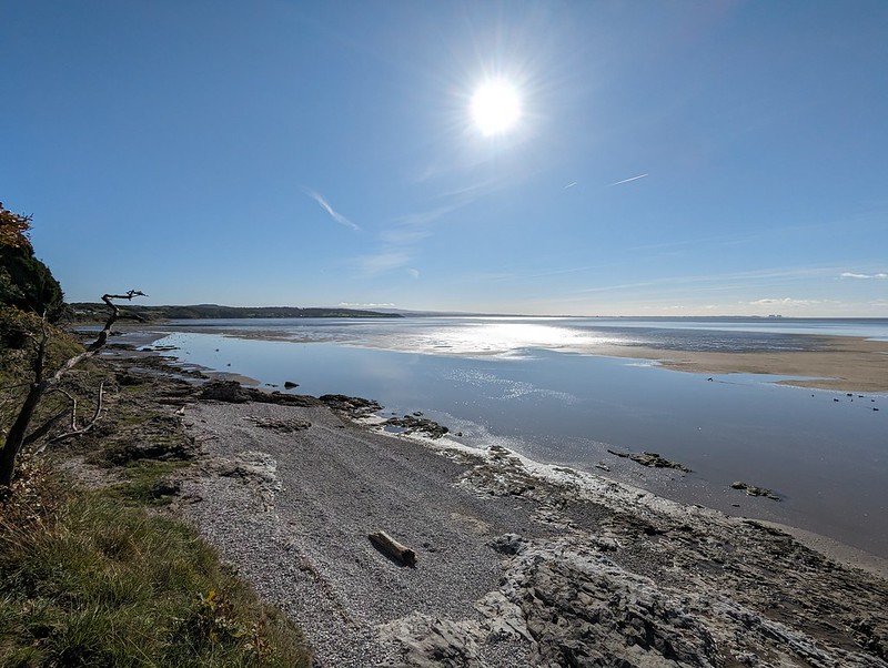
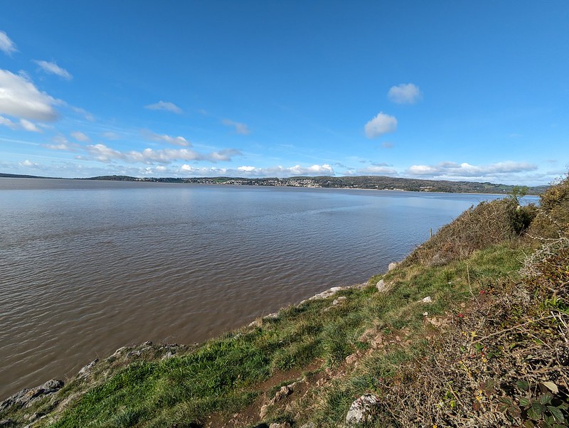
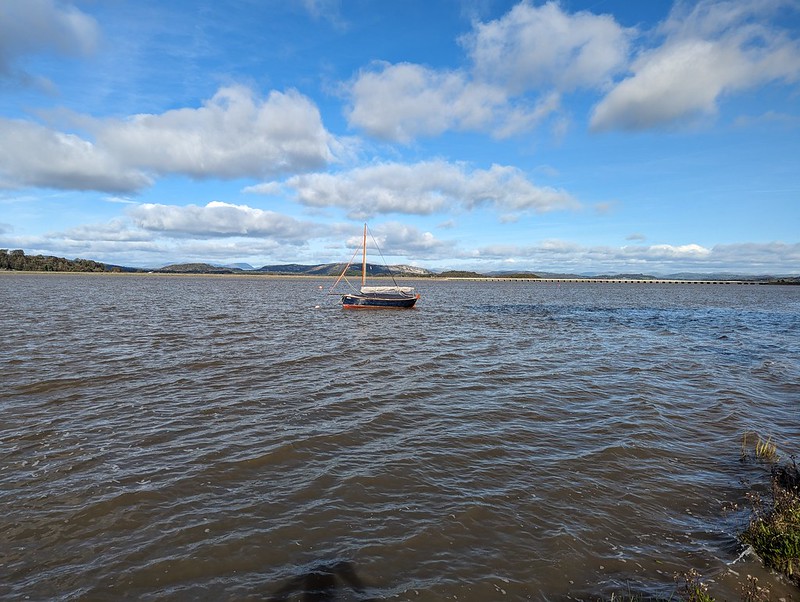
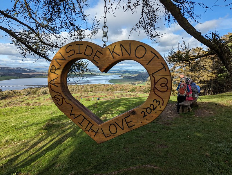
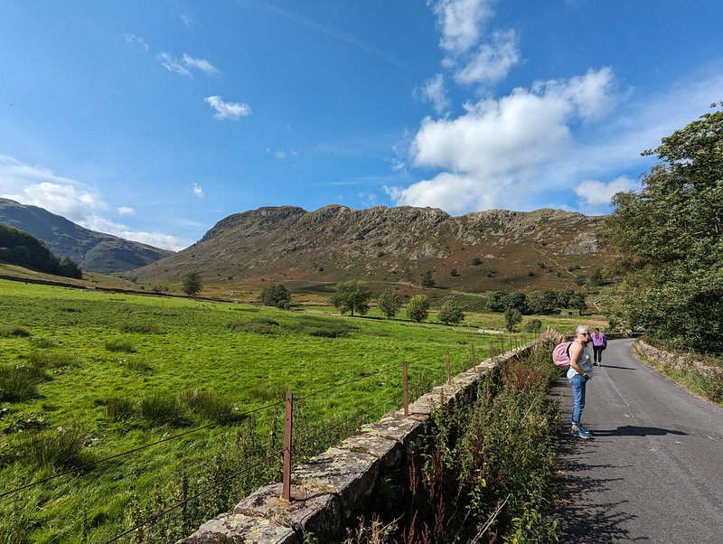
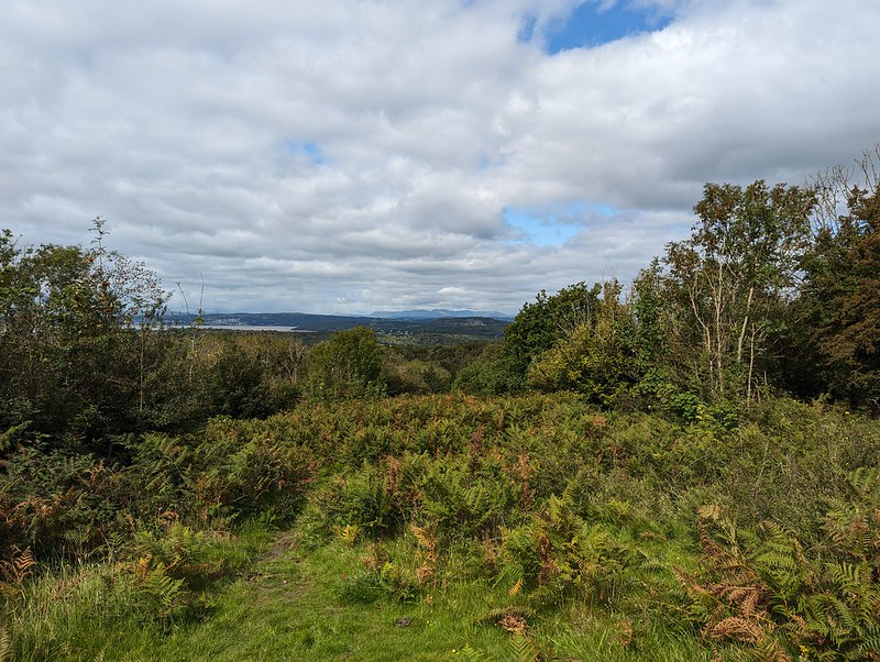
By the Sunday of the music festival weekend, we are usually ready for a change and a walk. Last year was no exception, so we opted for the classic local route, around the coast to Arnside and back via the Knot. (Except for UF who will have made one of his standard lame excuses around playing snap or utilising his season ticket at Man City, or having a bone in his leg).
Around the coast.
It’s always a good walk, but throw in some clear blue skies, some sunshine and a few old friends and you can’t go wrong.
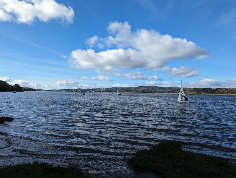
Looking south to Know Point and Clougha Pike.Grange-over-Sands.Turning the corner into the estuary.High tide at New Barns.Old dinghy moored near Arnside.Racing dinghies on the Kent.
I keep saying that I should join the sailing club at Arnside, but then I never get around to it. But I really should. It must have been pretty windy that day, some of these yachtsmen are really leaning out to counteract their boats heeling.
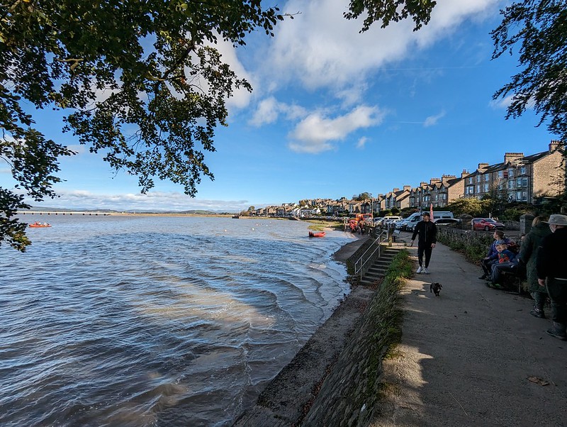
Arriving on the prom.
I suppose we probably purchased pasties or the like for a lunch in Arnside, we usually do.
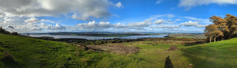
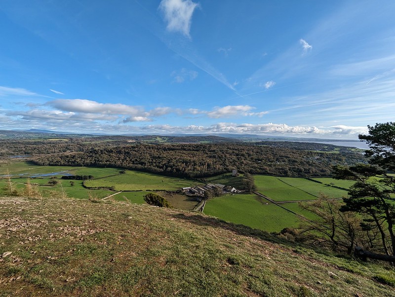
The Kent estuary, Whitbarrow and the Lakeland fells beyond from Arnside Knot.Arnside Knot pano.The sculpture again – this time with some people in.The view south – Ingleborough, Arnside Tower Farm, Middlebarrow, Warton Crag and the Bowland Fells. Descending from the Knot.
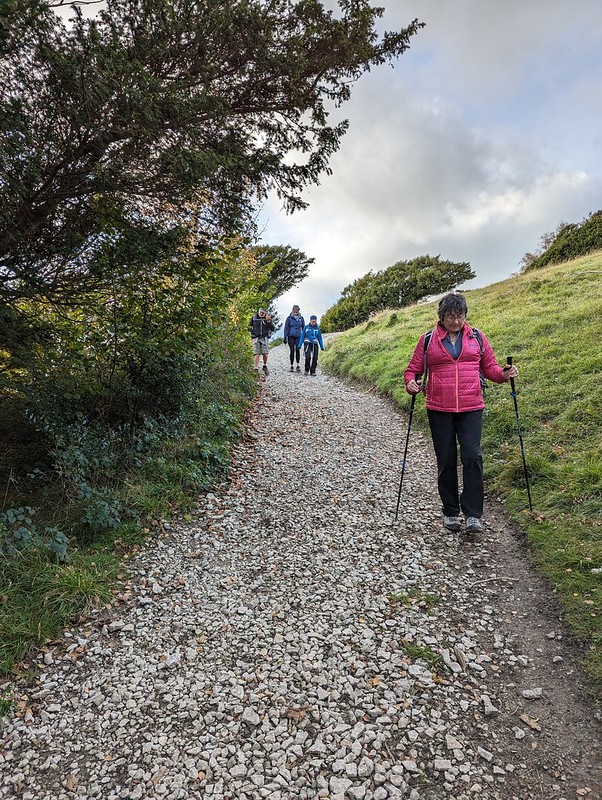
As usual, I was a bit rubbish at taking any team photos. I did get this one on the last leg of the walk which makes TBH look preposterously tall. J meanwhile seems to be taking extra special care over where she is placing her feet.
Anyway, after that, all back to ours for tea. Another fab weekend.
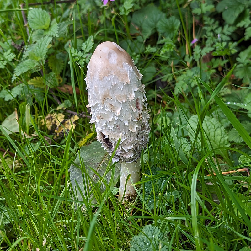
Okay, the Shaggy Inkcap was not one of the acts from the Lancaster Music Festival. This photo is the sole representative from our habitual Sunday walk around Jenny Brown’s Point, the weekend before the festival. I neglected to mention that my previous post shaded me into last October. So I’m now officially nearly ‘only’ six months behind!
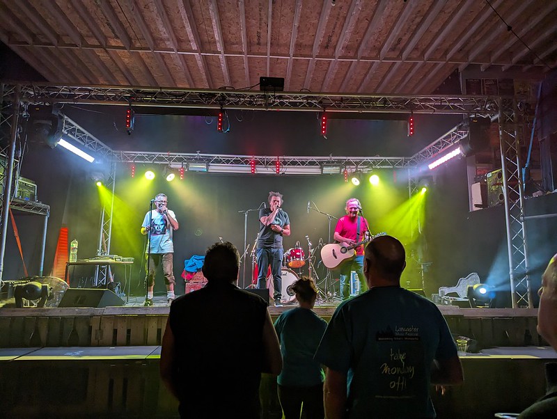
Mid-October brought the aforementioned Music Festival, one of the highlights of my year, and, as has recently become a tradition, a gaggle of visitors to share the fun with us.
Peloton at Kanteena.
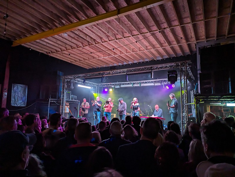
I broke with my previous self-imposed rule about not going to gigs on a school night and went to the Kanteena on the Thursday night. Local band Peloton opened (a ska version of ‘Psycho-Killer’ anyone?) They’re marvellous and we saw them again, later in the weekend. Next up were a sort of Latin rock-band from New York (who’s name escapes me) followed by perennial festival favourites The Uptown Monotones, who are from Graz in Austria, but who seem to have made Lancaster their second home.
Uptown Monotones at Kanteena.
As you can see, it wasn’t exactly thronged; unlike the rest of the weekend, when just about every venue was heaving. I think the festival may, to a certain extent, be a victim of its own success.
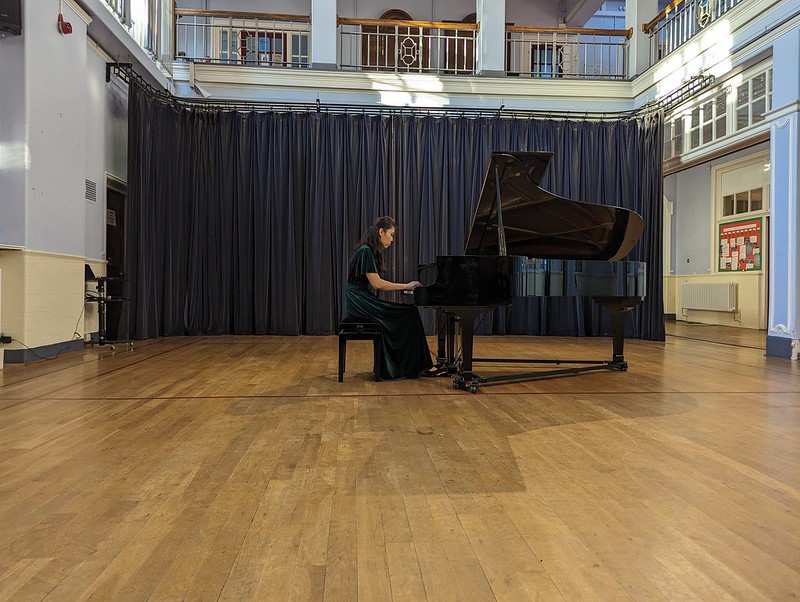
Siqian Li at work
On the Friday evening, I didn’t even need to leave work to begin my musical excursion. Over the weekend, classical pianist Siquian Li was playing all of the best pianos in Lancaster. Apparently, the very best is the one in our main hall at work. I had a front row seat and it was spellbinding. So good, in fact, that I persuaded our group to start with her performance at the Storey Institute the next day. UF was the first of our visitors to arrive on the Friday evening and once we’d met up we went to see…other stuff? I can’t remember now! Maybe we finished the night with the Uptown Monotones again at the Storey? Or the Gregson? Or was that another year? Oh dear. I can’t really remember many of the bands I saw at Reading Festival either, but that was at least 30 years ago. I’m sure we enjoyed ourselves anyway.
On to Saturday…
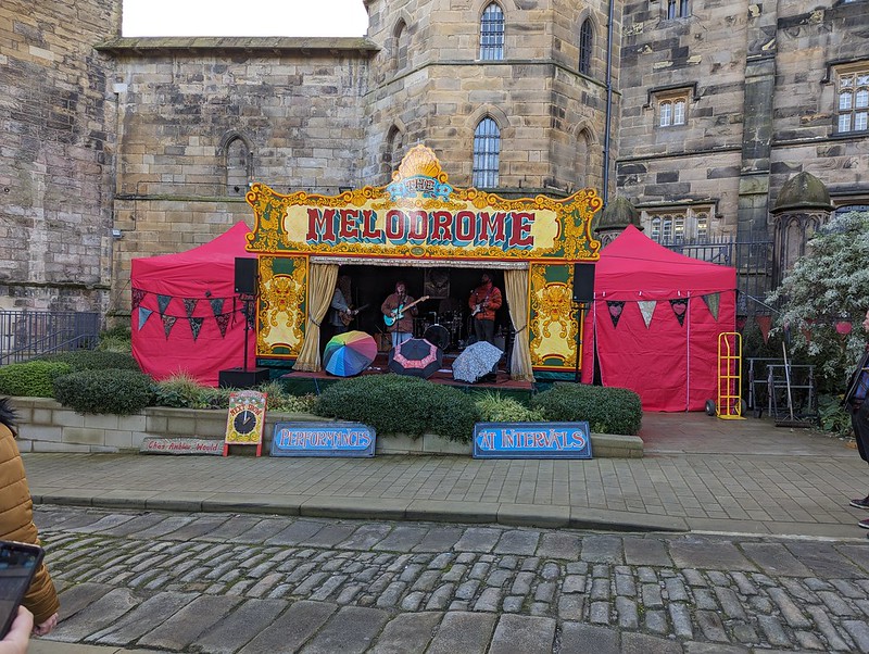
Across the fields to the railway station.Away from the Numbers at Kanteena.Harri Larkin at Lancaster Castle. Excellent.Lancaster Castle.Uptown Monotones in Lancaster Priory.A view over Lancaster.
I do know that on the Saturday evening some of us took some time out from the music to watch Alfie Moore, of ‘It’s a Fair Cop’ fame at The Grand Theatre. Very good he was too. TBH and I had also recently seen Bridget Riley at the Grand (I think). And at some point we saw Daliso Chaponda rehearsing new material for a Radio 4 show in a smallish room above the Borough Pub in Lancaster. Both of them were hilarious. Neither of these were that weekend, but since I didn’t take photos at either event I now have now clear idea about when they happened!
Reggie Mental at Kanteena.
Reggie Mental are another local ska band with a nice line in off-the-wall covers, ‘Inbetween Days’ for example, although they mostly cover late seventies British ska bands’ songs. The Kanteena was absolutely rammed for their performance.
A date for your diaries: this year’s festival is the 10th to the 13th of October. I’ve no idea of the line-up, but no doubt lots of local favourites will be there and hopefully some of the acts which seem to travel every year to entertain us.
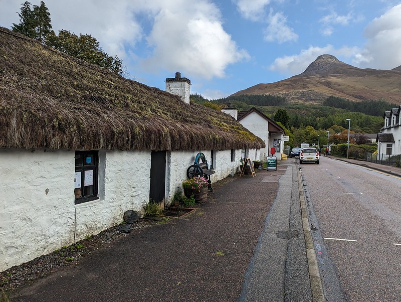
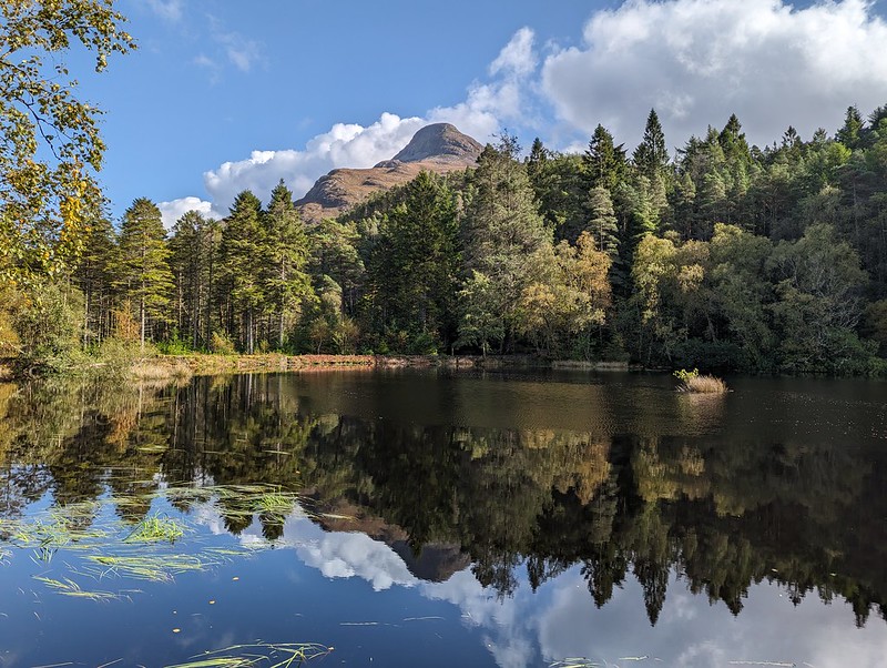
Glencoe Folk Museum – housed in thatched eighteenth century crofters cottages.
The Sunday of our Glencoe break was absolutely glorious. Uncle Fester and The Prof elected to stay in the house to watch the golf. I know; they often seem like quite rational types, but clearly some kind of mental instability is suspected.
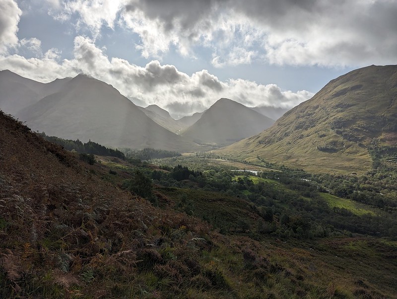
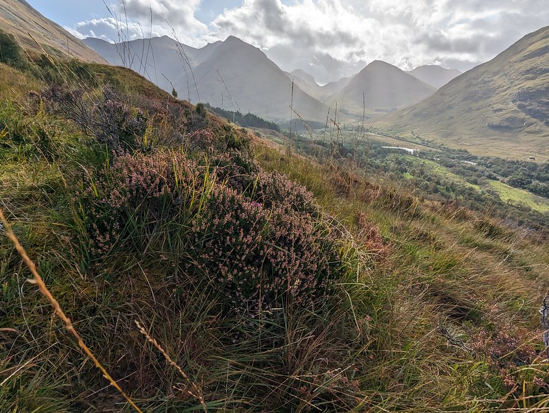
Impressive looking ridges either side of Fionn Ghleann (I think).
The rest of the party decided to head for the Pap of Glencoe. Since breathing, and moving, more both proving a bit painful for me, I thought I would just settle for a bit of a wander. Initially I followed on up the path heading for the Pap, but with no intention of going all the way up. The views were tremendous.
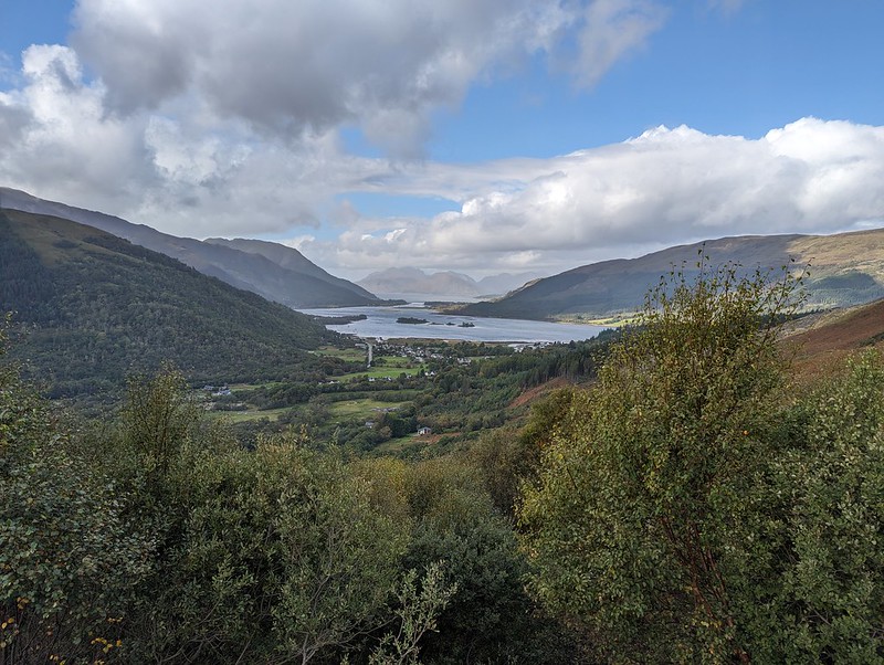
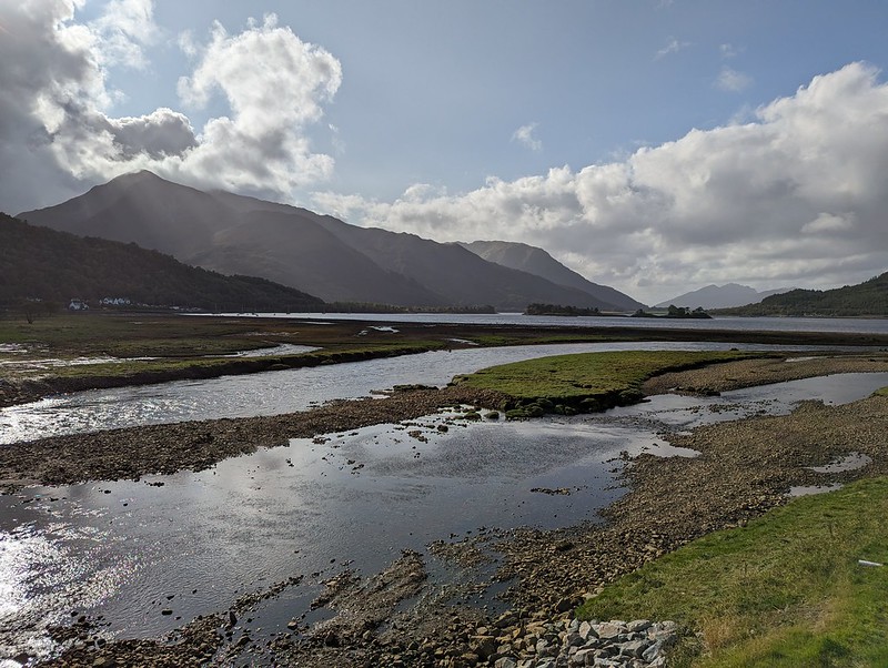
Looking down to Loch Leven.Those hills again.
After a couple of small, innocuous looking rocky steps, which, since I couldn’t really bend down, I thought I might struggle to descend (I was right), I chose to slowly amble back down.
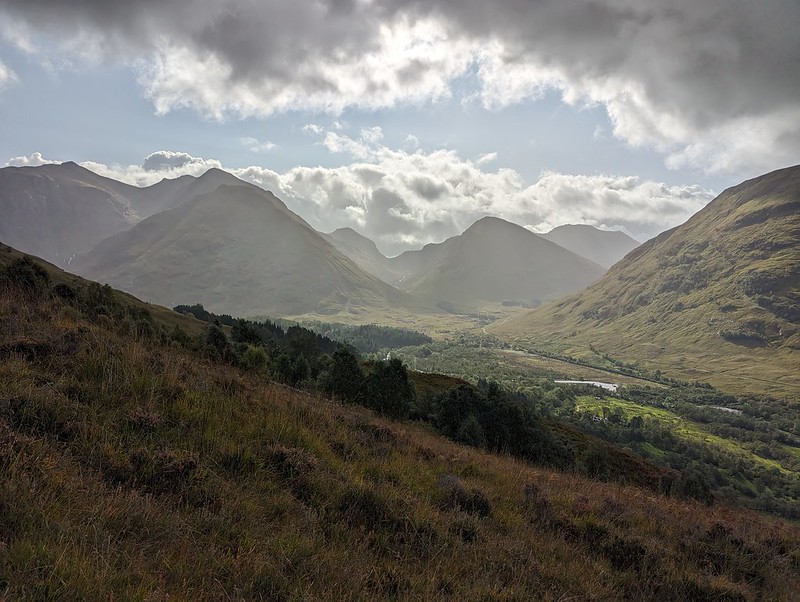
And again. It’s a very long time since I did Bidean nam Bian (on the left here). Too long.
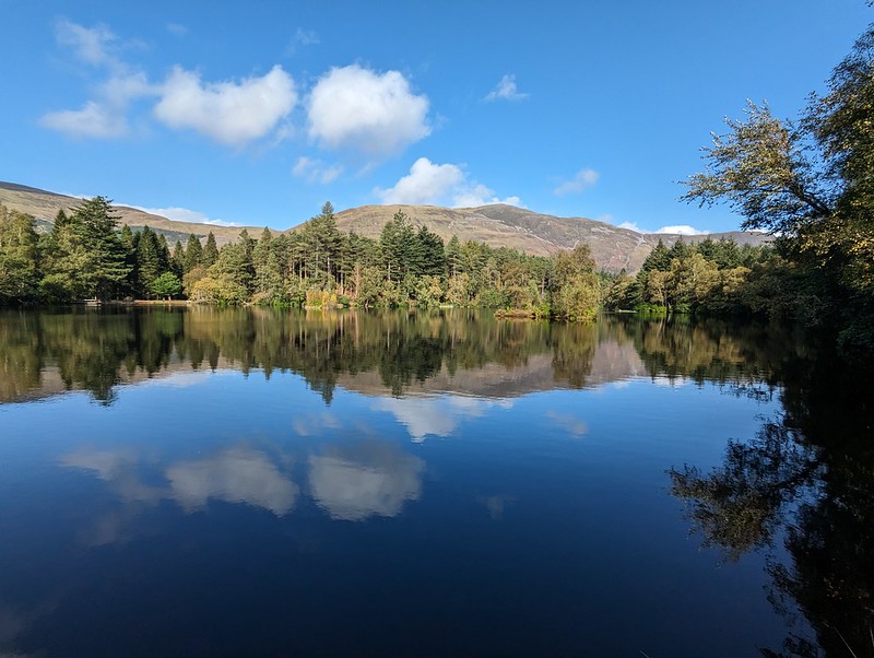
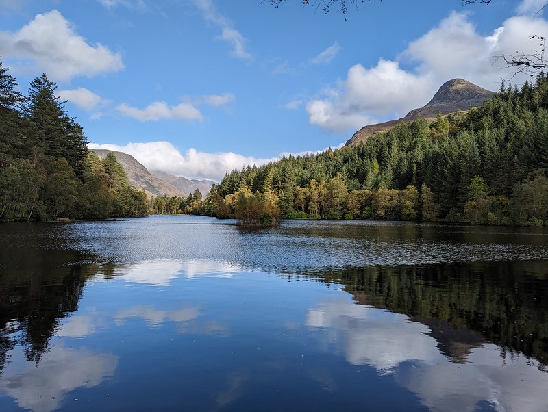
And then to do a slow circuit of the small lochan above Glencoe.
We have ‘chatty benches’ in Silverdale, but this road-sign takes friendliness to another level. Glencoe Lochan.
It was genuinely warm and I made good use of the many benches stationed around along the path.
Glencoe Lochan.
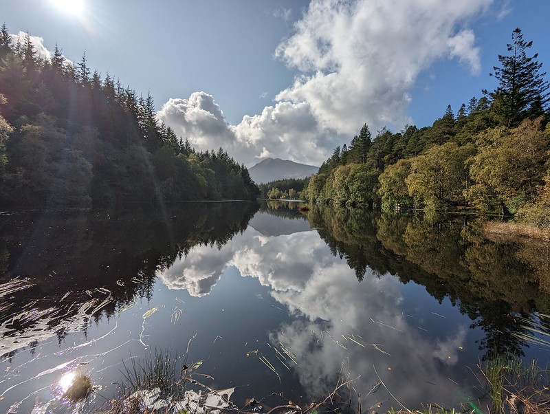
The were quite a few dragonflies about and I quixotically tried to photograph them using my phone, with no success whatsoever.
Glencoe Lochanand the Pap of Glencoe.Glencoe Lochanand the Pap of Glencoe from a slightly different angle.Beinn a’ Bheithir and Loch Leven.
I finished with a little wander by the loch.
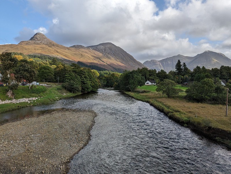
River Coe, Pap of Glencoe, Sgorr nam Fiannaidh and Bidean nam Bian.
And was back in time to see the end of the Ryder Cup. Oh no! Could it be that I have a smidge of ‘mental instability’ too?
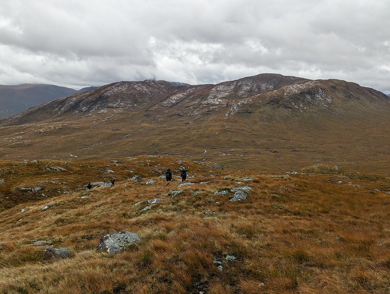
Late September. The Tower Captain and I drove* up to Glencoe to join a small party of old muckers who’d already been there most of the week. (*Well, he drove, I took photos out of the window obviously).
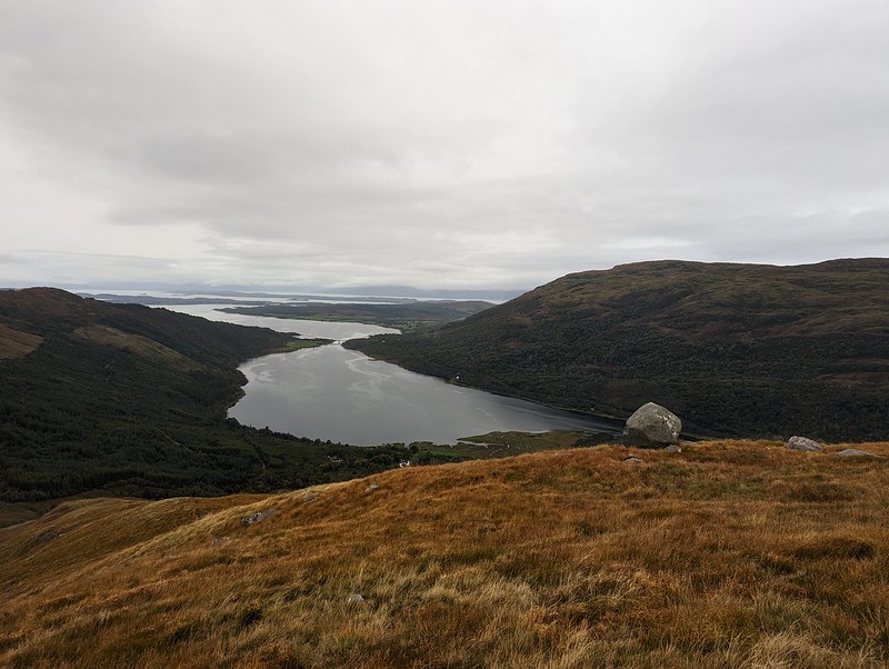
On the Saturday, we dragged ourselves away from the drama of the Ryder Cup* and headed around the coast to Glen Creran, parking one car up the valley in the car park near Elleric, before returning to park the other near Druimavuic from where we began our traverse of the longish ridge of Beinn Sgulaird. (*Not as tricky for me as it was for some of the others. I hate golf. Although I do enjoy watching Europe beat the USA)
Looking down to Loch Creran.
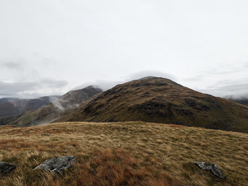
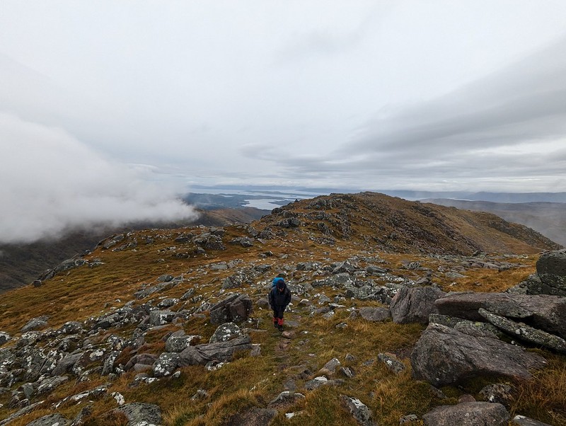
Now Beinn Sgulaird was a new Munro to me. Not something that happens very often. I think the last new one I ticked off was Stuchd an Lochain back in 2011. I didn’t think much about that novelty last September, but this evening I dug out my old Munros map/tick-list and have enjoyed looking it over and wondering about some of the other Munros I’ve yet to climb. I’ll never finish them all, which I’m totally happy with, in fact there are many I’ve climbed before that I’m really hankering after revisiting, but it is nice to grab a new one now and again. If I remember right, the reason we’d lit upon Beinn Sgulaird in the first place was that it was one of UF’s remaining four unticked Munros. He’s obviously much more single-minded than me. And braver. I’ve done some summits in the Skye Cuillin, but on the whole I’m content to leave those hills to people with a better head for heights than me. And better balance, come to that.
Meall Garbh from unnamed top at 488m.
We did Stuchd an Lochain mostly in mist. This was another cloudy day, but we had much better views than we did that day.
Looking back to the 488m top.
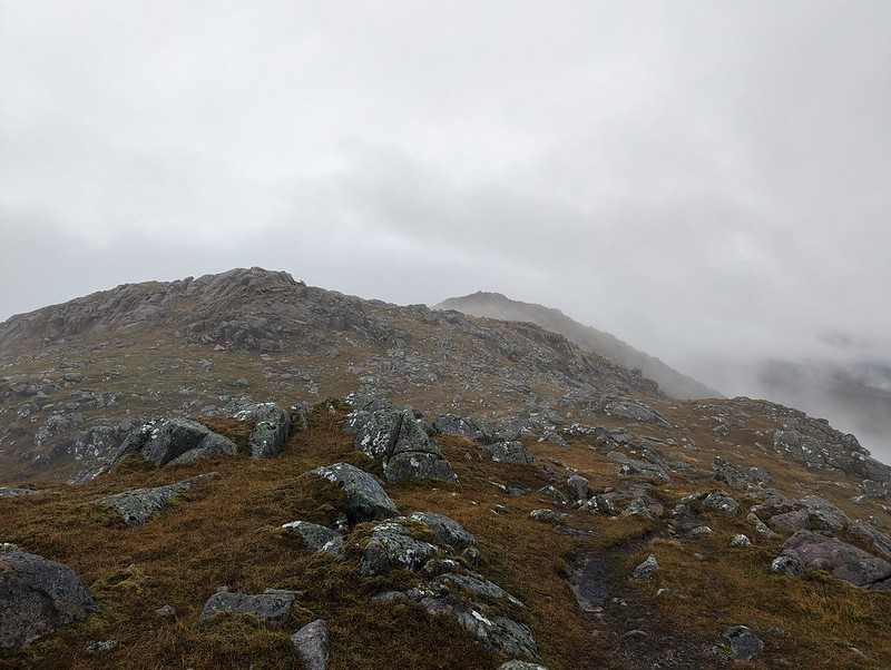
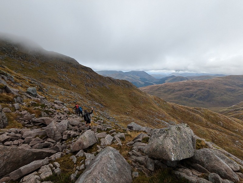
There was a small, but easy to follow path, and although I never move very quickly, we made steady progress.
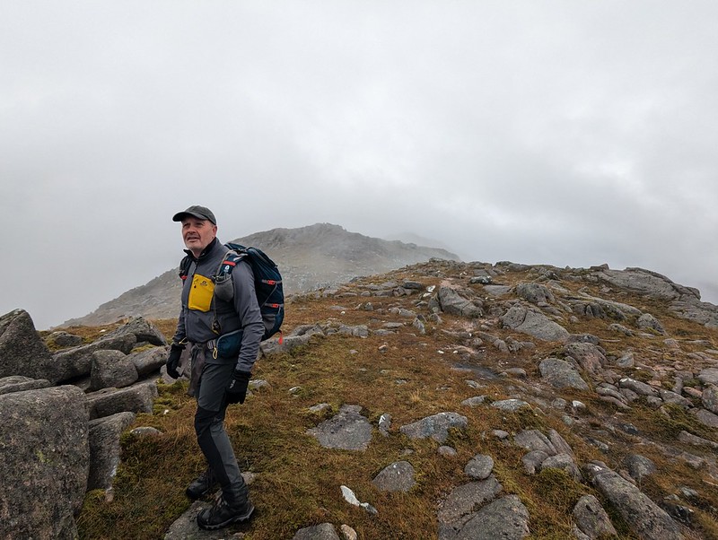
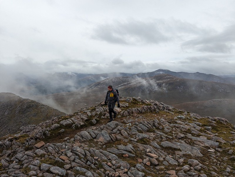
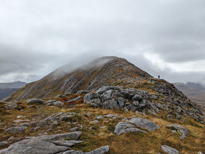
Andy on Meall Garbh (I think).
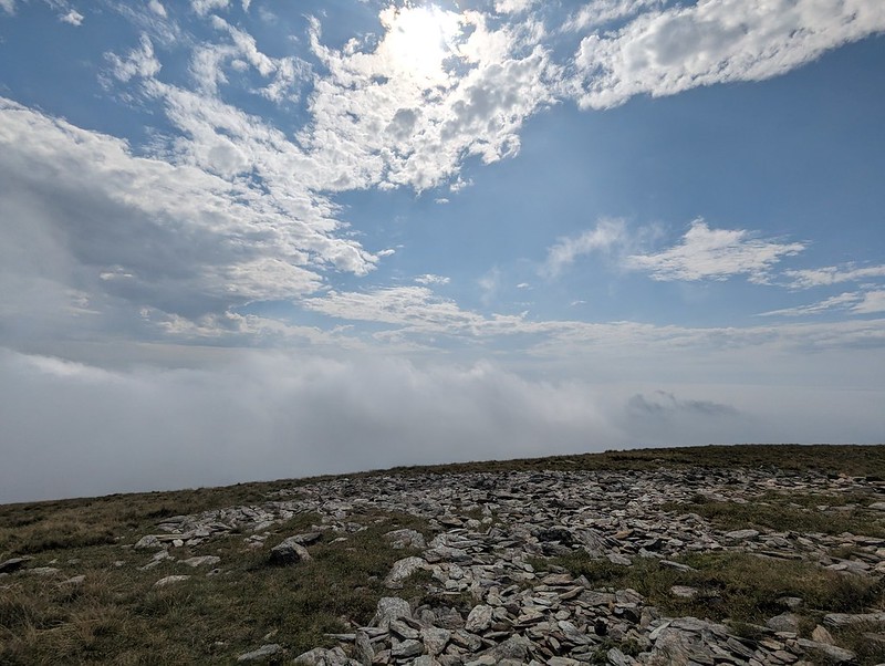
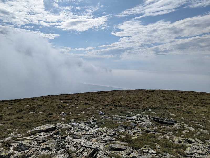
The cloud on the ridge was swirling about and offering partial views, which was very atmospheric.
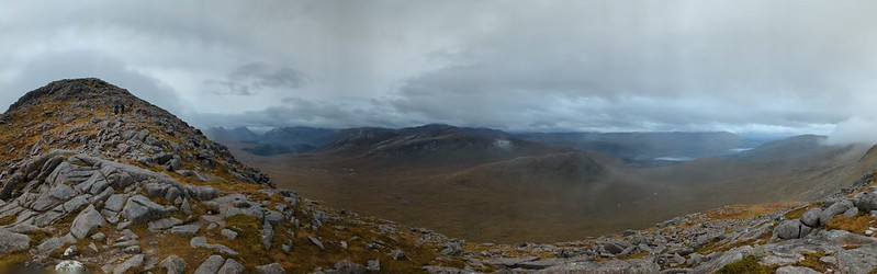
Misty conditions.A partial clearing.Andy again.The descent from Meall Garbh.Beinn Trilleachan (I think).Pano.The ridge on to Beinn Sgulaird.Looking back to Meall Garbh. (I think).
I don’t seem to have taken a summit photo. I’m not sure why not, but we were in the cloud for a while, either side of the summit.
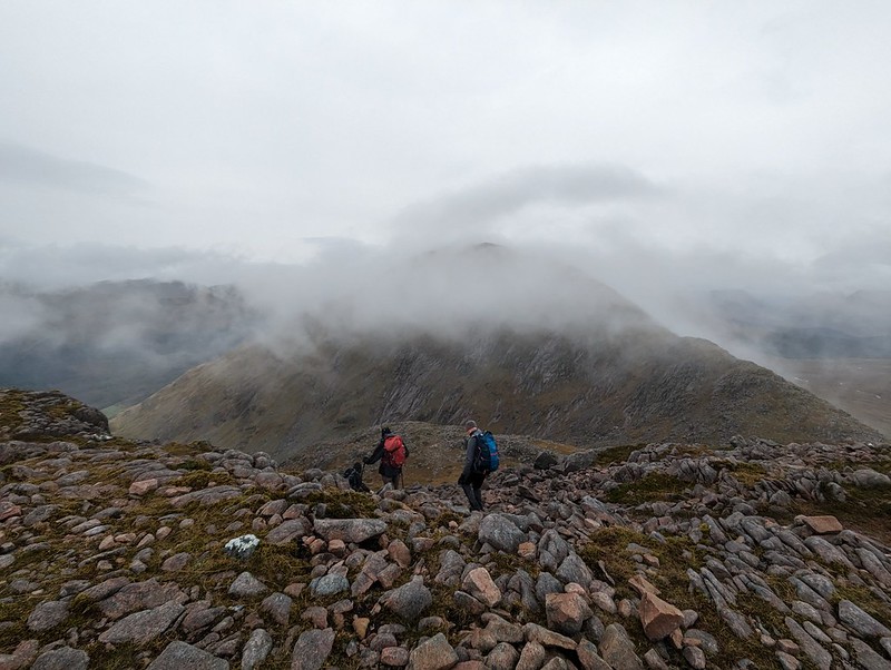
Descending into Coire nan Tulach.
The Prof was adamant that from the top we should turn-tail and retrace our ascent route, since there had been a good path. He was in a minority of one however. Old, wiser heads prevailed. Well….older anyway.
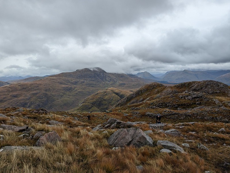
Stob Gaibhre in the foreground. I presume that’s Beinn Fhionnlaidh beyond. Looks good.
Any trace of a path, faint or otherwise, soon disappeared. Never-the-less, to begin with the descent into Coire nan Tulach was great. It was rough going, yes, but rocky and interesting, with expansive views and a real, remote wild feel to it.
Pretty much the same view again. I like them both!
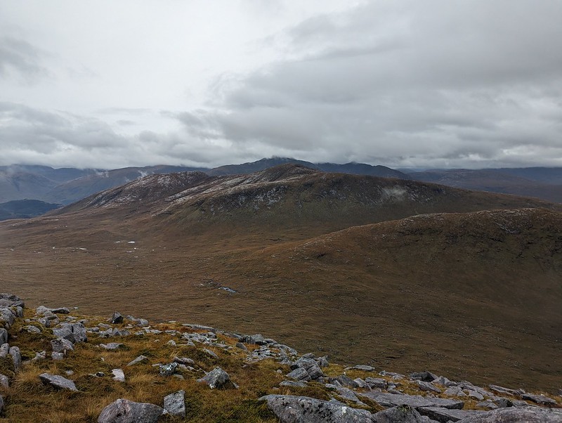
But the lower we descended, the more tussocky and awkward the going became. We skirted around Stob Gaibhre and then dropped off the ridge down towards Glen Ure.
Beinn Trilleachan. Rocky.
I fell over, which was annoying. Then I fell again, but this time it was more than annoying. It ought to have been an innocuous affair – I pitched forward onto a large tussock – but the impact was on my sternum which was extremely painful and which took me almost a month to recover from. Maybe I cracked a rib. Certainly breathing was uncomfortable for the rest of that day and the one which followed. I’ve always been prone to tumbling now and again, but it seems that these days I don’t bounce like I used to. Maybe the Prof was right about our choice of descent route. Just don’t tell him I admitted that.
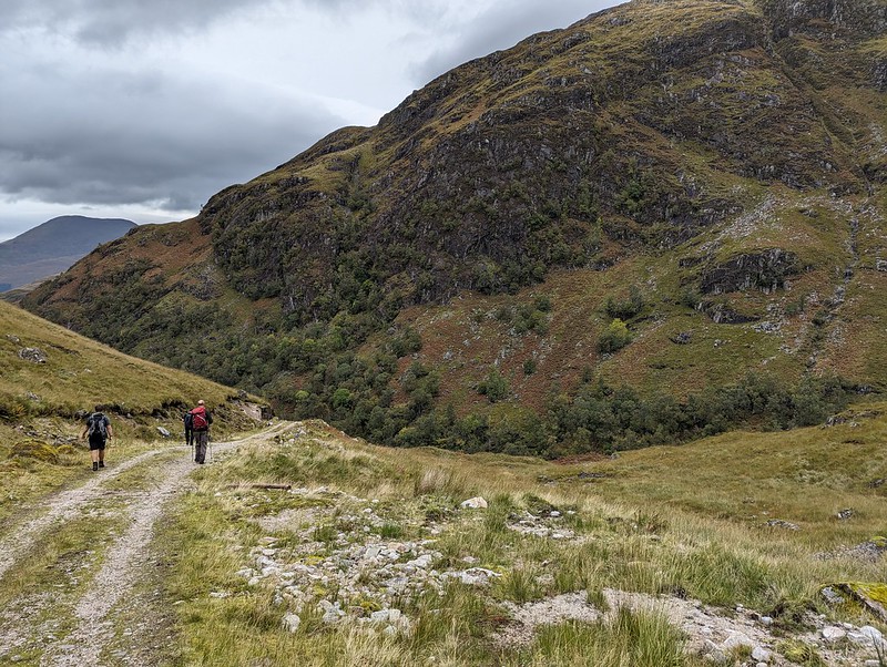
Glen Ure.
Fortunately, once we hit the track in Glen Ure the rest of the walk became an easy and very pleasant affair, although I think it did spit with rain a little.
Looking back. An Grianan in the centre. Looks worth investigating.Beinn Fhionnlaidhon the left.The whole ridge:Stob Gaibhre, Beinn Sgulaird, Meall Garbh and point 488m on the right.
Back in the car park, UF, for reasons only he knows, decided to settle an argument with a tree by backing his car into it. I think he lost, although said collision didn’t seem to slow him or his speedy vehicle down any on the drive back around to Glen Coe.
A mostly brilliant day. Some views, a new tick, an interesting gnarly ridge, great company and rounded all off with another fabulous meal at The Laroch in Ballachulish (which is highly recommended).
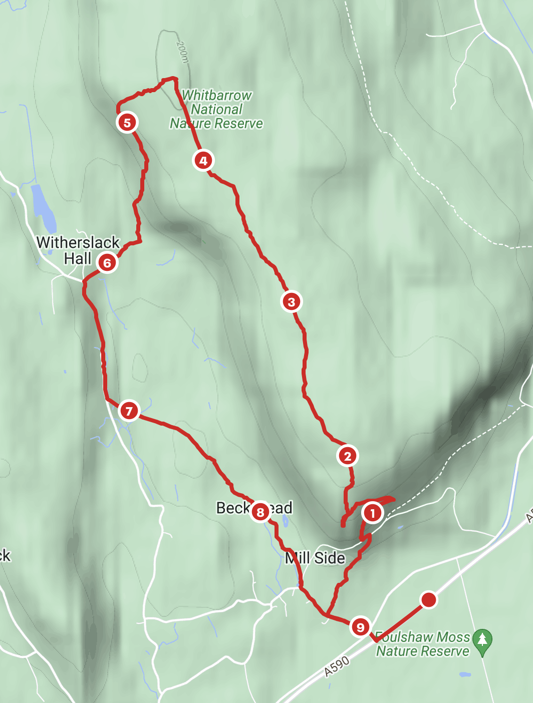
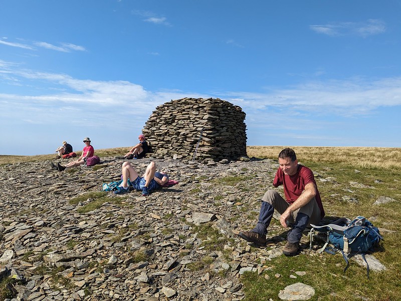
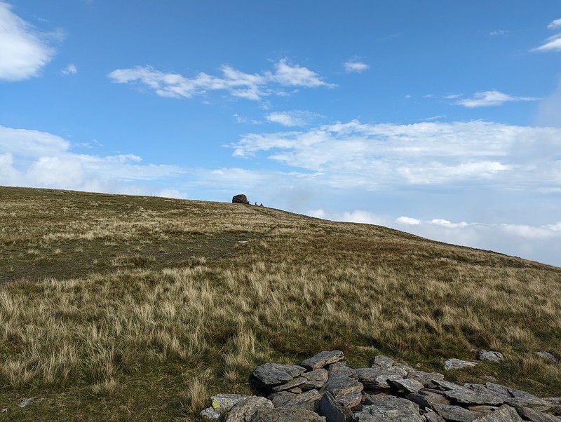
Map.
MapMyWalk gives a little over 10 miles, and almost exactly 1000m of climbing (which is definitely an underestimate).
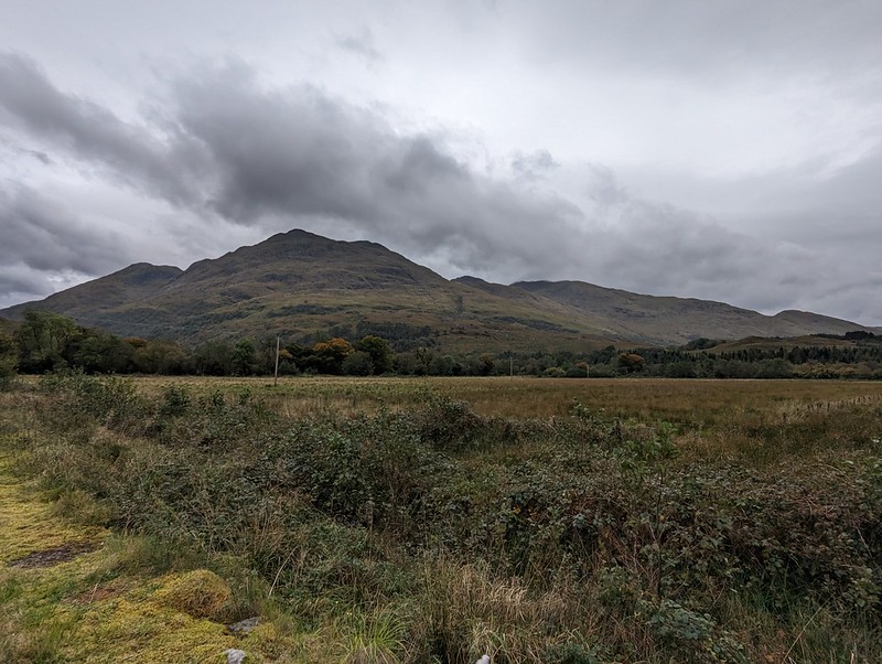
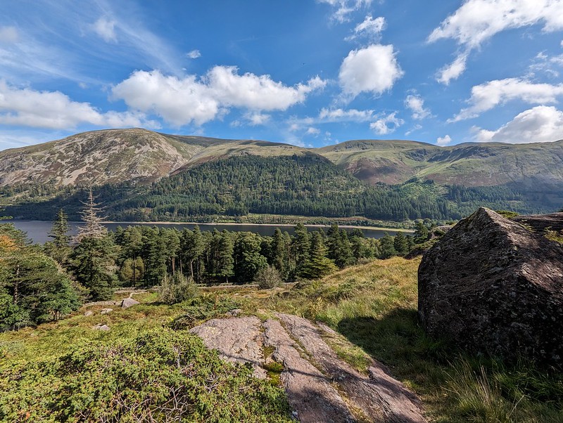
TBH recently declared herself to be ‘fed up with Whitbarrow’. I suppose we have climbed it quite a few times in recent years, but I’m struggling to imagine getting tired of that prospect.
Foulshaw Moss, The River Kent and Arnside Knott from the south-western tip of Whitbarrow.
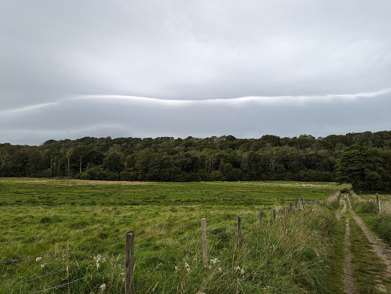
On the Sunday after our TMTCH gig, we needed something reasonably local and reasonably short because the forecast suggested that things were going to get very wet later in the day. They did.
A bit of a sit and a chinwag.
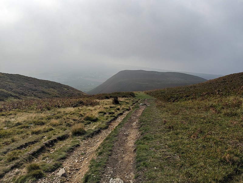
Whitbarrow, then was ideal on both counts.
Gummer How, the Lakeland Fells and Lord’s Seat.
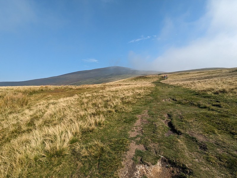
Early sunshine soon gave way to much greyer, gloomy skies.
J and MM by the large cairn on Lord’s Seat.A view of the Forest of Bowland Fells, Warton Crag, Arnside Knott and the Kent Estuary.
By the time we were off the hill by Witherslack Hall there were a few drops of moisture in the air.
Chapel Head Scar.Approaching Witherslack Hall.Curious looking cloud over the woods on Yewbarrow.
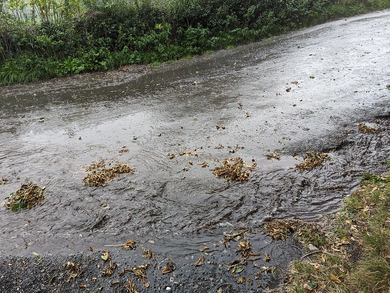
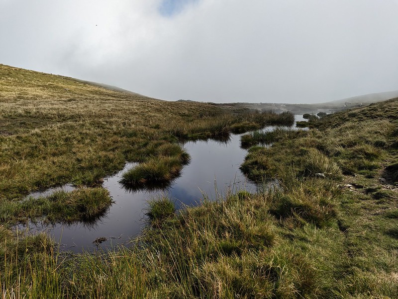
We almost made it back, but somewhere around Beck Head it began to absolutely chuck it down.
A road turned into a stream.
Not to worry, we’d got out again, and had a fabulous weekend together.
We didn’t walk along the A590. Must have forgotten to pause the app.
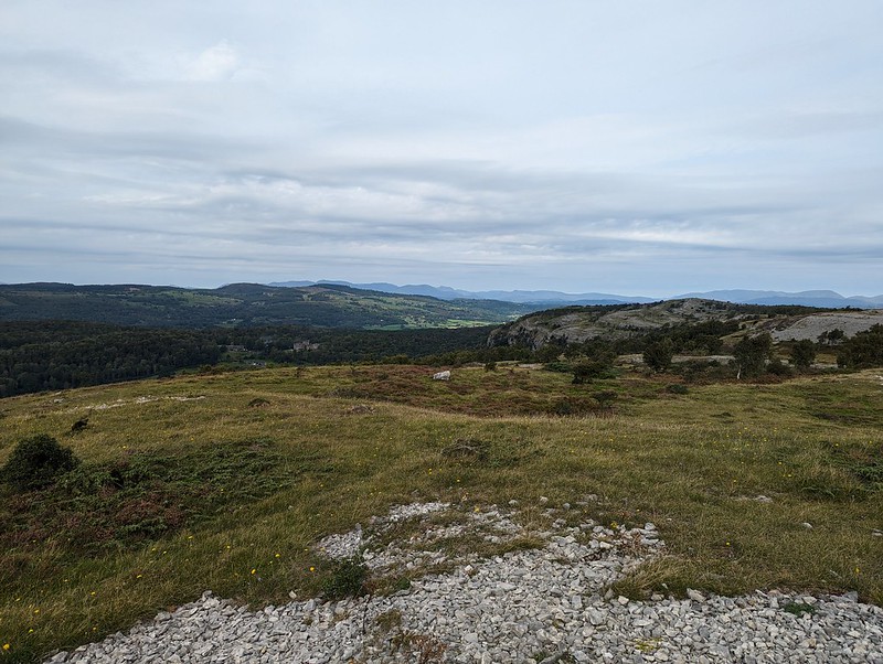
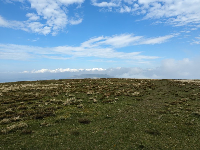
The substantial track up Black Combe from the south.
Old friends J and A, MM and F, and UF had booked a cottage in Silverdale for the weekend. Back in our Manchester days, UF and I went to a fair few gigs together. (Perhaps I should say back in my Manchester days, since UF still lives on the outskirts of Manchester). One of the bands we saw together way back then was The Men They Couldn’t Hang. We’ve seen them many times since, although none of those all that recently. But they were playing the Platform in Morecambe and hence the get-together.
Black Combe
I suspect that J and A do more hill-walking than just about anyone else I know, but they live in Aberdeen, so chances to walk in the Lake District don’t come around all that often. J had never climbed Black Combe and asked was everyone amenable to join him in putting that right? We were.
Bog!
There was a little miscommunication over where we were going to park, but the layby we ended up in was perfect for our intended route – a north-south traverse starting and finishing to the west of the hill. The weather was a bit odd – warm and sunny with lots of lovely blue sky, but heavy, low cloud to the south. Black Combe wasn’t busy at all, and the people we did see were cyclists flying along on ebikes which seems to be becoming the norm for mountain-bikers.
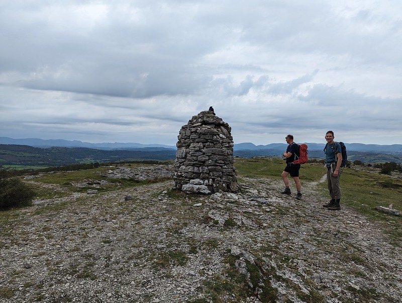
The team by the large cairn on Black Combe’s south top.TBH napping.
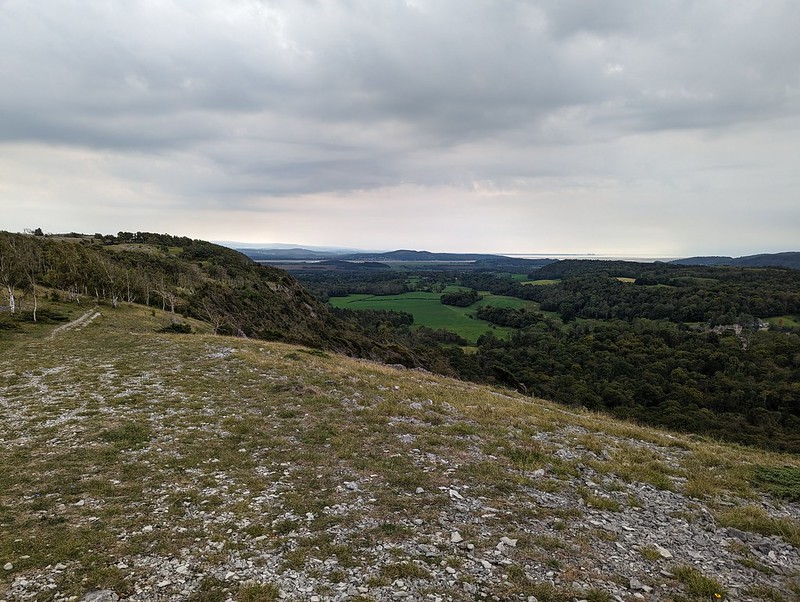
I suggested this spot on the south top for a lunch break because it has terrific views over Morecambe Bay. Well, sometimes it has terrific views over Morecambe Bay, but not on this occasion sadly…
The view!Looking back up to the large cairn.
As usual, I hadn’t brought any lunch, so had a little wander down to another prominent cairn to see whether that offered any better view, which it did to a very limited extent…
A partial view of Morecambe Bay.The hills north of Black Combe.On our descent.Whitbeck
TBH and I then went for a refreshing dip in the sea at Silecroft. It was spitting with rain by then, but that didn’t detract I didn’t feel. The others didn’t join us, they were eager to get back to their cottage to get fed, watered and spruced up for our evening’s entertainment. My old friend X-Ray joined us at the venue and we also bumped into another friend of mine, E, who was TBH’s work colleague many moons ago and who was at the gig with a relative of a member of the band. TMTCH were fantastic. We’re off to see them again soon, well UF and I anyway, in Barnoldswick of all places.
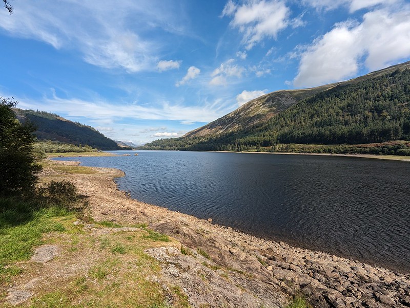
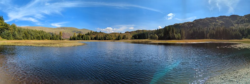
What with Harrop Tarn being my new favourite swimming spot, after my visit last June, I was keen to share it with my nearest and dearest, so when A asked about a potential swim when her boyfriend L was visiting, that was the first suggestion which sprang to mind. The small parking area at Stockhow Bridge was already jam-packed when we arrived, but we were lucky to find some roadside parking close to the junction of the currently closed road around the western side of Thirlmere and the main road.
Thirlmere Reservoir.Helvellyn.
It was a beautiful day, quite warm, so the views back across the reservoir to Helvellyn and its satellites gave me frequent welcome excuses to stop for a breather and take photos during the steepish ascent.
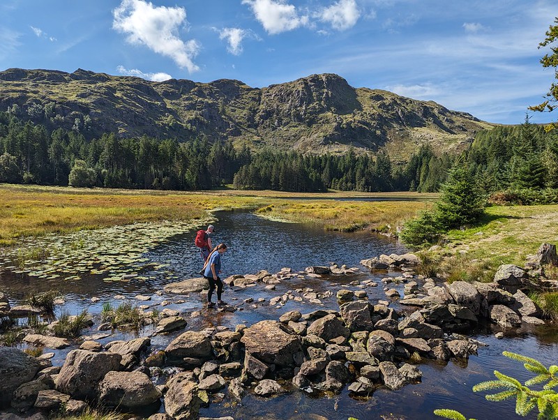
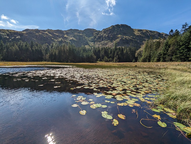
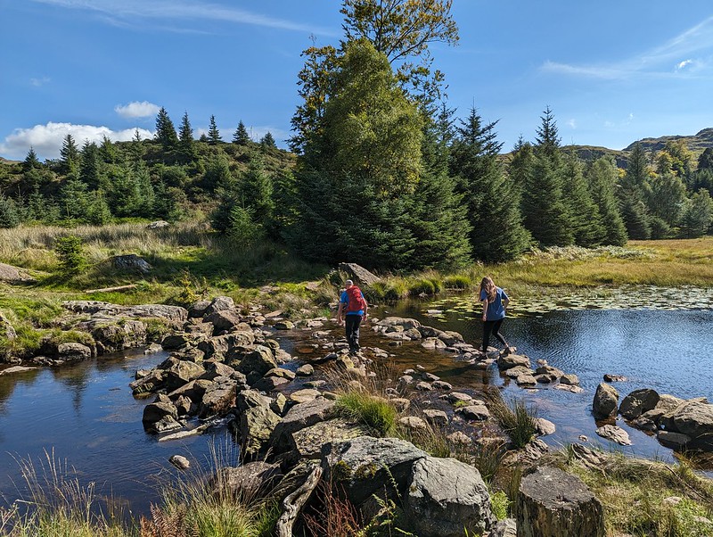
The rocky bowl which holds Harrop Tarn.A and L racing each other on the stepping stones.
There’s a bridge across Dob Gill near the outflow from Harrop Tran, but A insisted on a race across the stepping stones. And then again with a headstart. And again with a more generous headstart, but L is a triathlete and clearly very agile, and no amount of leeway was going to get our A across first.
L was ready and into the water before I’d even undone my laces. Then out again even faster. Apparently the water was cold. He wasn’t wrong. I guess triathletes are used to the luxury of a wetsuit. A is undeniably much hardier than I am: she and her friend S (the Tower Captain’s daughter for long-suffering readers) have instigated a new ‘tradition’ of going for an open water swim on S’s birthday. In March! This year that was in a stream up by Alston in the Pennines (it looked lovely, but A was a bit vague about the exact location). Last year it was in High Dam, with snow still sitting on the banks. Brrr. Never-the-less, on this occasion she took her time getting in and didn’t last much longer in the water than L had.
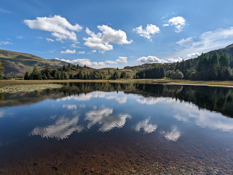
Harrop Tarnpano.
TBH took an absolute age acclimatising herself inch by squealing inch. By the time she was fully immersed I’d almost finished my first circuit of the tarn (like a lot of mammals adapted to cold water I have my own built in insulation). I could see that TBH intended to follow my lead, so I cut a corner and we swam a circuit together. Or almost together – like most people, TBH swims faster than I do.
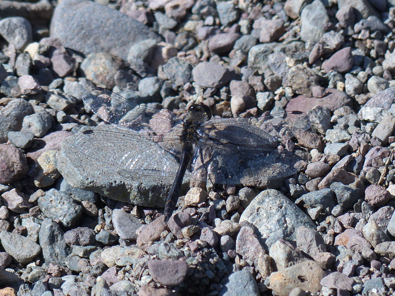
Black Darter.
Not the most attractive dragonfly perhaps, but exciting for me because I’m not aware of having seen one of these before and I certainly haven’t photographed one.
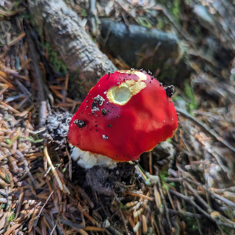
Another stepping stone race. Only ever going to be one winner.Fly agaric?Elephant Hawkmoth Caterpillar.
The first time I saw, and photographed, one of these, was also on a walk with A. And her friend S and the Tower Captain come to that, way back in 2009. One of the photos I took then somehow ended up high on the list of results of an internet image search and for a few years that post would get heavy traffic every July and August when people were trying to work out what it was they’d seen clambering on their Fuschias.
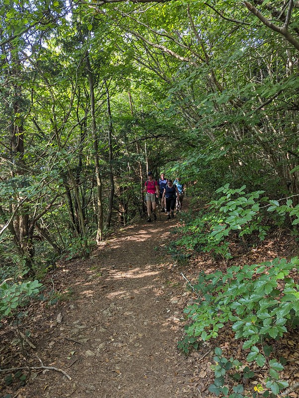
I enticed The Tower Captain out for a walk with TBH and I by telling him it would be a pub crawl, which, in fairness, was exactly how it turned out. We had to work for our pints though. We first of all walked across the field to Silverdale Green, through Clark’s Lot to Hollins Lane and then down through Fleagarth Wood to Quaker’s Stang, thereby eschewing the villages own fine hostelries.
From there we went over Warton Crag to Warton.
Looking back towards the Coniston Fells.The Coniston Fells and Arnside Knott from near the top of Warton Crag.The Tower Captain and his dogs at the top of Warton Crag.
The dog on the left here, Bramble, is now completely blind, but the vast majority of the time you wouldn’t know it, which is pretty amazing. He does occasionally plow into fences or passing hikers, but mostly manages to lead the way with no apparent difficulty and obvious enthusiasm.
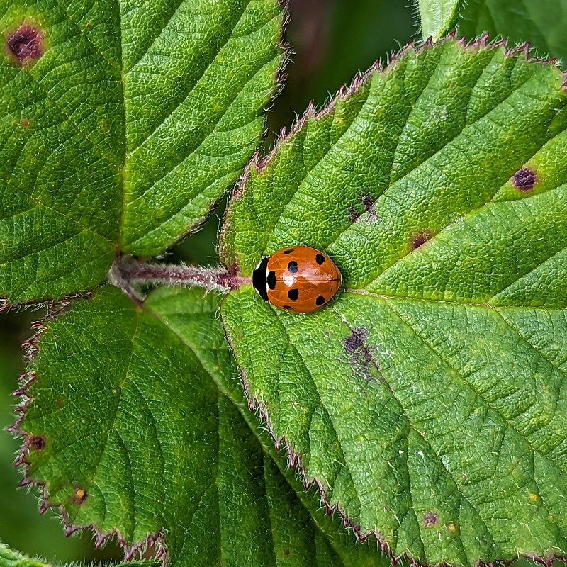
7-spot Ladybird.Warton, Millhead and Carnforth. Clougha Pike beyond.A view to Ingleborough.The Old School Brewery.
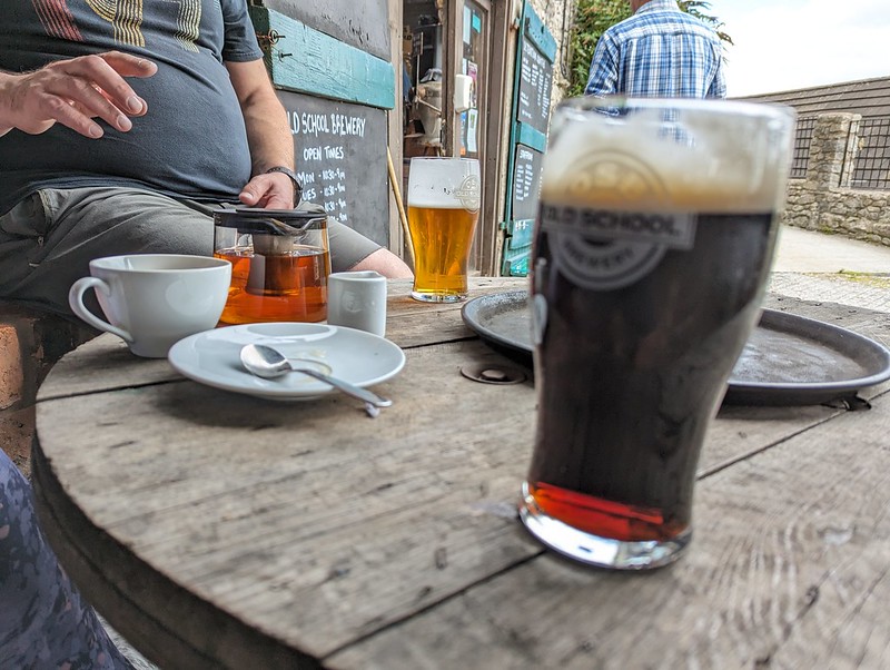
On the outskirts of Warton, we stopped for refreshments – beers and tea, at the Old School Brewery. We would have eaten too, but I think the vegan options were rather limited. To none. So we didn’t.
A pint of Blackboard, and other, inferior, beverages.
I really enjoy the OSB’s dark beer Blackboard, which is good because their bitters are, in my opinion, which is clearly out of step with that of the average bitter aficionado, over-hopped and therefore a bit too bitter. Not a view which is widely shared: their beers are extremely popular locally. We sat in the quirky wooden structure which was built to accommodate customers during Covid regulations and which is now, I believe, facing a retrospective planning application. I hope it is allowed to stay, it was certainly very popular on this August Bank Holiday Monday.
TC and TBH outside the Malt Shovel.
Since we’d failed to sate our appetites at the OSB, we wandered around the corner for some pub grub at the Malt Shovel, were I also had a nostalgic pint of John Willies Lees, which was surprisingly good, given that I never thought much of their bitter back in my Manchester days. I do recall having a soft spot for their barley wine, with its fearsome potency.
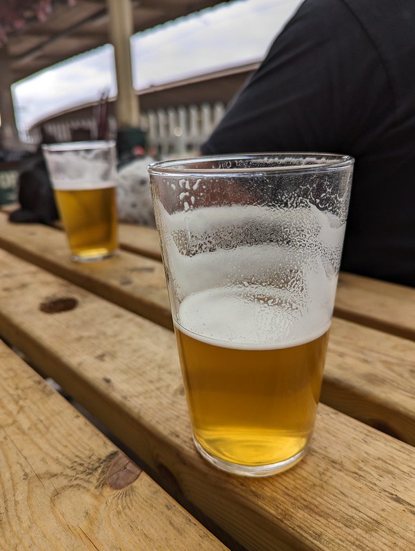
Another short wander brought us to Carnforth Station, where we just about had time, whilst waiting for our train home, to sink a pint of Lancaster Blonde from the Brief Encounter tearoom, so called because it was the setting for the 1945 film which is the station’s claim to fame.
A couple of pints of Lancaster Blonde from the Brief Encounter Refreshment Room.
A shortish post, by my standards, but a highly enjoyable way to spend a day.
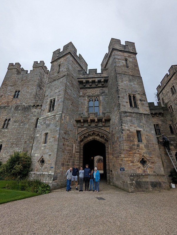
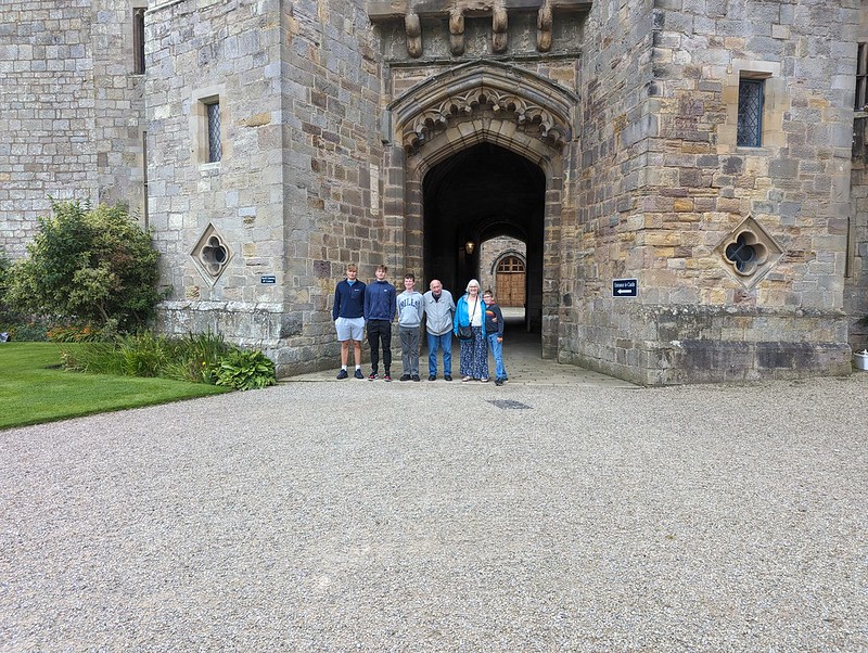
We had one more opportunity to meet up with my brother-in-law and his family and drove to Raby Castle, which is near Crook in County Durham, where they were staying with TBH’s parents, who also joined us for the day.
My in-laws with their grandsons, again.
Since we first met, TBH has been telling me how fabulous Raby Castle is, but somehow we’ve never got around to visiting it together.
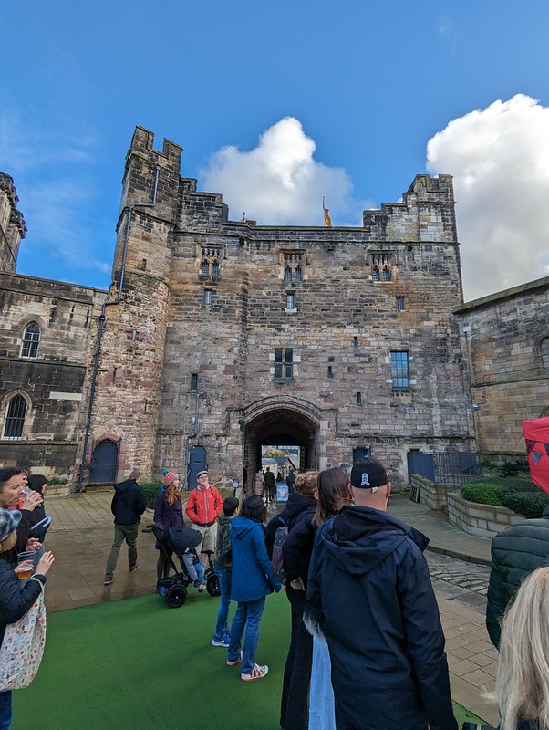
Raby castle, courtyard.
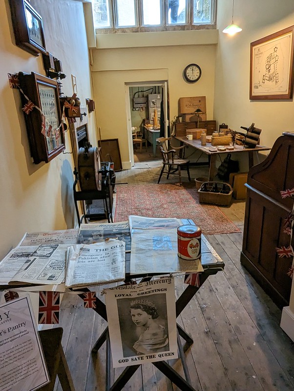
It seems to have avoided being ‘slighted’ during the Civil War, the fate of many English Castles, so it’s still in a good state of repair and is much a stately home as a castle.
I think this was the butler’s room.
Each of the rooms was curated by a member of staff, all of whom were keen to answer questions and to tell stories about the house, it’s former occupants and ghostly residents. It was certainly an enjoyable venue for a family day out on a grey and damp day.
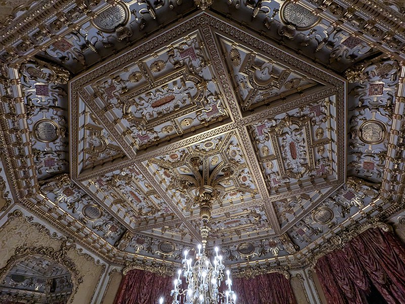
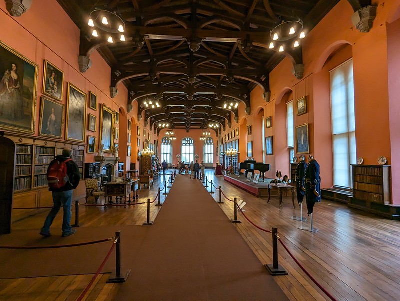
A room with……a fancy ceiling.Dining room.Guns galore.The recently restored state coach.A huge room.A griffon?The family chapel.A lion on the end of a pew.And the whippet (?) opposite.Lots of shiny pots, kettles and jelly molds in the kitchen.Raby Castle exterior.