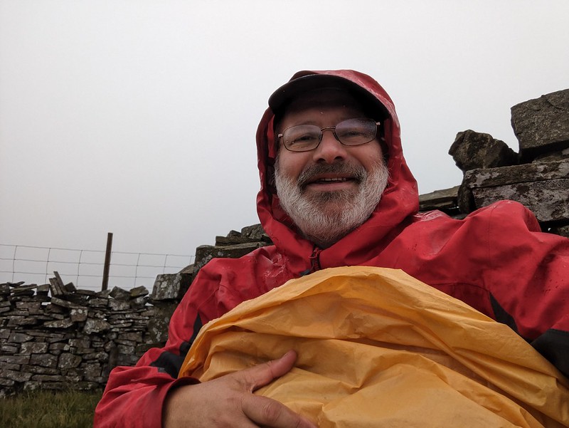
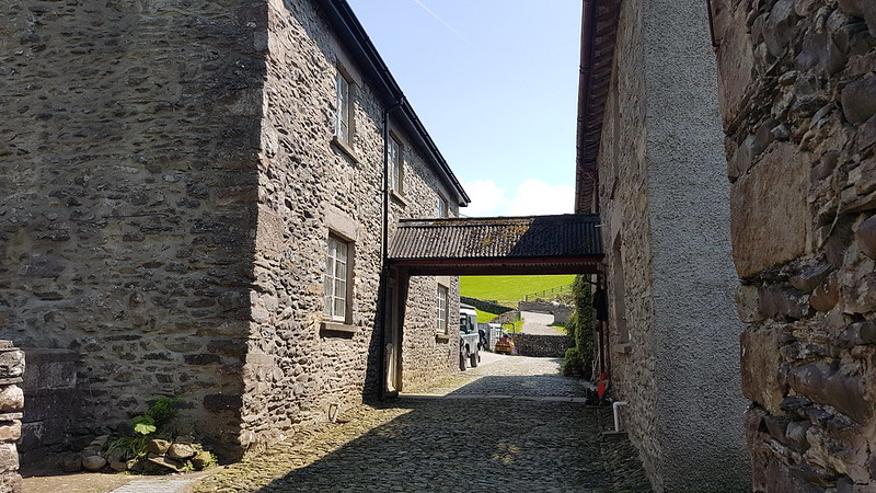
July fizzled out in a welter of wet weather, leaving me stuck at home, perusing my maps and the none too promising forecasts and feeling increasingly stir crazy. When the first of August rolled around, I couldn’t stand it any longer and decided to get out for a walk, come what may. There’s probably an object lesson to be learned from the consequences of that decision, but I’m not entirely decided what the moral of this sorry tale should be. Maybe an inquiry is required, they seem to be in vogue. Here’s the evidence…
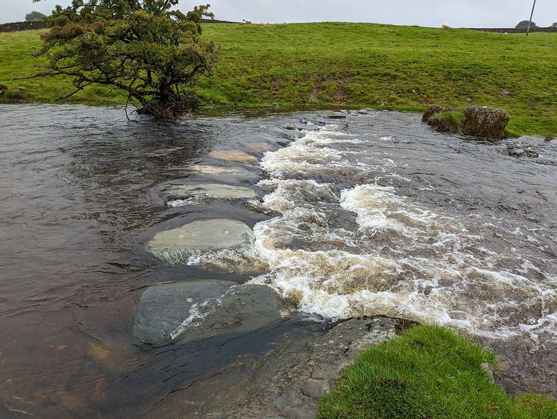
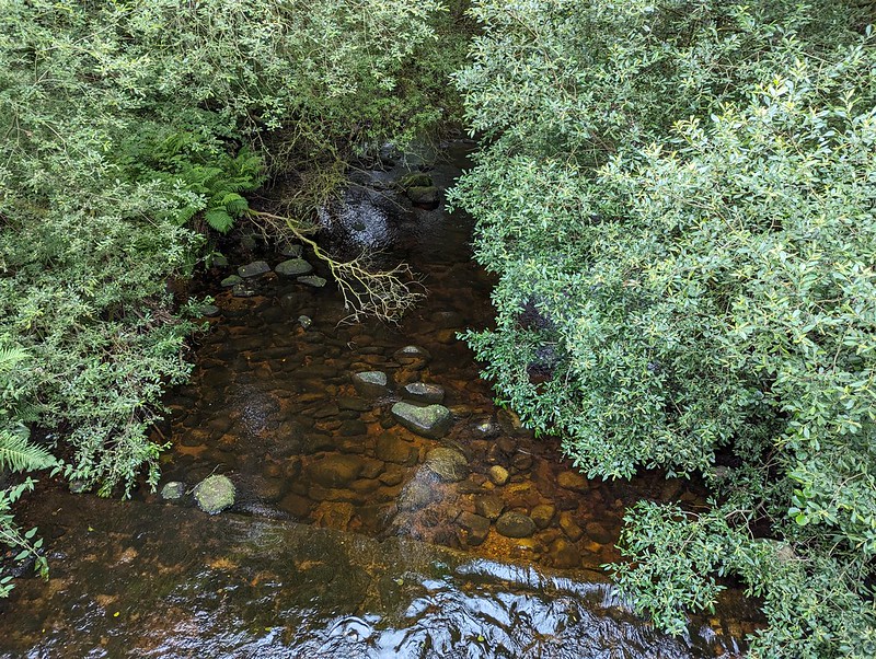
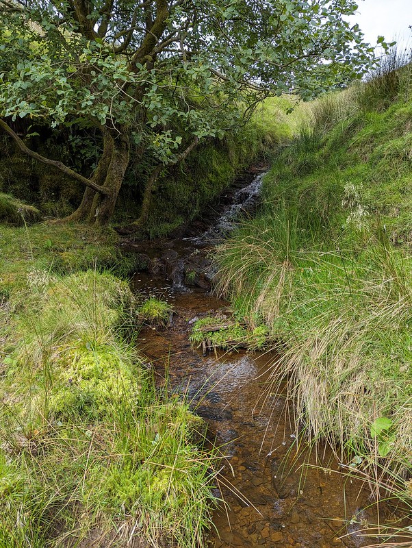
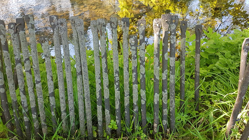
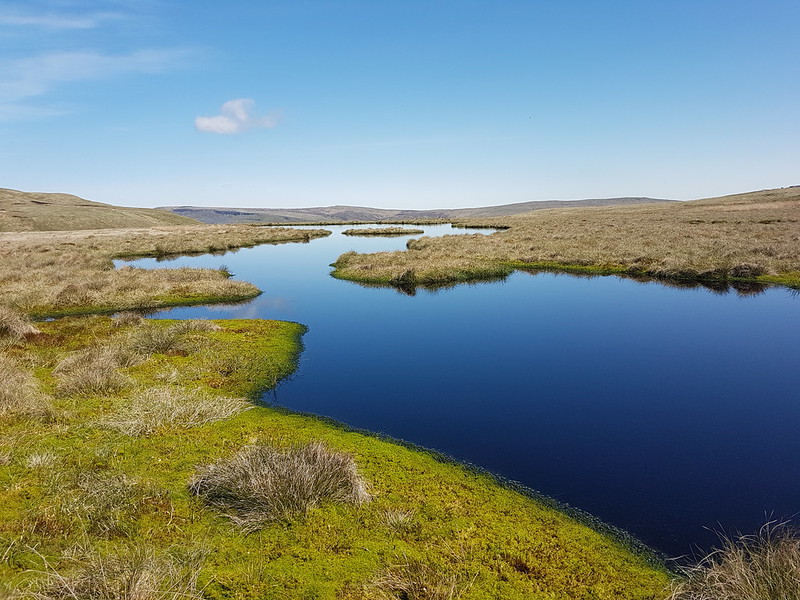
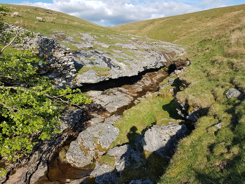
Submerged stepping stones.
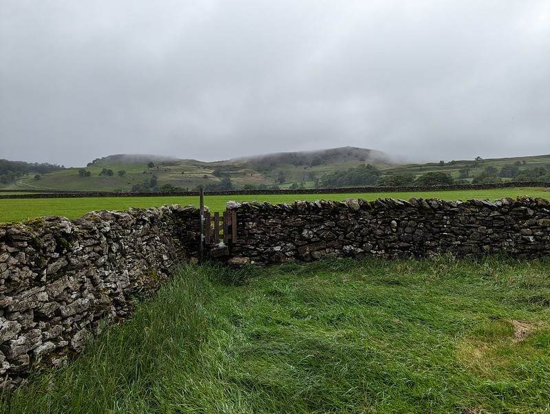
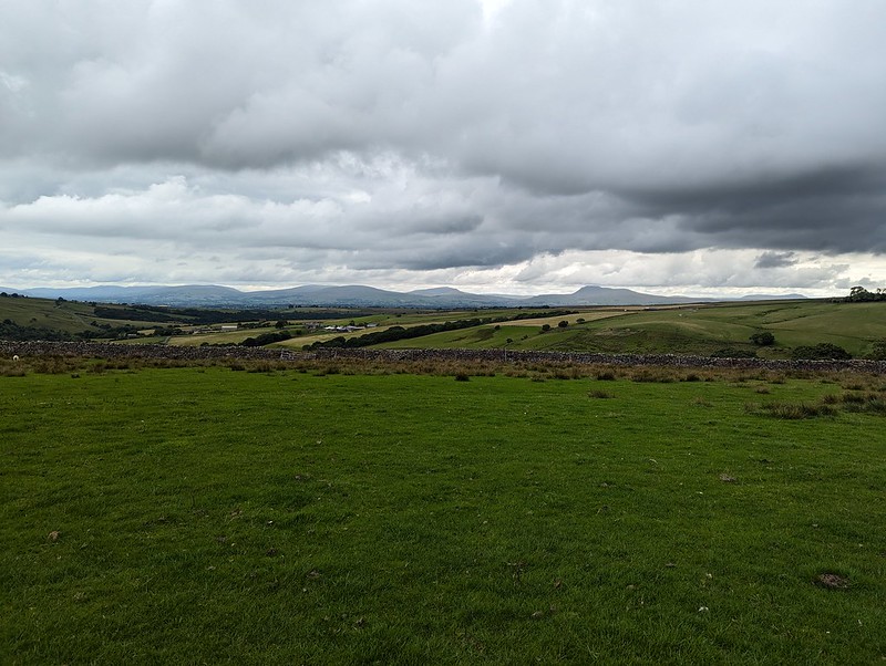
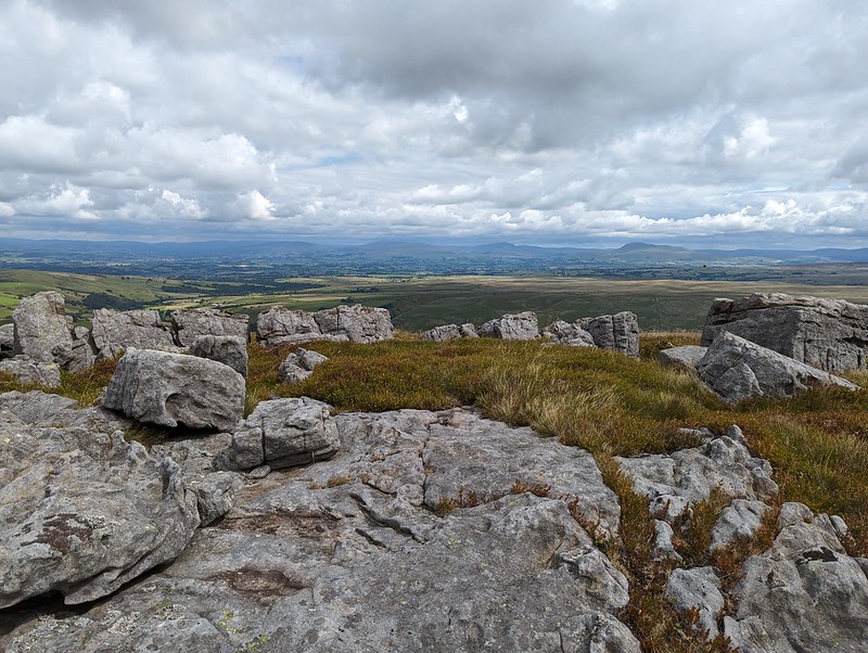
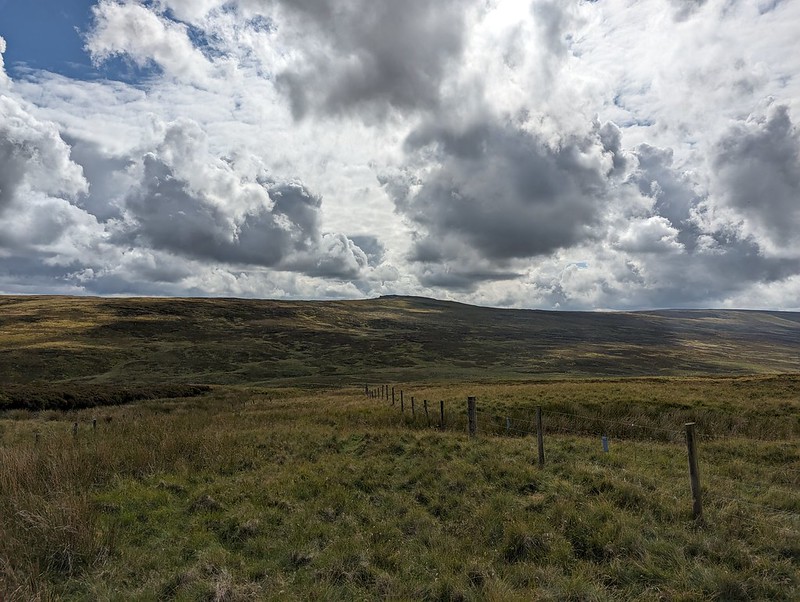
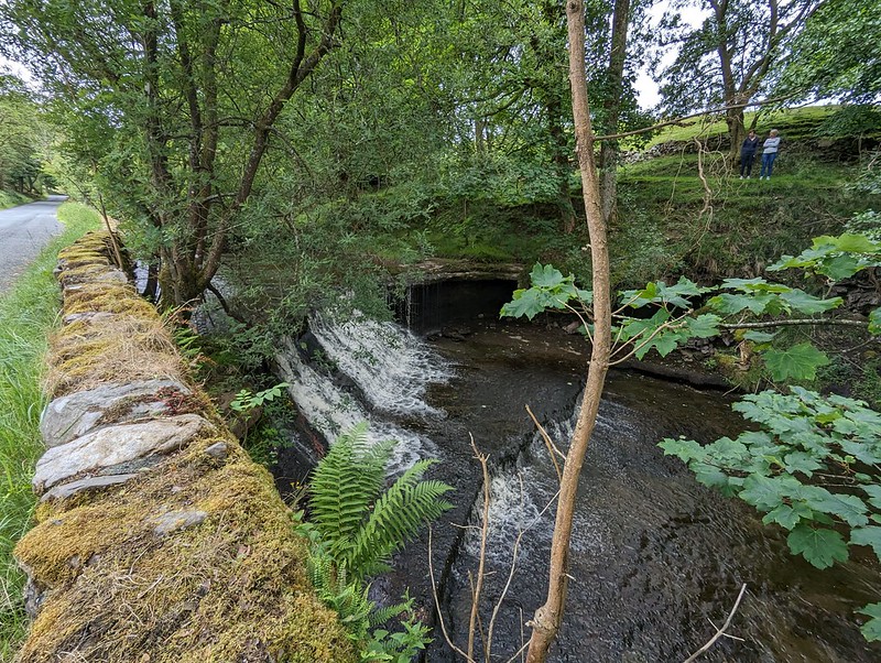
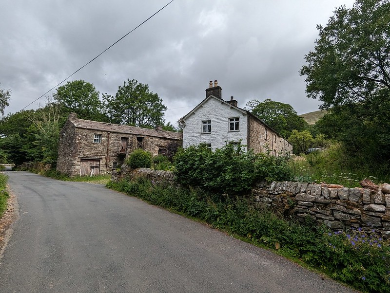
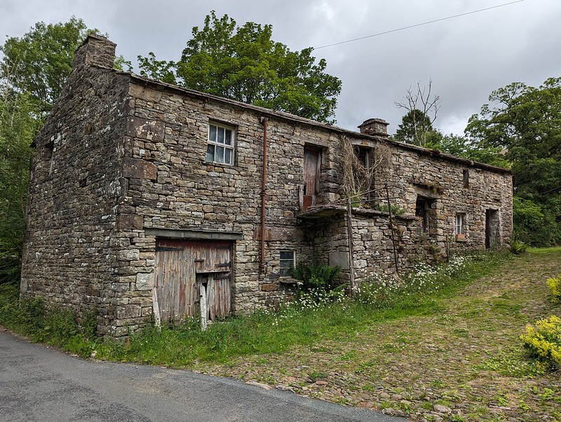
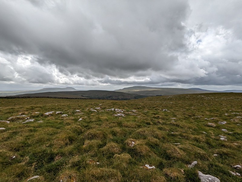
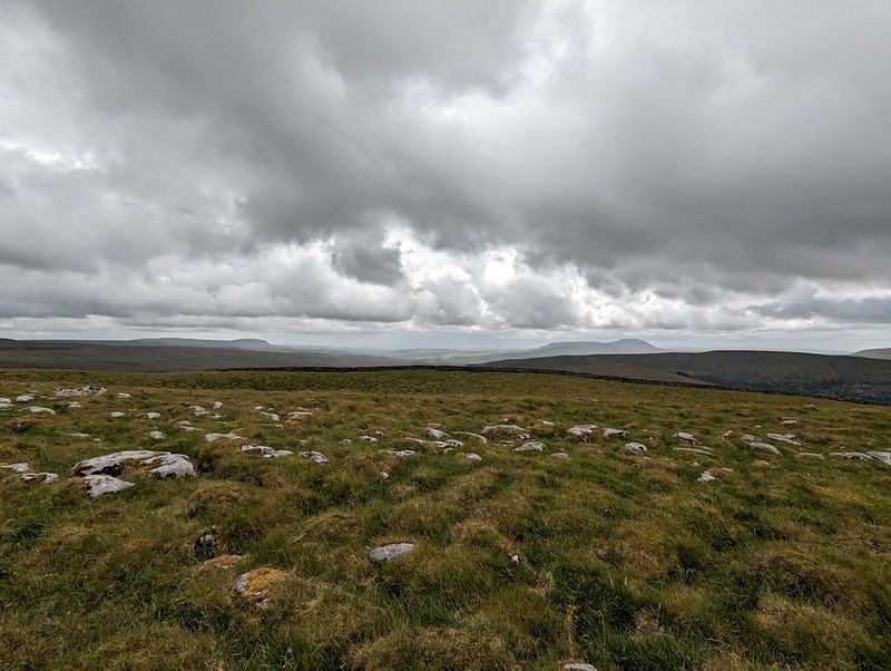
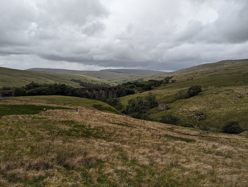
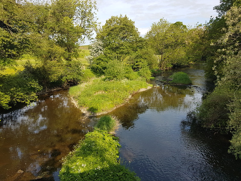
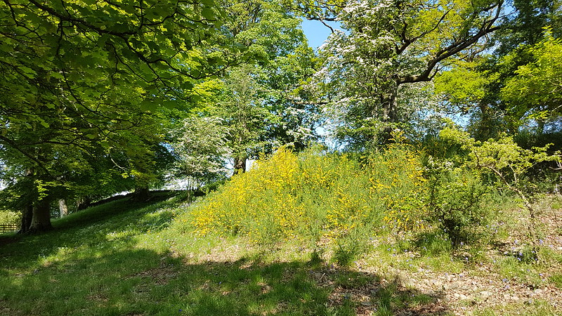
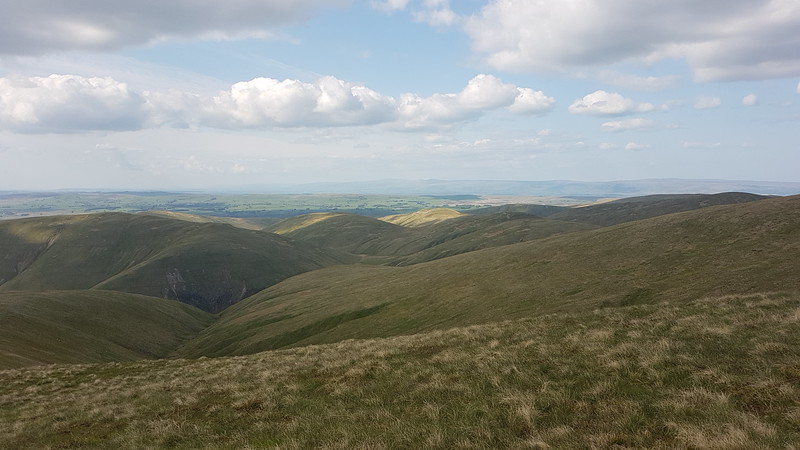
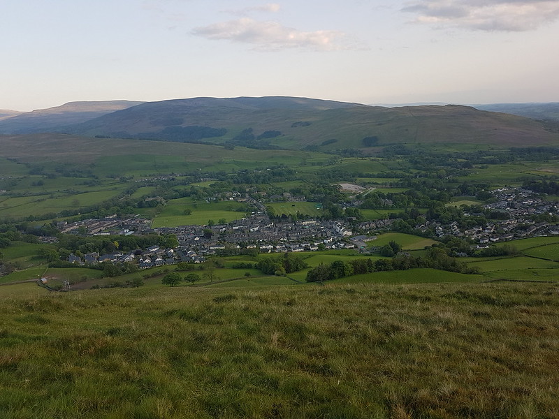
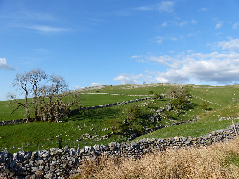
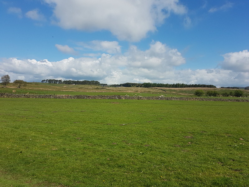
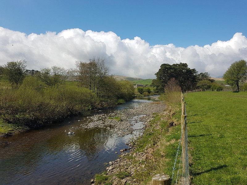
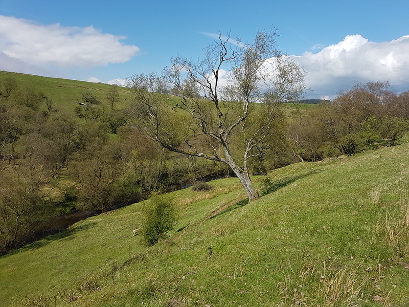
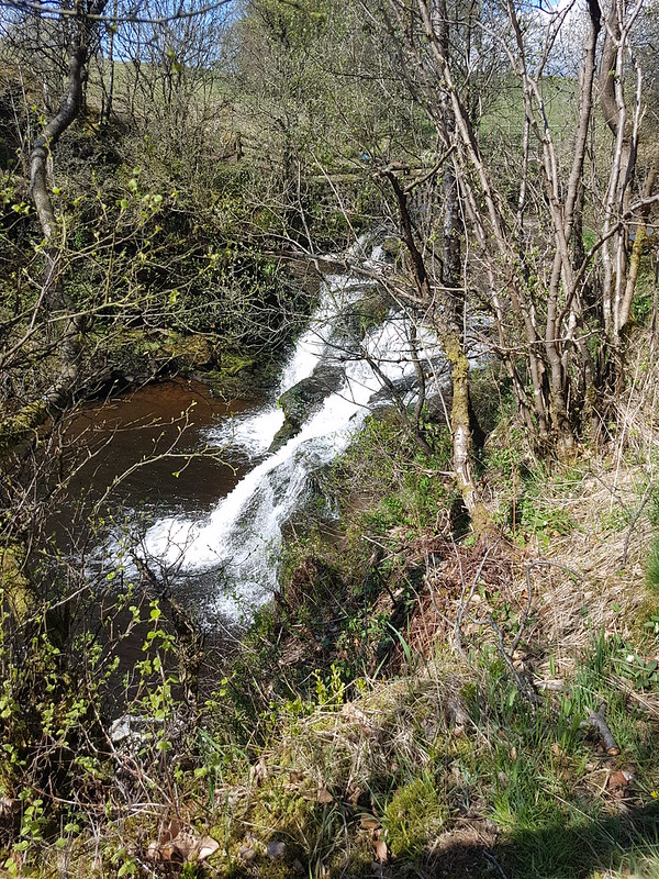
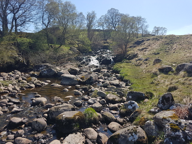
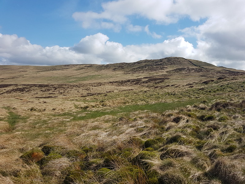
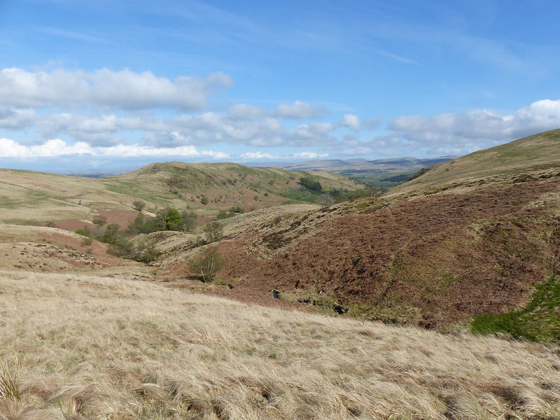
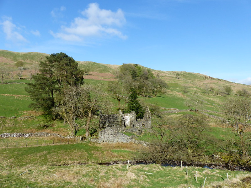
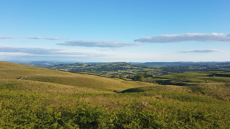
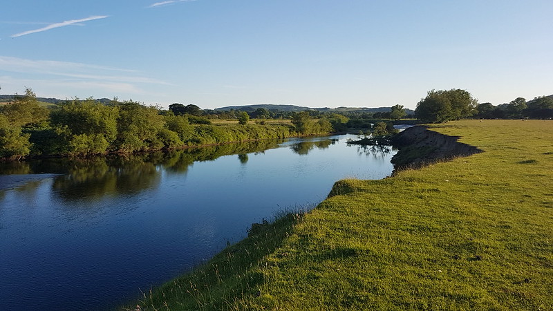
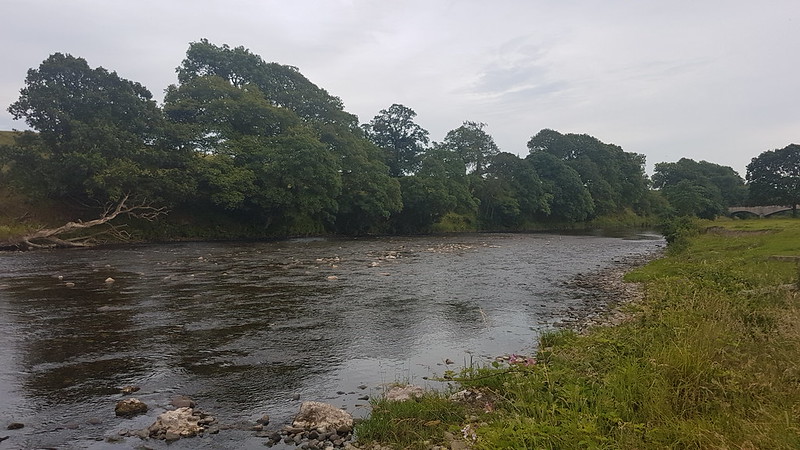
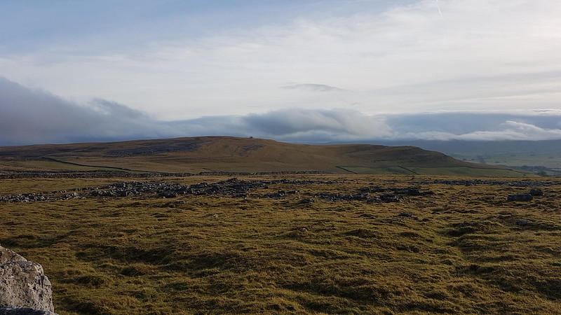
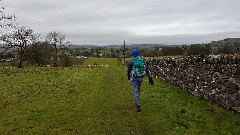
I’d plumped for a Lune Catchment wander, and was thinking that Smearsett Scar, at the eastern extreme of the Lune’s Yorkshire Dales reach, would be ideal. Optimistically, I was thinking that, if the weather was a little better than expected, I might extend the route to explore the limestone pavements of Moughton Scar too. In the event, the cloud was so low that even the little wooded heights above Austwick were hidden in the miasma. I hastily adjusted my plans, deciding to head south from the village, away from the hills. Had I taken a little more time and care, I might have noticed the words ‘stepping stones’ on the route I’d chosen and had second thoughts. I did eventually have those second thoughts, but only after I’d walked as far as Austwick Beck and seen the submerged stepping stones.
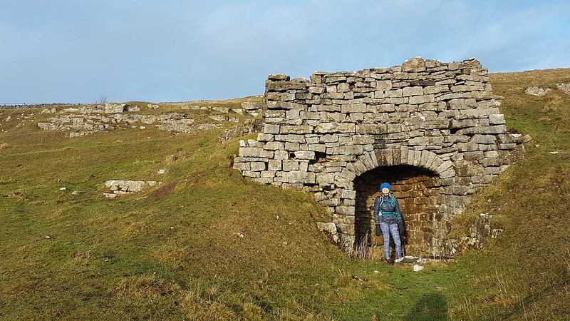
Oxenber Woods.
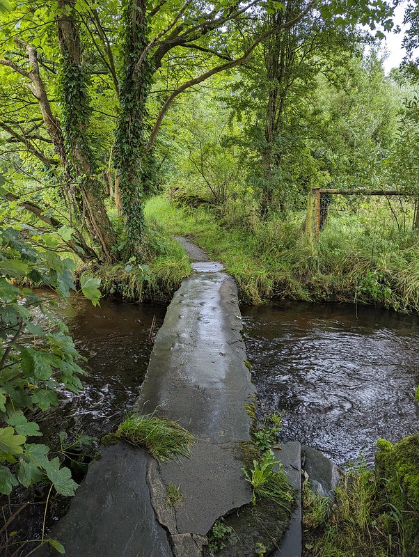
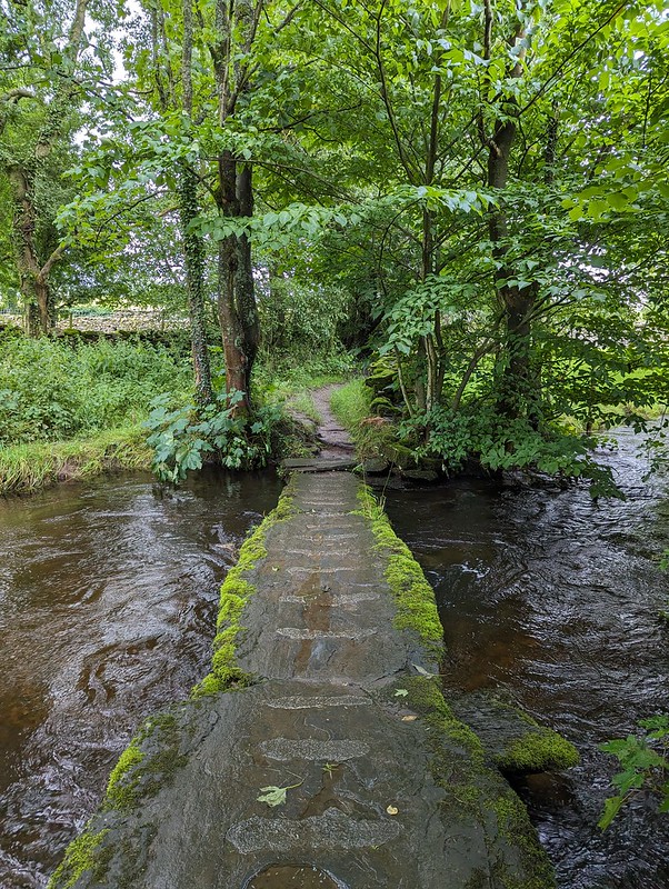
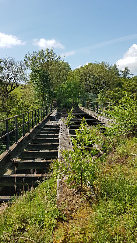
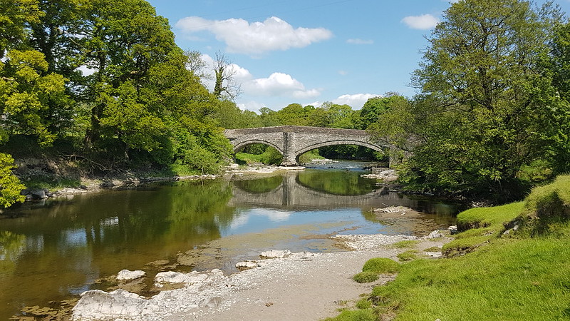
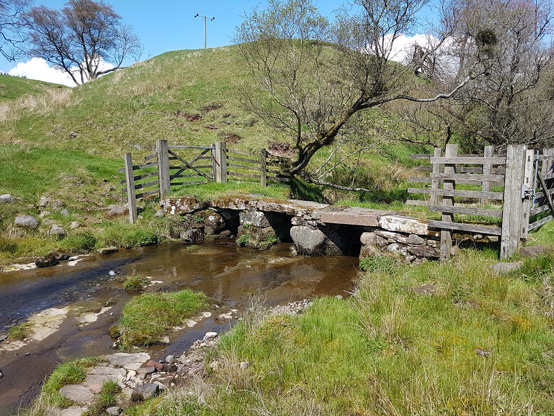
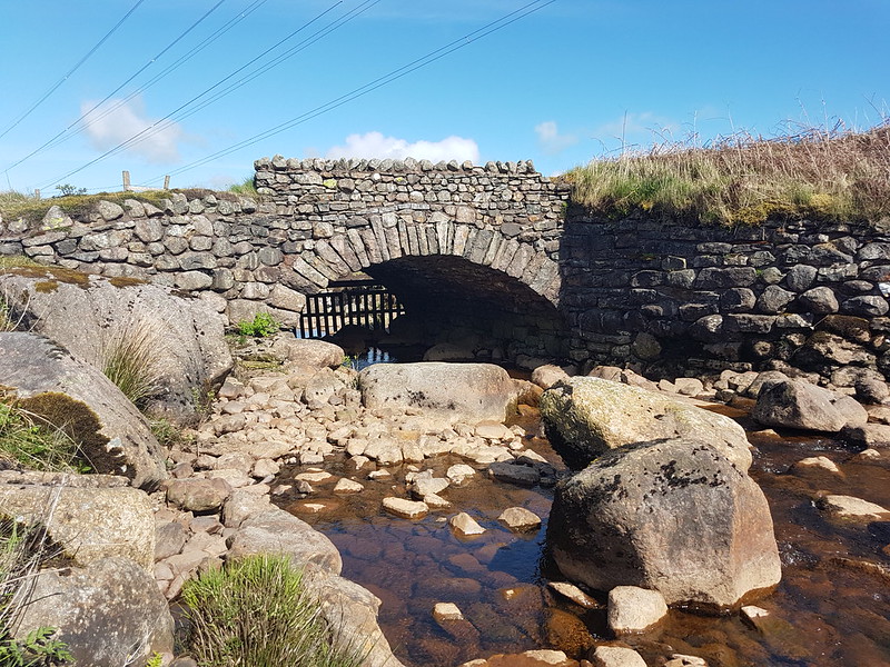
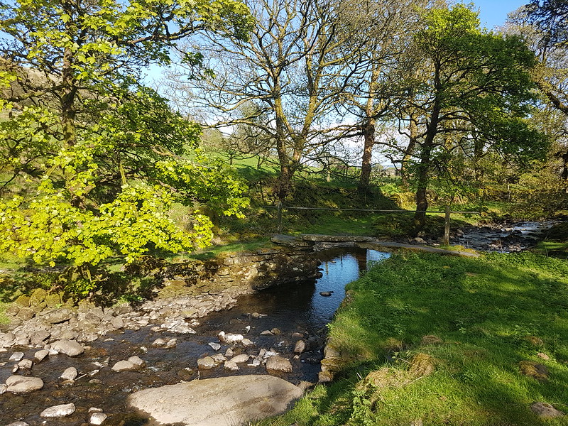
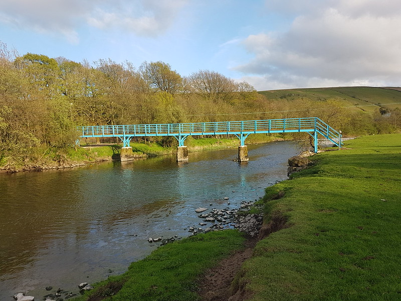
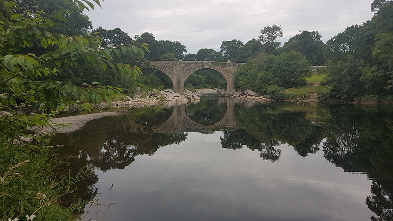
My second attempt to leave Austwick also brought me to Austwick Beck, but a little upstream of the stepping stones where there were two clapper bridges.
Little Bridges, Austwick Beck.Little Bridges, Austwick Beck.
They’re named ‘Little Bridges’ on the OS map. Makes me think of Baloo addressing Mowgli as ‘Little Britches’ in the Disney version of the Jungle Book. (I had an LP of the soundtrack which I listened to obsessively as a kid. Maybe that’s why I’m so happy listening to a playlist of Chet Baker, Sidney Bechet, John Coltrane, Nina Simone, Herbie Hancock and the like as I write?)
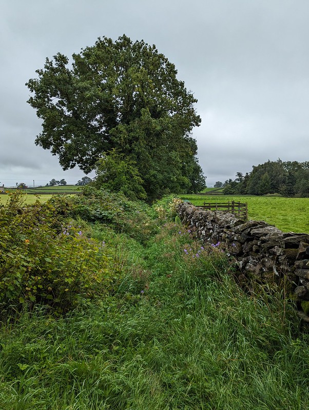
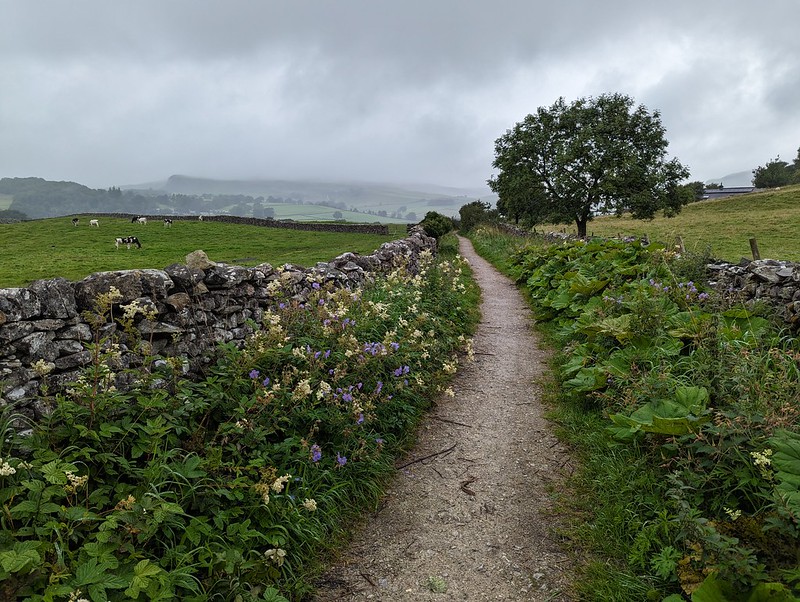
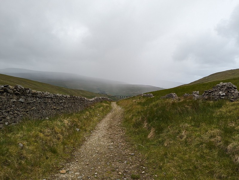
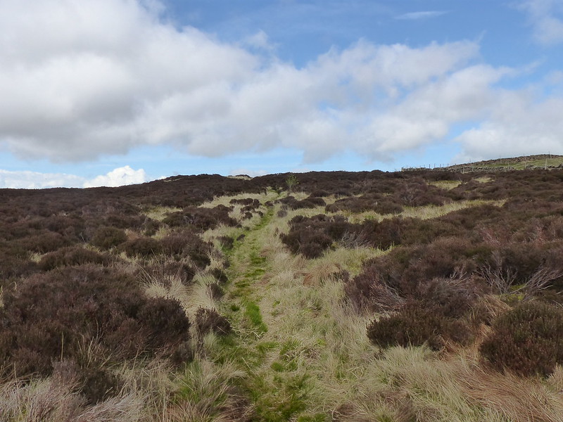
After that more auspicious start, the quality of this path quickly nose-dived where it passed between two walls and very quickly became extremely overgrown. This part is the best bit…
An inviting path?
Under the trees it was plagued by low branches and nettles. I’d put my overtrousers on before I plunged into the vegetation, so at least didn’t get stung. I next needed a machete where the path met the A65 road and the stile over the wall was protected, on both sides, by dense thickets of brambles. Which at least brought me into the open. Maybe I was just disheartened by the rain – did I mention that it was, inevitably, raining? – or the heavy going so far, but even walking through this meadow, in knee high wet grass seemed like unduly hard work.
Another inviting path?
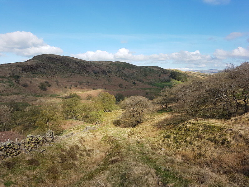
I decided to use minor lanes where possible, and at Lawkland turned right along Graystonber Lane.
Cottages at Lawkland.With an old post box.
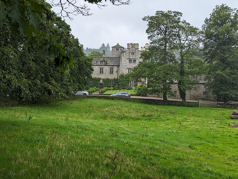
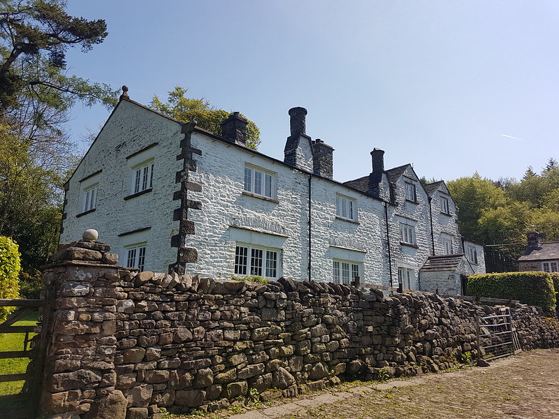
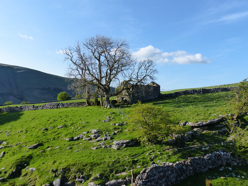
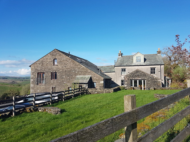
Faceache’s algorithm has clearly pigeonholed me as a middle-aged sad-act and keeps suggesting groups like The Dull Men’s Club, The Country Lane Appreciation Society, Bathtubs in Fields, and most recently The Peeling Paint Appreciation Society. To be fair, I think it has me pretty well sussed. But, for some reason, I’ve stopped seeing endless photographs of post boxes, which is a shame, because I do find them appealing – especially the Victorian ones. In fact I like them almost as much as I like a listed building. This one, Lawkland Hall, is a bit special, it’s grade I and those aren’t ten-a-penny. It was restored in 1912, but the oldest part dates back to the Sixteenth Century.
Lawkland Hall.Lawkland Hall.
I might not have known that Lawkland Hall was worth a look, but the miserable weather had at least given me a chance to read a little more of John Self’s marvellous ‘Land of The Lune’ and I’d seen a picture there.
At Lawkland Green I turned left on a path which would take me across several fields back to the A65. They were large fields. One field was home to a small herd of what I assumed were bullocks. They ignored me. Then, when I was half way across, one of them started to walk my way. Then a couple of others decided to investigate. Pretty soon, they were all running full-pelt across the field.
Raging bullocks?
Do they look angry to you? They don’t really do they. But they seemed very aggressive at the time. What’s more, that stream was wider and deeper then it looks in the photo and I got wet feet plodging through it.
The following field held nothing more threatening than a number of tall, broad mushrooms, which I assumed were Parasol Mushrooms, but I may have been wrong of course (see the comments section in my previous post).
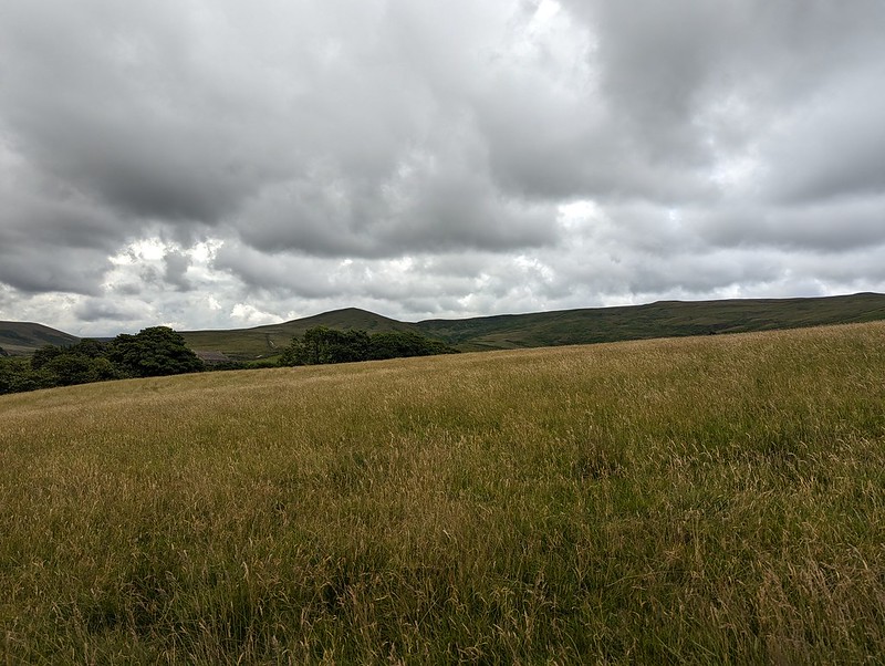
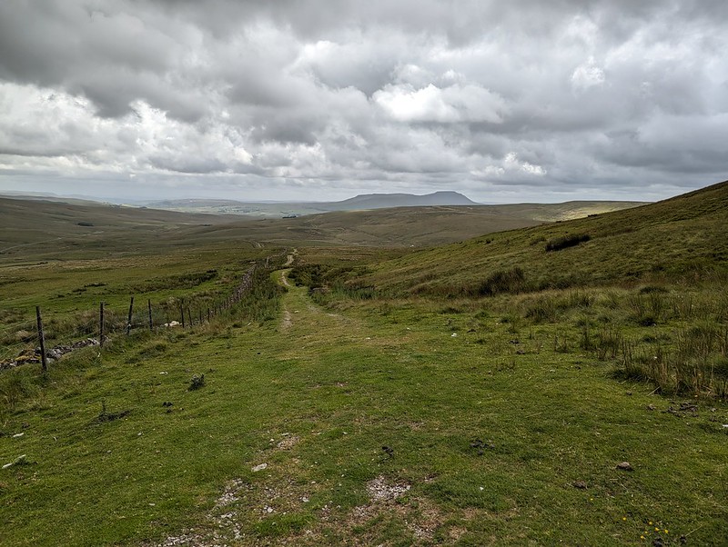
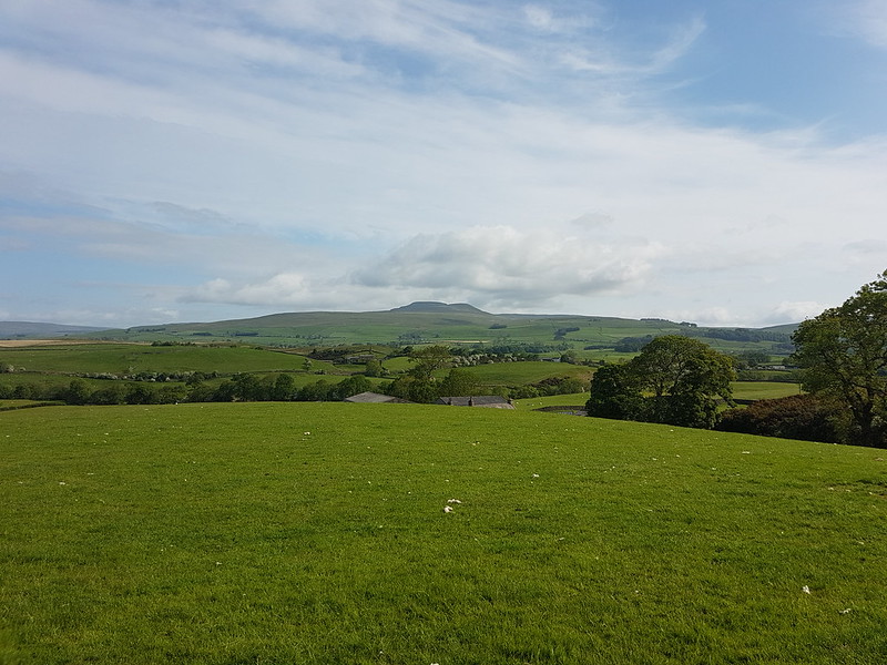
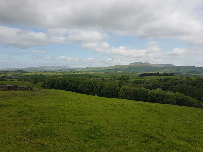
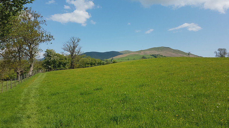
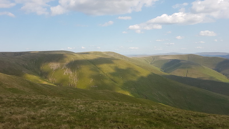
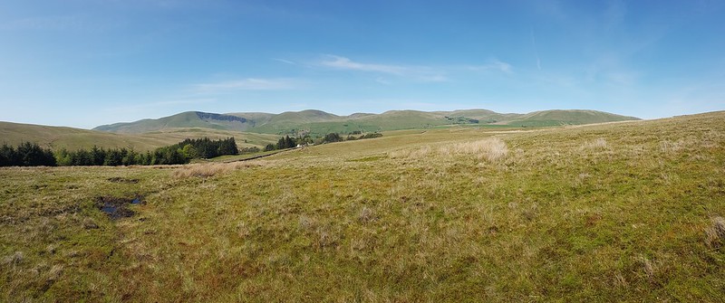
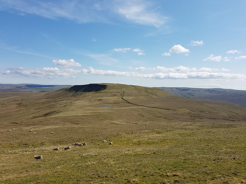
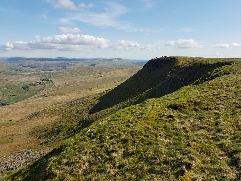
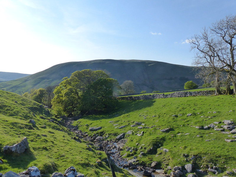
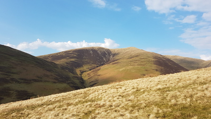
The next section was road walking, but mostly along a very quiet lane. The weather showed some signs of improving: the cloud was lifting a little and the rain was slackening off. As I descended through fields towards the tiny hamlet of Feizor, it even began to look as if Smearsett Scar might emerge from the cloud.
Smearsett Scar. Almost.Smearsett Scar, very nearly clear.
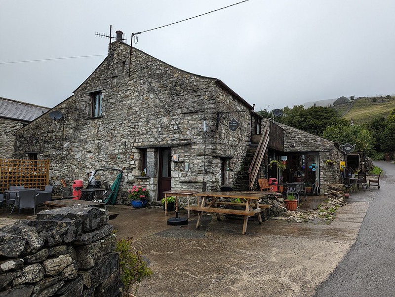
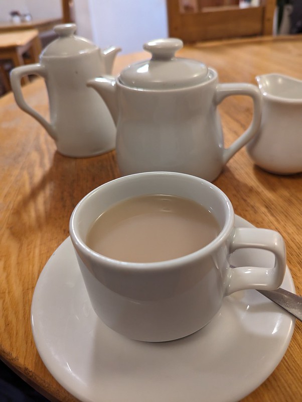
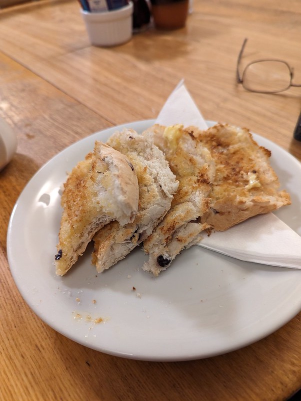
I suppose I might have reinstated my plan to climb the scar, but decided instead to head for the tearoom, which old friend J has been raving about (in an approving way) for ages.
She was quite right. It was lovely. A pot of extra hot water with my Earl Grey without even asking for it – TBH’s test of a tea room’s standard of service. The fact that it was busy late on a wet, mid-week afternoon is probably a good sign too.
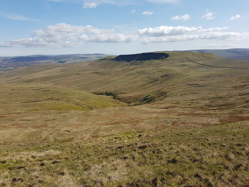
Smeatsett Scar – cloud free!Hale Lane.Hale Lane.
After the tea shop, there were longer gaps between the showers. The little ditch by the lane was gurgling away however, brimful of run-off.
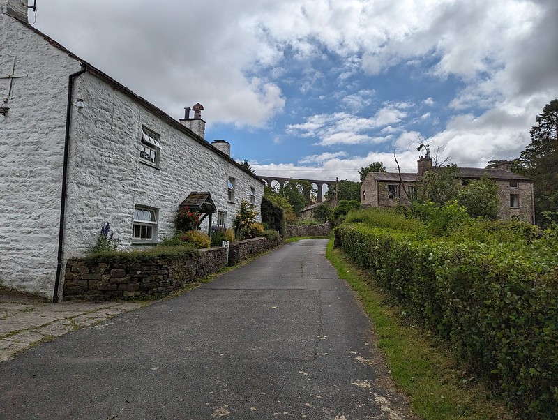
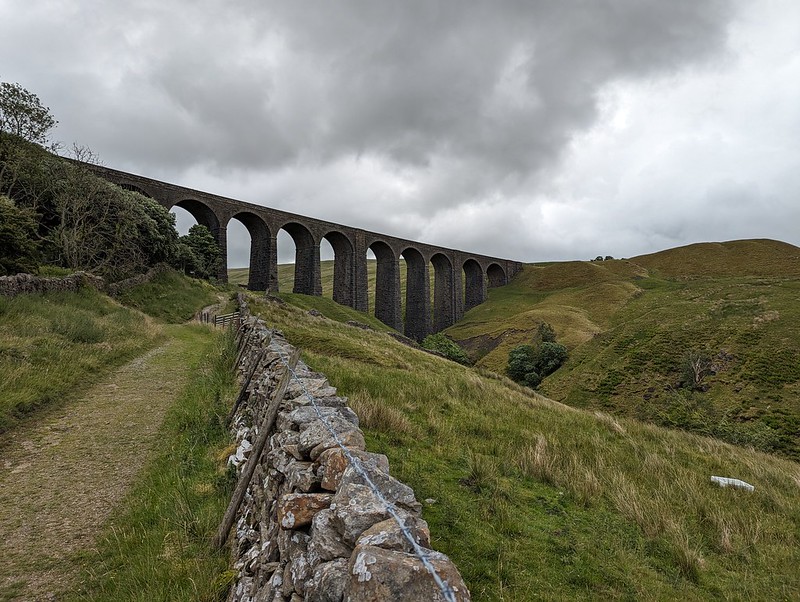
Burn Moor – and sunshine?Austwick and Robin Proctor’s Scar.Studrigg Scar and Moughton Scars.Austwick Beck.Austwick Bridge.
‘Probably C18’ according to Historic England.
Austwick Cross and The Church of the Epiphany.
Austwick church is more recent, finished in 1839 according to the same source, originally as a lecture hall and only latterly turned into a church. The pillar is of a similar age, but the base is ‘probably C15’.
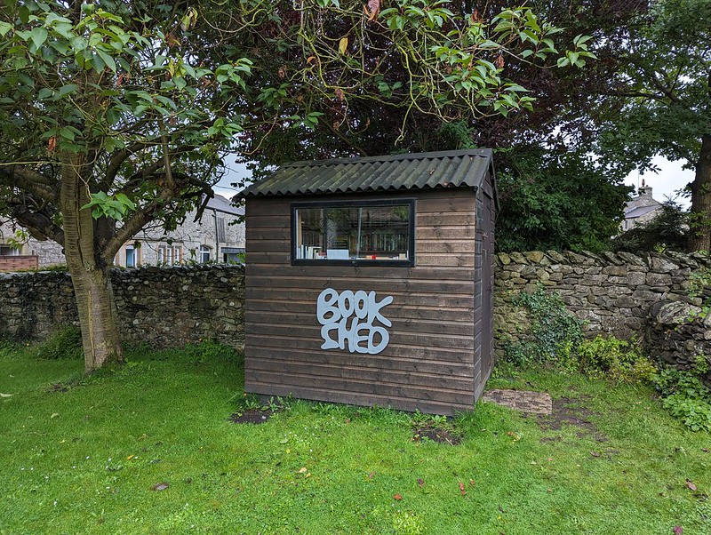
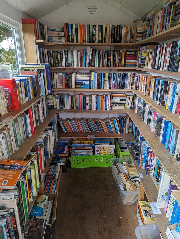
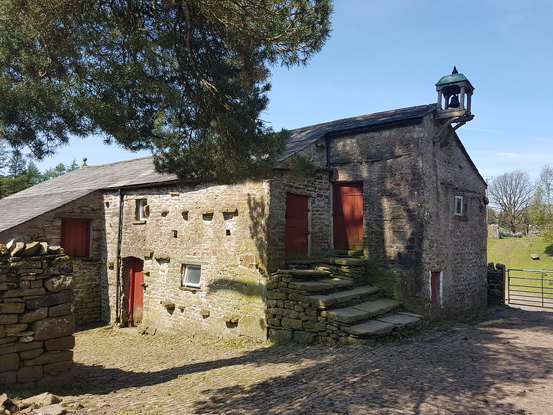
In the grounds of the church…
Book shed.Heaven!
I managed to restrain myself and only came away with a couple of books.
So: have you reached a verdict? Is the moral – when the weather is truly awful, best stay at home? Or the opposite? There was definitely an element of what our friend JB calls ‘Type 2 fun’. It was a bit grim at the time, and I got very wet, but there were some good bits too, especially in retrospect. I’ll let you draw your own conclusions.
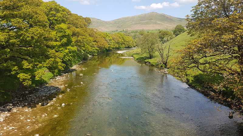
Late sun catches the River Roeburn and Morecambe Bay.
A Wednesday walk in early July; another fabulous Lune Catchment outing. I was able to get out on a Wednesday because it was a strike day. With hindsight, I’m slightly ambivalent about our industrial action: the ‘deal’ we eventually settled for was so poor, putting us even further behind where we were before ‘austerity’, that the personal cost of numerous unpaid strike days seems hardly worth it, but on the other hand, now that it’s over, I’m really missing those occasional days off and the midweek escapes to the hills.
My route could be summarised as a high-level circuit of the headwaters of the River Roeburn. At this remove I can’t remember what inspired me to plan such a long and ambitious route for a day when the forecast wasn’t especially promising.
I drove in on the road from Hornby which crosses a shoulder of Caton Moor, giving great views of the head of the dale, before losing lots of height, sadly. Even so, where I parked, by Barkin Bridge, the map shows a spot height of 144m, which, given that the Bowland hills are of modest heights even by paltry British standards, is a conveniently high start.
The River Roeburn from Barkin Bridge.Roeburndale Methodist Chapel at Lower Salter.
I climbed up the road past Lower Salter, beneath threatening clouds, before dropping back down again to the river on this metalled track…
Mallowdale Pike, High Stephen’s Head, Gallows Hill.River Roeburn again.
It began to rain and I reluctantly donned my cag, but it soon stopped and I didn’t put it on again until many hours later, right at the end of the walk, as I was returning to my car past the farm and cottages at Middle Salter. At other times, I could see showers passing through, or at least it looked like it was probably raining nearby, but none of them caught me.
Haylot Farm.
A little judicious trespassing here, across a couple of fields and on to Haylot Fell, would have saved me a lot of time and effort. Had I known what was to come, I might have gone for it.
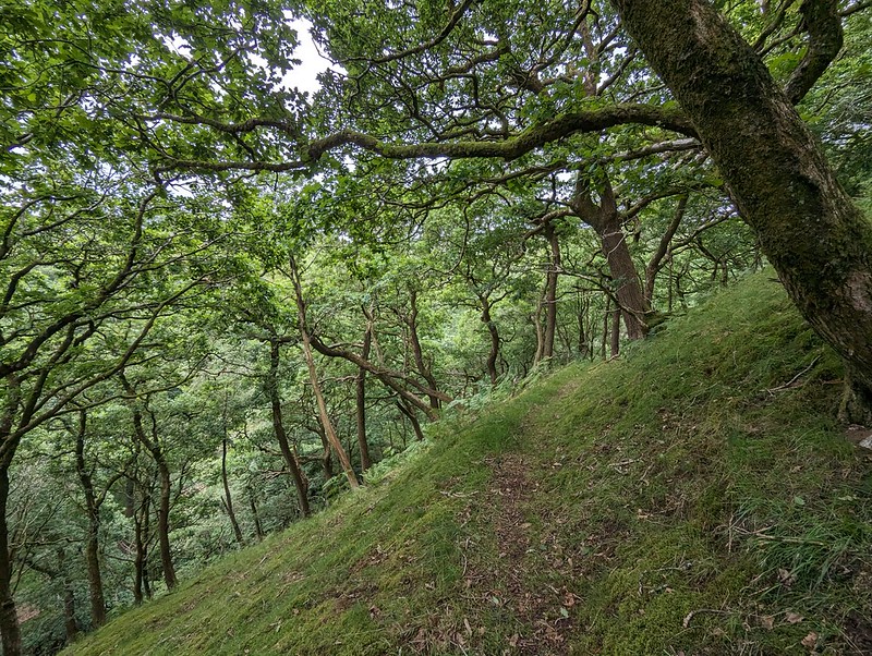
The hills above Kirkby and the Three Peaks.Mallowdale Pike.Melling Wood.
Instead, I followed the right-of-way down into Melling Wood – I know I’ve enthused about this steeply-sloping oak wood on the blog before. It’s a lovely spot.
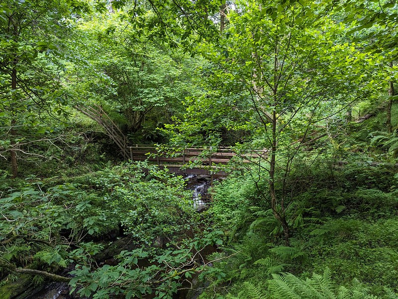
Footbridge across Mallow Gill.
So – I’d realised that if I stepped over the fence by this footbridge I would be on Access Land. Well, almost: strictly speaking I would also need to cross a sidestream of Mallow Gill too, but once on the far bank, I would be on Access Land. Easy. Or so I thought.
Mallow Gill.
The sidestream I needed to cross is on the right here, although you can’t really see it in the photograph. My problem was that the banks were very steep and I didn’t fancy trying to get down into it, or fancy my chances of successfully getting up the far bank. On the map, the hillside here looks entirely benign, with widely spaced contours – there’s no hint that this will be steep terrain. But it was. And the ground was dry and seemed to be composed of leaf mould, which was loose and unstable and difficult to make progress on. Added to that, there were lots more steep-sided sidestreams which the map also fails to disclose. I eventually climbed to the top edge of the wood and followed a very boggy path there which looked to have been made by hooved creatures – sheep or deer. I fell into one of the boggiest bits, which rather negated the way the weather considerately directed the showers away from me.
Haylot Fell.
Anyway, I eventually climbed high enough to leave the wood and finally managed to cross the stream on to the Access Land. The stream, Lambclose Syke, was comically small by now, making a mockery of my previous inability to cross it.
Lambclose Syke.Hawkshead, Mallowdale Pike, High Stephen’s Head.
Mallowdale Pike is an unusually shapely fell by Bowland standards, at least when seen from below. I’ve been intending to climb it for an age. I had half an idea to include it today, but it didn’t really fit neatly with the rest of my plans, so it’s still on my ‘to-do’ list.
The Three Peaks again.Pano – Caton Moor, Three Peaks, Mallowdale Pike.High Stephen’s Head and Gallows Hill.
Instead I headed up Gallows Hill and then along the rock scattered edge from there to High Stephen’s Head.
Morecambe Bay and Caton Moor Wind Farm.The view north again.A sheltered spot on High Stephen’s Head.
This hollow offered excellent shelter from the chilly wind, whilst still allowing extensive views to the North. Too good an opportunity to overlook, so I broke out my stove for the day’s first lengthy brew stop: Atkinson’s of Lancaster Blue Sky which is black tea but with a bit of Grapefruit flavour, my go to hike brew these days.
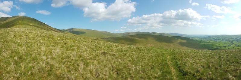
Forest of Bowland terrain.
Paths in the Forest of Bowland are usually little used, sketchy or even non-existent. The going was often rough and quite hard work. My hand-me down boots did me proud though, and my feet stayed dry through all of the bogs and peat hags.
Lesser Black-backed Gulls.
As I approached Ward’s Stone, the air was thronged with Lesser Black-backed Gulls. The cacophony was astonishing. The walk between Ward’s Stone and Wolfhole Crags was accompanied by the constant calling of the gulls, who seemed to be always on the move. Apparently, the breeding colony here was once the largest in the UK, but for many years culling was allowed, ostensibly to protect the water course from pollution, but since the gulls will eat Grouse eggs and chicks the action also protected the shooting industry’s revenue. It seems that after the species was red-listed and the licence to cull elapsed, the persecution continued illegally, for a while at least. I haven’t managed to find any data regarding the recovery or otherwise of the breeding colony. There seemed to be a lot of gulls, but that’s not very scientific evidence. This colony was at one time the largest in the UK, and since the UK has 40% of the World’s population of this species, it was pretty important.
Bog Asphodel.
I know that gulls often vociferously protect their nests and I fully expected to be dive-bombed, which I wasn’t looking forward to, but whilst they made a lot of noise, the gulls left me well alone – maybe I didn’t get close enough to their nesting sites?
Queen’s Chair.
I think this must be the feature, close to the eastern summit of Ward’s Stone, marked as the Queen’s Chair – to be honest, it didn’t look remotely comfortable.
Grey Mare and Foal, Ward’s Stone.
This jumble of large boulders seems to be called Grey Mare and Foal although I couldn’t see why. However, on the leeward side of the rocks, well out of the wind…
Grey Mare and Foal, Ward’s Stone.
There’s was a large flat slab, resting on other rocks, which must surely have been laid like this to make a seat? It was extremely comfortable, with a view of my route ahead, and an ideal spot for brew number two and a spot of lunch.
A perfect seat for lunch.
Here on Ward’s Stone, the highest spot in the Forest of Bowland, I saw some other walkers: two couples. They were the only other walkers I met all day.
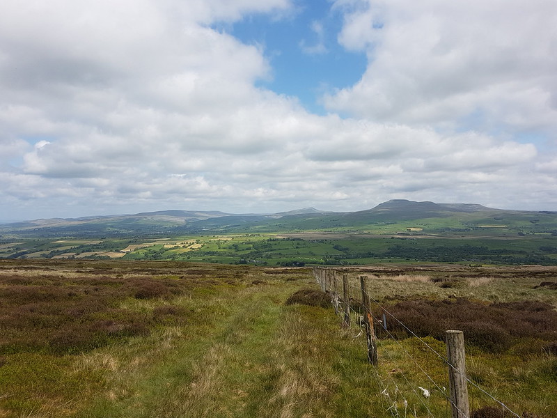
White Hill, Wolfhole Crag and Pendle Hill.Pendle Hill and Fair Snape Fell.
Whilst Pendle Hill stands proud and alone and is very distinctive and easy to recognise, Fair Snape Fell is the highest hill in a jumble of Bowland fells which I’m not sufficiently familiar with to distinguish between.
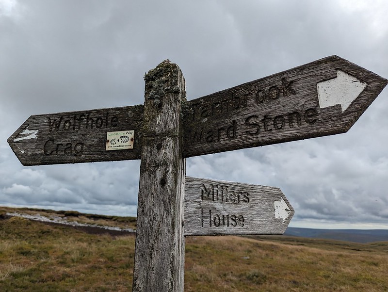
White Hill, Wolfhole Crag and Pendle Hill.Pendle Hill and Fair Snape Fell and its neighbours. From Grey Crag? White Hill and Wolfhole Crag. Slowly getting closer.Lesser Black-backed Gull.Lichened signpost.Wolfhole Crag.
I think I’ve been to Wolfhole Crag before, many, many years ago. But if I have, I’d forgotten its jumbled, bouldery edge. I was impressed with what I found. I suppose that when a walk mostly covers quite featureless, bleak moorland, any rocky character really stands out.
I found another spot out of the wind, behind one of the towering boulders, made yet another brew and may have drifted off for a bit.
Looking back to Wolfhole Crag.Fair Snape Fell.Mallowdale Pike and Hawkshead.
From Wolfhole Crag, I dropped down to the Hornby Road. This would be my return route to my car, but I decided on an out-and-back to White Hill first, even though it was already well into the afternoon.
Wolfhole Crag.Stoat trap.White Hill.
I’m assuming that White Hill is not often visited. There wasn’t much of a path and the going was hard work in places. On the other hand, the sun came out, and there were no Lesser Black-backed Gulls which meant a bit of relief from their raucous and relentless cawing. What’s more, it also meant there were other, different, birds to see. In fact, I was quite surprised to find how much time I spent taking photos of birds.
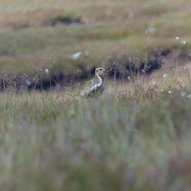
Golden Plover.
Mostly, my photos are really rubbish shots of Golden Plover. I didn’t see many, perhaps three, but those birds seemed happy to play a game with me, bobbing up and down in the grass and heather, or suddenly appearing in full sight, but with the light behind them so that all I could capture was a silhouette.
Golden Plover.
My game of hide-and-seek with this bird must have looked particularly comical: we were on opposite sides of a peat hag and both anxious not to be seen, so were both bobbing in and out of sight. I have lots of photos, but in most of them my camera has done a fabulous job of focusing on the vegetation between me and the plover. I haven’t often seen Golden Plovers before though, so was very happy to have an opportunity to get even dodgy shots. I also took a few blurred photos of Curlews in flight. And two distant, not especially sharp photos of what I’ve almost convinced myself might be a Merlin – Britain’s smallest bird of prey which lives on small moorland birds like pippits. I thought I saw one once before, flying around the craggy edge on Clougha Pike, not so far from here.
White Hill Trig Pillar.White Hill sighting tower. Wolfhole Crag and Ward’s Stone beyond.Sighting tower. Used to plan the Haweswater Aqueduct.
There are three of these fairly tall structures on White Hill. There are similar pillars on Selside Pike near Haweswater in the Lake District, and on Tarn Crag above Longsleddale. They were used during the construction of the Haweswater Aqueduct which carries water from Haweswater reservoir in the Eastern Lakes to Manchester.
Forest of Bowland terrain 2.Wolfhole Crag and Ward’s Stone from Botton Crag.
My descent route was very close to the way I had come up, but the rocky slabs of Botton Crag gave slightly easier walking than the heathery amd tussocky terrain elsewhere on the moor.
Looking toward Fair Snape Fell.Hornby Road.
On the map, Hornby Road is marked as a Roman Road, although it seems the modern track may not always stick to the Roman route. The track connects Slaidburn to Hornby and Wray in the Lune valley. A quick Google suggests that it is popular with cyclists, which makes a lot of sense.
Hornby Road.
Although I still had quite a long way to go, the track at least gave some easy walking to finish my long day. With the clouds gathering, the drama of the skies and the light kept me royally entertained.
Big skies over the Three Peaks.
Fortunately, my ‘new’ phone seems to have a really flair for clouds – I imagine the in phone processing power of the software designed by the boffins at Google?
The kind of light which makes a late finish worth while.One final view towards the Three Peaks.Threatening clouds amassing over Mallowdale Pike, High Stephen’s Head, Gallows Hill and Haylot Fell.High Salter.Haymaking near Middle Salter.
As the evening grew gloomy and I put my cag back on for the last few hundred yards, the local farmers were still busy cutting the grass for silage.
MapMyWalk gives a little under 18 miles and around 660 metres of ascent. More importantly, another day of really enjoyable walking.
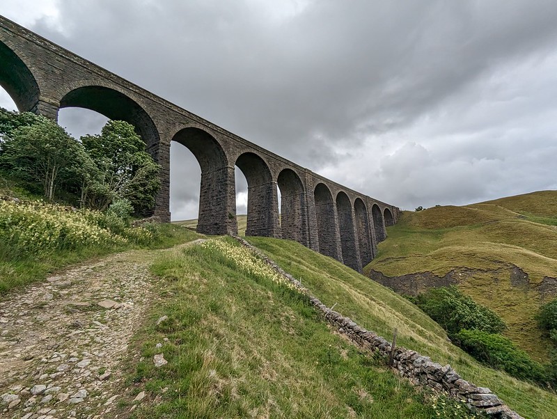
Dent Head Viaduct and Packsaddle Bridge over Fell End Gill.
Another Lune Catchment walk, on a day of decidedly mixed weather. I don’t mind a bit of mixed weather, depending, I suppose, on the ratios employed in the recipe: I can stand a bit of rain so long as it isn’t poured with too heavy a hand and if I get some dramatic skies in compensation.
I know that Dentdale is lovely, but curiously, given that it’s not really all that far from home, I haven’t actually visited all that often. I’ve climbed Whernside from Dent on a couple of occasions. We camped here once, in the rain, when the kids were little I think. But I haven’t visited most of the valley, I hadn’t climbed any of the hills to the north or east. All of which is even more odd, given that where I parked, this early July Sunday morning, by the magnificent Dent Head Viaduct, was about a five minute drive from Gearstones Lodge, where we’ve spent a weekend prior to every Christmas for a few years now. In fact, we fairly recently watched the cloud pouring over Great Knoutberry Hill and Wold Fell from the northern end of Whernside during a cloud inversion weekend at Gearstones.
Bridge End Cottage (I think).
My walk began downhill, along the road – neither of which would usually be my first choice when picking a route, but on this occasion, with the infant River Dee alongside, a mass of wild flowers on the verges and lots of old, listed buildings to admire, I was more than happy. Both the viaduct and the old bridge are listed, along with just about every building in this upper part of the valley it seems. All, perhaps, except this one, if I’m right that this is Bridge End Cottage. In fact, I might have finished and published this post by now, apart from the fact that I’ve spent a lot of time down the rabbit-hole of reading all of the listings on the Historic England website. I think I enjoy the fact that they are quite clearly dense with information, but simultaneously, make no sense to me whatsoever.
“Rock-faced sandstone in massive blocks, mostly coursed but some snecked, with brick soffits to the arches. Slightly curved line on north-south axis. Ten tall round-headed arches on battered rectangular piers, that in the centre broader than the others and with a broad tapered pilaster; short cavetto-moulded imposts at the springing of the arches, rusticated voussoirs (now with 3 tie-plates to each arch), a moulded string course, and parapets with rounded coping.”
This is the viaduct, for example. Snecked? Soffits? Cavetto? Imposts? At least I know what voussoirs are, after a previous rabbit-hole episode, although I can’t tell you what it means for them to be rusticated; and I’m guessing that, in this context, ‘battered’ has nothing to do with coating in a mixture of flour, egg and beer and then deep-frying? (Although it has probably been tried in Scotland).
The River Dee.Dee Side House.
Formerly Dentdale Youth Hostel and before that a hunting lodge; now available as a holiday let. I’ll let you insert here your own rant about the YHA losing its way and selling off so many wonderful remote properties like this one. I’m saddened that I never got around to staying here whilst it was still a hostel, but even more upset that apparently Patterdale Hostel in the Lakes, where I have stayed many, many times, including for several big family get-togethers when I was in my teens, is facing a similar fate.
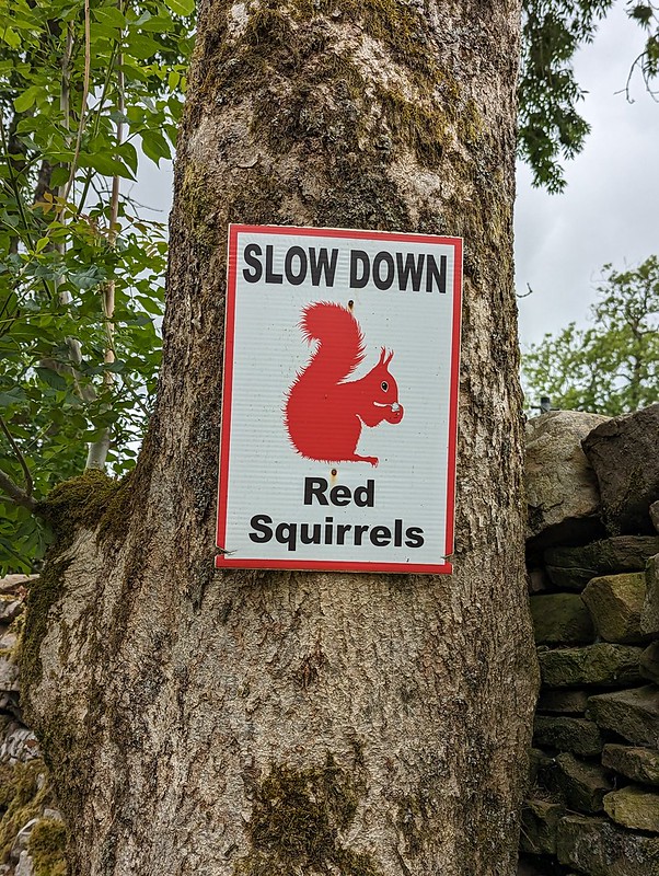
Common Spotted-orchid.Scow Force.Speed up – missed Red Squirrel photo opportunity.
I did see a Red Squirrel, running along the top of a gate, but I was much too slow with my camera to get a photo. I was impressed that somebody has put out these signs in an attempt to save the local squirrels from motorists, but I clearly needed to speed up, not slow down, in response to the presence of squirrels.
Bettony.
I passed a garden hereabouts which had been decked out as a picnic spot for Dales Way walkers – which seemed like a really generous thing to do and reminded me of the esrtwhile ‘Hiker’s Rest’ near to Beck Head at the southern end of Whitbarrow.
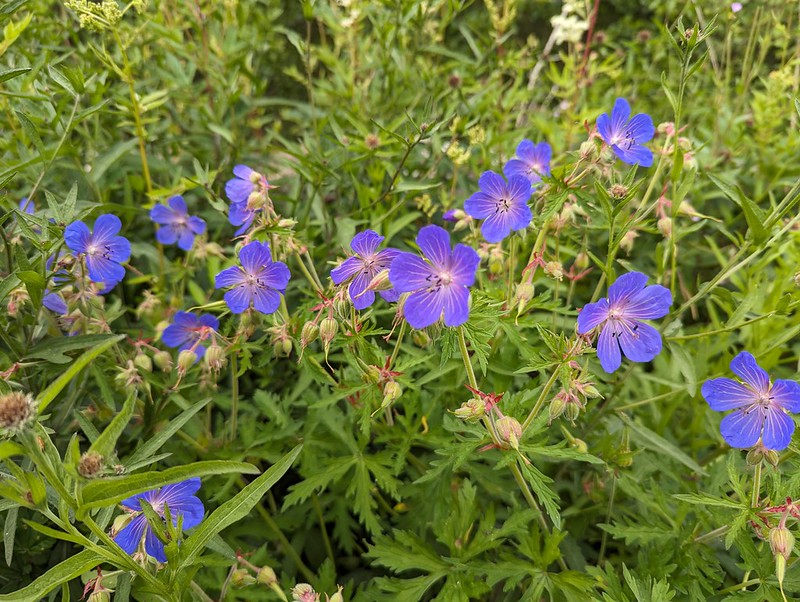
Meadow Crane’s-bill.The River Dee.East Stonehouse.Outbuilding at East Stonehouse.
There was something about the higgledy-piggledy design of this building which I found appealing. Higgledy-piggledy is the technical term obviously; I can’t think how else to put it, not asymmetric exactly, most houses aren’t symmetrical after all. It’s something to do with the windows and doors all being different sizes and positioned at different levels, I think. Anyway, I liked it.
West Stonehouse.
Confusingly, West Stonehouse lies NNE of East Stonehouse. I’m sure it made sense to name them that way to somebody at some time, but it seems very odd now. Here’s a snippet of the Historic England description of West Stonehouse:
“White-painted rubble, the centre portion random, with quoins, and the outer portions coursed, also with quoins; stone slate roof.”
I often bemoan the modern penchant for using the word random, when the desired import is actually ‘arbitrary’; so I was struck by the use of ‘random’ here. Apparently random rubble stone is where undressed or hammer dressed stones are used. Like a dry-stone wall; the stones are all different sizes and fit together like the squares and rectangles in a painting by Piet Mondrian, not in neat, even layers, which would be ‘coursed’. So there you go.
It probably makes more sense with a picture – I shall have to take one.
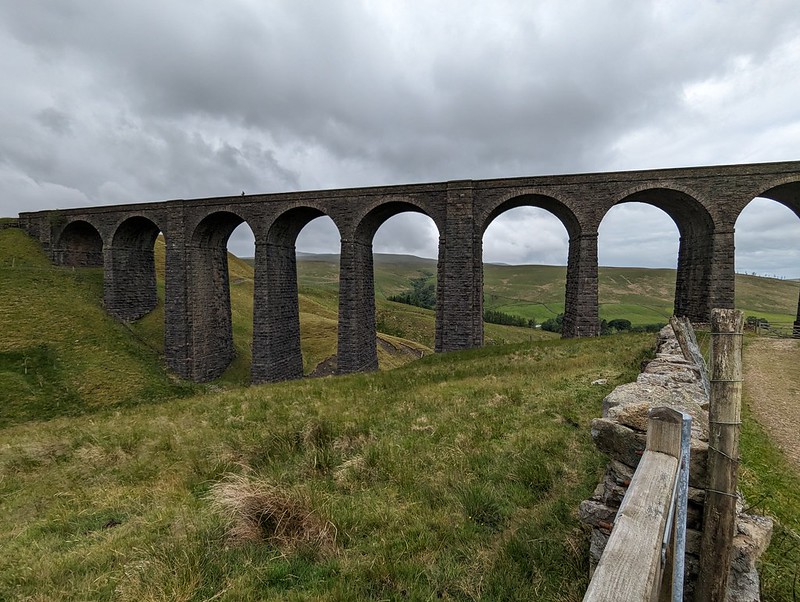
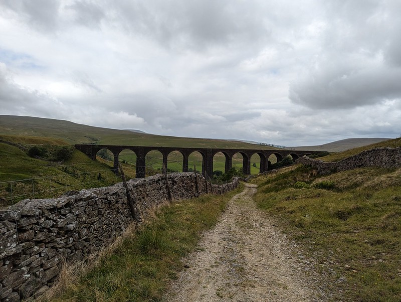
Arten Gill Viaduct.
By the track from Stonehouse there was an information board about the mining, or possibly quarrying, or – looking at the map – probably both, which formerly went on in this area. I didn’t take a photo, which is most unlike me, but the area’s industrial past no doubt explains the effort which was expended in creating the cobbled track up towards Arten Gill Viaduct.
Cobbled bridleway.Arten Gill Viaduct.
This viaduct was if anything even more attractive than the Dent Head one had been. You’ll have to bear with me, I took lots of photos. On the other hand, I didn’t manage to catch the pair of raptors, I think Kestrels, which were flying in and out of the trees by the viaduct.
Arten Gill Viaduct.
Tautologically, the stream below is labelled, on the map, both as Arten Gill, and as Artengill Beck.
Arten Gill Viaduct.
The skies were beginning to build some ominously dramatic looking clouds and I was soon paying for it in the first of several showers. To be fair, the showers were at least short-lived and mostly not too heavy either.
Arten Gill Viaduct.
The track rises steadily, without being hard work and so was ideal. There were lots of birds about – Wheatear and Pipits, but most entertainingly Stonechats.
Male Stonechat.
A couple of individuals, first one and then later another, took it upon themselves to fly ahead in little short hops and then stop and wait on the fence, allowing me to get very close before scooting on again.
Male Stonechat.
Naturally, I took lots of photos.
I also got overly excited, during a shower, about what I decided was a Mountain Ringlet, even though I strongly suspected that they are not found in the Dales. Which absence would, of course, make my discovery all the more notable and exciting. When I finally got close enough to get a photo and a close look, it transpired that it was in fact a very small Ringlet, of the plain, old common-or-garden variety.
A sidestream.And another – being neatly directed across the track.An excess of weather.
Having reached the top of the pass, I could have taken a direct line up to the top of Great Knoutberry Hill, but I’d done a bit of research online and read great things about the track, Galloway Gate, which contours around the southern and western slopes of the hill.
Whernside from Galloway Gate.Ingleborough and Whernside and more showers.Looking down Dentdale.
Choosing Galloway Gate turned out to be a good decision – it’s a fine walk which gives great views, particularly down into Dentdale.
Baugh Fell and Wild Boar Fell from Galloway Gate.
Eventually, I turned right, heading uphill and on to Pikes Edge, where there a number of scattered cairns and even more scattered boulders.
Ingleborough and Whernside from one of the cairns on Pikes Edge.Looking down Dentdale again.
As I approached the summit of Great Knoutberry Hill, I was engulfed in by far and away the heaviest shower of the day – for a while it was really chucking it down. A little annoyingly then, I found that I had unpacked my waterproof trousers from my rucsac, which is something I very rarely bother to do. Since I was wearing shorts anyway, and my waterproof trousers are mostly holes and layers of duct tape patched up with more duct tape, it probably wasn’t that great a loss. Also, this stone seat, possibly of random rubble, was facing away from the wind…
Stone seat/shelter on Great Knoutberry Hill.Lunch stop in a Bivvy bag in pouring rain.
Since the rain was falling horizontally, once I was hunkered down on the seat, and snug inside my bivvy bag, I was able to enjoy my packed lunch and a brew despite the rain. Anyway, it soon started to clear again.
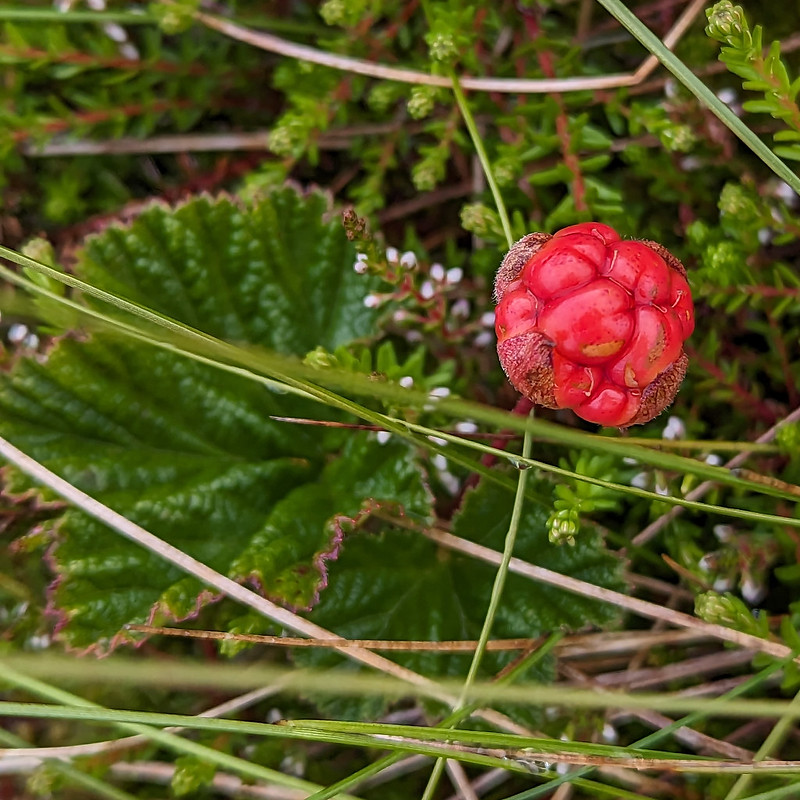
Ingleborough and Whernside from Great Knoutberry Hill.Cloudberry – or Knoutberry.
I had a bit of a wander in the vicinity of the trig pillar and found several Cloudberries. I don’t think I’ve ever seen them before, although I shouldn’t have been surprised to find them here, since Knoutberry is apparently a local name for Cloudberries. I also read that they are regarded as somewhat of a delicacy in Scandinavia; that the UK population of plants is predominantly male, so that it’s rare to find fruit; and that this example isn’t ripe, since they turn orange when they’re ripe.
Widdale Tarns.
Great Knoutberry Hill is merely the highest point on the huge expanses of Widdale Fell. Beforehand, I had been contemplating a little wander to explore the tarns at least, but based on the area around the summit, I decided that it would be very rough going and that I would leave that for another day. Looking at the map again now, I see that Widdale Fell has an impressive looking edge above Widdale itself, that most of the streams drain either directly into the River Ure or into the Ure via Widdale Beck; but that some of the streams run down into Garsdale and the River Clough – a tributary of the Lune which I haven’t explored at all yet: so I shall need to come back at some point.
On this occasion I took a more direct route back towards the crossroads between Great Knoutberry Hill and Wold Fell.
Pen-y-ghent, Wold Fell, Ingleborough and Whernside.Pennine Bridleway signpost.
This is the signpost at the crossroads, which I hadn’t photographed when I first passed it because it had been raining at the time. This track is part of the Pennine Bridleway, a route which, like the Dales Way, some of which I also lay on this route, always seems superb wherever I encounter it.
Wold Fell.Juvenile Wheatear.On Wold Fell, looking back to Great Knoutberry Fell.
Wold Fell was quite odd: limestone pavement, mostly grassed over, a very flat topped hill – there was a small cairn, as you can see, but it was very difficult to tell whether that was the actual highest point of the fell.
Ingleborough and Whernside from Wold Fell.
The lump between, and in front of, Ingleborough and Whernside is Blea Moor. I’ve often looked at it, especially when climbing Whernside from Little Dale via Greensett Tarn, but never been up it. I suppose I might get around to it at some point, although the lower slopes above Ribble Head are a bit of-puttingly rough and reed covered.
Pen-y-ghent and Ingleborough from Wold Fell.Descending towards Ingleborough.
From Wold Fell it was a simple romp down a track and then a minor road, accompanied by a couple more brief showers, back to the car.
Fell End Gill.Dent Head Viaduct again.Common Spotted-orchid.
As almost always seems to be the case with my Lune Catchment outings, it was a very satisfying trip, packed with interest, from which I came away with a host of ideas for possible future excursions.
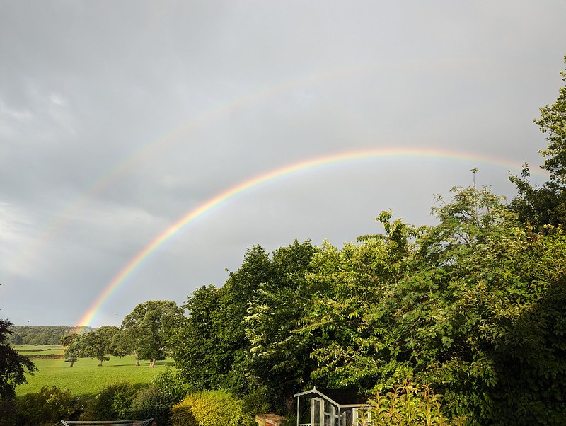
More showers at home – and a double rainbow.
Back at home, there were more showers, and this time an accompanying double rainbow.
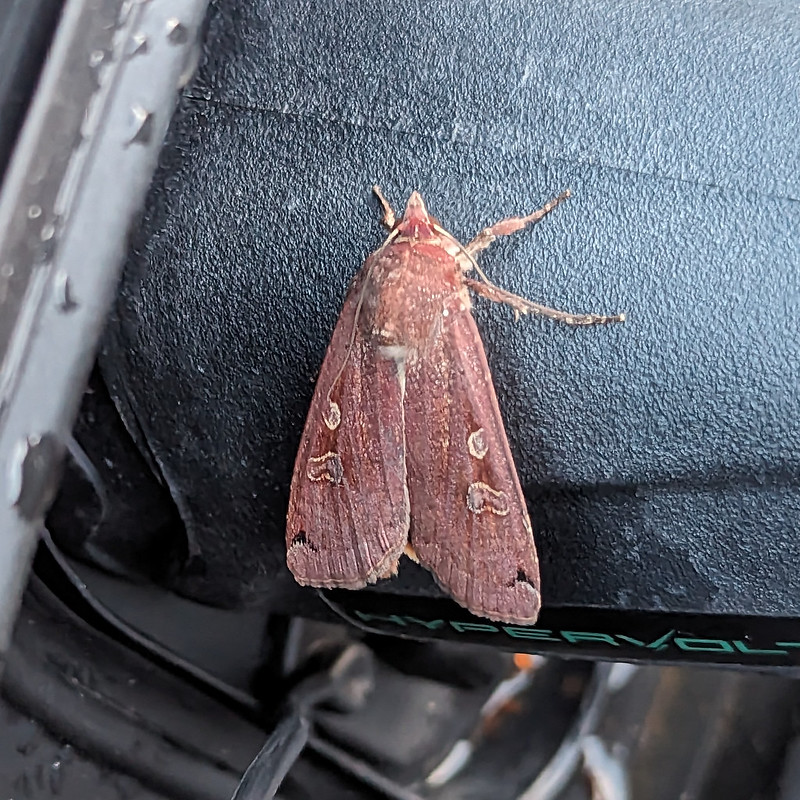
Later still, around 10pm, Little S sent me back outside to have a look at the moth which was resting on the plug on the charging cable for our car. It was dark and I’m amazed that my phone managed an image as clear as this…
A Large Yellow Underwing?
I’m told that this is a Yellow Underwing Moth , although to an untutored eye it also looks very similar to a Square-spot Rustic Moth. I’ll settle for it being a lovely colour, whichever.
Map the first.Map the second.
MpaMyWalk gives a little shy of ten miles and 485 metres of ascent, which seems about right.
Another Lune Catchment outing. I parked at Clapham Station, which, like our own village station, is quite a long way outside the settlement it serves. The car park was large and very empty, so I shan’t feel bad about using it. Besides which, I would have used the train if the first train in the morning had been at a more reasonable time, and if the fare weren’t so ridiculously expensive. There’s a listed waiting room at the station – I shall have to go back!
River Wenning.
The bridge I crossed over the wenning is also listed, I’m not sure why I didn’t take a photo; most unlike me.
My route initially took me through farmland, very pleasant, but unremarkable. However, I did take a lot of photos of the various views of Ingleborough.
Ingleborough.
Near Wenning Side I exchanged good mornings with a couple who seemed to be assiduously creosoting every gate, fance, stile etc on their property. Climbing a stile later on I managed to get thoroughly tarred-up with the sticky stuff.
Clapham Wood Hall.
There’s very little access to Keasden Beck, but from Clapham Wood Hall I was able to follow it as far as Turnerford Bridge.
Keasden Beck.Another view of Ingleborough.
At West Borronhead I hit access land and turned uphill. With hindsight, I should have turned immediately and followed Alder Gill Syke and the fence beside it. As it was, I went a little further west first and then found myself climbing steeply through tall bracken beneath which were years of accumulated dead bracken, which made for very difficult progress. Once I got to the stream, there was always at least a faint path of sorts.
Pano from beside Alder Gill Syke.
Alder Gill Syke (don’t ‘gill’ and syke’ both mean stream?) gives a good route all the way up Burns Moor, with a steady, fairly easy going and expanding views across the valley of the Wenning to the much more famous hills opposite.
Gragareth, Whernside, Ingleborough over the Wenning Valley.Gragareth, Whernside, Ingleborough over the Wenning Valley, pano.An evil trap.
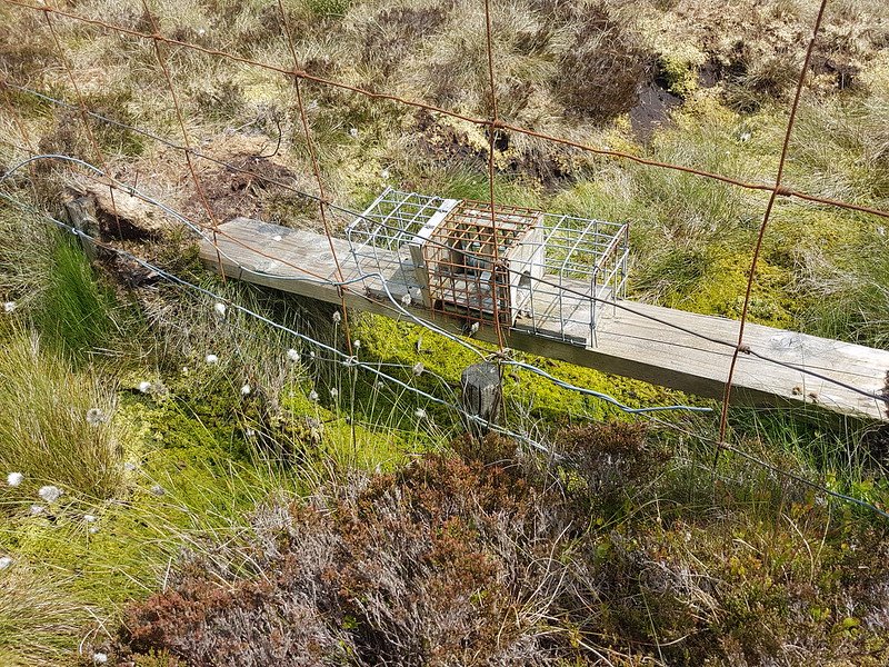
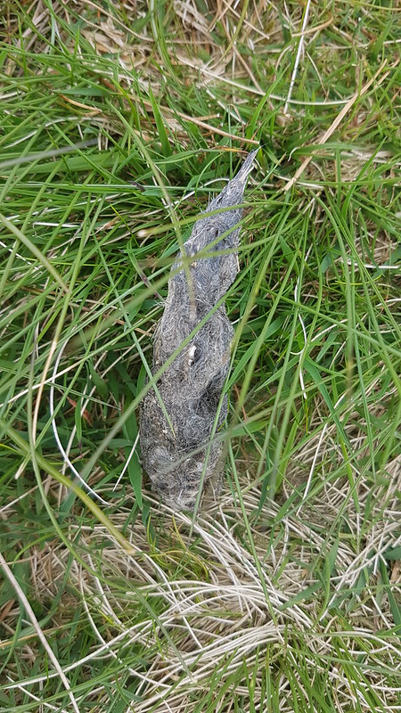
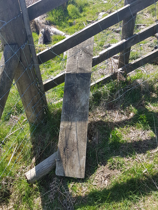
I’m sure I must have seen these before; I certainly saw a few on this walk, and I’ve seen them again since in the Bowland Fells. Naively, when I saw this one, I assumed it must be part of some sort of wildlife population survey. Sadly not. This device is intended to kill Weasels and Stoats. They don’t like to get their feet wet apparently; by putting a plank or log across a section of bog and putting a trap on that plank, gamekeepers can protect their precious Grouse. Has anybody designed a ‘humane’ trap for grouse-shooting toffs?
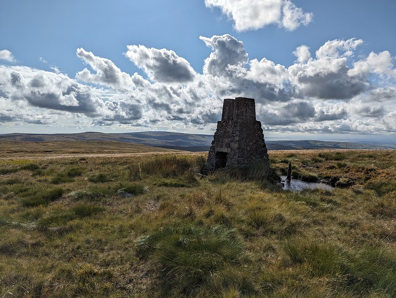
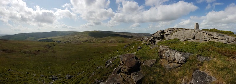
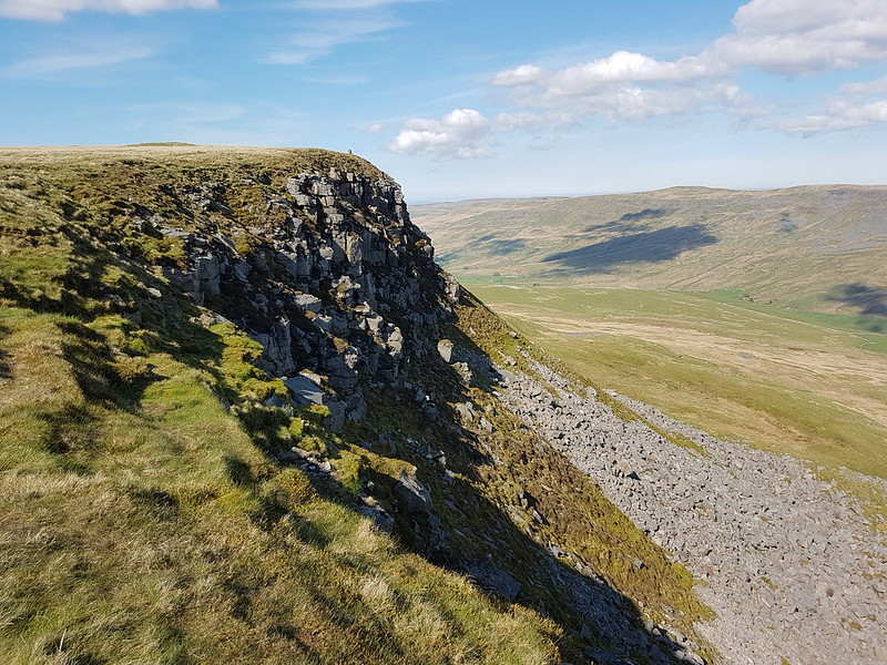
Burn Moor trig pillar.
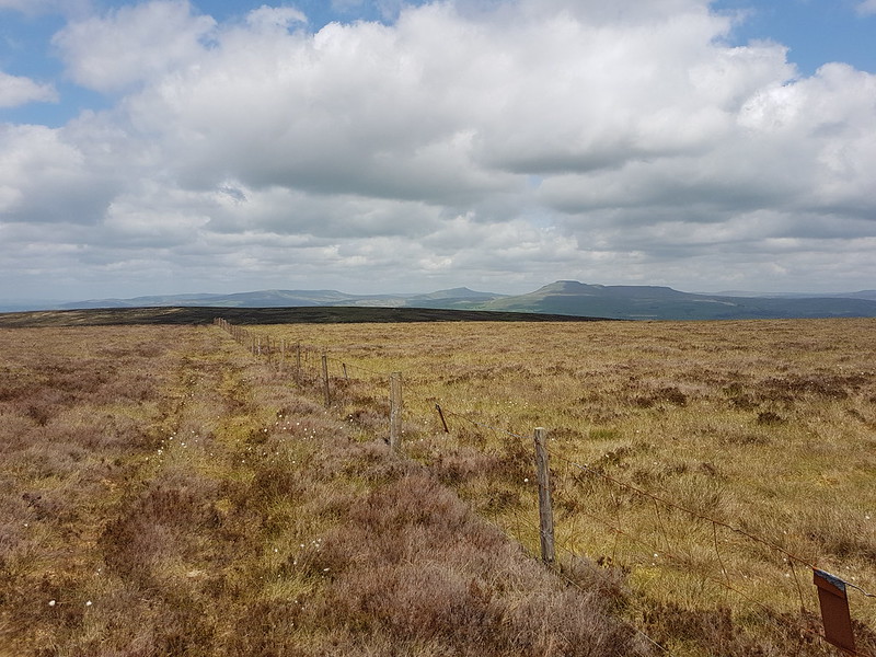
This was another very quiet walk. In fact I didn’t see any other walkers until I arrived at Bowland Knotts. I suspect Burn Moor trig pillar is little visited. Not far from the trig pillar is this curio:
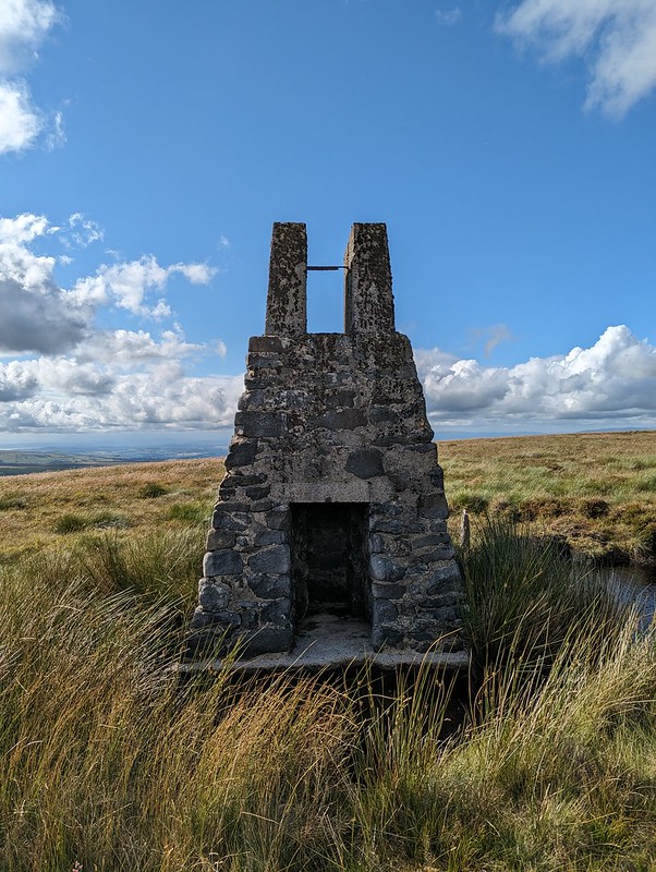
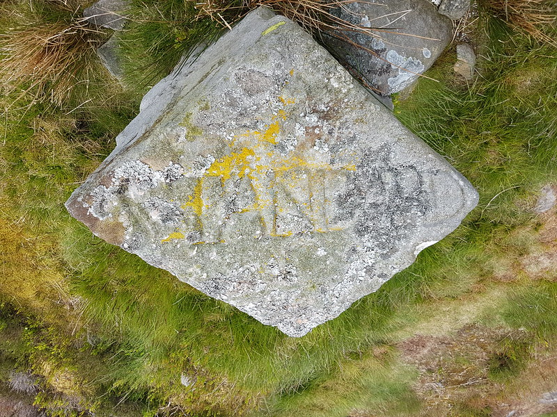
Standard on Burn Moor. Looking down towards Morecambe Bay.
Marked on the OS map as ‘Standard On Burn Moor’, it has large capital letters carved on it and on the top…
Standard on Burn Moor.
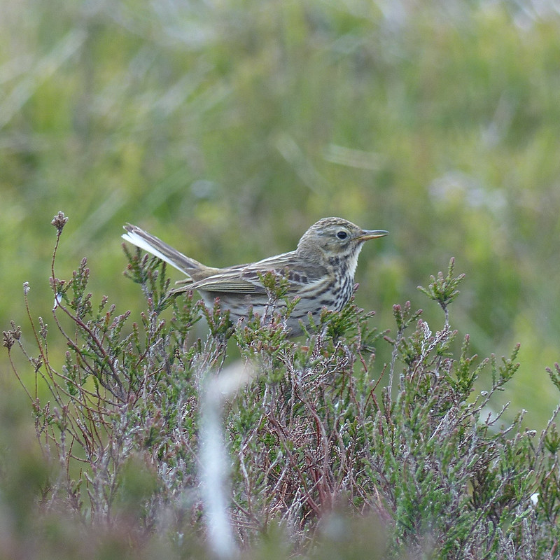
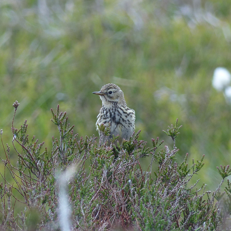
…the word ‘Standard’. Odd. It made a very comfy backrest for me whilst I ate a bit of lunch and enjoyed the views. I also had some company; this Meadow Pipit flew around me, from fence post to heather and back again, singing all the time. I assume there was a nest somewhere nearby.
Meadow Pipit.Meadow Pipit.
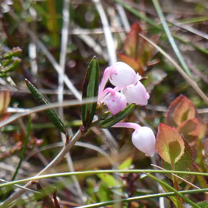
On the long steady ascent of Thistle Hill to Crowd Stones there was no path and I had reason to be glad of the fact that the heather had been burned in strips, because by stringing together recently burned areas or relatively new growth patches, I could make easier progress. I used the presence of lots of small pink flowers as an excuse for a bit of a photo stop rest.
Bilberry flower.Bog Rosemary.Cranberry flowers.
I think there were Lousewort too, which are also pink, but for some reason I ignored those.
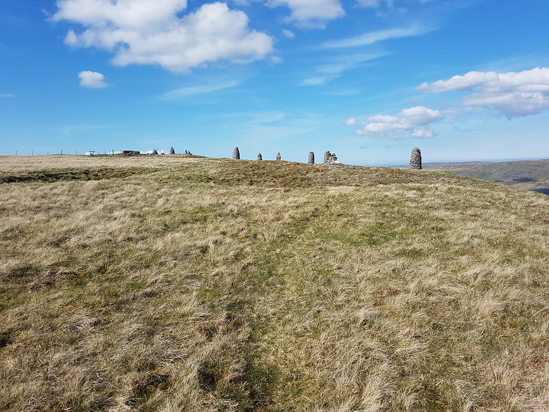
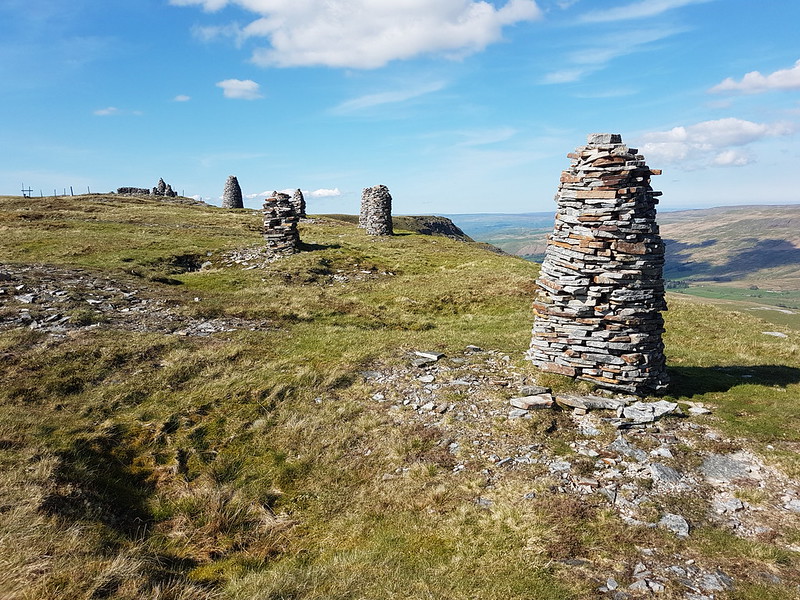
Boundary stone? One of many.
Another excuse for a pause were the frequent boundary stones. At least, that’s what I assume this is. Some had crosses, others had a single letter.
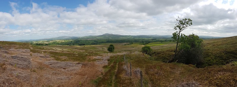
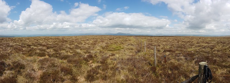
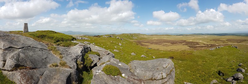
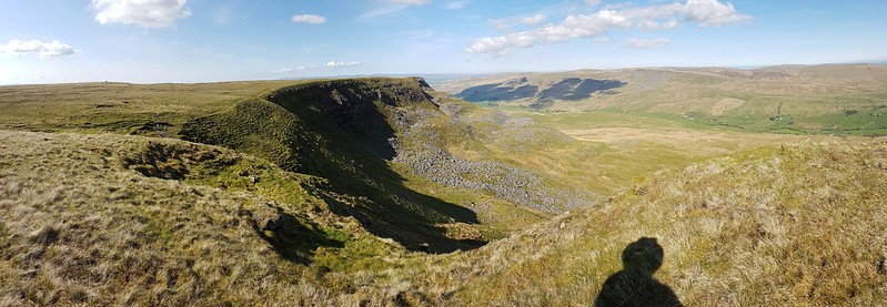
Looking back to Burn Moor from Thistle Hill.Pano from much the same spot.And in the other direction – Raven’s Castle, White Hill, Ward’s Stone.
I took a lot of panorama photos on this walk. I know they don’t work too well in a blog post, but you can always click on them to see larger versions on Flickr, and I think they reflect the wide-open spaces of this walk well.
Crowd Stones – looking down towards Morecambe Bay.
Crowd Stones is also named Raven’s Castle on the nap, but since there’s another Raven’s Castle a little further along the ridge, I shall stick with Crowd Stones. Which is….well, lots of scattered stones. I’d been hoping for something a little more spectacular.
Crowd Stones – Wofhole Crag and Ward’s Stone.
None-the-less, I stopped here for a while for a drink and to try, without much success, to photograph a Curlew which was circling.
Crowd Stones – White Hill.Pen-y-ghent and Fountains Fell.Bowland Knotts.
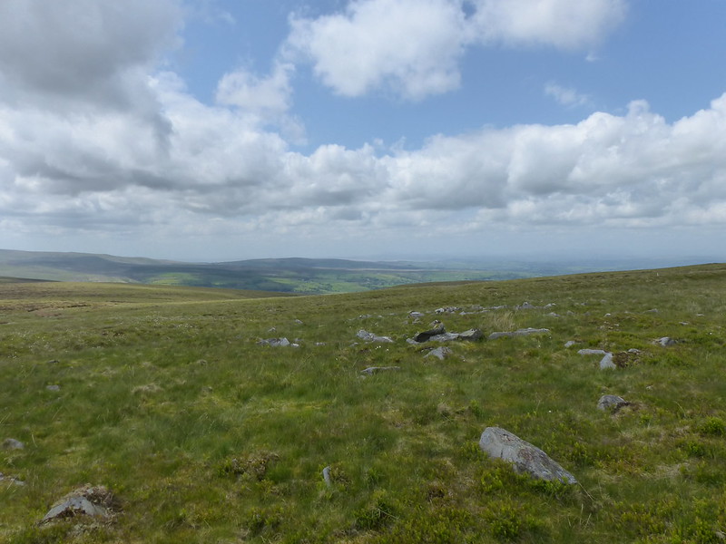
From this cairn I looked down on the swep of moorland which feeds Keasden Beck. All the little streams seem to be named, my favourite names being Outlaw Gill Sike and Bull Wham. I also liked the fact that the hillside below Raven’s Castle is called Hailshowers Fell.
Stocks Reservoir and Pendle Hill.
From Raven’s Castle there was a definite path again and I felt a bit less off the beaten track.
Descending from Raven’s Castle towards Cold Stone and Bowland Knotts.Cold Stone and Bowland Knotts.Cold Stone.Bowland Knotts pano.
Bowland Knotts came as a bit of a surprise. A really attractive series of gritstone edges and crags. How come I’ve never heard of them before? I found a sunny spot below the trig pillar and settled down for a wee nap.
I think that, at this point, I had originally planned to continue along the Knotts to Hanging Stone, Knotteranum, and Rock Cat Knott and then to strike across worryingly contour free Austwick Common to hit a footpath near Chapman Bank. I’d certainly like to try the first part of that, but on this occasion time was marching on and I was already a bit weary, so I decided to ‘cheat’ and follow the minor Keasden Road downhill back to Clapham Station.
Burn Moor on the left and the valley of Keasden Beck.
Also, I was anxiously following the last day of the Premier League season on the BBC website.
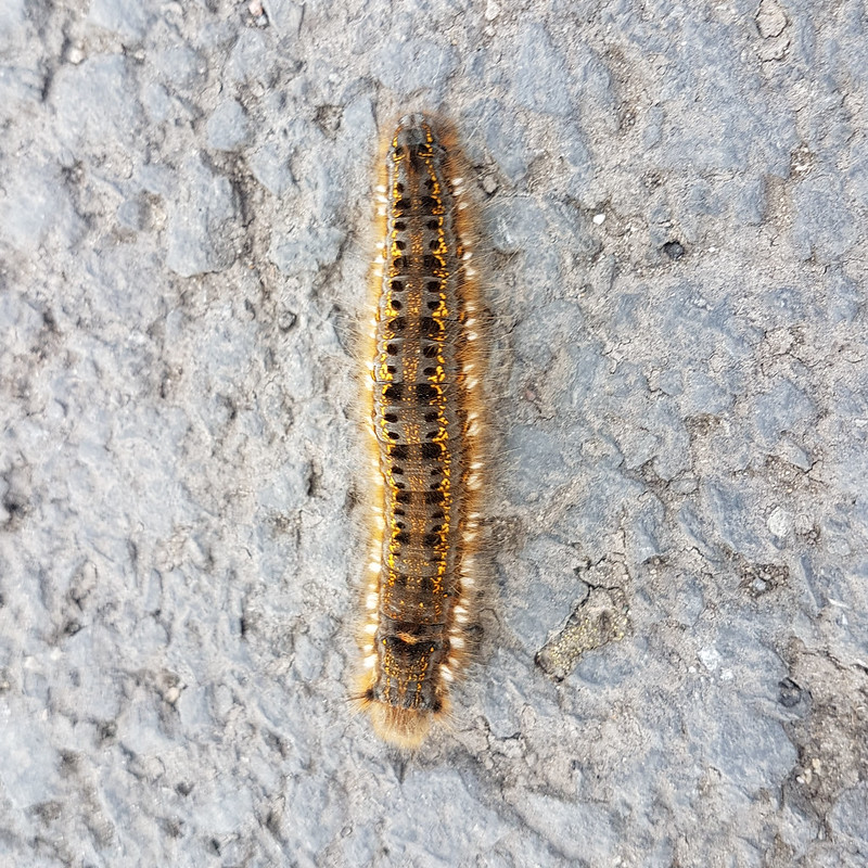
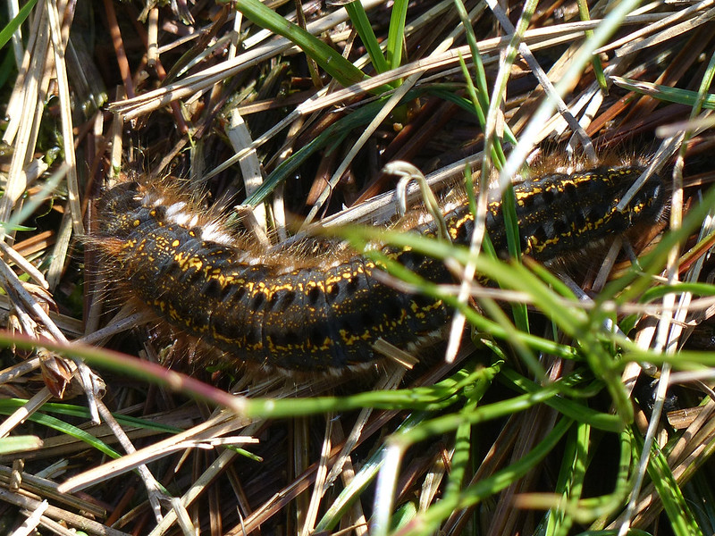
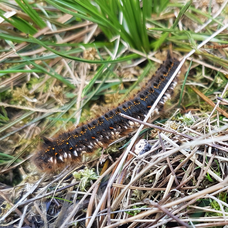
Drinker Moth Caterpillar.
When Leicester went one nil up, hopes of their potential survival were cruelly raised.
Road sign.
But sadly, the important numbers were: Bournemouth 0 – Everton 1. B****r!
Ingleborough again.
MapMyWalk gives 15 miles and just over 500m of ascent. Another very worthwhile outing.
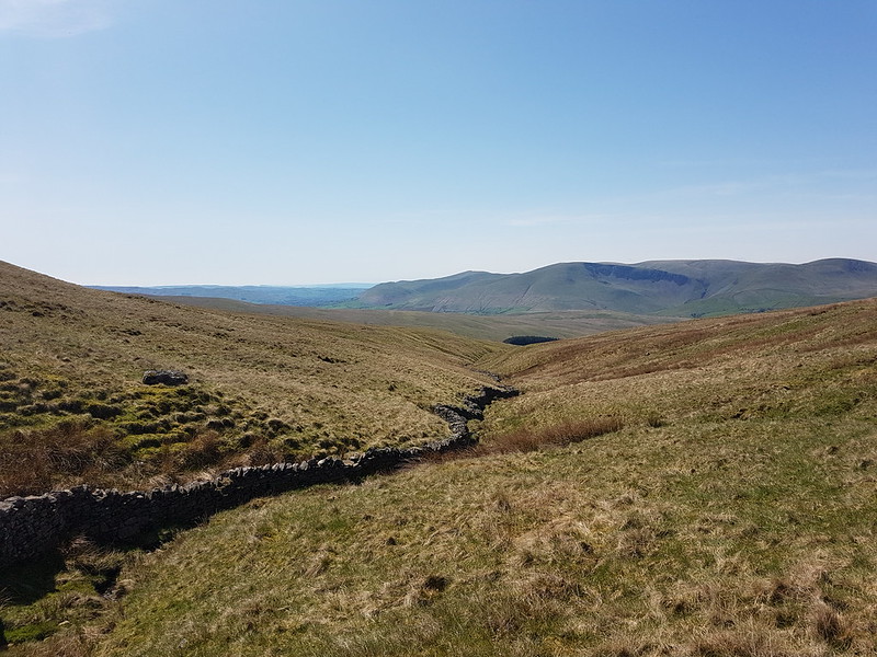
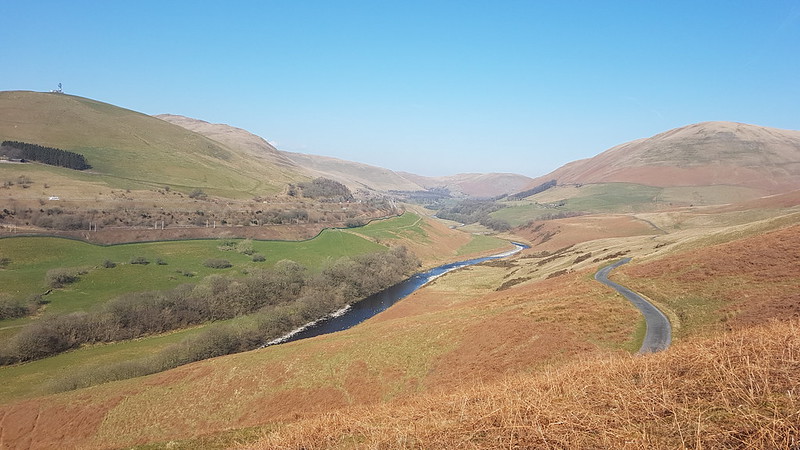
If you take an interest in the Lune and its many tributaries, then inevitably you will be drawn to the area around Sedbergh, where the rivers Lune, Rawthey, Clough, and Dee all meet in close proximity. I’ve been looking at the map and trying to work out routes which take advantage of that fact a great deal. The night before this walk, I had the ridiculous idea of following the Rawthey and the Lune from Sedbergh as far as Crook of Lune, crossing the Howgill Fells to Cautley and then returning to Sedbergh along the Rawthey. Even I realised that was overly ambitious, but I set off anyway, with a compromise plan which I knew would really be the route I would end up walking.
The playing fields of…Sedbergh School.
I parked not far from Sedbergh School, where, years ago, B played in a couple of sevens tournaments and I got to poke about and see how the other half live and wonder at all the wealth on display. From there, I wandered along a minor lane, past the cemetery, to the tiny Hamlet of Birks. I was very taken with Birks, where there are several very old, listed properties, of which these are two…
Birks.
Birks is by the Rawthey, and from here I was able to follow the river downstream towards its confluence with the Lune.
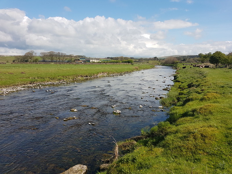
River Rawthey.River Rawthey.Birks Mill.Broom.
When I see bushes with yellow flowers in the spring, I always anticipate Gorse, so I was surprised to find that this little thicket was Broom.
Broom.
What my photo doesn’t really capture is that all around the Broom the bank was peppered with Bluebells and Stitchwort and the combination of yellow, blue and white looked magnificent.
Opposite where the Dee flowed into the Rawthey, I clambered down the steep bank to take a photo.
Confluence of the Dee and the Rawthey.River Rawthey.
A little downstream for there, the path crossed a disused railway line, with a tall embankment.
River Rawthey and a golf course.Derelict railway bridge over the Rawthey.
In these health and safety conscious times, there’s a tall and stout fence blocking any access to the bridge, although I did manage to clamber onto a parapet to get a view. Years ago, on a walking tour with my dad and a good friend of ours in Snowdonia, we followed a disused railway line and crossed a derelict viaduct much like this – it was exhilarating to say the least.
Brigflatts from the bridge.
I was hoping to visit the Quaker church at Brigflatts, but it seemed that there was no access from the riverbank path, so that will have to wait for another time.
Germander Speedwell.Path along the old railway line.
There’s no official path along the railway, but it looks like it’s being used regularly – something to store away for future walks.
The bridge from below.A mini ‘fence’ by the river.
I was really puzzled by this miniature ‘fence’ by the riverside. The only time I’ve encountered metal rods quite like this, we were using them as pegs to guy a small marquee we borrowed every year for the village Field Day.
Made of giant pegs?
Close by there was a small, clearly man-made plinth which I thought looked like the footings for a bridge. Does anyone have a theory what these might be and why they would be lined up ‘on parade’ by the river’s edge?
Winder in the Howgill Fells.
The path I was following, and the route I would take as far as Crook of Lune, is part of the Dales Way. Based on this section, I suspect it would be a great long distance route to follow.
Holme Knott.
I’ve climbed the Middleton Fells a number of times over the years, but not Holme Knott at the northern end of the ridge, and recently I’ve been eyeing it on the map and dreaming up routes which incorporate an ascent. It must surely have great views of the rivers and their confluences? This photo was taken as I stood by this little footbridge…
Little bridge over Haverah Beck.
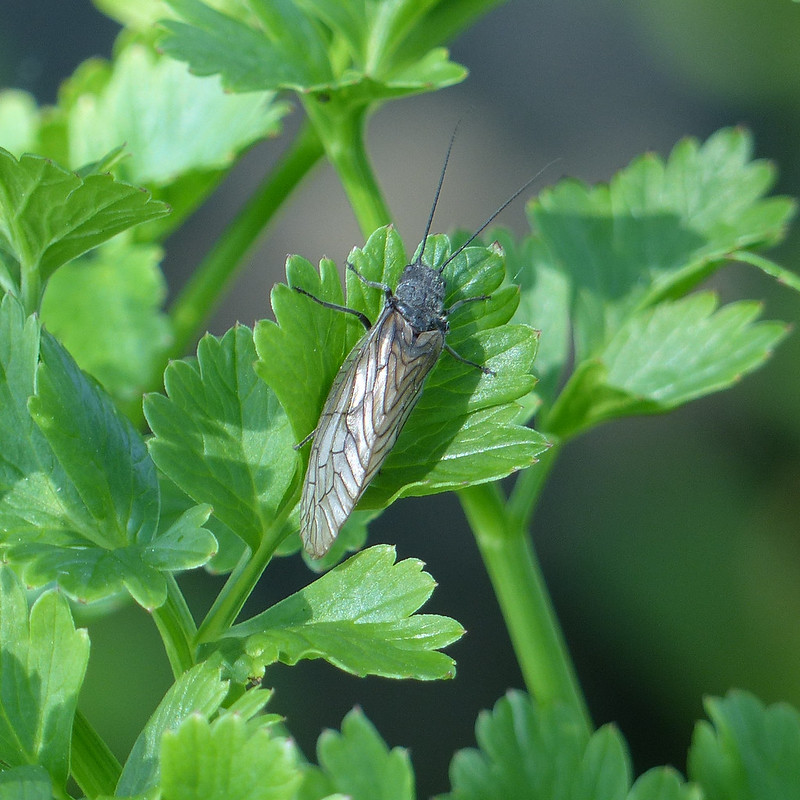
As I crossed the bridge, I noticed this Alder Fly…
Alder Fly.
This encounter sparked a lengthy hiatus in my walk, and in this post I suppose, as I realised that the lush vegetation in and by the stream, mostly Wild Celery, Mint and Brook Lime I think, was home to an abundance of creepy-crawlies. I took loads of photos, and here are a few of them. Well, quite a few. If you’re more interested in views than in small creatures, you might want to scroll down a bit.
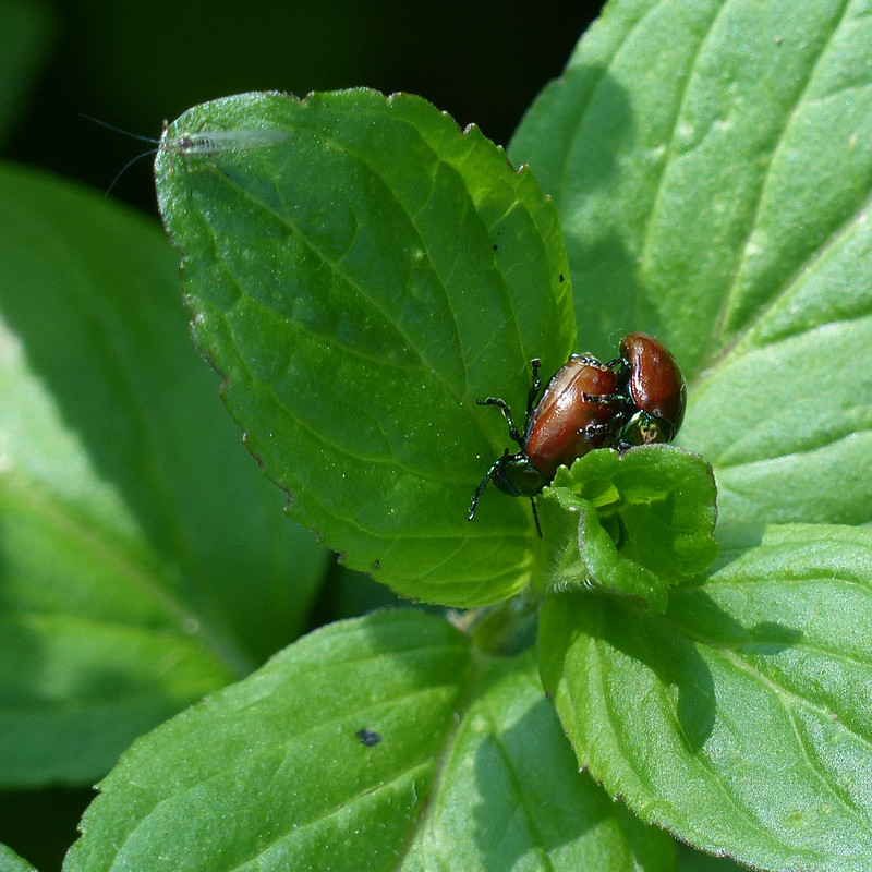
Chrysolina polita.
There were lots of these beetles, common and widespread apparently, which hasn’t prevented them being unknown to me. I’m a sucker for a beetle with a metallic sheen.
Chrysolina polita.Chrysolina Polita.Chrysolina politaA Wolf Spider, male.
Quite a few Wolf Spiders too, on the rocks at the edge of the stream.
Wolf Spider, female.
“The wolf spider is a medium-sized spider that hunts on the ground during the day; it chases down its prey and leaps on it, just like a wolf.”
Wolf Spiders – two female, one male. The female in the bottom right is carrying an egg sac.
“Wolf spider young disperse by using silk ‘parachutes’ to float away on the wind.”
There are quite a few UK species of Wolf Spider, but apparently an examination under a microscope is required to make a confident identification, and I’m happy with Wolf Spider anyway.
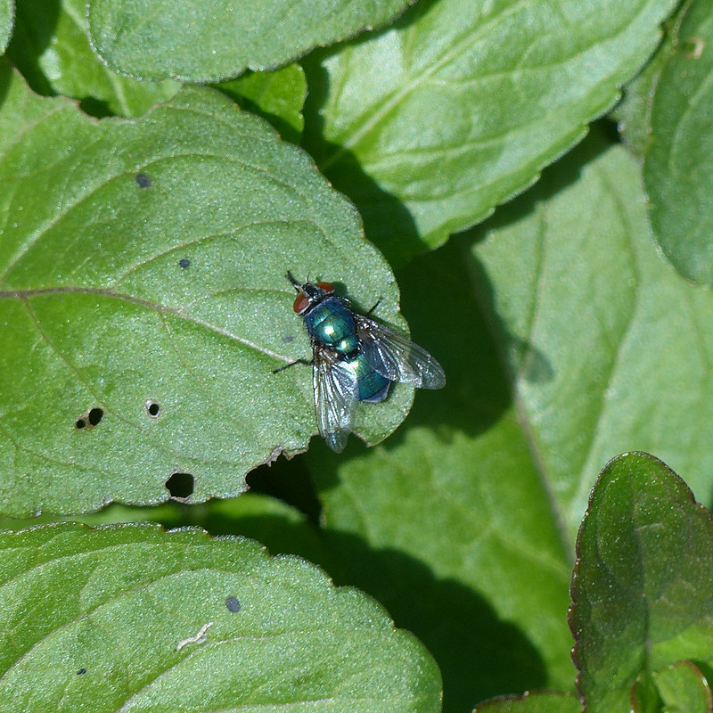
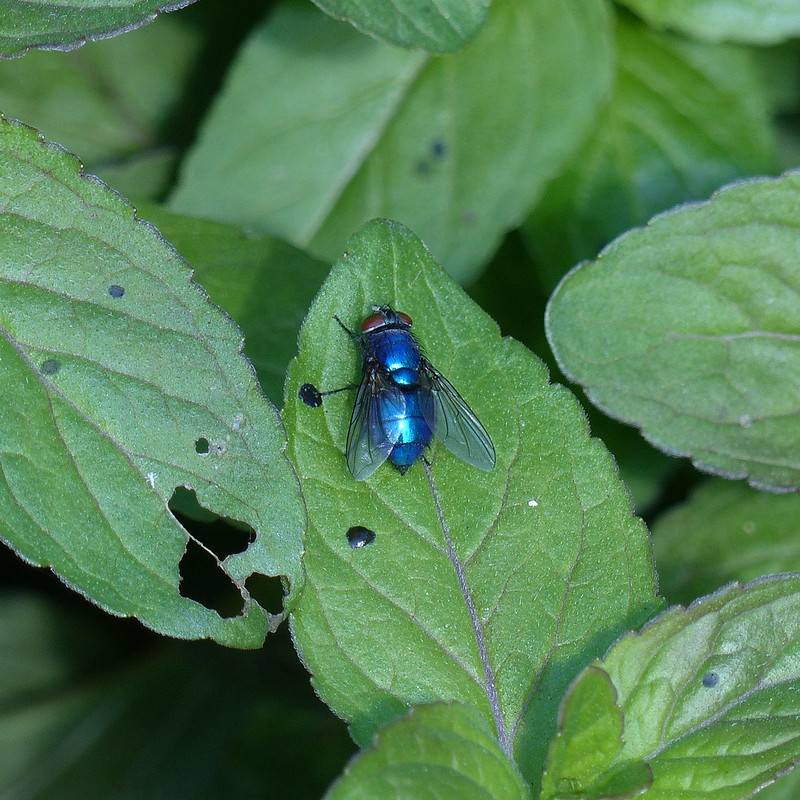
Fly – possibly Graphomyia Maculata, female.Fly – possibly Graphomyia Maculata, female.A Greenbottle, or something like it.
Not all shiny green flies are Greenbottles so this is a tentative identification.
Also a Greenbottle, or something like it. I think.
You might think a shiny blue fly would be a Bluebottle, but I don’t think this one is; according to my field guide, the abdomen of a Greenbottle “ranges from bright green to bluish green”, so I’m inclined to think that this is another Greenbottle, although, admittedly, this is more blue than green. Incidentally, could that be another reflected selfie just by the edge of the left wing of the fly?
Also a Greenbottle, or something like it. I think.
Then again, this one is blue and green, so what to make of that?
Pfeiffer’s Amber Snail – Oxyloma elegans
There were lots and lots of these tiny snails. At first, I wasn’t even sure that they were snails.
Pfeiffer’s Amber Snail.
Apparently, unlike other snails, they can’t completely withdraw into their shells.
A Drone Fly – Eristalis pertinax, female.
And there ends the sample of the many photos which I took during what was probably about a half an hour of snapping away. A very happy half-hour. What the group of four who walked past me thought of my intense absorption I suppose I shall never know.
The path to The Oaks.Wisteria.Bluebells.Arant Haw and Winder.Lincoln’s Inn Bridge.
Probably Seventeenth Century according to Historic England. Very elegant, I thought.
The Lune, looking downstream from near Lincoln’s Inn Bridge.Lune Viaduct.
The second of three viaducts on the walk, here’s the lowdown…
“The Lune Viaduct carried the railway 30 m (100 ft) above the river Lune on a 38 m (124 ft) cast iron arch. It was suspended between three red sandstone arches built on each side of it. The total length was 162 m (177 yds). Its beautiful setting has earned it a listing of Grade II*.
A little to the south a bridge consisting of an arch identical to that on the Lune Viaduct crosses the river Rawthey.
North, an 11 arch red sandstone viaduct set on a curve crossed the Dillicar Beck at Low Gill, shortly before the railway joined the main line. This too is a marvellous site in a splendid setting. Both of the latter two are listed Grade II.”
Restoration work was fairly recently carried out on the bridge; it’s a shame that the line wasn’t converted in the process into a footpath or cycleway as has been so successful elsewhere.
Ravens (I think) nesting on the viaduct.
From the viaduct, the Dales Way climbs a little above the river and passes through fields and past a number of picturesque farmhouses.
Another view of Arant Haw and Winder.Low Branthwaite.Howgill Fells pano – with bonus fells on the left.
It was lovely walking. Around here somewhere, I was overtaken by a father and (grown up) son who were walking the Way together. They were walking much faster than me (although I did bump into them again a little later), but slowed down to chat for a while. They were really enjoying their walk and did a very good job of selling the Dales Way.
The route rejoins the river just beyond Hole House…
Hole House.
At Hole House there seemed to be two houses connected by a little section of roof, which struck me as very neighbourly and practical.
River Lune.
Maybe not the best photo – a fence prevented getting closer – but here the river passed through a very narrow, rocky cleft, clearly flowing at great speed. Just upstream the river is much wider and far more placid looking…
River Lune.
I’ve been reading river guides, for kayakers, to the river and some of it is pretty sobering – we shan’t be venturing onto it in our open inflatable canoes any time soon.
Near where Chapel Beck flows into the Lune I met the four walkers who had passed me by Haverah Beck and who’d now found a very pleasant spot for their picnic lunch. I dutifully took photos of all the points where sidestreams entered the Lune, including Chapel Beck, and of the many footbridges which took me over those streams, but have decided not to include those not particularly exciting pictures in what may already be an overlong post!
Crook of Lune Wood.
The woods here were full of Bluebells, but, as usual, my attempts to capture the way the flowers seem to blush the woodland floor a deep blue failed miserably.
Bluebells and Stitchwort.Lowgill Viaduct – Grayrigg Forest behind.
Sadly, there’s isn’t a great view of Lowgill viaduct from down by the river – I guess I will have to come back. What a shame!
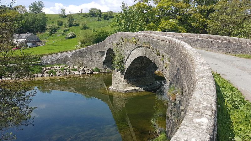
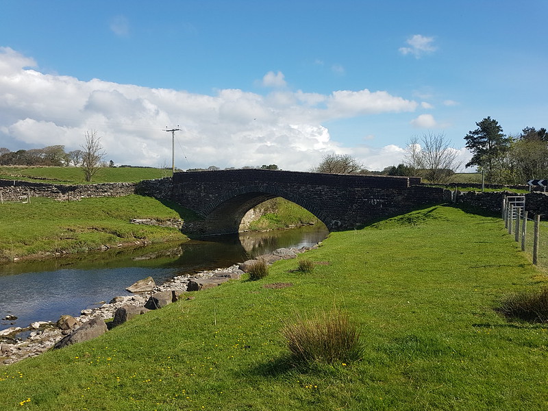
Crook of Lune Bridge.
“Believed to be C16 or earlier. Humped and unusually narrow. Forms part of ancient north-south route along Lunesdale, used in C17 and C18 by drovers. A very picturesque feature in this setting.”
TBH can attest to the description ‘unusually narrow’: she wasn’t best pleased about my navigation last year when she was driving us this way to meet our ‘camping friends’ for a walk.
…which is where I was headed on this occasion too.
I’ve been wondering why I have no photos from my hot sticky ascent out of the valley up towards Four Lane Ends, or of the clearly little used path through the farmyard at Riddings, or of the rather nice looking little campsite at Beck House, where the lady of the house escorted me through a small section of track by the house which was sardined with Sheep. I’m not sure whether it was a kindness or whether she was worried that I would let the Sheep escape, or perhaps a mixture of the two. Anyway, it occurs to me now that the reason that I didn’t take any photos until I’d climbed most of the way to the shoulder of Fell Head called Whin’s End is that my phone had been low on charge, so I’d plugged it into the portable charger Little S bought me and stuffed it into the top of my rucksack, where it wasn’t handy for quick snaps.
I retrieved it again when I halted for a rather belated brew stop.
Looking across the Lune Valley to Firbank Fell and Lambrigg Fell. Lowgill Viaduct on the right.
I climbed Lambrigg Fell once, many years ago, and remember bumping into and chatting to the farmer, who expressed his surprise to meet anyone else up there.
A pano from Whin’s End.
The path I took onto Whin’s End, seen in the photo above, is the same path which we used to contour round to Blakethwaite Bottom for a wild-camp one wet weekend six years ago. I was thinking I should come back some day and walk its entire length.
Grayrigg Pike and Tebay Gorge.Fell Head.Fox scat, I think.
I know, I’m sorry, but I’m increasingly struck by how many hill-paths are regularly marked with fox scat. I’m encouraged to think that there must be a very healthy population of foxes on our hills even though we rarely see them.
Northern Howgills and the Pennine skyline.Lune Valley, Bowland Fells and, in the distance, the Kent Estuary and Arnside Knott.Howgill Fells.Approaching The Calf and White Fell Head.
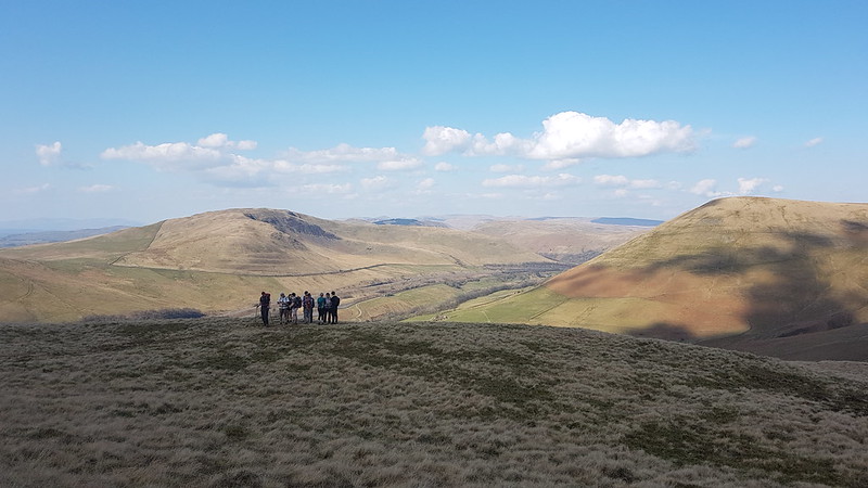
It was getting on a bit by now, but there were still a few other walkers on the Howgill tops.
The valley of the Rawthey, Garsdale and Dentdale. Ingleborough and Whernside in the centre.
Given my Lune obsession, I was really thrilled by this view of three valleys which carry major tributaries all converging.
Arant Haw.The light catching Bram Rigg Beck.Looking back to Calders.‘Three valleys’ pano.Sedbergh.
By the end of my walk, it was getting a little shady for photos. As I descended, I could hear a crowd cheering and some sort of open-air concert. I could hear the vocals very clearly and the drums up to a point, but no other instruments, some acoustic trick of the topography no doubt. The singer was doing an eclectic set of covers which began with ‘Teenage Kicks’. I don’t remember what the other songs were but I do recall being impressed by the choices, and it sounded like the crowd were appreciating it too.
Map 1
MapMyWalk gives a little over 16 miles and about 750m of ascent. Probably best I didn’t try to extend the route down to Cautley. However, how about a Tour de Howgills? Now then!
Another Lune catchment outing, which, once again, didn’t disappoint. I had splendid views of the Howgill Fells all day. I’d parked down by Rawthey Bridge and when I left the minor road which leaves the A road there, took another version of this view which was rather spoiled by the foreground of dessicated Mole corpses hanging from the barbed wire fence – a grisly traditional method for a mole-catcher to show the success of his labour.
The field path took me past a series of old farmhouses, heading up the valley of the Rawthey.
New House Farm.
What intrigued me about this farmhouse was the unusual tall building with the pyramidal roof, which is a coach house apparently, according to Historic England, added in 1914 to a building which is “probably early/mid C18”. I should have taken a photo back down the hill at Wraygreen, which is considerably older. Next time.
Approaching Needle House.
I’ve included this photo because it shows the trees beyond the house, clearly planted, looking almost like an arboretum, of which more in a moment.
Needle House.
I was surprised to find that the very striking Needle House is not listed. I did find a fascinating history of the Frankland family, who lived here and modified the house, written by Dr Helga Frankland, whose father seems to have been taken with all things Scandinavian (so hence Helga?).
Barn by Needle House.
“Unusual features created by my father include the belfry on the gable end of West Laithe in the yard at Needlehouse. It is based on belfries seen on farms in Scandinavia. We used the bell to summon people to the house from the fields.”
Laithe is a northern word for Barn, apparently.
Bridge over Needlehouse Gill.Needlehouse Gill.
“My father planted all the woods on our land, except for the much older Uldale Wood and the natural woodland in the gills. Scandinavia held a strong fascination for my great grandfather, grandfather and my father. By skillful placing of relatively small, largely coniferous woods, my father managed to create a landscape that looks more wooded than it actually is and therefore, has echoes of Scandinavia.”
In the woods beyond the gill, I was delighted to spot four or five Red Squirrels, or, very possibly, the same Red Squirrel four or five times. I have one very blurred photo to remind me, but if I hadn’t taken it myself, I don’t think I would know that it was of a squirrel. Much of the walk to this point had been accompanied by the sound of Cuckoos, but, as usual, I didn’t see them at all.
Needlehouse Gill again.
I watched a largish bird of prey fly up and along the gill. I don’t know what type sadly.
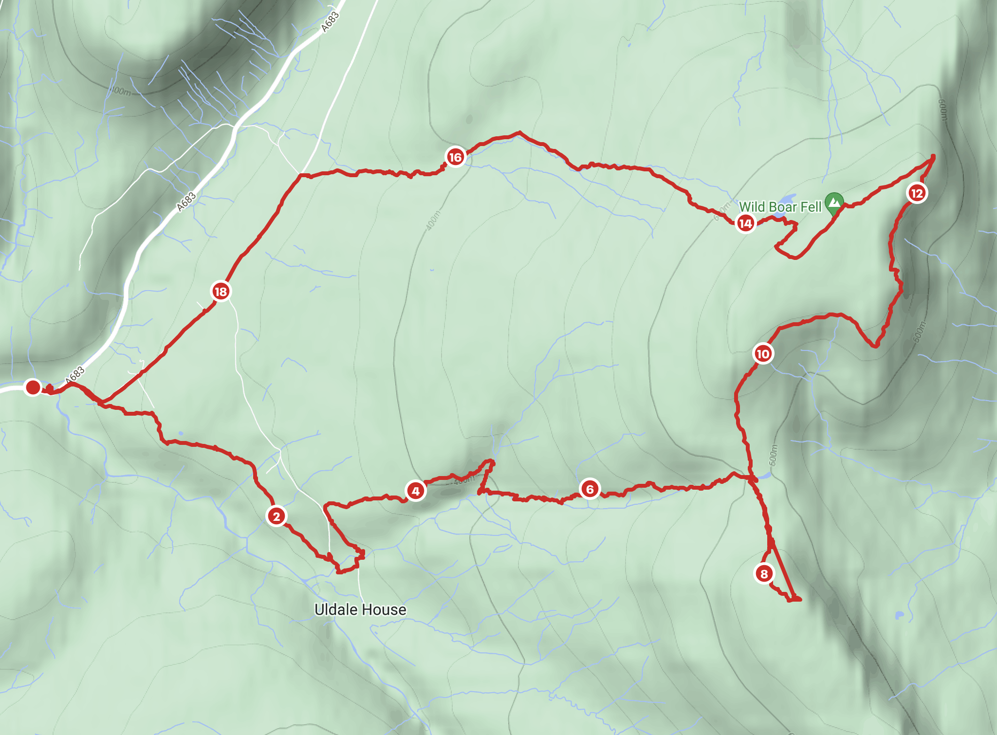
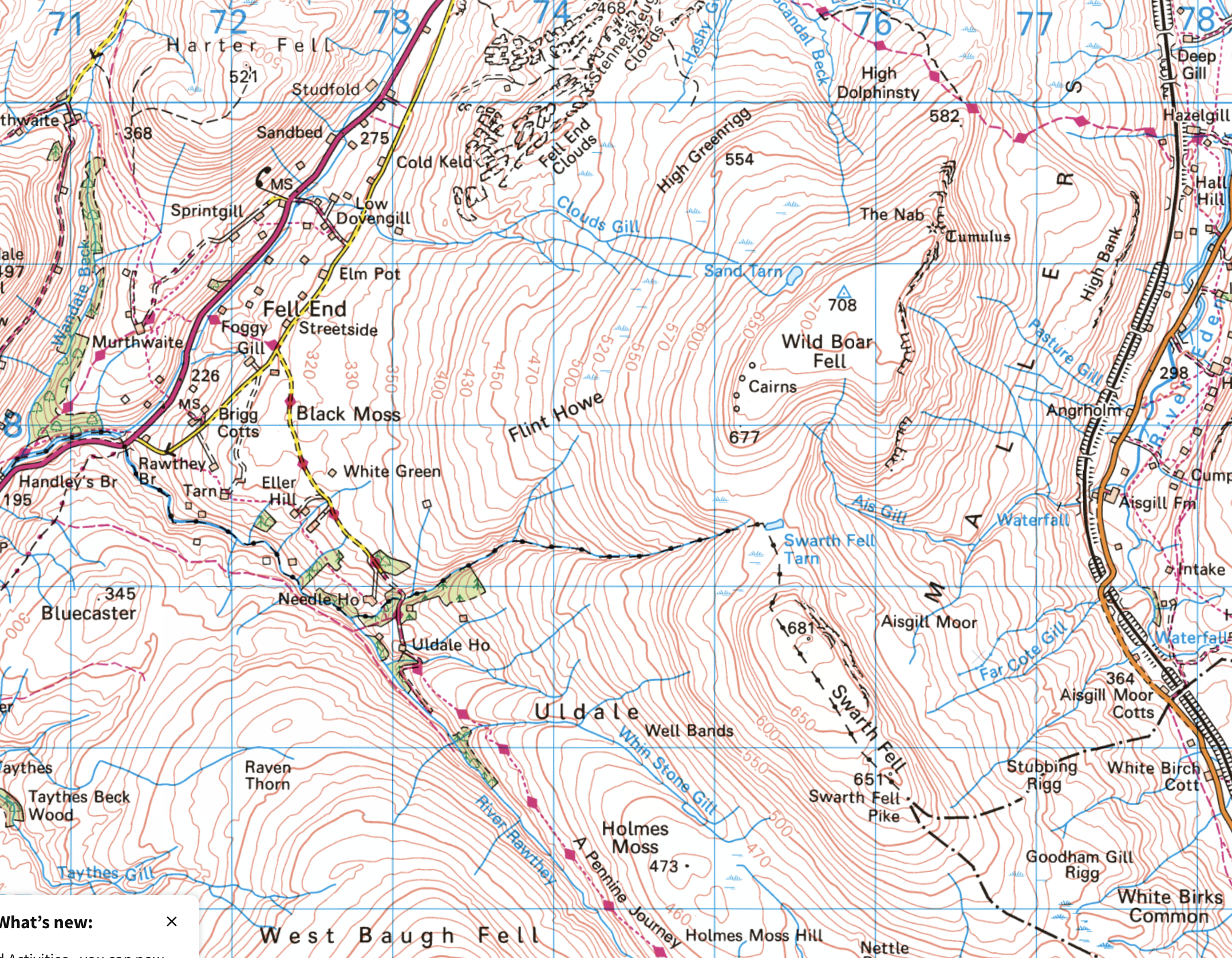
Part of the reason for choosing this route was the fact that I haven’t climbed Wild Boar Fell for far too long. It used to be a bit of a favourite. I always used the same route: up the Rawthey, over Holmes Moss Fell, which was invariably very wet, then onto Swarth Fell, Wild Boar Fell and down via Fell End Clouds. This time I intended to ring the changes and explore some more Lune feeders. My original plan had been to hop over the fence here, onto access land, and follow the gill upstream, but the going looked like it might be difficult, due to the steep banks and fallen trees, so instead I almost doubled back on the track and then took to the open fell-side.
Looking back towards the Howgills.
It wasn’t half as wet underfoot as it might have been I suspect.
Drinker Moth Caterpillar.
I found a hint of a path, which took me down into Grain Gill, and then followed the gill down into Needlehouse Gill which at some point becomes Uldale Gill.
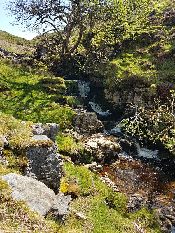
Waterfall.
I took lots of photos of small falls and cascades, but this was the best, so can stand in for them all.
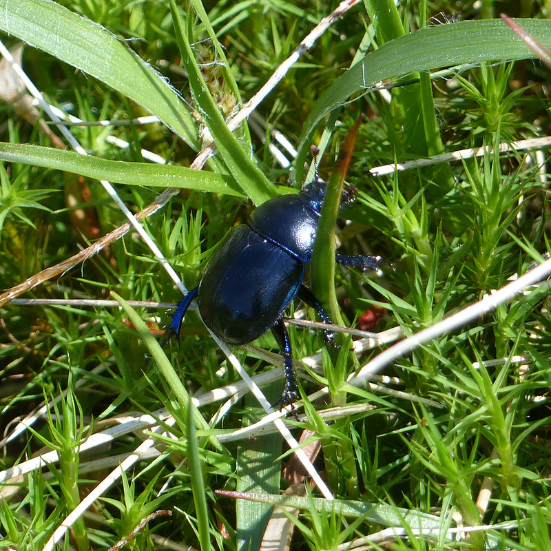
Dor Beetle.
I watched this Dor Beetle as it wandered around in the rough vegetation, laboriously and seemingly with quite a lot of effort, going back and forth over the same ground for reasons I couldn’t fathom.
Looking back down the gill to Cautley Crag.
On the left of this photo you can see a small sliver of white, which is where water was spouting from a hole in the crags and pouring under the wall into the stream. The boulders in the foreground are, I assumed, the dry bed of a tributary stream where a spring would emerge in wet weather.
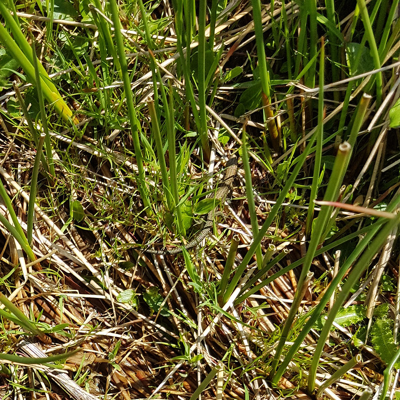
In the absence of a path, following the stream turned out to be quite heavy going, so I decided that it would be a good idea to climb up to the left, above the northern bank of the gill. I was wrong. That bright idea brought me into very boggy ground with tall reeds. The only upside was that I saw a number of Common Lizards…
Common Lizard.
…which were all too fast for me to get any decent photos.
Fortunately, when I climbed high enough, the going got much easier.
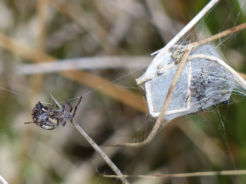
Looking back to the Howgill Fells.Larinioides cornutus.
I’m reliably informed that this spider, on an impressive web stretching between sedge stems, is Larinioides cornutus, the Furrow Orbweaver. They like damp places, which fits. This must be a female, which makes a silken cocoon and then produces pheromones to attract a mate. At the time, I thought the cocoon might be full of babies, but with hindsight, it looks more like a larder.
Furrow Orbweaver.
The ‘furrow’ in her name refers to the pattern on her back, which sadly she never deigned to reveal to me.
Furrow Orbweaver.
She was intent on running repairs of her web.
Furrow Orbweaver.Furrow Orbweaver.
But then I must have upset her in some way and she disappeared into her lair. I’m well aware that not everyone likes arachnids, but as you can probably tell, I was entranced.
Looking back from near the top of the gill.Swarth Fell Tarn.Cairn on Swarth Fell.Wild Boar Fell from Swarth Fell.Looking south from Swarth Fell. That’s Whernside and Ingleborough peeking out from behind Baugh Fell.
I found a very comfortable spot amongst the boulders on Swarth Fell, made a brew and then had a little nap in the sun whilst it cooled down. You can’t beat a bit of a snooze during a hill walk if you ask me.
On the way back down to the col, I followed the steep eastern edge…
The eastern edge of Swarth Fell.
The rivers both Eden and Ure rise down there somewhere. The first is heading for Carlisle, the Solway Firth and hence the Irish Sea, whilst the other, via the Ouse and the Humber, heads through York to the North Sea.
Looking back to Swarth Fell.The Band.
This path, around The Band to High White Scar, is not marked on the OS map, but it is an absolute delight. As I walked along it, I watched a Buzzard gliding out across Aisgill Head.
Ais Gill and Swarth Fell.High White Scar. Mallerstang Edges beyond.Along the edge.A proliferation of cairns.
Wild Boar Fell has a large summit plateau and two tops, both with a spot height of 708m.
Cairns!Yoadcomb Scar.Yoadcomb Scar pano.Looking back to Yoadcomb Scar.The Nab, Eden Valley, Northern Pennines.The Nab pano.Trig pillar.
Here’s ‘the other’ top. Not quite as exciting as the one to the east, to be honest.
Sand Tarn.Forcepot Sike.
Forcepot Sike apparently drains Sand Tarn, although there wasn’t an obvious or easy to spot outflow. The hills opposite are Harter Fell (there’s a few of those about!) and Green Bell. I don’t think I’ve ever climbed the former, and it must be about thirty years since I climbed the latter – and since the source of the Lune is said to be on its slopes, it’s high on my to do list. Of course, we know that the Lune, like any river, has countless sources, but we’ll let that lie.
Clouds Gill.
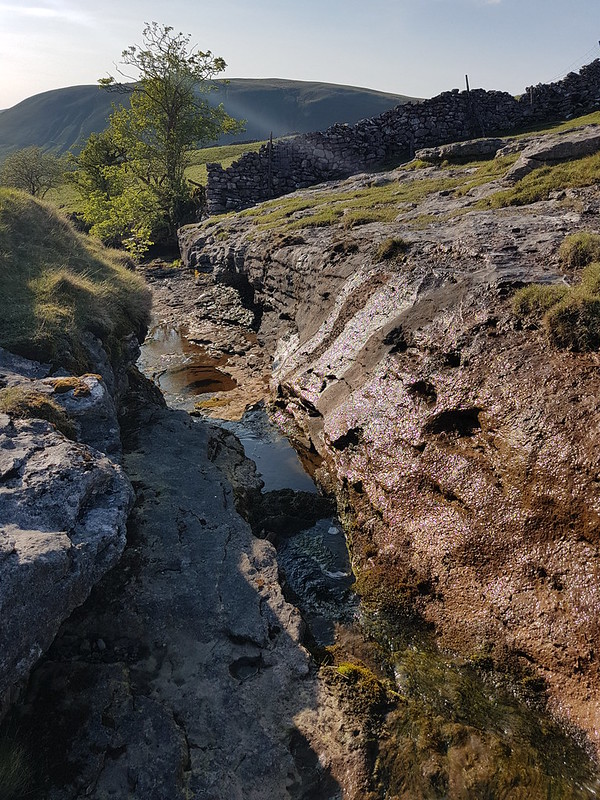
This was pathless going, but much easier than that had been by Uldale Gill. The stream gradually grew as it absorbed lots of other rivulets, at some point becoming Clouds Gill. I’ve come down these slopes a few times before, but always heading for Fell End Clouds, never sticking with the gill. As the terrain changed to limestone country, that brought unexpected bonuses. The stream began to appear and disappear underground.
Clouds Gill.
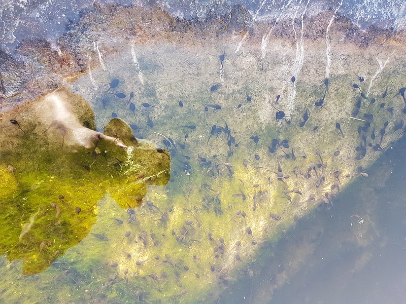
In some spots I could see the water flowing through a narrow channel to the left and below the exposed rocky riverbed. In other places the river had eroded large deep pots which were full of stagnant water. And also full of tadpoles.
Tadpoles.
Many moons ago, I used to walk to school with friends. Our route took us across fields and via a small footbridge over Johnny’s Brook. Armed with coffee jars or buckets, we would collect frogspawn, tadpoles, frogs, sticklebacks and other unfortunate denizens of the brook and take our finds to school. There was an aquarium tank in one of our classrooms, I remember. Whether the aquarium was a result of our enthusiasm or its cause, I don’t recall. I do know that I’ve never seen tadpoles in this profusion before, pool after pool, deep or shallow, were full of them. But then suddenly – no more.
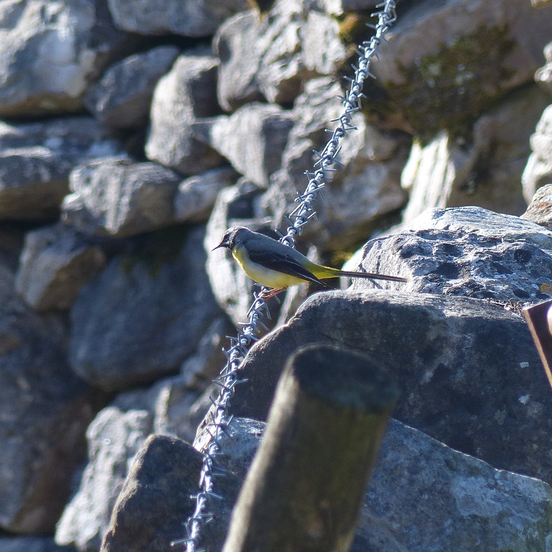
Grey Wagtail.Mayfly?
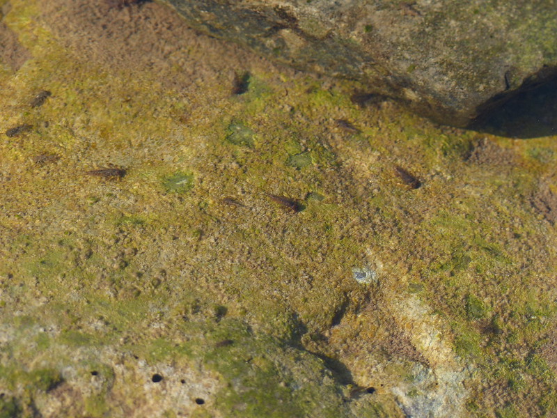
I’m assuming that this is a Mayfly, although my field guide describes them as ‘flimsy’ whereas this looked quite sturdy to me. Apparently, there are 47 different species in the UK. The winged stage of their lives lasts for just a couple of hours or up to a couple of days, depending on the species. The nymphs, living in the water, often live for a year or even two, although, again, that depends of the species.
Mayfly nymphs? About to emerge?
Limestone, of course, erodes in interesting ways. Here the stream had created a narrow gorge and a huge rock overhang.
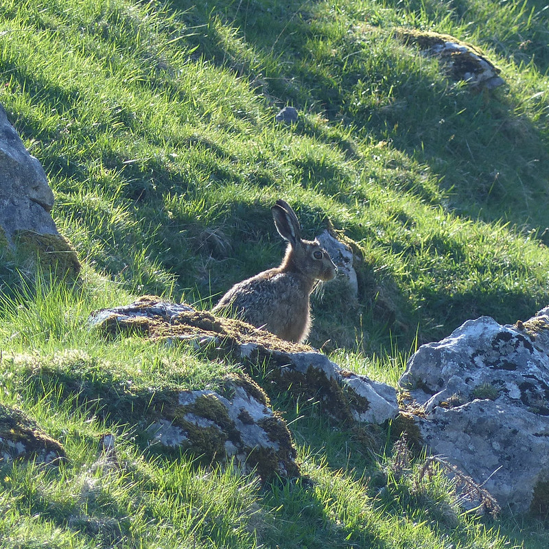
From above.From below.Hare.
I’ve begun to think that certain creatures are emblematic of the landscapes of the Lune, particularly Curlews and Hares. Maybe Grey Wagtails as well.
Cloud Gill and Harter Fell.A roofless barn.Fell End Clouds.
I had planned to cross the valley and have a wander through the woods of Murthwaite Park, but it was getting late, so I just wandered along the minor road back to the car.
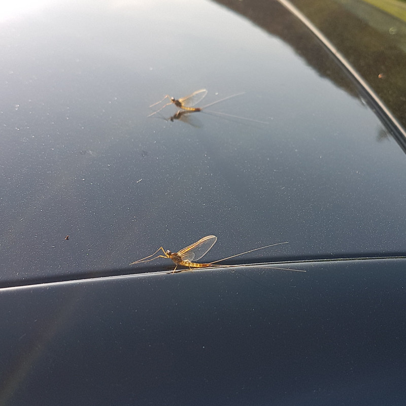
Another view of Fell End Clouds.Valerian, host to tiny flies. St. Marks flies or something similar?
When I got back to the car it was covered with Mayflies. These did look flimsy.
Mayflies.
There had been lots of cars parked along the road near the Cross Keys, presumably for the walk up to Cautley Spout and beyond, which is a very fine walk and another which is high on my ‘to do’ list. But I’d met a couple on Swarth Fell, another couple at the Nab and two blokes and their dog by the trig pillar on Wild Boar Fell, and that was it. On a sunny Saturday in May. I can’t think why Wild Boar Fell is not much more popular, but I’m not complaining!
A little over 11 miles, but largely pathless so harder work than that might sound.
In my own haphazard, arbitrary fashion, I’ve been seeking out the tributaries, and catchment hills of the River Lune since an exchange in the comments section of this blog back in 2017.
“That’s a pretty full set of experiences for an evening walk. Flowers, birds, deer, caves, gorges, rivers.”
“I may continue this theme of exploring tributaries of the Lune – a walk which starts low in the Lune valley and then climbs up into the hills gives a tremendous variety of scenery, flora, fauna etc.”
“I think your suggested tributary project is a good idea.”
Isn’t it amazing how far a little encouragement can take you!
Tebay Bridge.
Having rather neglected the Lune, and it’s legion of sources, in my rush to tick-off Wainwrights by the dozen last year, I’ve been itching to get back to a little exploration. With a dodgy forecast which suggested that the higher hills, and the western Lakes in particular, would be best avoided, I drove up to Tebay in first drizzle and eventually heavy rain and dense cloud. Only as I emerged from Tebay gorge did the cloud suddenly clear, revealing huge swathes of unexpected blue sky.
The Lune from Tebay Bridge.
This is a route I’ve been wanting to walk for a while, because it crosses almost entirely virgin territory for me, but it’s a good job I didn’t leave it for an evening walk, as I have most of my previous Lune Catchment walks, since it turned out to be a fairly long wander. When I plan routes I have a tendency to be fairly ambitious regarding how much I can pack in, and also to not bother checking the length of the route before I embark.
Peacock Butterfly.
I saw quite a lot of butterflies during the early part of the walk, particularly Peacocks.
Birk Beck
I’ve always liked walks which follow rivers or streams and this route along Birk Beck was no exception.
Looking towards the Howgills and Tebay Gorge.
Although I was enjoying glorious sunshine, the nearby Howgills remained draped in cloud for most of the morning.
Under the M6 motorway.
This was a walk with a wide assortment of bridges. I’m a sucker for a bridge, even modern concrete ones, so that was another bonus.
Birk Beck.An uninspiring view of…Tebay Services.
Back in the days when I first met the people who are still my most frequent companions in the hills, when we travelled up to Scotland every New Year and every Easter and occasionally at other times of the year too, we habitually stopped at Tebay West services. It was a bit of a ritual, never to be missed. So I was pleased to be able to send them this view of the services, admittedly rather hidden in the trees. Not one of them recognised them; they must be getting old!
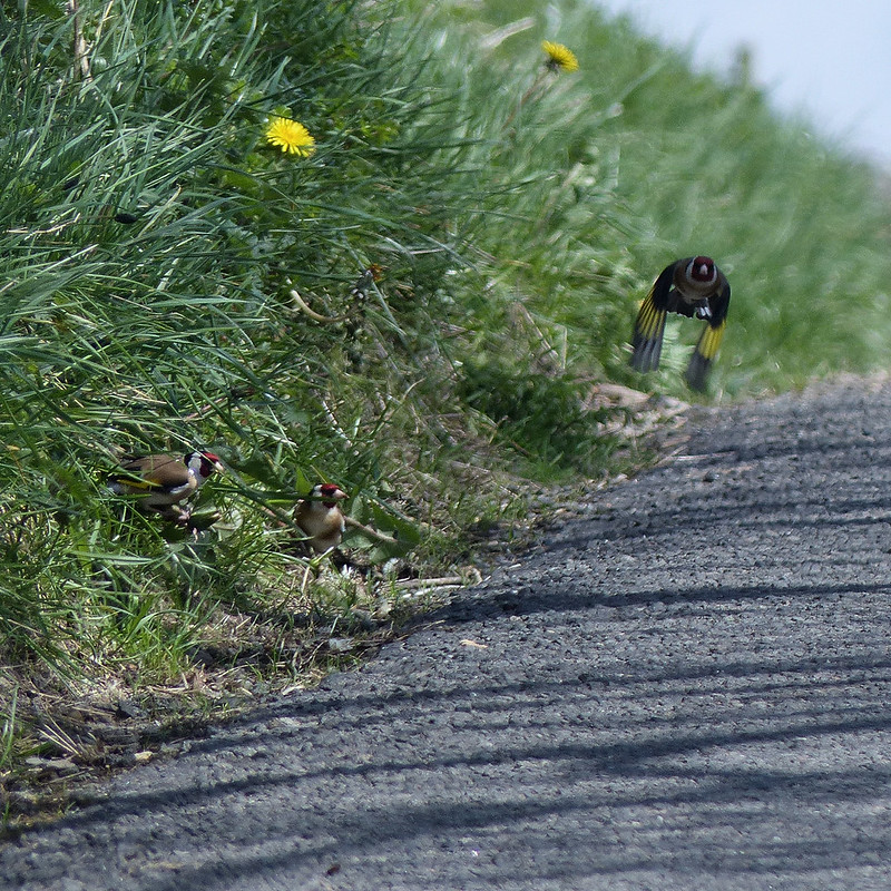
Birkbeck Viaduct.Birk Beck.Goldfinches.
Climbing up the little minor road towards the services, from the hamlet of Greenholme, I passed a tree occupied by a charm of Goldfinches and managed to snatch a photo of a few which were pecking at Dandelion flowers on the verge. All along the beck I could hear and occasionally glimpse small birds, tits and finches, but, with the trees now in leaf, it wasn’t generally possible to get photos.
Sealed gate.
Leaving the road, on a path which would take me back down to Birk Beck, I encountered this gate which had been wired shut. It was the first of several such obstacles I came across and I really should have contacted the local footpaths officer. There was no other recourse but to clamber over the gate, which as you can see was a bit decrepit, but fortunately it didn’t collapse from under me.
Across the beck to another minor lane.Looking back to Scout Green.
I’m not sure why I didn’t take any photos whilst I was passing through Scout Green, I remember it as a charming spot.
Green Brow.
From this point the path was crossing much rougher grassland, often quite wet. Now there were Curlews, Lapwings and Ravens to be seen and heard. The path climbed a little above the beck.
Birk Beck.
One of the things I had been particularly looking forward to was the waterfall Docker Force.
Docker Force.
Since there’s a good photo of it on Geograph, I’d assumed that it would be easy to access. Not a bit of it. It’s well below the path and can be heard from there, but not seen. Once again, I clambered over a gate, but this time because I was trespassing, and then I made my way down through some extremely squelchy woodland. At the bottom, there’s a small cliff and I couldn’t see an obvious way down, so I made do with this sideways on view.
West Coast Mainline and Crosby Ravensworth Fell.
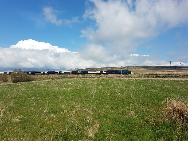
Once again, I feel the need to disclaim any impression I might be making of train-spotterish tendencies; it’s just that somehow I’m compelled to take a photo whenever a train passes. Do you think I might be in denial?
Shap Wells Hotel.Clapper Bridge over Trundle Beck.Queen’s Monument.
At the back of the Shap Wells Hotel, up a little rise, is this monument.
Celebrating Queen Victoria’s coronation.
Which seemed quite appropriate since this was the day that ol’ Big Ears got crowned. Visiting this monument was as close as I came to joining in the celebrations.
It seems like a very out-of-the-way spot for a monument. Come to that, it’s a bit remote for an enormous hotel too.
Shap Wells Hotel.
Aside for a trio of bird-watchers in the grounds, the hotel seemed to be deserted. In fact, I hardly saw anyone all day – another advantage of these Lune tributary wanderings, there’s plenty of solitude on offer.
Wasdale Beck.
Having visited it’s more famous namesake in the Western Lakes so many times over the years, it was nice to finally get acquainted with the less well-known Wasdale.
Green Hairstreak Butterfly.Common Lizard.
I’ve seen quite a few Common Lizards this year on my walks, but they’ve almost always been too quick for me to catch in a picture. I would hazard a guess that this was the largest of all the ones I’ve encountered this year.
Conifers.
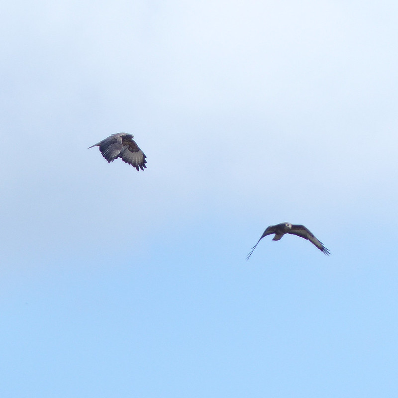
The path climbs a little above the beck, along the boundary of a conifer plantation which looks to have been clear-felled and replanted. There was a very cool breeze blowing and I’d been on the lookout for a sheltered spot in which to stop for a brew. I found a place, down by the fence, between a large tree-stump and a small grassy bank, which I thought might be as good as I would find. As I was fiddling with my stove, a large (i.e. female) Buzzard swept down along the course of the stream, flying unusually low for a Buzzard, so that I had a marvellous view from above. I have to confess, however, that I was relieved when she swerved away from me and across the slope opposite. This spring and summer, we’ve had gulls nesting at work and they have been extremely protective of their nest: to venture into the car park has meant risking several swooping attacks. I don’t think anyone has actually been clawed at any point, but I think lots of us have had our hair ruffled a few times. I never managed to be as composed as one or two of my colleagues who strode confidently across the tarmac unflinching under the barrage, but, on the other hand, I didn’t take to cowering under a brolly either. Past experience tells me that Buzzards are equally concerned parents; I’ve been ‘warned off’ a few times. When the female was joined by a tiercel, even though they initially settled on a distant dry-stone wall, I began to pack-up the stove and prepared to make myself scarce. In fact, they didn’t actually come too close, but I knew I wouldn’t have a restful cuppa whilst they were circling, so I moved on.
A pair of buzzards.Broken stile.
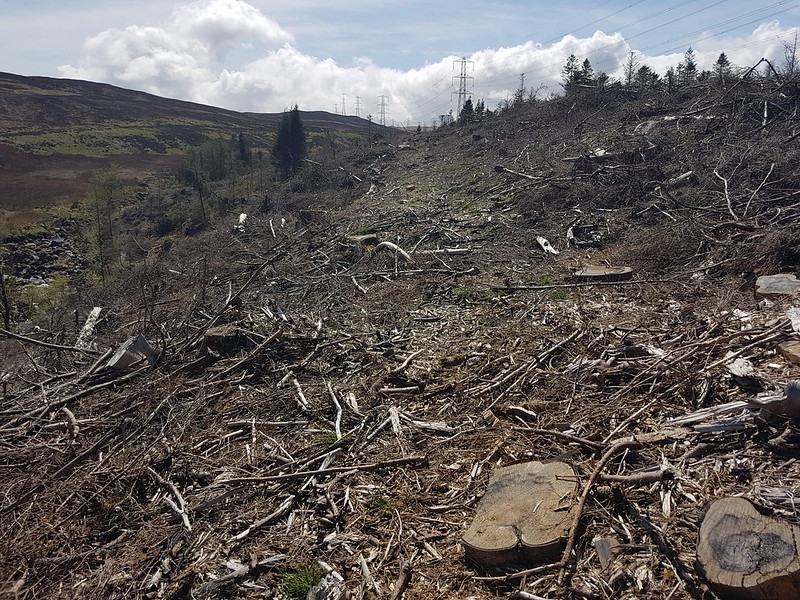
A little further-up I encountered more footpath obstructions, firstly a collapsed stile, which wasn’t too much of a problem, but then felled trees which made life very difficult. Much of the brashing had not been removed, leaving the track covered in heaps of broken branches and twigs, and clearly heavy machinery had been used so that the track was deeply rutted and pocked. It was really quite unpleasant.
Felled conifers.
Fortunately, it didn’t last too long.
Wasdale Beck.Wasdale Old Bridge.
At Wasdale Old Bridge, I finally did stop for a cup of tea and watched a pair of Dippers flitting in and out from the underside of the bridge, where I assume they had a nest. I managed to scotch any possibility of another brew-stop by clumsily tipping my unused tea leaves into the stream.
Packhorse Hill, Yarlside, Shap Pink Quarry.
The next section of the route was all on a broad gravel track. Not the most attractive path, but at least easy going. I thought Packhorse Hill looked worthy of a look at some point. Likewise the hills around the upper reaches of Wasdale and Crookdale.
Looking back towards the Pennines.Unusual sign?
Along the track, the vegetation on the left was dominated by heather, whereas to the right it was all grasses. I can only assume that the stark contrast is due to a different grazing regime.
The path over into Bethersdale.The hills around Crookdale.Crookdale Crag.Stone Chat, male.Stone Chat, female.
There were Stone Chats all along the wall here. Curlews were circling and calling too, but much harder to catch on camera.
Crookdale Crag.
Crookdale Crag has been added to my ‘to visit’ list too. Along with the Birkbeck Fells. An ever expanding list!
Looking towards Bretherdale.
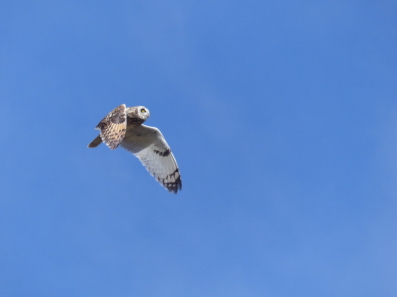
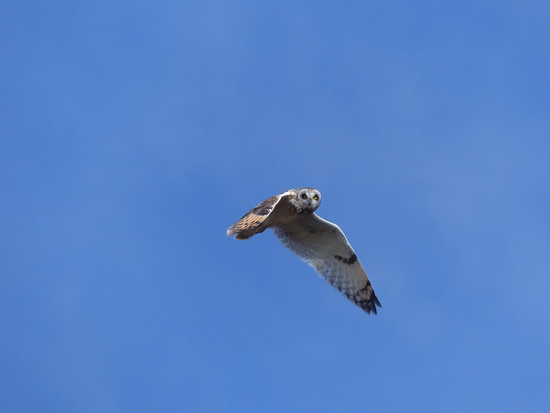
The path, which had started well, seemed to peter out, or at least, I lost it for a while. It was rough and fairly boggy ground. Bizarrely, I was just thinking that it was perfect territory for Short-eared Owls – one of my few previous sightings was above nearby Wet Sleddale – when one came sweeping low down the hillside from behind me. I scrambled for my camera whilst trying to keep an eye on the owl. It hunted, nearby, apparently not much bothered by my presence. It’s behaviour reminded me of Kestrels: hovering quite low and then plunging into the grass. Not surprising I suppose since both hunt voles. Landing some distance away it scanned the surroundings – I have photos of it looking straight at me, but also with its head turned to the extreme left and right.
Short-eared Owl.
Fortunately, it eventually flew back towards me to hunt again, before finally leaving. Of the many photos I was able to take, these two are by far and away the best. A beautiful bird and a magical experience.
Short-eared Owl.
I suppose after that I was predisposed to fall in love with Bretherdale, which I duly did.
Thorny Bank and Bretherdale.
Thorny Bank is yet another hill I shall have to climb at some point.
The Drinker Moth caterpillar.The Drinker Moth caterpillar.Broken egg shell and tiny spider?Thorny Bank and Bretherdale again.Far Crag.
There was a sketchy path here, but it was very wet underfoot and once again I was very glad to have M’s boots.
Parrocks.
I’ve decided to buy Parrocks and do it up. When my long lost wealthy relative leaves me a surprise legacy of millions, obviously.
Rusted latch.
This latch was rusted shut and since the fence was topped with barbed-wire, there was no other option than to climb the broken gate, which felt decidedly like it might give way under the strain.
Simple bridge over Bretherdale Beck at Greenhead. More ruined farm buildings.Bretherdale Head.
I think that there was a for-sale sign at Bretherdale Head and the gate was locked and festooned with barbed wire. I had been thinking that the land here was being managed for conservation, but now began to wonder if it had just been too uneconomic to farm and was abandoned. Later, I did see a chap on a quad bike, at Midwath Stead, who I assume was a farmer, so some of the area is being worked, but I didn’t see many sheep on the hills.
Breasthigh Beck.
Breasthigh Beck is yet another feeder of the Lune and since Breasthigh Road follows it upstream and then over into ‘the other’ Borrowdale, this is somewhere else I shall have to come back to.
Maybe that road sign wasn’t unique after all!Midwath Stead.Primroses – the road verge was full of them.Bretherdale Hall.Stepping stones in Bretherdale Beck and more ruins!Confluence of Bretherdale Beck and Birk Beck.
It was rather late in the day, otherwise this looked like a good spot for a dip. I shall bear it in mind!
At the end of my walk I was following Birk Beck again, but on the south bank this time. A Hare sprang up from where it had been hidden in the grass and raced away from me. Seemingly by coincidence, a Buzzard soared in from another direction, but their paths converged and for a few seconds the raptor flew just above the Hare. I couldn’t decide whether the Buzzard actually hoped to catch the Hare, but it seemed like an uneven contest – the Hare was so fast and soon away and safe. Shortly afterwards, I stopped to check my position on the OS app, put my phone back in my pocket and then realised that there was another Hare right by my foot. It seemed to be trying to press itself down into the sward and with its eyes, either side of its head, was able to look straight up at me without lifting it’s head at all. We stared at each other briefly, then I reached for my phone again, the spell was apparently broken and the Hare, well….hared off at great speed, much too quick for me to get even a rubbish photo.
M6 bridge over the Lune.M6 bridge over the Lune.
Although the OS map shows the footbridge, it also says ‘Ford’ by the path, so I was very pleased to discover that the bridge was for public use and I wouldn’t have to finish my walk by immersing myself in the Lune.
Footbridge over the Lune.
MapMyWalk gives 16 miles and 400m of ascent. A very full day in many ways.
I have several more Lune Catchment posts to come and can’t pass up this opportunity to share again the marvellous online book ‘Landsof The Lune‘ by John Self, which if you have interest in the area is a must read.
The route – should you wish to trace it on the map and/or on the ground: park at Old Tebay, follow the Lune north-east, cross the Lune, through Bybeck, under the motorway, left on the track to Birk Beck, follow Birk Beck to Bridge End, right on the lane, path off to the left, cross Birk Beck and take the minor lane to Scout Green, paths by Birk Beck to Shap Wells Hotel, path up Wasdale and keep that direction to cross the A6, turn left to recross the A6 over Bretherdale Bank and down Bretherdale, minor road to Bretherdale Hall, turn left and cross the beck, turn right at the meeting of paths, then along Birk Beck and the Lune to Tebay.
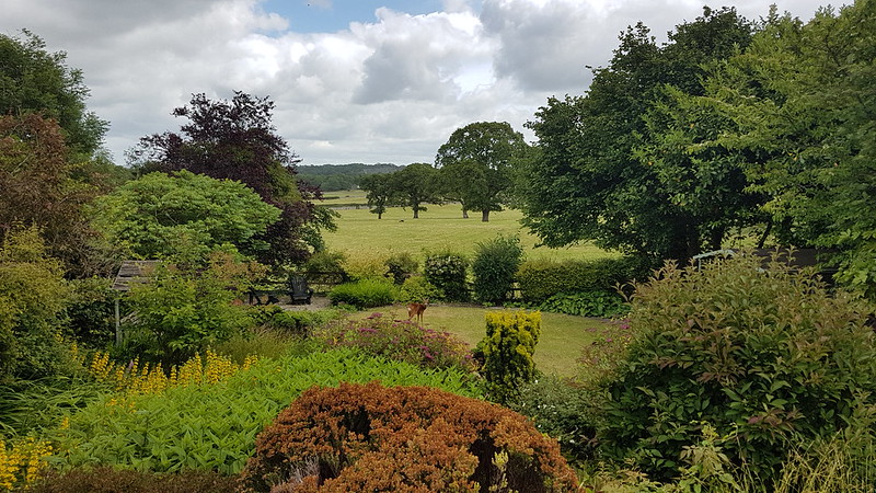
The morning after the Tigers victory over Saracens, and I was up at the Pepper Pot looking over the village. The weather doesn’t look too promising does it?
But later on, when I noticed a deer on our lawn, it had started to brighten up…
Garden with Roe Deer.
By the time B returned from his shift pot-washing at the local hotel, it was glorious, and hot.
‘Fancy a drive Dad?’, he asked.
This was code for, ”Are you willing to sit in the passenger seat for an hour whilst I drive?”
B has his provisional licence, has passed his theory test, and is very keen to clear the final hurdle and gain the independence which driving would give him.
“We could go to High Dam for a swim.”
Potter Tarn. Coniston Fells in the distance.
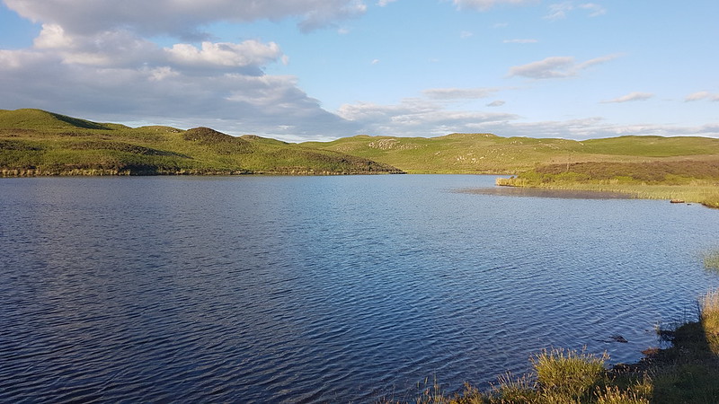
Which seemed like a good idea, except I suggested, given the late hour, that we substitute Gurnal Dubs for High Dam, it being closer to home and not surrounded by trees, so that we might have both later sun and a later onset of midge attack.
Forest of Bowland, Scout Scar and Cunswick Scar, Arnside Knott, Whitbarrow.
The walk up to the reservoir was very pleasant, if somewhat warm work.
Gurnal Dubs.
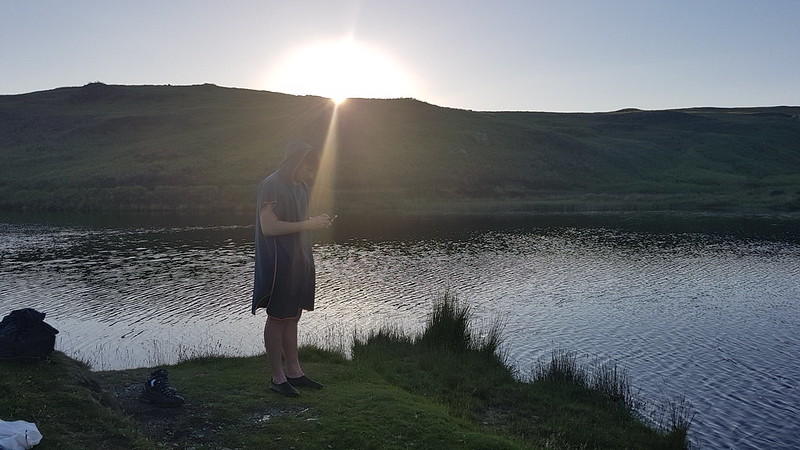
A work colleague, who lives quite close to Gurnal Dubs, had reported a recent swim there and that the water was ‘quite warm’. I hate to think what would qualify as cold in her estimation. It was pretty bracing. But very refreshing and, after a long period where it never seemed to warm up, a welcome and unusually late start to wild-swimming for the year.
After our swim.
By the time we were out of the water we were already losing the sun.
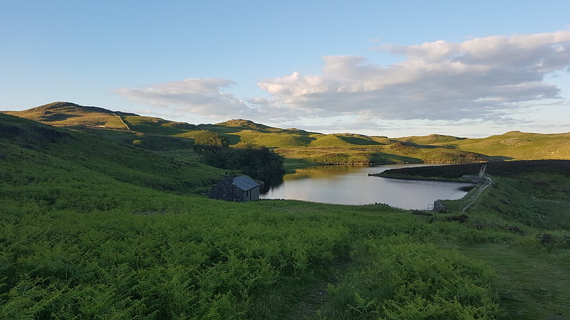
Looking back to Gurnal Dubs.
The views on the way down were even better than they had been on the way up, with the landscape decked in dark shadows and late, golden sunshine.
Potter Tarn, Coniston Fells, Scafell and Scafell Pike.Scout Scar and Cunswick Scar, Arnside Knott, Whitbarrow, Gummer How.Almost back to the road and the car.
The following evening, a Monday, Little S had Explorers. He’s transferred from the local unit to the one which meets in Littledale, at the very pleasant Scout camp on the banks of Artle Beck. Usually, after dropping him off, I take B to a boxing gym in Lancaster, but for some reason that was off, so I was at a loose end, which gave me a chance to try a spot down in the Lune Valley which I’d previously picked out as having potential for swimming.
River Lune.Caton Moor wind farm beyond.River Lune and Ingleborough.
It was a bit of a walk from the carpark at Bull Beck near Caton, so I didn’t have all that much time to swim, but the walk was nice enough in itself.
Swimming spot.
How was it? A lot warmer than Gurnal Dubs, quite pleasant in fact. Fairly fast flowing. Not as deep as I had hoped, but just about deep enough. Due to the strength of the current, I found myself walking upstream on the shingle bank and then floating back down river before repeating the process. Not a bad way to spend a Monday evening.
River Lune.
One more local-ish swim to report, though I’m jumping forward almost to mid-July and another Monday evening. After a hot day at school, B wondered whether I could give him and some friends a lift to Settle to swim. I didn’t have to think too long about that one: too far away. We compromised on Devil’s Bridge at Kirby Lonsdale, as long as they promised not to jump off the bridge.
Devil’s Bridge.
Whilst they were, I later found out, having a great time, I had a wander down the Lune, enjoying the riverside flowers.
Meadow Crane’s-bill.Giant Bellflower, I think.Monkeyflower – naturalised from North America.Himalayan Balsam – another non-native plant.
This one is a bit of a cheat, you can perhaps tell by the light; there was plenty of Himalayan Balsam by the Lune, but I’d also photographed some the day before, in better light, when I picked up Little S from another Scout Camp, this one down near Ormskirk.
River Lune. Too shallow to swim in.Pipe Bridge carrying water from Haweswater in the Lakes to Manchester.
I had my swimming stuff with me, and found, as I thought I might, that the water under the bridge, on the right hand side anyway, was deep enough for me to have a dip. In honesty, not one of my favourite swims this summer, but it had stiff competition.
The end of March, and another meet up of our little group of hill-walking friends, expertly organised, as ever, by Andy, even down to finding a perfectly situated little parking area just off the Fair Mile Road in the Lune Gorge. TBH had driven and, as navigator, I had chosen to bring her the most direct way, over the very, very narrow Crook of Lune Bridge*, a choice of which she thoroughly approved, in no way castigating me for my decision or filling the car with invective as she gingerly inched across.
(*Confusingly, there’s another Crook of Lune, near to Caton, much further down the river)
Fell ponies.
Andy had a box-ticking exercise in mind, wanting to visit a couple of tops which were new to him, but fortunately his route was also a very pleasant walk, so we’ll let him off.
Little S had joined us, mostly, I think, due to the promise of a slap-up meal in Lancaster after the days exertions, and he was appalled by our determination to stop approximately every ten yards for a natter/breather/photo opportunity.
Dillicar Knott and its mast.The Lune Gorge again, from somewhere in the vicinity of Linghaw.
Little S wasn’t overly impressed either with the long stop we had on Linghaw, ostensibly for drinks and snacks, but quickly becoming a sunbathing/snoozing stop.
The hill behind our little group here is Grayrigg Forest, which we visited together not so long ago, on what was probably another box-ticking exercise. The weather had been a bit grey that day, but this time we had struck it lucky with plenty of sunshine and blue skies.
The headwaters of Carlin Gill. Some of us camped just beyond there a few summers ago.I had to crop this photo to remove my finger-end, a bad habit I seem to have recently acquired when using my phone as a camera.On Fell Head.
I think of Fell Head as a favourite spot because it’s a great viewpoint, and I used to bring a packed tea up here after work during the few years I lived in Arnside. In my head, I did this many times, but since I only lived in Arnside for four years and the window when the evenings are light enough is quite short, and because I think of other hills with much the same affection, for the same reasons, I suspect I only actually did it a couple of times.
Anyway, back then I would sit and eat my tea, and watch the traffic far below on the M6 and then head back to my car, but we had a ridge to traverse…
The ridge to Breaks Head.
We had an even longer lunch/nap stop on Height of Bush Howe, which was very relaxing, but which had the consequence that, with a table booked in Lancaster, we didn’t have time to include The Calf in our circuit, and we also needed to get our skates on to get back to our cars.
I think that long ridge is our descent route on White Fell, which probably makes the top on the right Arant Haw, but don’t quote me on that.Descending White Fell.Fell Head.Chapel Beck – a Lune tributary.Chapel Beck again. White Fell on the right.Bush Howe, White Fell Head, The Calf, Bram Rigg Top.
A great days walking, in fabulous company. The meal later, at Molly’s in Lancaster, was equally good. The night before, TBH and I had been at a Northern Soul night with our neighbours, and the day after a few of us met for another sunny walk. A perfect weekend!
Here’s our route. As you can see, on the way downhill, I discovered the ability to walk in a perfect straight line. Either that, or I paused the app when we stopped and forgot to start it again.
MapMyWalk tells me that we walked 10.39km, but the map itself seems to be implying more like 12.4 – I’ve noticed discrepancies like this before. Maybe it’s my fault for pausing the app. It also gives 560 metres of ascent, which seems about right.
The weather over Christmas was a bit dismal. This walk, on the day after Boxing Day, had the most promising forecast, and in the event was mostly dry. We chose a route over smallish hills since that seemed to offer the best chance of some views. We’d parked in Orton. The stream we followed out of the village eventually becomes Chapel Beck and flows into the Lune so that this walk, although I didn’t realise it at the time, is part of my exploration of the Lune catchment.
TBH had come out without a hat and so is wearing my Aldi fleece hat which I’ve subsequently lost – a real shame since I really liked it. It was, however, too big for TBH. The farm behind TBH is Broadfell and beyond that is Orton Scar.
Looking South, over the Lune valley to the Howgills which were in and out of the clouds during our walk.Lime Kiln, not marked on the OS map.Beacon Fell.On the way up Beacon Fell.Beacon Fell – looking toward the Pennines.A lunch spot with a little shelter from the wind.Looking towards Knott, our next target – notice the isolated trees..Part of the pennines catching the sun.Those trees again and sunshine on the Pennines again.
I was surprised by how busy Beacon Fell was, expecting to find it deserted. Knott, on the other hand, was very quiet – we didn’t see anyone up there and there wasn’t much of a path.
TBH by the trig pillar on Knott.
The long limestone knoll in the centre of the photo above is Castle Folds the site of a Romano British settlement – I shall have to come back to have a closer look – perhaps when it’s a bit warmer.
The weather deteriorated as we walked back to the village, with a bit of drizzle falling.
Back in the village, we discovered that a bus shelter had been turned into a charity secondhand bookstall, with an honesty box – so I came away with a couple of books. Yet another good reason to come back some time to this fascinating area.