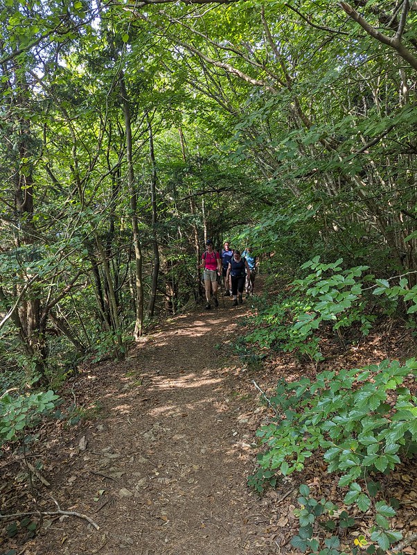
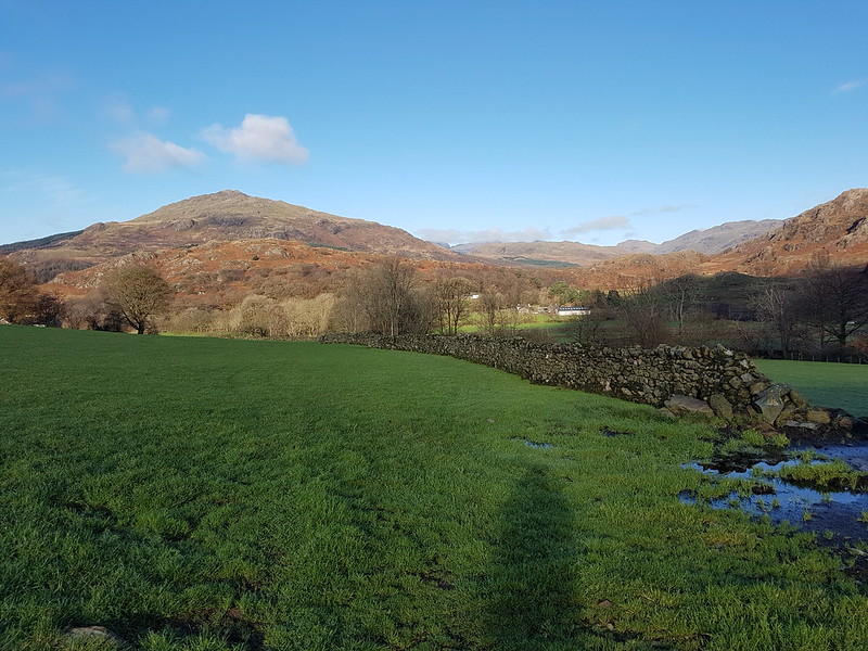
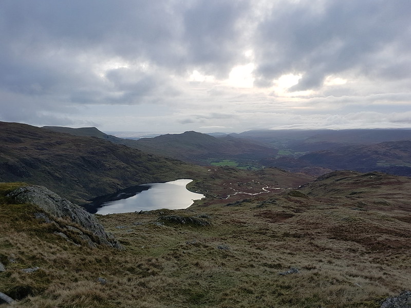
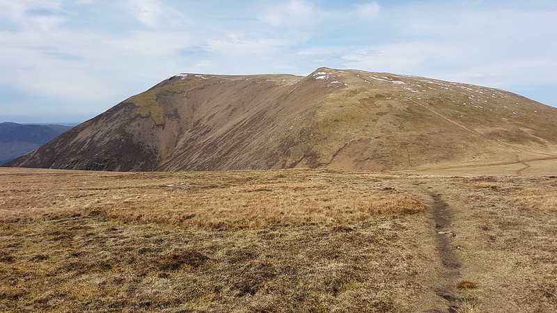
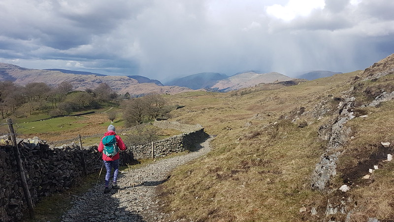
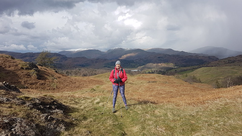
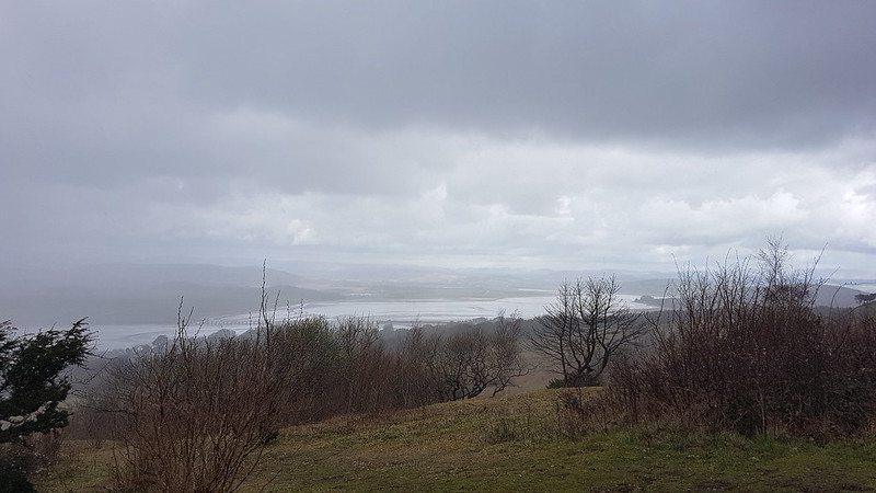
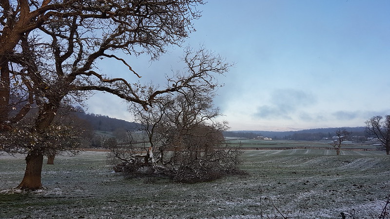
TBH recently declared herself to be ‘fed up with Whitbarrow’. I suppose we have climbed it quite a few times in recent years, but I’m struggling to imagine getting tired of that prospect.
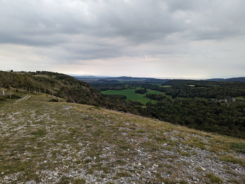
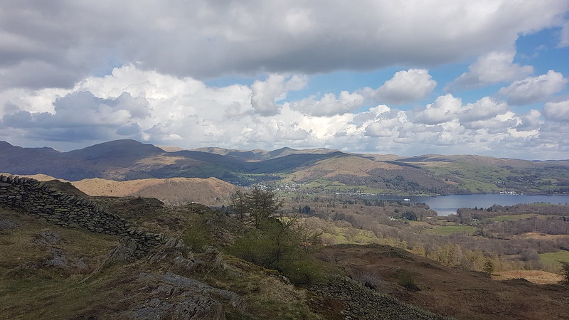
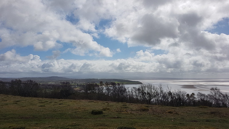
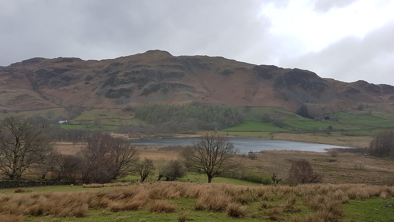
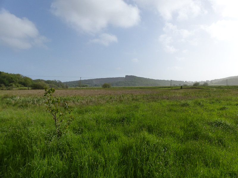
Foulshaw Moss, The River Kent and Arnside Knott from the south-western tip of Whitbarrow.
On the Sunday after our TMTCH gig, we needed something reasonably local and reasonably short because the forecast suggested that things were going to get very wet later in the day. They did.
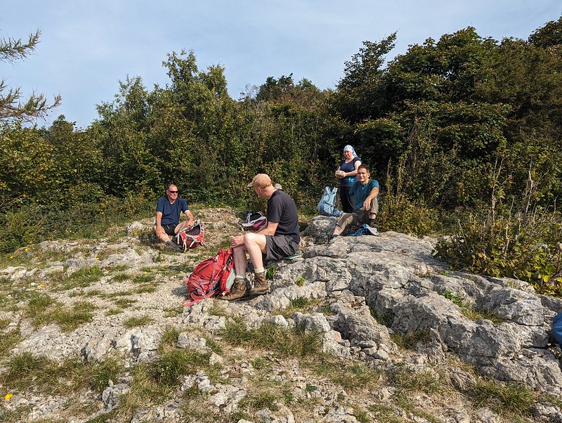
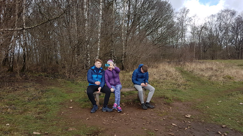
A bit of a sit and a chinwag.
Whitbarrow, then was ideal on both counts.
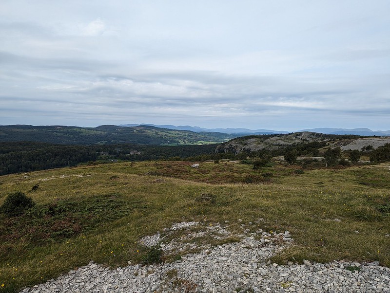
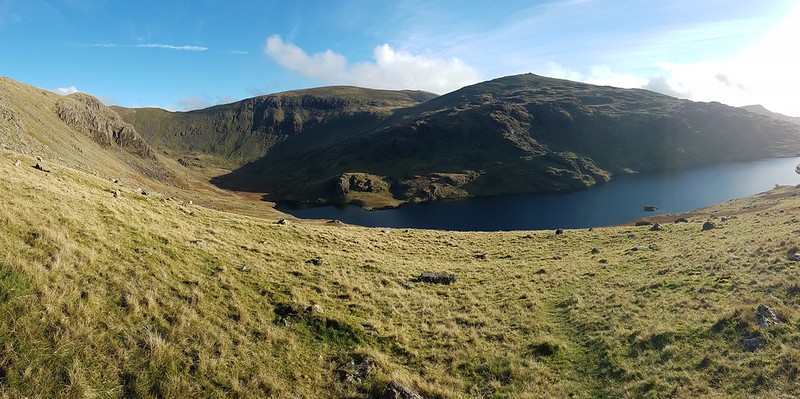
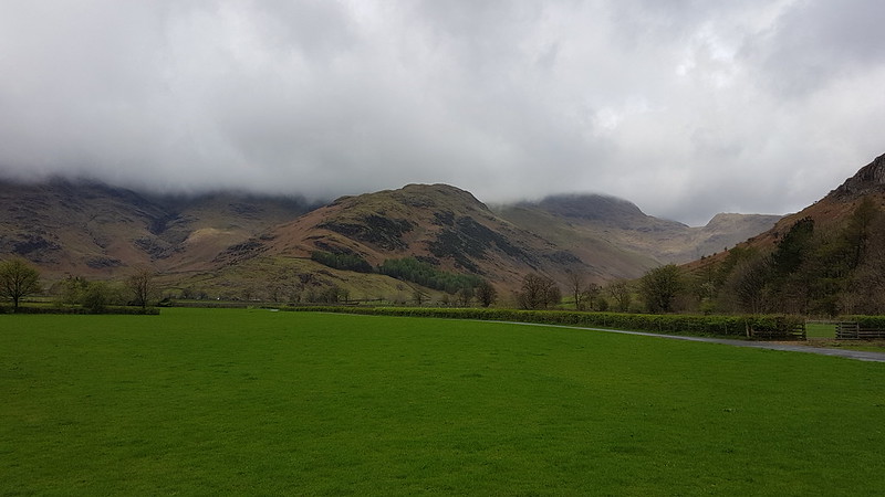
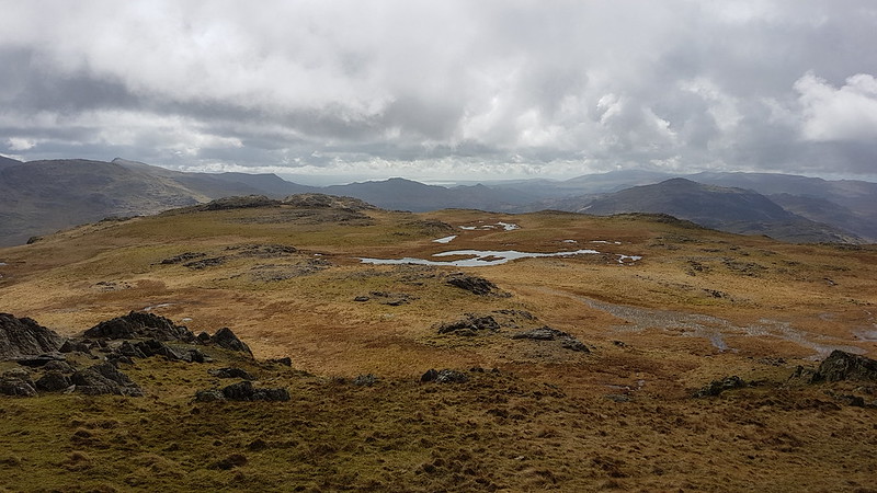
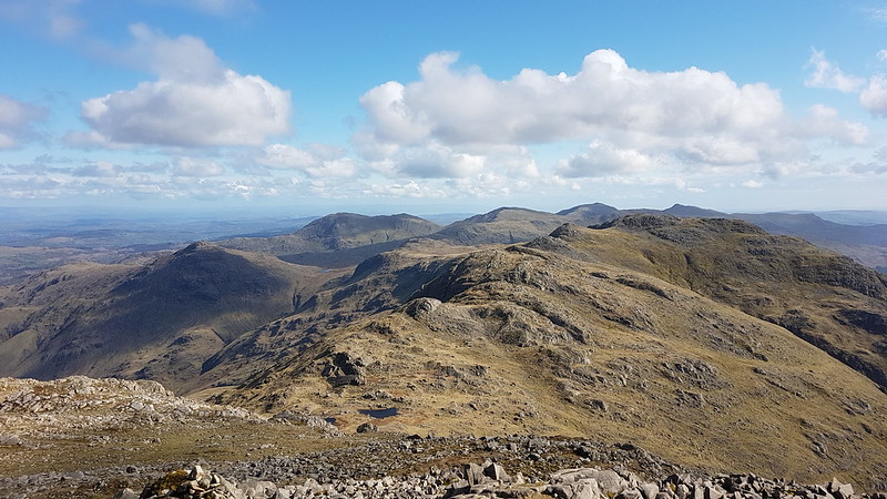
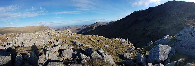
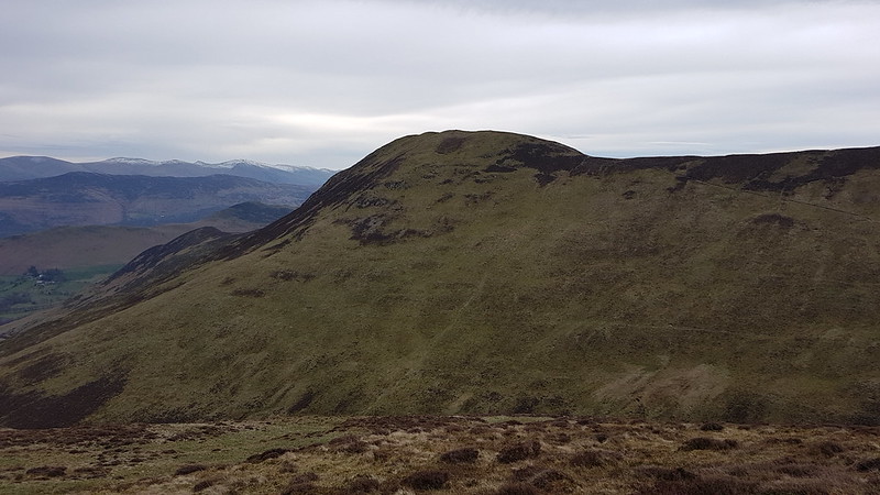
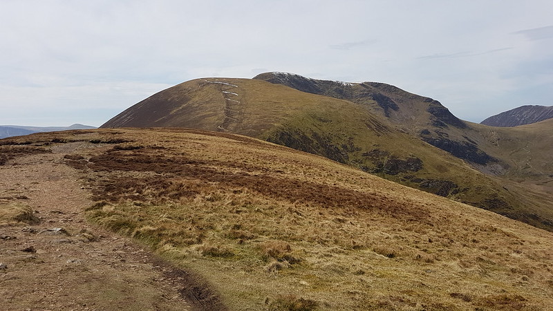
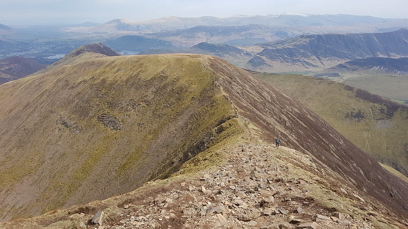
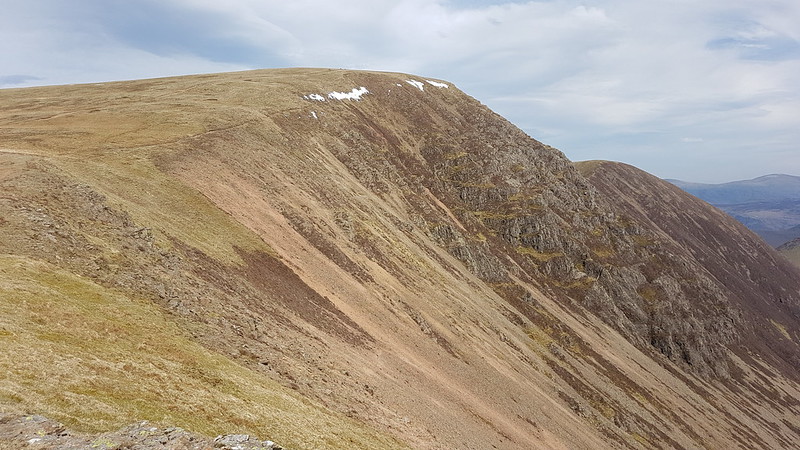
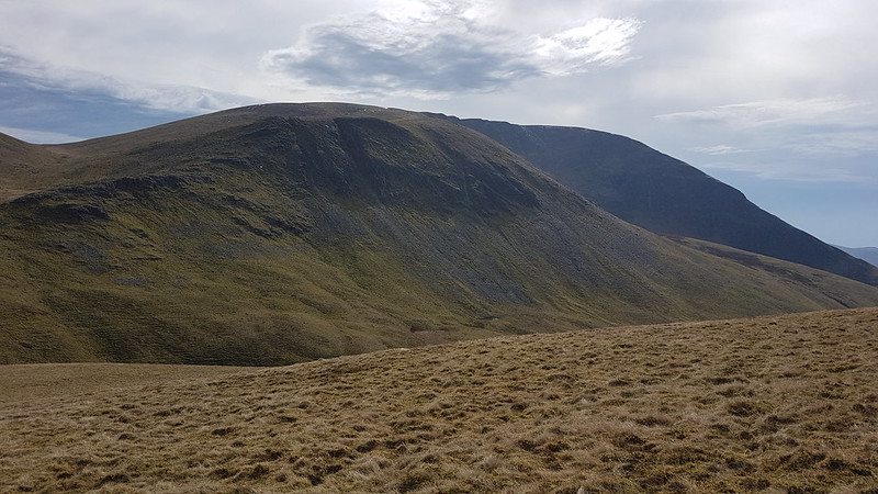
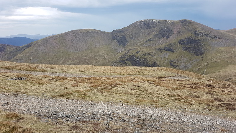
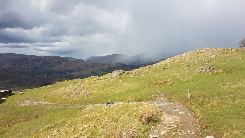
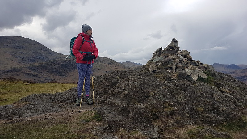
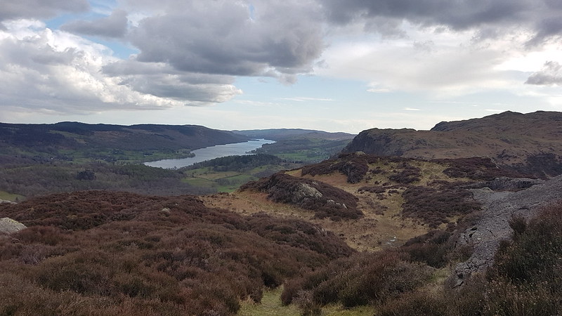
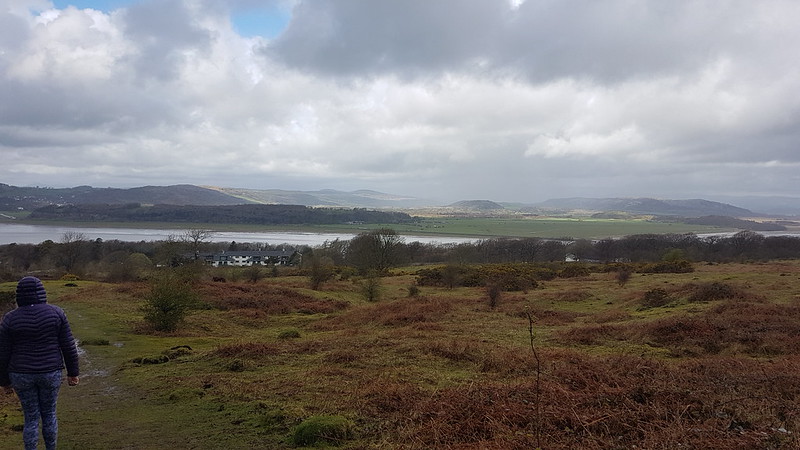
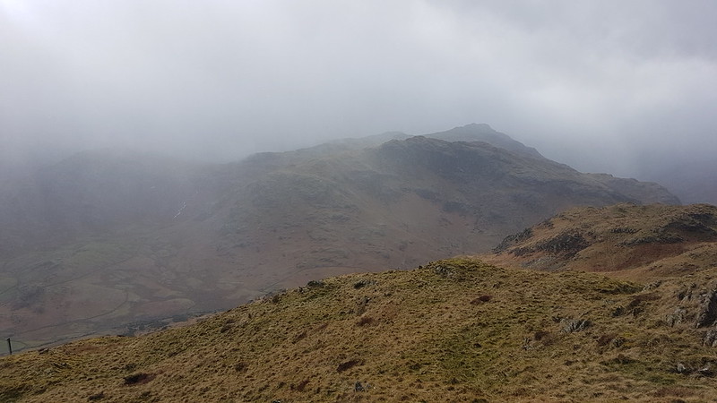
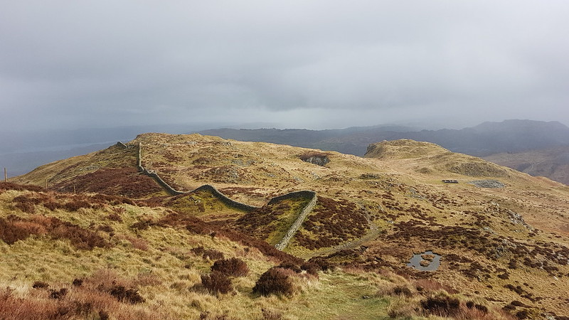
Gummer How, the Lakeland Fells and Lord’s Seat.
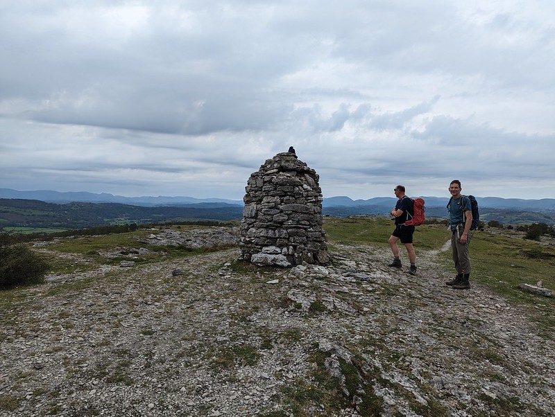
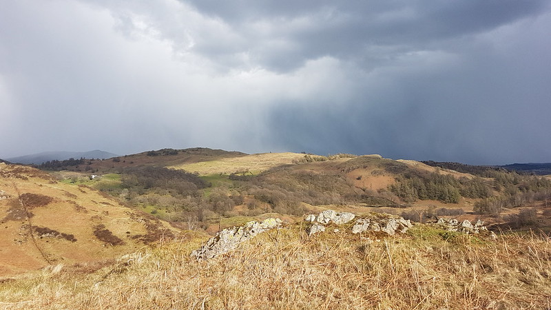
Early sunshine soon gave way to much greyer, gloomy skies.
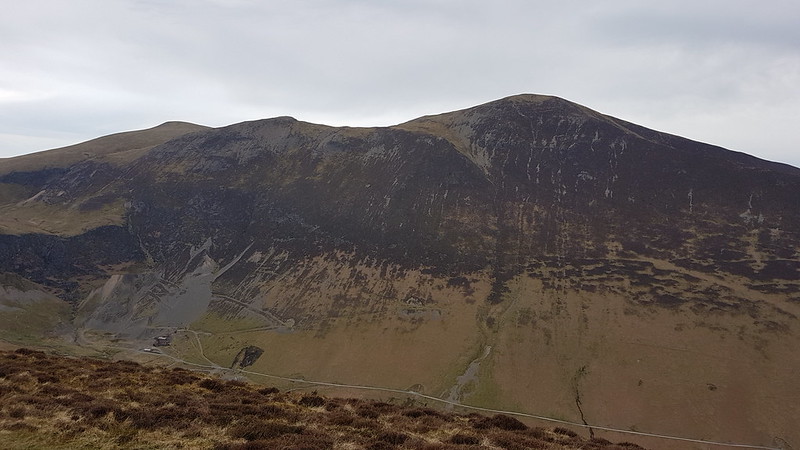
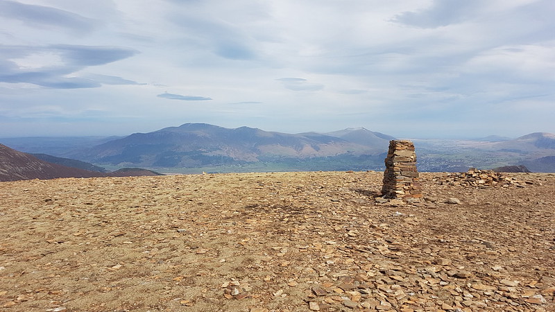
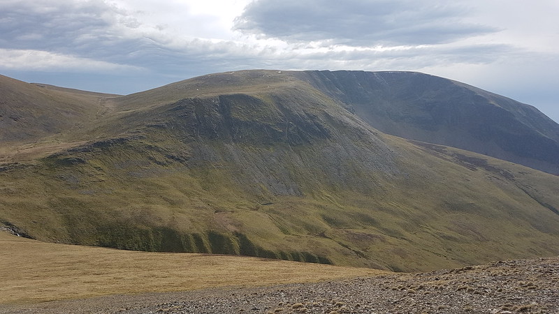
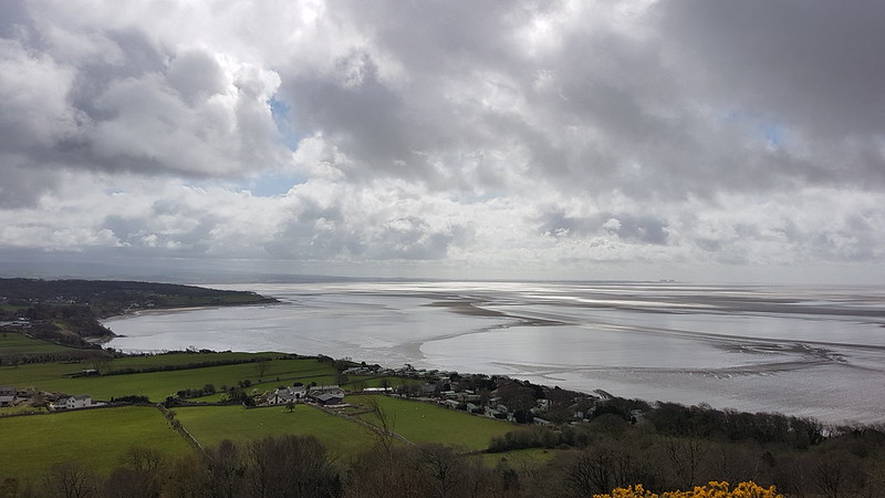
J and MM by the large cairn on Lord’s Seat.A view of the Forest of Bowland Fells, Warton Crag, Arnside Knott and the Kent Estuary.
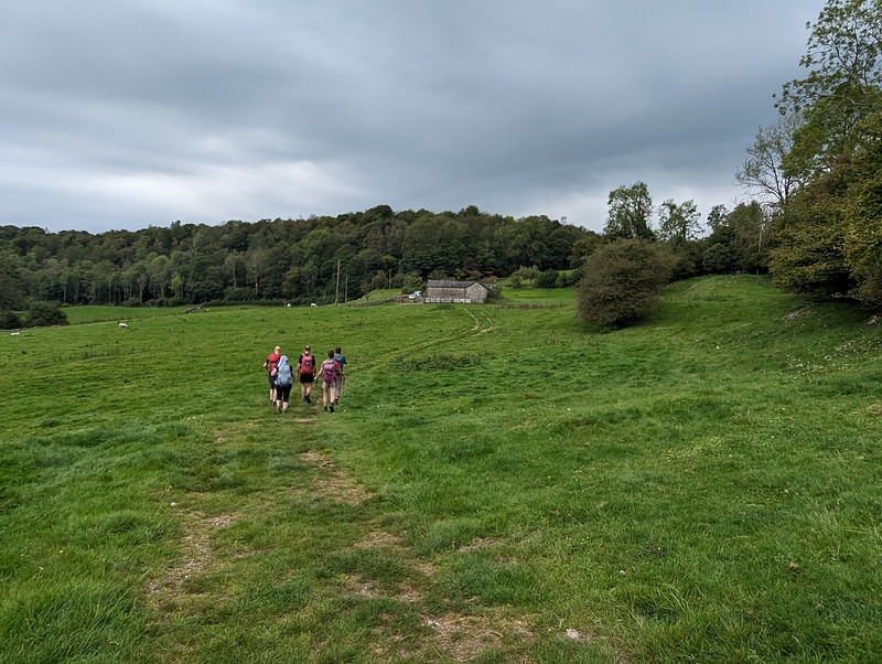
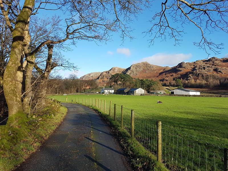
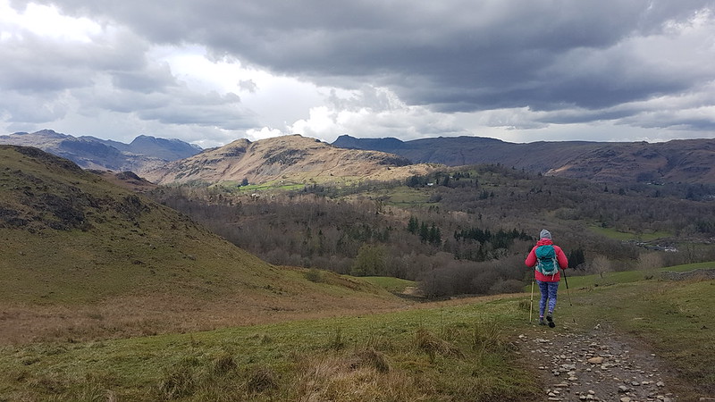
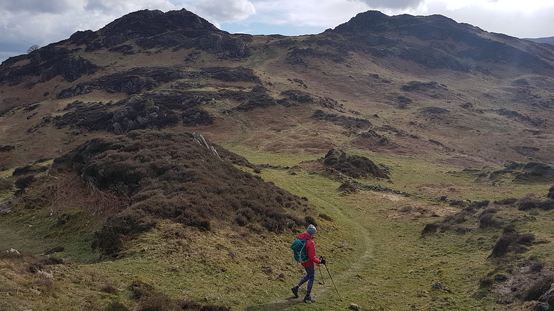
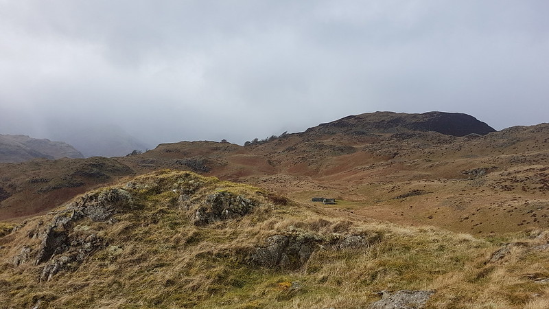
By the time we were off the hill by Witherslack Hall there were a few drops of moisture in the air.
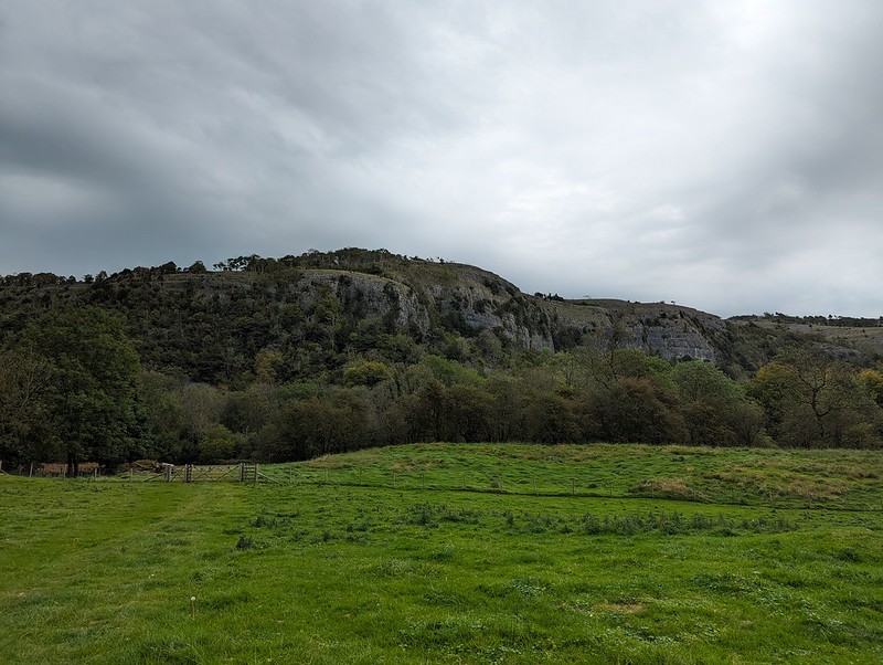
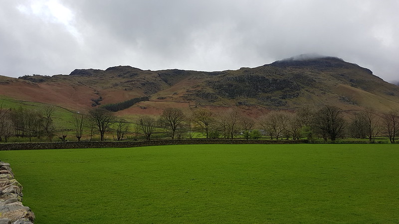
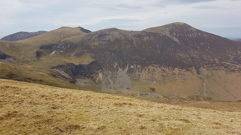
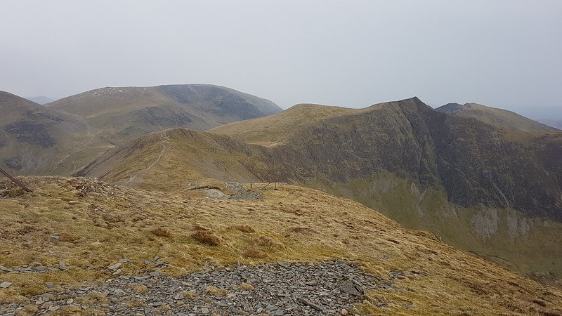
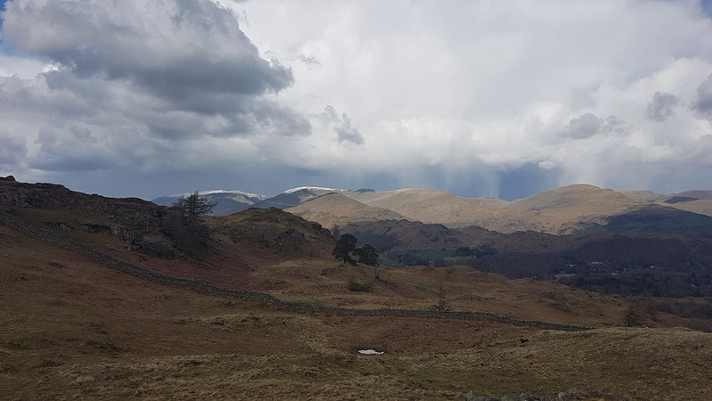
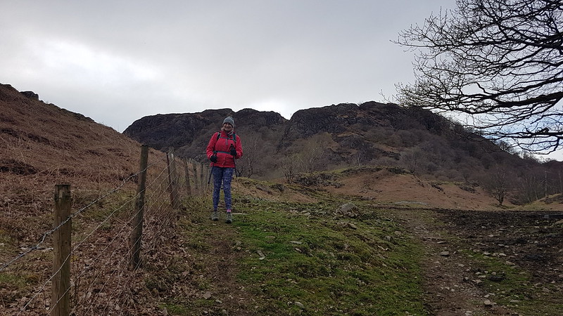
Chapel Head Scar.Approaching Witherslack Hall.Curious looking cloud over the woods on Yewbarrow.
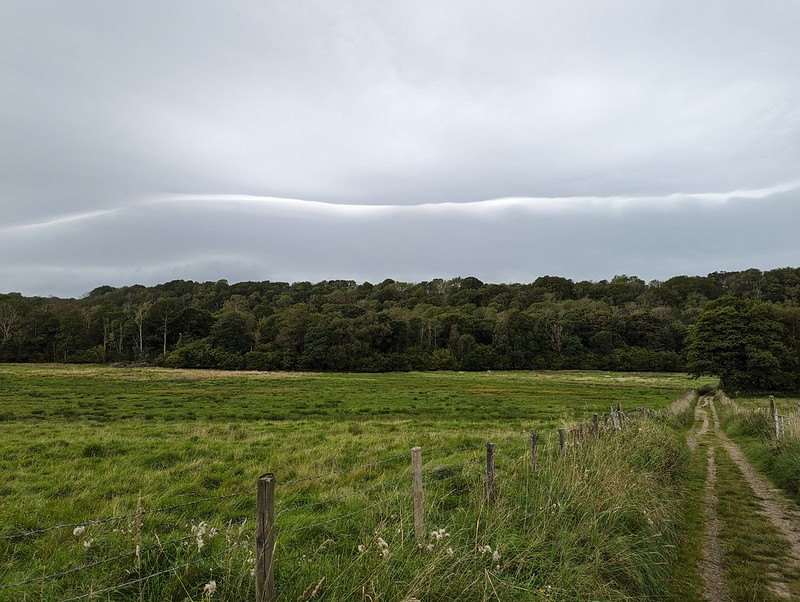
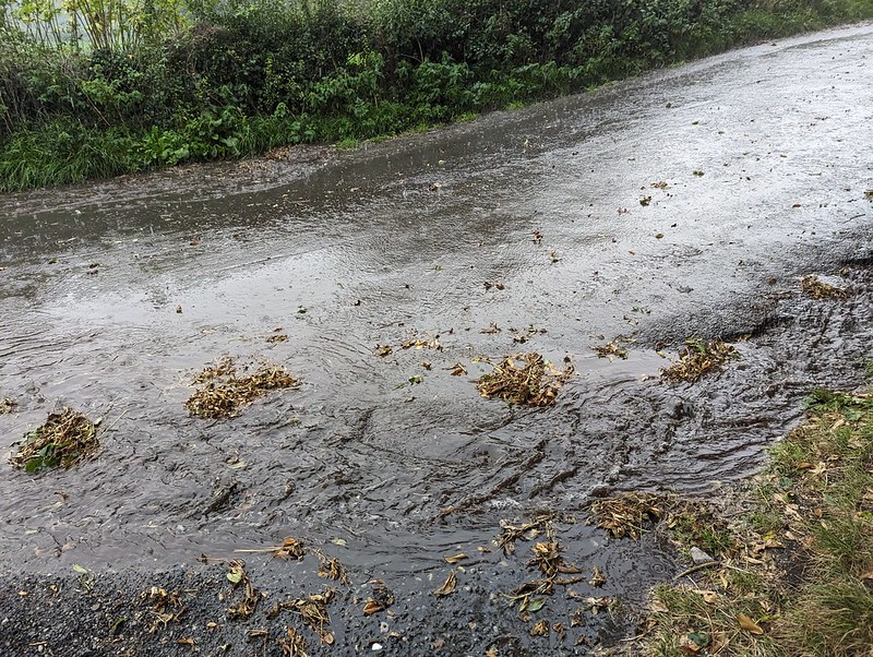
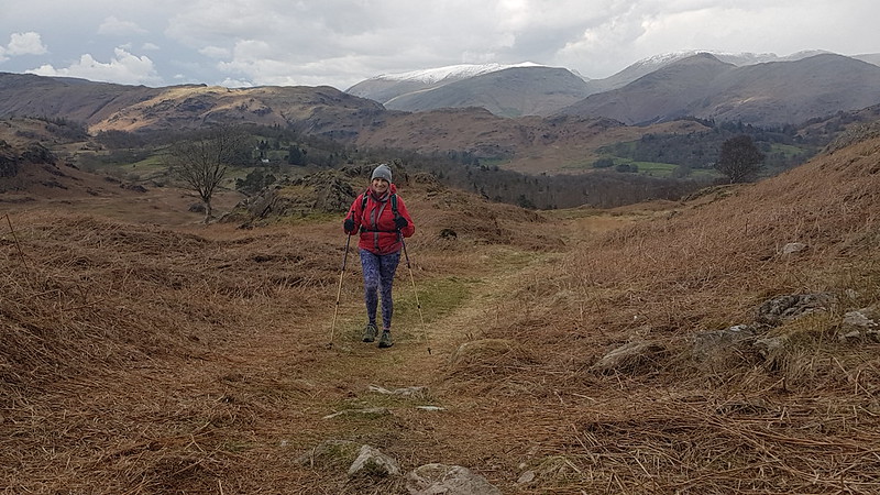
We almost made it back, but somewhere around Beck Head it began to absolutely chuck it down.
A road turned into a stream.
Not to worry, we’d got out again, and had a fabulous weekend together.
We didn’t walk along the A590. Must have forgotten to pause the app.
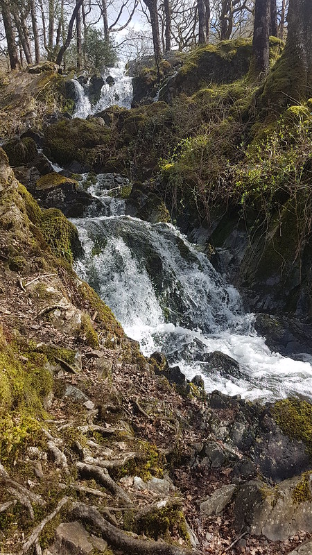
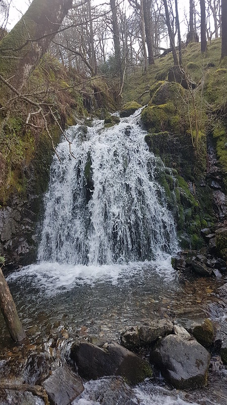
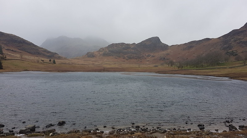
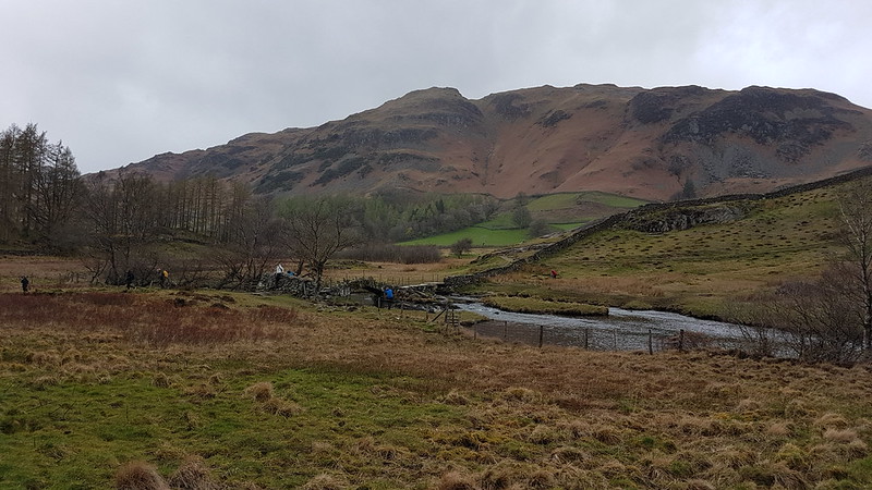
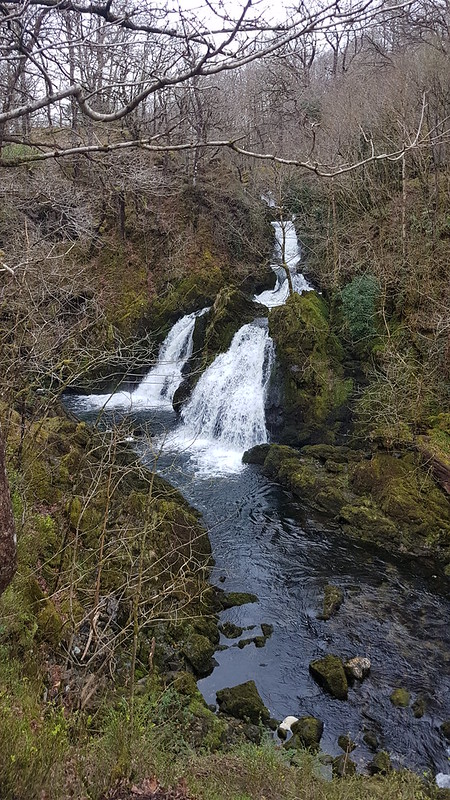
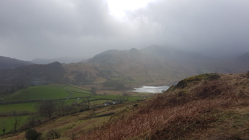
Waterfall on Tarn Beck near Seathwaite in the Duddon Valley.
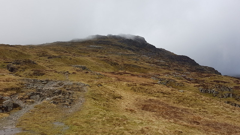
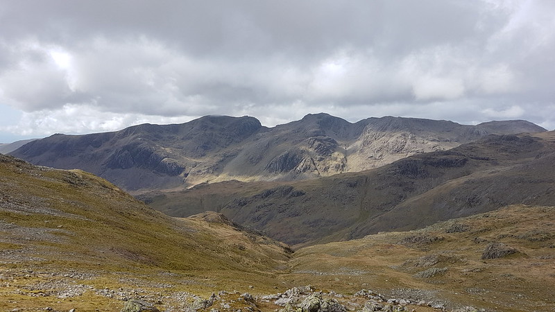
When, last January, in the first flush of enthusiasm for my new assault on the Wainwrights, I tackled the Coniston Fells in less than optimal weather conditions, I chose an inefficient route taking in the three central fells of the range and leaving three scattered outliers – Dow Crag, Grey Friar and Great Carrs. With hindsight, I think that this is no bad thing, since it gives me an excuse for more walks in the area.
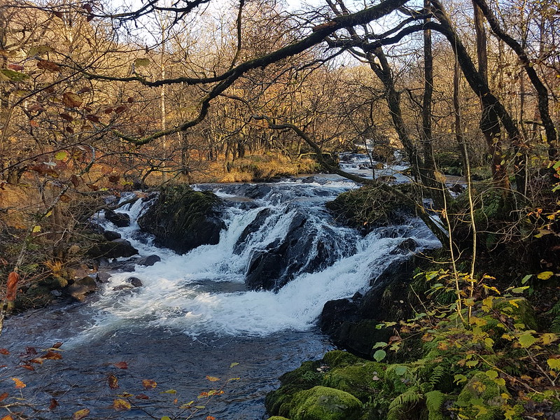
So, this mid-November Saturday found me parked on the roadside by Tarn Beck, just outside Seathwaite in the Duddon Valley.
Another waterfall on Tarn Beck.
It was a glorious morning, and very quiet in Seathwaite, in stark contrast to what I might have expected on the Coniston side of the hills.
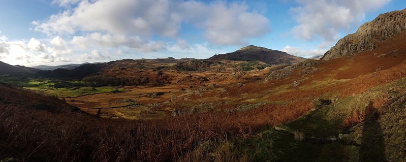
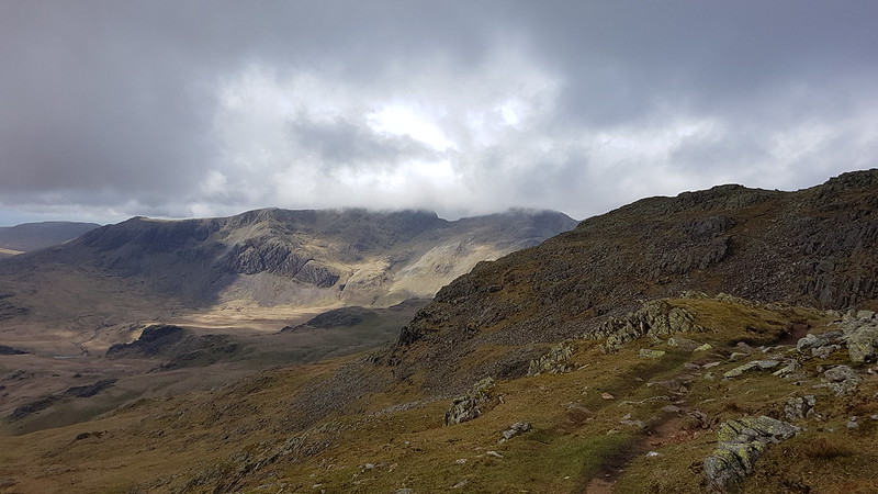
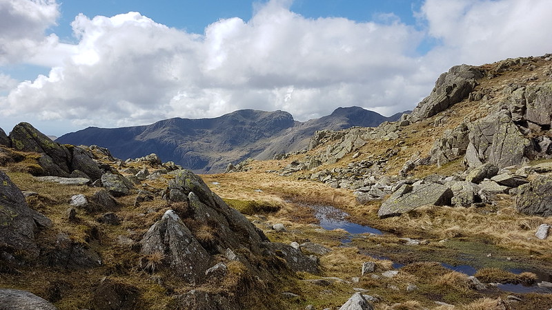
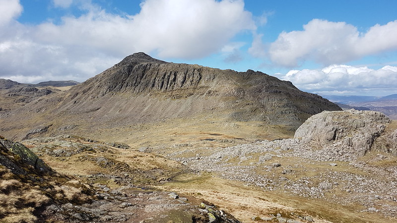
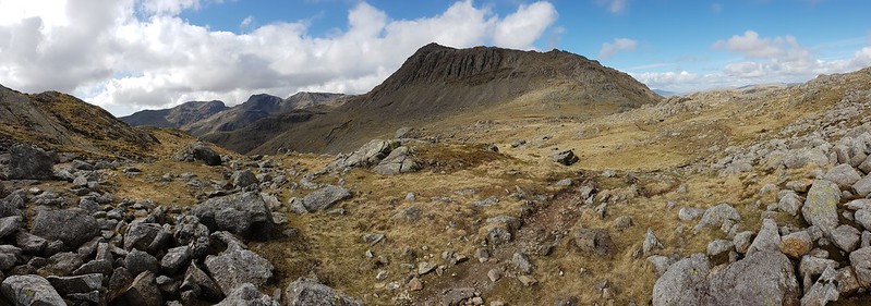
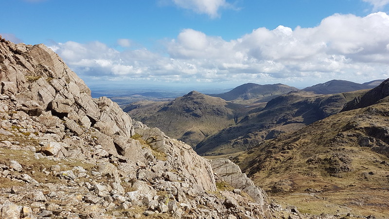
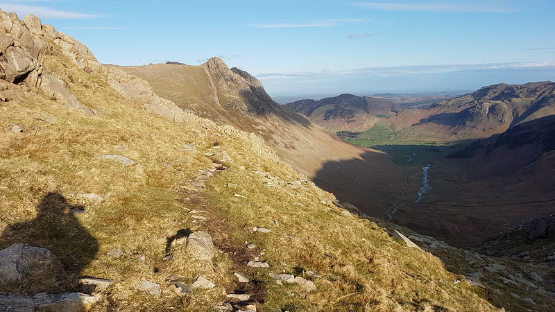
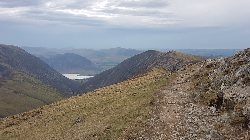
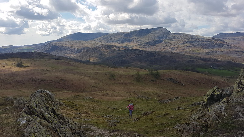
Heading away from Seathwaite.Harter Fell.
Harter Fell tended to dominate the views on this walk and I took lots of photographs of it, many of which, but by no means all, have made it into this post.
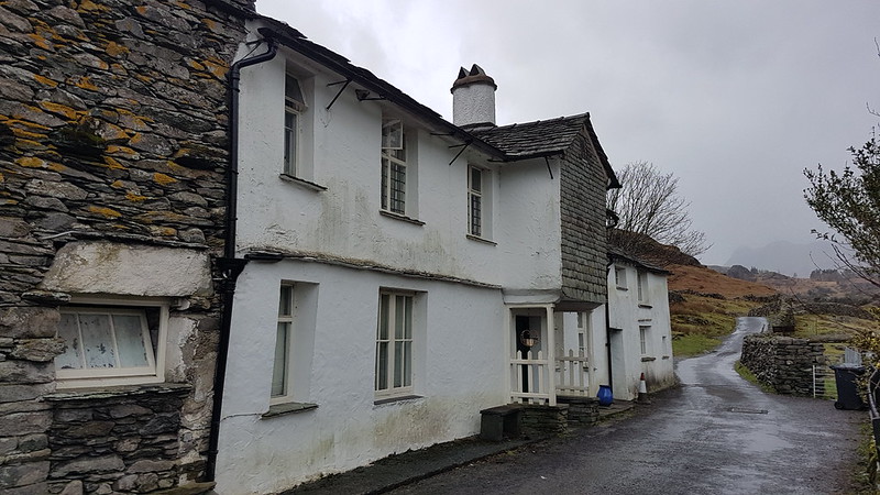
Tongue House.Throng Close and Tongue House Close. Tongue House High Close is slightly out of the picture to the right.
The Coniston Fells are liberally supplied with crags and hows and pikes and this western side is no exception. The path climbs between Tongue House Close and Tongue House High Close, just right of centre in the photo above.
Harter Fell pano.Grey Friar.
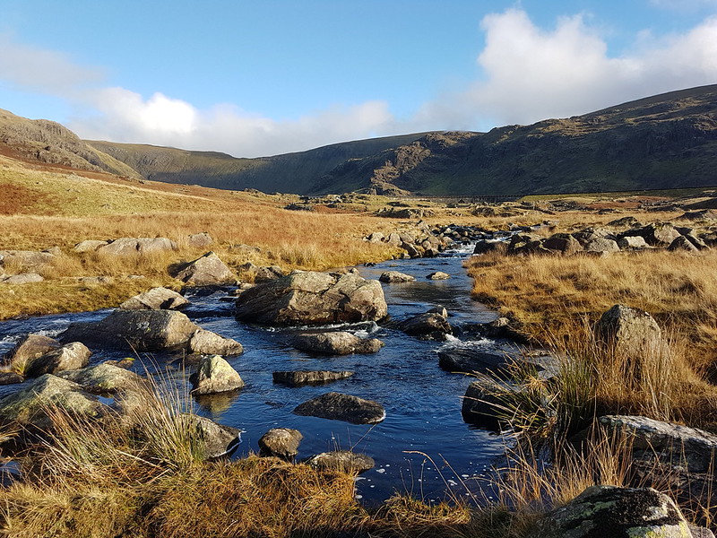
The path I had chosen fell away slightly leftwards here, towards those shaded crags on the slopes of Troutal Fell, the south-west arm of Grey Friar. Between here and those crags, the path crosses Tarn Beck. There’s no footbridge marked on the map, but this is the busy, touristy Lake District – there’ll be a bridge surely?
Harter Fell again, and Cirrus clouds – a sign of what was to come?
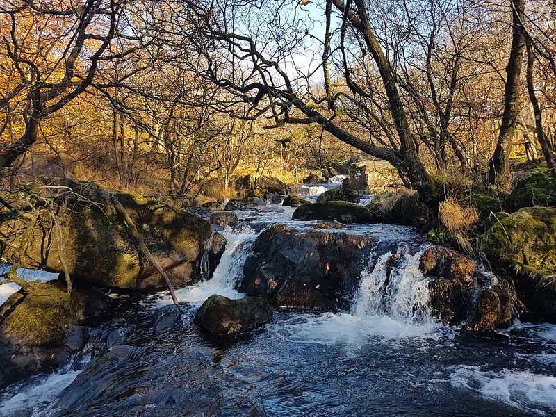
The ground descended very gently towards Tarn Beck and was quite boggy. When I reached the stream…
Tarn Beck again.
…it was to discover that there is no bridge. What’s more the stream was large and deep and fast-flowing.
It was so sunny at this point that I actually contemplated a swim, but sanity prevailed, in part because of how fast the stream was running. I hate to think how cold the water would have been.
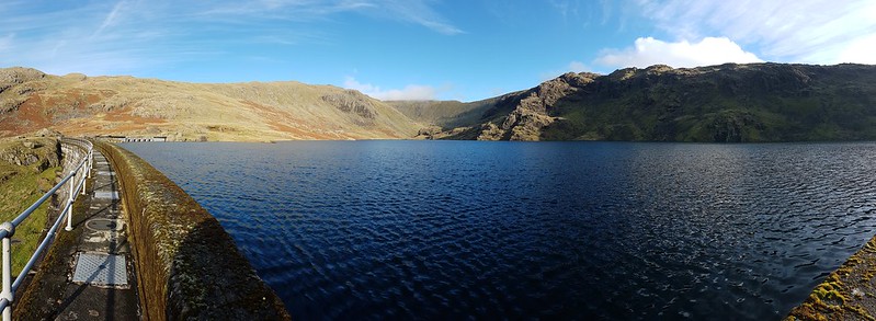
Since I clearly couldn’t cross Tarn Beck without a dip, I followed it instead and then cut up to the dam of Seathwaite Tarn…
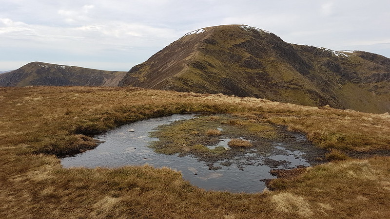
Seathwaite Tarn pano.
I paused on the dam to take several photos of a lone Goosander, none of which came out very well.
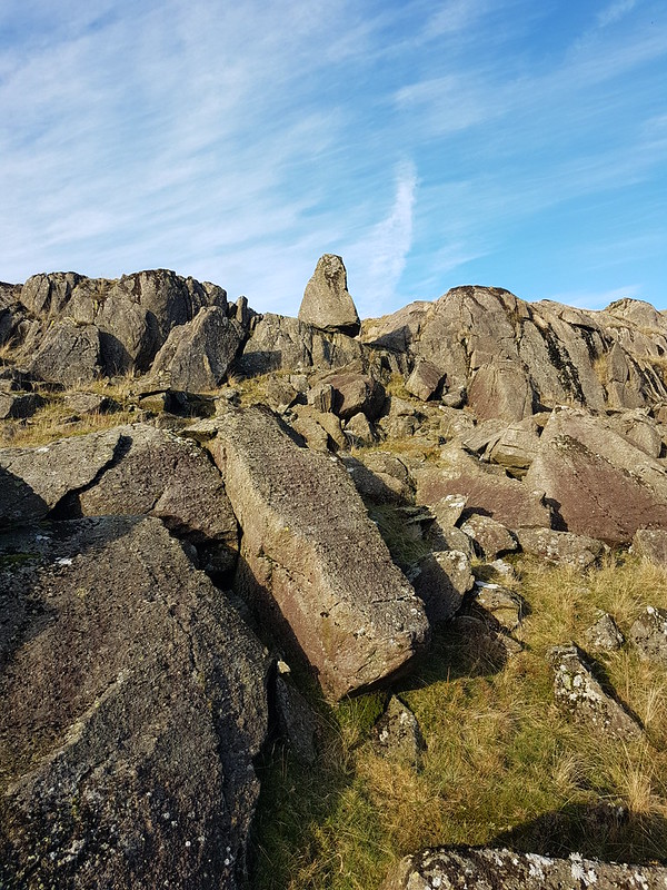
The rough rocks of Tarn Brow and Cirrostratus – another warning sign!
The early part of the steady climb away from the tarn was enlivened by the presence of numerous brightly coloured waxcaps…
Waxcap.Waxcaps.
Naturally, I took loads of pictures, but I’ve restricted myself to just two here.
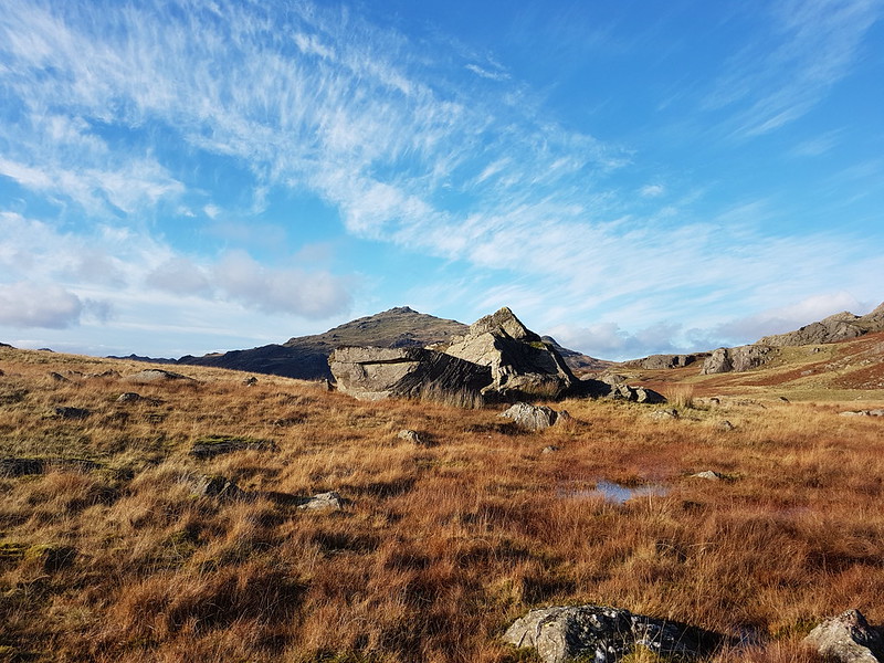
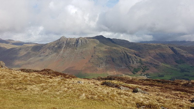
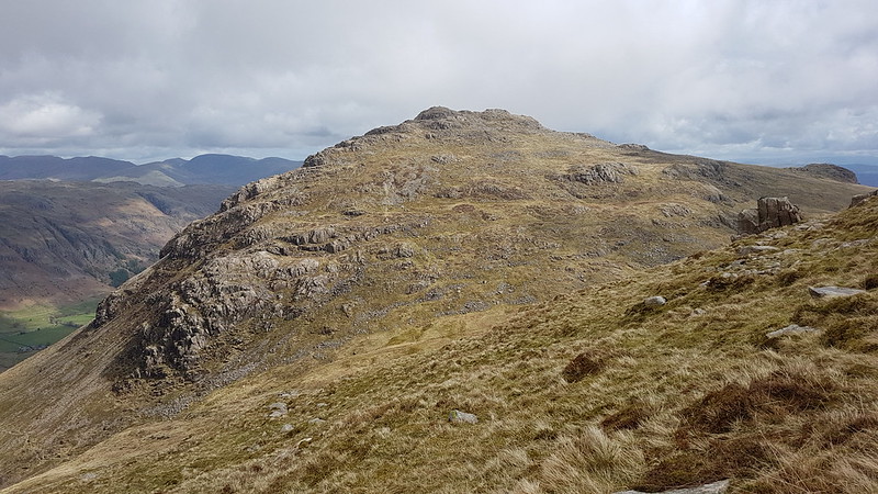
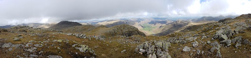
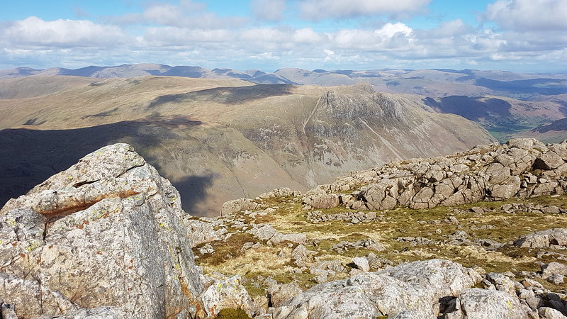
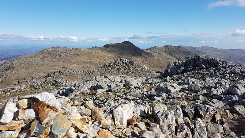
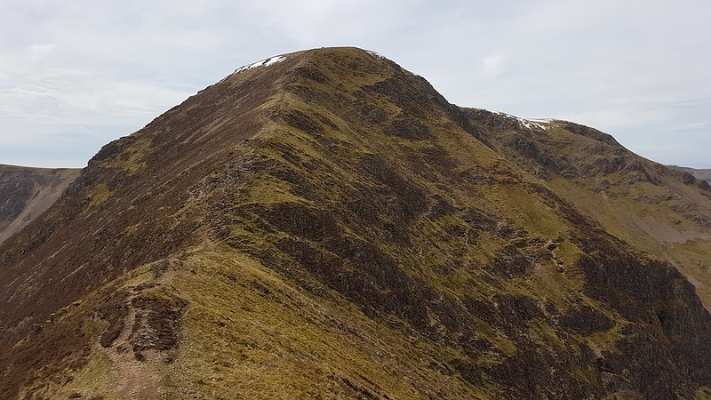
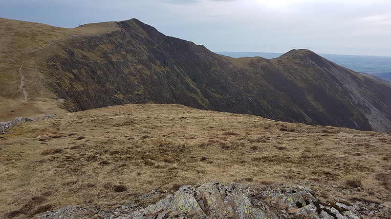
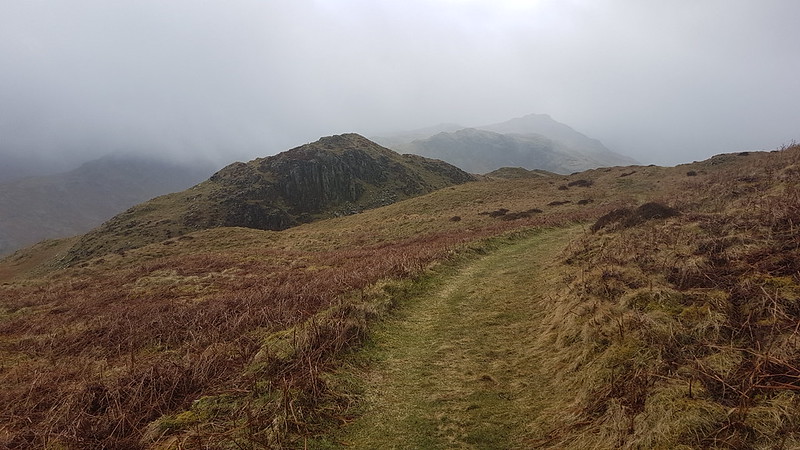
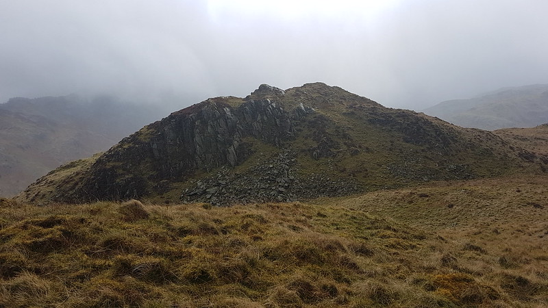
Brim Fell and Dow Crag.
In my mind, Dow Crag is always associated with the eponymous crag above Goat Water, with the south ridge over Brown Pike and Buck Pike and with Easy Gully, which is far from easy and which I haven’t ascended for many, many moons. It was good to see it from this less familiar perspective.
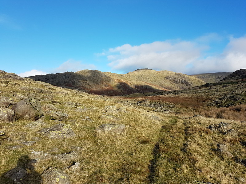
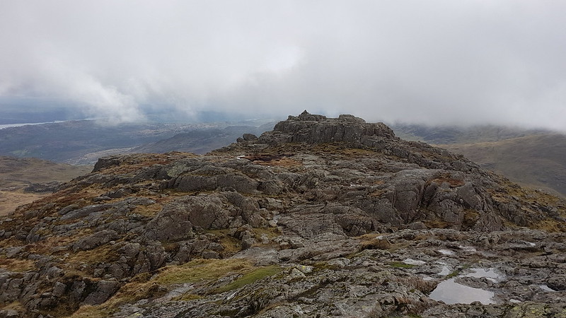
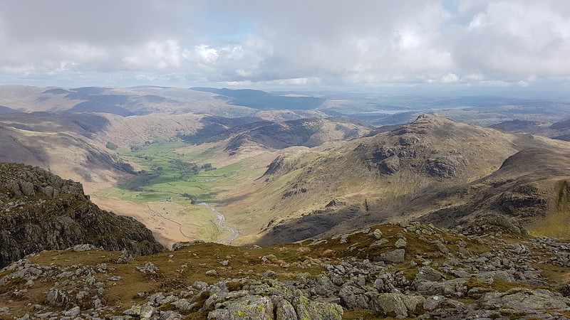
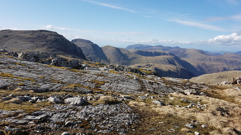
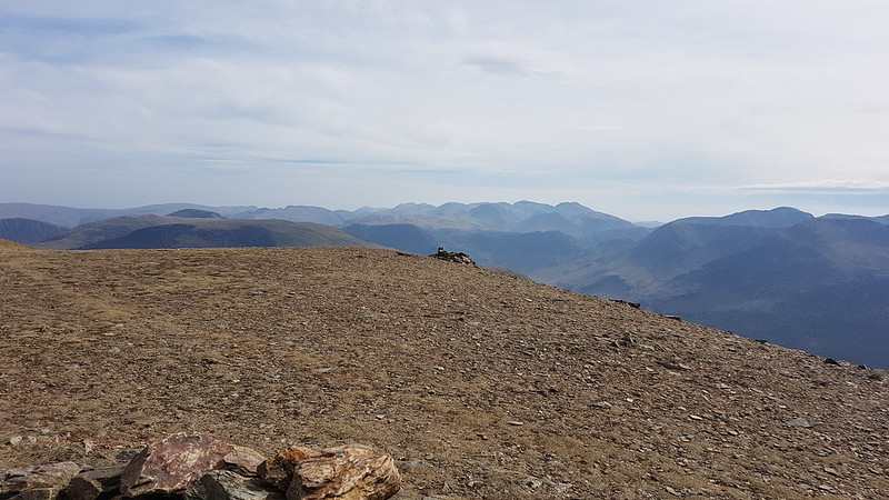
Harter Crag, with ominously dark skies behind.Looking north – the Scafells capped with cloud.Looking south-west, back to the Duddon Valley. Oh no!Brim Fell and the Old Man – just evading the clouds.
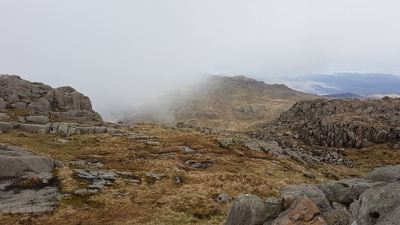
Sadly, I arrived at the summit cairn on Grey Friar at the same time as the low cloud brought by the encroaching weather front. I was lucky to still have some views, but not the spectacular views I might have expected given the open blue skies at the start of the walk. In addition, the temperature had dropped appreciably and, without the warming sunshine, it now felt very much like mid-November in the hills.
Grey Friar summit. And very grey weather.
I found a sheltered spot for a quick drink and a snack. Truth be told, as usual, I had an overly ambitious plan B which involved climbing the main ridge and completing a horseshoe round to Dow Crag. It was clear though that I didn’t have the daylight hours left for that route, or the weather to make the extra effort worthwhile.
One last, contrasting, view of Harter Fell.
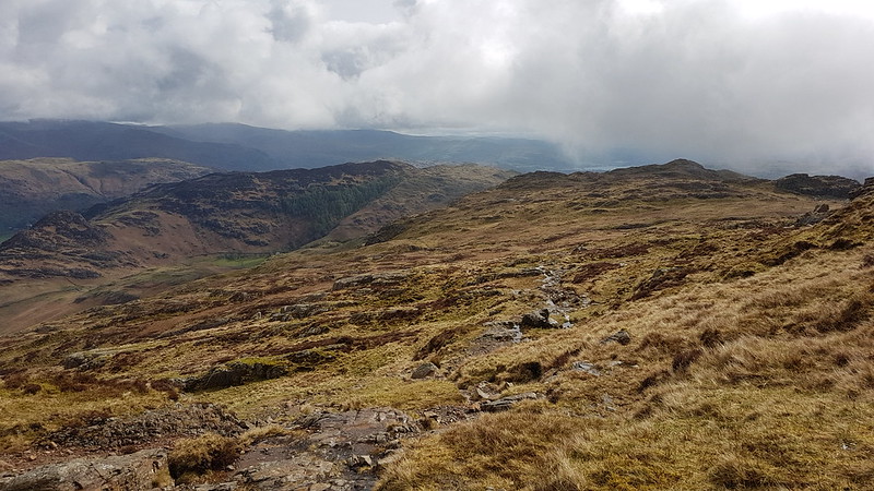
So, I beat a hasty retreat, retracing my ascent route initially, before following a track down, which gave very easy walking and which is presumably a remnant of the construction of the Seathwaite Tarn dam.
Looking down to Seathwaite Tarn.Seathwaite Tarn pano. Dow Crag now lost in cloud.
Presumably due to the lack of retail outlets and other tourist attractions, the lovely Duddon Valley often seems to be relatively quiet; I saw very few other walkers on this outing. When I get around to ticking-off Dow Crag I think I shall have to do it from this side for a change.
October half-term. Some very mixed weather, if I remember right. I stuck to local walks. Actually, the weather was sometimes better than expected, and then I felt a bit cheated, because I could have gone further afield, but in truth we were probably getting better weather here on the coast than I would have experienced in the hills, so local walks weren’t a bad choice after all.
A lot of weather out in the Bay.
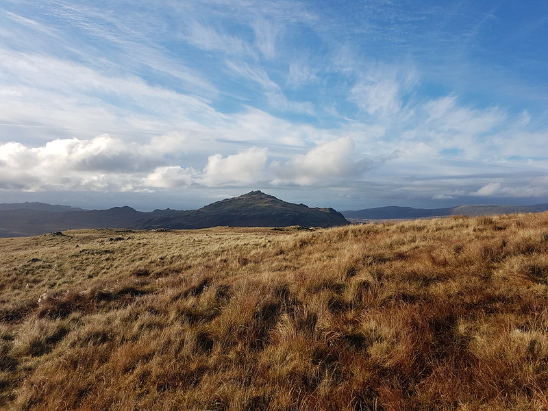
These photos are from a short outing up Arnside Knott. An ascent of the Knott, or a walk around the coast to Arnside, or some combination of the two are my go to walks these days, especially when there’s some drama in the skies.
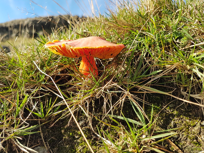
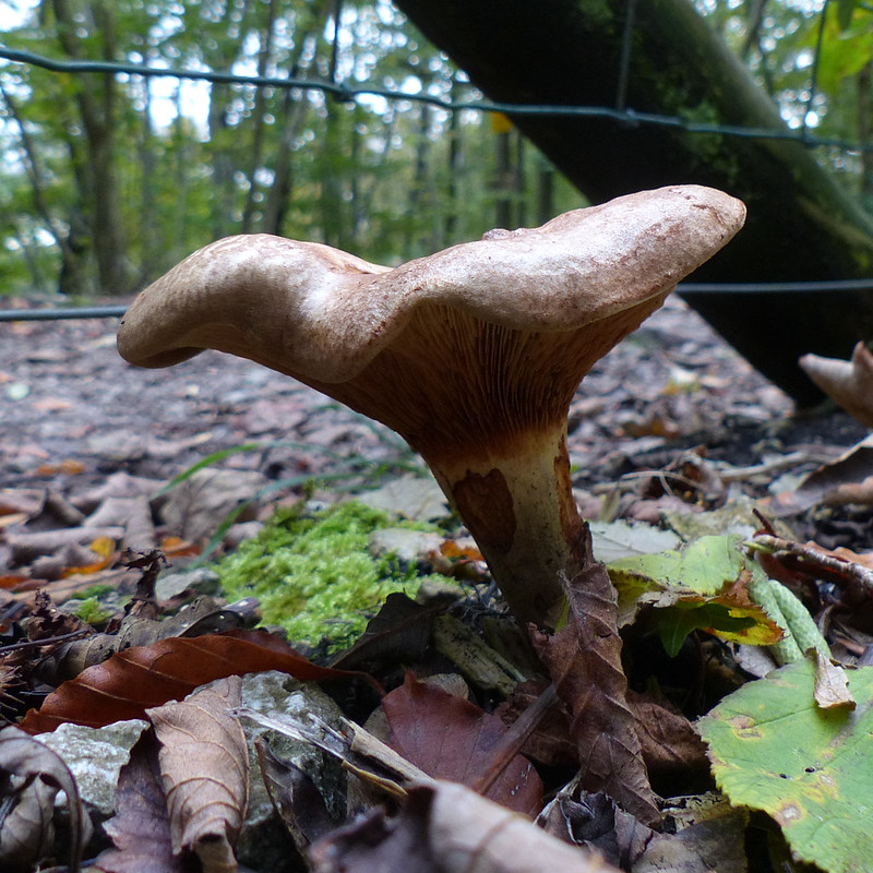
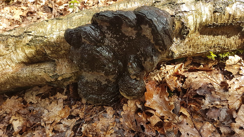
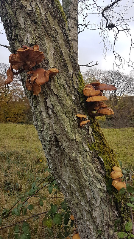
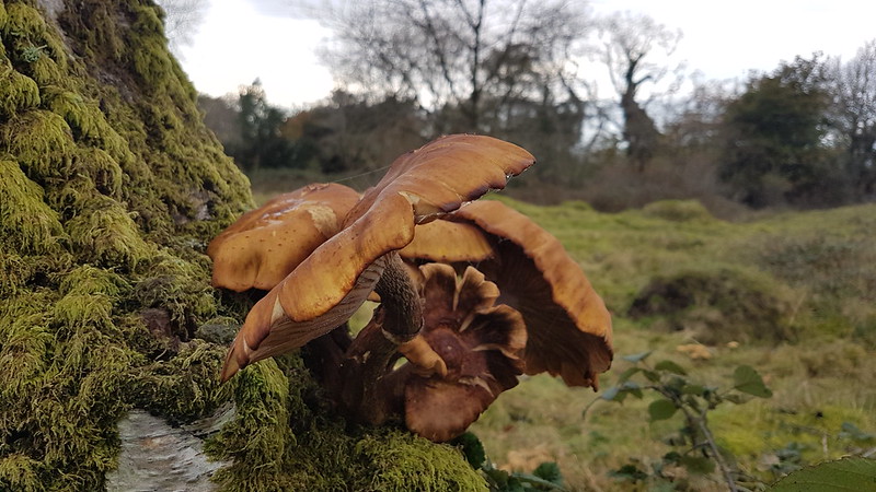
Crow.Gummer How and Whitbarrow from Arnside Knott. No sign of the Lakeland Fells beyond.Fungi.
I’ve joined a few Faceache groups, a butterflies and moths one, obviously, a plant ID one, and a fungi of the world one. I think the latter made me more conscious of the huge amount and diversity of fungi on display locally last autumn.
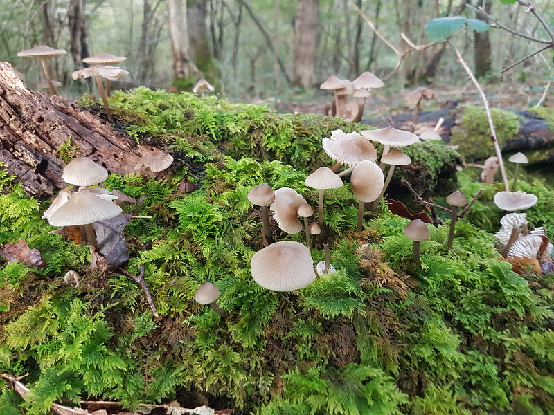
More fungi.
I took loads of photos on this walk, and through the week generally. The ones I took on this day mostly weren’t very sharp. Maybe it was a gloomy day, although there were definitely some periods of blue sky…
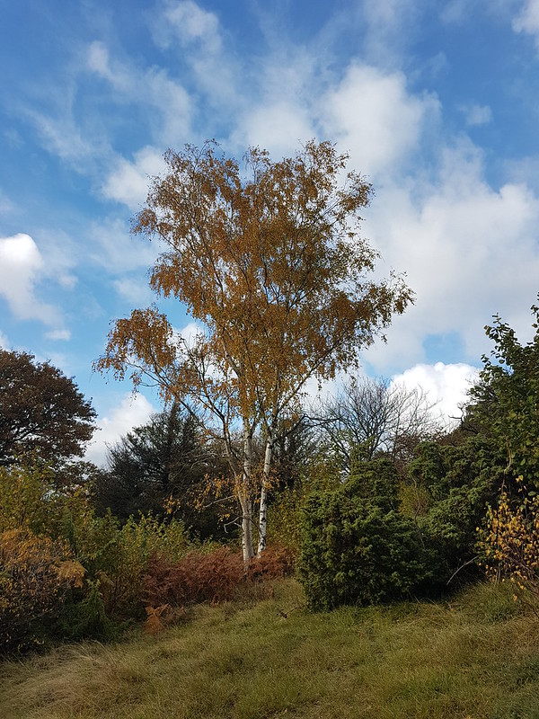
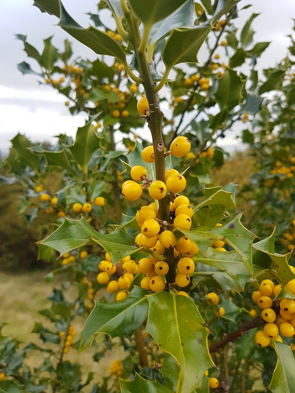
Finally, I was surprised to find this holly bush, which was liberally festooned with yellow berries. I wondered if it might be a cultivar, a garden escapee, but I’ve since read that yellow or orange berries are just a rare variation of our native holly.
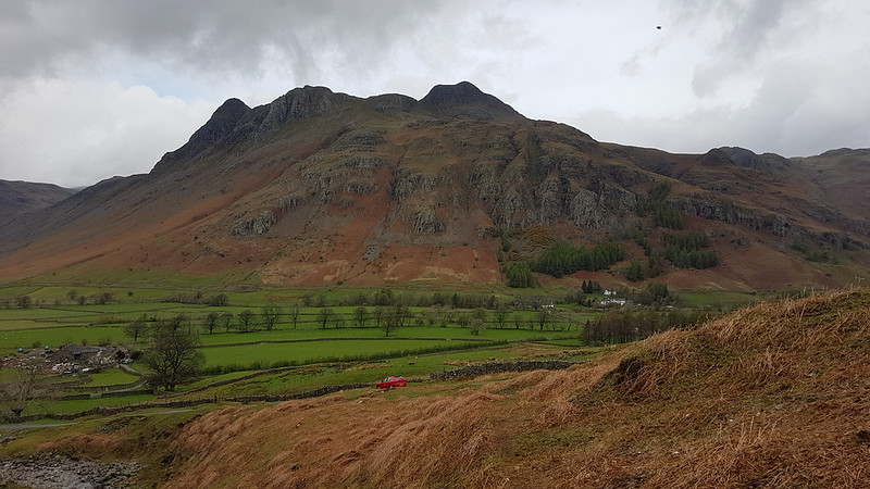
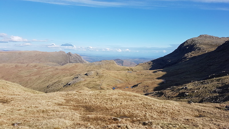
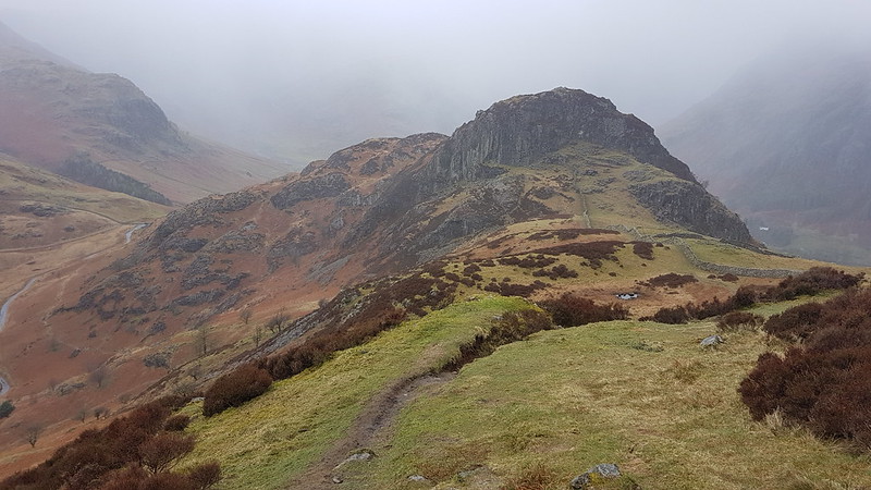
White Stones – The Band. Crinkle Crags and Bowfell hidden in the cloud, but Rossett Pike is clear on the right of the photo.
Easter Monday. The forecast was a bit mixed, but generally for improvement throughout the day. I had big plans, so I’d set off early and was parked up in the National Trust carpark by the Old Dungeon Ghyll Hotel while there was still plenty of room.
Pike of Blisco.Side Pike.
As I walked up the road towards Blea Tarn the cloud lifted off the Langdale Pikes, but it was cold and pretty gloomy.
Langdale Pikes.
The Langdale Pikes would dominate the view for much of the early part of the walk, and then again towards the end. I took a lot of photographs of the iconic crags.
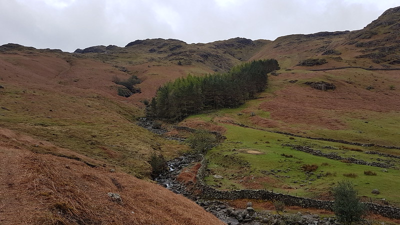
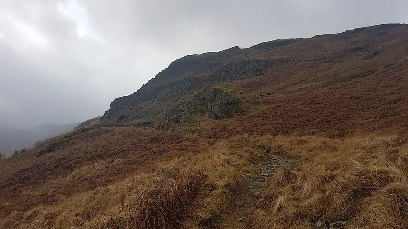
Redacre Gill.
My route up Pike O’Blisco curls right behind the stand of trees and then follows the gill into the obvious deep cleft right of centre.
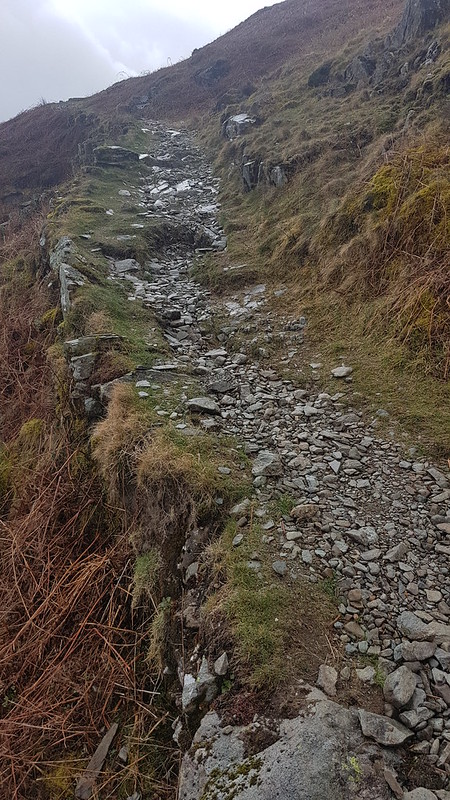
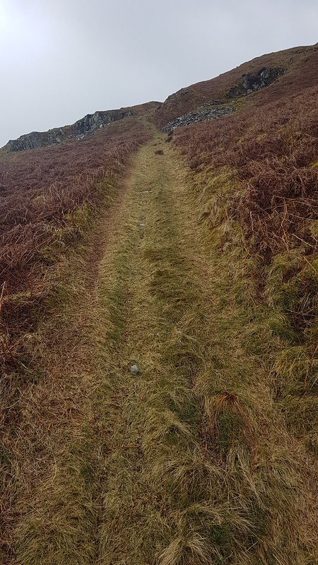
I’ve been thinking a lot recently about the incredible standard of the paths in the Lakes. This was an easy one to follow at a lovely gradient. somebody did a very fine job of making it.
It was spitting with rain now and again and my cag went on and off a few times.
A well constructed path.Kettle Crag, Langale Pikes, Side Pike.
I seem to have stopped taking panorama shots for a while, without really deciding to, but I took loads on this walk. If you click on them, or on any of the other pictures for that matter, you’ll see a larger version on Flickr.
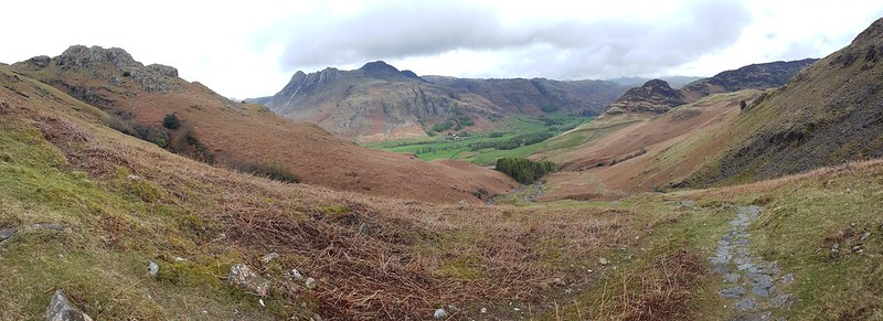
Side Pike and Lingmoor.Side-streams, in often quite deep ravines, with lots of little waterfalls, abounded. This area would definitely repay further exploration.Pike O’Blisco.
As I reached the top of the gully and the angle levelled off, the weather turned temporarily a bit grim. I have several photos obviously taken in the rain. Fortunately, it was short-lived, and when the sun appeared once again, it had wet rocks to sparkle on.
The Langdale Pikes again!Lingmoor with Fairfield Horseshoe beyond and a glimpse of Windermere.Pike O’Blisco summit.
The wind was blowing from the west, so those large slabs just below the summit offered superb shelter. I settled down, leaning against one of them, poured myself a hot cordial and video-called my Dad to wish him a happy birthday.
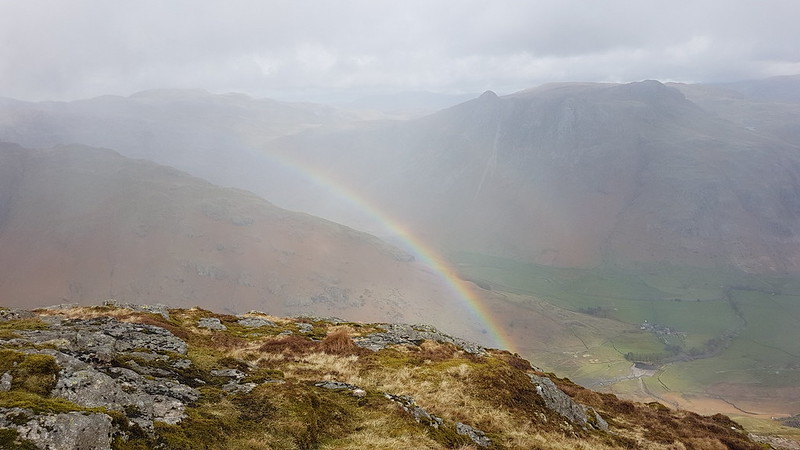
Langdale Pikes and a rainbow.
It was soon raining again, but I had a well-sheltered spot and it didn’t seem to matter too much somehow.
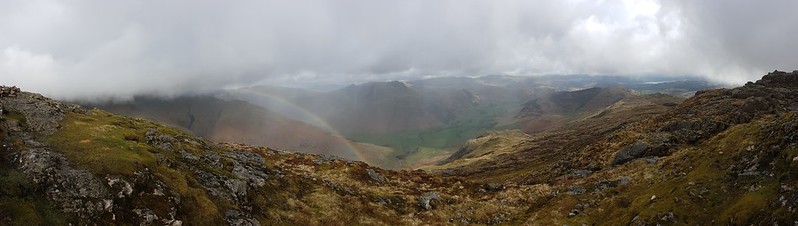
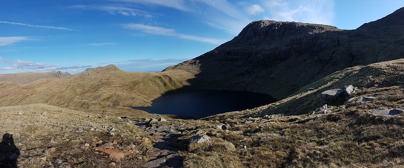
Rainbow panorama.Red Tarn and Cold Pike.
Cold Pike was my next target. I decided to take the path which angles up towards the head of Browney Gill, but then strike left when the angle eased.
Red Tarn again. Wet Side Edge behind, which is heading up to Great Carrs, hidden in the cloud.Looking back to Pike O’Blisco. The broken crags on the left look like they might give a good scrambling route.Pike O’Blisco disappearing into the cloud, from near the top of Cold Pike.
I found another sheltered spot on Cold Pike for another quick stop. The clouds blew in once again. The weather was changing very quickly.
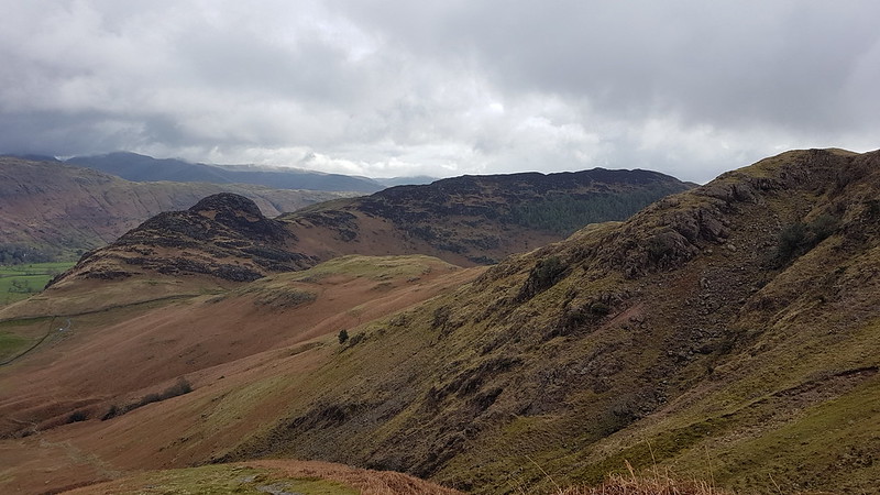
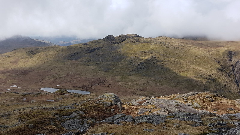
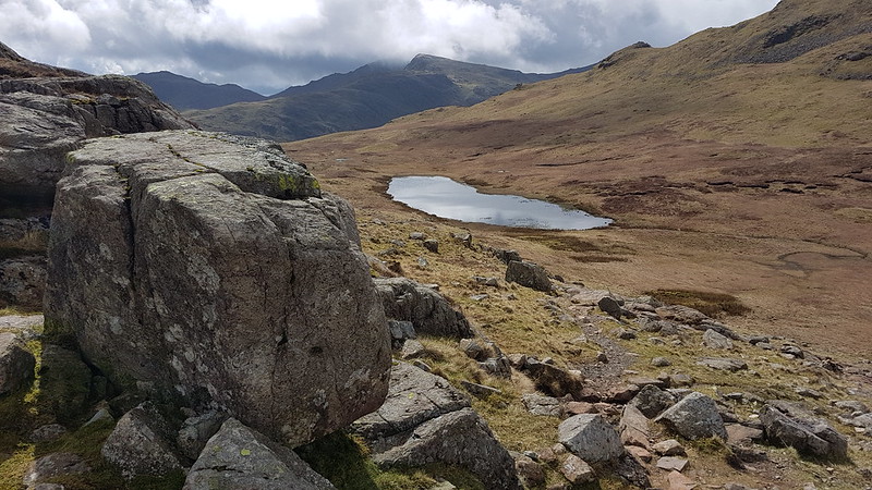
Pike O’Blisco from Cold Pike. The Helvellyn and Fairfield range behind.Looking back to Cold Pike.Pike O’Blisco and Cold Pike. Wetherlam behind.Panorama from the same spot.The many tarns of Stonesty Pike. The Duddon Estuary, Harter Fell, Whitfell and Black Combe behind.Crinkle Crags.Upper Eskdale and the Scafells.The ‘Bad Step’. There were a couple of guys standing beneath it, having quite a lengthy discussion before deciding to follow the path around to the left. I went round too. I’ve been both up and down that way in the past and I don’t remember it being all that difficult.Bowfell just about out of the cloud.Lingmoor and Pike O’Blisco. Windermere beyond.The Duddon Valley and Harter Fell.Langdale, Lingmoor and Pike o’Blisco.Panorama – Scafells, Bowfell, Langdale Pikes, Langdale, Pike O’Blisco, Windermere, Coniston Fells.
There are a lot of ups and downs on Crinkle Crags. The scenery is fantastically rocky, but it does mean you really have to concentrate over where you are putting your feet to avoid taking a tumble.
Scafells.
If the Langdale Pikes had kept drawing my eye during the early part of the walk, it was now Scafell and Scafell Pike which were hogging my attention.
The weather hadn’t been too bad, but it was getting bluer and brighter…
Scafells again.Bowfell.Scafells and Bowfell panorama.Pike O’Blisco and Wetherlam.Pike O’Blisco, Crinkle Crags and Three Tarns.Langdale Pikes from Bowfell. Helvellyn and Fairfield range behind.Esk Pike, Grasmoor, Allen Crags, Glaramara, Skiddaw, Blencathra.Scafells.Langdale Pikes, Langdale, Lingmoor, Windermere.Pike O’Blisco, Wetherlam, Coniston Old Man, Crinkle Crags, Dow Crag.Esk Pike.
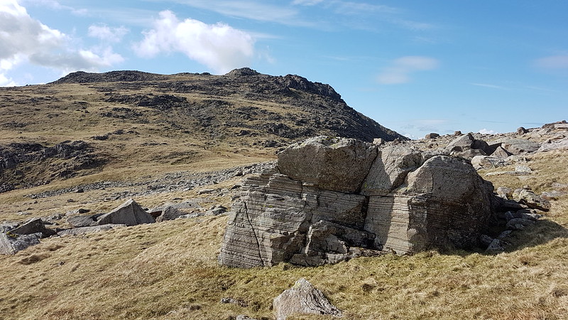
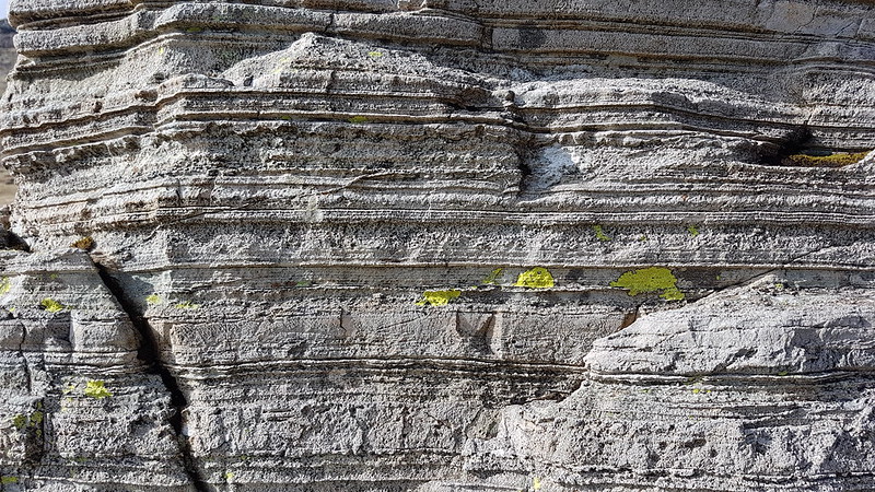
I know that the geology of the Lake District is quite complex, with some igneous rocks, lots of slate, periods when the area was underwater and sedimentary rocks were laid down, three separate periods of orogeny lifting the hills, glaciation etc – but I don’t often feel like I know what I’m looking at. The rocks on this walk seemed to change quite often.This large boulder, in Ore Gap had lots of parallel striations which make me think it must be sedimentary. And yet we’re in the central part of the hills, close to Borrowdale, where I thought the rock would be volcanic?
Sedimentary, my dear Watson?
I have a book on the shelf in front of me, ‘Lakeland Rocky Rambles’, which I’ve never really dipped in to – hmm, could be a new project.
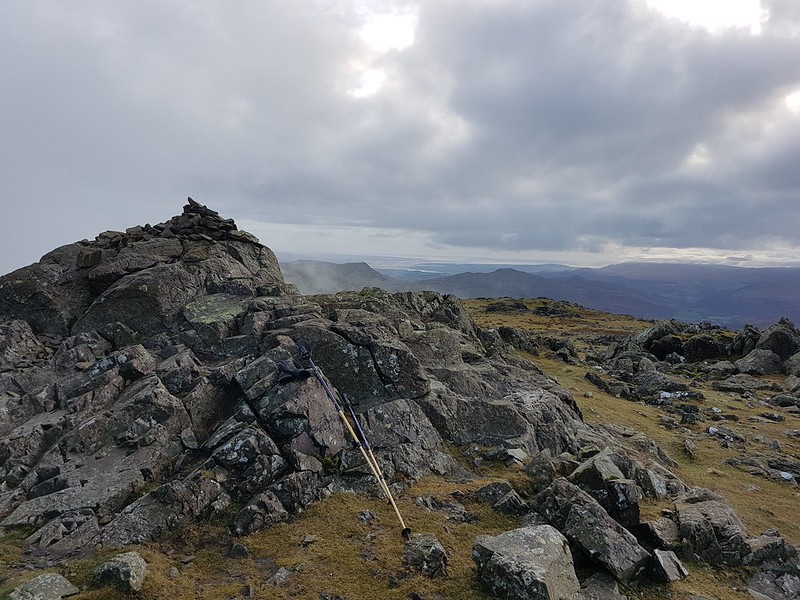
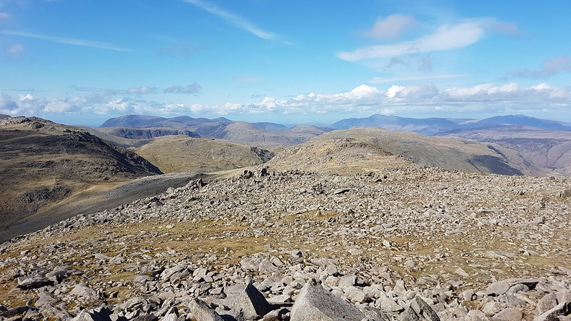
Dale Head, Maiden Moor, Allen Crag, Glaramara, Derwentwater, Skiddaw, Blencathra. (And Many more!)Looking back to Bowfell and Crinkle Cragsfrom Esk Pike.Great End, Great Gable, Green Gable, Grasmoor and more of the North-western fells.Langdale Pikes,Rossett Pike, Bowfell. Angle Tarn panorama.Panorama from Rossett Pike.Langdale Pikes, Langdale and Lingmoor from just below the summit of Rossett Pike.Buck Pike and Black Pike – my descent route.Another panorama.
I think it’s 11 years since I was last on Rossett Pike. Back then, I didn’t get too much of a view, but I did have my one and only (so far) close encounter with a Dotterel. That was also towards the end of a walk, and thinking back, I’m pretty sure that whilst I may not be particularly fit, I am at least fitter now than I was then.
Buck Pike.Pike O’Stickle and Mickleden.
I picked up a path which skirted below Black Crag and kept me in the sun for a bit longer. It was a great way down, never too steep, and deposited me on the path down from Stake Pass which has superb zig-zags. Once down in the valley I followed two walkers, one of whom was barefoot. I met another barefoot walker a couple of weeks later. I quite like the idea, but I think I would probably stub my toes roughly every five minutes.
I wasn’t quite dark when I arrived back at the car, but it wasn’t far off.
Around the head of Langdale.
Some hike stats:
MapMyWalk gives a little over 13 miles (although once again, confusingly, the numbers on the map make it look closer to 25 km i.e. well over 15 miles. Who knows.) The app also suggests 1162m of ascent, which is definitely an underestimate. For a slightly different route, over exactly the same hills, Walking Englishman gives 12 miles and 1466m of ascent. I think the truth, for the climbing at least, lies somewhere between those two figures. The fact that they differ by around a 1000 feet is a bit shicking!
It was far enough, at least, to leave me feeling pleasantly tired by the end.
Despite all the effort, there are ‘only’ six Wainwrights, to wit: Pike O’Blisco, Cold Pike, Crinkle Crags, Bowfell, Esk Pike and Rossett Pike.
There’s lots more Birketts because all of the Crinkles are on the list. And some of the bobbles on the ridge down from Rossett Pike – but I wasn’t very careful about which of either of those I actually visited, so I shan’t list them on this occasion.
Leaving aside all of the stats, it was an absolutely superb day which will live very long in the memory. All day long I was thinking that this area is definitely the best bit of the Lakes. But I was thinking much the same thing when I did the Coledale Horseshoe, so I think all we can conclude is that I’m fickle!
Braithwaite and Skiddaw from the lower slopes of Barrow.
This as the day after my Steel Fell – Helm Crag circuit and my fourth consecutive day in the hills. It’s a long time since that happened. We have an electric car these days, and I’d driven up to Braithwaite nervously watching the charge dropping, since this was the furthest I’d been in it. I needn’t have worried.
I’d been looking at websites, this one in particular, which detail routes enabling the dedicated bagger to knock off all of the Wainwrights in no time flat. That’s where the idea for my route around Martindale came from and that’s what put me on to the Coledale Horseshoe.
Swinside.
Now, to be clear, I realise that the Coledale Horseshoe is an obvious route, and I’ve walked it several times before over the years. But in the past, I wasn’t remotely aware of which tops were Wainwrights and which weren’t. Foolishly, I would begin with the steep climb up Rowling End and ignorantly bypass two potential ticks on Barrow and Outerside. (And that’s still the best approach to Causey Pike, in my opinion). So, it was seeing just how many Wainwrights I could take-in which brought me this way. In the event, I got greedy and even added a couple of tops to the route suggested on Walking Englishman. I truly have tick-fever!
Cat Bells.
Anyway, I’m getting ahead of myself. There’s a fair bit of street parking in Braithwaite. I was walking a little after nine, popping in to a little local shop to supplement my pack-up with a homemade pasty. It’s a long steady pull up Barrow. There were a handful of other walkers about. Actually, the same applies all day: I saw a few people, but it was never busy and later on it seemed like I had the hills to myself.
From Barrow: Causey Pike, Scar Crags, Sail, Eel Crag, Outerside, Stile End, Hopegill Head, Grisedale Pike.
Just down from the top of Barrow, I found a little hollow in the heather which was quite well sheltered from the wind for the first of several hot grapefruit barley-water stops.
Looking back to Barrow.
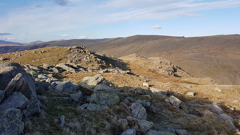
From Barrow the main path skirts around Stile End, but it’s a Birkett, and gripped by tick-fever, I thought I would include it in my circuit. Come to that, I think the main path misses Outerside too.
Braithwaite, Skiddaw and Blencathra.
It was on the steep nose of Outerside that I got the first hint of just how windy my walk was going to be that day. It had been fairly breezy up till then, but now I found myself having to pause occasionally to get my balance.
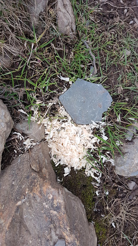
A ‘hash’ trail? I saw a number of piles of sawdust on the path over Outerside. I suspect this was a ‘hash’ trail for runners to follow, although my impression was that hashing involved following a trail laid down by ‘hares’ and stopping at pubs for a quick round of drinks. This location seemed a bit unpromising on the booze front.From Outerside: Stile End and Barrow, Blencathra, Keswick, Great Mell Fell, The Dodds and Derwentwater beyond.
In fact, it was so windy that I was wondering whether I would have to cut my route short. In the bizarre way that this can happen in the hills, on top of Outerside there was virtually no wind at all. My next move would be to take the path which traversed up toward Causey Pike. Since the wind was coming from the south and this path crossed a north-facing slope, it would surely be sheltered? I decided to continue and find-out how difficult the going would be on the ridge.
Causey Pike – note the easy-angled path on the right of the picture.
In the event, this slope wasn’t protected from the wind at all, which seemed to have decided to reverse it’s direction and blast this path with great venom. But then, on the ridge, which you would think would be really exposed, it was relatively calm.
Sail and Eel Crag.Sand Hill, Hobcarton Head and Grisedale Pike.Pano: Grisedale Pike, Outerside, Skiddaw, Stile End, Barrow.Scar Crags, Sail, Eel Crag, Coledale Hause, Sand Hill, Hopegill Head, Hobcarton Head.Causey Pike.
Just to the left and slightly below that final knobble on Causey Pike I found a small crag with a perfectly flat patch of ground beneath it which was almost entirely out of the wind and stopped for my lunch.
From Scar Crags, looking at the zig-zags on Sail and Eel Crag beyond.
The going was quite easy along the Scar Crags ridge and although, disappointingly, you can’t tell from my photographs, the clouds began to thin and break up, the sun came out, and most of the rest of the day was much brighter.
Sand Hill, Hopegill Head, Hobcarton Head, Grisedale Pike.
The Fix-The Fells people, presumably, have done a superb job with the path on Sail, which is slightly raised above the surrounding hillside and which glides up the hill in seventeen gentle zig-zags. (Okay it may not be seventeen, I’ve forgotten, but I did count them from the bottom, so that I could use them to measure my progress as I climbed).
From Sail: the ridge onto Eel Crag.
The OS, and Mr Birkett, call this fell Crag Hill, and down to the right, there’s another Birkett, which, confusingly, he calls Eel Crag. Had I done my research in advance I could have diverted to include it, but I didn’t, and anyway this walk was quite long enough as it was. I shall have to come back, but a walk around the edge of this combe looks an enticing prospect, so that’s no hardship.
And again, from the Coll.Looking back to Sail and Causey Pike.
I’d had a brief chat with the chap in this picture, mostly about the wind, who cheerfully told me that it was ‘much worse’ on Grisedale Pike and that he had thought he was going to be blown off the hill.
Sand Hill, Hopegill Head, Hobcarton Head, Grisedale Pike. Skiddaw and Blencathra from Eel Crag.Grasmoor from Eel Crag.
I hadn’t really decided to definitely include Grasmoor in my loop until this point. But the sun was shining, I was feeling good and making reasonable time, so why not? And while I was at it, I might as well have a wander out to Wandope too.
Wandope.Wandope again.
I don’t know why, but for some reason, this section of the walk was particularly wind-blasted. Briefly I was leaning sideways and staggering about.
Looking back to Scar Crag on Crag Hill.Grasmoor.
On Wandope Moss I was staggered to see three walkers completely open out their large map. I expected to see them sail away toward Coledale Hause clinging to their map, but somehow they managed to keep it under control and even refold it neatly. I was half tempted to ask them where they wanted to go, but then they set off toward Whiteless Edge, without needing my assistance.
The Solway Firth and Criffel (I think) from Grasmoor. A bit hazy!A host of hills from Grasmoor.
You can just see the edge of the rough stone shelter on Grasmoor. It offered a little protection from the wind, so I stopped for another drink and to admire the expansive views.
Sand Hill, Hopegill Head, Hobcarton Crag, Grisedale Pike. Skiddaw and Blencathra beyond.
The route down, skirting the edge of Dove Crag, was lovely, but required a bit of care, with the wind blowing hard over the edge.
Dove Crag on Grasmoor.
In fact, further down a gust caught me as I was off balance, and I do go over, but only on to my behind and fortunately I wasn’t hurt.
Grisedale Pike.Sand Hill.
I’d been thinking that the top of Liza Beck would probably present another opportunity to get out of the wind and that proved to be the case, so I stopped both to drain the last of the cordial in my flask and to refill my water-bottle, a birthday present from TBH which has a built-in filter for precisely this sort of eventuality.
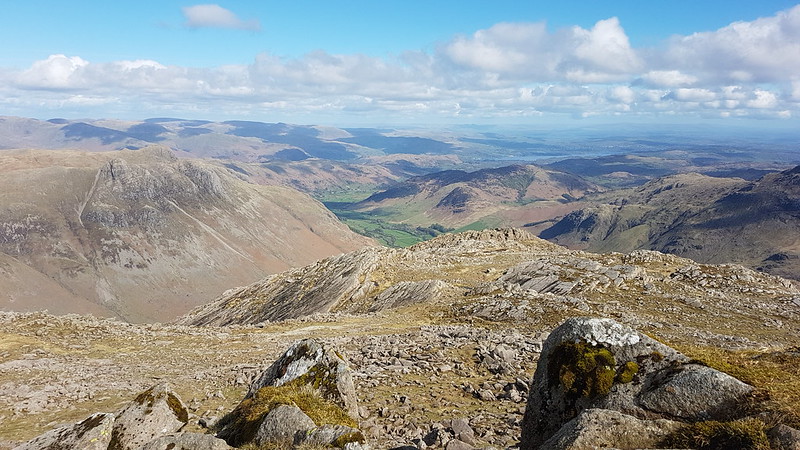
Dove Crag on Grasmoor.Eel Crag – I definitely need to come back to traverse that edge..Grasmoor again.From Hopegill Head: along the ridge to Whiteside.From Hopegill Head: along the ridge to Whiteside.The northern end of Crummock Water visible down through the valley.From Hopegill Head:Grisedale Pike and Hobcarton Crag.Hopegill Head and Ladyside Pike.Sail and Eel Crag.Grasmoor, Hobcarton Crag, Grisedale Pike and Whiteside. In reality, the sky looked much blacker than this.
Disappointingly, you can’t tell at all from this photo, but when I reached the top of Grisedale Pike the skies to the south and west were really black. It looked like it was probably raining on Grasmoor. The ridge is quite defined at this point and by bobbing down on the north side of the top I could get into a fairly well sheltered spot. My first thought was that the very dark skies would make for some dramatic photos and I snapped away gleefully. Then it occurred to me that the wind would bring the showers this way and that I was about to be engulfed in some very heavy rainfall. So I used the shelter to hastily pull on my waterproofs (in the case of my trousers, full of holes and more duct-tape than trouser, that name can only be used ironically).
None-too-soon, as I finished getting them on it started to chuck it down. It was a fierce shower which lasted around 40 minutes. The first, steep, part of the descent slithering down wet, slippy rocks and loose scree in horizontal rain, was really not much fun. But when the gradient and the rain eased I could reflect on a very satisfying day on a magnificent range of hills as I plodged down into Braithwaite.
Some walk stats: MapMyWalk gives a little over 12 miles, although, as you can see, I paused the app on Grasmoor and didn’t restart it until Coledale Hause, and the numbers on the map seem to show a little over 22 km, which is close to 14 miles and might be nearer the truth. The map and the figures given often don’t tally, which is a bit weird. The app also gives a little over 1300m of ascent, but that’s definitely a bit short of the mark.
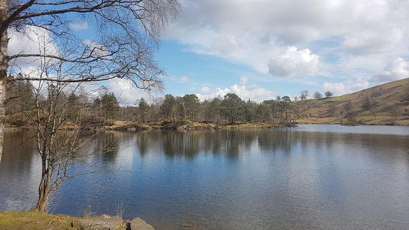
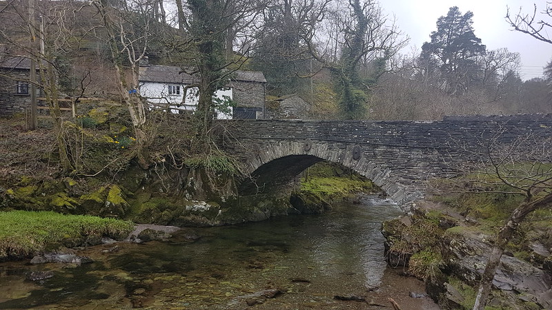
Two days after my birthday, and time to climb some actual hills, although, in truth, quite diddy ones. I can’t remember why, but it was already well after midday when we parked in the car-park just off the busy A593 which runs between Ambleside and Coniston. We were in the little car park near Glen Mary Bridge which has the dual advantage of being a National Trust carpark and of being beside Tom Gill, the stream which drains Tarn Hows.
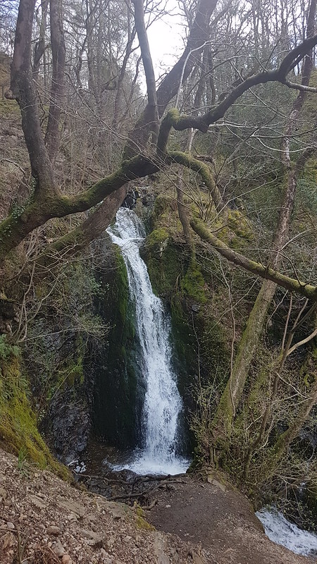
Tom Gill Waterfall
We’ve been this way before, and knew that the walk up through the woods, besides the many waterfalls in Tom Gill would be delightful.
Tom Gill WaterfallIn the woods.Tarn Hows
When we arrived at Tarn Hows, the sun was shining and it was really very attractive. I could almost understand why the crowds flock there. It was a bit too cold and a bit too busy to strip off for a swim, so we decided to have a very early, at least in terms of the walk, lunch stop by the shore of the tarn.
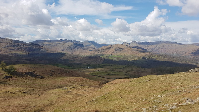
Inevitably, away from the tarn, it was much quieter as we headed steadily up through Iron Keld Plantation towards Black Fell. (The OS have both Black Fell and Black Crag, but since I am currently obsessing about ticking off Wainwrights, I’ll stick with the name the old curmudgeon used.)
Looking towards the hills around Langdale and Eskdale.
It was no surprise that the views from Black Fell are superb, but fabulous to have such fine conditions to enjoy them. I was disproportionately chuffed that Lingmoor, where I’d been earlier in the week, featured prominently in those views.
Ambleside and the head of Windermere.Wetherlam.Looking towards Helvellyn and Fairfield.
The weather looked a bit grim over the long ridge of hills which runs north-south between Clough Head, the Dodds, Helvellyn, and the Fairfield Horseshoe. It looked grim over those hills all day. Curious how that can happen and how localised the weather in Cumbria can be.
Below the top of of Black Fell there’s a very substantial cairn. We decided to investigate.
And then decided to have a second lunch stop just below the cairn from where there was an excellent view along Windermere…
The weather still looks grim towards Helvellyn and Fairfield.On our descent, Coniston Water in the distance.
We were on the same path we had followed when we walked from Coniston to Ambleside last summer, although we would divert off to the left fairly soon.
The weather still looks grim towards Helvellyn and Fairfield.Low Arnside Farm. Grade II listed. Property of the National Trust. The gift of Beatrix Potter.
I’m beginning to wonder if there are any old buildings in the Lake District which Beatrix Potter didn’t buy and give to the National Trust.
The weather looks even grimmer towards Helvellyn and Fairfield.
We still had sunshine, but it wouldn’t last much longer. We soon had the first of several short showers, with a little hail mixed in. We didn’t see much sun after that, but it generally stayed fine at least.
Only Lingmoor has the sun.
Although I’ve climbed Holme Fell quite a few times over the years, I’ve never used this route before, up the long broad ridge from Oxen Fell via Man Crag. It’s a terrific route which I discovered in one the Aileen and Brian Evans Cicerone ‘Short Walks’ guides.
The weather looks marginally less grim towards Helvellyn and Fairfield.Black Fell. Not black. Unlike the skies behind it.Yew Tree Tarn and Coniston Water.
We had another brief drink and snack stop on the ridge, but it had become a bit cold and windy to stop for very long.
This is an extremely lumpy ridge with lots of rocky little knolls. Fortunately, we found a series of little paths which wound around the bumps.
Ivy Crag on the left, the top of Holme Fell on the right.The disused reservoir over TBH’s shoulder is reputed to be a good place to swim. It’s on my list!The top.
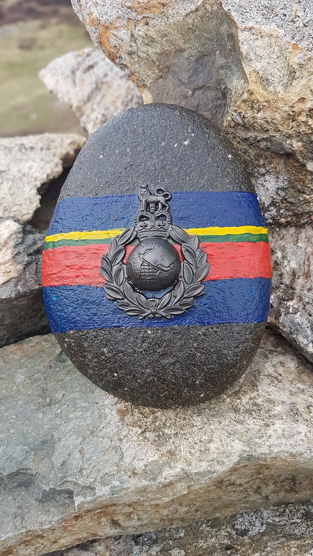
This painted stone was on the summit cairn. I wish I knew what it was commemorating? The writing just says Africa, Europe, Asia, Aust so I’m not sure that helps. Curious that the Americas are omitted.
Coniston Water.On the descent. Holme Fells impressive crags behind.Yew Tree Farm and Barn. Grade II listed. Property of the National Trust. The gift of Beatrix Potter.Inevitably. I liked the open gallery along the front of the barn.
Some stats: MapMyWalk gives 7½ miles and 360m of ascent. The Evans say 6¼ miles, but their (excellent) route drops down from Uskdale Gap and so misses the top of Holme Fell which probably accounts for the difference.
If you’re looking for a half-day walk in the Lakes I reckon you’d be hard-pressed to beat this one for variety and views.
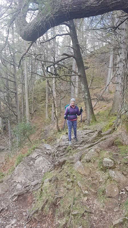
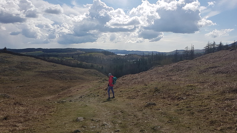
The ‘upper’ path from Far Arnside. Third time running I’d foolowed this path, which I don’t usually use.
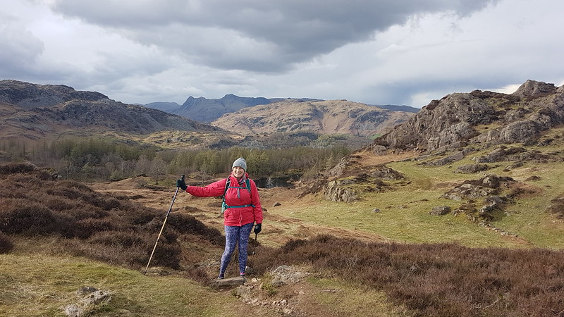
Long-suffering readers will know that on, or close to, my birthday I like to climb a hill to celebrate. This year, my Lingmoor walk was just two days before my birthday and a couple of days later I was back in the Little Langdale area with TBH, so I did pretty well.
On the actual day, the forecast was pretty ropey. Never-the-less, we managed to persuade the boys to join us for a walk to Arnside over the Knott. Possibly the promise of a pie in Arnside had some influence on their decision.
In Far Arnside, we sheltered behind a tall hedge for the duration of a short, sharp hail shower. It was pretty fierce, but also wind-driven so that in the lea of the hedge it came over our heads and we didn’t do too badly.
Warton Crag, the Bay and Bowland from Heathwaite. I think you can see showers tracking in off the Bay.Taking a Heathwaite selfie. Not sure why Little S wasn’t included.Far Arnside and The Bay. As we approached the toposcope on the Knott, the heavens opened again.Kent Estuary in the rain.River Kent, Cartmel Fell, Gummer How, Yewbarrow and Whitbarrow Scar – bigger fells beyond conspicuous by their absence.
Fortunately, it was another short-lived shower. And the pies and sausage-rolls at the Old Bakehouse went a long-way as compensation for the changeable weather.
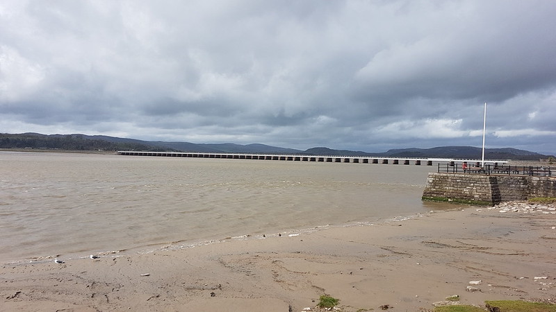
Kent Viaduct. Louring skies.Arnside Tower – blue skies!
As I said – a very changeable day.
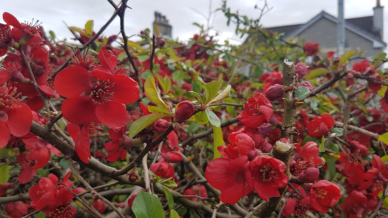
Quince.
A had been working on my birthday and so wanted to go for a walk the following day. The weather was similar to the day before and although we had originally planned to go to Arnside for pies again, A eventually decided that a short Eaves Wood stroll would have to suffice.
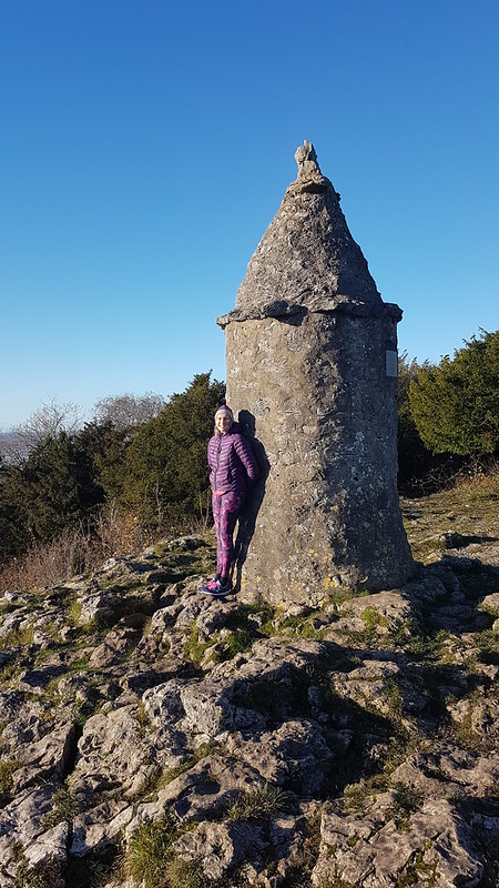
TBH and A at the Pepper Pot.
It’s very handy having some little hills on the doorstep to climb when the weather isn’t conducive to a longer expedition!
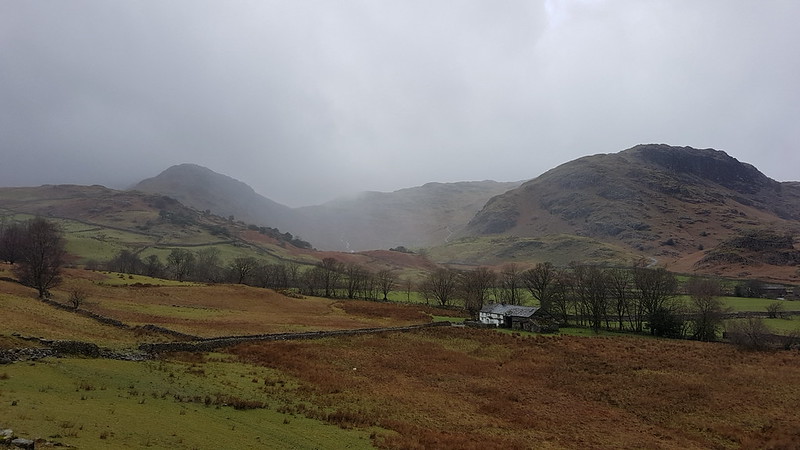
Blea Tarn. Side Pike on the far side and the Langdale Pikes obscured by clouds behind.
B had a shift in the cafe at Brockholes; since I was dropping him off there, I decided to stay in the Lakes and make the most of it, despite a fairly ropey forecast. I had a fine time, even though it rained on and off most of the day.
I parked up by Blea Tarn, another National Trust carpark, although the joy of ‘free’ parking was tempered by high winds and driving rain which weren’t terribly encouraging. I rarely set-off for a walk in full waterproofs, I’m a fair weather walker, as much as I can manage to be.
Looking back towards Blea Tarn. The plug of rock in this photo is Tarnclose Crag.
Fortunately, my route started downhill into Little Langdale and I hadn’t walked far before both the wind and the rain had abated a bit.
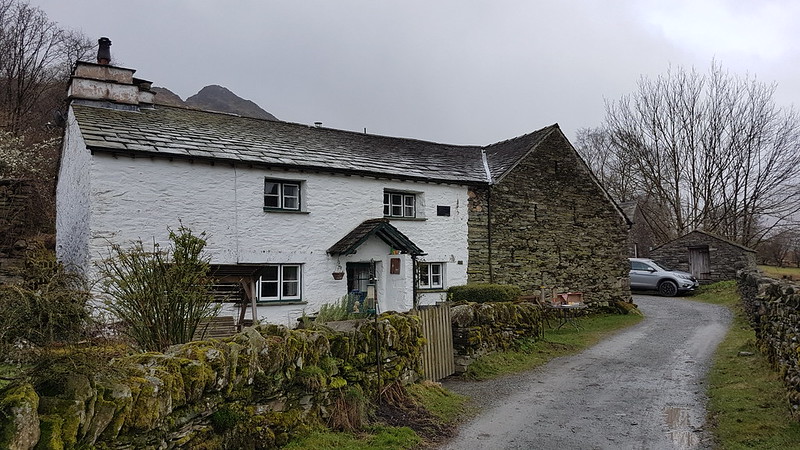
Farmhouse at Fell Foot When the skies are grey and the weather is rotten, I always think the white-washed stone buildings still look attractive. I’ve often thought that the porch over the door here is unusual. Turns out this is a Grade II listed building.
“At the foot of Wrynose Pass. C16 north wing, the main block C17. A long, low house, white-washed stone rubble, flag roof, 2 storeys. The door is under the overhang of a slate-hung upper storey, gabled, and without windows, the timber beam ends showing in the gable.”
This shows the entire farm complex at Fell Foot with Castle Crag behind, itself a scheduled monument because of it’s suspected history as a hill-fort. By the farm there’s the Ting Mound where the Norse inhabitants of the valley had council meetings.
Behind Castle Crag you can see Lingmoor which is out of the cloud and would remain so all day, unlike any of the surrounding higher hills. I assume these very rocky lumps – Side Pike, Tarnclose Crag and Castle Crag are volcanic in origin, but would love to find out more.
Bridge End Cottage.
The National Trust own both Fell Foot Farm and Bridge End Cottage, in the latter case at least, gifted to them by Beatrix Potter. Bridge End Cottage is another grade II listed building.
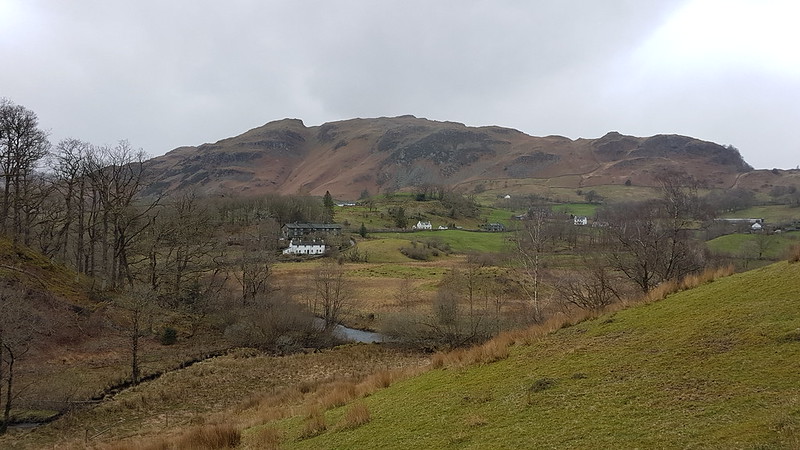
I had half an idea that I might be able to bag Holme Fell and Black Crag as well as Lingmoor, but I needed to collect B from Brockholes at the end of his shift, and even I could see that I would be pushing it to manage all that and still arrive on time to pick him up. On the other hand, just climbing Lingmoor would undoubtedly leave me with quite a bit of time to kill, so I decided to extend my walk along Little Langdale as far as Skelwith Bridge and then come back up Great Langdale before bagging Lingmoor.
Lingmoor and Little Langdale Tarn.High Hall Garth – you’ve guessed it, Grade II and property of the National Trust.Low Hall Garth. Owned by the NT, gifted by Beatrix Potter, Grade II. Lingmoor and Slater’s Bridge.
I didn’t divert, as I usually have, to photograph the marvellous Slater’s Bridge – it was very busy. It has appeared on the blog many times before. (Here for example, or here). It’s an amazing structure, in a low-key picturesque sort of way. I’ve never thought to look up it’s protected status before, but it turns out that it trumps the other local properties by being Grade II*.
“Slater’s Bridge II*. Over River Brathay. C17 packhorse bridge of slate and natural boulders. Huge boulder in mid-stream supports segmental arched bridge of 15 ft span with 3 1/2 ft voussoirs, and a flat causeway of a single slab on slate supports.”
Voussoirs? A wedge-shaped or tapered stone used to construct an arch, obviously. Learn a new thing every day! (And forget it the next sadly.)
The obvious knobble on Lingmoor with a prominent gully on its right, is Busk Pike, of which more later.
No sign of any voussoirs at the next bridge down the Brathay, but still quite a handsome footbridge I thought.
Little Langdale and Lingmoor.Colwith Force.
At Chesters, at Skelwith bridge, I managed to buy a nice lunch* from their takeaway counter and then was lucky to get a picnic table under the eaves and so out of the rain. (*Pricey, but very tasty.)
Elter Water. Lingmoor on the left. This should be one of the iconic views of the Langdale Pikes, but they were still lost in the cloud.Bridge over Great Langdale Beck in Elterwater. Rebuilt 1702. Grade II listed of course.
Judging by Historic England’s map, just about every building in the village of Elterwater must be listed. I shall have to come back to investigate some time. Since one of those listed buildings is the Britannia Inn, that should be an enjoyable experience!
I left Elterwater on a steep and stony track and was amused by this cycle route sign at the bottom, since ‘challenging’ seems like a huge understatement to me.
This path leaves that track at around its highest point. I think it must be an old mining track, it has fabulous zig-zags and clearly someone has gone to a lot of effort in constructing it.
I’ve become a bit obsessed with being able to put a name to every hill, hump and hollow in the view. I blame Andy. The wooded hill in the middle-ground here doesn’t have a name on the OS map and there’s no path to the top, but the wooded slopes on it’s northern and eastern flanks are access land, Fletcher’s Wood, so it would be possible to get at least close to the top. The higher ground to the right, meanwhile, is the end of the Black Crag ridge. TBH and I traversed those slopes on our walk between Coniston and Ambleside last summer.
A day of contrasts – the Coniston Fells are lost in what I suspect was foul weather, whilst the sun is trying to shine on Little Langdale Tarn.
The weather had brightened up enough for me to take a short stop and drink some of the contents of my flask. The view was limited by the dense, low clouds, but still pretty good.
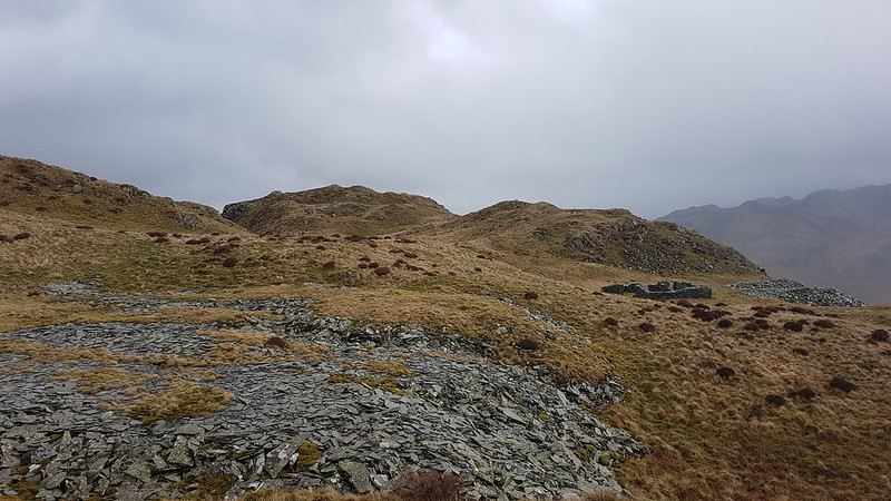
After the initial steep climb, somewhat eased by the marvellous zig-zags, a much steadier ascent ensues. There were still a number of broad grassy tracks, testament to this areas quarrying history. I took the lower path, intending to take in Busk Pike.
Looking down on Little Langdale Tarn. Holme Fell visible through the rain.Spoil heaps and small, tumble-down walled structures like this were dotted about the hillside.Busk Pike.Busk Pike again.
I’d like to revisit Busk Pike when the views are less curtailed by clouds.
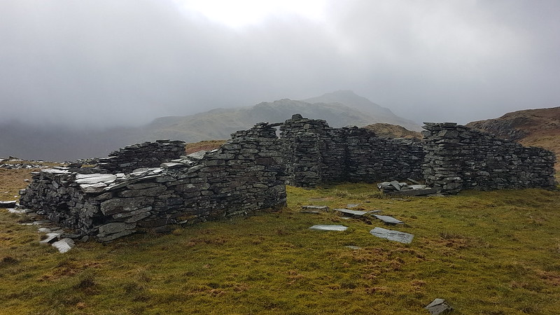
Brown How – the summit of Lingmoor – from Busk Pike. Notice the ruined buildings between the two tops.This was the biggest of the many derelict buildings I saw on Lingmoor. It provided a sheltered spot for another drinks stop. The sun even shone a little, although it also started drizzling again, just in case I was getting complacent about the weather. Looking back to Busk Pike and the the old mine buildings.And again.from a little higher up.
On the summit of Lingmoor, I met a family party of three, the first walkers I’d met since leaving the track near Dale End. We congratulated each other on the fact that it was “Not too bad”. As soon as our conversation ended, I realised that it was indeed ‘too bad’: the weather was back to how it had been when I first set-off from Blea Tarn – a howling gale and very heavy rain. It seemed highly plausible that closer to the higher hills around the head of Langdale, the weather had remained this way all day.
I was keen to get out of these conditions and back to the car, but I did divert slightly to include Lingmoor Tarn on my route…
Side Pike – it had been my intentionto include this on my route, but with the weather now so foul and with time running short, I decided to keep it for another day.MapMyWalk gives a little over 11 miles and 560m of ascent (the latter might be a bit of an overestimate)
B had told me his shift finished at 6.30, but when I arrived to pick him up (and two friends who had also been working at Brockholes that day), it turned out that, because the cafe had been so quiet, they’d been ‘sent home’ an hour early. B was furious that I hadn’t been answering my phone (it had been on flight mode, preserving the battery whilst I probably didn’t have a signal anyway). Unfortunately for B, beggar’s can’t be chooser’s, and he soon calmed down when I offered to leave him behind, if he didn’t like the free taxi-service on offer.
A post to (almost) clear-up November. On three successive weekends TBH and I got out for short local walks. Here she is on what was evidently a glorious Sunday at the Pepper Pot.
The week before, the day after my exhausting wander around Gait Barrows in the sun, we completed our standard Jenny Brown’s circuit.
It was a grey day and the only photographs I took were of these large toadstools growing on a tree in Sharp’s Lot.
On the final weekend in November A had a challenging journey, during storm Arwen, to collect B and I from a do at Kirkby Rugby club. Then, at around 2am, TBH and I were out in the gale, dismantling the trampoline which had begun the evening at the bottom of the garden, but which was now flying around our patio (which is several feet higher than the lawn where it started). The storm did quite a bit of damage – knocking out the downpipe from our gutters, moving a shed a few inches, destroying a section of fence as well as a gate etc. What’s more, we were without electricity for a quite a while – not quite 24 hours.
The path through the fields behind the house was closed due to felled telephone and powerlines, but since I could see all of the fallen lines, and avoid them, I decided to go that way anyway. One of the line of oaks had fallen…
And another, larger oak was down in the fields between Bottom’s Lane and The Row…
It was quite sad to see these trees, which I’ve photographed so many times, so swiftly destroyed.
We were actually meant to be away on this Sunday – TBH had managed to transfer our hotel booking from our postponed anniversary celebration a month before. But we didn’t get off until after dark, because B had an emergency appointment due to a suspected broken nose – a rugby injury. We might as well have gone anyway: the doctor told B that, since his breathing wasn’t affected, he could get his nose straightened out when he stops playing rugby, but not before.
Anyway, we did eventually get away – more about our brief trip in my next post.
And blow, blow they certainly did. We’re well acquainted with Atlantic storms up here in the North Wet, but we don’t often get really severe winds in the summer when the trees are in their summery finery. TBH warned me not to go down to the beach, so, of course, curiosity got the better of me and I had to go and take a look. And after I’d had a look, I abandoned any thought I’d entertained of heading out onto the sands, turned tail and sort the shelter of the woods. The woodland floor was carpeted with leaves and twigs, but it was still relatively sheltered in there.
Which begs the question, why did I venture out of the woods and across the fields by Black Dyke? I don’t remember, but I do remember that it was more than a bit draughty, was spitting with rain and that dark clouds seemed to be threatening worse to come.
Goldfinches seem to be almost ubiquitous these days; I watched a family of half a dozen flitting back and forth between an ash tree on the edge of the woods and the electric fence. I guess they were impervious because they weren’t earthed?
Black Dyke.
The footbridge over Leighton Beck – not much water running under it.
Middlebarrow and Arnside Tower from the far side of Silverdale Moss.
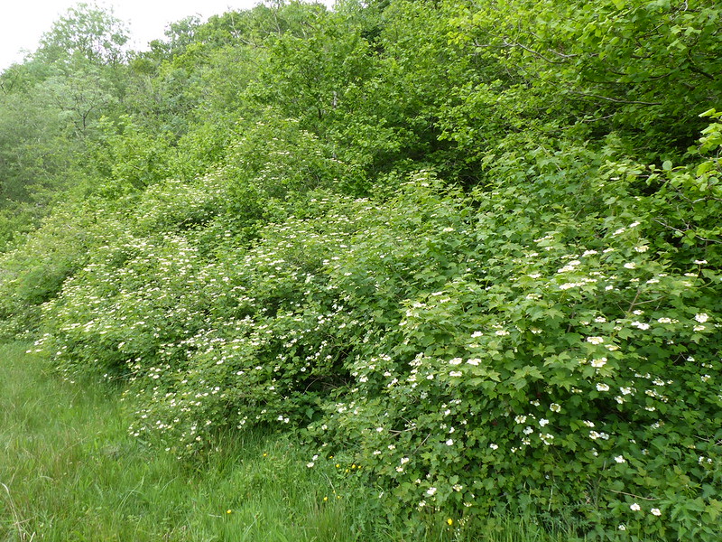
I’ve made many visits to Lambert’s Meadow this year. It seems to be a very fruitful spot for insect photos, particularly in the vicinity of this sprawling guelder rose hedge.
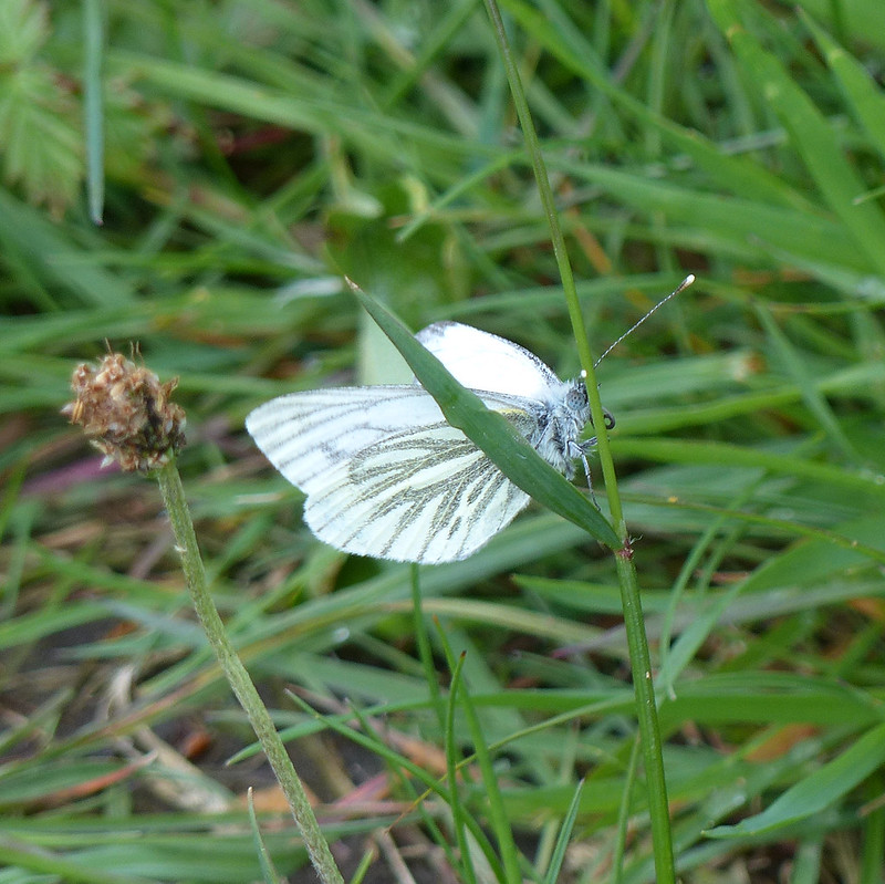
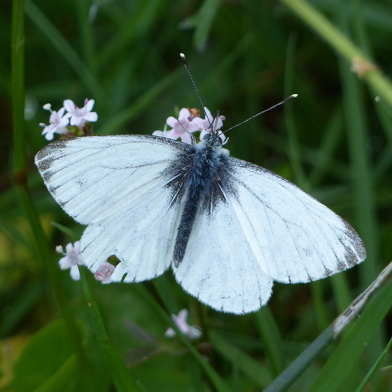
Green-veined white butterfly.
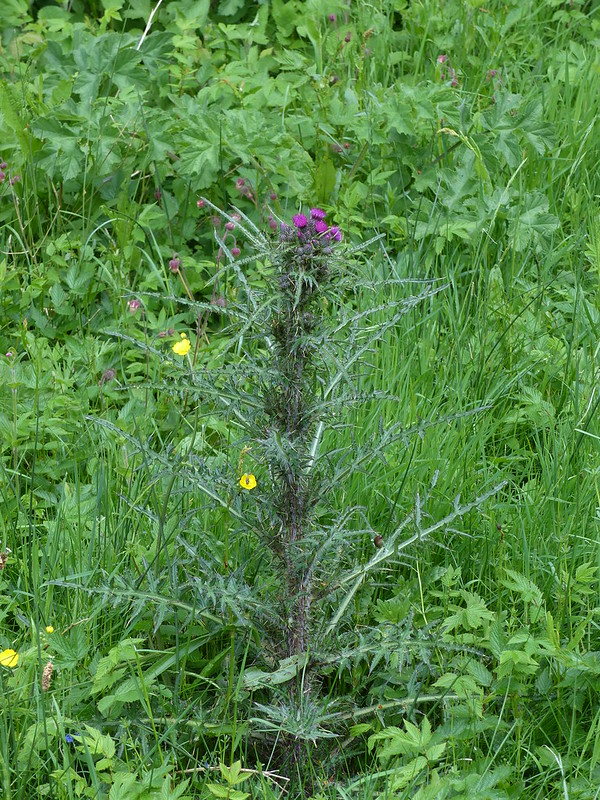
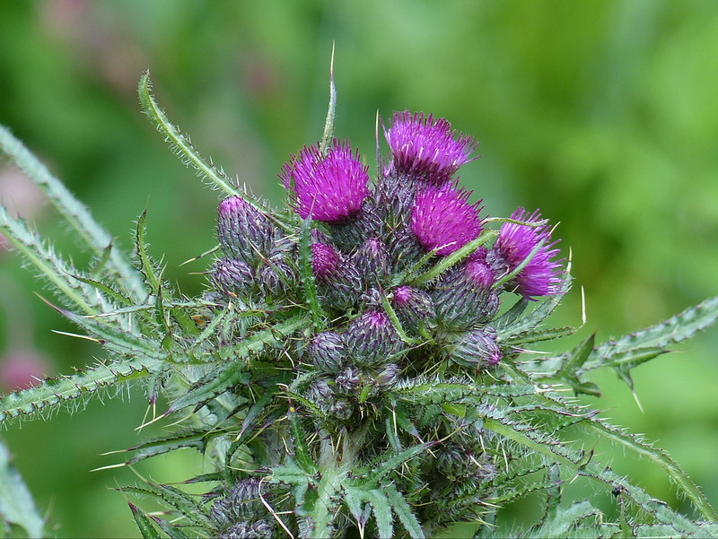
Marsh thistle. I think.
The first I’d seen flowering this year.
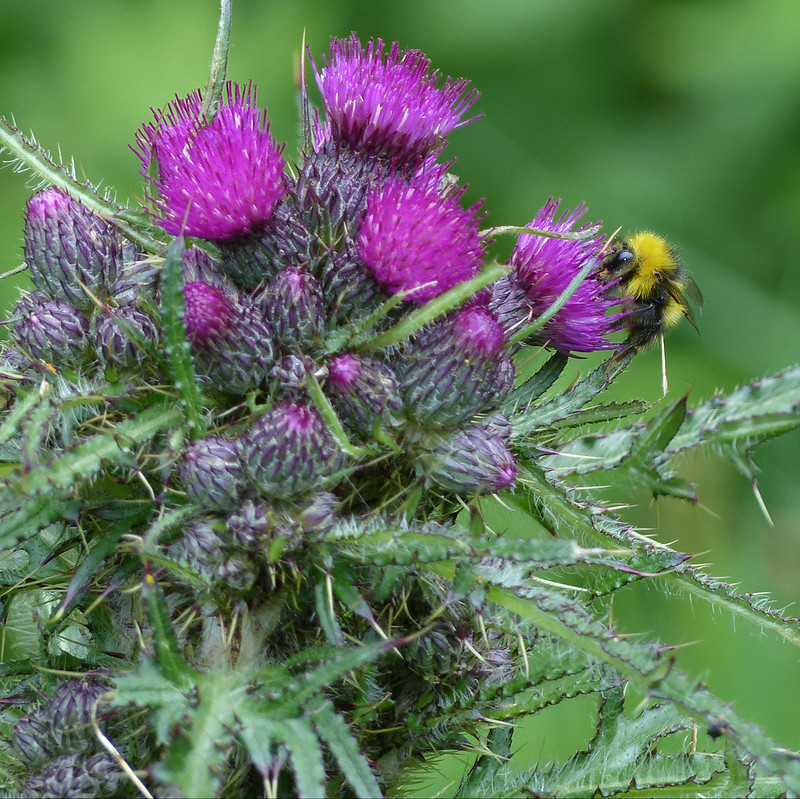
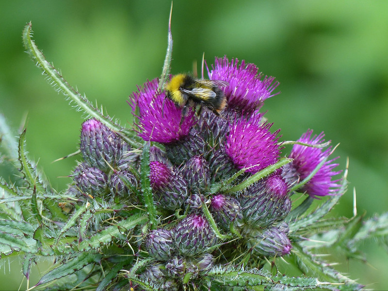
I thought they looked rather fine and this early bumblebee liked them too.
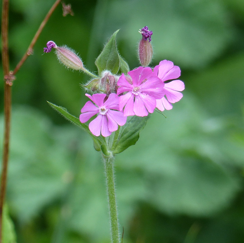
Red campion. Is pink. Why not pink campion?
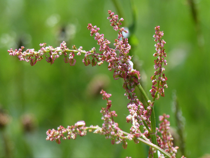
Sorrel.
The Jubilee Wood car-park on the edge of Eaves Wood. Until a day or two before this photo was taken, the car park had been closed and roped off, but here it is open and fairly busy again, reflecting the beginning of the easing of the lockdown restrictions. (This is from about a week before the end of May.)
Tunes – today amusing songs which are also great to listen too in their own right. First up…
‘Here Come the Judge’ by Pigmeat Markham
Allegedly, the first rap record, from 1968.
Then, ‘Werewolves of London’ by Warren Zevon. This one brings back happy memories of howling along with the kids in the car. This was before the boys started laughing at my musical tastes, listening to grime and opening conversations with barely articulated Caribbean slang like, ‘Wagwan fam?’
The next is a song I’ve only recently come across, ‘Sharon’ by David Bromberg.
What those three all have in common, is that they are the only songs I know by each of the artists. To finish, here’s a song by someone who, by contrast, I’ve followed since discovering great songs like this when I was at school, way back when…
That’s so clever.
Can’t help thinking I’m spoiling you here! What else should I have included? ‘Funky Gibbon’? ‘The Streak’? ‘Shut Up’ by Madness? These are all pretty old songs, I’m obviously missing some more recent possibilities.