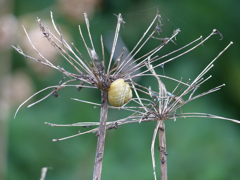
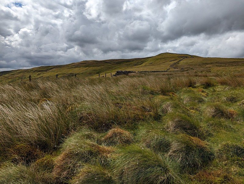
A post to deal with mid-September last year. On a dull Sunday, after a walk around Jenny Brown’s Point with TBH, I went to Lambert’s Meadow and took a few photos of spiders and a lot of photos of snails. Do snails breed in September? I don’t think I’ve ever seen so many in one visit.
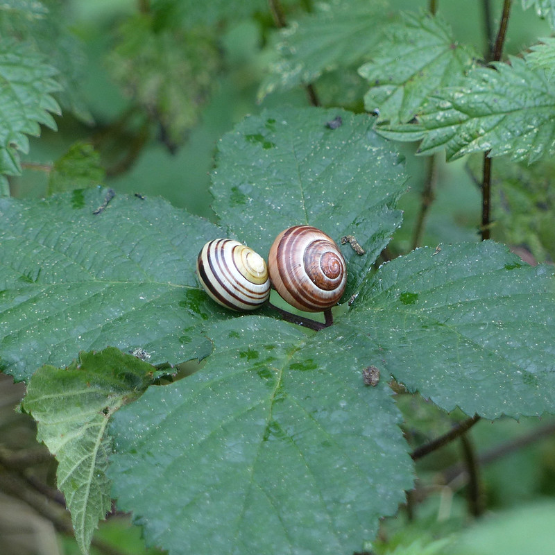
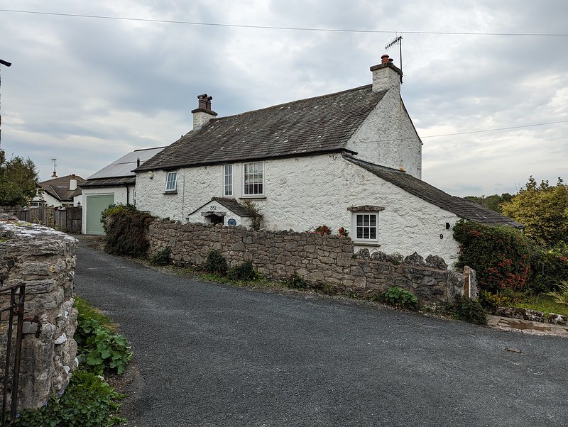
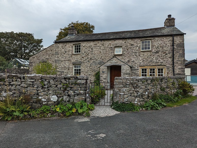
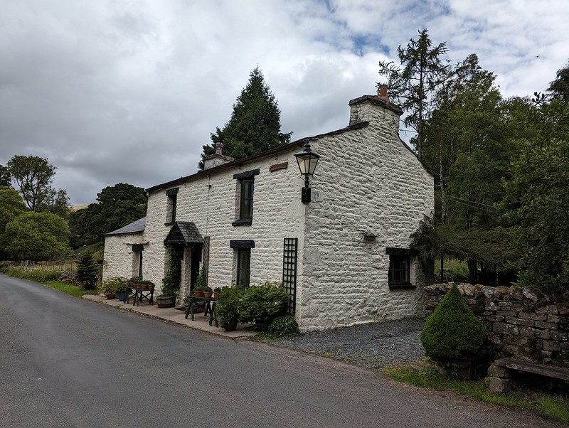
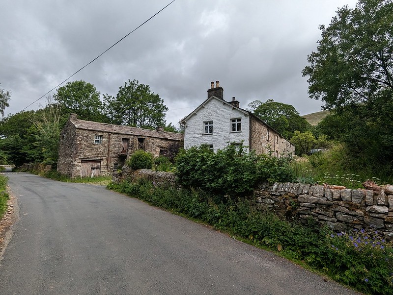
More banded snails.Cottage at Silverdale Green.Another cottage at Silverdale Green.
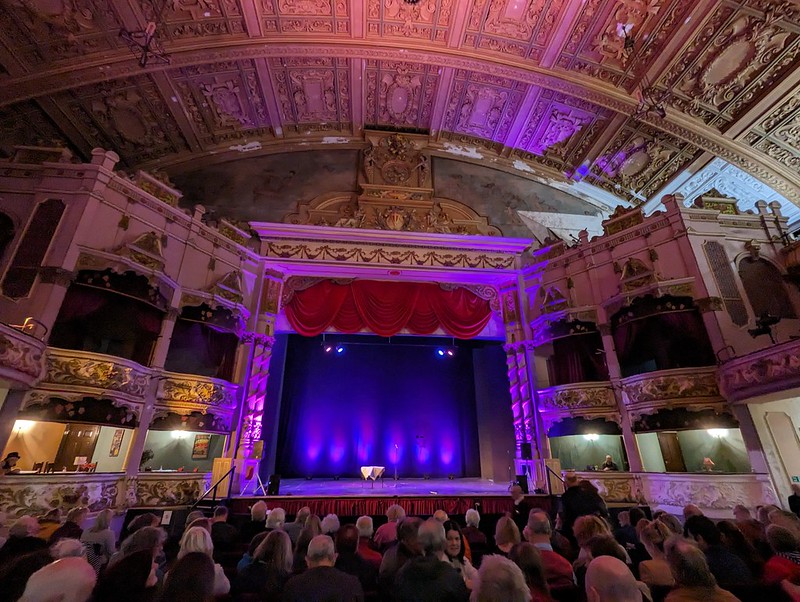
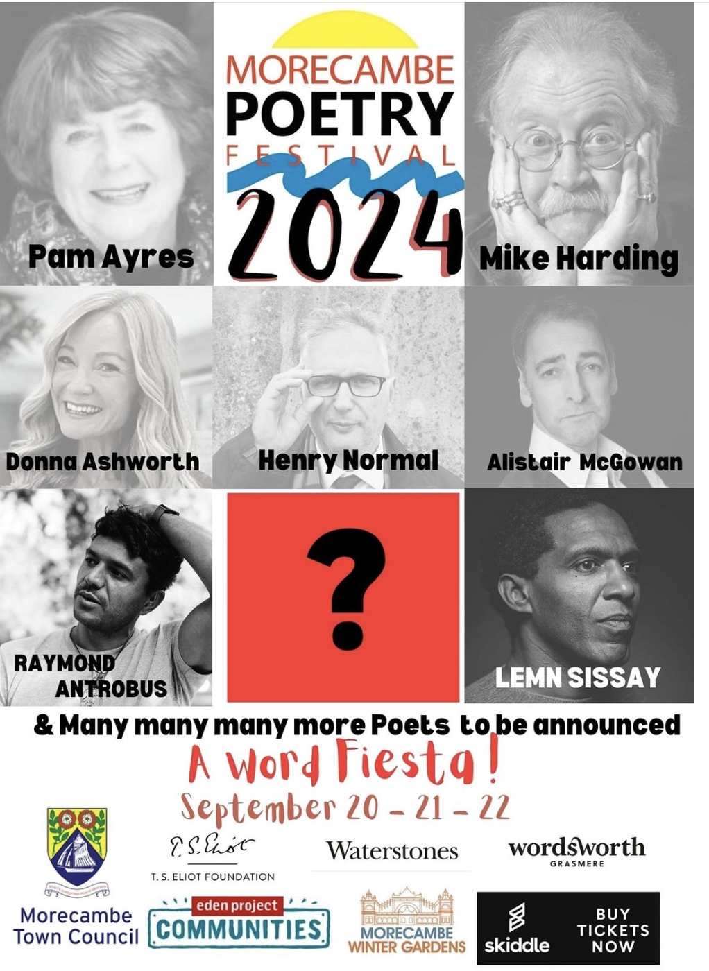
On the following weekend, the second Morecambe Poetry festival took place at the Winter Gardens. This time TBH joined me and we went to see the headline poets on both the Friday and Saturday nights; first Brian Bilston and Henry Normal, then Jackie Kay and Carol Ann Duffy. Fabulous.
Morecambe Winter Gardens.
The line up for this year’s festival looks every bit as enticing, hopefully TBH will join me again.
I saw Lemn Sissay at the first festival and years ago when I lived in Manchester and likewise, I saw Mike Harding live several times, but not for a very long time. This time, two BBC programmes – Loose Ends and The Verb – will be broadcast live from the festival. Things are on the up and up, both for Morecambe and for the Winter Gardens.
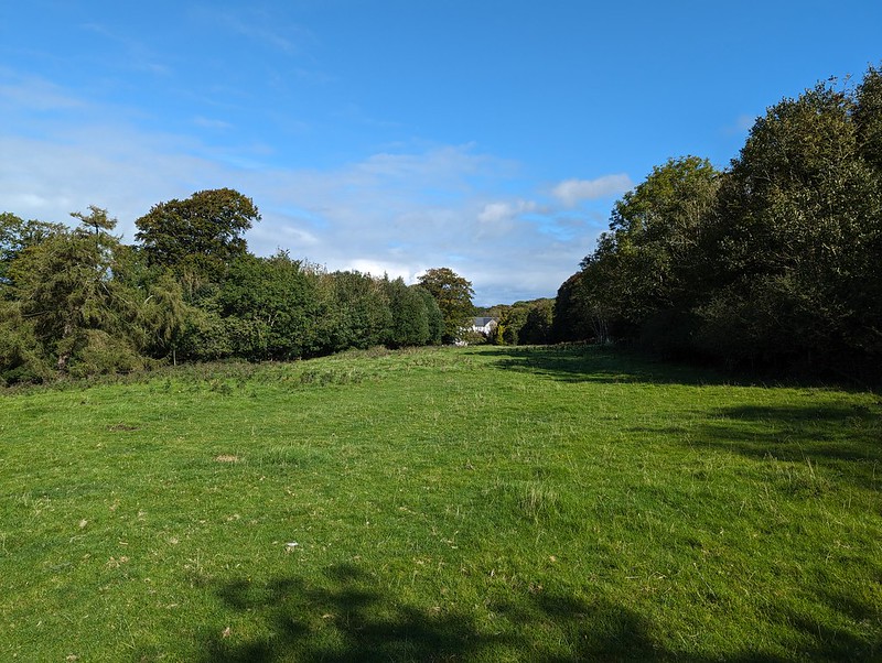
On the Sunday of that weekend, TBH had a mission to perform.
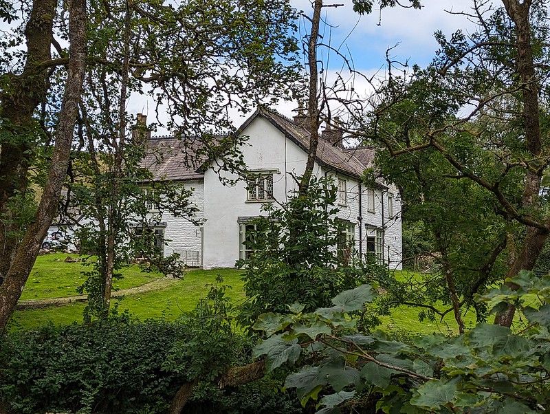
Hazelwood Hall.
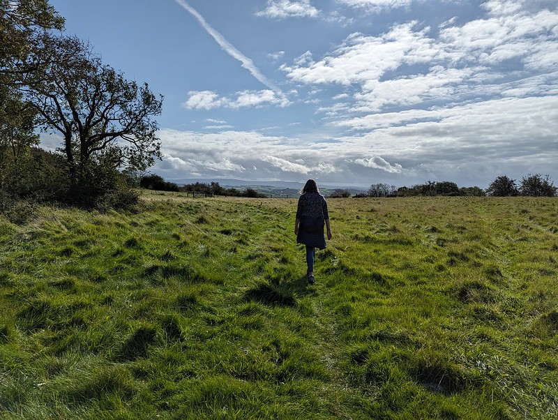
She took me to Heald Brow with a hand drawn map she’d been given by a colleague.
TBH on Heald Brow – Bowland Fells on the horizon.
The map showed the location of…
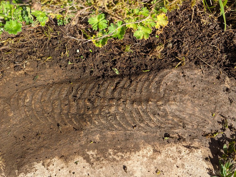
Heald Brow fossilised Nautiloid.
I’ve heard about this impressive fossil a few times from friends in the village, but have never actually managed to find it. With the aid of TBH’s map, we found it this time almost immediately. It’s hard to spot because it’s generally covered with a piece of turf which you’re supposed to replace, although I’m not sure why.
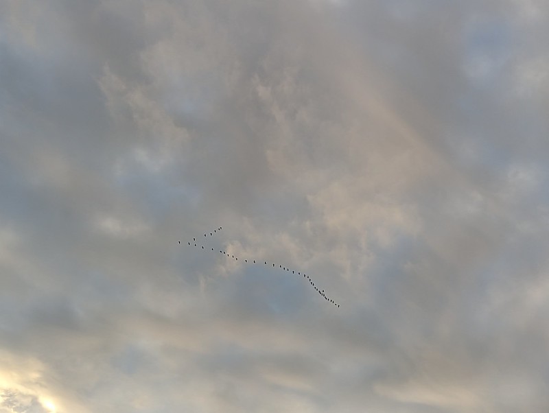
A skein of geese.Post sunset light at The Cove.
Later, I was out again for a wander to the Cove and across the Lots.
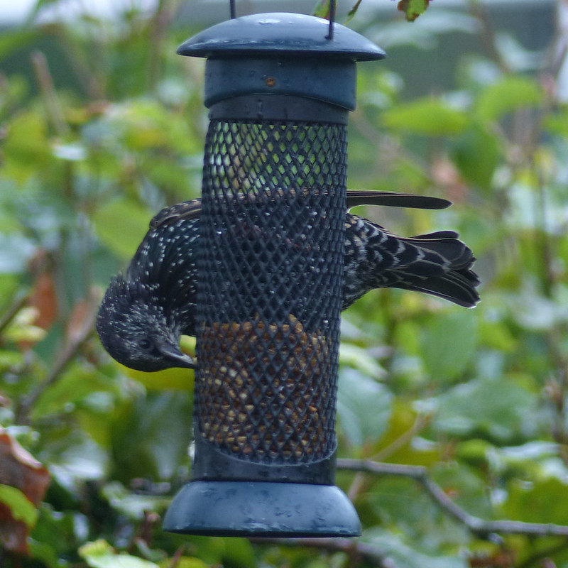
After years of not putting out food for the birds because our cats were a bit too interested, we’ve now realised that our one remaining cat is too old, fat and slow (I sympathise) to do any harm anymore. I snaffled a number of feeders from my parents a while ago and since TBH strung them all up (the feeders, not my parents!) from the Silver Birch by our kitchen window they have been giving me a great deal of pleasure ever since.
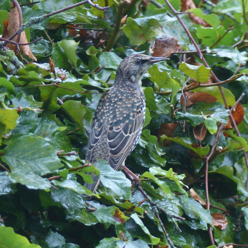
Starling eating dried meal-worms.Starling on our beech hedge.
Expect a lot more photos of our very varied visitors as I catch-up (ho ho) with the intervening six-months or so.
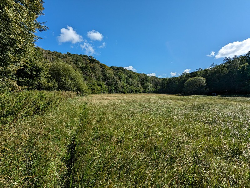
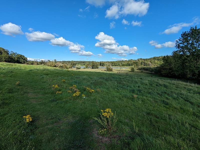
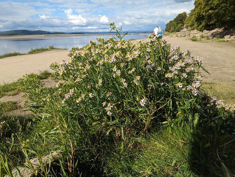
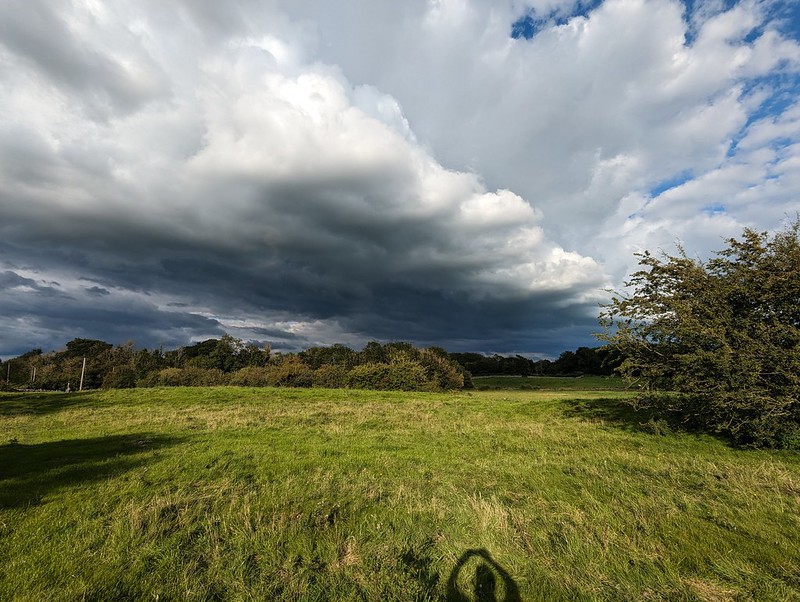
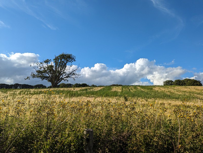
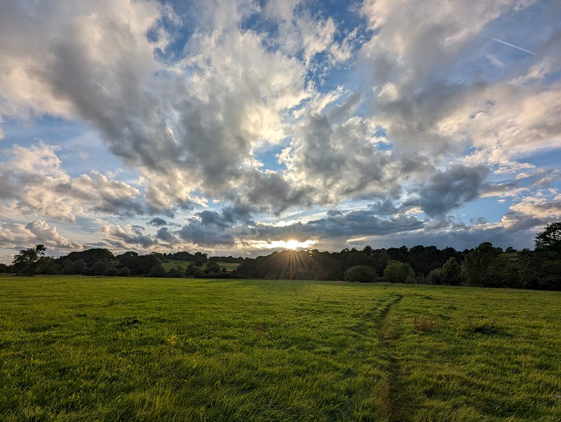
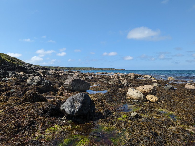
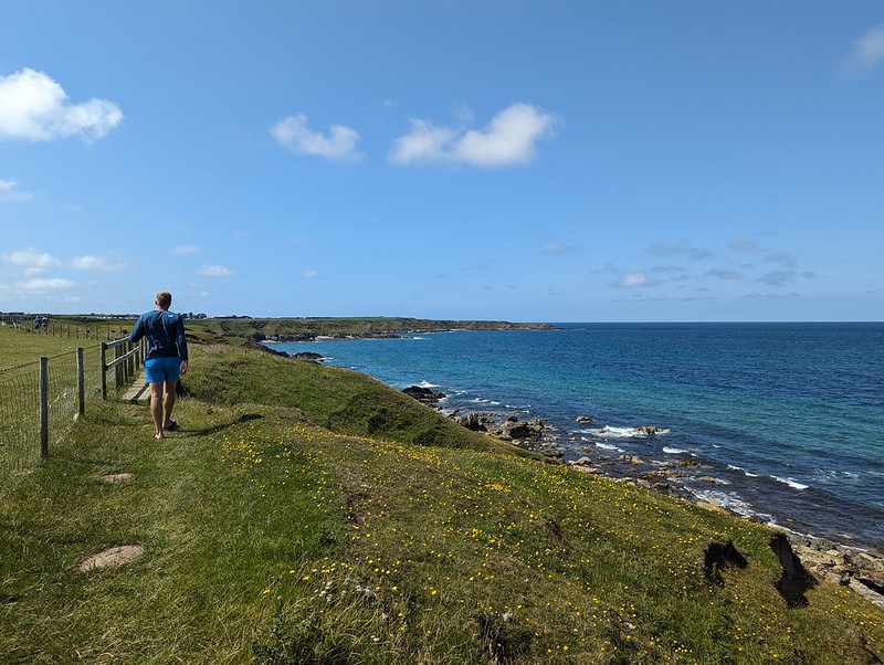
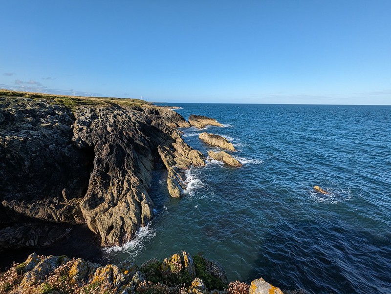
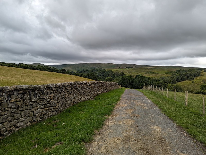
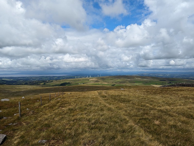
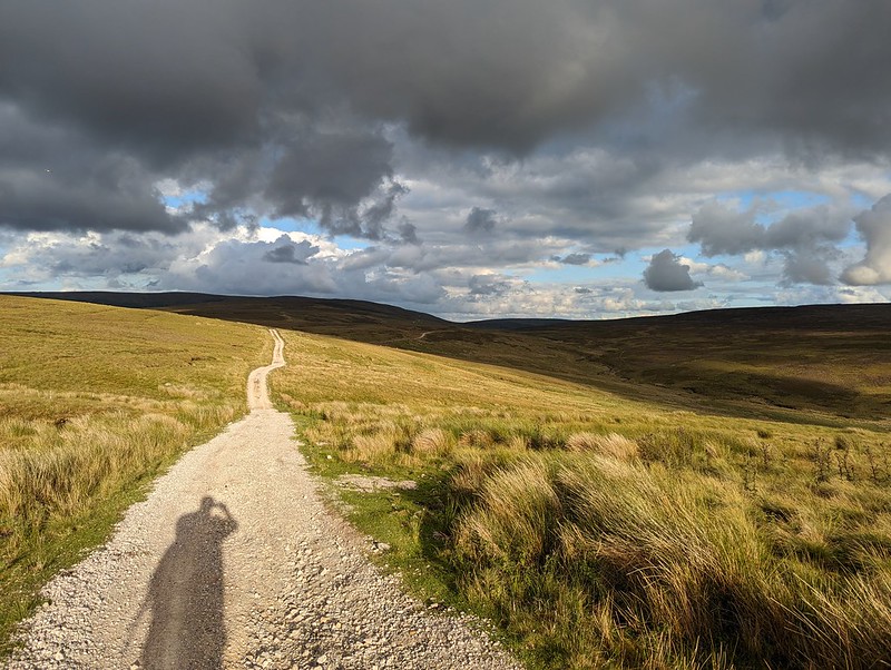
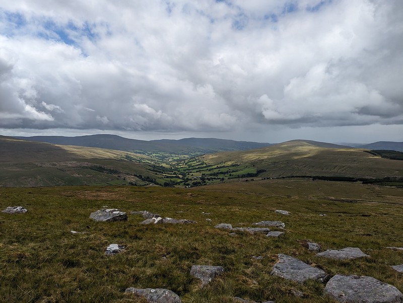
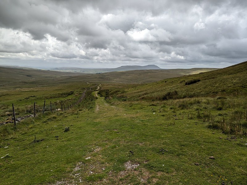
My behaviour towards the end of our summer break was far from migratory; I almost exclusively stuck to my home patch. I must admit, I sometimes look back at my photos, or at MapMyWalk, and wonder why I didn’t go further afield; why not get out and climb some fells? Partly, it’s laziness and the fact that I don’t need to drive anywhere, but also, this summer gone at least, it was often weather related: the blue skies in these photos are almost certainly deceptive. This walk only began mid-afternoon and I can tell you I wasn’t sunbathing in the garden before I set-off. I know this because I didn’t sunbathe in the garden at all last August – the weather just wasn’t up to it.
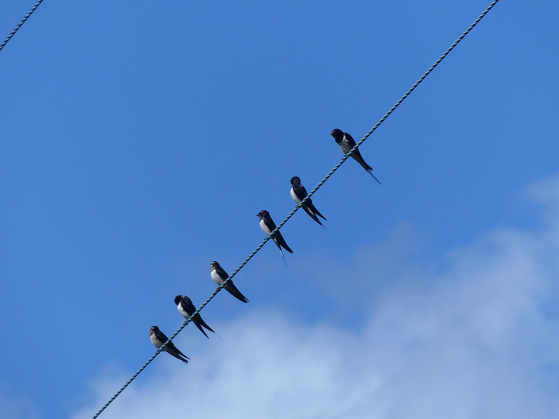
Swallows – gathering to gossip about the long flight to come?
So, not a long walk, distance wise at least; not much over six miles, although that did take me four and a half hours. Lots of stopping and gawking, often, I’ve since realised, at creatures, like these swallows, which don’t live here all-year-round, and which are much more ready to travel beyond their home patch than I am.
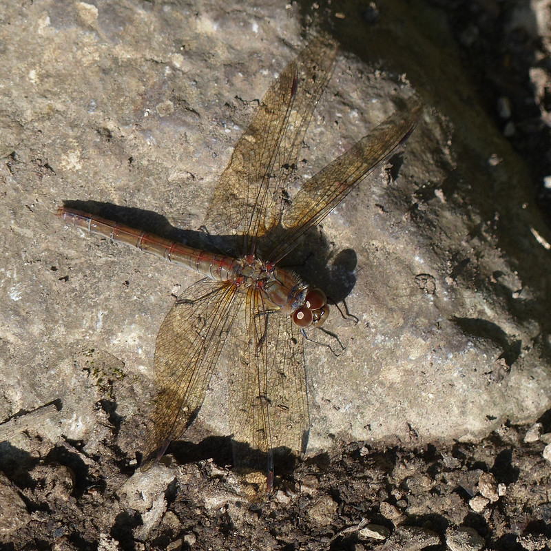
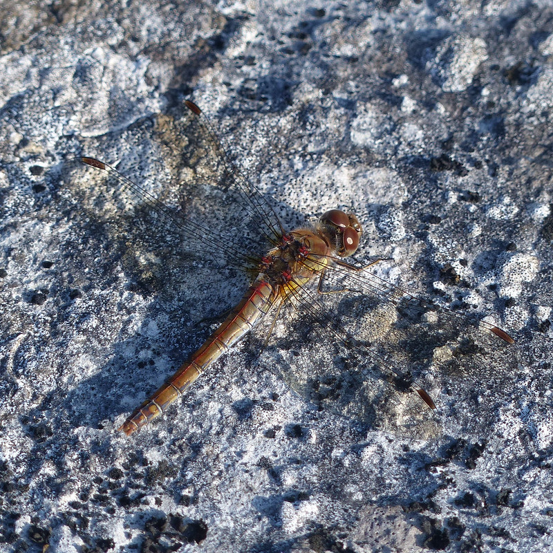
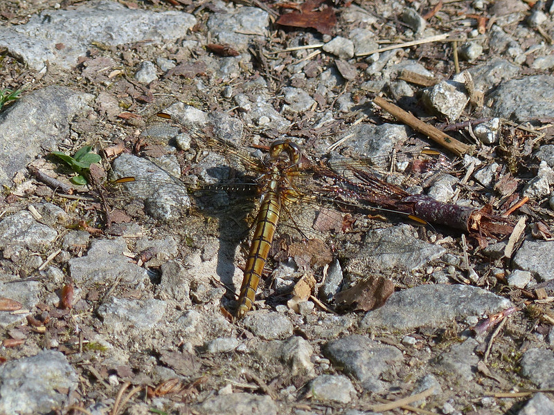
Common Darter.
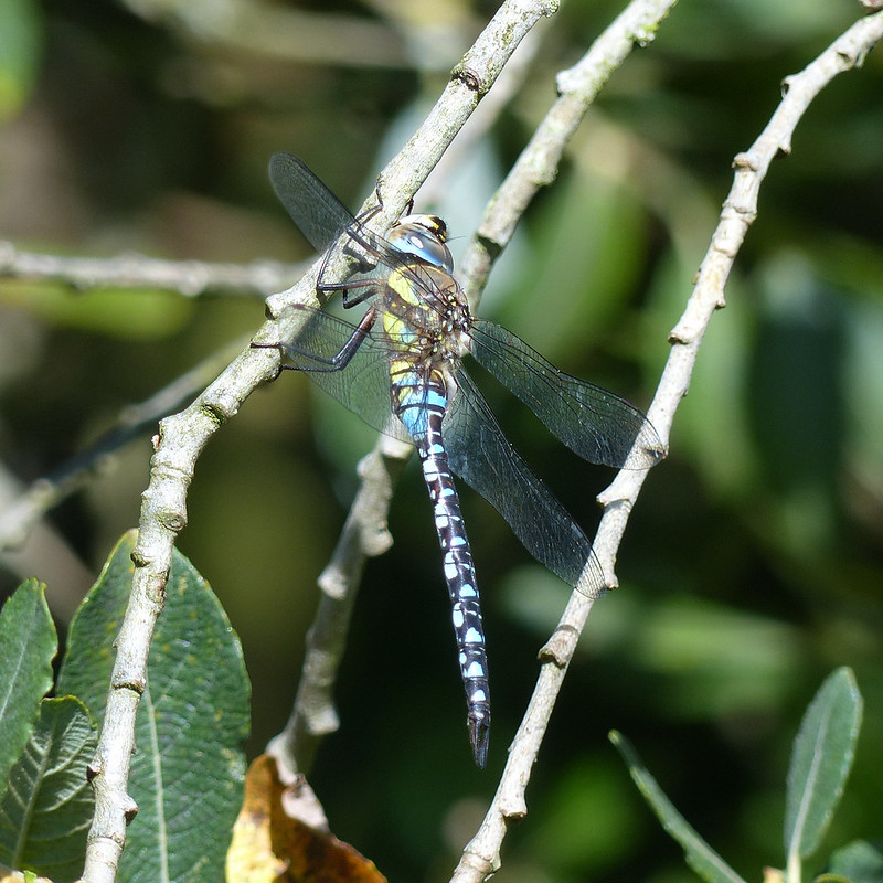
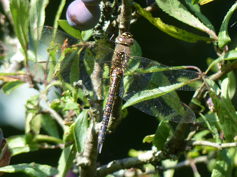
I went first to Lambert’s Meadow and back to the lush strip of Great Willowherb which grows along one margin of the meadow, hoping to find Migrant Hawkers there. The air above the field was very busy with dragonflies, but at first I didn’t spot any at rest. But then, on a Willow Tree, I spotted one. Then two. And eventually six, all in close proximity to each other. There were still more on nearby Guelder Rose bushes. Even though they are very colourfully marked, the stripes and mottling are surprisingly good disguise when they’re perched amongst foliage.
A couple of Migrant Hawkers.
I’ve since read that this social behaviour is peculiar to Migrant Hawkers; dragonflies are generally solitary, territorial and aggressive. Migrant Hawkers, however, have an unusual life-cycle; perhaps because in the southern end of their range they live in Algeria, where the pools where they breed can dry-out, their larval stage, typically at least two years for most dragonflies, is much shorter. On the other hand, they have an unusually long adult life and because they aren’t breeding for all of their adult life, the competitiveness which usually characterises dragonfly behaviour is not present.
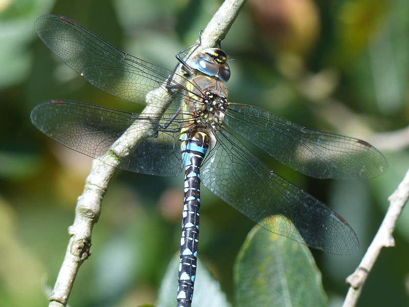
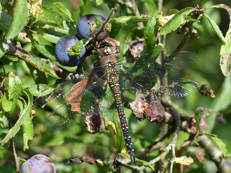
Migrant Hawker, male.
They are also much more likely than other species to travel considerable distances in search of likely breeding territory, hence the name ‘Migrant’, although I think that also relates to the fact that weren’t a resident British species until relatively recently.
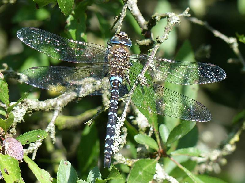
Migrant Hawker, male.Migrant Hawker. Male?
‘Britain’s Dragonflies’ is pretty clear that female Migrant Hawkers are predominantly brown with yellow markings. I saw several specimens which were definitely mostly brown, but with blue markings, like this one. So I’m a bit confused as to whether this is a male or a female.
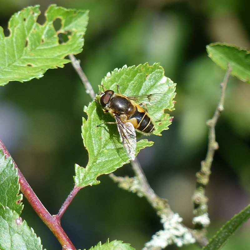
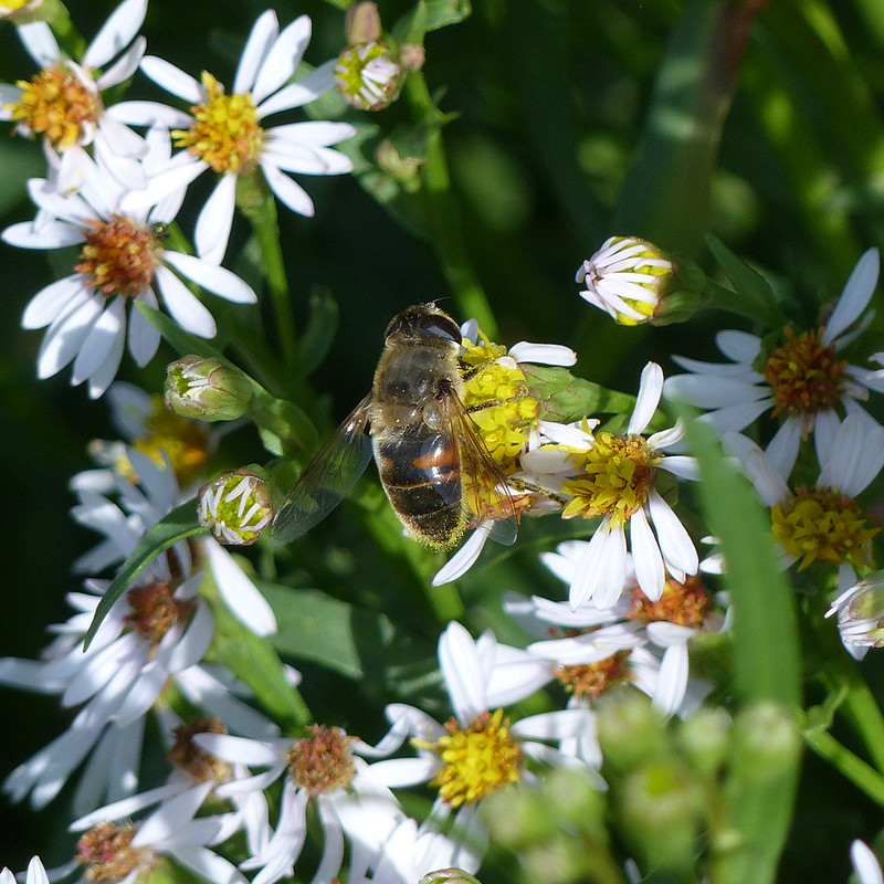
Two Migrant Hawkers.Hoverfly – possibly Eristalis arbustorum, on an Ox-eye Daisy.Garden Snail.
From Lambert’s Meadow, I headed to Gait Barrows for a walk around Hawes Water and up on to the limestone pavement.
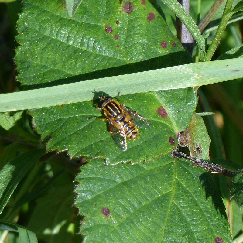
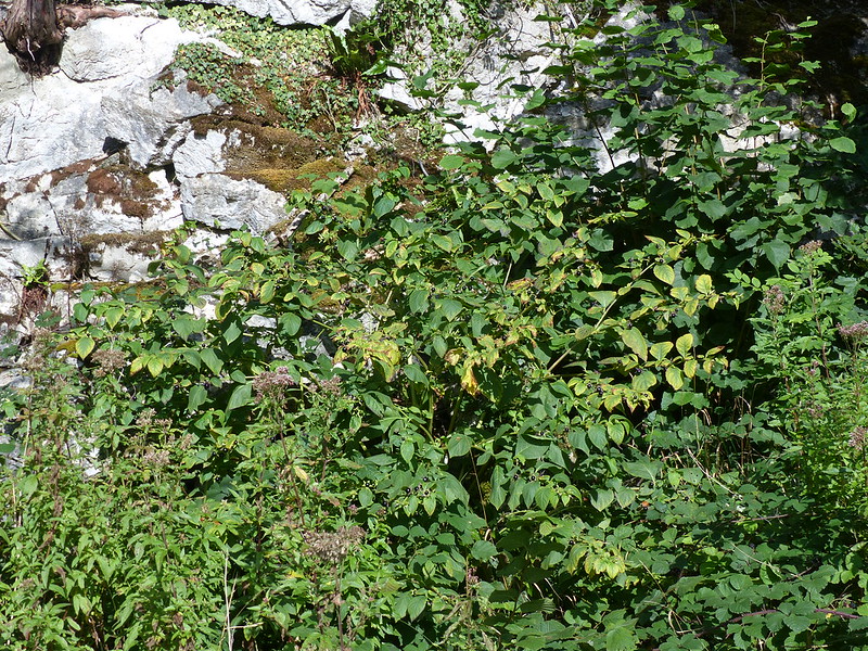
A mass of Common Knapweed in one of the Meadows by Hawes Water Moss.Hawthorns covered in berries.Ragwort and Hawes Water.Hoverfly – Helophilus pendulus, The Footballer.Deadly Nightshade, Atropa belladonna.
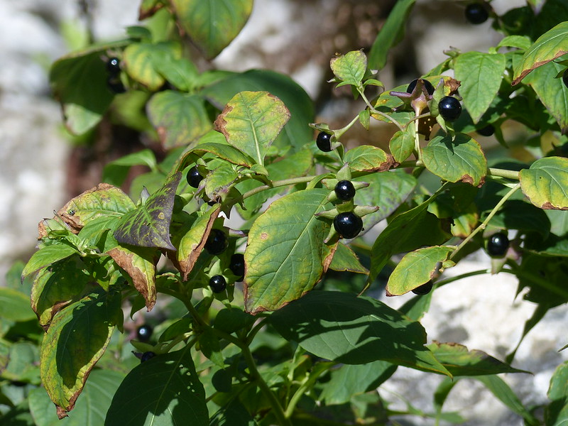
The two Deadly Nightshade shrubs growing beneath the low limestone crags close to Hawes Water, which I’d noticed when they were flowering earlier in the year, were now liberally festooned with berries. Apparently they are sweet to taste, which seems like a waste since, like all parts of the plant, they are hallucinogenic in small doses and highly toxic in even moderate amounts.
Deadly Nightshade berries.
In Greek mythology the three fates are Clotho, Lachesis and Atropos. Clotho spins the thread of life, Lachesis measures it, and Atropos cuts it. In other words, Atropos personifies death itself, hence Atropa in the Latin name of this plant. Meanwhile, Belladonna, ‘beautiful lady’ comes from the practice by women of using some part of the plant to dilate their pupils.
Apparently, the plant is considered to be native only in the south of England and plants found further north are the remnant of plants grown in the past for medicinal purposes, which, perhaps surprisingly, given its toxicity, were legion. So: another migrant.
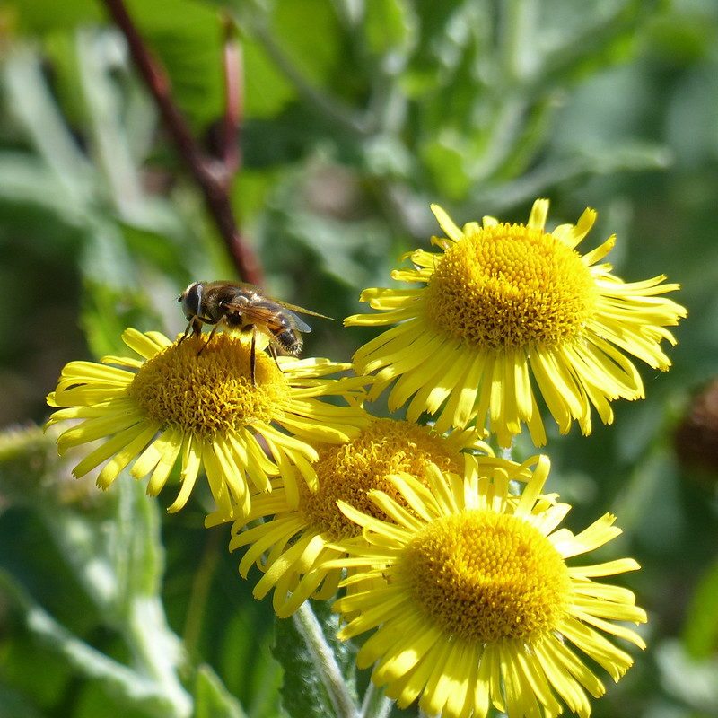
Hoverfly on Common Fleabane.
I think this is also Eristalis arbustorum; Eristalis species are the Drone Flies. Other photos show that this one has a pale face which is why I think it’s arbustorum. In honesty, I was more interested in the Fleabane which is not, despite its name, all that common in this area.
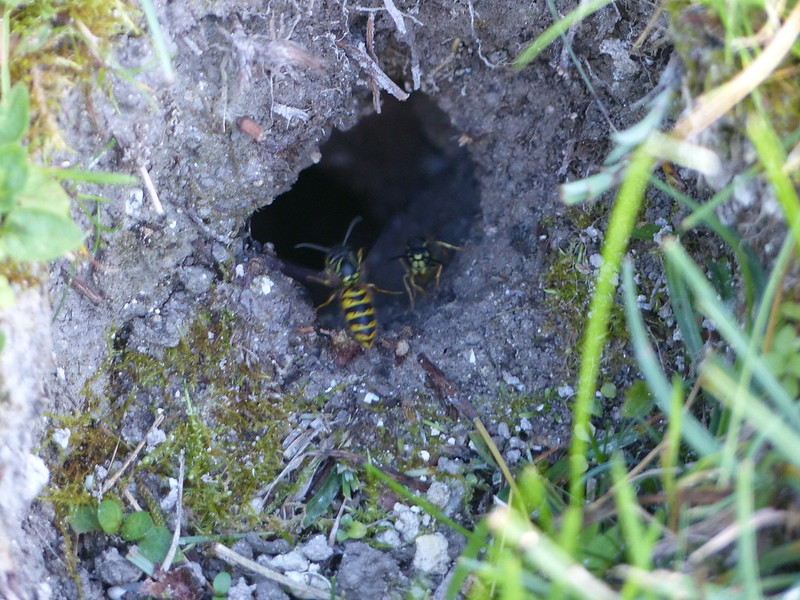
Wasps flit back and forth from a small hole in the ground.
Not the best photo, I know, but the best of the many I took. It had to be included to remind me of the happy moments when I watched, fascinated, as wasps ferried in and out. At the time I assumed that there was a nest in the hole. I suppose another explanation is that there was some abundant food source in there that they were exploiting.
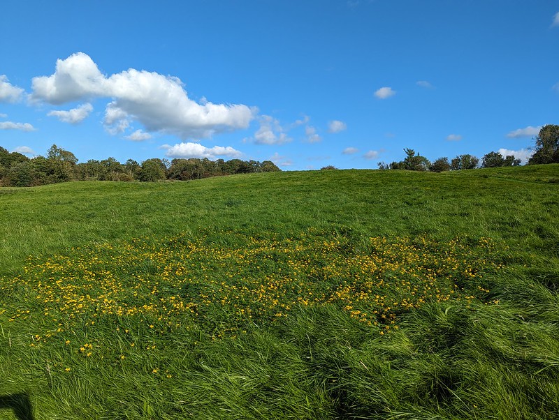
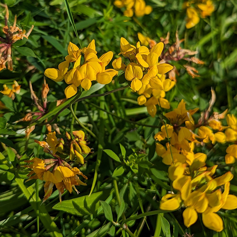
A patch of yellow flowers in one of the Gait Barrow meadows.Bird’s-foot Trefoil.Migrant Hawker, female.
Just below the extensive area of limestone pavement at Gait Barrows a large Blackthorn, which had grown out to be a small tree, proved to be another resting spot for a group of Migrant Hawkers.
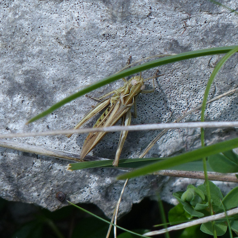
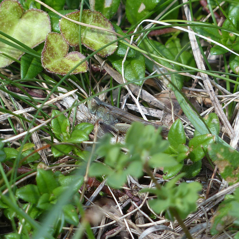
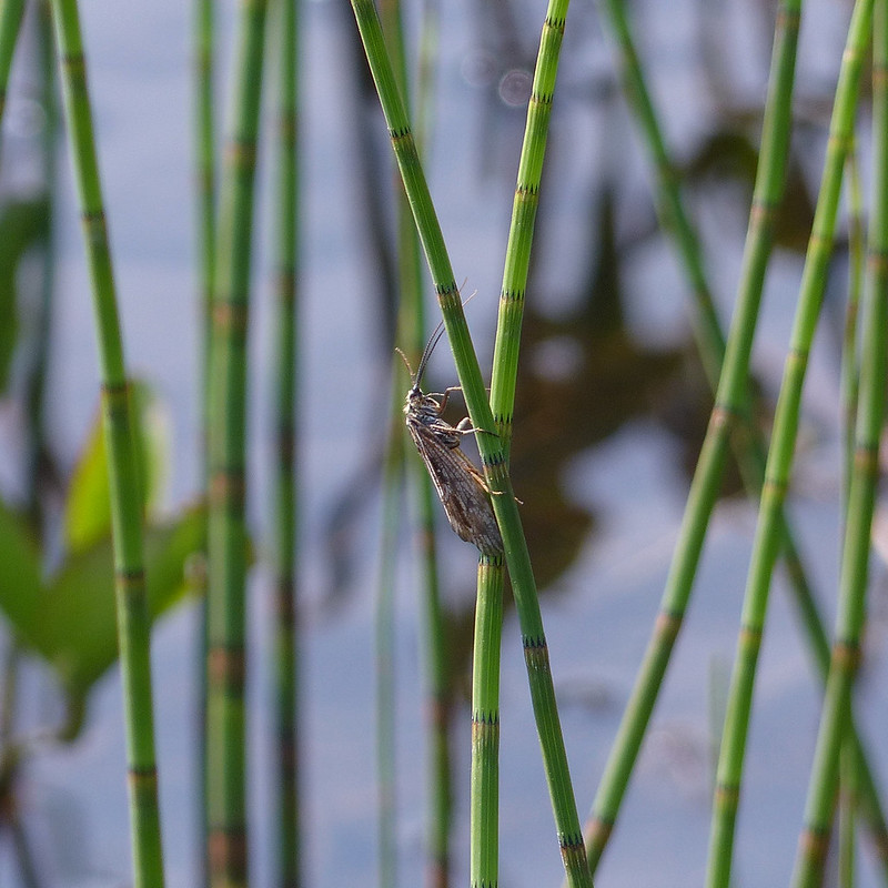
This looks, to my untutored eye, very like a Rufous Grasshopper. It probably isn’t. My field guide shows the distribution of that species being solely along, or close to, the south coast. However, I looked up a more recent distribution map, and whilst they are largely restricted to the south of England, there have been verified sightings near Doncaster. Admittedly, that’s still a long way from here, but, on the other hand, they do like calcareous grassland, so this is the right kind of habitat. Maybe they’re migrating north too?
Wishful thinking aside, whilst trying to research whether or not it would be possible to find Rufous Grasshoppers in this area, I came across an old annual newsletter of the North Lancashire Naturalists Group. I’ve only read the Orthoptera section so far, but now I know where and when to look for Dark Bush Crickets locally, which might not excite everyone I realise, but is obviously right up my street. I also came across some familiar names of friends from the village who are members (and, in one case, Chair) of the group and are involved in recording. Why haven’t I joined myself? No doubt they would tell me what kind of grasshopper I have here.
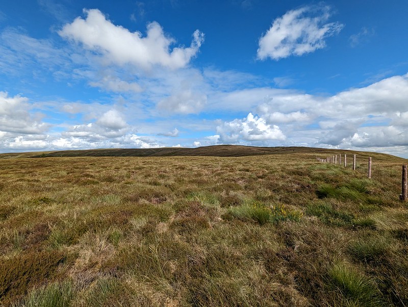
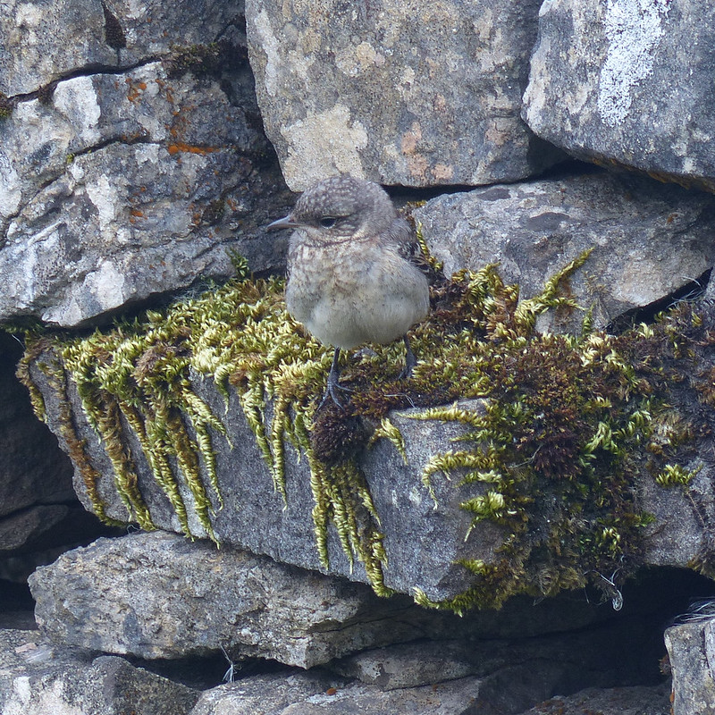
At the point which I think of as the ‘top’ of the limestone pavement, where there’s a substantial memorial cairn, there’s a small set of steps with a rustic wooden handrail. As I climbed the three steps something seemed to fly away from the handrail.
‘That’s an unusual bird,’ I was thinking.
It seemed to land nearby, on or close to some bracken…
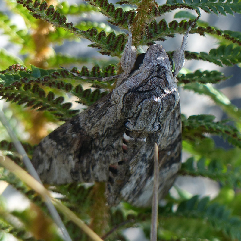
Can you see it?
I couldn’t. Or rather, I could, but it was so still and so well disguised, I thought I was looking at the end of a dried branch or twig. Fortunately, I decided to investigate.
Convolvulus Hawk-moth.
It was a Convolvulus Hawk-moth. I think this is probably the biggest moth I’ve ever seen; I’ve read that they can have a five inch wing-span. Their daytime defence strategy is to keep very still and hope not to be noticed. This one let me crawl right up to the bracken frond it was hanging beneath.
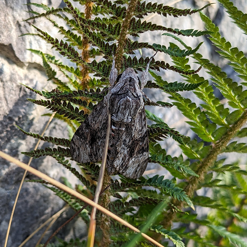
Convolvulus Hawk-moth.
This moth is native to North Africa and Southern Europe. It can’t generally overwinter in the UK, so this was a true migrant. The large, colourful, horned caterpillars live on Convolvulus – Bindweed. There’s plenty of that in our garden, but it dies back every winter, which I think is why the caterpillars can’t survive here. I’m not sure the photos do it justice: it was breathtaking.
Fortunately, nobody happened by whilst I was spread-eagled on the ground trying to find the best vantage points for photos.
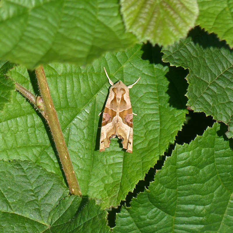
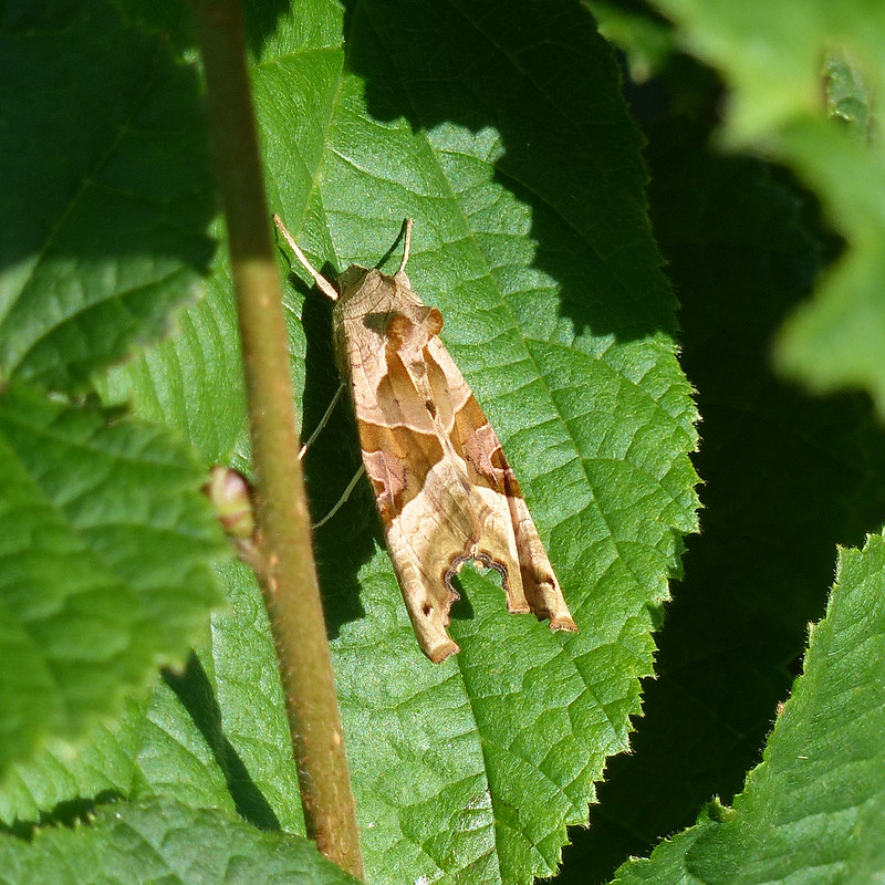
Angle Shades Moth.
One final surprise for the day, on a leaf of a small Hazel sapling, an Angle Shades Moth. I knew that it was an Angle Shades, even though I don’t think I’ve seen one before. It’s bizarre that obscure facts like that stick with me, but that I can’t remember useful things like people’s names.
Angle Shades Moth.Angle Shades Moth.Another Common Darter.
If every local walk were as packed with interest as this one, I might never both going anywhere else!
Cove Road – Holgates – Far Arnside – Park Point– Arnside Point – White Creek – Blackstone Point – New Barns – Arnside – Black Dyke Road – Silverdale Moss – Challan Hall Allotment – Hawes Water – The Row – Hagg Wood
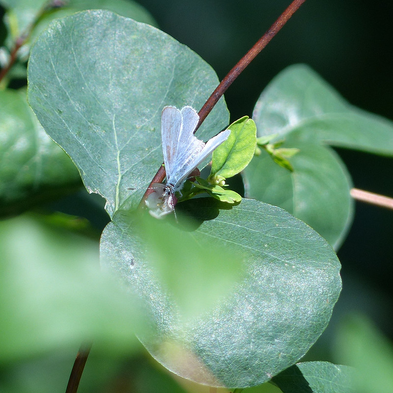
Holly Blue Butterfly.
Home again and a familiar walk around the coast to Arnside and then back via Silverdale Moss and Hawes Water. It was a walk which involved a lot of stopping and gawking, and during which I took nearly four hundred photos (I’ve edited them down a bit for this post!). It was a good day for butterflies, spiders, harvestmen, grasshoppers and various other things.
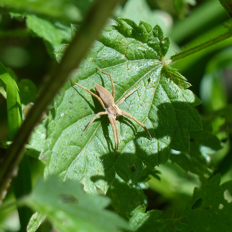
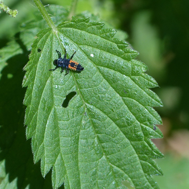
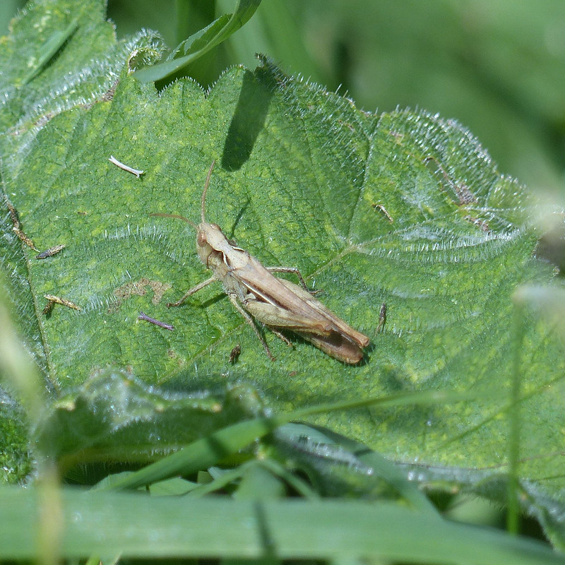
Harvestman.Nursery Web Spider.HarlequinLadybird nymph.Field Grasshopper?
I find Grasshoppers very tricky to identify. I found this guide useful, if not conclusive.
Harvestman.Brimstone Butterfly.
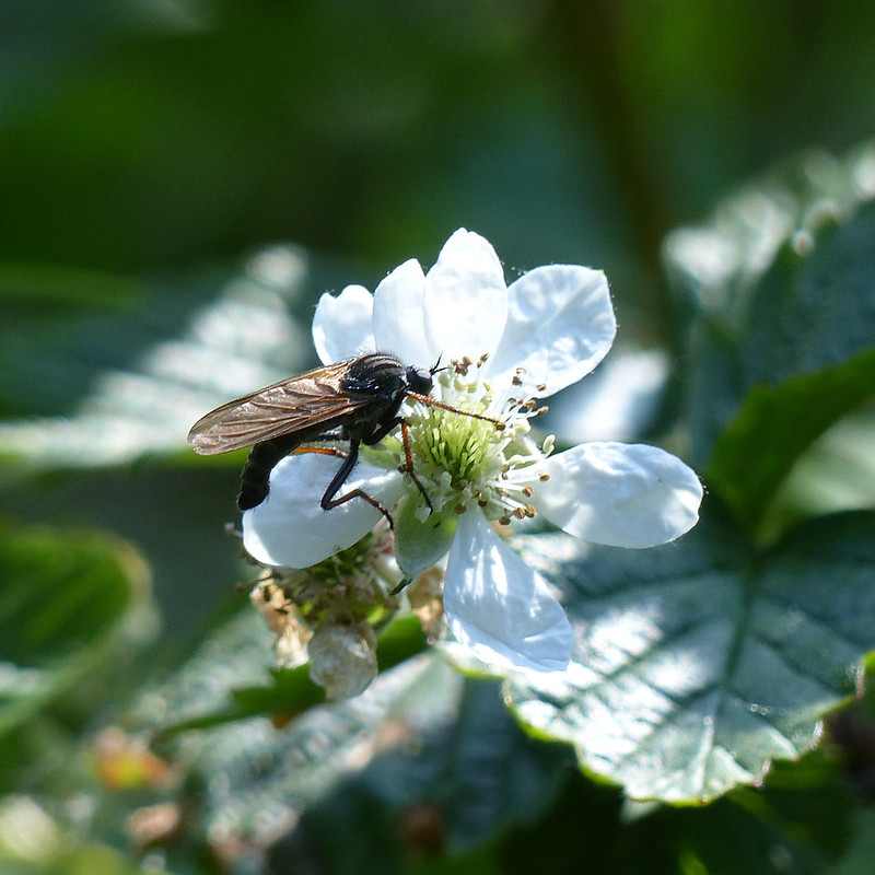
I spent a long time by a Buddleia at the edge of the caravan park at Far Arnside – it was very popular with the butterflies, with quite a few bees and hoverflies visiting too.
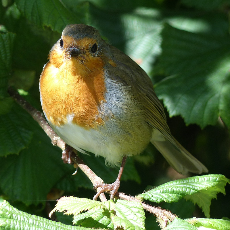
Peacock Butterfly.Large White Butterfly.A curious Robin.
Whilst I was snapping away, a Robin appeared close by in the hedge and watched me for quite some time.
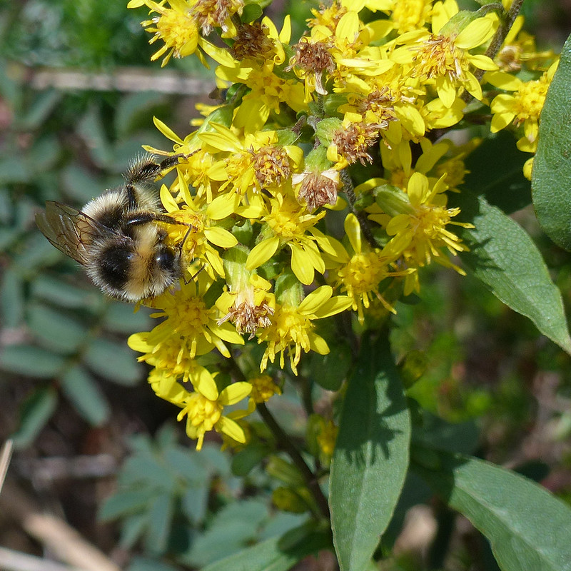
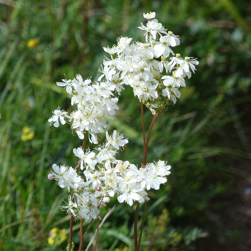
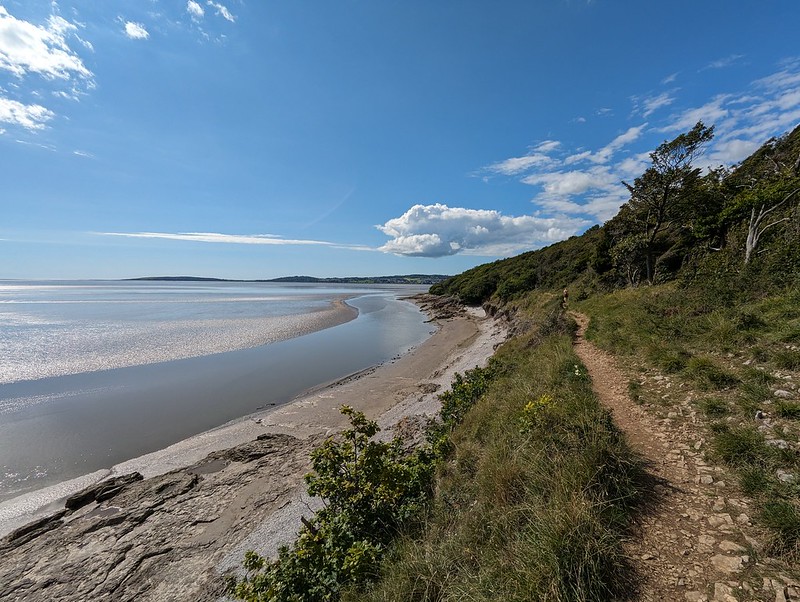
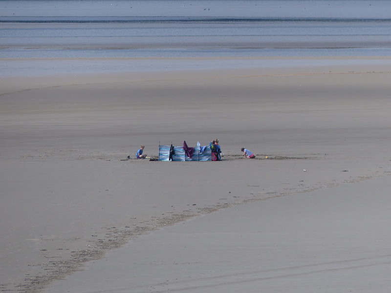
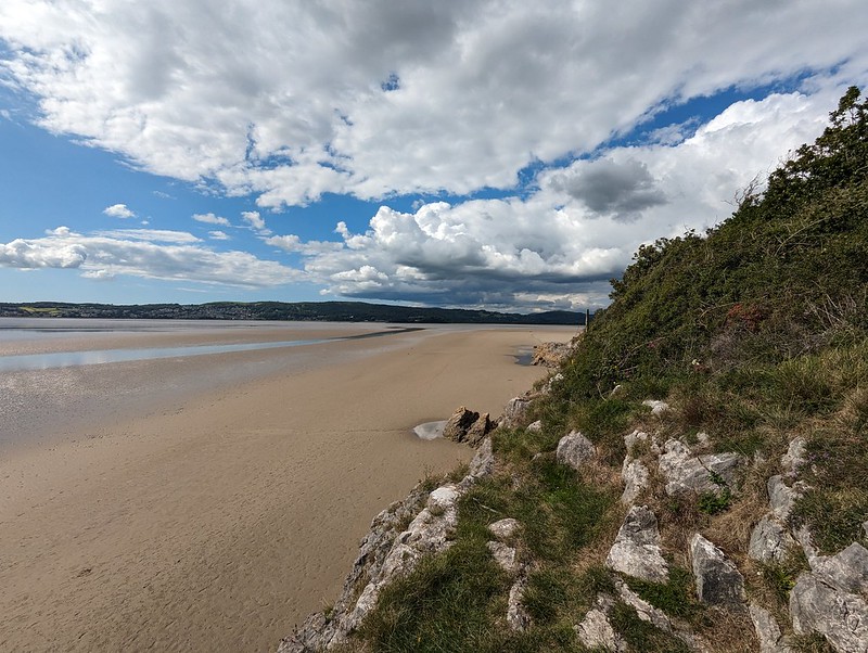
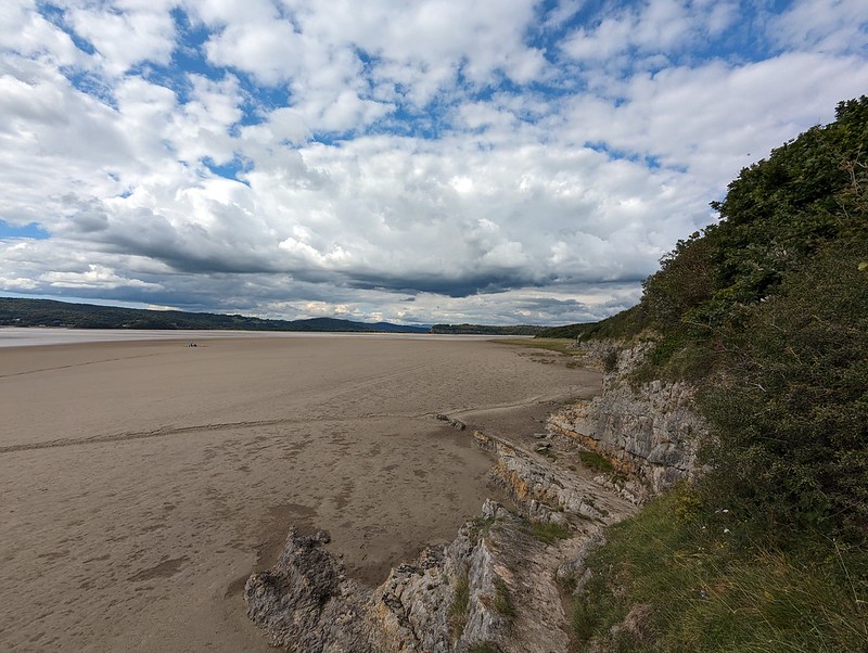
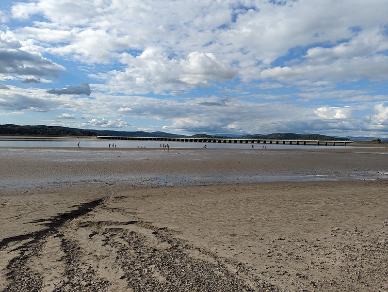
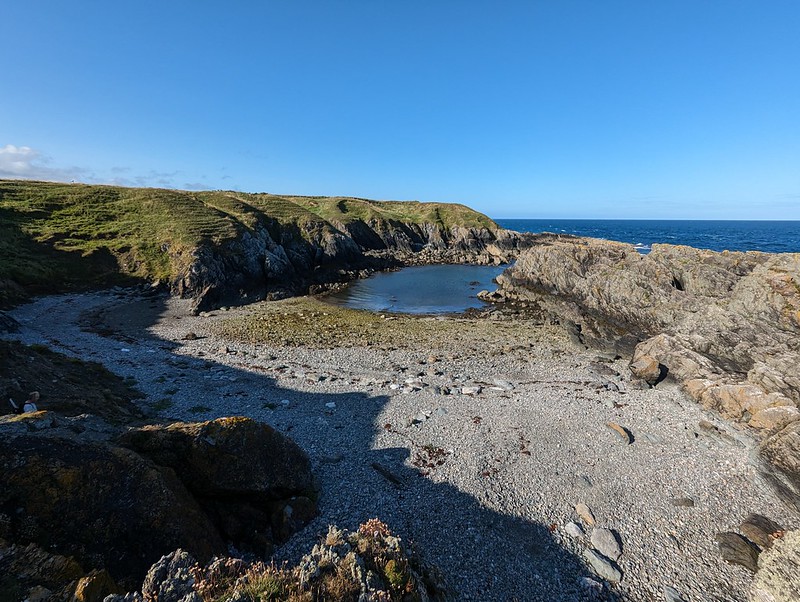
Common Blue Butterfly (female).Field Grasshopper?Common Green Grasshopper?Bumblebee on a St. John’s Wort.Dropwort.Tiny orb web Spider.Looking south along the coast to Clougha Pike.Looking North to Grange-Over-Sands.Holidaymakers enjoying the mud.
I was surprised to see a few family groups dotted about on the mud of the Bay, with a full collection, by the looks of it, of beach paraphernalia. Of course, I love the area myself, so I shouldn’t be surprised at all that other people want to enjoy it too.
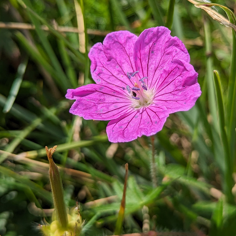
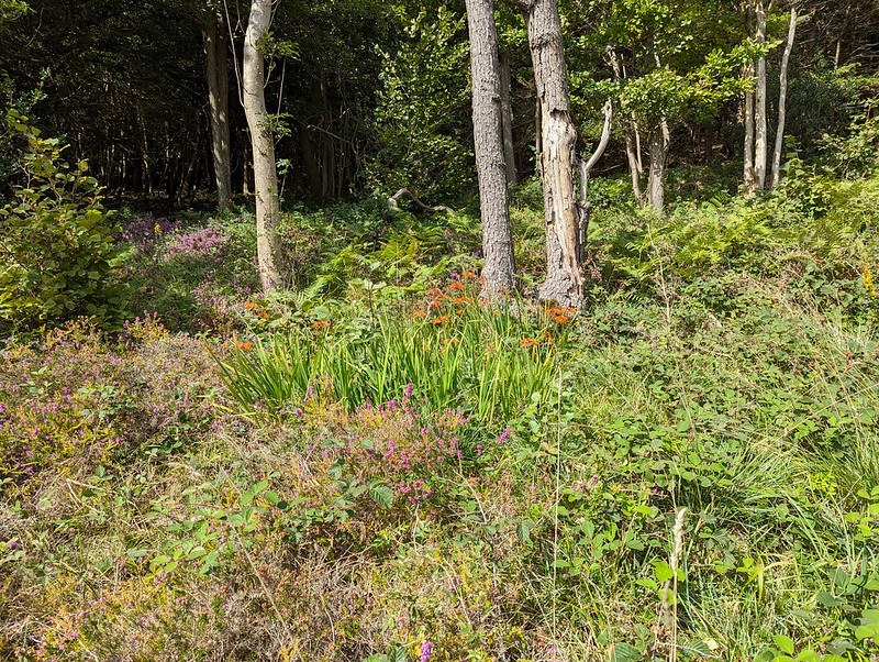
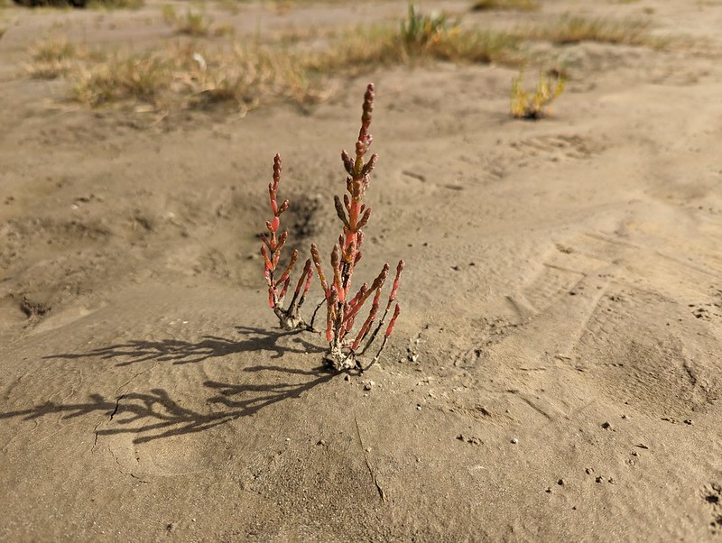
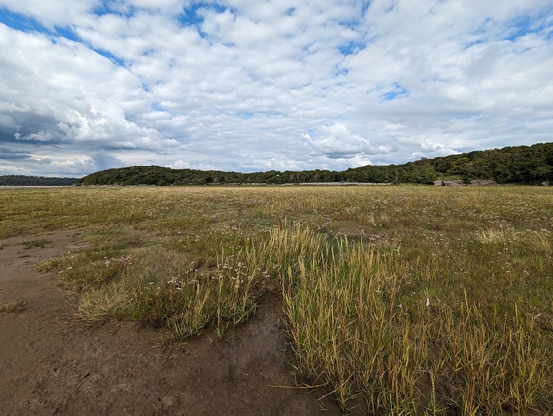
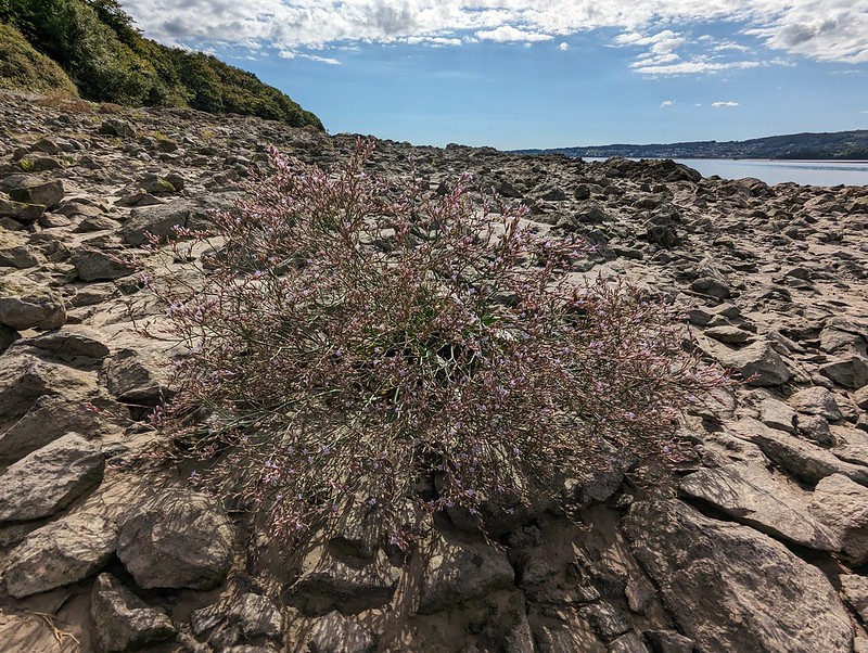
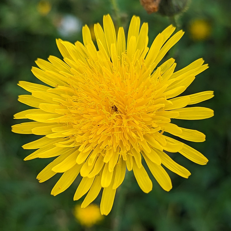
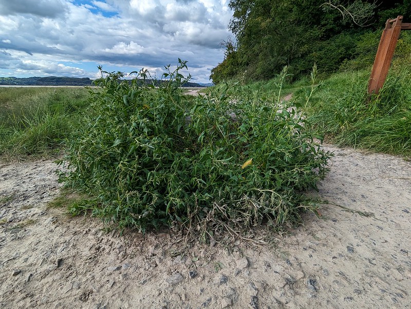
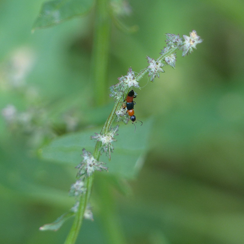
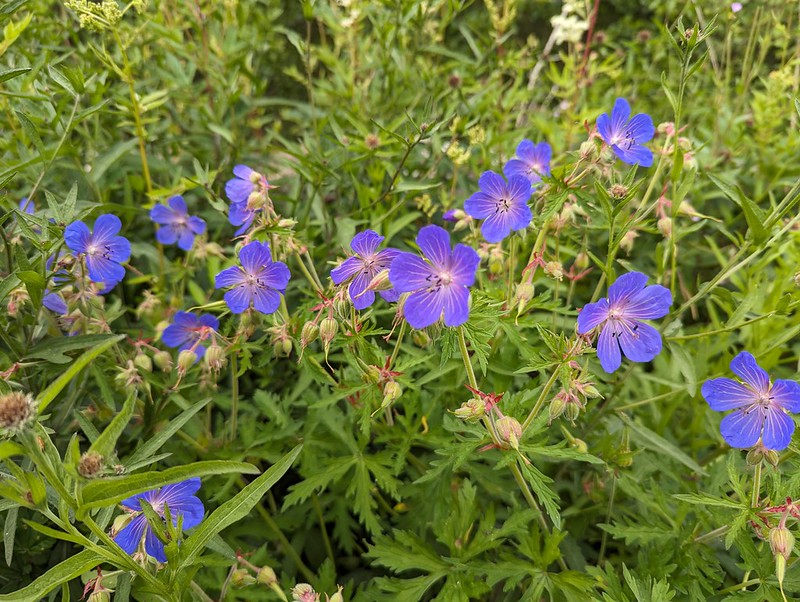
Heather on the clifftop.Bloody Crane’s-bill.Naturalised Montbresia.Approaching Park Point.And around the point looking up the Kent Estuary.Marsh Samphire.The foreshore at White Creek with lots of…Sea Asters.The estuary near New Barns.Lax-flowered Sea-lavender.Lax-flowered Sea-lavender.Approaching New Barns.At New Barns.A yellow composite (which is to say, I don’t know what it is!).Common Darter.Common Carder Bee (possibly) on Marsh Woundwort.I think that this is an Orache, possibly Spear-leaved Orache.A Rove Beetle, on the Orache, – one of the Paederus species.
Paederus species are widespread across the world and I was surprised to discover that one (or possibly more) of them can cause severe skin reactions.
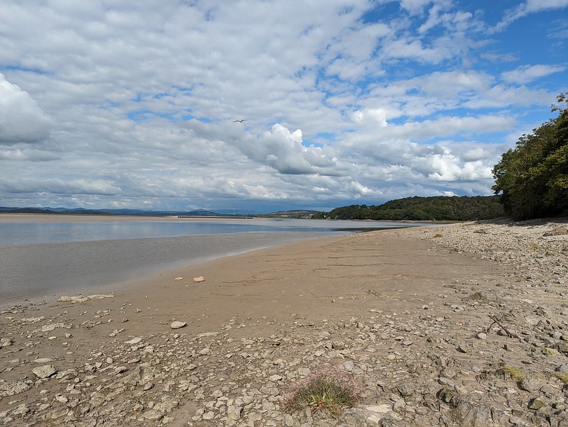
The Kent near Anside.Another boat on the Kent.A particularly vigorous clump of Sea Aster.
This tall clump of Sea Asters was thronged with bees and hoverflies, particularly Drone Flies.
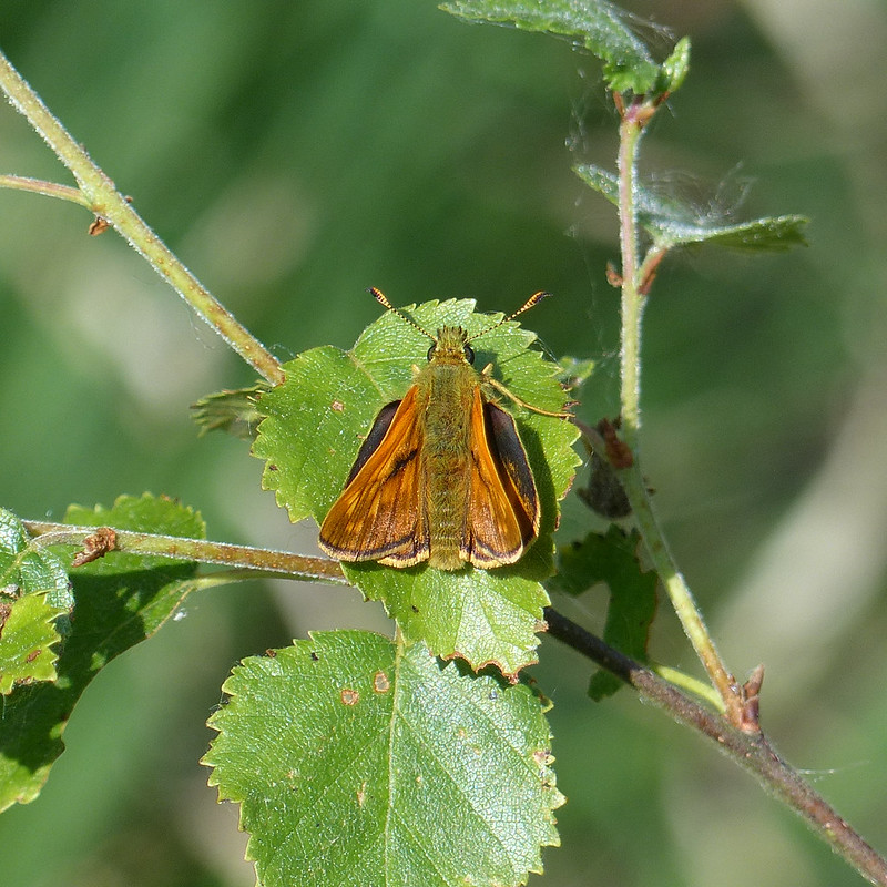
A Drone Fly on the Sea Aster.Gatekeeper.
A sixth species of butterfly for the day, not bad going.
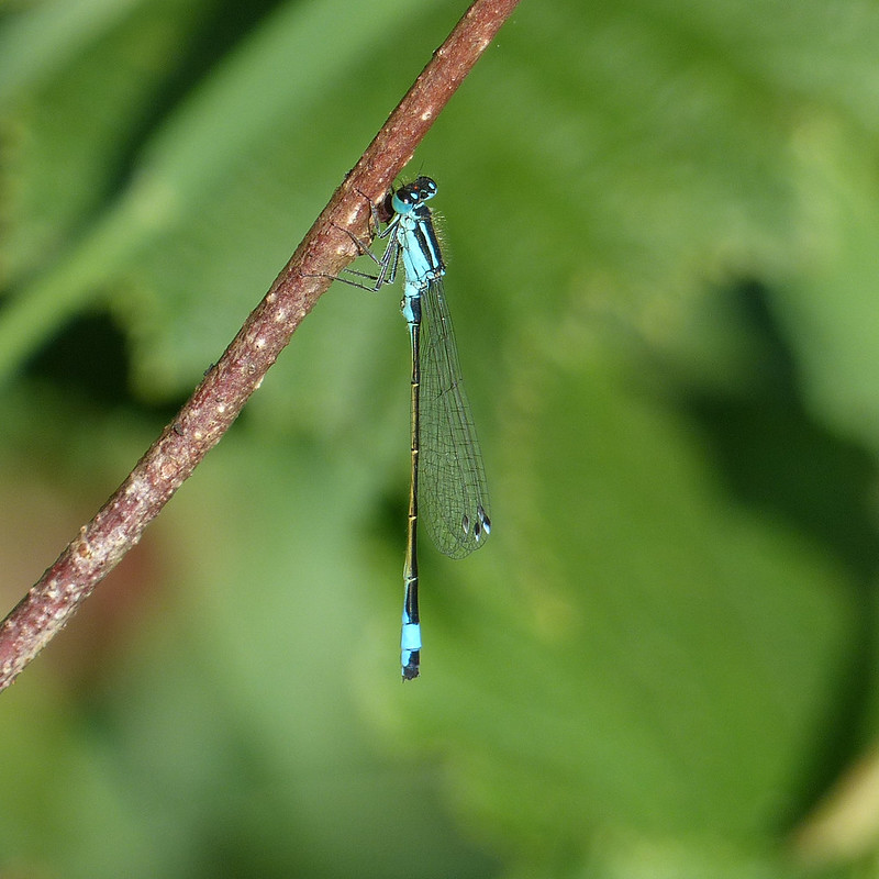
People paddling in the Kent at Arnside.Blue-tailed Damselfly.
Over the years, I’ve taken countless photos of Blue-tailed Damselflies, but curiously, I don’t recall noticing the rather gorgeous two-toned wing-spots which are characteristic of the species before.
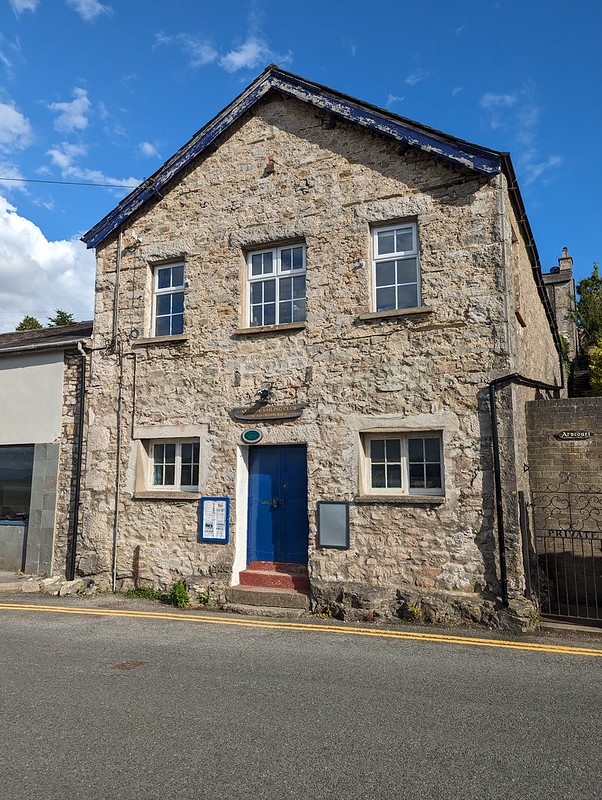
Former Custom House Arnside – now home to the Sailing Club.
I’ve walked past the Sailing Club in Arnside many, many times. I’ve often thought of joining – I’ll no doubt get around to it at some point – but I’d never been inside their clubhouse. I have now. But I’m getting ahead of myself – that post is still some way off.
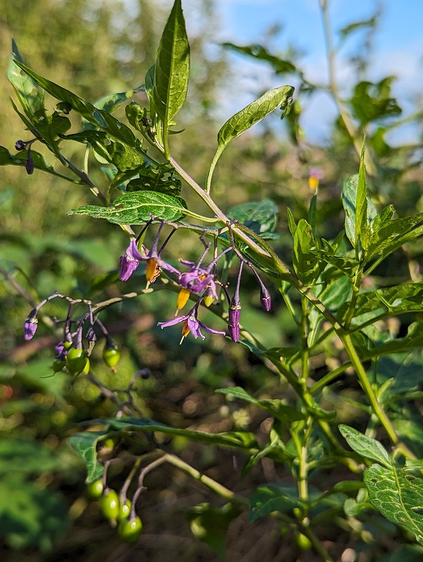
Bittersweet.The footpath beside Black Dyke.
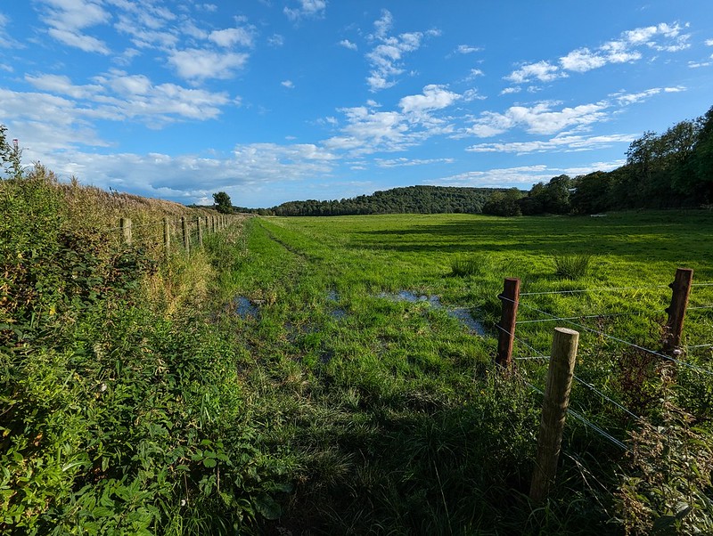
I’d only set-off from home mid-afternoon, so it was getting quite late. I’d originally intended to follow the path beside Black Dyke, but as you can perhaps tell, it was pretty water-logged, testament to what a wet year 2023 was. So instead, I turned left and headed East…
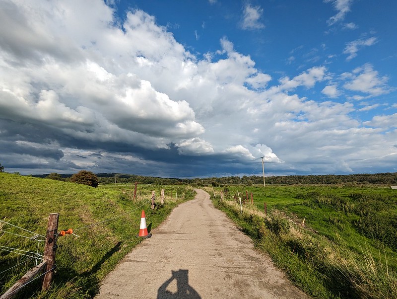
A drier alternative, heading East.
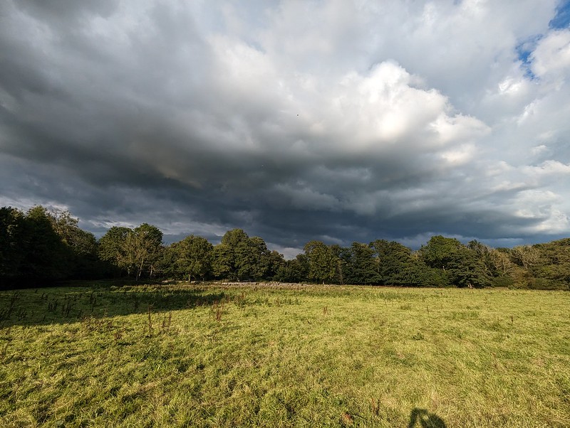
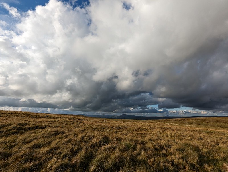
…towards some very dark looking skies.
Ominous clouds.Blue skies back the way I’ve just come.
Long-suffering readers might know that I love to be on the edge of a weather front like this with strongly contrasting weather evident in different directions.
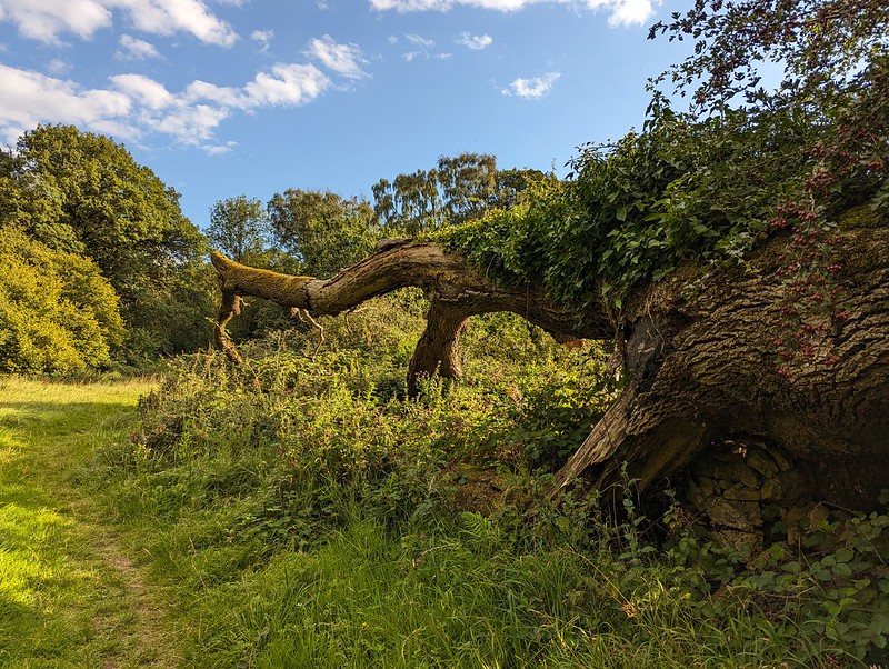
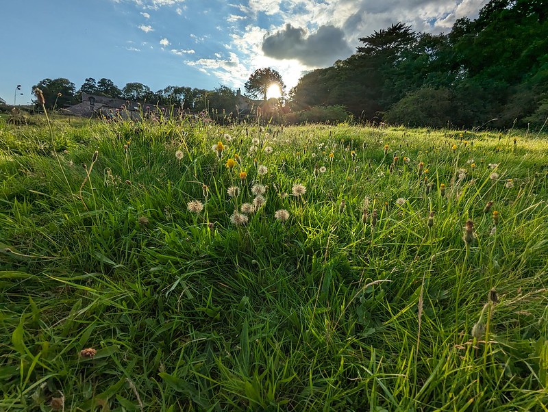
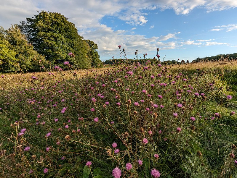
Silverdale Moss and Middlebarrow.More threatening clouds.The remnants of the Cloven Ash.Hawes Water.Dandelion clocks.Common Knapweed.Thistleheads.Inman Oaks – nearly home.
You may have noticed that no Skylarks appear in this post. The fact is, that I was listening to Horace Andy’s marvellous 1972 debut album ‘Skylarking’ whilst I was choosing the pictures for this post. Now that I’m almost done, my soundtrack is the similarly laidback reggae of John Holt’s ‘1000 Volts of Holt’.
A really delightful walk and a precursor to another family get together the following day.
We had one more day in our little cottage in Staffordshire, but Little S was under the weather and B needed a lift to Uttoxeter to catch a train to Manchester where he was meeting friends. Unfortunately, the main road was closed due to an accident, which meant that trip took a lot longer than it ought to have done.
Calwich Park.
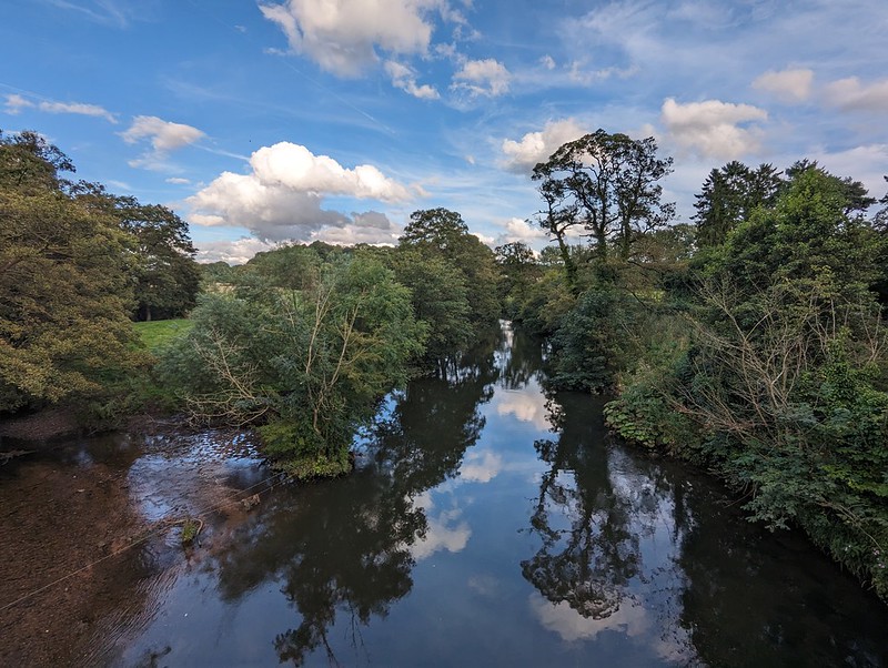
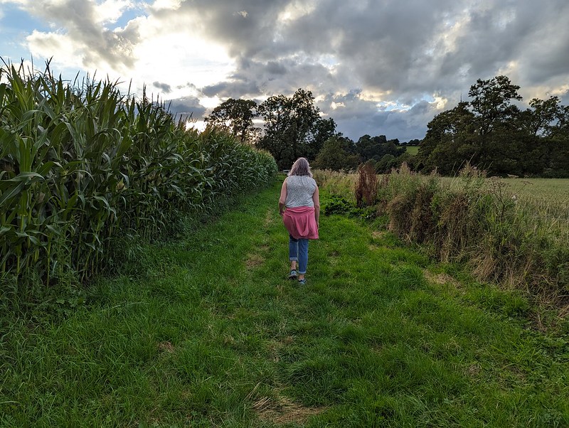
So TBH and I finished off our short trip with a wander in the vicinity of the cottage. The countryside was green and rolling and very pleasant.
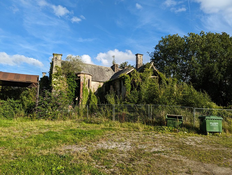
I’d noticed Calwich Abbey on the map and was keen to take a peek. According to the Historic England website the house is Victorian, but in a Tudor style, and is built on the site of a medieval abbey. It was derelict when the listing was made, in 1984, but was sold in 2015, so hopefully it will be restored?
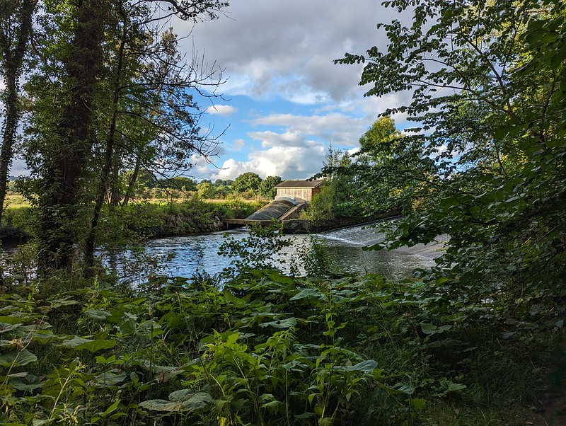
Calwich Abbey, otherwise known as The House of Usher.Another Ground Beetle. Maybe a Pterostichusspecies?Buzzard, I think.River Dove.TBH by the River Dovenear Norbury.Small scale hydro scheme?
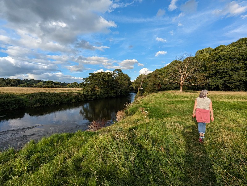
The path through the woods near Norbury were overgrown from the off – nettles, brambles etc; all the obstacles to pleasant country walking in the summer. As we progressed it became more and more impenetrable. We should really have turned back. By the end, a machete was needed, and my habitual choice of shorts had turned out to be a very poor decision. Then it was spitting with rain as we walked along a minor lane for a while.
TBH heading towards the Dove.
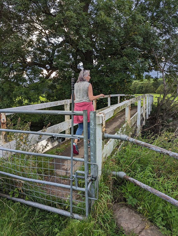
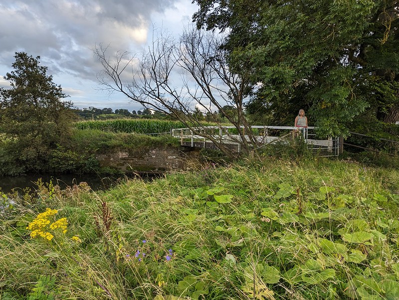
At least the last section, over the Dove via the charmingly named Toadhole Footbridge was much more pleasant.
TBH on Toadhole Footbridge.
As we crossed the bridge, we were lucky enough to catch sight of a Kingfisher, my first for some time.
River Dove.TBH on Toadhole Footbridge.Almost back to our accommodation.
Looking at the map, after our walk, it struck me that there is probably quite a bit of scope for decent walks in this area, just outside the National Park. The wooded valley of Ordley Brook looks particularly worth exploring. Another time perhaps. I certainly hope it’s not too long before we come back to the Peak District for another visit – perhaps a slightly longer one next time.
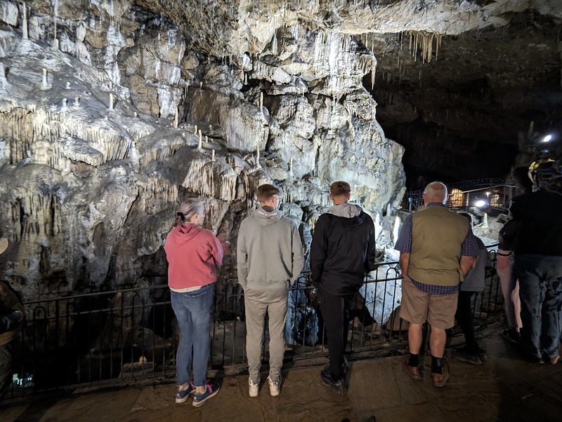
When I was a nipper, trips to the limestone caverns around Castleton where a regular treat, at least that’s how I remember it and we certainly visited all of the show caves in that area. But I don’t think we ever visited Poole’s Cavern near Buxton. So, we’d booked online the night before to put that right. Driving up, Google maps took us on a high level route, coming into Buxton from Axe Edge Moor, which I very much enjoyed because of the fantastic views.
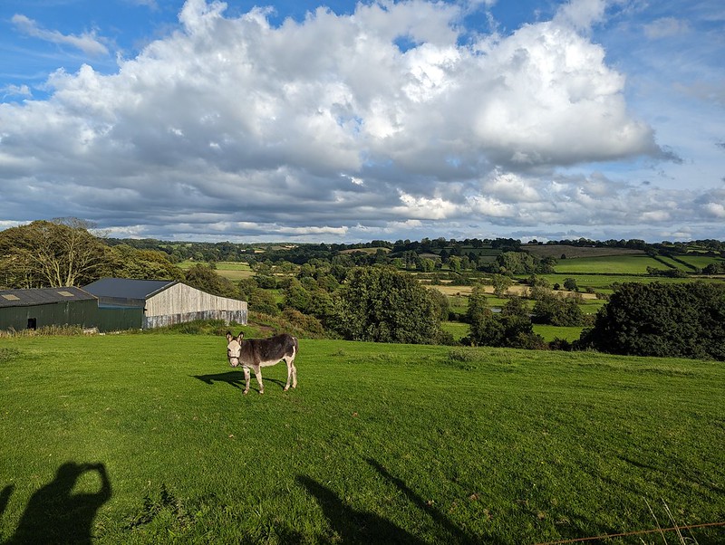
One of the resident Buzzards near our accommodation.
Actually, I’m getting ahead of myself. There were a pair of Buzzards evidently resident in the trees near to our rental property and I took every opportunity to try to get photos of them. Here’s one I took whilst I was waiting for everybody to be ready to set off for Buxton.
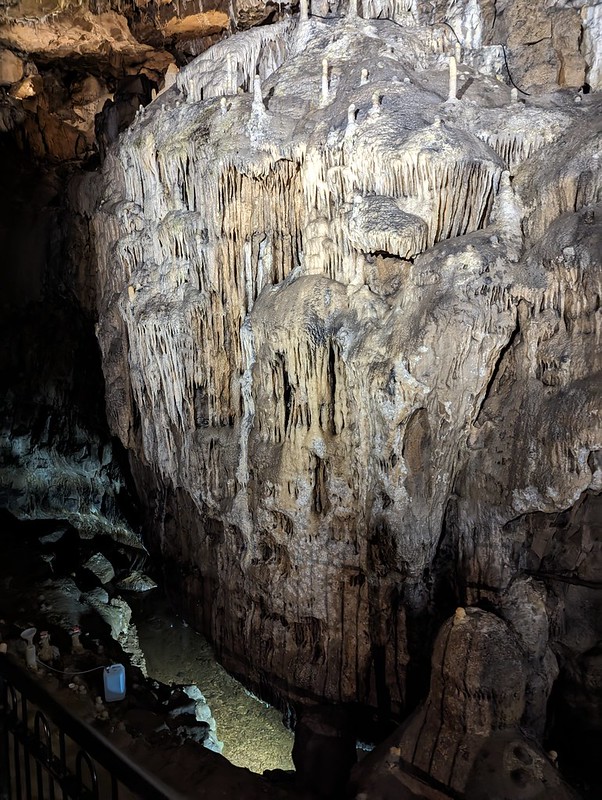
Flowstone features Poole cavern.
I thoroughly enjoyed Poole’s Cavern. There was an interesting little museum in the visitor’s centre too. Apparently there’s evidence that the cave was occupied from the Bronze Age onwards. One of the occupants was an outlaw called Poole, hence the name.
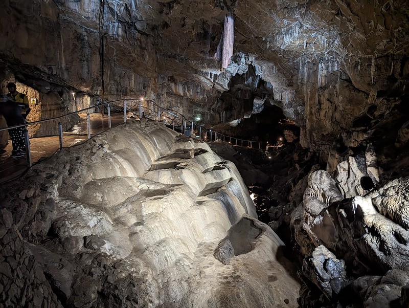
Flowstone features Poole cavern.
The large and broken stalactite in the centre is called The Flitch of Bacon. I was more impressed with the pools in the flowstone beneath.
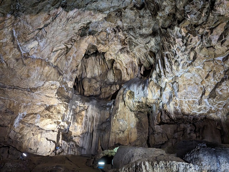
An abundance of stalagmites and stalactites.
Quarrying in the hillside above the cavern has caused the stalactites and stalagmites to grow at an increased rate. Research is ongoing into this accelerated growth.
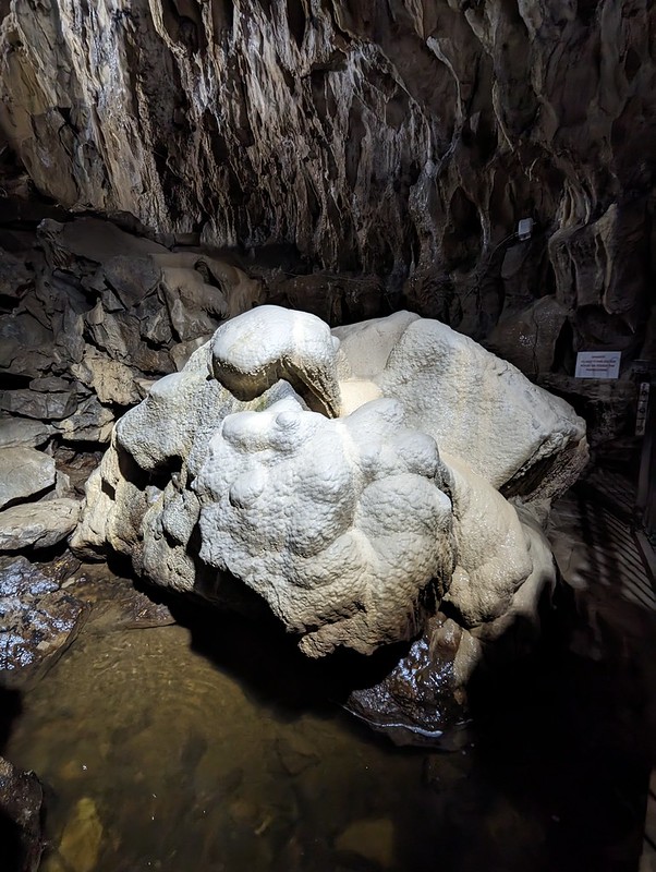
Stalagmites and stalactitesPoached Egg Stalagmites.More flowstone features.And more (or a backdrop from a scene in Alien?)And more.Flowstone coated boulder at the furthest point of the tour.
Seasoned cavers have apparently been working for years to dig a way through the stonefall at the end of the passage to find a way through to potential caverns beyond. It sounds like a dangerous and thankless task.
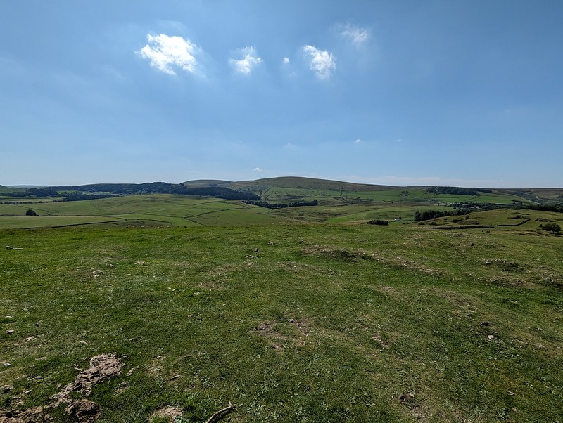
Poole’s Cavern is part of Buxton Country Park. There’s a Go Ape there too, and so I booked the DBs in for an afternoon session, we lunched at the cafe in the visitor centre, and then while the boys were doing their Tarzan thing, TBH and I went for a wander through Grin Low Woods and up to the top of the hill, where there’s a folly and a fine view over Buxton.
Grin Low.Grinlow Tower (Solomon’s Temple).
Grinlow Tower was apparently commissioned by the splendidly named Solomon Mycock to provide work for the unemployed in the town.
Buxton from the top of the tower.Looking towards Axe Edge Moor.
Back in 1983, my dad, his friend John and myself completed a challenge event called the Bullocky Smithy Hike. It’s an annual thing, still running if you fancy a go, organised by Hazel Grove Scouts. It’s advertised as 56 miles, but whilst there are checkpoints there’s no fixed route. We did a bit of road walking to avoid stumbling down Miller’s Dale in the dark, so I’ve always claimed that we walked 60. To be honest, it’s mainly the checkpoints (and the pain in my left knee for the last few miles) which I remember. At the checkpoints volunteers offered friendly encouragement, lavish quantities of food, hot sweet tea and (I think) treatment for blisters and muscle aches. I think we crossed Axe Edge Moor at about three in the morning. I was exhausted and very, very cold at this point. The checkpoint was in a barn close to the Cat and Fiddle Pub, I think, and the warmth and the tea and soup on offer, cheered me up no end. A couple of years later, in my first year at University, a fellow resident of the tiny Halls I lived in, an ultra-runner, won the event in a ridiculous, record time of around 9 hours. We took 22 I think. I don’t think I’d even realised it was a race. There’s a fuller, more detailed, account of a more recent completion here, which I enjoyed reading.
We took a different route down through the woods and found lots of heavily laden raspberry canes.
Sculpture of a Lime Burner, Grin Low Woods.
Although tucking into the raspberries slowed us down somewhat, we still had time to kill before the DBs were done swinging through the trees, so we had a wander down into Buxton.
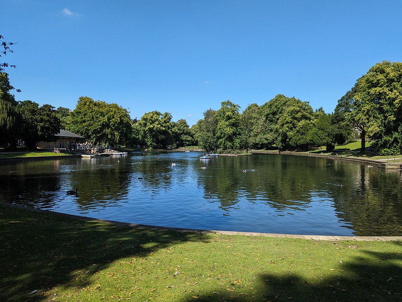
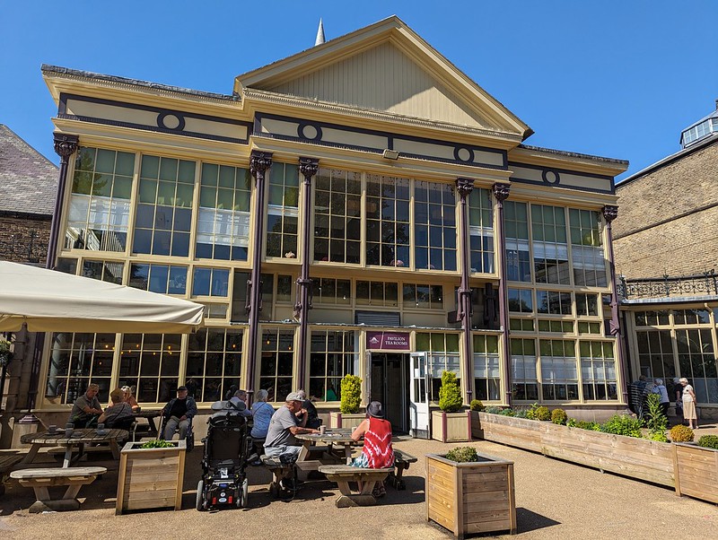
Boating Lake, Pavilion Gardens.Buxton Pavilion.
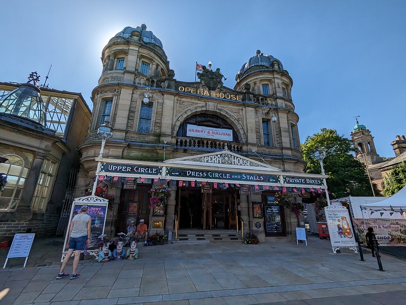
Back in University Hiking Club days I think we held at least one post-hike Meal and Barn Dance (we’d call it a Ceilidh these days I suspect) in Buxton, I think in the Pavilion, although I could easily be wrong. I also ran the Buxton half-marathon years ago, a very hilly affair with a brutal first few miles up on to Axe Edge Moor. Anyway, it’s a handsome spa town and a lovely place to visit, so I was glad to be back.
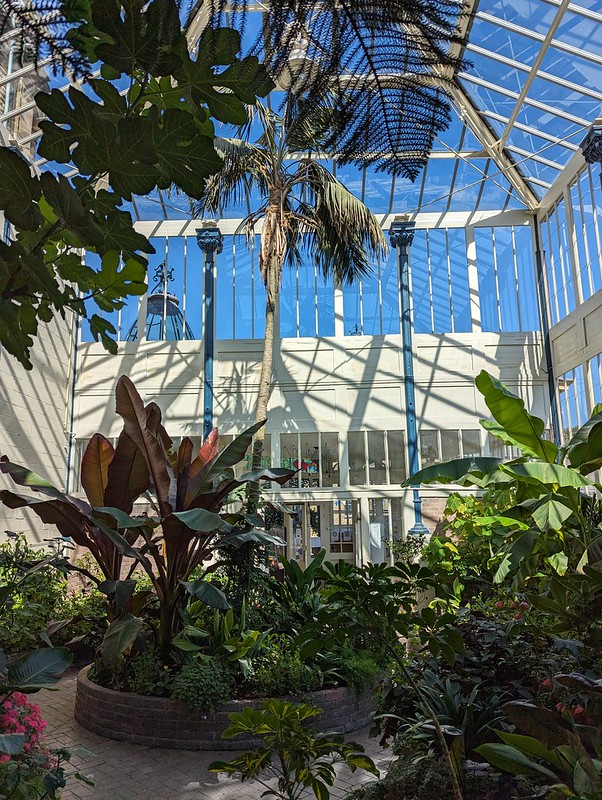
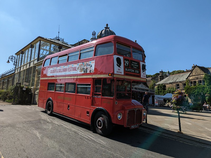
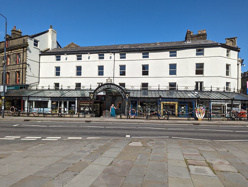
Buxton Pavilion.Pavilion Tea Rooms.Pavilion Interior.Buxton Opera House.London Transport Bus – a bit lost?Buxton CrescentGrove Hotel.Cafe at the Green Pavilion.
We popped into the Cafe at the Green Pavilion for a drink. It was hot by now, so I settled on a locally brewed beer. Very nice too. The menu looked enticing, so we were disappointed that the staff were in the process of closing up, and we couldn’t come back for tea. In fact, I can’t remember what we did by way of an evening meal – maybe this was the night we had late fish and chips from the chippy on the Market Square in Ashbourne? Also very nice.
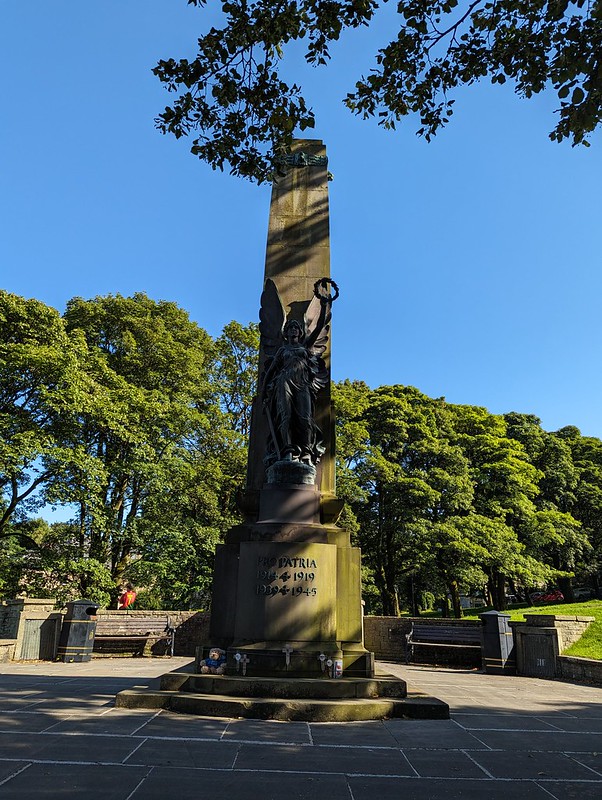
War Memorial.
There were a group filming by the War Memorial, but whether film or TV, drama or documentary, I’ve no idea.
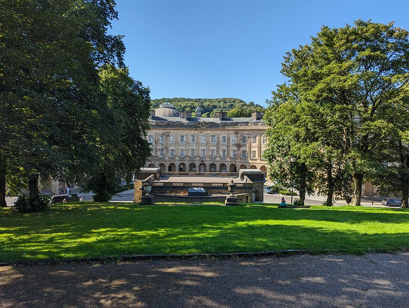
The Crescent and the Pump Room Roof.
I did dip into the Pump Room, now a visitor centre and cafe, but my photos of the interior are not very impressive.
Danebower Colliery Ventilation Chimney.
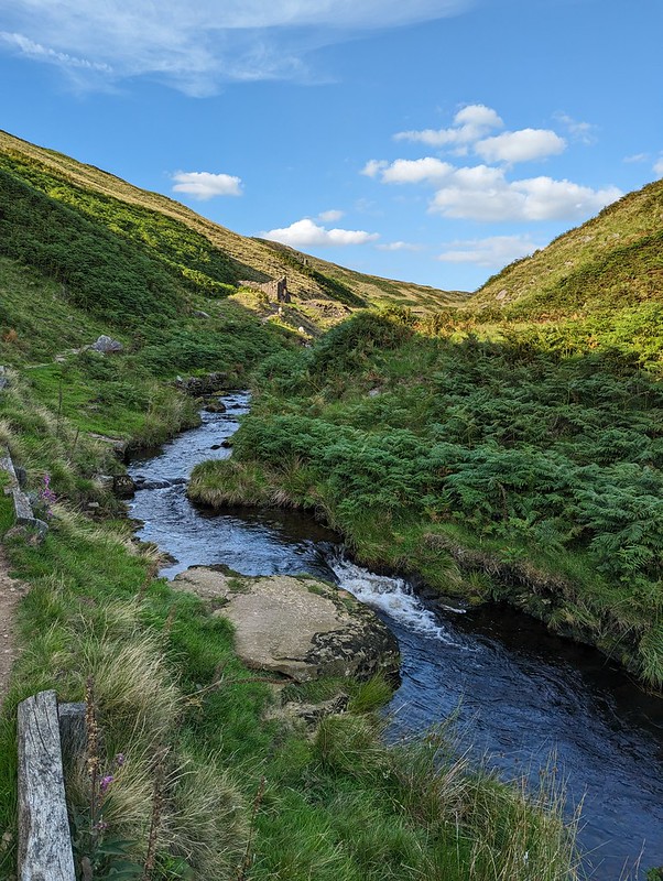
We weren’t done yet. I’d taken a leaf out of Andy’s book and been scouring satellite images looking for a suitable layby to give us access to the River Dane, because I’d also been scouring the internet for wild-swimming spots in the Peak District. There don’t seem to be many likely venues.
River Dane
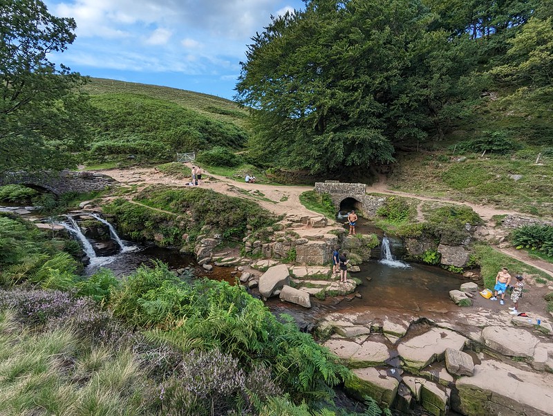
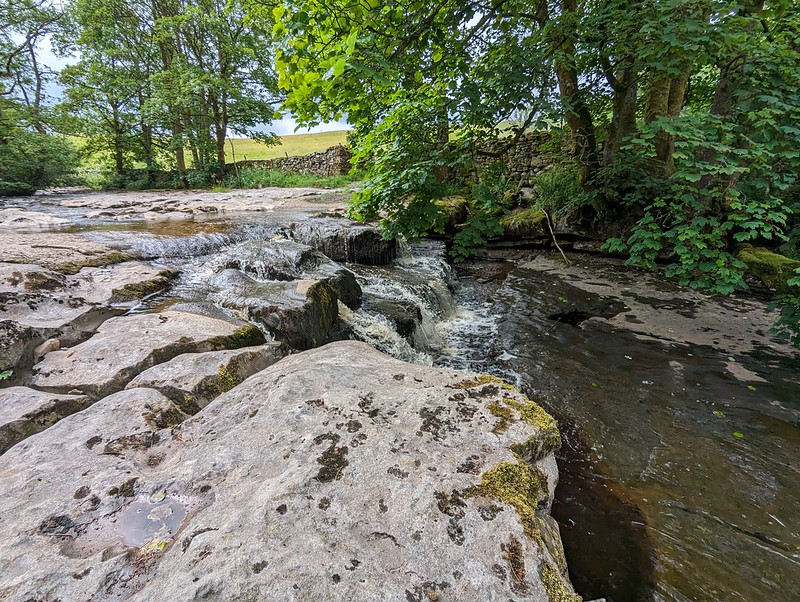
Which probably explains why, even though it was getting quite late, the pools at Three Shires Head were very busy. It’s nice to see people enjoying the outdoors, but, as much as I enjoy loud music, in the right circumstances, I prefer it when other people don’t subject me to their execrable taste in modern pop. (Heh, heh, I sound like my dad: ‘It just goes thump, thump, thump’). In fact, the pools are not ideal for swimming. Well, you can manage a couple of strokes in the pool on the left in the photo below, but neither is very deep.
Three Shires Head.
We consoled ourselves by ducking under each of the waterfalls, a bracing experience, which seemed to start a bit of a trend.
It’s a long time since I last visited Three Shires Head and I was trying to remember whether the paths were as eroded then as they are now. I remember it as quite an isolated, quiet spot, although, since it’s not far from a major road, I suppose that I might be guilty of looking back through rose-tinted spectacles.
Advancing shadows. The Roaches on the skyline.
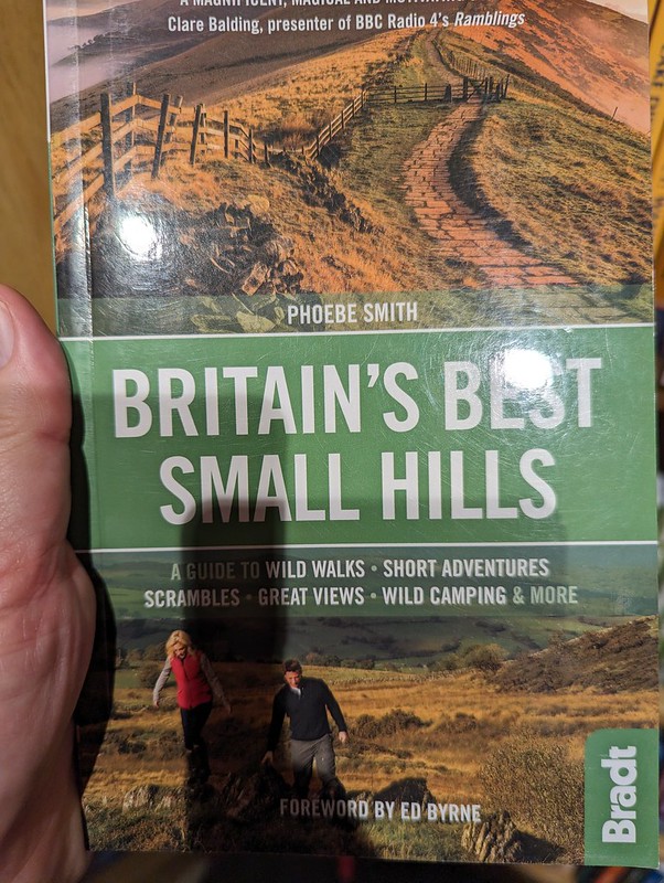
All-in-all, a really enjoyable day. And, Grin Low, which was new to me, might be one for our forthcoming book ‘Small Hills with Disproportionately Good Views’. Talking of which, we have a competitor…
Our idea made flesh!
I saw this in Waterstones in Lancaster and then, fortuitously, also found it in the Oxfam bookshop, so I now have a copy. Some of our favourites are in there, but many are not, so we may be in the clear. Phew! Unless Phoebe Smith has a volume two on the way? Oh no!
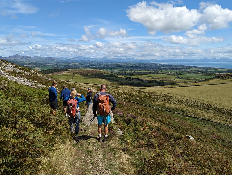
No trip to Towyn is complete without an ascent of Birthday Hill. This time we were a little early for Little S’s big day, but, as ever, it was a great sociable walk.
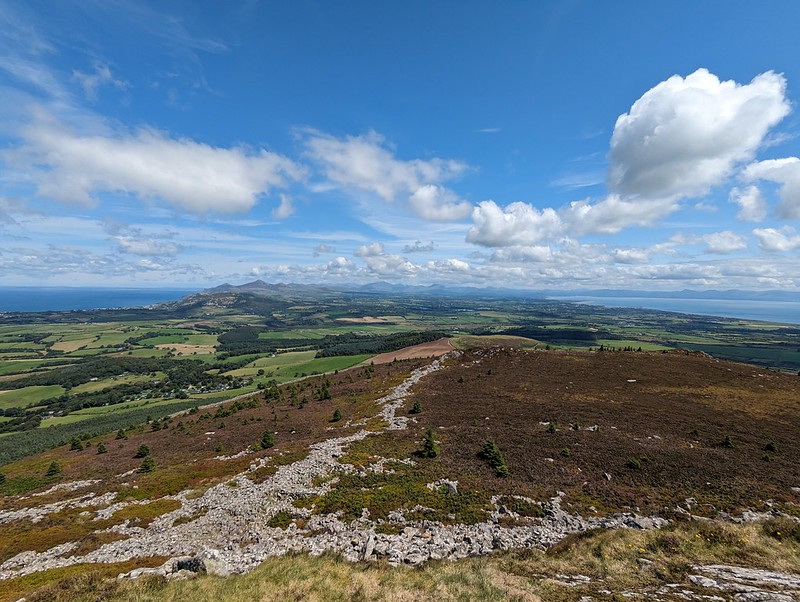
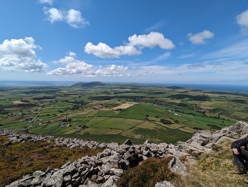
The view along the Llyn Peninsula from Carn Fadryn.
As usual, we sat on the top for an age, enjoying the amazing all-round views.
A good spot to wait for the slow coaches (like me).
On our way down, we passed a young family with small kids who seemed to be enjoying their walk. I wondered whether they would be back again when the kids were towering over their parents like the DBs do.
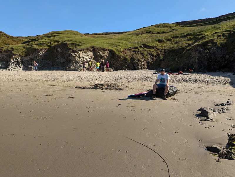
Porth Towyn pano.
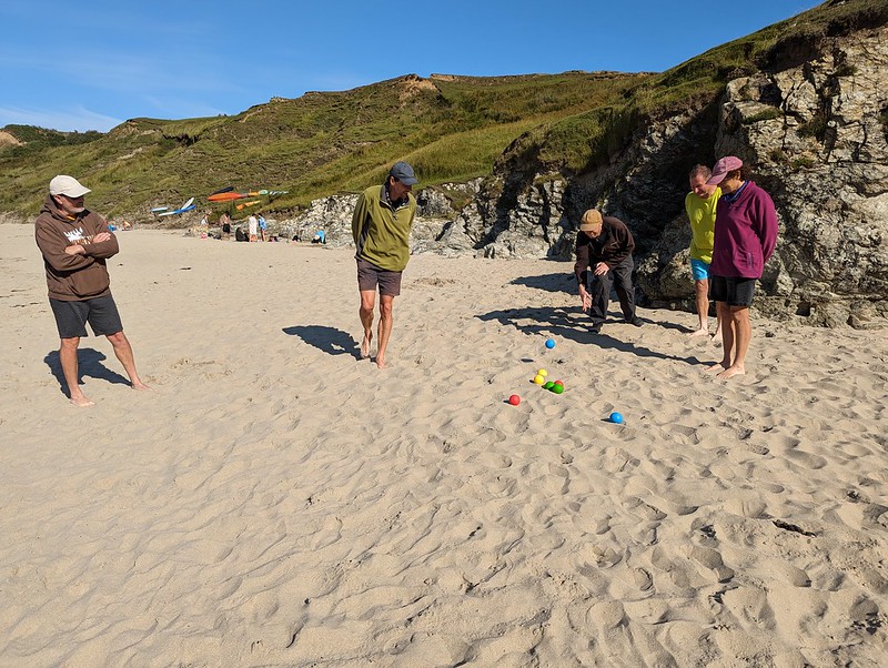
With the sun actually shining, and a bit of accompanying warmth, a trip to the beach was the obvious follow up. We squeezed in the usual favourites: swimming, body-boarding, tennis, chucking stuff at other stuff and beach cricket; although, sadly, the standard of fielding has noticeably declined over the years. I think it might have been the next morning when I finally got around to a snorkel, but the water was very cloudy.
TBF body-boarding.The Prof taking it all in.The DBs playing beach tennis.A highly competitive match of chucking things at other things.
The Eternal Weather Optimist has been living in symbiosis with his famous green fleece since at least the mid-80s, rather like the ecosystem of algae, fungi, moths, and insects which survive in the fur of sloths. Although, admittedly, he moves a good deal faster than your average sloth. Unlike me.
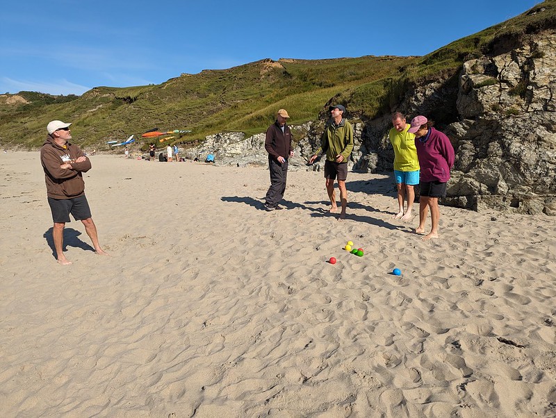
This is obviously Boules for the old and infirm, with the ‘cochonnet‘ within falling distance.
This might seem a bit rich coming from me, ridiculing my old friends just because they would have as good a chance of reaching the jack by holding their boule above their head and falling flat on their face in the sand, but these folk are all older than me*, I bring the youthful zest to the party! I can chuck a boule more than a couple of yards at least. Even if I have undermined my argument somewhat by using imperial units. *Well, a bit older anyway. Aside from the EWO, but I’m not as old as his fleece, so that’s okay.
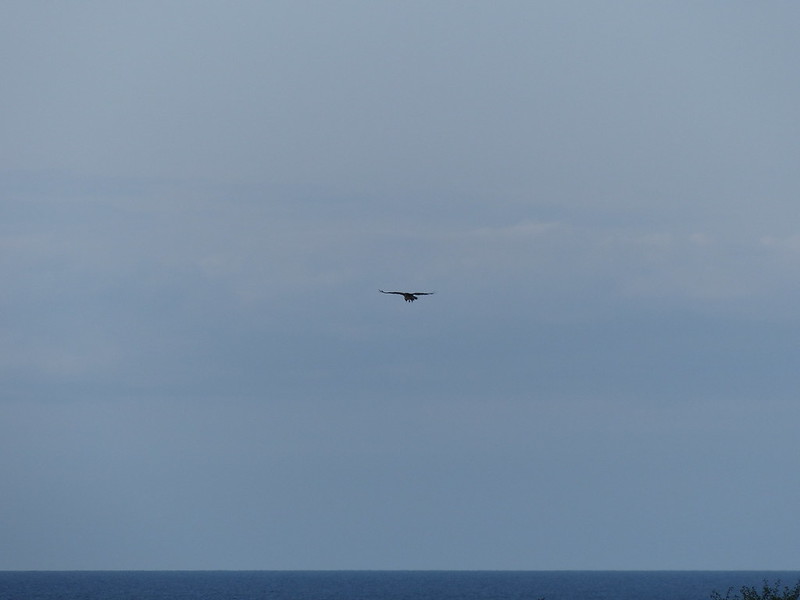
A large hovering raptor. A Buzzard?
Later, back at the tents, there was a good deal of excitement about a bird of prey which was hovering above the cliffs. It was clearly much too big to be a Kestrel, which is the obvious first thought in this situation. My expertise was called upon and then immediately called into question when I suggested that it was probably a Buzzard. But they do hover, honest. Not as proficiently as Kestrels, but they can do it.
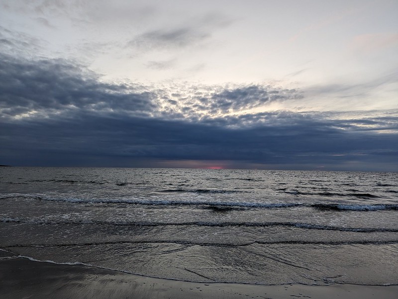
Sunset from Porth Towyn.
Later still, we had a late wander down to the beach, another staple of our trips. I think this was the evening when we tried to throw some frisbees around in a very strong wind, without much accuracy, or catching.
A late trip to the beach.
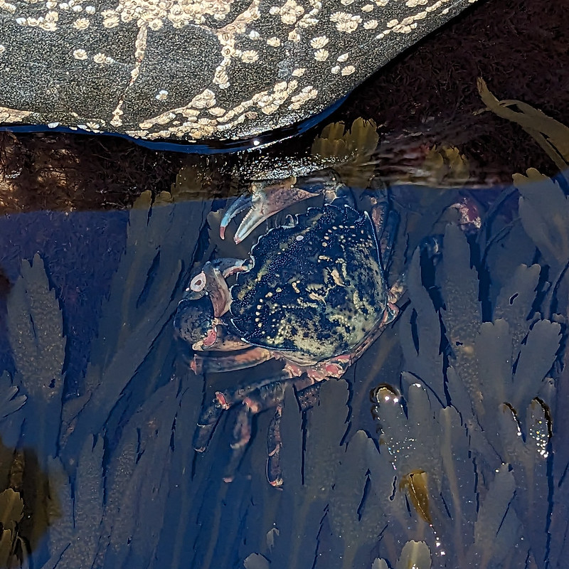
Little S and I decided to go rock-pooling in near darkness. Our rock-pooling was never very successful on this trip, but we did find a good-sized Shore Crab. It was very dark and the photo was taken with flash.
A large Shore Crab.
The next day, we were heading home, but still managed to fit in some swimming and a little more fruitless rockpooling before we needed to pack up.
Rockpools and seaweed.Rockpool colour.Seaweed.Little S.B heading back to help pack up our tent.
A short trip, with some very mixed weather, but our trips to the Llyn Peninsula are always good value. Roll on next summer!
The first time we made what was to become our annual pilgrimage to the Llyn Peninsula to get our summer holiday kick-started, in 2006, the kids were toddlers. In fact, Little S wasn’t born until the following year. One of the many happy consequence of having our young brood with us, were early morning walks for me with one or other of the the boys in a baby carrier. The walks were always a great opportunity to see a bit of nature, particularly seals. I would invariably walk along the coastal path for a while and then turn back. Thus summer, I was feeling nostalgic about those early morning outings, and although I’m not so good at early starts these days, on the Monday morning I managed to walk along the coast a little and be back for a late breakfast. Since the weather had turned grotty when I’d turned right along the coast the previous day, I wanted to try that way again. And because the path had been initially very churned up, I decided to return along the minor lane and then take the track back to Porth Ysgaden where I’d turned back the day before.
As soon as was on the lane I met a large, black beetle and a hairy caterpillar.
Unidentified Beetle.A hairy caterpillar. Maybe an Oak Eggar Moth caterpillar?
There were lots of Gatekeepers enjoying the sunshine in the hedgerows.
Gate-keeper Butterfly.
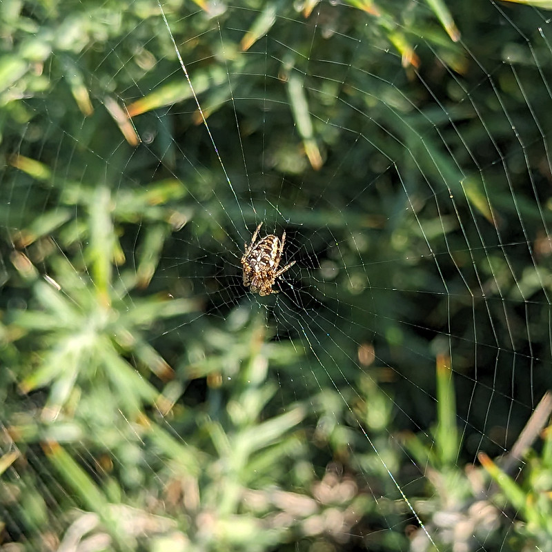
And where the hedge was gorse bushes, there were myriad small webs, most with a tiny spider in its centre.
Araneus diadematus – Garden Spider.
Because the spiders were so small, it was difficult to get either my ‘birding’ camera or my phone to focus on them. I thought perhaps I’d stumbled on some new-to-me small species of spider, but now that I’ve cropped some photos and had a proper look at them, I think they’re bog-standard, but none-the-less handsome Garden Spiders, Araneus diadematus.
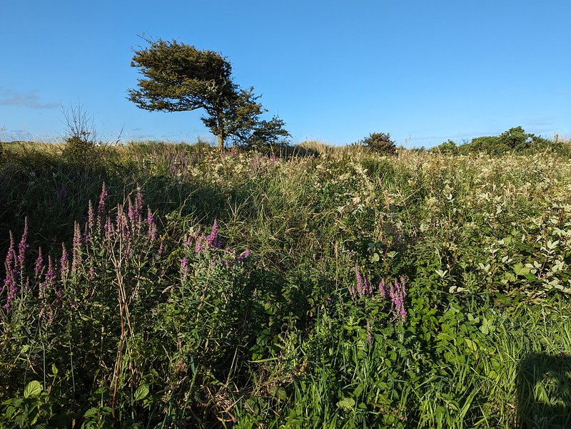
A wide verge – Purple Loosestrife and Meadow Sweet.Porth Ysgaden.
From Porth Ysgaden, the strip of land along the coast, which the path runs through, belongs to The National Trust. I remembered it as being a really pleasant stretch to walk, and I wasn’t wrong.
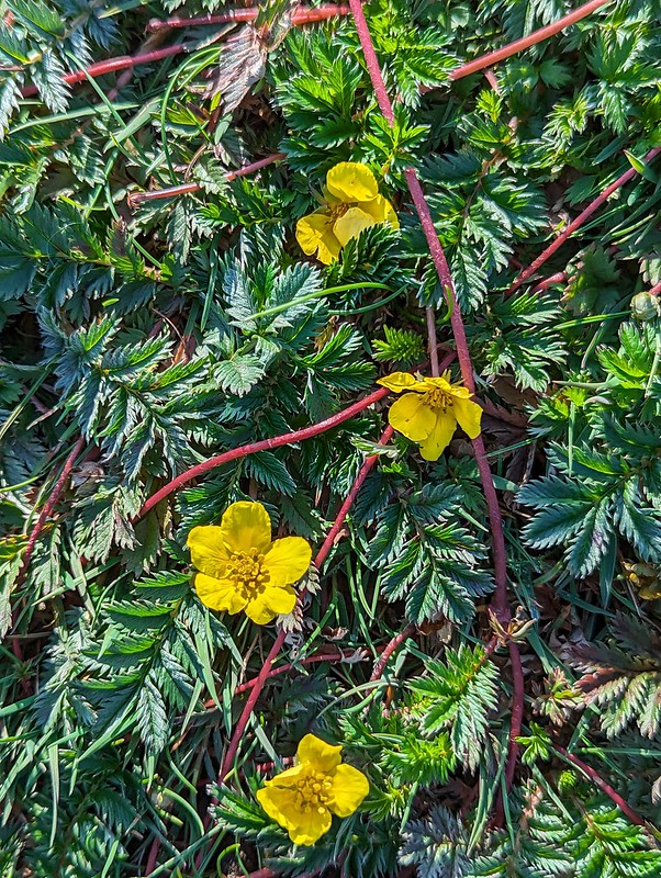
West along the coast.Silverweed.Silverweed runners.
Silverweed is a common plant which is easy to find close to home, but I don’t think I’ve ever seen it looking as vigorous as it did along this stretch of grassland. The surface was matted with its scarlet runners. Apparently, Silverweed was once prized for its starchy tuber, which is good to eat, but I’ve read that it’s not wise to introduce it in your garden because it will take over, which I can well believe.
Another coastal view.
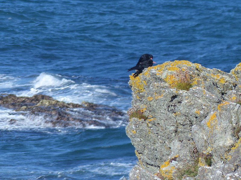
I followed the clifftop as closely as possible and kept getting tantalising views of a pair of corvids which I thought must be Choughs. Birds from the crow family often seem to take particular joy in their acrobatic displays in flight, and this pair of birds were swooping across the cliff faces and zawns with what looked like glee.
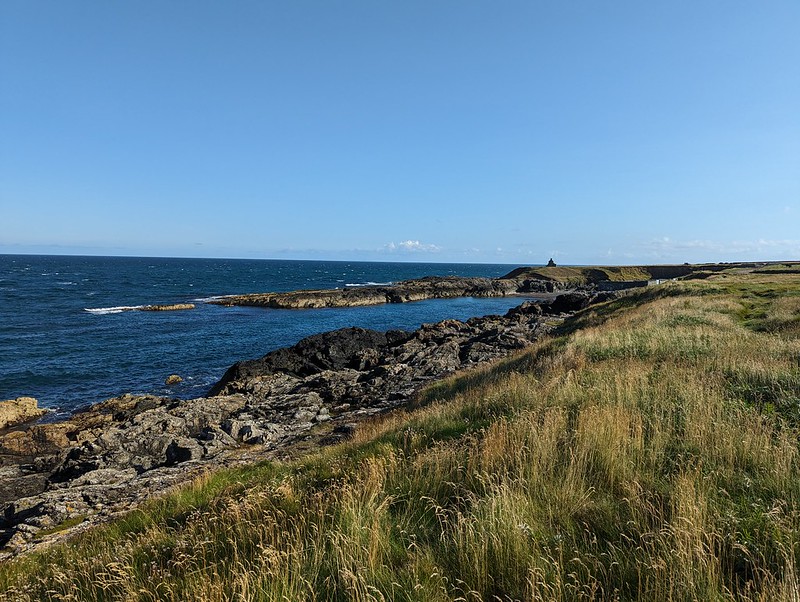
Porth Gwylan
I was really taken with Porth Gwylan. If I’ve been this far along the coast before, then I don’t remember it. A long arm of rock forms a natural harbour. There were small whitecaps in the sea, but the water in the Porth was completely calm. I thought this might be an interesting place to come snorkelling at some point.
A Chough.
The Choughs (or some Choughs at least) reappeared and stationed themselves at the end of the ‘harbour arm’, preening each other and generally looking right at home.
Choughs.A view from the furthest reach of my walk, near Porth Ychain.
I would have loved to carry on: it seems crazy that, in all of our many visits over the years, I’ve never been a little down the coast to the long beach of Traeth Penllech or to the headland above it, Penrhyn Melyn, which I imagine is a wonderful viewpoint.
Having turned back, I decided to walk on the opposite side of the strip of coastal grassland, away from the sea, and by the low mounded hedge and the fence. This turned out to be a great idea, since, now that I wasn’t busy watching the sea, I discovered that this little patch of heath was thronging with birds.
Thrift which has gone over. Carn Fadryn behind.Juvenile Stonechat.
A whole family of Stonechats were bobbing about in a thicket of brambles. I have some out-of-focus shots of an adult male, but only this juvenile posed for long enough for me to get some half decent photos.
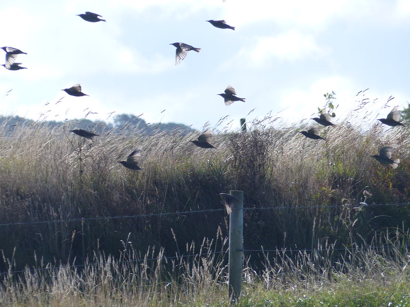
Starlings?
The fields beyond the hedge were busy with some quite large flocks of brown birds, which would periodically take to the wing, but then, on some unheard signal, all settle together in the vegetation in the field and disappear.
Starlings?
I think that they were juvenile Starlings, but that’s a tentative guess. As you can see, this particular field was dotted with blue flowers…
Mystery blue flowers.
They look a little like Chicory flowers, but Chicory is a tall plant, and these definitely weren’t tall. From what I’ve read, it seems that a number of flowering plants are being used as green manure in fallow fields, so this may not even be a native British species anyway.
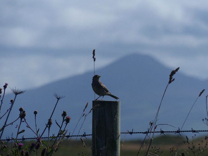
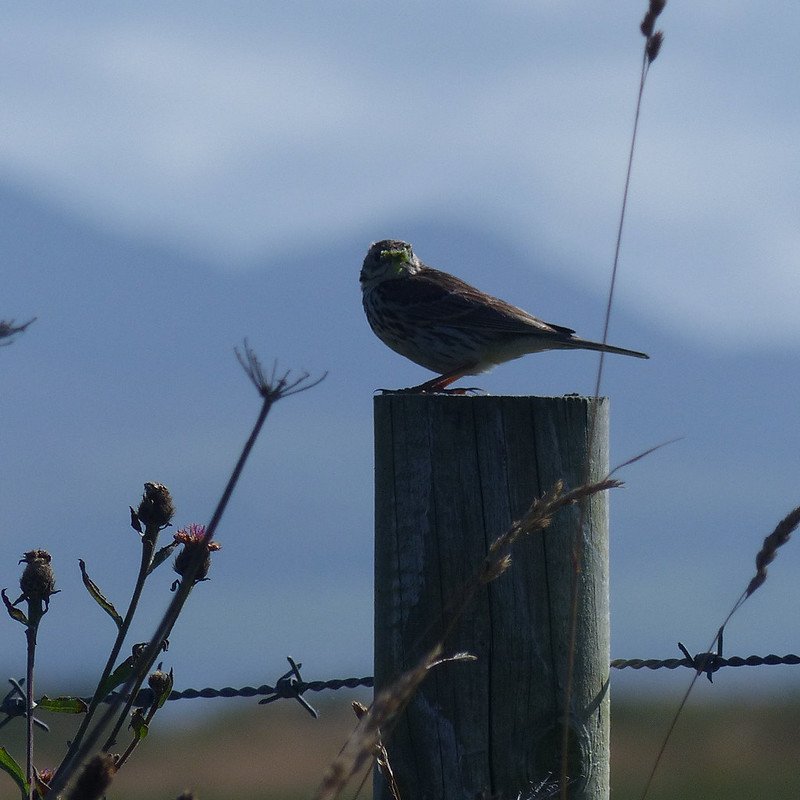
Meadow Pipit?
I’m still pretty rubbish at identifying LBJs, but I assume that this is a Meadow Pipit. There were quite a few of these about, but I’d only managed to get some very distant photos, before this one decided to pose for me on a fencepost, with a wriggly green grub in its beak.
Meadow Pipit?Porth Gwylan, the hills in the background are Yr Eifl and its neighbours.Pipits?
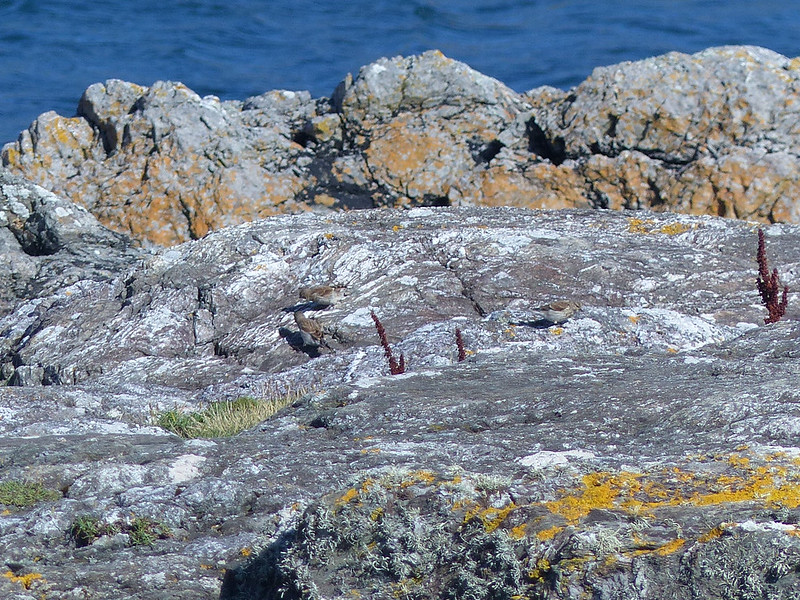
Back at Porth Ysgaden, I watched several more LBJs hopping about on the rocks. Because they were on the rocks, I naively assumed that they were Rock Pipits, but it now seems likeliest that they were more Meadow Pipits. A lovely interlude. Next time, which will be next summer, all things being equal, I need to make it a little further down the coast. Maybe I should investigate public transport options so that I don’t have to walk out and back. Ultimately, of course, I would like to walk the entire coast path around the peninsula, that would be a treat.
Late sun catches the River Roeburn and Morecambe Bay.
A Wednesday walk in early July; another fabulous Lune Catchment outing. I was able to get out on a Wednesday because it was a strike day. With hindsight, I’m slightly ambivalent about our industrial action: the ‘deal’ we eventually settled for was so poor, putting us even further behind where we were before ‘austerity’, that the personal cost of numerous unpaid strike days seems hardly worth it, but on the other hand, now that it’s over, I’m really missing those occasional days off and the midweek escapes to the hills.
My route could be summarised as a high-level circuit of the headwaters of the River Roeburn. At this remove I can’t remember what inspired me to plan such a long and ambitious route for a day when the forecast wasn’t especially promising.
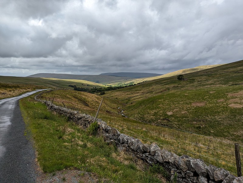
I drove in on the road from Hornby which crosses a shoulder of Caton Moor, giving great views of the head of the dale, before losing lots of height, sadly. Even so, where I parked, by Barkin Bridge, the map shows a spot height of 144m, which, given that the Bowland hills are of modest heights even by paltry British standards, is a conveniently high start.
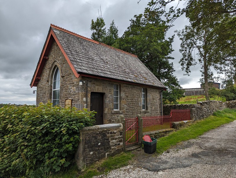
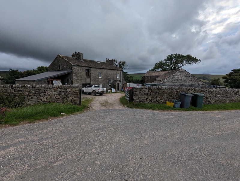
The River Roeburn from Barkin Bridge.Roeburndale Methodist Chapel at Lower Salter.
I climbed up the road past Lower Salter, beneath threatening clouds, before dropping back down again to the river on this metalled track…
Mallowdale Pike, High Stephen’s Head, Gallows Hill.River Roeburn again.
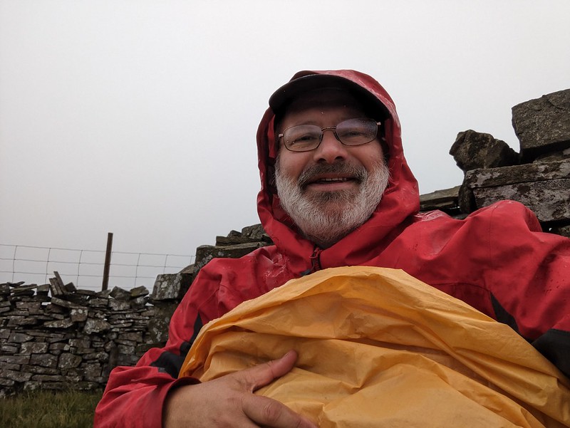
It began to rain and I reluctantly donned my cag, but it soon stopped and I didn’t put it on again until many hours later, right at the end of the walk, as I was returning to my car past the farm and cottages at Middle Salter. At other times, I could see showers passing through, or at least it looked like it was probably raining nearby, but none of them caught me.
Haylot Farm.
A little judicious trespassing here, across a couple of fields and on to Haylot Fell, would have saved me a lot of time and effort. Had I known what was to come, I might have gone for it.
The hills above Kirkby and the Three Peaks.Mallowdale Pike.Melling Wood.
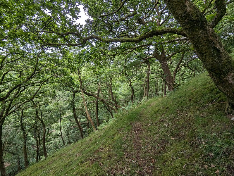
Instead, I followed the right-of-way down into Melling Wood – I know I’ve enthused about this steeply-sloping oak wood on the blog before. It’s a lovely spot.
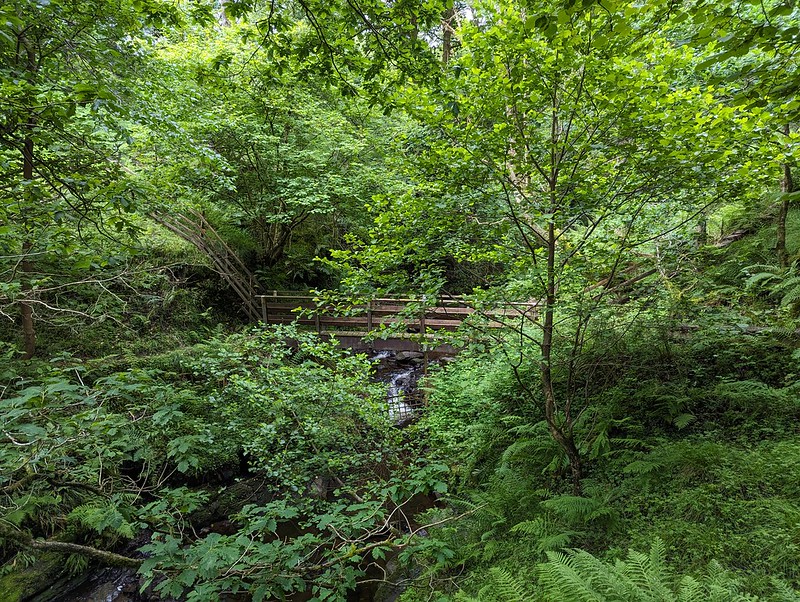
Footbridge across Mallow Gill.
So – I’d realised that if I stepped over the fence by this footbridge I would be on Access Land. Well, almost: strictly speaking I would also need to cross a sidestream of Mallow Gill too, but once on the far bank, I would be on Access Land. Easy. Or so I thought.
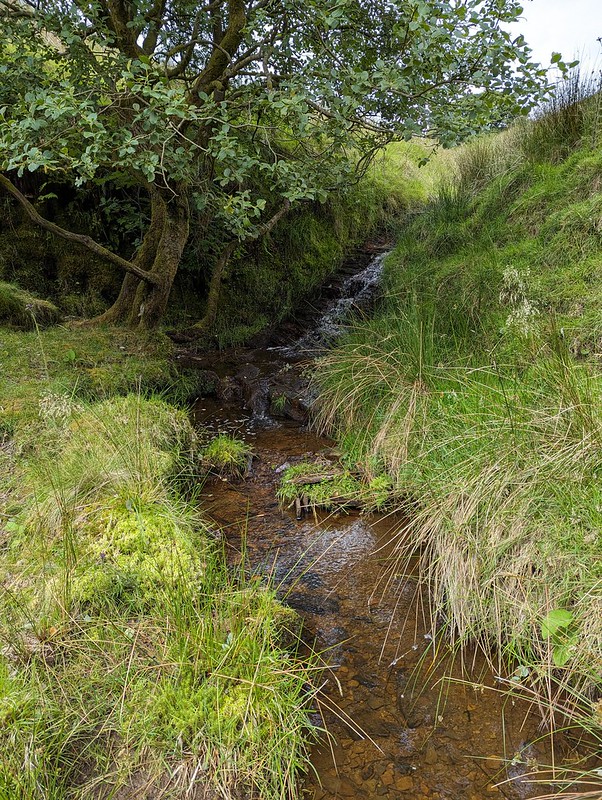
Mallow Gill.
The sidestream I needed to cross is on the right here, although you can’t really see it in the photograph. My problem was that the banks were very steep and I didn’t fancy trying to get down into it, or fancy my chances of successfully getting up the far bank. On the map, the hillside here looks entirely benign, with widely spaced contours – there’s no hint that this will be steep terrain. But it was. And the ground was dry and seemed to be composed of leaf mould, which was loose and unstable and difficult to make progress on. Added to that, there were lots more steep-sided sidestreams which the map also fails to disclose. I eventually climbed to the top edge of the wood and followed a very boggy path there which looked to have been made by hooved creatures – sheep or deer. I fell into one of the boggiest bits, which rather negated the way the weather considerately directed the showers away from me.
Haylot Fell.
Anyway, I eventually climbed high enough to leave the wood and finally managed to cross the stream on to the Access Land. The stream, Lambclose Syke, was comically small by now, making a mockery of my previous inability to cross it.
Lambclose Syke.Hawkshead, Mallowdale Pike, High Stephen’s Head.
Mallowdale Pike is an unusually shapely fell by Bowland standards, at least when seen from below. I’ve been intending to climb it for an age. I had half an idea to include it today, but it didn’t really fit neatly with the rest of my plans, so it’s still on my ‘to-do’ list.
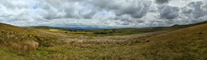
The Three Peaks again.Pano – Caton Moor, Three Peaks, Mallowdale Pike.High Stephen’s Head and Gallows Hill.
Instead I headed up Gallows Hill and then along the rock scattered edge from there to High Stephen’s Head.
Morecambe Bay and Caton Moor Wind Farm.The view north again.A sheltered spot on High Stephen’s Head.
This hollow offered excellent shelter from the chilly wind, whilst still allowing extensive views to the North. Too good an opportunity to overlook, so I broke out my stove for the day’s first lengthy brew stop: Atkinson’s of Lancaster Blue Sky which is black tea but with a bit of Grapefruit flavour, my go to hike brew these days.
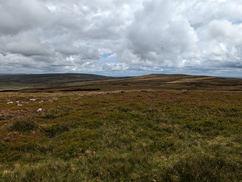
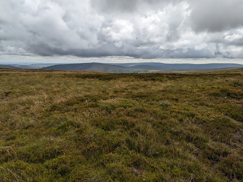
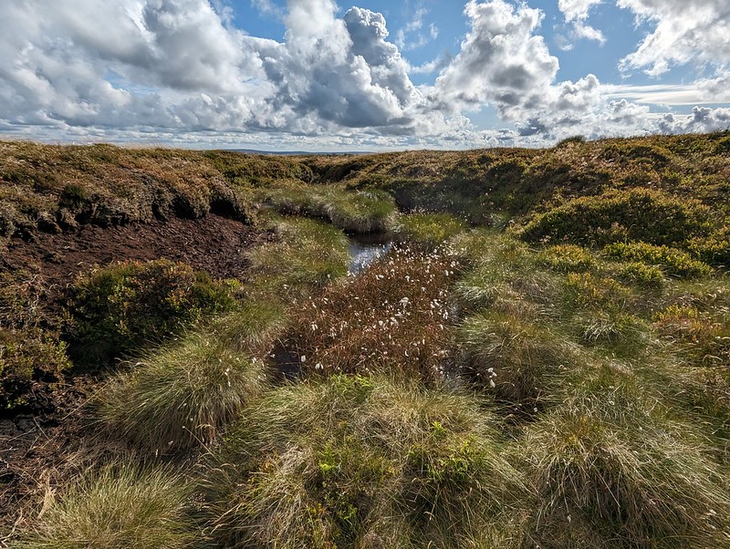
Forest of Bowland terrain.
Paths in the Forest of Bowland are usually little used, sketchy or even non-existent. The going was often rough and quite hard work. My hand-me down boots did me proud though, and my feet stayed dry through all of the bogs and peat hags.
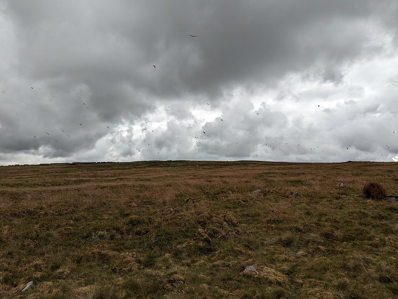
Lesser Black-backed Gulls.
As I approached Ward’s Stone, the air was thronged with Lesser Black-backed Gulls. The cacophony was astonishing. The walk between Ward’s Stone and Wolfhole Crags was accompanied by the constant calling of the gulls, who seemed to be always on the move. Apparently, the breeding colony here was once the largest in the UK, but for many years culling was allowed, ostensibly to protect the water course from pollution, but since the gulls will eat Grouse eggs and chicks the action also protected the shooting industry’s revenue. It seems that after the species was red-listed and the licence to cull elapsed, the persecution continued illegally, for a while at least. I haven’t managed to find any data regarding the recovery or otherwise of the breeding colony. There seemed to be a lot of gulls, but that’s not very scientific evidence. This colony was at one time the largest in the UK, and since the UK has 40% of the World’s population of this species, it was pretty important.
Bog Asphodel.
I know that gulls often vociferously protect their nests and I fully expected to be dive-bombed, which I wasn’t looking forward to, but whilst they made a lot of noise, the gulls left me well alone – maybe I didn’t get close enough to their nesting sites?
Queen’s Chair.
I think this must be the feature, close to the eastern summit of Ward’s Stone, marked as the Queen’s Chair – to be honest, it didn’t look remotely comfortable.
Grey Mare and Foal, Ward’s Stone.
This jumble of large boulders seems to be called Grey Mare and Foal although I couldn’t see why. However, on the leeward side of the rocks, well out of the wind…
Grey Mare and Foal, Ward’s Stone.
There’s was a large flat slab, resting on other rocks, which must surely have been laid like this to make a seat? It was extremely comfortable, with a view of my route ahead, and an ideal spot for brew number two and a spot of lunch.
A perfect seat for lunch.
Here on Ward’s Stone, the highest spot in the Forest of Bowland, I saw some other walkers: two couples. They were the only other walkers I met all day.
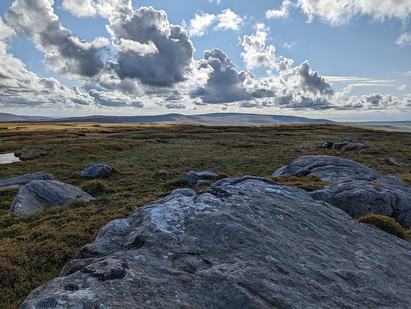
White Hill, Wolfhole Crag and Pendle Hill.Pendle Hill and Fair Snape Fell.
Whilst Pendle Hill stands proud and alone and is very distinctive and easy to recognise, Fair Snape Fell is the highest hill in a jumble of Bowland fells which I’m not sufficiently familiar with to distinguish between.
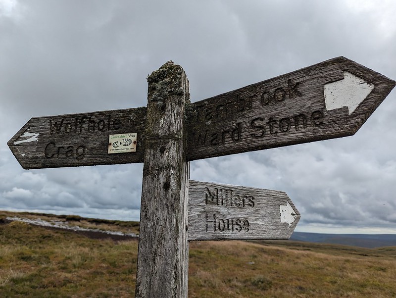
White Hill, Wolfhole Crag and Pendle Hill.Pendle Hill and Fair Snape Fell and its neighbours. From Grey Crag? White Hill and Wolfhole Crag. Slowly getting closer.Lesser Black-backed Gull.Lichened signpost.Wolfhole Crag.
I think I’ve been to Wolfhole Crag before, many, many years ago. But if I have, I’d forgotten its jumbled, bouldery edge. I was impressed with what I found. I suppose that when a walk mostly covers quite featureless, bleak moorland, any rocky character really stands out.
I found another spot out of the wind, behind one of the towering boulders, made yet another brew and may have drifted off for a bit.
Looking back to Wolfhole Crag.Fair Snape Fell.Mallowdale Pike and Hawkshead.
From Wolfhole Crag, I dropped down to the Hornby Road. This would be my return route to my car, but I decided on an out-and-back to White Hill first, even though it was already well into the afternoon.
Wolfhole Crag.Stoat trap.White Hill.
I’m assuming that White Hill is not often visited. There wasn’t much of a path and the going was hard work in places. On the other hand, the sun came out, and there were no Lesser Black-backed Gulls which meant a bit of relief from their raucous and relentless cawing. What’s more, it also meant there were other, different, birds to see. In fact, I was quite surprised to find how much time I spent taking photos of birds.
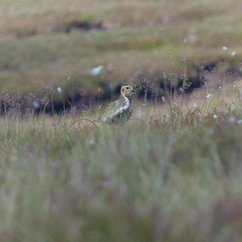
Golden Plover.
Mostly, my photos are really rubbish shots of Golden Plover. I didn’t see many, perhaps three, but those birds seemed happy to play a game with me, bobbing up and down in the grass and heather, or suddenly appearing in full sight, but with the light behind them so that all I could capture was a silhouette.
Golden Plover.
My game of hide-and-seek with this bird must have looked particularly comical: we were on opposite sides of a peat hag and both anxious not to be seen, so were both bobbing in and out of sight. I have lots of photos, but in most of them my camera has done a fabulous job of focusing on the vegetation between me and the plover. I haven’t often seen Golden Plovers before though, so was very happy to have an opportunity to get even dodgy shots. I also took a few blurred photos of Curlews in flight. And two distant, not especially sharp photos of what I’ve almost convinced myself might be a Merlin – Britain’s smallest bird of prey which lives on small moorland birds like pippits. I thought I saw one once before, flying around the craggy edge on Clougha Pike, not so far from here.
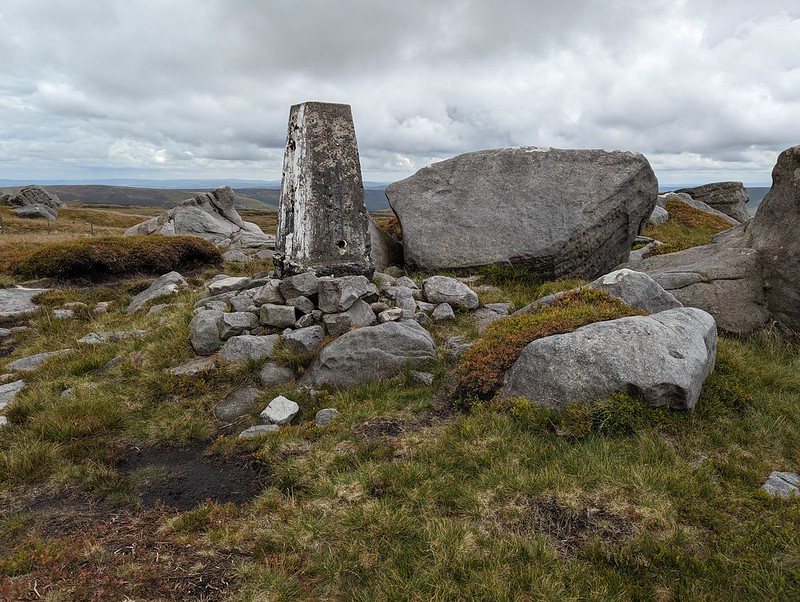
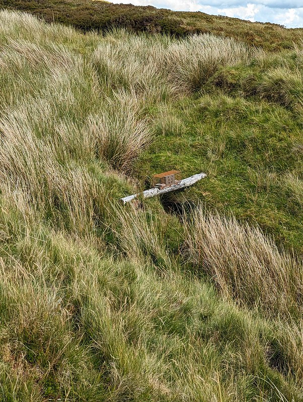
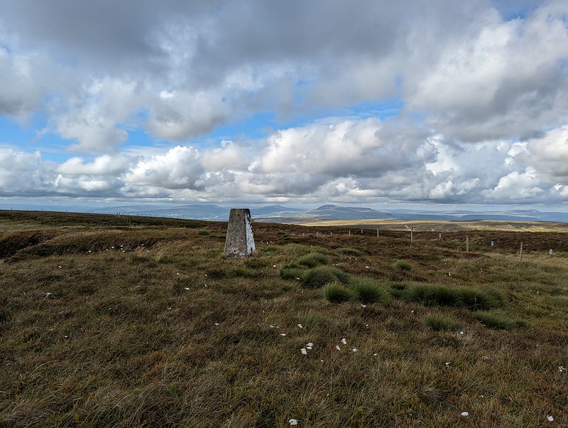
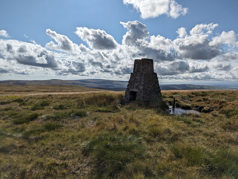
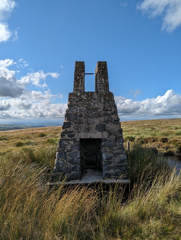
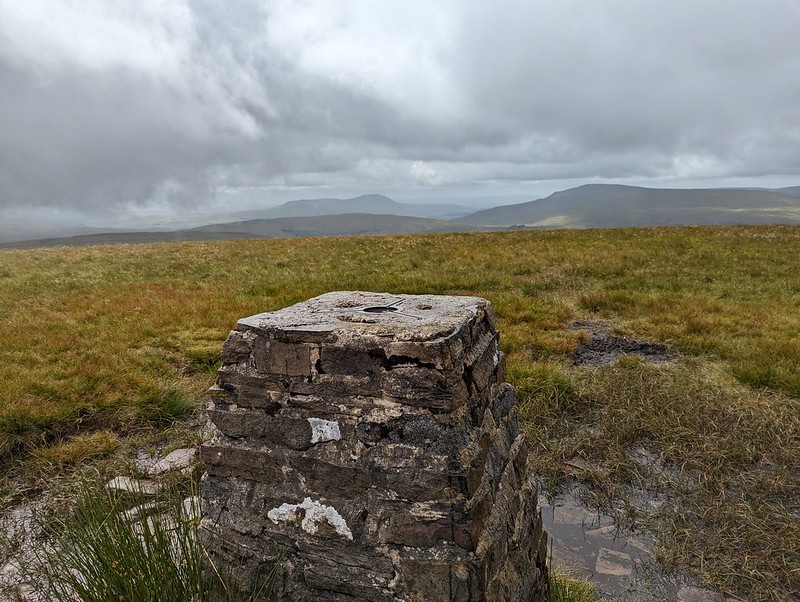
White Hill Trig Pillar.White Hill sighting tower. Wolfhole Crag and Ward’s Stone beyond.Sighting tower. Used to plan the Haweswater Aqueduct.
There are three of these fairly tall structures on White Hill. There are similar pillars on Selside Pike near Haweswater in the Lake District, and on Tarn Crag above Longsleddale. They were used during the construction of the Haweswater Aqueduct which carries water from Haweswater reservoir in the Eastern Lakes to Manchester.
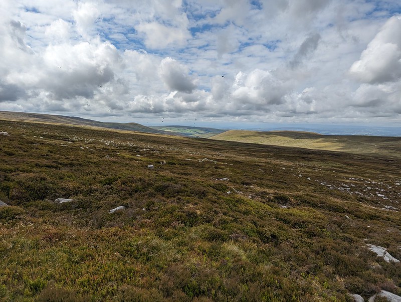
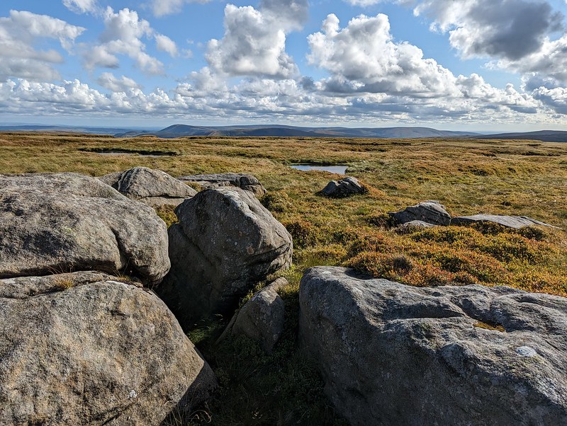
Forest of Bowland terrain 2.Wolfhole Crag and Ward’s Stone from Botton Crag.
My descent route was very close to the way I had come up, but the rocky slabs of Botton Crag gave slightly easier walking than the heathery amd tussocky terrain elsewhere on the moor.
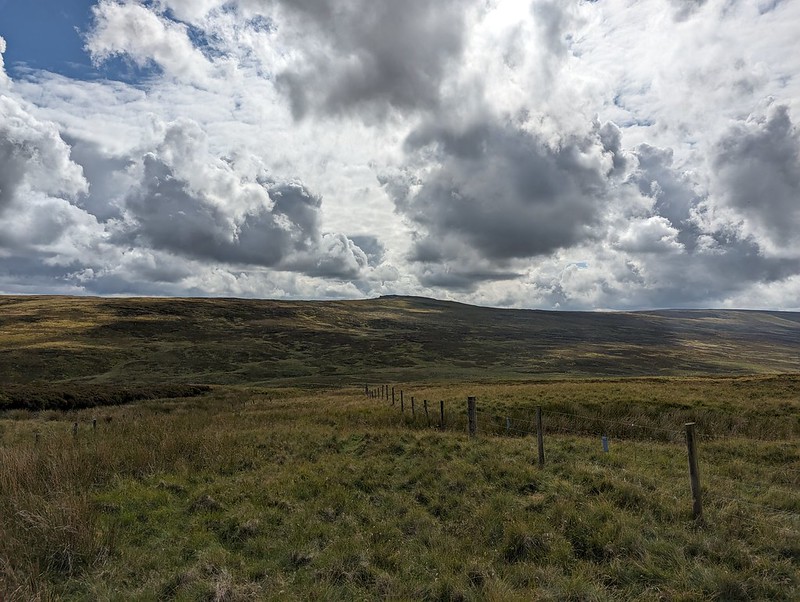
Looking toward Fair Snape Fell.Hornby Road.
On the map, Hornby Road is marked as a Roman Road, although it seems the modern track may not always stick to the Roman route. The track connects Slaidburn to Hornby and Wray in the Lune valley. A quick Google suggests that it is popular with cyclists, which makes a lot of sense.
Hornby Road.
Although I still had quite a long way to go, the track at least gave some easy walking to finish my long day. With the clouds gathering, the drama of the skies and the light kept me royally entertained.
Big skies over the Three Peaks.
Fortunately, my ‘new’ phone seems to have a really flair for clouds – I imagine the in phone processing power of the software designed by the boffins at Google?
The kind of light which makes a late finish worth while.One final view towards the Three Peaks.Threatening clouds amassing over Mallowdale Pike, High Stephen’s Head, Gallows Hill and Haylot Fell.High Salter.Haymaking near Middle Salter.
As the evening grew gloomy and I put my cag back on for the last few hundred yards, the local farmers were still busy cutting the grass for silage.
MapMyWalk gives a little under 18 miles and around 660 metres of ascent. More importantly, another day of really enjoyable walking.
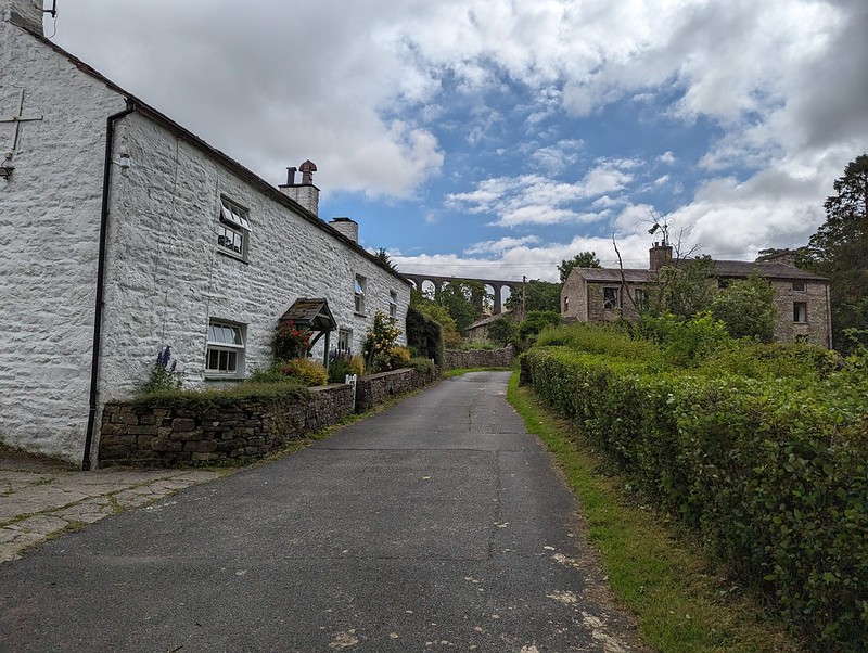
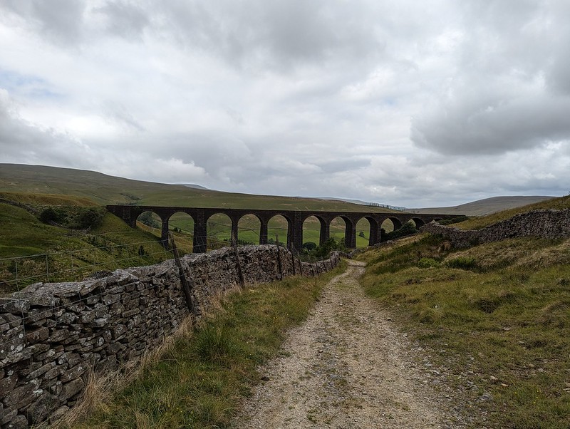
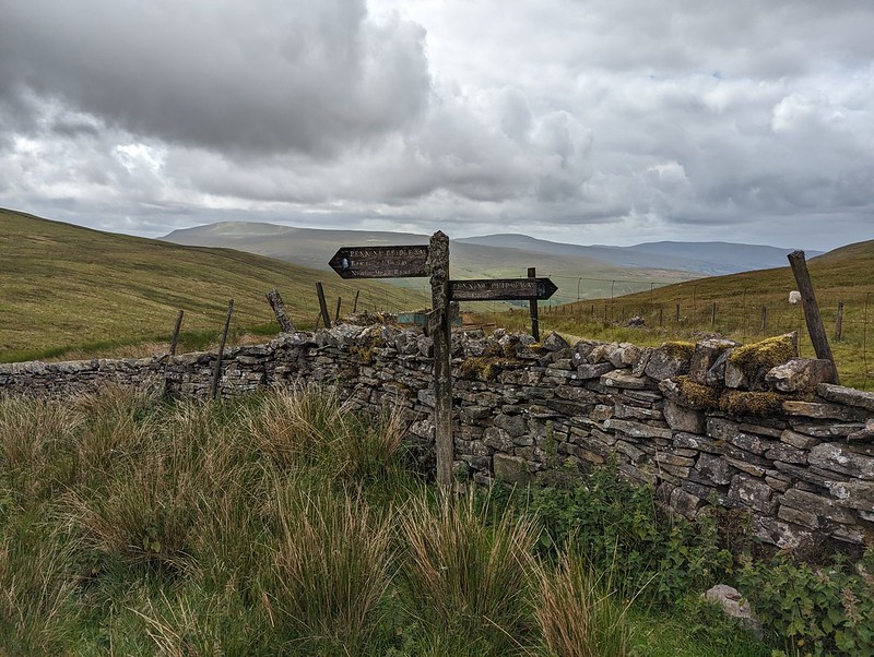
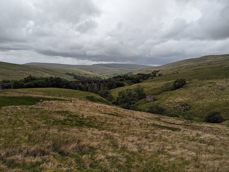
Dent Head Viaduct and Packsaddle Bridge over Fell End Gill.
Another Lune Catchment walk, on a day of decidedly mixed weather. I don’t mind a bit of mixed weather, depending, I suppose, on the ratios employed in the recipe: I can stand a bit of rain so long as it isn’t poured with too heavy a hand and if I get some dramatic skies in compensation.
I know that Dentdale is lovely, but curiously, given that it’s not really all that far from home, I haven’t actually visited all that often. I’ve climbed Whernside from Dent on a couple of occasions. We camped here once, in the rain, when the kids were little I think. But I haven’t visited most of the valley, I hadn’t climbed any of the hills to the north or east. All of which is even more odd, given that where I parked, this early July Sunday morning, by the magnificent Dent Head Viaduct, was about a five minute drive from Gearstones Lodge, where we’ve spent a weekend prior to every Christmas for a few years now. In fact, we fairly recently watched the cloud pouring over Great Knoutberry Hill and Wold Fell from the northern end of Whernside during a cloud inversion weekend at Gearstones.
Bridge End Cottage (I think).
My walk began downhill, along the road – neither of which would usually be my first choice when picking a route, but on this occasion, with the infant River Dee alongside, a mass of wild flowers on the verges and lots of old, listed buildings to admire, I was more than happy. Both the viaduct and the old bridge are listed, along with just about every building in this upper part of the valley it seems. All, perhaps, except this one, if I’m right that this is Bridge End Cottage. In fact, I might have finished and published this post by now, apart from the fact that I’ve spent a lot of time down the rabbit-hole of reading all of the listings on the Historic England website. I think I enjoy the fact that they are quite clearly dense with information, but simultaneously, make no sense to me whatsoever.
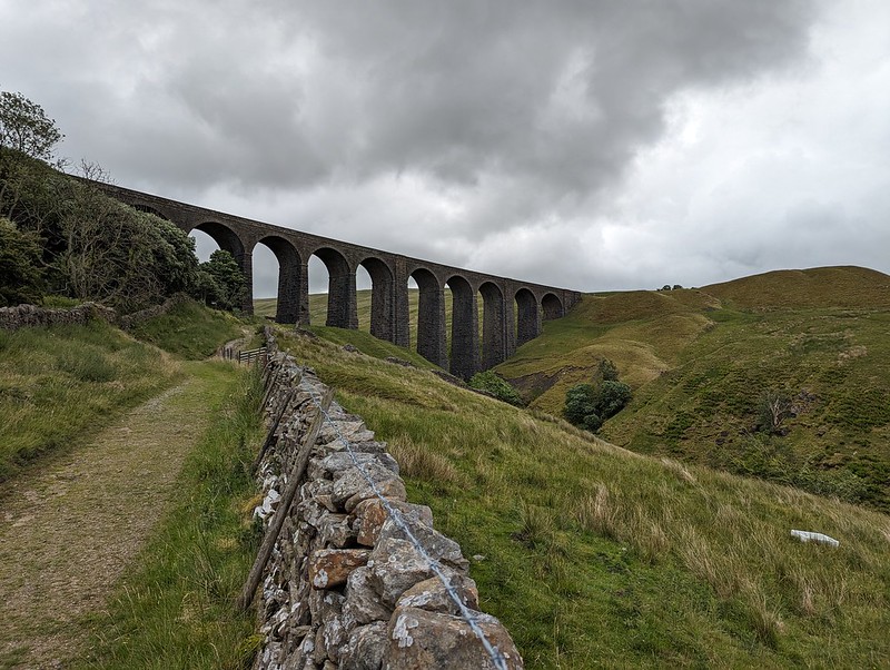
“Rock-faced sandstone in massive blocks, mostly coursed but some snecked, with brick soffits to the arches. Slightly curved line on north-south axis. Ten tall round-headed arches on battered rectangular piers, that in the centre broader than the others and with a broad tapered pilaster; short cavetto-moulded imposts at the springing of the arches, rusticated voussoirs (now with 3 tie-plates to each arch), a moulded string course, and parapets with rounded coping.”
This is the viaduct, for example. Snecked? Soffits? Cavetto? Imposts? At least I know what voussoirs are, after a previous rabbit-hole episode, although I can’t tell you what it means for them to be rusticated; and I’m guessing that, in this context, ‘battered’ has nothing to do with coating in a mixture of flour, egg and beer and then deep-frying? (Although it has probably been tried in Scotland).
The River Dee.Dee Side House.
Formerly Dentdale Youth Hostel and before that a hunting lodge; now available as a holiday let. I’ll let you insert here your own rant about the YHA losing its way and selling off so many wonderful remote properties like this one. I’m saddened that I never got around to staying here whilst it was still a hostel, but even more upset that apparently Patterdale Hostel in the Lakes, where I have stayed many, many times, including for several big family get-togethers when I was in my teens, is facing a similar fate.
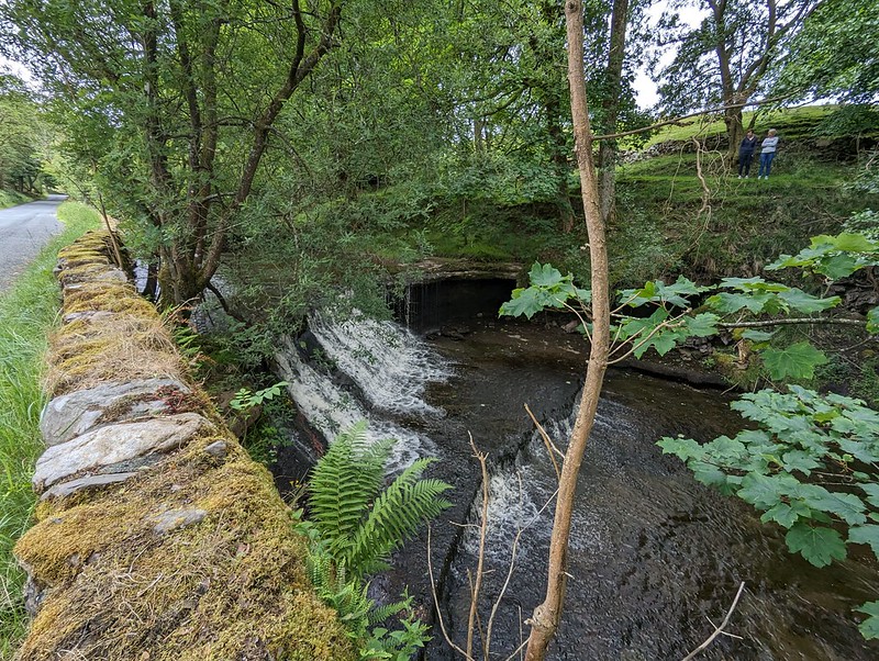
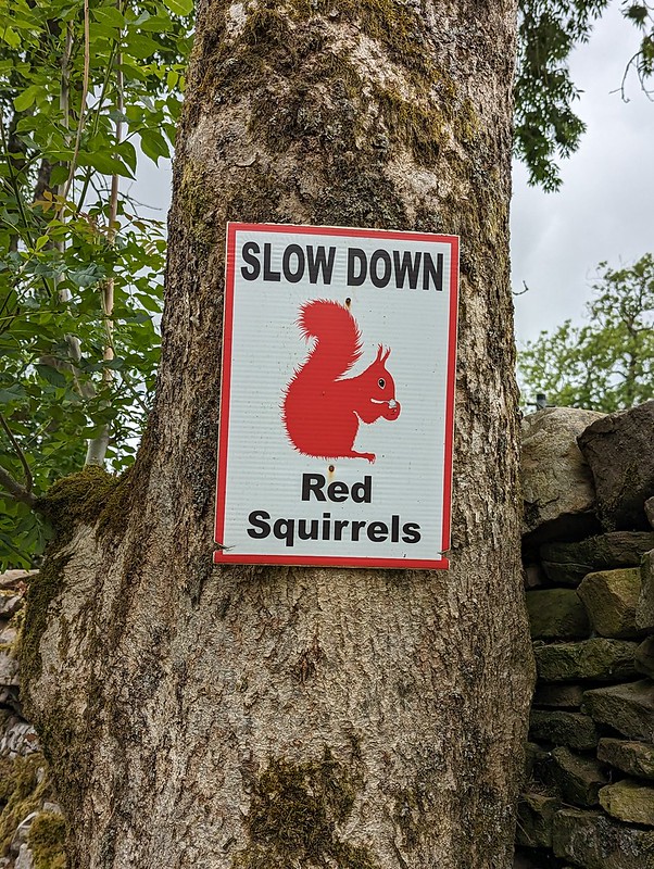
Common Spotted-orchid.Scow Force.Speed up – missed Red Squirrel photo opportunity.
I did see a Red Squirrel, running along the top of a gate, but I was much too slow with my camera to get a photo. I was impressed that somebody has put out these signs in an attempt to save the local squirrels from motorists, but I clearly needed to speed up, not slow down, in response to the presence of squirrels.
Bettony.
I passed a garden hereabouts which had been decked out as a picnic spot for Dales Way walkers – which seemed like a really generous thing to do and reminded me of the esrtwhile ‘Hiker’s Rest’ near to Beck Head at the southern end of Whitbarrow.
Meadow Crane’s-bill.The River Dee.East Stonehouse.Outbuilding at East Stonehouse.
There was something about the higgledy-piggledy design of this building which I found appealing. Higgledy-piggledy is the technical term obviously; I can’t think how else to put it, not asymmetric exactly, most houses aren’t symmetrical after all. It’s something to do with the windows and doors all being different sizes and positioned at different levels, I think. Anyway, I liked it.
West Stonehouse.
Confusingly, West Stonehouse lies NNE of East Stonehouse. I’m sure it made sense to name them that way to somebody at some time, but it seems very odd now. Here’s a snippet of the Historic England description of West Stonehouse:
“White-painted rubble, the centre portion random, with quoins, and the outer portions coursed, also with quoins; stone slate roof.”
I often bemoan the modern penchant for using the word random, when the desired import is actually ‘arbitrary’; so I was struck by the use of ‘random’ here. Apparently random rubble stone is where undressed or hammer dressed stones are used. Like a dry-stone wall; the stones are all different sizes and fit together like the squares and rectangles in a painting by Piet Mondrian, not in neat, even layers, which would be ‘coursed’. So there you go.
It probably makes more sense with a picture – I shall have to take one.
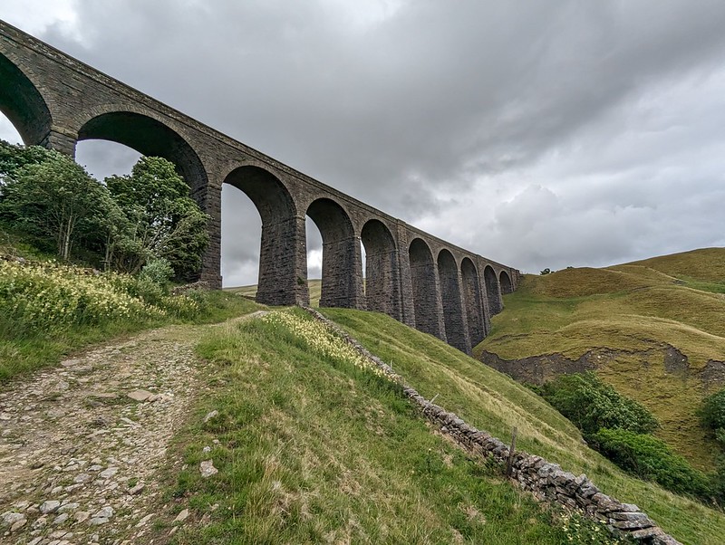
Arten Gill Viaduct.
By the track from Stonehouse there was an information board about the mining, or possibly quarrying, or – looking at the map – probably both, which formerly went on in this area. I didn’t take a photo, which is most unlike me, but the area’s industrial past no doubt explains the effort which was expended in creating the cobbled track up towards Arten Gill Viaduct.
Cobbled bridleway.Arten Gill Viaduct.
This viaduct was if anything even more attractive than the Dent Head one had been. You’ll have to bear with me, I took lots of photos. On the other hand, I didn’t manage to catch the pair of raptors, I think Kestrels, which were flying in and out of the trees by the viaduct.
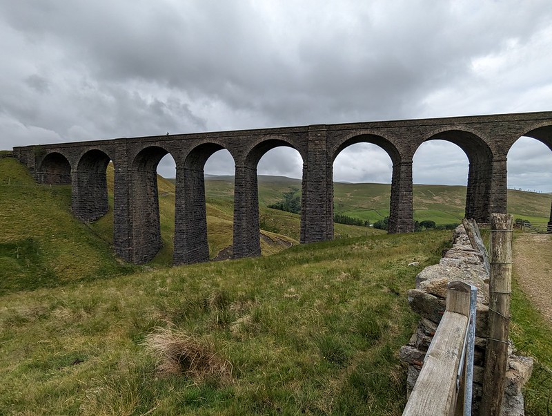
Arten Gill Viaduct.
Tautologically, the stream below is labelled, on the map, both as Arten Gill, and as Artengill Beck.
Arten Gill Viaduct.
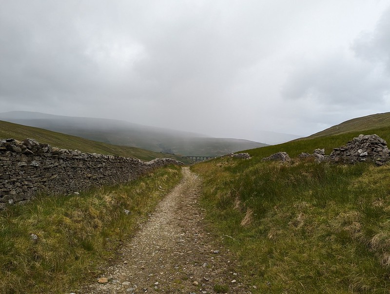
The skies were beginning to build some ominously dramatic looking clouds and I was soon paying for it in the first of several showers. To be fair, the showers were at least short-lived and mostly not too heavy either.
Arten Gill Viaduct.
The track rises steadily, without being hard work and so was ideal. There were lots of birds about – Wheatear and Pipits, but most entertainingly Stonechats.
Male Stonechat.
A couple of individuals, first one and then later another, took it upon themselves to fly ahead in little short hops and then stop and wait on the fence, allowing me to get very close before scooting on again.
Male Stonechat.
Naturally, I took lots of photos.
I also got overly excited, during a shower, about what I decided was a Mountain Ringlet, even though I strongly suspected that they are not found in the Dales. Which absence would, of course, make my discovery all the more notable and exciting. When I finally got close enough to get a photo and a close look, it transpired that it was in fact a very small Ringlet, of the plain, old common-or-garden variety.
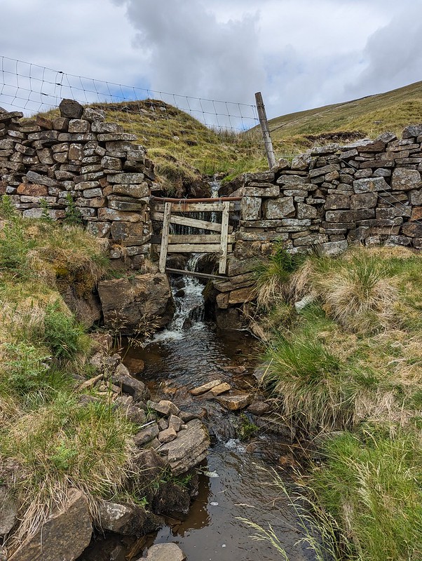
A sidestream.And another – being neatly directed across the track.An excess of weather.
Having reached the top of the pass, I could have taken a direct line up to the top of Great Knoutberry Hill, but I’d done a bit of research online and read great things about the track, Galloway Gate, which contours around the southern and western slopes of the hill.
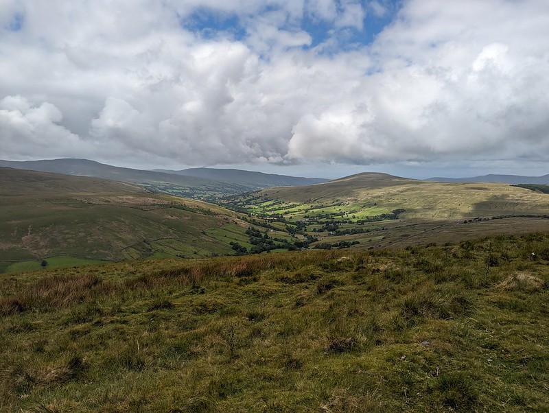
Whernside from Galloway Gate.Ingleborough and Whernside and more showers.Looking down Dentdale.
Choosing Galloway Gate turned out to be a good decision – it’s a fine walk which gives great views, particularly down into Dentdale.
Baugh Fell and Wild Boar Fell from Galloway Gate.
Eventually, I turned right, heading uphill and on to Pikes Edge, where there a number of scattered cairns and even more scattered boulders.
Ingleborough and Whernside from one of the cairns on Pikes Edge.Looking down Dentdale again.
As I approached the summit of Great Knoutberry Hill, I was engulfed in by far and away the heaviest shower of the day – for a while it was really chucking it down. A little annoyingly then, I found that I had unpacked my waterproof trousers from my rucsac, which is something I very rarely bother to do. Since I was wearing shorts anyway, and my waterproof trousers are mostly holes and layers of duct tape patched up with more duct tape, it probably wasn’t that great a loss. Also, this stone seat, possibly of random rubble, was facing away from the wind…
Stone seat/shelter on Great Knoutberry Hill.Lunch stop in a Bivvy bag in pouring rain.
Since the rain was falling horizontally, once I was hunkered down on the seat, and snug inside my bivvy bag, I was able to enjoy my packed lunch and a brew despite the rain. Anyway, it soon started to clear again.
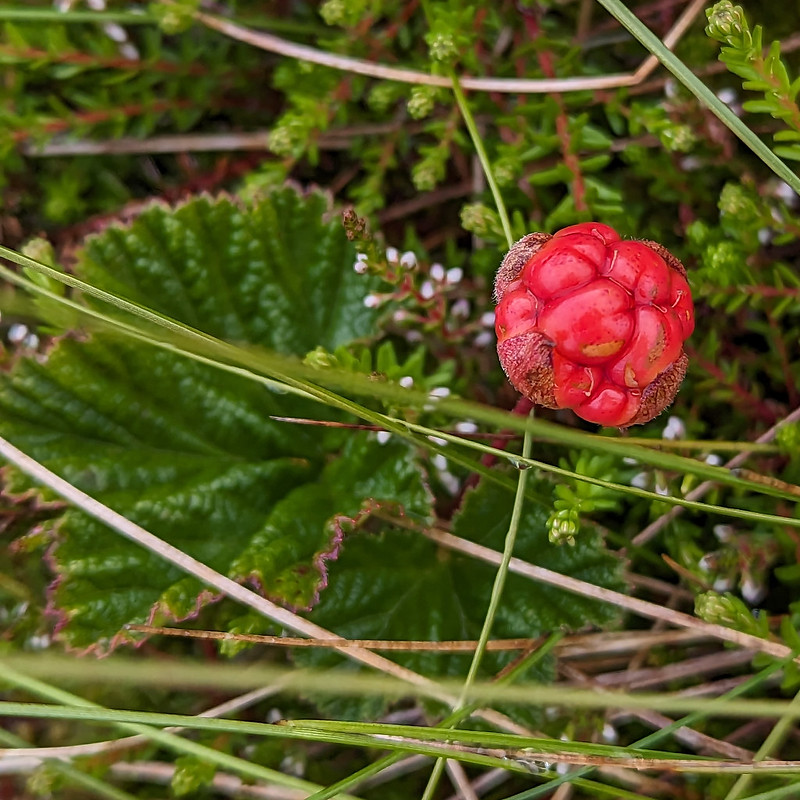
Ingleborough and Whernside from Great Knoutberry Hill.Cloudberry – or Knoutberry.
I had a bit of a wander in the vicinity of the trig pillar and found several Cloudberries. I don’t think I’ve ever seen them before, although I shouldn’t have been surprised to find them here, since Knoutberry is apparently a local name for Cloudberries. I also read that they are regarded as somewhat of a delicacy in Scandinavia; that the UK population of plants is predominantly male, so that it’s rare to find fruit; and that this example isn’t ripe, since they turn orange when they’re ripe.
Widdale Tarns.
Great Knoutberry Hill is merely the highest point on the huge expanses of Widdale Fell. Beforehand, I had been contemplating a little wander to explore the tarns at least, but based on the area around the summit, I decided that it would be very rough going and that I would leave that for another day. Looking at the map again now, I see that Widdale Fell has an impressive looking edge above Widdale itself, that most of the streams drain either directly into the River Ure or into the Ure via Widdale Beck; but that some of the streams run down into Garsdale and the River Clough – a tributary of the Lune which I haven’t explored at all yet: so I shall need to come back at some point.
On this occasion I took a more direct route back towards the crossroads between Great Knoutberry Hill and Wold Fell.
Pen-y-ghent, Wold Fell, Ingleborough and Whernside.Pennine Bridleway signpost.
This is the signpost at the crossroads, which I hadn’t photographed when I first passed it because it had been raining at the time. This track is part of the Pennine Bridleway, a route which, like the Dales Way, some of which I also lay on this route, always seems superb wherever I encounter it.
Wold Fell.Juvenile Wheatear.On Wold Fell, looking back to Great Knoutberry Fell.
Wold Fell was quite odd: limestone pavement, mostly grassed over, a very flat topped hill – there was a small cairn, as you can see, but it was very difficult to tell whether that was the actual highest point of the fell.
Ingleborough and Whernside from Wold Fell.
The lump between, and in front of, Ingleborough and Whernside is Blea Moor. I’ve often looked at it, especially when climbing Whernside from Little Dale via Greensett Tarn, but never been up it. I suppose I might get around to it at some point, although the lower slopes above Ribble Head are a bit of-puttingly rough and reed covered.
Pen-y-ghent and Ingleborough from Wold Fell.Descending towards Ingleborough.
From Wold Fell it was a simple romp down a track and then a minor road, accompanied by a couple more brief showers, back to the car.
Fell End Gill.Dent Head Viaduct again.Common Spotted-orchid.
As almost always seems to be the case with my Lune Catchment outings, it was a very satisfying trip, packed with interest, from which I came away with a host of ideas for possible future excursions.
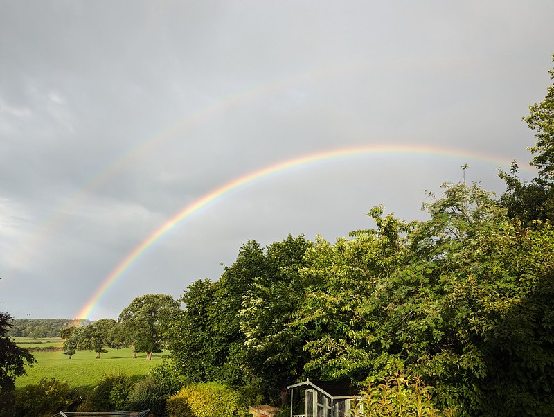
More showers at home – and a double rainbow.
Back at home, there were more showers, and this time an accompanying double rainbow.
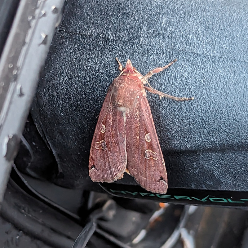
Later still, around 10pm, Little S sent me back outside to have a look at the moth which was resting on the plug on the charging cable for our car. It was dark and I’m amazed that my phone managed an image as clear as this…
A Large Yellow Underwing?
I’m told that this is a Yellow Underwing Moth , although to an untutored eye it also looks very similar to a Square-spot Rustic Moth. I’ll settle for it being a lovely colour, whichever.
Map the first.Map the second.
MpaMyWalk gives a little shy of ten miles and 485 metres of ascent, which seems about right.
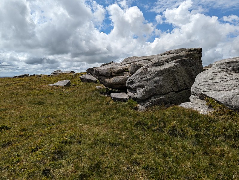
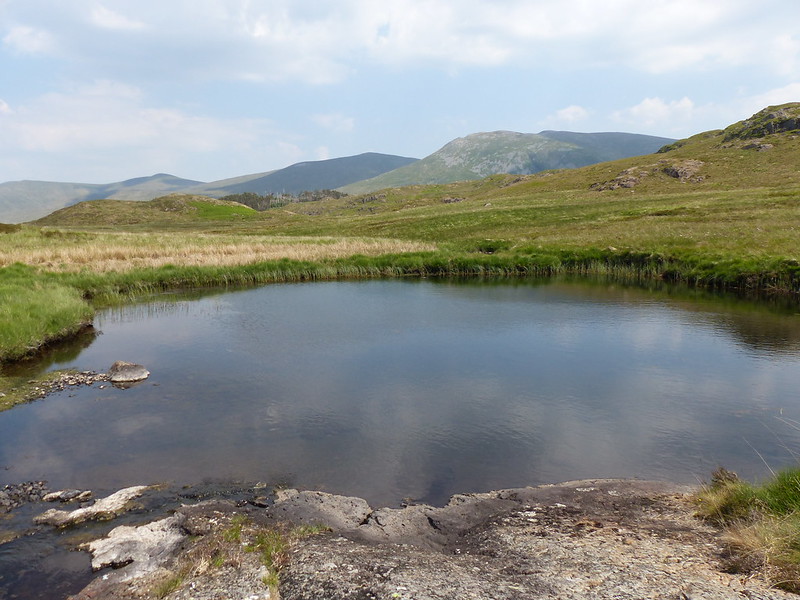
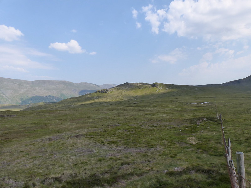
The weekend after Whit week, and I was back at Thirlmere. This time I’d parked at Steel End where, despite road signs to the contrary, the road is still open, although it is closed beyond that. The reason I’d chosen to come this way, was that last summer, when I’d been gleefully ticking off Wainwrights with abandon, I walked the boggy central spine of the Lakes, from High Raise to Bleaberry Fell, but I’d missed Armboth Fell, which lies to the east of the central ridge. (I use the term ‘ridge’ very loosely here!). After a lengthy spell of very dry weather, this seemed like the perfect opportunity to make that good. Ideally, I’d have been starting the walk from the next car park north, at Dobgill Bridge, but, as I say, the road was closed. So instead I needed to use the permission path along the lakeshore to get to my intended starting point.
Wythburn and Steel Fell.
What a happy accident that was, since this path was lovely, and absolutely stuffed with wildlife, so that the walk (and, by extension, this post too) became a bit of a hybrid between my hill walking and my slow, local walks where I stop every few steps to snap away with my camera. By the lake there were loads of birds: a Heron, Greylag and Canada Geese and lots of gulls. If I’d had a pair of binoculars with me, I’m might have been there for hours.
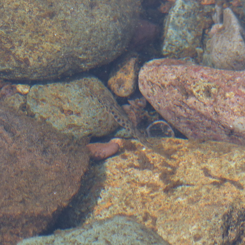
Common Sandpiper.
I think this might have been a juvenile sandpiper; it kept flying short distances ahead of me, so that I gradually gained on it, which strikes me as typical behaviour of a young bird. This sandpiper…
Common Sandpiper.
…was nearby and making quite a racket, so I took it to be a concerned parent. Of course, I could be completely wrong.
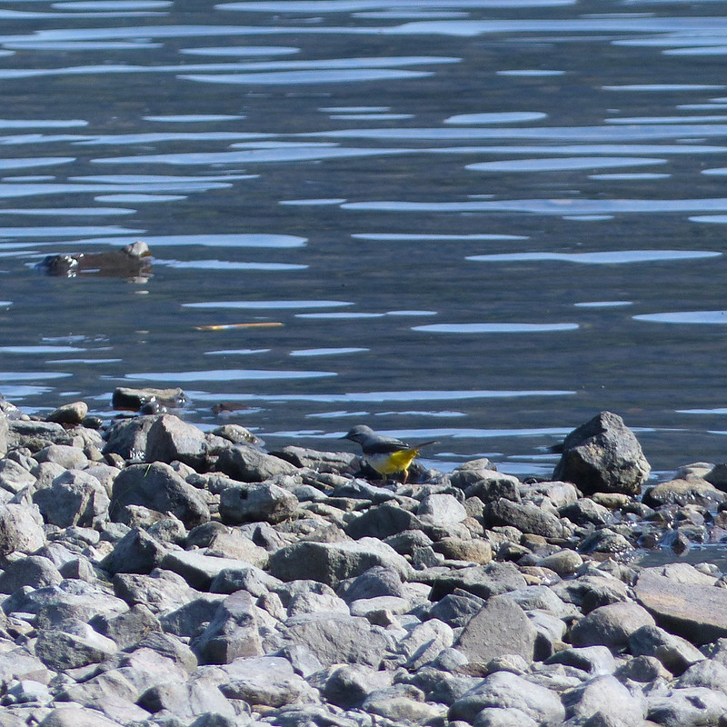
Grey Wagtail.Thirlmere.Foxgloves.Keeled Skimmer, female. My first.
The path was soon away from the reservoir shore and in the trees and I was chasing after moths and butterflies, not always with success. In particular, there were some fritillaries about which I did eventually manage to photograph, but only from a considerable distance, so that the photos are not sufficient for identification purposes. Fortunately, I would get better chances later in the day.
The brambles were flowering in profusion, and that seemed to attract a host of insects of various forms.
Large Skipper Butterfly.Hoverfly, Eristalis intricaria, male.
There were hosts of hoverflies and bees about, but they were extremely elusive, so whilst I have a lot of photographs, there’s only really this one which is up to scratch.
There were lots and lots of these about. They were constantly on the move, so I took loads of photographs, hoping that I would have at least one which was reasonably clear and sharp.
These flies with orange at the base of their wings were also quite ubiquitous, always on flowers.
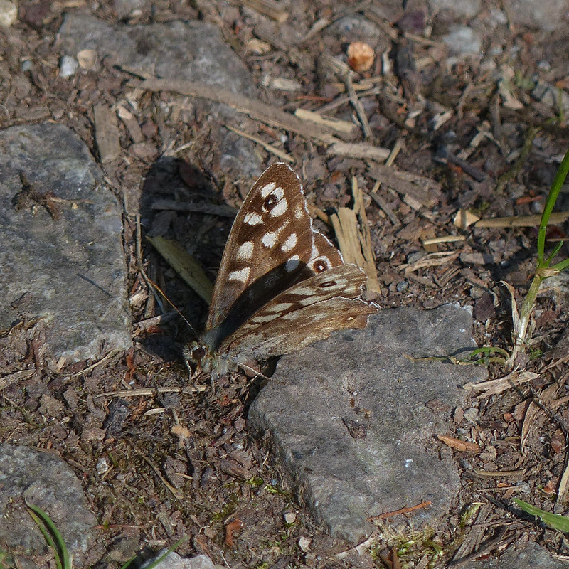
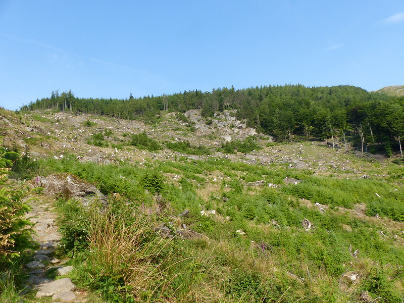
Green-veined White Butterfly.Speckled Wood Butterfly.Felled forestry by Dob Gill.
Once I reached Dobgill Bridge, I turned uphill, away from Thirlmere, on a very familiar path which had changed beyond all recognition, since the forestry through which the path used to rise had largely been clear-felled.
Small Heath Butterfly.
Once the path entered the trees, it seemed clear that it isn’t used as heavily as it used to be (before the road was closed) and the trees were encroaching on the path.
Dob Gill.Dob Gill flowing out of Harrop Tarn.
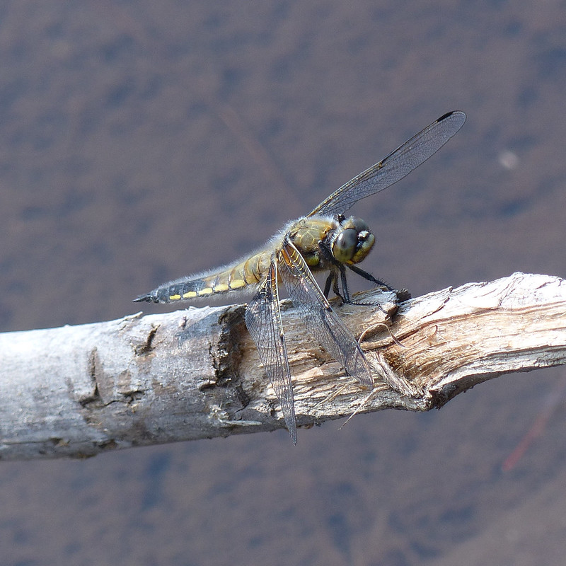
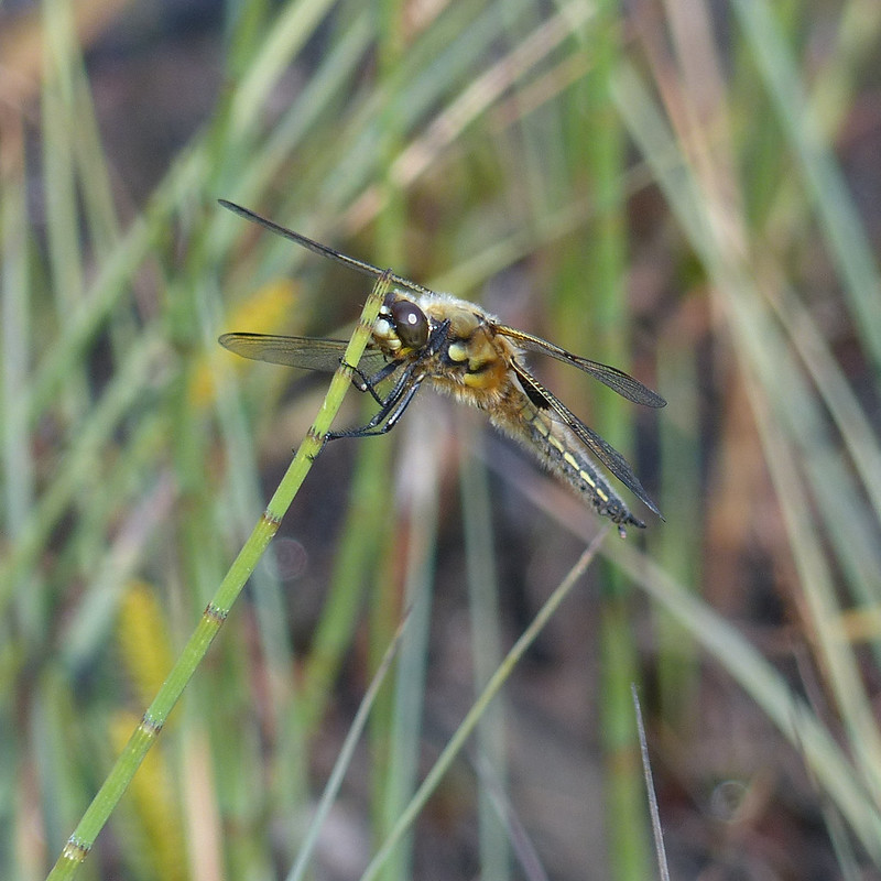
Where Dob Gill leaves Harrop Tarn there were once again lots of fritillary butterflies about, which I chased to no avail, but there were also, without exaggeration, hundreds of Four-spotted Chaser Dragonflies about, with which I had a bit more success…
I think that this is a Caddis Fly. Closed related to lepidoptera, apparently, there are 196 species in the UK and Google Lens is not giving me much help in pinning this one down.
Bog Bean.
The Bog Bean had mostly finished flowering, so I had to content myself with a photo of this one, which was quite far out into the water.
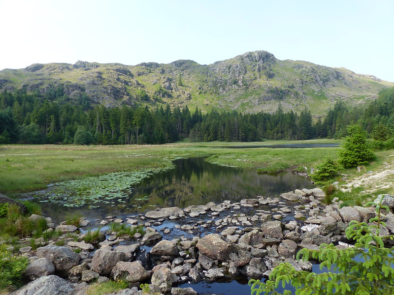
Yellow Water-lily.Harrop Tarn.
I continued around the tarn a little way and then found a small path making a beeline for the shingle beach you can just about see on the extreme right of this photo.
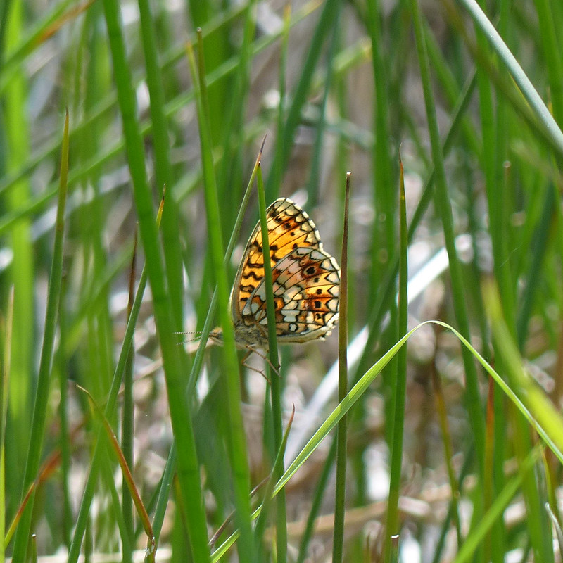
Small Pearl-bordered Fritillary Butterfly.
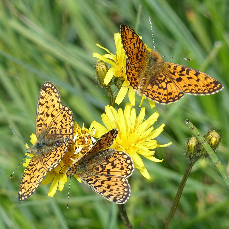
As I approached the tarn, I finally managed to get a photo of one of the butterflies which had been eluding me: a Small Pearl-bordered Fritillary. Down by the tarn, there were lots more…
Small Pearl-bordered Fritillaries.
I was intending to swim, but first I was distracted by a profusion of butterflies, dragonflies and damselflies which were about.
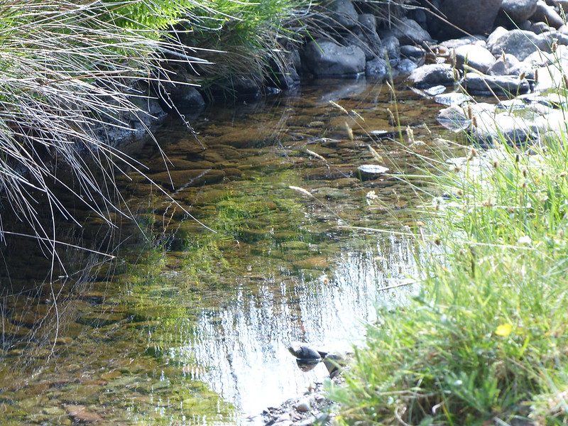
Large Red Damselfly.
When I eventually dragged myself away, the beach was perfect: it shelves steeply so that two strides and I was in. The sun shone; the water was cool, but not cold; there were constant splashes around me as fish (brown trout?) leapt from the water to take flies; dragonflies and damselflies skittered about just above the surface of the tarn. In short, it was idyllic, and I took a leisurely tour widdershins around the tarn.
Once out of the water, I was busy again taking no end of photos.
Brown trout fry?Brown trout fry?Four-spotted Chaser.Four-spotted Chaser, male.
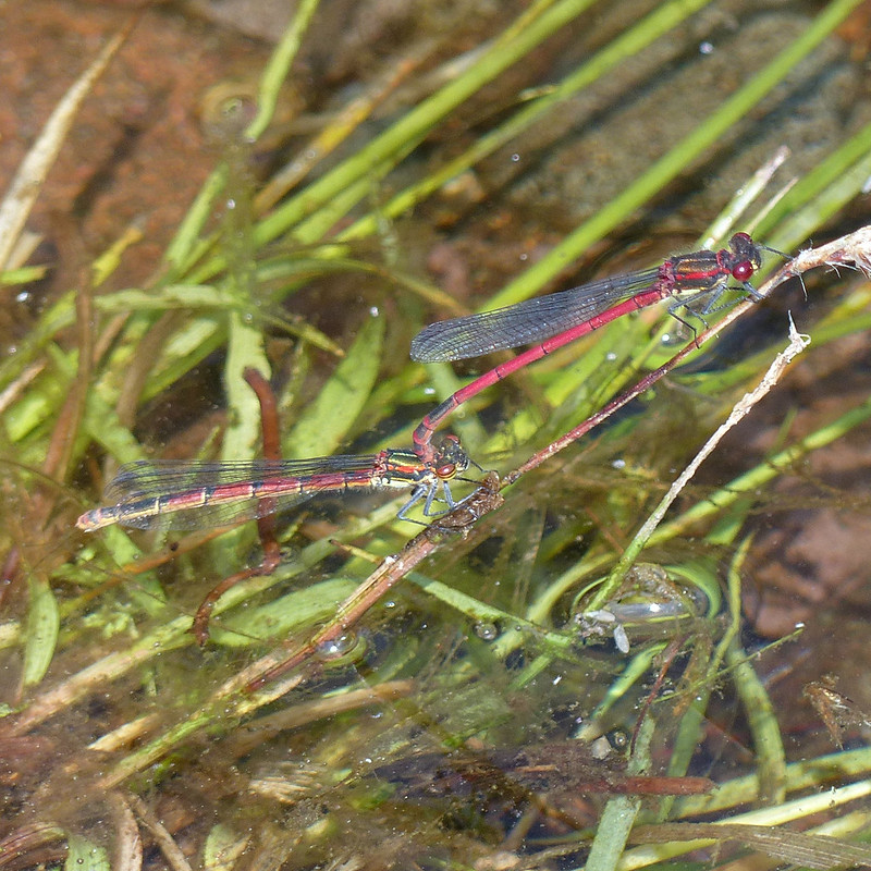
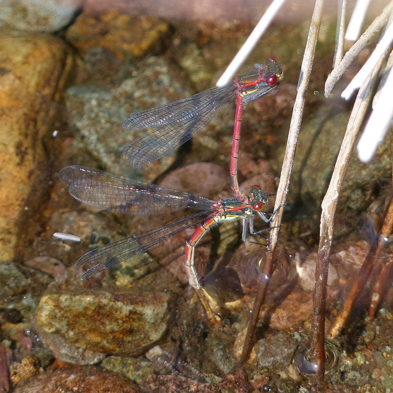
There were both blue and red damselflies about, but predominantly red. It was hard to get photos, because they were constantly on the move, perhaps because they didn’t want to fall prey to the Four-spotted Chasers which were also abundant.
Mating pair of Large Red Damselflies.
Even the mating Large Red Damselflies, of which there were many, many pairs, kept flying about, with the male still grasping the female by the neck.
Mating pair of Large Red Damselflies.
On the right here, she is laying eggs, whilst he is still in flight, hovering, hence the blurred wings.
Mating pair of Large Red Damselflies.Mating pair of Large Red Damselflies.
I have several more photos of mating pairs, so there is obviously a healthy population here.
Wolf spiders, female and male.Golden Ringed Dragonfly flying above Mosshause Gill.
There was one, or possibly two, Golden Ringed Dragonflies flying very quickly along Mosshause Gill, which flows into the tarn near to the shingle beach. It’s a large and spectacular dragonfly, but was moving to quickly for me to manage any photographs. Since the flights along the stream were regular and predictable, I decided to stand in the stream bed to try to capture an image of the dragonflies, and you can sort of see one in the photo above. I have better photos, here from a few years ago.
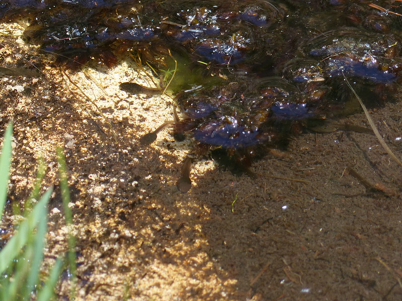
Tadpoles.
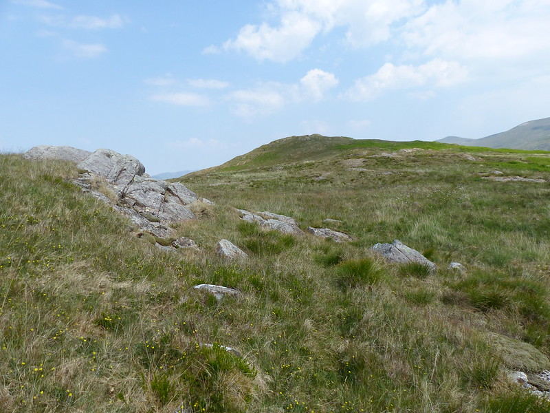
The path through the forest was hot work. When I reached open country, I turned sharp right, along the edge of the trees to head for Brown Rigg…
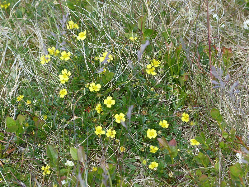
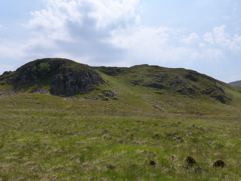
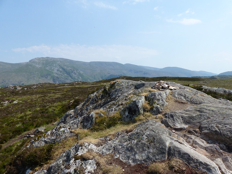
Brown Rigg.Tormentil.Blea Tarn Fell/Bell Crags.
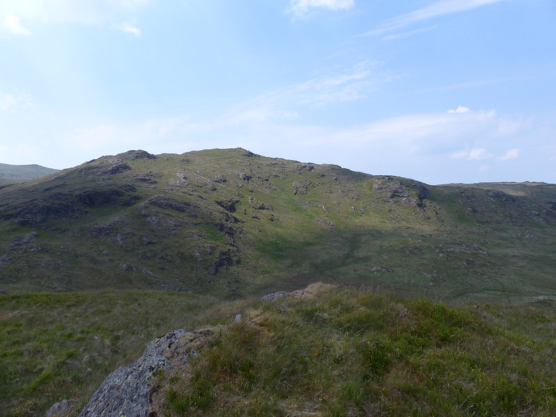
Brown Rigg is one of those Birketts which take you off the beaten path and make Birkett bagging well worth while. From Brown Rigg there’s a fine view of a rocky little top called either Blea Tarn Fell according to Birkett, or Bell Crags in the Fellranger books by my name-sake Mark Richards.
Blea Tarn Fell from Brown Rigg.
Whatever the name, it’s a really handsome fell and another which it would be a shame to miss. First though, I had unfinished business…
Armboth Fell (in the shade).
Ordinarily, I think this route would be madness, but I was able to head down to Launchy Tarn and then climb from there on to Armboth Fell. I won’t say it was dry, but it was dry enough.
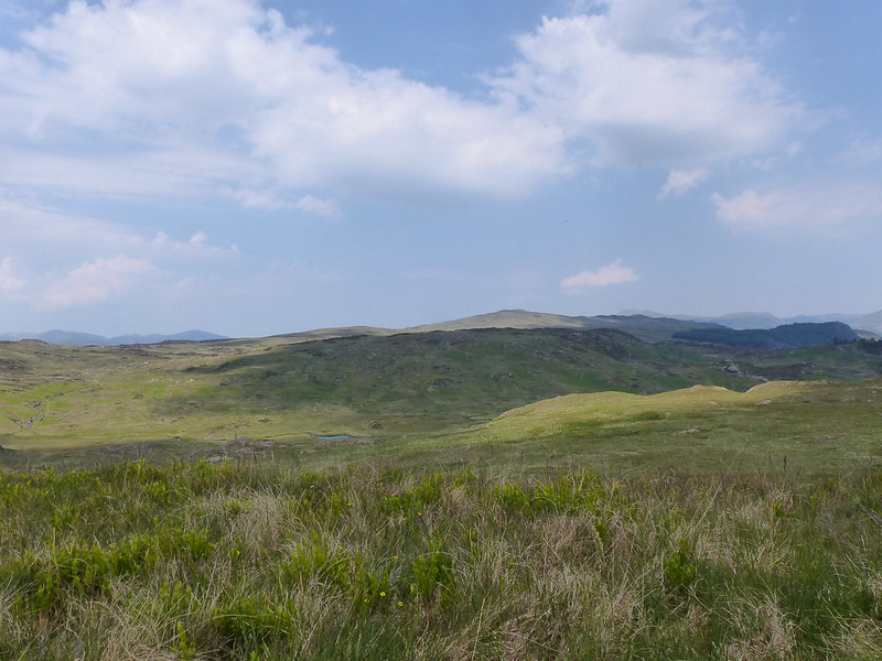
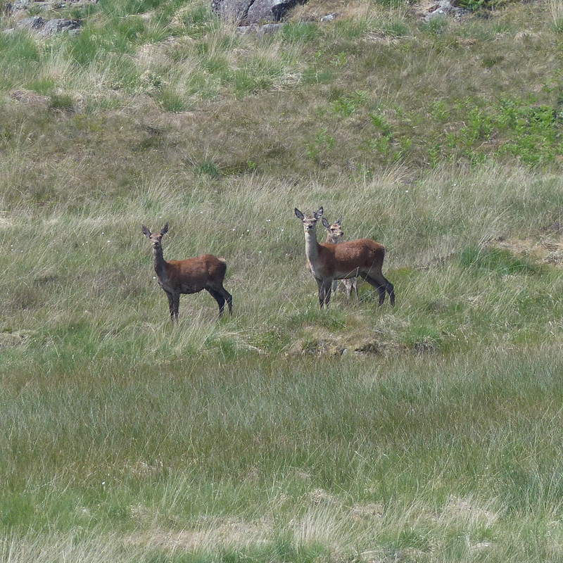
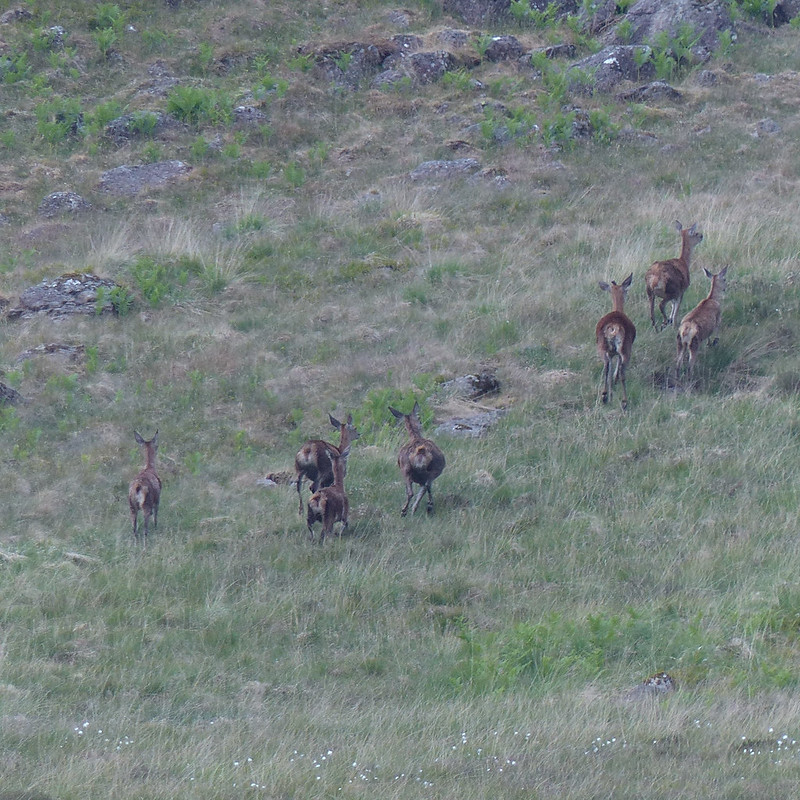
Small Heath Butterfly.Looking back to Brown Rigg.Red Deer hinds.Run away!
Years ago, I used to bivvy with friends in this area, above Harrop Tarn, and then explore the rather complex, boggy and empty terrain between there, Ullscarf and High Seat. I have a real soft-spot for this area, partly because it a great place to see Red Deer.
Another Four-spotted Chaser.
I was still seeing Four-spotted Chasers, wherever there was a bit of open water.
I had wondered about another dip, in Launchy Tarn, but it didn’t look deep enough, or particularly inviting.
Launchy Tarn.Wild Thyme.Armboth Fell.
This rocky little rib gives Armboth Fell a quite dramatic top, not at all in keeping with the rest of the hill. I did visit a couple of other nearby knolls, just in case they were higher!
High Tove.
From Armboth Fell, it’s a fairly short walk to High Tove. I think that’s about the most that can be said for High Tove.
Looking back to Armboth Fell, Helvellyn behind.High Seat.
The walk southward along the ridge was actually pleasant with little sign of the extreme boginess which usually presides here. I made sure to summit every little outcrop, since there are numerous Birketts this way.
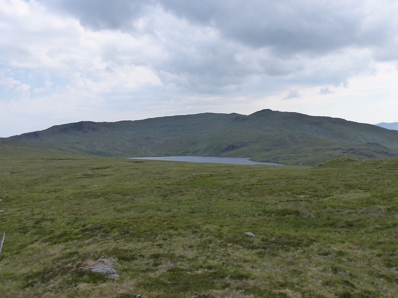
Standing Crag, Ullscarf, Low Saddle, Blea Tarn.
I had been planning to include a swim in Blea Tarn, but it had clouded up, and I suspected that time was marching on. (My new phone arrived while I was out, so without a phone, I didn’t know the time. Quite odd – but in a pleasant way, since I had all the hours that June daylight affords to complete my walk.)
Blea Tarn Fell.From Blea Tarn Fell, looking down to Armboth Fell, Launchy Tarn and Brown Rigg.
Blea Tarn Fell and/or Bell Crags really is a cracker, with superb views, I can definitely recommend it.
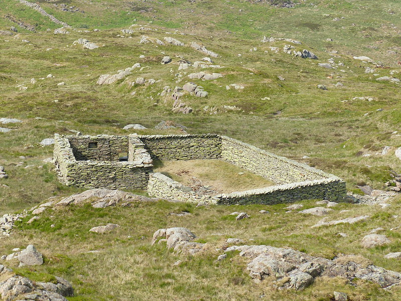
High Seat and Armboth Fell.Very neat sheepfold.
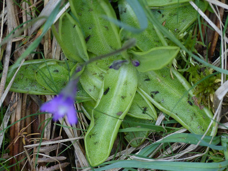
From there I returned to Harrop tarn and then took the footpath down the edge of the forestry back to Dobgill Bridge, then back along the shore to my car. The path turned out to be very rocky and a bit awkward – I think I prefer the path I used on the way up. I did see these Butterwort by going that way…
Common Butterwort.Fly trap!
“Common butterwort is an insectivorous plant. Its bright yellow-green leaves excrete a sticky fluid that attracts unsuspecting insects; once trapped, the leaves slowly curl around their prey and digest it. The acidic bogs, fens and damp heaths that common butterwort lives in do not provide it with enough nutrients, so it has evolved this carnivorous way of life to supplement its diet.”
A terrific day, with lots of interest. Harrop tarn has shot to the top of my list of favourite places to swim and Blea Tarn Fell has firmly cemented its place in my affections. I can definitely see myself coming back this way in June next year: I fancy a wild camp in this neck of the woods.
No MapMyWalk stats or map, for obvious reasons, but here’s a map so that you can trace my route for yourself: