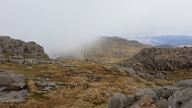
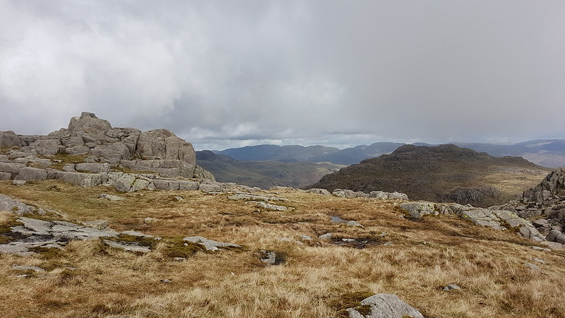
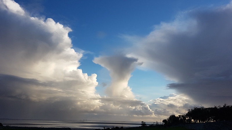
July fizzled out in a welter of wet weather, leaving me stuck at home, perusing my maps and the none too promising forecasts and feeling increasingly stir crazy. When the first of August rolled around, I couldn’t stand it any longer and decided to get out for a walk, come what may. There’s probably an object lesson to be learned from the consequences of that decision, but I’m not entirely decided what the moral of this sorry tale should be. Maybe an inquiry is required, they seem to be in vogue. Here’s the evidence…
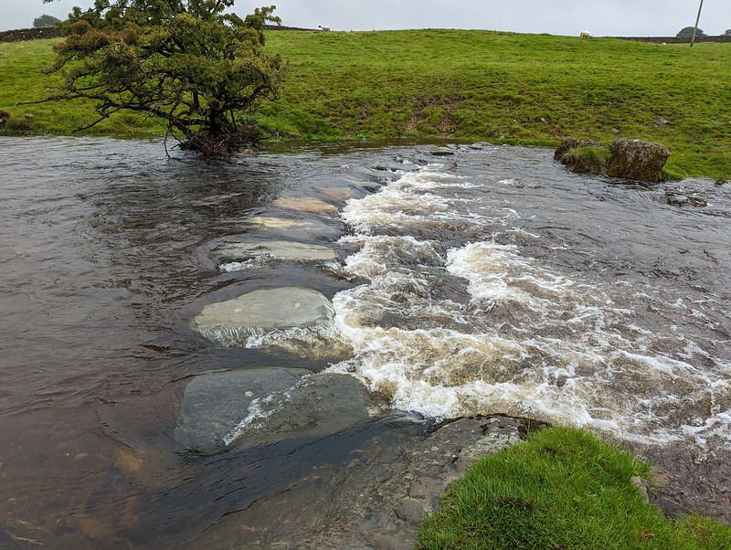
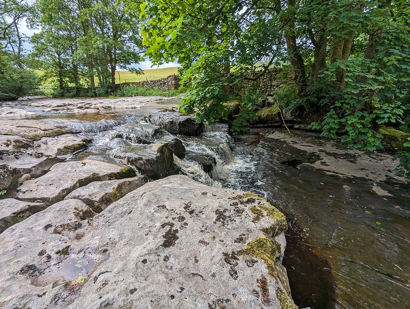
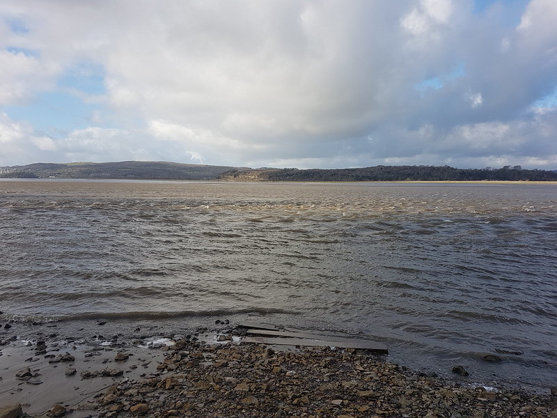
Submerged stepping stones.
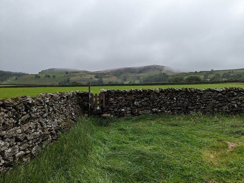
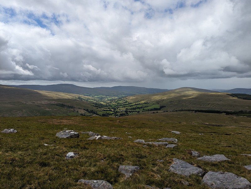
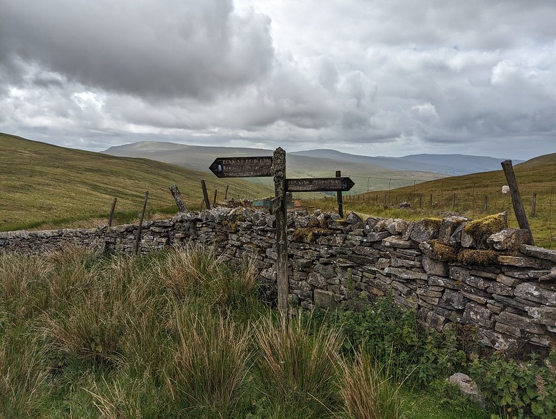
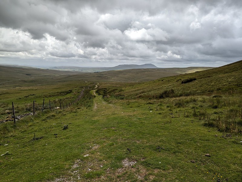
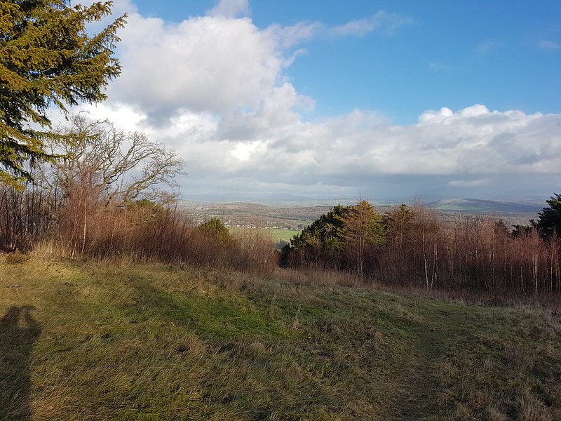
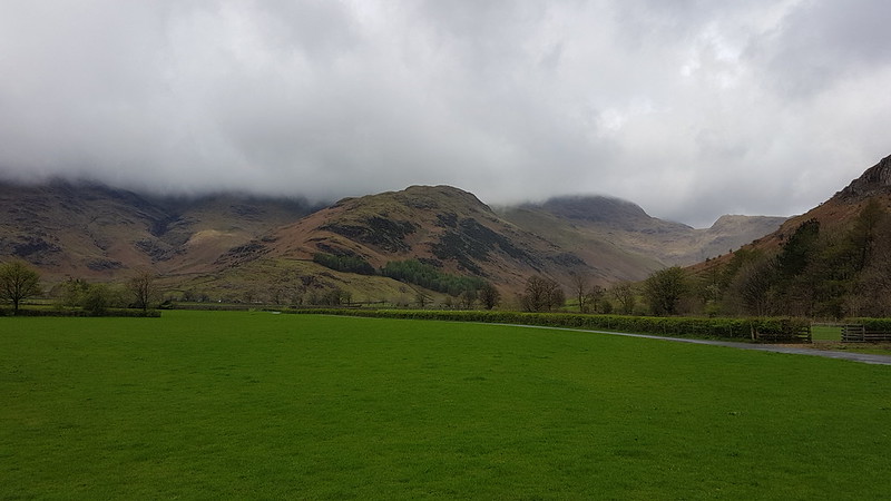
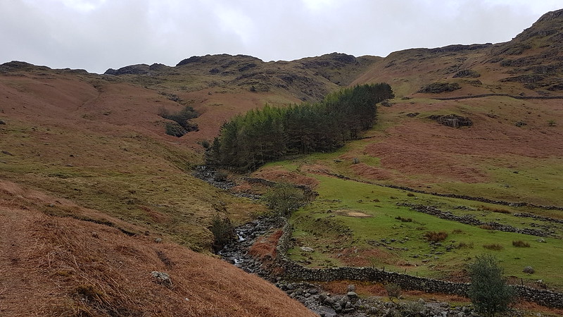
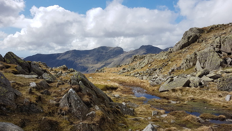
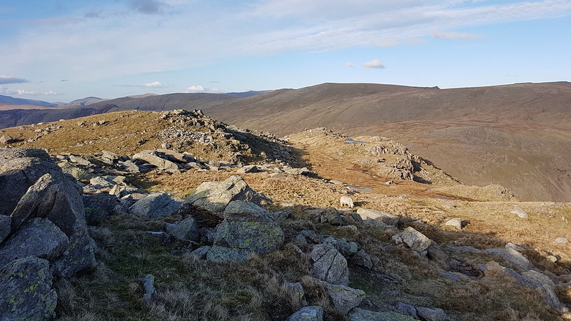
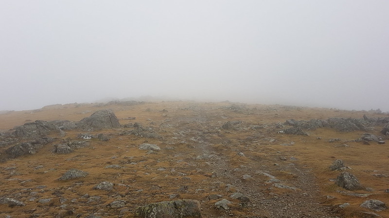
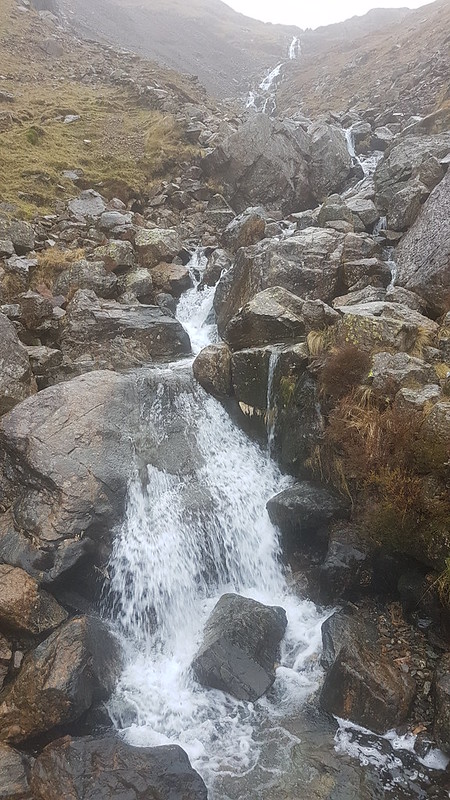
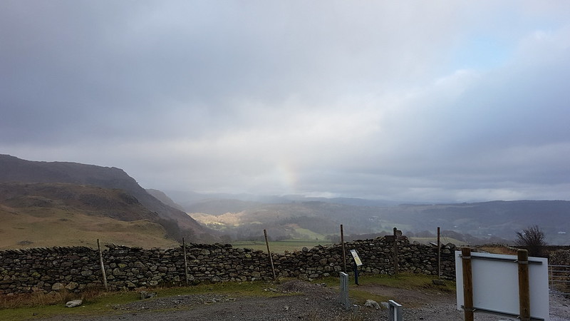
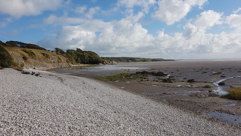
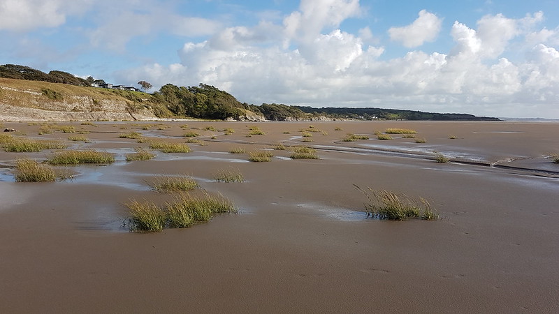
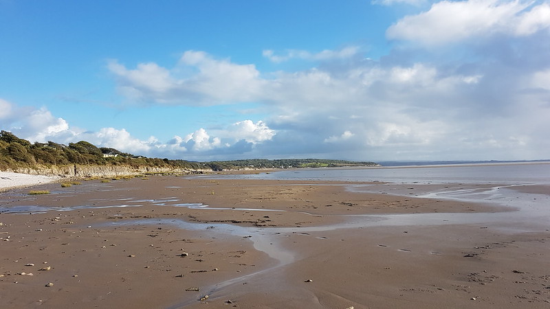
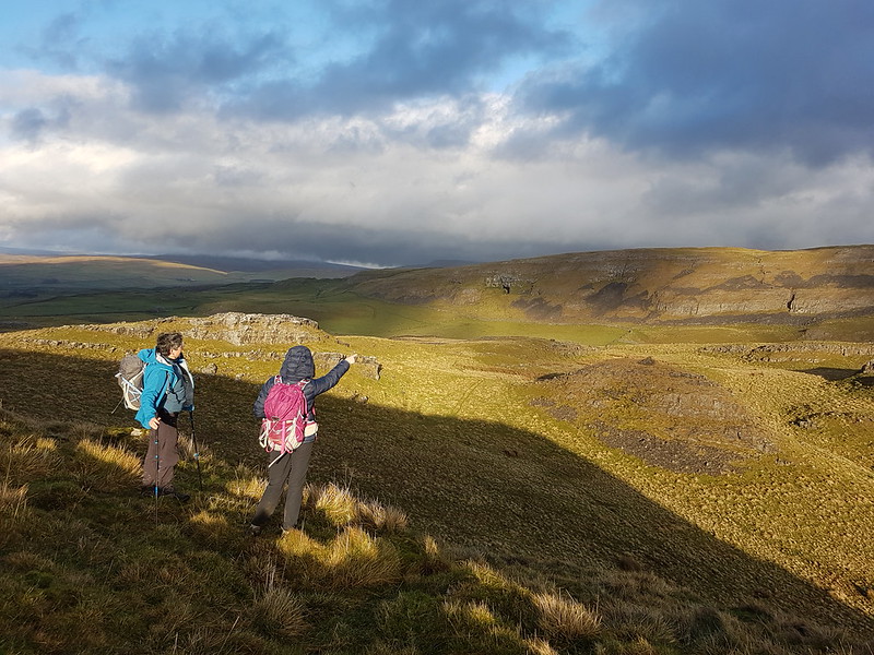
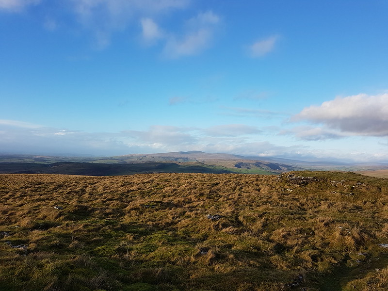
I’d plumped for a Lune Catchment wander, and was thinking that Smearsett Scar, at the eastern extreme of the Lune’s Yorkshire Dales reach, would be ideal. Optimistically, I was thinking that, if the weather was a little better than expected, I might extend the route to explore the limestone pavements of Moughton Scar too. In the event, the cloud was so low that even the little wooded heights above Austwick were hidden in the miasma. I hastily adjusted my plans, deciding to head south from the village, away from the hills. Had I taken a little more time and care, I might have noticed the words ‘stepping stones’ on the route I’d chosen and had second thoughts. I did eventually have those second thoughts, but only after I’d walked as far as Austwick Beck and seen the submerged stepping stones.
Oxenber Woods.
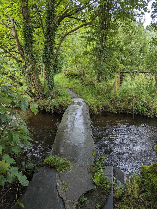
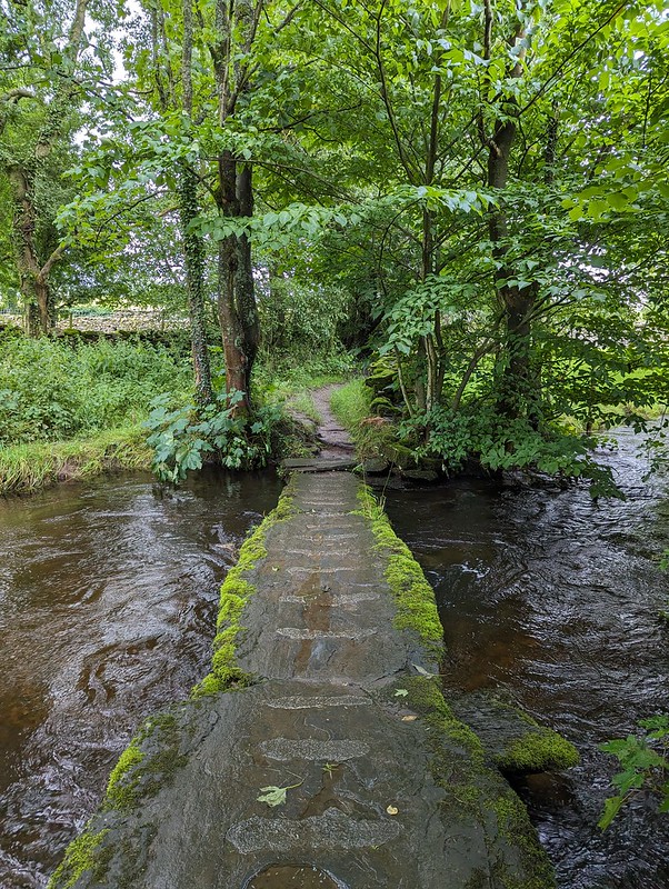
My second attempt to leave Austwick also brought me to Austwick Beck, but a little upstream of the stepping stones where there were two clapper bridges.
Little Bridges, Austwick Beck.Little Bridges, Austwick Beck.
They’re named ‘Little Bridges’ on the OS map. Makes me think of Baloo addressing Mowgli as ‘Little Britches’ in the Disney version of the Jungle Book. (I had an LP of the soundtrack which I listened to obsessively as a kid. Maybe that’s why I’m so happy listening to a playlist of Chet Baker, Sidney Bechet, John Coltrane, Nina Simone, Herbie Hancock and the like as I write?)
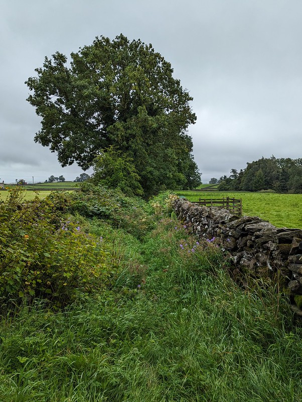
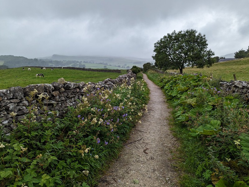
After that more auspicious start, the quality of this path quickly nose-dived where it passed between two walls and very quickly became extremely overgrown. This part is the best bit…
An inviting path?
Under the trees it was plagued by low branches and nettles. I’d put my overtrousers on before I plunged into the vegetation, so at least didn’t get stung. I next needed a machete where the path met the A65 road and the stile over the wall was protected, on both sides, by dense thickets of brambles. Which at least brought me into the open. Maybe I was just disheartened by the rain – did I mention that it was, inevitably, raining? – or the heavy going so far, but even walking through this meadow, in knee high wet grass seemed like unduly hard work.
Another inviting path?
I decided to use minor lanes where possible, and at Lawkland turned right along Graystonber Lane.
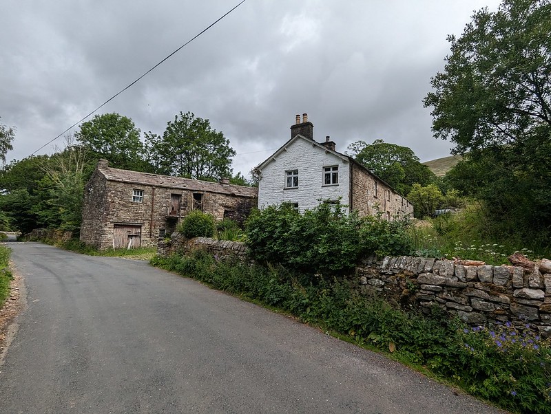
Cottages at Lawkland.With an old post box.
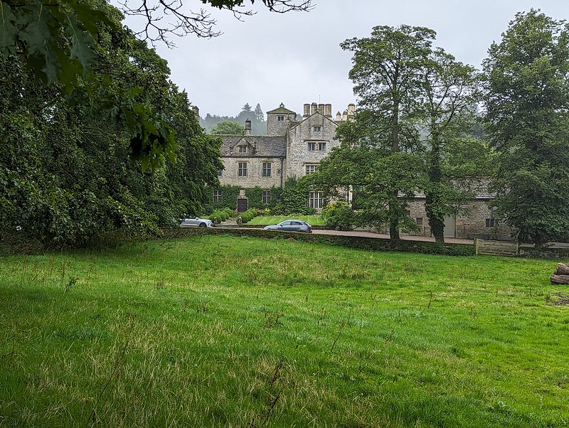
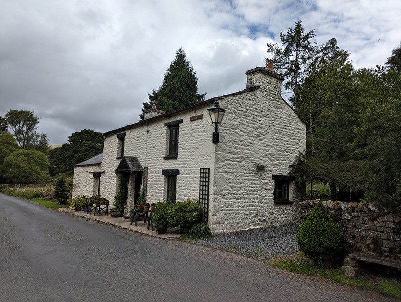
Faceache’s algorithm has clearly pigeonholed me as a middle-aged sad-act and keeps suggesting groups like The Dull Men’s Club, The Country Lane Appreciation Society, Bathtubs in Fields, and most recently The Peeling Paint Appreciation Society. To be fair, I think it has me pretty well sussed. But, for some reason, I’ve stopped seeing endless photographs of post boxes, which is a shame, because I do find them appealing – especially the Victorian ones. In fact I like them almost as much as I like a listed building. This one, Lawkland Hall, is a bit special, it’s grade I and those aren’t ten-a-penny. It was restored in 1912, but the oldest part dates back to the Sixteenth Century.
Lawkland Hall.Lawkland Hall.
I might not have known that Lawkland Hall was worth a look, but the miserable weather had at least given me a chance to read a little more of John Self’s marvellous ‘Land of The Lune’ and I’d seen a picture there.
At Lawkland Green I turned left on a path which would take me across several fields back to the A65. They were large fields. One field was home to a small herd of what I assumed were bullocks. They ignored me. Then, when I was half way across, one of them started to walk my way. Then a couple of others decided to investigate. Pretty soon, they were all running full-pelt across the field.
Raging bullocks?
Do they look angry to you? They don’t really do they. But they seemed very aggressive at the time. What’s more, that stream was wider and deeper then it looks in the photo and I got wet feet plodging through it.
The following field held nothing more threatening than a number of tall, broad mushrooms, which I assumed were Parasol Mushrooms, but I may have been wrong of course (see the comments section in my previous post).
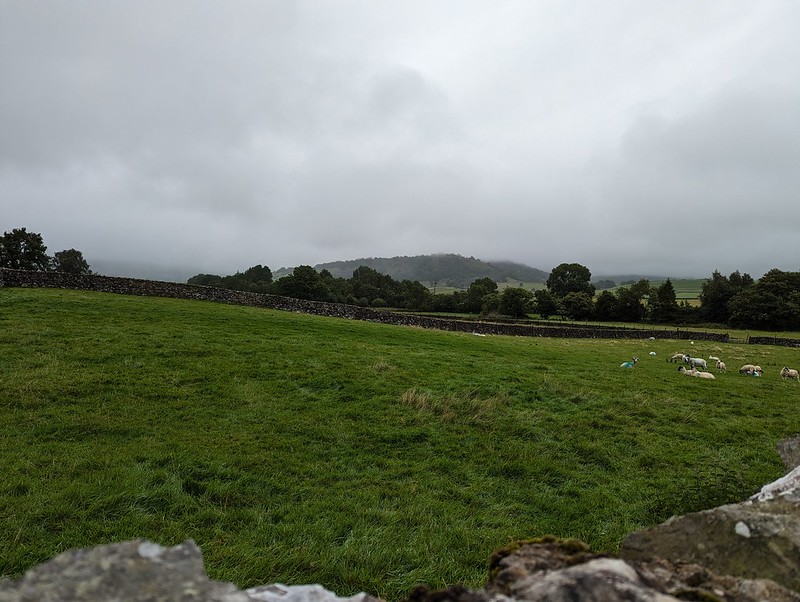
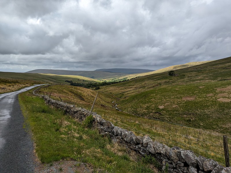
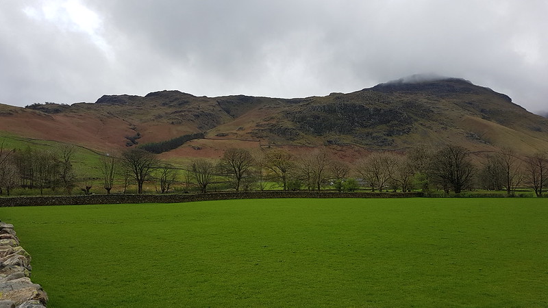
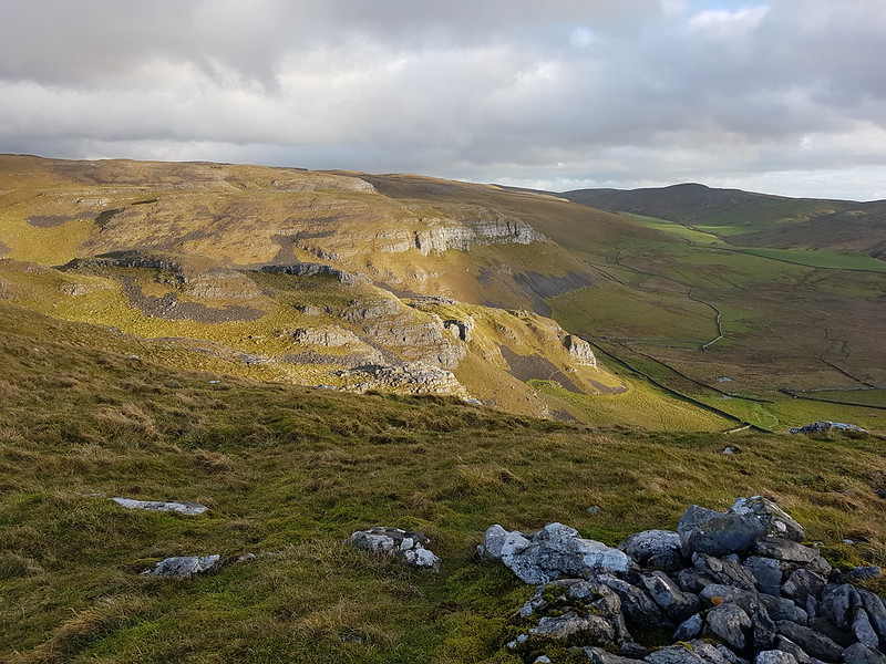
The next section was road walking, but mostly along a very quiet lane. The weather showed some signs of improving: the cloud was lifting a little and the rain was slackening off. As I descended through fields towards the tiny hamlet of Feizor, it even began to look as if Smearsett Scar might emerge from the cloud.
Smearsett Scar. Almost.Smearsett Scar, very nearly clear.
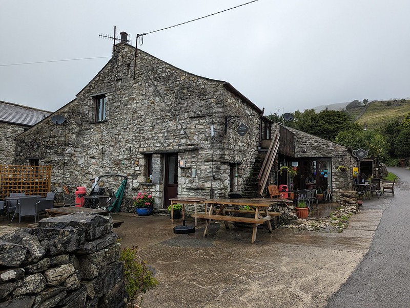
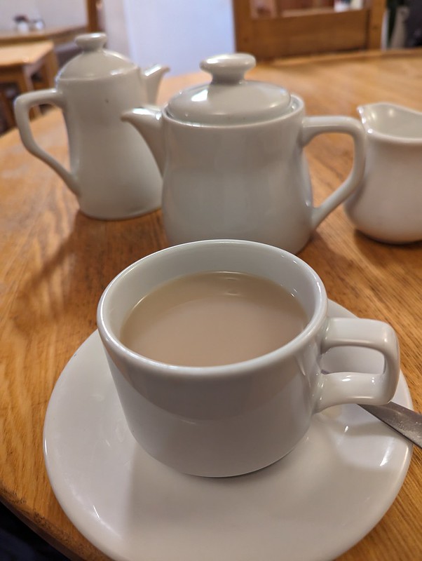
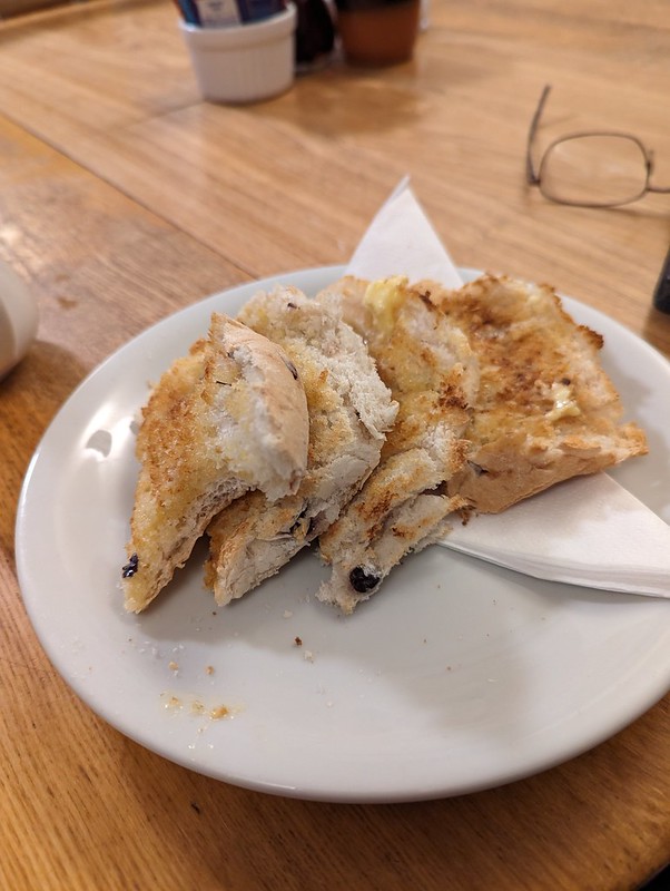
I suppose I might have reinstated my plan to climb the scar, but decided instead to head for the tearoom, which old friend J has been raving about (in an approving way) for ages.
She was quite right. It was lovely. A pot of extra hot water with my Earl Grey without even asking for it – TBH’s test of a tea room’s standard of service. The fact that it was busy late on a wet, mid-week afternoon is probably a good sign too.
Smeatsett Scar – cloud free!Hale Lane.Hale Lane.
After the tea shop, there were longer gaps between the showers. The little ditch by the lane was gurgling away however, brimful of run-off.
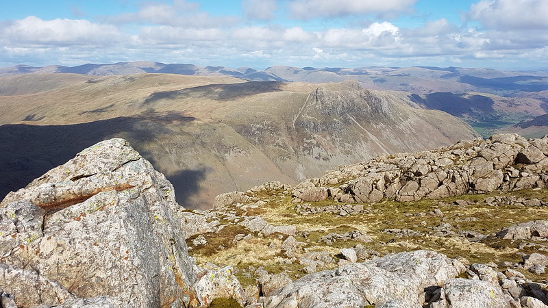
Burn Moor – and sunshine?Austwick and Robin Proctor’s Scar.Studrigg Scar and Moughton Scars.Austwick Beck.Austwick Bridge.
‘Probably C18’ according to Historic England.
Austwick Cross and The Church of the Epiphany.
Austwick church is more recent, finished in 1839 according to the same source, originally as a lecture hall and only latterly turned into a church. The pillar is of a similar age, but the base is ‘probably C15’.
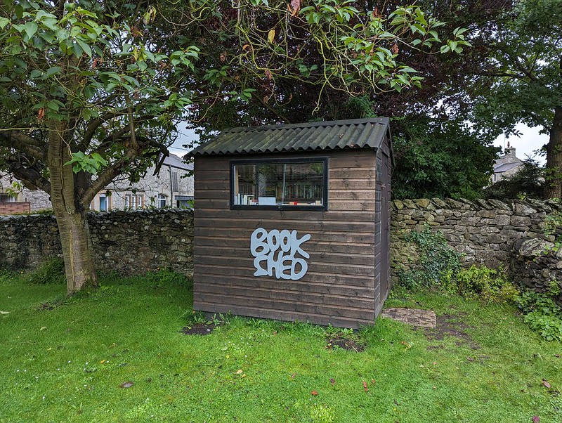
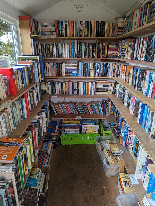
In the grounds of the church…
Book shed.Heaven!
I managed to restrain myself and only came away with a couple of books.
So: have you reached a verdict? Is the moral – when the weather is truly awful, best stay at home? Or the opposite? There was definitely an element of what our friend JB calls ‘Type 2 fun’. It was a bit grim at the time, and I got very wet, but there were some good bits too, especially in retrospect. I’ll let you draw your own conclusions.
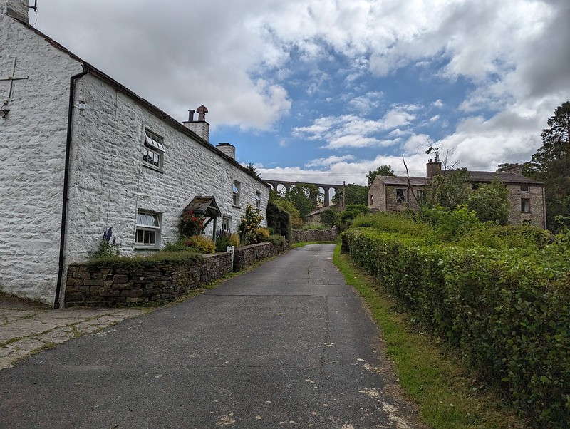
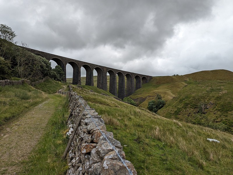
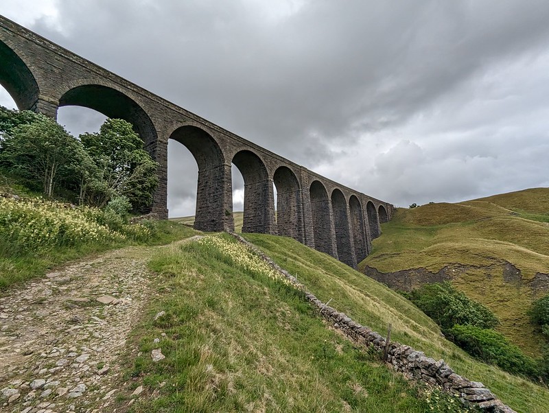
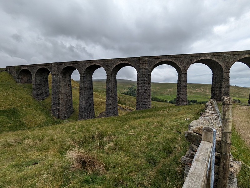
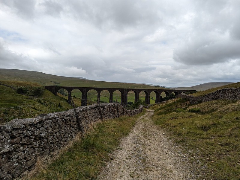
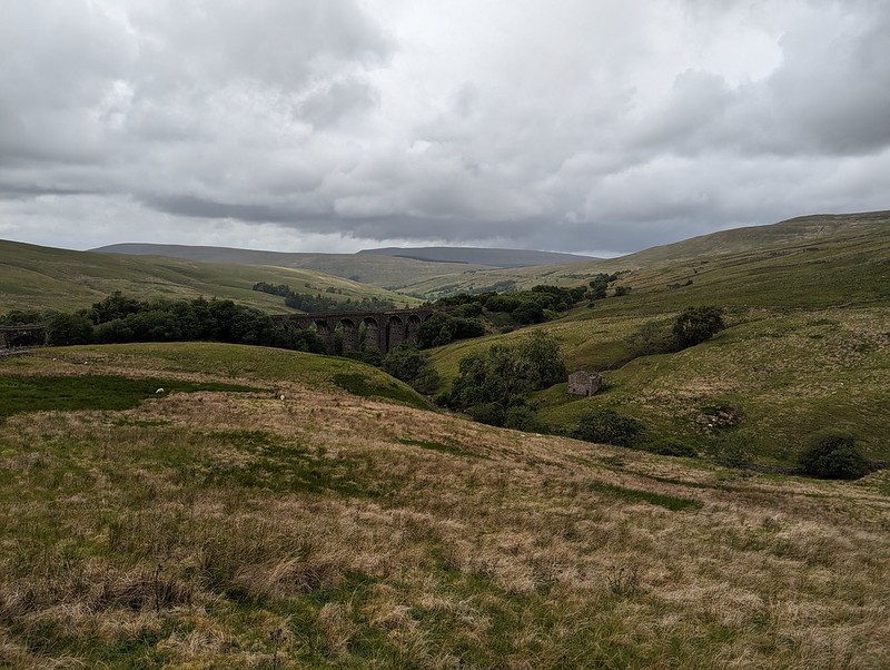
Dent Head Viaduct and Packsaddle Bridge over Fell End Gill.
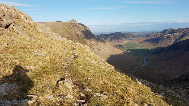
Another Lune Catchment walk, on a day of decidedly mixed weather. I don’t mind a bit of mixed weather, depending, I suppose, on the ratios employed in the recipe: I can stand a bit of rain so long as it isn’t poured with too heavy a hand and if I get some dramatic skies in compensation.
I know that Dentdale is lovely, but curiously, given that it’s not really all that far from home, I haven’t actually visited all that often. I’ve climbed Whernside from Dent on a couple of occasions. We camped here once, in the rain, when the kids were little I think. But I haven’t visited most of the valley, I hadn’t climbed any of the hills to the north or east. All of which is even more odd, given that where I parked, this early July Sunday morning, by the magnificent Dent Head Viaduct, was about a five minute drive from Gearstones Lodge, where we’ve spent a weekend prior to every Christmas for a few years now. In fact, we fairly recently watched the cloud pouring over Great Knoutberry Hill and Wold Fell from the northern end of Whernside during a cloud inversion weekend at Gearstones.
Bridge End Cottage (I think).
My walk began downhill, along the road – neither of which would usually be my first choice when picking a route, but on this occasion, with the infant River Dee alongside, a mass of wild flowers on the verges and lots of old, listed buildings to admire, I was more than happy. Both the viaduct and the old bridge are listed, along with just about every building in this upper part of the valley it seems. All, perhaps, except this one, if I’m right that this is Bridge End Cottage. In fact, I might have finished and published this post by now, apart from the fact that I’ve spent a lot of time down the rabbit-hole of reading all of the listings on the Historic England website. I think I enjoy the fact that they are quite clearly dense with information, but simultaneously, make no sense to me whatsoever.
“Rock-faced sandstone in massive blocks, mostly coursed but some snecked, with brick soffits to the arches. Slightly curved line on north-south axis. Ten tall round-headed arches on battered rectangular piers, that in the centre broader than the others and with a broad tapered pilaster; short cavetto-moulded imposts at the springing of the arches, rusticated voussoirs (now with 3 tie-plates to each arch), a moulded string course, and parapets with rounded coping.”
This is the viaduct, for example. Snecked? Soffits? Cavetto? Imposts? At least I know what voussoirs are, after a previous rabbit-hole episode, although I can’t tell you what it means for them to be rusticated; and I’m guessing that, in this context, ‘battered’ has nothing to do with coating in a mixture of flour, egg and beer and then deep-frying? (Although it has probably been tried in Scotland).
The River Dee.Dee Side House.
Formerly Dentdale Youth Hostel and before that a hunting lodge; now available as a holiday let. I’ll let you insert here your own rant about the YHA losing its way and selling off so many wonderful remote properties like this one. I’m saddened that I never got around to staying here whilst it was still a hostel, but even more upset that apparently Patterdale Hostel in the Lakes, where I have stayed many, many times, including for several big family get-togethers when I was in my teens, is facing a similar fate.
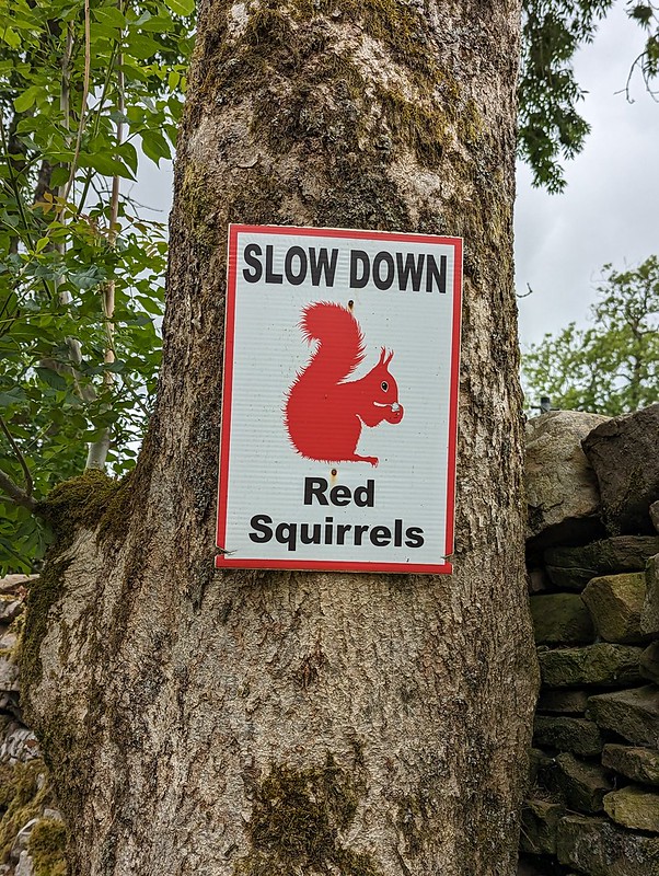
Common Spotted-orchid.Scow Force.Speed up – missed Red Squirrel photo opportunity.
I did see a Red Squirrel, running along the top of a gate, but I was much too slow with my camera to get a photo. I was impressed that somebody has put out these signs in an attempt to save the local squirrels from motorists, but I clearly needed to speed up, not slow down, in response to the presence of squirrels.
Bettony.
I passed a garden hereabouts which had been decked out as a picnic spot for Dales Way walkers – which seemed like a really generous thing to do and reminded me of the esrtwhile ‘Hiker’s Rest’ near to Beck Head at the southern end of Whitbarrow.
Meadow Crane’s-bill.The River Dee.East Stonehouse.Outbuilding at East Stonehouse.
There was something about the higgledy-piggledy design of this building which I found appealing. Higgledy-piggledy is the technical term obviously; I can’t think how else to put it, not asymmetric exactly, most houses aren’t symmetrical after all. It’s something to do with the windows and doors all being different sizes and positioned at different levels, I think. Anyway, I liked it.
West Stonehouse.
Confusingly, West Stonehouse lies NNE of East Stonehouse. I’m sure it made sense to name them that way to somebody at some time, but it seems very odd now. Here’s a snippet of the Historic England description of West Stonehouse:
“White-painted rubble, the centre portion random, with quoins, and the outer portions coursed, also with quoins; stone slate roof.”
I often bemoan the modern penchant for using the word random, when the desired import is actually ‘arbitrary’; so I was struck by the use of ‘random’ here. Apparently random rubble stone is where undressed or hammer dressed stones are used. Like a dry-stone wall; the stones are all different sizes and fit together like the squares and rectangles in a painting by Piet Mondrian, not in neat, even layers, which would be ‘coursed’. So there you go.
It probably makes more sense with a picture – I shall have to take one.
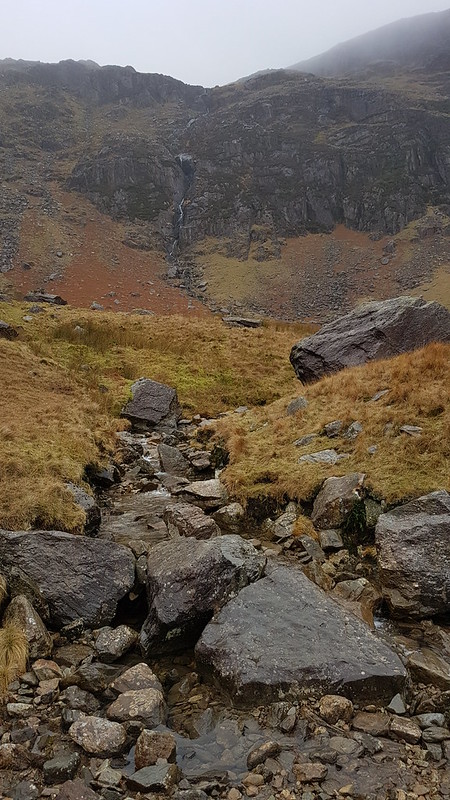
Arten Gill Viaduct.
By the track from Stonehouse there was an information board about the mining, or possibly quarrying, or – looking at the map – probably both, which formerly went on in this area. I didn’t take a photo, which is most unlike me, but the area’s industrial past no doubt explains the effort which was expended in creating the cobbled track up towards Arten Gill Viaduct.
Cobbled bridleway.Arten Gill Viaduct.
This viaduct was if anything even more attractive than the Dent Head one had been. You’ll have to bear with me, I took lots of photos. On the other hand, I didn’t manage to catch the pair of raptors, I think Kestrels, which were flying in and out of the trees by the viaduct.
Arten Gill Viaduct.
Tautologically, the stream below is labelled, on the map, both as Arten Gill, and as Artengill Beck.
Arten Gill Viaduct.
The skies were beginning to build some ominously dramatic looking clouds and I was soon paying for it in the first of several showers. To be fair, the showers were at least short-lived and mostly not too heavy either.
Arten Gill Viaduct.
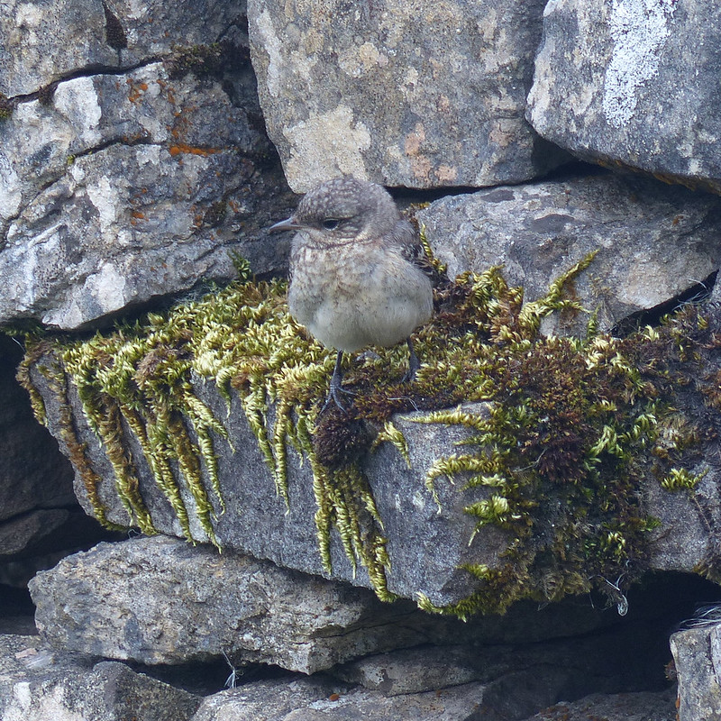
The track rises steadily, without being hard work and so was ideal. There were lots of birds about – Wheatear and Pipits, but most entertainingly Stonechats.
Male Stonechat.
A couple of individuals, first one and then later another, took it upon themselves to fly ahead in little short hops and then stop and wait on the fence, allowing me to get very close before scooting on again.
Male Stonechat.
Naturally, I took lots of photos.
I also got overly excited, during a shower, about what I decided was a Mountain Ringlet, even though I strongly suspected that they are not found in the Dales. Which absence would, of course, make my discovery all the more notable and exciting. When I finally got close enough to get a photo and a close look, it transpired that it was in fact a very small Ringlet, of the plain, old common-or-garden variety.
A sidestream.And another – being neatly directed across the track.An excess of weather.
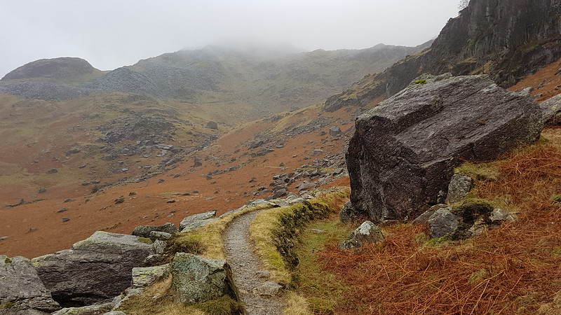
Having reached the top of the pass, I could have taken a direct line up to the top of Great Knoutberry Hill, but I’d done a bit of research online and read great things about the track, Galloway Gate, which contours around the southern and western slopes of the hill.
Whernside from Galloway Gate.Ingleborough and Whernside and more showers.Looking down Dentdale.
Choosing Galloway Gate turned out to be a good decision – it’s a fine walk which gives great views, particularly down into Dentdale.
Baugh Fell and Wild Boar Fell from Galloway Gate.
Eventually, I turned right, heading uphill and on to Pikes Edge, where there a number of scattered cairns and even more scattered boulders.
Ingleborough and Whernside from one of the cairns on Pikes Edge.Looking down Dentdale again.
As I approached the summit of Great Knoutberry Hill, I was engulfed in by far and away the heaviest shower of the day – for a while it was really chucking it down. A little annoyingly then, I found that I had unpacked my waterproof trousers from my rucsac, which is something I very rarely bother to do. Since I was wearing shorts anyway, and my waterproof trousers are mostly holes and layers of duct tape patched up with more duct tape, it probably wasn’t that great a loss. Also, this stone seat, possibly of random rubble, was facing away from the wind…
Stone seat/shelter on Great Knoutberry Hill.Lunch stop in a Bivvy bag in pouring rain.
Since the rain was falling horizontally, once I was hunkered down on the seat, and snug inside my bivvy bag, I was able to enjoy my packed lunch and a brew despite the rain. Anyway, it soon started to clear again.
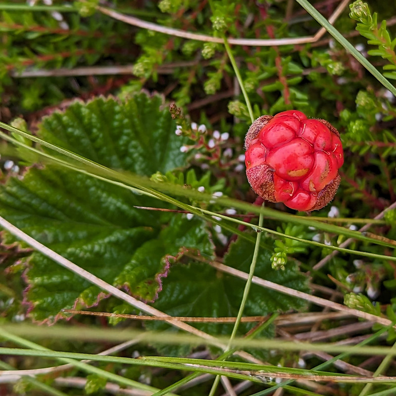
Ingleborough and Whernside from Great Knoutberry Hill.Cloudberry – or Knoutberry.
I had a bit of a wander in the vicinity of the trig pillar and found several Cloudberries. I don’t think I’ve ever seen them before, although I shouldn’t have been surprised to find them here, since Knoutberry is apparently a local name for Cloudberries. I also read that they are regarded as somewhat of a delicacy in Scandinavia; that the UK population of plants is predominantly male, so that it’s rare to find fruit; and that this example isn’t ripe, since they turn orange when they’re ripe.
Widdale Tarns.
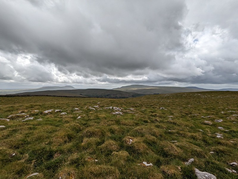
Great Knoutberry Hill is merely the highest point on the huge expanses of Widdale Fell. Beforehand, I had been contemplating a little wander to explore the tarns at least, but based on the area around the summit, I decided that it would be very rough going and that I would leave that for another day. Looking at the map again now, I see that Widdale Fell has an impressive looking edge above Widdale itself, that most of the streams drain either directly into the River Ure or into the Ure via Widdale Beck; but that some of the streams run down into Garsdale and the River Clough – a tributary of the Lune which I haven’t explored at all yet: so I shall need to come back at some point.
On this occasion I took a more direct route back towards the crossroads between Great Knoutberry Hill and Wold Fell.
Pen-y-ghent, Wold Fell, Ingleborough and Whernside.Pennine Bridleway signpost.
This is the signpost at the crossroads, which I hadn’t photographed when I first passed it because it had been raining at the time. This track is part of the Pennine Bridleway, a route which, like the Dales Way, some of which I also lay on this route, always seems superb wherever I encounter it.
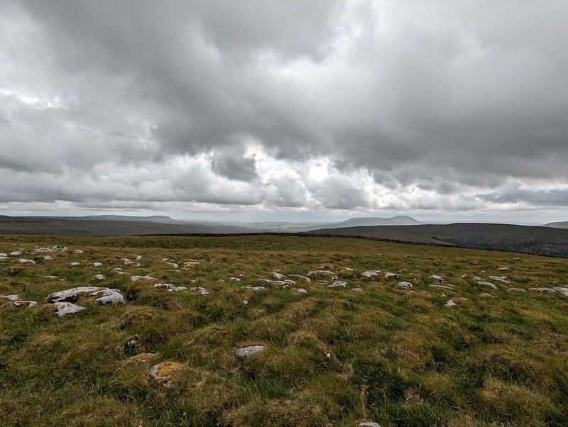
Wold Fell.Juvenile Wheatear.On Wold Fell, looking back to Great Knoutberry Fell.
Wold Fell was quite odd: limestone pavement, mostly grassed over, a very flat topped hill – there was a small cairn, as you can see, but it was very difficult to tell whether that was the actual highest point of the fell.
Ingleborough and Whernside from Wold Fell.
The lump between, and in front of, Ingleborough and Whernside is Blea Moor. I’ve often looked at it, especially when climbing Whernside from Little Dale via Greensett Tarn, but never been up it. I suppose I might get around to it at some point, although the lower slopes above Ribble Head are a bit of-puttingly rough and reed covered.
Pen-y-ghent and Ingleborough from Wold Fell.Descending towards Ingleborough.
From Wold Fell it was a simple romp down a track and then a minor road, accompanied by a couple more brief showers, back to the car.
Fell End Gill.Dent Head Viaduct again.Common Spotted-orchid.
As almost always seems to be the case with my Lune Catchment outings, it was a very satisfying trip, packed with interest, from which I came away with a host of ideas for possible future excursions.
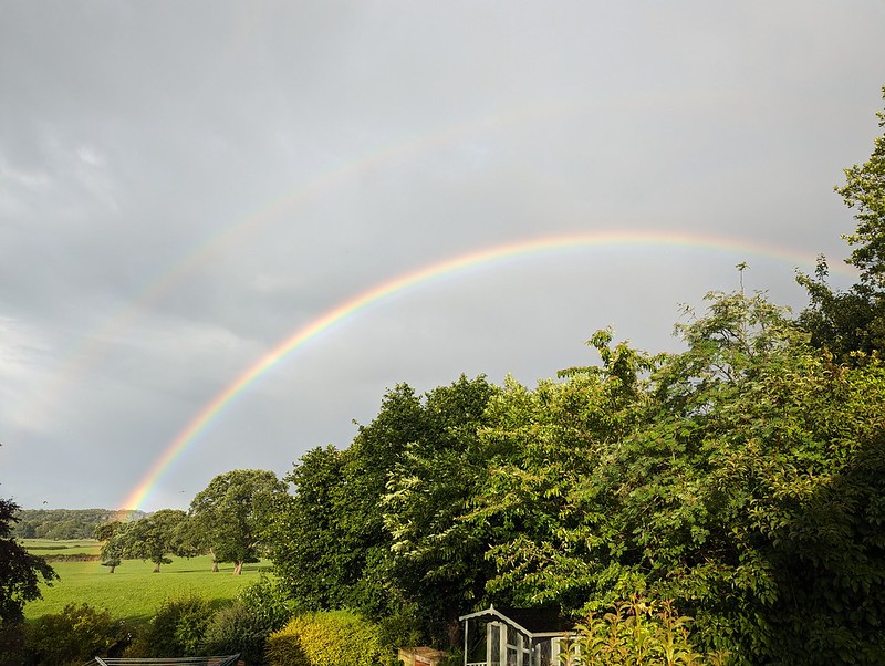
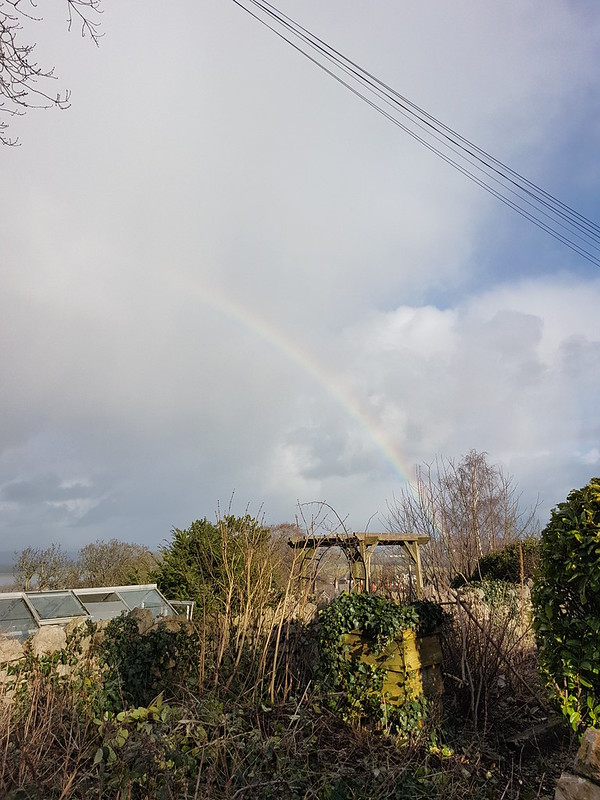
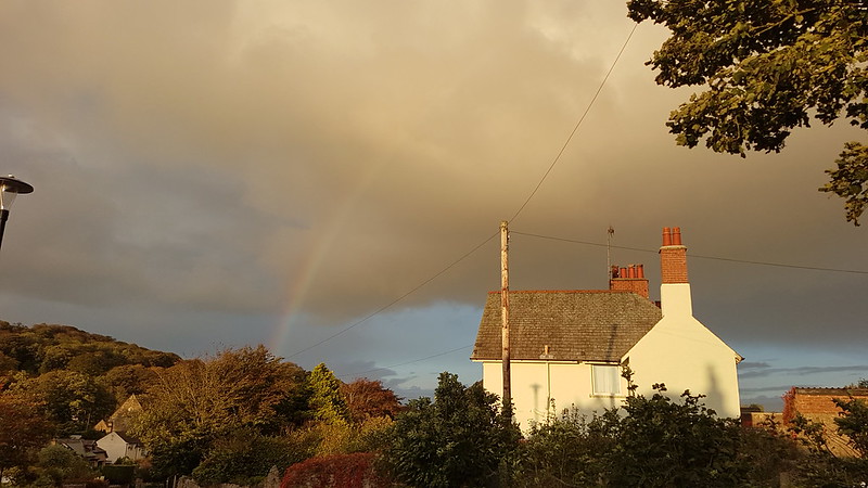
More showers at home – and a double rainbow.
Back at home, there were more showers, and this time an accompanying double rainbow.
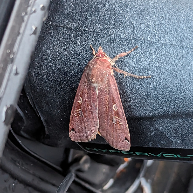
Later still, around 10pm, Little S sent me back outside to have a look at the moth which was resting on the plug on the charging cable for our car. It was dark and I’m amazed that my phone managed an image as clear as this…
A Large Yellow Underwing?
I’m told that this is a Yellow Underwing Moth , although to an untutored eye it also looks very similar to a Square-spot Rustic Moth. I’ll settle for it being a lovely colour, whichever.
Map the first.Map the second.
MpaMyWalk gives a little shy of ten miles and 485 metres of ascent, which seems about right.
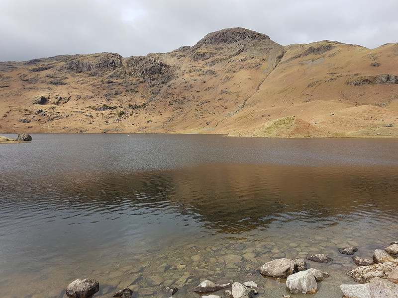
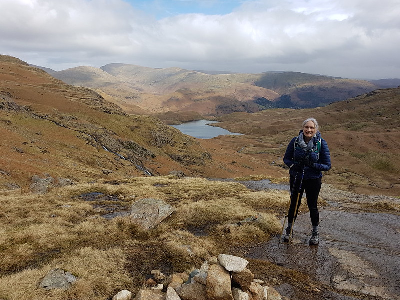
The last Sunday in March. TBH wanted another training walk, but this time of only eight miles. I thought we could kill two birds with one stone and mop up Blea Rigg which, during my Wainwright bagging frenzy last year, I managed to omit.
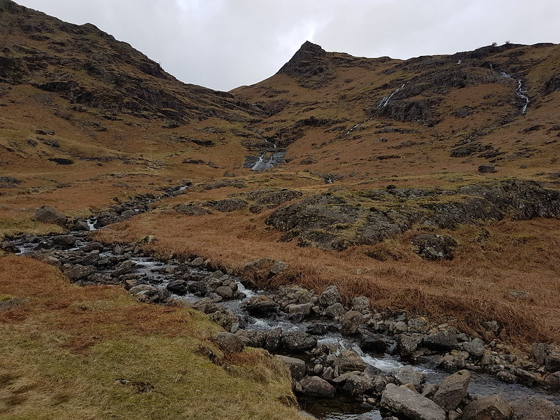
Sourmilk Gill, Tarn Crag and Gibson Knott.
It was a bit of a mixed day, with a cold wind and, later in the day particularly, some drizzly rain, but with occasional sunshine and even one or two quite warm spells.
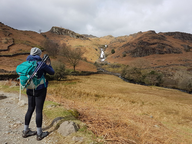
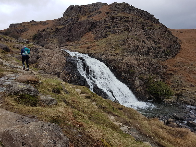
TBH photographing waterfalls on Sourmilk Gill.
It’s familiar territory this, being relatively accessible from home, but a great area, so always worth another visit.
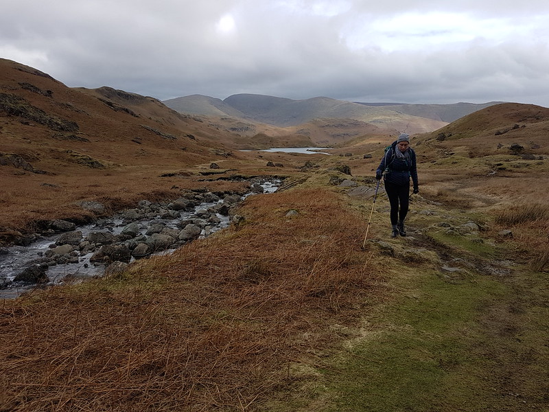
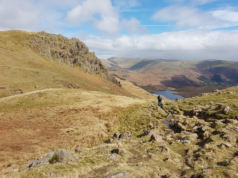
At the top of the falls.Easedale Tarn and Tarn Crag.
TBH hates to wait for her lunch, feeling that it should always arrive on the dot of midday. By the time we reached Easedale Tarn we’d been on the look-out for a likely-looking spot for some time and she was, apparently, approaching starvation. Fortunately, the slight descent here towards the tarn took us out of the wind and gave us just the shelter we needed for a comfortable refueling stop.
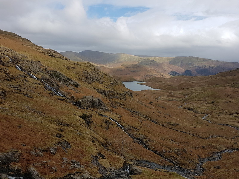
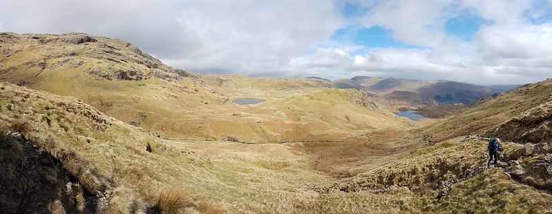
Easedale Tarn pano.Easedale Gill and Belles Knott.Looking back to Easedale Tarn, Seat Sandal, Fairfield, Great Rigg and Stone Arthur. Belles Knott and Easedale Gill again.Looking back again – the stream which flows from Codale Tarn looks worthy of investigation.TBH on the slabs above a surprisingly awkward scrambly section of path.Looking back again – Belles Knott, on the left, not quite as dramatic from this direction.
This was the sunniest and warmest part of the day, and very pleasant indeed.
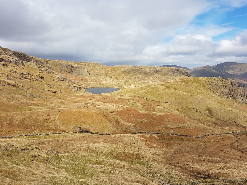
Codale Tarn – a great spot for a swim, but maybe not in March.
Looking at these photos, and at the map, this area has many great places for a dip. I find myself wondering how many I could string together in a single route. The thing is, I’ve tried this a few times before, and the answer is always: less than I think. I probably need to learn to just enjoy a swim or two and accept that, in this regard at least, less is more.
Codale and Easedale Tarns pano.On the Blea Rigg ridge.Harrison Stickle, Pavey Ark and Stickle Tarn – in the first of many showers.Frogspawn.The tarns near Lang How – raining again.Grasmere, Rydal Water, Loughrigg and Windermere from Silver How.A steep descent towards Grasmere and Rydal Water.Descending back to Grasmere.
In the event, the route was a little over nine miles.
Oh, and, spoiler alert, TBH did her Mighty Hike on Saturday. It went well and she enjoyed herself. I shan’t take all of the credit, but no doubt my carefully planned training routes were key to her success! B has subsequently suggested that we should all take part next year. One to ponder.
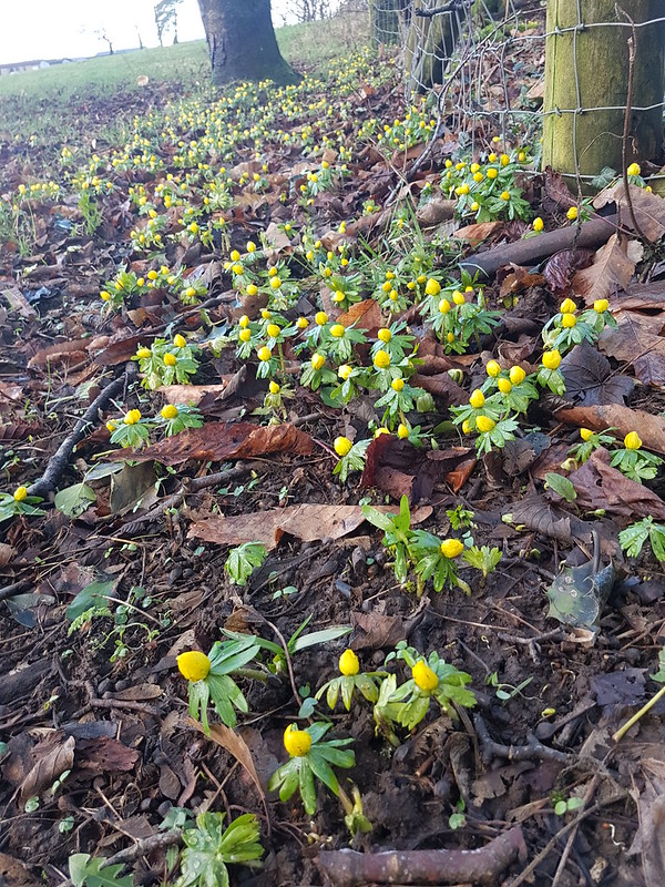
Winter Aconites – not quite flowering, but almost there.
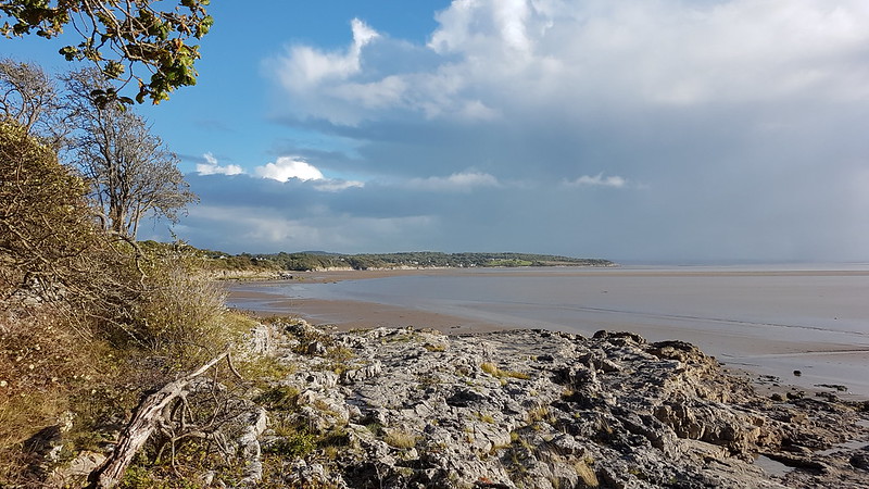
Mid-January. It’s a whole fortnight (and two posts) since I walked around the coast to Arnside and back over the Knott. Better do it again! What’s-more, I was back to it the following day. You have been warned!
Looking back, the first photo I took that day, from almost outside my own front door, had me puzzled for a moment. Then I remembered – it shows a thin strip of blue along the northern skyline – the weather had suddenly and somewhat unexpectedly improved, and the photo was an aide memoire to remind me of that happy change. To the south the skies were still black. Later, I took a picture of a dark, shadowed Arnside Knott with completely blue skies behind it.
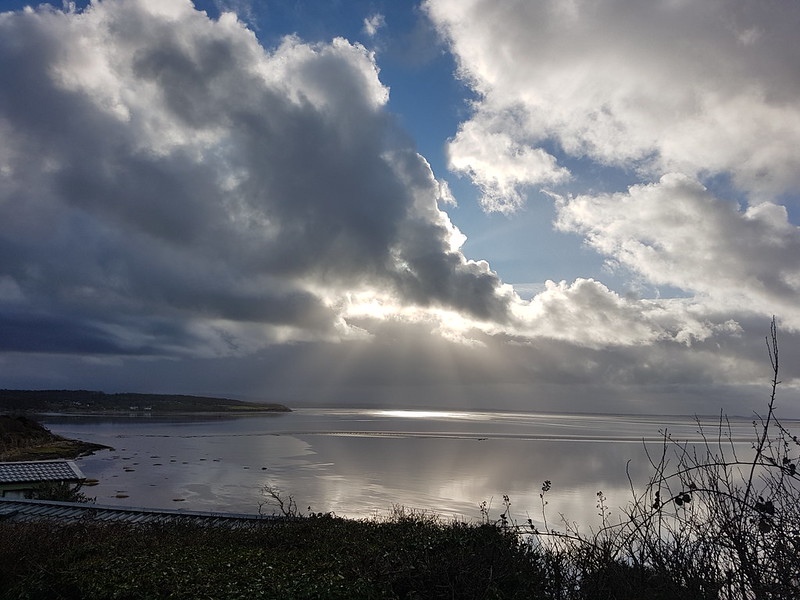
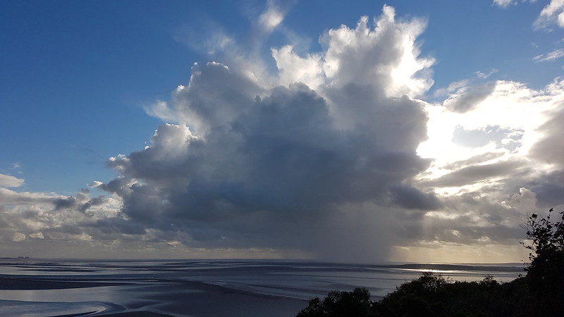
Fortunately, rents began to appear in the massed clouds, giving some prospect of sunshine to go with the blue…
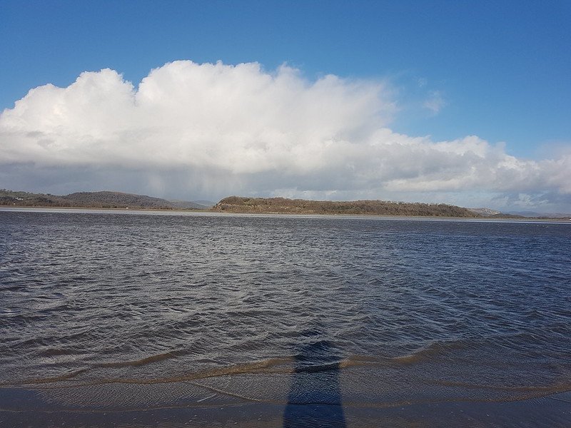
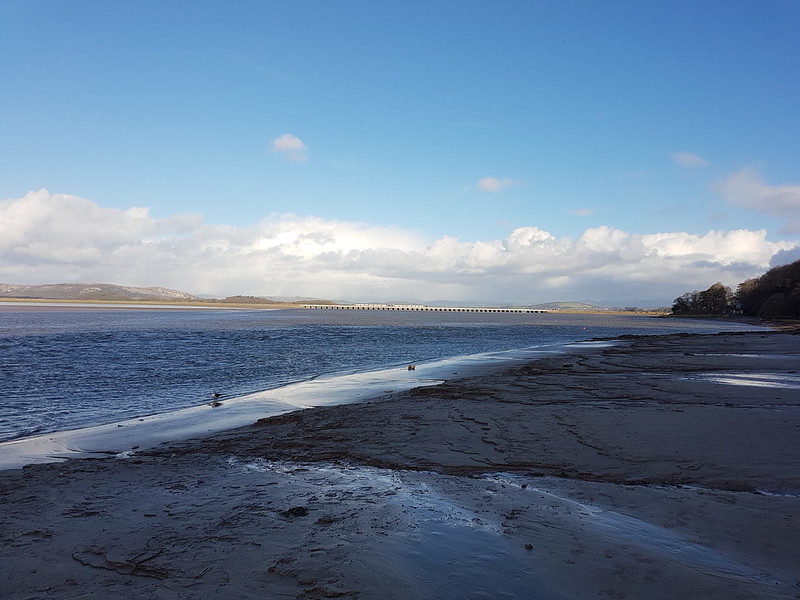
Light show off Know End Point.Round the coast again!Grange-Over-Sands and Hampsfell.Turning the corner into the Kent Estuary.
I like to drop down on to the sands at this point, if not before, but the tide had clearly been high and it looked far too wet to take that option. Which was a shame, because the cliff path itself was extremely muddy and puddled.
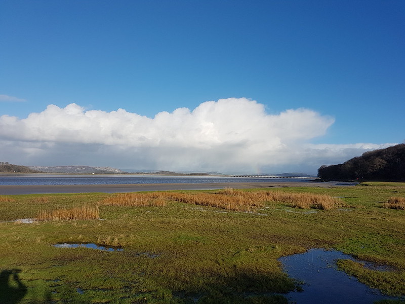
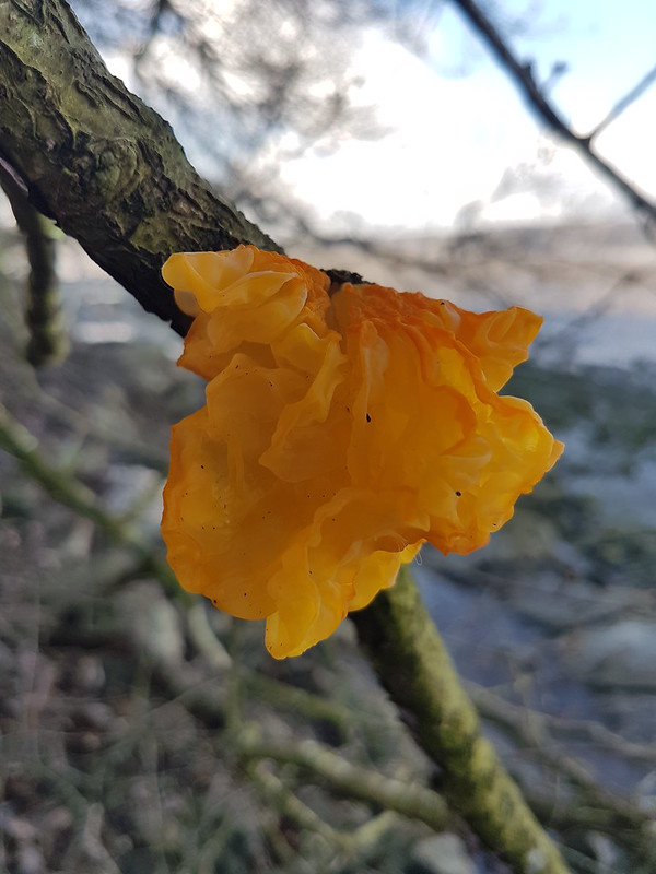
The Salt Marsh at White Creek – inundated.Meathop Fell across the Kent – showers beyond?From New Barns – Whitbarrow Scar catching the light, hint of a rainbow behind the viaduct.Witches Butter – another gelatinous fungi.A train crossing the viaduct.
I’m no trainspotter, but a train crossing this, or any viaduct, always has me scrabbling for my phone to take pictures. I can’t explain my disproportionate excitement. Having said that, I also love crossing the viaduct on the train, but I think that’s mostly to do with the views it affords. I really hope the proposed footbridge along the viaduct becomes a reality, but I don’t know how likely that is.
Whitbarrow still basking in the sun. Yewbarrow in a black shadow.
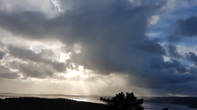
The Lakeland Fells were mostly missing in the views, hidden in cloud, and it was clear that there were plenty of showers about, and the occasional attendant rainbows. I never tire of watching the play of light and shadows across the landscape on showery days like this one. It helps if the showers are falling elsewhere, on someone else!
A vicious looking cross-current in the river.
The photo doesn’t really do it justice, but the river here was highly agitated, with waves apparently surging in opposing directions, upstream and down. Maybe the tide was on the turn?
Now Whitbarrow has lost the sun and it’s the viaduct which is lit-up.Arriving on Arnside Promenade.A rainbow from High Knott Road.
There are lots of paths up the Knott, but I’ve definitely found a favourite, the path which climbs up from Redhill Woods to the bench on the south side of the summit, on which I don’t think I’ve ever met another walker.
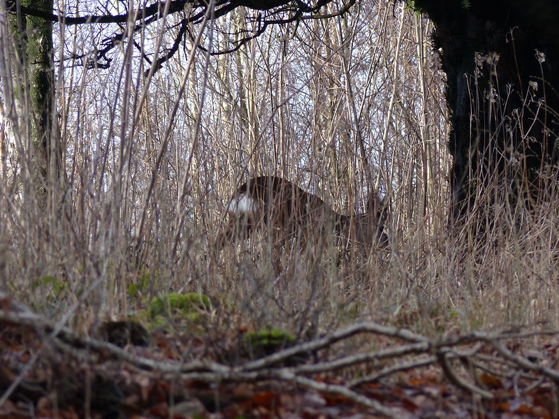
I had company, however, on this occasion – two pairs of Roe Deer which I could see on the slopes below me, but which then darted across the path ahead of me, making their way into the trees towards the trig pillar. Although we often have deer in the garden – there are two there now – I still enjoy seeing them whilst out walking. It’s a bit harder to get good photos in the woods though!
Roe Deer – one of a group of four.Winter flooding and Silverdale Moss – Ingleborough just about visible.Beetham Fell and Farleton Fell from Arnside Knott.Reclining Beech.
I wonder how long ago this tree fell into its current position? Before I moved to the area, so quite a while ago. It’s sent up a thicket of branches, each like a separate trunk. Is it the resilience of fallen trees which live on like this which I admire?
I’ve recently finished reading ‘Wild Fell’ by Lee Schofield about the RSPB management of two farms in the Lake District at Haweswater and Swindale, and which I can thoroughly recommend. One astonishing fact I gleaned from it is that there’s a single Aspen in Utah, called Pando for some reason, which occupies over a hundred acres, has 40,000 trunks, is estimated to weigh 6,000 tons and is thought to be several thousand years old. Aspen spread by sending up suckers, so all of the trunks are genetically identical and are thought to share a vast root system. It is, of course, under threat, probably due to overgrazing.
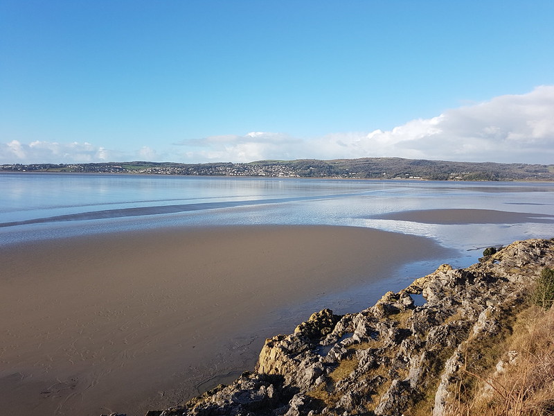
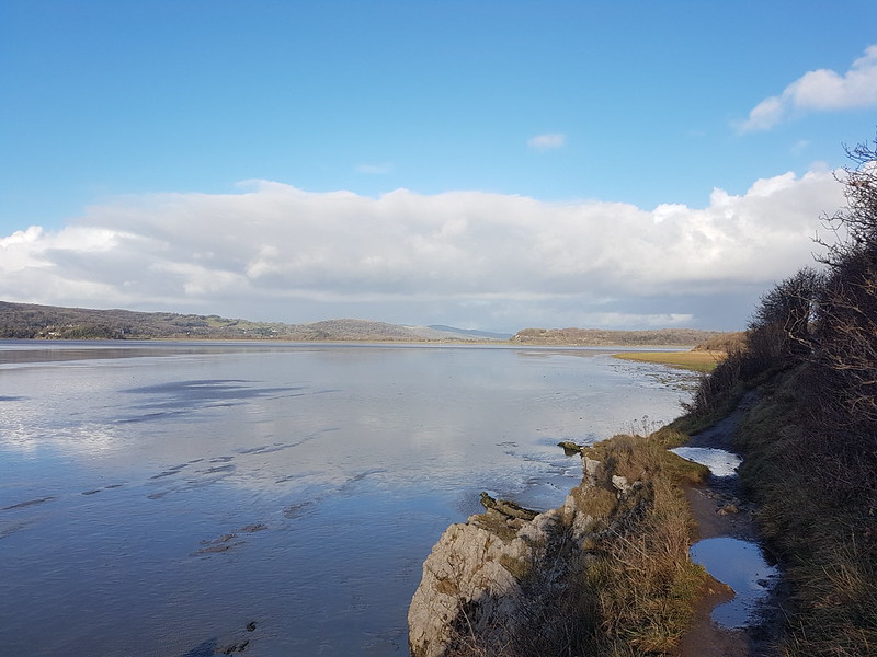
Looking along the Kent.Gummer How – the Fells beyond noticeably absent from the view. Grange-Over-Sands and Hampsfell.Another free light-show over the Bay.Arnside Knott.
I was heading home via Far Arnside and Holgates Caravan Park – using the same paths I had set out along. In stark contrast to earlier, Arnside Knott was now brightly illumined by the sun, but the skies behind were heavily clouded and rather ominous. I could see that a shower was coming, could I beat it home?
Caught in a sharp shower when almost home.
No! Still, a brief drenching seems a small price to pay for what preceded it.
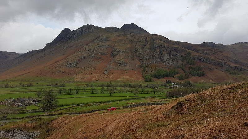
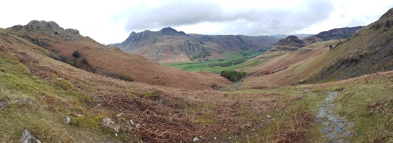
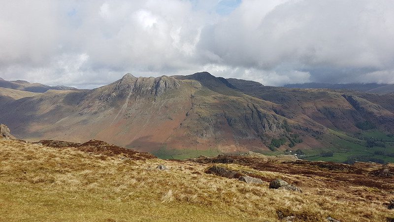
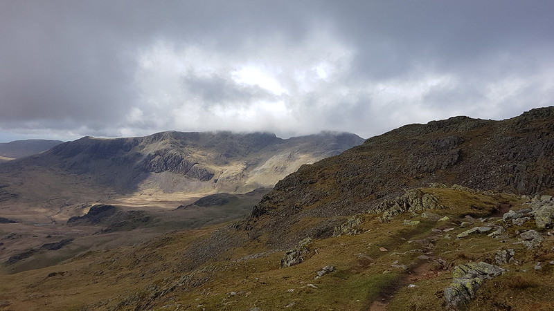
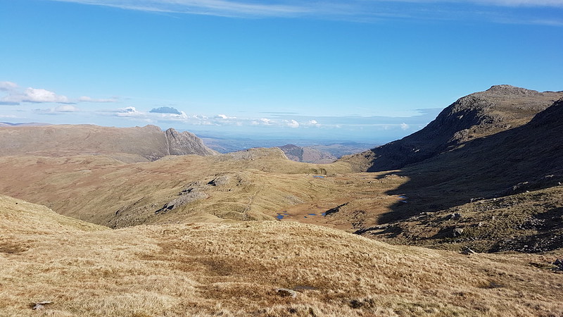
White Stones – The Band. Crinkle Crags and Bowfell hidden in the cloud, but Rossett Pike is clear on the right of the photo.
Easter Monday. The forecast was a bit mixed, but generally for improvement throughout the day. I had big plans, so I’d set off early and was parked up in the National Trust carpark by the Old Dungeon Ghyll Hotel while there was still plenty of room.
Pike of Blisco.Side Pike.
As I walked up the road towards Blea Tarn the cloud lifted off the Langdale Pikes, but it was cold and pretty gloomy.
Langdale Pikes.
The Langdale Pikes would dominate the view for much of the early part of the walk, and then again towards the end. I took a lot of photographs of the iconic crags.
Redacre Gill.
My route up Pike O’Blisco curls right behind the stand of trees and then follows the gill into the obvious deep cleft right of centre.
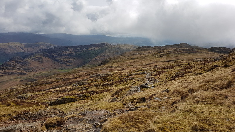
I’ve been thinking a lot recently about the incredible standard of the paths in the Lakes. This was an easy one to follow at a lovely gradient. somebody did a very fine job of making it.
It was spitting with rain now and again and my cag went on and off a few times.
A well constructed path.Kettle Crag, Langale Pikes, Side Pike.
I seem to have stopped taking panorama shots for a while, without really deciding to, but I took loads on this walk. If you click on them, or on any of the other pictures for that matter, you’ll see a larger version on Flickr.
Side Pike and Lingmoor.Side-streams, in often quite deep ravines, with lots of little waterfalls, abounded. This area would definitely repay further exploration.Pike O’Blisco.
As I reached the top of the gully and the angle levelled off, the weather turned temporarily a bit grim. I have several photos obviously taken in the rain. Fortunately, it was short-lived, and when the sun appeared once again, it had wet rocks to sparkle on.
The Langdale Pikes again!Lingmoor with Fairfield Horseshoe beyond and a glimpse of Windermere.Pike O’Blisco summit.
The wind was blowing from the west, so those large slabs just below the summit offered superb shelter. I settled down, leaning against one of them, poured myself a hot cordial and video-called my Dad to wish him a happy birthday.
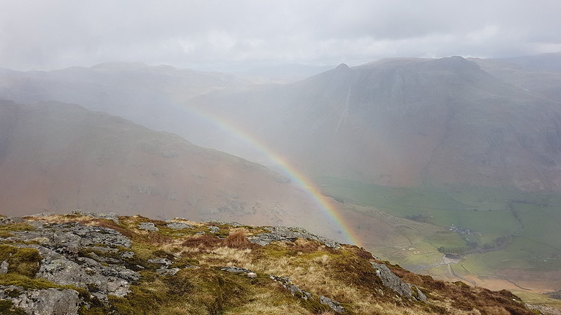
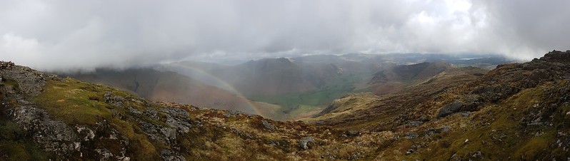
Langdale Pikes and a rainbow.
It was soon raining again, but I had a well-sheltered spot and it didn’t seem to matter too much somehow.
Rainbow panorama.Red Tarn and Cold Pike.
Cold Pike was my next target. I decided to take the path which angles up towards the head of Browney Gill, but then strike left when the angle eased.
Red Tarn again. Wet Side Edge behind, which is heading up to Great Carrs, hidden in the cloud.Looking back to Pike O’Blisco. The broken crags on the left look like they might give a good scrambling route.Pike O’Blisco disappearing into the cloud, from near the top of Cold Pike.
I found another sheltered spot on Cold Pike for another quick stop. The clouds blew in once again. The weather was changing very quickly.
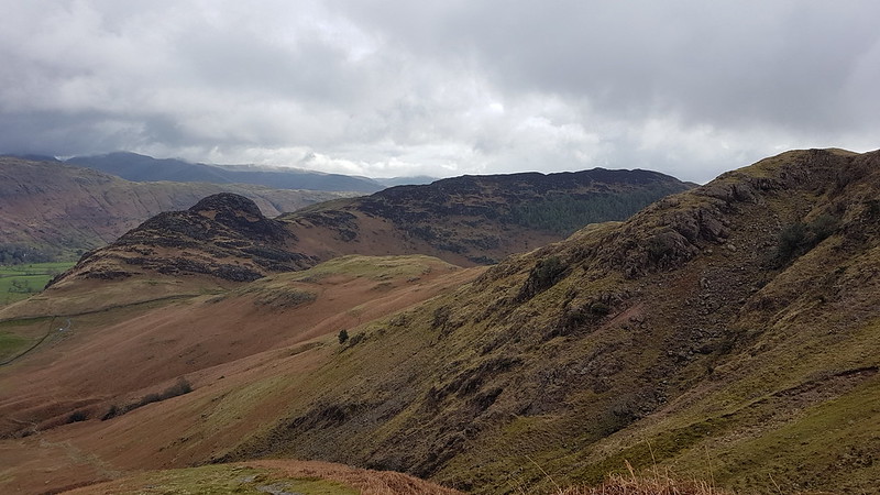
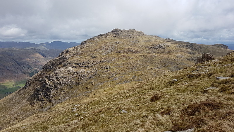
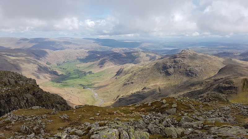
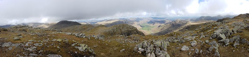
Pike O’Blisco from Cold Pike. The Helvellyn and Fairfield range behind.Looking back to Cold Pike.Pike O’Blisco and Cold Pike. Wetherlam behind.Panorama from the same spot.The many tarns of Stonesty Pike. The Duddon Estuary, Harter Fell, Whitfell and Black Combe behind.Crinkle Crags.Upper Eskdale and the Scafells.The ‘Bad Step’. There were a couple of guys standing beneath it, having quite a lengthy discussion before deciding to follow the path around to the left. I went round too. I’ve been both up and down that way in the past and I don’t remember it being all that difficult.Bowfell just about out of the cloud.Lingmoor and Pike O’Blisco. Windermere beyond.The Duddon Valley and Harter Fell.Langdale, Lingmoor and Pike o’Blisco.Panorama – Scafells, Bowfell, Langdale Pikes, Langdale, Pike O’Blisco, Windermere, Coniston Fells.
There are a lot of ups and downs on Crinkle Crags. The scenery is fantastically rocky, but it does mean you really have to concentrate over where you are putting your feet to avoid taking a tumble.
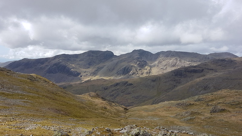
Scafells.
If the Langdale Pikes had kept drawing my eye during the early part of the walk, it was now Scafell and Scafell Pike which were hogging my attention.
The weather hadn’t been too bad, but it was getting bluer and brighter…
Scafells again.Bowfell.Scafells and Bowfell panorama.Pike O’Blisco and Wetherlam.Pike O’Blisco, Crinkle Crags and Three Tarns.Langdale Pikes from Bowfell. Helvellyn and Fairfield range behind.Esk Pike, Grasmoor, Allen Crags, Glaramara, Skiddaw, Blencathra.Scafells.Langdale Pikes, Langdale, Lingmoor, Windermere.Pike O’Blisco, Wetherlam, Coniston Old Man, Crinkle Crags, Dow Crag.Esk Pike.
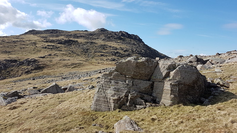
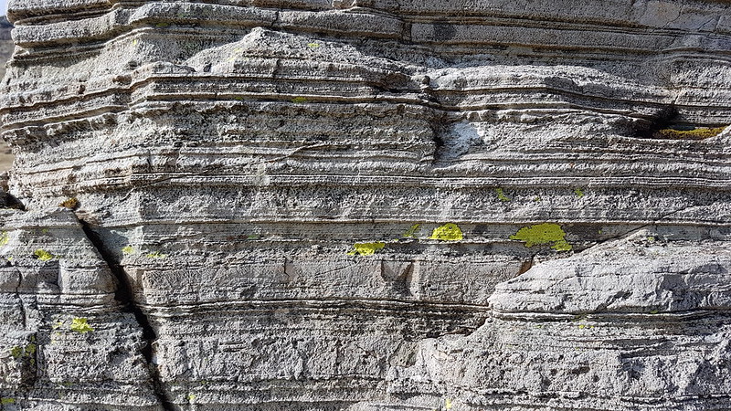
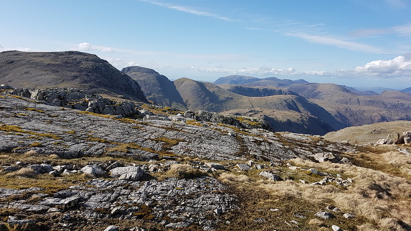
I know that the geology of the Lake District is quite complex, with some igneous rocks, lots of slate, periods when the area was underwater and sedimentary rocks were laid down, three separate periods of orogeny lifting the hills, glaciation etc – but I don’t often feel like I know what I’m looking at. The rocks on this walk seemed to change quite often.This large boulder, in Ore Gap had lots of parallel striations which make me think it must be sedimentary. And yet we’re in the central part of the hills, close to Borrowdale, where I thought the rock would be volcanic?
Sedimentary, my dear Watson?
I have a book on the shelf in front of me, ‘Lakeland Rocky Rambles’, which I’ve never really dipped in to – hmm, could be a new project.
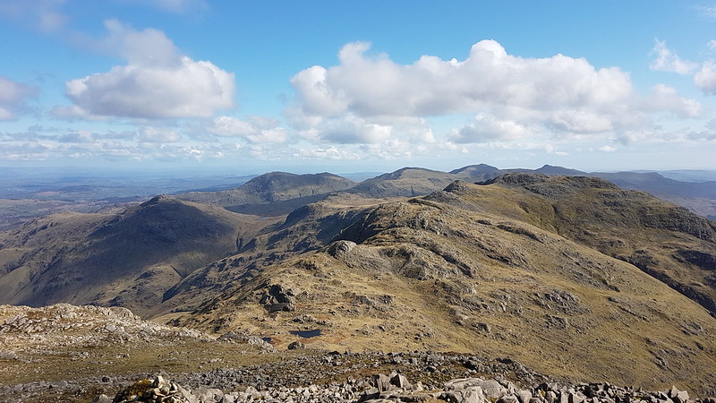
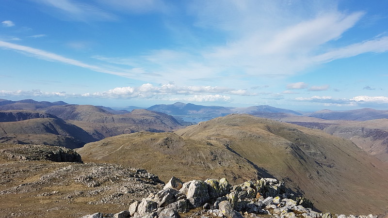
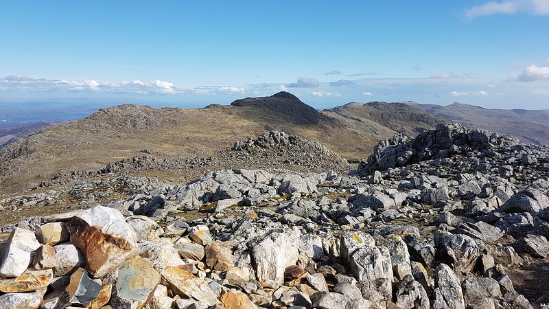
Dale Head, Maiden Moor, Allen Crag, Glaramara, Derwentwater, Skiddaw, Blencathra. (And Many more!)Looking back to Bowfell and Crinkle Cragsfrom Esk Pike.Great End, Great Gable, Green Gable, Grasmoor and more of the North-western fells.Langdale Pikes,Rossett Pike, Bowfell. Angle Tarn panorama.Panorama from Rossett Pike.Langdale Pikes, Langdale and Lingmoor from just below the summit of Rossett Pike.Buck Pike and Black Pike – my descent route.Another panorama.
I think it’s 11 years since I was last on Rossett Pike. Back then, I didn’t get too much of a view, but I did have my one and only (so far) close encounter with a Dotterel. That was also towards the end of a walk, and thinking back, I’m pretty sure that whilst I may not be particularly fit, I am at least fitter now than I was then.
Buck Pike.Pike O’Stickle and Mickleden.
I picked up a path which skirted below Black Crag and kept me in the sun for a bit longer. It was a great way down, never too steep, and deposited me on the path down from Stake Pass which has superb zig-zags. Once down in the valley I followed two walkers, one of whom was barefoot. I met another barefoot walker a couple of weeks later. I quite like the idea, but I think I would probably stub my toes roughly every five minutes.
I wasn’t quite dark when I arrived back at the car, but it wasn’t far off.
Around the head of Langdale.
Some hike stats:
MapMyWalk gives a little over 13 miles (although once again, confusingly, the numbers on the map make it look closer to 25 km i.e. well over 15 miles. Who knows.) The app also suggests 1162m of ascent, which is definitely an underestimate. For a slightly different route, over exactly the same hills, Walking Englishman gives 12 miles and 1466m of ascent. I think the truth, for the climbing at least, lies somewhere between those two figures. The fact that they differ by around a 1000 feet is a bit shicking!
It was far enough, at least, to leave me feeling pleasantly tired by the end.
Despite all the effort, there are ‘only’ six Wainwrights, to wit: Pike O’Blisco, Cold Pike, Crinkle Crags, Bowfell, Esk Pike and Rossett Pike.
There’s lots more Birketts because all of the Crinkles are on the list. And some of the bobbles on the ridge down from Rossett Pike – but I wasn’t very careful about which of either of those I actually visited, so I shan’t list them on this occasion.
Leaving aside all of the stats, it was an absolutely superb day which will live very long in the memory. All day long I was thinking that this area is definitely the best bit of the Lakes. But I was thinking much the same thing when I did the Coledale Horseshoe, so I think all we can conclude is that I’m fickle!
The forecast was promising: ‘Low cloud, with a strong chance of cloud inversions on larger fells, particularly in the South.’ I was hooked (line and sinker!) and was out early and parked up in the car park at the top of the metalled part of the Walna Scar road. Despite the early hour, not long after eight, the car park was already pretty busy and filling up fast.
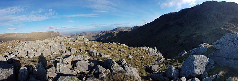
The OS map shows a path climbing the southern slopes of The Old Man, skirting the quarry and joining the more popular route above Low Water. In fact, there are lots of minor paths and if you pick one which heads further west you can keep plodding up through interesting terrain to Old Man Breast and then the top.
Limestone Haws.
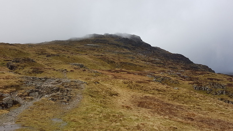
I was suspicious of what seemed like quite high cloud for an inversion, but continued to climb hopefully.
The view begins to disappear.
Once entered, the mist turned out to be the sort of mist which has you soaked through before you’ve fully realised just how wet it is. Still, it remained quite pleasant. I sat by the enormous summit cairn on the Old Man, looking at the lack of view and willing the cloud to clear, whilst I supped a couple of cups of cordial from my flask.
Then I set off along the ridge, over Brim Fell to Swirl How. The weather gradually deteriorated. Not only did the fine mist turn to a heavy downpour, but the wind picked up too so that the freezing cold rain was driven horizontally across the ridge.
The cairn on Swirl How.
It was all a bit horrible. In different circumstances, I might have done an out-and-back to Great Carrs, and I originally intended to include Wetherlam, but now I just wanted to get off the hill.
The ‘view’ along the ridge.
Fortunately, once I started to descend Prison Band I dropped out of the worst of the wind, and although it continued to rain, on and off, without the driving wind it didn’t seem so bad.
I chatted to a couple of chaps who asked if they were on Prison Band (I’m not sure where else they could have been?).
“What’s it like on the ridge?”
“Wild.”
“Yep, it was pretty foul on Wetherlam,” they chuckled, before continuing on up.
Re-emerging from the mist.
From that point, I enjoyed the rest of the walk, rain or no rain. Showers kept sweeping through, but they were less and less frequent.
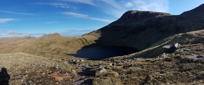
Levers Water.
The sharp showers made patterns on the surface of Levers Water and I watched them being driven across the tarn.
No swimming! No difficulty complying with that injunction on this occasion.Levers Water Beck.Levers Water Beckagain.I love these constructed paths, associated with the mine-workings. I followed this one around to Low Water Beck and the Pudding Stone.Low Water Beck.
Stepping off the path by Low Water Beck, to let a couple past who were coming the other way and who seemed a bit nervous of the uneven and slippery surface, I skidded on the wet grass and went arse-over-tit. They seemed quite concerned about me, I’m not sure whether that was despite or because of the fact that I was laughing at my own clumsiness.
Another mine track.Sod’s Law in operation – as I sat in my car finishing my flask and eating my lunch, sunshineappeareddown in the valley, bringing a feeble rainbow with it.
A surprisingly enjoyable outing, all told. And the fact that I shall need to go back to pick up Dow Crag, Grey Friar etc is not a hardship at all.
UF was up from Manchester since we had tickets to see Martin Simpson and Martin Taylor at the Brewery Arts in Kendal. I invited TC to bring his dogs out for a walk around the village with us. We started in Eaves Wood with a visit to the Pepper Pot, then walked through Burton Well Wood and across Lambert’s Meadow. The fact that I have no photographs is, I think, a good indication of how poor the weather was. In the photo above, we are at the now decrepit bench at the top of the hill at Myer’s Allotment. Even on a wet day there was a bit of a view over Leighton Moss…
We dropped down through Fleagarth Wood to Jenny Brown’s Point, where, since it had stopped raining and the sand was reasonably firm, we decided to walk around the coast back to the village.
It was bracingly windy and rather splendid.
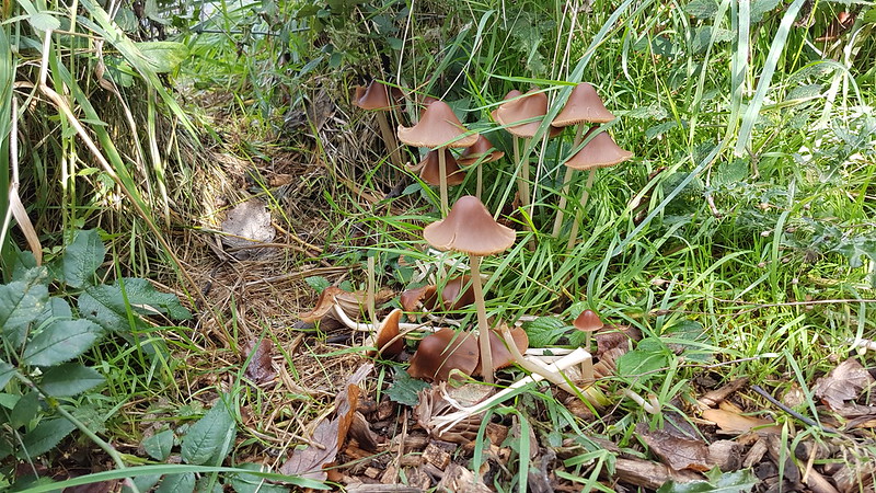
Ink Caps, I think.
The next morning, a Sunday, UF made an early exit to make a prior engagement. Usually, when he makes a Sunday flit, he’ll be playing snap – the variant that has ‘seven no trumps’ and the like – or watching City play, but, if I remember right, on this occasion he was meeting friends for a walk. It might have been a good one, because the weather was much brighter, with big clouds, plenty of sunshine and heavy showers tracking in off the Bay. Having said that, I didn’t set out for a walk until late afternoon, so it’s possible I’d been waiting for the weather to improve.
I managed to string a five mile route out over nearly three hours. Tea breaks to sit and watch the showers falling elsewhere were the order of the day.
At Far Arnside, I spent some time looking for the fossilised corals in the rocks on the edge of the Bay; something I hadn’t done for quite some time.
Clougha Pike and Ward’s Stone from Heathwaite.Kent Estuary and Whitbarrow from Arnside Knott.Humphrey Head.
I was surprised to get to the top of Arnside Knott without being caught by any showers. Perhaps I celebrated too soon: as I began to descend, it finally started to rain on me.
It was short lived though, and brought a rainbow with it.
Mushroom cloud formation above Heysham Nuclear Power Plant. Hmmm.Late light on the houses of Townsfield.Almost home. More rain and another rainbow.
Here’s the two Martins, performing a song from Martin Simpson’s repertoire, written, I think, by his father-in-law. It seems highly appropriate for these ‘Eat or Heat’ times.
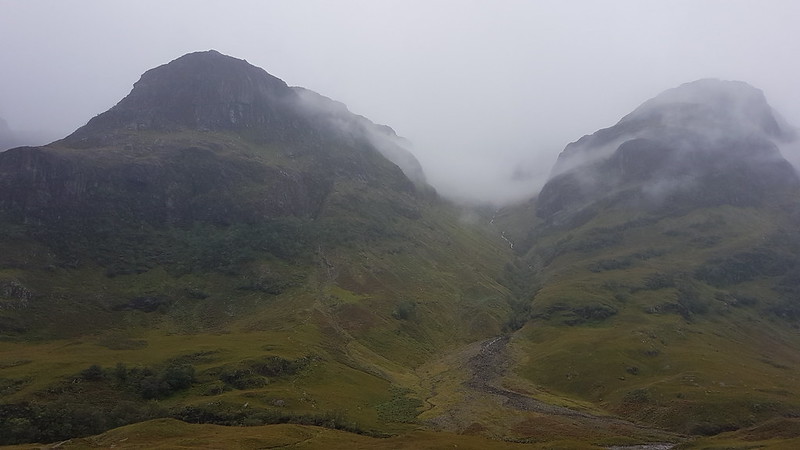
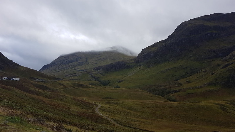
Two of the Three Sisters – Gearr Aonach and Aonach Dubh
Some of the gang had a cottage booked in Glen Coe for a few days at the tail-end of September. The Tower Captain and I were able to join them for the weekend and booked an excellent B’n’B in Glenachulish, which I wish I could advertise here, but I’ve forgotten what it was called.
Across Glen Coe – Am Bodach on the Aonach Eagach.
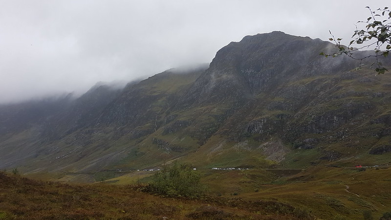
It was a very wet weekend, but I think we made the most of it.
On the Saturday, we were out for three short walks, well some of us at least.
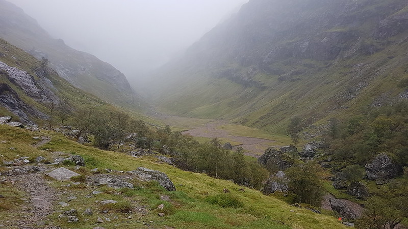
First of all we had a wander up into the ‘Lost Valley’, Coire Gabhail.
Waterfalls on the Allt Coire Gabhail.
It drizzled and the cloud was low, but even in less than perfect conditions it’s an awe-inspiring place. Andy was telling me that one winter he and TBF and I came down this way off Bidean nam Bian. My memory for these things is appalling, and frankly I can’t recall the day. Looking at the map now, such a descent looks fraught with difficulties, but in those days we had the unfounded and unshakable confidence of youth on our side.
Coire Gabhail – the Hidden Valley.
Having glimpsed the hanging valley through the mist, we turned tail and set-off back down again.
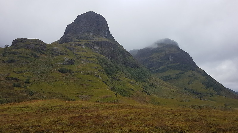
Another waterfall on the Allt Coire Gabhail.Gearr Aonach and Aonach Dubhagain.
By the time we reached Glen Coe again, the cloud had a least lifted a bit.
Looking down Glen CoeBeinn Fhada and Gearr Aonach.Buachaille Etive Beag.Making scones.
We returned to the cottage where the majority of our party were staying and Andy made us all some very tasty scones. Vegetable soup too, I think, but it’s the scones, jam and cream which have stuck in my mind!
River Coe
Later, the Tower Captain and Andy and I had a wander to Signal Rock, a fairly underwhelming feature, but it did get us out again and gave Andy and I an opportunity to rehash some old Clachaig Inn stories.
The Pap of Glencoe.
Later still, the three of us were out again for a very short walk on the shores of Loch Leven.
Loch Leven.
In the evening, we had a table booked the Laroch Restaurant, where the food was superb, and the company genial. There was a covers band playing an extremely eclectic mix of tunes in the public bar. The sheer variety of their set list had us playing ‘name that tune’ and LL, a recent addition to our little group, proved to have an encyclopaedic knowledge of pop music which belied her tender years.
A great day, considering how much it rained. Would the morrow bring some better weather?
Early in May, we met up with our old friends for a walk, and to celebrate Andy’s birthday. We had the least far to travel, since we were meeting at the Littledale carpark on the edge of the Forest of Bowland, not too far from Lancaster. So, naturally, never knowingly on time for anything, we were the last to arrive. I think the last of Andy’s bacon butties had yet to be washed down with a mug of tea at that point, so we may not have delayed things too much.
Leaving the cars, we started with an easy ascent of Baines Cragg, which, despite many previous visits to this area, I’ve never climbed before – it turned out to be an excellent viewpoint. It’s a shame the skies were so grey – I shall have to go back and have another look when the weather is more clement.
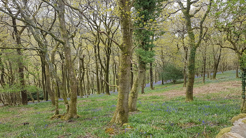
Bluebells in Cragg WoodCrossing Ottergear Bridge, part of the Thirlmere Aqueduct.
Apparently the Thirlmere Aqueduct, which transports water from the Lake District to Manchester, is the longest gravity-fed aqueduct in Britain (source).
The track which crosses Ottergear Bridge was presumably constructed as part of the engineering work related to the aqueduct. It took us to the path which climbs Clougha Pike from the Rigg Lane car park.
Slow Worm
When we lived on The Row, we used to see Slow Worms in our garden quite often. They seemed to like our compost heaps. B did once find one in our current garden, but that was years ago.
They are thought to be the longest-lived of all lizards; the remarkable age of 54 years has been reliably recorded.
from ‘Fauna Britannica’ by Stefan Buczacki
Brew/lunch/cake stop number 1.Looking over Caton Moor towards Ingleborough.Andy Goldsworthy sculpture.TBH in one of the sculptures.
Below the sculptures we found a sheltered spot, out of the wind, for our second cake/brew/lunch stop. For me, this was a highlight of the day. The heathery slope was comfortable, the view to the north, if somewhat hazy and grey, was still extensive and, above all else, the company was excellent.
Ward’s Stone.
Andy had been keen to tick-off Ward’s Stone, but the weather wasn’t great, so we decided to follow this track which looped around Grit Fell and then come back over the top of Grit Fell.
It was along here somewhere that ‘the trouser incident’ occurred. J has a pair of waterproof overtrousers, apparently designed for cross-country skiing, with zips down both the inside and the outside of both legs – making it possible, in theory, to put them on whilst wearing skis. However, with all 4 zips undone, and in a strong wind with driving rain, the trousers had 4 long flapping pieces and even without the encumbrance of skis, try as she might, J couldn’t get them on. It didn’t help that she got the giggles, which turned out to be infectious and soon, whilst TBF and TBH tried to help, the rest of us were doubled-up laughing and making entirely unhelpful suggestions. Eventually, the trousers were tamed, just about in time for the fierce shower to come to an end.
TBF, J and TBH heading to Grit Fell, Ward’s Stone behind. Hats, gloves, full waterproofs – a wintery May!Ingleborough. And showers over The Lune valley.On Grit Fell.Our descent route.Brew stop number 3. It started to rain moments after we sat down.My phone batteries packed up (temporarily) near the end of the walk – I think it may have been because I let my phone get too wet – hence the gap in the route.
Andy’s account, with a better map, better photos etc is here.
The weekend before Christmas, when we would, in normal circumstances, be gathered together for a wet weekend of overeating, anecdote bingo, and maybe a bit of walking. Obviously that couldn’t happen last year. At least we could meet up for a walk. Sadly, the Surfnslide crew were self-isolating and weren’t able to join us.
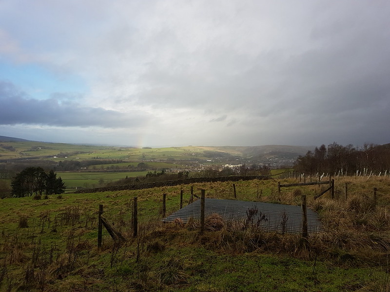
Rainbow over Settle. Glad I got that sheet of corrugated iron in the foreground!
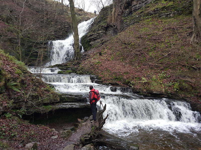
We met in Settle with a view to climb Warrendale Knotts. I suggested we divert slightly from our planned itinerary to take a look at Scaleber Force…
Scaleber Force.
I’d noticed that a small section of woodland here is access land, and that a right-of-way drops down to the bottom of the falls and then abruptly stops.
The EWO and Scaleber Force.
I think you’ll agree, it was worth a little out-and-back along a minor lane to see it. We found a likely spot, out of the wind, for an early lunch spot, thinking shelter might be at a premium later in the walk. Naturally, once we’d settled down, it began to rain. This seems to have been a recurring theme when we’ve met for walks of late.
Pendle Hill. Plus more corrugated iron.High Hill Lane – that’s High Hill straight ahead.
It brightened up and we had a lovely sunny spell back along High Hill Lane.
But it was soon grey and wet again. It was that sort of day.
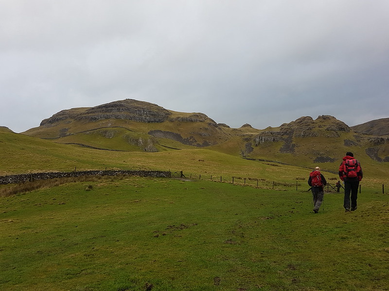
Warrendale Knotts.
The route we took up Warrendale Knotts proved to be ridiculously steep near the top, but it was well worth the effort…
Attermire Scar from Warrendale Knotts. The distant big hole in the middle of the picture is Victoria Cave.On Warrendale Knotts.
We spent quite some time on this modest top. It was very windy, but with the clouds scudding across the views were constantly changing and very dramatic.
Crepuscular Rays.Warrendale Knotts and Attermire Scar. Rye Loaf Hill on the right.Pen-y-ghentPen-y-ghent and one of the cairns on Warrendale Knotts. Is that Fountains Fell in the cloud on the right?Leaving the top.
Eventually, we had to move on. In fact, the Cheshire contingent had some pressing engagement and we chose to walk with them, initially at least, and so by-passed Victoria Cave.
Another view of Pen-y-ghent.
The weather deteriorated again, but the Adopted Yorkshire Woman assured us that she remembered a shelter, or possibly a cave, in the vicinity of Jubilee Cave, which would be kitted out with comfortable benches and provide a pleasant dry spot for another lunch stop. Sadly, it never materialised. Hard words may have been spoken about the vividness of the AYW’s imagination.
Jubilee Cave.
AT Jubilee Cave, the Cheshire crew left us to take a direct route back to Settle, whilst the remainder of our small party returned to Settle via Winskill and Langcliffe. That’s a very pleasant route, but I didn’t take any more photos, because the rain returned and this time it meant business. We did enjoy a brief dry spell and had a hurried stop in order to drain the dregs from our flasks, but by the time we reached the cars it was chucking it down. A small price to pay for a terrific walk though.
The day before this walk I uninstalled and reinstalled MapMyWalk. It worked, so here’s the resultant map. I think the numbers are kilometres, although the 4 and 6 seem a bit odd?Warrendale Knotts, not named on the OS 1:50,000 is the trig pillar with a psot height of 440m.
I’ve never climbed Warrendale Knotts before, and I still haven’t been up Rye Loaf Hill. Looking at the map of the Dales, it also occurs to me that I haven’t been up Great Shunner Fell or Buckden Pike or Fountains Fell since the mid-eighties. Which seems criminal given that they’re all relatively close to home. Aside from the Three Peaks area, the closest bit to home, I’ve been neglecting the Dales. I have a lot of exploring to do!