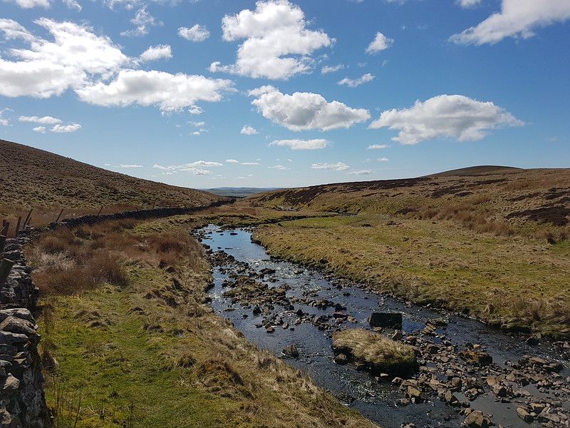
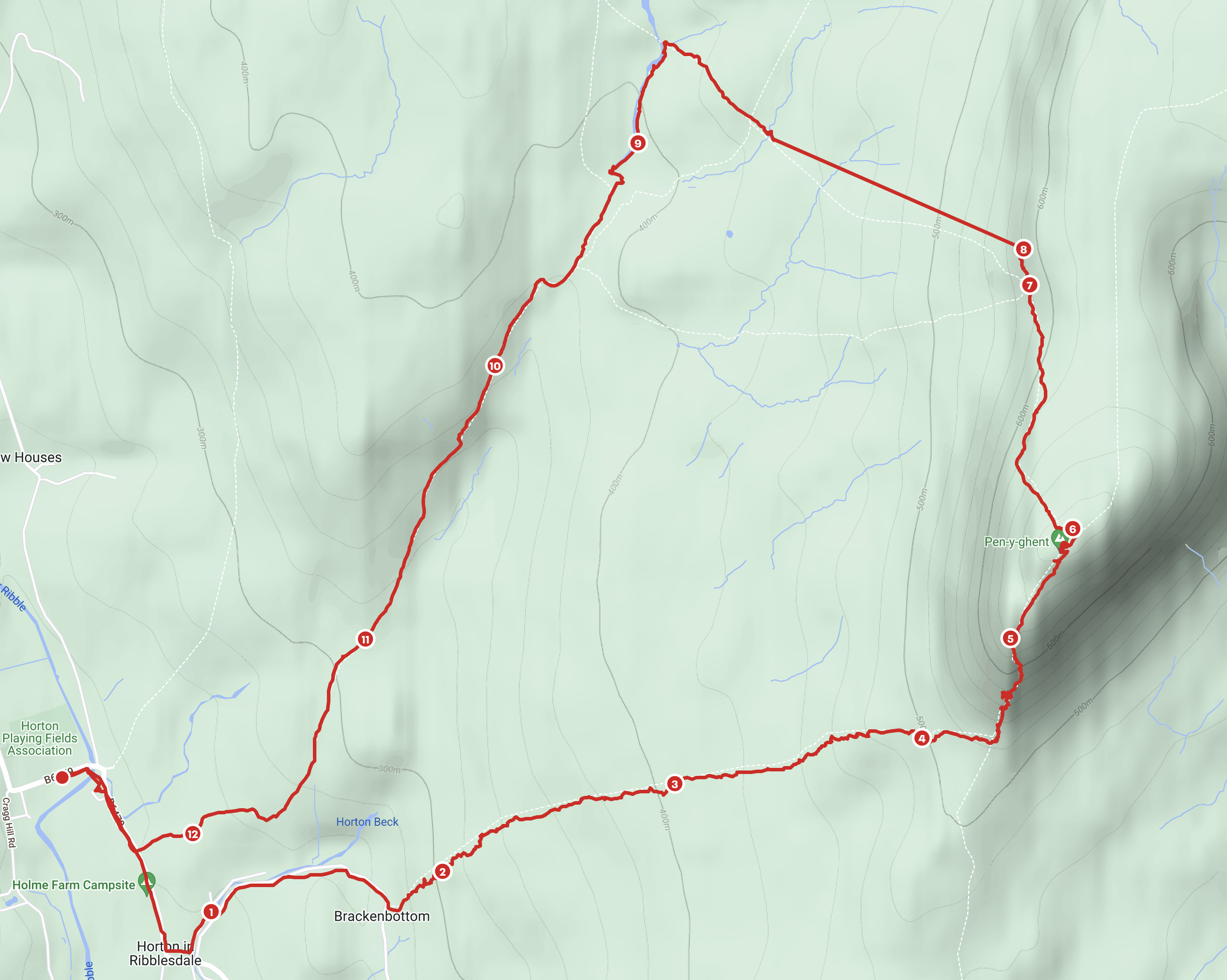
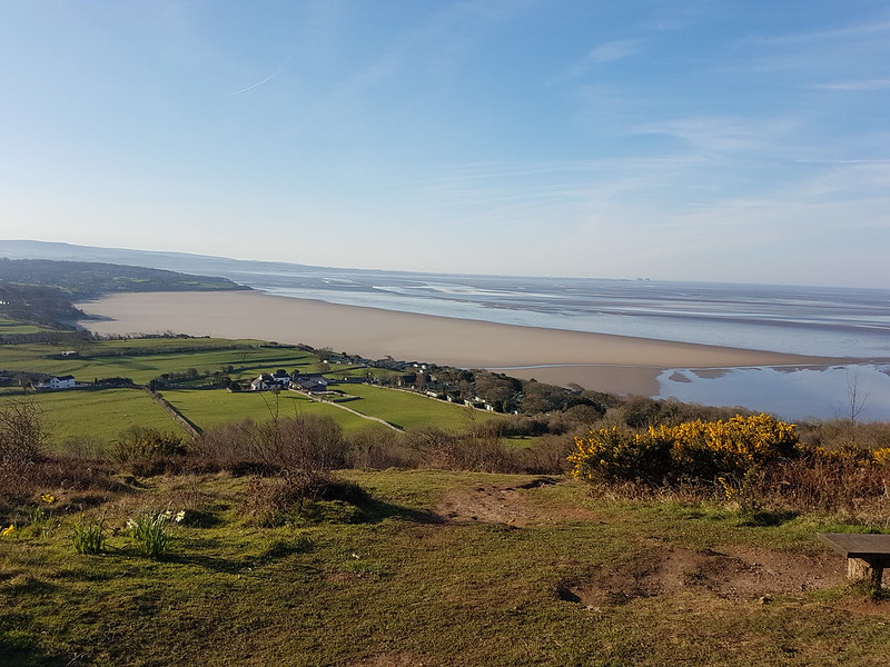
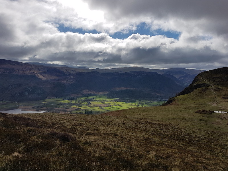
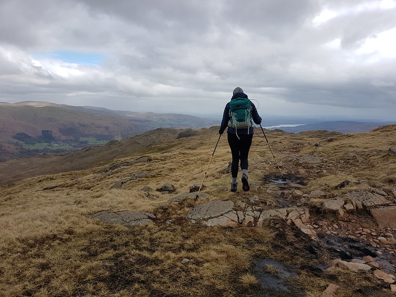
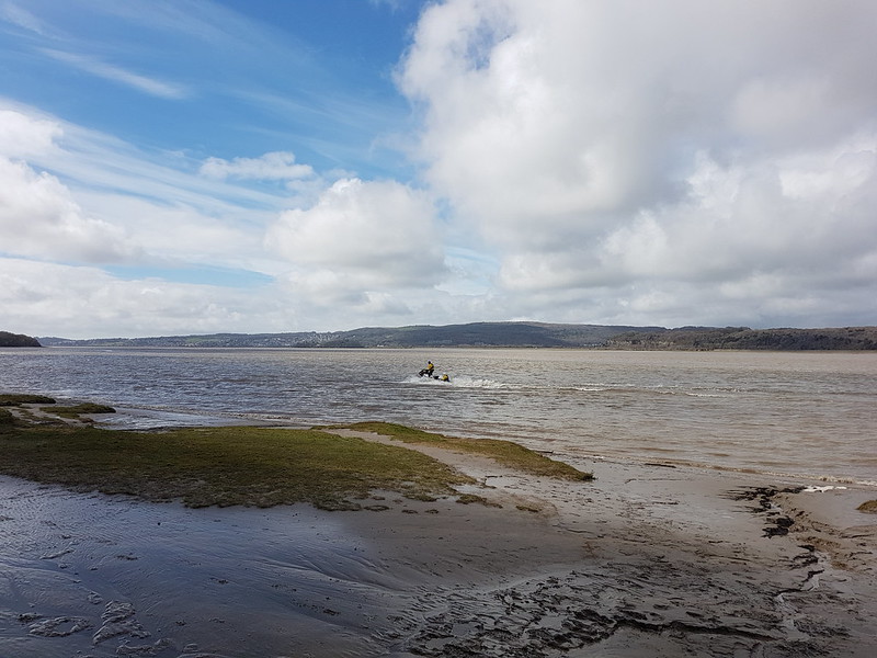
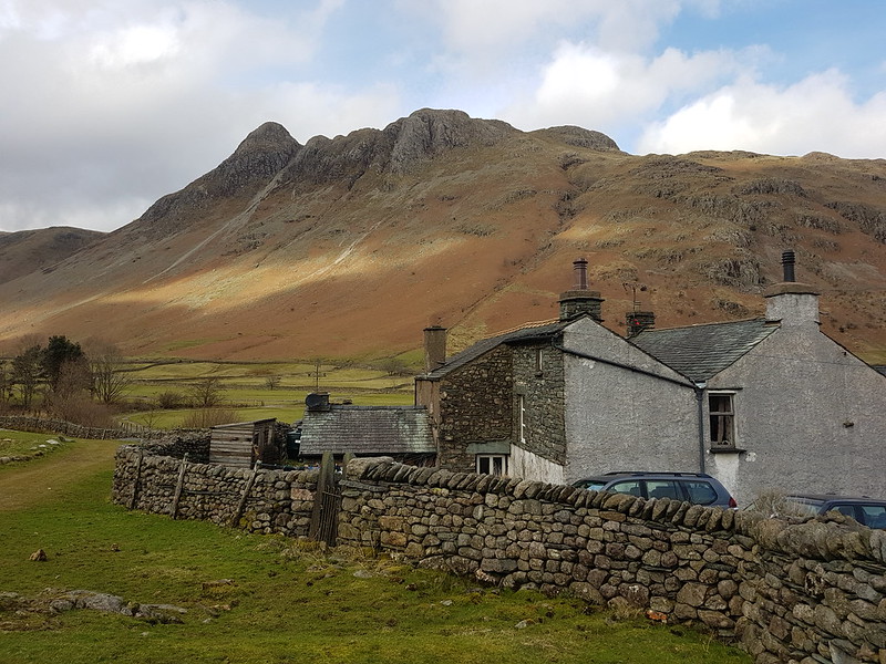
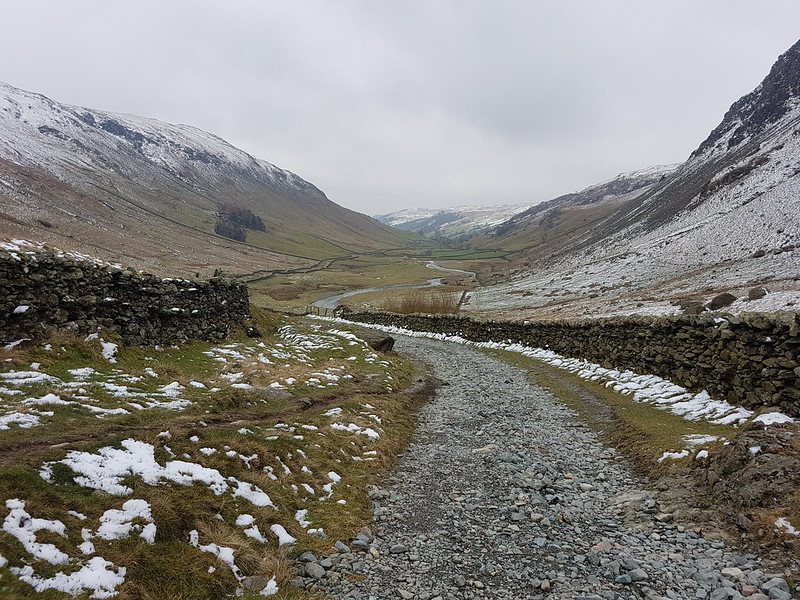
Silverdale Green – Clark’s Lot – Hollin’s Lane – Fleagarth Wood – Quaker’s Stang – Cragfoot – Crag Road – Occupation Road – Warton Crag – Occupation Road – Coach Road – Peter Lane – Summer House Hill – Leighton Hall – Grizedale Farm – Leighton Moss – Golf Course – The Row – Hagg Wood
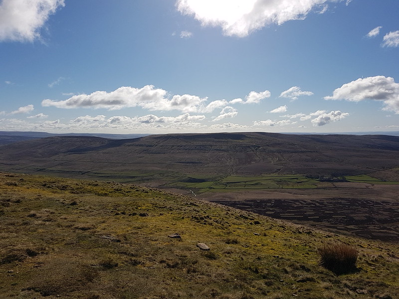
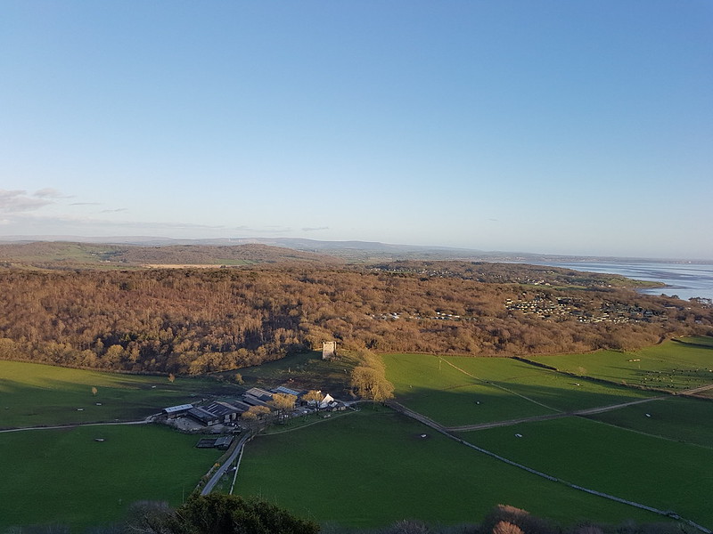
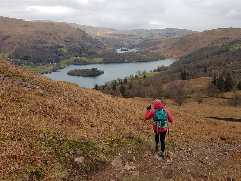
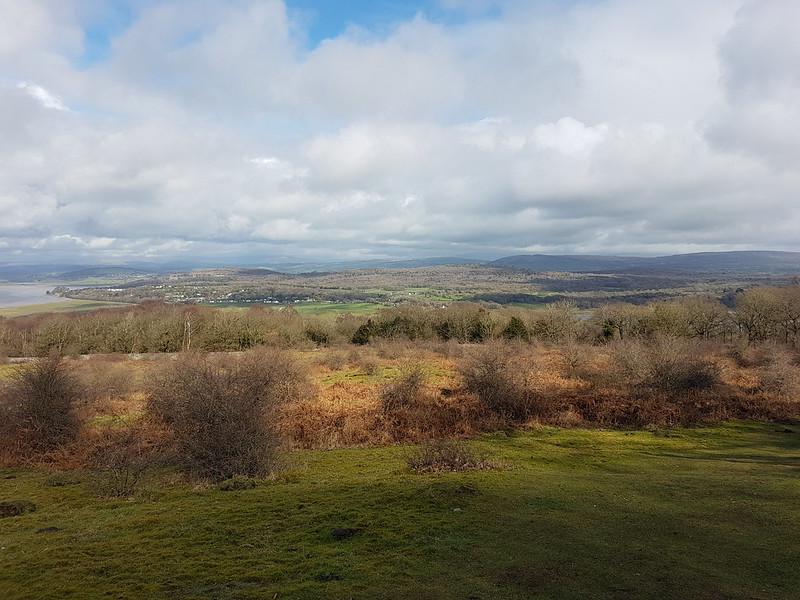
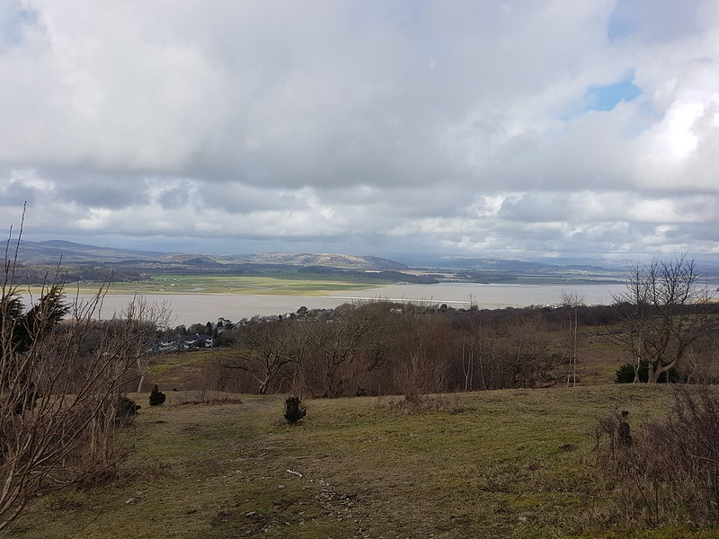
The view from Summer House Hill: Leighton Hall, Leighton Moss and Arnside Knott. Grange and the Coniston Fells in the distance.
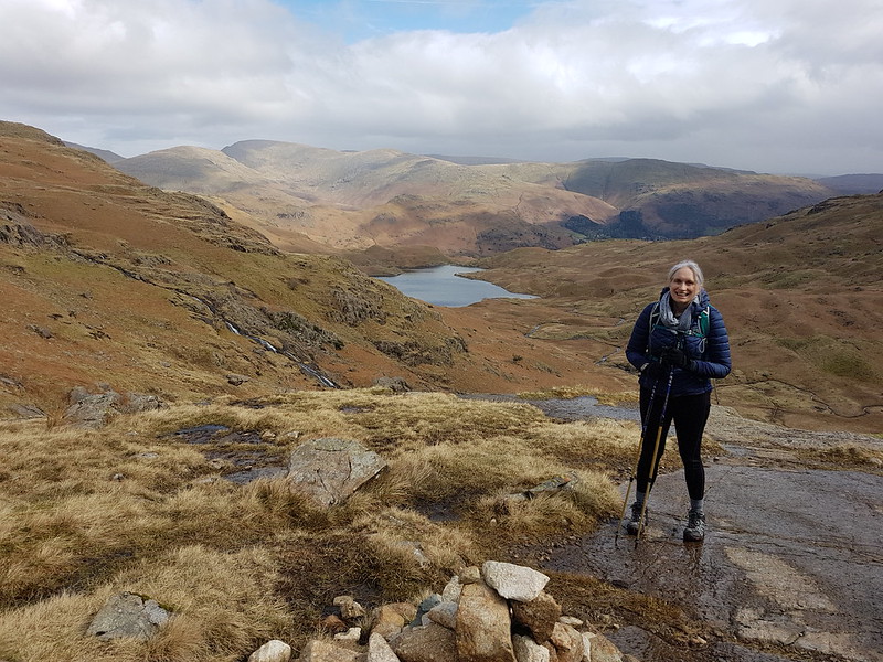
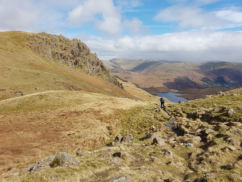
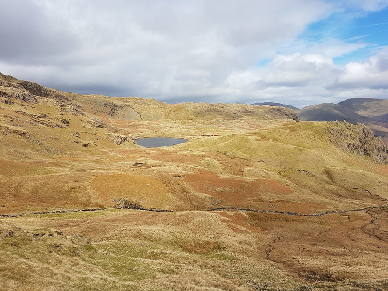
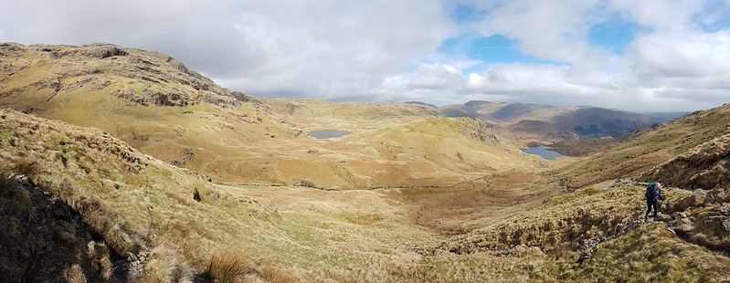
Another local training walk. Another glorious spring day. It was a cracking walk – and I have not much else to say about it.
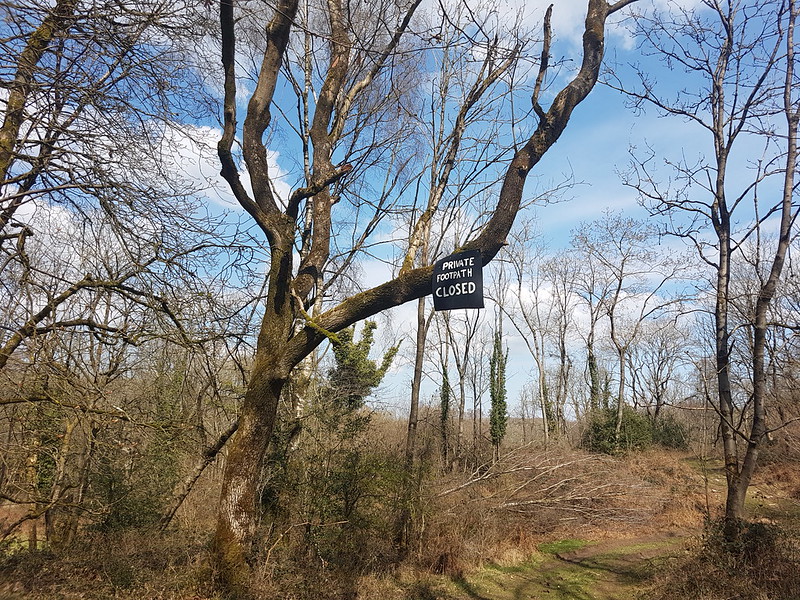
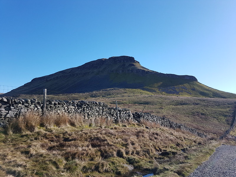
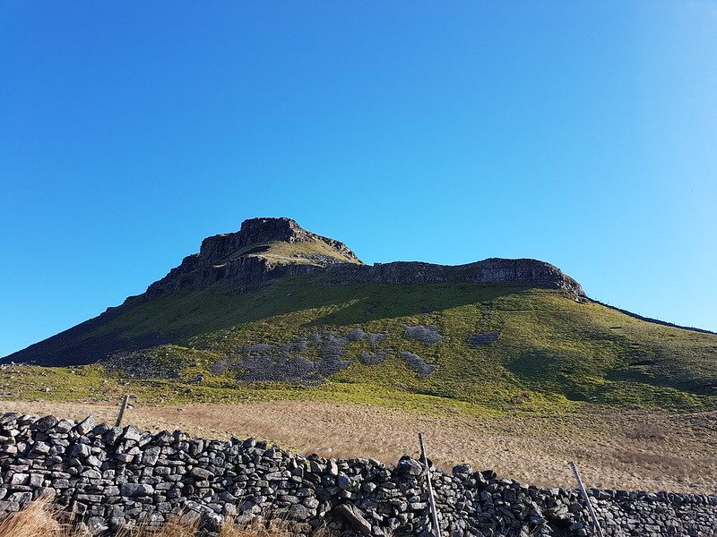
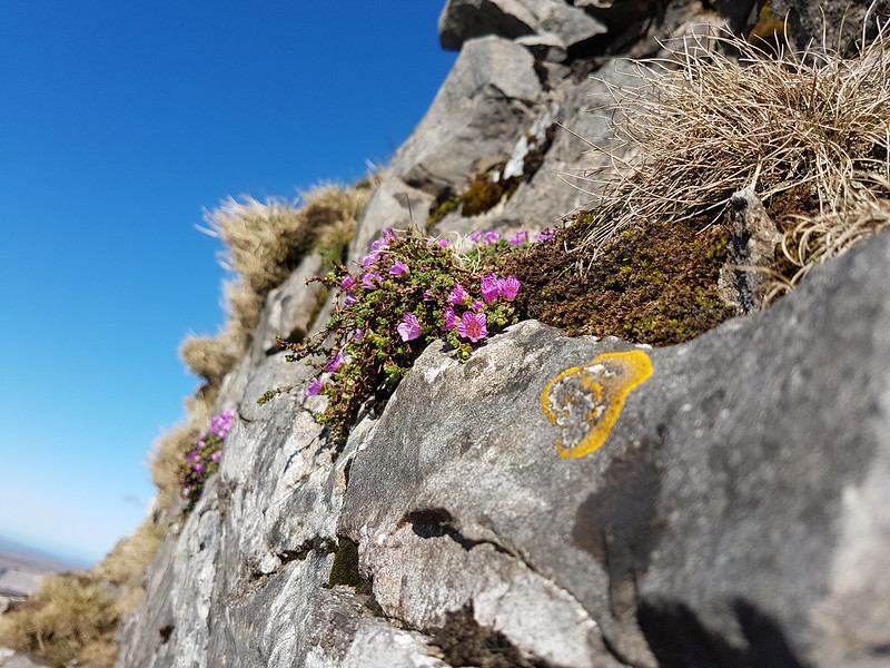
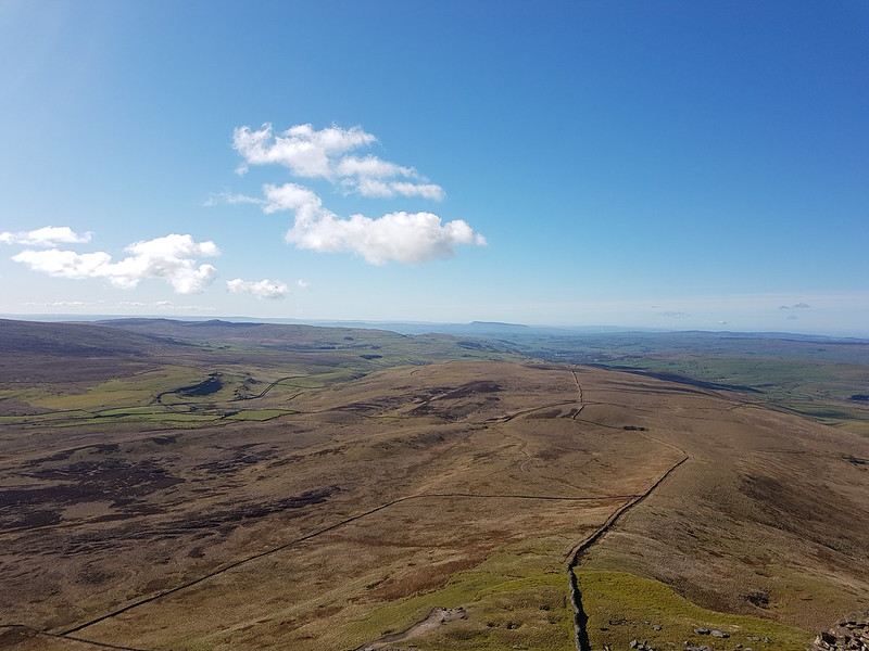
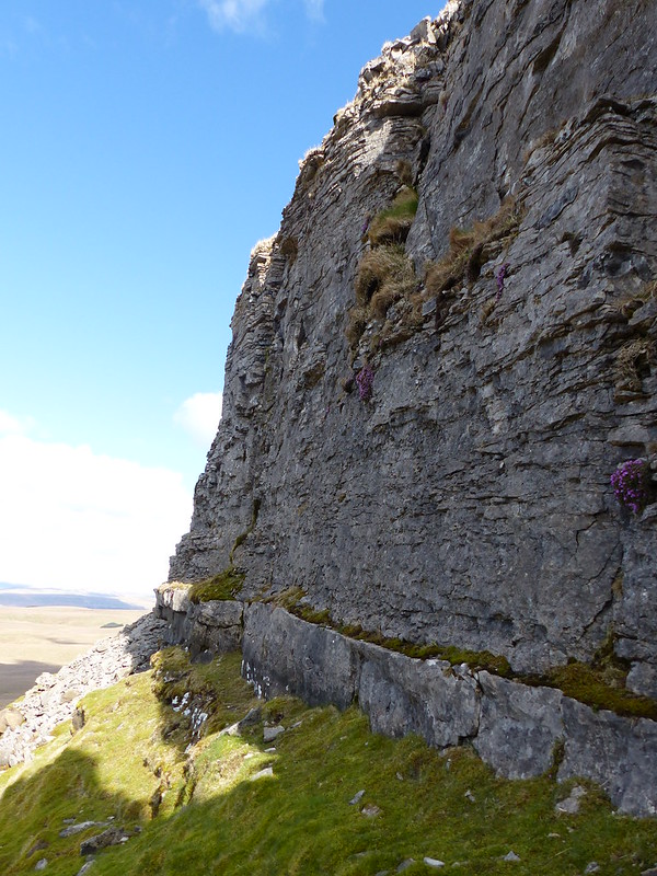
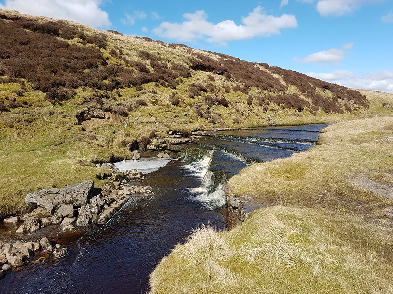
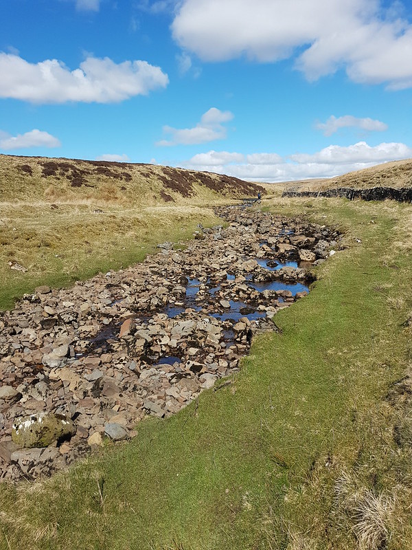
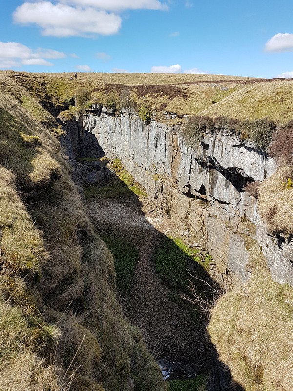
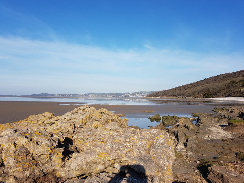
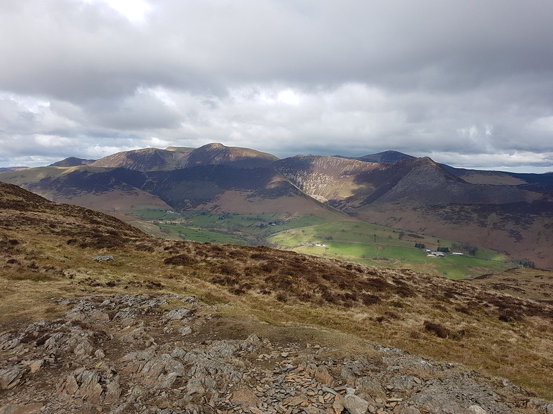
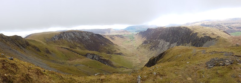
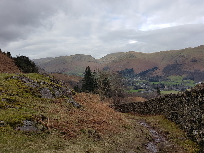
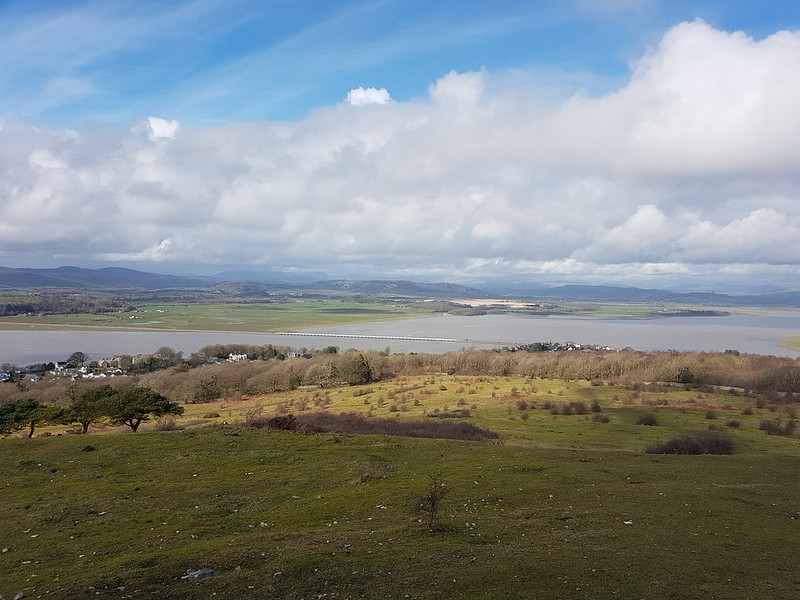
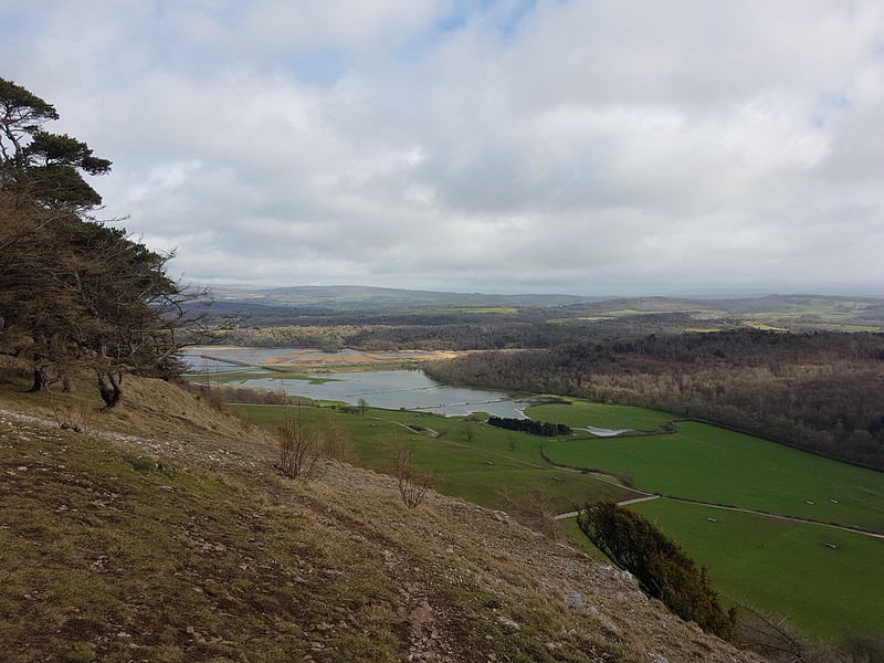
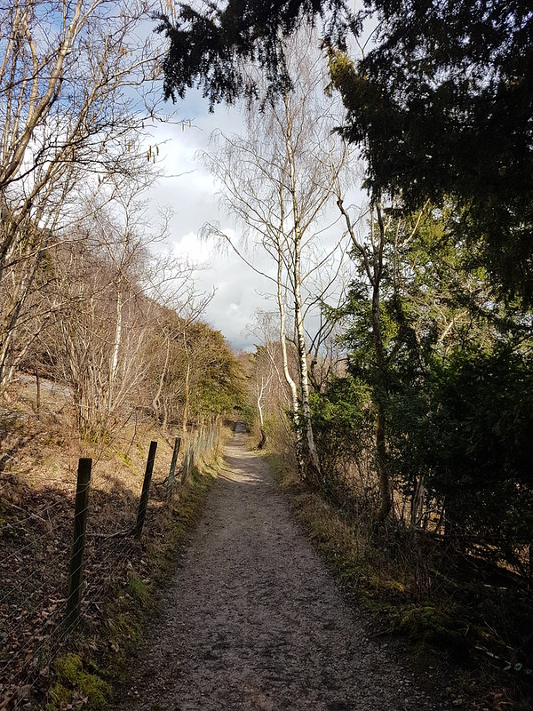
On Occupation Road.A large clear-felled area next to Occupation Road.Arnside Knott and Gummer How from our ascent route on Warton Crag.View North from near the summit of Warton Crag.Warton and the Forest of Bowland skyline.The hills above Kirkby Lonsdale and Ingleborough.South from Warton Crag pano.Easter Island miniatures on Warton Crag.Excellent permission path from which permission has been withdrawn.
This former path us to cut a corner between Occupation Road (a track) and Coach Road, out of Warton. It was a lovely route, and also gave access to The Three Brothers, some very large limestone boulders which the kids used to enjoy clambering about on. It’s very sad that we’re not allowed this way anymore.
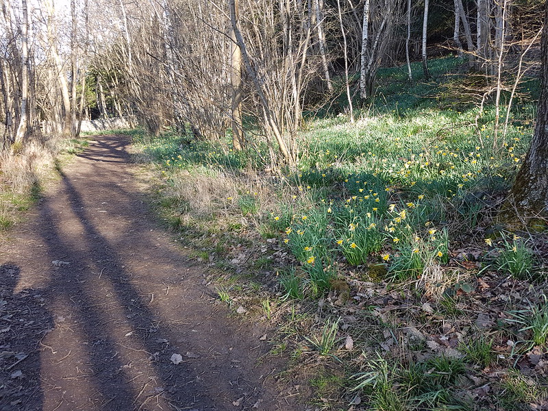
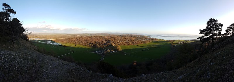
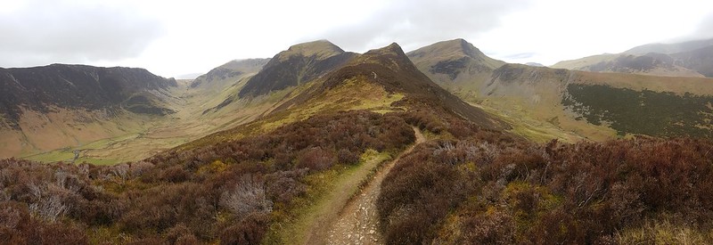
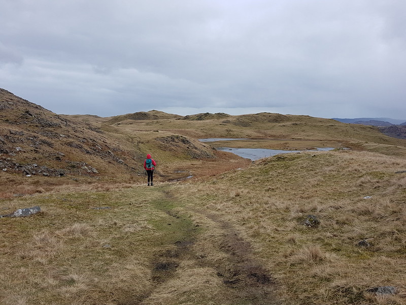
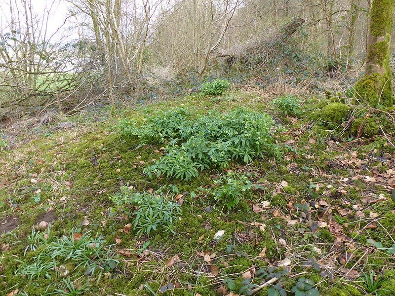
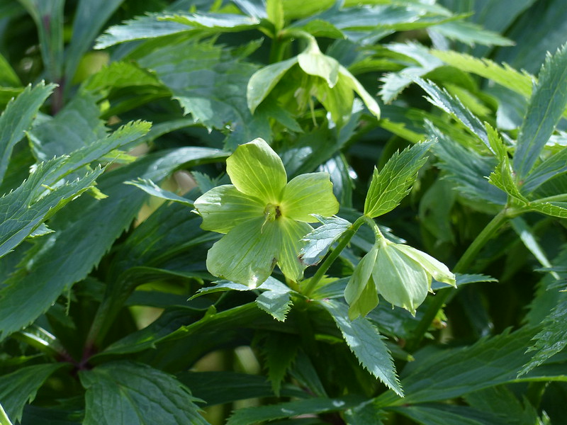
Back on Occupation Road – TBH shoves over an old beech tree. Probably.Anemones.Summer House Hill pano.
I stayed in Horton-in-Ribblesdale on the night of my nineteenth birthday, when I was walking the Pennine Way with my Dad. I say, ‘with my Dad’, and it’s true to say that it was only he and I that walked the whole thing together, but the day in question was a Saturday, and we were joined by my uncle Uwe, who had been with us since Edale, and a bus driver from Derby called Warwick, who had joined us at Crowden after spending several hours stuck in a peat bog on Bleaklow, and by my mum, my brother, several cousins, my aunt, and at least half of the village scout group. We were a big party.
After a day with a lot of rain, most of the group had decamped to the YHA at Stainforth, but my Dad and my uncle and I had the luxury of a B’n’B in Horton. The day picked up considerably: the evening meal was excellent, we had at least one bottle of wine with it, and then we watched ‘Blazing Saddles’ on the box in the fug of a very warm sitting room.
New Inn Bridge over the River Ribble, Horton in Ribblesdale. Late 18th Century.
It’s taken a long time for it to happen (multiply my age by three), but a visit to this neck of the woods on or around my birthday I think may now have become a habit.
Newly surfaced path from Brackenbottom.
I took the path up from Brackenbottom. I always seem to come this way. Maybe I need to branch out a little. Since my last visit, a lot of work has been done on the footpath here.
Pen-y-ghent.
I’d had an early start, but there were still plenty of people about. Somewhere in the vicinity of where I took the photo above, a weasel, or stoat, ran along the base of the drystone wall right in front of me. I wasn’t anything like fast enough to capture a picture before it disappeared from view.
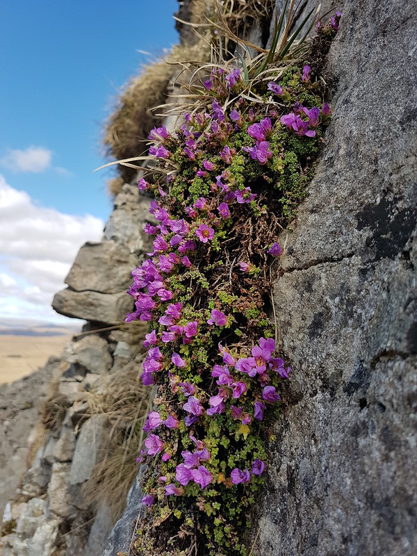
Recent visits have always been later in the day, and I hadn’t thought about that when I set out; I usually clamber about below those steep cliffs looking for Purple Saxifrage – which is what brings me here in early April. I didn’t want to lose the sunshine though, so contented myself with a couple of smallish clumps on the sun-washed crags just above the main path.
Purple Saxifrage.The long ridge up from Stainforth. Pendle Hill in the background.
One possibility for an alternative ascent route would be to follow this ridge from Stainforth.
The summit was quite busy. I plonked myself down in the lea of the wall, which was a very warm spot in the sunshine, put a brew on to stew…
Atkinson’s of Lancaster Blue Sky tea – grapefruit flavoured.
…and wondered about the hills across the valley. Knowing now that I was looking at Fountains Fell, I’m trying to think when I was last up there, and whether it could really be as long ago as 1985? Although I frequently climb each of the Three Peaks these days, I also completely neglect the rest of the Dales. Essentially, I’m spoiled for choice.
Fountains Fell and Malham Moor.
Incidentally, the valley which drains south between Pen-y-ghent and Fountains Fell is Silverdale, so for that reason alone, is very much overdue a visit from me.
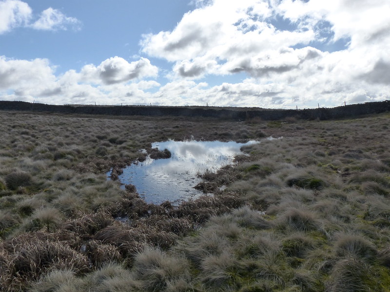
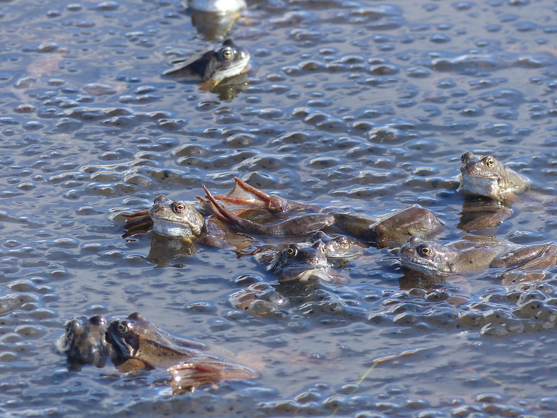
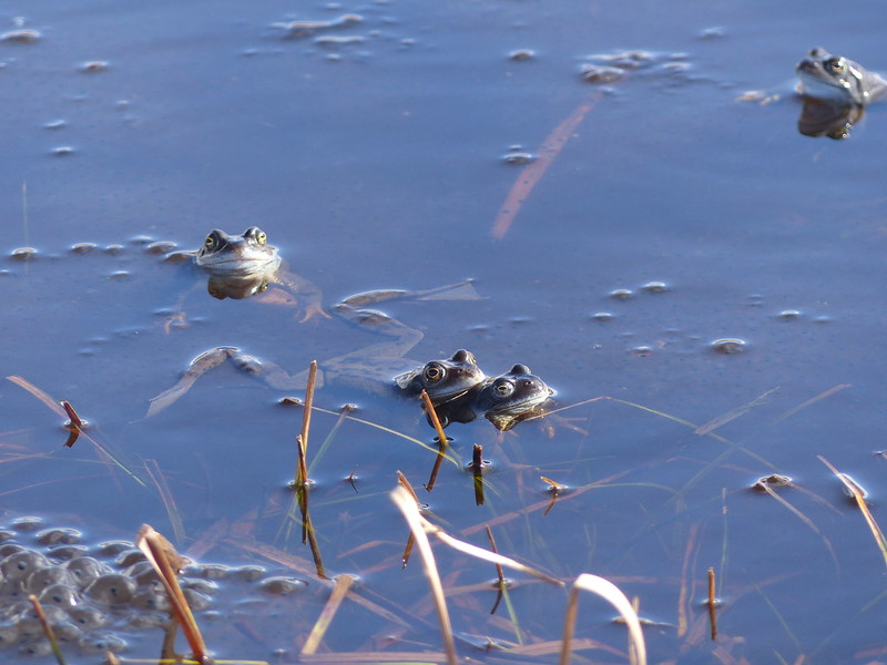
Just a few strides from the trig pillar on Pen-y-ghent, there’s a small pond or large puddle, too insignificant to appear on the OS map.
Frog puddle.
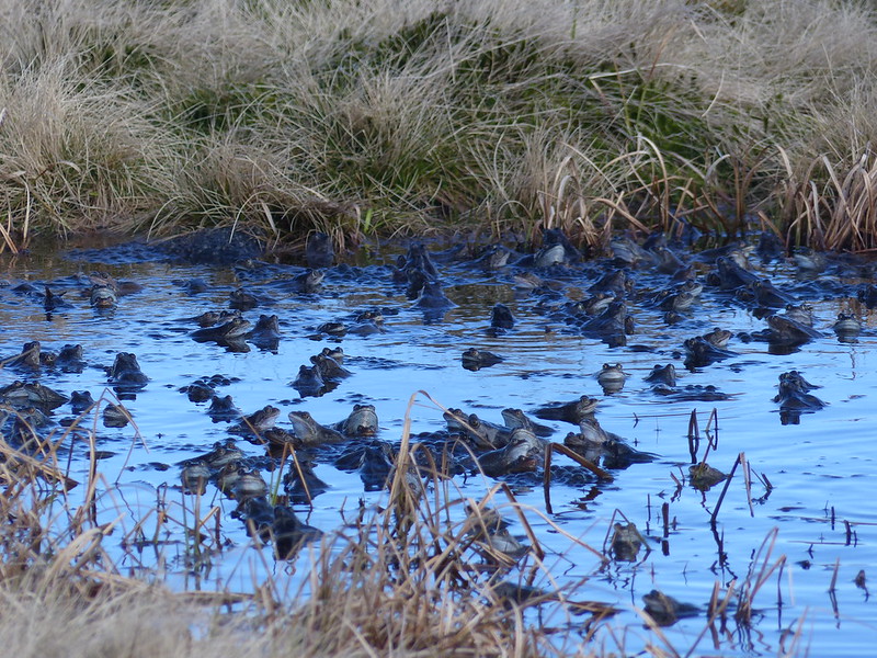
On a previous visit, in search of Purple Saxifrage, I also enjoyed an unexpected bonus encounter with hundreds of mating frogs in this miniature tarn. Even though I had been remembering that occasion, and how I had been surprised by the sound of the harmonised croaking of the frogs, I was duped in exactly the same way again: I heard the rhythmic drone and wondered whether there might be tractors out in the Ribble valley doing a very early silage cut, or if I might spot a distant rescue helicopter over Ingleborough.
Frogs!
This time however, I was very quick to realise my error. I took a few photos and then began to edge toward the pool. I was too hasty however and all of the frogs skedaddled. What’s more, the sun had temporarily nipped behind a cloud.
Frogs galore.
I moved away a little, found a slightly elevated tussock, which was a least a little drier than the surrounding ground and sat down to wait. Eventually, the frogs resurfaced, and so did the sun. This time, I was much more circumspect about approaching their gathering.
Mating in a sea of frogspawn.
I edged slowly towards them and took a multitude of photos.
A quieter part of the pond.
The main path was just a few yards away, but I was spellbound and oblivious of the hordes passing close by. Fortunately for me, other walkers all seemed to be completely incurious about what was occupying me. Possibly, it was British reserve?
One very orange frog.
The frogs were not so shy. What the photos don’t capture is the frenzied and incessant activity – the frogs were almost constantly on the move. Also, the pictures lack the fabulous repetitive sawing of their voices. I did take a couple of videos, but somehow, sadly, they seem to have got lost when I uploaded all the photos from my camera.
Is that too many frog photos now – I have a lot more!
I’m really not sure how long I sat there; it may have been as much as an hour.
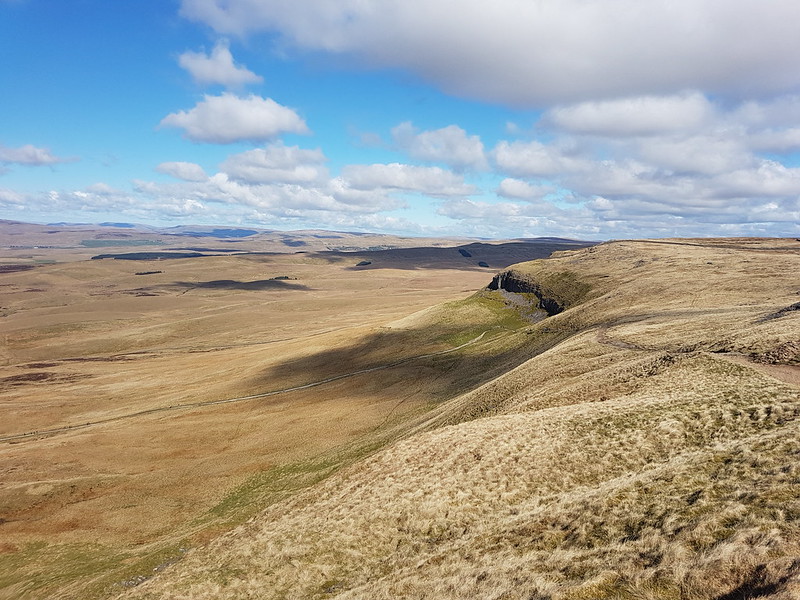
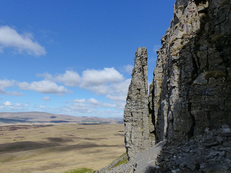
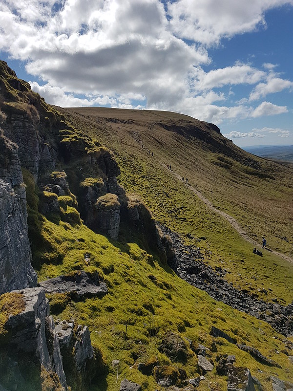
Ingleborough.Looking north along the western edge of Pen-y-ghent.Rock tower.And again.Steep limestone cliffs dotted with Purple Saxifrage.Looking up at the Saxifrage.Purple Saxifrage.
Where the main Pennine Way path turns sharply left and down towards Horton, I knew that there were cliffs where I could expect to find more saxifrage.
Looking south along the western edge of Pen-y-ghent.
I had another brew and then clambered about on the steep ground just below the cliffs, looking for specimens. Again, a lot of time was ‘wasted’, but I was very happy pottering about.
The busy Pennine Way path – heading up to the top.The busy Pennine Way path – heading down to Horton.
I hadn’t originally planned it this way, but since the main path looked so crowded, I kept straight on, following a much less obvious trod…
Faint path heading across Horton Moor.
Which I had completely to myself.
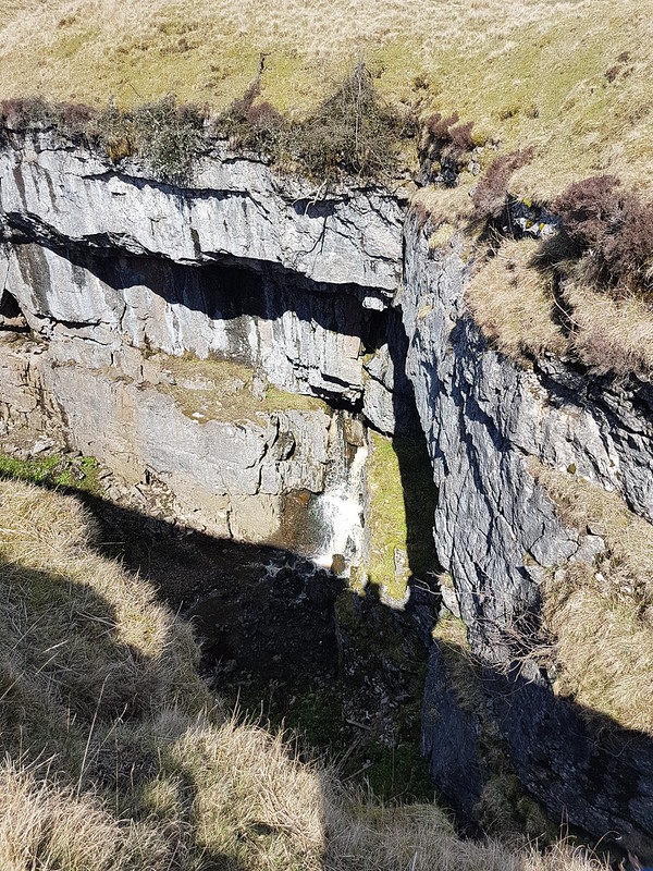
Horton Moor and Ingleborough.Looking back up to Pen-y-ghent.Hull Pot Beck.Hull Pot Beck.Small cascade in Hull Pot Beck.Hull Pot Beck – it’s dry downstream of this point.Hull Pot.There’s Hull Pot Beck emerging half way down.Pen-y-ghent.
I’d be happy to settle for frogs, saxifrage and lashings of sunshine for every birthday walk I think, although a slap-up-meal, a bottle of plonk and a Mel Brooks film to follow wouldn’t go amiss either.
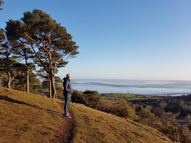
Two early April ascents of the Knott – without a walk around the coast to Arnside on either occasion. In between, I drove down to Lincoln and back to fetch my parents for a visit.
Coal Tit.
April is a great time for birding – the birds are busy and the trees still without leaves so it’s easy to see what they’re up to. I have other photos from this walk – blurred, and/or obscured by twigs – of Blue Tits, Great Tits and warblers, possibly Chiff-chaffs, although I know I’m guilty of assuming that all warblers are Chiff-chaffs.
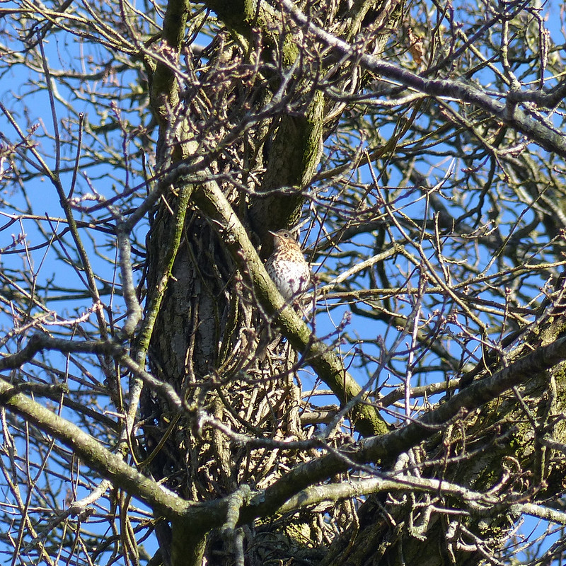
Song Thrush.Arnside Knott pano – click on the image to see a bigger zoomable version.Far Arnside and our ‘beach’.‘Wet oil on seat’ – I wonder who was so public spirited?
This is the second seat at the marvellous viewpoint on Heathwaite. This one is set in a little bower in the thicket of Gorse and so is also wonderfully sheltered. I’m sure there only used to be one bench here, but I can’t recall when this second one appeared. It was great to see that someone is looking after it. There are lots of benches dotted around the AONB and several seem to have been adopted, even, in some cases with plant pots and decoration provided. What a brilliant thing to do.
Far Arnside daffodils.Female Wheatear.
Wheatears are birds I associate with spring and summer walks in the hills, but they are migratory, and at the right times can be seen around our coast.
Park Point and Grange-over-Sands.Mum and Dad at The Quarterhouse.
The second day was my Birthday. They will keep coming around. We went for lunch at The Quarterhouse in Lancaster. B and I both had a platter of smoked meats and fish, which was very tasty, and everybody else’s meal looked good too. I’d go again.
TBH and Mum at The Quarterhouse.Pasteis de Nata
I even had a sweet, which is most unusual for me.
Warton Crag, Clougha Pike and Silverdale from Castlebarrow.
Long-suffering readers will now that I like to climb a hill on my Birthday. On this occasion, it was two hills, although just Castlebarrow in Eaves Wood and Arnside Knott again. I managed something a bit more ambitious the following day.
Arnside Tower.TBH on the Knott.Silverdale Moss and a distant Ingleborough.Arnside Tower, Middlebarrow, Warton Crag, Clougha Pike. Pano looking south from the Knott.The Howgills from the Knott.River Kent and Lakeland Fells from the Knott.
Another Sunday, another training walk. We decided to make this one a local wander. I think TBH had requested something quite lengthy, which I had dually planned, but then forestalled that plan by heading out for an early run, so that we eventually cut our walk a little shorter to compensate.
Anyway – we walked around the coast to Arnside, but then not back over the Knott (shock, horror), but rather continued along the river to Storth and back via Hazelslack, Leighton Beck Bridge and Hawes Water. In all, 11¾ miles, according to MapMyWalk at least.
Blue skies over the River Kent.
You can probably tell from the first photo, with TBH in several layers and gloves, that with the day starting overcast, it wasn’t particularly warm, but as we walked around the coast a few patches of blue began to appear and eventually it turned into a warm and sunny day, so that we were both a bit over-dressed.
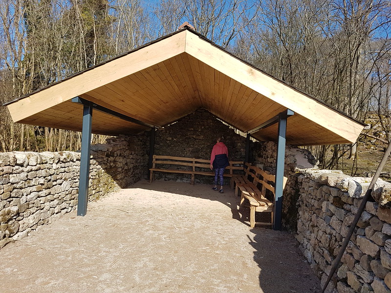
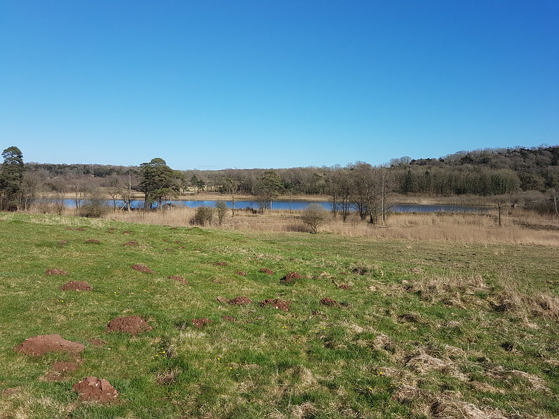
River Kent salt-marshes pano.Whitbarrow Scar across the Kent.Stile surrounded by ‘clart’ between Hazelslack and Leighton Beck Bridge.Leighton Beck Bridge from Leighton Beck.Beetham Fell.New shelter at Gait Barrows.
There’s a smart new structure in the National Nature Reserve at Gait Barrows – I’m not sure what the intended uses will be. I can see myself maybe pausing here for a cup of tea from time to time.
The view from inside the shelter.Hawes Water.
By the end of our walk, all the clouds had gone; quite a contrast with the earlier. So, typically British predictably unpredictable weather!
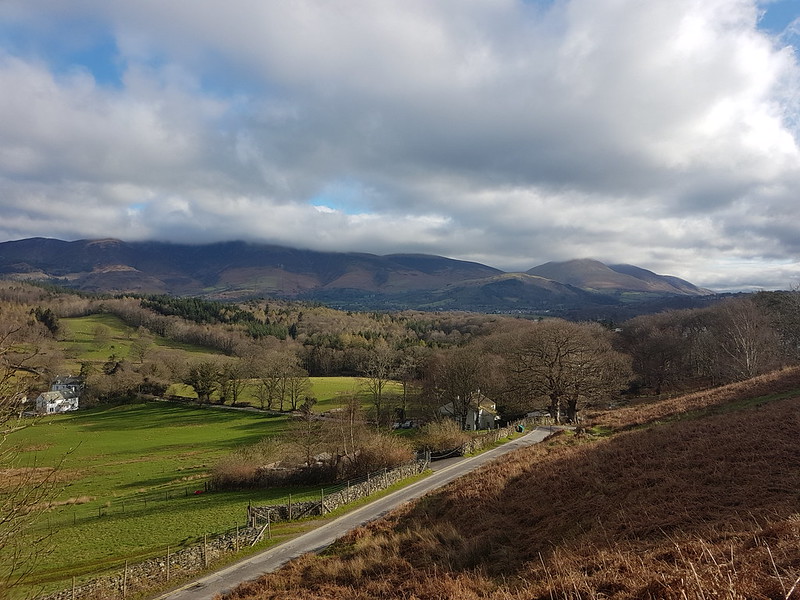
Skiddaw and Blencathra clothed in clouds. Latrigg sensibly sitting beneath them.
April Fools’ Day – the start of our Easter Holidays. The kids all had exams coming up (they’ve finished now of course), so we had no plans to go anywhere, but luckily for us, there’s plenty of nice places not too far from home.
From Skellgill Bank – Swinside, Skiddaw, Blencathra and Derwentwater.
The forecast let me down a bit – low cloud was predicted, but it was supposed to lift and clear; which it did briefly, although I don’t think Skiddaw ever fully emerged, and then the cloud swept back in again and there were some lengthy showers later in the day. Not to worry – I had a good day anyway.
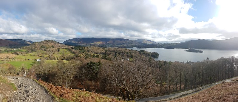
I started on Cat Bells, with fabulous views both across Derwentwater and into the North-Western Fells.
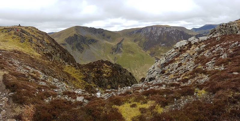
Rowling End, Causey Pike and Barrow.Looking ahead to Cat Bells, Maiden Moor, Hindscarth and Robinson.The North-Western Fells.Looking down into Borrowdale.
Dropping off Cat Bells brought some welcome shelter from the cold, northerly wind and I stopped just short of the hause for a first hot drink from my flask, to enjoy the view down into Borrowdale and, if I remember right, to chat to my mum and dad about my plans to fetch them, a couple of days later, for a visit.
Bassenthwaite, Cat Bells, Skiddaw, Derwentwater and Blencathra.The North-Western Fells again.Dale Head and Hindscarth from close to the summit of High Spy.Dale Head – weather deteriorating.
I found another spot out of the wind as I descended towards Dalehead Tarn. The weather was clearly deteriorating at this point, and it was obvious that it would be raining soon. In fact, it started not long after I’d stopped for another drink and some lunch; but actually, hunkered down amongst some rocks, I was pretty comfortable despite the rain.
Classic Dale Head view down to the Newlands Valley.
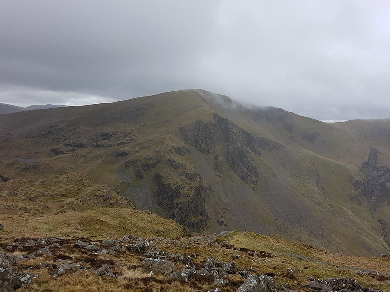
Cloud was swirling around Dale Head as I reached the summit and I was pretty lucky that I could still see the tremendous view down to the Newlands Valley. I think this is the fifth time that an ascent of Dale Head as featured on my blog. I remember climbing here from the old Youth Hostel at Honister Pass in September 1985 – although that may not have been my first ascent. There were many other visits between that one and the five that I’ve written about here. Although I’m extremely fond of Dale Head, I’ve never consciously decided to make it one of my most climbed hills in the Lakes – it just seems to have turned out that way. In the meantime, it’s many years since I’ve been up, for example, Great Gable or Kirk Fell.
High Crag, High Stile, Red Pike and Buttermere.
I’d originally planned to include both Hindscarth and Robinson in this round, but the cloud had rapidly dropped and with no view from Hindscarth, and plans for the evening which didn’t really leave me enough time anyway, I decided to leave Robinson for another time. (The reascent onto Robinson might just have been a factor too!)
The long ridge off Hindscarth, Robinson on the right.
That decision also had the happy consequence that I got to descend the long ridge from Hindscarth over High Crags and Scope End which is a lovely route.
Newlands Beck.
With five Wainwright’s checked-off – Cat Bells, Maiden Moor, High Spy, Dale Head and Hindscarth – I passed into triple figures of hills coloured in, since Christmas 2022, on my ‘new’ Wainwright map. After my raging full-on approach last year, I’ve adopted a more relaxed attitude so far this year. Much as I enjoyed some of those big days, I did begin to wonder if it wasn’t more sensible to ration the hills a bit. Also, I was beginning to miss my regular visits to local hills outside the Lakes and particularly the varied delights of my Lune Catchment outings. To be honest, I’m also a little put off by the longer drives needed to clear-up some of the more remote areas which I’ve so far neglected.
Dramatic light on Keskadale.
The views from the path across the fields from Little Town back to where I was parked near Skelgill were terrific; a reminder, if it was needed, of how superb a low-level walk in the Lakes can be.
A smidgen under 11 miles and around 3000 feet of up and down, according to MapMyWalk.
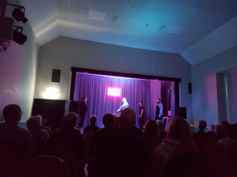
Happy Place
Later, we were at the Arnside Educational Institute for a performance of ‘Happy Place’ by Forget About The Dog theatre company. (Sorry about the rotten photo!) It was superb. I shan’t attempt to precis the story, but it’s a sci-fi, comedy, musical about fantasies and friendships, was highly inventive, brilliantly performed and very, very funny. My in-laws saw it, in Hamsterley Village Hall I think, the night before, and they loved it too.
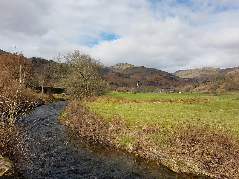
The last Sunday in March. TBH wanted another training walk, but this time of only eight miles. I thought we could kill two birds with one stone and mop up Blea Rigg which, during my Wainwright bagging frenzy last year, I managed to omit.
Sourmilk Gill, Tarn Crag and Gibson Knott.
It was a bit of a mixed day, with a cold wind and, later in the day particularly, some drizzly rain, but with occasional sunshine and even one or two quite warm spells.
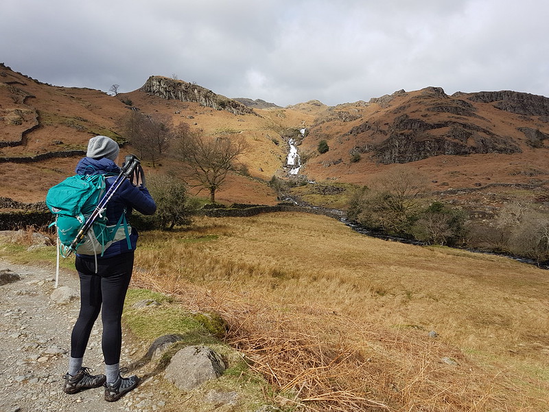
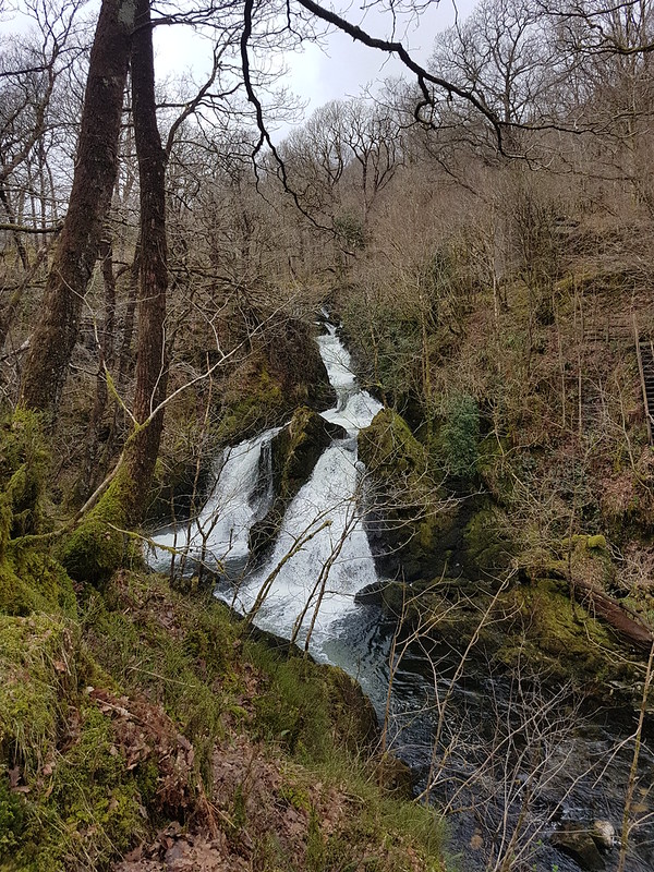
TBH photographing waterfalls on Sourmilk Gill.
It’s familiar territory this, being relatively accessible from home, but a great area, so always worth another visit.
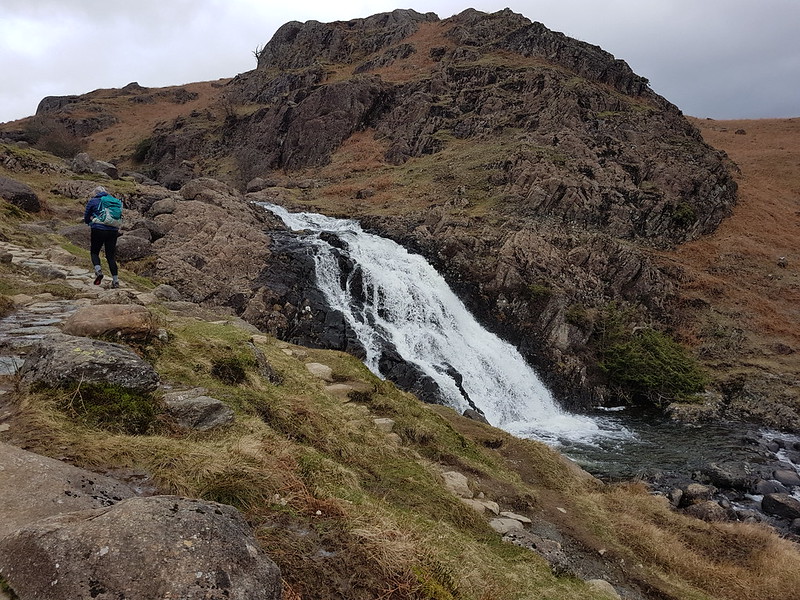
At the top of the falls.Easedale Tarn and Tarn Crag.
TBH hates to wait for her lunch, feeling that it should always arrive on the dot of midday. By the time we reached Easedale Tarn we’d been on the look-out for a likely-looking spot for some time and she was, apparently, approaching starvation. Fortunately, the slight descent here towards the tarn took us out of the wind and gave us just the shelter we needed for a comfortable refueling stop.
Easedale Tarn pano.Easedale Gill and Belles Knott.Looking back to Easedale Tarn, Seat Sandal, Fairfield, Great Rigg and Stone Arthur. Belles Knott and Easedale Gill again.Looking back again – the stream which flows from Codale Tarn looks worthy of investigation.TBH on the slabs above a surprisingly awkward scrambly section of path.Looking back again – Belles Knott, on the left, not quite as dramatic from this direction.
This was the sunniest and warmest part of the day, and very pleasant indeed.
Codale Tarn – a great spot for a swim, but maybe not in March.
Looking at these photos, and at the map, this area has many great places for a dip. I find myself wondering how many I could string together in a single route. The thing is, I’ve tried this a few times before, and the answer is always: less than I think. I probably need to learn to just enjoy a swim or two and accept that, in this regard at least, less is more.
Codale and Easedale Tarns pano.On the Blea Rigg ridge.Harrison Stickle, Pavey Ark and Stickle Tarn – in the first of many showers.Frogspawn.The tarns near Lang How – raining again.Grasmere, Rydal Water, Loughrigg and Windermere from Silver How.A steep descent towards Grasmere and Rydal Water.Descending back to Grasmere.
In the event, the route was a little over nine miles.
Oh, and, spoiler alert, TBH did her Mighty Hike on Saturday. It went well and she enjoyed herself. I shan’t take all of the credit, but no doubt my carefully planned training routes were key to her success! B has subsequently suggested that we should all take part next year. One to ponder.
What’s this, some grass, some mud and a large foot in a scruffy none-too-clean shoe? Not my most artistic composition, I’ll admit, but I should also add that this is arguably the most exciting photo in this lengthy post, in as much as, it’s unique; I’m sure I haven’t ever shared another picture quite like this one, which can’t be said for any of the many images which follow. You have been warned!
The outsize trotter is mine and is there for scale. On this particular Saturday morning in late March, before I set-off for my walk – around the coast to Arnside and back over the Knott, for the umpteenth time, you’ll be completely unsurprised to hear – before I set-off, I traipsed down to the bottom of our back garden, probably to dump some vegetable peel and the like in the compost bin. In the lawn, I discovered five large bald patches, with some indistinct paw prints in them and some pretty impressive claw-marks. I know that there were five, because I took photos of them all – of course I did. In addition, there were a number of small holes, with swirls of grass and moss around them, as if they had been made by a twisting motion. I have a couple of books on animal tracks and signs, and between them and a bit of lazy internet research it seems that the most likely culprits are badgers. The small holes are made by them sticking their snouts into the ground in search of their favourite food: earthworms.
They came back and did it again a few nights later, but, sadly, I’ve never seen them and they don’t seem to have been back since. TBH is not quite as devastated as I am, by the fact that our lawn is not being ripped up on a regular basis. She’s already fed-up with the Roe Deer consuming many flowers, particularly, but not exclusively, tulips, and would like to erect a tall mesh fence with a roll of barbed wire along the top and probably towers manned by sharpshooters.
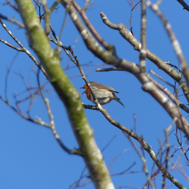
Robin.
And so, leaving our garden; around the coast to Arnside and over the Knott, episode three hundred and fifty-seven (or thereabouts). Other local walks are available, obviously, but I seem to be in the grip of a monomania and, recently at least, only a walk to Arnside and back will do me.
Hazel Catkins.
At least spring was well and truly underway and so there were new things to see relative to other walks this way from earlier in the year.
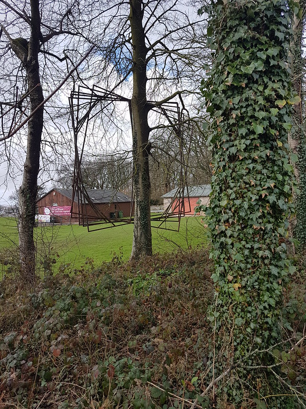
Sculpture?
I’m assuming that these large metal squares serve some purpose at the cricket ground and weren’t just hung in the tree as a piece of modern art, although I think they pass muster as an example of the latter. I really ought to ask Little S what he thinks!
Louring skies over Arnside Knott.
Rather than walking across the fields towards Far Arnside, as I usually do, I took the road by the shore, hoping to walk on the sand from the little cove known locally as ‘the dip’. However, when I reached the dip, the sand was wet and and not at all firm and so not a very enticing prospect, and I stuck with the road.
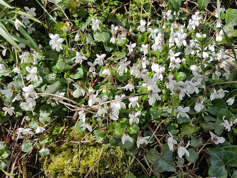
A display of white violets on the verge.
I’m glad that I did, otherwise I might have missed a superb display of white Violets on the verge which stretched out over several yards. It was a gloomy morning, but the sun came out just at that moment, just as I was photographing the violets.
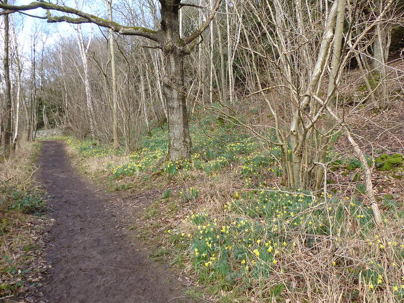
Far Arnside Daffs.
If the violets were a somewhat unexpected bonus, the daffodils in the woods at Far Arnside were totally anticipated and half the reason I had been drawn this way. And when the daffs are on display, I also know that I will find Green Hellebores flowering too…
Green Hellebore among the daffs.Green Hellebore.Around the coast again!Gorse flowering.Hampsfell and Grange-over-Sands.The Kent Estuary.
Not only do I love the view that is revealed when I turn a slight corner here into the Kent Estuary, I also like to drop down on to the sands here, where there’s a handy ramp down across the small limestone cliffs…
The slabs which lead down to the ‘beach’.
I hadn’t been doing that of late, because the beach had always been very wet and muddy, and often slightly submerged. It was no different on this occasion, everything was under an inch of water or more, but for some reason I abandoned caution and decided to head down anyway.
Lichened rocks.Seaweed – Spiral Wrack, I think.
Looking back towards Grange, it looked distinctly like it was raining over there. I thought: “Oh look, it’s raining in Grange”. I didn’t make the obvious inference: “Oh dear, it’s about to rain on me”.
Which of course, it did. Quite heavily, but fortunately not for too long.
A heavy shower.
It was quite odd to be walking in an inch or two of water whilst it was also pelting down.
Seaweed – possibly Bladder Wrack, or a mixture of Bladder Wrack and Spiral Wrack?
Jumping forward to the here and now, June, where we are possibly going to get our first rain in weeks today: I went to a talk about plants this week which was organised by the local Horticultural Society. It was a fascinating presentation, and one of the things I took away from it was the fact that seaweeds are not regarded as plants, but rather as multicellular algae.
A muddy path and a faint rainbow over Whitbarrow Scar.River Kent, light catching a corner of Whitbarrow, and the viaduct. Coastguards training.
By the Coastguard Station on the outskirts of Arnside, some of the coastguard officers were busy training. With hindsight, how I knew that’s who they were, and that they weren’t just thrill-seekers having fun, I can’t remember. It did look like fun, although maybe a little bit on the chilly side.
Haverbrack, Beetham Fell, Farleton Fell.
The views from the Knott were rather limited, since many of the Lakeland Fells were smothered by clouds. Still worth the climb however.
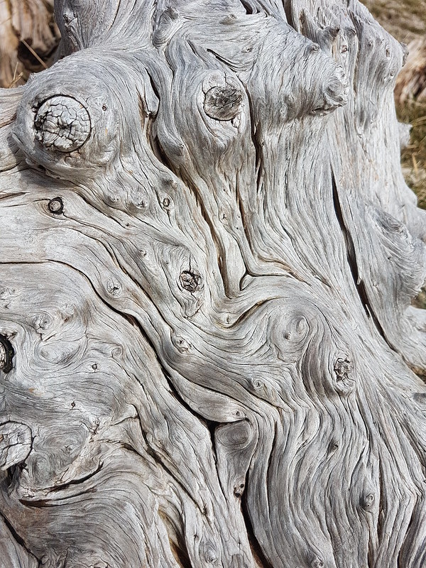
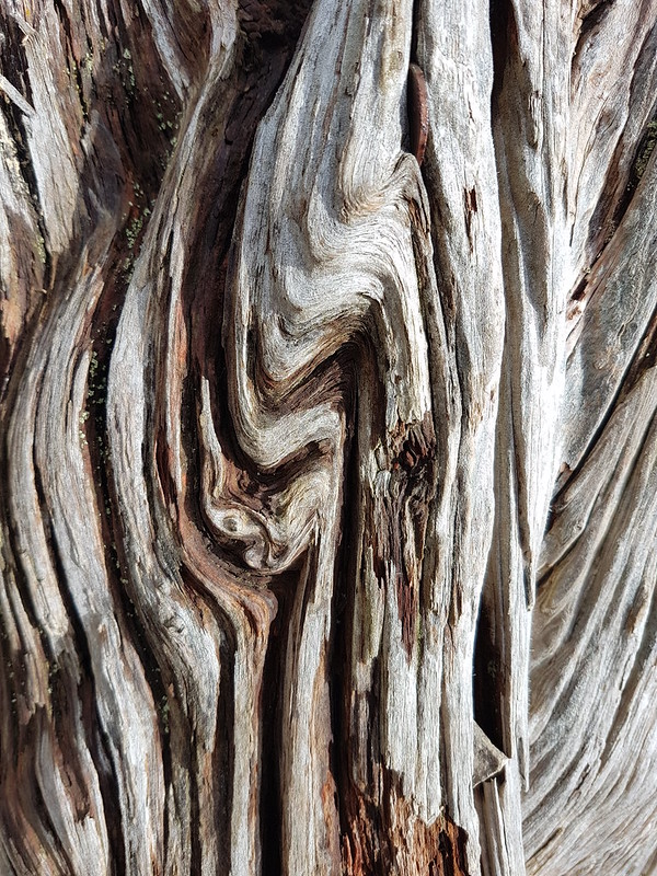
River Kent and Gummer How from the Knott.River Kent pano.Gummer How, Whitbarrow Scar, Foulshaw Moss, Scout Scar, River Kent.Silverdale Moss and Hutton Roof beyond.Morecambe Bay.Whitbarrow Scar again.Knotty tree trunk.
I walk past these couple of old, gnarly tree-stumps almost every time I climb the Knott; what possessed me to take lots of photos of their whorled and fissured surfaces on this occasion rather than any other, I couldn’t say.
Fissured tree trunk.Saul’s Road.Arnside Tower Farm and Middlebarrow Wood.
There are Hellebores to be found along the edge of Middlebarrow Wood – to the right they are scattered along the perimeter of Holgates Caravan Park, to the left there’s a single spot where a large clump and several smaller outlying clumps always appear. I chose to head to the left.
Silverdale Moss and Beetham Fell.Green Hellebore – a sizeable patch.
Every spring, I worry that this little clearing, just by the footpath, will have been swamped by the brambles which seem to dominate everywhere else. So far, my fears have been misfounded.
Lots of flowers this year.Rather shy and retiring blooms.Perhaps, a bit nondescript – but I like them.
I’ve limited myself to a handful of the host of photos I took. The flowers are green and rather nondescript, and I’ve posted inumerable photos of them over the years, since I first stumbled upon them flowering, but I like them and I’m afraid I shan’t tire of them anytime soon.
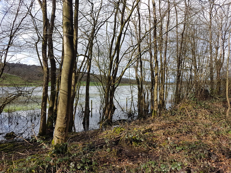
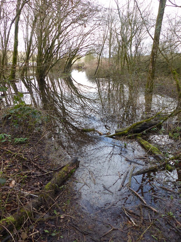
Flooded fields by Middlebarrow Wood.The path along Black Dyke to Arnside – waders required.
Rather astonishingly, I was able to walk this path shortly after this photo was taken, without getting my feet wet. At the time, however, it was very flooded.
Willow catkins.Quince flowerbuds.…and flowering.
The thicket of Quince at the corner of Elmslack and Cove Road wasn’t really flowering in earnest yet, which given that one year it burst into flower at New Year, seemed quite late. The Quince bushes here, and the hedge opposite are one of the many places around the village, including our own garden, where you can reliably hear the incessant chatter of Sparrows pretty much all year round. Despite being called House Sparrows, they are definitely fond of a nice dense hedgerow. Ours nest under our eaves, but seem to spend much of the day hidden in our Beech hedge, chattering away.
Next weekend, TBH will be taking part in a charity walk. Back in March, when she signed up for it with colleagues from work, she was a bit vague about the details; she could tell me the date, but not the charity, or the route, or the length, or the amount of climbing. It transpires that it’s a marathon: 26 miles around Ullswater, with about 900m of ascent and it’s for MacMillan.
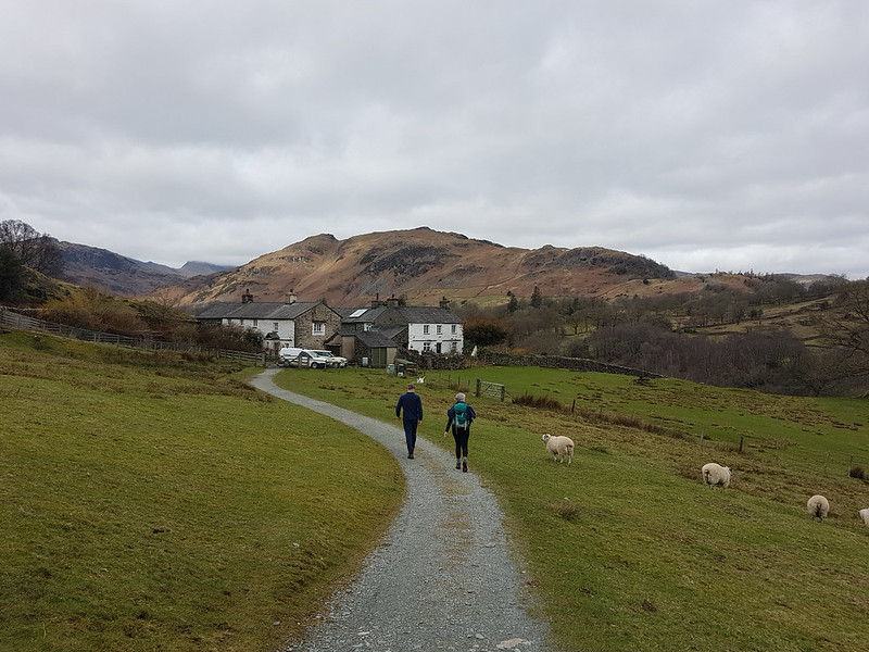
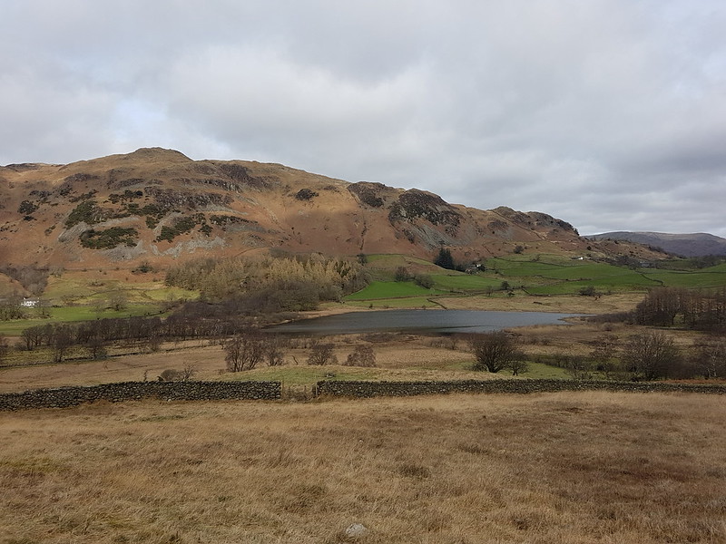
High Park, Little Langdale.
What she did have was a training schedule, which involved a four mile walk pretty much every day, with longer routes at the weekends. Since she was diving into this routine mid-scheme, she requested that I plan a route of 14 miles with a modicum of ascent.
Lingmoor and Little Langdale Tarn.
I used the OS app to plot a course around Little and Great Langdale, a sort of Tour de Lingmoor, a longer version of a walk the boys and I did with the scouts a few years ago, and not too dissimilar to the first half of my, rather wet, ascent of Lingmoor last Easter. The app gave the length of the route as 12¾ miles, with just short of 500m of climbing, which I was a bit surprised by. I was pretty confident that in reality it would work out as a bit longer since, as much as I had fiddled about, my route on the map still consisted of a series of straight lines and would have cut out some of the fractal complexity, or to put it another way, the wiggly bits, of actual paths.
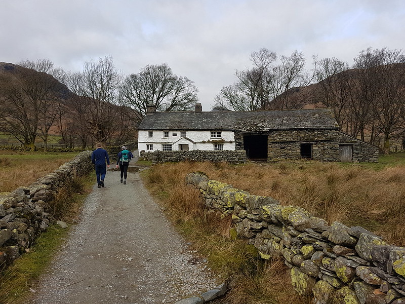
Bridge End, Little Langdale.
B decided to join us for the walk. If you’re wondering why he doesn’t have a rucksack, it’s because he was still suffering from his rugby-tackle induced shoulder injury and would have been uncomfortable carrying one.
I’d originally planned to use of the National Trust car parks, either in Langdale or at Blea Tarn, but when we got to Skelwith Bridge and saw that there were spaces available to park there, I realised that that was a much better option. It also gave TBH and B an opportunity to pop into Chester’s and supplement their packed lunches.
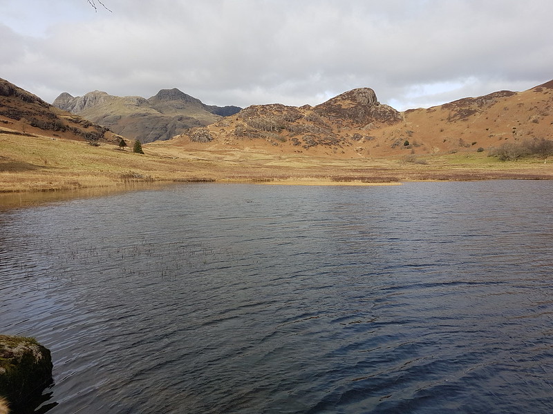
Fell Foot, Castle How, Pike O’Blisco, Langdale Pikes.Waterfall in Bleamoss BeckBlea Tarn, Langdale Pikes, Side Pike.
It was a gloomy day, but by the time we reached Blea Tarn, there were signs of it brightening up. Nevertheless, the trees by the tarn provided a bit of welcome cover from the cold wind for our lunch stop.
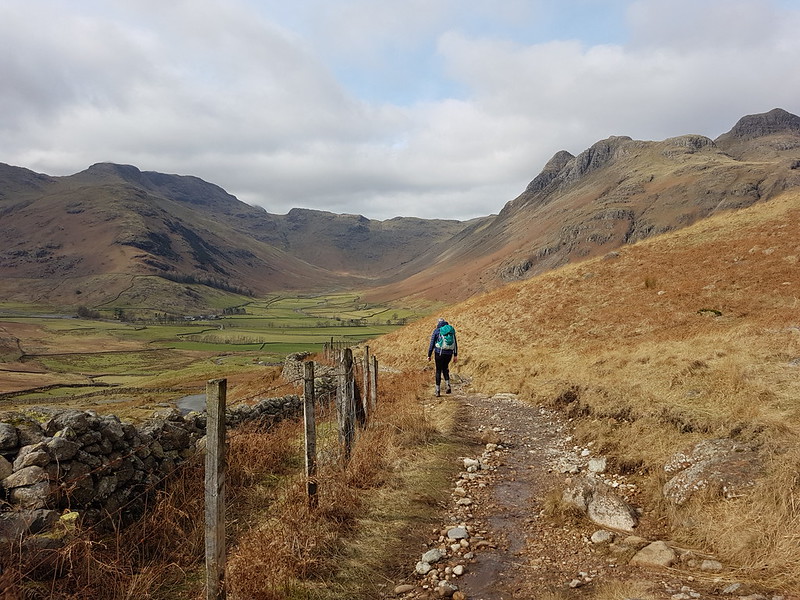
Descending towards Mickleden.Langdale Pikes.Langdale Pikes and Mickleden pano.Pike Of Stickle and Loft Crag from Stool End.
The paths were all quite busy; it’s a wonderful area, so why wouldn’t they be? The area around Slater’s Bridge and Cathedral Quarry in Little Langdale were particularly popular. Our little excursion into Mickleden was the only part of the walk where I don’t think we saw other walkers.
Approaching the footbridge, and the weir, Mickleden Beck.
The patches of blue soon disappeared again and by the end of our walk it was threatening rain, not that that put a damper on our day in any way.
Looking back to Harrison Stickle.The classic view of the Langdale Pikes across Elter Water.As planned.As walked.
According to MapMyWalk the route was actually almost 14½ miles, with just over 400m of ascent. If you’re planning a Mighty Hike and need a tune-up bimble, you can’t go far wrong with this circuit.
TBH stuck fairly strictly to her, plan until a bout of illness precluded long walks, and then she never resumed, deciding that she is probably fit enough as it is. More training walk write-ups still to come, however.
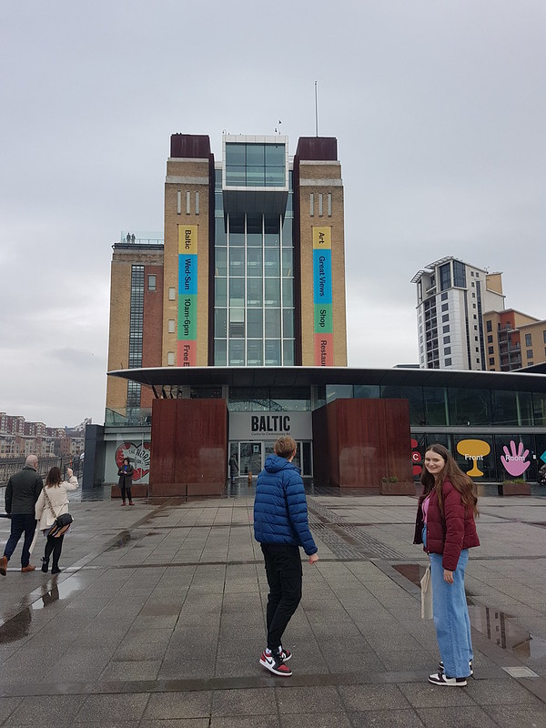
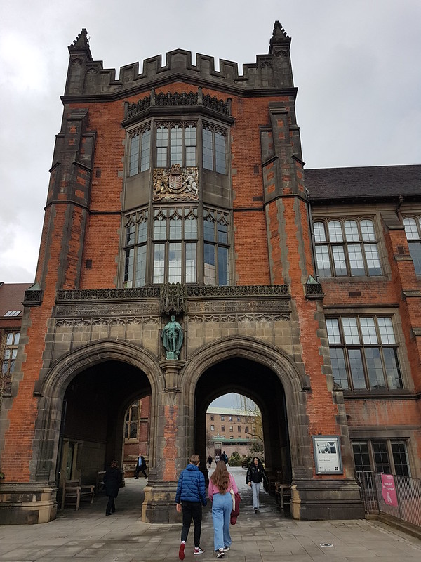
B had an open day at Newcastle University. Much to his delight, we all chose to go with him. He was only allowed one guest, and TBH bagged that spot, so Little S and I met A and went sightseeing around the town.
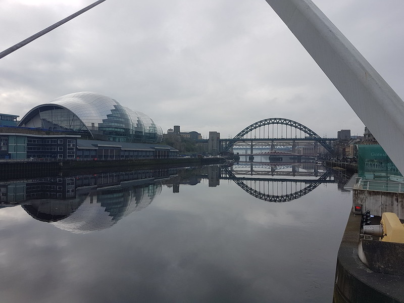
Another bridge and the Baltic art gallery.The curvy glass building is a music venue – The Sage, Gateshead.Visiting the Baltic.
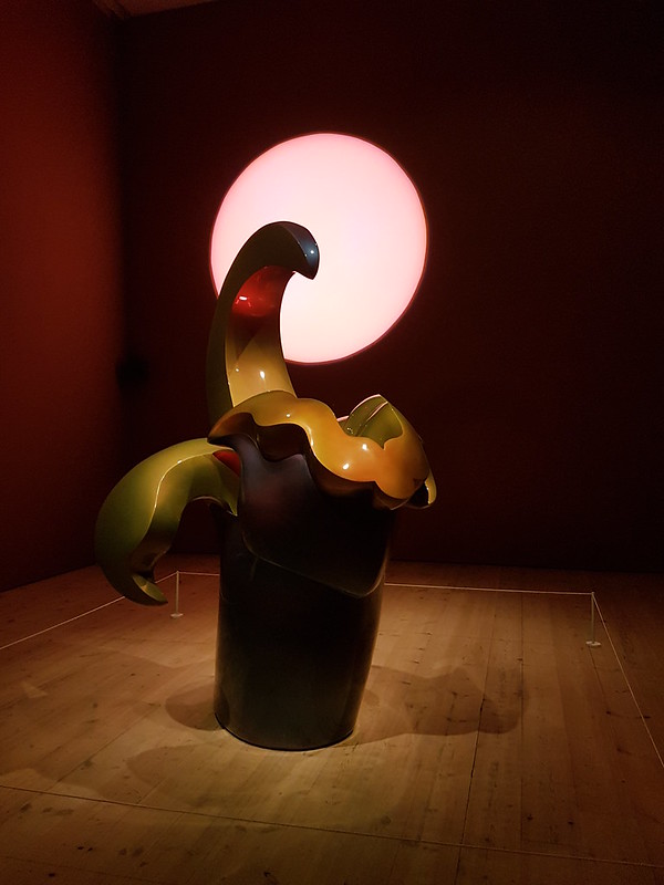
Little S has been taking me to task – apparently he feels that I have unfairly branded him a Philistine on the basis of one incident many, many years ago. He may have a point. Although he is sticking by his opinion of Miro. Anyway, he was quite happy to have a gander in the Baltic and even indulged me again later on, as you’ll see.
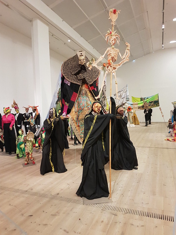
Tyne bridges again from the viewing platform at the Baltic.The Procession, Hew Locke.
The exhibit which has left a lasting impression was this huge display of near life-size figures.
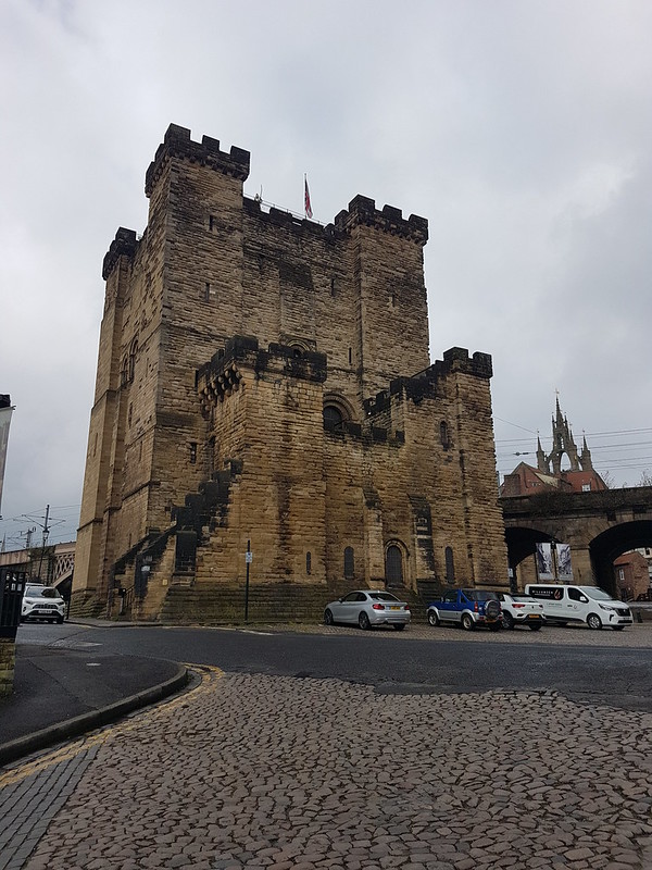
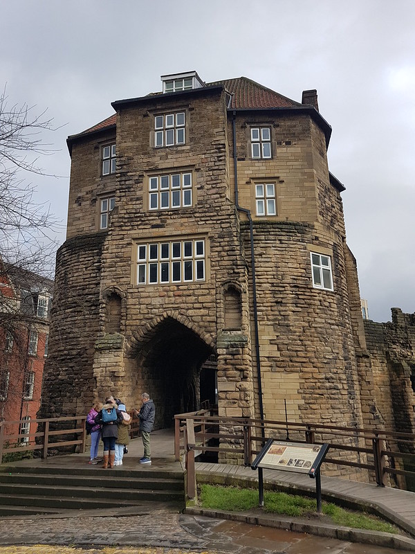
More art. Newcastle castle.
This was far from my first visit to Newcastle, but somehow it has escaped my notice that Newcastle actually has a castle. Seems obvious that it would, with hindsight.
Newcastle castle.Newcastle castle.
A was keen to take us a vegan cafe she likes. It was very good. Even Little S evidently enjoyed his meal and he’s usually an unapologetic carnivore.
The weather had been good when we left home, but then we’d been in the cloud as we drove over the Pennines and it remained foggy after that. We’d arrived in Newcastle to find it cold and drizzly. Fortunately, whilst we were in the cafe it brightened up considerably.
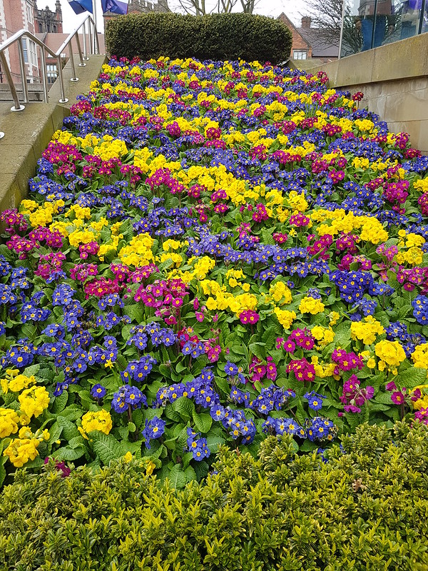
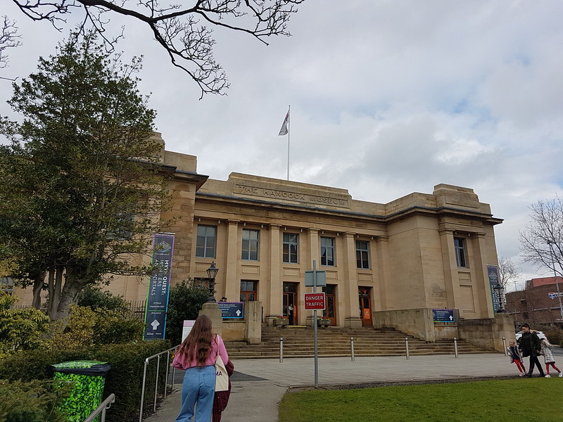
Our view through the cafe window.Flower bed at the Uni.Part of the University.The Hancock Museum.Fossil.
The Hancock Museum was another one of those places, stuffed to the rafters with a disparate hodge-podge of wonderful stuff.
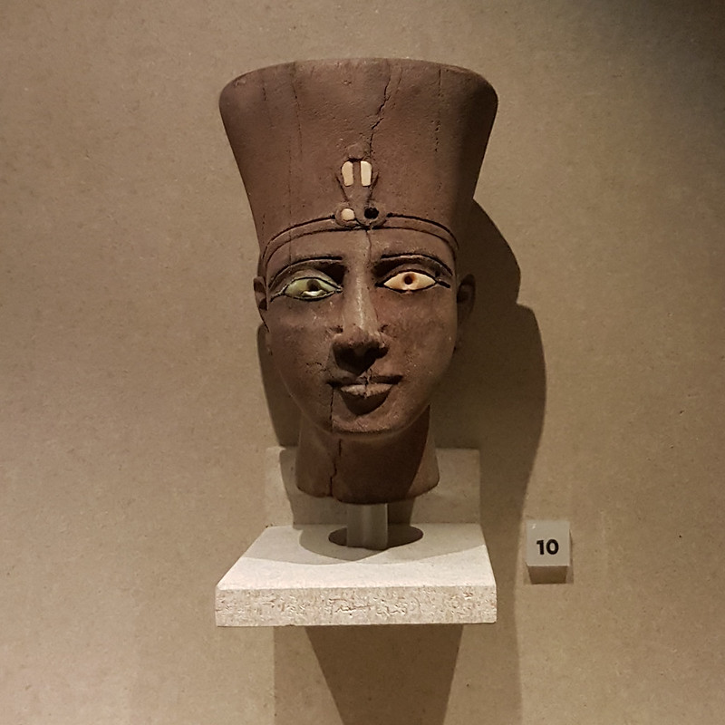
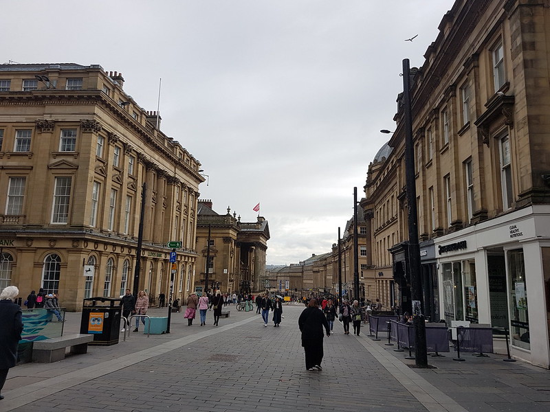
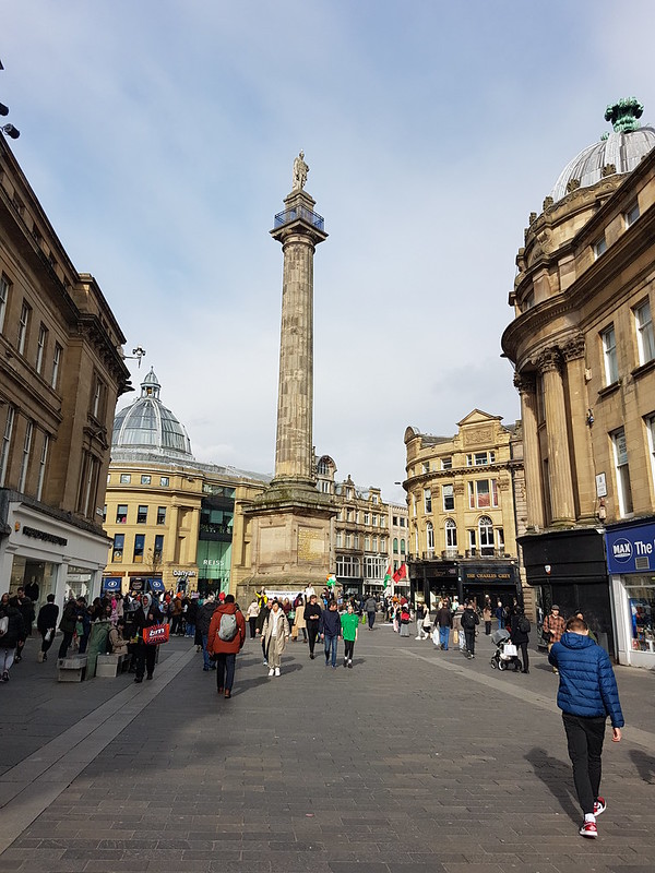
Surely ancient Egyptian?I liked the shiny clock.Newcastle city centre.The very fetching Central Arcade.Grainger Market.Monument.Art at the Laing Art Gallery.Art at the Laing Art Gallery.
We were killing time to a certain extent, before a meet-up with the kids’ grandparents for a meal in a very busy Spoons near the uni. It was only when we had run out of time that Little S remembered to tell me that he wanted to go shopping for a suit for his forthcoming prom. Doh!
B was impressed with Newcastle. It’s a good job that I was too, since it seems likely that we will have a few more visits to the North-East over the next few years.
It was a strike day. I was on the picket line as you can see!
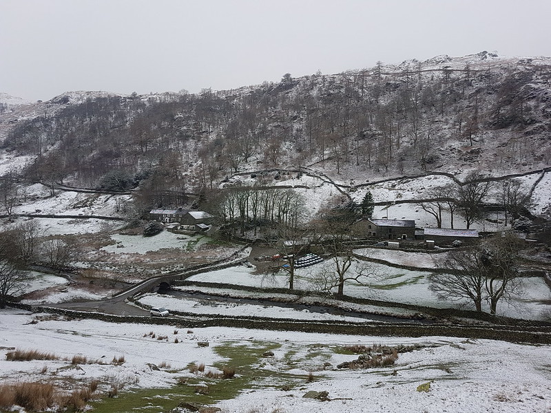
You can see my car in the photo, the only one in the parking space at Sadgill, at the end of the metalled road along Longsleddale. Admittedly, I’d got there fairly early – but, at the weekend, the limited spaces here fill up very quickly. On this midweek day in March, there were eventually three cars. The weather wasn’t ideal, I’ll grant, but the MWIS forecast had actually suggested that the cloud would be lifting off the hills in the Eastern Lakes. It didn’t.
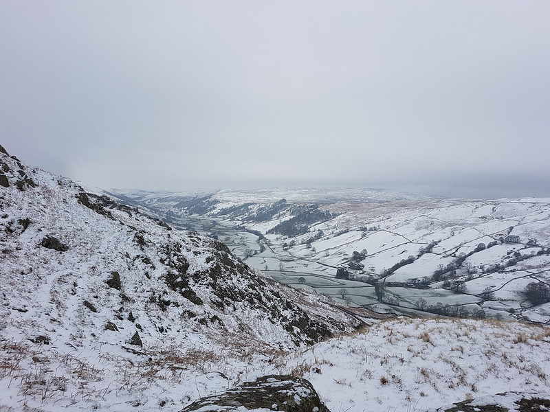
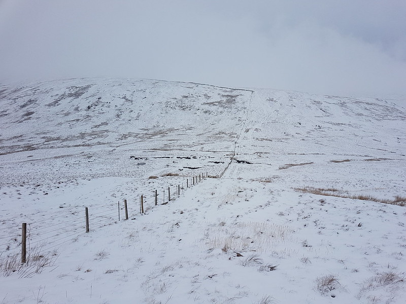
Looking up Longsleddale.
It’s not marked on the map, but there’s a path signposted from the parking area which heads directly uphill towards Great Howe – I’d noted it on a previous visit and had in mind to try it out.
The same view from just before I entered the clouds.
I haven’t been carrying my stove this winter, settling instead for a flask of hot cordial and an insulated mug of tea. I stopped to drink the tea, and to video-call my mum and dad, when it was evident that I would shortly be entering the cloud and losing the view.
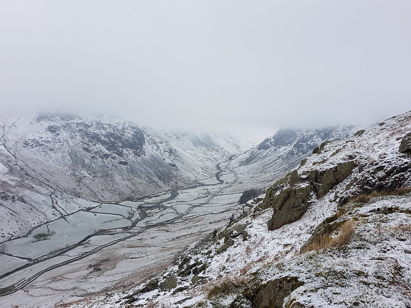
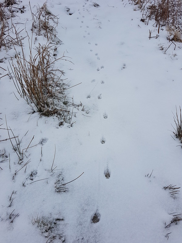
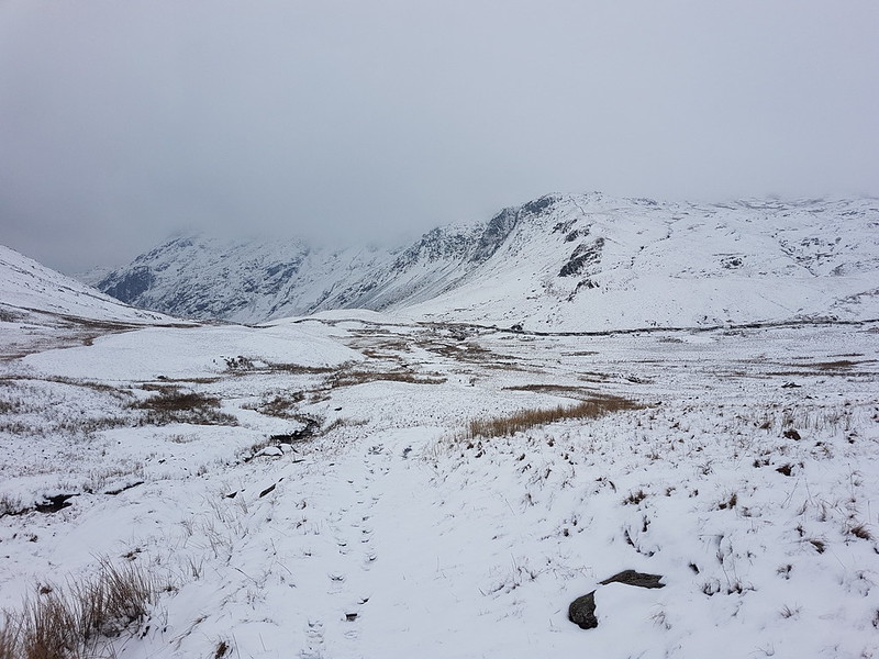
Looking down Longsleddale.Typical view for the next few hours.Fox tracks?
Throughout the day the paths had tracks like these, often two or three sets, along them. When the guy who had arrived in the second car in the car park overtook me, he expressed surprise that I didn’t have a dog with me, but I think the tracks were actually made by a fox or foxes.
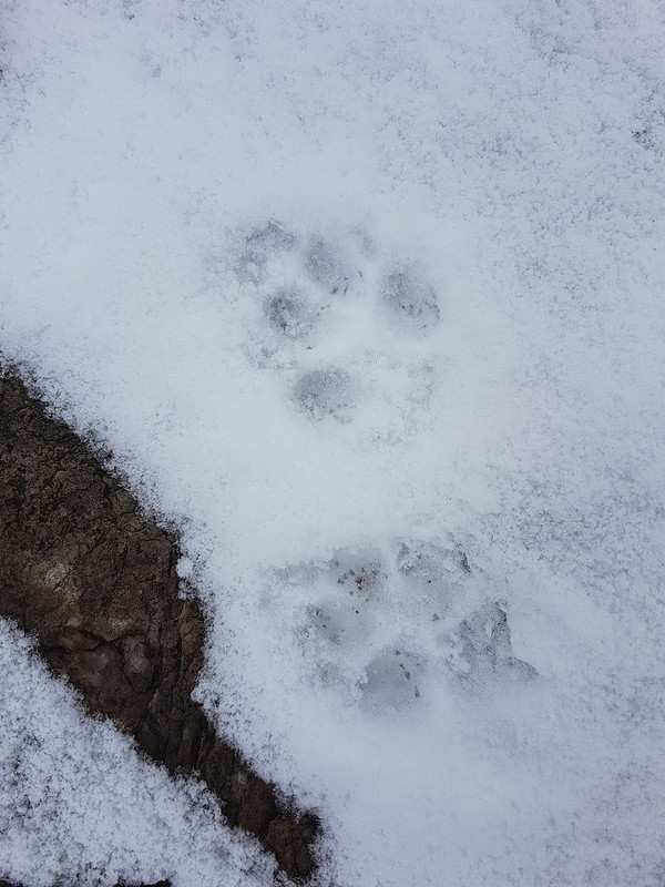
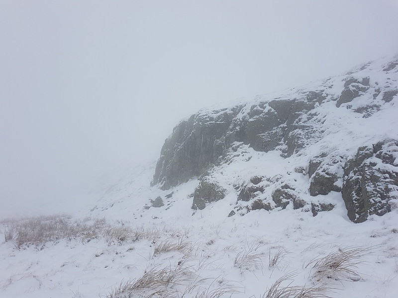
Fox prints?Crags looming out of the mist.
Visibility was poor, but with the OS map to help, navigation was relatively easy. Judging distances and the size of things can be difficult however. Suddenly a rise will loom up, looking huge, but then turn out to be negligible.
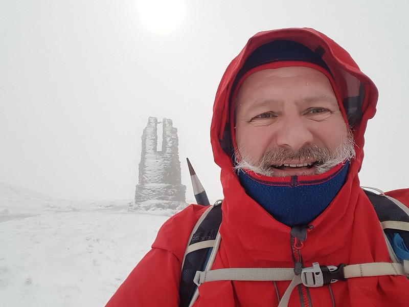
Yours truly on Grey Crag.
I thought the area marked on the map as Greycrag Tarn (where there is no Tarn) might be awkward to navigate, both in terms of not losing the way and because it looks boggy on the map. In the event, I just stuck to a bearing, which worked really well, and I didn’t encounter anything too sloppy for Malcolm’s boots to cope with.
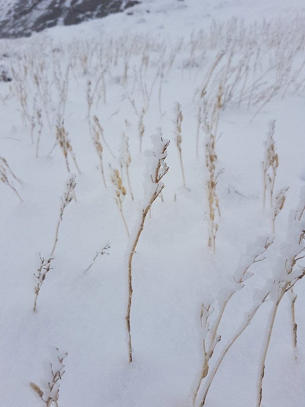
Ice covered grass stems.
It had become quite windy, and before beginning to climb again toward Tarn Crag I found a marvellously sheltered spot to drink some hot cordial, eat my lunch, and admire some icicles.
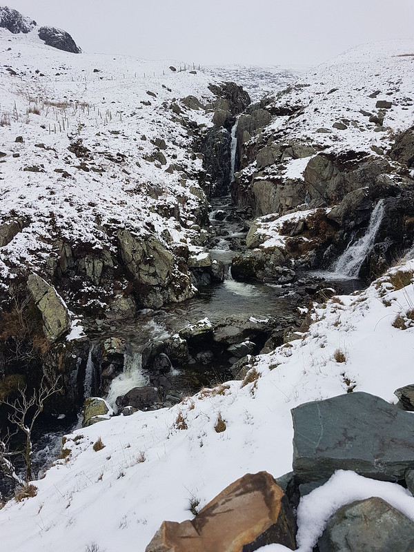
Icicles.Yours truly and the survey pillar near the top of Tarn Crag.Fence – a handy navigational tool.Descending out of the cloud to Brownhowe Bottom.Steel Rigg and Raven Crag.Heading down in to Longsleddale.Waterfalls in Wren Gill. Or is it Cleft Ghyll?Longsleddale after a significant thaw.
A couple passed me as I finished my cordial beside the track down into the valley. They must have arrived in the third car. That was all the people I saw during this walk.
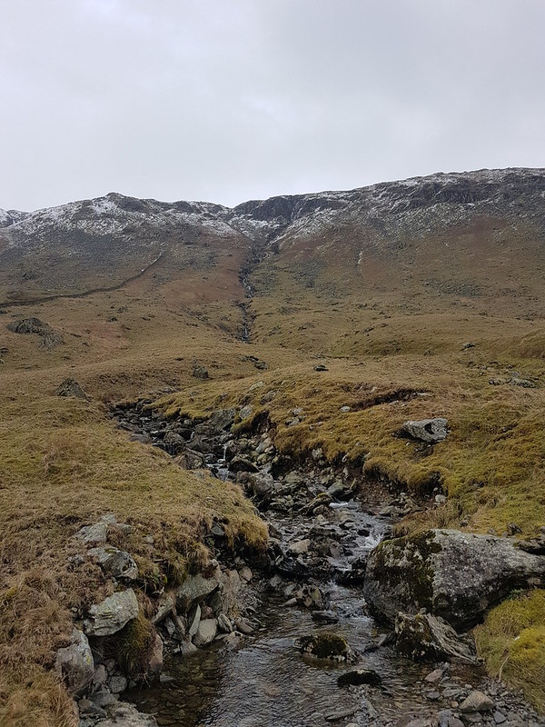
Galeforth Gill – a good alternative way up.
There’d been a significant thaw; the treacherous layer of verglass, which had coated the surface of the track when I’d arrived, had now gone. I’d been a bit concerned about descending the track in such icy conditions so wasn’t upset to see the change. The axe and crampons I’d lugged around all day, didn’t get put to use. Despite the far from perfect weather, I’d really enjoyed having a day out in winter conditions. Now, how I could I engineer more walking on quiet days when everybody else is at work…?
I can dream!
It turns out it was almost exactly ten years after my last ascent of these two hills. And quite a few years since I brought the kids to Longsleddale for a swim.