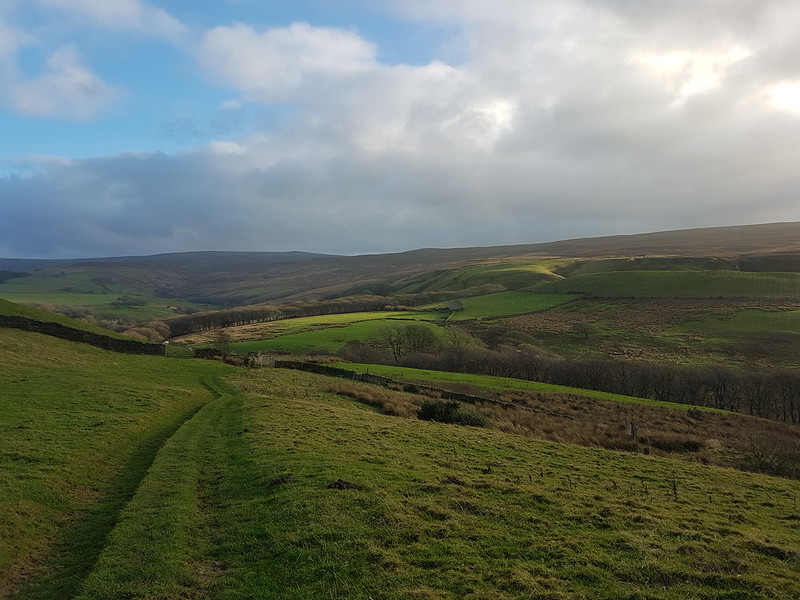
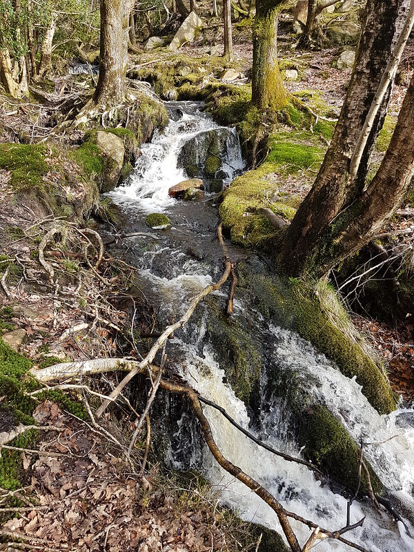
Udale. I think – the stream at the bottom is Udale Beck anyway.
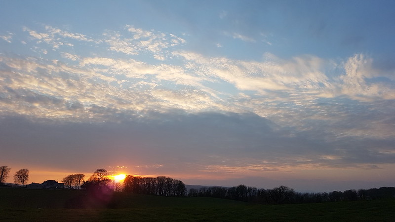
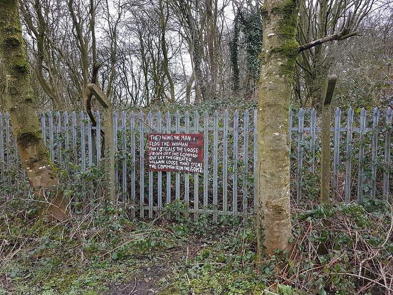
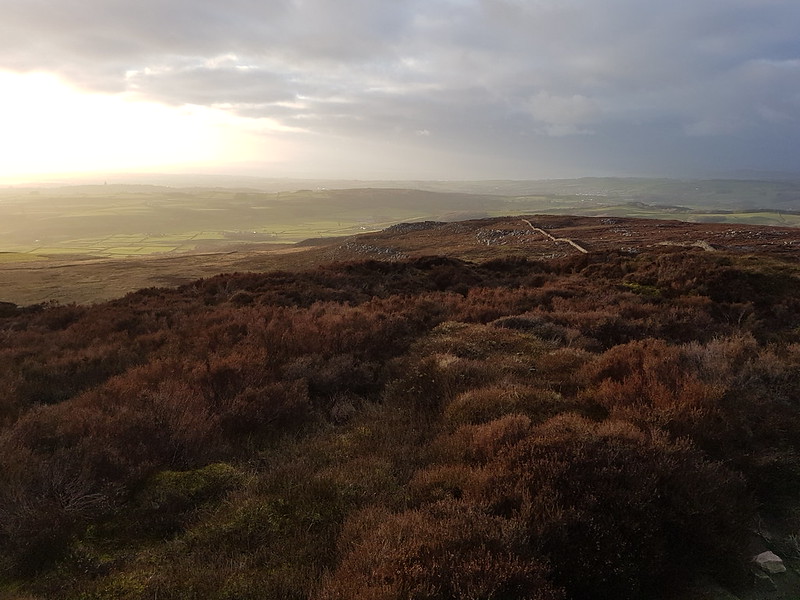
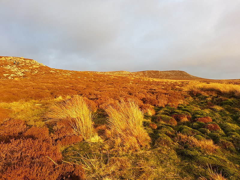
We had a ‘continental’* training day at work, starting at eight and finishing at one, not that I actually got away at one. It was the end of November, so that didn’t leave an awful lot of daylight, but with a high start from the Littledale car park, which is not far from Lancaster, and no ambitious plans, there was still time to squeeze in a good little wander.
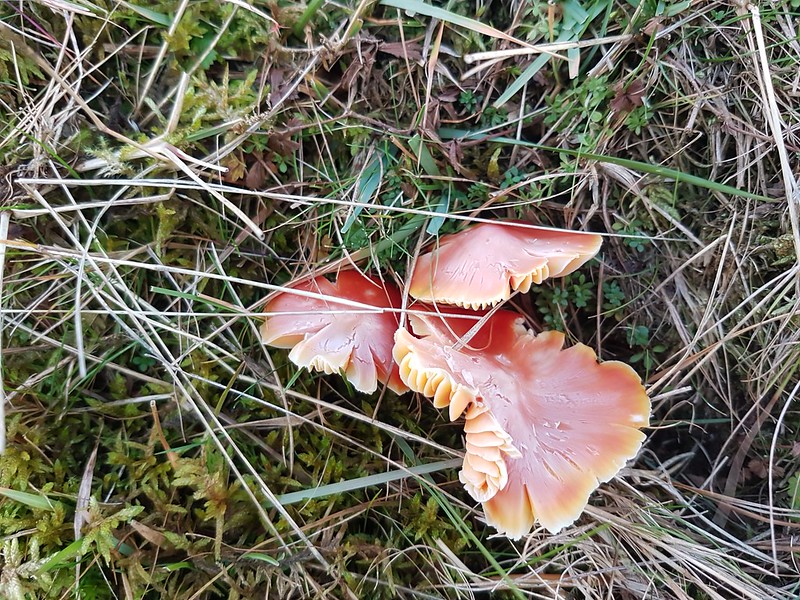
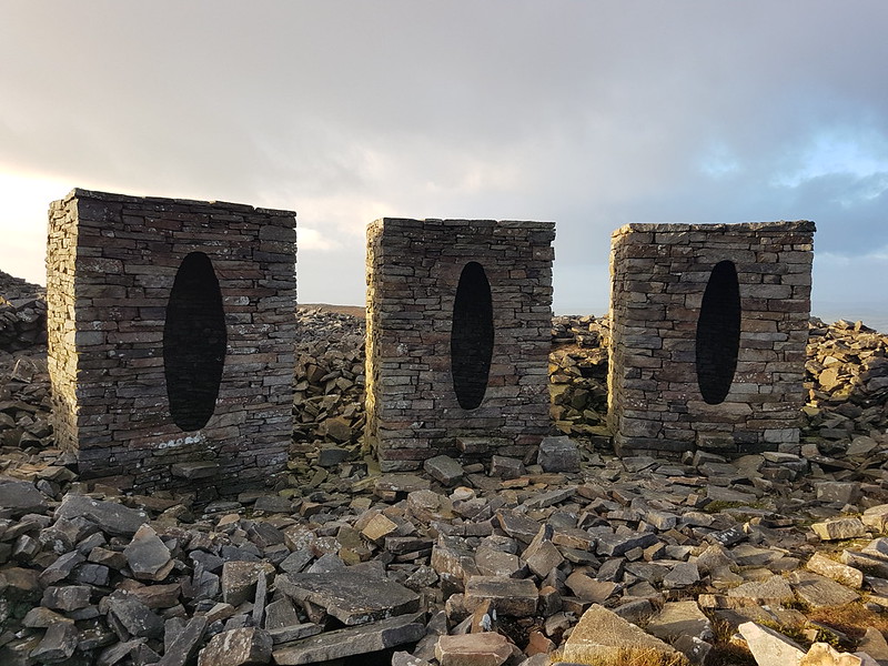
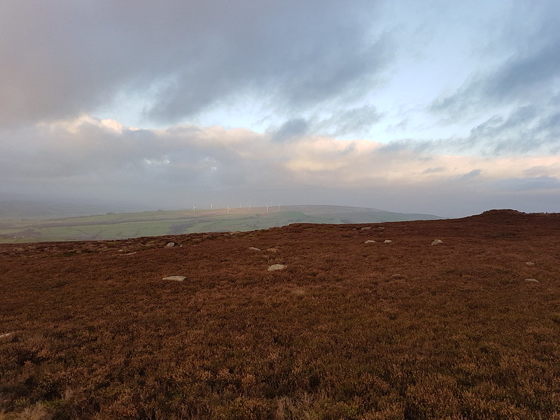
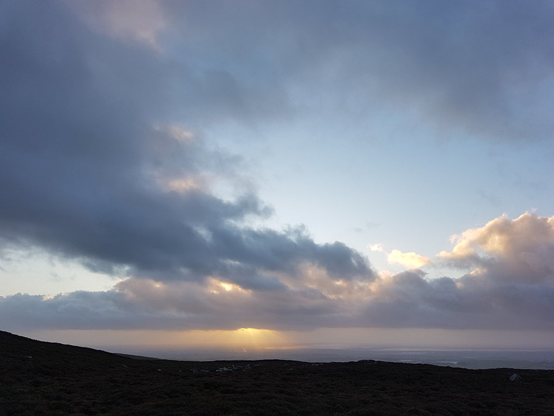
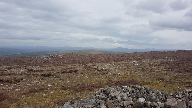
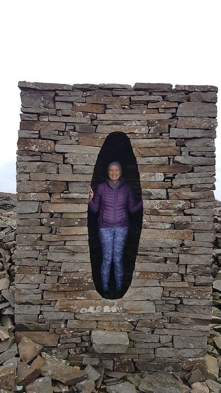
Waxcaps.The wind farm on Caton Moor.Approaching the Andy Goldsworthy sculpture – that’s it on the horizon.Lovely, low winter light on the moors.The Andy Goldsworthy sculpture.The sculpture, the wind farm and some changeable weather.The Caton Moor wind farm again.The sun dropping towards Morecambe Bay.
That’s it, short and sweet. I’m beginning to think that these short, hit-and-run excursions might often be my favourite walks. Having said that, I notice that this one was nearly six miles, so not too brief after all.
Of course, it helps if you have the right terrain for a pleasant, short walk on your doorstep.
*Is there anywhere on the continent where people actually work these hours?
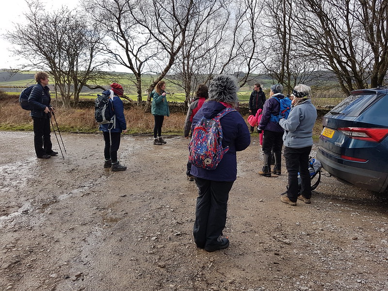
Early in May, we met up with our old friends for a walk, and to celebrate Andy’s birthday. We had the least far to travel, since we were meeting at the Littledale carpark on the edge of the Forest of Bowland, not too far from Lancaster. So, naturally, never knowingly on time for anything, we were the last to arrive. I think the last of Andy’s bacon butties had yet to be washed down with a mug of tea at that point, so we may not have delayed things too much.
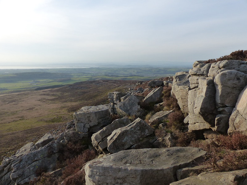
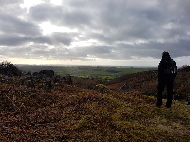
Leaving the cars, we started with an easy ascent of Baines Cragg, which, despite many previous visits to this area, I’ve never climbed before – it turned out to be an excellent viewpoint. It’s a shame the skies were so grey – I shall have to go back and have another look when the weather is more clement.
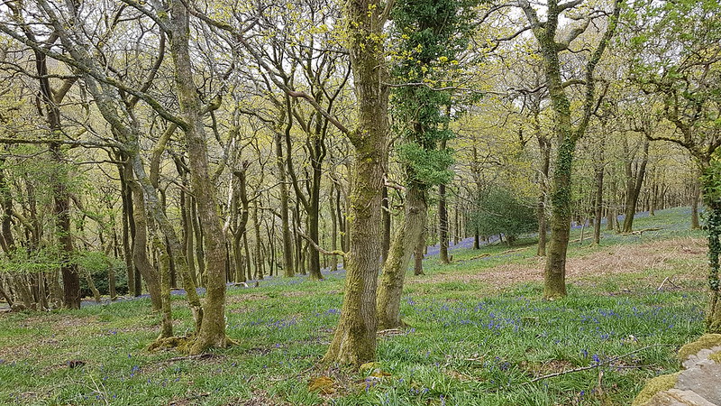
Bluebells in Cragg WoodCrossing Ottergear Bridge, part of the Thirlmere Aqueduct.
Apparently the Thirlmere Aqueduct, which transports water from the Lake District to Manchester, is the longest gravity-fed aqueduct in Britain (source).
The track which crosses Ottergear Bridge was presumably constructed as part of the engineering work related to the aqueduct. It took us to the path which climbs Clougha Pike from the Rigg Lane car park.
Slow Worm
When we lived on The Row, we used to see Slow Worms in our garden quite often. They seemed to like our compost heaps. B did once find one in our current garden, but that was years ago.
They are thought to be the longest-lived of all lizards; the remarkable age of 54 years has been reliably recorded.
from ‘Fauna Britannica’ by Stefan Buczacki
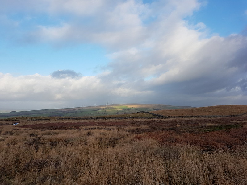
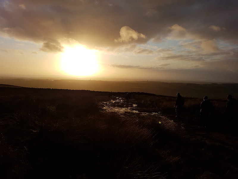
Brew/lunch/cake stop number 1.Looking over Caton Moor towards Ingleborough.Andy Goldsworthy sculpture.TBH in one of the sculptures.
Below the sculptures we found a sheltered spot, out of the wind, for our second cake/brew/lunch stop. For me, this was a highlight of the day. The heathery slope was comfortable, the view to the north, if somewhat hazy and grey, was still extensive and, above all else, the company was excellent.
Ward’s Stone.
Andy had been keen to tick-off Ward’s Stone, but the weather wasn’t great, so we decided to follow this track which looped around Grit Fell and then come back over the top of Grit Fell.
It was along here somewhere that ‘the trouser incident’ occurred. J has a pair of waterproof overtrousers, apparently designed for cross-country skiing, with zips down both the inside and the outside of both legs – making it possible, in theory, to put them on whilst wearing skis. However, with all 4 zips undone, and in a strong wind with driving rain, the trousers had 4 long flapping pieces and even without the encumbrance of skis, try as she might, J couldn’t get them on. It didn’t help that she got the giggles, which turned out to be infectious and soon, whilst TBF and TBH tried to help, the rest of us were doubled-up laughing and making entirely unhelpful suggestions. Eventually, the trousers were tamed, just about in time for the fierce shower to come to an end.
TBF, J and TBH heading to Grit Fell, Ward’s Stone behind. Hats, gloves, full waterproofs – a wintery May!Ingleborough. And showers over The Lune valley.On Grit Fell.Our descent route.Brew stop number 3. It started to rain moments after we sat down.My phone batteries packed up (temporarily) near the end of the walk – I think it may have been because I let my phone get too wet – hence the gap in the route.
Andy’s account, with a better map, better photos etc is here.
I didn’t get out half as much this summer for after walk wanders as I usually do. I made excuses about the being too busy with driving A to and from dancing lessons, but these three evening walks from the same week in the tail end of April give the lie to that – so, obviously, I just didn’t make enough effort as the summer went on.
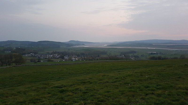
But anyway – back to the week when I was still trying. On the Monday evening, I dropped A off in Milnthorpe and drove the short distance to park in Heversham and climb Heversham Head. Bizarrely, in nearly thirty years of living nearby I’ve never climbed it before. In my defence, on the OS map there’s no path shown – I think it was Conrad who alerted me to the fact that there is actually access to the top. I followed the route in this leaflet (I think the field boundaries shown might be slightly misleading). Very good it was too, but it’s a shame I hadn’t set off earlier since the very flat light rather spoiled the extensive views.
I shall have to come this way again, although I’m slightly put off by the many pinch-stiles, some of which are very tight for the more portly gentleman, and one of which had me thinking I was irretrievably stuck and contemplating having to wait there, like Winnie the Pooh in Rabbit’s burrow, until I had lost some weight.
Dallam Hall
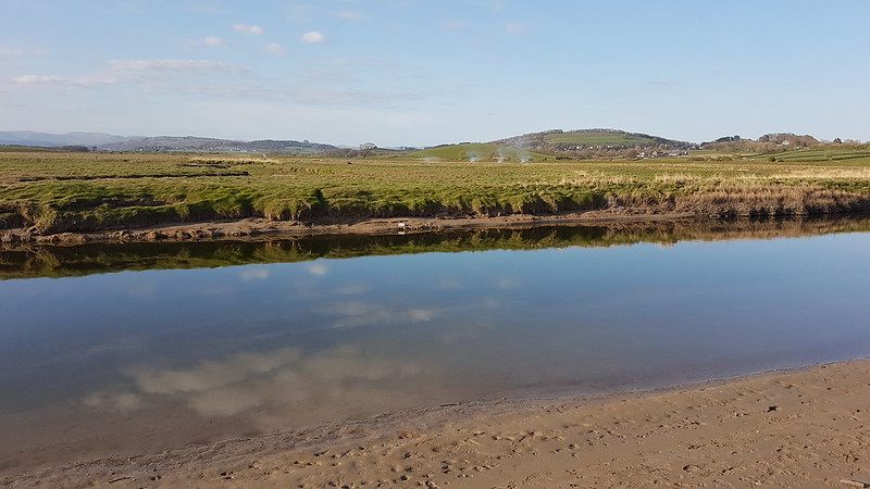
The following night was brighter, and I was out earlier. This time I walked from where A has her lessons, down through Milnthorpe, through the grounds of Dallam Hall, beside the River Bela, and out to where the Bela flows into the Kent estuary.
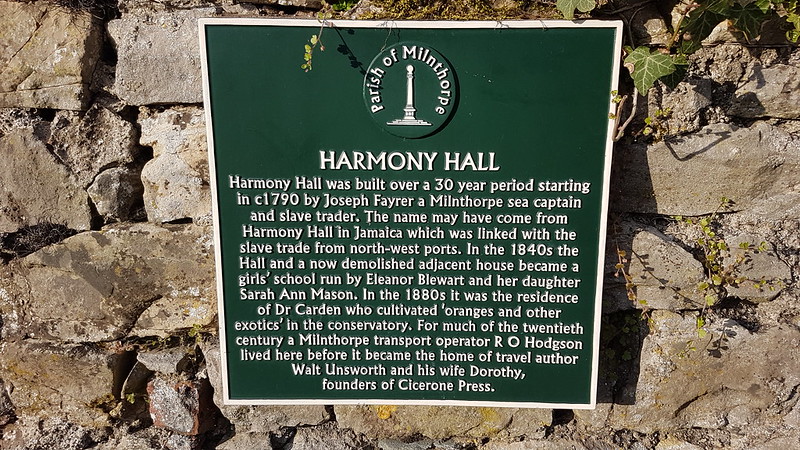
River Bela – Heversham Head prominent on the right-hand side in the background.River Bela and Milnthorpe Bridge.River Bela and Milnthorpe.Harmony Hall.
It’s always very sobering to be confronted with evidence of sleepy little Milnthorpe’s past as a slaving port.
Incidentally, I’m a huge fan of both Cicerone Press, these days based in Kendal, and of Mr Unsworth.
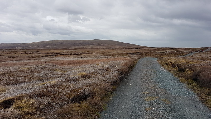
On the Friday evening, with no driving duties to undertake, I drove straight from work to the Rigg Lane carpark, for an evening ascent of Clougha Pike.
On my way up, I was tempted away from my usual route by a path which leading up into Windy Clough. A thin path took me onto slopes of shattered stones and boulders on the left side of the valley. The path seemed to split frequently, each bifurcation leading to difficult choices between two increasingly marginal options. Eventually, there was no discernible path, so I struck uphill, finding a thin trod following the wall along the high ground. When this hit a cross-wall I followed it down into the valley bottom, where there was a gate and, once again, a path. This lead me into surprisingly tall and scratchy vegetation, but also, eventually, onto a lovely path which gradually ascended up towards the edge on Clougha Pike.
Looking towards Caton Moor, having escaped Windy Clough.Looking up the edge.
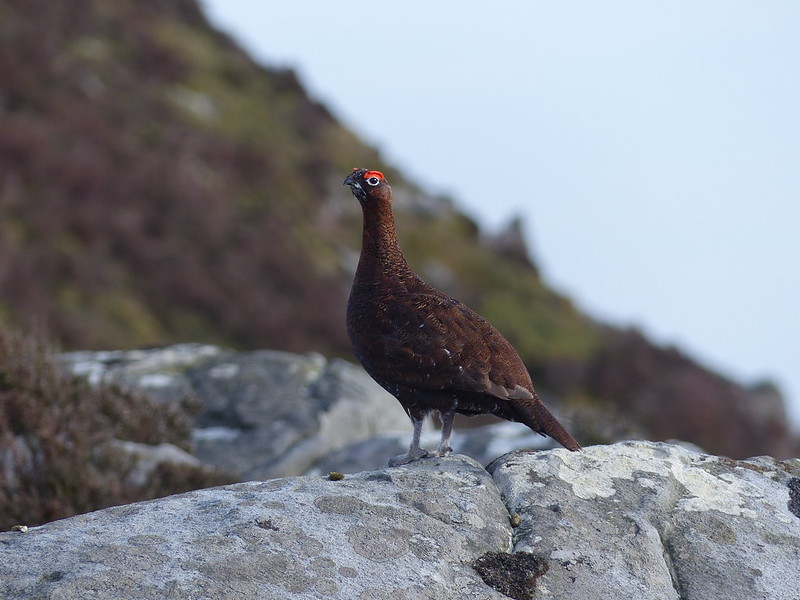
There were loads of Red Grouse about. The males were strutting their stuff and very easy to photograph, so I took lots of pictures. The females were far more discrete and only showed themselves very briefly. They’re endearing birds, if somewhat loud. It’s a shame that they’re essentially there to be shot by ‘sportsmen’.
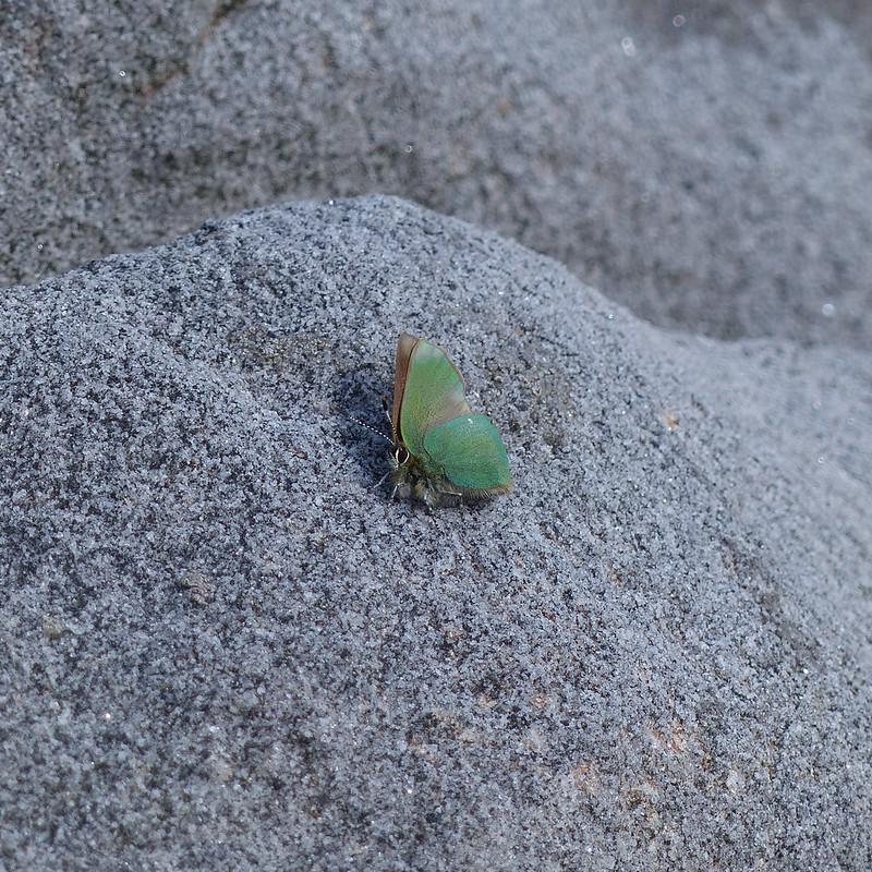
I found a comfortable spot on a huge boulder and sat down for a brew and a rest and to contemplate the view. It was warm, but very windy, so I was surprised to see this tiny Green Hairstreak clinging to the rock.
Because I’ve previously seen these butterflies in woodland I’d incorrectly assumed that they are woodland creatures, but apparently they are well adapted to a number of habitats, including moorland.
Another male Grouse.Along the edge.Who you looking at?Meadow Pipit (I think).The top!Looking over to Hawthornthwaite Fell.Morecambe Bay.Hunkered down for another brew and a ‘meal deal’ tea.Looking along the edge.
After my earlier misadventure, I wasn’t dissuaded from taking another new route – I’d spotted a thin path traversing the ground just below the edge and decided that would give an interesting new perspective.
It proved to be a very pleasant alternative to retracing the edge path, although I suspect that in winter it may well be very boggy.
An exciting day for A, her first lesson back in school. It was literally one lesson, although lasting for a couple of hours. Given the proscription against the use of public transport, I wanted to drive her there and back, but if I’d returned home in between I wouldn’t have been home for long before I needed to set off to pick her up again.
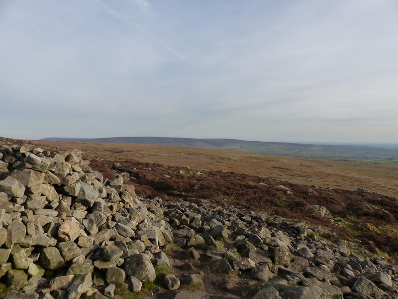
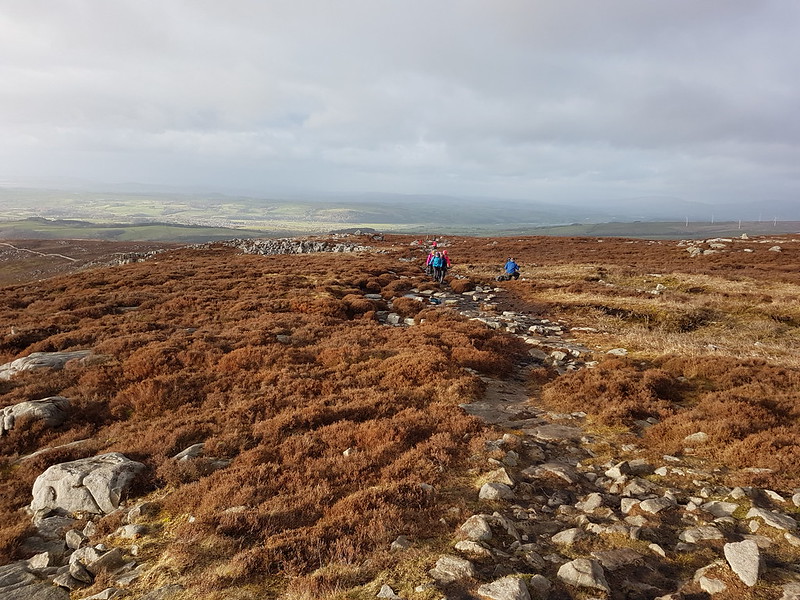
Caton Moor and Ingleborough from Clougha.
So, I decided to have an up and back wander on Clougha Pike from the Rigg Lane car park.
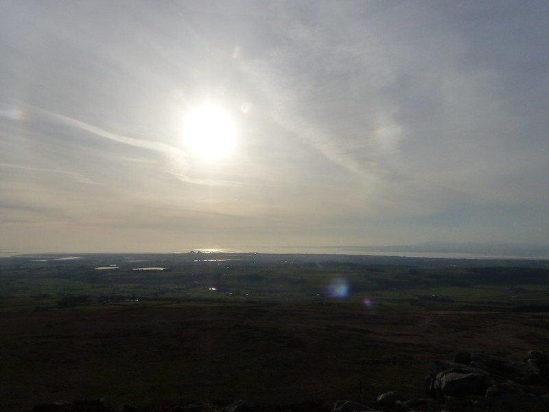
Morecambe Bay from Clougha.
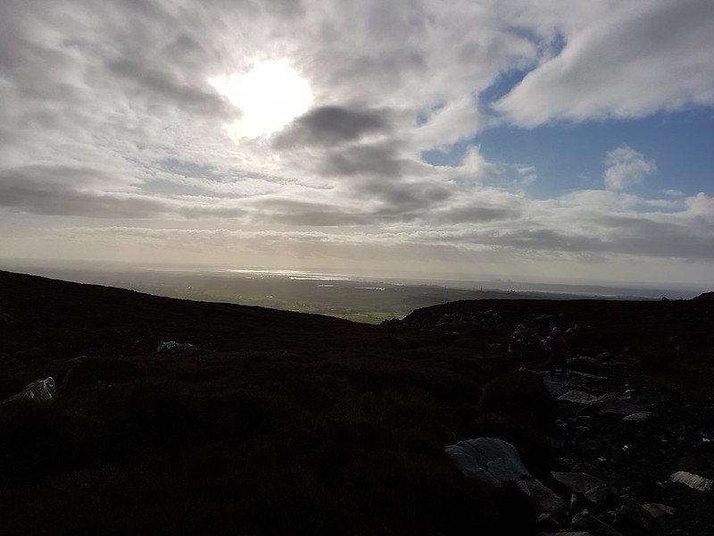
It was hot and sticky. I really didn’t expect to reach the top before the time I’d decided was my cut-off point, but I did. Once there, I even thought I had time for a brief drink-and-sandwich stop, and I was probably right, but then four old friends arrived on the summit who I hadn’t seen for a while – quite a coincidence since we were the only people up there. It seemed rude to rush off, but I kept my catching-up chatter to a minimum, much as I would have liked to have chewed the fat for a while longer.
Emperor Moth caterpillar. A very striking caterpillar – the adults too look stunning, at least in the photographs I’ve seen. Maybe an early evening ascent of Clougha is called for at the appropriate time of year.
Looking back up to the edge.
I was a little late picking-up A, but I think she forgave me. She certainly wasn’t surprised!
I’ve put the music at the top of the post for once: I think it deserves pride of place.
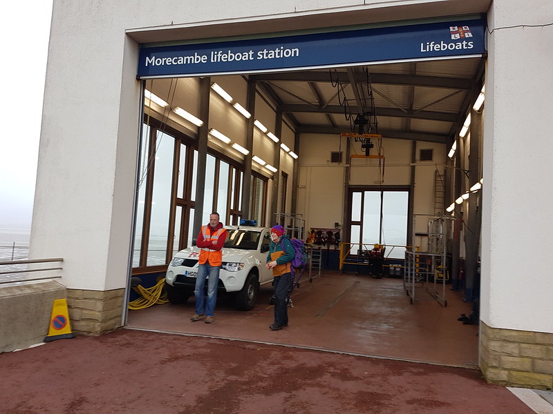
So, as advertised, finally, here it is. Back in March, I signed up for a brilliant project which combined singing and hill-walking. There were just two rehearsals, the second of which I couldn’t make because I was in the Tower Captain’s car on the way up the M74 for our weekend at Bridge of Orchy.
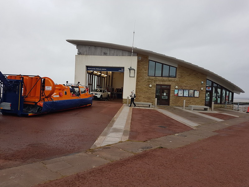
Actually, there was a third, very last minute, practice, on the morning of the event, in the Morecambe lifeboat station…
…for which purpose, the lifeboat people had very kindly moved their hovercraft out…
Then we wandered down to the end of the stone jetty for the first performance…
It was wet and windy and absolutely perishing. Sounded good, though, to my untutored ears.
And, through the wind and the rain, our destination, Clougha Pike, briefly appeared above the buildings along Morecambe’s seafront…
“Breakers, rollers, pebbles, sand, Half at sea and half on land,”
Admittedly, it is a bit hard to pick out in the photo, but it is there.
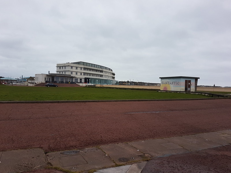
I lived for a while in a third floor flat on the promenade and the views of the Bay in one direction and across Lancaster to Clougha in the other were superb.
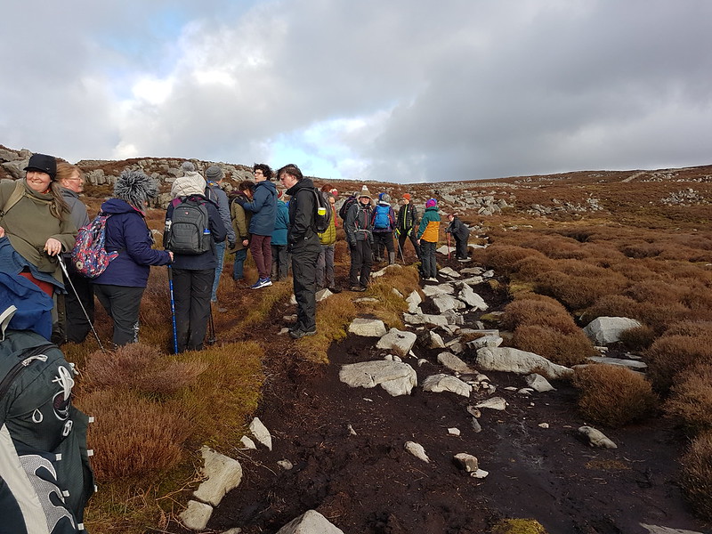
Anyway, our aim was to climb Clougha starting from the sea front and then get down safely before it got dark, so there was no time to hang around. We passed the Midland…
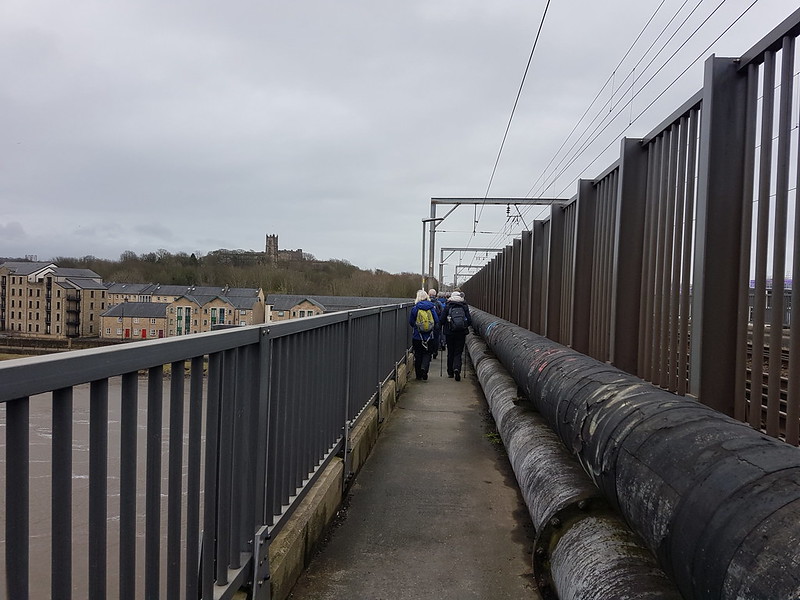
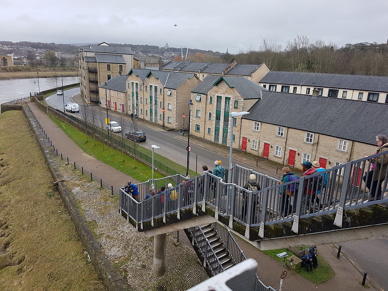
And joined the network of cycle tracks which connect Morecambe and Lancaster.
We crossed the Lune by Carlisle Bridge…
And then set-off on a long loop along the quay and then a footpath to Freeman’s Wood, where we sang again.
The graffiti is part of the lyrics from the song.
Freeman’s Pools.
The route had been cunningly devised to bring us all the way through both Morecambe and Lancaster on either footpaths or very quiet bits of road.
An arrangement has been made with the Fox and Goose pub, on the outskirts of town, so that we could use their beer garden for a quick break and use their loos. We’d been walking for a few hours without really stopping and I was more than ready for a sit down, a drink and a sandwich.
The next part of the walk was inevitably confined to the roads, there being an unfortunate lack of paths linking Lancaster to the hills above it. At least we could see Clougha more clearly now and the weather was improving too.
We stopped again at the Rigg Lane car park, where the ascent would begin in earnest, and where we were offered an impromptu stretching routine…
Some people had opted to miss some parts of the walk, and joined us again at the car park.
“The brook is from a picture book”
An unnamed (on the OS map) tributary of The River Conder, which itself drains into the Lune near Glasson Dock; which makes this walk one of my Lune Catchment walks.
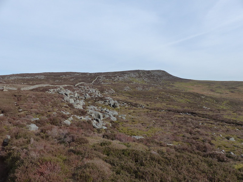
Clougha Pike.
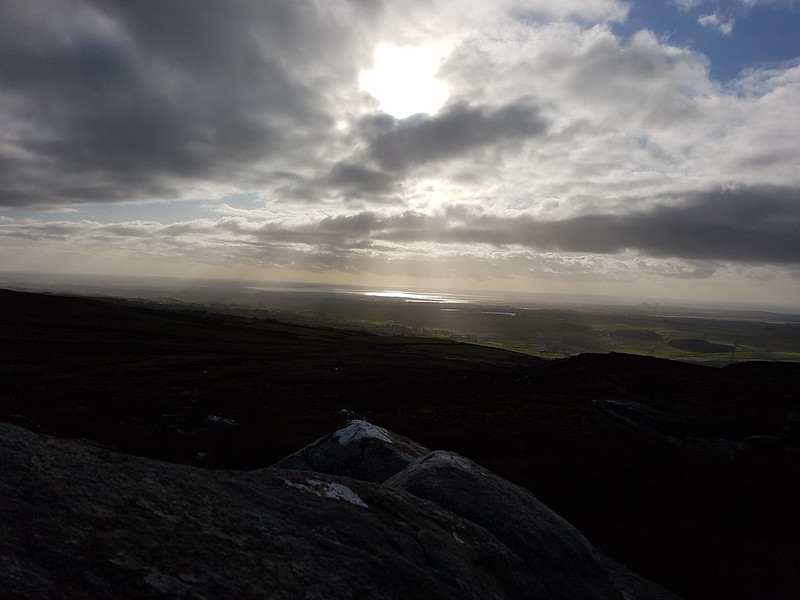
Morecambe Bay.
“Rocks like booby traps.”
The going was pretty rough here and the pace predictably slowed. I’d been feeling a bit bushed, but picked up now that we were off the roads.
Approaching the top.
Most of the people I talked to seemed to belong to at least one of the, I discovered, many choirs in the Lancaster area. I used to sing with the Carnforth Community choir for a while, and enjoyed it enormously, but the meetings changed to an evening which I can’t really make. One positive outcome for me of joining this project, aside from the fact that I had a great time, is that I was told about a choir which sounds very welcoming and which meets in Lancaster on a night which is much more convenient. Well – used to meet in Lancaster and will, at some point presumably, be meeting again.
“Rain will slick the stones, Wind will wind around your bones.”
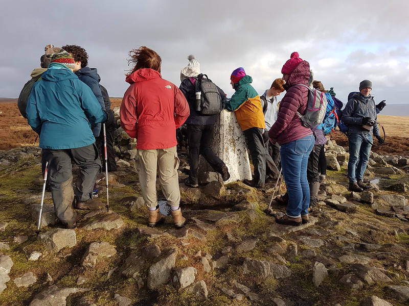
We sang one last time on the top and then it was just a matter of wending our way back to the car park and then the logistics, thankfully well organised by Dan, of getting everybody back to their cars and/or homes.
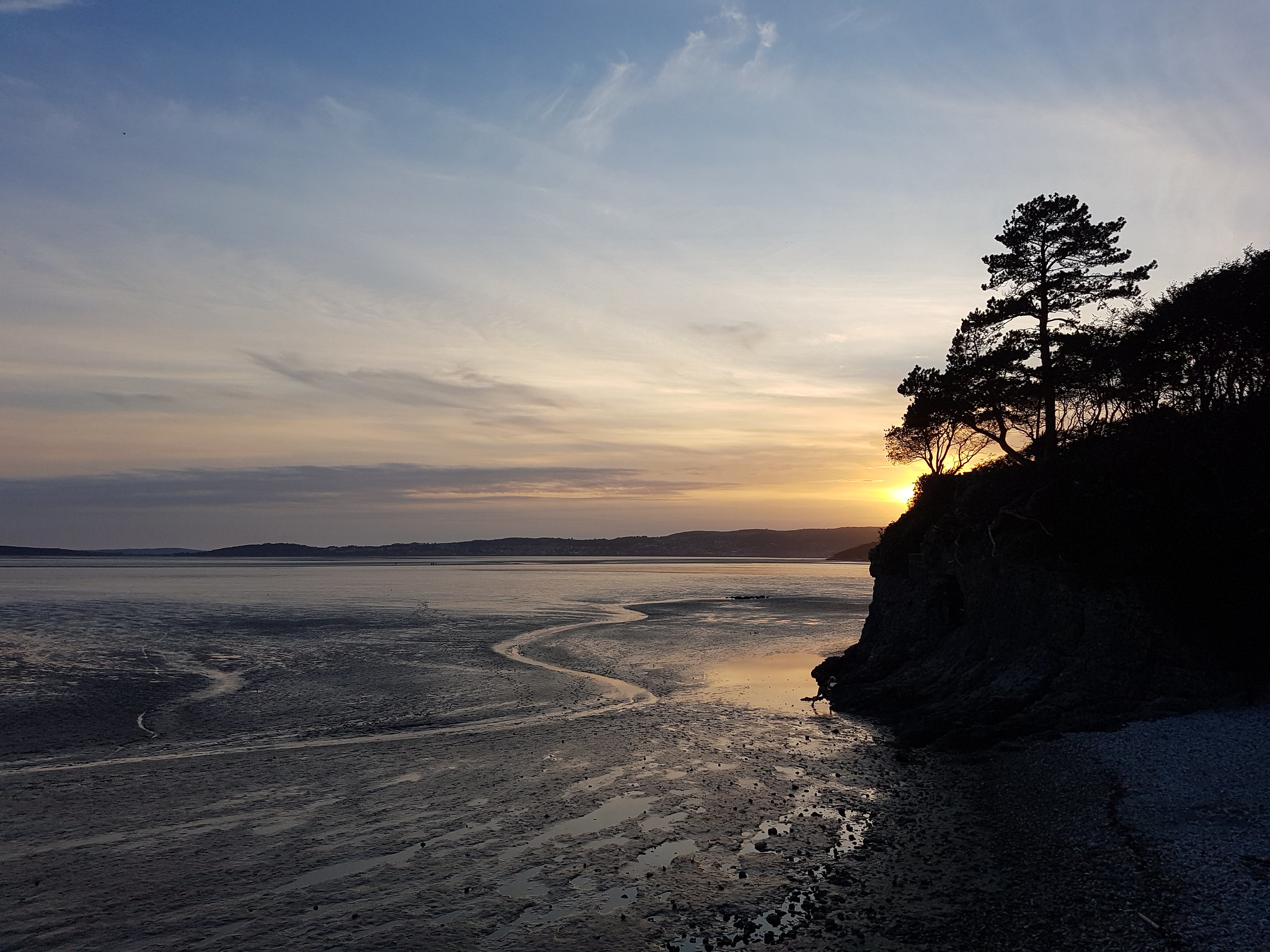
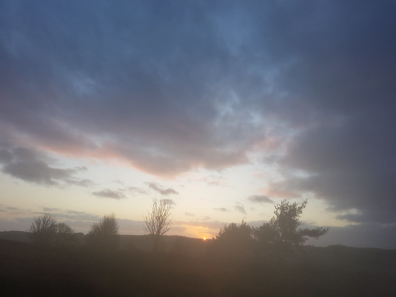
We were none too soon heading down – the sun was getting low in the sky.
Mapmywalk gave a little over 16 miles all told, from car to car. Dan told us that from the end of the stone jetty to the top of Clougha was 13 miles, which sounds about right. You could shorten it a fair bit by taking a more direct line through Lancaster, which would be pleasant enough, although that would also necessitate a fair bit more up and down I think.
Have you ever climbed a hill with a choir? Or tried a sea to summit ascent?
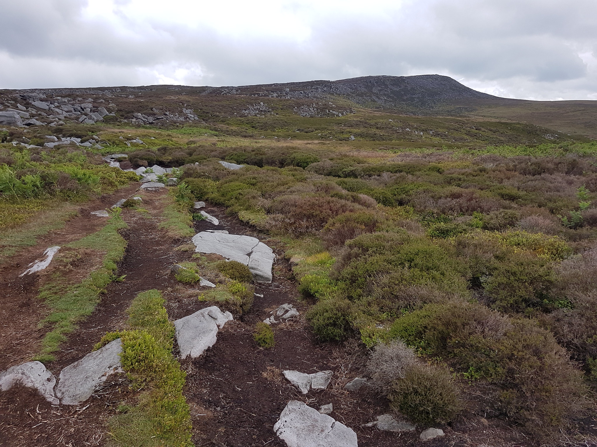
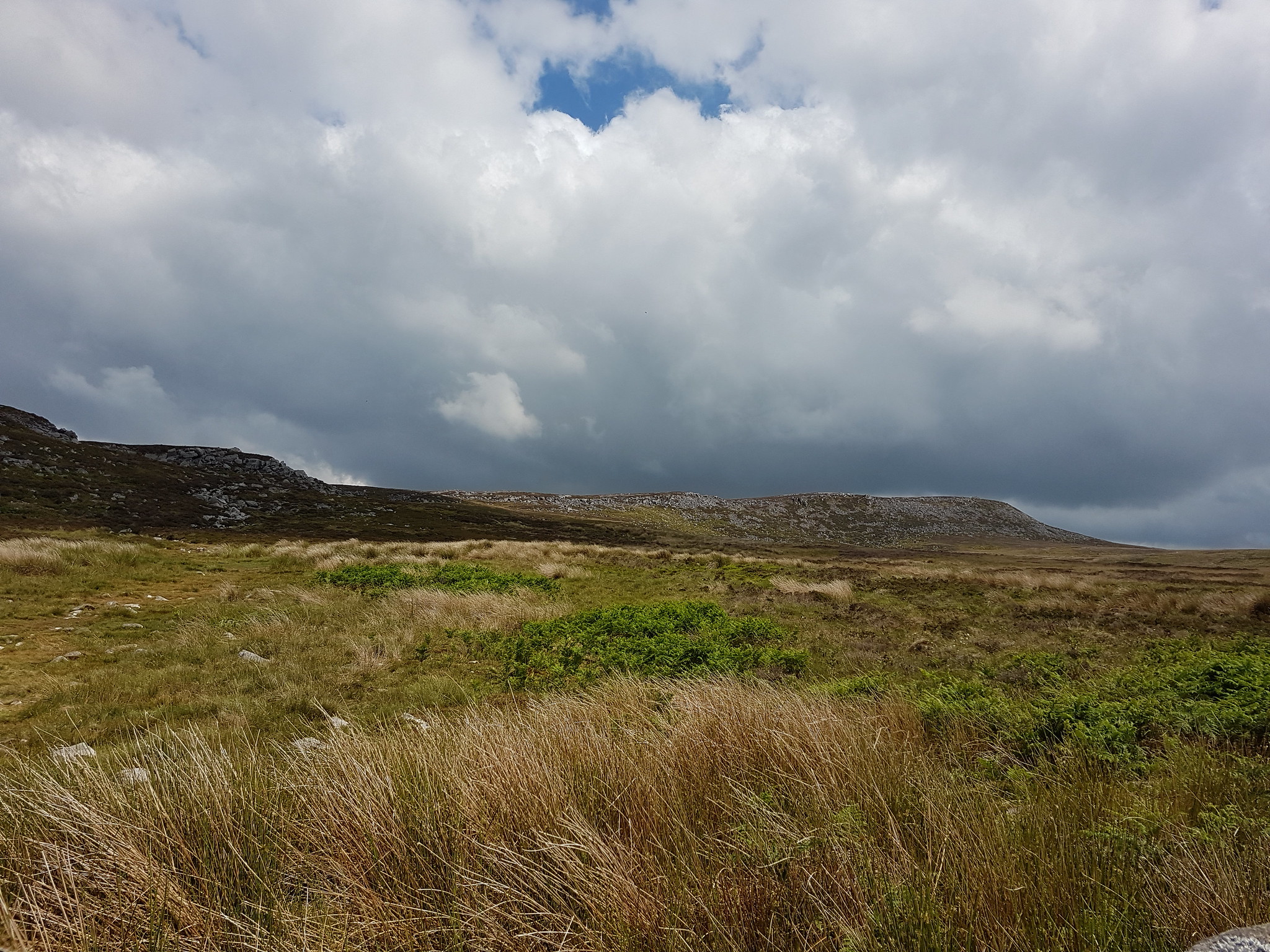
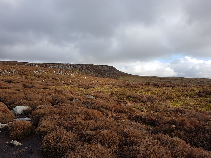
Across the peat and gritstone moorland of Clougha Pike on the edge of the Forest of Bowland. Overhead an everchanging sky. Underfoot springy heather and bilberry. (I shall have to return when they are purple with flower and loaded with berries respectively.)
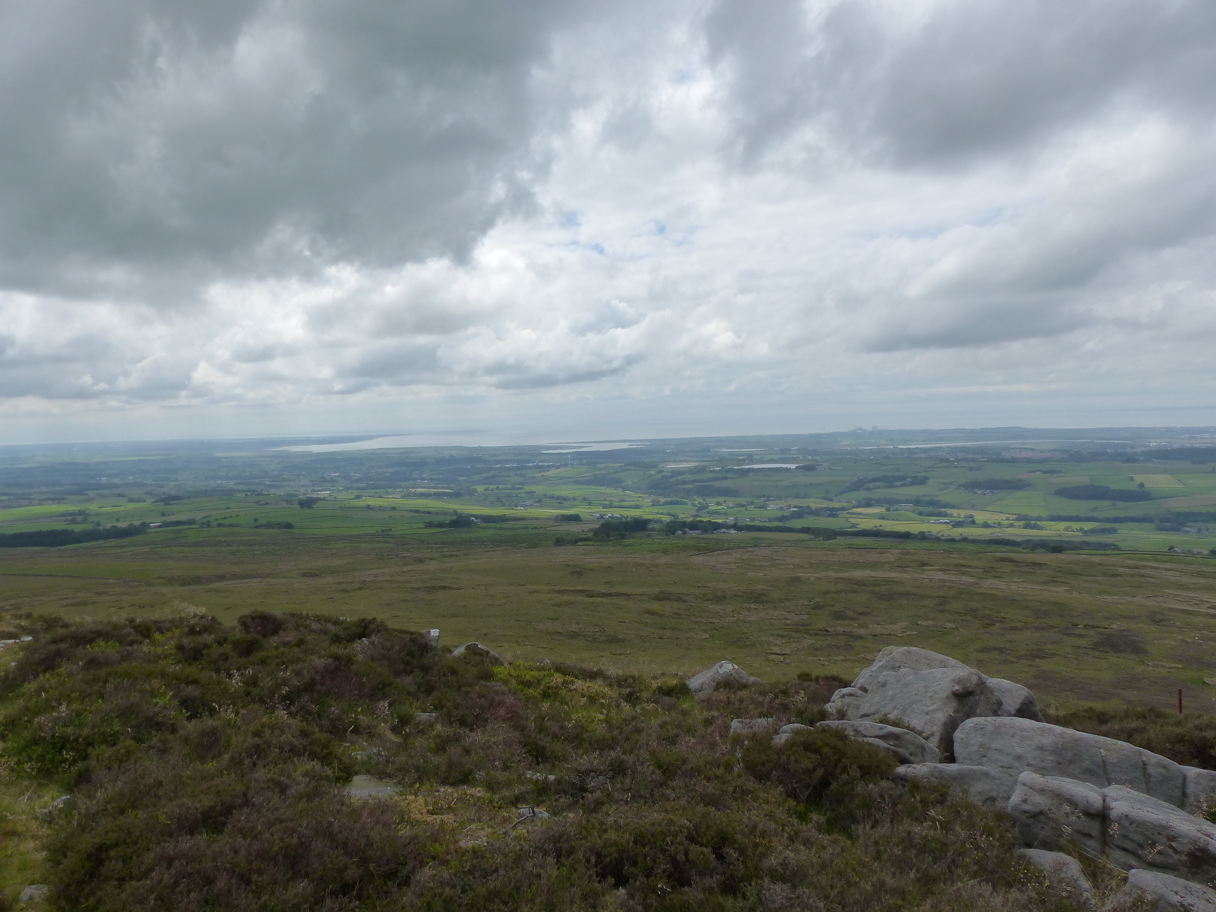
The views over the Bay, and of the sinuous curves of the Lune where magnificent. So where the views of the Lakeland fells.
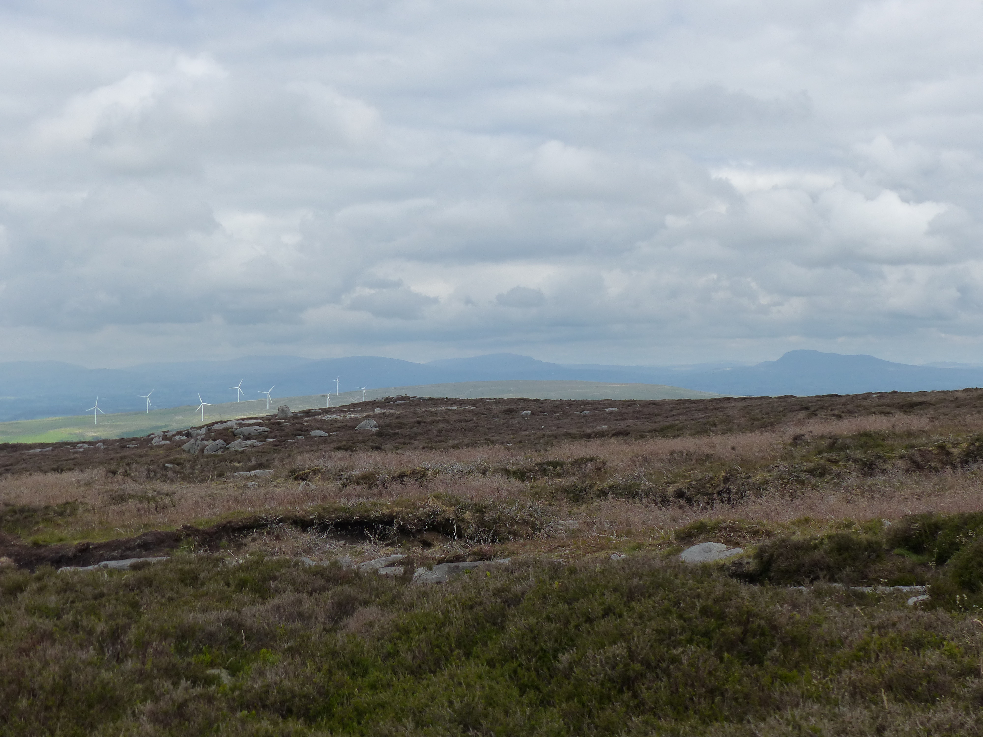
Nearby on Caton Moor the wind turbines where stately in their slow rotation.
I have colleagues who were prominent in the successful campaign to prevent an extension of this wind farm, but if I’m honest, I like them. I know that many people feel that they are a blot on the landscape, but I think that it’s important to remember that our landscape has been very much shaped by man. The moors themselves only look this way because they are managed for grouse. I crossed several areas today where the heather had been burned, or where the regeneration process had begun and the tough old heather had been superceded by short tender new plants. The rattle of grouse calls was my constant companion on this walk. At one point I had three of them clacking at each other with me stuck in the middle. I was surprised by the vivid scarlet of their combs. I also often heard the weird burbling call of curlews. At one point whilst I was concentrating on where I was putting my feet a soft bass ronk ronk made me look up to catch the eye of a raven. He was following the edge, as I was, but his ascent was enviably effortless and he soon disappeared over the summit. A shiny black millipede narrowly avoided being crushed under one of my clodhoppers. Watching it crawl across the peat was fascinating. It’s tiny legs came together in a series of triangles which then seemed to flow along its length.
Ingleborough’s dark shape is recognisable from any direction. I don’t envy the Brigantes in their hill-fort on the top.
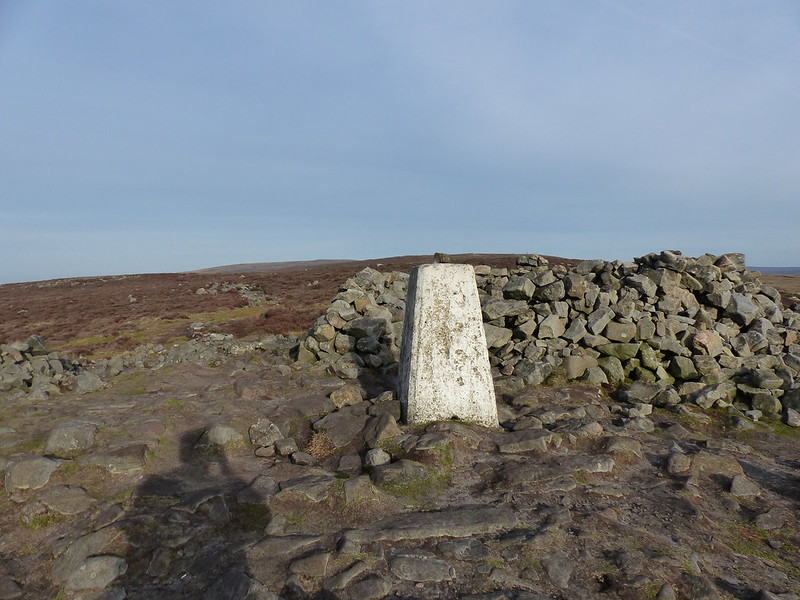
I had some sandwiches in my rucksack for my tea and precious little else. Not for example, a hat and gloves, which would have been welcome as I ate the sandwiches sat amongst the gritstone boulders slightly below the trig point.
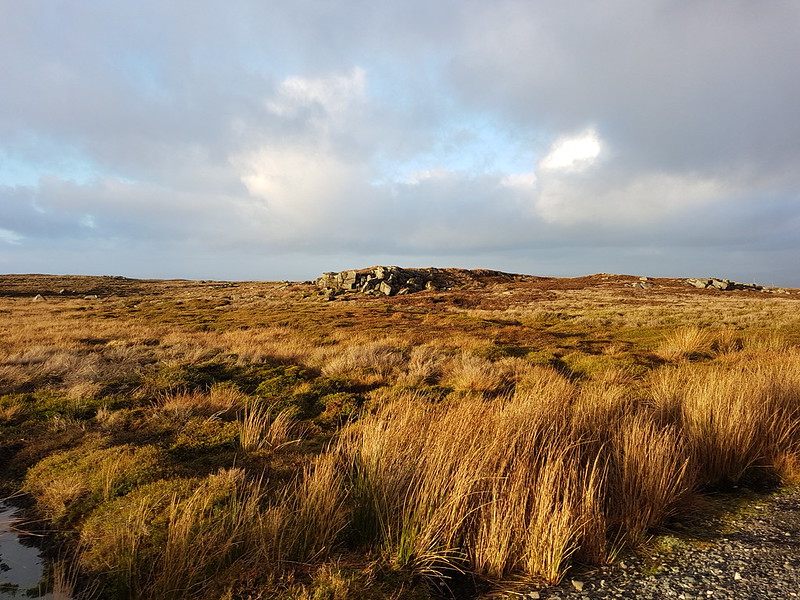
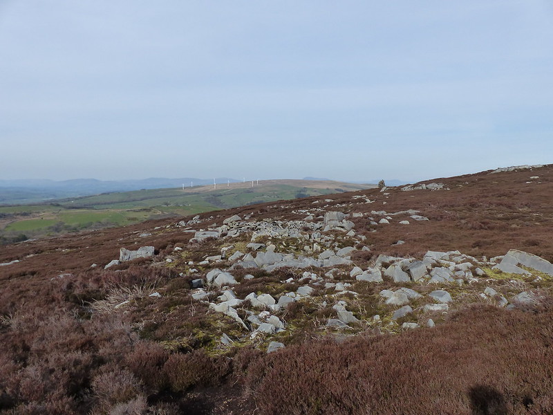
On my way down, I passed this squat tower. It evidently once had a door in it, but that has been ‘bricked-up’. I have no idea of its purpose, but the area around it is a jumble of rocks, half-built walls and shelters. I suspect that some form of quarrying or mining has been carried out here.