The MWIS forecast was predicting the best chance of cloud free summits in the South and West. I was fancying a Birkett bagging trip, but also felt drawn to the Coniston Fells, where I’ve ticked off all of the higher summits (barring Black Sails which lies just west of Wetherlam). But, I had a cunning plan: park at Torver and climb Dow Crag via the ridge south-west of the Walna Scar road, where there were 4 lower ticks waiting for me.
I parked in the church car-park in Torver, where they ask for a £2 donation, far less than the robbery which goes on elsewhere. I was walking by about 8.30. The first field I crossed seemed absolutely saturated, but fortunately was well frozen. And the large snowdrift alongside the drystone wall was firm and a pleasure to walk on.
I climbed up through the conifers of High Torver Park and then up to an easing of the gradient at Bull Haw Moss, which was predictably boggy, but again relatively easy to cross since it was mostly frozen hard.

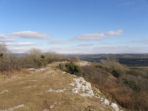
This photo, looking across Bull Haw Moss perfectly catches my ridge walk, starting from the little pimple just peeking into the extreme left of the skyline and finishing at Goat’s Hause on the right-hand side.

Coniston Old Man was imposing from here and I was planning to include that in my walk too. Don’t be fooled by the blue skies and sunshine: the by now familiar easterly was howling through, not just cold, but buffeting too.
As I approached Ashgill Quarry, I left the excellent path to head across the grassy slopes of Bleaberry Haws.

I wasn’t heading for the summit of Bleaberry Haws itself however, but it’s neighbour High Pike Haws, the little pimple seen in the first photo, and below….

The OS map has a couple of features on Bleaberry Haws marked out in the Gothic script which suggests something of great antiquity. Somehow I missed the Enclosure, but found this….

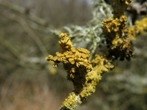
,,,which I assume is what is marked on the map as a Cairn. A Ring Cairn? Subsequent internet research suggests that there is also a small stone circle on Bleaberry Haws which isn’t marked on the OS map. I shall have to come back one balmy summer evening and have a proper explore, take a closer look at both Bleaberry Haws and also Ashgill quarry.
In the dip between Bleaberry Haws and High Pike Haw, a well compacted snowdrift was sculpted into ridges and hollows. By the wind?

From High Pike Haw I followed my nose uphill toward White Maiden. More by luck than judgement, I found a route which followed a slight dip alongside a line of crags.
The edge of the dip was drifted deep and the crags often festooned with ice….


One particular ice formation stood out from quite some distance…

Here it is in all it’s glory. I estimate that it was around 15’ high.

Reaching the summit of White Maiden, the views really opened out.

Black Combe and Whitfell at the back, Caw in the foreground.

The high fells around Upper Eskdale.

Along the ‘ridge’ to White Pike, my next objective.
Up here on the tops the wind was really something. The walk to White Pike, pretty much with the wind, was OK, but turning back to head for Walna Scar with the wind into my face was rough going. It was the kind of wind which has you turning your head to snatch a breath and which you know will throw you over when you’re off balance. I met another walker, my first of the day, who I’d watched descending the ridge from Buck Pike. He said he’d intended to continue to Coniston Old Man but the wind had changed his mind for him.
At the top of the Walna Scar road, where the wind seemed particularly ferocious, I was having similar misgivings. The climb up to Brown Pike afforded some degree of shelter however.

Buck Pike from Brown Pike.
The walk along the ridge from Brown Pike to the summit of Dow Crag was enlivened by the variability of the gusts. At times the wind was howling up the cliffs on my right and seemingly continuing up and over and missing me. At other times I was buffeted and rocked by the gale. The snow was very firm and I probably should have stopped to put on the microspikes that I’d bought myself just a few days before for exactly this eventuality. On one particularly icy section a gust caught me and I fell, but fortunately only my pride was hurt.

Looking back to Brown Pike and frozen Blind Tarn. Morecambe Bay beyond.

Coniston Old Man from the descent from Dow Crag.

Dow Crag and Goat’s Water from Goat’s Hause.
By the time I reached Goat Hause (which was very busy) I’d made up my mind: I’d had enough of fighting the wind and Coniston Old Man would have to wait for another day.

All that remained then was a steady ramble down past Goat’s Water and then beside Torver Beck, past the imposing Banishead Quarry….


And back to Torver.

A very fine outing.