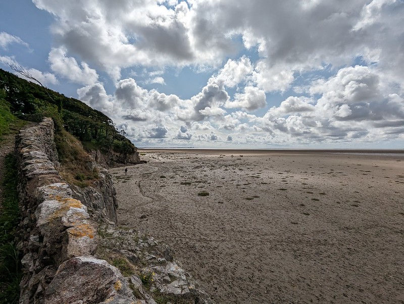
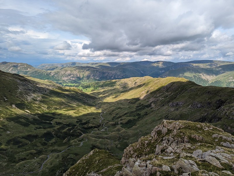
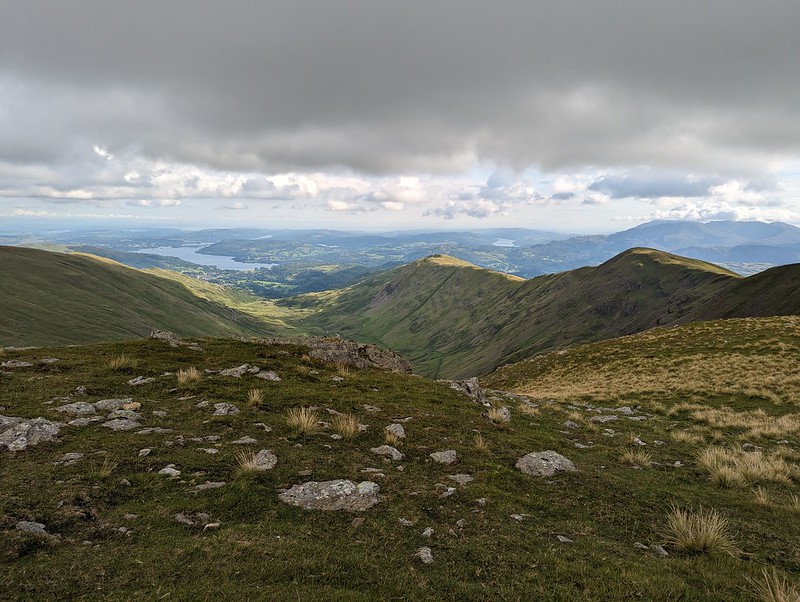
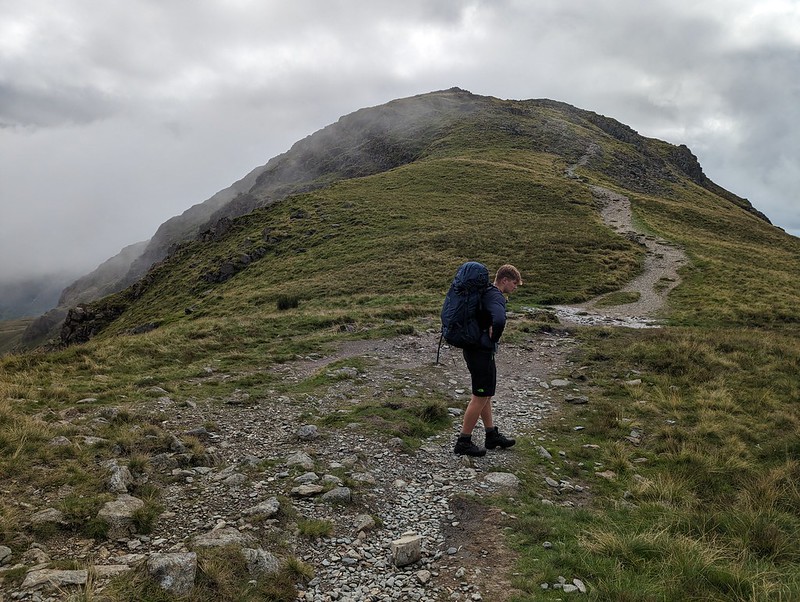
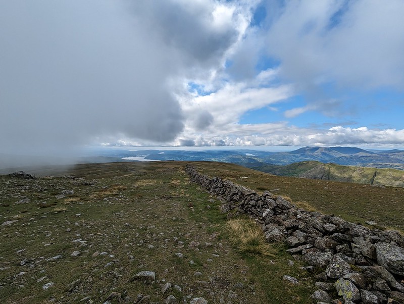
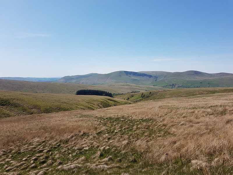
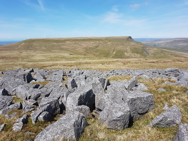
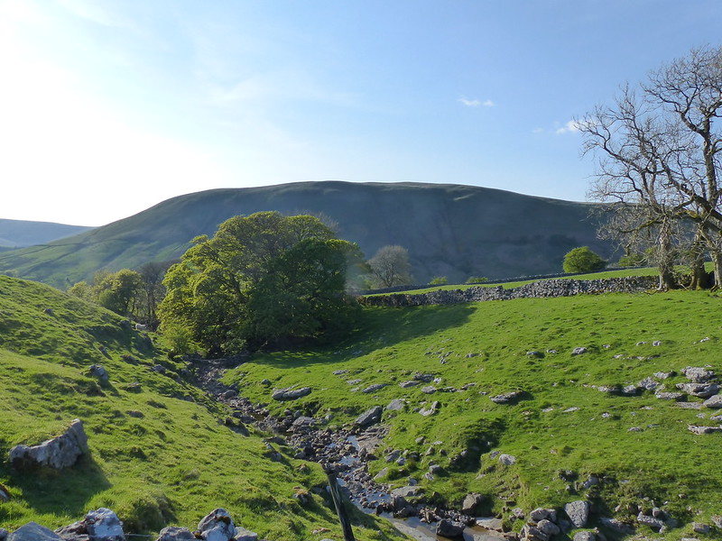
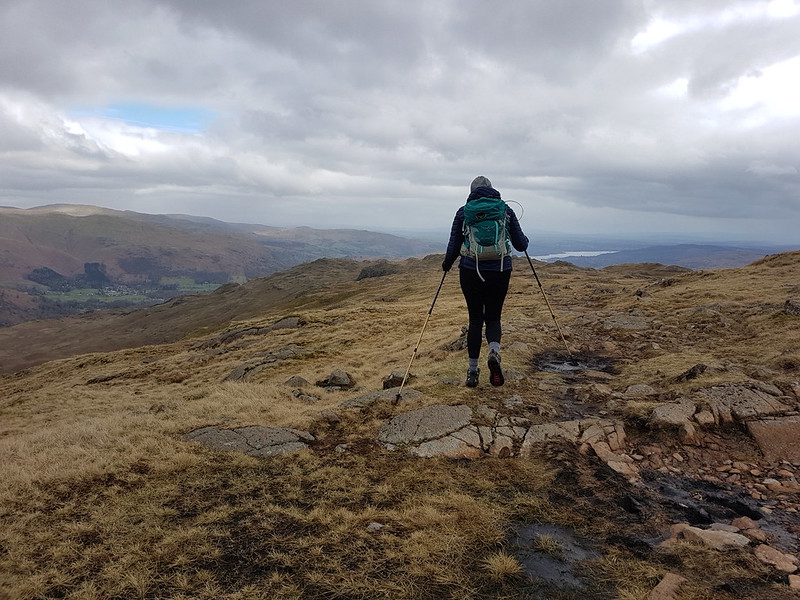
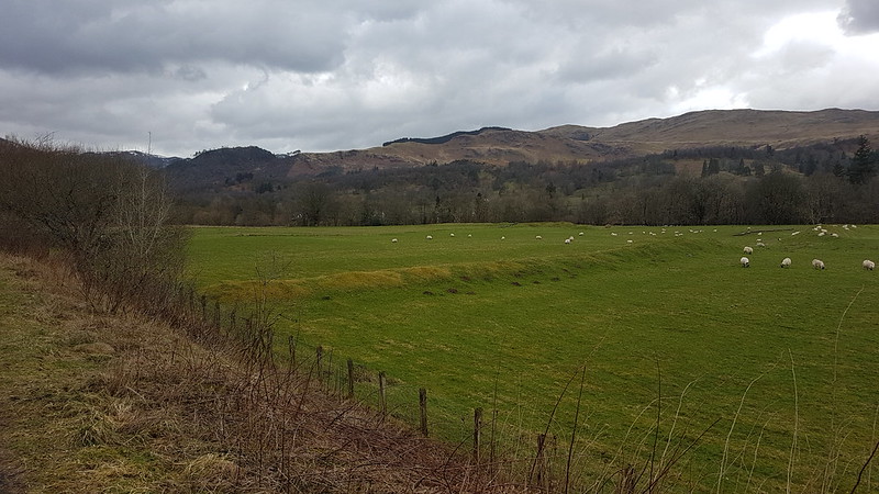
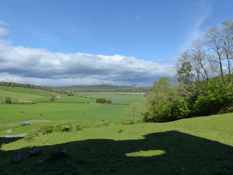
Two more local strolls from the back end of August. The first was a quick trip to The Cove and around The Lots, with TBH, but since she wasn’t ready to leave the house when I was, I first walked across the fields to Stankelt road and around Clark’s Lot first.
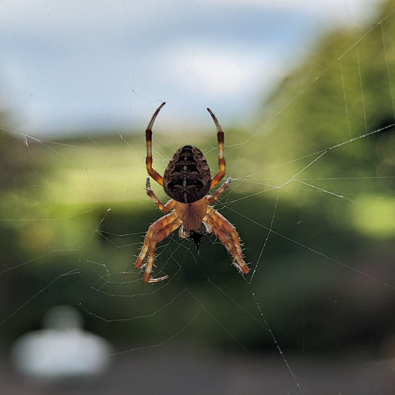
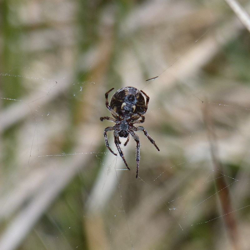
Looking towards Grange from the Cove.And the other way from the Cove.Garden Spider.
This spider was in our garden, but only just, hanging just beyond one of our kitchen windows.
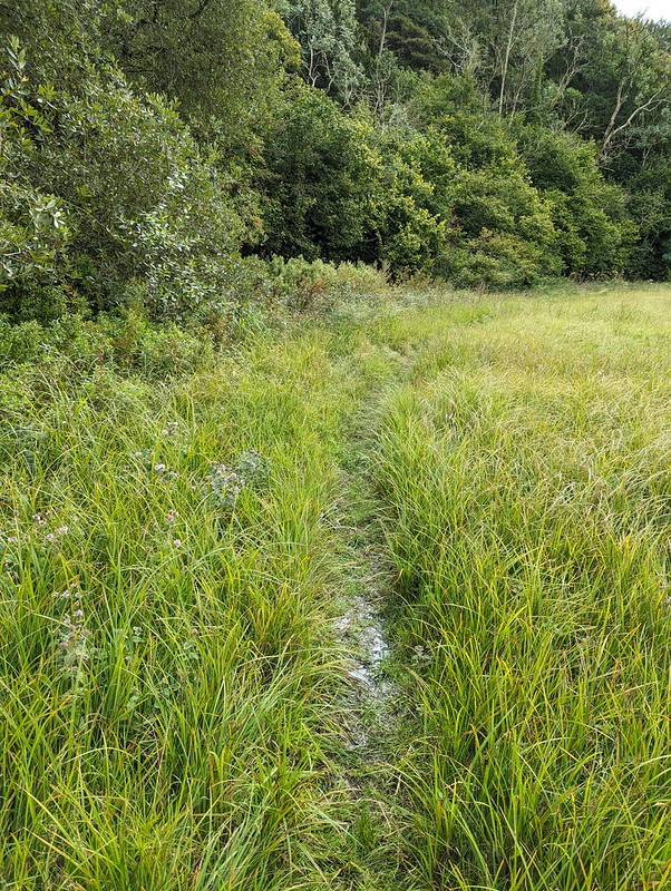
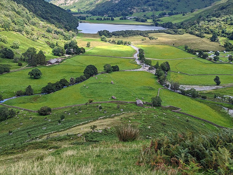
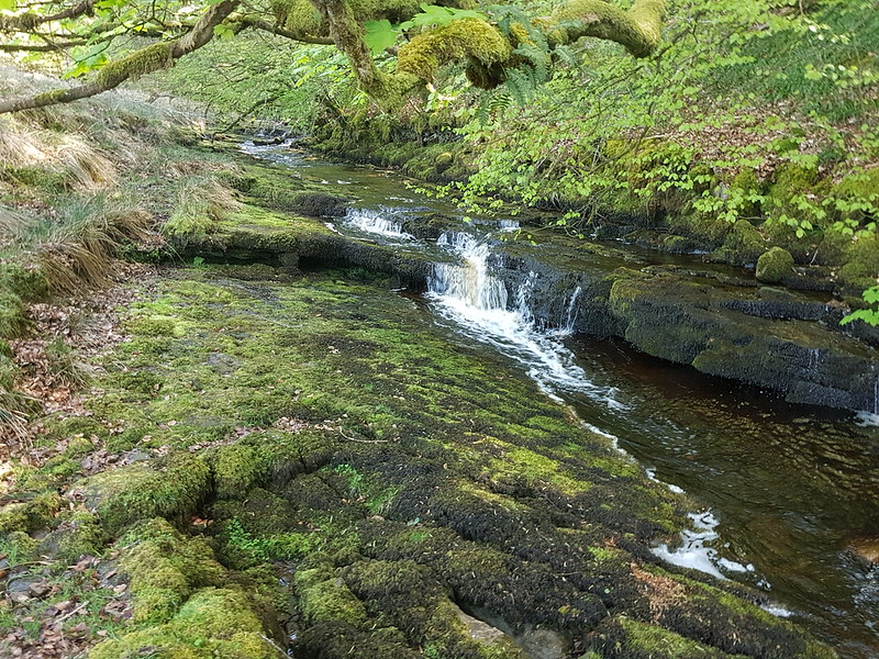
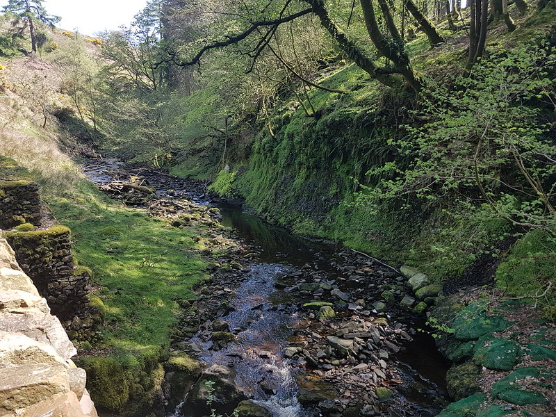
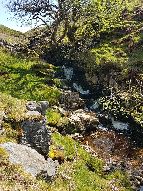
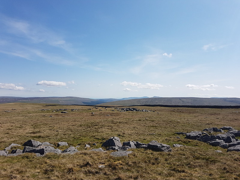
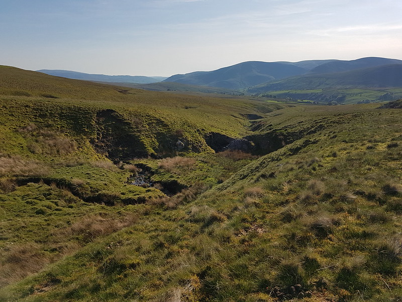
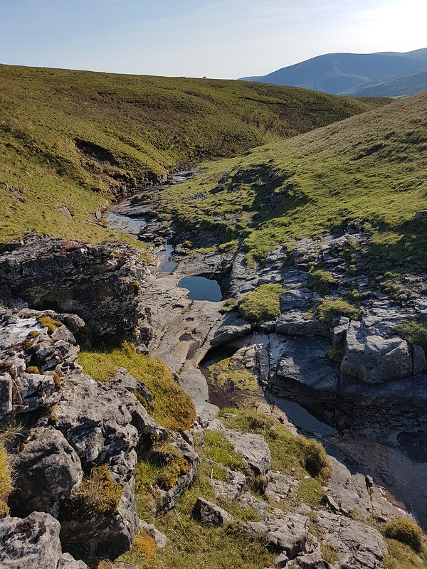
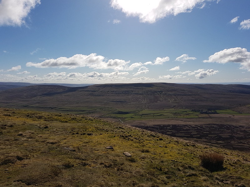
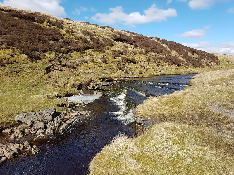
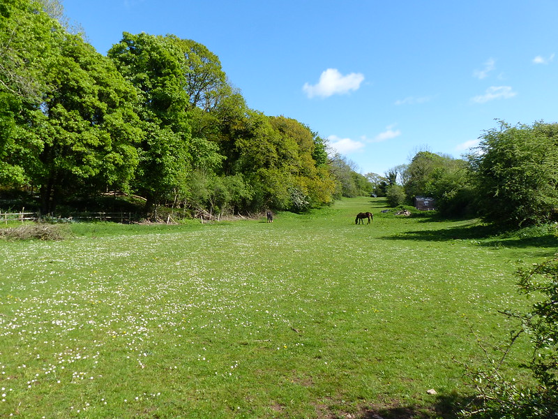
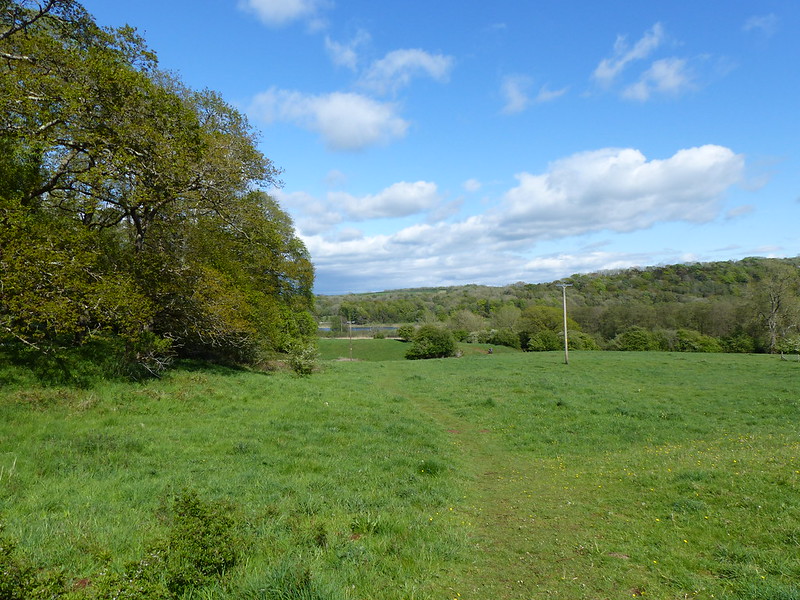
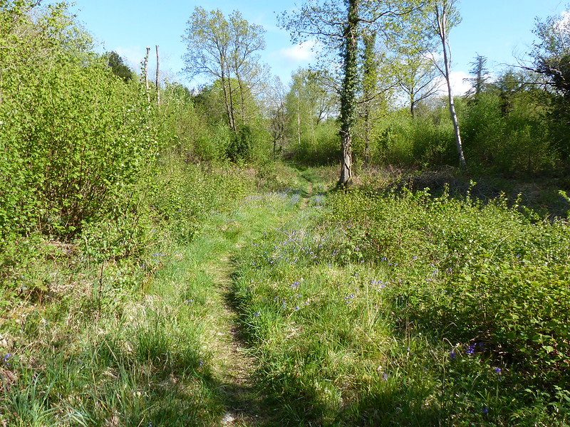
The following day I walked our circuit around Jenny Brown’s Point, but had a mooch around Lambert’s Meadow first. This slight path runs around the eastern edge of the meadow…
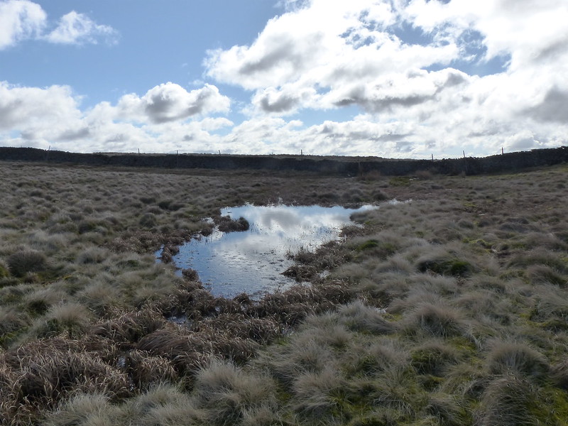
Lambert’s Meadow – very wet.
It’s where I take most of my photos – you can see here that’s it under a couple of inches of water, which isn’t uncommon at all in the winter, but which shows what a wet August we were having.
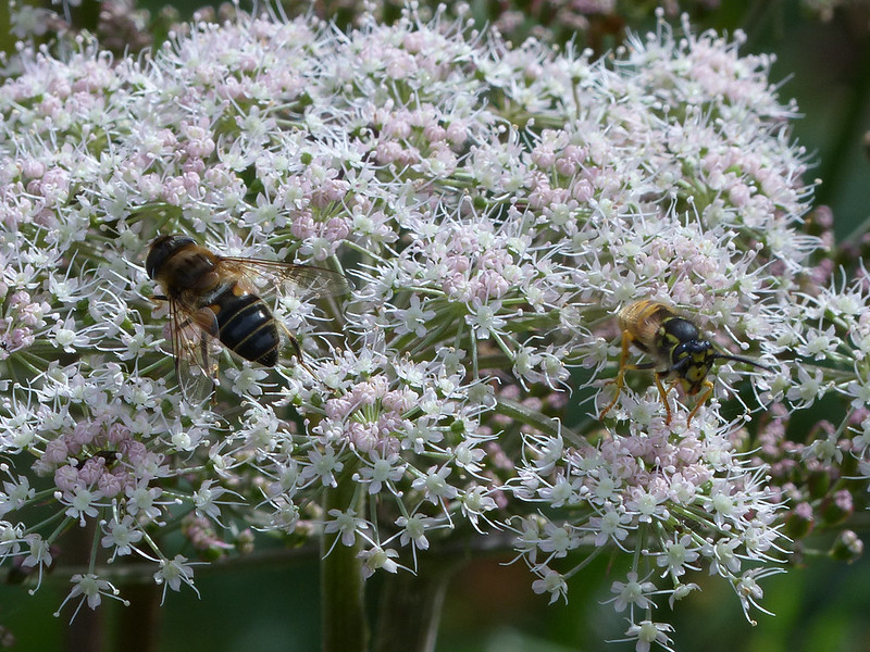
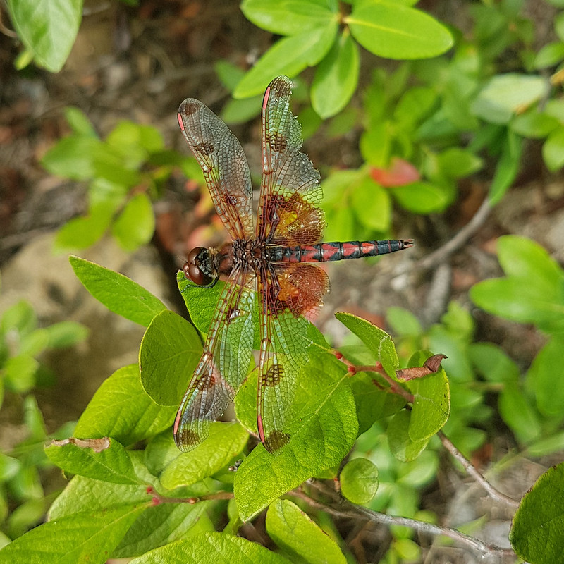
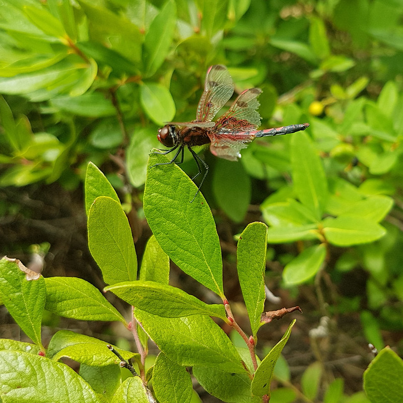
Harlequin Ladybird, with a raindrop on its back.Wet Guelder Rose berries.A couple of wasps and a fly.Hoverfly, possibly Eristalis arbustorum.Bog Hoverfly – Sericomyia silentis, I think.
“This is a large and brightly marked hoverfly, with 3 pairs of wedge-shaped yellow bars and reddish-orange legs.” It prefers wet heath, so Lambert’s Meadow is the right sort of spot.
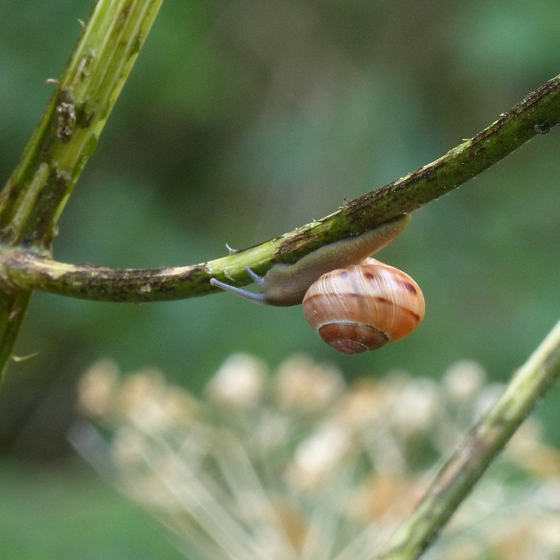
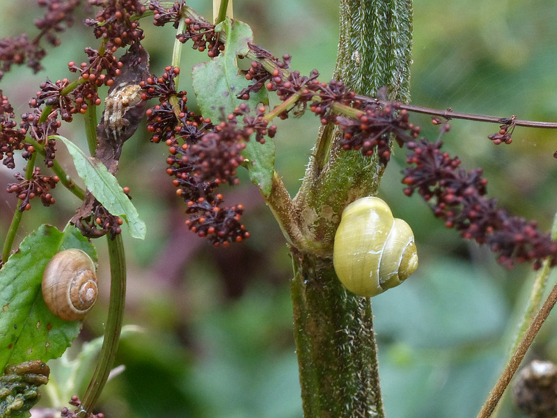
The light wasn’t great, but there was plenty to see and photograph. In particular, a variety of snails seemed to be having some sort of rave. They were everywhere.
Garden Snail.Banded Snail.A slug and a few snails.
There were actually several more snails on these two tall stems, who knows why they were so busy that day?
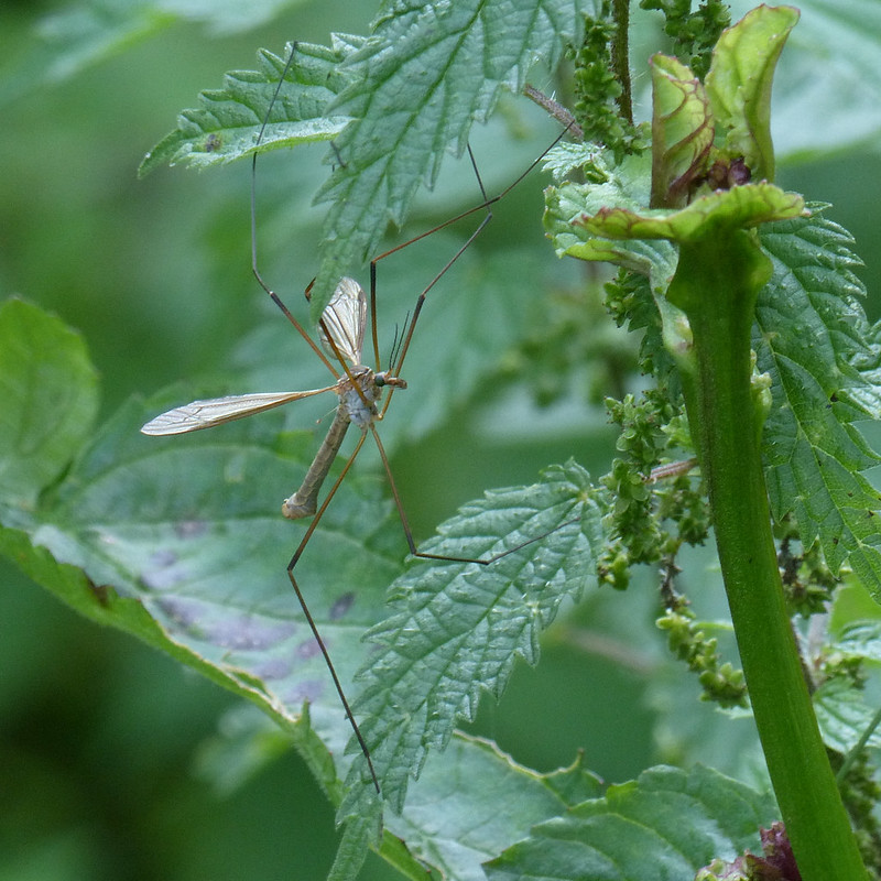
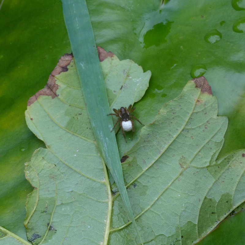
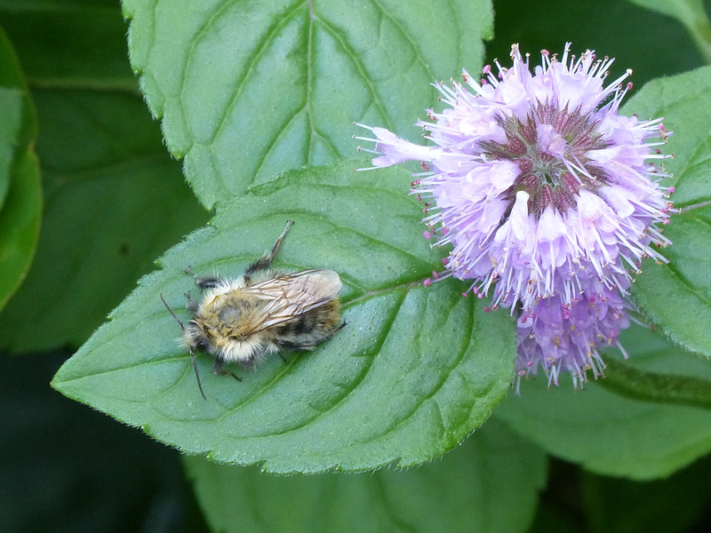
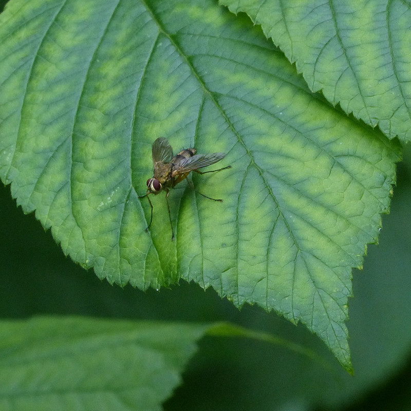
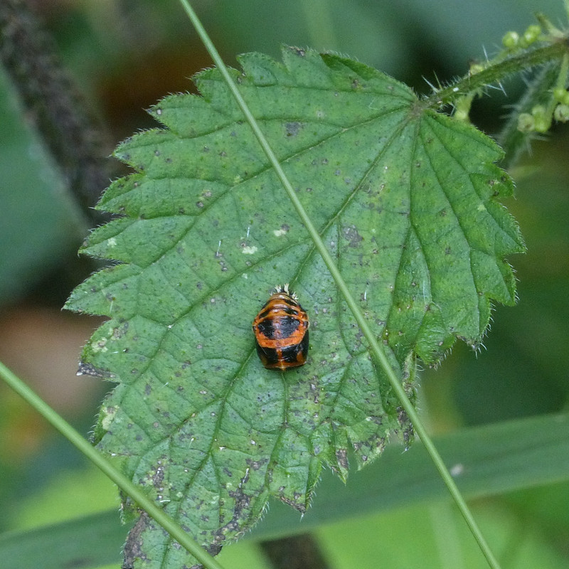
Probably the Banded Snail from the photo above – White-lipped.Two more White-lipped Snails.Crane Fly.Pirate Wold Spider – Pirata piraticus. Female carrying an egg sac.A very hairy bee – I don’t know which kind.A fly.Harlequin Ladybird Larva.A ladybird chrysalis – also possibly a Harlequin.
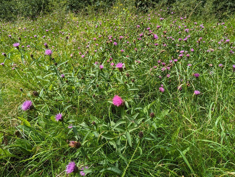
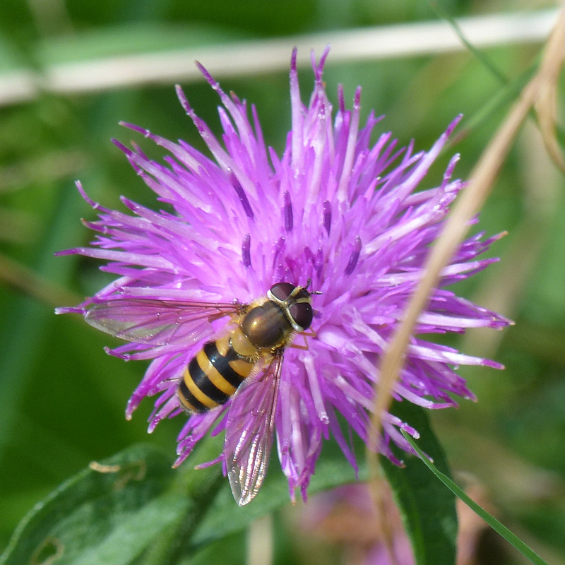
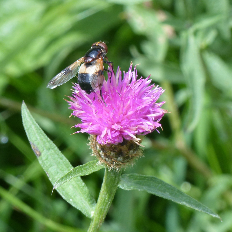
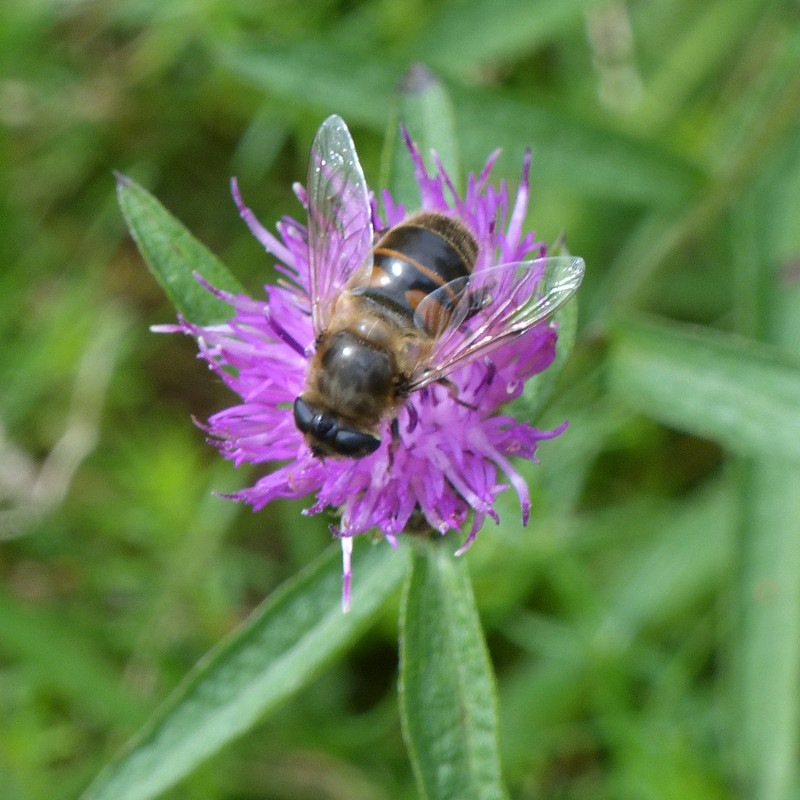
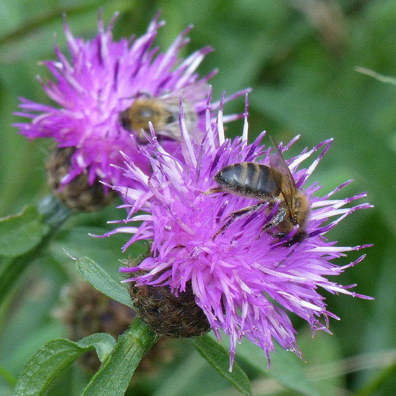
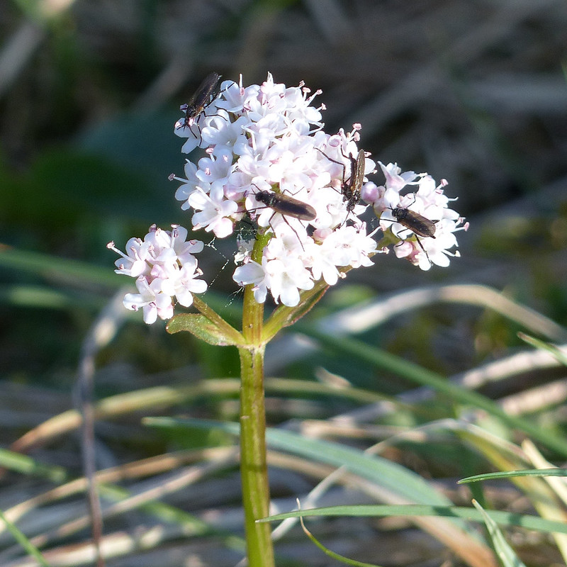
On my way down to Jenny Brown’s, I emerged from Fleagarth Woods into a small clearing which was mobbed with wildflowers, especially Common Knapweed. The flowers were really busy with bees and hoverflies, so of course, I took no end of photos.
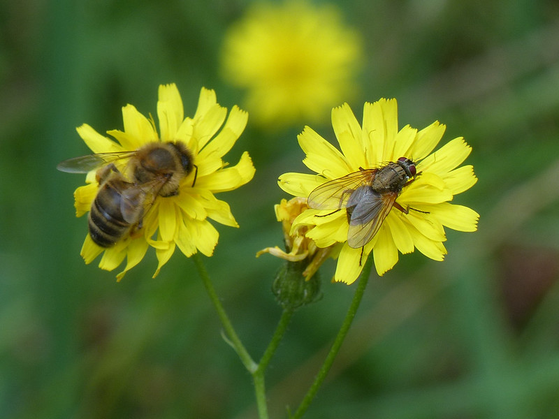
A patch of wildflowers, mostly Common Knapweed.Hoverfly – a Syrphus species.Hoverfly – Pellucid Fly – Volucella pellucens.Marmalade Hoverfly (Episyrphus balteatus).Drone Fly, possibly Eristalis Tenax, the Common Drone Fly.Hoverfly – Helophilus Pendulus – The Footballer. On Sneezewort.Honey Bee and a fly.Honey Bee on Common Knapweed.A tiny micro-moth.
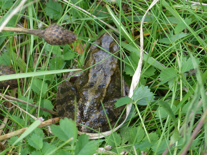
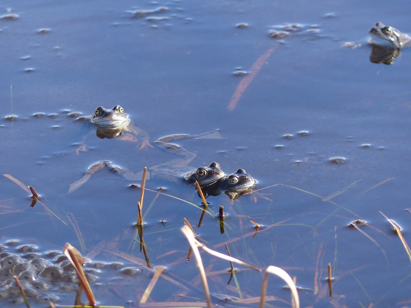
My roaming through the flowers disturbed this frog…
A frog!
Had I realised how many different species of hoverfly were in that little clearing, I probably would have stayed to take even more photos, but until I got home to download and look at the photos I wasn’t aware of the variety.
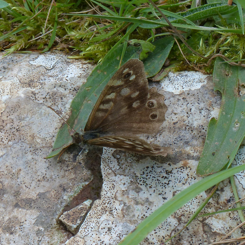
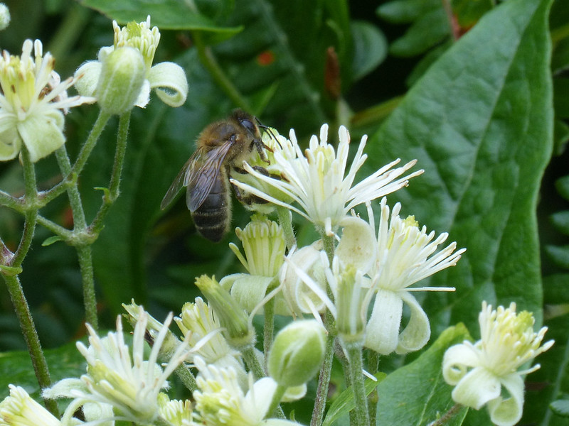
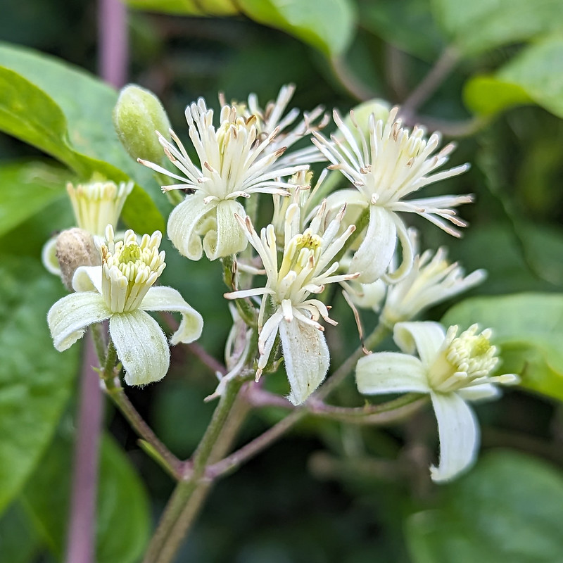
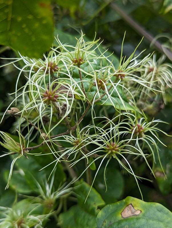
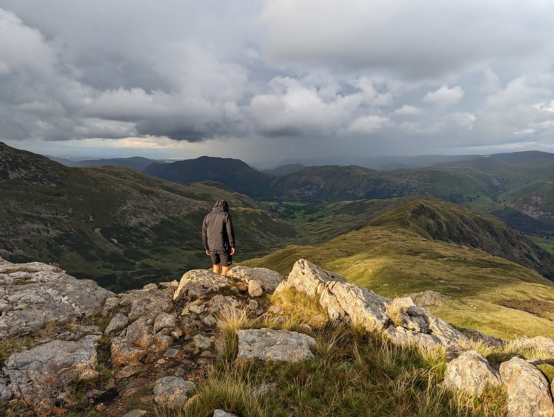
Speckled Wood Butterfly.Honey Bee on Traveller’s Joy flowers.Traveller’s Joy flowers.Traveller’s Joy seeds.Looking towards Grange from Jack Scout.
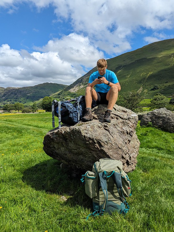
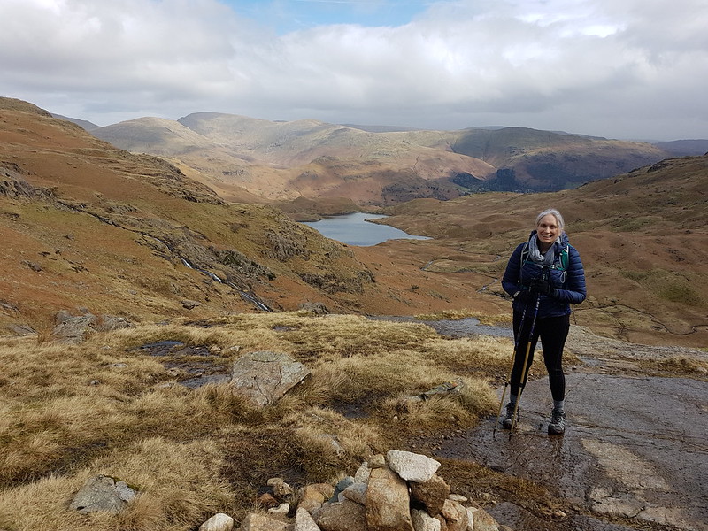
B and I had been discussing various plans for a night or two away somewhere, but dodgy weather and the fact that B was quite busy between work and social commitments had prevented that so far. However, the forecast looked half reasonable, and B could spare me an afternoon and the following morning, so we hastily packed (fortunately my gear had dried out in the day since my wash-out walk from Austwick) and set-out for Patterdale. We parked at Cow Bridge, just north of Brothers Water. I was pleasantly surprised to find that the car park wasn’t full, especially given that it’s free.
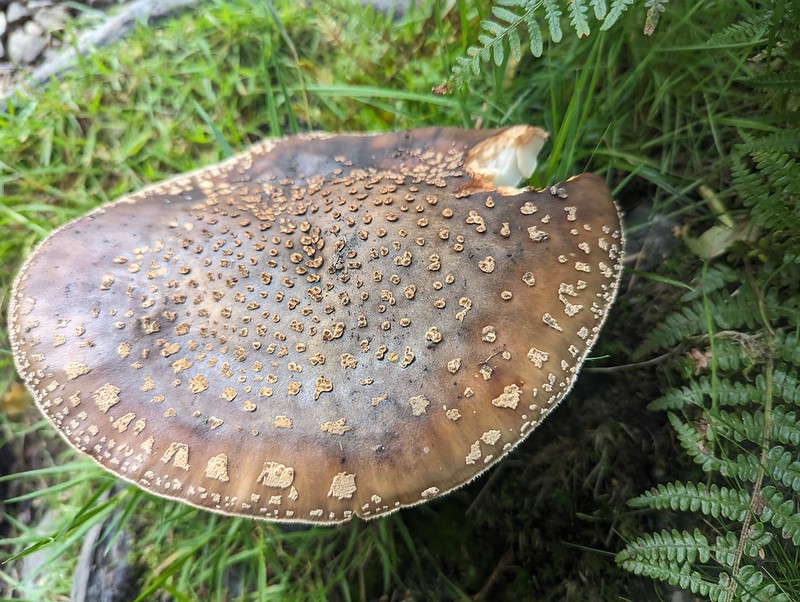
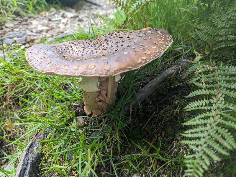
Fungi in Deepdale Park.
We used the permission path beside the road through Low Wood. The map shows a much more direct route through the woods on to the Hartsop above How ridge, but I would have been much happier to take the less steep route even if I hadn’t been carrying camping gear. Actually, B had volunteered to carry the tent, so although I had the food, pans and stoves, my pack wasn’t as heavy as it might have been.
Fungi. Possibly Amanita rubescens?Gavel Pike.
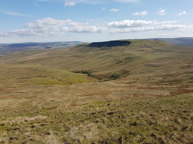
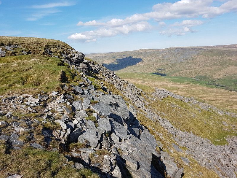
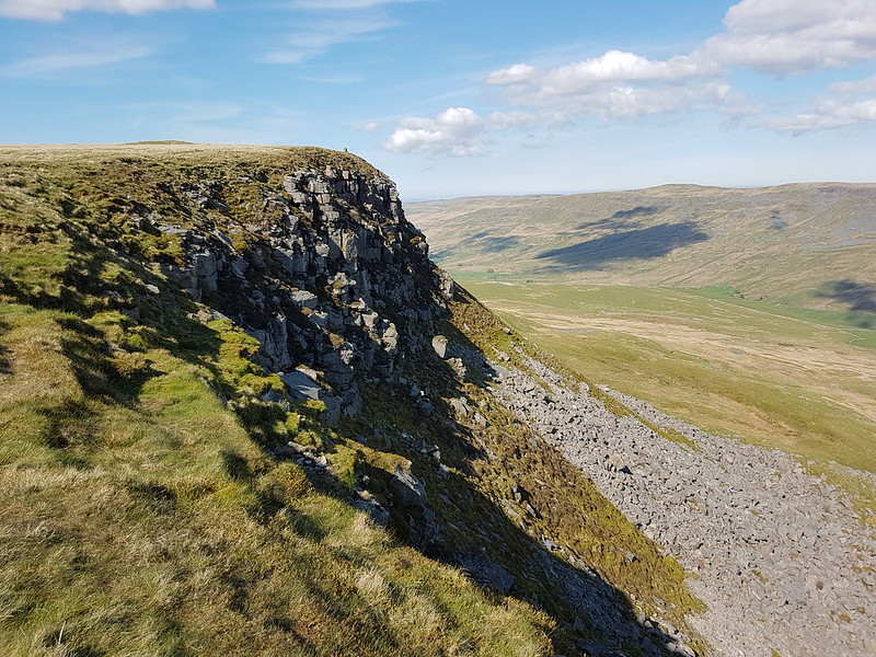
Gavel Pike looks very dramatic from this direction, which is a bit misleading, but it’s a Birkett which is well worth taking a detour to visit when climbing St Sunday Crag.
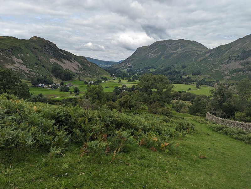
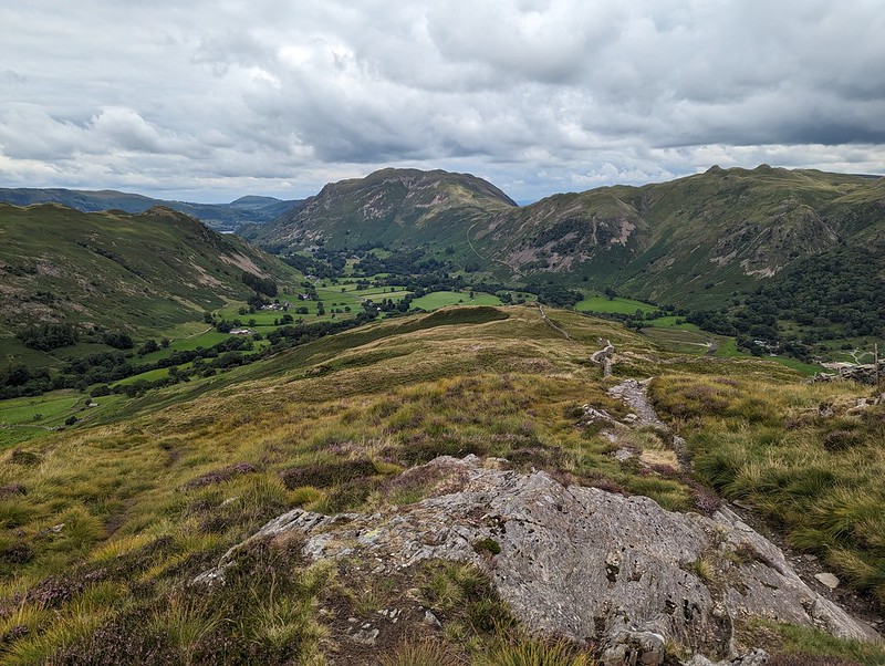
Arnison Crag and Place Fell either side of Patterdale.Arnison Crag, Great Mell Fell, Place Fell, and Angle Tarn Pikes from Gale Crag or thereabouts.“So, where are we going to camp?”
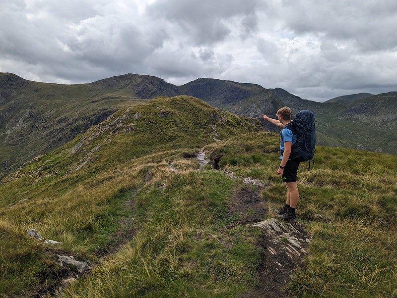
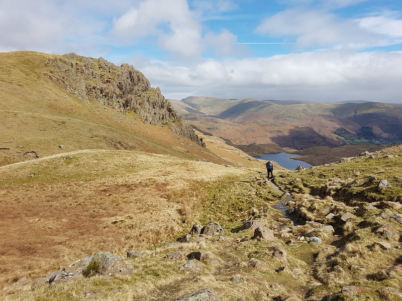
The long ridge over Hartsop above How is a lovely walk. It gave us lots of opportunity to look ahead to the various potential campsites I’d identified. I let B make the decision and he was most taken with the idea of dropping down into Link Cove, the craggy corrie below Hart Crag and Scrubby Crag. Although I left the choice to B, that was my preferred option too. I’ve visited Link Cove a couple of times before, ascending in to it on the way up Fairfield from Deepdale, with Andy and Uncle Fester years ago and I’d been wanting to return.
B admiring Dove Crag, Hart Crag and Fairfield. Before succumbing to ‘ant attack’.
There were a lot of flying ants about. We’d decided to stop here for a drink and a snack, but this little knoll seemed to be a particular focus of their attention and we were quickly overwhelmed and decided to move on.
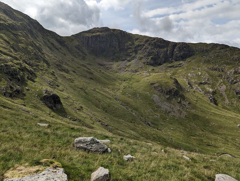
Link Cove dead ahead.Link Cove.
There’s no path into Link Cove. We took a line which angled down below the darkly shadowed crag on the left of the photo above, then climbed again onto the small ridge in the middle of the cwm. This was rough going, but I love getting off-piste into dramatic scenery like this.
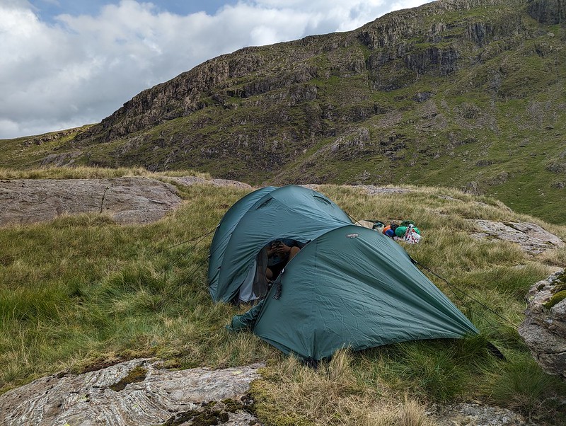
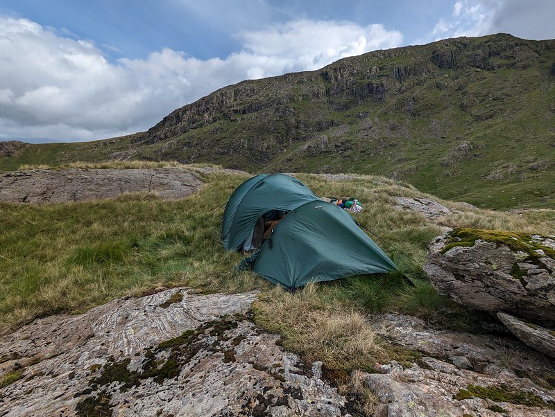
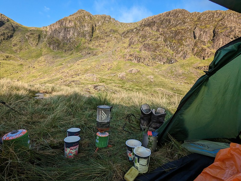
Tent pitched.
It was hard to find any level, dry ground to pitch the tent on. This spot was probably more level than it looks in the photo, but it wasn’t as dry as we might have liked. Then again, after the weather we’d had, it was always going to be hard to find a spot which wasn’t soggy.
Camp in Link Cove.Looking down Deepdale.
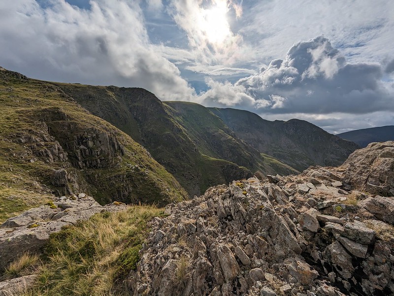
Once we were pitched and organised, we left our gear and set-off unencumbered for a circuit of Link Cove. I thought the map suggested that The Step would give a good ascent route and that proved to be the case.
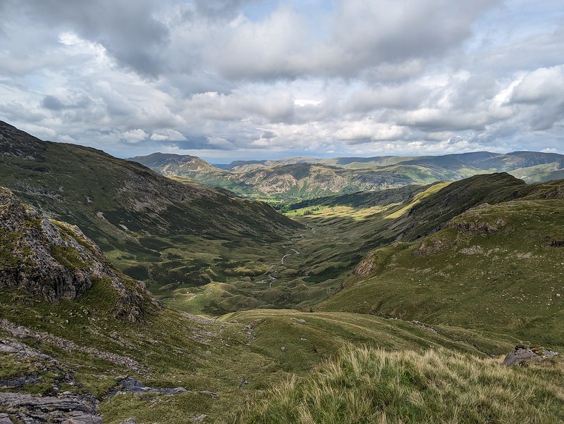
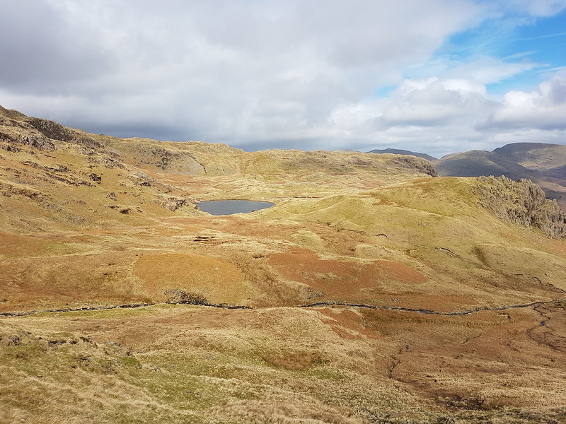
The High Street range from ‘The Step’. Looking across Link Cove to Hart Crag. Our tent is to the right of that short rocky ridge in the cove.St. Sunday Crag.Looking down Deepdale. Hartsop above How ridge on the right.Black Tippet and the northern buttresses of Fairfield. Cofa Pike on the right.
You can’t beat this sort of exploration – we had great views into Link Cove, then suddenly we hit the far side of the ridge and found terrific views of the northern steeps of Fairfield. From Scrubby Crag we decided that a detour to take in the summit of Fairfield was called for.
Dollywaggon Pike, Nethermost Pike, Helvellyn and Striding Edge.Cofa Pike and St. Sunday Crag.
The skies to the east were looking increasingly grey and it was clearly raining not too far away. It would surely be only a matter of time before we got our own shower.
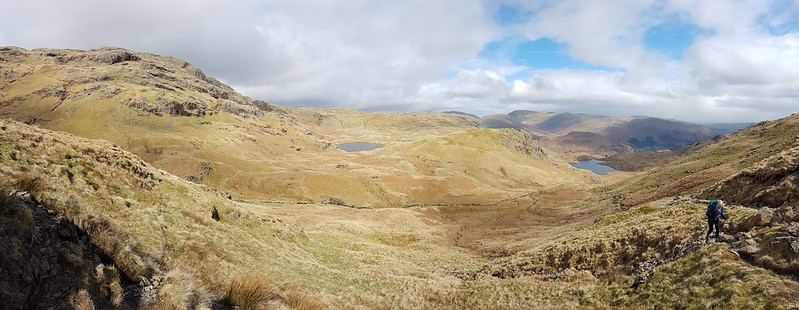
Looking west. Scafells, Gable, Dale Head, Maiden Moor, Northwestern Fells.Rainbow Weather.Looking down Rydal. Great Rigg and Heron Pike on the right. Windermere, Coniston Water and Morecambe Bay in the distance.Link Cove, Deepdale, Hartsop above How. Sunshine and showers.
I thought we could descend, with care, the gully to the south of Scrubby Crag, but B took one look at it and clearly doubted my sanity, so we climbed Hart Crag instead, descended the ridge towards Hartsop above How and then repeated our route down into the cove and back up to our tent.
St Sunday Crag.Descending towards our camp.
Of course, eventually it began to rain and didn’t stop for quite some time, even though the sun was still shining too…
Dove Crag.
We thought we could pick out the path to the cave on Dove Crag which is meant to be a good bivvy spot.
A Link Cove frog.
We were using the tent which we’ve borrowed (seemingly indefinitely) from Andy. It’s not the lightest, but it’s amazingly spacious and the huge porch was superb in the wet – perfect for me to sit in and cook our evening meal (filled pasta, pesto, dried fruit and custard, very satisfying).
Second Day
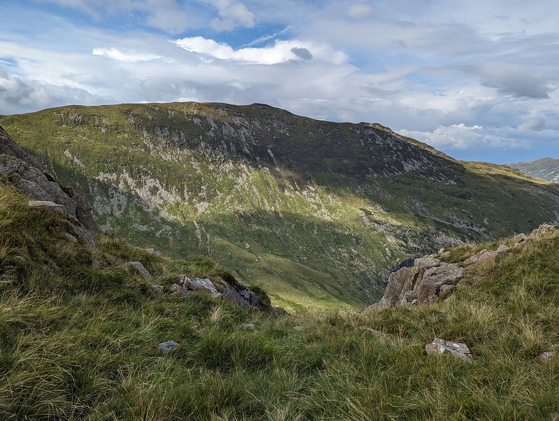
A breakfast view of Scrubby Crag.
This early morning photo might be a bit misleading. Once again, we seemed to be on the divide as far as the weather was concerned. To the west, all was blue sky and sunshine; to the east, low cloud. And although the wind was, I was sure, blowing from the west, the cloud was sweeping up Deepdale towards us. Still, we at least had sunshine whilst we breakfasted and packed up.
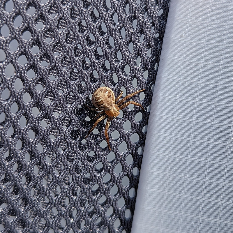
A Crab Spider. Xysticusspecies. I think.Ascending The Step again, with atmospheric clouds.
We wanted to regain the main ridge, and could choose to retrace either our ascent or our descent routes of the previous evening. Despite its initial steepness, we agreed that The Step was much the easier going of the two. With the cloud sweeping in across the crags, it was atmospheric too.
Hart Crag.The ‘view’ to the East.And to the West. Coniston and Langdale Fells. Heron Pike and Great Rigg in the foreground.Looking South from Dove Crag. Windermere, Coniston Water and Coniston Fells.
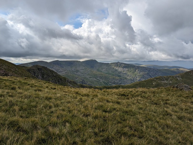
As you can see from the photos, the weather was really odd, but it gradually improved as we wandered over Dove Crag and then Little Hart Crag and finally along another delightful ridge to High Hartsop Dodd.
Middle Dodd, Little Hart Crag and Red Screes.Looking down Scandale. Scandale Tarn in the foreground.
I have several spots in the area earmarked as potential wild-camping locations. Scandale tarn is one of them.
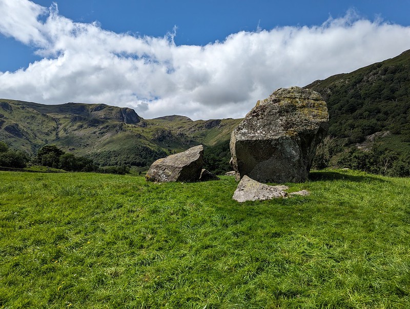
Middle Dodd and Red Screes.The complex terrain at the head of Dovedale.B descending towards Brothers Water.Looking down on the Romano British enclosed stone hut circle.
I’ve waffled on before about this amazing archeological site. Historic England has a thorough physical description, but doesn’t supply much detail about who lived here and how they might have lived.
Another view of the settlement. The knoll on the right is the site of the oval cairn.A final rest stop.Looking up Dovedale.
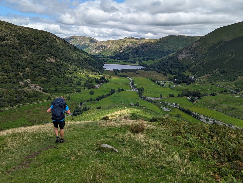
This was effectively a day’s walk divided in two, which I think is probably a good way to plan an overnighter. We both enjoyed it immensely and were both keen to go again. B also wanted to borrow some gear and take some of his friends wild-camping, but then he got a job pitching and packing-up much bigger tents (marquees) and his availability became severely restricted. Who knows, maybe next summer we’ll get a mutually convenient spell of settled weather and manage to fit some more trips in?
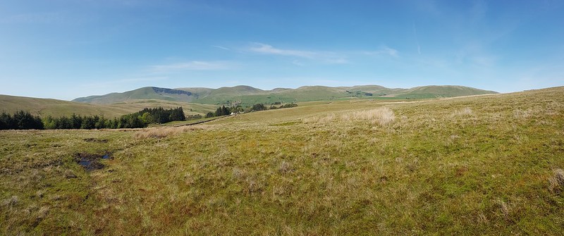
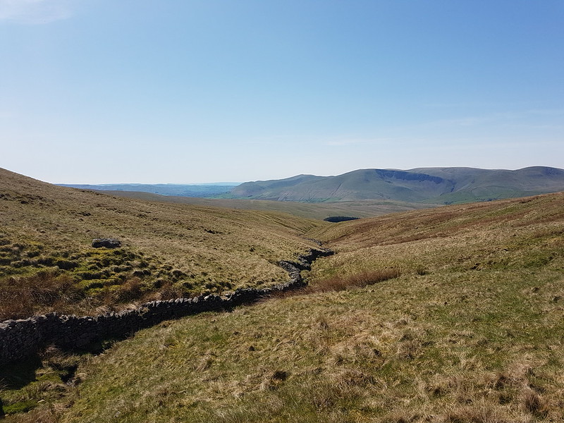
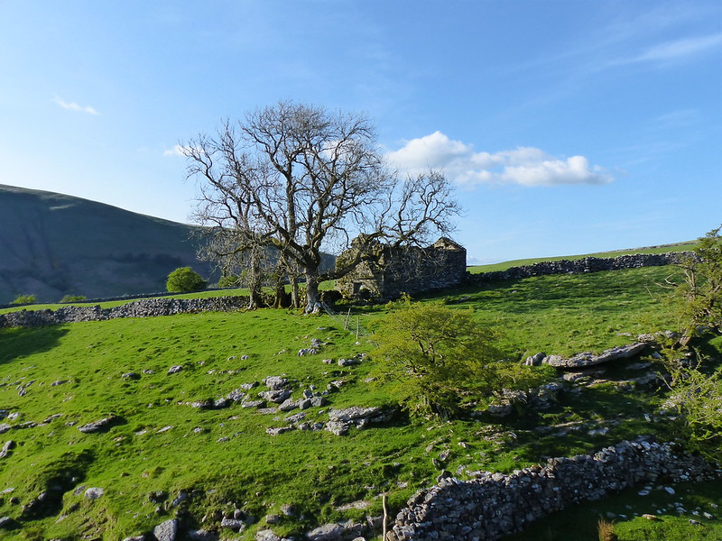
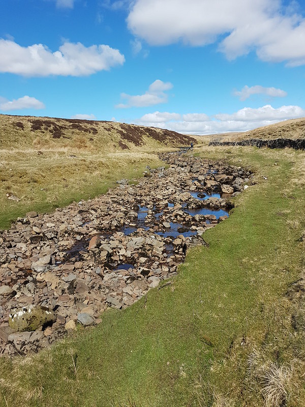
Another Lune catchment outing, which, once again, didn’t disappoint. I had splendid views of the Howgill Fells all day. I’d parked down by Rawthey Bridge and when I left the minor road which leaves the A road there, took another version of this view which was rather spoiled by the foreground of dessicated Mole corpses hanging from the barbed wire fence – a grisly traditional method for a mole-catcher to show the success of his labour.
The field path took me past a series of old farmhouses, heading up the valley of the Rawthey.
New House Farm.
What intrigued me about this farmhouse was the unusual tall building with the pyramidal roof, which is a coach house apparently, according to Historic England, added in 1914 to a building which is “probably early/mid C18”. I should have taken a photo back down the hill at Wraygreen, which is considerably older. Next time.
Approaching Needle House.
I’ve included this photo because it shows the trees beyond the house, clearly planted, looking almost like an arboretum, of which more in a moment.
Needle House.
I was surprised to find that the very striking Needle House is not listed. I did find a fascinating history of the Frankland family, who lived here and modified the house, written by Dr Helga Frankland, whose father seems to have been taken with all things Scandinavian (so hence Helga?).
Barn by Needle House.
“Unusual features created by my father include the belfry on the gable end of West Laithe in the yard at Needlehouse. It is based on belfries seen on farms in Scandinavia. We used the bell to summon people to the house from the fields.”
Laithe is a northern word for Barn, apparently.
Bridge over Needlehouse Gill.Needlehouse Gill.
“My father planted all the woods on our land, except for the much older Uldale Wood and the natural woodland in the gills. Scandinavia held a strong fascination for my great grandfather, grandfather and my father. By skillful placing of relatively small, largely coniferous woods, my father managed to create a landscape that looks more wooded than it actually is and therefore, has echoes of Scandinavia.”
In the woods beyond the gill, I was delighted to spot four or five Red Squirrels, or, very possibly, the same Red Squirrel four or five times. I have one very blurred photo to remind me, but if I hadn’t taken it myself, I don’t think I would know that it was of a squirrel. Much of the walk to this point had been accompanied by the sound of Cuckoos, but, as usual, I didn’t see them at all.
Needlehouse Gill again.
I watched a largish bird of prey fly up and along the gill. I don’t know what type sadly.
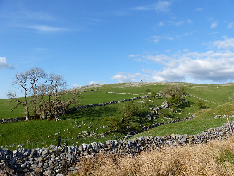
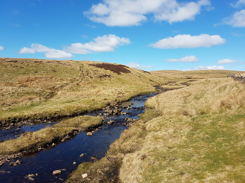
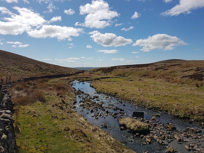
Part of the reason for choosing this route was the fact that I haven’t climbed Wild Boar Fell for far too long. It used to be a bit of a favourite. I always used the same route: up the Rawthey, over Holmes Moss Fell, which was invariably very wet, then onto Swarth Fell, Wild Boar Fell and down via Fell End Clouds. This time I intended to ring the changes and explore some more Lune feeders. My original plan had been to hop over the fence here, onto access land, and follow the gill upstream, but the going looked like it might be difficult, due to the steep banks and fallen trees, so instead I almost doubled back on the track and then took to the open fell-side.
Looking back towards the Howgills.
It wasn’t half as wet underfoot as it might have been I suspect.
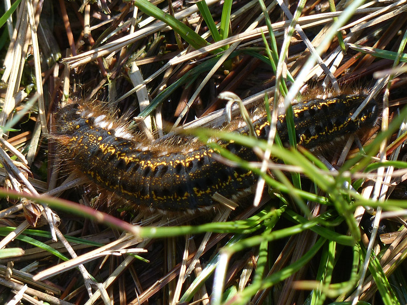
Drinker Moth Caterpillar.
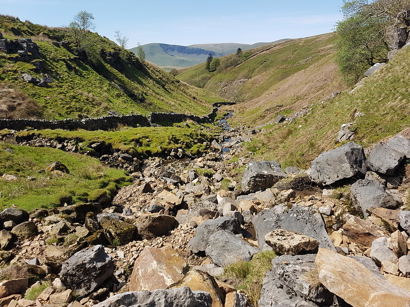
I found a hint of a path, which took me down into Grain Gill, and then followed the gill down into Needlehouse Gill which at some point becomes Uldale Gill.
Waterfall.
I took lots of photos of small falls and cascades, but this was the best, so can stand in for them all.
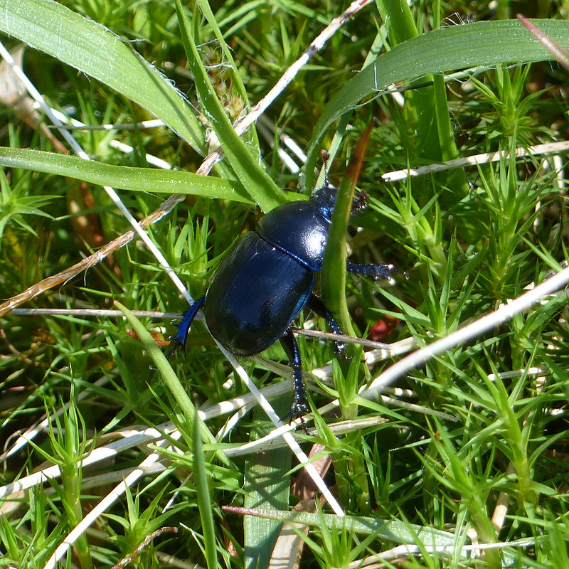
Dor Beetle.
I watched this Dor Beetle as it wandered around in the rough vegetation, laboriously and seemingly with quite a lot of effort, going back and forth over the same ground for reasons I couldn’t fathom.
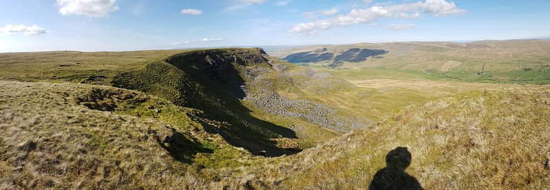
Looking back down the gill to Cautley Crag.
On the left of this photo you can see a small sliver of white, which is where water was spouting from a hole in the crags and pouring under the wall into the stream. The boulders in the foreground are, I assumed, the dry bed of a tributary stream where a spring would emerge in wet weather.
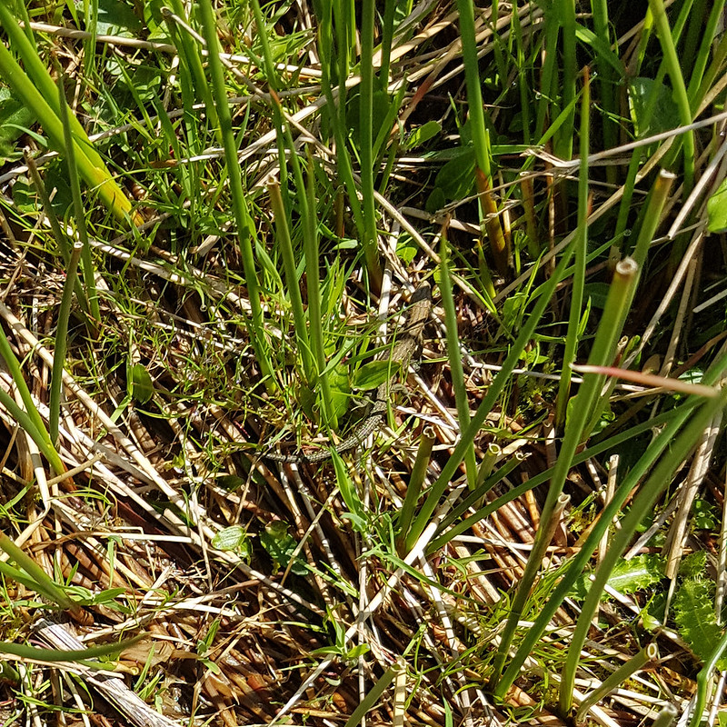
In the absence of a path, following the stream turned out to be quite heavy going, so I decided that it would be a good idea to climb up to the left, above the northern bank of the gill. I was wrong. That bright idea brought me into very boggy ground with tall reeds. The only upside was that I saw a number of Common Lizards…
Common Lizard.
…which were all too fast for me to get any decent photos.
Fortunately, when I climbed high enough, the going got much easier.
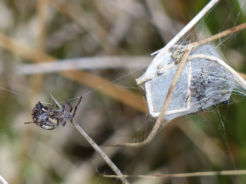
Looking back to the Howgill Fells.Larinioides cornutus.
I’m reliably informed that this spider, on an impressive web stretching between sedge stems, is Larinioides cornutus, the Furrow Orbweaver. They like damp places, which fits. This must be a female, which makes a silken cocoon and then produces pheromones to attract a mate. At the time, I thought the cocoon might be full of babies, but with hindsight, it looks more like a larder.
Furrow Orbweaver.
The ‘furrow’ in her name refers to the pattern on her back, which sadly she never deigned to reveal to me.
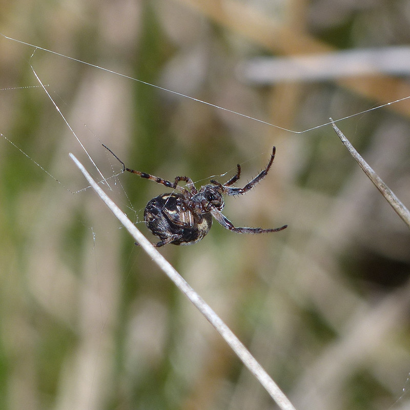
Furrow Orbweaver.
She was intent on running repairs of her web.
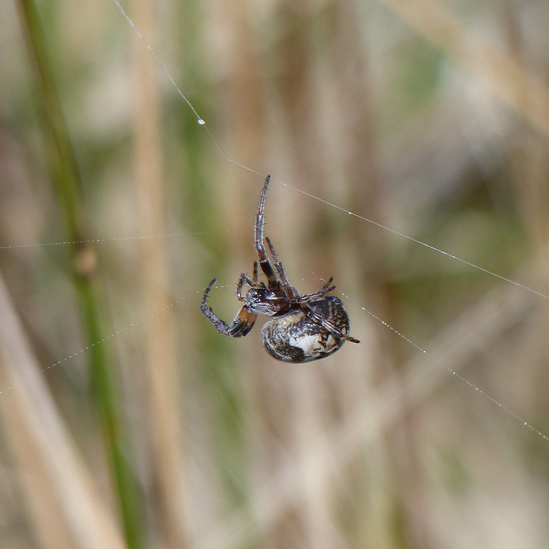
Furrow Orbweaver.Furrow Orbweaver.
But then I must have upset her in some way and she disappeared into her lair. I’m well aware that not everyone likes arachnids, but as you can probably tell, I was entranced.
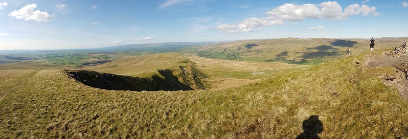
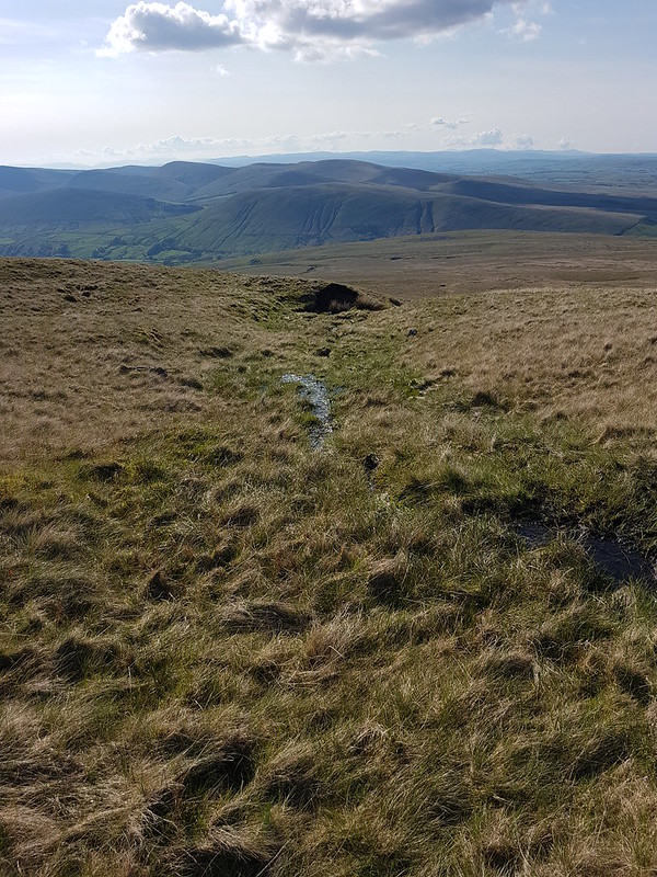
Looking back from near the top of the gill.Swarth Fell Tarn.Cairn on Swarth Fell.Wild Boar Fell from Swarth Fell.Looking south from Swarth Fell. That’s Whernside and Ingleborough peeking out from behind Baugh Fell.
I found a very comfortable spot amongst the boulders on Swarth Fell, made a brew and then had a little nap in the sun whilst it cooled down. You can’t beat a bit of a snooze during a hill walk if you ask me.
On the way back down to the col, I followed the steep eastern edge…
The eastern edge of Swarth Fell.
The rivers both Eden and Ure rise down there somewhere. The first is heading for Carlisle, the Solway Firth and hence the Irish Sea, whilst the other, via the Ouse and the Humber, heads through York to the North Sea.
Looking back to Swarth Fell.The Band.
This path, around The Band to High White Scar, is not marked on the OS map, but it is an absolute delight. As I walked along it, I watched a Buzzard gliding out across Aisgill Head.
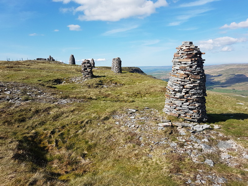
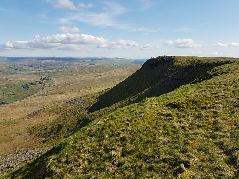
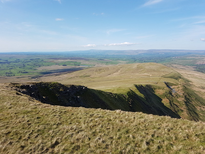
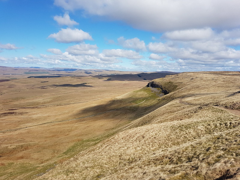
Ais Gill and Swarth Fell.High White Scar. Mallerstang Edges beyond.Along the edge.A proliferation of cairns.
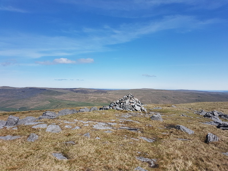
Wild Boar Fell has a large summit plateau and two tops, both with a spot height of 708m.
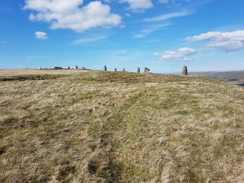
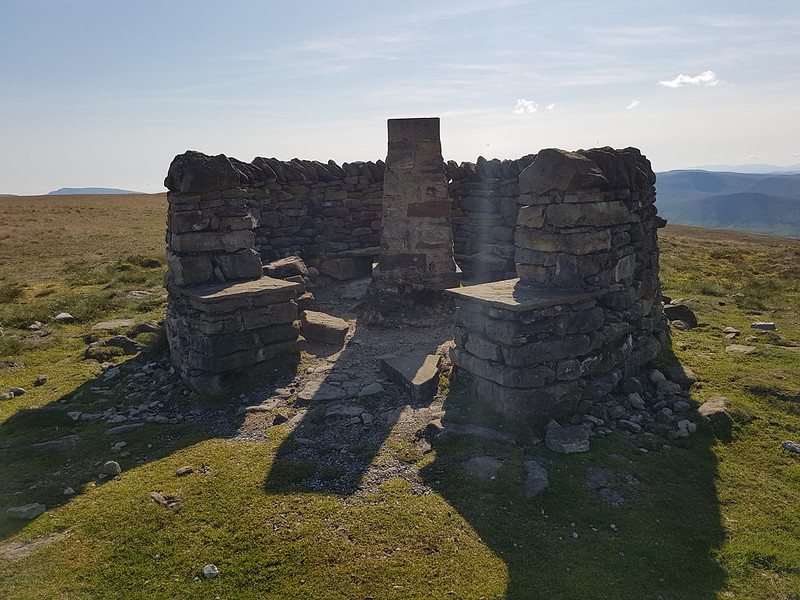
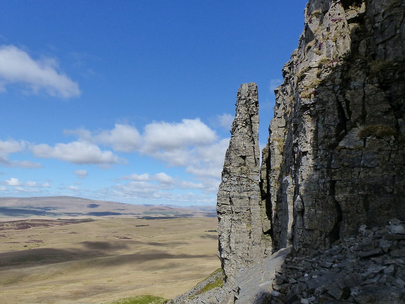
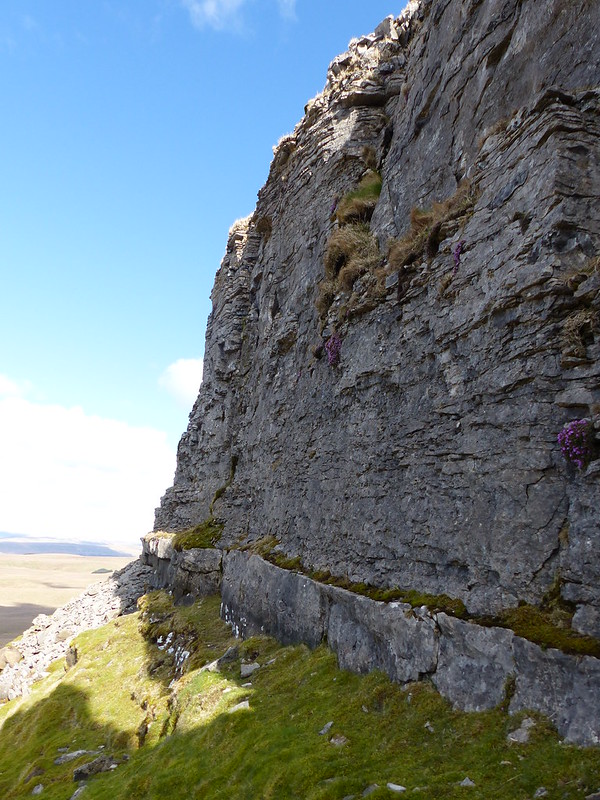
Cairns!Yoadcomb Scar.Yoadcomb Scar pano.Looking back to Yoadcomb Scar.The Nab, Eden Valley, Northern Pennines.The Nab pano.Trig pillar.
Here’s ‘the other’ top. Not quite as exciting as the one to the east, to be honest.
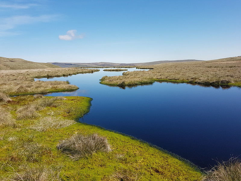
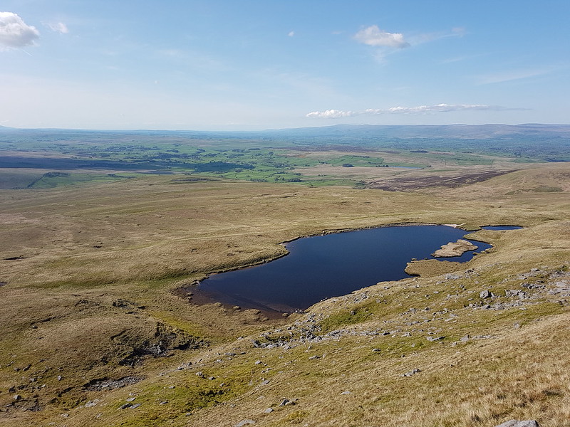
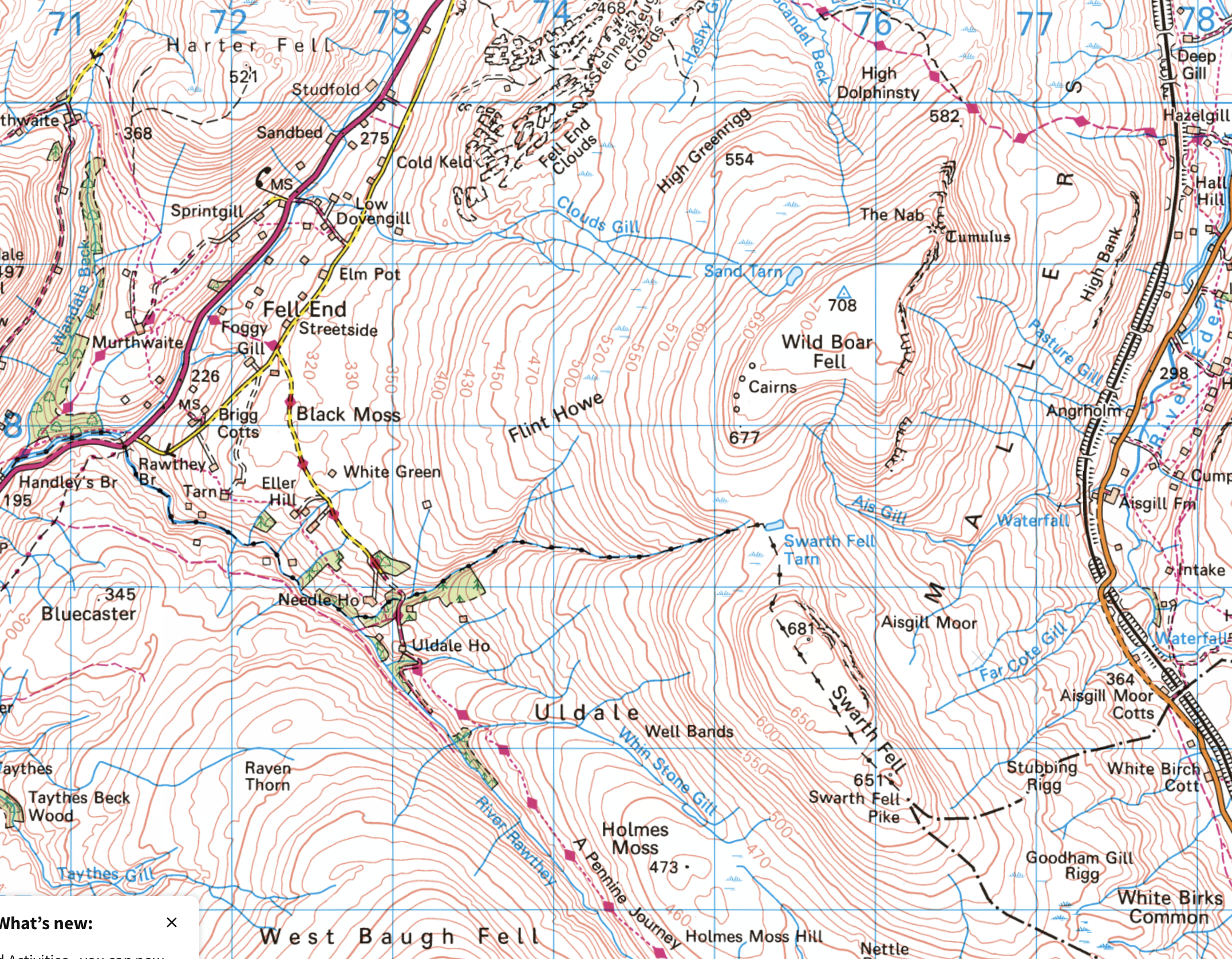
Sand Tarn.Forcepot Sike.
Forcepot Sike apparently drains Sand Tarn, although there wasn’t an obvious or easy to spot outflow. The hills opposite are Harter Fell (there’s a few of those about!) and Green Bell. I don’t think I’ve ever climbed the former, and it must be about thirty years since I climbed the latter – and since the source of the Lune is said to be on its slopes, it’s high on my to do list. Of course, we know that the Lune, like any river, has countless sources, but we’ll let that lie.
Clouds Gill.
This was pathless going, but much easier than that had been by Uldale Gill. The stream gradually grew as it absorbed lots of other rivulets, at some point becoming Clouds Gill. I’ve come down these slopes a few times before, but always heading for Fell End Clouds, never sticking with the gill. As the terrain changed to limestone country, that brought unexpected bonuses. The stream began to appear and disappear underground.
Clouds Gill.
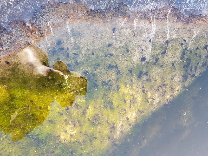
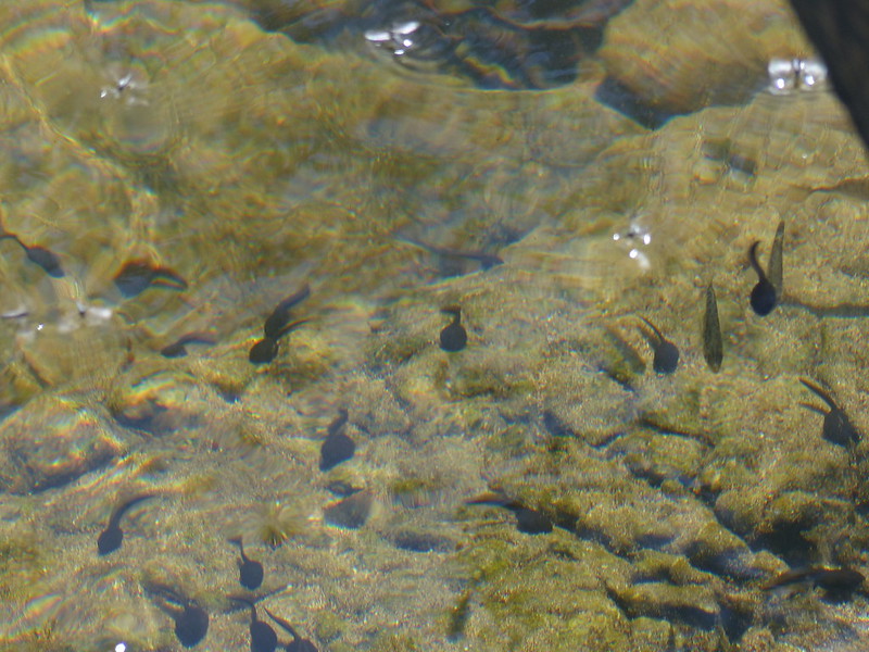
In some spots I could see the water flowing through a narrow channel to the left and below the exposed rocky riverbed. In other places the river had eroded large deep pots which were full of stagnant water. And also full of tadpoles.
Tadpoles.
Many moons ago, I used to walk to school with friends. Our route took us across fields and via a small footbridge over Johnny’s Brook. Armed with coffee jars or buckets, we would collect frogspawn, tadpoles, frogs, sticklebacks and other unfortunate denizens of the brook and take our finds to school. There was an aquarium tank in one of our classrooms, I remember. Whether the aquarium was a result of our enthusiasm or its cause, I don’t recall. I do know that I’ve never seen tadpoles in this profusion before, pool after pool, deep or shallow, were full of them. But then suddenly – no more.
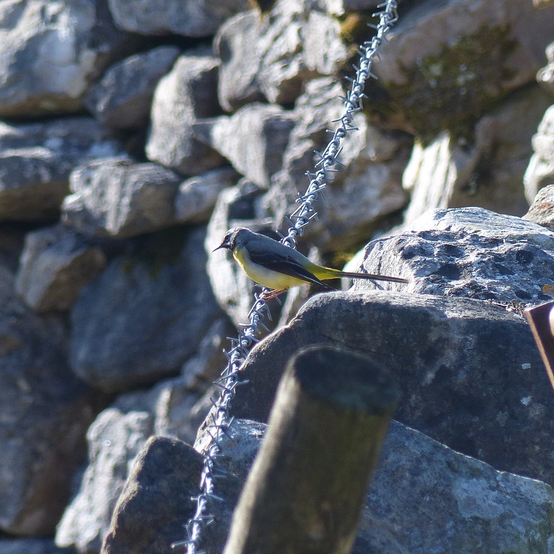
Grey Wagtail.Mayfly?
I’m assuming that this is a Mayfly, although my field guide describes them as ‘flimsy’ whereas this looked quite sturdy to me. Apparently, there are 47 different species in the UK. The winged stage of their lives lasts for just a couple of hours or up to a couple of days, depending on the species. The nymphs, living in the water, often live for a year or even two, although, again, that depends of the species.
Mayfly nymphs? About to emerge?
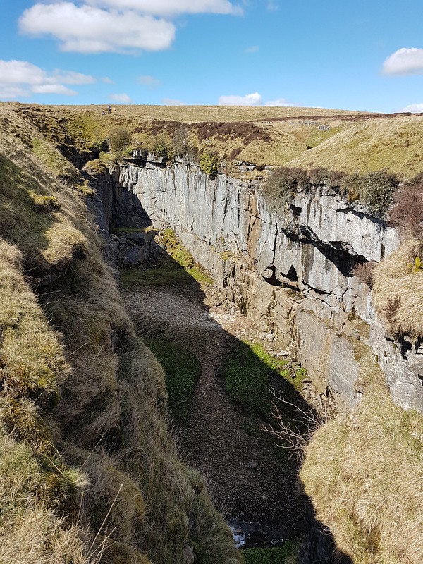
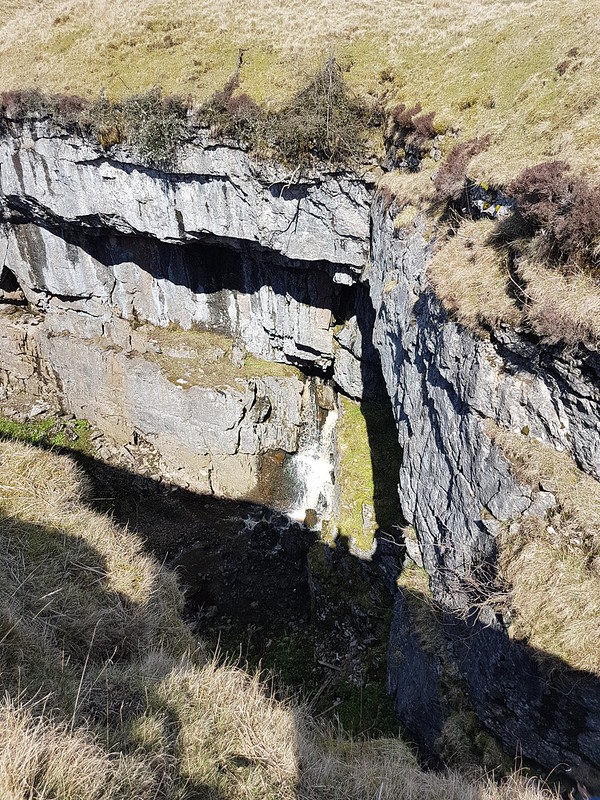
Limestone, of course, erodes in interesting ways. Here the stream had created a narrow gorge and a huge rock overhang.
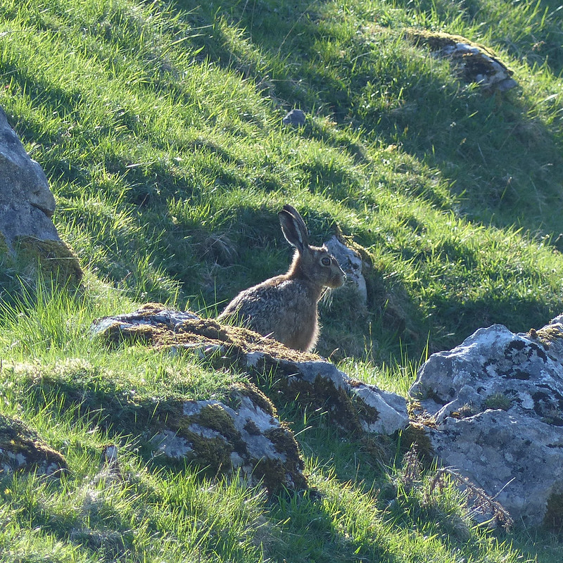
From above.From below.Hare.
I’ve begun to think that certain creatures are emblematic of the landscapes of the Lune, particularly Curlews and Hares. Maybe Grey Wagtails as well.
Cloud Gill and Harter Fell.A roofless barn.Fell End Clouds.
I had planned to cross the valley and have a wander through the woods of Murthwaite Park, but it was getting late, so I just wandered along the minor road back to the car.
Another view of Fell End Clouds.Valerian, host to tiny flies. St. Marks flies or something similar?
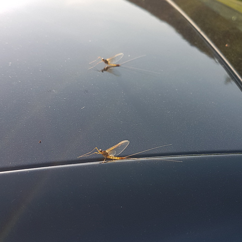
When I got back to the car it was covered with Mayflies. These did look flimsy.
Mayflies.
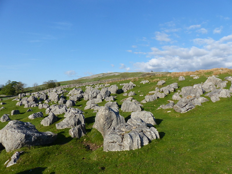
There had been lots of cars parked along the road near the Cross Keys, presumably for the walk up to Cautley Spout and beyond, which is a very fine walk and another which is high on my ‘to do’ list. But I’d met a couple on Swarth Fell, another couple at the Nab and two blokes and their dog by the trig pillar on Wild Boar Fell, and that was it. On a sunny Saturday in May. I can’t think why Wild Boar Fell is not much more popular, but I’m not complaining!
A little over 11 miles, but largely pathless so harder work than that might sound.
I stayed in Horton-in-Ribblesdale on the night of my nineteenth birthday, when I was walking the Pennine Way with my Dad. I say, ‘with my Dad’, and it’s true to say that it was only he and I that walked the whole thing together, but the day in question was a Saturday, and we were joined by my uncle Uwe, who had been with us since Edale, and a bus driver from Derby called Warwick, who had joined us at Crowden after spending several hours stuck in a peat bog on Bleaklow, and by my mum, my brother, several cousins, my aunt, and at least half of the village scout group. We were a big party.
After a day with a lot of rain, most of the group had decamped to the YHA at Stainforth, but my Dad and my uncle and I had the luxury of a B’n’B in Horton. The day picked up considerably: the evening meal was excellent, we had at least one bottle of wine with it, and then we watched ‘Blazing Saddles’ on the box in the fug of a very warm sitting room.
New Inn Bridge over the River Ribble, Horton in Ribblesdale. Late 18th Century.
It’s taken a long time for it to happen (multiply my age by three), but a visit to this neck of the woods on or around my birthday I think may now have become a habit.
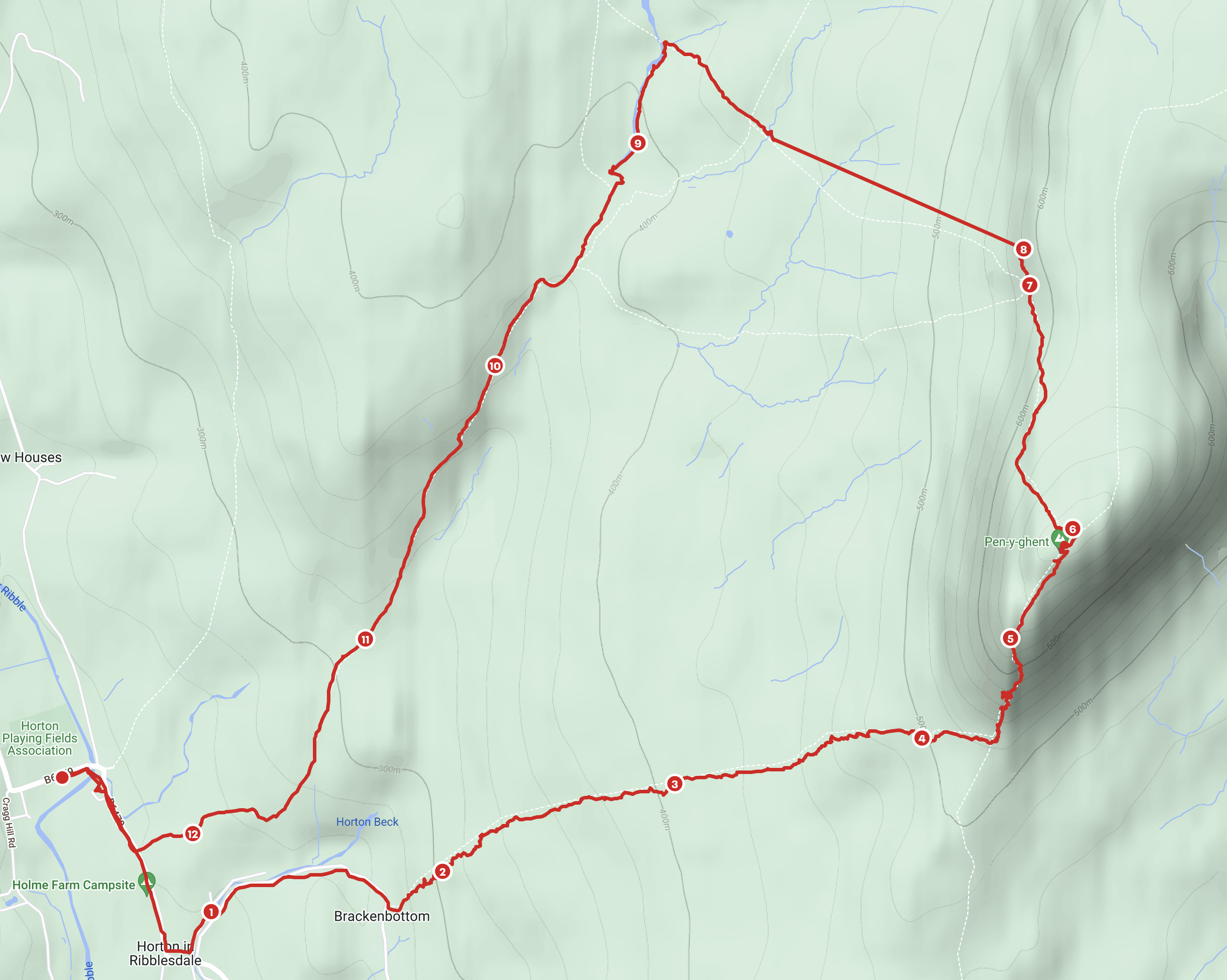
Newly surfaced path from Brackenbottom.
I took the path up from Brackenbottom. I always seem to come this way. Maybe I need to branch out a little. Since my last visit, a lot of work has been done on the footpath here.
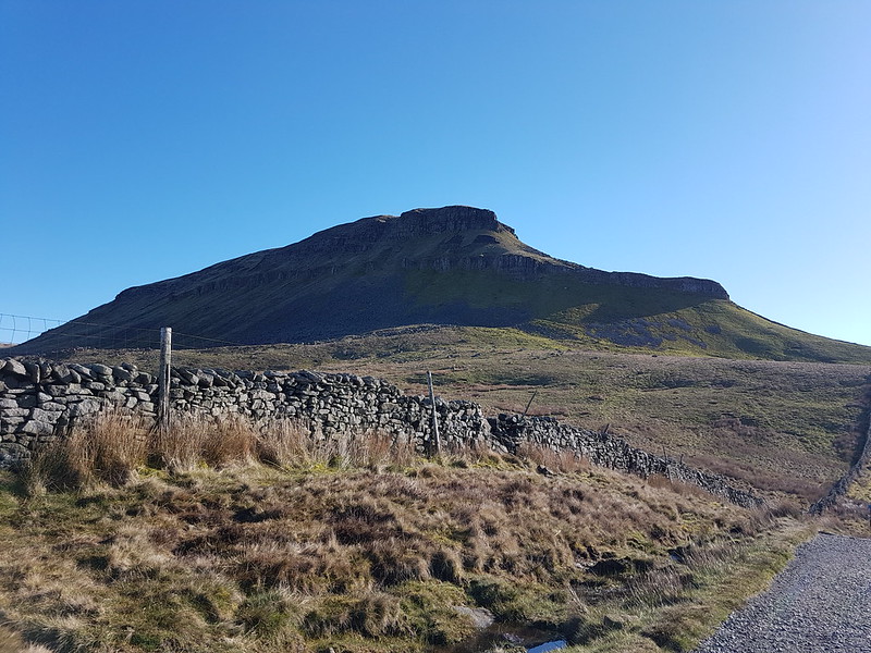
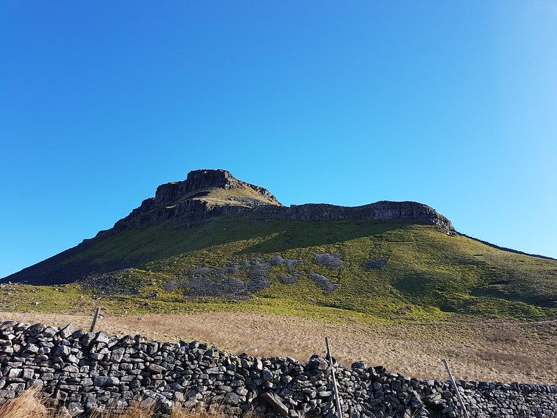
Pen-y-ghent.
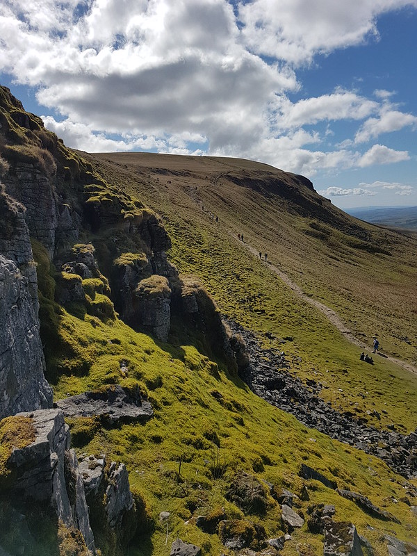
I’d had an early start, but there were still plenty of people about. Somewhere in the vicinity of where I took the photo above, a weasel, or stoat, ran along the base of the drystone wall right in front of me. I wasn’t anything like fast enough to capture a picture before it disappeared from view.
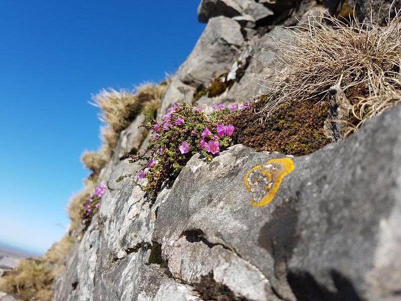
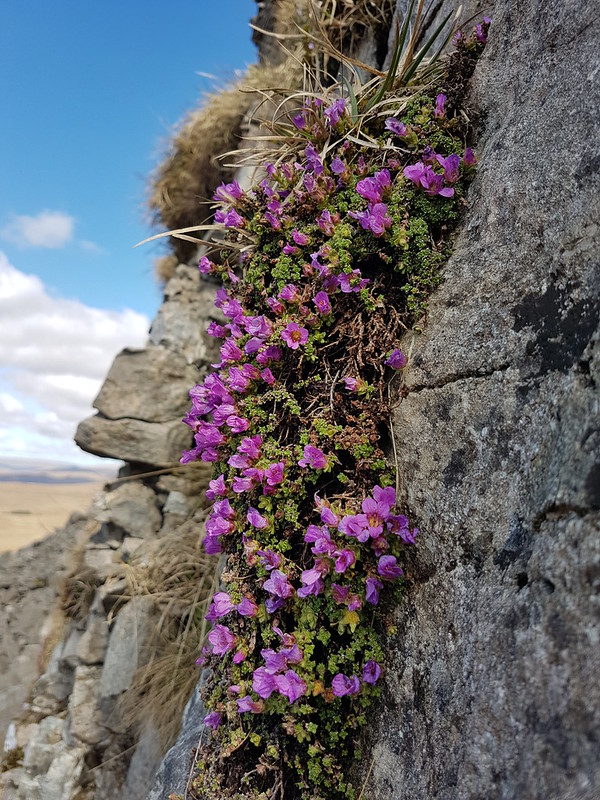
Recent visits have always been later in the day, and I hadn’t thought about that when I set out; I usually clamber about below those steep cliffs looking for Purple Saxifrage – which is what brings me here in early April. I didn’t want to lose the sunshine though, so contented myself with a couple of smallish clumps on the sun-washed crags just above the main path.
Purple Saxifrage.The long ridge up from Stainforth. Pendle Hill in the background.
One possibility for an alternative ascent route would be to follow this ridge from Stainforth.
The summit was quite busy. I plonked myself down in the lea of the wall, which was a very warm spot in the sunshine, put a brew on to stew…
Atkinson’s of Lancaster Blue Sky tea – grapefruit flavoured.
…and wondered about the hills across the valley. Knowing now that I was looking at Fountains Fell, I’m trying to think when I was last up there, and whether it could really be as long ago as 1985? Although I frequently climb each of the Three Peaks these days, I also completely neglect the rest of the Dales. Essentially, I’m spoiled for choice.
Fountains Fell and Malham Moor.
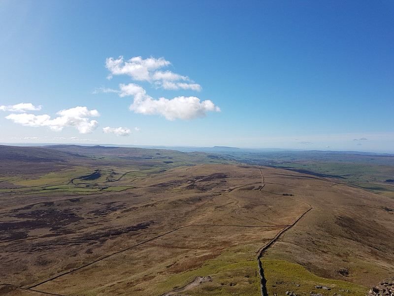
Incidentally, the valley which drains south between Pen-y-ghent and Fountains Fell is Silverdale, so for that reason alone, is very much overdue a visit from me.
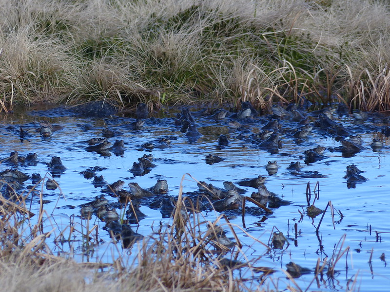
Just a few strides from the trig pillar on Pen-y-ghent, there’s a small pond or large puddle, too insignificant to appear on the OS map.
Frog puddle.
On a previous visit, in search of Purple Saxifrage, I also enjoyed an unexpected bonus encounter with hundreds of mating frogs in this miniature tarn. Even though I had been remembering that occasion, and how I had been surprised by the sound of the harmonised croaking of the frogs, I was duped in exactly the same way again: I heard the rhythmic drone and wondered whether there might be tractors out in the Ribble valley doing a very early silage cut, or if I might spot a distant rescue helicopter over Ingleborough.
Frogs!
This time however, I was very quick to realise my error. I took a few photos and then began to edge toward the pool. I was too hasty however and all of the frogs skedaddled. What’s more, the sun had temporarily nipped behind a cloud.
Frogs galore.
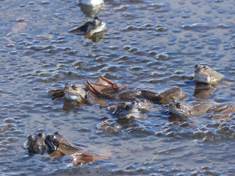
I moved away a little, found a slightly elevated tussock, which was a least a little drier than the surrounding ground and sat down to wait. Eventually, the frogs resurfaced, and so did the sun. This time, I was much more circumspect about approaching their gathering.
Mating in a sea of frogspawn.
I edged slowly towards them and took a multitude of photos.
A quieter part of the pond.
The main path was just a few yards away, but I was spellbound and oblivious of the hordes passing close by. Fortunately for me, other walkers all seemed to be completely incurious about what was occupying me. Possibly, it was British reserve?
One very orange frog.
The frogs were not so shy. What the photos don’t capture is the frenzied and incessant activity – the frogs were almost constantly on the move. Also, the pictures lack the fabulous repetitive sawing of their voices. I did take a couple of videos, but somehow, sadly, they seem to have got lost when I uploaded all the photos from my camera.
Is that too many frog photos now – I have a lot more!
I’m really not sure how long I sat there; it may have been as much as an hour.
Ingleborough.Looking north along the western edge of Pen-y-ghent.Rock tower.And again.Steep limestone cliffs dotted with Purple Saxifrage.Looking up at the Saxifrage.Purple Saxifrage.
Where the main Pennine Way path turns sharply left and down towards Horton, I knew that there were cliffs where I could expect to find more saxifrage.
Looking south along the western edge of Pen-y-ghent.
I had another brew and then clambered about on the steep ground just below the cliffs, looking for specimens. Again, a lot of time was ‘wasted’, but I was very happy pottering about.
The busy Pennine Way path – heading up to the top.The busy Pennine Way path – heading down to Horton.
I hadn’t originally planned it this way, but since the main path looked so crowded, I kept straight on, following a much less obvious trod…
Faint path heading across Horton Moor.
Which I had completely to myself.
Horton Moor and Ingleborough.Looking back up to Pen-y-ghent.Hull Pot Beck.Hull Pot Beck.Small cascade in Hull Pot Beck.Hull Pot Beck – it’s dry downstream of this point.Hull Pot.There’s Hull Pot Beck emerging half way down.Pen-y-ghent.
I’d be happy to settle for frogs, saxifrage and lashings of sunshine for every birthday walk I think, although a slap-up-meal, a bottle of plonk and a Mel Brooks film to follow wouldn’t go amiss either.
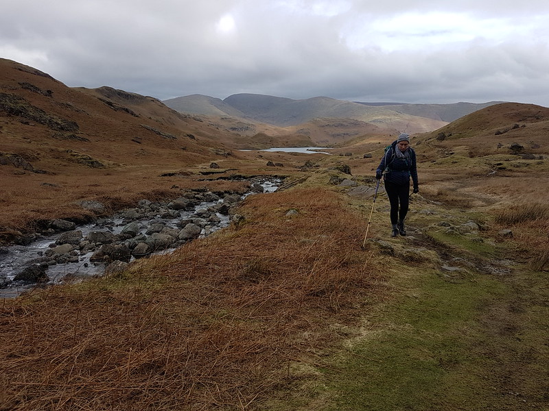
The last Sunday in March. TBH wanted another training walk, but this time of only eight miles. I thought we could kill two birds with one stone and mop up Blea Rigg which, during my Wainwright bagging frenzy last year, I managed to omit.
Sourmilk Gill, Tarn Crag and Gibson Knott.
It was a bit of a mixed day, with a cold wind and, later in the day particularly, some drizzly rain, but with occasional sunshine and even one or two quite warm spells.
TBH photographing waterfalls on Sourmilk Gill.
It’s familiar territory this, being relatively accessible from home, but a great area, so always worth another visit.
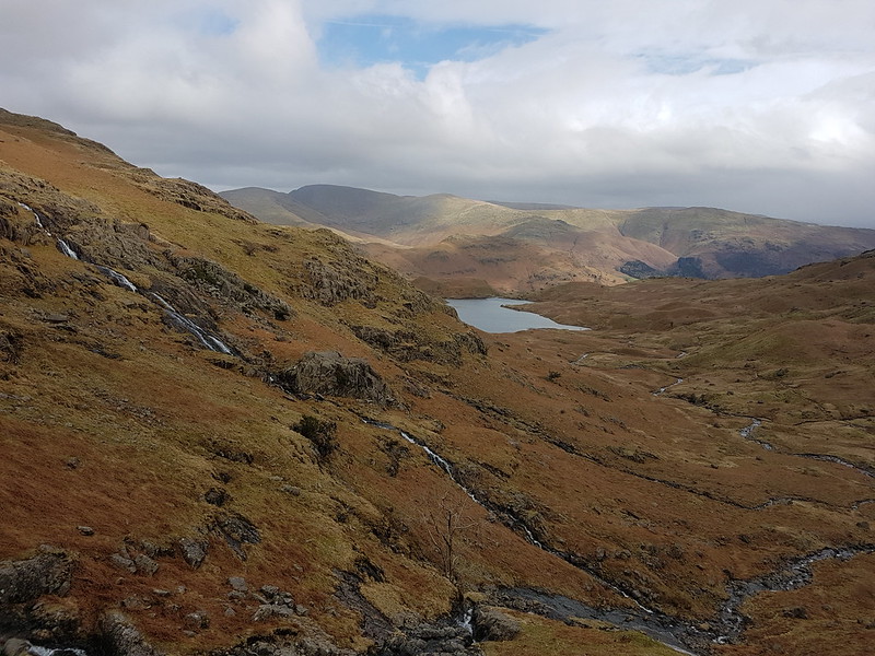
At the top of the falls.Easedale Tarn and Tarn Crag.
TBH hates to wait for her lunch, feeling that it should always arrive on the dot of midday. By the time we reached Easedale Tarn we’d been on the look-out for a likely-looking spot for some time and she was, apparently, approaching starvation. Fortunately, the slight descent here towards the tarn took us out of the wind and gave us just the shelter we needed for a comfortable refueling stop.
Easedale Tarn pano.Easedale Gill and Belles Knott.Looking back to Easedale Tarn, Seat Sandal, Fairfield, Great Rigg and Stone Arthur. Belles Knott and Easedale Gill again.Looking back again – the stream which flows from Codale Tarn looks worthy of investigation.TBH on the slabs above a surprisingly awkward scrambly section of path.Looking back again – Belles Knott, on the left, not quite as dramatic from this direction.
This was the sunniest and warmest part of the day, and very pleasant indeed.
Codale Tarn – a great spot for a swim, but maybe not in March.
Looking at these photos, and at the map, this area has many great places for a dip. I find myself wondering how many I could string together in a single route. The thing is, I’ve tried this a few times before, and the answer is always: less than I think. I probably need to learn to just enjoy a swim or two and accept that, in this regard at least, less is more.
Codale and Easedale Tarns pano.On the Blea Rigg ridge.Harrison Stickle, Pavey Ark and Stickle Tarn – in the first of many showers.Frogspawn.The tarns near Lang How – raining again.Grasmere, Rydal Water, Loughrigg and Windermere from Silver How.A steep descent towards Grasmere and Rydal Water.Descending back to Grasmere.
In the event, the route was a little over nine miles.
Oh, and, spoiler alert, TBH did her Mighty Hike on Saturday. It went well and she enjoyed herself. I shan’t take all of the credit, but no doubt my carefully planned training routes were key to her success! B has subsequently suggested that we should all take part next year. One to ponder.
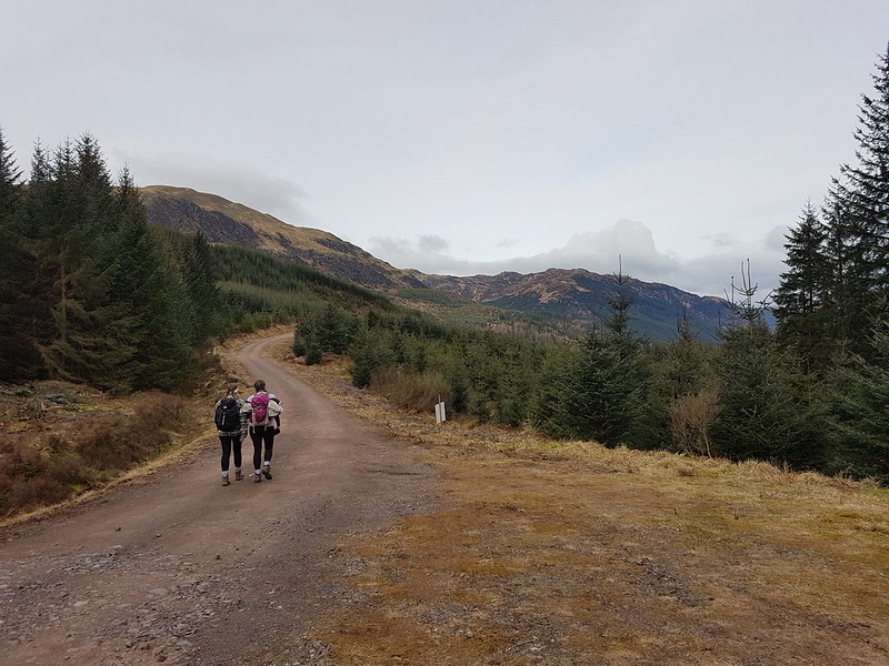
The day after our exertions on Stob Ghabhar. The forecast was okay, but we were looking for an easy stroll which was in the general direction of home. As we did last year, we parked near Kilmahog, not far from Callander.
A ditch full of frogspawn.
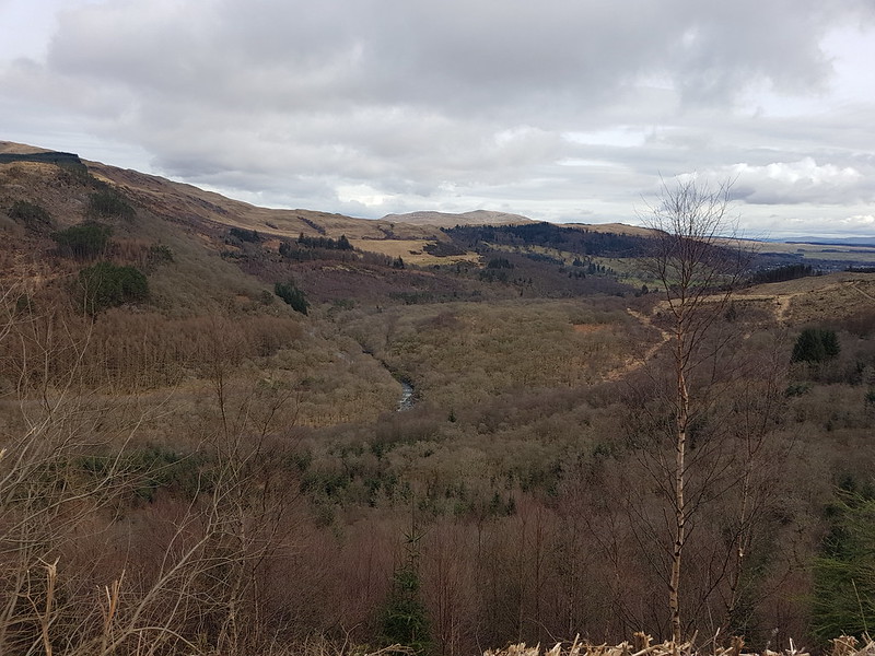
Our route took us on forest tracks up to the bottom end of Loch Lubnaig and then back along the disused railway line which follows the Garbh Uisge. It was a very pleasant, sociable walk.
Old buddies.
As they had done most of the weekend, A and S, who have been friends since before they started school, were busy catching-up now that they’re both studying at far-flung universities.
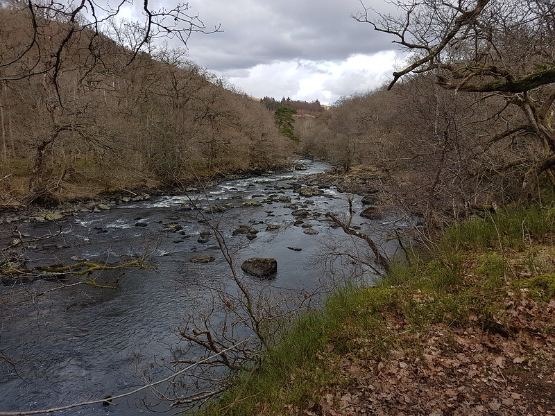
Garbh Uisge.Loch Lubnaig.
We even had a little sunshine as we approached the loch, and we found a spot to sit down and enjoy it whilst we ate some lunch.
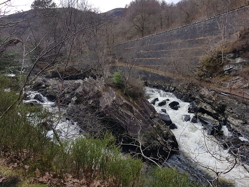
Loch LubnaigGarbh Uisge.Falls of Leny.Garbh Uisge.In the woods.
The walk back through the woods by the river was very pleasant. A lovely conclusion to an excellent weekend.
This handsome frog was sheltering under the paddle boards by the shore of the pond the next morning. I thought it might be an American Bullfrog, but they’re huge, up to 8 inches I’ve read. I think this is the very similar, but smaller, Green Frog. The dorsolateral ridges running from the head down the sides of the torso are a distinguishing feature apparently.
Green Frog.
I think that this is a male, because the ear – the tympanic membrane – is larger than the gorgeous golden eye.
TBH and I needed another shortish outing because of our plans for the afternoon.
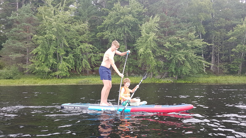
B and M share a paddle board.
So we took to the water again.
Here’s the pond…
Stony Creek Pond.
We were staying on the north side of the southern most bulb – we canoed northwards, past a beaver lodge, under the bridge, which required a bit of care, up beyond the little island almost to the northern extremity of the pond.
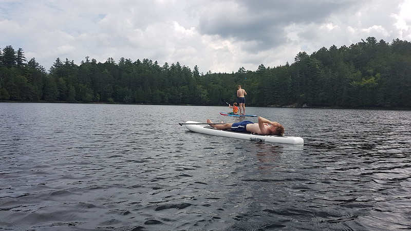
Little S taking it easy.Prof A.Our destination – a tiny beach.
We were heading for this little beach. The lake bed here was firm and sandy – perfect for swimming. By the boathouse the lake has a deep layer of very soft silt, which makes getting out for a swim a bit awkward, without a paddle board.
W arriving.
The trees to W’s right are growing on the small island, where there was a Bald Eagle nest. Prof A challenged us to swim to the island and, I think, was a bit surprised when B and I accepted the challenge. It wasn’t all that far, maybe a 500m round trip, at a guess. The island is private, so we didn’t quite go the whole way. We didn’t see any eagles, but we had a good view of the nest.
Once back, I had a bit of a wander. Close by there was a picnic table and a fire-pit – I think this was one of the campgrounds which seem to be scattered around the area – they can be rented at relatively low cost I believe.
There were dragonflies and damselflies of various sizes and colours about. I took numerous blurred photos of a mating pair of damselflies, the male was a lovely combination of royal blue and mauve. I failed too with an orange dragonfly and an electric blue damselfly similar to those I see close to home.
Calico Pennant Dragonfly.
I chased this dragonfly along the edge of the lake, but at least I got some relatively sharp shots. I’m reasonably confident with my identification, although online descriptions say that the markings on the body are ‘orange triangles’, whereas to me they look like red hearts.
Calico Pennant Dragonfly.
Which reminds me of a blogger I once knew who found heart-shapes everywhere.
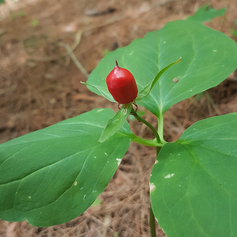
I was fascinated too by the plants and fungi under the trees. Although they were all unfamiliar, I was trying to figure out their place in the ecosystem by analogy with the things I see around home. For example…
Berry.
This plant with its single layer of large leaves and what must have been a single central flower put me in mind of our own Herb Paris.
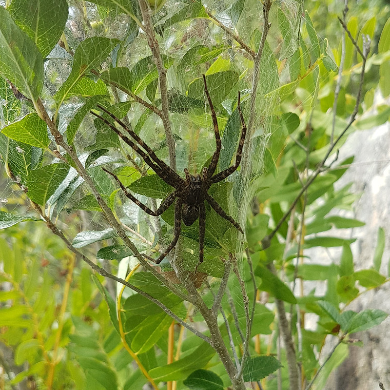
Time was marching on, and I turned to go back along the fringe of the lake to the boats when I was startled by this monster…
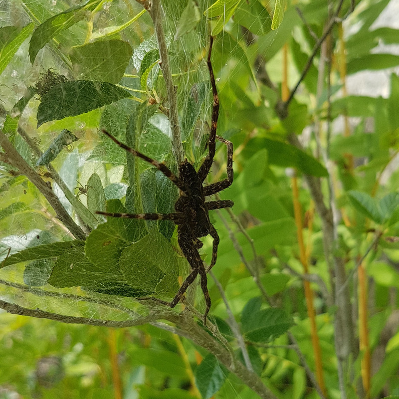
A Fishing Spider.
In retrospect, it perhaps wasn’t quite as big as it seemed, but it was still, by some distance, the biggest spider I’ve seen in the wild. Feisty too: it kept waving two of its legs at me in a very aggressive fashion, or, at least, it seemed that way.
A nursery net spider. Notice all of the ghostly baby spiders in the nest.
I think it’s a Striped Fishing Spider, Dolomedes Scriptus. There’s a very similar species, the Dark Fishing Spider, Dolomedes Tenebrosus, but although this spider looks dark, I think that may be more to do with the fact that it was in the shade.
A beady eye.
Fishing Spiders don’t use a nest for hunting, but the female carries her eggs around in a silken sac before building a nest for her brood when they hatch. That probably explains the aggression. This nest was pretty big. They are also one of the species of spider which practice sexual cannibalism, with the female devouring the male after mating.
I gather that, as the name suggests, Fishing Spiders can hunt in or under the water, eating tadpoles, small fish and insects which live in the water or on the surface. They also hunt in the woods surrounding the lake however.
Talking of hunting…
A damselfly becomes a meal.
…this damselfly has fallen prey to this fly, which is not too dissimilar from the one in my previous post. During the damselfly’s death throes the pair of them landed on my hat.
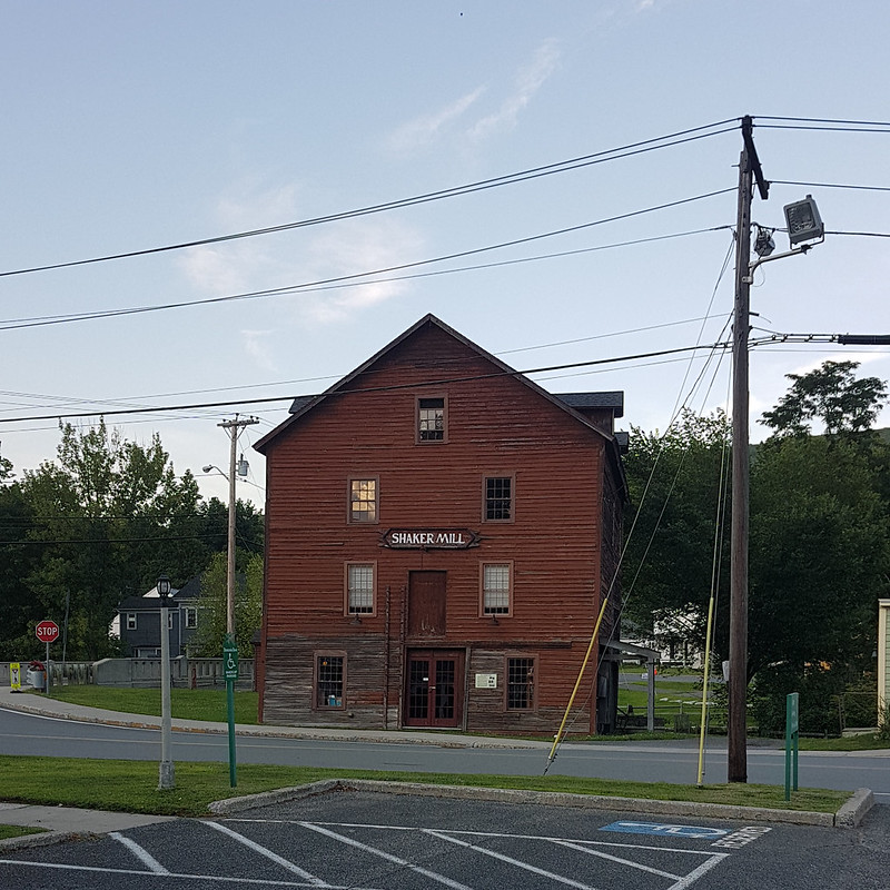
The reason we needed a short outing, was that TBH and I had a long drive in prospect. Our daughter A was also in the States, working as a Camp Counsellor at a Summer Camp in West Stockbridge, Massachusetts. A was keen to see her uncle, aunt and cousins whilst she was stateside. She could get a 24 hour pass and somehow TBH had convinced herself that West Stockbridge was about an hour-and-half’s drive from where we were staying. When we looked it up again, our app was giving three-and-a-half hours. Each way. And that was before the many wrong turns we took. It was a long day.
West Stockbridge Shaker Mill.
This was the only photo I took in West Stockbridge. The following day, when we had to repeat the long journey to take A back, TBH and I had a wander around the wonderful Turnpark sculpture park, which was closed, but not locked-up. It was fantastic and I really should have taken lots of photos. Next time!
Whilst we were shouting at the satnav, Prof A took the boys bouldering. Or perhaps that was the next day, maybe they were shopping for a new toy. Or playing with that toy?
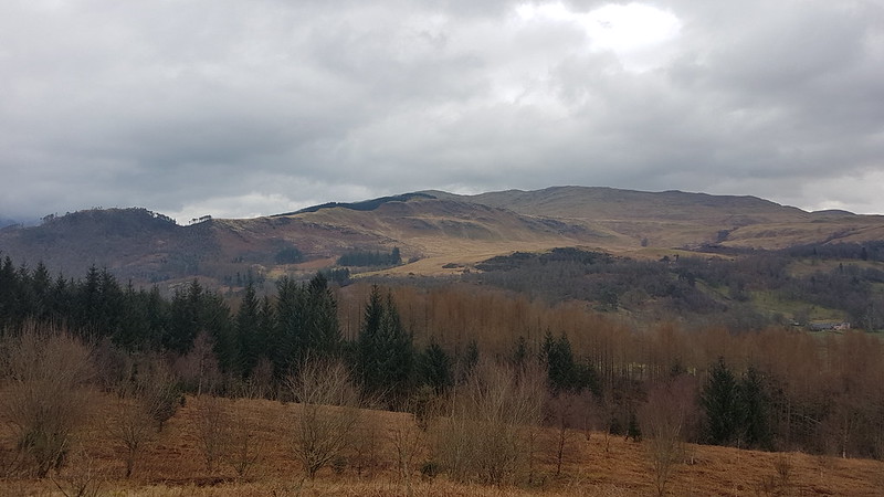
The view east from Bochastle Hill. Is that the Ochils beyond Callander?
After their exertions of the day before, The Prof and The Tower Captain were both in need of an easier day. Obviously, I was up for another Big Day On The Hills, but felt that they needed my company. Well, okay, I was a bit tired too. I was also put off by a forecast which sounded like the winds would be even fiercer than they had been on the Saturday. I found a circuit on my OS maps app which looked ideal and wasn’t too far out of our way home.
The high ground north of Callander.
We had a little drizzle, but the wind was quite mild, and later in the day, TC and I were both down to just a t-shirt – pretty mild for March!
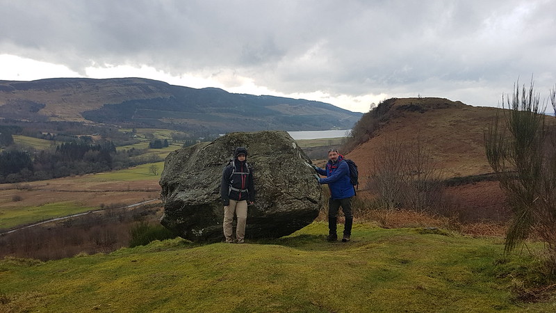
Samson’s Stone, Dunmore Fort, Loch Venachar.
With hindsight, we should have climbed Dunmore Fort which is not only a little higher than Bochastle Hill, but also has some very impressive looking defensive structures on its western side. Next time.
We chatted to one of the marshals who were out on the course for the Callander 10K which would be running later in the day and then walked down a road with a sign declaring it to be ‘a walking and cycling friendly road’. A nice idea, but it’s drivers that need to be friendly, not roads.
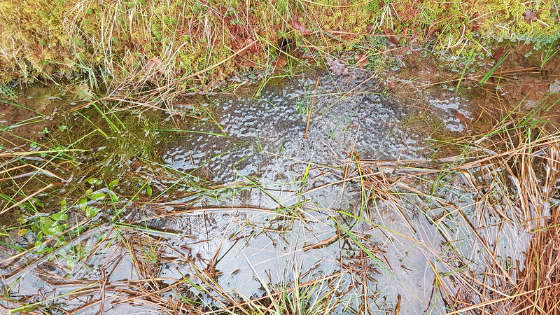
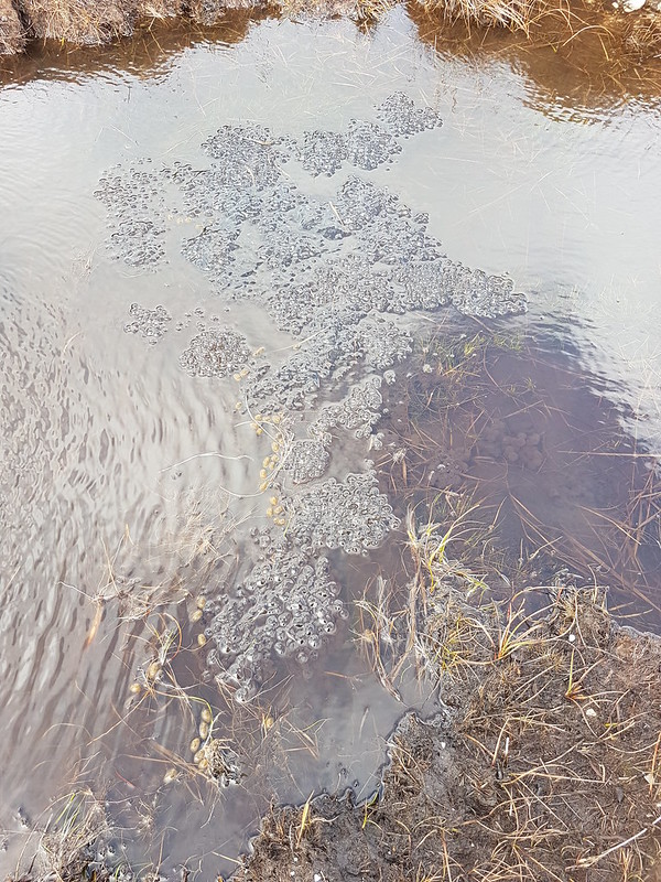
Eas Gobhain.Coilhallan Wood.The ditches by the track were full of frogspawn.
As the track through Coilhallan Wood descended towards Callander, there were tantalising views towards Ben Ledi, always partially obscured by trees…
Ben Ledi.
We climbed Ben Ledi back in 2015, on another day with a ropey forecast, which I enjoyed enormously, despite the forecast proving to be largely correct.
Ben Ledi. Garbh Uisge and Eas Gobhain meet to form the River Teith.
We found a bench on the outskirts of Callander and sat by the river to eat our lunch, and watch runners coming by near the end of their 10K. They were of all shapes and sizes, ages, and speeds. Some were struggling, some clearly very happy. It made me feel quite nostalgic for the days when I used enter races of this kind myself.
Bochastle Roman Fort.
From Callander, we walked back to the car park along the course of the former Callander to Oban railway line. In the field next to the line there are earthworks which betray the site of a Roman Fort. This is even further north than the Antonine Wall which stretched between the Clyde and Forth estuaries. It was built in AD85, which means it predates Hadrian’s Wall.
The next day it was back to work sadly, but at least I had some welcome company during my breakfast…
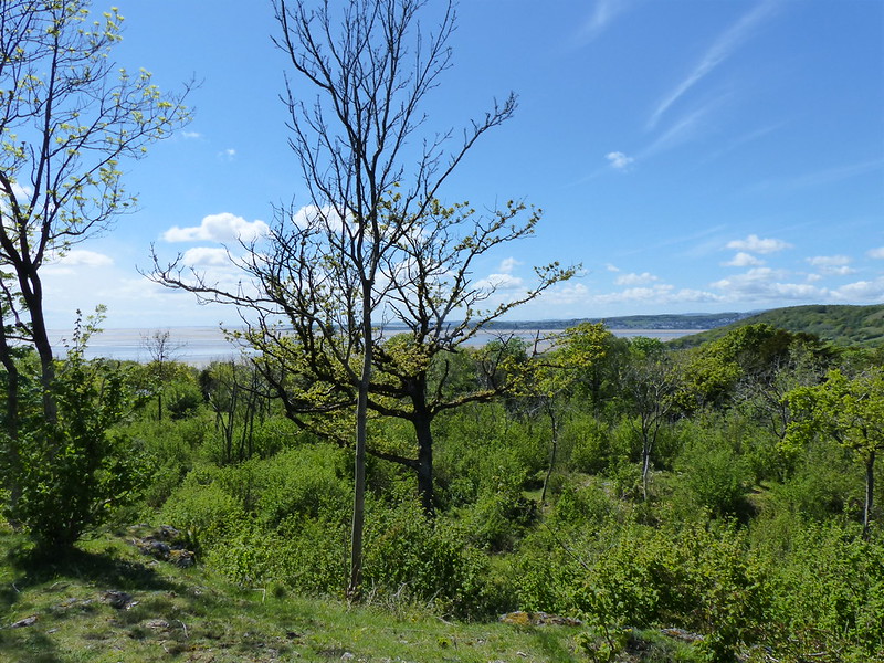
Unusually, for my recent posts, all of these photos are from a single lazy local walk, a few miles spaced out over several hours, during which I took lots of photos and stopped for several brews.
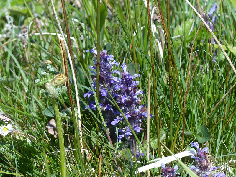
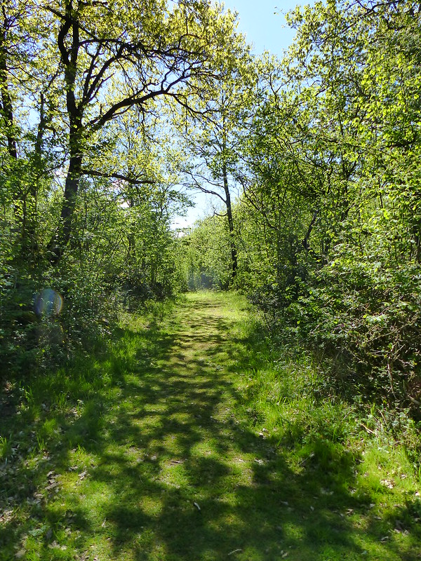
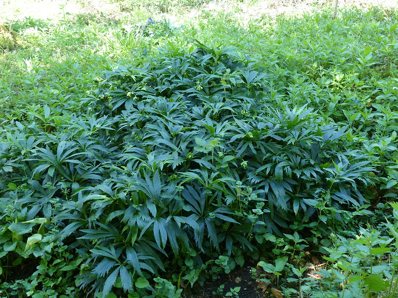
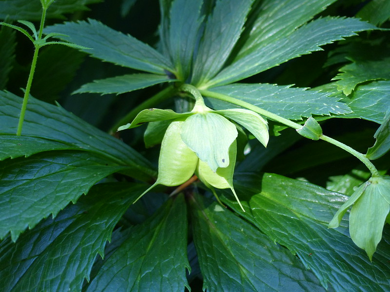
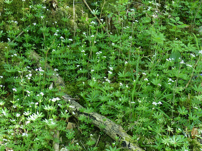
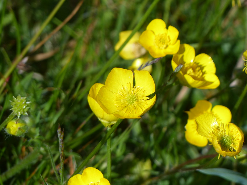
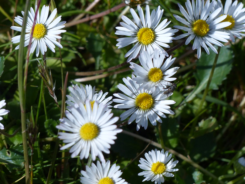
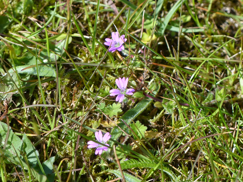
Bugle.Sun-dappled path through Middlebarrow Wood.Mayflowers.Arnside Tower doorway.The view from Arnside Tower over Silverdale Moss to Beetham Fell.Green Hellebore in Middlebarrow Wood.I don’t think I’ve noticed the large size of the seeds which develop inside the flowers.Sweet Woodruff.Herb Paris.Reed beds at Silverdale Moss.Paddock near Far Waterslack.Buttercups.Daisies (of the Galaxy?) Dove’s-foot Crane’s-bill.
Quite clever of this tiny flower to incorporate both the names of two birds and two hyphens in its name.
Heading towards Hawes Water.A swimmer.
I managed quite a bit of swimming this summer, but am still jealous of this solitary bather, since I’ve never swum in Hawes Water. It’s quite hard to see how you could get in through the reeds, although a couple of the houses on Moss Lane have private jetties.
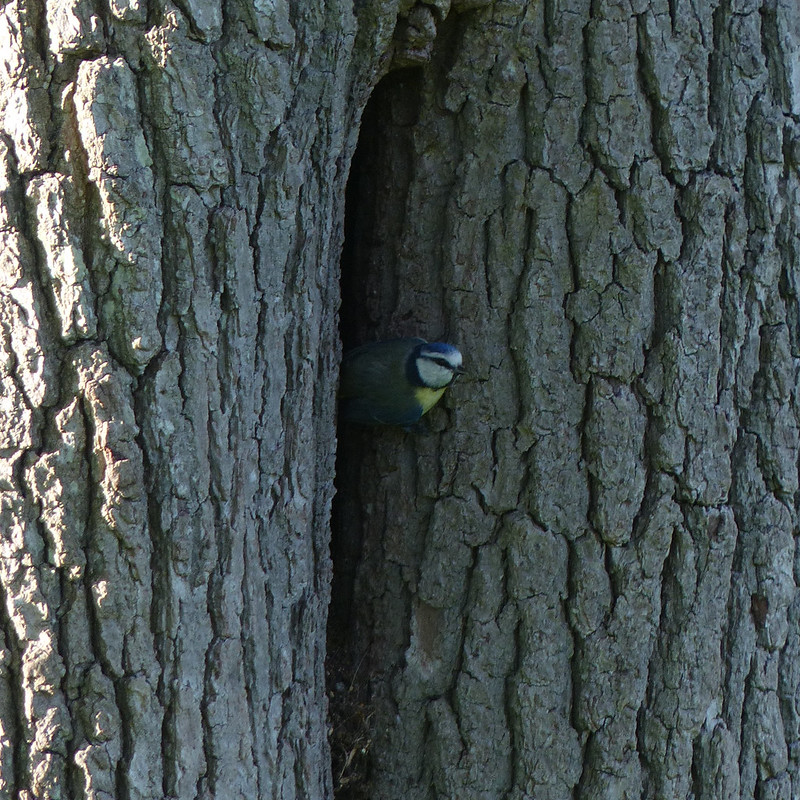
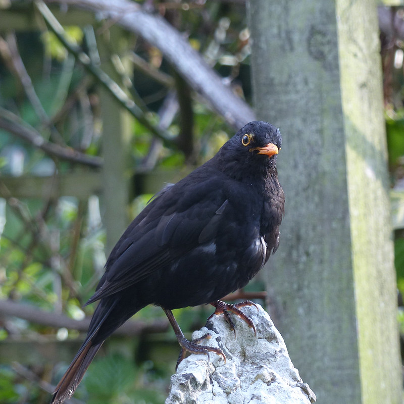
Bird’s-eye Primroses growing in some of the cleared land. Vindication of Natural England’s tree-felling policy?Femal Mallard.Tadpoles and fish in the stream between Little Hawes Water and Hawes Water.Azure Damselfly (I think).Bluebells, Gait Barrows.Limestone Pavement, Gait BarrowsAngular Solomon’s-Seal growing in a grike.Looking towards Trowbarrow from a brew stop.Eaves Wood.Inman Oaks.Blue Tit. I watched blue tits going in and out of this fissure last spring. I wonder of it was the same pair nesting this year? This Nuthatch was also in-and-out, of a neighbouring tree, presumably bringing food to a nest.Male Blackbird on our garden wall.
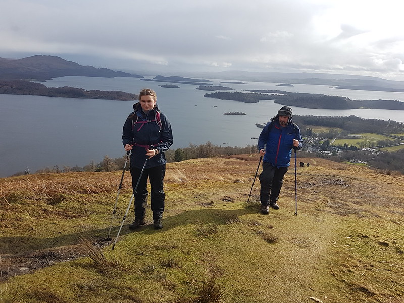
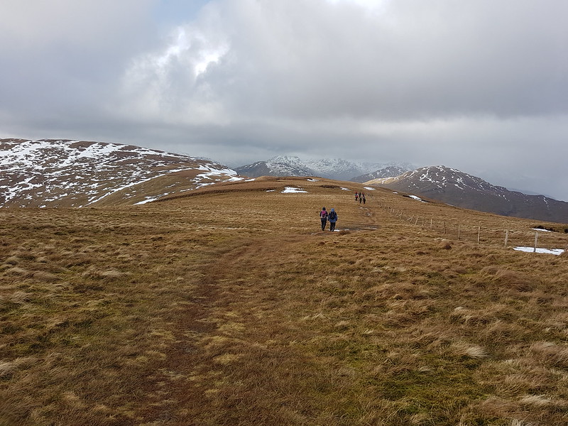
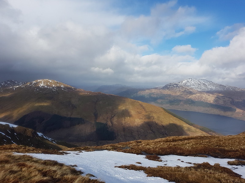
A and TC climbing out of Luss – huge view of Loch Lomond behind.
After the wash-out of the day before, we had one day to rescue the situation and persuade A and her friend S that winter hill-walking in the Highlands is for them. Our usual procedure for the Sunday of these weekends is to head south for our walk, so that we have a slightly shorter drive home. This year was no exception, and we decided to walk from the village of Luss into the smaller hills (by Scottish standards) on the western side of Loch Lomond.
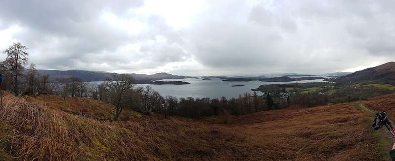
Loch Lomond pano – click on this or any other picture to see a larger version on flickr.
The forecast was for kinder weather, which on the whole was what we got, but with a few showers thrown in for good measure.
A snowy Ben Lomond in the background.
Puddle full of frogspawn.
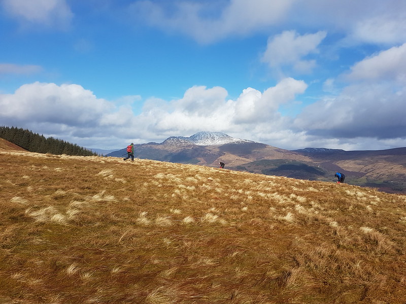
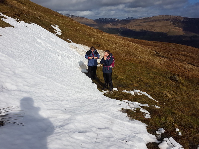
A and S very happy to get their hands on some snow…
…until their hands got cold that is!
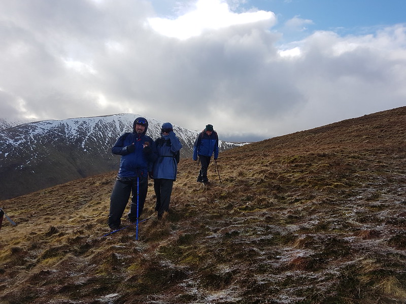
The Tower Captain and Loch Lomond.
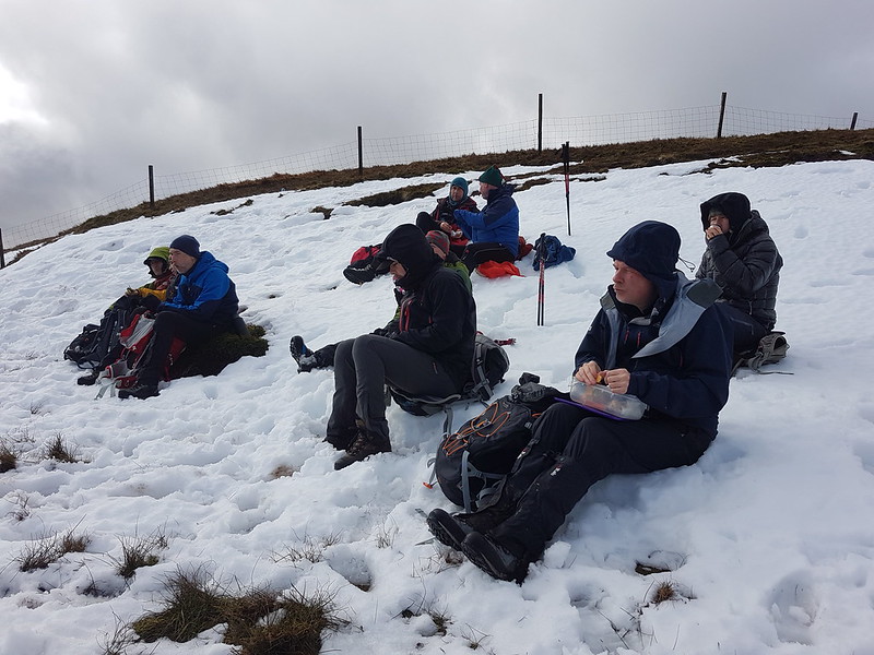
A chilly lunch.
There was a fierce wind blowing all day and this rather cold looking lunch stop was actually relatively sheltered.
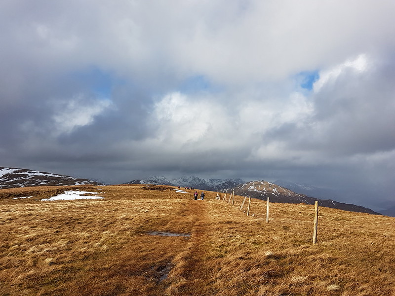
On the ridge.
On the rim of Corrie na h-Eanachan.
Beinn Bhreac and Ben Lomond.
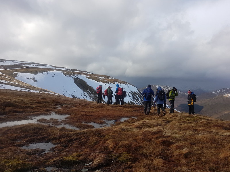
These ‘little’ hills have some pretty impressive corries . It’s a good job we took the opportunity to enjoy these views of Beinn Bhreac, which we climbed on another windy March day a couple of years ago, because as we crossed the rather featureless summit plateau of Beinn Dubh, the weather came in again and we had a a lengthy shower of hail and snow which, given the strong wind blowing, was pretty unpleasant. We stood with our backs to it for a while, but it soon became evident that it wouldn’t be sensible to try to wait it out in such an exposed spot.
We stumbled along and were soon heading downhill which quickly brought some respite and then the weather began to clear again…
Blue skies reappear.
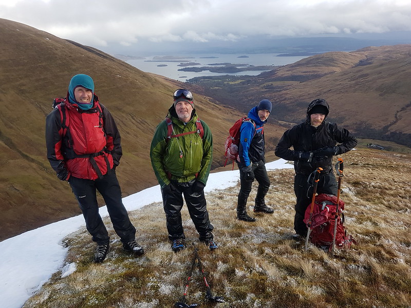
‘Boys’ – The Eternal Weather Optimist, The Shandy Sherpa, The Lanky Dane, The Hairy Oatcake.
The Tower Captain, The Junior Tower Captain, Old Grandfather Sheffield.
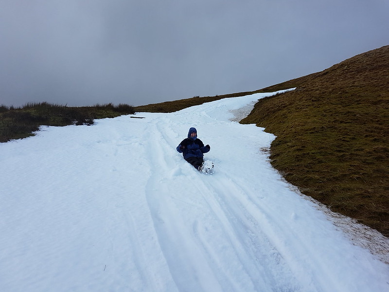
The girls seem to have come through the brief squally ordeal unscathed and both seemed to be enjoying themselves. Especially when we discovered some snow patches to slide down…
S enjoys a bumslide as much as her Dad.
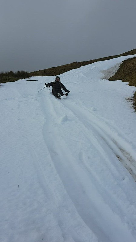
So does A – she insisted going up and down this bit a few times. It’s a video – you’ll need to click on the picture to play it on flickr – worth it for her grin at the end I think, but then I’m biased.
I think they both want to go again next year, so mission accomplished it seems.