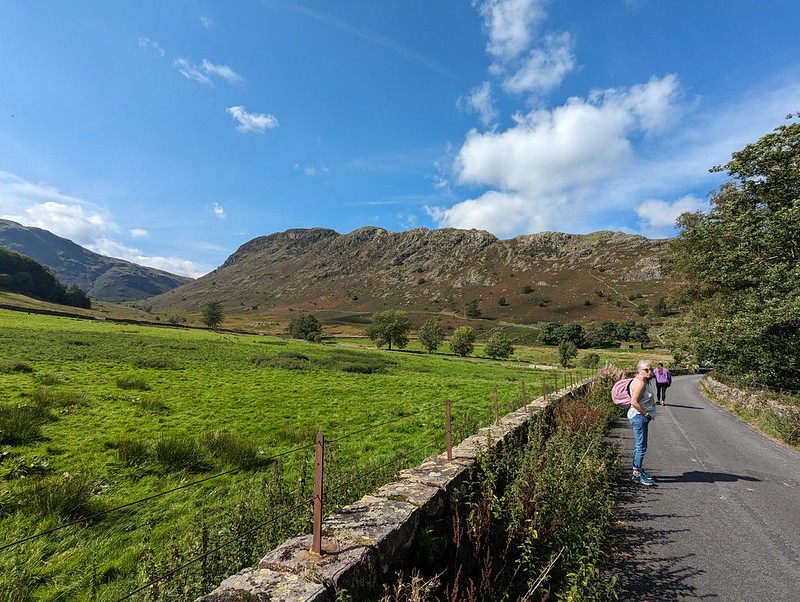
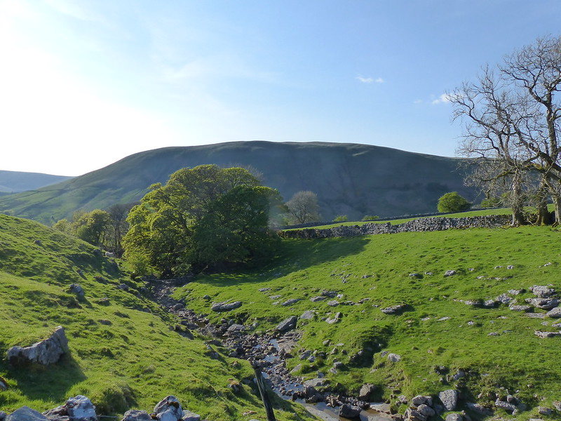
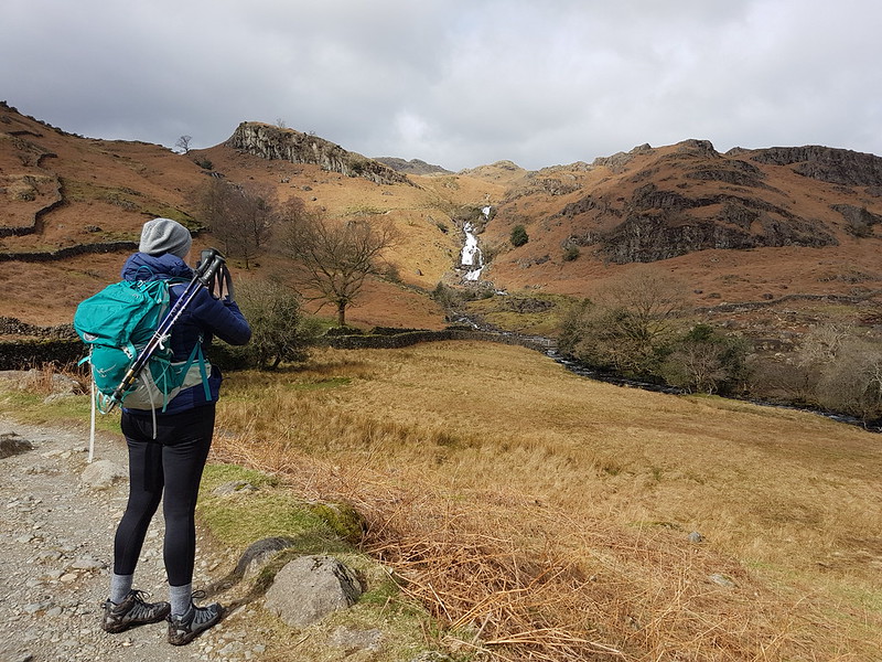
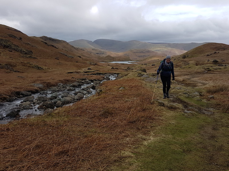
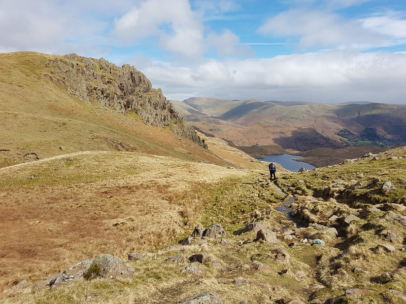
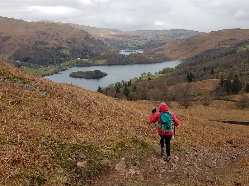
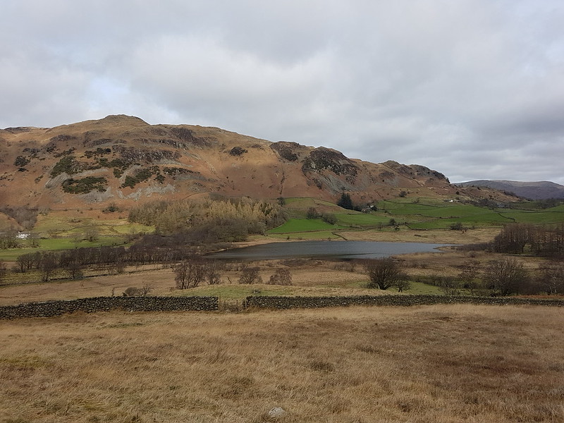
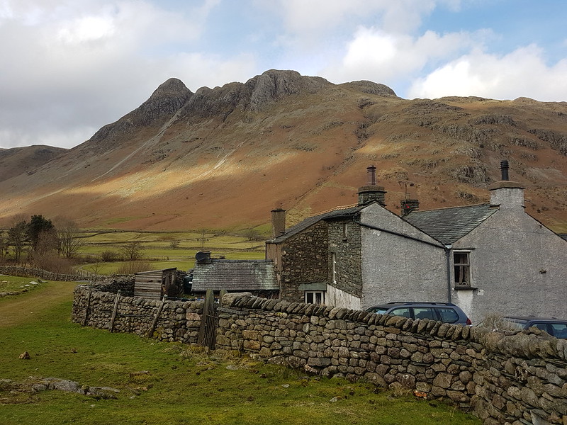
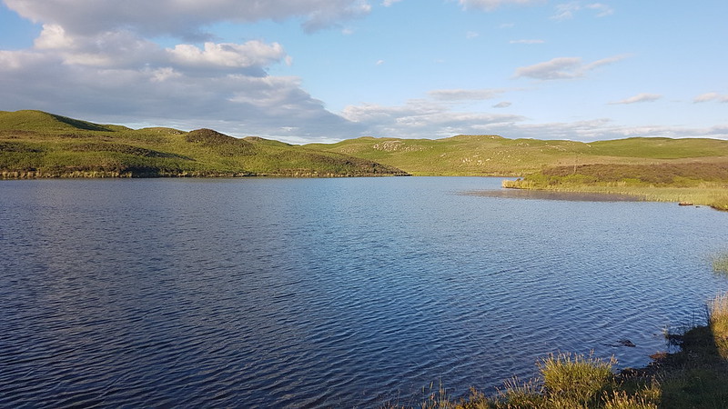
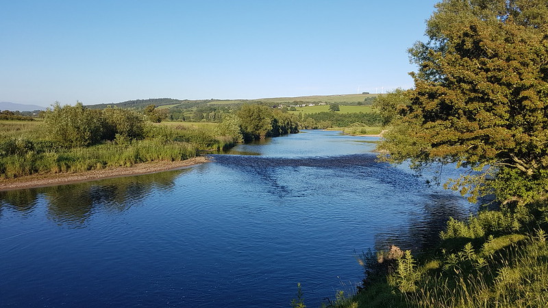
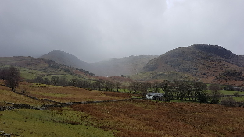
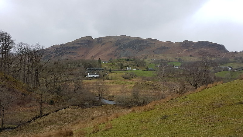
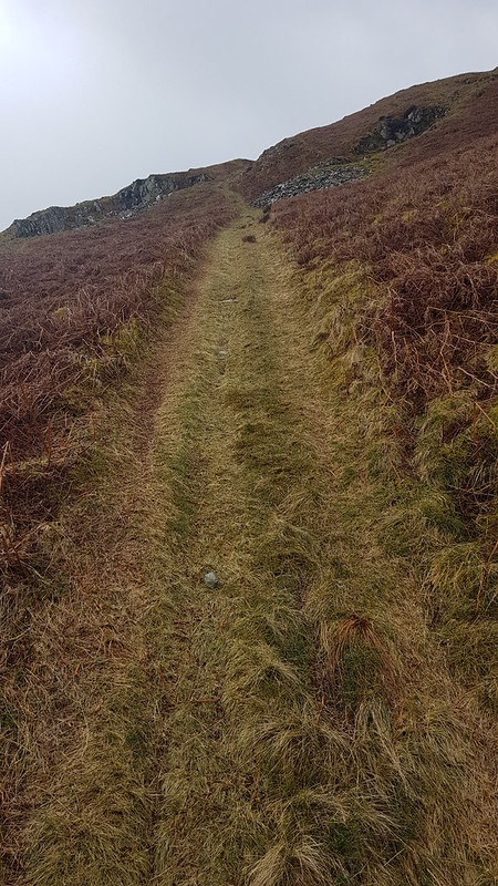
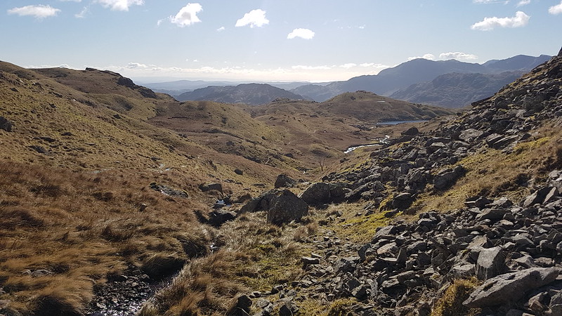
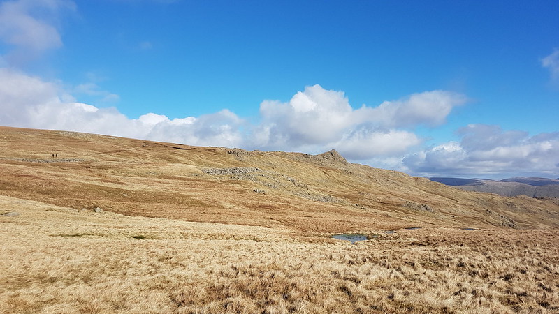
What with Harrop Tarn being my new favourite swimming spot, after my visit last June, I was keen to share it with my nearest and dearest, so when A asked about a potential swim when her boyfriend L was visiting, that was the first suggestion which sprang to mind. The small parking area at Stockhow Bridge was already jam-packed when we arrived, but we were lucky to find some roadside parking close to the junction of the currently closed road around the western side of Thirlmere and the main road.
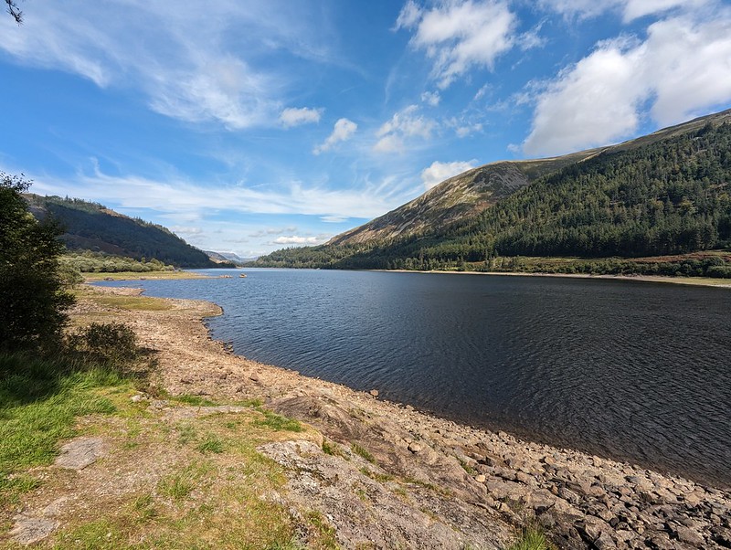
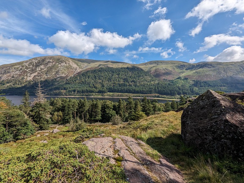
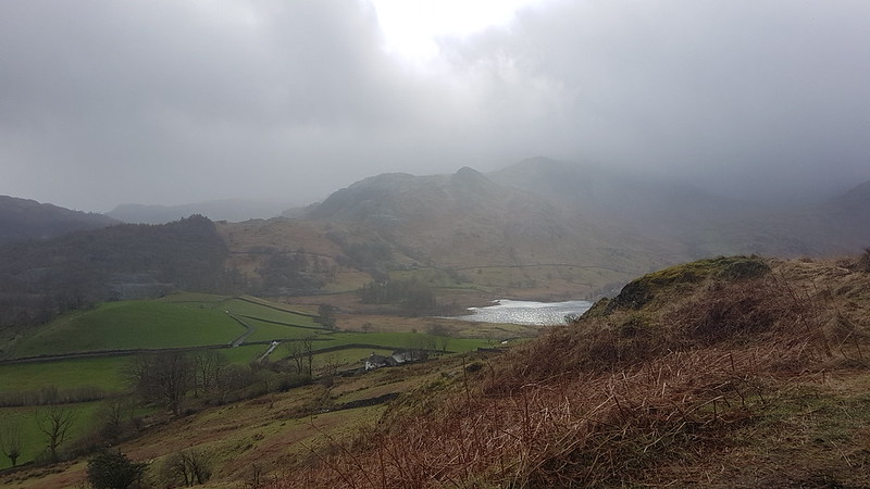
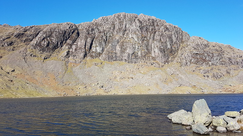
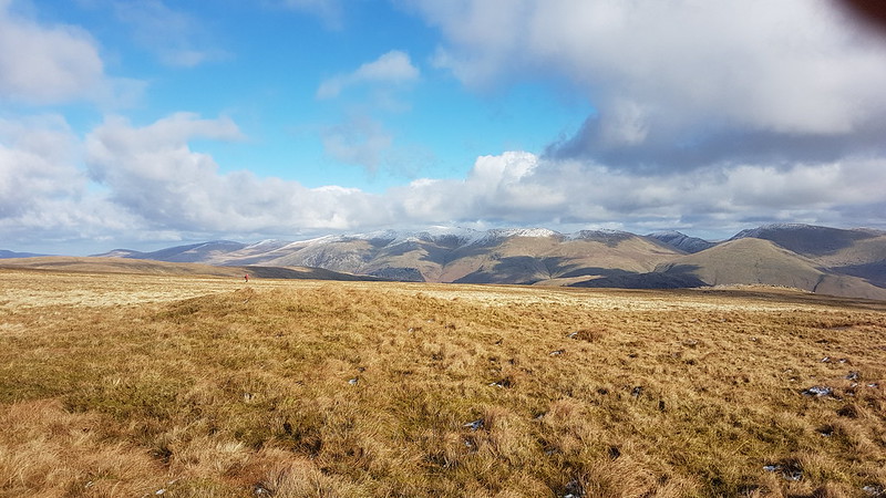
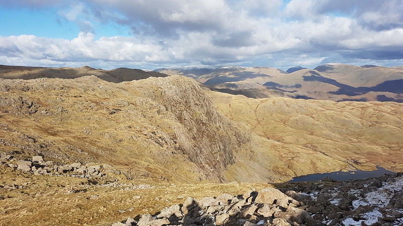
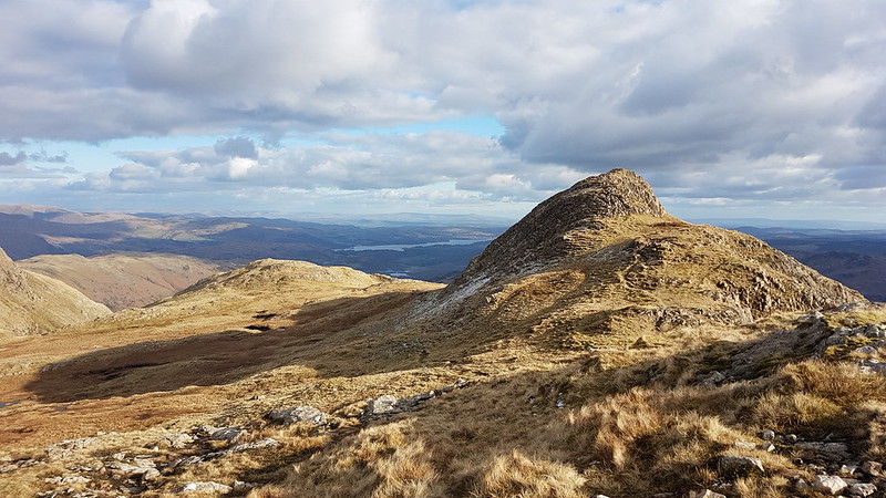
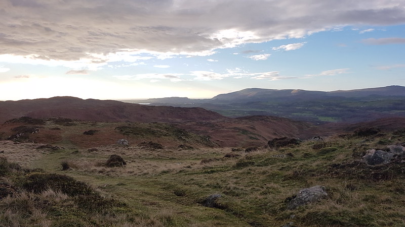
Thirlmere Reservoir.Helvellyn.
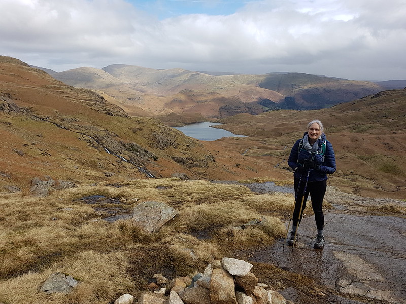
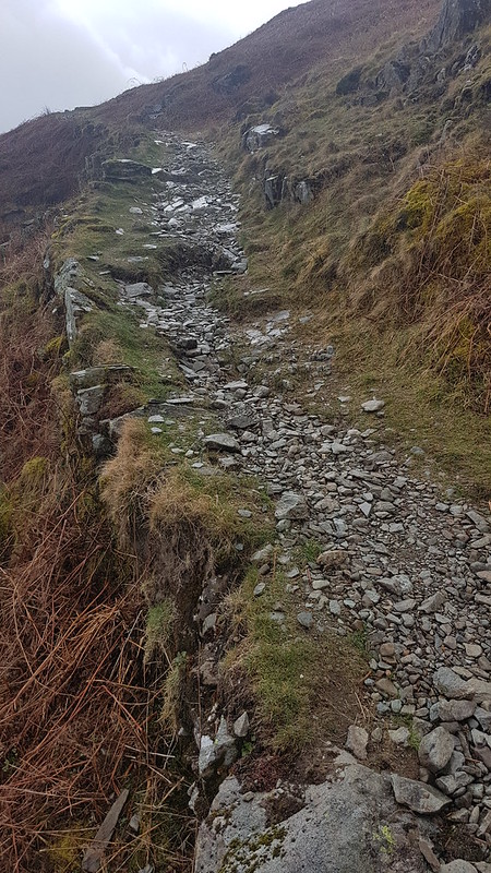
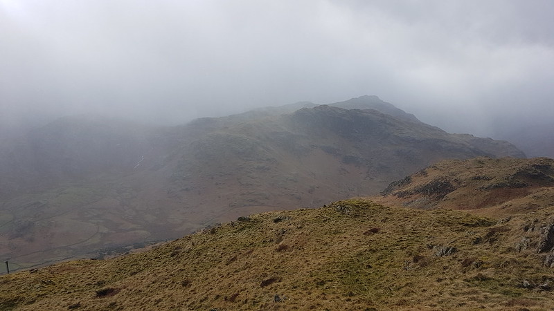
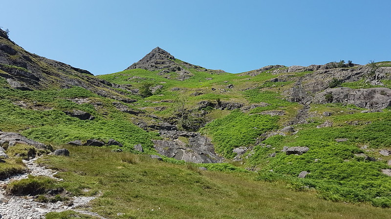
It was a beautiful day, quite warm, so the views back across the reservoir to Helvellyn and its satellites gave me frequent welcome excuses to stop for a breather and take photos during the steepish ascent.
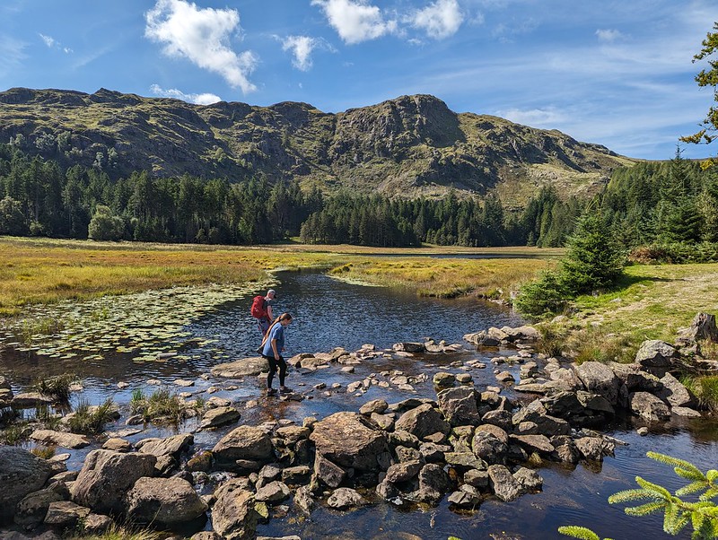
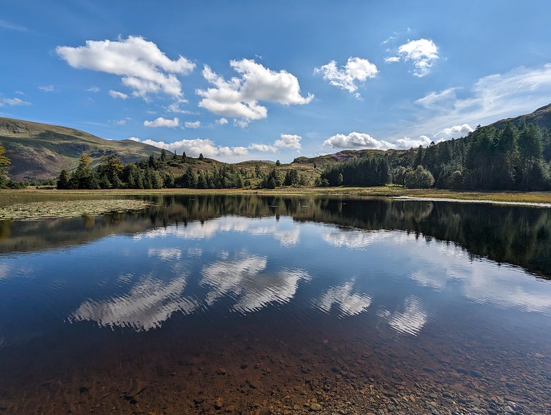
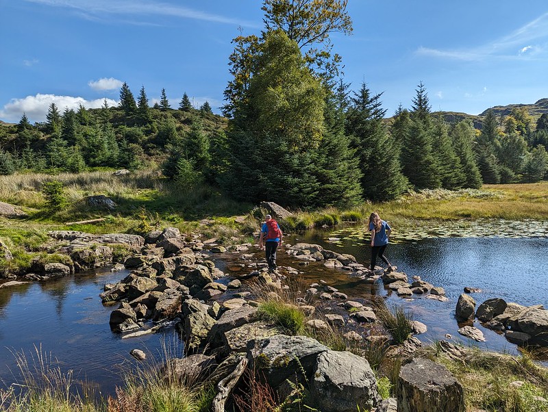
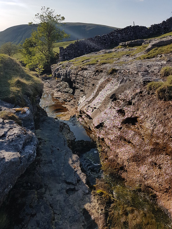
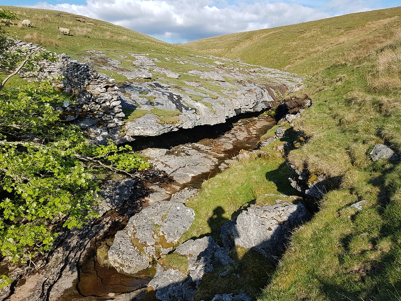
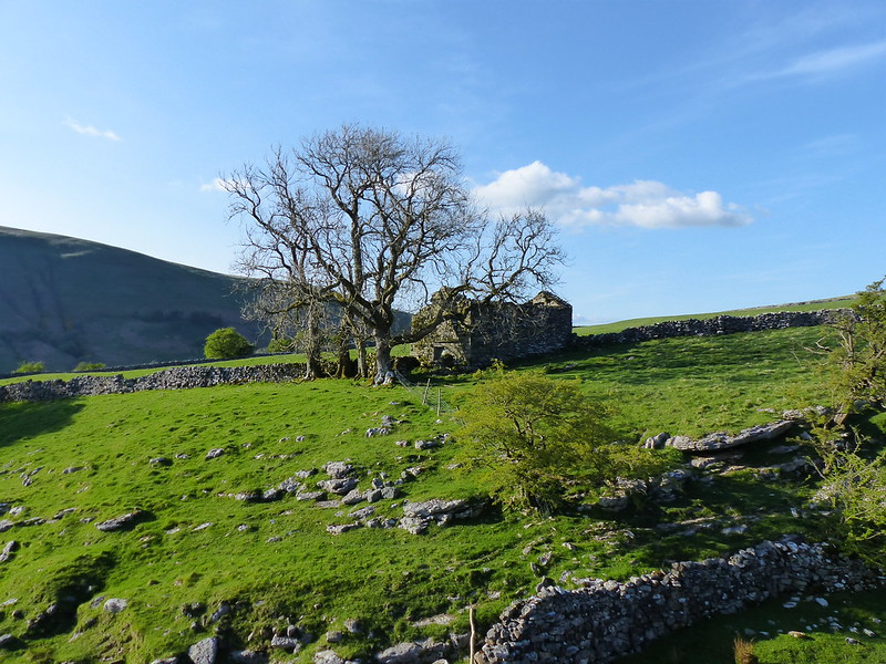
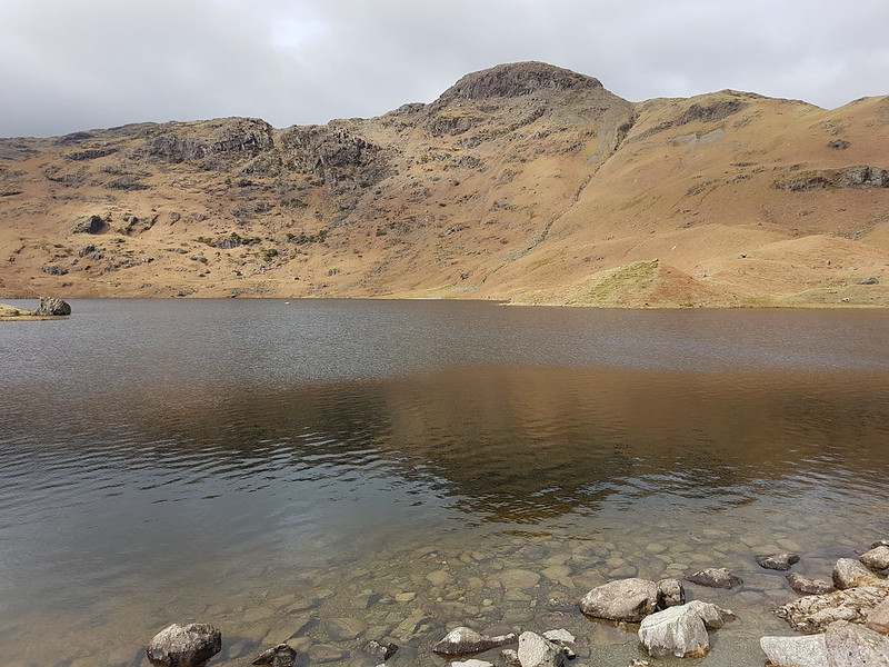
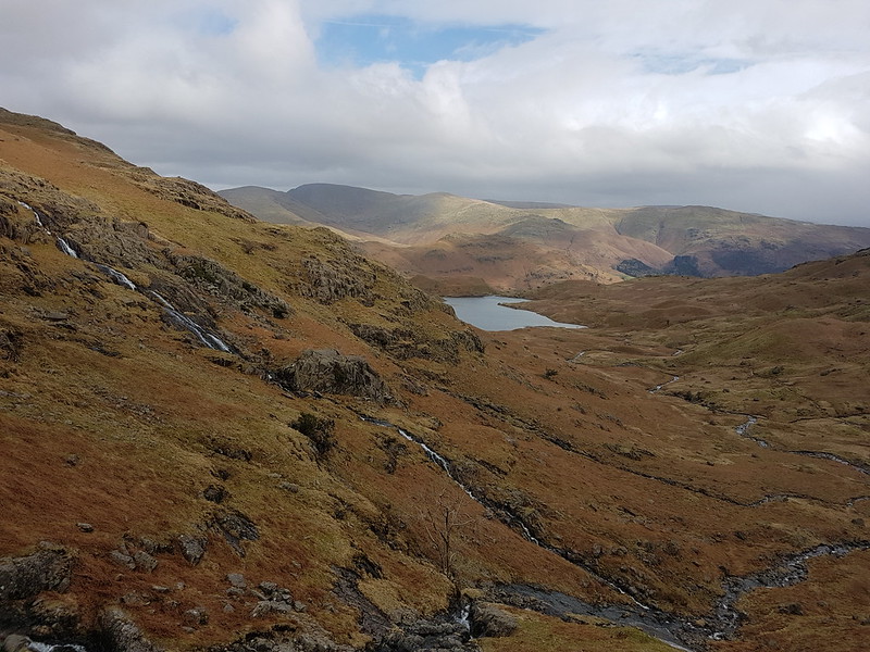
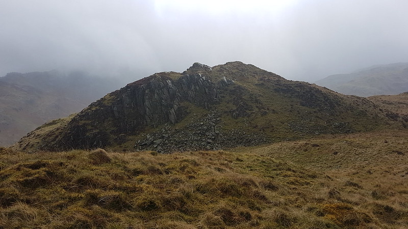
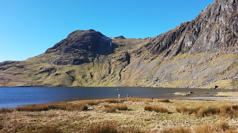
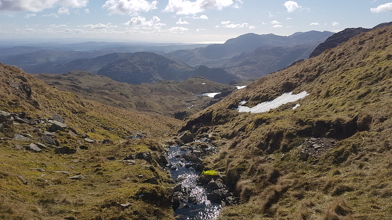
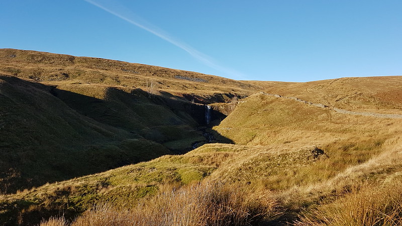
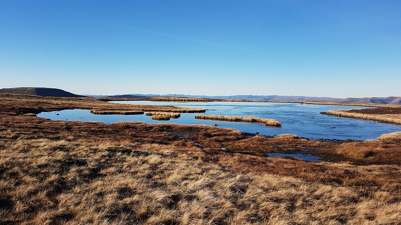
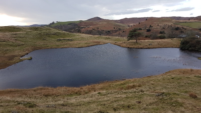
The rocky bowl which holds Harrop Tarn.A and L racing each other on the stepping stones.
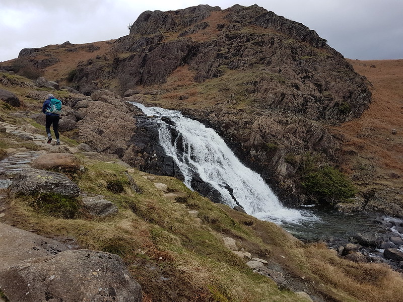
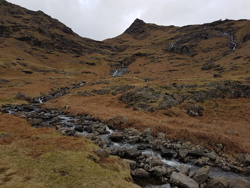
There’s a bridge across Dob Gill near the outflow from Harrop Tran, but A insisted on a race across the stepping stones. And then again with a headstart. And again with a more generous headstart, but L is a triathlete and clearly very agile, and no amount of leeway was going to get our A across first.
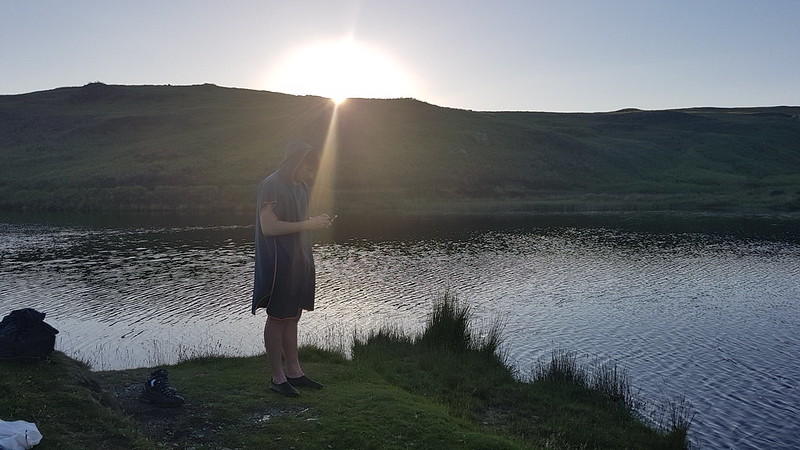
L was ready and into the water before I’d even undone my laces. Then out again even faster. Apparently the water was cold. He wasn’t wrong. I guess triathletes are used to the luxury of a wetsuit. A is undeniably much hardier than I am: she and her friend S (the Tower Captain’s daughter for long-suffering readers) have instigated a new ‘tradition’ of going for an open water swim on S’s birthday. In March! This year that was in a stream up by Alston in the Pennines (it looked lovely, but A was a bit vague about the exact location). Last year it was in High Dam, with snow still sitting on the banks. Brrr. Never-the-less, on this occasion she took her time getting in and didn’t last much longer in the water than L had.
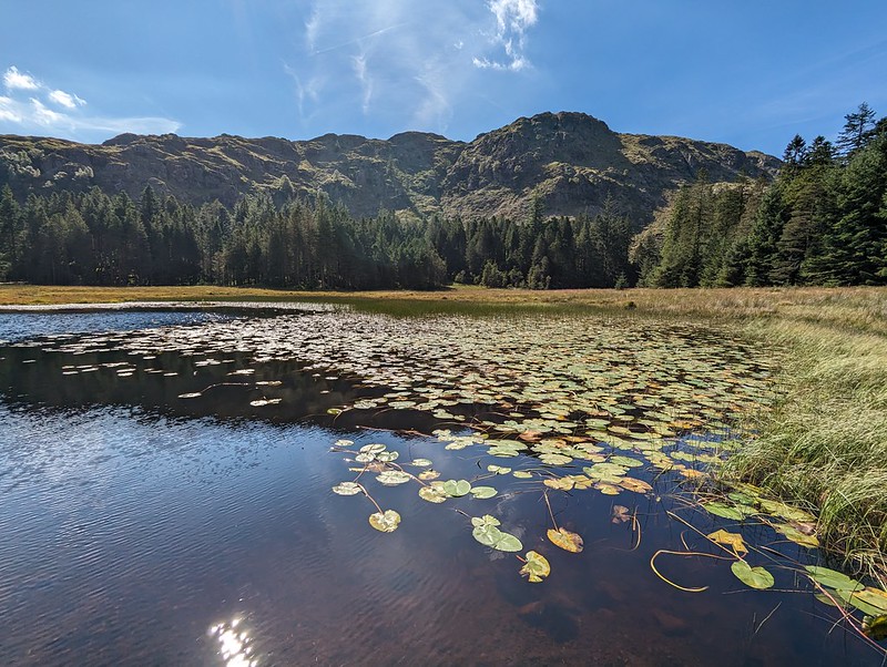
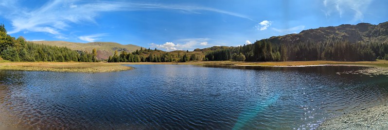
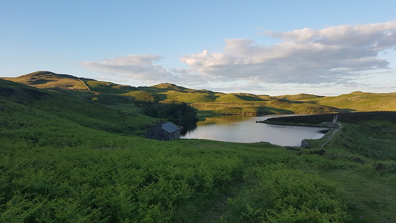
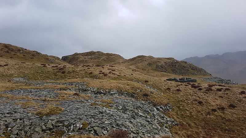
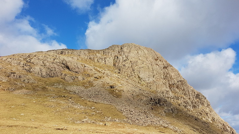
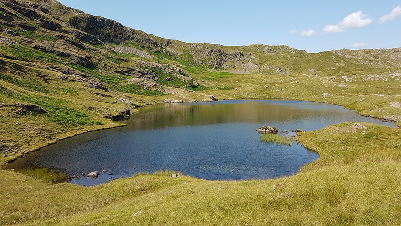
Harrop Tarnpano.
TBH took an absolute age acclimatising herself inch by squealing inch. By the time she was fully immersed I’d almost finished my first circuit of the tarn (like a lot of mammals adapted to cold water I have my own built in insulation). I could see that TBH intended to follow my lead, so I cut a corner and we swam a circuit together. Or almost together – like most people, TBH swims faster than I do.
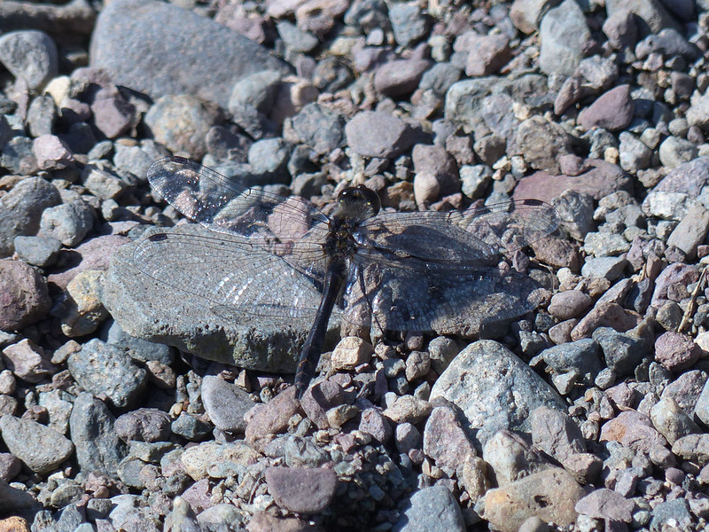
Black Darter.
Not the most attractive dragonfly perhaps, but exciting for me because I’m not aware of having seen one of these before and I certainly haven’t photographed one.
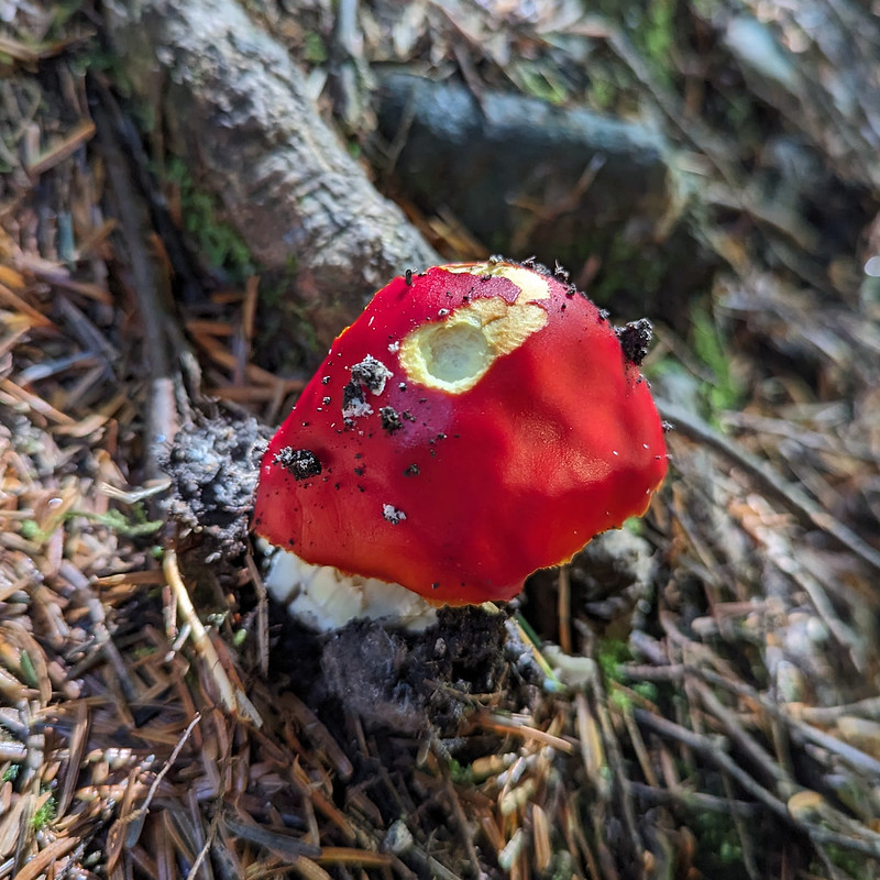
Another stepping stone race. Only ever going to be one winner.Fly agaric?Elephant Hawkmoth Caterpillar.
The first time I saw, and photographed, one of these, was also on a walk with A. And her friend S and the Tower Captain come to that, way back in 2009. One of the photos I took then somehow ended up high on the list of results of an internet image search and for a few years that post would get heavy traffic every July and August when people were trying to work out what it was they’d seen clambering on their Fuschias.
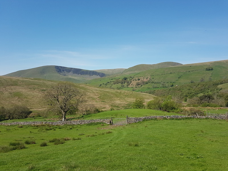
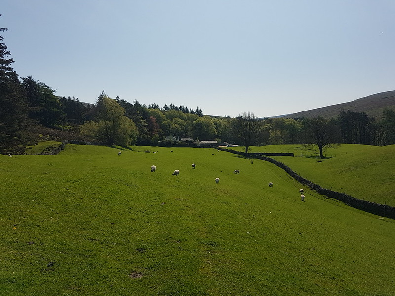
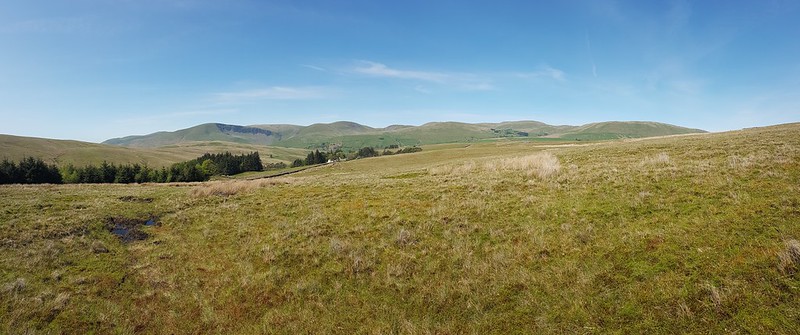
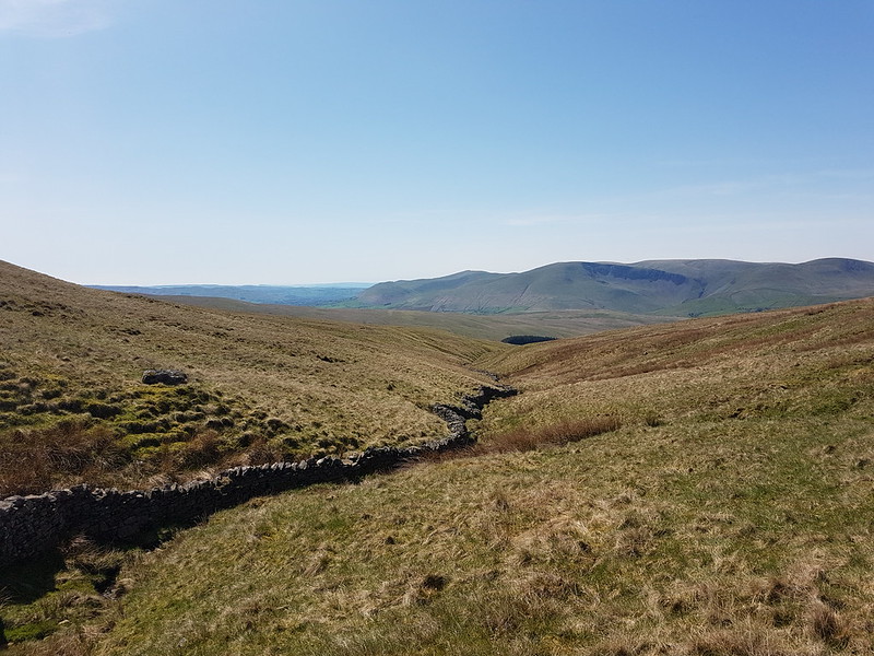
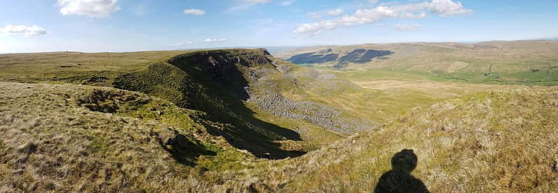
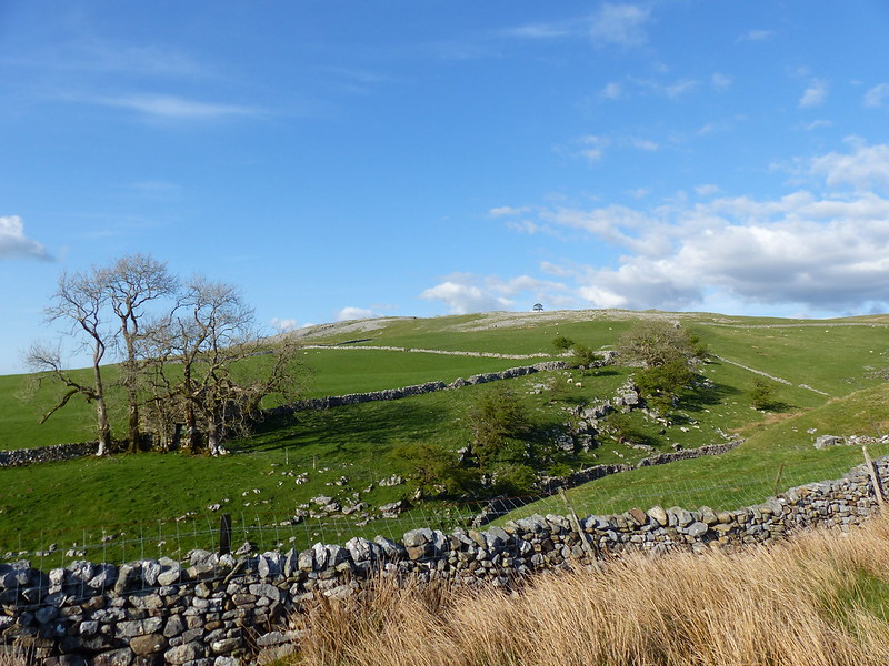
Another Lune catchment outing, which, once again, didn’t disappoint. I had splendid views of the Howgill Fells all day. I’d parked down by Rawthey Bridge and when I left the minor road which leaves the A road there, took another version of this view which was rather spoiled by the foreground of dessicated Mole corpses hanging from the barbed wire fence – a grisly traditional method for a mole-catcher to show the success of his labour.
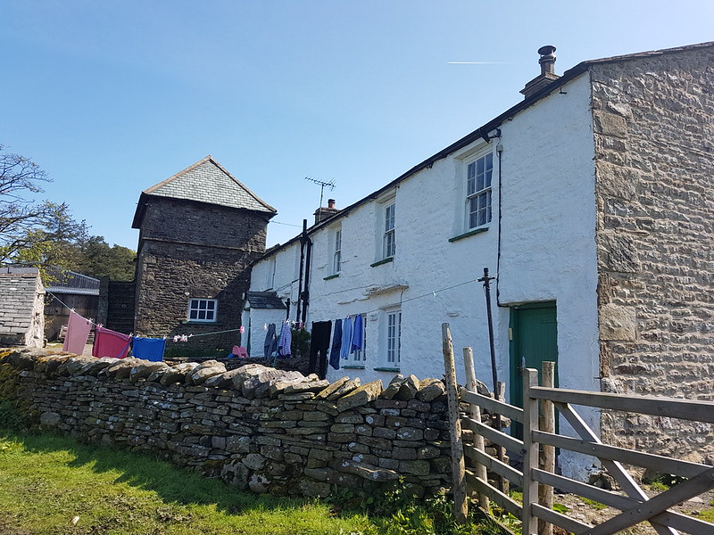
The field path took me past a series of old farmhouses, heading up the valley of the Rawthey.
New House Farm.
What intrigued me about this farmhouse was the unusual tall building with the pyramidal roof, which is a coach house apparently, according to Historic England, added in 1914 to a building which is “probably early/mid C18”. I should have taken a photo back down the hill at Wraygreen, which is considerably older. Next time.
Approaching Needle House.
I’ve included this photo because it shows the trees beyond the house, clearly planted, looking almost like an arboretum, of which more in a moment.
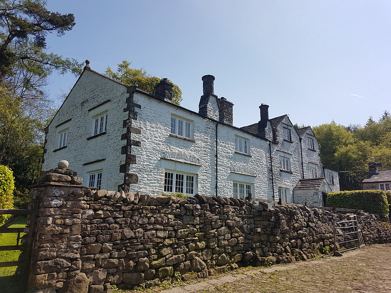
Needle House.
I was surprised to find that the very striking Needle House is not listed. I did find a fascinating history of the Frankland family, who lived here and modified the house, written by Dr Helga Frankland, whose father seems to have been taken with all things Scandinavian (so hence Helga?).
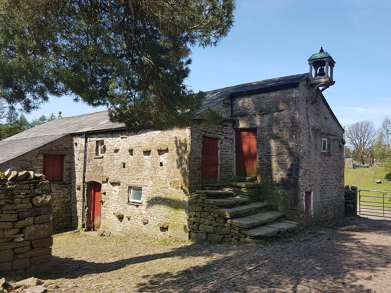
Barn by Needle House.
“Unusual features created by my father include the belfry on the gable end of West Laithe in the yard at Needlehouse. It is based on belfries seen on farms in Scandinavia. We used the bell to summon people to the house from the fields.”
Laithe is a northern word for Barn, apparently.
Bridge over Needlehouse Gill.Needlehouse Gill.
“My father planted all the woods on our land, except for the much older Uldale Wood and the natural woodland in the gills. Scandinavia held a strong fascination for my great grandfather, grandfather and my father. By skillful placing of relatively small, largely coniferous woods, my father managed to create a landscape that looks more wooded than it actually is and therefore, has echoes of Scandinavia.”
In the woods beyond the gill, I was delighted to spot four or five Red Squirrels, or, very possibly, the same Red Squirrel four or five times. I have one very blurred photo to remind me, but if I hadn’t taken it myself, I don’t think I would know that it was of a squirrel. Much of the walk to this point had been accompanied by the sound of Cuckoos, but, as usual, I didn’t see them at all.
Needlehouse Gill again.
I watched a largish bird of prey fly up and along the gill. I don’t know what type sadly.
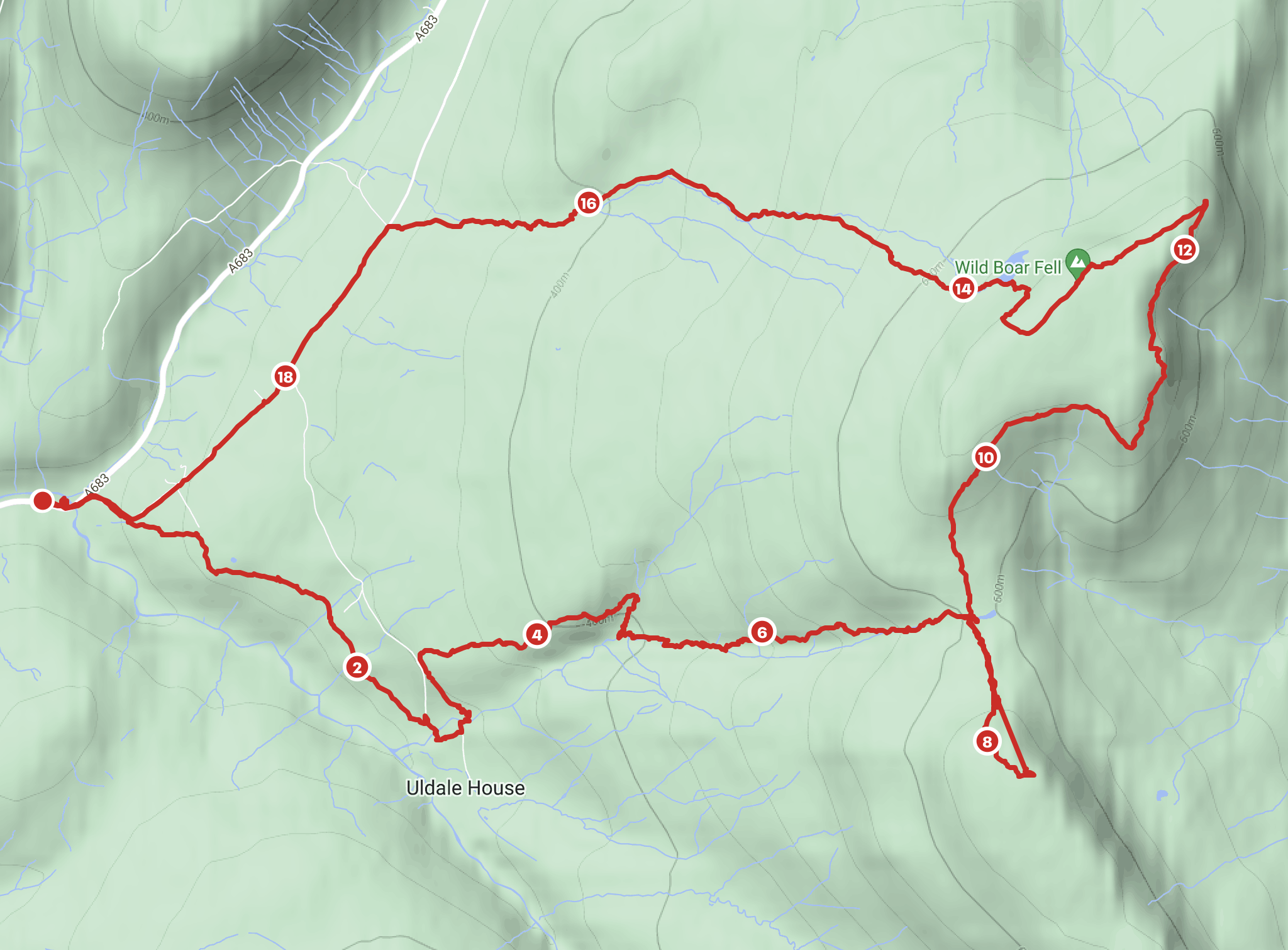
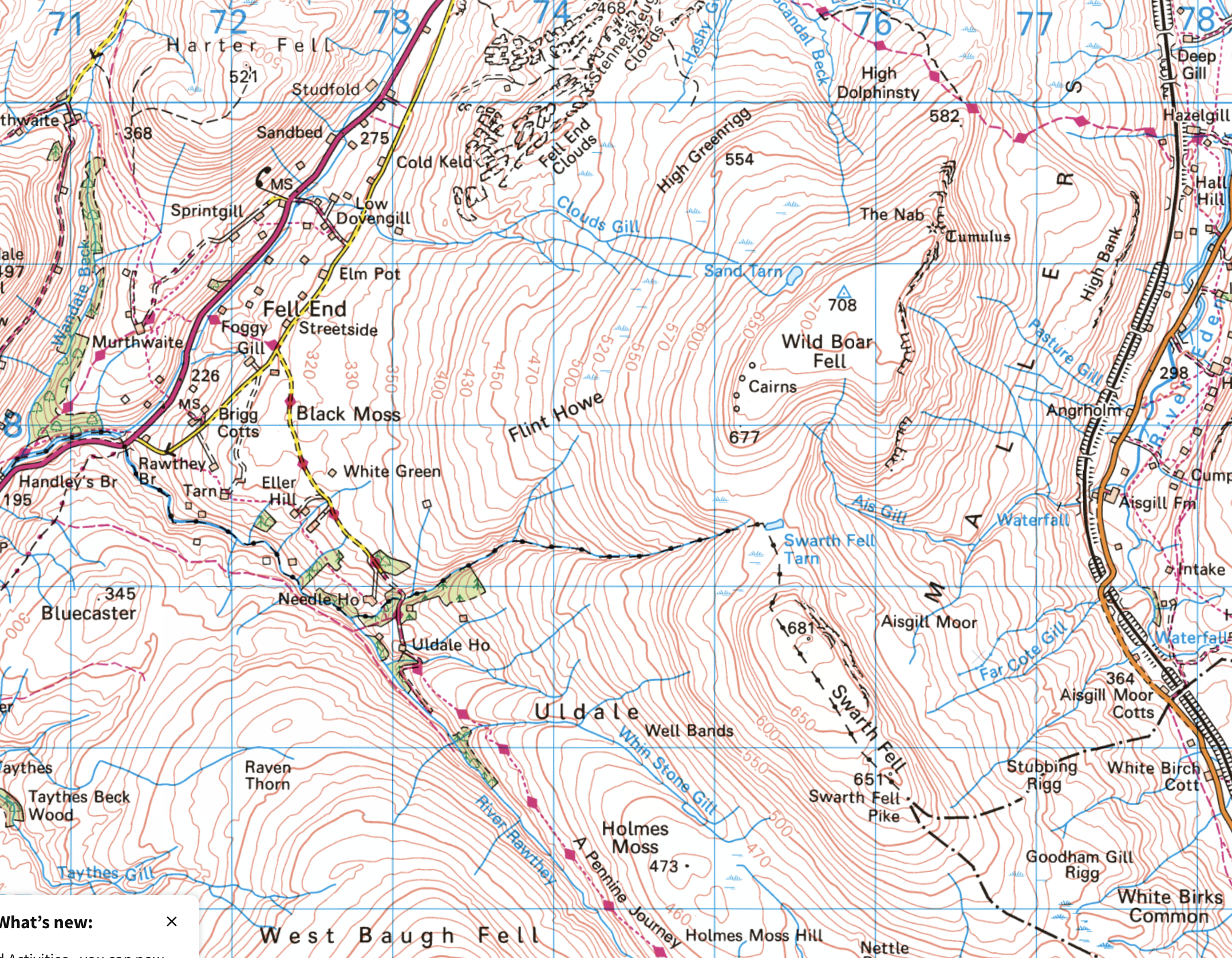
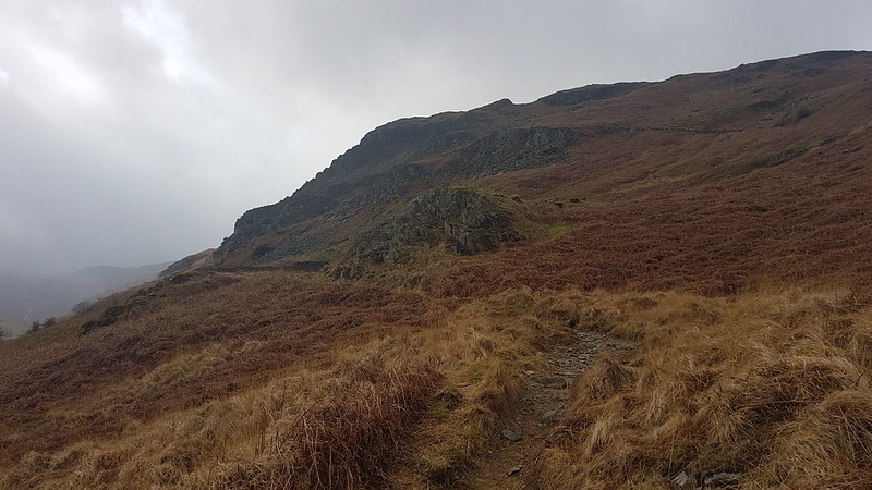
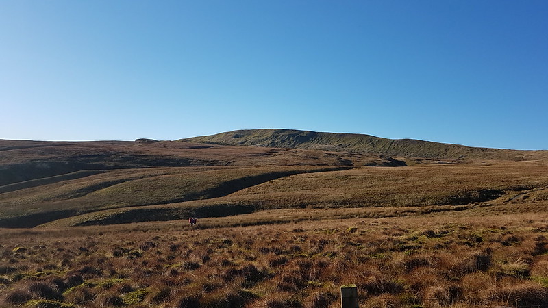
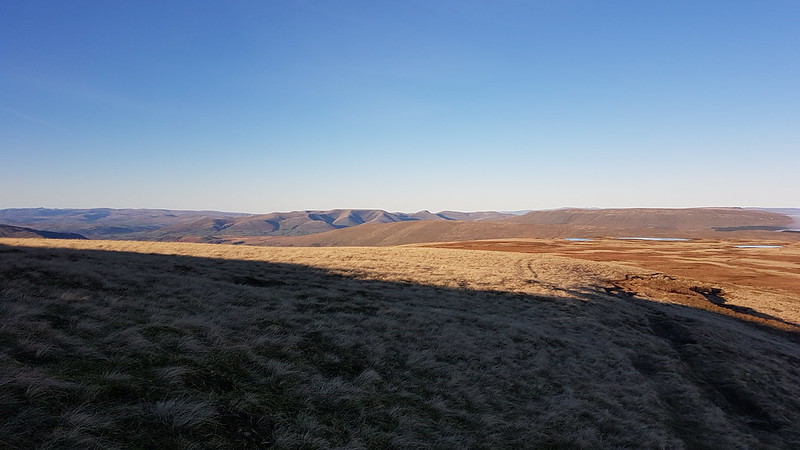
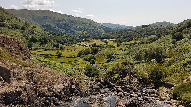
Part of the reason for choosing this route was the fact that I haven’t climbed Wild Boar Fell for far too long. It used to be a bit of a favourite. I always used the same route: up the Rawthey, over Holmes Moss Fell, which was invariably very wet, then onto Swarth Fell, Wild Boar Fell and down via Fell End Clouds. This time I intended to ring the changes and explore some more Lune feeders. My original plan had been to hop over the fence here, onto access land, and follow the gill upstream, but the going looked like it might be difficult, due to the steep banks and fallen trees, so instead I almost doubled back on the track and then took to the open fell-side.
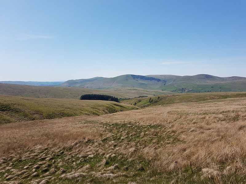
Looking back towards the Howgills.
It wasn’t half as wet underfoot as it might have been I suspect.
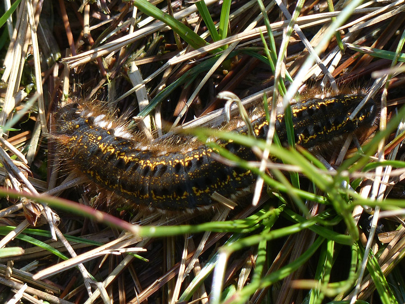
Drinker Moth Caterpillar.
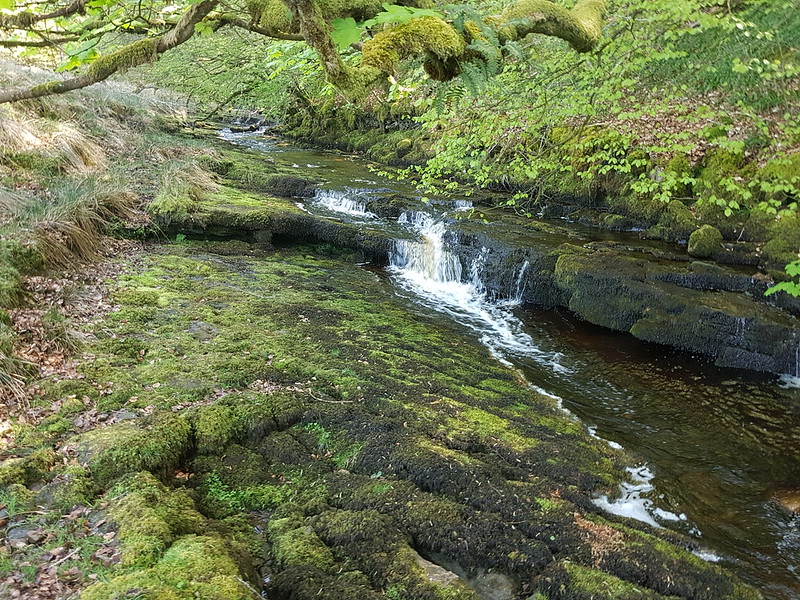
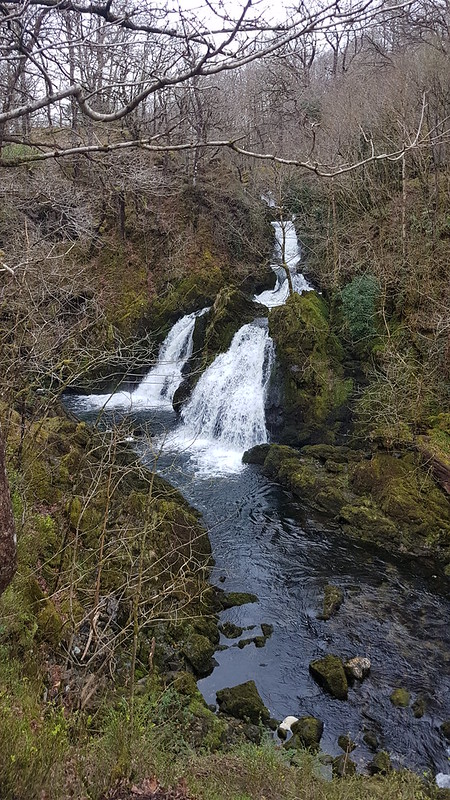
I found a hint of a path, which took me down into Grain Gill, and then followed the gill down into Needlehouse Gill which at some point becomes Uldale Gill.
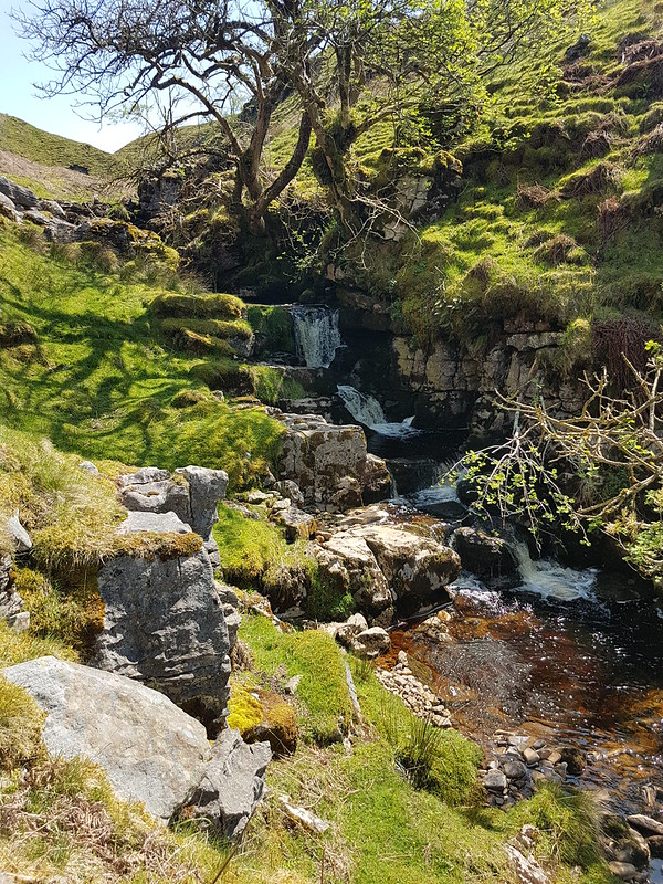
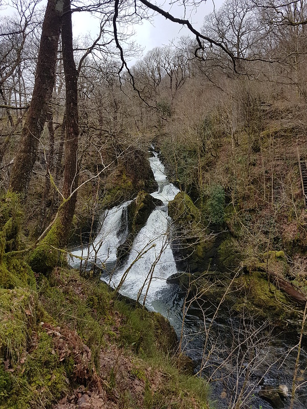
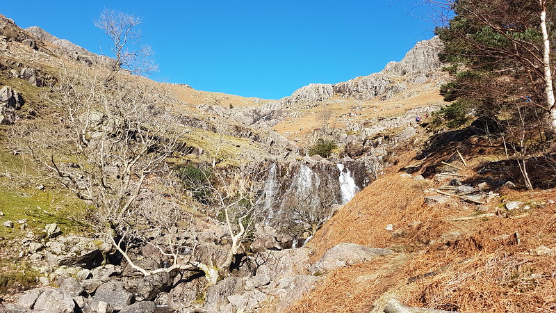
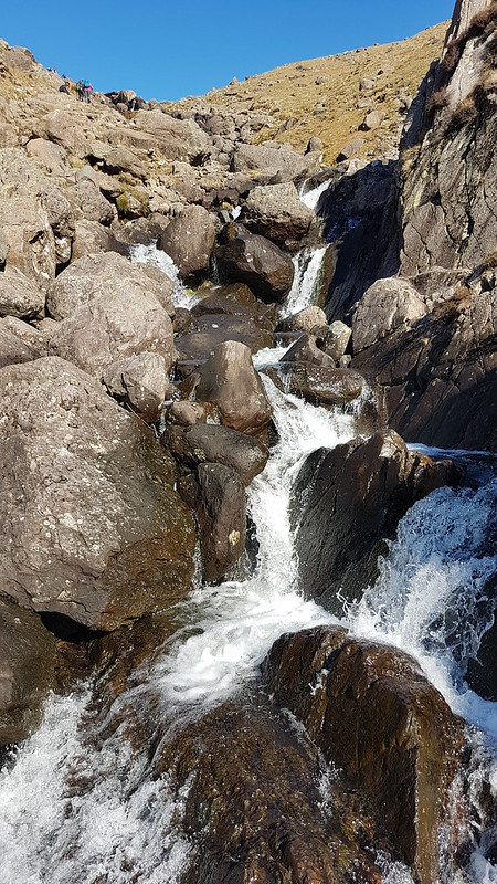
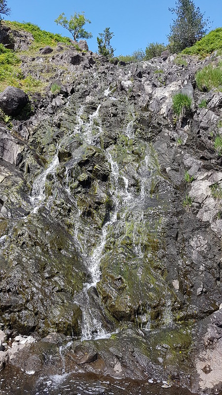
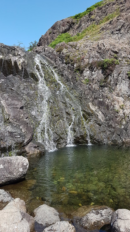
Waterfall.
I took lots of photos of small falls and cascades, but this was the best, so can stand in for them all.
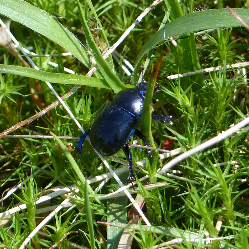
Dor Beetle.
I watched this Dor Beetle as it wandered around in the rough vegetation, laboriously and seemingly with quite a lot of effort, going back and forth over the same ground for reasons I couldn’t fathom.
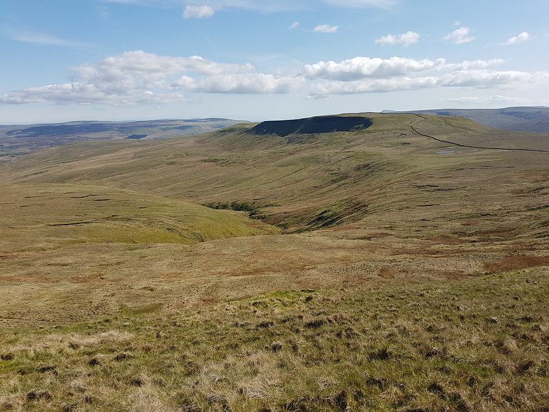
Looking back down the gill to Cautley Crag.
On the left of this photo you can see a small sliver of white, which is where water was spouting from a hole in the crags and pouring under the wall into the stream. The boulders in the foreground are, I assumed, the dry bed of a tributary stream where a spring would emerge in wet weather.
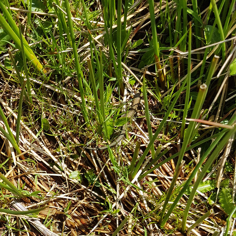
In the absence of a path, following the stream turned out to be quite heavy going, so I decided that it would be a good idea to climb up to the left, above the northern bank of the gill. I was wrong. That bright idea brought me into very boggy ground with tall reeds. The only upside was that I saw a number of Common Lizards…
Common Lizard.
…which were all too fast for me to get any decent photos.
Fortunately, when I climbed high enough, the going got much easier.
Looking back to the Howgill Fells.Larinioides cornutus.
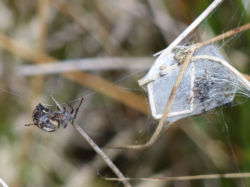
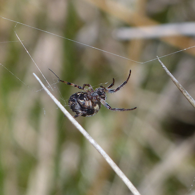
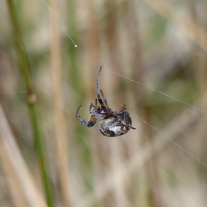
I’m reliably informed that this spider, on an impressive web stretching between sedge stems, is Larinioides cornutus, the Furrow Orbweaver. They like damp places, which fits. This must be a female, which makes a silken cocoon and then produces pheromones to attract a mate. At the time, I thought the cocoon might be full of babies, but with hindsight, it looks more like a larder.
Furrow Orbweaver.
The ‘furrow’ in her name refers to the pattern on her back, which sadly she never deigned to reveal to me.
Furrow Orbweaver.
She was intent on running repairs of her web.
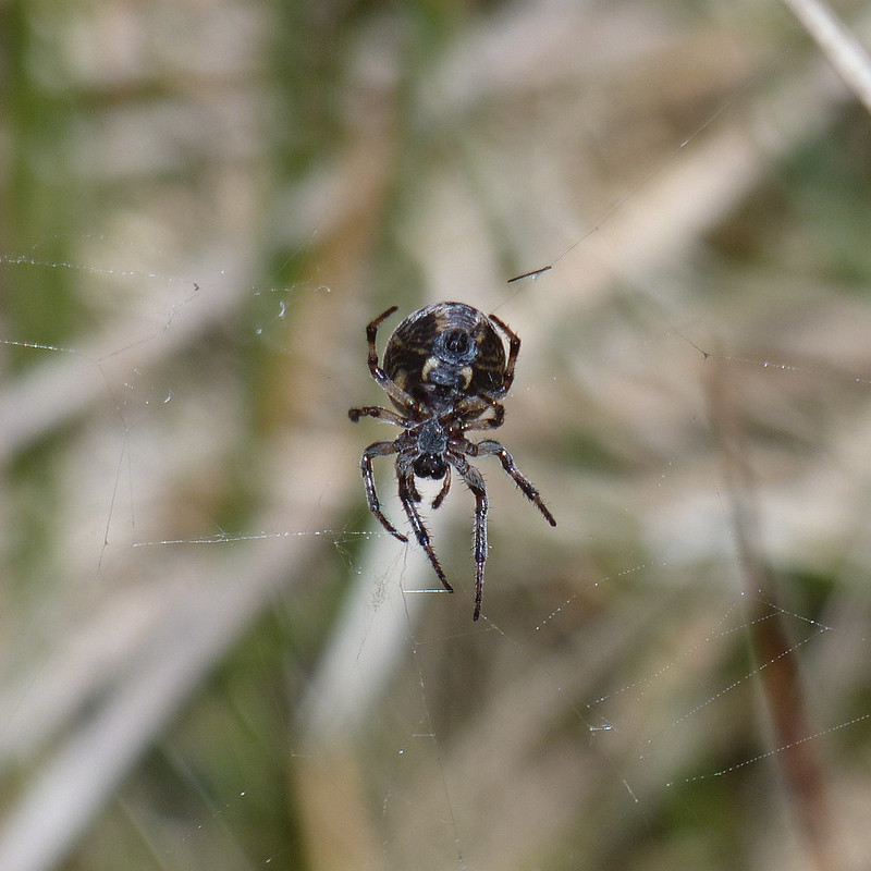
Furrow Orbweaver.Furrow Orbweaver.
But then I must have upset her in some way and she disappeared into her lair. I’m well aware that not everyone likes arachnids, but as you can probably tell, I was entranced.
Looking back from near the top of the gill.Swarth Fell Tarn.Cairn on Swarth Fell.Wild Boar Fell from Swarth Fell.Looking south from Swarth Fell. That’s Whernside and Ingleborough peeking out from behind Baugh Fell.
I found a very comfortable spot amongst the boulders on Swarth Fell, made a brew and then had a little nap in the sun whilst it cooled down. You can’t beat a bit of a snooze during a hill walk if you ask me.
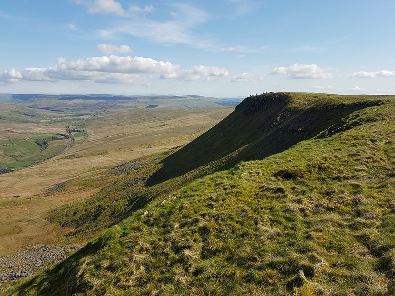
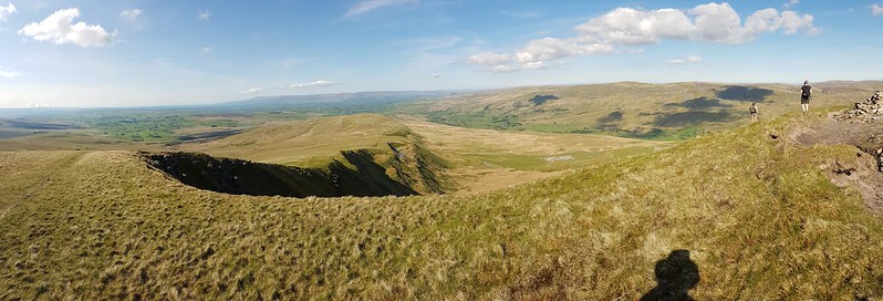
On the way back down to the col, I followed the steep eastern edge…
The eastern edge of Swarth Fell.
The rivers both Eden and Ure rise down there somewhere. The first is heading for Carlisle, the Solway Firth and hence the Irish Sea, whilst the other, via the Ouse and the Humber, heads through York to the North Sea.
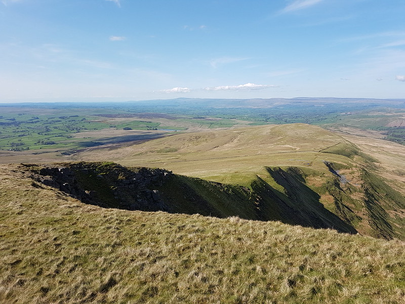
Looking back to Swarth Fell.The Band.
This path, around The Band to High White Scar, is not marked on the OS map, but it is an absolute delight. As I walked along it, I watched a Buzzard gliding out across Aisgill Head.
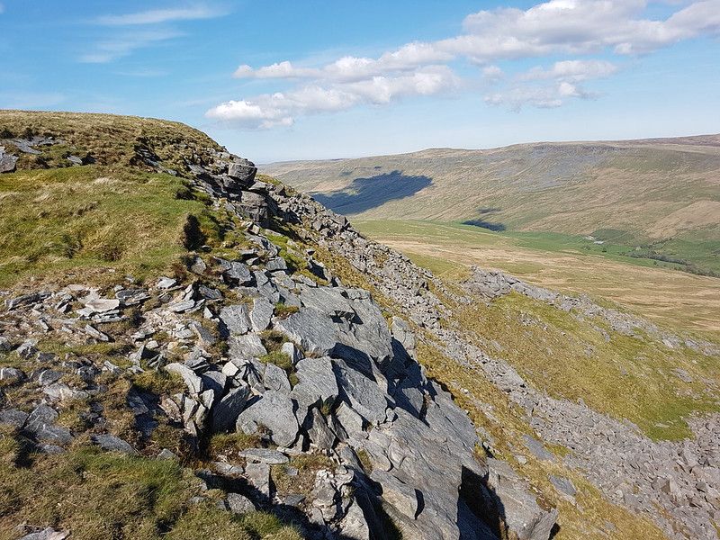
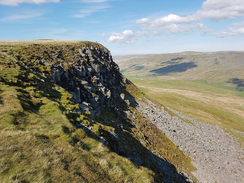
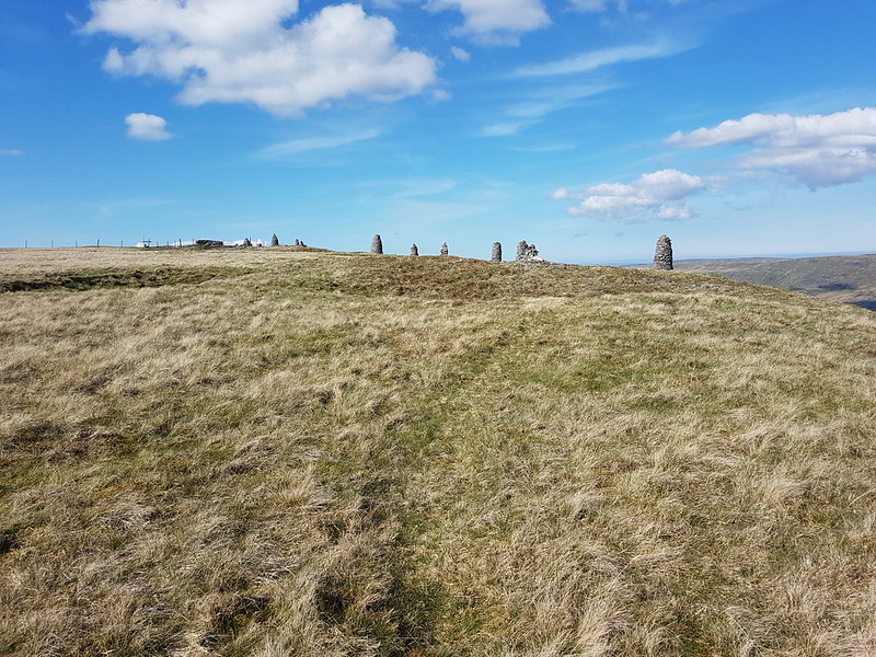
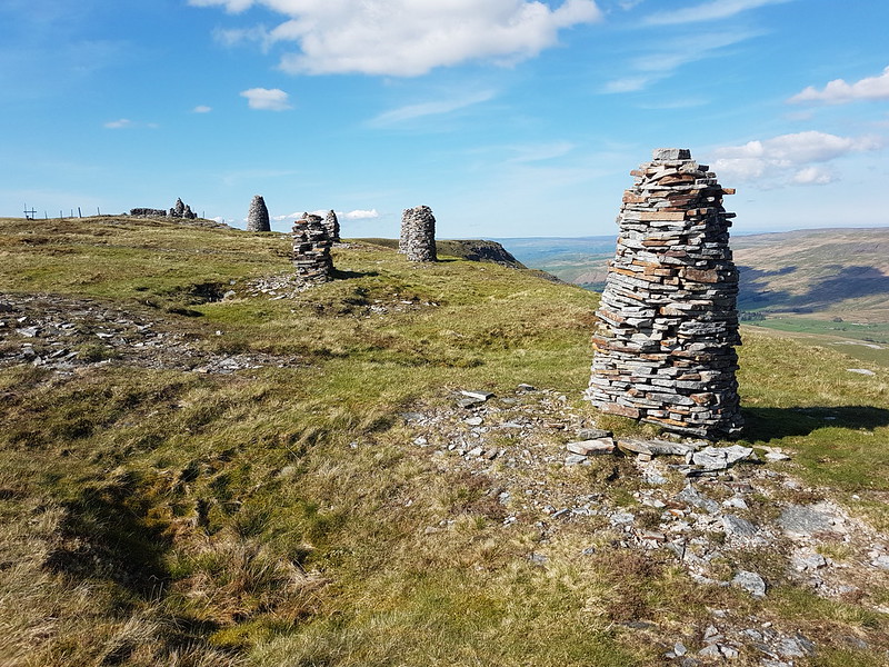
Ais Gill and Swarth Fell.High White Scar. Mallerstang Edges beyond.Along the edge.A proliferation of cairns.
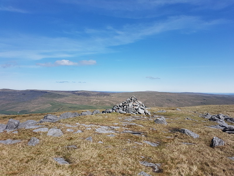
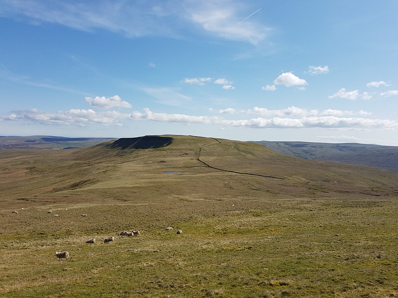
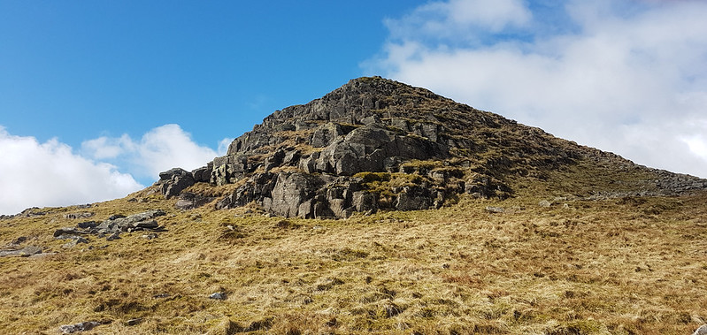
Wild Boar Fell has a large summit plateau and two tops, both with a spot height of 708m.
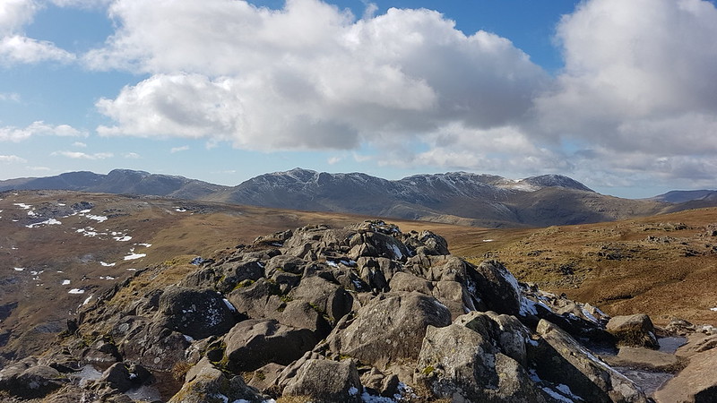
Cairns!Yoadcomb Scar.Yoadcomb Scar pano.Looking back to Yoadcomb Scar.The Nab, Eden Valley, Northern Pennines.The Nab pano.Trig pillar.
Here’s ‘the other’ top. Not quite as exciting as the one to the east, to be honest.
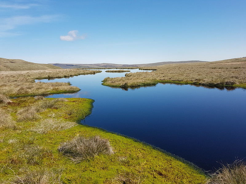
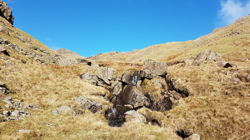
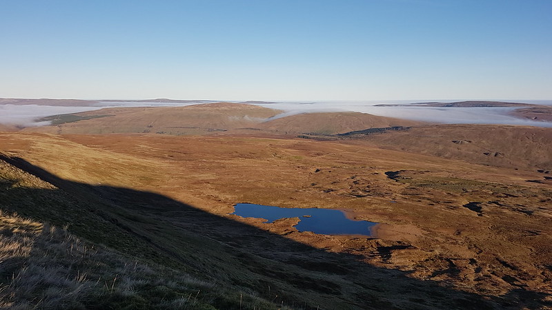
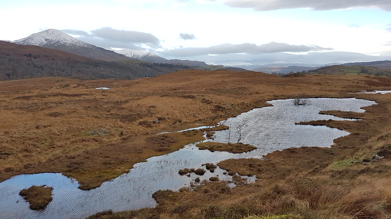
Sand Tarn.Forcepot Sike.
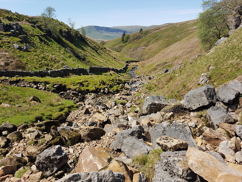
Forcepot Sike apparently drains Sand Tarn, although there wasn’t an obvious or easy to spot outflow. The hills opposite are Harter Fell (there’s a few of those about!) and Green Bell. I don’t think I’ve ever climbed the former, and it must be about thirty years since I climbed the latter – and since the source of the Lune is said to be on its slopes, it’s high on my to do list. Of course, we know that the Lune, like any river, has countless sources, but we’ll let that lie.
Clouds Gill.
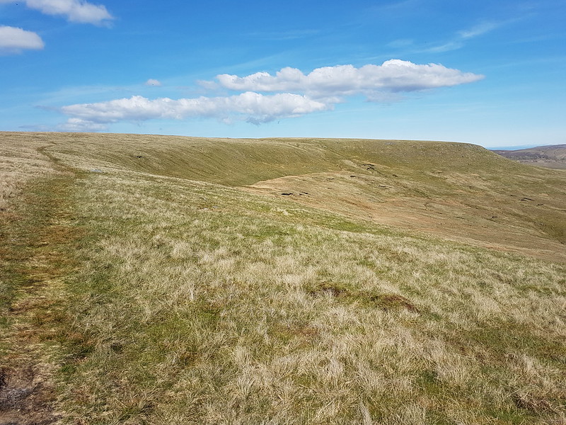
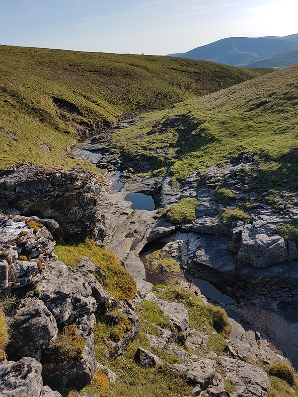
This was pathless going, but much easier than that had been by Uldale Gill. The stream gradually grew as it absorbed lots of other rivulets, at some point becoming Clouds Gill. I’ve come down these slopes a few times before, but always heading for Fell End Clouds, never sticking with the gill. As the terrain changed to limestone country, that brought unexpected bonuses. The stream began to appear and disappear underground.
Clouds Gill.
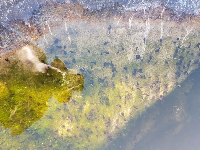
In some spots I could see the water flowing through a narrow channel to the left and below the exposed rocky riverbed. In other places the river had eroded large deep pots which were full of stagnant water. And also full of tadpoles.
Tadpoles.
Many moons ago, I used to walk to school with friends. Our route took us across fields and via a small footbridge over Johnny’s Brook. Armed with coffee jars or buckets, we would collect frogspawn, tadpoles, frogs, sticklebacks and other unfortunate denizens of the brook and take our finds to school. There was an aquarium tank in one of our classrooms, I remember. Whether the aquarium was a result of our enthusiasm or its cause, I don’t recall. I do know that I’ve never seen tadpoles in this profusion before, pool after pool, deep or shallow, were full of them. But then suddenly – no more.
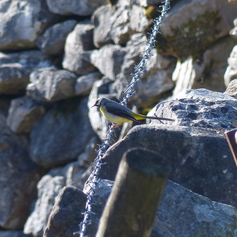
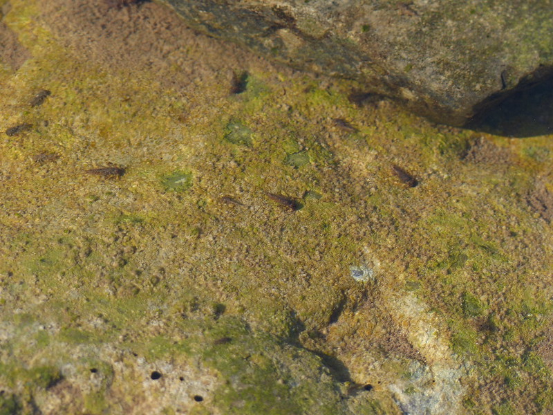
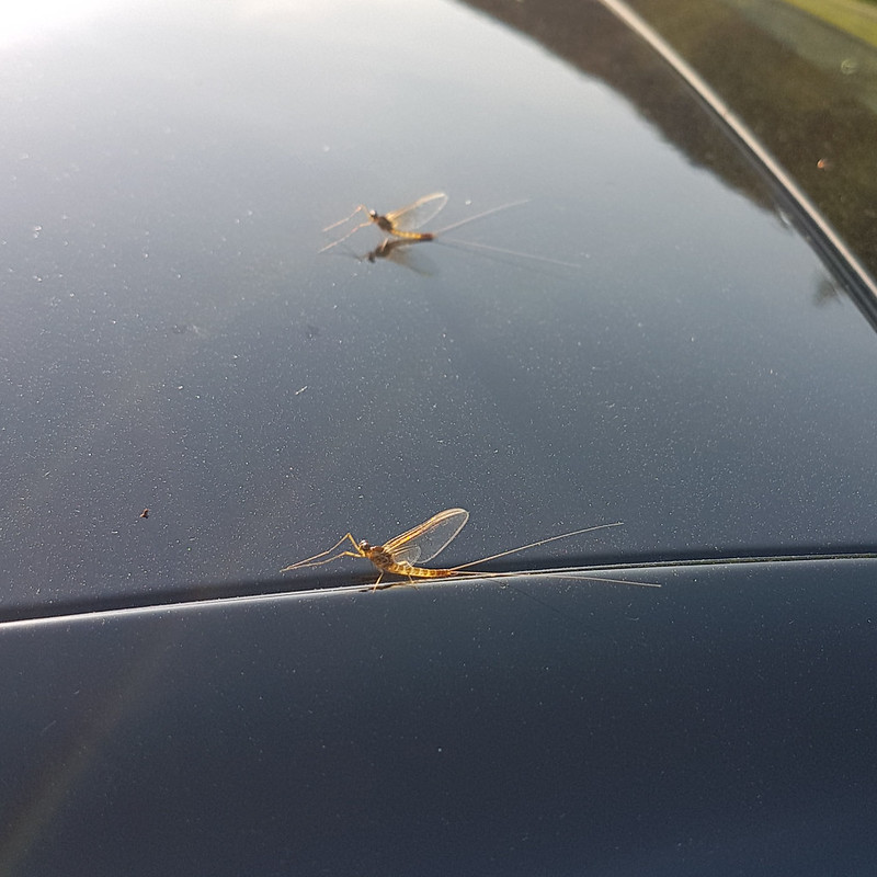
Grey Wagtail.Mayfly?
I’m assuming that this is a Mayfly, although my field guide describes them as ‘flimsy’ whereas this looked quite sturdy to me. Apparently, there are 47 different species in the UK. The winged stage of their lives lasts for just a couple of hours or up to a couple of days, depending on the species. The nymphs, living in the water, often live for a year or even two, although, again, that depends of the species.
Mayfly nymphs? About to emerge?
Limestone, of course, erodes in interesting ways. Here the stream had created a narrow gorge and a huge rock overhang.
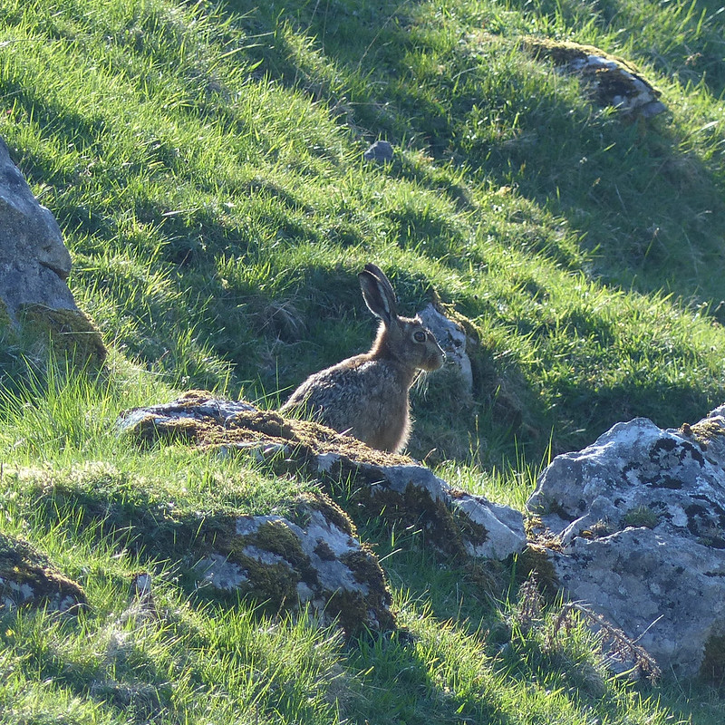
From above.From below.Hare.
I’ve begun to think that certain creatures are emblematic of the landscapes of the Lune, particularly Curlews and Hares. Maybe Grey Wagtails as well.
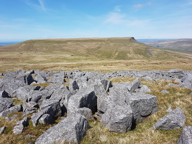
Cloud Gill and Harter Fell.A roofless barn.Fell End Clouds.
I had planned to cross the valley and have a wander through the woods of Murthwaite Park, but it was getting late, so I just wandered along the minor road back to the car.
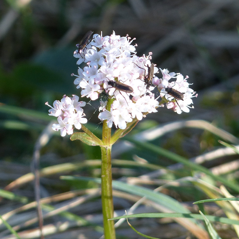
Another view of Fell End Clouds.Valerian, host to tiny flies. St. Marks flies or something similar?
When I got back to the car it was covered with Mayflies. These did look flimsy.
Mayflies.
There had been lots of cars parked along the road near the Cross Keys, presumably for the walk up to Cautley Spout and beyond, which is a very fine walk and another which is high on my ‘to do’ list. But I’d met a couple on Swarth Fell, another couple at the Nab and two blokes and their dog by the trig pillar on Wild Boar Fell, and that was it. On a sunny Saturday in May. I can’t think why Wild Boar Fell is not much more popular, but I’m not complaining!
A little over 11 miles, but largely pathless so harder work than that might sound.
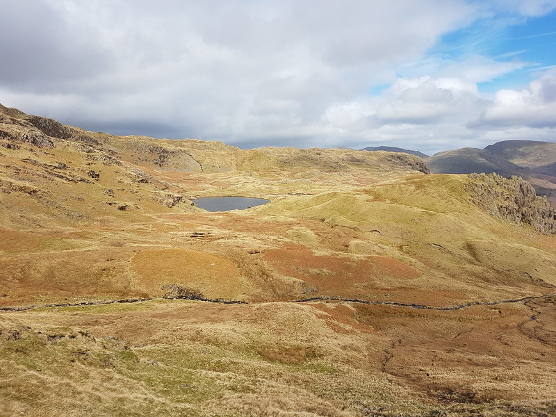
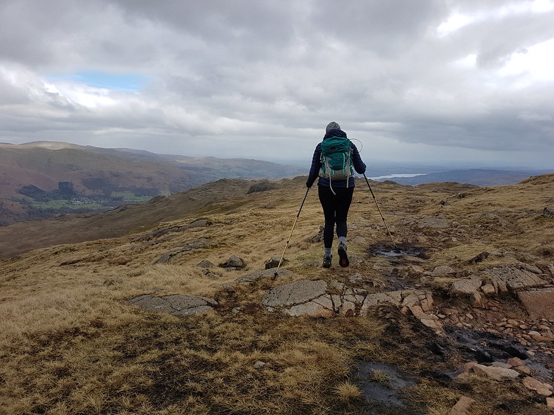
The last Sunday in March. TBH wanted another training walk, but this time of only eight miles. I thought we could kill two birds with one stone and mop up Blea Rigg which, during my Wainwright bagging frenzy last year, I managed to omit.
Sourmilk Gill, Tarn Crag and Gibson Knott.
It was a bit of a mixed day, with a cold wind and, later in the day particularly, some drizzly rain, but with occasional sunshine and even one or two quite warm spells.
TBH photographing waterfalls on Sourmilk Gill.
It’s familiar territory this, being relatively accessible from home, but a great area, so always worth another visit.
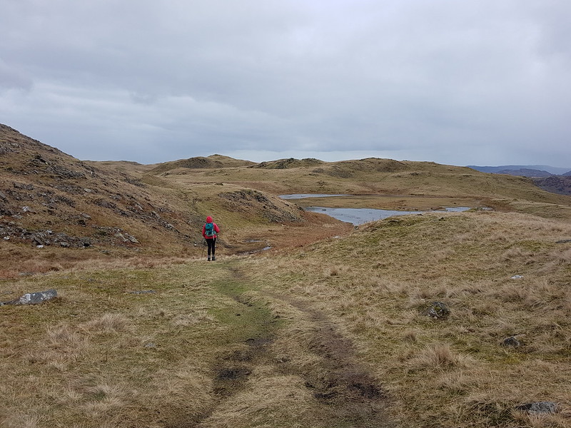
At the top of the falls.Easedale Tarn and Tarn Crag.
TBH hates to wait for her lunch, feeling that it should always arrive on the dot of midday. By the time we reached Easedale Tarn we’d been on the look-out for a likely-looking spot for some time and she was, apparently, approaching starvation. Fortunately, the slight descent here towards the tarn took us out of the wind and gave us just the shelter we needed for a comfortable refueling stop.
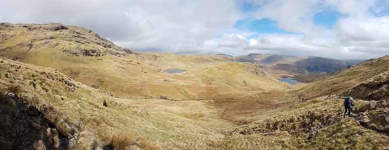
Easedale Tarn pano.Easedale Gill and Belles Knott.Looking back to Easedale Tarn, Seat Sandal, Fairfield, Great Rigg and Stone Arthur. Belles Knott and Easedale Gill again.Looking back again – the stream which flows from Codale Tarn looks worthy of investigation.TBH on the slabs above a surprisingly awkward scrambly section of path.Looking back again – Belles Knott, on the left, not quite as dramatic from this direction.
This was the sunniest and warmest part of the day, and very pleasant indeed.
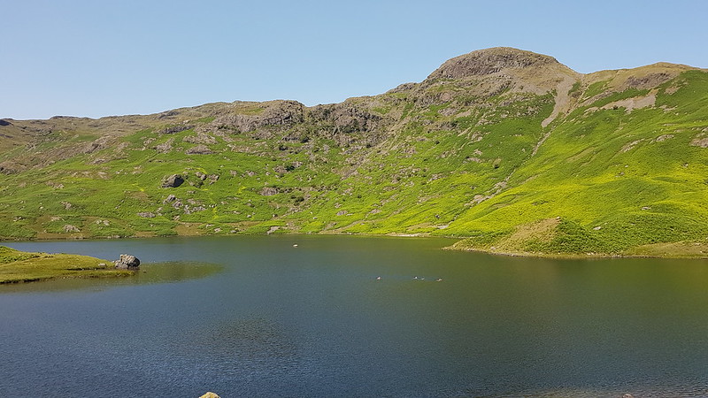
Codale Tarn – a great spot for a swim, but maybe not in March.
Looking at these photos, and at the map, this area has many great places for a dip. I find myself wondering how many I could string together in a single route. The thing is, I’ve tried this a few times before, and the answer is always: less than I think. I probably need to learn to just enjoy a swim or two and accept that, in this regard at least, less is more.
Codale and Easedale Tarns pano.On the Blea Rigg ridge.Harrison Stickle, Pavey Ark and Stickle Tarn – in the first of many showers.Frogspawn.The tarns near Lang How – raining again.Grasmere, Rydal Water, Loughrigg and Windermere from Silver How.A steep descent towards Grasmere and Rydal Water.Descending back to Grasmere.
In the event, the route was a little over nine miles.
Oh, and, spoiler alert, TBH did her Mighty Hike on Saturday. It went well and she enjoyed herself. I shan’t take all of the credit, but no doubt my carefully planned training routes were key to her success! B has subsequently suggested that we should all take part next year. One to ponder.
Next weekend, TBH will be taking part in a charity walk. Back in March, when she signed up for it with colleagues from work, she was a bit vague about the details; she could tell me the date, but not the charity, or the route, or the length, or the amount of climbing. It transpires that it’s a marathon: 26 miles around Ullswater, with about 900m of ascent and it’s for MacMillan.
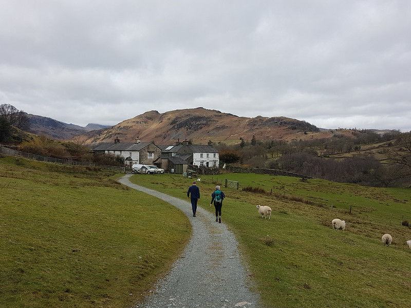
High Park, Little Langdale.
What she did have was a training schedule, which involved a four mile walk pretty much every day, with longer routes at the weekends. Since she was diving into this routine mid-scheme, she requested that I plan a route of 14 miles with a modicum of ascent.
Lingmoor and Little Langdale Tarn.
I used the OS app to plot a course around Little and Great Langdale, a sort of Tour de Lingmoor, a longer version of a walk the boys and I did with the scouts a few years ago, and not too dissimilar to the first half of my, rather wet, ascent of Lingmoor last Easter. The app gave the length of the route as 12¾ miles, with just short of 500m of climbing, which I was a bit surprised by. I was pretty confident that in reality it would work out as a bit longer since, as much as I had fiddled about, my route on the map still consisted of a series of straight lines and would have cut out some of the fractal complexity, or to put it another way, the wiggly bits, of actual paths.
Bridge End, Little Langdale.
B decided to join us for the walk. If you’re wondering why he doesn’t have a rucksack, it’s because he was still suffering from his rugby-tackle induced shoulder injury and would have been uncomfortable carrying one.
I’d originally planned to use of the National Trust car parks, either in Langdale or at Blea Tarn, but when we got to Skelwith Bridge and saw that there were spaces available to park there, I realised that that was a much better option. It also gave TBH and B an opportunity to pop into Chester’s and supplement their packed lunches.
Fell Foot, Castle How, Pike O’Blisco, Langdale Pikes.Waterfall in Bleamoss BeckBlea Tarn, Langdale Pikes, Side Pike.
It was a gloomy day, but by the time we reached Blea Tarn, there were signs of it brightening up. Nevertheless, the trees by the tarn provided a bit of welcome cover from the cold wind for our lunch stop.
Descending towards Mickleden.Langdale Pikes.Langdale Pikes and Mickleden pano.Pike Of Stickle and Loft Crag from Stool End.
The paths were all quite busy; it’s a wonderful area, so why wouldn’t they be? The area around Slater’s Bridge and Cathedral Quarry in Little Langdale were particularly popular. Our little excursion into Mickleden was the only part of the walk where I don’t think we saw other walkers.
Approaching the footbridge, and the weir, Mickleden Beck.
The patches of blue soon disappeared again and by the end of our walk it was threatening rain, not that that put a damper on our day in any way.
Looking back to Harrison Stickle.The classic view of the Langdale Pikes across Elter Water.As planned.As walked.
According to MapMyWalk the route was actually almost 14½ miles, with just over 400m of ascent. If you’re planning a Mighty Hike and need a tune-up bimble, you can’t go far wrong with this circuit.
TBH stuck fairly strictly to her, plan until a bout of illness precluded long walks, and then she never resumed, deciding that she is probably fit enough as it is. More training walk write-ups still to come, however.
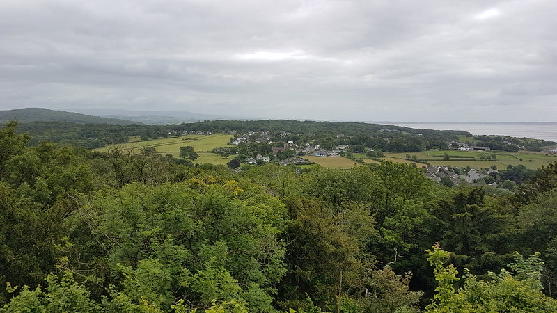
The morning after the Tigers victory over Saracens, and I was up at the Pepper Pot looking over the village. The weather doesn’t look too promising does it?
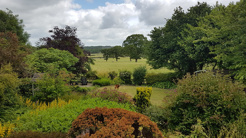
But later on, when I noticed a deer on our lawn, it had started to brighten up…
Garden with Roe Deer.
By the time B returned from his shift pot-washing at the local hotel, it was glorious, and hot.
‘Fancy a drive Dad?’, he asked.
This was code for, ”Are you willing to sit in the passenger seat for an hour whilst I drive?”
B has his provisional licence, has passed his theory test, and is very keen to clear the final hurdle and gain the independence which driving would give him.
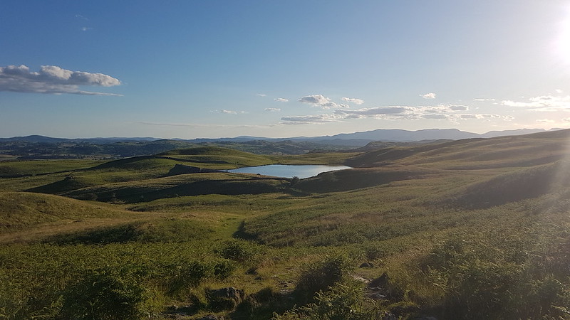
“We could go to High Dam for a swim.”
Potter Tarn. Coniston Fells in the distance.
Which seemed like a good idea, except I suggested, given the late hour, that we substitute Gurnal Dubs for High Dam, it being closer to home and not surrounded by trees, so that we might have both later sun and a later onset of midge attack.
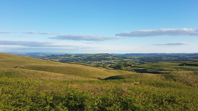
Forest of Bowland, Scout Scar and Cunswick Scar, Arnside Knott, Whitbarrow.
The walk up to the reservoir was very pleasant, if somewhat warm work.
Gurnal Dubs.
A work colleague, who lives quite close to Gurnal Dubs, had reported a recent swim there and that the water was ‘quite warm’. I hate to think what would qualify as cold in her estimation. It was pretty bracing. But very refreshing and, after a long period where it never seemed to warm up, a welcome and unusually late start to wild-swimming for the year.
After our swim.
By the time we were out of the water we were already losing the sun.
Looking back to Gurnal Dubs.
The views on the way down were even better than they had been on the way up, with the landscape decked in dark shadows and late, golden sunshine.
Potter Tarn, Coniston Fells, Scafell and Scafell Pike.Scout Scar and Cunswick Scar, Arnside Knott, Whitbarrow, Gummer How.Almost back to the road and the car.
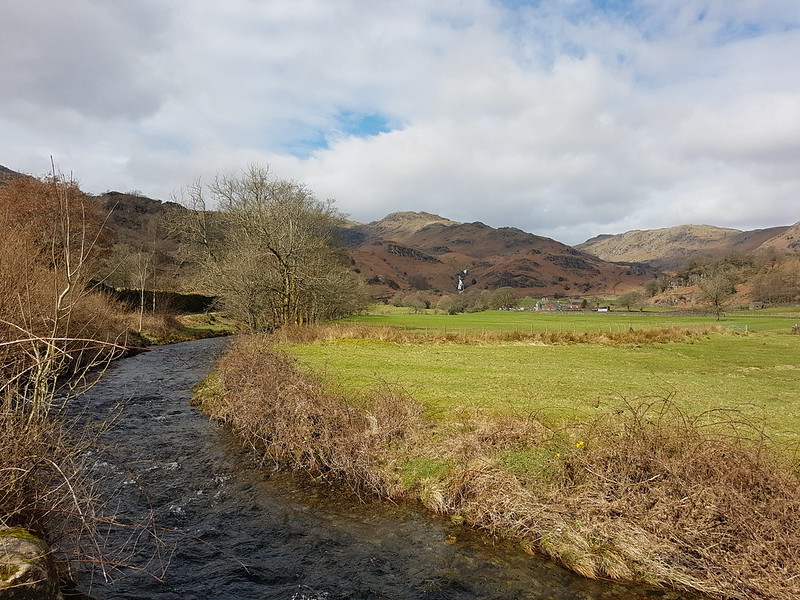
The following evening, a Monday, Little S had Explorers. He’s transferred from the local unit to the one which meets in Littledale, at the very pleasant Scout camp on the banks of Artle Beck. Usually, after dropping him off, I take B to a boxing gym in Lancaster, but for some reason that was off, so I was at a loose end, which gave me a chance to try a spot down in the Lune Valley which I’d previously picked out as having potential for swimming.
River Lune.Caton Moor wind farm beyond.River Lune and Ingleborough.
It was a bit of a walk from the carpark at Bull Beck near Caton, so I didn’t have all that much time to swim, but the walk was nice enough in itself.
Swimming spot.
How was it? A lot warmer than Gurnal Dubs, quite pleasant in fact. Fairly fast flowing. Not as deep as I had hoped, but just about deep enough. Due to the strength of the current, I found myself walking upstream on the shingle bank and then floating back down river before repeating the process. Not a bad way to spend a Monday evening.
River Lune.
One more local-ish swim to report, though I’m jumping forward almost to mid-July and another Monday evening. After a hot day at school, B wondered whether I could give him and some friends a lift to Settle to swim. I didn’t have to think too long about that one: too far away. We compromised on Devil’s Bridge at Kirby Lonsdale, as long as they promised not to jump off the bridge.
Devil’s Bridge.
Whilst they were, I later found out, having a great time, I had a wander down the Lune, enjoying the riverside flowers.
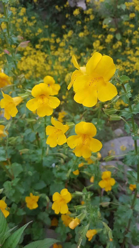
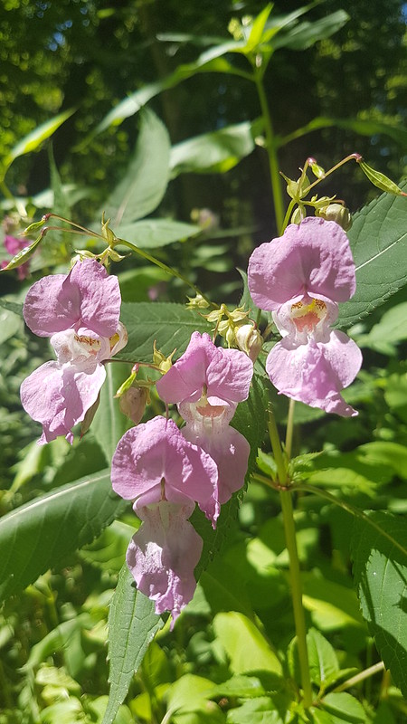
Meadow Crane’s-bill.Giant Bellflower, I think.Monkeyflower – naturalised from North America.Himalayan Balsam – another non-native plant.
This one is a bit of a cheat, you can perhaps tell by the light; there was plenty of Himalayan Balsam by the Lune, but I’d also photographed some the day before, in better light, when I picked up Little S from another Scout Camp, this one down near Ormskirk.
River Lune. Too shallow to swim in.Pipe Bridge carrying water from Haweswater in the Lakes to Manchester.
I had my swimming stuff with me, and found, as I thought I might, that the water under the bridge, on the right hand side anyway, was deep enough for me to have a dip. In honesty, not one of my favourite swims this summer, but it had stiff competition.
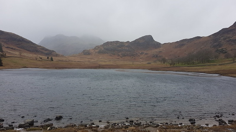
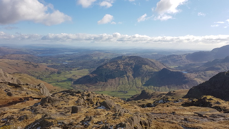
Blea Tarn. Side Pike on the far side and the Langdale Pikes obscured by clouds behind.
B had a shift in the cafe at Brockholes; since I was dropping him off there, I decided to stay in the Lakes and make the most of it, despite a fairly ropey forecast. I had a fine time, even though it rained on and off most of the day.
I parked up by Blea Tarn, another National Trust carpark, although the joy of ‘free’ parking was tempered by high winds and driving rain which weren’t terribly encouraging. I rarely set-off for a walk in full waterproofs, I’m a fair weather walker, as much as I can manage to be.
Looking back towards Blea Tarn. The plug of rock in this photo is Tarnclose Crag.
Fortunately, my route started downhill into Little Langdale and I hadn’t walked far before both the wind and the rain had abated a bit.
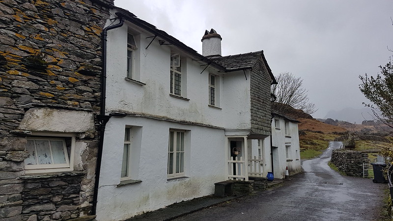
Farmhouse at Fell Foot When the skies are grey and the weather is rotten, I always think the white-washed stone buildings still look attractive. I’ve often thought that the porch over the door here is unusual. Turns out this is a Grade II listed building.
“At the foot of Wrynose Pass. C16 north wing, the main block C17. A long, low house, white-washed stone rubble, flag roof, 2 storeys. The door is under the overhang of a slate-hung upper storey, gabled, and without windows, the timber beam ends showing in the gable.”
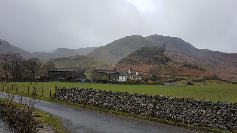
This shows the entire farm complex at Fell Foot with Castle Crag behind, itself a scheduled monument because of it’s suspected history as a hill-fort. By the farm there’s the Ting Mound where the Norse inhabitants of the valley had council meetings.
Behind Castle Crag you can see Lingmoor which is out of the cloud and would remain so all day, unlike any of the surrounding higher hills. I assume these very rocky lumps – Side Pike, Tarnclose Crag and Castle Crag are volcanic in origin, but would love to find out more.
Bridge End Cottage.
The National Trust own both Fell Foot Farm and Bridge End Cottage, in the latter case at least, gifted to them by Beatrix Potter. Bridge End Cottage is another grade II listed building.
I had half an idea that I might be able to bag Holme Fell and Black Crag as well as Lingmoor, but I needed to collect B from Brockholes at the end of his shift, and even I could see that I would be pushing it to manage all that and still arrive on time to pick him up. On the other hand, just climbing Lingmoor would undoubtedly leave me with quite a bit of time to kill, so I decided to extend my walk along Little Langdale as far as Skelwith Bridge and then come back up Great Langdale before bagging Lingmoor.
Lingmoor and Little Langdale Tarn.High Hall Garth – you’ve guessed it, Grade II and property of the National Trust.Low Hall Garth. Owned by the NT, gifted by Beatrix Potter, Grade II. Lingmoor and Slater’s Bridge.
I didn’t divert, as I usually have, to photograph the marvellous Slater’s Bridge – it was very busy. It has appeared on the blog many times before. (Here for example, or here). It’s an amazing structure, in a low-key picturesque sort of way. I’ve never thought to look up it’s protected status before, but it turns out that it trumps the other local properties by being Grade II*.
“Slater’s Bridge II*. Over River Brathay. C17 packhorse bridge of slate and natural boulders. Huge boulder in mid-stream supports segmental arched bridge of 15 ft span with 3 1/2 ft voussoirs, and a flat causeway of a single slab on slate supports.”
Voussoirs? A wedge-shaped or tapered stone used to construct an arch, obviously. Learn a new thing every day! (And forget it the next sadly.)
The obvious knobble on Lingmoor with a prominent gully on its right, is Busk Pike, of which more later.
No sign of any voussoirs at the next bridge down the Brathay, but still quite a handsome footbridge I thought.
Little Langdale and Lingmoor.Colwith Force.
At Chesters, at Skelwith bridge, I managed to buy a nice lunch* from their takeaway counter and then was lucky to get a picnic table under the eaves and so out of the rain. (*Pricey, but very tasty.)
Elter Water. Lingmoor on the left. This should be one of the iconic views of the Langdale Pikes, but they were still lost in the cloud.Bridge over Great Langdale Beck in Elterwater. Rebuilt 1702. Grade II listed of course.
Judging by Historic England’s map, just about every building in the village of Elterwater must be listed. I shall have to come back to investigate some time. Since one of those listed buildings is the Britannia Inn, that should be an enjoyable experience!
I left Elterwater on a steep and stony track and was amused by this cycle route sign at the bottom, since ‘challenging’ seems like a huge understatement to me.
This path leaves that track at around its highest point. I think it must be an old mining track, it has fabulous zig-zags and clearly someone has gone to a lot of effort in constructing it.
I’ve become a bit obsessed with being able to put a name to every hill, hump and hollow in the view. I blame Andy. The wooded hill in the middle-ground here doesn’t have a name on the OS map and there’s no path to the top, but the wooded slopes on it’s northern and eastern flanks are access land, Fletcher’s Wood, so it would be possible to get at least close to the top. The higher ground to the right, meanwhile, is the end of the Black Crag ridge. TBH and I traversed those slopes on our walk between Coniston and Ambleside last summer.
A day of contrasts – the Coniston Fells are lost in what I suspect was foul weather, whilst the sun is trying to shine on Little Langdale Tarn.
The weather had brightened up enough for me to take a short stop and drink some of the contents of my flask. The view was limited by the dense, low clouds, but still pretty good.
After the initial steep climb, somewhat eased by the marvellous zig-zags, a much steadier ascent ensues. There were still a number of broad grassy tracks, testament to this areas quarrying history. I took the lower path, intending to take in Busk Pike.
Looking down on Little Langdale Tarn. Holme Fell visible through the rain.Spoil heaps and small, tumble-down walled structures like this were dotted about the hillside.Busk Pike.Busk Pike again.
I’d like to revisit Busk Pike when the views are less curtailed by clouds.
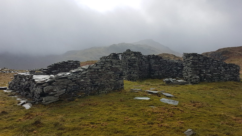
Brown How – the summit of Lingmoor – from Busk Pike. Notice the ruined buildings between the two tops.This was the biggest of the many derelict buildings I saw on Lingmoor. It provided a sheltered spot for another drinks stop. The sun even shone a little, although it also started drizzling again, just in case I was getting complacent about the weather. Looking back to Busk Pike and the the old mine buildings.And again.from a little higher up.
On the summit of Lingmoor, I met a family party of three, the first walkers I’d met since leaving the track near Dale End. We congratulated each other on the fact that it was “Not too bad”. As soon as our conversation ended, I realised that it was indeed ‘too bad’: the weather was back to how it had been when I first set-off from Blea Tarn – a howling gale and very heavy rain. It seemed highly plausible that closer to the higher hills around the head of Langdale, the weather had remained this way all day.
I was keen to get out of these conditions and back to the car, but I did divert slightly to include Lingmoor Tarn on my route…
Side Pike – it had been my intentionto include this on my route, but with the weather now so foul and with time running short, I decided to keep it for another day.MapMyWalk gives a little over 11 miles and 560m of ascent (the latter might be a bit of an overestimate)
B had told me his shift finished at 6.30, but when I arrived to pick him up (and two friends who had also been working at Brockholes that day), it turned out that, because the cafe had been so quiet, they’d been ‘sent home’ an hour early. B was furious that I hadn’t been answering my phone (it had been on flight mode, preserving the battery whilst I probably didn’t have a signal anyway). Unfortunately for B, beggar’s can’t be chooser’s, and he soon calmed down when I offered to leave him behind, if he didn’t like the free taxi-service on offer.
New Dungeon Ghyll Hotel – Stickle Ghyll – Stickle Tarn – Sergeant Man – High Raise – Thunacar Knott – Pavey Ark – Harrison Stickle – Loft Crag – Pike of Stickle – Mark Gate – New Dungeon Ghyll Hotel.
Stickle Ghyll
March arrived and brought with it some clear, blue skies. Time to get back to the Lakes! I didn’t get off particularly early, I can’t remember why, and was lucky to squeeze into a space in the National Trust’s New Dungeon Ghyll carpark at around ten. (Does everyone refer to the two Langdale pubs as the ODG and the NDG?)
Of course, Langdale is always going to be popular, especially with a good forecast, and there were a few people ahead of me on the path heading up Stickle Ghyll. Somewhat to my surprise, I gradually overhauled several groups and we leap-frogged each other up the path. Just in case I was getting ideas above my station however, a group of younger walkers caught up with me just short of Stickle Tarn and flew past as if I were barely moving.
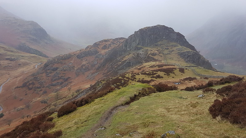
Stickle Ghyll.Pavey Ark and Stickle Tarn.
Although the air was quite cold, in the sunshine I had warmed up well during the climb and was down to a t-shirt. Time to shove a few layers back on at Stickle Ghyll where, as well as a new, splendid view, we were exposed to a biting wind.
Harrison Stickle across Stickle Tarn.
Despite that very icy wind, a couple of people had changed into bathing costumes and were wading out into the tarn. One of them was protesting loudly and I’m not sure whether either of them actually swam. I’m sure it would have been extremely bracing.
Pavey Ark again. Jack’s Rake fairly prominent.
I think the last time I did Jack’s Rake was on my first hike with TBH, so over 20 years ago. It looked popular today, as did the alternative route on the path up the eastern shoulder of Pavey Ark. I had been considering the latter as one possible onward route, but decided to head for Sergeant Man instead, since it looked like I would have the path to myself.
I did, and it was a marvellous route, a fairly faint path following a small stream above the valley of Bright Beck, not one of the paths on the map, which all head further east onto the Blea Rigg ridge. I think you can see the stream I followed on the map below, enclosed by a rocky rib on its western side. Eventually the path left that stream and headed across and up to meet the stream which drains the cluster of small tarns between Sergeant Man and Codale Head.
Anyway, I’m getting a bit ahead of myself: this….
…is the first of those becks. You can just see Sergeant Man left of centre. It was pleasantly sheltered here and I took advantage of that fact and stopped for a hot drink.
Looking back down to Stickle Ghyll from my brew stop.
The path kept splitting and got steadily fainter and harder to follow.
Approaching Sergeant Man.
Eventually, I lost the path and followed the stream which I presume flows out of the tarns.
Looking down the stream. Forest of Bowland and Morecambe Bay on the horizon. Gummer How quite distinctive in the distance. Lingmoor and Side Pike in the foreground. Wetherlam and the Coniston Fells on the right.Sergeant Man.
Eventually, I left the stream and the shelter that its banks offered, and took a direct route to the top. The crags are broken, but I enjoyed stringing a route together which stayed on the rock as much as possible and offered some easy scrambling.
Codale Head. Snow-capped Fairfield right of Codale Head.From Sergeant Man: Scafells, Bowfell, Esk Pike, Great End.Codale Head.Helvellyn ridge on the left, Fairfield to the right.
Codale Head is not a Wainwright, but is a Birkett. A bit like Sergeant Man, it isn’t exactly a prominent summit, but it is well worth a visit.
Eastern Fells from the slopes of High Raise. Esk Pike, The Scafells, Great End, Gable and Pillar from High Raise.
I know that High Raise is essentially a big lump, but it has a rocky top and always feels to me like its very central in the lakes. You can certainly see a lot of the area’s more distinctive hills from there.
High Raise summit cairn. Glaramara, Dale Head and the North-western Fells behind.Another High Raise view – North-western Fells, Bassenthwaite, Skiddaw, Blencathra.Crinkle Crags, Bowfell, Esk Pike, Scafell Pike, Great End, Great Gable. The ridge extending towards the camera is the Rossett Pike, Buck Pike, Black Crags ridge. You can pick out Lining Crag on the right of the ridge too.Glaramara.Looking back to Sergeant Man.And again, from futher away.Harrison Stickle from Thunacar Knott.Sergeant Man again from close to Pavey Ark. St. Sunday Crag prominent through Grisedale Pass.
After leaving Sergeant Man there was very little opportunity to find any shelter on High Raise or Thunacar Knott, but I had high hopes for Pavey Ark – well justified high hopes as it turned out. I dropped just a little way below the top, on the Langdale side, and was soon out of the cold wind and enjoying the sunshine, the views, a hot drink and possibly even a moment’s snooze. I think I sat there for almost an hour. A very peaceful hour.
Langdale, Lingmoor and Side Pike. Blea Tarn just visible on the right. Windermere in the distance.
It felt quite warm out of the wind, but just after finally setting-off again I slipped on verglas and found myself sitting in a puddle. One sleeve and the seat of my pants were wet, but fortunately only my pride was hurt. There was a fair bit of ice about and I ought to have payed more attention to this slip.
Harrison Stickle.Looking back to Pavey Ark.
There seemed to be several paths between Pavey Ark and Harrison Stickle, weaving their way through the craggy terrain. I chose to stick close to the rocky edge and then found myself on a good path which contoured around on to the south facing side of Harrison Stickle, i.e. the steep face. When that path seemed to be losing height, I looked up to the crags on my right and spotted a small chimney which seemed to offer an easy route upwards. I climbed up to a wide ledge and then started to shin up the chimney. My legs aren’t as flexible as they once were, and in trying to lift my right boot just a little higher to reach a toehold, I shifted my weight and ….off I went. I didn’t fall far and landed on my feet, back on the broad ledge. I wasn’t hurt, but I was a bit shaken. Now I had to choose between two unpalatable options – backtrack down to the path, or have another go at the chimney. The chimney still looked very easy, especially now that I had rehearsed my moves, and in the end I decided to give that a second try, with a bit more circumspection. In fact, it was very easy. What’s-more, once up the chimney I was very nearly on the summit.
On the summit I met a party of three ladies whom I’d been following up the Stickle Ghyll path. They’d been walking faster than me, but stopping more often, which meant that I kept catching-up with them, whereupon they would set-off again. If they’d overheard my colourful response to slipping off the crag just below, they didn’t show any signs of disapproval!
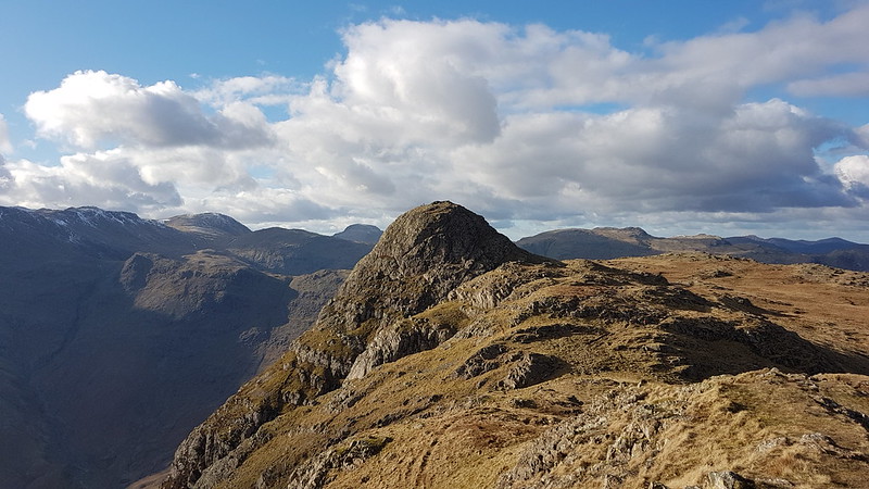
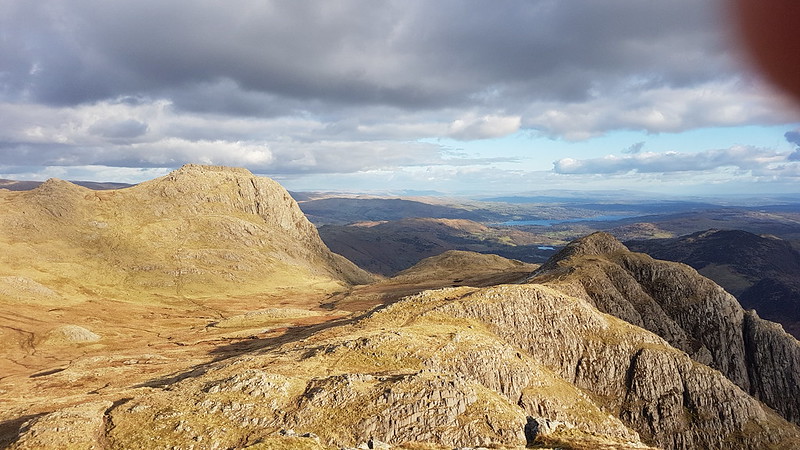
Harrison Stickle from the west.Pike O’Blisco. Coniston Fells behind.Pike O’Stickle from Loft Crag.Harrison Stickle, Loft Crag and Windermere from Pike O’Stickle. With intruding finger.Loft Crag.Harrison Stickle.
Some hike stats: MapMyWalk gives a little under 7 miles (before my phone ran out of juice), and 830 metres of ascent.
More importantly, seven more Wainwrights ticked off: Sergeant Man, High Raise, Thunacar Knott, Pavey Ark, Harrison Stickle, Loft Crag, Pike O’Stickle.
Even more importantly – an absolutely cracking day out.
(I had planned to extend the round to take in Rossett Pike, but by the time I got to Loft Crag, with clouds accumulating overhead, that seemed like a long way away, and I took a more direct route back to my car instead.)
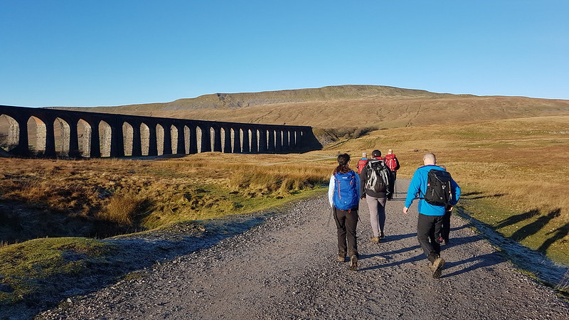
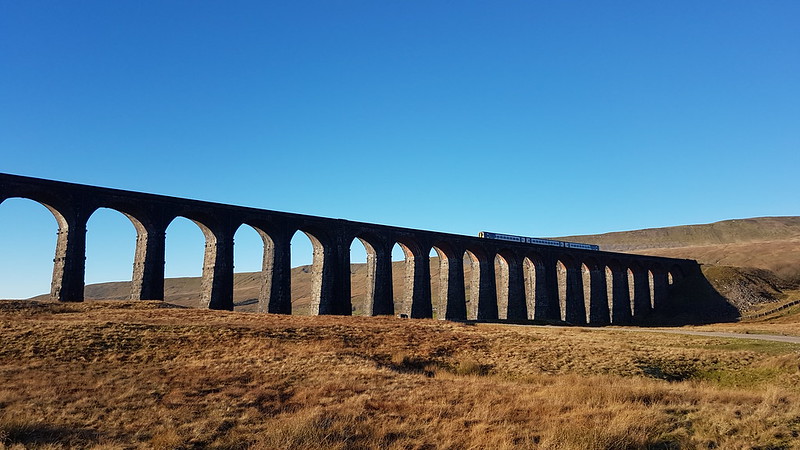
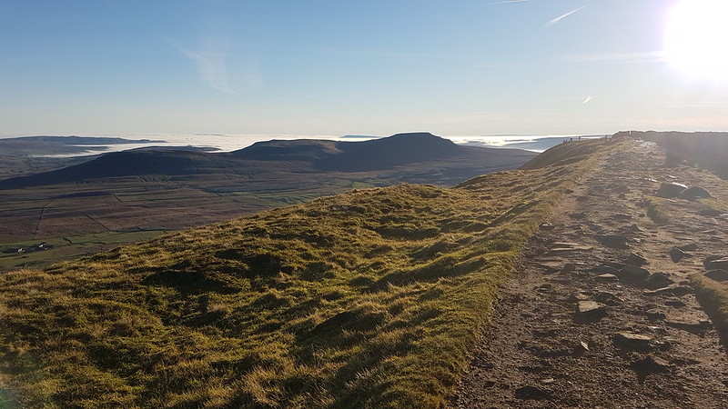
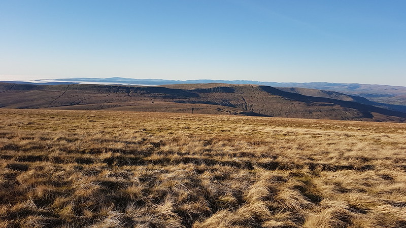
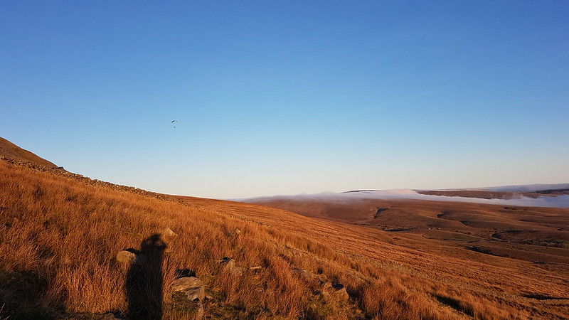
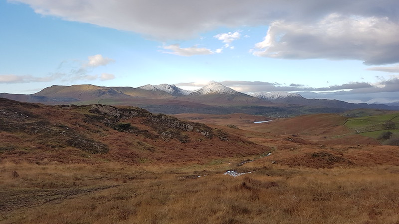
A reduced team near the start of the walk by Ribblehead Viaduct. Whernside behind.
The next day, a Sunday, we were better prepared. Up and out! The early bird and all that. We were walking just before 11 – practically an Alpine start! We were a much smaller party, with many of the group having opted for a waterfalls walk from Ingleton. The weather was magnificent again.
As ever, the Ribblehead Viaduct looked stunning; even more so when a train crossed for some reason.
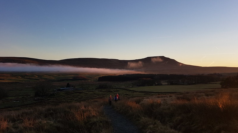
Andy had a cunning plan, we first followed the railway line as far as Force Gill. There we turned uphill – this is a route I’ve taken many times recently, but where a second left turn would have taken us up towards the Greensett Tarn and the top, instead we continued on, following the Craven Way path which curls around the shoulder of Whernside and down into Dentdale. This is where Andy’s cunning plan came into play – we left the path at it’s high point and struck across the moor to hit the ridge by the Whernside tarns.
Well, most of us did, UF and the Prof had some objection to this idea, I think they were worried about getting mud on their shoes, or something equally daft. Here they are…
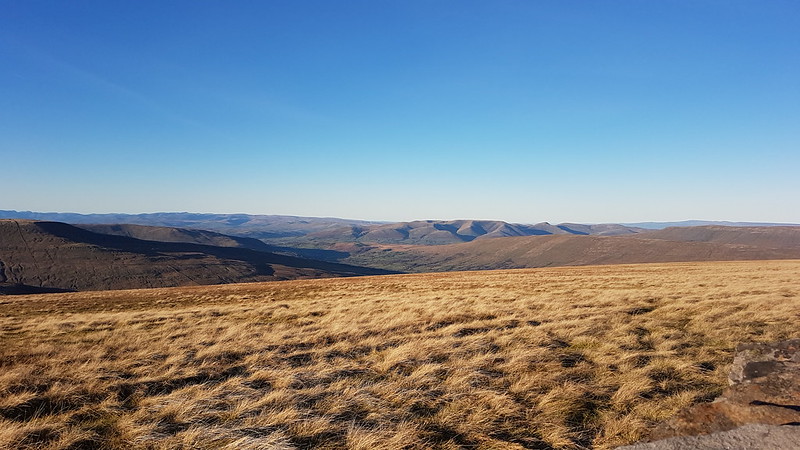
…on the more direct route to Whernside, where we would meet them again.Craven Way track – looking to Pen-y-Ghent and Ingleborough.Our diminished group in the vicinity of Craven Wold.Wold Fell, I think, with Great Knoutberry Hill on the left – both overdue a visit. The deep cleft between them is Arten Gill with Arten Gill Viaduct at the bottom.
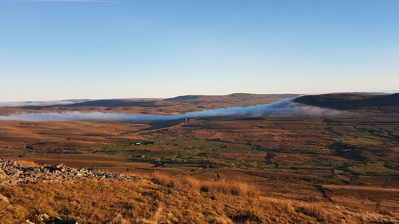
We were constantly entertained by the mist on the move: flowing down Arten Gill’s steep valley and across the moors towards Ingleborough.
One of the Whernside Tarns. Lake District Fells in the background.From a little further up the ridge – Howgill Fells in the centre, Baugh Fell on the right with the three Whernside tarns in front of it.Greensett Tarn, Pen-y-Ghent beyond.Greensett Tarn, Great Knoutberry Hill, Wold Fell and a sea of cloud beyond.Approaching the top of Whernside, a view of Ingleborough.Great Coum with the Lake District hills behind.Howgill Fells.
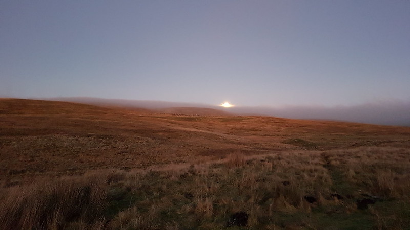
This chap was trying to take off, without much success, he would run toward the steeper ground, but then the wind would drag him and his chute back again.
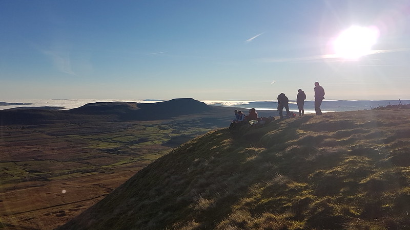
A summit picnic – reunited with UF and the Prof.
It had been quite mild during our ascent, but it was really quite chilly on the top. The views were stunning – the air was so clear that we could pick out the Isle of Man and the hills of North Wales, both poking above the sea of cloud.
Ribblehead, Pen-y-Ghent beyond. The mist making a much more rapid ascent of Park Fell than we had the day before.Here’s the parascender again – finally airborne.Ribblehead and mist again and some lovely late light.Ingleborough.Winterscales Beck and Ingleborough.The moon rising above the moor.
A couple of cracking days which will live long in the memory.
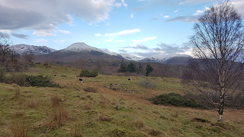
Jump forward a week from our walk from Carperby and the forecast was reasonably promising, but with strong winds part of that forecast, I decided to stick to low fells and an exploration of Torver Common. I parked close to where the Cumbria Way crosses the A5084 Coniston Road. Initially, I followed the Cumbria Way down to the shore of the lake, with some light rain falling intermittently.
In Torver Common Wood a path (not a right-of-way) led uphill toward open ground. There were many fallen trees after the storm of a week before and it was necessary to weave a way through, around or under the trees.
A first view of the Coniston Fells.
I was surprised, when I emerged from the trees, to discover that the Coniston Fells were all cloud free. They would remain so for most of the day, and would dominate the view from that point on.
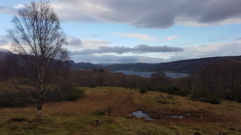
Looking back to Coniston Water and the snowy fells beyond. Looking South. Coniston Water and Beacon Fell.Coniston Fells again.Long Moss Tarn.Kelly Hall Tarn.Near Mill Bridge – the old mill house? And Torver Beck.Torver Tarn (unnamed on the map). Plain Riggs on the right – where I was heading.From Plain Riggs– across Torver Tarn to Beacon Fell.
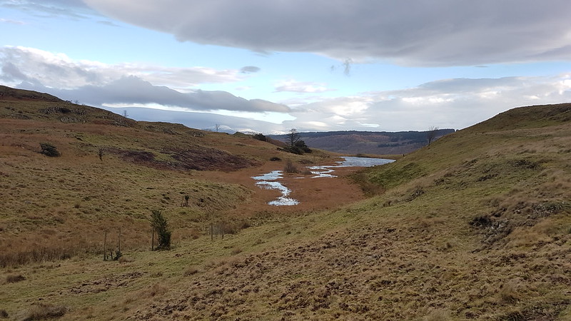
From Plain Riggs I stuck to the high ground heading for Green How. The area is dotted with small tarns, all unnamed on the map. Here’s one of them…
Andy has been telling me for ages that I ought to stump up for the OS Maps app. Of course, he was right all along. I’ve got it now, and it was invaluable on this relatively pathless terrain.
Pool Scar – Black Combe beyond.The cairn on Yew Bank, looking to the Coniston Fells.The cairn on Yew Bank, looking towards Beacon Fell.Duddon Estuary and Black Combe.The way this cairn is marked on the OS map suggests that it is prehistoric. Beacon TarnConiston Fells from Beacon Fell.Coniston Water from Beacon Fell.Sunlight catching Black Combe.
Although there had been a fair bit of blue sky about for most of the day, there had also been a blanket of cloud blocking out the sun and it had been really quite gloomy as you can see from my photos. Then, as I’d almost finished my walk, it began to brighten up…
The final part of the walk, back on the Cumbria Way, was delightful.
Stable Harvey Moss
No big hills, but a great leg-stretcher, and another indication that neither Covid nor plantar fasciitis were holding me back. What’s-more, Beacon Fell and Yew Bank are both ‘Outlying Fells’ although I wasn’t aware of that at the time, or I might have diverted slightly to include Wool Knott to the south of Beacon Tarn, which is another.
I did actually complete the loop – it’s just that my phone ran out of juice. I need to find a solution to my phone quickly running down now that I’m using it as a camera, using MapMyWalk and the OS maps app.
The day after our swim in Gurnal Dubs. This time I was on my own. It was very hot. I got comprehensively sun-burned.
I thought I would string together some of the blue bits on the map. I parked in the lay-by north of Grasmere, called in at the village to supplement my liquid supplies in the village shop, then walked up Easedale to the base of the steeper, scrambling section of Sourmilk Gill. It’s easy, grade 1 stuff, which is probably all I’m up to these days, but I had it to myself and it was very entertaining.
Promising pool in Sourmilk Gill.
I might have been tempted by an earlier than planned dip in this plunge pool, but a couple were just getting into the water as I came past, so I decided to leave them to it, and continued up the rocks.
Looking back down Easedale from the top of the steep part of Sourmilk Gill.Easedale Tarn with swimmers, and Tarn Crag.
There were a fair few people picnicking on the shores of Easedale Tarn, and quite a few more paddling at the edge of the water, but very few swimming out away from the shore. Still, it wasn’t hard to find a quietish spot to change and make a brew.
Easedale Tarn from my lunch and brew stop.
I can never drink tea when it’s just brewed, so once it was done I swam well out into the lake – roughly level with the boulder you can see in the photo above – then back again to drink the tea and eat some lunch. Then I repeated the swim.
Since I was carrying trunks, a towel and water-shoes, I’d opted to leave my camera at home – which turned out to be frustrating since there were lots of colourful dragonflies about, Keeled Skimmers and Golden-ringed Dragonflies predominantly.
After my second swim, I continued to the base of my second scramble of the day, another pleasant but easy route up Easedale Gill.
Easedale Gill and Belles Knott, the ‘Easedale Matterhorn’.
In the past, I’ve followed those two scrambles with a slightly harder route on Belles Knott, but I’d decided in advance that I would steer clear of that and, in the event, I felt pretty exhausted anyway by the time I reached the end of the scrambling in Easedale Gill. I’m not sure whether my tiredness was due to lockdown rustiness, the heat, the unfamiliar exercise of scrambling and swimming or a combination of all three.
Fortunately, only a little ascent remained to get me to Codale Tarn….
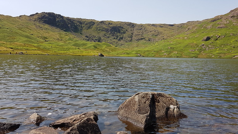
Codale Tarn.
Which I had all to myself.
Codale Tarn from my brew spot.
Again, I made a brew, swam, drank the tea then swam again. Each swim took me across the tarn to the rocky patch you can see slightly right of centre in the photo above, then back again. I think this might narrowly pip the other places I swam this summer for favourite swimming spot.
The slopes of Tarn Crag, Easedale Tarn and Seat Sandal and the Fairfield Horseshoe.
All that remained was to wind my weary way back to Grasmere.