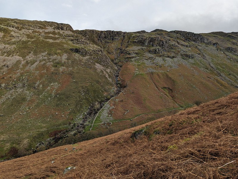
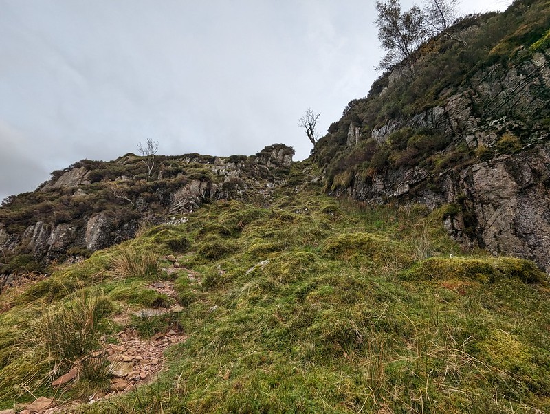
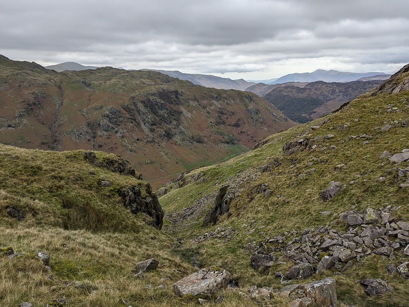
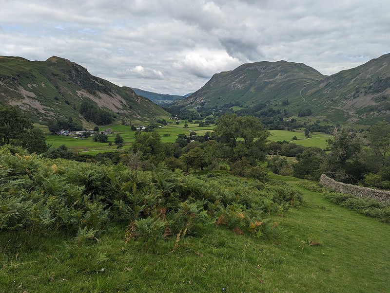
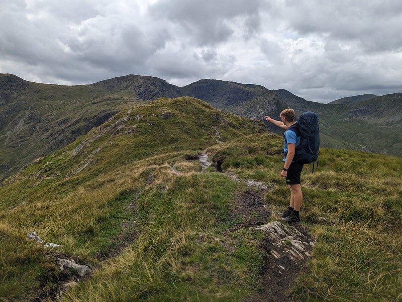
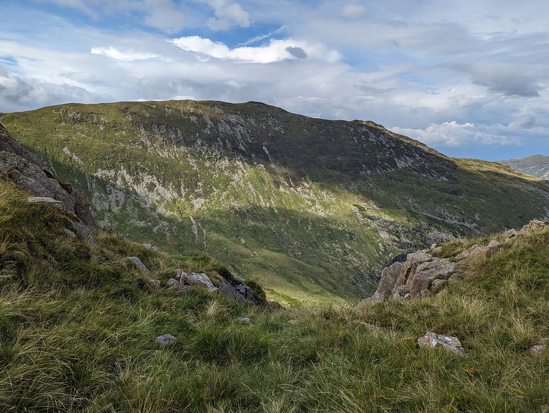
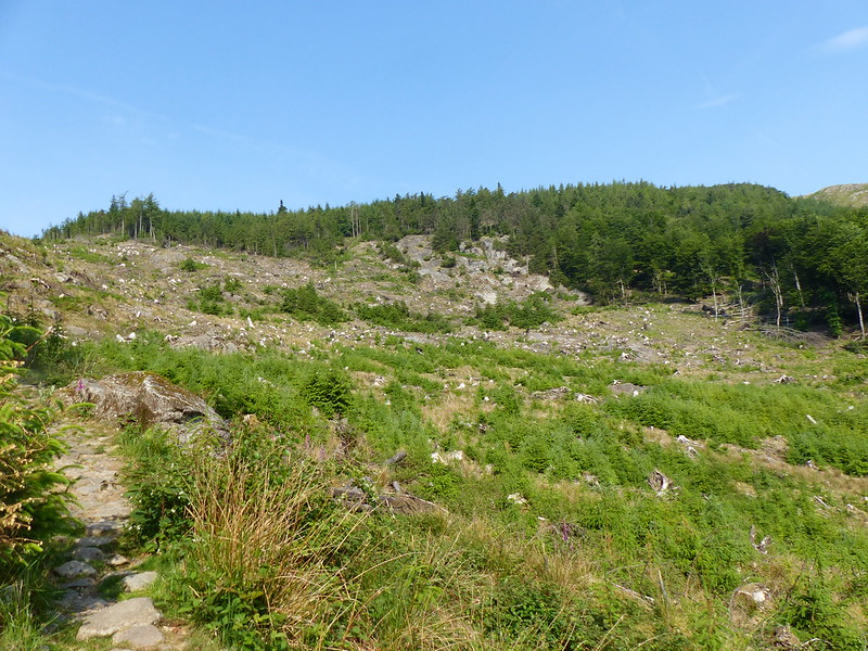
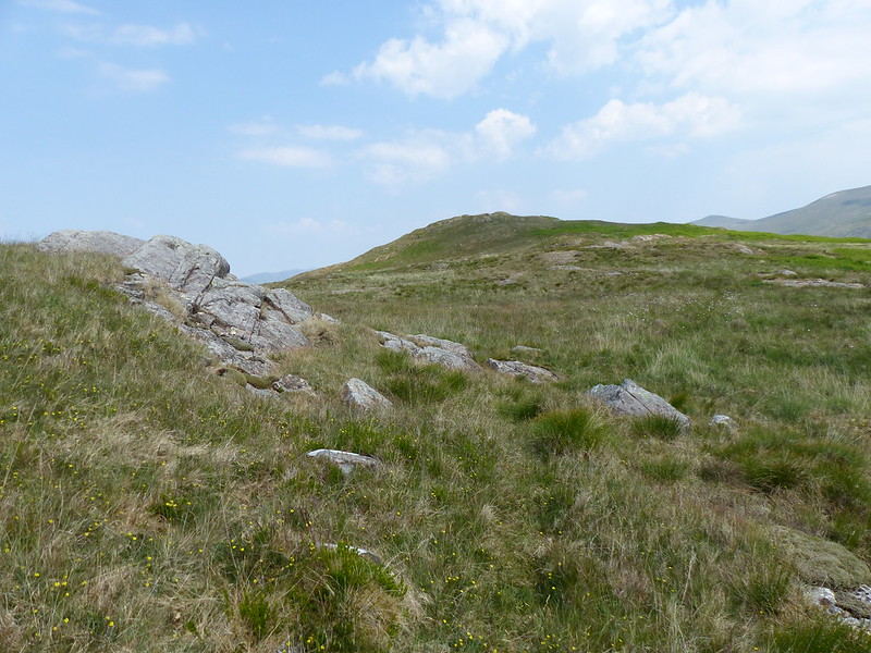
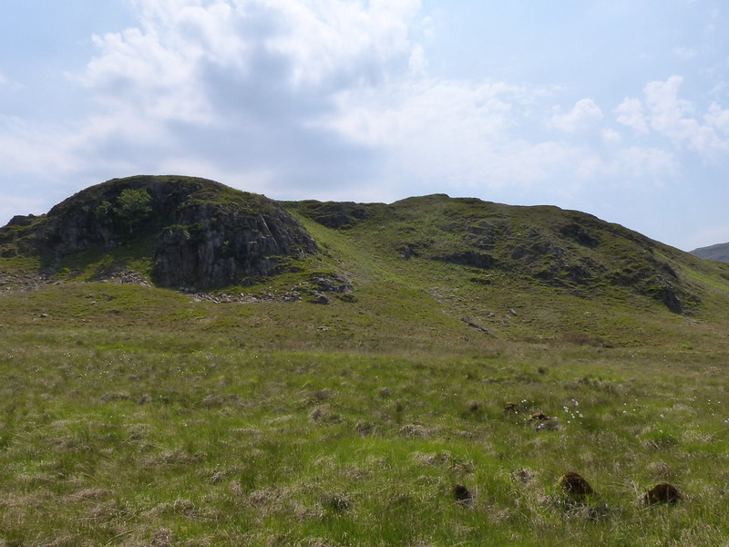
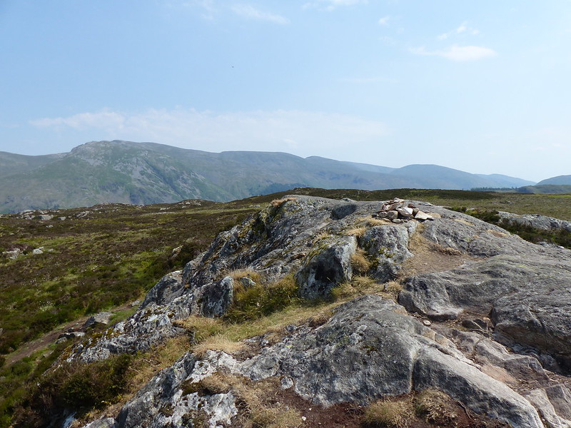
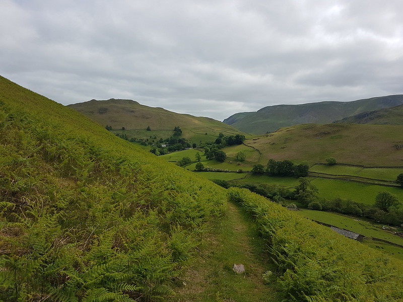
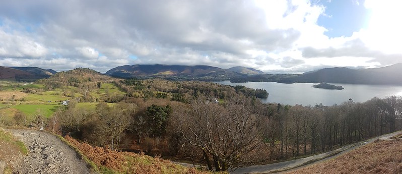
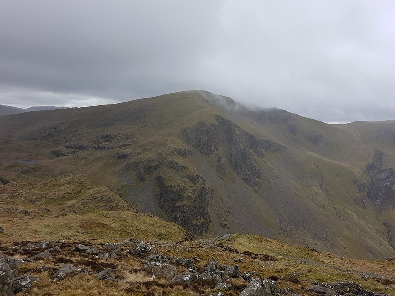
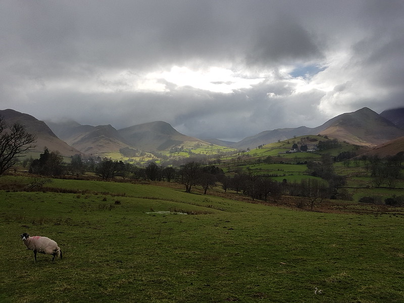
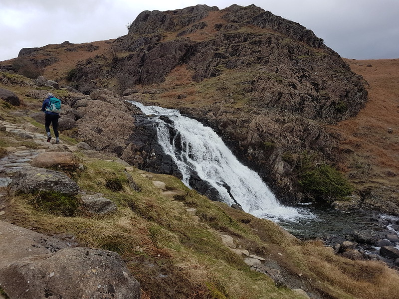
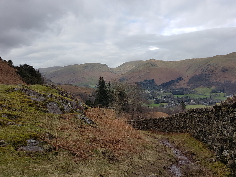
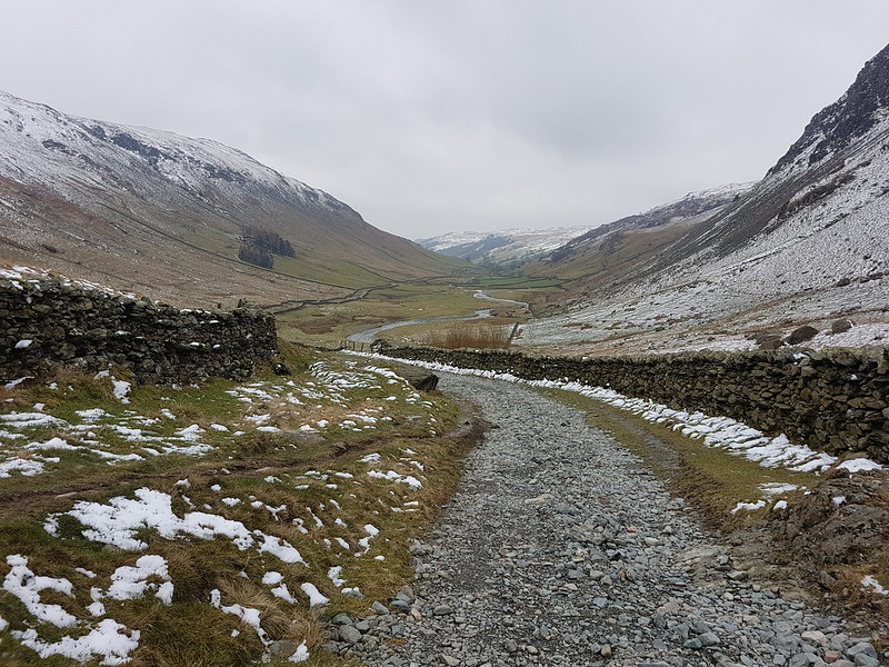
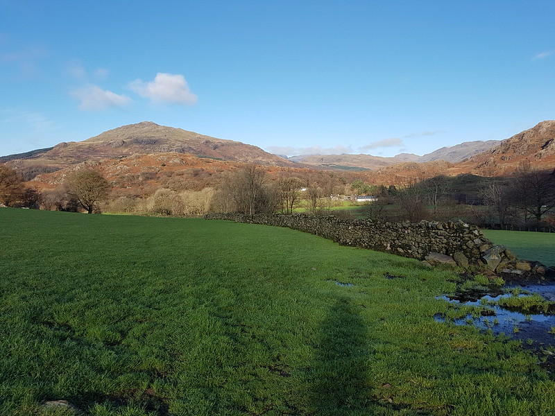
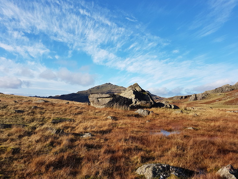
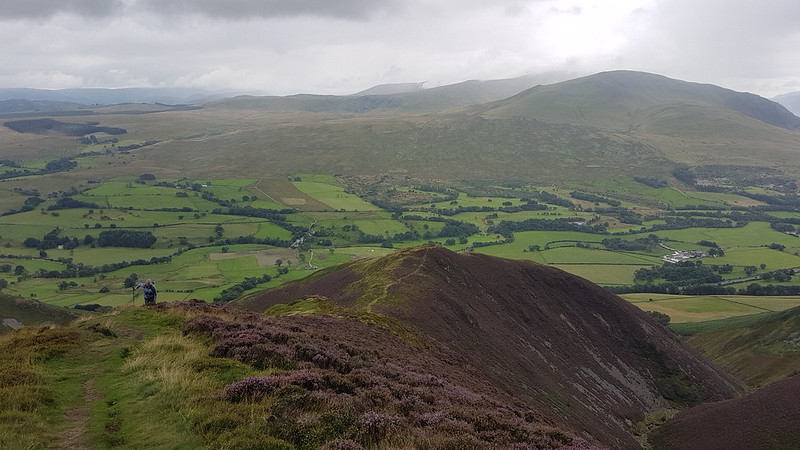
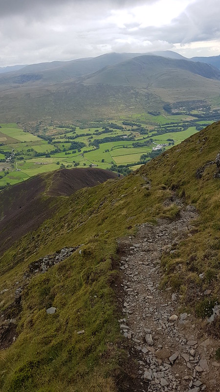
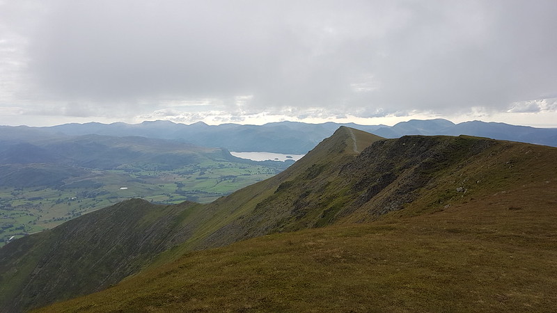
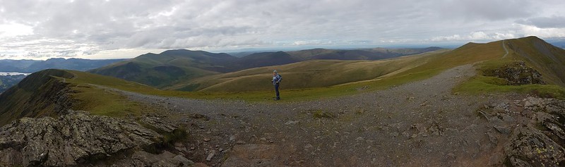
An October outing up two Wainwrights which I’ve never climbed before. Not sure how I’ve managed to avoid them. Anyway, my mistake: they were well worth a visit. In the photo above, you can see that there’s a lot of steep stuff on Eagle Crag and it’s not immediately obvious how you’ll get up there, but fortunately it’s all plain sailing; the path winds round to the left of the first knoll, Bleak How, and then finds a passage through the remaining complexities.
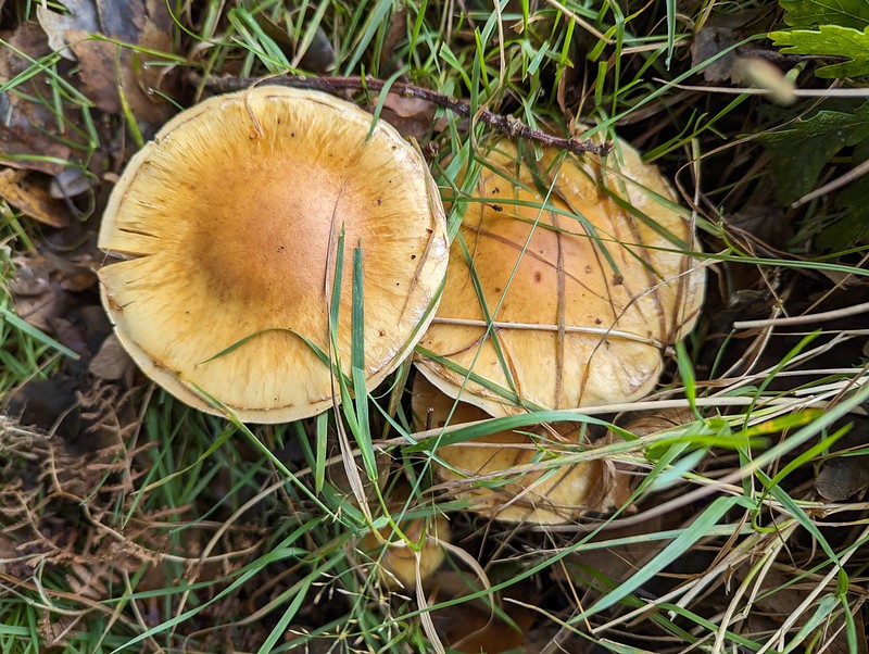
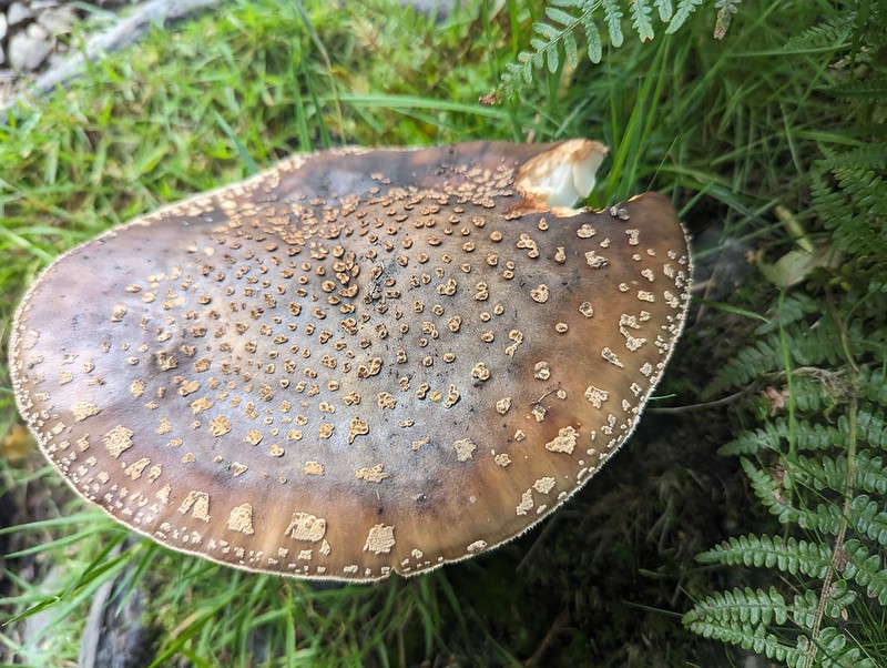
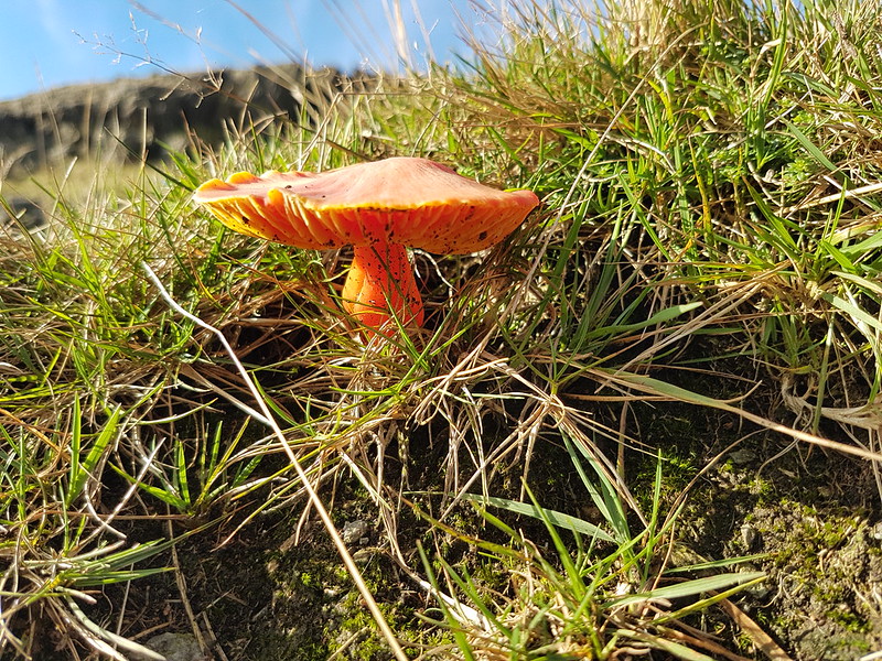
Fungi.
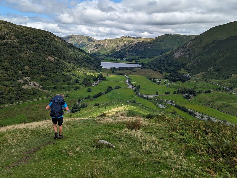
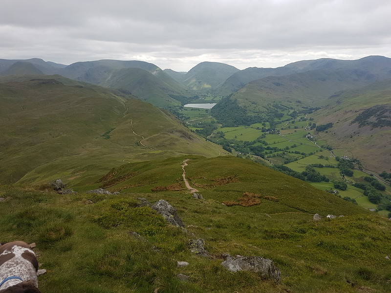
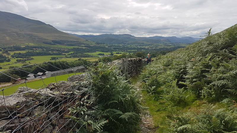
Having said that, after the initial easy plod along Stonethwaite Beck and then a boggy bit of field, I turned away from the valley path either too late or too early and then found myself fighting spiky, crumpled bracken uphill, but eventually managed to reach a sketchy path by the wall which then lead me around the craggy parts of Bleak How and on to the ridge.
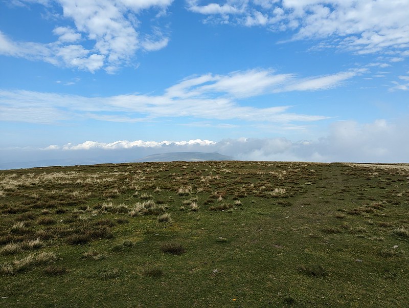
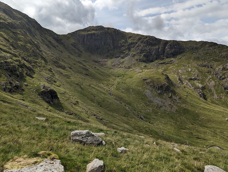
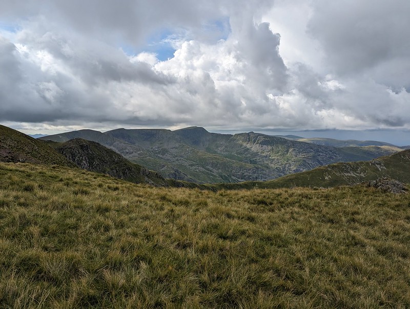
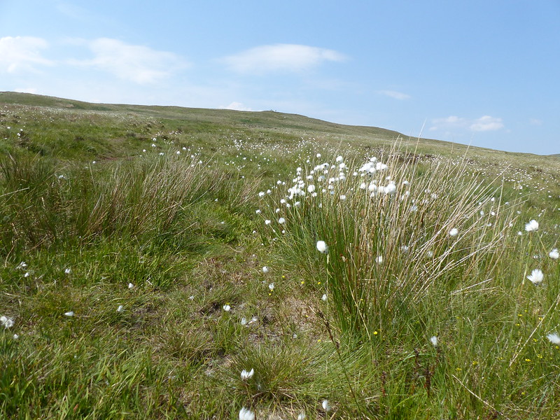
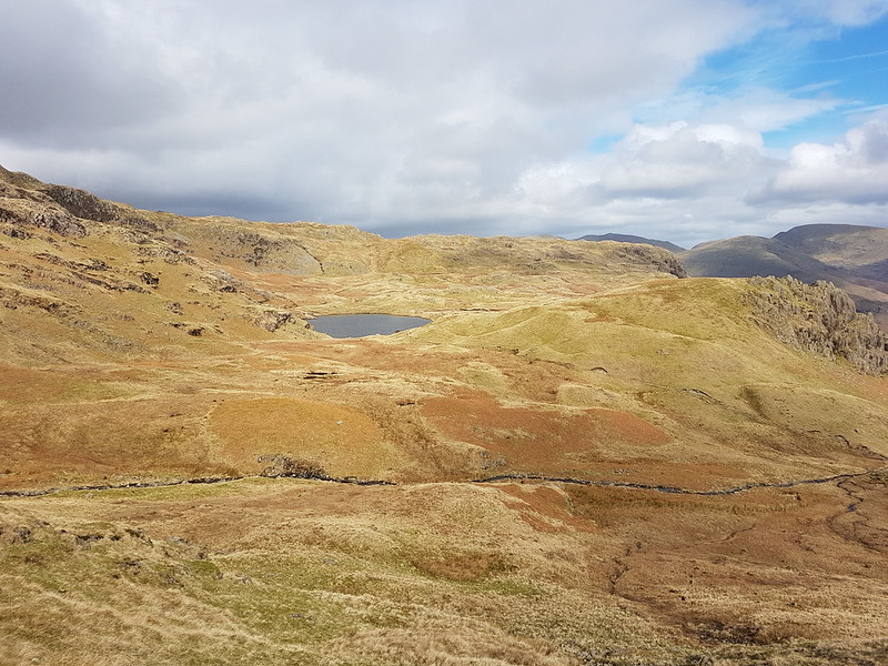
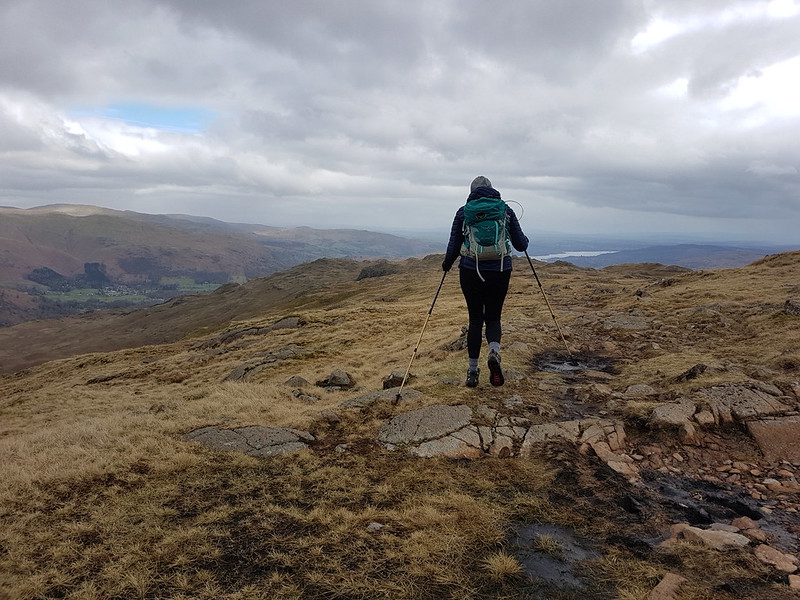
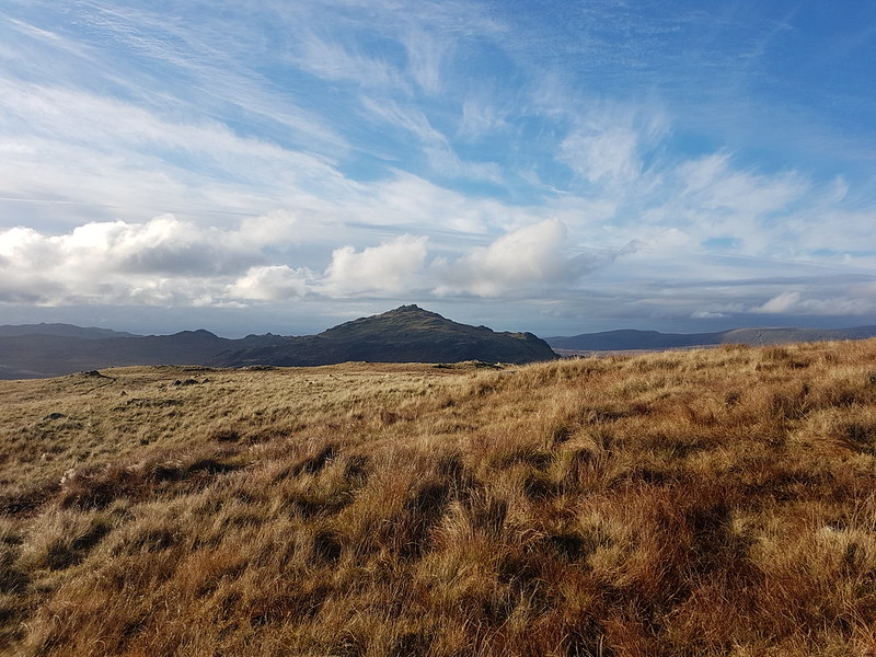
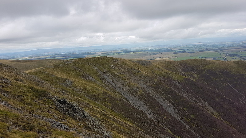
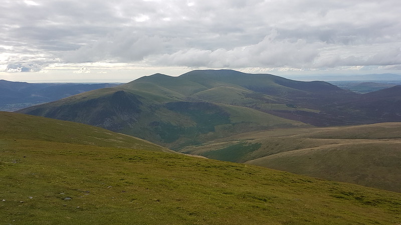
Long Band on Coldbarrow Fell.
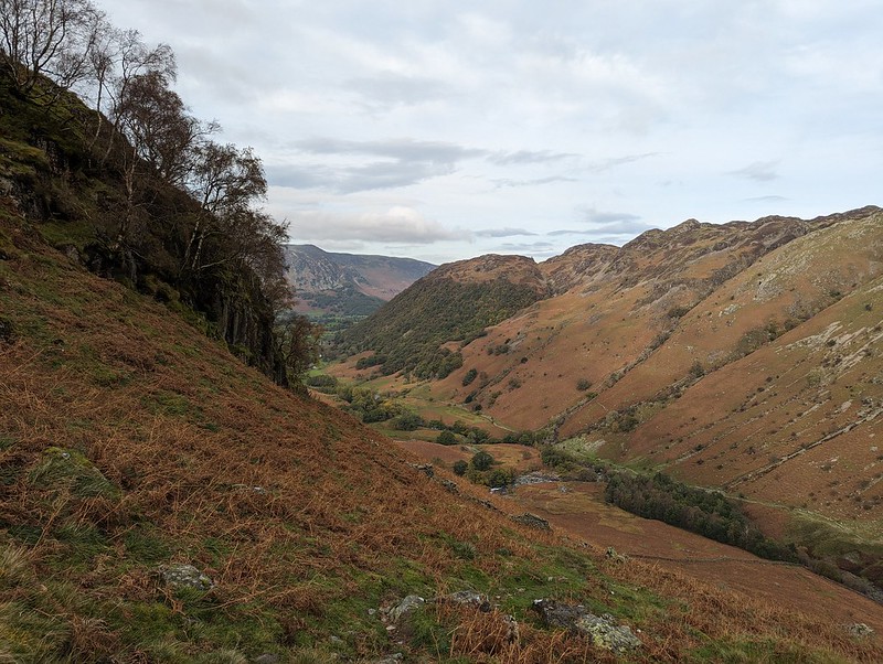
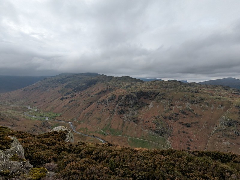
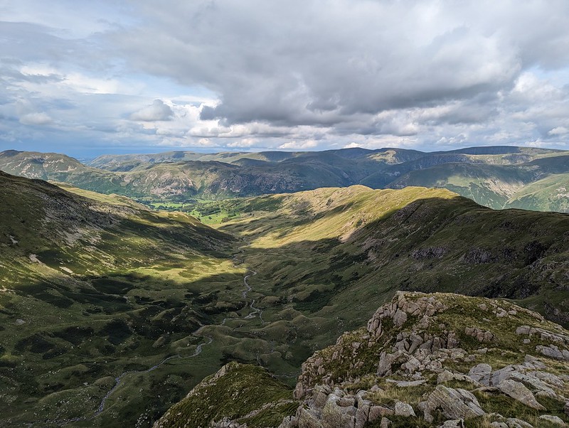
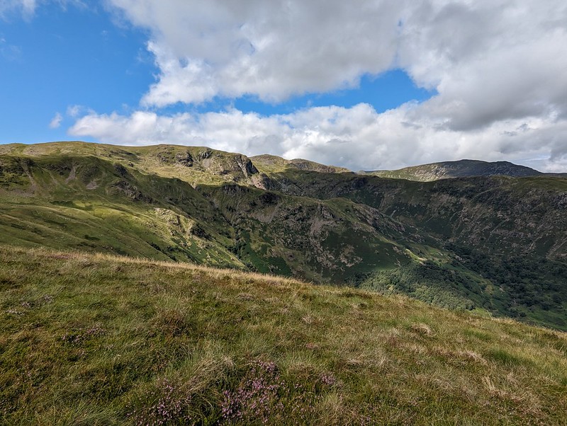
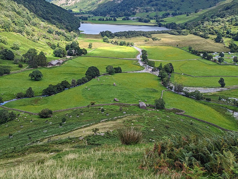
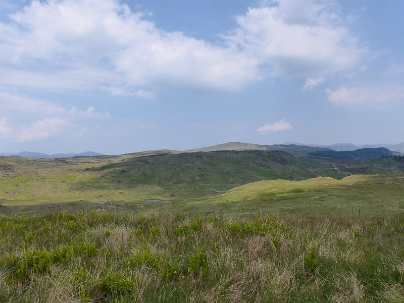
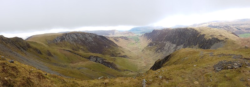
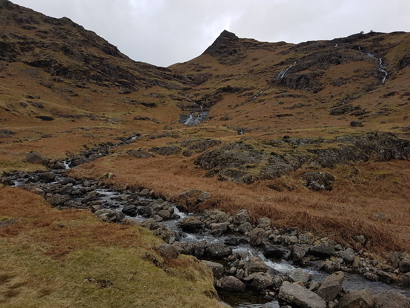
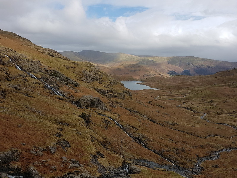
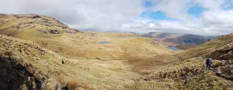
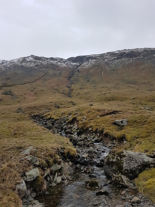
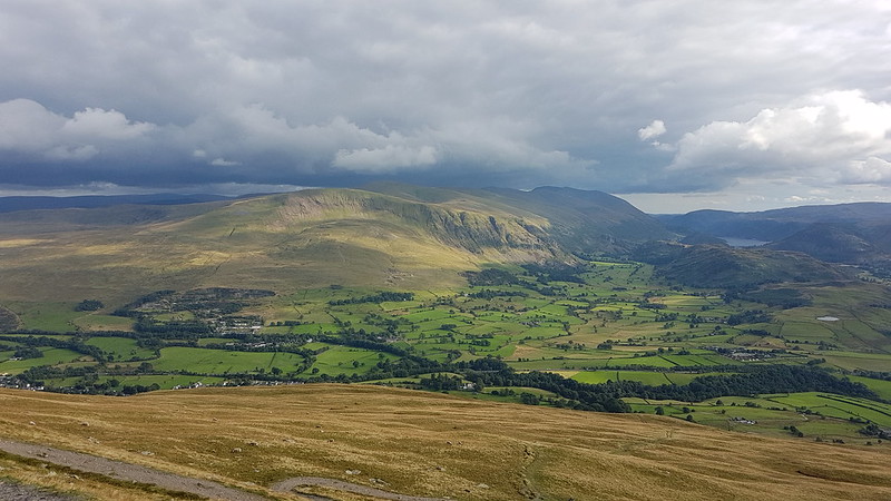
This stream, unnamed on the OS map, has carved quite an impressive looking amphitheatre below Long Band on the opposite fellside and I filed away the idea of having a gander there on a future walk.
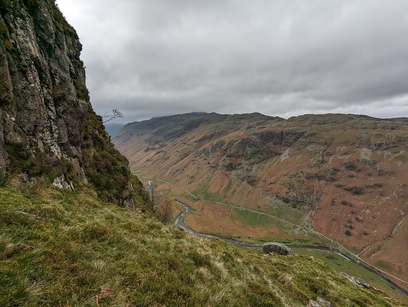
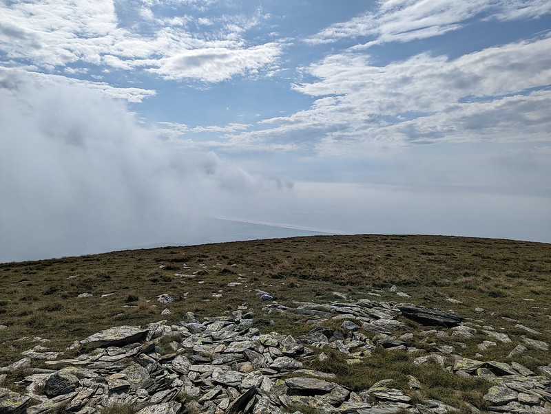
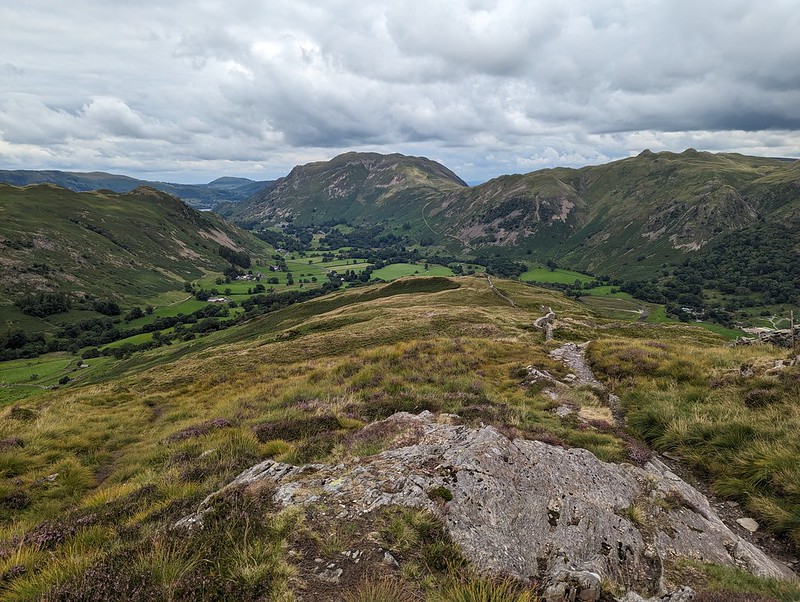
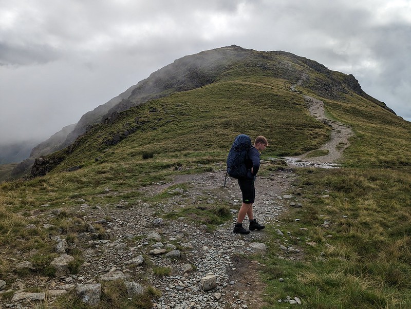
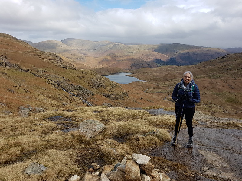
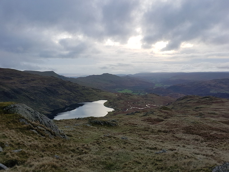
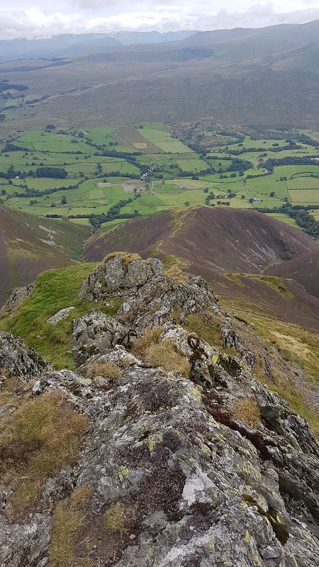
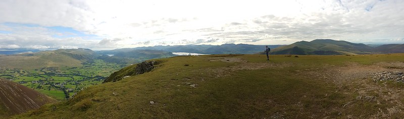
My ascent route, approaching Eagle Crag..Knotts and Great Crag above Stonethwaite.
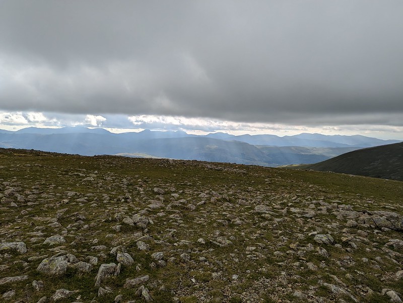
It was a fairly grey day, with occasionally the odd drop of moisture in the air and the apparent threat of rain, but none-the-less good walking weather.
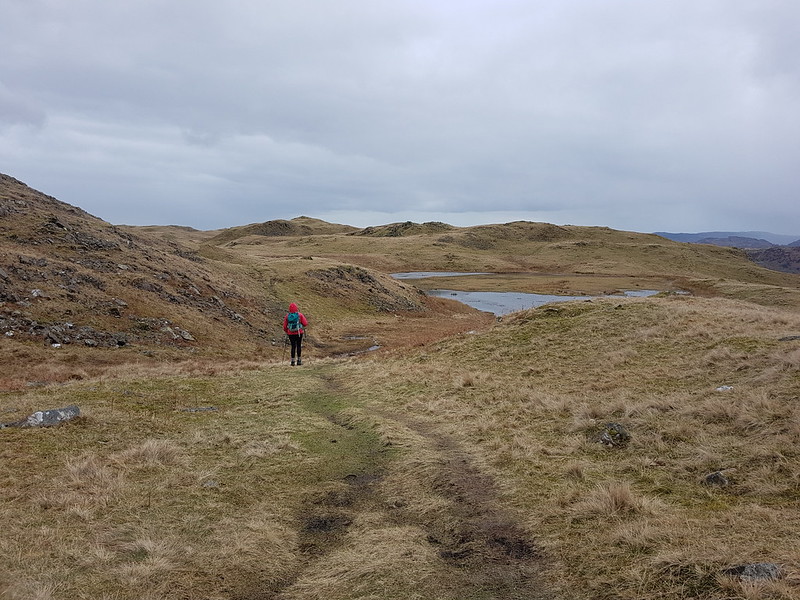
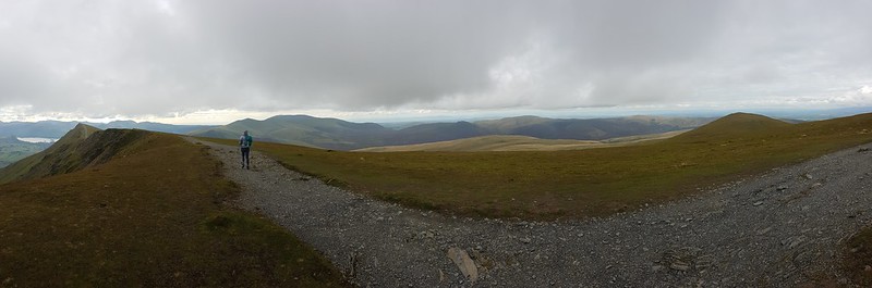
A broad ramp.
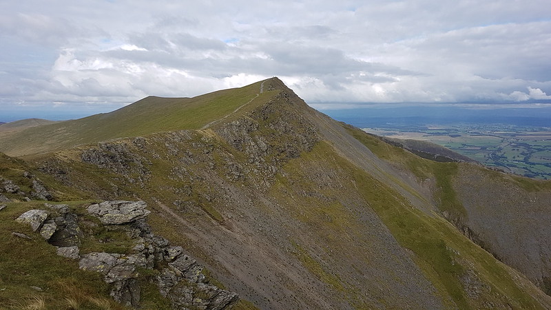
The route follows a resourceful path which finds first a broad ramp with crags above and below, and then switches back up an easy-angled gully through what might have seemed impenetrable cliffs.
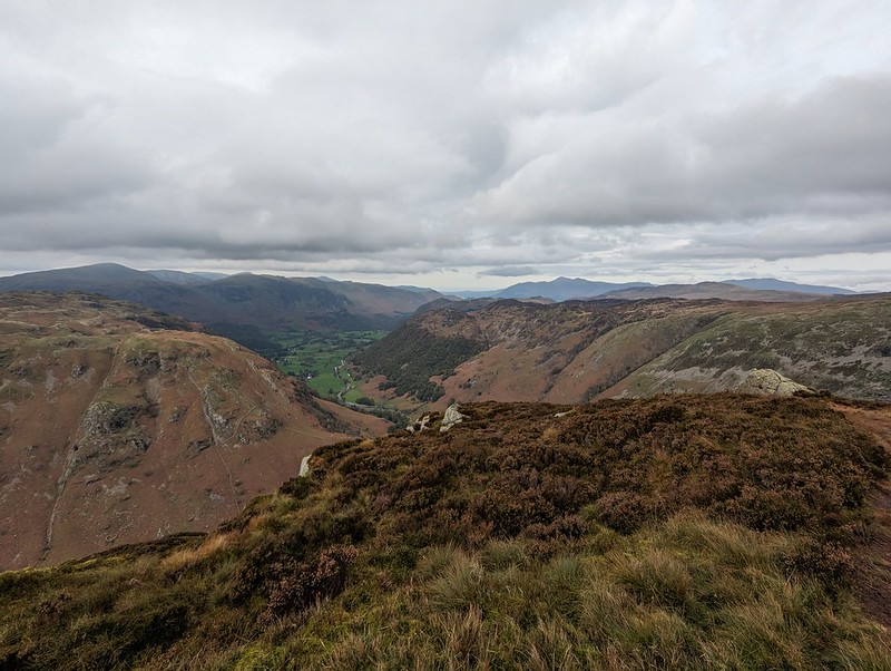
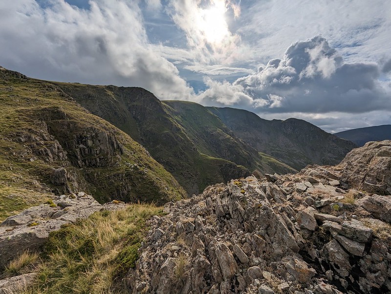
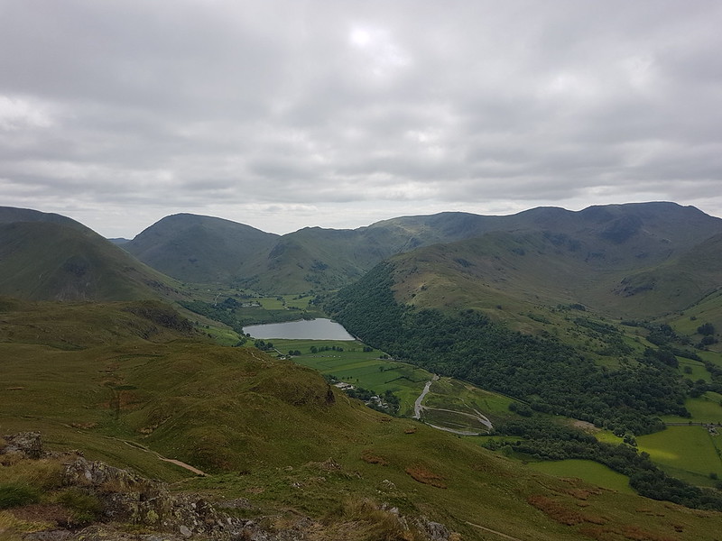
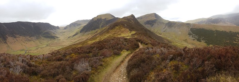
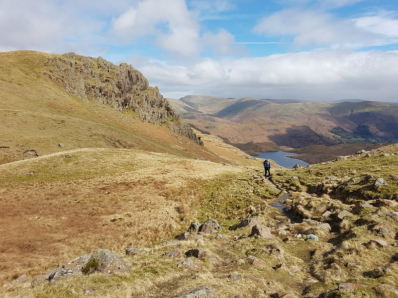
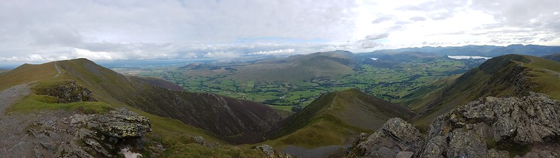
Looking down on Bleak How.Heron Crag and Langstrath.A steepish section.Looking to Sergeant’s Crag
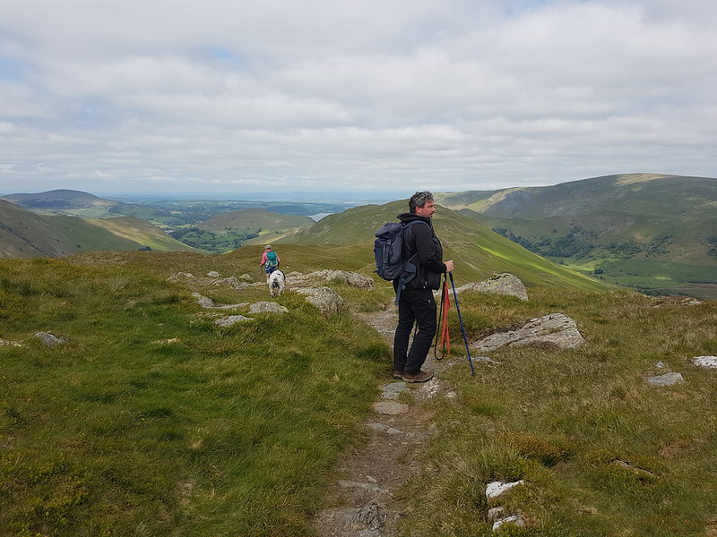
On the last part of the ascent, the path loops drunkenly back and forth following broad ledges separated by short slabby crags. You could probably take a more direct route, but it’s pleasant walking so why bother?
Sergeant’s Crag and Langstrath.Sergeant’s Crag again.
Too many photos of Sergeant’s Crag? I liked the look of it!
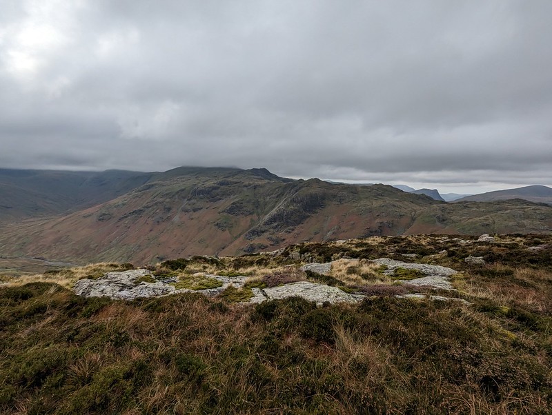
The long Glaramara ridge.Looking north to Skiddaw.
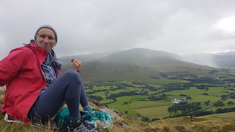
On the top, the inevitable cup of tea, a video-call with my Mum and Dad, and a brief conversation with another walker. I saw surprisingly few that day.
Sergeant’s Crag.Again!Looking back to Eagle Crag.Eagle Crag again.Glaramara.
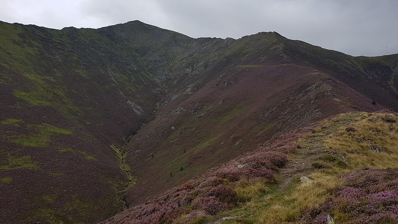
Not much more climbing to attain Sergeant’s Crag and then I took an off-piste route down towards Langstrath, aiming to avoid Bull Crag and Blea Crag and the crags around Lamper Knott. With hindsight, I’m not sure it’s a route I could recommend: there’s a lot of crags and even the grassy parts are liberally sprinkled with boulders and rocks. Still, I enjoyed it immensely.
An off piste descent.Approaching Langstrath Beck.
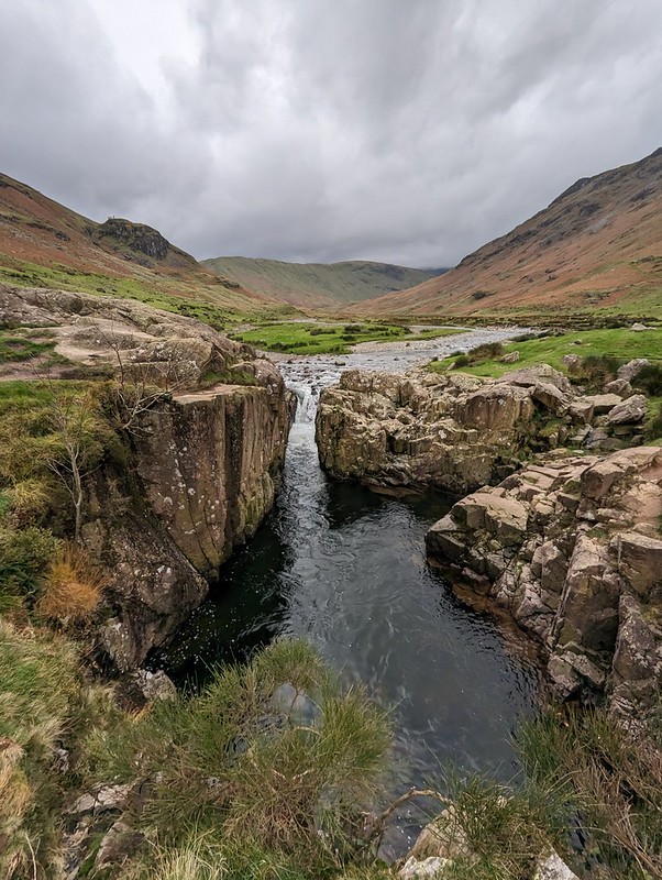
I wanted to come down this way so that I could have a peek at the renowned Black Moss Pot…
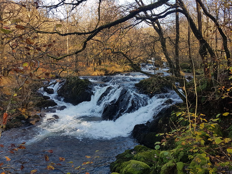
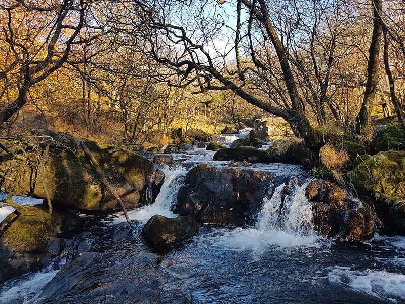
Blackmoss Pot.
There were quite a few wet-suited swimmers nearby, the ones who had just finished swimming advising and encouraging another group who had just arrived. I’ve never swum here myself and it’s on my wish-list, although not for a grey day towards the end of October!
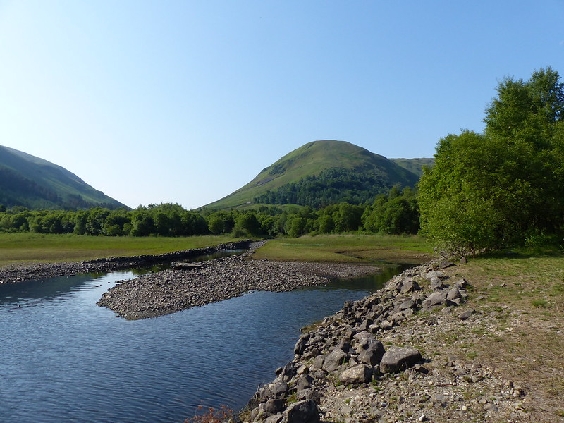
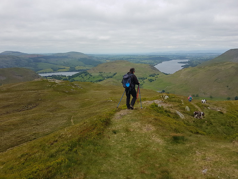
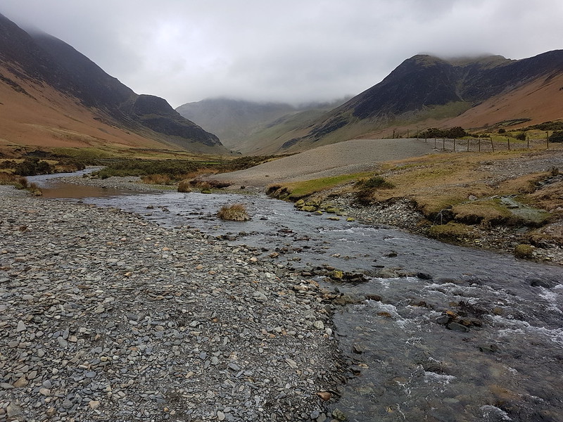
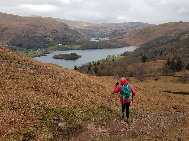
Langstrath Beck.Stonethwaite.Map the first.Around six and a half miles – but there’s a lot packed into that short walk.
The substantial track up Black Combe from the south.
Old friends J and A, MM and F, and UF had booked a cottage in Silverdale for the weekend. Back in our Manchester days, UF and I went to a fair few gigs together. (Perhaps I should say back in my Manchester days, since UF still lives on the outskirts of Manchester). One of the bands we saw together way back then was The Men They Couldn’t Hang. We’ve seen them many times since, although none of those all that recently. But they were playing the Platform in Morecambe and hence the get-together.
Black Combe
I suspect that J and A do more hill-walking than just about anyone else I know, but they live in Aberdeen, so chances to walk in the Lake District don’t come around all that often. J had never climbed Black Combe and asked was everyone amenable to join him in putting that right? We were.
Bog!
There was a little miscommunication over where we were going to park, but the layby we ended up in was perfect for our intended route – a north-south traverse starting and finishing to the west of the hill. The weather was a bit odd – warm and sunny with lots of lovely blue sky, but heavy, low cloud to the south. Black Combe wasn’t busy at all, and the people we did see were cyclists flying along on ebikes which seems to be becoming the norm for mountain-bikers.
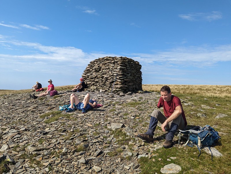
The team by the large cairn on Black Combe’s south top.TBH napping.
I suggested this spot on the south top for a lunch break because it has terrific views over Morecambe Bay. Well, sometimes it has terrific views over Morecambe Bay, but not on this occasion sadly…
The view!Looking back up to the large cairn.
As usual, I hadn’t brought any lunch, so had a little wander down to another prominent cairn to see whether that offered any better view, which it did to a very limited extent…
A partial view of Morecambe Bay.The hills north of Black Combe.On our descent.Whitbeck
TBH and I then went for a refreshing dip in the sea at Silecroft. It was spitting with rain by then, but that didn’t detract I didn’t feel. The others didn’t join us, they were eager to get back to their cottage to get fed, watered and spruced up for our evening’s entertainment. My old friend X-Ray joined us at the venue and we also bumped into another friend of mine, E, who was TBH’s work colleague many moons ago and who was at the gig with a relative of a member of the band. TMTCH were fantastic. We’re off to see them again soon, well UF and I anyway, in Barnoldswick of all places.
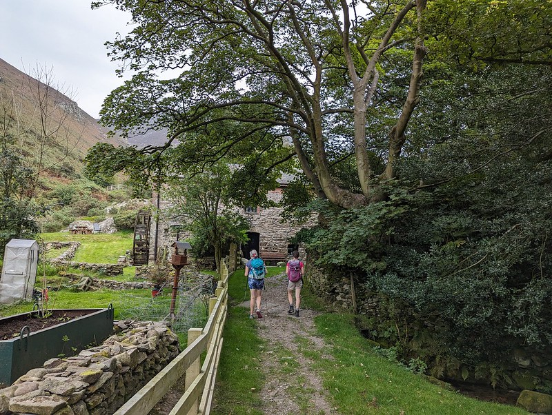
B and I had been discussing various plans for a night or two away somewhere, but dodgy weather and the fact that B was quite busy between work and social commitments had prevented that so far. However, the forecast looked half reasonable, and B could spare me an afternoon and the following morning, so we hastily packed (fortunately my gear had dried out in the day since my wash-out walk from Austwick) and set-out for Patterdale. We parked at Cow Bridge, just north of Brothers Water. I was pleasantly surprised to find that the car park wasn’t full, especially given that it’s free.
Fungi in Deepdale Park.
We used the permission path beside the road through Low Wood. The map shows a much more direct route through the woods on to the Hartsop above How ridge, but I would have been much happier to take the less steep route even if I hadn’t been carrying camping gear. Actually, B had volunteered to carry the tent, so although I had the food, pans and stoves, my pack wasn’t as heavy as it might have been.
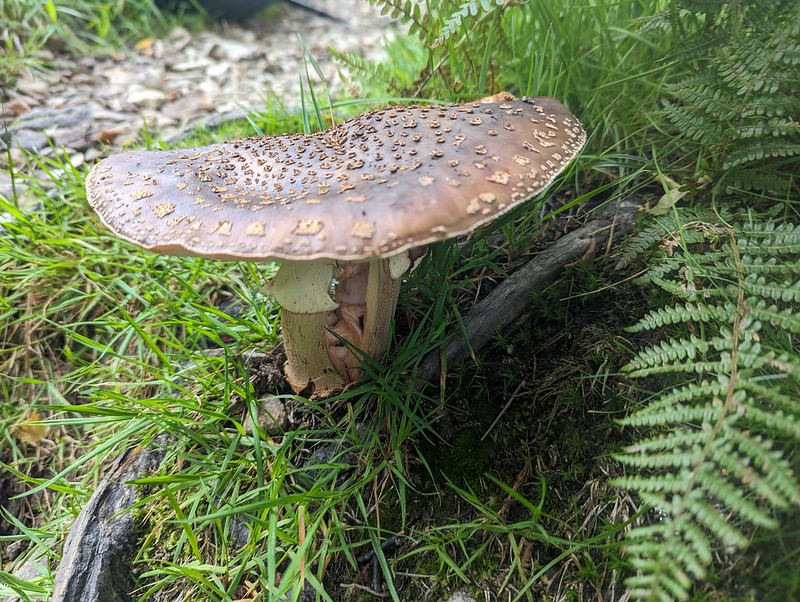
Fungi. Possibly Amanita rubescens?Gavel Pike.
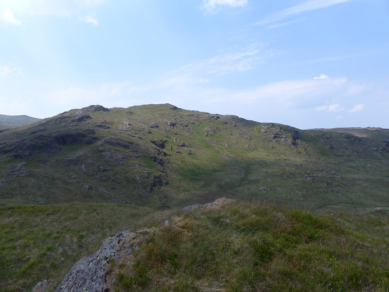
Gavel Pike looks very dramatic from this direction, which is a bit misleading, but it’s a Birkett which is well worth taking a detour to visit when climbing St Sunday Crag.
Arnison Crag and Place Fell either side of Patterdale.Arnison Crag, Great Mell Fell, Place Fell, and Angle Tarn Pikes from Gale Crag or thereabouts.“So, where are we going to camp?”
The long ridge over Hartsop above How is a lovely walk. It gave us lots of opportunity to look ahead to the various potential campsites I’d identified. I let B make the decision and he was most taken with the idea of dropping down into Link Cove, the craggy corrie below Hart Crag and Scrubby Crag. Although I left the choice to B, that was my preferred option too. I’ve visited Link Cove a couple of times before, ascending in to it on the way up Fairfield from Deepdale, with Andy and Uncle Fester years ago and I’d been wanting to return.
B admiring Dove Crag, Hart Crag and Fairfield. Before succumbing to ‘ant attack’.
There were a lot of flying ants about. We’d decided to stop here for a drink and a snack, but this little knoll seemed to be a particular focus of their attention and we were quickly overwhelmed and decided to move on.
Link Cove dead ahead.Link Cove.
There’s no path into Link Cove. We took a line which angled down below the darkly shadowed crag on the left of the photo above, then climbed again onto the small ridge in the middle of the cwm. This was rough going, but I love getting off-piste into dramatic scenery like this.
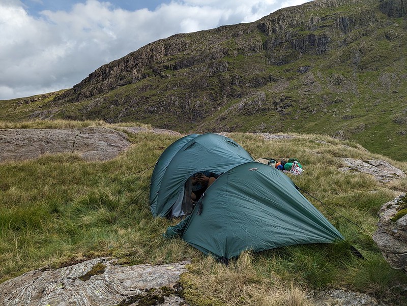
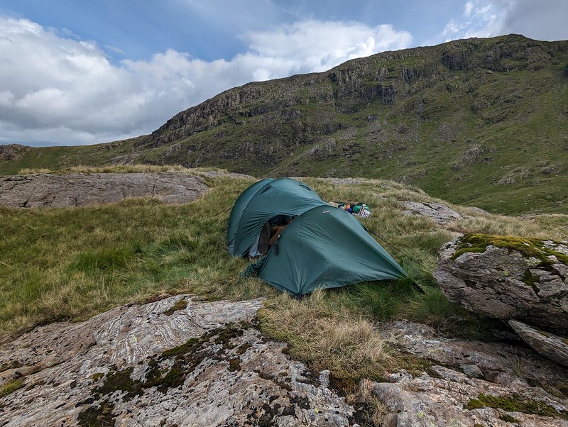
Tent pitched.
It was hard to find any level, dry ground to pitch the tent on. This spot was probably more level than it looks in the photo, but it wasn’t as dry as we might have liked. Then again, after the weather we’d had, it was always going to be hard to find a spot which wasn’t soggy.
Camp in Link Cove.Looking down Deepdale.
Once we were pitched and organised, we left our gear and set-off unencumbered for a circuit of Link Cove. I thought the map suggested that The Step would give a good ascent route and that proved to be the case.
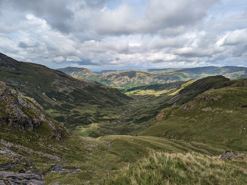
The High Street range from ‘The Step’. Looking across Link Cove to Hart Crag. Our tent is to the right of that short rocky ridge in the cove.St. Sunday Crag.Looking down Deepdale. Hartsop above How ridge on the right.Black Tippet and the northern buttresses of Fairfield. Cofa Pike on the right.
You can’t beat this sort of exploration – we had great views into Link Cove, then suddenly we hit the far side of the ridge and found terrific views of the northern steeps of Fairfield. From Scrubby Crag we decided that a detour to take in the summit of Fairfield was called for.
Dollywaggon Pike, Nethermost Pike, Helvellyn and Striding Edge.Cofa Pike and St. Sunday Crag.
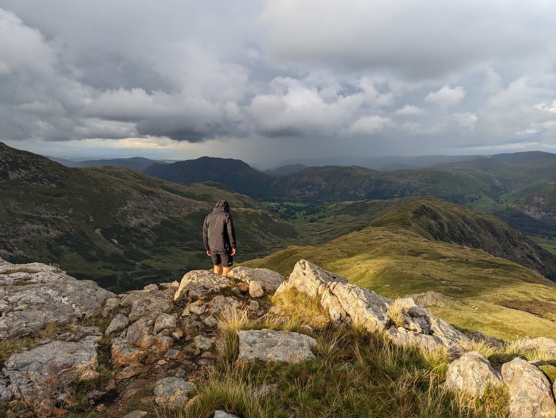
The skies to the east were looking increasingly grey and it was clearly raining not too far away. It would surely be only a matter of time before we got our own shower.
Looking west. Scafells, Gable, Dale Head, Maiden Moor, Northwestern Fells.Rainbow Weather.Looking down Rydal. Great Rigg and Heron Pike on the right. Windermere, Coniston Water and Morecambe Bay in the distance.Link Cove, Deepdale, Hartsop above How. Sunshine and showers.
I thought we could descend, with care, the gully to the south of Scrubby Crag, but B took one look at it and clearly doubted my sanity, so we climbed Hart Crag instead, descended the ridge towards Hartsop above How and then repeated our route down into the cove and back up to our tent.
St Sunday Crag.Descending towards our camp.
Of course, eventually it began to rain and didn’t stop for quite some time, even though the sun was still shining too…
Dove Crag.
We thought we could pick out the path to the cave on Dove Crag which is meant to be a good bivvy spot.
A Link Cove frog.
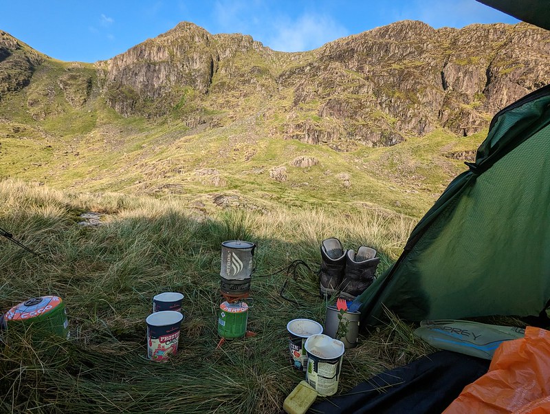
We were using the tent which we’ve borrowed (seemingly indefinitely) from Andy. It’s not the lightest, but it’s amazingly spacious and the huge porch was superb in the wet – perfect for me to sit in and cook our evening meal (filled pasta, pesto, dried fruit and custard, very satisfying).
Second Day
A breakfast view of Scrubby Crag.
This early morning photo might be a bit misleading. Once again, we seemed to be on the divide as far as the weather was concerned. To the west, all was blue sky and sunshine; to the east, low cloud. And although the wind was, I was sure, blowing from the west, the cloud was sweeping up Deepdale towards us. Still, we at least had sunshine whilst we breakfasted and packed up.
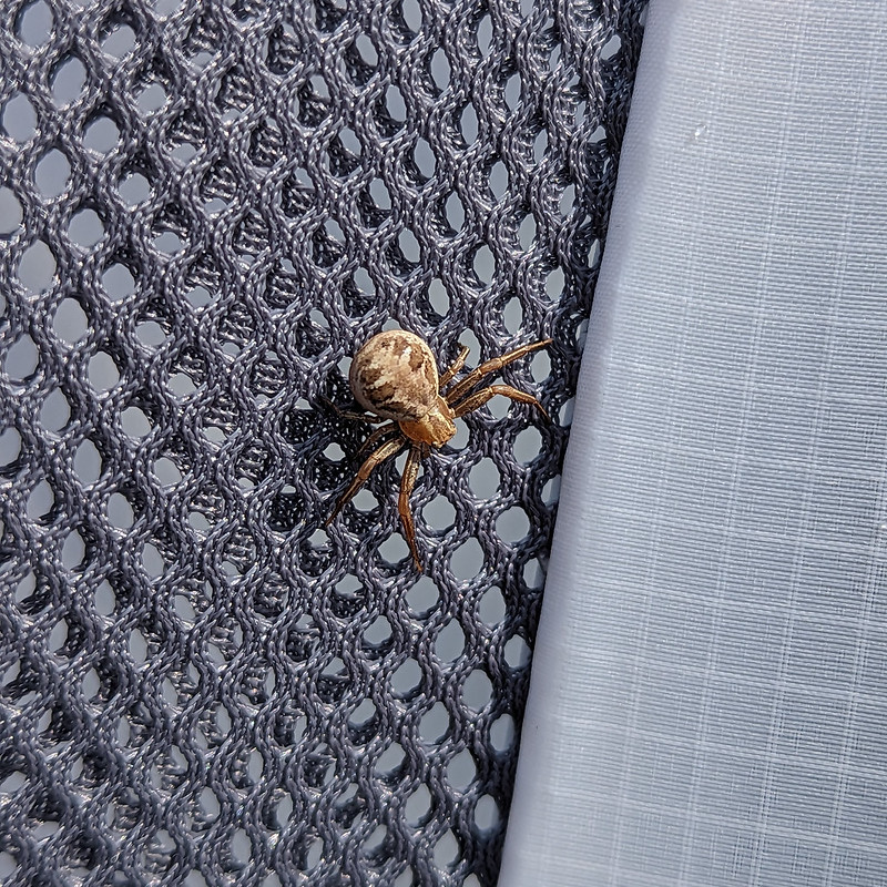
A Crab Spider. Xysticusspecies. I think.Ascending The Step again, with atmospheric clouds.
We wanted to regain the main ridge, and could choose to retrace either our ascent or our descent routes of the previous evening. Despite its initial steepness, we agreed that The Step was much the easier going of the two. With the cloud sweeping in across the crags, it was atmospheric too.
Hart Crag.The ‘view’ to the East.And to the West. Coniston and Langdale Fells. Heron Pike and Great Rigg in the foreground.Looking South from Dove Crag. Windermere, Coniston Water and Coniston Fells.
As you can see from the photos, the weather was really odd, but it gradually improved as we wandered over Dove Crag and then Little Hart Crag and finally along another delightful ridge to High Hartsop Dodd.
Middle Dodd, Little Hart Crag and Red Screes.Looking down Scandale. Scandale Tarn in the foreground.
I have several spots in the area earmarked as potential wild-camping locations. Scandale tarn is one of them.
Middle Dodd and Red Screes.The complex terrain at the head of Dovedale.B descending towards Brothers Water.Looking down on the Romano British enclosed stone hut circle.
I’ve waffled on before about this amazing archeological site. Historic England has a thorough physical description, but doesn’t supply much detail about who lived here and how they might have lived.
Another view of the settlement. The knoll on the right is the site of the oval cairn.A final rest stop.Looking up Dovedale.
This was effectively a day’s walk divided in two, which I think is probably a good way to plan an overnighter. We both enjoyed it immensely and were both keen to go again. B also wanted to borrow some gear and take some of his friends wild-camping, but then he got a job pitching and packing-up much bigger tents (marquees) and his availability became severely restricted. Who knows, maybe next summer we’ll get a mutually convenient spell of settled weather and manage to fit some more trips in?
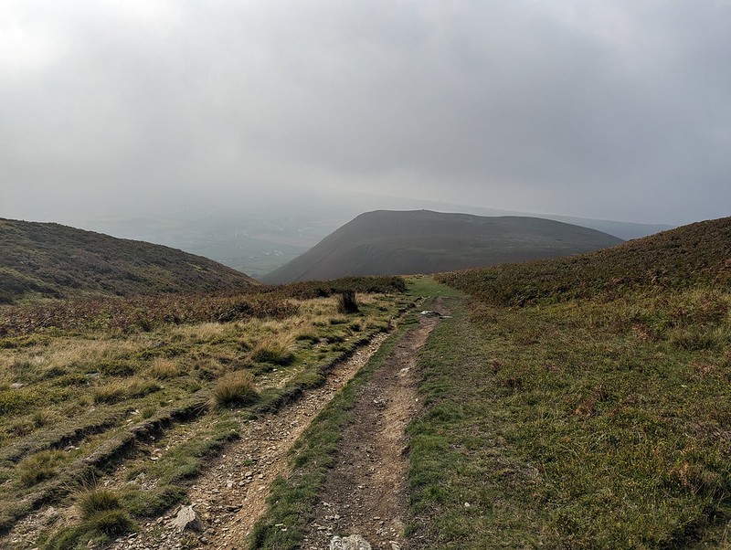
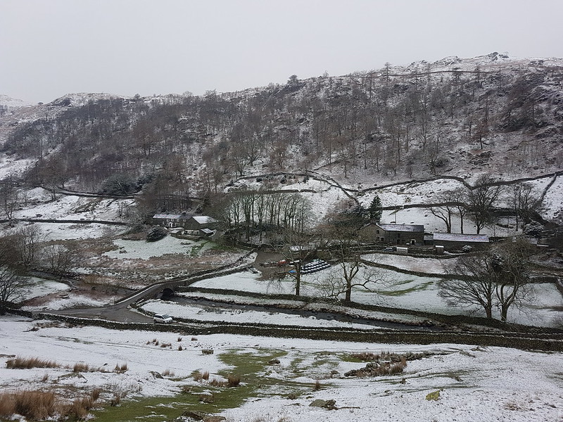
The weekend after Whit week, and I was back at Thirlmere. This time I’d parked at Steel End where, despite road signs to the contrary, the road is still open, although it is closed beyond that. The reason I’d chosen to come this way, was that last summer, when I’d been gleefully ticking off Wainwrights with abandon, I walked the boggy central spine of the Lakes, from High Raise to Bleaberry Fell, but I’d missed Armboth Fell, which lies to the east of the central ridge. (I use the term ‘ridge’ very loosely here!). After a lengthy spell of very dry weather, this seemed like the perfect opportunity to make that good. Ideally, I’d have been starting the walk from the next car park north, at Dobgill Bridge, but, as I say, the road was closed. So instead I needed to use the permission path along the lakeshore to get to my intended starting point.
Wythburn and Steel Fell.
What a happy accident that was, since this path was lovely, and absolutely stuffed with wildlife, so that the walk (and, by extension, this post too) became a bit of a hybrid between my hill walking and my slow, local walks where I stop every few steps to snap away with my camera. By the lake there were loads of birds: a Heron, Greylag and Canada Geese and lots of gulls. If I’d had a pair of binoculars with me, I’m might have been there for hours.
Common Sandpiper.
I think this might have been a juvenile sandpiper; it kept flying short distances ahead of me, so that I gradually gained on it, which strikes me as typical behaviour of a young bird. This sandpiper…
Common Sandpiper.
…was nearby and making quite a racket, so I took it to be a concerned parent. Of course, I could be completely wrong.
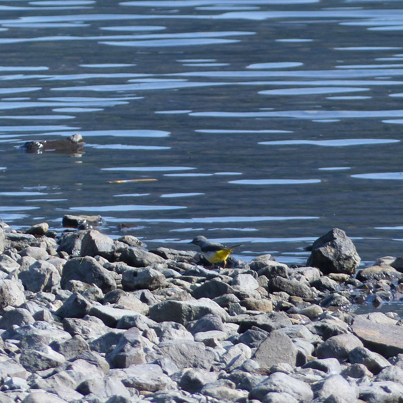
Grey Wagtail.Thirlmere.Foxgloves.Keeled Skimmer, female. My first.
The path was soon away from the reservoir shore and in the trees and I was chasing after moths and butterflies, not always with success. In particular, there were some fritillaries about which I did eventually manage to photograph, but only from a considerable distance, so that the photos are not sufficient for identification purposes. Fortunately, I would get better chances later in the day.
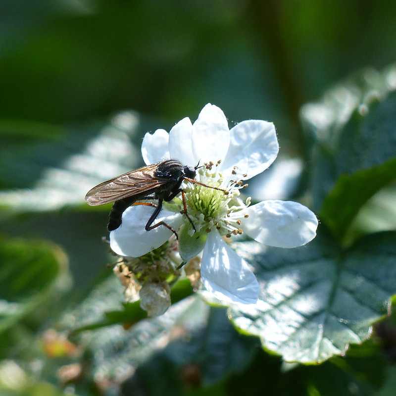
The brambles were flowering in profusion, and that seemed to attract a host of insects of various forms.
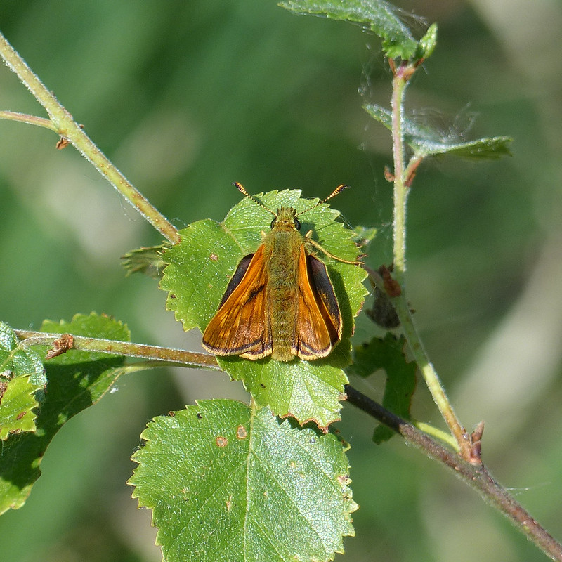
Large Skipper Butterfly.Hoverfly, Eristalis intricaria, male.
There were hosts of hoverflies and bees about, but they were extremely elusive, so whilst I have a lot of photographs, there’s only really this one which is up to scratch.
There were lots and lots of these about. They were constantly on the move, so I took loads of photographs, hoping that I would have at least one which was reasonably clear and sharp.
These flies with orange at the base of their wings were also quite ubiquitous, always on flowers.
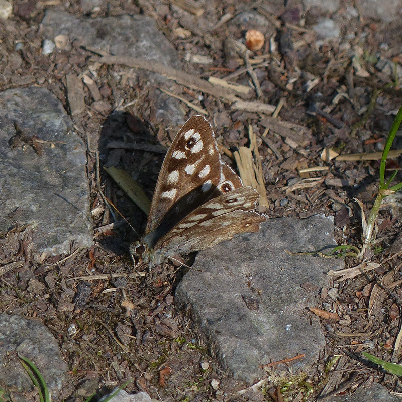
Green-veined White Butterfly.Speckled Wood Butterfly.Felled forestry by Dob Gill.
Once I reached Dobgill Bridge, I turned uphill, away from Thirlmere, on a very familiar path which had changed beyond all recognition, since the forestry through which the path used to rise had largely been clear-felled.
Small Heath Butterfly.
Once the path entered the trees, it seemed clear that it isn’t used as heavily as it used to be (before the road was closed) and the trees were encroaching on the path.
Dob Gill.Dob Gill flowing out of Harrop Tarn.
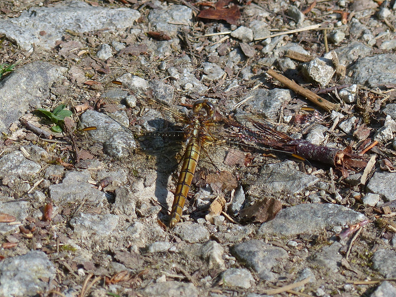
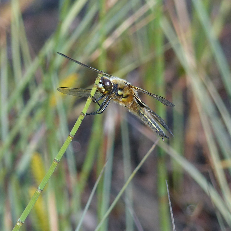
Where Dob Gill leaves Harrop Tarn there were once again lots of fritillary butterflies about, which I chased to no avail, but there were also, without exaggeration, hundreds of Four-spotted Chaser Dragonflies about, with which I had a bit more success…
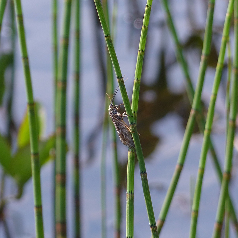
I think that this is a Caddis Fly. Closed related to lepidoptera, apparently, there are 196 species in the UK and Google Lens is not giving me much help in pinning this one down.
Bog Bean.
The Bog Bean had mostly finished flowering, so I had to content myself with a photo of this one, which was quite far out into the water.
Yellow Water-lily.Harrop Tarn.
I continued around the tarn a little way and then found a small path making a beeline for the shingle beach you can just about see on the extreme right of this photo.
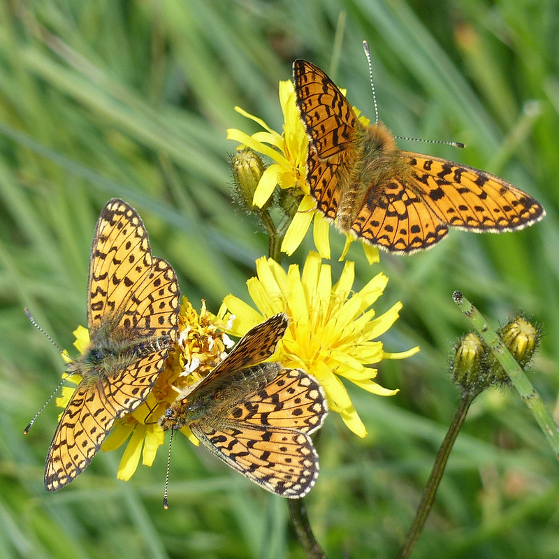
Small Pearl-bordered Fritillary Butterfly.
As I approached the tarn, I finally managed to get a photo of one of the butterflies which had been eluding me: a Small Pearl-bordered Fritillary. Down by the tarn, there were lots more…
Small Pearl-bordered Fritillaries.
I was intending to swim, but first I was distracted by a profusion of butterflies, dragonflies and damselflies which were about.
Large Red Damselfly.
When I eventually dragged myself away, the beach was perfect: it shelves steeply so that two strides and I was in. The sun shone; the water was cool, but not cold; there were constant splashes around me as fish (brown trout?) leapt from the water to take flies; dragonflies and damselflies skittered about just above the surface of the tarn. In short, it was idyllic, and I took a leisurely tour widdershins around the tarn.
Once out of the water, I was busy again taking no end of photos.
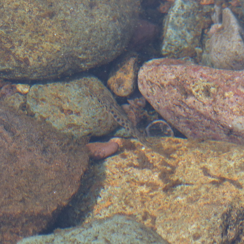
Brown trout fry?Brown trout fry?Four-spotted Chaser.Four-spotted Chaser, male.
There were both blue and red damselflies about, but predominantly red. It was hard to get photos, because they were constantly on the move, perhaps because they didn’t want to fall prey to the Four-spotted Chasers which were also abundant.
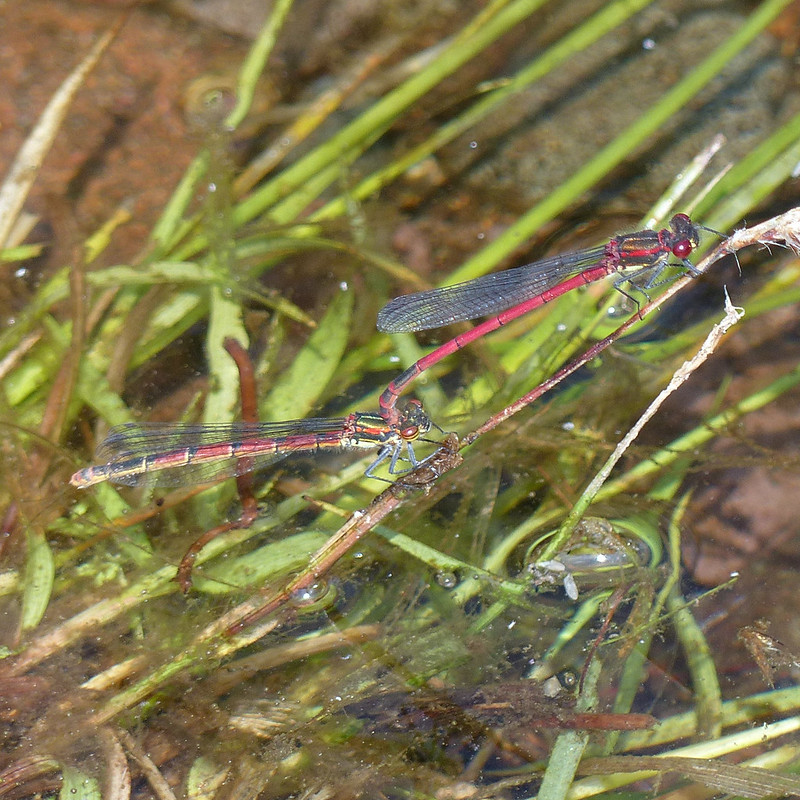
Mating pair of Large Red Damselflies.
Even the mating Large Red Damselflies, of which there were many, many pairs, kept flying about, with the male still grasping the female by the neck.
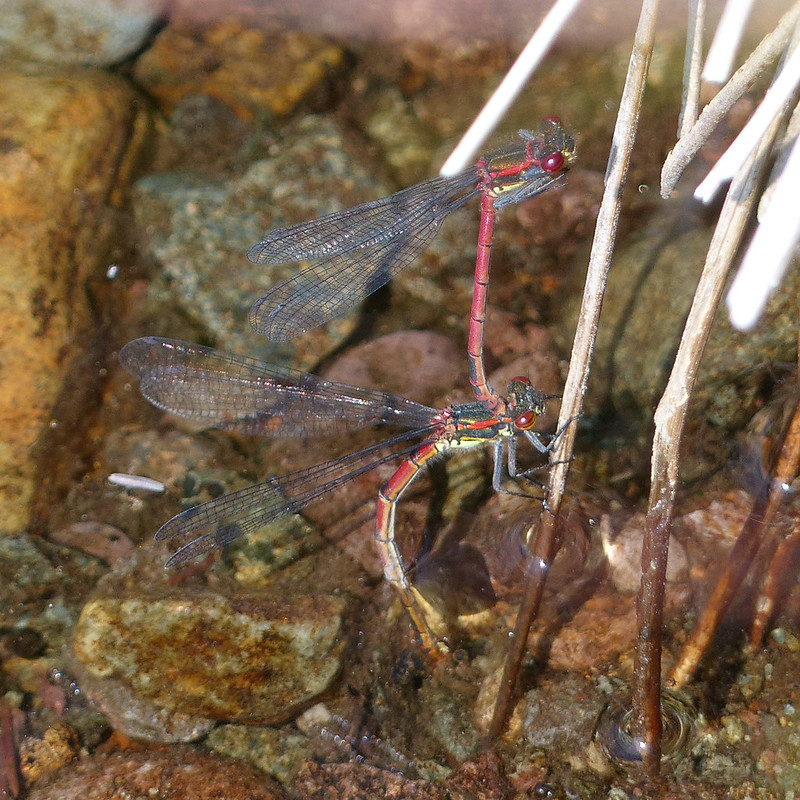
Mating pair of Large Red Damselflies.
On the right here, she is laying eggs, whilst he is still in flight, hovering, hence the blurred wings.
Mating pair of Large Red Damselflies.Mating pair of Large Red Damselflies.
I have several more photos of mating pairs, so there is obviously a healthy population here.
Wolf spiders, female and male.Golden Ringed Dragonfly flying above Mosshause Gill.
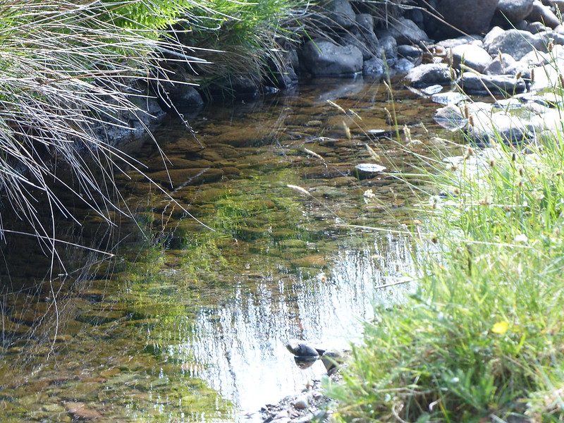
There was one, or possibly two, Golden Ringed Dragonflies flying very quickly along Mosshause Gill, which flows into the tarn near to the shingle beach. It’s a large and spectacular dragonfly, but was moving to quickly for me to manage any photographs. Since the flights along the stream were regular and predictable, I decided to stand in the stream bed to try to capture an image of the dragonflies, and you can sort of see one in the photo above. I have better photos, here from a few years ago.
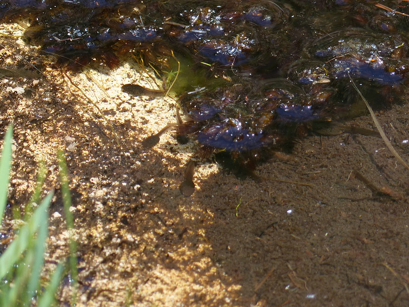
Tadpoles.
The path through the forest was hot work. When I reached open country, I turned sharp right, along the edge of the trees to head for Brown Rigg…
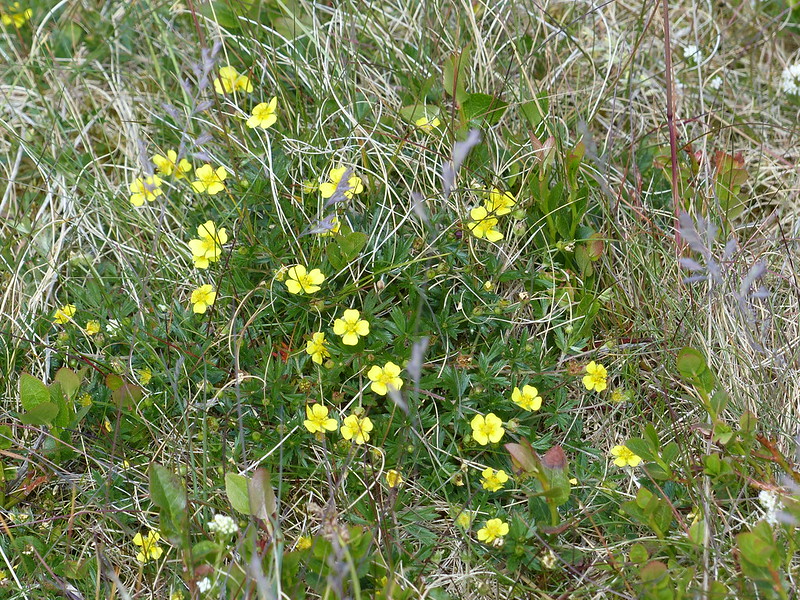
Brown Rigg.Tormentil.Blea Tarn Fell/Bell Crags.
Brown Rigg is one of those Birketts which take you off the beaten path and make Birkett bagging well worth while. From Brown Rigg there’s a fine view of a rocky little top called either Blea Tarn Fell according to Birkett, or Bell Crags in the Fellranger books by my name-sake Mark Richards.
Blea Tarn Fell from Brown Rigg.
Whatever the name, it’s a really handsome fell and another which it would be a shame to miss. First though, I had unfinished business…
Armboth Fell (in the shade).
Ordinarily, I think this route would be madness, but I was able to head down to Launchy Tarn and then climb from there on to Armboth Fell. I won’t say it was dry, but it was dry enough.
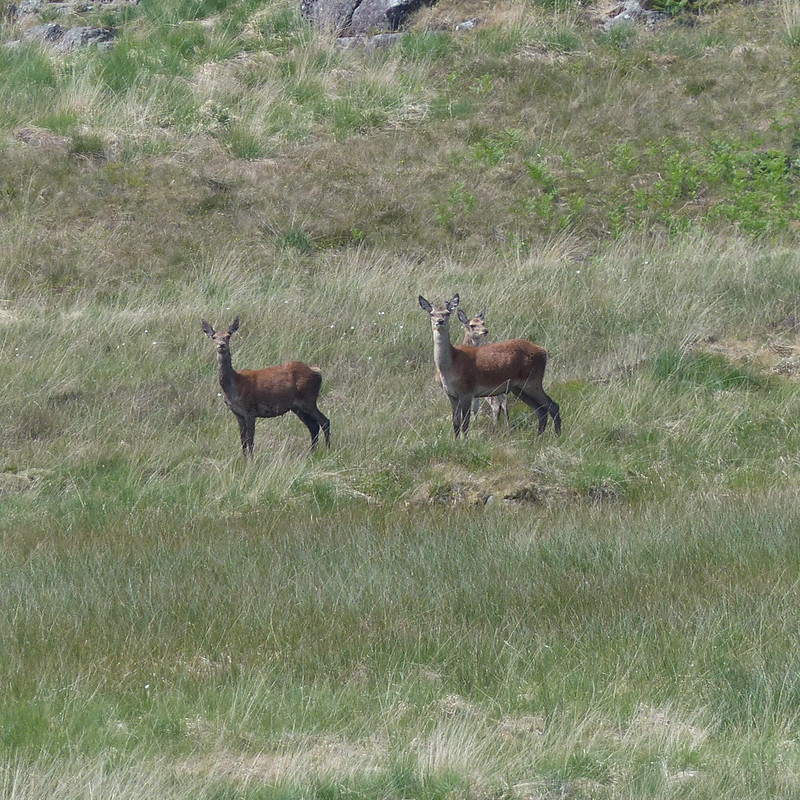
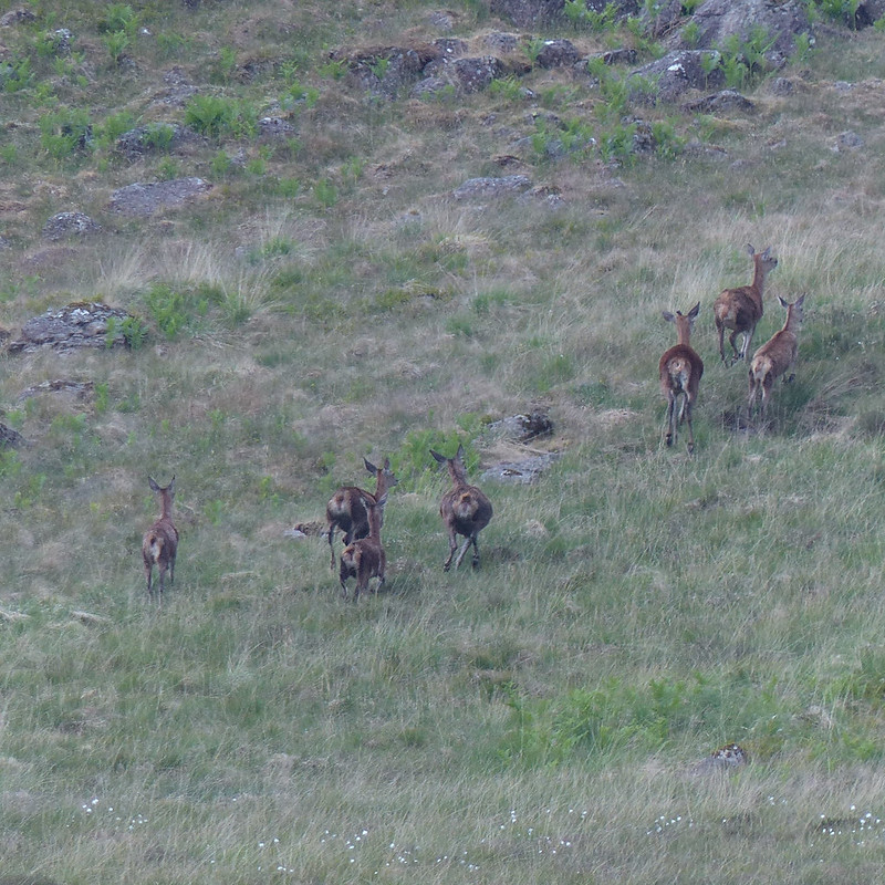
Small Heath Butterfly.Looking back to Brown Rigg.Red Deer hinds.Run away!
Years ago, I used to bivvy with friends in this area, above Harrop Tarn, and then explore the rather complex, boggy and empty terrain between there, Ullscarf and High Seat. I have a real soft-spot for this area, partly because it a great place to see Red Deer.
Another Four-spotted Chaser.
I was still seeing Four-spotted Chasers, wherever there was a bit of open water.
I had wondered about another dip, in Launchy Tarn, but it didn’t look deep enough, or particularly inviting.
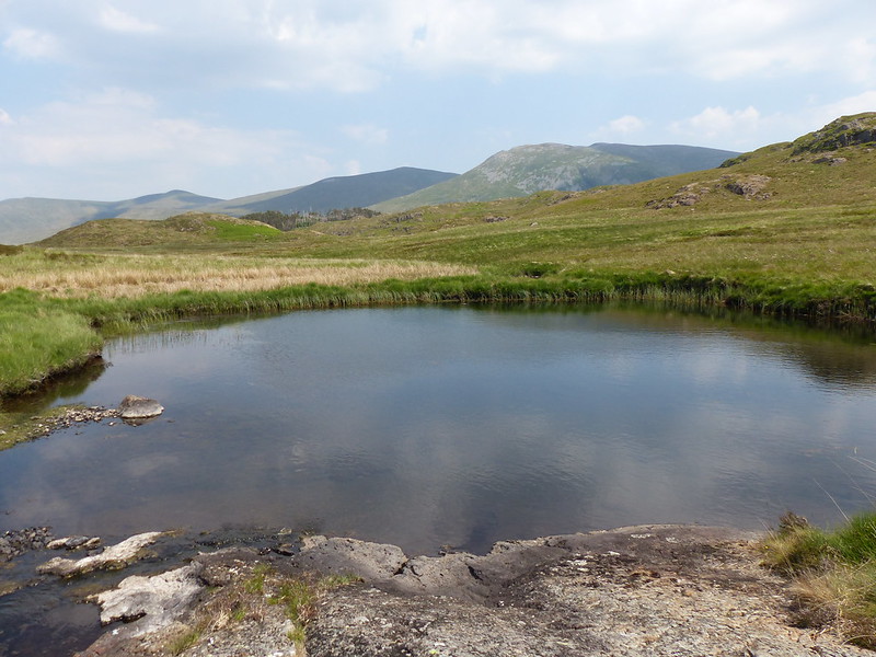
Launchy Tarn.Wild Thyme.Armboth Fell.
This rocky little rib gives Armboth Fell a quite dramatic top, not at all in keeping with the rest of the hill. I did visit a couple of other nearby knolls, just in case they were higher!
High Tove.
From Armboth Fell, it’s a fairly short walk to High Tove. I think that’s about the most that can be said for High Tove.
Looking back to Armboth Fell, Helvellyn behind.High Seat.
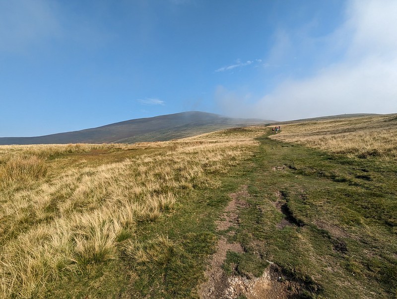
The walk southward along the ridge was actually pleasant with little sign of the extreme boginess which usually presides here. I made sure to summit every little outcrop, since there are numerous Birketts this way.
Standing Crag, Ullscarf, Low Saddle, Blea Tarn.
I had been planning to include a swim in Blea Tarn, but it had clouded up, and I suspected that time was marching on. (My new phone arrived while I was out, so without a phone, I didn’t know the time. Quite odd – but in a pleasant way, since I had all the hours that June daylight affords to complete my walk.)
Blea Tarn Fell.From Blea Tarn Fell, looking down to Armboth Fell, Launchy Tarn and Brown Rigg.
Blea Tarn Fell and/or Bell Crags really is a cracker, with superb views, I can definitely recommend it.
High Seat and Armboth Fell.Very neat sheepfold.
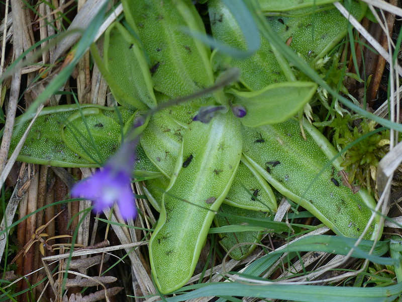
From there I returned to Harrop tarn and then took the footpath down the edge of the forestry back to Dobgill Bridge, then back along the shore to my car. The path turned out to be very rocky and a bit awkward – I think I prefer the path I used on the way up. I did see these Butterwort by going that way…
Common Butterwort.Fly trap!
“Common butterwort is an insectivorous plant. Its bright yellow-green leaves excrete a sticky fluid that attracts unsuspecting insects; once trapped, the leaves slowly curl around their prey and digest it. The acidic bogs, fens and damp heaths that common butterwort lives in do not provide it with enough nutrients, so it has evolved this carnivorous way of life to supplement its diet.”
A terrific day, with lots of interest. Harrop tarn has shot to the top of my list of favourite places to swim and Blea Tarn Fell has firmly cemented its place in my affections. I can definitely see myself coming back this way in June next year: I fancy a wild camp in this neck of the woods.
No MapMyWalk stats or map, for obvious reasons, but here’s a map so that you can trace my route for yourself:
It’s a slightly ridiculous situation that the Tower Captain and I are near neighbours, but we generally only go walking together when somebody else organises a get together in Scotland. In his defence, he is often very busy with his campanology and I, erm, can’t think of a decent excuse right now, but something might come to me if you wait? Anyway, we had that conversation at some point this year, and decided that we must make more of an effort. To that end, bless him, he booked a day off work so that we could get out during Whit. TBH elected to join us, and TC brought his spaniels, so we were a party of five. The not-so-famous five.
Beda Fell.
The route was a circuit of Boredale – Place Fell via High Dodd, Angletarn Pikes and Beda Fell. Sandwiched between two glorious, practically cloud free days, this was a bit of an oddity weather-wise. It kept threatening to rain, but equally, kept threatening to clear up too, without ever quite managing either. Out of the wind, at times it got really warm. In the breeze, it was often quite parky.
Looking back to Hallin Fell.
On the steady climb towards High Dodd, it was very warm and we stopped to cool down and to take a drink. There were lots of butterflies about I think, but none willing to pose for photos.
High DoddOn High Dodd.
We by-passed Sleet Fell, which I think is a Birkett, so I shall have to come this way again. High Dodd is also a Birkett, but not a Wainwright. It is, in my opinion, well worth a slight detour to visit.
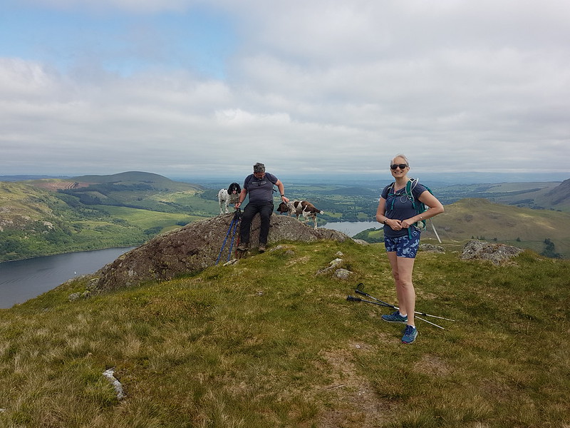
Hanley, The Tower Captain, Bramble. Gowbarrow Fell catching the sun behind.Place Fell.Where have they got to?
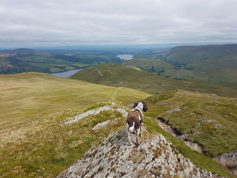
Bramble and I got a little ahead of the others on our way to the top of Place Fell, which is a bit of a novelty for me. I suspect Bramble has had more practice than I have, and kept pausing to check on the party.
Place Fell pano. Helvellyn and Dodds beyond.Almost there.Pano from the summit of Place Fell. High Street range, round as far as St. Sunday Crag.
We hunkered down out of the wind just by the summit and admired the views whilst eating our lunches. I don’t have records, but I would guess that Place Fell must be very high on the list of my most climbed Lake District hills. We had a few family get togethers at Patterdale Hostel when I was in my teens, and I’ve been back there many times since, I’ve also camped at both Side Farm and at Sykeside down by Brother’s Water on numerous occasions, so, one way and another, I’ve had plenty of opportunities to pop up Place Fell.
A view down to Brother’s Water.Brother’s Water and the hills around Deepdale. The long ridge of Hartsop above How prominent.Sheffield Pike, Ullswater and Place Fell.The onward ridge.Looking back to Place Fell.Beda Fell.Extra layers donned.Boredale and Beda Head.The Nab.A long steady descent – the best kind!
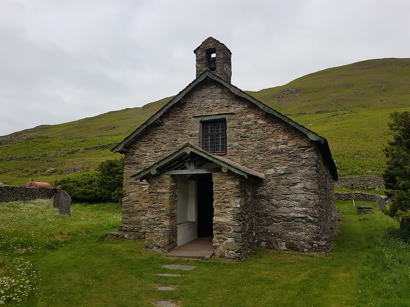
The final part of our route gave us a chance to visit both of Martindale’s churches, which I’ve been meaning to do for a long time.
St. Martin’s. Martindale ‘Old’ church.
Apparently, the ‘old’ church was built in the sixteenth century, although the first reference to a church here goes back to 1220, and one of the Yewes is 1300 years old.
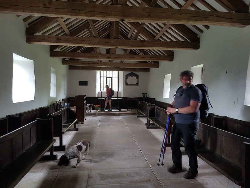
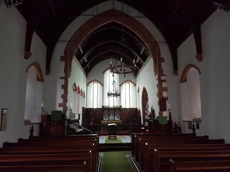
Simple, spartan interior.St. Peter and St. Martin, Martindale.
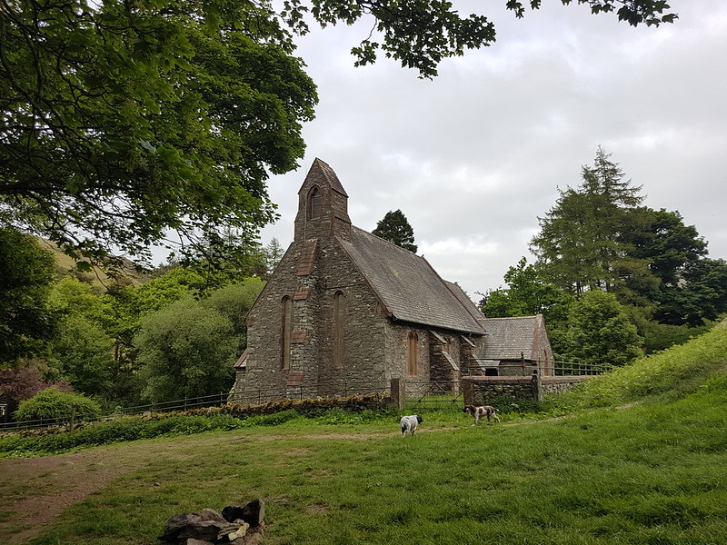
The other church was built in the 1880s.
Interior.
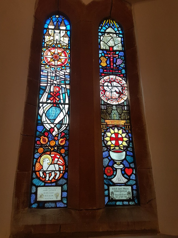
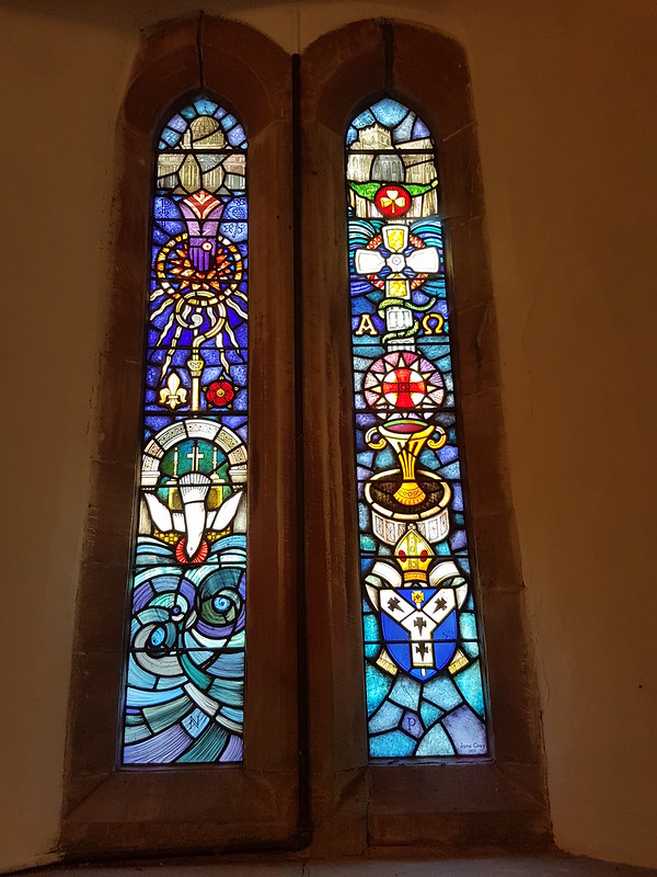
I was very happy, because it has stained glass windows, by the artist Jane Grey.
They’re wonderfully colourful windows, so I’m not sure why I only took pictures of three of them. I suppose that gives me the excuse I need to pay another visit sometime.
I also need to nag TC about another walk. We need to get some training in before our next projected Glen Coe trip.
The blues in all of these windows are fantastic.
A fabulous day, and three more Wainwrights ticked off in my not-so-relentless rebagging round.
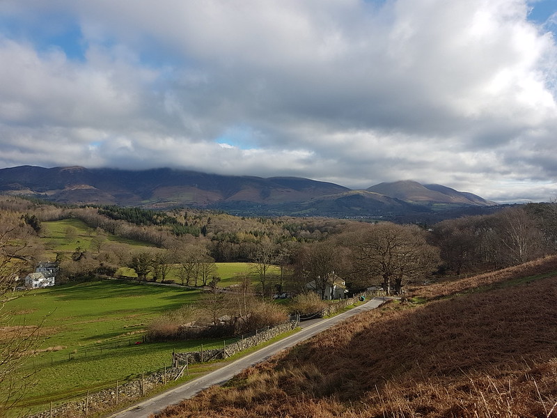
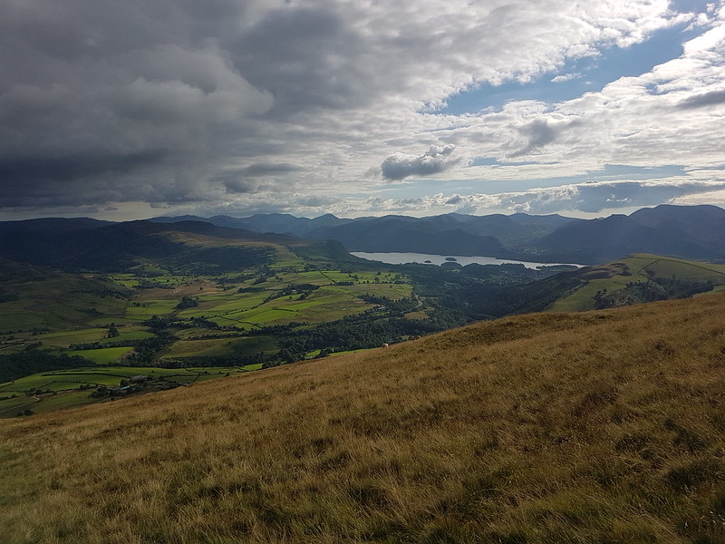
Skiddaw and Blencathra clothed in clouds. Latrigg sensibly sitting beneath them.
April Fools’ Day – the start of our Easter Holidays. The kids all had exams coming up (they’ve finished now of course), so we had no plans to go anywhere, but luckily for us, there’s plenty of nice places not too far from home.
From Skellgill Bank – Swinside, Skiddaw, Blencathra and Derwentwater.
The forecast let me down a bit – low cloud was predicted, but it was supposed to lift and clear; which it did briefly, although I don’t think Skiddaw ever fully emerged, and then the cloud swept back in again and there were some lengthy showers later in the day. Not to worry – I had a good day anyway.
I started on Cat Bells, with fabulous views both across Derwentwater and into the North-Western Fells.
Rowling End, Causey Pike and Barrow.Looking ahead to Cat Bells, Maiden Moor, Hindscarth and Robinson.The North-Western Fells.Looking down into Borrowdale.
Dropping off Cat Bells brought some welcome shelter from the cold, northerly wind and I stopped just short of the hause for a first hot drink from my flask, to enjoy the view down into Borrowdale and, if I remember right, to chat to my mum and dad about my plans to fetch them, a couple of days later, for a visit.
Bassenthwaite, Cat Bells, Skiddaw, Derwentwater and Blencathra.The North-Western Fells again.Dale Head and Hindscarth from close to the summit of High Spy.Dale Head – weather deteriorating.
I found another spot out of the wind as I descended towards Dalehead Tarn. The weather was clearly deteriorating at this point, and it was obvious that it would be raining soon. In fact, it started not long after I’d stopped for another drink and some lunch; but actually, hunkered down amongst some rocks, I was pretty comfortable despite the rain.
Classic Dale Head view down to the Newlands Valley.
Cloud was swirling around Dale Head as I reached the summit and I was pretty lucky that I could still see the tremendous view down to the Newlands Valley. I think this is the fifth time that an ascent of Dale Head as featured on my blog. I remember climbing here from the old Youth Hostel at Honister Pass in September 1985 – although that may not have been my first ascent. There were many other visits between that one and the five that I’ve written about here. Although I’m extremely fond of Dale Head, I’ve never consciously decided to make it one of my most climbed hills in the Lakes – it just seems to have turned out that way. In the meantime, it’s many years since I’ve been up, for example, Great Gable or Kirk Fell.
High Crag, High Stile, Red Pike and Buttermere.
I’d originally planned to include both Hindscarth and Robinson in this round, but the cloud had rapidly dropped and with no view from Hindscarth, and plans for the evening which didn’t really leave me enough time anyway, I decided to leave Robinson for another time. (The reascent onto Robinson might just have been a factor too!)
The long ridge off Hindscarth, Robinson on the right.
That decision also had the happy consequence that I got to descend the long ridge from Hindscarth over High Crags and Scope End which is a lovely route.
Newlands Beck.
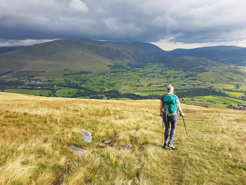
With five Wainwright’s checked-off – Cat Bells, Maiden Moor, High Spy, Dale Head and Hindscarth – I passed into triple figures of hills coloured in, since Christmas 2022, on my ‘new’ Wainwright map. After my raging full-on approach last year, I’ve adopted a more relaxed attitude so far this year. Much as I enjoyed some of those big days, I did begin to wonder if it wasn’t more sensible to ration the hills a bit. Also, I was beginning to miss my regular visits to local hills outside the Lakes and particularly the varied delights of my Lune Catchment outings. To be honest, I’m also a little put off by the longer drives needed to clear-up some of the more remote areas which I’ve so far neglected.
Dramatic light on Keskadale.
The views from the path across the fields from Little Town back to where I was parked near Skelgill were terrific; a reminder, if it was needed, of how superb a low-level walk in the Lakes can be.
A smidgen under 11 miles and around 3000 feet of up and down, according to MapMyWalk.
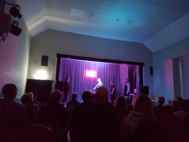
Happy Place
Later, we were at the Arnside Educational Institute for a performance of ‘Happy Place’ by Forget About The Dog theatre company. (Sorry about the rotten photo!) It was superb. I shan’t attempt to precis the story, but it’s a sci-fi, comedy, musical about fantasies and friendships, was highly inventive, brilliantly performed and very, very funny. My in-laws saw it, in Hamsterley Village Hall I think, the night before, and they loved it too.
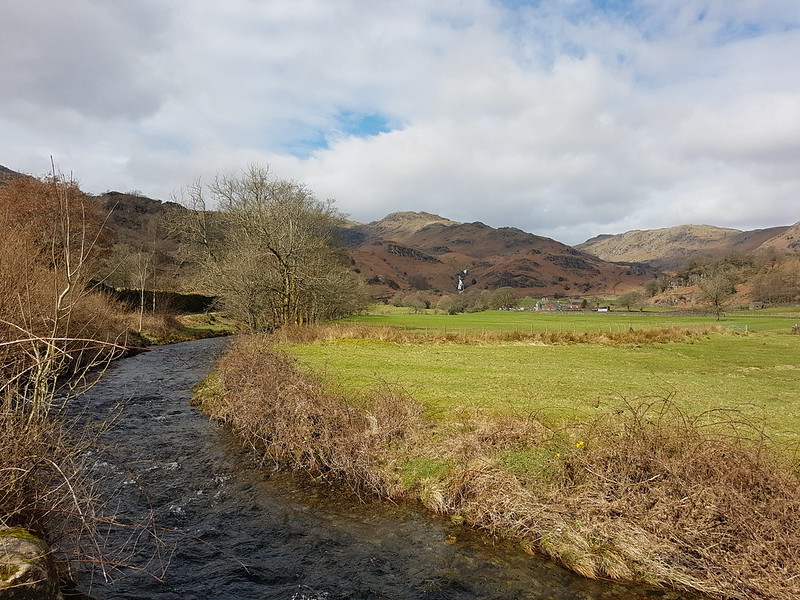
The last Sunday in March. TBH wanted another training walk, but this time of only eight miles. I thought we could kill two birds with one stone and mop up Blea Rigg which, during my Wainwright bagging frenzy last year, I managed to omit.
Sourmilk Gill, Tarn Crag and Gibson Knott.
It was a bit of a mixed day, with a cold wind and, later in the day particularly, some drizzly rain, but with occasional sunshine and even one or two quite warm spells.
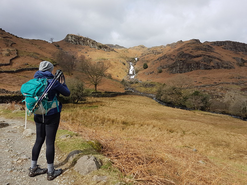
TBH photographing waterfalls on Sourmilk Gill.
It’s familiar territory this, being relatively accessible from home, but a great area, so always worth another visit.
At the top of the falls.Easedale Tarn and Tarn Crag.
TBH hates to wait for her lunch, feeling that it should always arrive on the dot of midday. By the time we reached Easedale Tarn we’d been on the look-out for a likely-looking spot for some time and she was, apparently, approaching starvation. Fortunately, the slight descent here towards the tarn took us out of the wind and gave us just the shelter we needed for a comfortable refueling stop.
Easedale Tarn pano.Easedale Gill and Belles Knott.Looking back to Easedale Tarn, Seat Sandal, Fairfield, Great Rigg and Stone Arthur. Belles Knott and Easedale Gill again.Looking back again – the stream which flows from Codale Tarn looks worthy of investigation.TBH on the slabs above a surprisingly awkward scrambly section of path.Looking back again – Belles Knott, on the left, not quite as dramatic from this direction.
This was the sunniest and warmest part of the day, and very pleasant indeed.
Codale Tarn – a great spot for a swim, but maybe not in March.
Looking at these photos, and at the map, this area has many great places for a dip. I find myself wondering how many I could string together in a single route. The thing is, I’ve tried this a few times before, and the answer is always: less than I think. I probably need to learn to just enjoy a swim or two and accept that, in this regard at least, less is more.
Codale and Easedale Tarns pano.On the Blea Rigg ridge.Harrison Stickle, Pavey Ark and Stickle Tarn – in the first of many showers.Frogspawn.The tarns near Lang How – raining again.Grasmere, Rydal Water, Loughrigg and Windermere from Silver How.A steep descent towards Grasmere and Rydal Water.Descending back to Grasmere.
In the event, the route was a little over nine miles.
Oh, and, spoiler alert, TBH did her Mighty Hike on Saturday. It went well and she enjoyed herself. I shan’t take all of the credit, but no doubt my carefully planned training routes were key to her success! B has subsequently suggested that we should all take part next year. One to ponder.
It was a strike day. I was on the picket line as you can see!
You can see my car in the photo, the only one in the parking space at Sadgill, at the end of the metalled road along Longsleddale. Admittedly, I’d got there fairly early – but, at the weekend, the limited spaces here fill up very quickly. On this midweek day in March, there were eventually three cars. The weather wasn’t ideal, I’ll grant, but the MWIS forecast had actually suggested that the cloud would be lifting off the hills in the Eastern Lakes. It didn’t.
Looking up Longsleddale.
It’s not marked on the map, but there’s a path signposted from the parking area which heads directly uphill towards Great Howe – I’d noted it on a previous visit and had in mind to try it out.
The same view from just before I entered the clouds.
I haven’t been carrying my stove this winter, settling instead for a flask of hot cordial and an insulated mug of tea. I stopped to drink the tea, and to video-call my mum and dad, when it was evident that I would shortly be entering the cloud and losing the view.
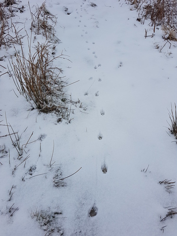
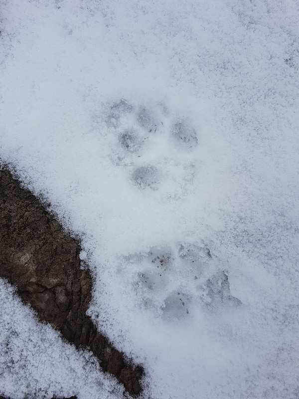
Looking down Longsleddale.Typical view for the next few hours.Fox tracks?
Throughout the day the paths had tracks like these, often two or three sets, along them. When the guy who had arrived in the second car in the car park overtook me, he expressed surprise that I didn’t have a dog with me, but I think the tracks were actually made by a fox or foxes.
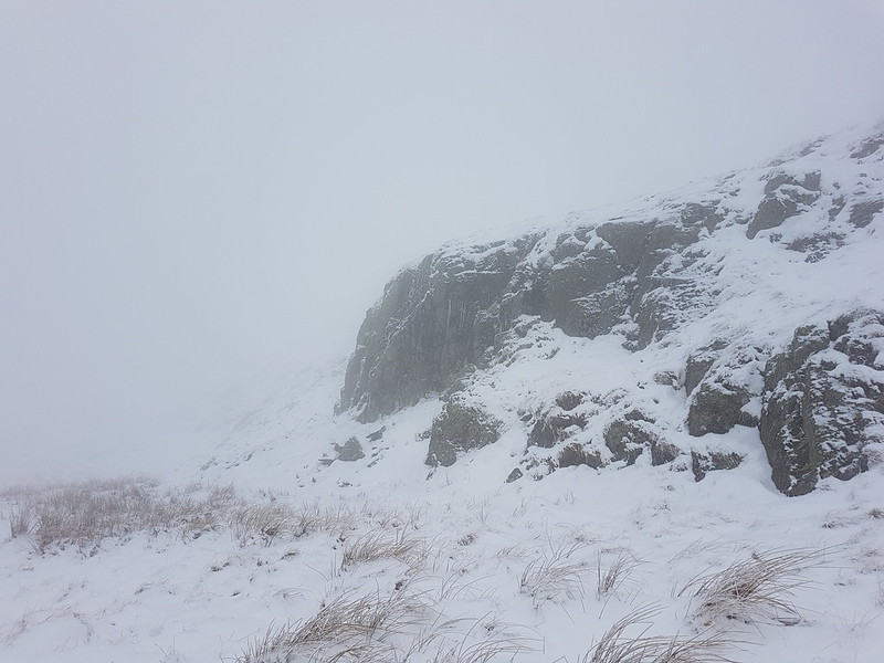
Fox prints?Crags looming out of the mist.
Visibility was poor, but with the OS map to help, navigation was relatively easy. Judging distances and the size of things can be difficult however. Suddenly a rise will loom up, looking huge, but then turn out to be negligible.
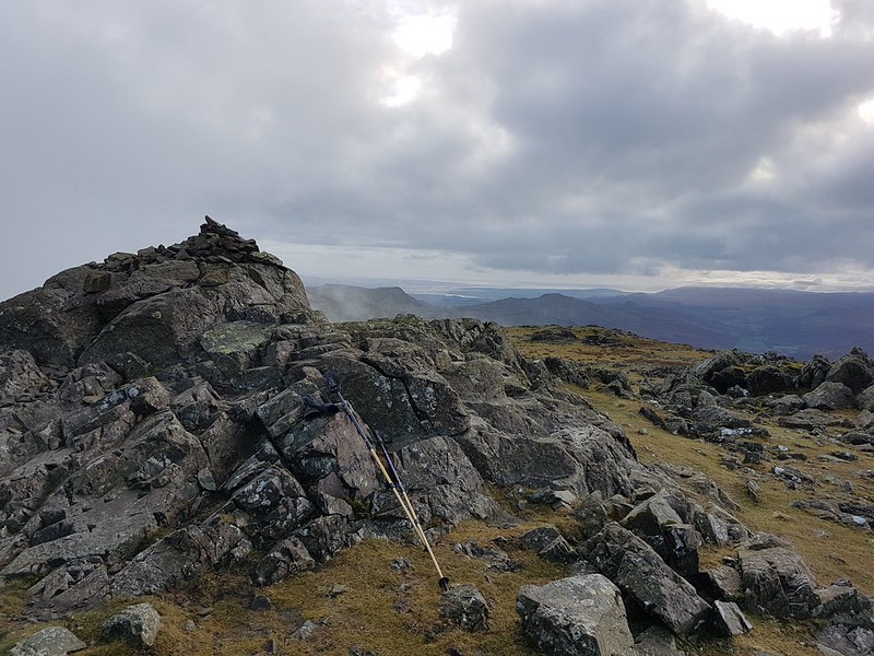
Yours truly on Grey Crag.
I thought the area marked on the map as Greycrag Tarn (where there is no Tarn) might be awkward to navigate, both in terms of not losing the way and because it looks boggy on the map. In the event, I just stuck to a bearing, which worked really well, and I didn’t encounter anything too sloppy for Malcolm’s boots to cope with.
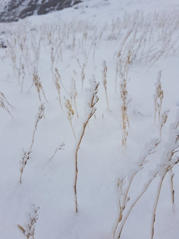
Ice covered grass stems.
It had become quite windy, and before beginning to climb again toward Tarn Crag I found a marvellously sheltered spot to drink some hot cordial, eat my lunch, and admire some icicles.
Icicles.Yours truly and the survey pillar near the top of Tarn Crag.Fence – a handy navigational tool.Descending out of the cloud to Brownhowe Bottom.Steel Rigg and Raven Crag.Heading down in to Longsleddale.Waterfalls in Wren Gill. Or is it Cleft Ghyll?Longsleddale after a significant thaw.
A couple passed me as I finished my cordial beside the track down into the valley. They must have arrived in the third car. That was all the people I saw during this walk.
Galeforth Gill – a good alternative way up.
There’d been a significant thaw; the treacherous layer of verglass, which had coated the surface of the track when I’d arrived, had now gone. I’d been a bit concerned about descending the track in such icy conditions so wasn’t upset to see the change. The axe and crampons I’d lugged around all day, didn’t get put to use. Despite the far from perfect weather, I’d really enjoyed having a day out in winter conditions. Now, how I could I engineer more walking on quiet days when everybody else is at work…?
I can dream!
It turns out it was almost exactly ten years after my last ascent of these two hills. And quite a few years since I brought the kids to Longsleddale for a swim.
Waterfall on Tarn Beck near Seathwaite in the Duddon Valley.
When, last January, in the first flush of enthusiasm for my new assault on the Wainwrights, I tackled the Coniston Fells in less than optimal weather conditions, I chose an inefficient route taking in the three central fells of the range and leaving three scattered outliers – Dow Crag, Grey Friar and Great Carrs. With hindsight, I think that this is no bad thing, since it gives me an excuse for more walks in the area.
So, this mid-November Saturday found me parked on the roadside by Tarn Beck, just outside Seathwaite in the Duddon Valley.
Another waterfall on Tarn Beck.
It was a glorious morning, and very quiet in Seathwaite, in stark contrast to what I might have expected on the Coniston side of the hills.
Heading away from Seathwaite.Harter Fell.
Harter Fell tended to dominate the views on this walk and I took lots of photographs of it, many of which, but by no means all, have made it into this post.
Tongue House.Throng Close and Tongue House Close. Tongue House High Close is slightly out of the picture to the right.
The Coniston Fells are liberally supplied with crags and hows and pikes and this western side is no exception. The path climbs between Tongue House Close and Tongue House High Close, just right of centre in the photo above.
Harter Fell pano.Grey Friar.
The path I had chosen fell away slightly leftwards here, towards those shaded crags on the slopes of Troutal Fell, the south-west arm of Grey Friar. Between here and those crags, the path crosses Tarn Beck. There’s no footbridge marked on the map, but this is the busy, touristy Lake District – there’ll be a bridge surely?
Harter Fell again, and Cirrus clouds – a sign of what was to come?
The ground descended very gently towards Tarn Beck and was quite boggy. When I reached the stream…
Tarn Beck again.
…it was to discover that there is no bridge. What’s more the stream was large and deep and fast-flowing.
It was so sunny at this point that I actually contemplated a swim, but sanity prevailed, in part because of how fast the stream was running. I hate to think how cold the water would have been.
Since I clearly couldn’t cross Tarn Beck without a dip, I followed it instead and then cut up to the dam of Seathwaite Tarn…
Seathwaite Tarn pano.
I paused on the dam to take several photos of a lone Goosander, none of which came out very well.
The rough rocks of Tarn Brow and Cirrostratus – another warning sign!
The early part of the steady climb away from the tarn was enlivened by the presence of numerous brightly coloured waxcaps…
Waxcap.Waxcaps.
Naturally, I took loads of pictures, but I’ve restricted myself to just two here.
Brim Fell and Dow Crag.
In my mind, Dow Crag is always associated with the eponymous crag above Goat Water, with the south ridge over Brown Pike and Buck Pike and with Easy Gully, which is far from easy and which I haven’t ascended for many, many moons. It was good to see it from this less familiar perspective.
Harter Crag, with ominously dark skies behind.Looking north – the Scafells capped with cloud.Looking south-west, back to the Duddon Valley. Oh no!Brim Fell and the Old Man – just evading the clouds.
Sadly, I arrived at the summit cairn on Grey Friar at the same time as the low cloud brought by the encroaching weather front. I was lucky to still have some views, but not the spectacular views I might have expected given the open blue skies at the start of the walk. In addition, the temperature had dropped appreciably and, without the warming sunshine, it now felt very much like mid-November in the hills.
Grey Friar summit. And very grey weather.
I found a sheltered spot for a quick drink and a snack. Truth be told, as usual, I had an overly ambitious plan B which involved climbing the main ridge and completing a horseshoe round to Dow Crag. It was clear though that I didn’t have the daylight hours left for that route, or the weather to make the extra effort worthwhile.
One last, contrasting, view of Harter Fell.
So, I beat a hasty retreat, retracing my ascent route initially, before following a track down, which gave very easy walking and which is presumably a remnant of the construction of the Seathwaite Tarn dam.
Looking down to Seathwaite Tarn.Seathwaite Tarn pano. Dow Crag now lost in cloud.
Presumably due to the lack of retail outlets and other tourist attractions, the lovely Duddon Valley often seems to be relatively quiet; I saw very few other walkers on this outing. When I get around to ticking-off Dow Crag I think I shall have to do it from this side for a change.
August Bank Holiday Monday, the final day of my long, eventful summer break, and TBH was keen to get out and climb a hill. We settled on Blencathra. We were very lucky and managed to find street parking in Threlkeld.
In the early part of the ascent – Doddick Fell ridge on the skyline.
The sun shone intermittently and it was even quite warm for a while. We were heading around the base of the hill, aiming for Sharp Edge, but when we reached Scaley Beck there was a steep little rock step to negotiate, down into the beck and I didn’t like the look of it, so we turned back for Doddick Fell instead.
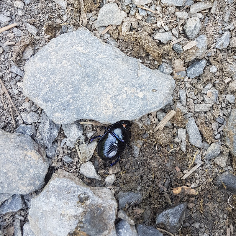
Looking to Clough Head.Dor Beetle – with tiny mite piggybacking on it’s head.Great Mell Fell.On the path which skirts the edge of the access land.
We’d not climbed far up Doddick Fell when some unforecast drizzle materialised. Just after we’d stopped for lunch!
Early lunch stop in the drizzle – showers over Clough Head.Hall’s Fell Ridge, Hallsfell Top, Doddick Gill and DoddickFell.
Doddick Fell turned out to be a marvellous route up Blencathra. I suspect all of the many ridges are worth a look.
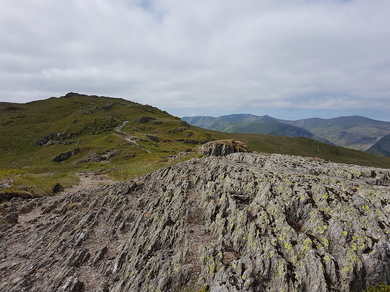
A little further up Doddick Fell. Rather splendid.Looking down Doddick Fell to Clough Head.Looking down Doddick Fell.Almost there.Looking down Doddick Fell from the top of the ridge.Scales Fell and the Pennines beyond.Hallsfell Top.Sharp Edge and Scales Tarn.Sharp Edge pano. (Click on this, or any other pictures to see larger images on Flickr.) Gategill Fell and Derwentwater.The Skiddaw massif. Criffel in the background?Blencathra pano 1
The views from Blencathra were superb. What’s-more, it wasn’t busy at all.
Looking over Mungrisdale Common to Great Calva and Knott.Blencathrapano 2.Blencathrapano 3Blencathrapano4Looking back up to the top.
We’d had another spell of sunny weather, but, as we started to descend, a band of ominous black clouds swept in from the East.
Clough Head, The Dodds ridge and Thirlmere.
It was very dramatic and I took no end of photos of Clough Head and the Dodds as the black cloud breezed over them.
Clough Head, The Dodds ridge and Thirlmere.Brooding skies, Derwentwater and the hills beyond.
We took the Blease Fell path down – one I knew to be easy-angled, pleasant walking.
An easy descent on Blease Fell.Almost down.
Last time I was up Blencathra, I was in the cloud the entire time, so this was a very welcome change.