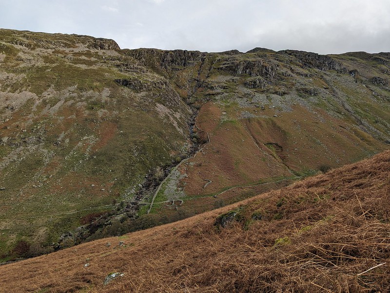
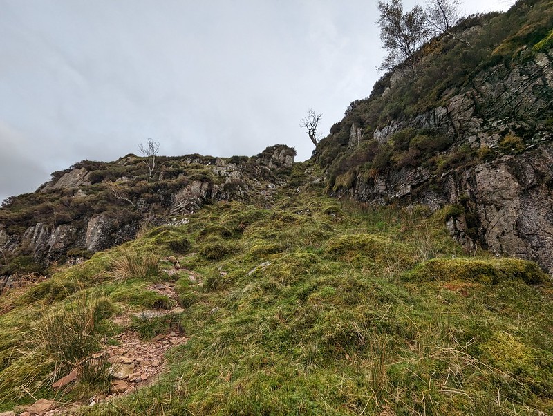
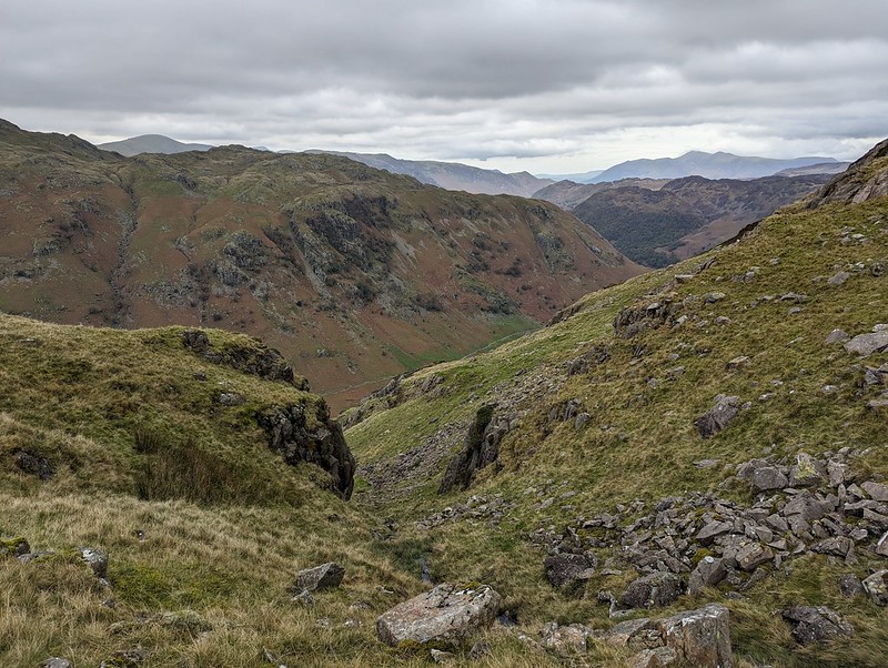
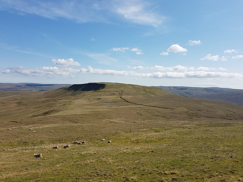
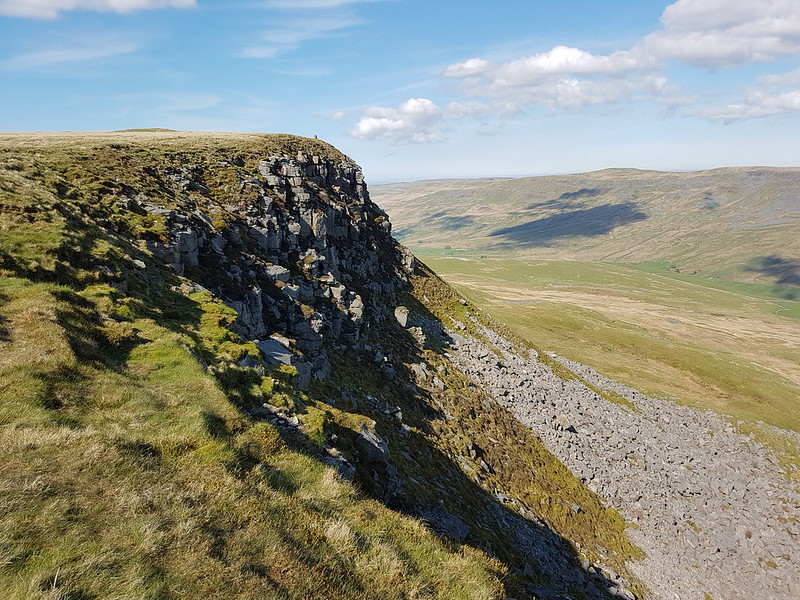
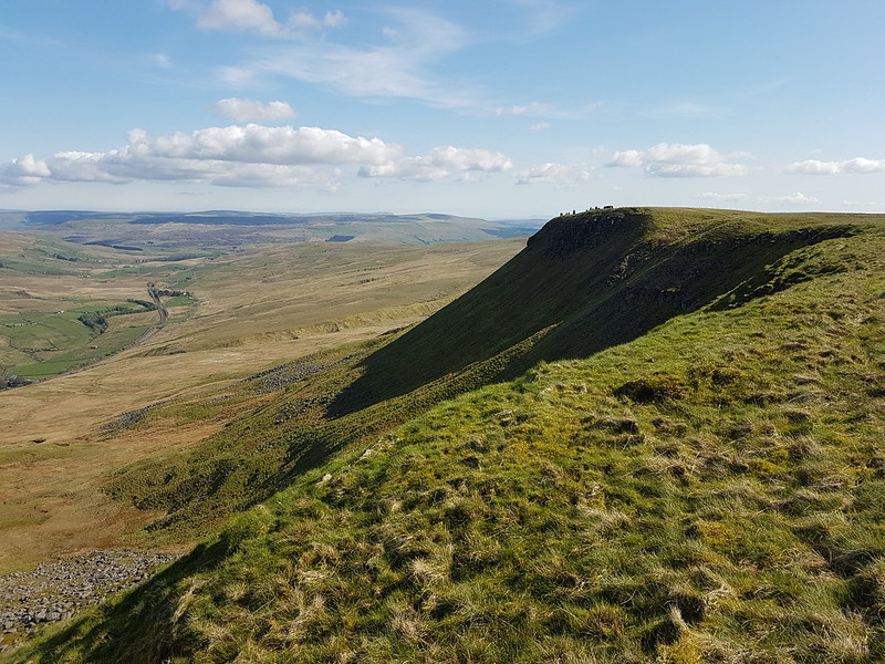
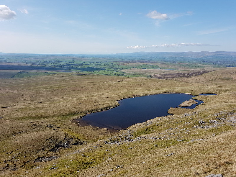
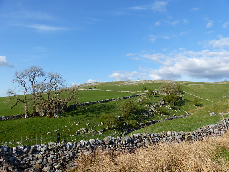
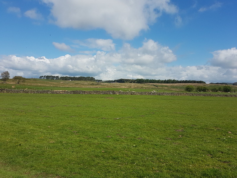
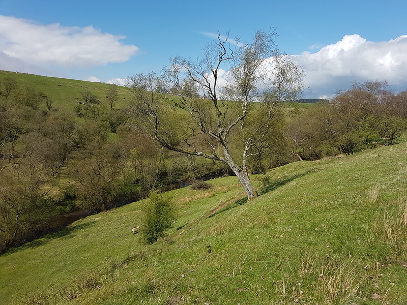
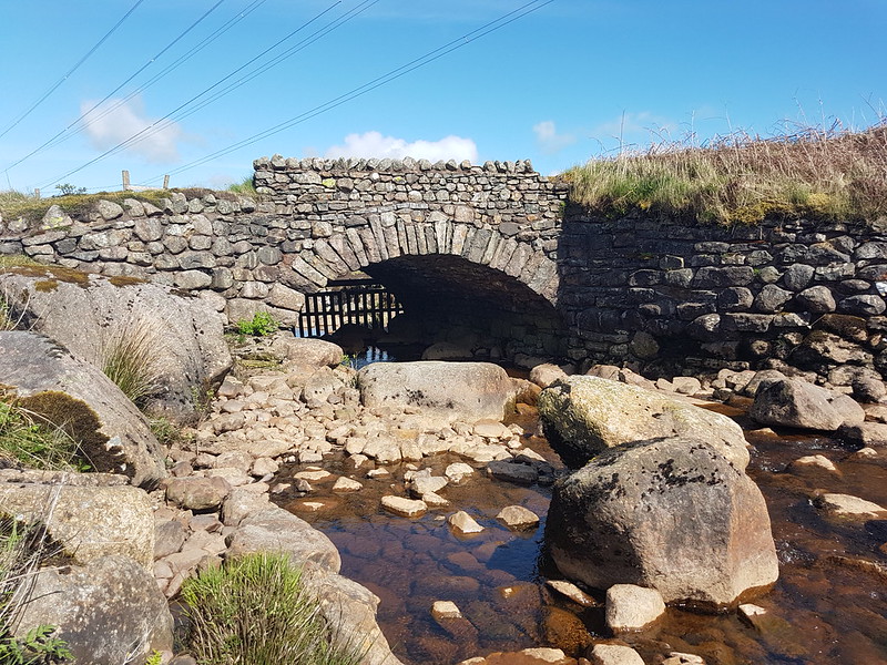
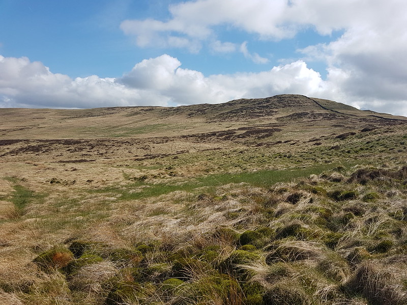
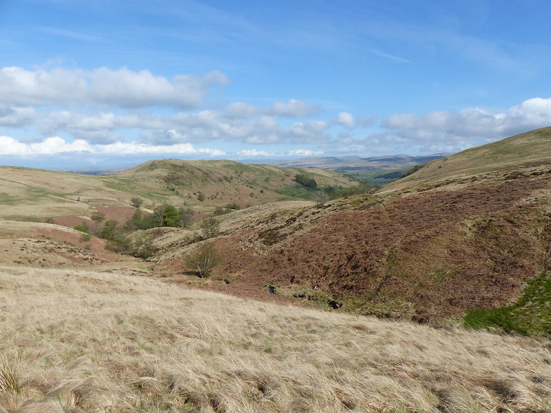
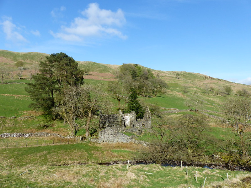
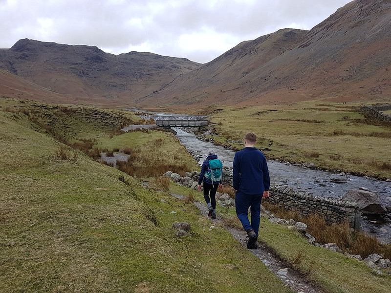
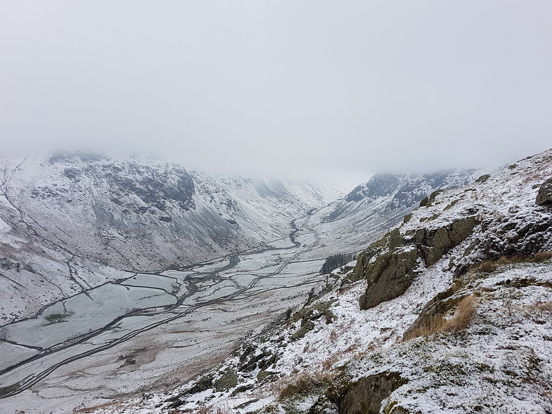
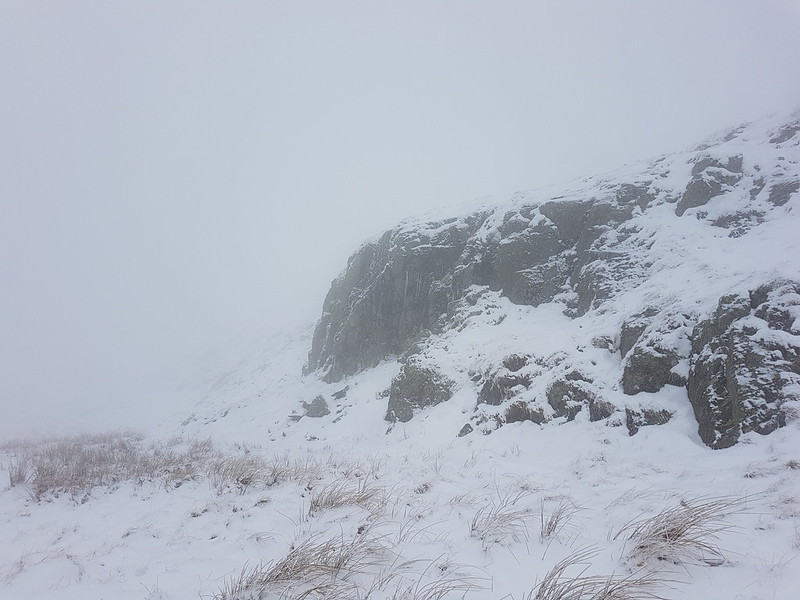
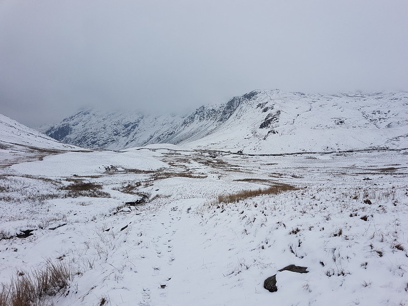
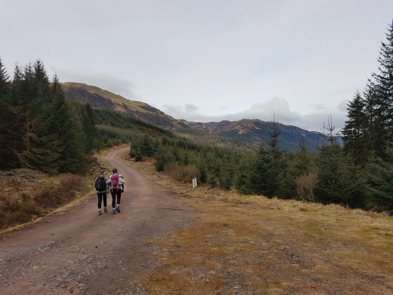
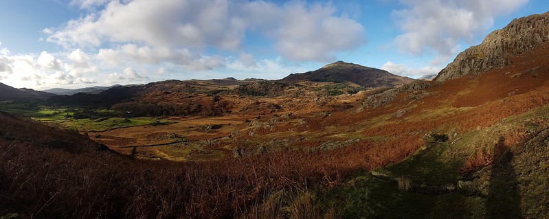
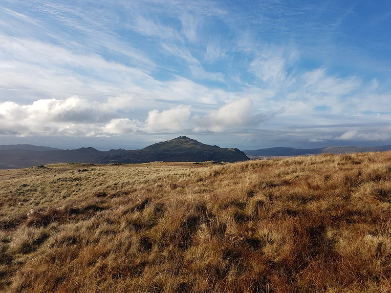
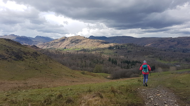
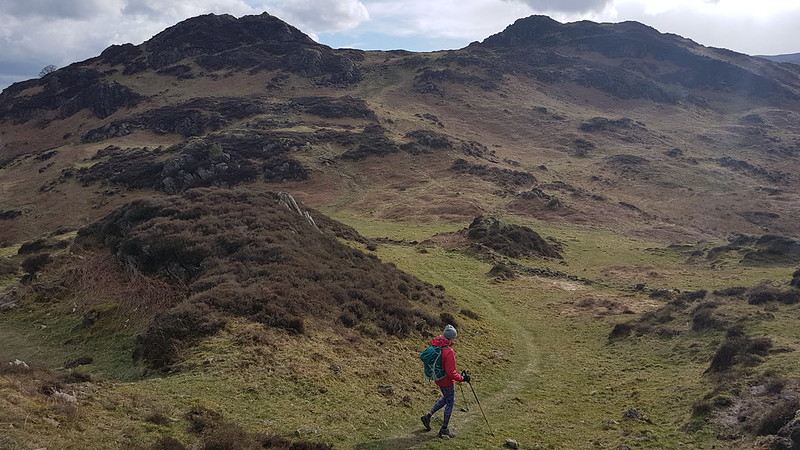
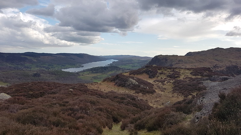
An October outing up two Wainwrights which I’ve never climbed before. Not sure how I’ve managed to avoid them. Anyway, my mistake: they were well worth a visit. In the photo above, you can see that there’s a lot of steep stuff on Eagle Crag and it’s not immediately obvious how you’ll get up there, but fortunately it’s all plain sailing; the path winds round to the left of the first knoll, Bleak How, and then finds a passage through the remaining complexities.
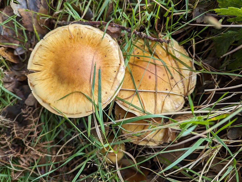
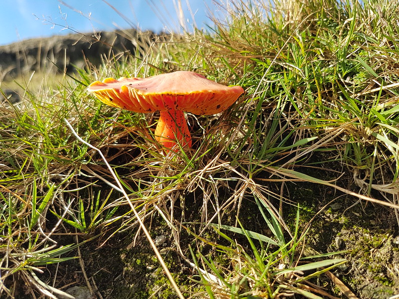
Fungi.
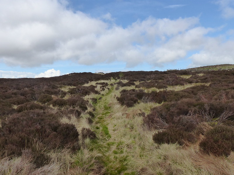
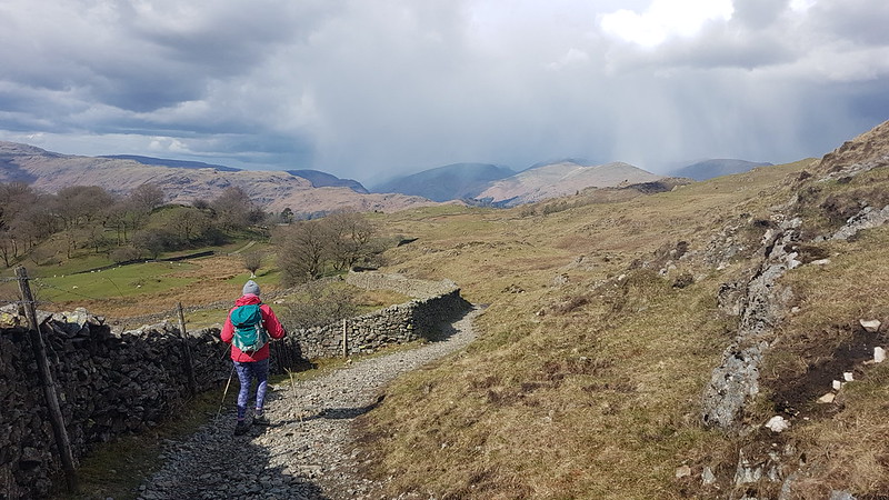
Having said that, after the initial easy plod along Stonethwaite Beck and then a boggy bit of field, I turned away from the valley path either too late or too early and then found myself fighting spiky, crumpled bracken uphill, but eventually managed to reach a sketchy path by the wall which then lead me around the craggy parts of Bleak How and on to the ridge.
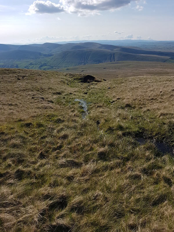
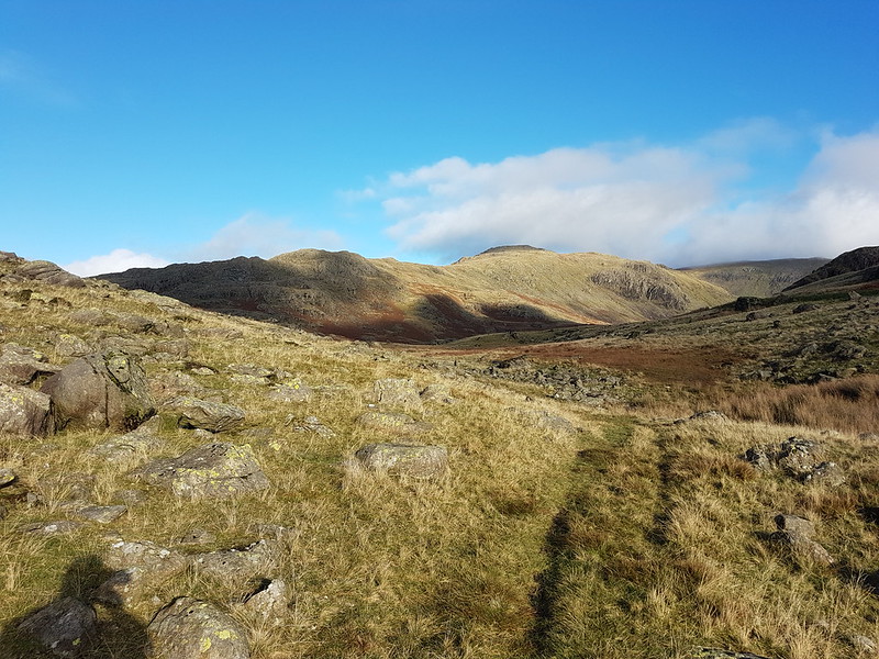
Long Band on Coldbarrow Fell.
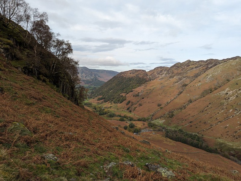
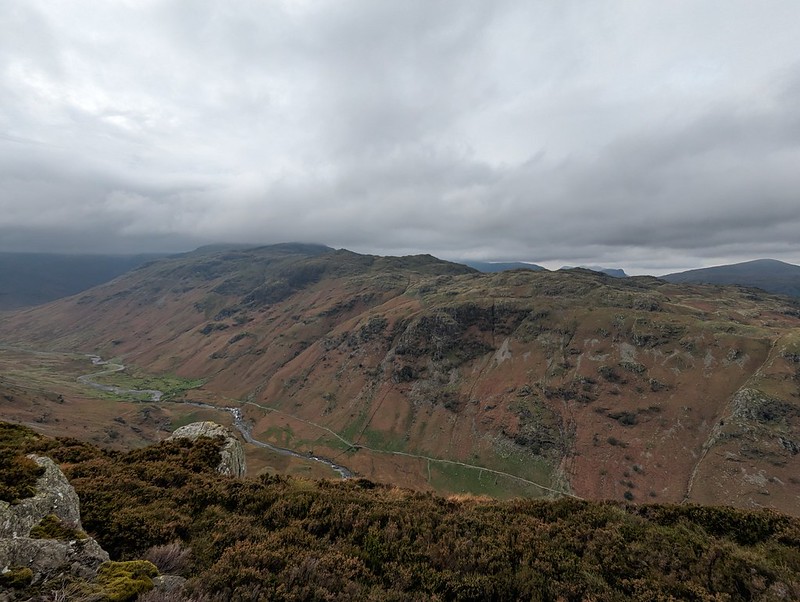
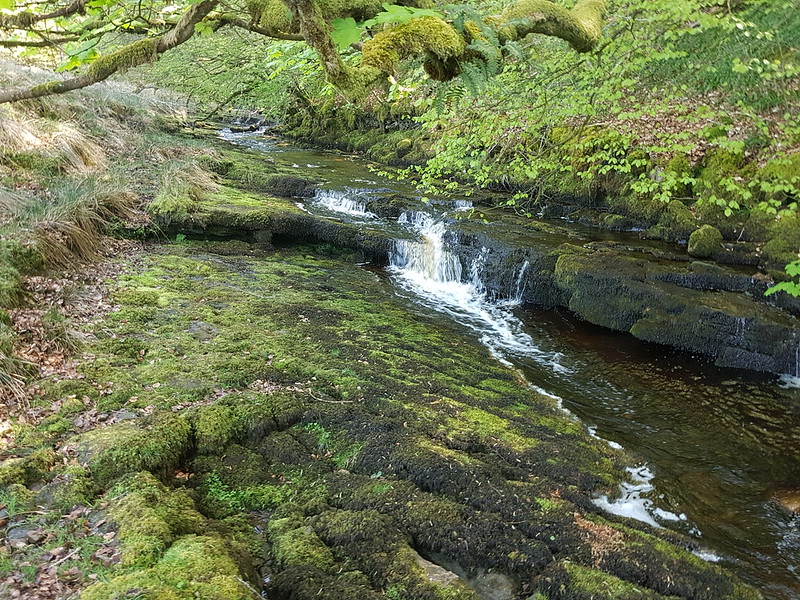
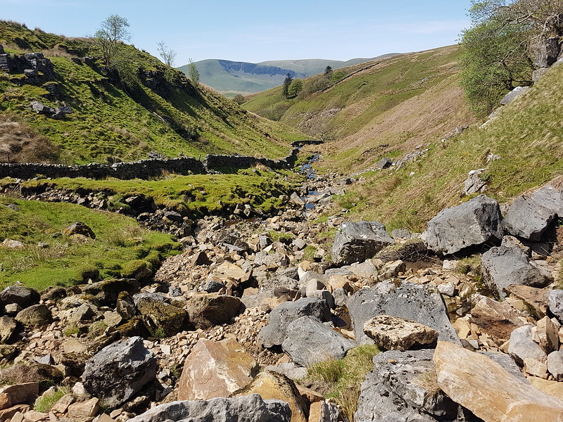
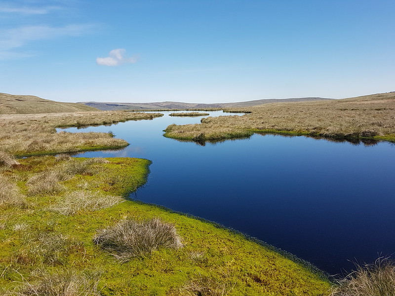
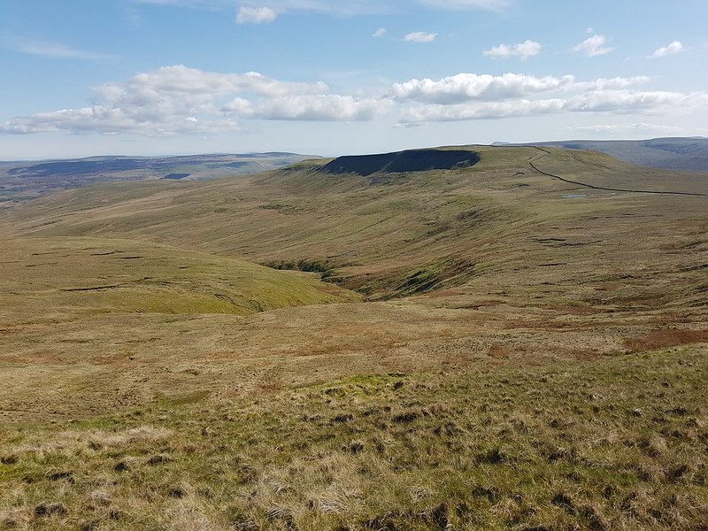
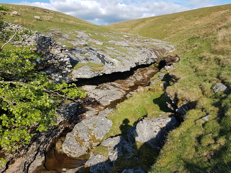
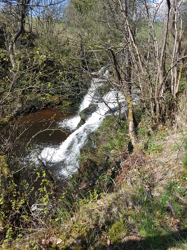
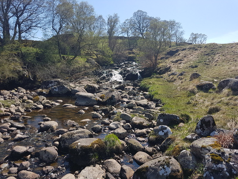
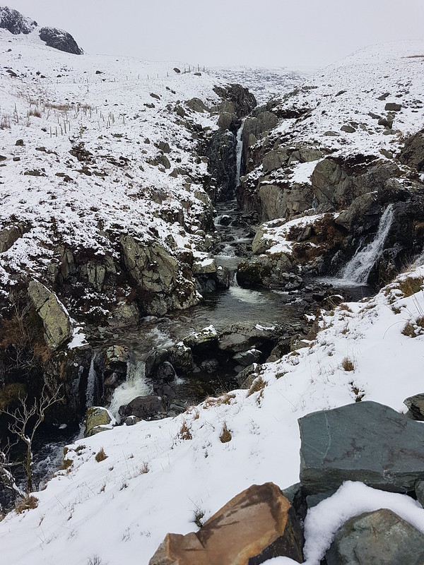
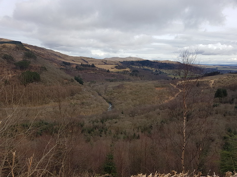
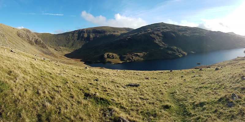
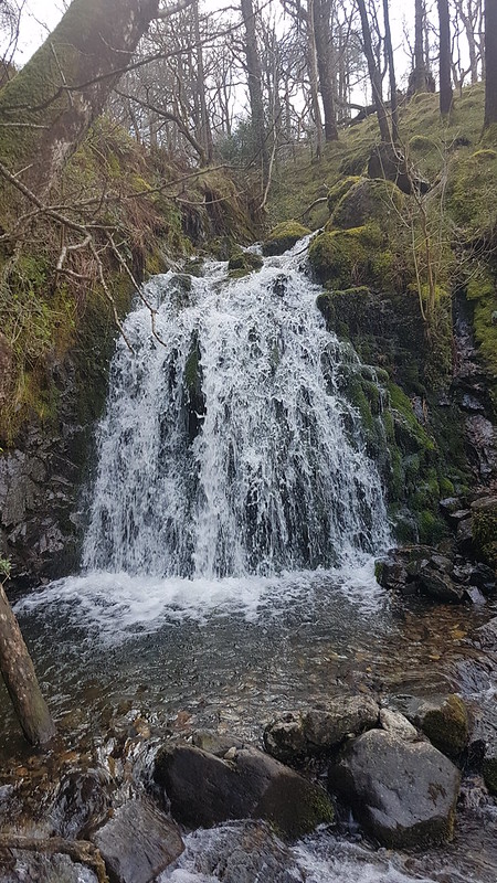
This stream, unnamed on the OS map, has carved quite an impressive looking amphitheatre below Long Band on the opposite fellside and I filed away the idea of having a gander there on a future walk.
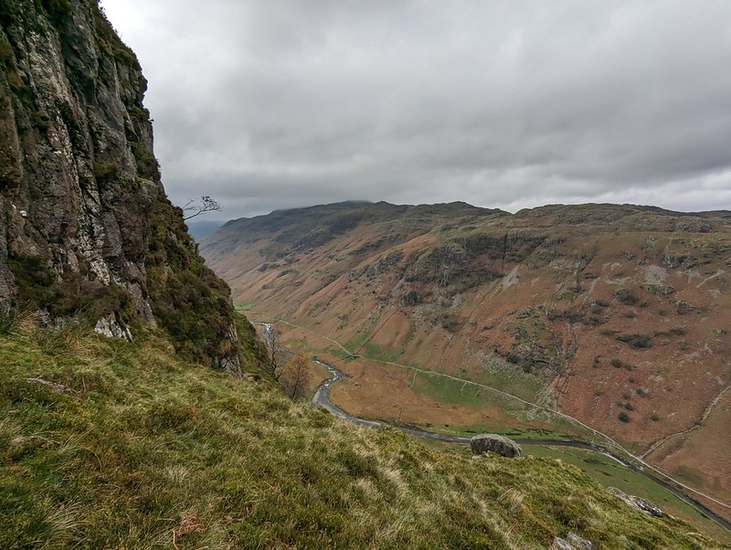
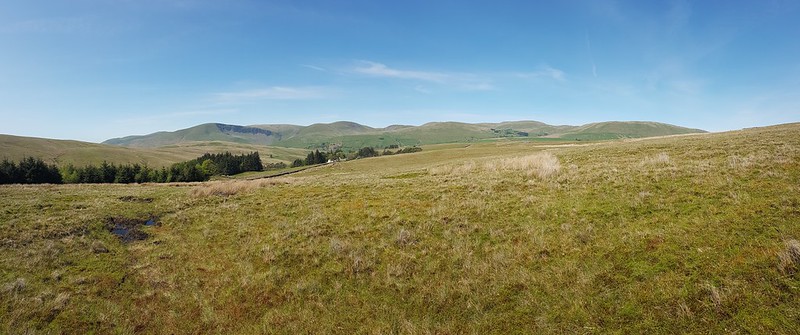
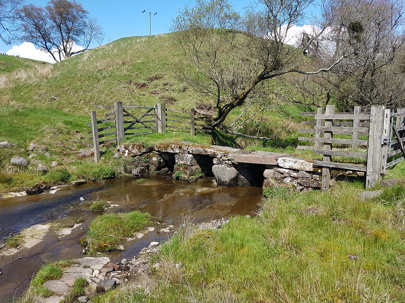
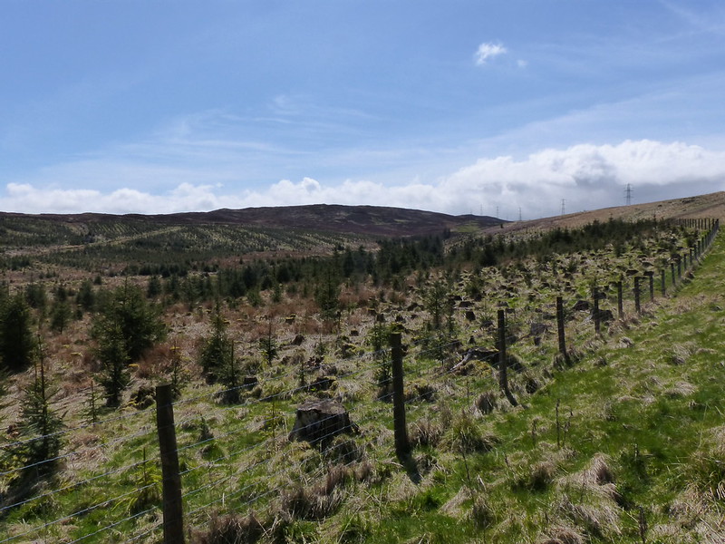
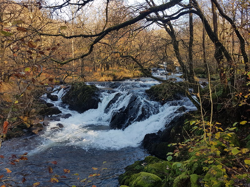
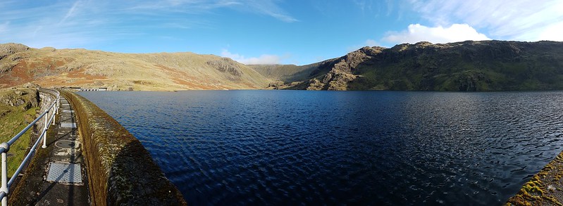
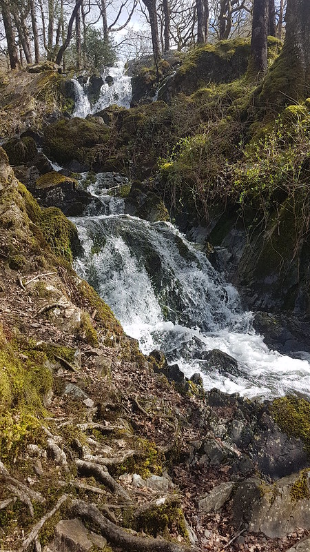
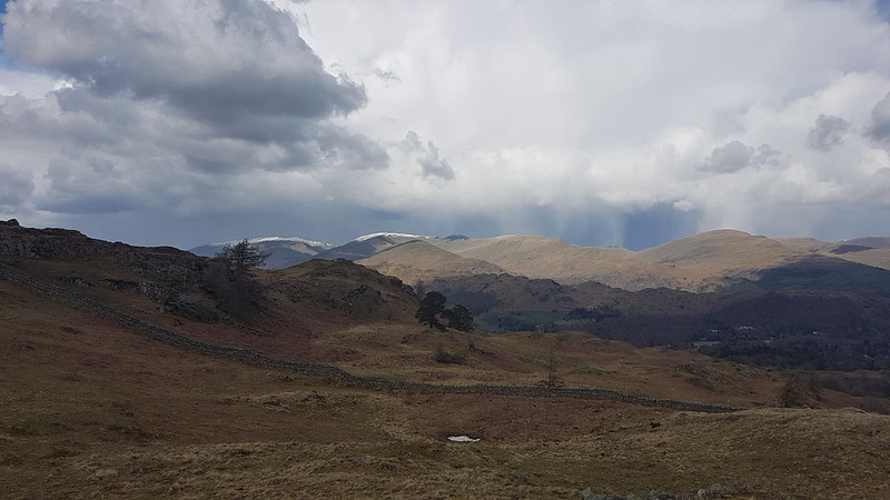
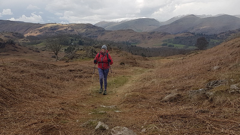
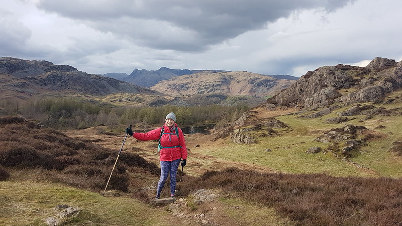
My ascent route, approaching Eagle Crag..Knotts and Great Crag above Stonethwaite.
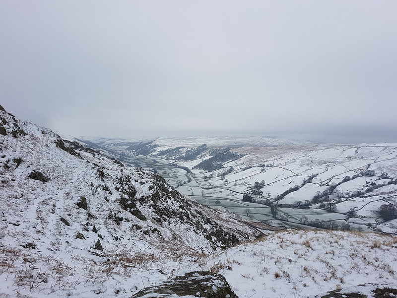
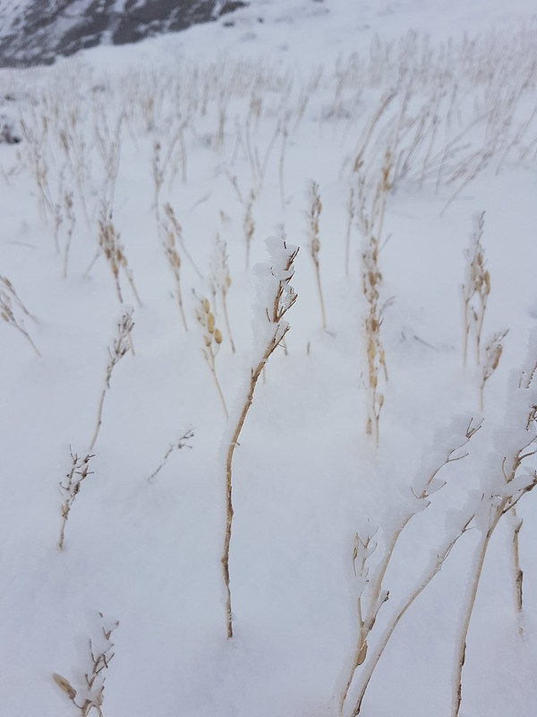
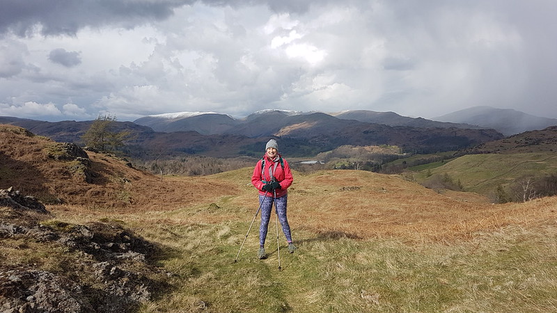
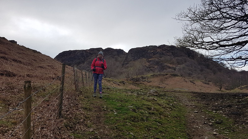
It was a fairly grey day, with occasionally the odd drop of moisture in the air and the apparent threat of rain, but none-the-less good walking weather.
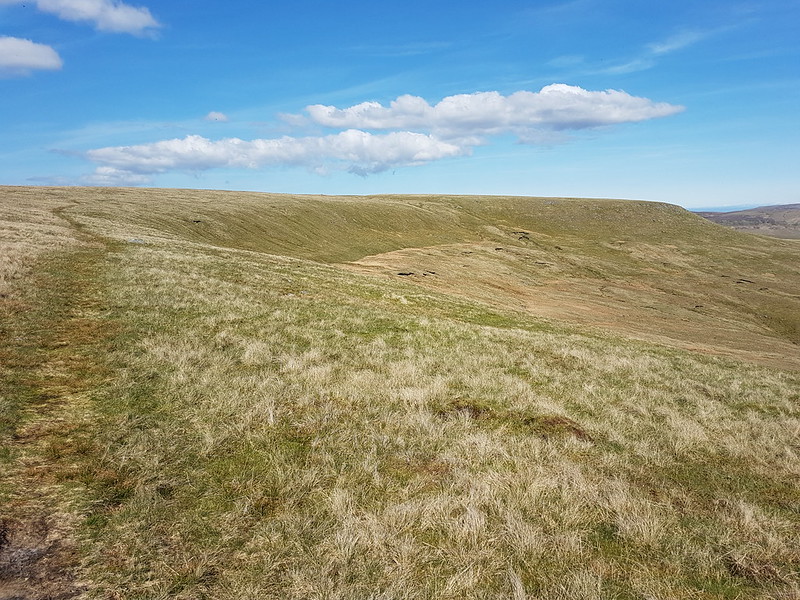
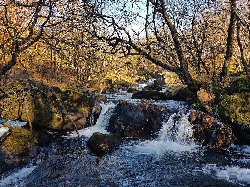
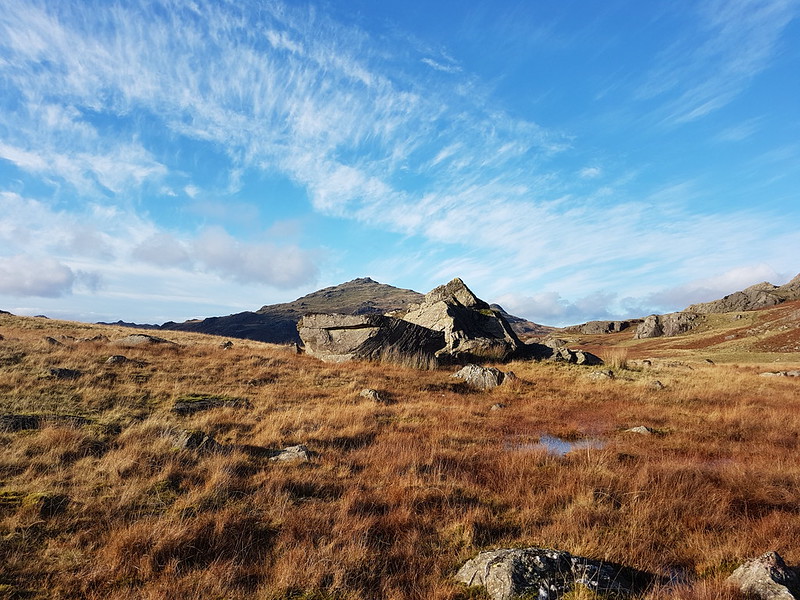
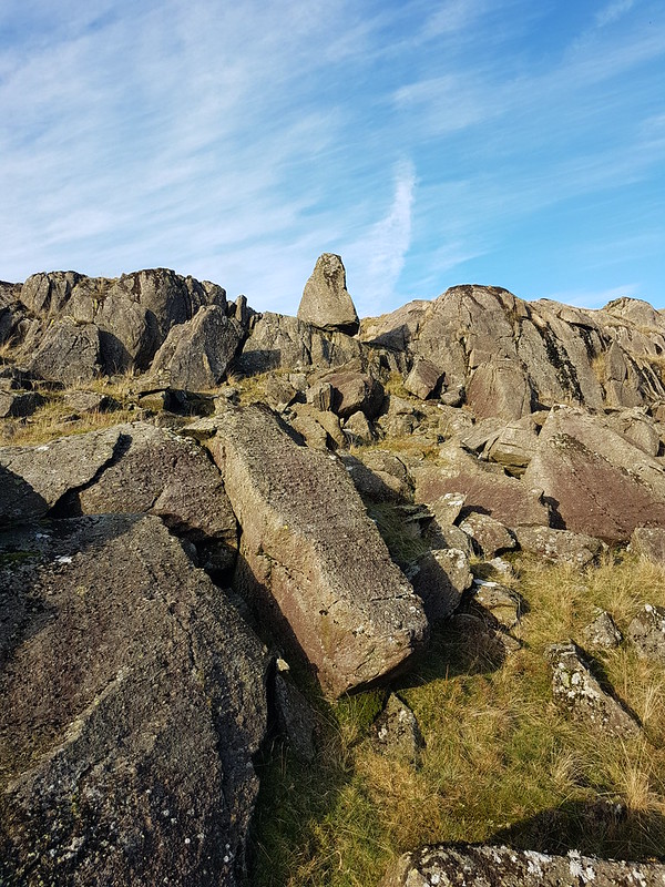
A broad ramp.
The route follows a resourceful path which finds first a broad ramp with crags above and below, and then switches back up an easy-angled gully through what might have seemed impenetrable cliffs.
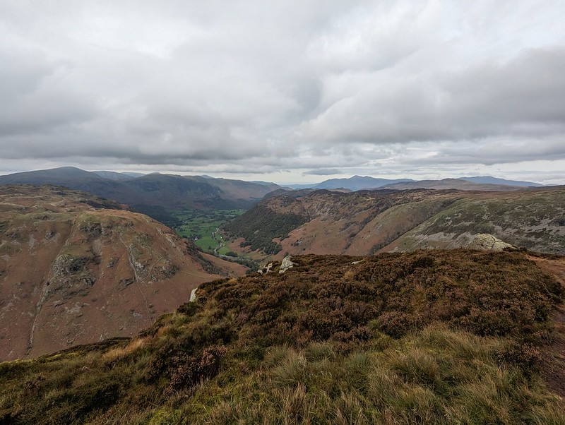
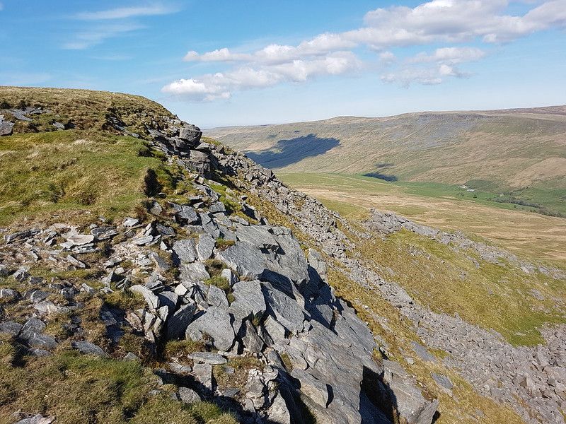
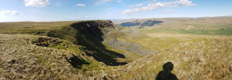
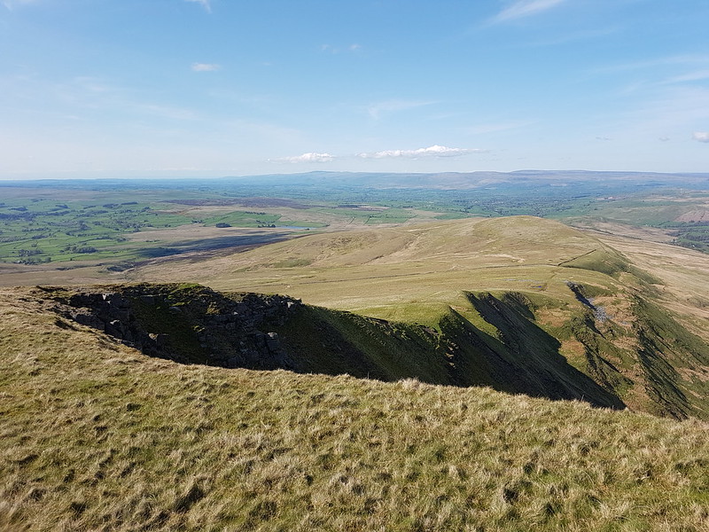
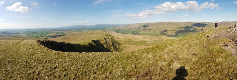
Looking down on Bleak How.Heron Crag and Langstrath.A steepish section.Looking to Sergeant’s Crag
On the last part of the ascent, the path loops drunkenly back and forth following broad ledges separated by short slabby crags. You could probably take a more direct route, but it’s pleasant walking so why bother?
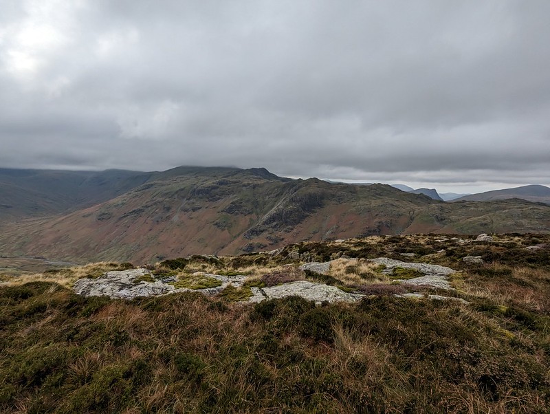
Sergeant’s Crag and Langstrath.Sergeant’s Crag again.
Too many photos of Sergeant’s Crag? I liked the look of it!
The long Glaramara ridge.Looking north to Skiddaw.
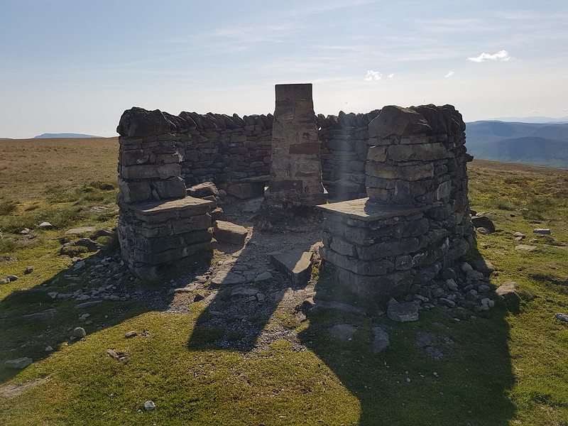
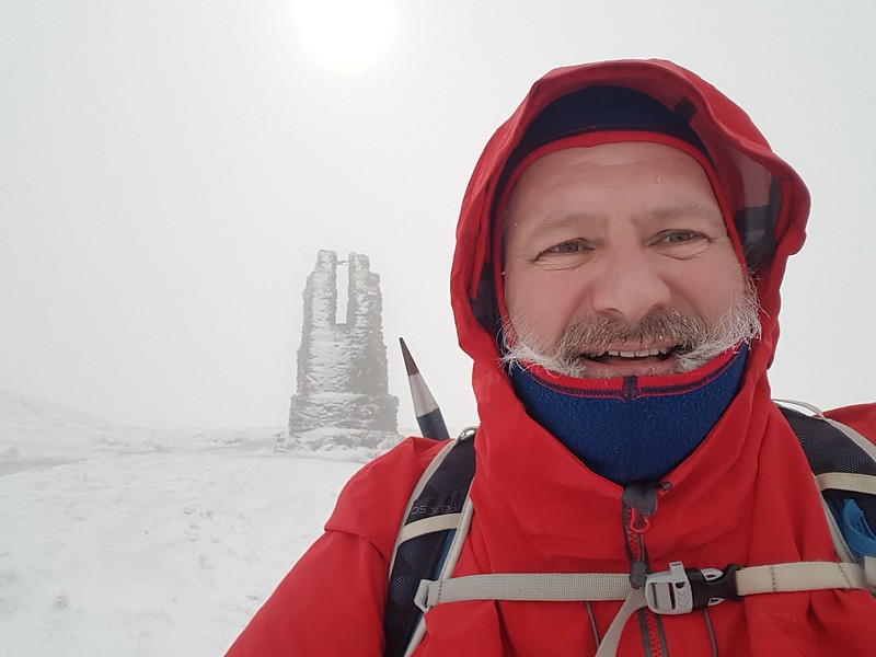
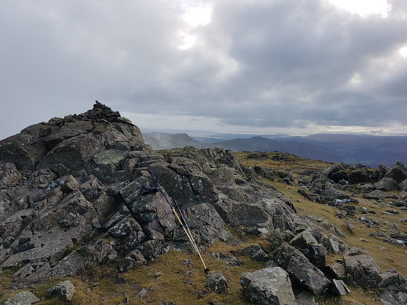
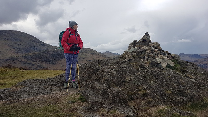
On the top, the inevitable cup of tea, a video-call with my Mum and Dad, and a brief conversation with another walker. I saw surprisingly few that day.
Sergeant’s Crag.Again!Looking back to Eagle Crag.Eagle Crag again.Glaramara.
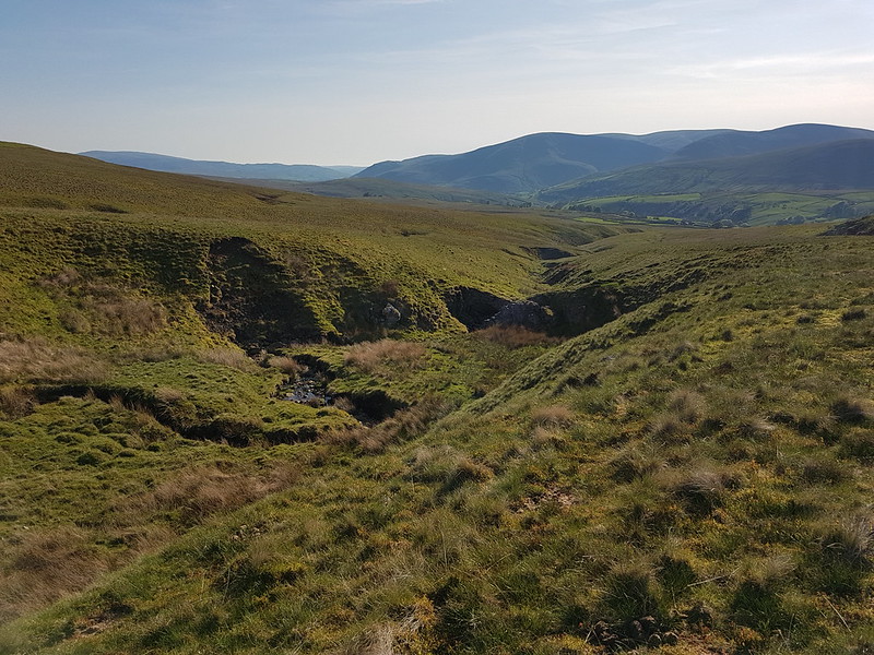
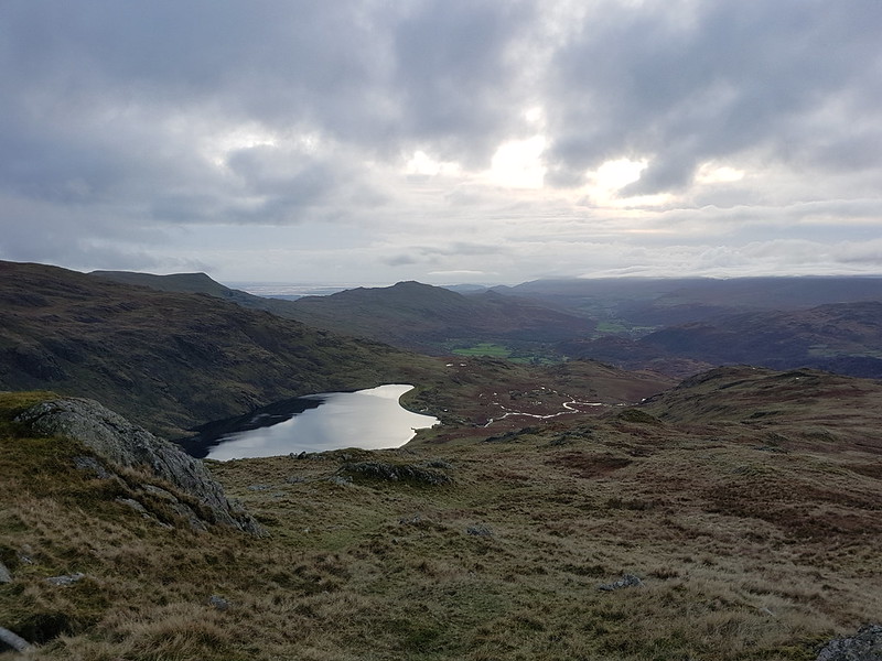
Not much more climbing to attain Sergeant’s Crag and then I took an off-piste route down towards Langstrath, aiming to avoid Bull Crag and Blea Crag and the crags around Lamper Knott. With hindsight, I’m not sure it’s a route I could recommend: there’s a lot of crags and even the grassy parts are liberally sprinkled with boulders and rocks. Still, I enjoyed it immensely.
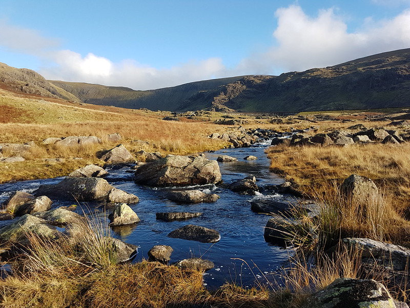
An off piste descent.Approaching Langstrath Beck.
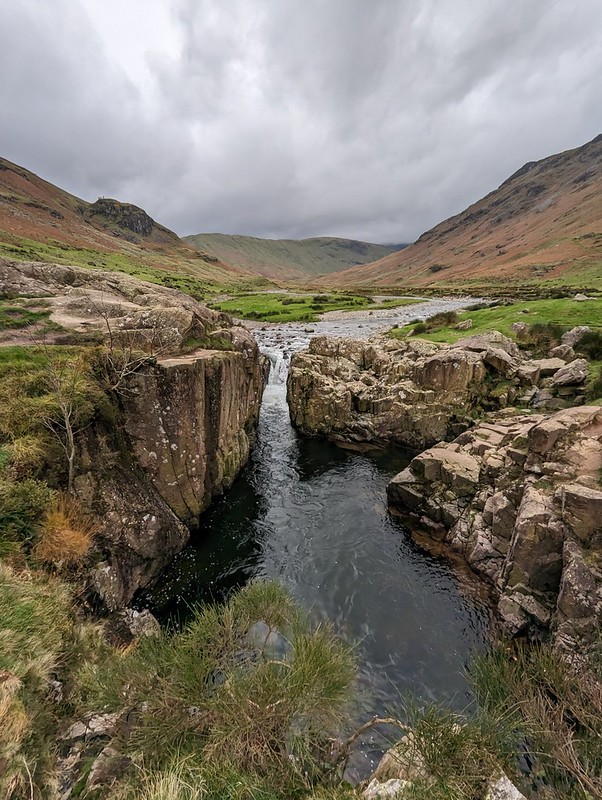
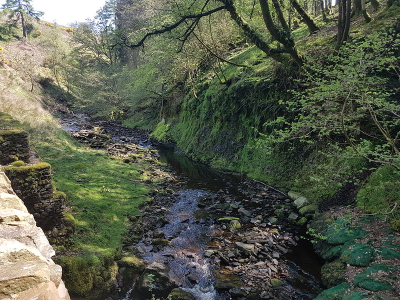
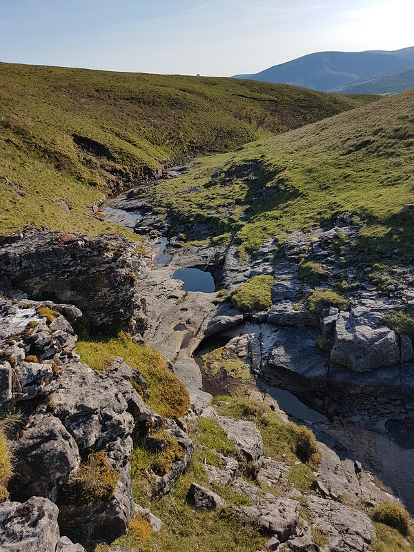
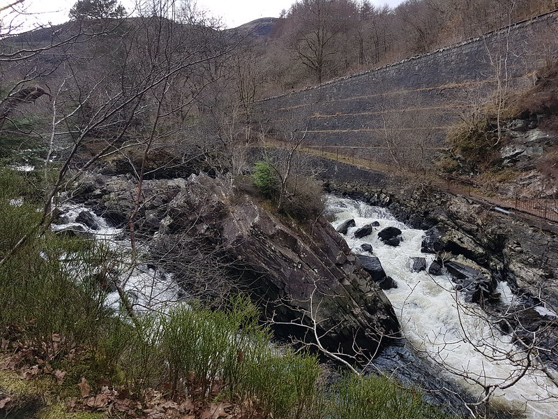
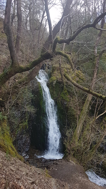
I wanted to come down this way so that I could have a peek at the renowned Black Moss Pot…
Blackmoss Pot.
There were quite a few wet-suited swimmers nearby, the ones who had just finished swimming advising and encouraging another group who had just arrived. I’ve never swum here myself and it’s on my wish-list, although not for a grey day towards the end of October!
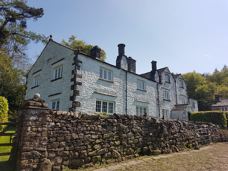
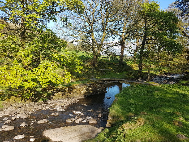
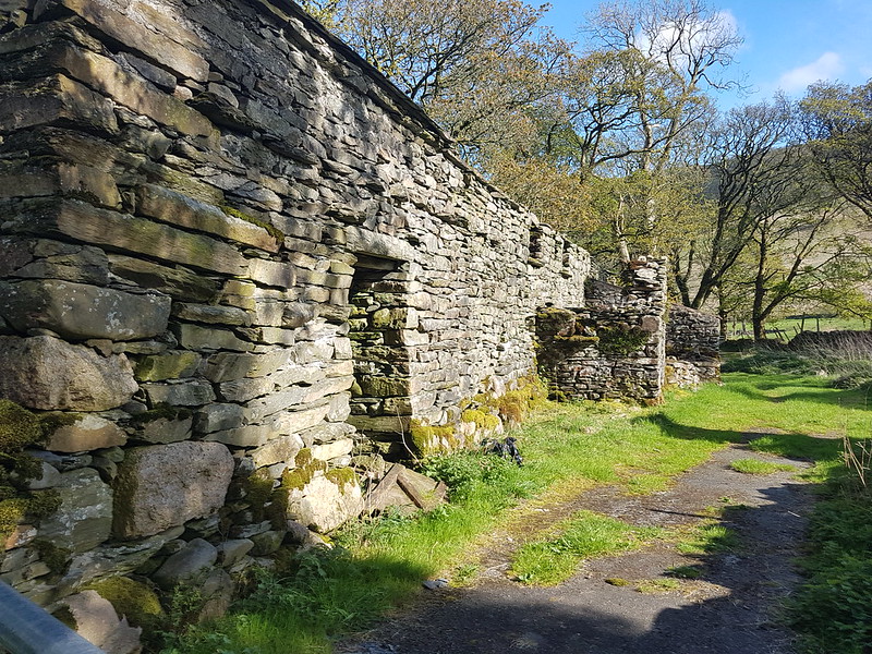
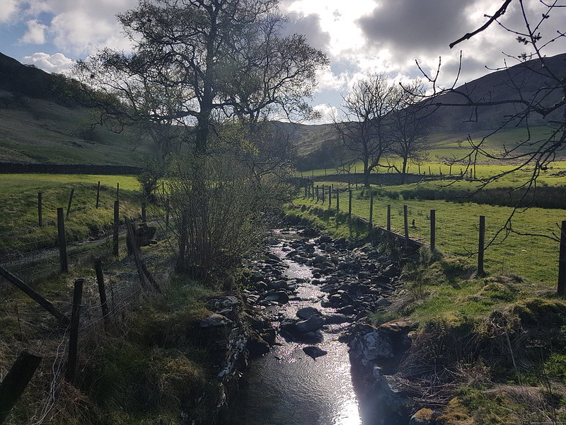
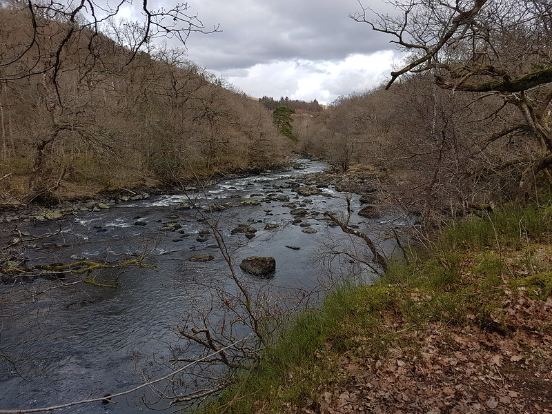
Langstrath Beck.Stonethwaite.Map the first.Around six and a half miles – but there’s a lot packed into that short walk.
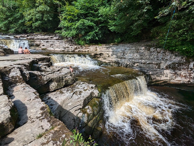
Stainforth Force. Little S just about visible in the water.
The post title may be a little misleading; I assume that most people don’t associate the series of waterfalls on the River Ribble, with the famed stand up comedian, actor and activist.
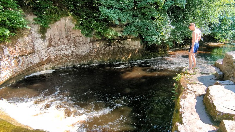
Little S in action.A video, but you will have to click on the image to go to Flickr to see S jumping in.
Little S and I visited Stainforth Force on a Friday afternoon in July, because all through the hot days of June, when S was sitting his GCSE exams, he had shown restraint and not been out for any swims, and I had promised him a trip to these falls, which I think he vaguely remembered from a visit many years ago. For less daredevil types like me, there’s a metal ladder down the cliffs into this same pool. It had been raining in the week and the water was bracing, to say the least.
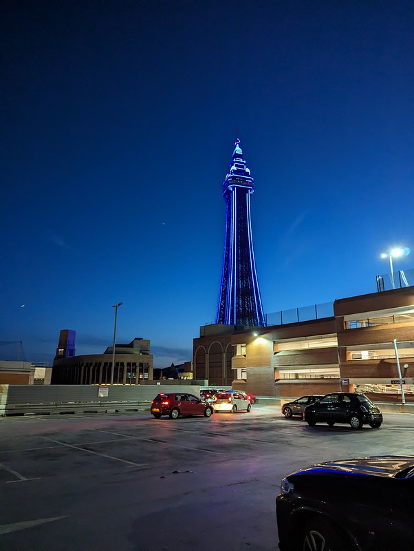
Blackpool Tower.
That evening, TBH and I were in Blackpool for one evening of their comedy festival, at the Opera House. In fact we saw Ryan Gleeson, Jojo Sutherland, Angelos Epithemiou, Tom Stade and Eddie Izzard. Tom Stade in particular had me in stitches with a decidely blue routine, but I’d picked-up B and his girlfriend A from Manchester Airport in the small hours the night before, so by the time Eddie Izzard appeared I was fighting the urge to fall asleep, perhaps not the best circumstances in which to relish his surreal riffing and bizarre juxtapositions. Still, a great evening and I’m sure we’ll be looking out for next year’s event.
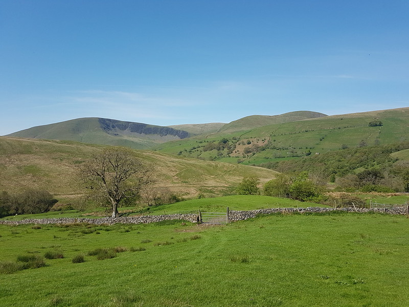
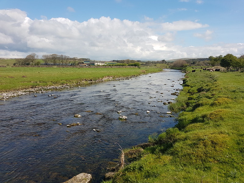
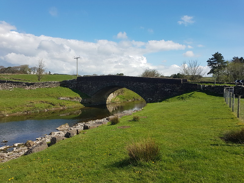
Another Lune catchment outing, which, once again, didn’t disappoint. I had splendid views of the Howgill Fells all day. I’d parked down by Rawthey Bridge and when I left the minor road which leaves the A road there, took another version of this view which was rather spoiled by the foreground of dessicated Mole corpses hanging from the barbed wire fence – a grisly traditional method for a mole-catcher to show the success of his labour.
The field path took me past a series of old farmhouses, heading up the valley of the Rawthey.
New House Farm.
What intrigued me about this farmhouse was the unusual tall building with the pyramidal roof, which is a coach house apparently, according to Historic England, added in 1914 to a building which is “probably early/mid C18”. I should have taken a photo back down the hill at Wraygreen, which is considerably older. Next time.
Approaching Needle House.
I’ve included this photo because it shows the trees beyond the house, clearly planted, looking almost like an arboretum, of which more in a moment.
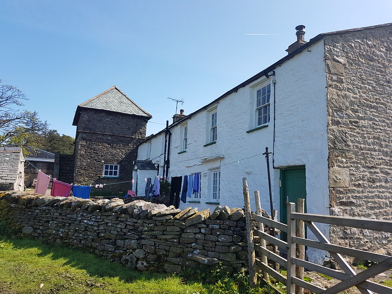
Needle House.
I was surprised to find that the very striking Needle House is not listed. I did find a fascinating history of the Frankland family, who lived here and modified the house, written by Dr Helga Frankland, whose father seems to have been taken with all things Scandinavian (so hence Helga?).
Barn by Needle House.
“Unusual features created by my father include the belfry on the gable end of West Laithe in the yard at Needlehouse. It is based on belfries seen on farms in Scandinavia. We used the bell to summon people to the house from the fields.”
Laithe is a northern word for Barn, apparently.
Bridge over Needlehouse Gill.Needlehouse Gill.
“My father planted all the woods on our land, except for the much older Uldale Wood and the natural woodland in the gills. Scandinavia held a strong fascination for my great grandfather, grandfather and my father. By skillful placing of relatively small, largely coniferous woods, my father managed to create a landscape that looks more wooded than it actually is and therefore, has echoes of Scandinavia.”
In the woods beyond the gill, I was delighted to spot four or five Red Squirrels, or, very possibly, the same Red Squirrel four or five times. I have one very blurred photo to remind me, but if I hadn’t taken it myself, I don’t think I would know that it was of a squirrel. Much of the walk to this point had been accompanied by the sound of Cuckoos, but, as usual, I didn’t see them at all.
Needlehouse Gill again.
I watched a largish bird of prey fly up and along the gill. I don’t know what type sadly.
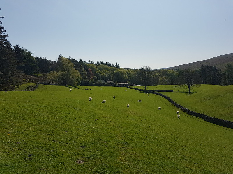
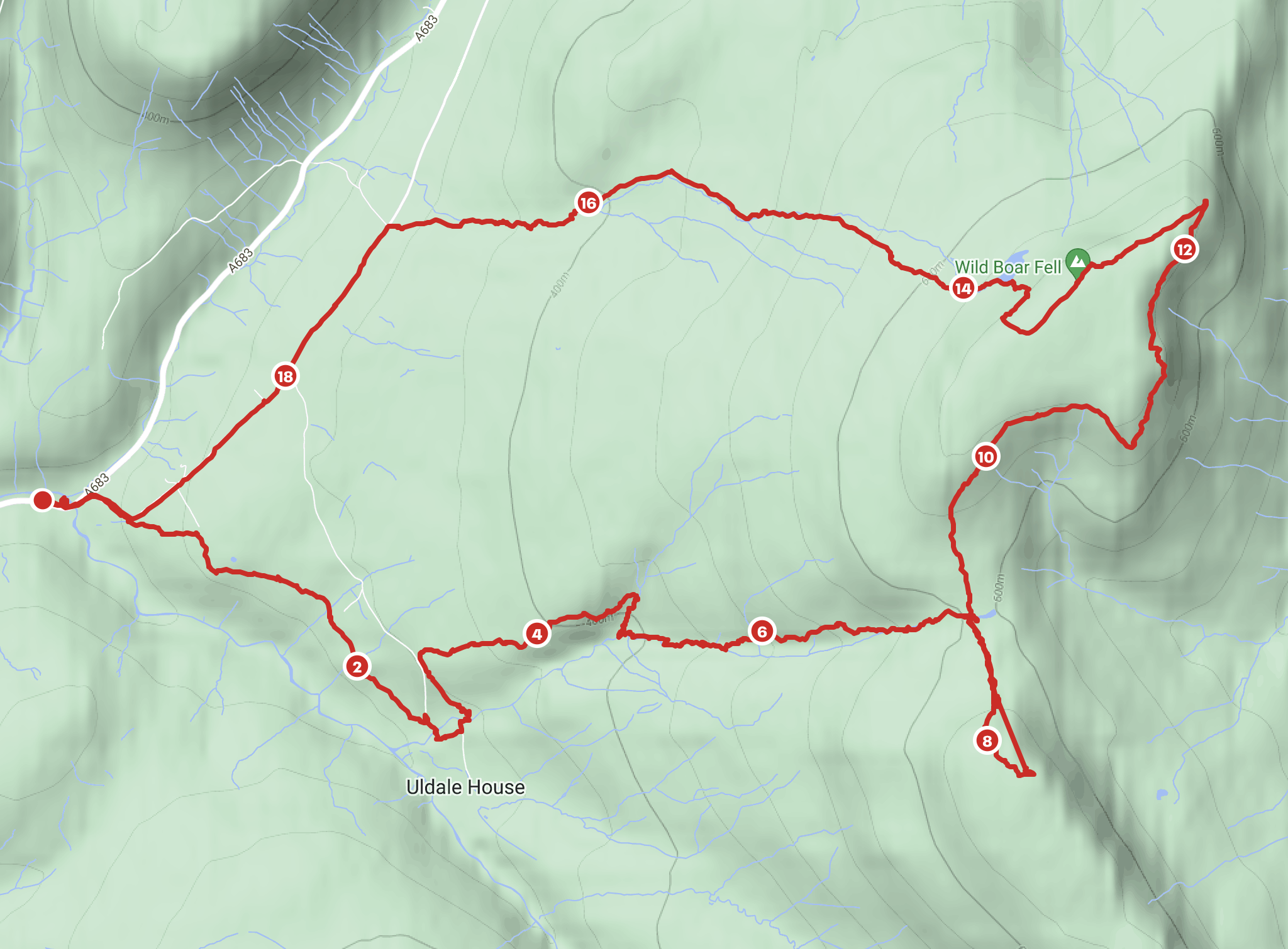
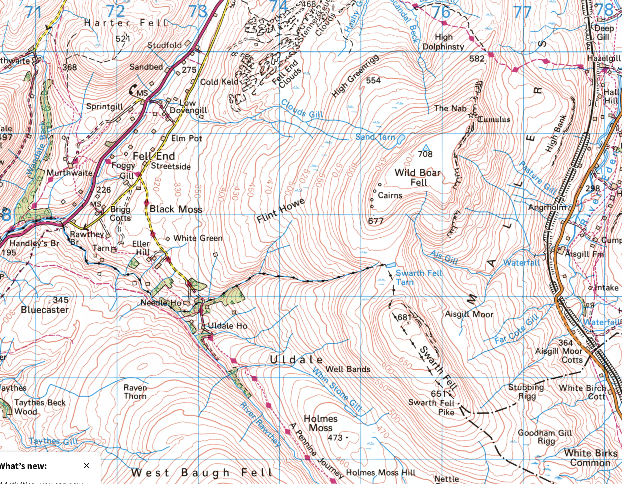
Part of the reason for choosing this route was the fact that I haven’t climbed Wild Boar Fell for far too long. It used to be a bit of a favourite. I always used the same route: up the Rawthey, over Holmes Moss Fell, which was invariably very wet, then onto Swarth Fell, Wild Boar Fell and down via Fell End Clouds. This time I intended to ring the changes and explore some more Lune feeders. My original plan had been to hop over the fence here, onto access land, and follow the gill upstream, but the going looked like it might be difficult, due to the steep banks and fallen trees, so instead I almost doubled back on the track and then took to the open fell-side.
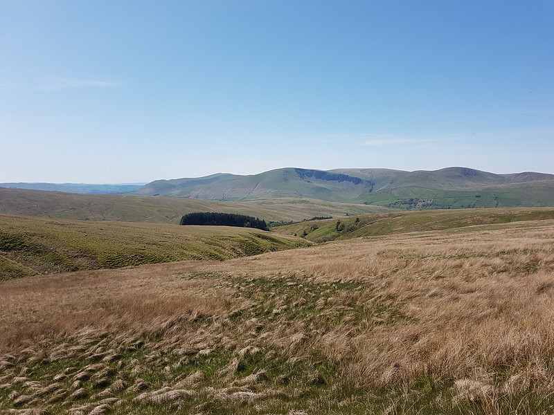
Looking back towards the Howgills.
It wasn’t half as wet underfoot as it might have been I suspect.
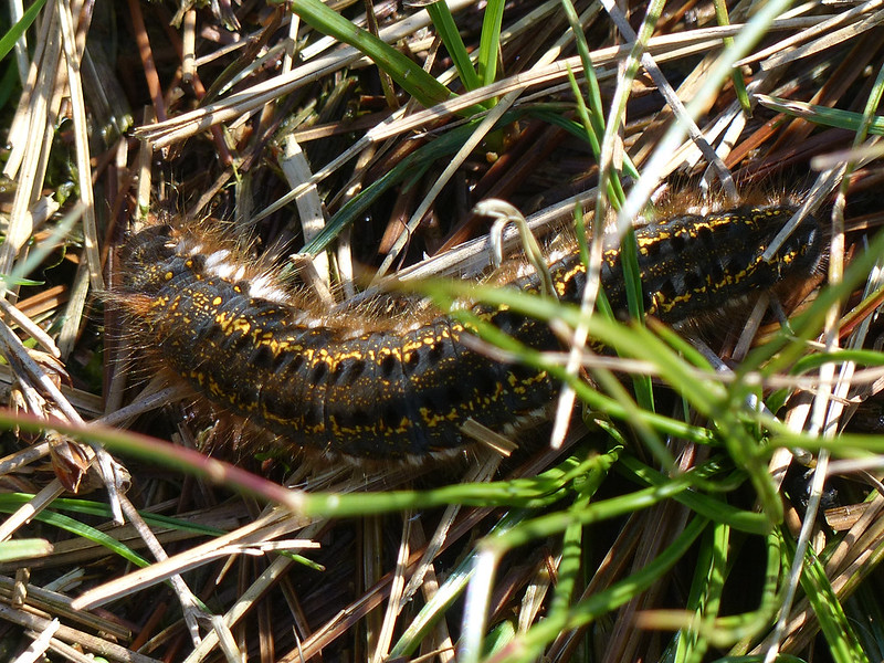
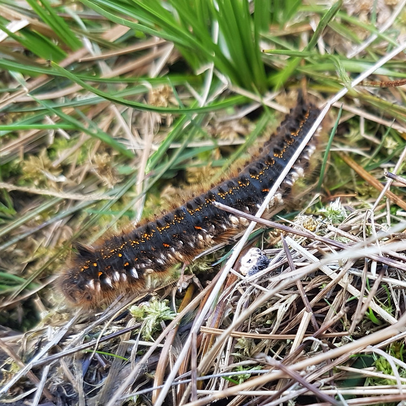
Drinker Moth Caterpillar.
I found a hint of a path, which took me down into Grain Gill, and then followed the gill down into Needlehouse Gill which at some point becomes Uldale Gill.
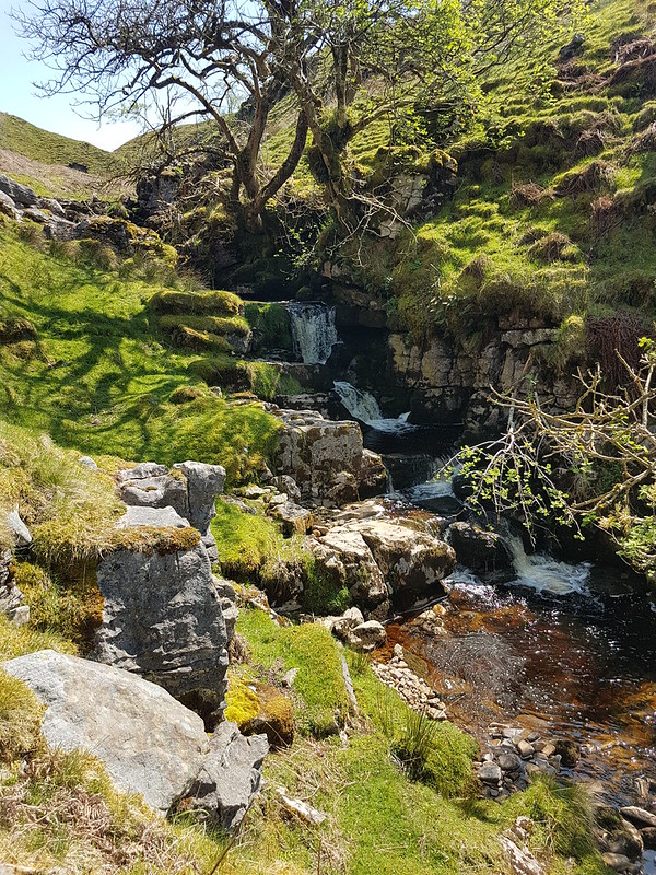
Waterfall.
I took lots of photos of small falls and cascades, but this was the best, so can stand in for them all.
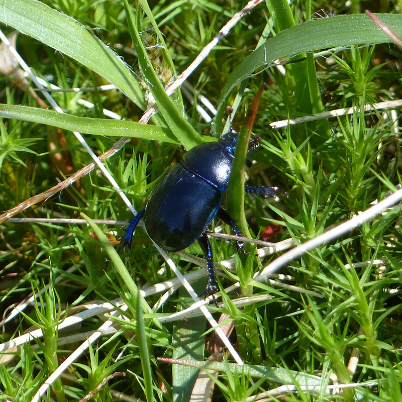
Dor Beetle.
I watched this Dor Beetle as it wandered around in the rough vegetation, laboriously and seemingly with quite a lot of effort, going back and forth over the same ground for reasons I couldn’t fathom.
Looking back down the gill to Cautley Crag.
On the left of this photo you can see a small sliver of white, which is where water was spouting from a hole in the crags and pouring under the wall into the stream. The boulders in the foreground are, I assumed, the dry bed of a tributary stream where a spring would emerge in wet weather.
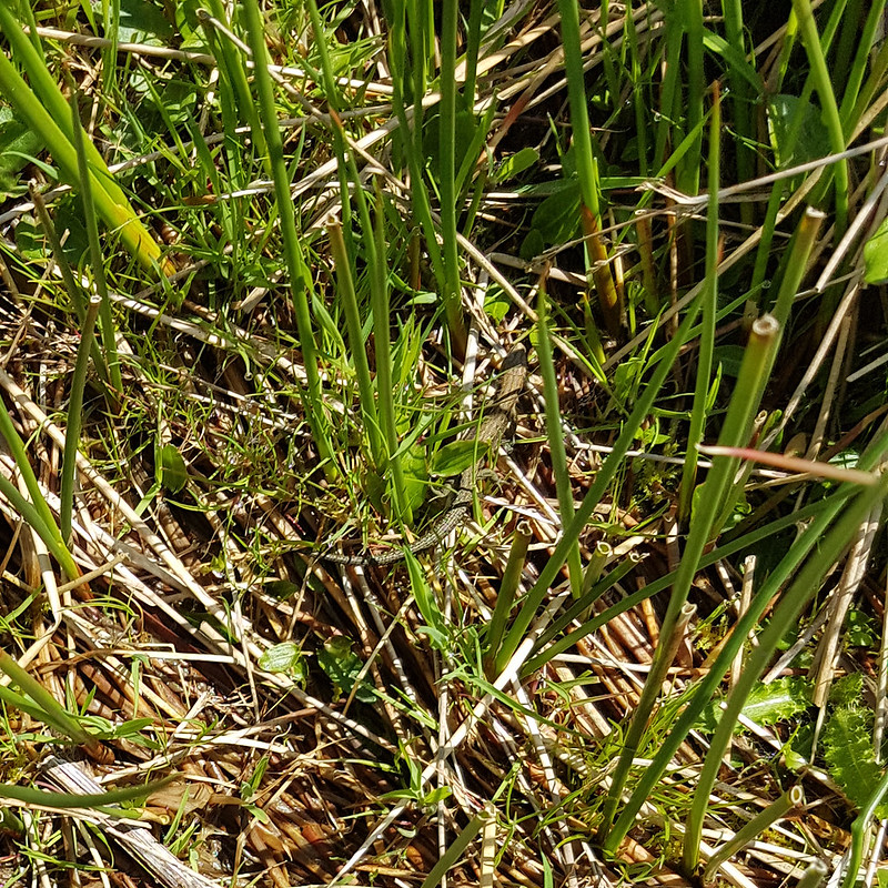
In the absence of a path, following the stream turned out to be quite heavy going, so I decided that it would be a good idea to climb up to the left, above the northern bank of the gill. I was wrong. That bright idea brought me into very boggy ground with tall reeds. The only upside was that I saw a number of Common Lizards…
Common Lizard.
…which were all too fast for me to get any decent photos.
Fortunately, when I climbed high enough, the going got much easier.
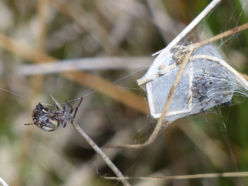
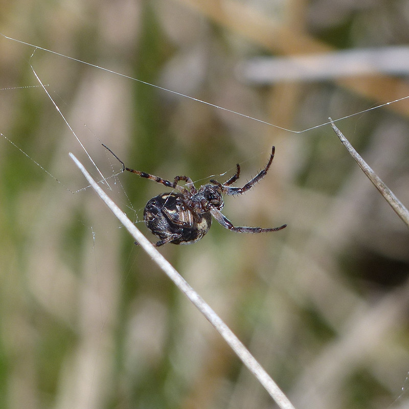
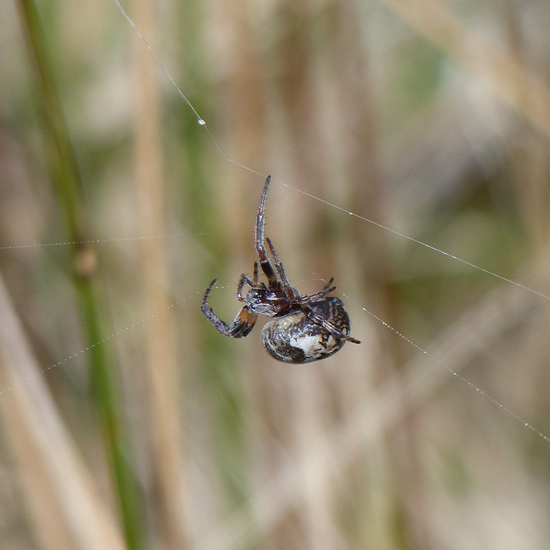
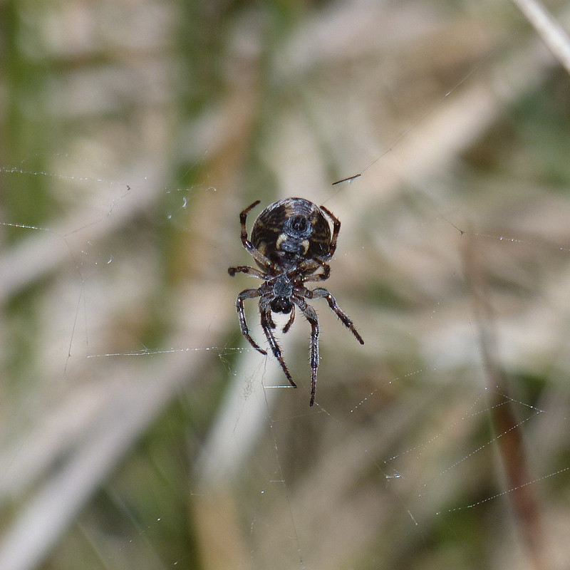
Looking back to the Howgill Fells.Larinioides cornutus.
I’m reliably informed that this spider, on an impressive web stretching between sedge stems, is Larinioides cornutus, the Furrow Orbweaver. They like damp places, which fits. This must be a female, which makes a silken cocoon and then produces pheromones to attract a mate. At the time, I thought the cocoon might be full of babies, but with hindsight, it looks more like a larder.
Furrow Orbweaver.
The ‘furrow’ in her name refers to the pattern on her back, which sadly she never deigned to reveal to me.
Furrow Orbweaver.
She was intent on running repairs of her web.
Furrow Orbweaver.Furrow Orbweaver.
But then I must have upset her in some way and she disappeared into her lair. I’m well aware that not everyone likes arachnids, but as you can probably tell, I was entranced.
Looking back from near the top of the gill.Swarth Fell Tarn.Cairn on Swarth Fell.Wild Boar Fell from Swarth Fell.Looking south from Swarth Fell. That’s Whernside and Ingleborough peeking out from behind Baugh Fell.
I found a very comfortable spot amongst the boulders on Swarth Fell, made a brew and then had a little nap in the sun whilst it cooled down. You can’t beat a bit of a snooze during a hill walk if you ask me.
On the way back down to the col, I followed the steep eastern edge…
The eastern edge of Swarth Fell.
The rivers both Eden and Ure rise down there somewhere. The first is heading for Carlisle, the Solway Firth and hence the Irish Sea, whilst the other, via the Ouse and the Humber, heads through York to the North Sea.
Looking back to Swarth Fell.The Band.
This path, around The Band to High White Scar, is not marked on the OS map, but it is an absolute delight. As I walked along it, I watched a Buzzard gliding out across Aisgill Head.
Ais Gill and Swarth Fell.High White Scar. Mallerstang Edges beyond.Along the edge.A proliferation of cairns.
Wild Boar Fell has a large summit plateau and two tops, both with a spot height of 708m.
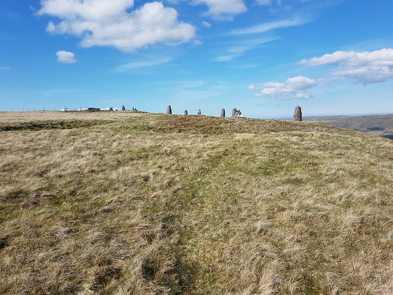
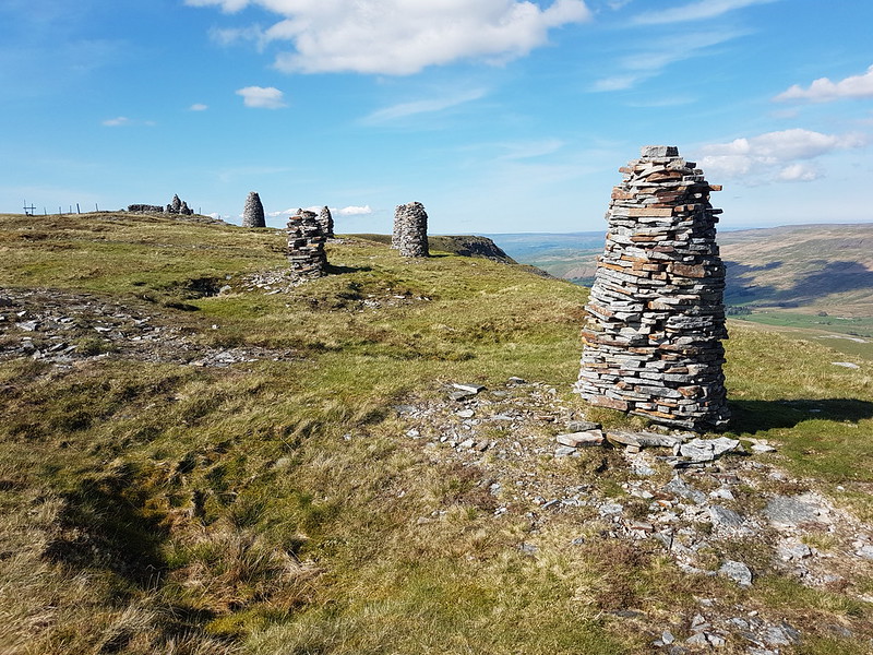
Cairns!Yoadcomb Scar.Yoadcomb Scar pano.Looking back to Yoadcomb Scar.The Nab, Eden Valley, Northern Pennines.The Nab pano.Trig pillar.
Here’s ‘the other’ top. Not quite as exciting as the one to the east, to be honest.
Sand Tarn.Forcepot Sike.
Forcepot Sike apparently drains Sand Tarn, although there wasn’t an obvious or easy to spot outflow. The hills opposite are Harter Fell (there’s a few of those about!) and Green Bell. I don’t think I’ve ever climbed the former, and it must be about thirty years since I climbed the latter – and since the source of the Lune is said to be on its slopes, it’s high on my to do list. Of course, we know that the Lune, like any river, has countless sources, but we’ll let that lie.
Clouds Gill.
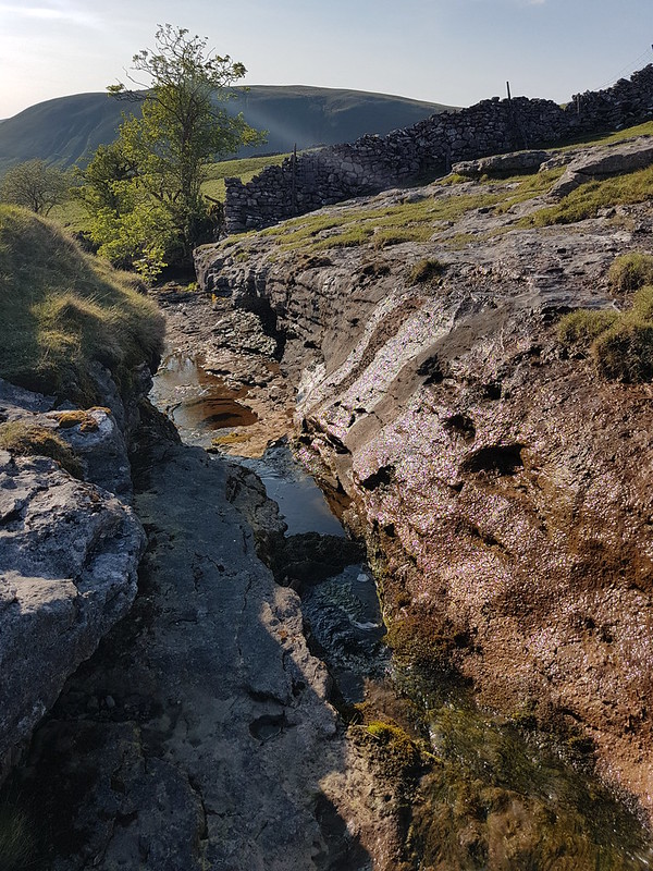
This was pathless going, but much easier than that had been by Uldale Gill. The stream gradually grew as it absorbed lots of other rivulets, at some point becoming Clouds Gill. I’ve come down these slopes a few times before, but always heading for Fell End Clouds, never sticking with the gill. As the terrain changed to limestone country, that brought unexpected bonuses. The stream began to appear and disappear underground.
Clouds Gill.
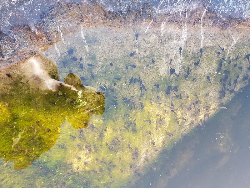
In some spots I could see the water flowing through a narrow channel to the left and below the exposed rocky riverbed. In other places the river had eroded large deep pots which were full of stagnant water. And also full of tadpoles.
Tadpoles.
Many moons ago, I used to walk to school with friends. Our route took us across fields and via a small footbridge over Johnny’s Brook. Armed with coffee jars or buckets, we would collect frogspawn, tadpoles, frogs, sticklebacks and other unfortunate denizens of the brook and take our finds to school. There was an aquarium tank in one of our classrooms, I remember. Whether the aquarium was a result of our enthusiasm or its cause, I don’t recall. I do know that I’ve never seen tadpoles in this profusion before, pool after pool, deep or shallow, were full of them. But then suddenly – no more.
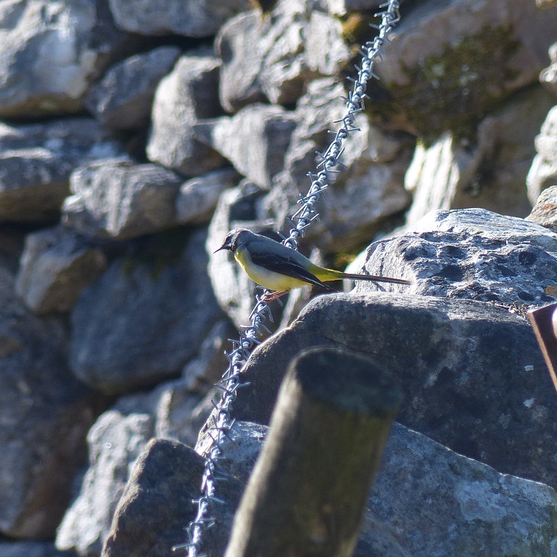
Grey Wagtail.Mayfly?
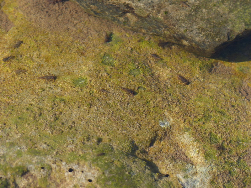
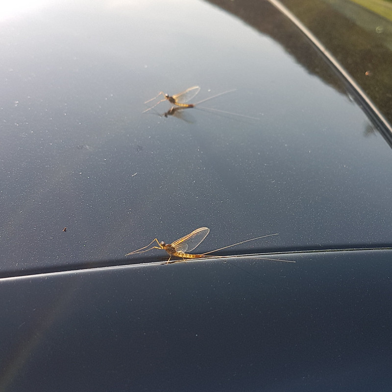
I’m assuming that this is a Mayfly, although my field guide describes them as ‘flimsy’ whereas this looked quite sturdy to me. Apparently, there are 47 different species in the UK. The winged stage of their lives lasts for just a couple of hours or up to a couple of days, depending on the species. The nymphs, living in the water, often live for a year or even two, although, again, that depends of the species.
Mayfly nymphs? About to emerge?
Limestone, of course, erodes in interesting ways. Here the stream had created a narrow gorge and a huge rock overhang.
From above.From below.Hare.
I’ve begun to think that certain creatures are emblematic of the landscapes of the Lune, particularly Curlews and Hares. Maybe Grey Wagtails as well.
Cloud Gill and Harter Fell.A roofless barn.Fell End Clouds.
I had planned to cross the valley and have a wander through the woods of Murthwaite Park, but it was getting late, so I just wandered along the minor road back to the car.
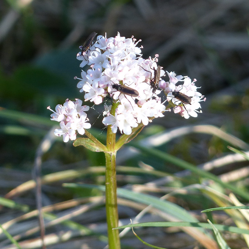
Another view of Fell End Clouds.Valerian, host to tiny flies. St. Marks flies or something similar?
When I got back to the car it was covered with Mayflies. These did look flimsy.
Mayflies.
There had been lots of cars parked along the road near the Cross Keys, presumably for the walk up to Cautley Spout and beyond, which is a very fine walk and another which is high on my ‘to do’ list. But I’d met a couple on Swarth Fell, another couple at the Nab and two blokes and their dog by the trig pillar on Wild Boar Fell, and that was it. On a sunny Saturday in May. I can’t think why Wild Boar Fell is not much more popular, but I’m not complaining!
A little over 11 miles, but largely pathless so harder work than that might sound.
In my own haphazard, arbitrary fashion, I’ve been seeking out the tributaries, and catchment hills of the River Lune since an exchange in the comments section of this blog back in 2017.
“That’s a pretty full set of experiences for an evening walk. Flowers, birds, deer, caves, gorges, rivers.”
“I may continue this theme of exploring tributaries of the Lune – a walk which starts low in the Lune valley and then climbs up into the hills gives a tremendous variety of scenery, flora, fauna etc.”
“I think your suggested tributary project is a good idea.”
Isn’t it amazing how far a little encouragement can take you!
Tebay Bridge.
Having rather neglected the Lune, and it’s legion of sources, in my rush to tick-off Wainwrights by the dozen last year, I’ve been itching to get back to a little exploration. With a dodgy forecast which suggested that the higher hills, and the western Lakes in particular, would be best avoided, I drove up to Tebay in first drizzle and eventually heavy rain and dense cloud. Only as I emerged from Tebay gorge did the cloud suddenly clear, revealing huge swathes of unexpected blue sky.
The Lune from Tebay Bridge.
This is a route I’ve been wanting to walk for a while, because it crosses almost entirely virgin territory for me, but it’s a good job I didn’t leave it for an evening walk, as I have most of my previous Lune Catchment walks, since it turned out to be a fairly long wander. When I plan routes I have a tendency to be fairly ambitious regarding how much I can pack in, and also to not bother checking the length of the route before I embark.
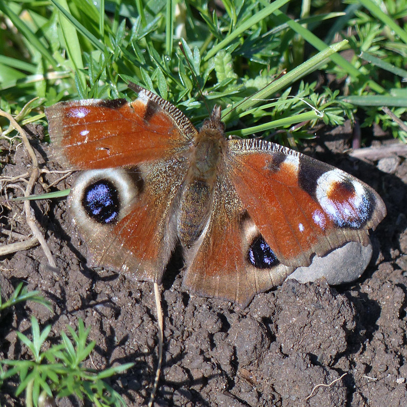
Peacock Butterfly.
I saw quite a lot of butterflies during the early part of the walk, particularly Peacocks.
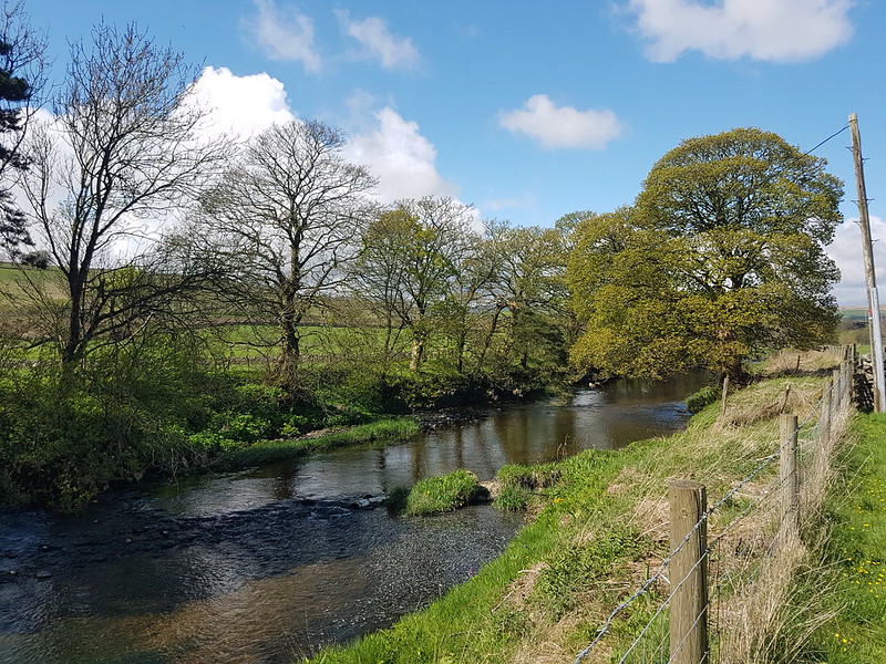
Birk Beck
I’ve always liked walks which follow rivers or streams and this route along Birk Beck was no exception.
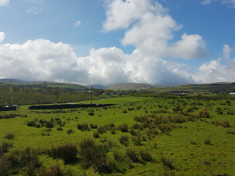
Looking towards the Howgills and Tebay Gorge.
Although I was enjoying glorious sunshine, the nearby Howgills remained draped in cloud for most of the morning.
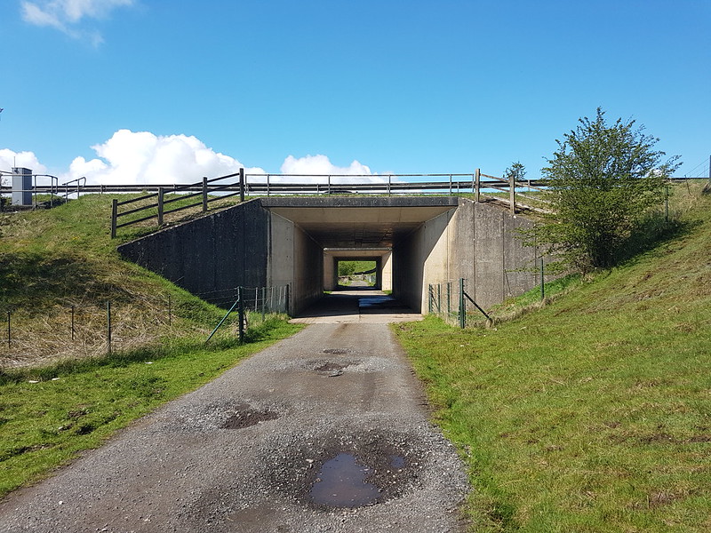
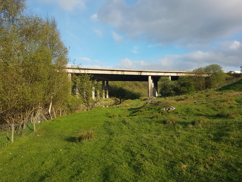
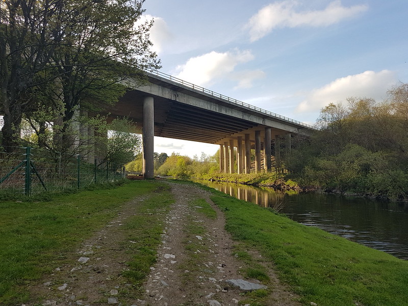
Under the M6 motorway.
This was a walk with a wide assortment of bridges. I’m a sucker for a bridge, even modern concrete ones, so that was another bonus.
Birk Beck.An uninspiring view of…Tebay Services.
Back in the days when I first met the people who are still my most frequent companions in the hills, when we travelled up to Scotland every New Year and every Easter and occasionally at other times of the year too, we habitually stopped at Tebay West services. It was a bit of a ritual, never to be missed. So I was pleased to be able to send them this view of the services, admittedly rather hidden in the trees. Not one of them recognised them; they must be getting old!
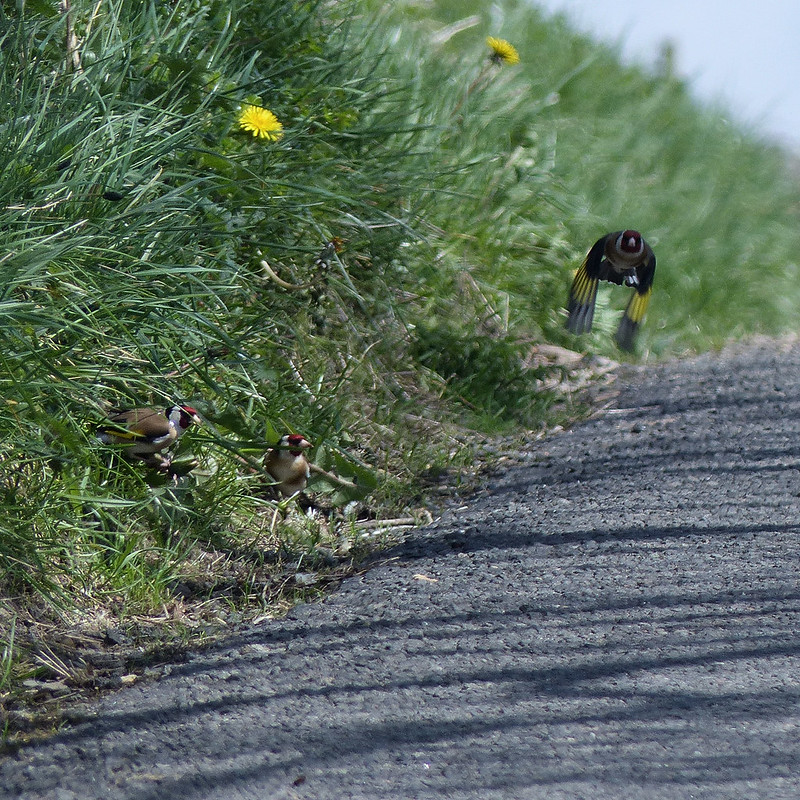
Birkbeck Viaduct.Birk Beck.Goldfinches.
Climbing up the little minor road towards the services, from the hamlet of Greenholme, I passed a tree occupied by a charm of Goldfinches and managed to snatch a photo of a few which were pecking at Dandelion flowers on the verge. All along the beck I could hear and occasionally glimpse small birds, tits and finches, but, with the trees now in leaf, it wasn’t generally possible to get photos.
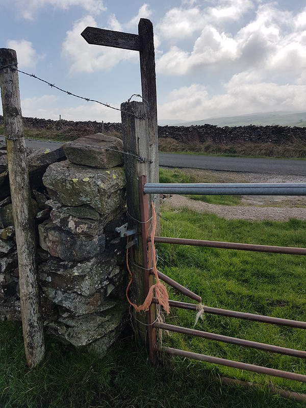
Sealed gate.
Leaving the road, on a path which would take me back down to Birk Beck, I encountered this gate which had been wired shut. It was the first of several such obstacles I came across and I really should have contacted the local footpaths officer. There was no other recourse but to clamber over the gate, which as you can see was a bit decrepit, but fortunately it didn’t collapse from under me.
Across the beck to another minor lane.Looking back to Scout Green.
I’m not sure why I didn’t take any photos whilst I was passing through Scout Green, I remember it as a charming spot.
Green Brow.
From this point the path was crossing much rougher grassland, often quite wet. Now there were Curlews, Lapwings and Ravens to be seen and heard. The path climbed a little above the beck.
Birk Beck.
One of the things I had been particularly looking forward to was the waterfall Docker Force.
Docker Force.
Since there’s a good photo of it on Geograph, I’d assumed that it would be easy to access. Not a bit of it. It’s well below the path and can be heard from there, but not seen. Once again, I clambered over a gate, but this time because I was trespassing, and then I made my way down through some extremely squelchy woodland. At the bottom, there’s a small cliff and I couldn’t see an obvious way down, so I made do with this sideways on view.
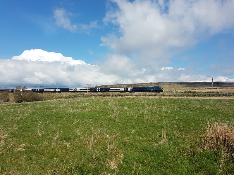
West Coast Mainline and Crosby Ravensworth Fell.
Once again, I feel the need to disclaim any impression I might be making of train-spotterish tendencies; it’s just that somehow I’m compelled to take a photo whenever a train passes. Do you think I might be in denial?
Shap Wells Hotel.Clapper Bridge over Trundle Beck.Queen’s Monument.
At the back of the Shap Wells Hotel, up a little rise, is this monument.
Celebrating Queen Victoria’s coronation.
Which seemed quite appropriate since this was the day that ol’ Big Ears got crowned. Visiting this monument was as close as I came to joining in the celebrations.
It seems like a very out-of-the-way spot for a monument. Come to that, it’s a bit remote for an enormous hotel too.
Shap Wells Hotel.
Aside for a trio of bird-watchers in the grounds, the hotel seemed to be deserted. In fact, I hardly saw anyone all day – another advantage of these Lune tributary wanderings, there’s plenty of solitude on offer.
Wasdale Beck.
Having visited it’s more famous namesake in the Western Lakes so many times over the years, it was nice to finally get acquainted with the less well-known Wasdale.
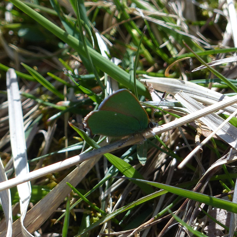
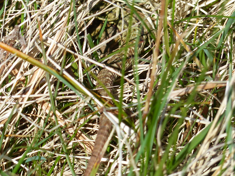
Green Hairstreak Butterfly.Common Lizard.
I’ve seen quite a few Common Lizards this year on my walks, but they’ve almost always been too quick for me to catch in a picture. I would hazard a guess that this was the largest of all the ones I’ve encountered this year.
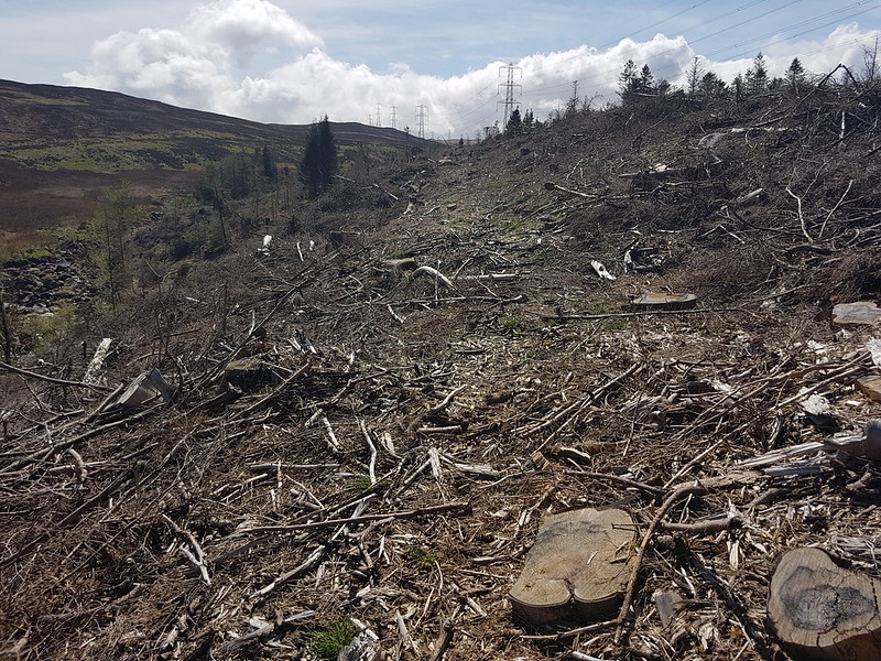
Conifers.
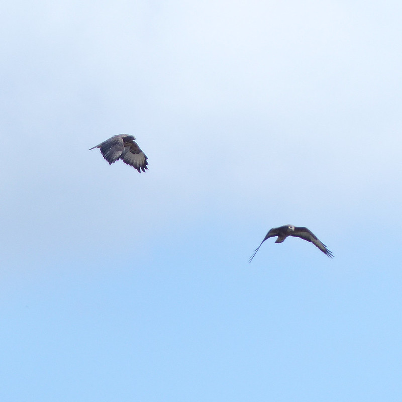
The path climbs a little above the beck, along the boundary of a conifer plantation which looks to have been clear-felled and replanted. There was a very cool breeze blowing and I’d been on the lookout for a sheltered spot in which to stop for a brew. I found a place, down by the fence, between a large tree-stump and a small grassy bank, which I thought might be as good as I would find. As I was fiddling with my stove, a large (i.e. female) Buzzard swept down along the course of the stream, flying unusually low for a Buzzard, so that I had a marvellous view from above. I have to confess, however, that I was relieved when she swerved away from me and across the slope opposite. This spring and summer, we’ve had gulls nesting at work and they have been extremely protective of their nest: to venture into the car park has meant risking several swooping attacks. I don’t think anyone has actually been clawed at any point, but I think lots of us have had our hair ruffled a few times. I never managed to be as composed as one or two of my colleagues who strode confidently across the tarmac unflinching under the barrage, but, on the other hand, I didn’t take to cowering under a brolly either. Past experience tells me that Buzzards are equally concerned parents; I’ve been ‘warned off’ a few times. When the female was joined by a tiercel, even though they initially settled on a distant dry-stone wall, I began to pack-up the stove and prepared to make myself scarce. In fact, they didn’t actually come too close, but I knew I wouldn’t have a restful cuppa whilst they were circling, so I moved on.
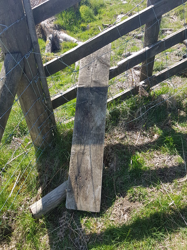
A pair of buzzards.Broken stile.
A little further-up I encountered more footpath obstructions, firstly a collapsed stile, which wasn’t too much of a problem, but then felled trees which made life very difficult. Much of the brashing had not been removed, leaving the track covered in heaps of broken branches and twigs, and clearly heavy machinery had been used so that the track was deeply rutted and pocked. It was really quite unpleasant.
Felled conifers.
Fortunately, it didn’t last too long.
Wasdale Beck.Wasdale Old Bridge.
At Wasdale Old Bridge, I finally did stop for a cup of tea and watched a pair of Dippers flitting in and out from the underside of the bridge, where I assume they had a nest. I managed to scotch any possibility of another brew-stop by clumsily tipping my unused tea leaves into the stream.
Packhorse Hill, Yarlside, Shap Pink Quarry.
The next section of the route was all on a broad gravel track. Not the most attractive path, but at least easy going. I thought Packhorse Hill looked worthy of a look at some point. Likewise the hills around the upper reaches of Wasdale and Crookdale.
Looking back towards the Pennines.Unusual sign?
Along the track, the vegetation on the left was dominated by heather, whereas to the right it was all grasses. I can only assume that the stark contrast is due to a different grazing regime.
The path over into Bethersdale.The hills around Crookdale.Crookdale Crag.Stone Chat, male.Stone Chat, female.
There were Stone Chats all along the wall here. Curlews were circling and calling too, but much harder to catch on camera.
Crookdale Crag.
Crookdale Crag has been added to my ‘to visit’ list too. Along with the Birkbeck Fells. An ever expanding list!
Looking towards Bretherdale.
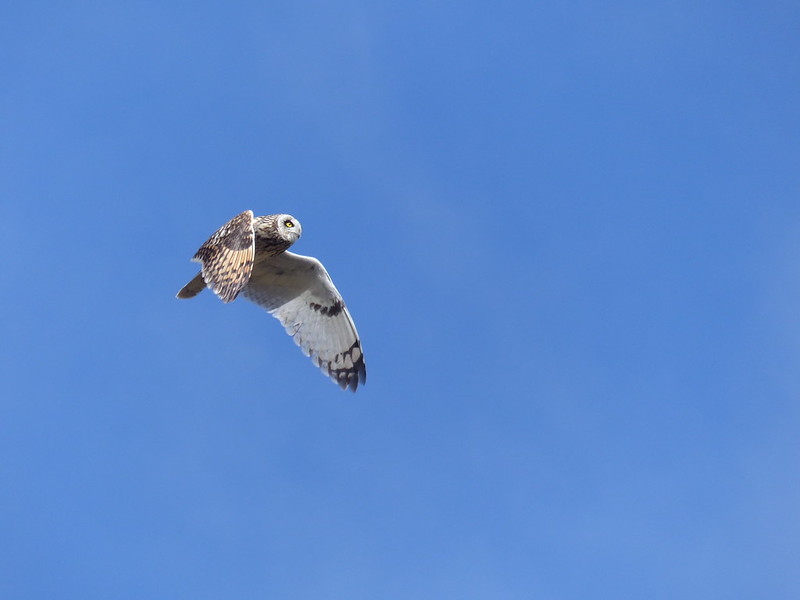
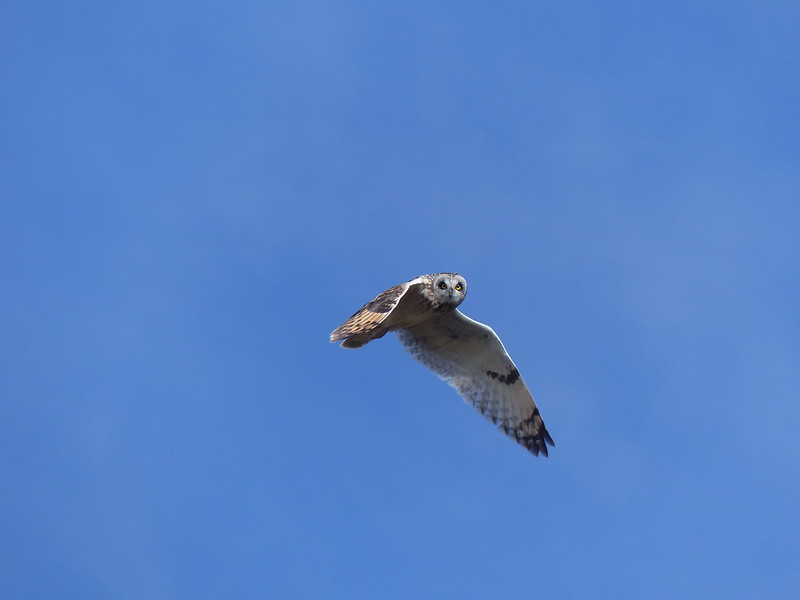
The path, which had started well, seemed to peter out, or at least, I lost it for a while. It was rough and fairly boggy ground. Bizarrely, I was just thinking that it was perfect territory for Short-eared Owls – one of my few previous sightings was above nearby Wet Sleddale – when one came sweeping low down the hillside from behind me. I scrambled for my camera whilst trying to keep an eye on the owl. It hunted, nearby, apparently not much bothered by my presence. It’s behaviour reminded me of Kestrels: hovering quite low and then plunging into the grass. Not surprising I suppose since both hunt voles. Landing some distance away it scanned the surroundings – I have photos of it looking straight at me, but also with its head turned to the extreme left and right.
Short-eared Owl.
Fortunately, it eventually flew back towards me to hunt again, before finally leaving. Of the many photos I was able to take, these two are by far and away the best. A beautiful bird and a magical experience.
Short-eared Owl.
I suppose after that I was predisposed to fall in love with Bretherdale, which I duly did.
Thorny Bank and Bretherdale.
Thorny Bank is yet another hill I shall have to climb at some point.
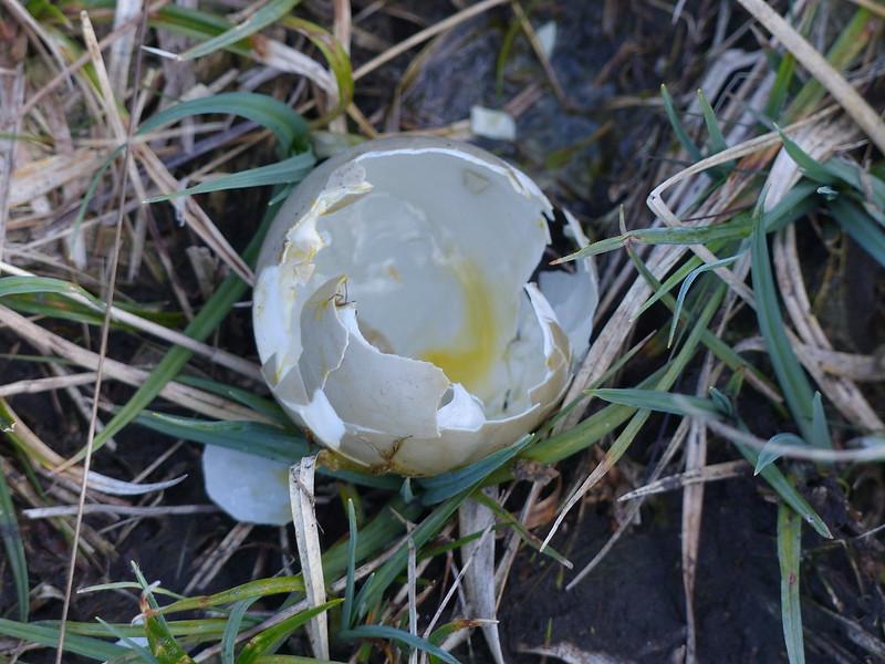
The Drinker Moth caterpillar.The Drinker Moth caterpillar.Broken egg shell and tiny spider?Thorny Bank and Bretherdale again.Far Crag.
There was a sketchy path here, but it was very wet underfoot and once again I was very glad to have M’s boots.
Parrocks.
I’ve decided to buy Parrocks and do it up. When my long lost wealthy relative leaves me a surprise legacy of millions, obviously.
Rusted latch.
This latch was rusted shut and since the fence was topped with barbed-wire, there was no other option than to climb the broken gate, which felt decidedly like it might give way under the strain.
Simple bridge over Bretherdale Beck at Greenhead. More ruined farm buildings.Bretherdale Head.
I think that there was a for-sale sign at Bretherdale Head and the gate was locked and festooned with barbed wire. I had been thinking that the land here was being managed for conservation, but now began to wonder if it had just been too uneconomic to farm and was abandoned. Later, I did see a chap on a quad bike, at Midwath Stead, who I assume was a farmer, so some of the area is being worked, but I didn’t see many sheep on the hills.
Breasthigh Beck.
Breasthigh Beck is yet another feeder of the Lune and since Breasthigh Road follows it upstream and then over into ‘the other’ Borrowdale, this is somewhere else I shall have to come back to.
Maybe that road sign wasn’t unique after all!Midwath Stead.Primroses – the road verge was full of them.Bretherdale Hall.Stepping stones in Bretherdale Beck and more ruins!Confluence of Bretherdale Beck and Birk Beck.
It was rather late in the day, otherwise this looked like a good spot for a dip. I shall bear it in mind!
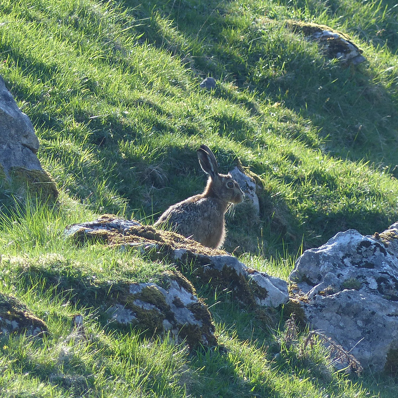
At the end of my walk I was following Birk Beck again, but on the south bank this time. A Hare sprang up from where it had been hidden in the grass and raced away from me. Seemingly by coincidence, a Buzzard soared in from another direction, but their paths converged and for a few seconds the raptor flew just above the Hare. I couldn’t decide whether the Buzzard actually hoped to catch the Hare, but it seemed like an uneven contest – the Hare was so fast and soon away and safe. Shortly afterwards, I stopped to check my position on the OS app, put my phone back in my pocket and then realised that there was another Hare right by my foot. It seemed to be trying to press itself down into the sward and with its eyes, either side of its head, was able to look straight up at me without lifting it’s head at all. We stared at each other briefly, then I reached for my phone again, the spell was apparently broken and the Hare, well….hared off at great speed, much too quick for me to get even a rubbish photo.
M6 bridge over the Lune.M6 bridge over the Lune.
Although the OS map shows the footbridge, it also says ‘Ford’ by the path, so I was very pleased to discover that the bridge was for public use and I wouldn’t have to finish my walk by immersing myself in the Lune.
Footbridge over the Lune.
MapMyWalk gives 16 miles and 400m of ascent. A very full day in many ways.
I have several more Lune Catchment posts to come and can’t pass up this opportunity to share again the marvellous online book ‘Landsof The Lune‘ by John Self, which if you have interest in the area is a must read.
The route – should you wish to trace it on the map and/or on the ground: park at Old Tebay, follow the Lune north-east, cross the Lune, through Bybeck, under the motorway, left on the track to Birk Beck, follow Birk Beck to Bridge End, right on the lane, path off to the left, cross Birk Beck and take the minor lane to Scout Green, paths by Birk Beck to Shap Wells Hotel, path up Wasdale and keep that direction to cross the A6, turn left to recross the A6 over Bretherdale Bank and down Bretherdale, minor road to Bretherdale Hall, turn left and cross the beck, turn right at the meeting of paths, then along Birk Beck and the Lune to Tebay.
Next weekend, TBH will be taking part in a charity walk. Back in March, when she signed up for it with colleagues from work, she was a bit vague about the details; she could tell me the date, but not the charity, or the route, or the length, or the amount of climbing. It transpires that it’s a marathon: 26 miles around Ullswater, with about 900m of ascent and it’s for MacMillan.
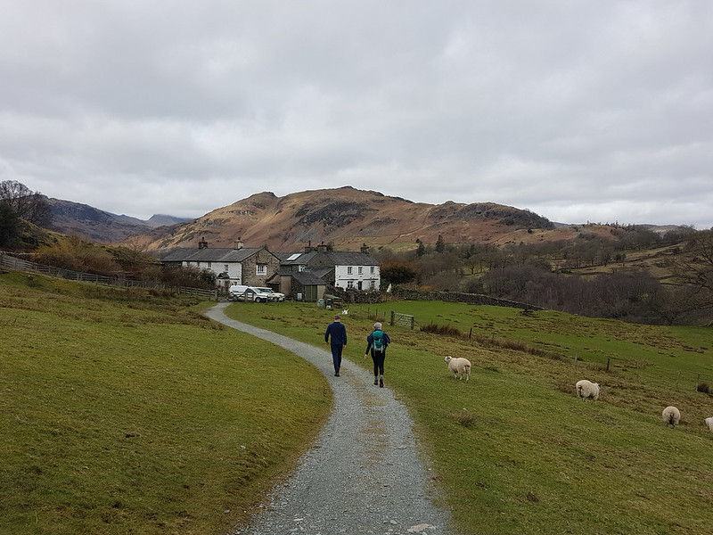
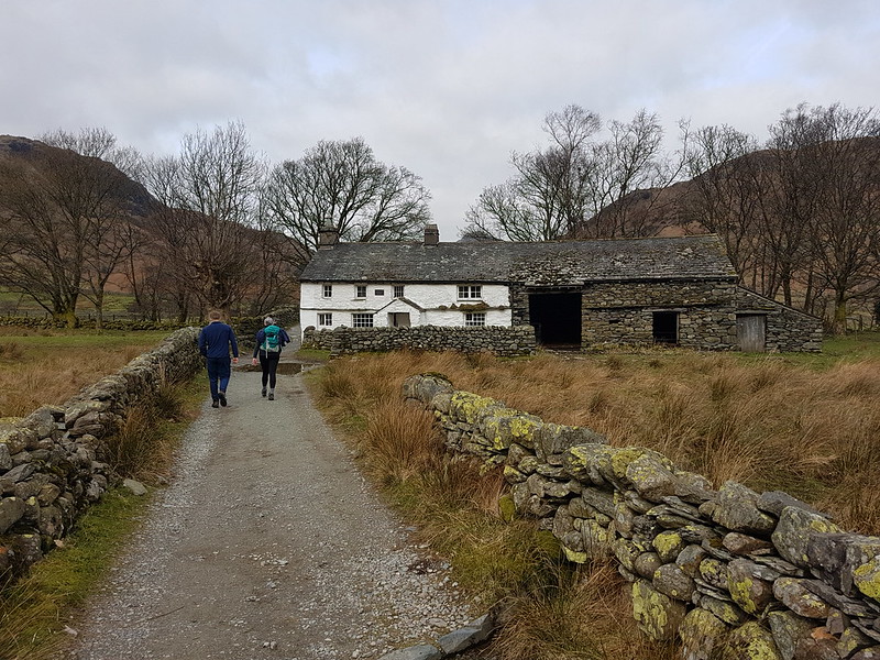
High Park, Little Langdale.
What she did have was a training schedule, which involved a four mile walk pretty much every day, with longer routes at the weekends. Since she was diving into this routine mid-scheme, she requested that I plan a route of 14 miles with a modicum of ascent.
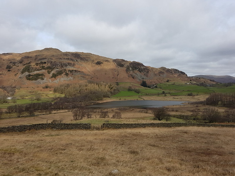
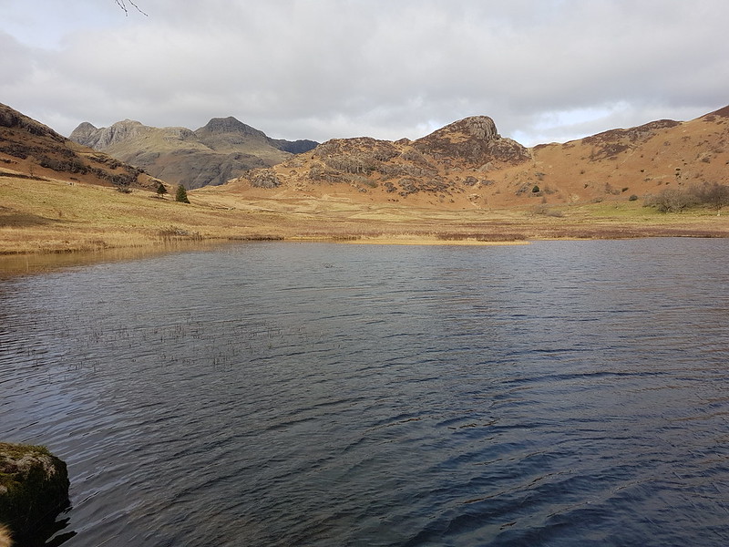
Lingmoor and Little Langdale Tarn.
I used the OS app to plot a course around Little and Great Langdale, a sort of Tour de Lingmoor, a longer version of a walk the boys and I did with the scouts a few years ago, and not too dissimilar to the first half of my, rather wet, ascent of Lingmoor last Easter. The app gave the length of the route as 12¾ miles, with just short of 500m of climbing, which I was a bit surprised by. I was pretty confident that in reality it would work out as a bit longer since, as much as I had fiddled about, my route on the map still consisted of a series of straight lines and would have cut out some of the fractal complexity, or to put it another way, the wiggly bits, of actual paths.
Bridge End, Little Langdale.
B decided to join us for the walk. If you’re wondering why he doesn’t have a rucksack, it’s because he was still suffering from his rugby-tackle induced shoulder injury and would have been uncomfortable carrying one.
I’d originally planned to use of the National Trust car parks, either in Langdale or at Blea Tarn, but when we got to Skelwith Bridge and saw that there were spaces available to park there, I realised that that was a much better option. It also gave TBH and B an opportunity to pop into Chester’s and supplement their packed lunches.
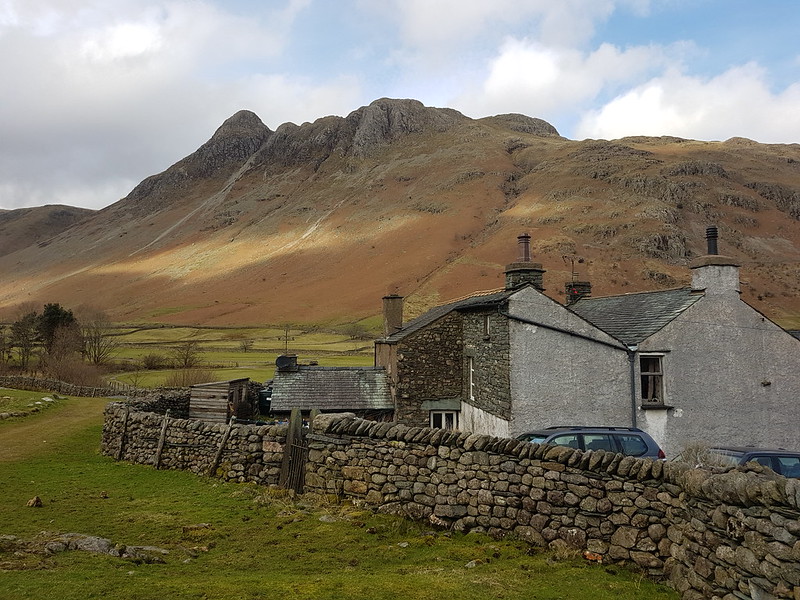
Fell Foot, Castle How, Pike O’Blisco, Langdale Pikes.Waterfall in Bleamoss BeckBlea Tarn, Langdale Pikes, Side Pike.
It was a gloomy day, but by the time we reached Blea Tarn, there were signs of it brightening up. Nevertheless, the trees by the tarn provided a bit of welcome cover from the cold wind for our lunch stop.
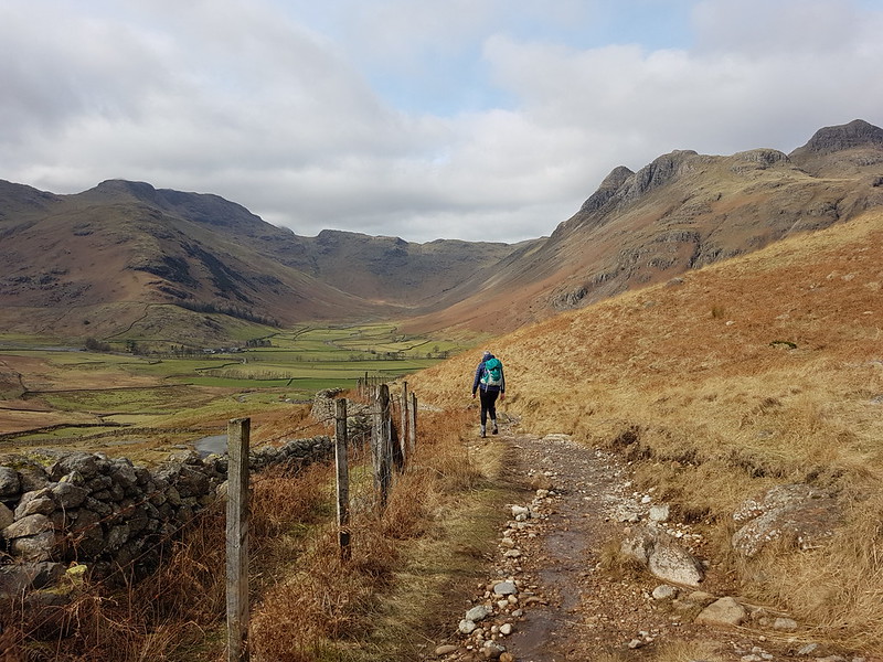
Descending towards Mickleden.Langdale Pikes.Langdale Pikes and Mickleden pano.Pike Of Stickle and Loft Crag from Stool End.
The paths were all quite busy; it’s a wonderful area, so why wouldn’t they be? The area around Slater’s Bridge and Cathedral Quarry in Little Langdale were particularly popular. Our little excursion into Mickleden was the only part of the walk where I don’t think we saw other walkers.
Approaching the footbridge, and the weir, Mickleden Beck.
The patches of blue soon disappeared again and by the end of our walk it was threatening rain, not that that put a damper on our day in any way.
Looking back to Harrison Stickle.The classic view of the Langdale Pikes across Elter Water.As planned.As walked.
According to MapMyWalk the route was actually almost 14½ miles, with just over 400m of ascent. If you’re planning a Mighty Hike and need a tune-up bimble, you can’t go far wrong with this circuit.
TBH stuck fairly strictly to her, plan until a bout of illness precluded long walks, and then she never resumed, deciding that she is probably fit enough as it is. More training walk write-ups still to come, however.
It was a strike day. I was on the picket line as you can see!
You can see my car in the photo, the only one in the parking space at Sadgill, at the end of the metalled road along Longsleddale. Admittedly, I’d got there fairly early – but, at the weekend, the limited spaces here fill up very quickly. On this midweek day in March, there were eventually three cars. The weather wasn’t ideal, I’ll grant, but the MWIS forecast had actually suggested that the cloud would be lifting off the hills in the Eastern Lakes. It didn’t.
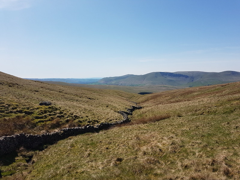
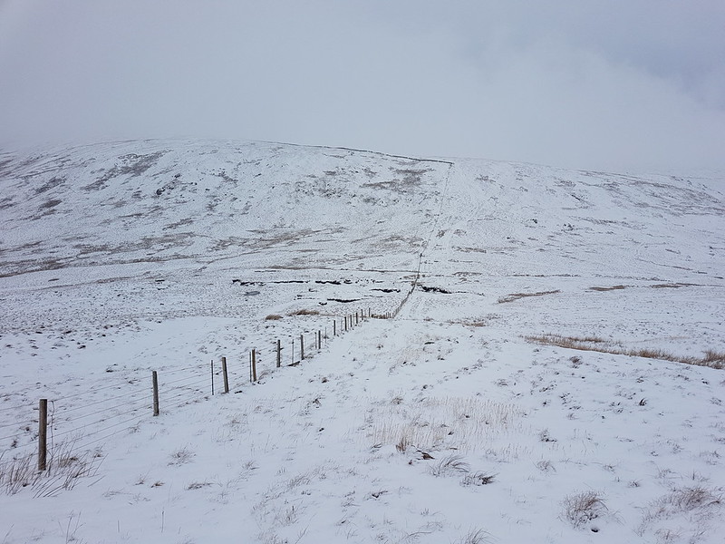
Looking up Longsleddale.
It’s not marked on the map, but there’s a path signposted from the parking area which heads directly uphill towards Great Howe – I’d noted it on a previous visit and had in mind to try it out.
The same view from just before I entered the clouds.
I haven’t been carrying my stove this winter, settling instead for a flask of hot cordial and an insulated mug of tea. I stopped to drink the tea, and to video-call my mum and dad, when it was evident that I would shortly be entering the cloud and losing the view.
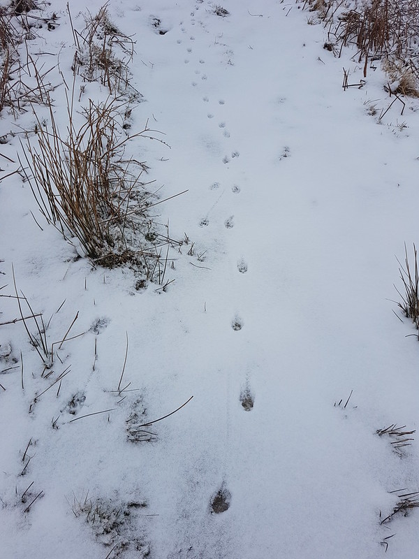
Looking down Longsleddale.Typical view for the next few hours.Fox tracks?
Throughout the day the paths had tracks like these, often two or three sets, along them. When the guy who had arrived in the second car in the car park overtook me, he expressed surprise that I didn’t have a dog with me, but I think the tracks were actually made by a fox or foxes.
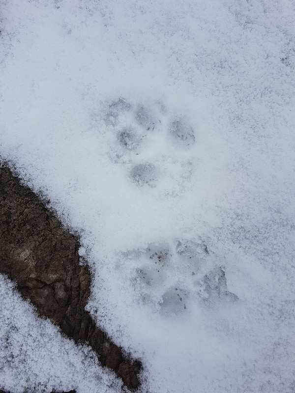
Fox prints?Crags looming out of the mist.
Visibility was poor, but with the OS map to help, navigation was relatively easy. Judging distances and the size of things can be difficult however. Suddenly a rise will loom up, looking huge, but then turn out to be negligible.
Yours truly on Grey Crag.
I thought the area marked on the map as Greycrag Tarn (where there is no Tarn) might be awkward to navigate, both in terms of not losing the way and because it looks boggy on the map. In the event, I just stuck to a bearing, which worked really well, and I didn’t encounter anything too sloppy for Malcolm’s boots to cope with.
Ice covered grass stems.
It had become quite windy, and before beginning to climb again toward Tarn Crag I found a marvellously sheltered spot to drink some hot cordial, eat my lunch, and admire some icicles.
Icicles.Yours truly and the survey pillar near the top of Tarn Crag.Fence – a handy navigational tool.Descending out of the cloud to Brownhowe Bottom.Steel Rigg and Raven Crag.Heading down in to Longsleddale.Waterfalls in Wren Gill. Or is it Cleft Ghyll?Longsleddale after a significant thaw.
A couple passed me as I finished my cordial beside the track down into the valley. They must have arrived in the third car. That was all the people I saw during this walk.
Galeforth Gill – a good alternative way up.
There’d been a significant thaw; the treacherous layer of verglass, which had coated the surface of the track when I’d arrived, had now gone. I’d been a bit concerned about descending the track in such icy conditions so wasn’t upset to see the change. The axe and crampons I’d lugged around all day, didn’t get put to use. Despite the far from perfect weather, I’d really enjoyed having a day out in winter conditions. Now, how I could I engineer more walking on quiet days when everybody else is at work…?
I can dream!
It turns out it was almost exactly ten years after my last ascent of these two hills. And quite a few years since I brought the kids to Longsleddale for a swim.
The day after our exertions on Stob Ghabhar. The forecast was okay, but we were looking for an easy stroll which was in the general direction of home. As we did last year, we parked near Kilmahog, not far from Callander.
A ditch full of frogspawn.
Our route took us on forest tracks up to the bottom end of Loch Lubnaig and then back along the disused railway line which follows the Garbh Uisge. It was a very pleasant, sociable walk.
Old buddies.
As they had done most of the weekend, A and S, who have been friends since before they started school, were busy catching-up now that they’re both studying at far-flung universities.
Garbh Uisge.Loch Lubnaig.
We even had a little sunshine as we approached the loch, and we found a spot to sit down and enjoy it whilst we ate some lunch.
Loch LubnaigGarbh Uisge.Falls of Leny.Garbh Uisge.In the woods.
The walk back through the woods by the river was very pleasant. A lovely conclusion to an excellent weekend.
Waterfall on Tarn Beck near Seathwaite in the Duddon Valley.
When, last January, in the first flush of enthusiasm for my new assault on the Wainwrights, I tackled the Coniston Fells in less than optimal weather conditions, I chose an inefficient route taking in the three central fells of the range and leaving three scattered outliers – Dow Crag, Grey Friar and Great Carrs. With hindsight, I think that this is no bad thing, since it gives me an excuse for more walks in the area.
So, this mid-November Saturday found me parked on the roadside by Tarn Beck, just outside Seathwaite in the Duddon Valley.
Another waterfall on Tarn Beck.
It was a glorious morning, and very quiet in Seathwaite, in stark contrast to what I might have expected on the Coniston side of the hills.
Heading away from Seathwaite.Harter Fell.
Harter Fell tended to dominate the views on this walk and I took lots of photographs of it, many of which, but by no means all, have made it into this post.
Tongue House.Throng Close and Tongue House Close. Tongue House High Close is slightly out of the picture to the right.
The Coniston Fells are liberally supplied with crags and hows and pikes and this western side is no exception. The path climbs between Tongue House Close and Tongue House High Close, just right of centre in the photo above.
Harter Fell pano.Grey Friar.
The path I had chosen fell away slightly leftwards here, towards those shaded crags on the slopes of Troutal Fell, the south-west arm of Grey Friar. Between here and those crags, the path crosses Tarn Beck. There’s no footbridge marked on the map, but this is the busy, touristy Lake District – there’ll be a bridge surely?
Harter Fell again, and Cirrus clouds – a sign of what was to come?
The ground descended very gently towards Tarn Beck and was quite boggy. When I reached the stream…
Tarn Beck again.
…it was to discover that there is no bridge. What’s more the stream was large and deep and fast-flowing.
It was so sunny at this point that I actually contemplated a swim, but sanity prevailed, in part because of how fast the stream was running. I hate to think how cold the water would have been.
Since I clearly couldn’t cross Tarn Beck without a dip, I followed it instead and then cut up to the dam of Seathwaite Tarn…
Seathwaite Tarn pano.
I paused on the dam to take several photos of a lone Goosander, none of which came out very well.
The rough rocks of Tarn Brow and Cirrostratus – another warning sign!
The early part of the steady climb away from the tarn was enlivened by the presence of numerous brightly coloured waxcaps…
Waxcap.Waxcaps.
Naturally, I took loads of pictures, but I’ve restricted myself to just two here.
Brim Fell and Dow Crag.
In my mind, Dow Crag is always associated with the eponymous crag above Goat Water, with the south ridge over Brown Pike and Buck Pike and with Easy Gully, which is far from easy and which I haven’t ascended for many, many moons. It was good to see it from this less familiar perspective.
Harter Crag, with ominously dark skies behind.Looking north – the Scafells capped with cloud.Looking south-west, back to the Duddon Valley. Oh no!Brim Fell and the Old Man – just evading the clouds.
Sadly, I arrived at the summit cairn on Grey Friar at the same time as the low cloud brought by the encroaching weather front. I was lucky to still have some views, but not the spectacular views I might have expected given the open blue skies at the start of the walk. In addition, the temperature had dropped appreciably and, without the warming sunshine, it now felt very much like mid-November in the hills.
Grey Friar summit. And very grey weather.
I found a sheltered spot for a quick drink and a snack. Truth be told, as usual, I had an overly ambitious plan B which involved climbing the main ridge and completing a horseshoe round to Dow Crag. It was clear though that I didn’t have the daylight hours left for that route, or the weather to make the extra effort worthwhile.
One last, contrasting, view of Harter Fell.
So, I beat a hasty retreat, retracing my ascent route initially, before following a track down, which gave very easy walking and which is presumably a remnant of the construction of the Seathwaite Tarn dam.
Looking down to Seathwaite Tarn.Seathwaite Tarn pano. Dow Crag now lost in cloud.
Presumably due to the lack of retail outlets and other tourist attractions, the lovely Duddon Valley often seems to be relatively quiet; I saw very few other walkers on this outing. When I get around to ticking-off Dow Crag I think I shall have to do it from this side for a change.
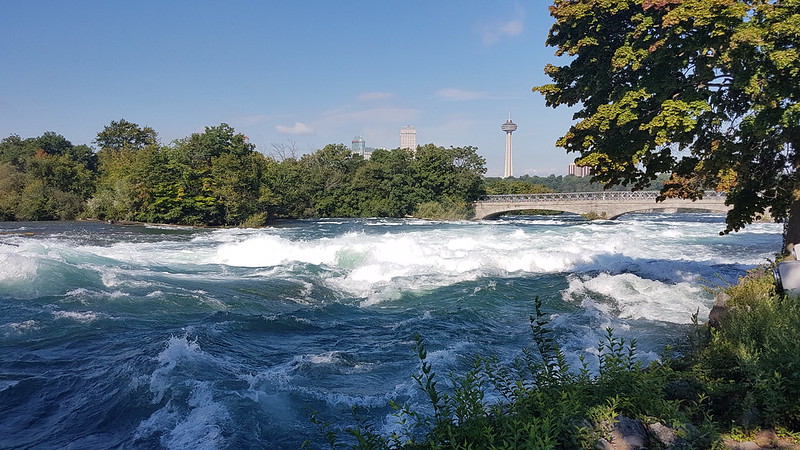
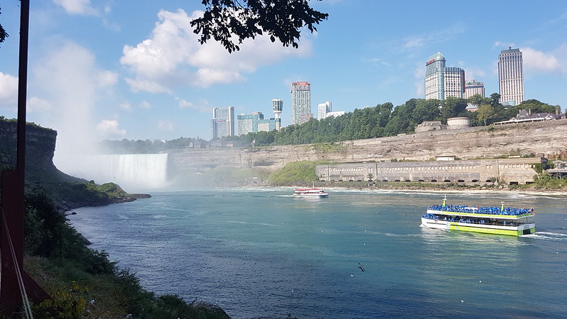
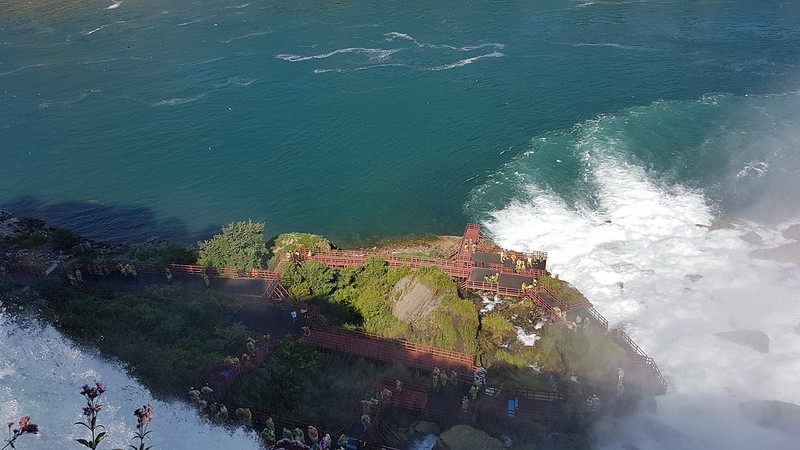
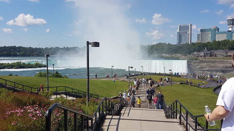
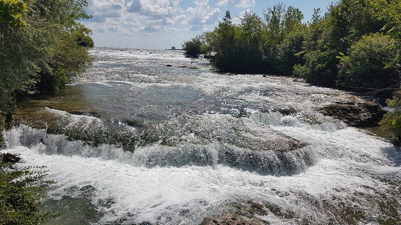
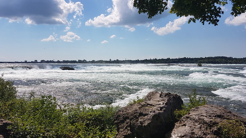
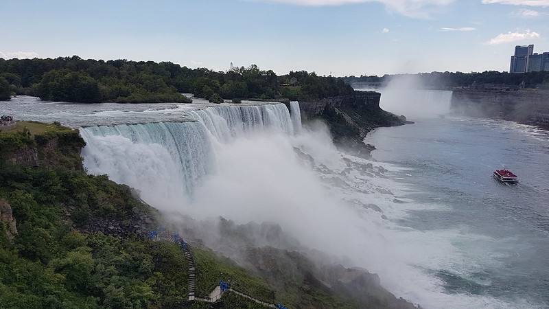
So, inevitably, if you’re in the area, you really have to go and see Niagara Falls. We’d seen the great plume of spray which rises high above the falls the day before – it’s unmissable even from quite a distance away.
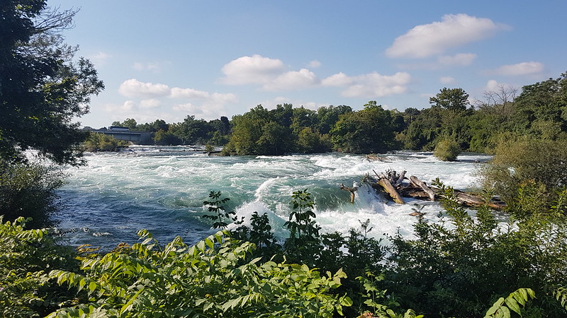
We’d had some good advice, from our local guides, about free parking by the river. This meant that we had an opportunity to walk by the river, and the rapids, which were pretty awe inspiring in their own right.
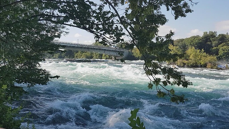
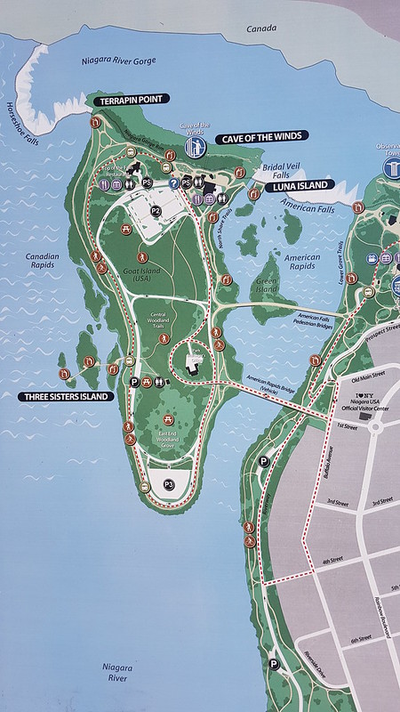
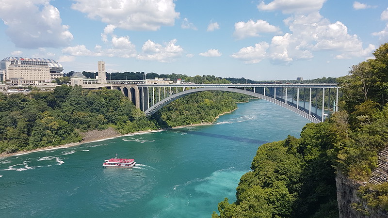
American RapidsAmerican Rapids – this one is a film – click on it to watch it on flickr.Route map.
I can’t remember, unfortunately, where I got this map from. I took a screenshot, so still have it on my phone. We parked in the lay-by on the bottom right of the map, followed the riverside paths to the pedestrian bridge then circled the island, anti-clockwise, visiting the Three Sisters Islands, eventually returning to the car for a picnic lunch. After lunch we walked back towards the falls and the Observation Tower in the top right-hand corner of the map, for our final treat of the day.
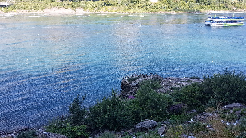
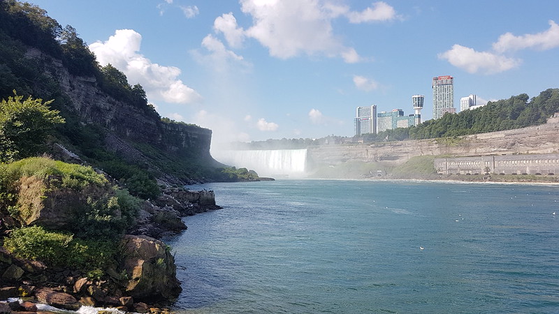
A gulp of Cormorants clustered by the river.A glimpse of Horseshoe Falls.
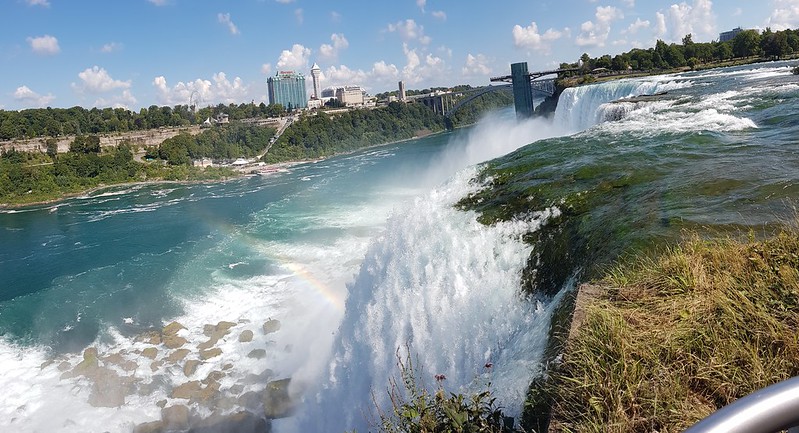
The tall buildings are on the Canadian side of the river, which I’m told is ‘tacky’. The US side was, at one time, heavily industrialised, due to all of the free power available, but after a public campaign and subscription, was purchased and turned into a park.
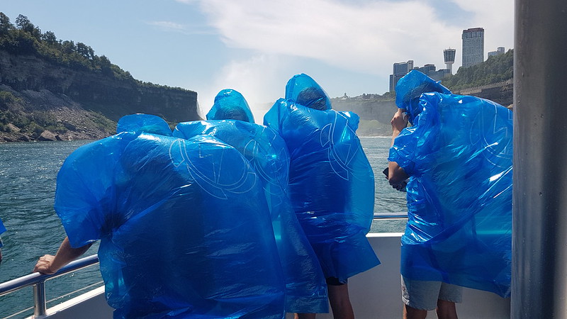
The boats here are Maids of the Mist which offer an excursion right into the cauldron of Horseshoe Falls. On the American boats everybody wears a blue coat – I say coat, but really polythene bag is closer to the truth – whereas the Canadian boats offer their customers red bags. I’m not sure why the colour-coding is deemed necessary.
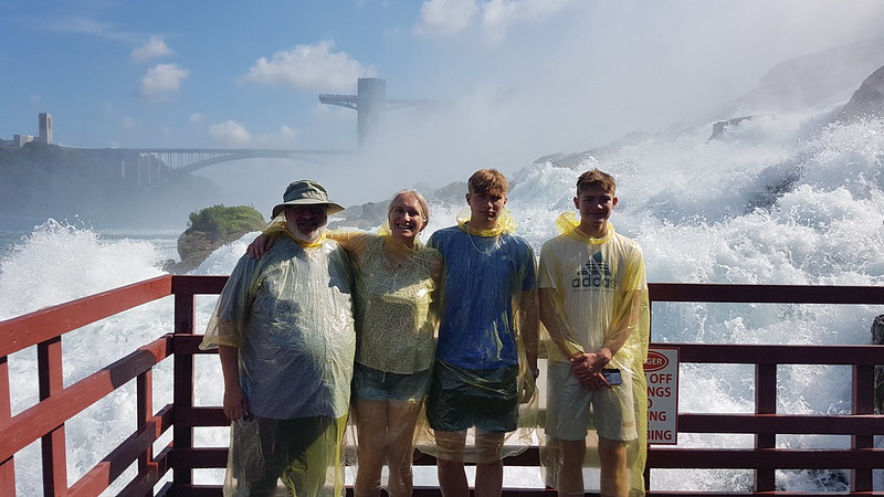
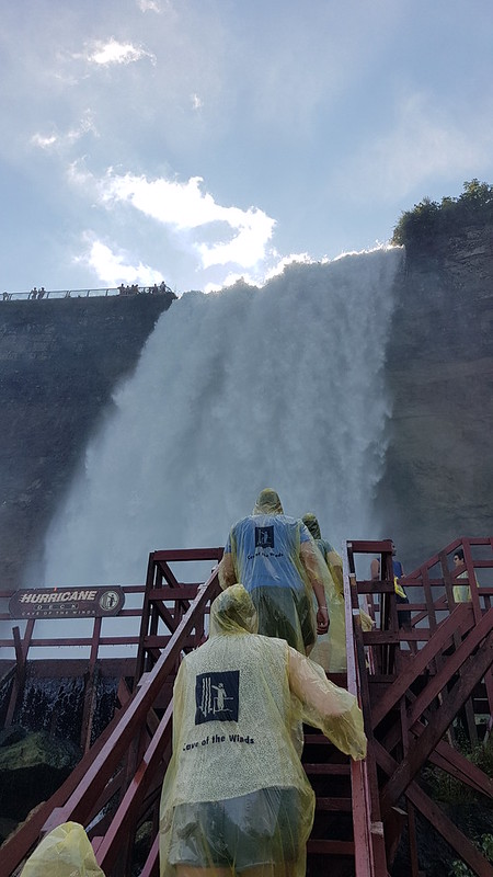
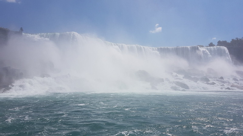
Because we were relatively early, TBH was convinced that we could avoid having to queue for the Cave of the Winds and she was absolutely right. A lift takes you down to the bottom of the Falls…
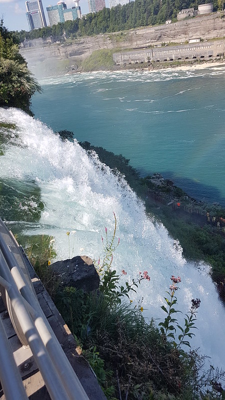
American and Bridal Veil Falls from below.
For this experience, the ponchos are yellow. Here we are before we got thoroughly drenched…
B almost breaks a smile.The base of the Falls.
The noise and the wind are phenomenal.
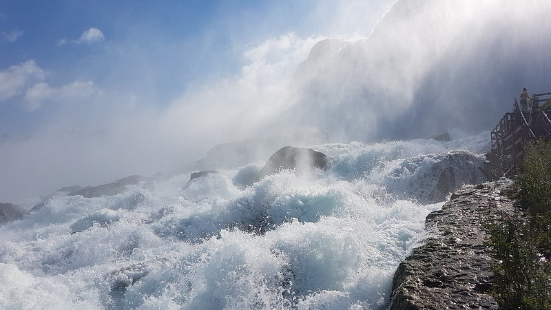
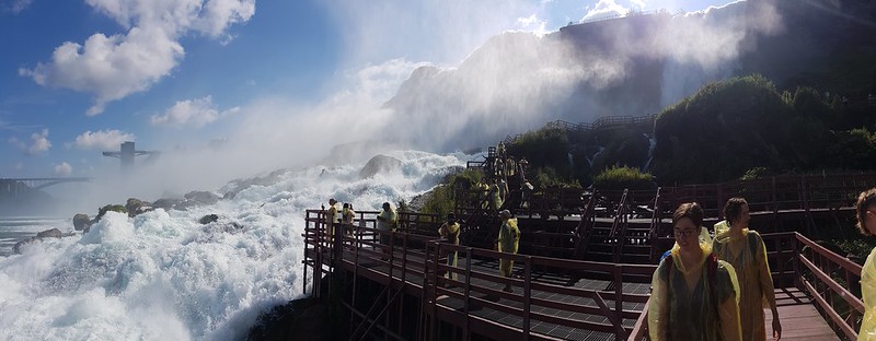
Looking toward Horseshoe Falls.I can’t say I was entirely convinced about the structural integrity of the rather rickety looking platforms.The Hurricane Deck below Bridal Veil Falls.
In places the platforms were awash. The Hurricane Deck was particularly wet. As the name suggests, a powerful blast of wind was driving across the deck, carrying a great deal of water with it. I was happy to watch the others take a cold shower.
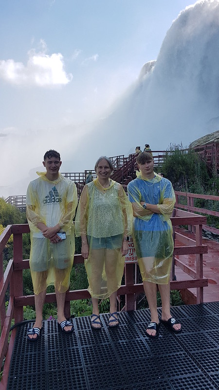
Soaked!
Here they are afterwards. I don’t know if you can tell from the picture, but they were drenched. B was having a wail of a time and almost broke into a smirk.
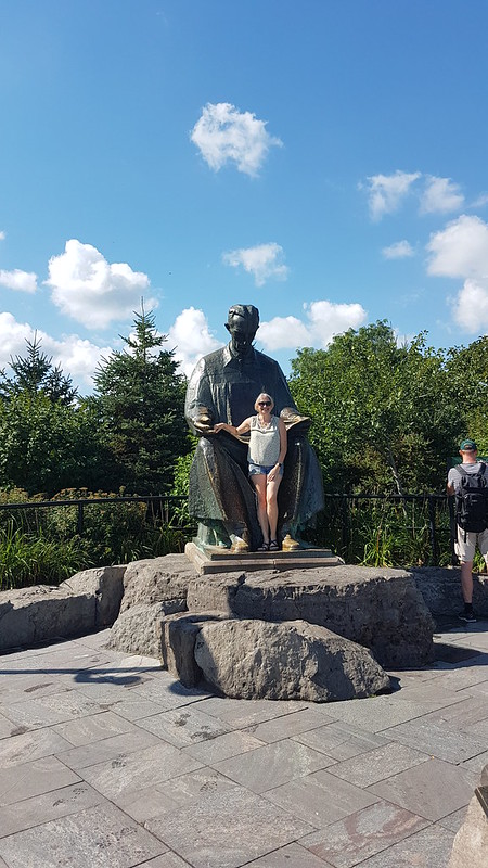
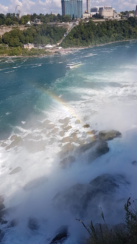
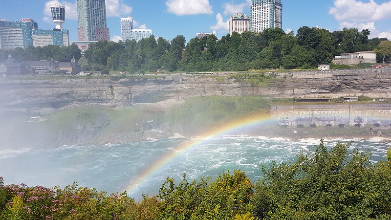
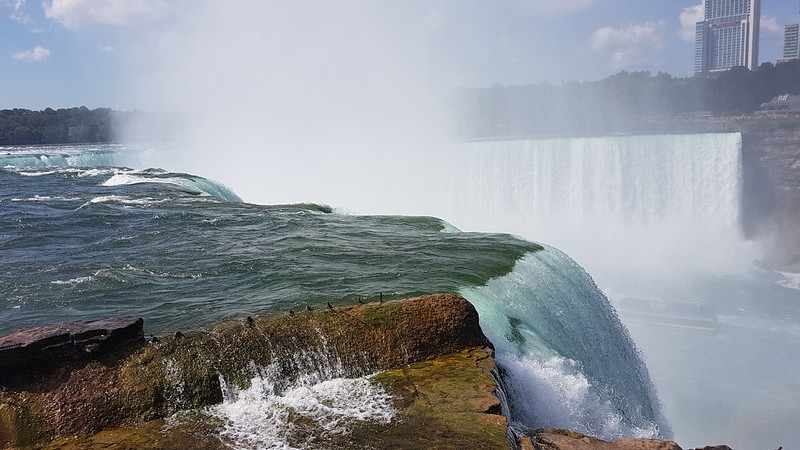
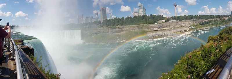
TBH with a statue of Nikola Tesla. Looking down from Luna Island on the Cave of the Winds platforms. Bridal Veil Falls on the left, American Falls to the right.Bridal Veil Falls from above.A rainbow below American Falls.Looking across American Falls from Luna Island.Approaching Horseshoe Falls.A rainbow beneath Horseshoe Falls.Looking across Horseshoe Falls.Horseshoe Falls pano.One of the channels between Three Sisters Islands.Canadian Rapids.Across American Falls to Horseshoe Falls.Rainbow International Bridge.
The penny-pinching side of my nature asserted itself and I declared myself satisfied with what I’d seen. Somewhat to my surprise, the DBs agreed. Thankfully, TBH told us we’d wouldn’t be coming back this way any time soon, and that she was going on the Maid of the Mist, with us or without us. We rapidly changed our minds and were soon queueing for a trip. Thank goodness we did.
American Falls.American Falls.
We weren’t very close to the front of the group going on to the boat. Lots of people were rushing to try to get a spot near to the front on the top deck, but hardly anyone was stopping on the lower deck, so I suggested we try that. It was a great choice, there were hardly any people there, we were able to stand right at the front, but also had space to wander about and to find other vantage points.
The wind turned the ponchos into massive air-bags.American Falls and Bridal Veil Falls.Approaching Horseshoe Falls.Part of Horseshoe Falls.
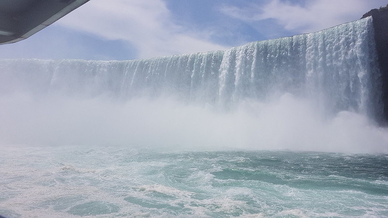
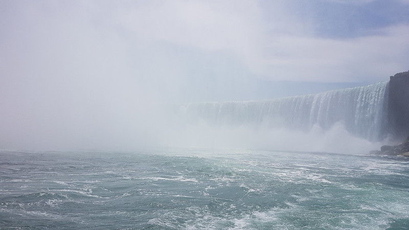
As we approached the maelstrom of Horseshoe Falls, the the falls themselves disappeared into the drenching mist. The roar of the falls was deafening, the boat swayed on the surging waters. It was chaotic, and my attempts to take photos were doomed to failure, but the immense power of the falls has left a lasting impression.
Hoseshoe Falls – sort of.
I was amazed to see gulls and diving ducks swimming on the surface of the river – it seemed incredible that anything could survive on or in the river – or that there could be any food there for the birds to find.
When you get off the Maid of the Mist, you have the option to climb a set of stairs at the side of American Falls – you can see them in the photo below. On a fine sunny day, full of very wet and windy experiences, this may well have been the wettest and windiest. Near the top, there was a bit of a queue to climb the last few steps – we decided that we really had now had enough and beat a hasty retreat back down the waiting lift.
Two days after my birthday, and time to climb some actual hills, although, in truth, quite diddy ones. I can’t remember why, but it was already well after midday when we parked in the car-park just off the busy A593 which runs between Ambleside and Coniston. We were in the little car park near Glen Mary Bridge which has the dual advantage of being a National Trust carpark and of being beside Tom Gill, the stream which drains Tarn Hows.
Tom Gill Waterfall
We’ve been this way before, and knew that the walk up through the woods, besides the many waterfalls in Tom Gill would be delightful.
Tom Gill WaterfallIn the woods.Tarn Hows
When we arrived at Tarn Hows, the sun was shining and it was really very attractive. I could almost understand why the crowds flock there. It was a bit too cold and a bit too busy to strip off for a swim, so we decided to have a very early, at least in terms of the walk, lunch stop by the shore of the tarn.
Inevitably, away from the tarn, it was much quieter as we headed steadily up through Iron Keld Plantation towards Black Fell. (The OS have both Black Fell and Black Crag, but since I am currently obsessing about ticking off Wainwrights, I’ll stick with the name the old curmudgeon used.)
Looking towards the hills around Langdale and Eskdale.
It was no surprise that the views from Black Fell are superb, but fabulous to have such fine conditions to enjoy them. I was disproportionately chuffed that Lingmoor, where I’d been earlier in the week, featured prominently in those views.
Ambleside and the head of Windermere.Wetherlam.Looking towards Helvellyn and Fairfield.
The weather looked a bit grim over the long ridge of hills which runs north-south between Clough Head, the Dodds, Helvellyn, and the Fairfield Horseshoe. It looked grim over those hills all day. Curious how that can happen and how localised the weather in Cumbria can be.
Below the top of of Black Fell there’s a very substantial cairn. We decided to investigate.
And then decided to have a second lunch stop just below the cairn from where there was an excellent view along Windermere…
The weather still looks grim towards Helvellyn and Fairfield.On our descent, Coniston Water in the distance.
We were on the same path we had followed when we walked from Coniston to Ambleside last summer, although we would divert off to the left fairly soon.
The weather still looks grim towards Helvellyn and Fairfield.Low Arnside Farm. Grade II listed. Property of the National Trust. The gift of Beatrix Potter.
I’m beginning to wonder if there are any old buildings in the Lake District which Beatrix Potter didn’t buy and give to the National Trust.
The weather looks even grimmer towards Helvellyn and Fairfield.
We still had sunshine, but it wouldn’t last much longer. We soon had the first of several short showers, with a little hail mixed in. We didn’t see much sun after that, but it generally stayed fine at least.
Only Lingmoor has the sun.
Although I’ve climbed Holme Fell quite a few times over the years, I’ve never used this route before, up the long broad ridge from Oxen Fell via Man Crag. It’s a terrific route which I discovered in one the Aileen and Brian Evans Cicerone ‘Short Walks’ guides.
The weather looks marginally less grim towards Helvellyn and Fairfield.Black Fell. Not black. Unlike the skies behind it.Yew Tree Tarn and Coniston Water.
We had another brief drink and snack stop on the ridge, but it had become a bit cold and windy to stop for very long.
This is an extremely lumpy ridge with lots of rocky little knolls. Fortunately, we found a series of little paths which wound around the bumps.
Ivy Crag on the left, the top of Holme Fell on the right.The disused reservoir over TBH’s shoulder is reputed to be a good place to swim. It’s on my list!The top.
This painted stone was on the summit cairn. I wish I knew what it was commemorating? The writing just says Africa, Europe, Asia, Aust so I’m not sure that helps. Curious that the Americas are omitted.
Coniston Water.On the descent. Holme Fells impressive crags behind.Yew Tree Farm and Barn. Grade II listed. Property of the National Trust. The gift of Beatrix Potter.Inevitably. I liked the open gallery along the front of the barn.
Some stats: MapMyWalk gives 7½ miles and 360m of ascent. The Evans say 6¼ miles, but their (excellent) route drops down from Uskdale Gap and so misses the top of Holme Fell which probably accounts for the difference.
If you’re looking for a half-day walk in the Lakes I reckon you’d be hard-pressed to beat this one for variety and views.