Sour Howes and Sallows

20220115_123606
River Kent from Ullthwaite Bridge. The monument on Hugill Fell visible on the skyline.

For Christmas, TBH bought me a Wainwright Map:

20220410_074132

“But I’ve done most of them,” I protested, “several times.”

“I know, I thought you might like to start again.”

A map, a ticklist, and a project – an irresistible combination!

Meanwhile, Little S has become highly engaged in his BJJ and trains several times a week, but has decided that the Saturday morning class, which he has regularly attended for years, is no longer appropriate since most of the participants are genuinely little, unlike the rangy Little S.

So, spurred on by TBH and with my calendar suddenly blank every Saturday, I’ve been getting out on the hills much more frequently than I have for a while.

20220115_123828
Croft Head.

Having said that, this walk, from mid-January, started late, after midday – I can’t remember what had kept me occupied in the morning, so a shortish route was required. I was very lucky, at that time of day, to get a parking spot in Kentmere, conveniently next to Ullthwaite Bridge.

20220115_125412
Bothy? by Acretarn Plantation.

We used to tease our friend UF for his obsession with seeking out small buildings which he had identified on the map as potential ‘secret’ bothies. This building looks relatively salubrious compared to some of his hopefuls: the glazing and interior decor are a bit lacking and the ceiling was falling in, but it looks like somebody has used the fireplace, so maybe it’s ripe for adoption by the MBA?

20220115_125333

If there’s been a common theme to my days on the hills to date this year it has been wind, wind and more wind. Cold and often very strong winds.

“Oh, you’ve caught the sun!” People will say.

“No, I’ve been wind-blasted.”

This afternoon was the single exception so far, a fairly mild day, especially for January. A faint path ascends alongside Park Beck, a really pleasant route.

20220115_131823
Park Beck. Sallows behind.
20220115_132622
Brunt Knott, Millrigg Knott, Spy Crag, Hugill Fell. And Mackerel sky?
20220115_135410
Pano. The humps and hollows of Sour Howes on the left. Moor Head, the broad ridge in the middle and Sallows on the right.
20220115_140019
View down Windermere.

It’s a long while since I was last on these hills and I’d forgotten what great views they have, Sour Howes in particular.

20220115_140110
Sour Howes pano.

I parked myself just off the top and enjoyed a late lunch and some hot cordial.

20220115_140556
Looking down into Troutbeck. Wansfell Pike behind. Scafells and Great Gable on the skyline.

The cloud was breaking up, and the sunlight began to alternately pick out different patches of hillside, which was wonderful to watch.

20220115_142606
Red Screes and Stony Cove Pike.
20220115_142900
Sallows.
20220115_142904
Howgills catching the sun.
20220115_143327
Stony Cove Pike, Thornthwaite Crag, Ill Bell, Yoke.

It looked like it would be the easiest thing in the world just to romp up onto the western ridge of the Kentmere Horseshoe, but that will have to wait for another day (and almost certainly won’t be ‘ the easiest thing in the world’ when that day comes!)

20220115_150912
Scour Rigg.

On the way down, I found a path and rather heedlessly followed it, which serendipitously brought me to the curious knolls of Scour Rigg. Then I wandered around Mould Rigg. The OS maps app was an invaluable aid in locating my position and guiding me down Whiteside End and onto the track which would take me back to my car.

20220115_151955
Kentmere Tarn.

MapMyWalk gives a smidgen under 7 miles and close to 400m of ascent (I reckon 420 from the map, so that’s not a bad figure, I don’t think). Not bad for a short winter afternoon. I was also thinking that these hills would be ideal for a summer evening stroll.

So, two down (and Capple Howe is a Birkett), just two hundred and twelve to go!

Sour Howes and Sallows

Farleton Fell – a long awaited encounter.

image

“Digressions, incontestably, are the sunshine; they are the life, the soul of reading…”

Laurence Sterne quoted in I Put a Spell on You by John Burnside.

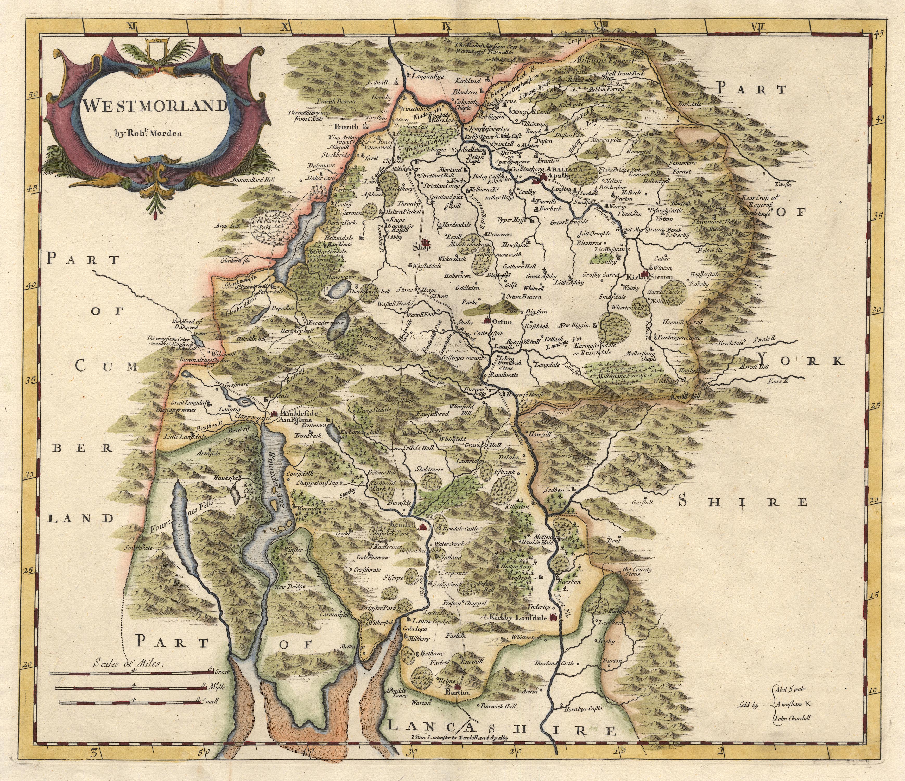
Some years ago now, I went to a meeting of the Mourholme Local History Society. I’ve only ever attended two of the meetings, one on the Silverdale Hoard and the other on maps of the area, and I enjoyed them both enormously, I really should make the effort to go again. Anyway, during the talk on maps I learned that on some early maps, before the concept of contours had been hit upon, hills were pictorially depicted, with the size of the picture presumably reflecting the perceived height of the hill in question.

Screen Shot 2018-04-04 at 11.14.55

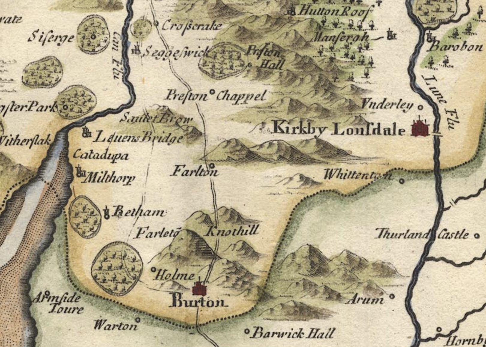
On Robert Morden’s map of Westmorland and Cumberland (1695), Farleto Knothill is one of the biggest hills, not just locally, but on the entire map. Oddly, it’s shown on the west side of the coach road through Burton, now the A6070, when it’s actually to the east. Since Morden relied on information sent by ‘Gentlemen of the County’, rather than carrying out surveys, these errors are perhaps not all that surprising. I assume that the prominence given to Farleto Knothill was precisely because it loomed over the coach road, dominating the view of travellers and appearing to be much larger than it actually is.

image

These days it also looms over Junction 36 of the M6, the South Lakes turn, and has become a very familiar landmark to visitors who drive up to the Lake District from the South. Andy had often mentioned that he had never climbed Farleton Fell, although he has frequently driven past it. Time to put that right.

image

We made a late start, but whether that was due to sleeping-in, board game-playing, poor weather, general indolence or a combination of those factors, I’ve already forgotten.

image

What I shan’t forgot is how unseasonably cold it was. The wind was bitter and I was woefully underdressed. I ended up borrowing a hat from TBH who took pity on me and made do with her hood.

image

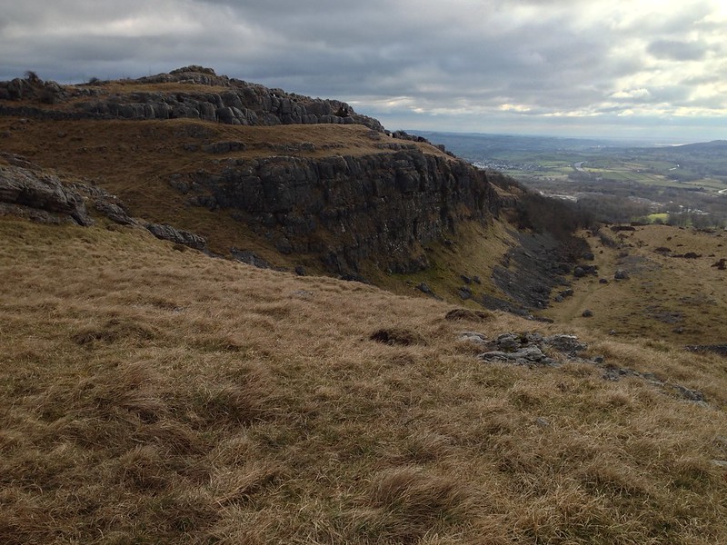
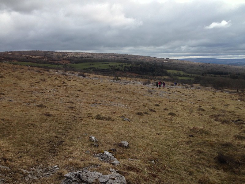
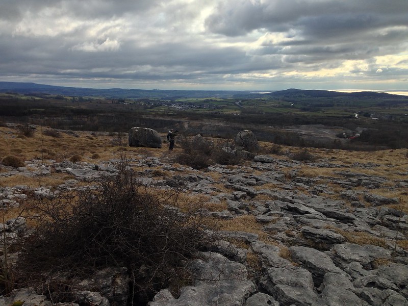
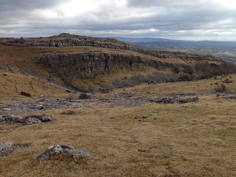
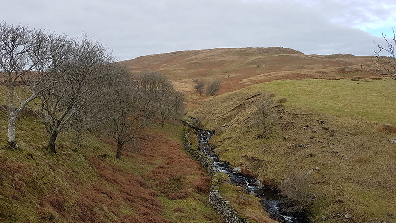
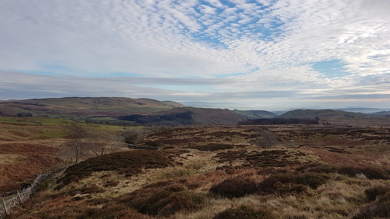
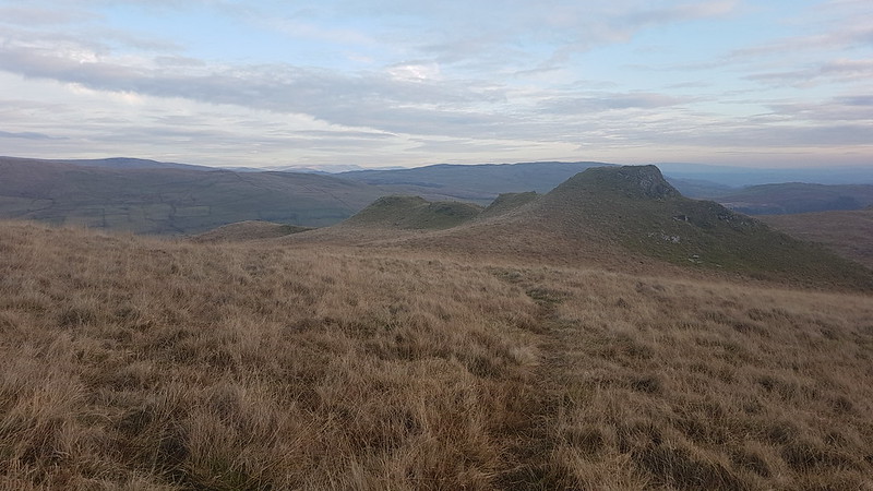
Even on a gloomy day, the views are vast and we took advantage of that fact by heading west first to then follow the limestone edge up to the top.

image

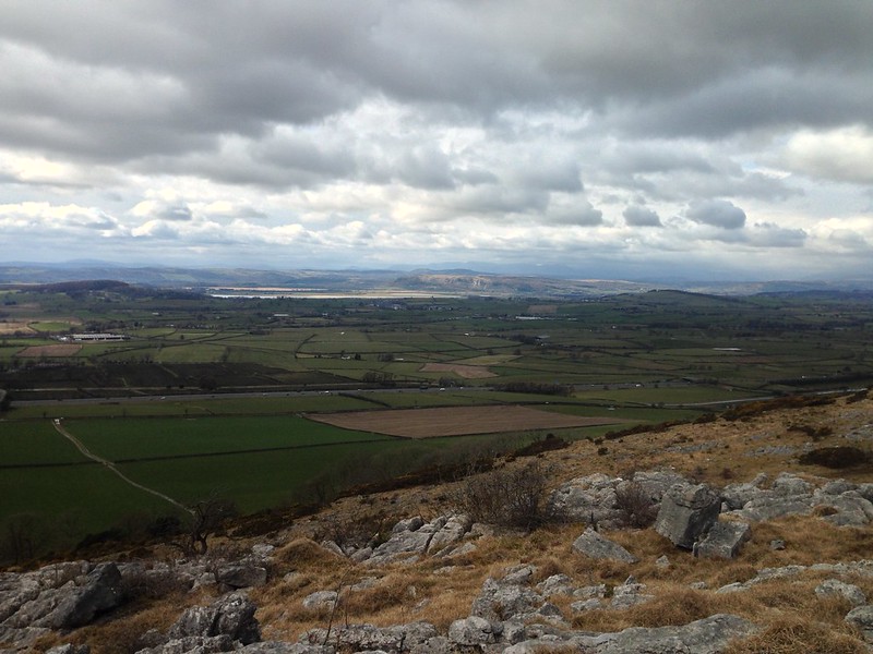
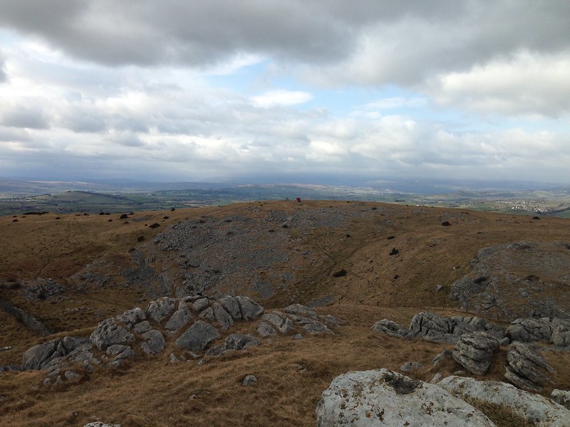
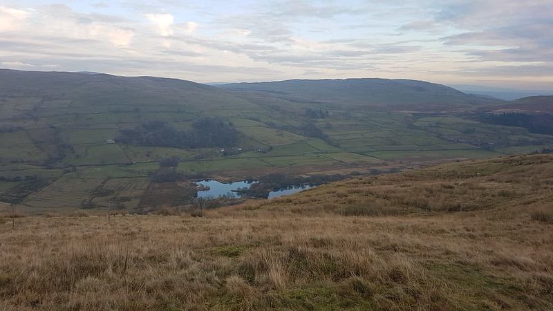
Looking toward Whitbarrow and the Kent Estuary.

Burnside uses the Sterne quote as an epigraph at the start of his book, which I suppose serves as fair warning that this memoir of a sort, is brim full of digressions. Since I finished ‘I Put a Spell on You’, I’ve been reading Graham Hoyland’s ‘Walking Through Spring’ an account of a walk from the Dorset Coast to Gretna Green all taking place between the Spring Equinox and the Summer Solstice. The full quote from Sterne, which is taken from ‘The Life and Opinions of Tristram Shandy, Gentleman’ is:

“Digressions, incontestably, are the sunshine;—they are the life, the soul of reading;—take them out of this book for instance,—you might as well take the book along with them;”

Which is undeniably true of Sterne’s great novel. It also applies to ‘Walking Through Spring’, which is very enjoyable but which sometimes feels like it is less about the walk than a patchwork of the research sparked off by each location or wildlife encounter along the way. Hoyland is a fan of W.G.Sebald so this wide-ranging style is perhaps no surprise. I should say however, that I’m enjoying ‘Walking Through Spring’ whereas I was completely underwhelmed by ‘The Rings of Saturn’. Perhaps I should give it another go.
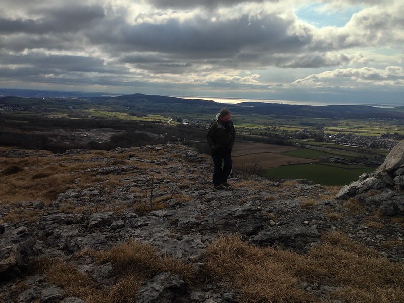
image

Enjoying the view.

This very digressive style of writing about a walk at the very least avoids the ‘I went through the gate and over a stile. It rained. I had ham sandwiches for my lunch.’ blow-by-blow account of a walk which some authors too often descend to. That was one of the many topics we discussed on one of our walks over the Easter weekend and maybe that’s another thing which Hoyland captures – the way that the steady, slow pace of walking allows for wide-ranging conversations and for people to get to know each other well. (He is walking with his partner and also often with friends and relatives).
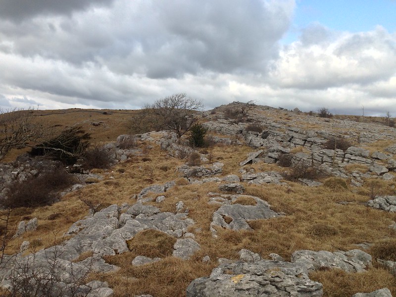
image

Following the edge.

image

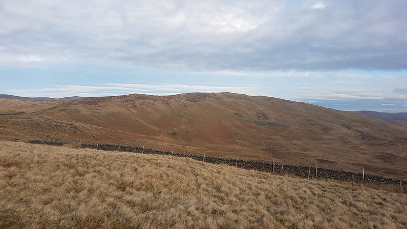
I’ve always called this hill Farleton Fell. The National Trust, who own the land, have it as Holmepark Fell. The Ordnance Survey have both of those names, as well as Newbiggin Crags and Farleton Knott which seems to be attached to the slightly lower top which lies to the North of the main summit and is seen in the photo above.

image

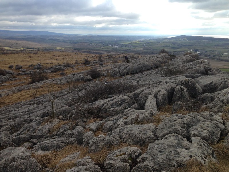
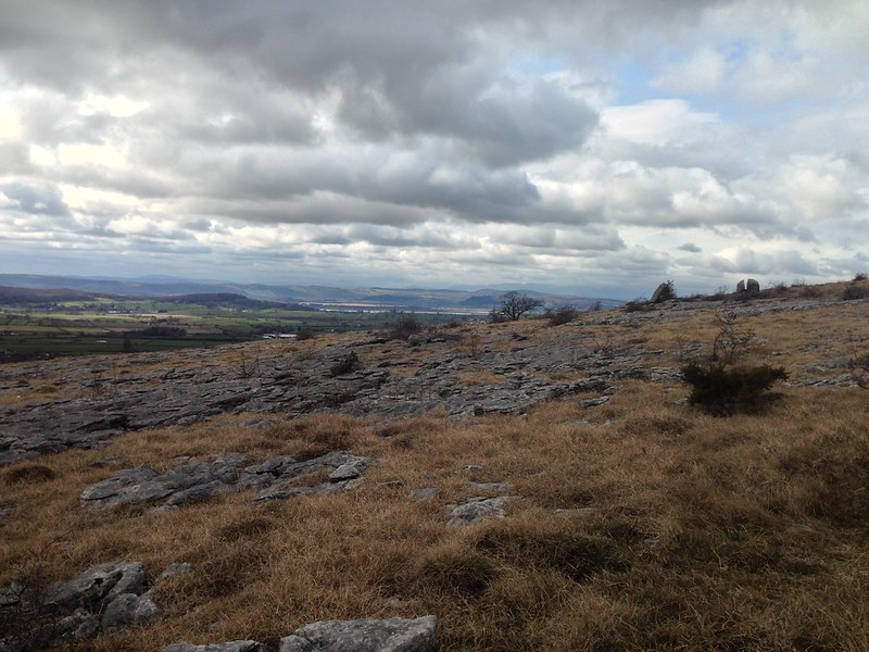
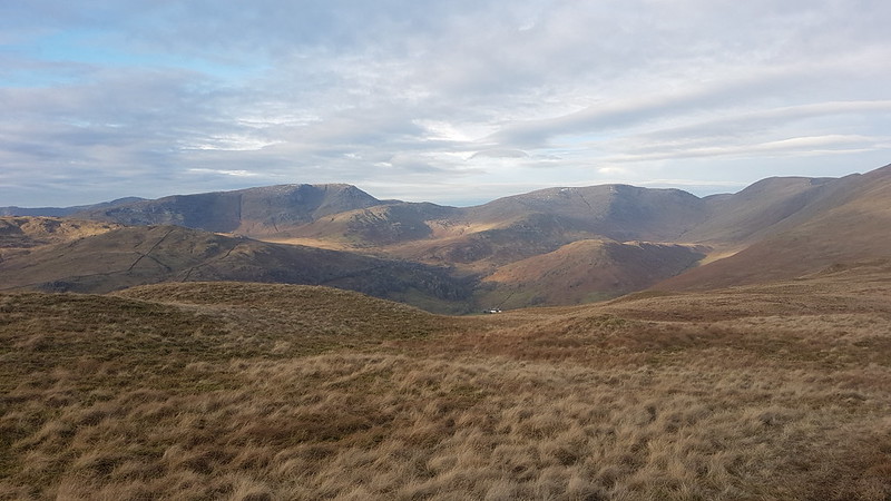
Looking back along the edge to Clougha Pike, Morecambe Bay and Warton Crag.

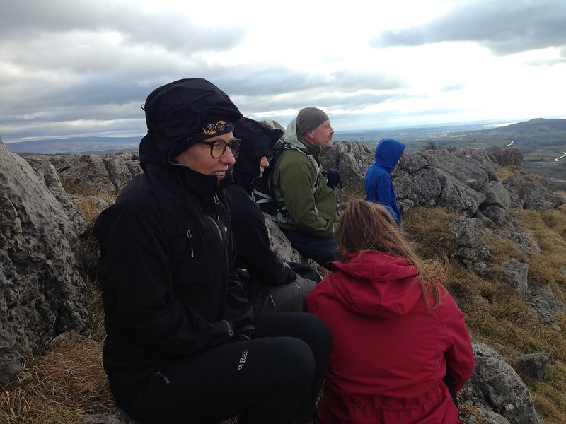
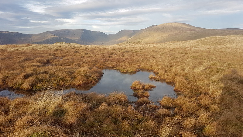
At the top we hunkered down behind the crags, following the example of small group of cows which were using the same shelter from the wind, and enjoyed the views for a while.

image

Andy was insistent that we should go over to Farleton Knott, and he was absolutely right because that gave a great view back to the limestone crags and also, apparently, if you went far enough over, down to the M6 and Junction 36, which he was inexplicably excited about. I decided to forgo that particular pleasure.

image

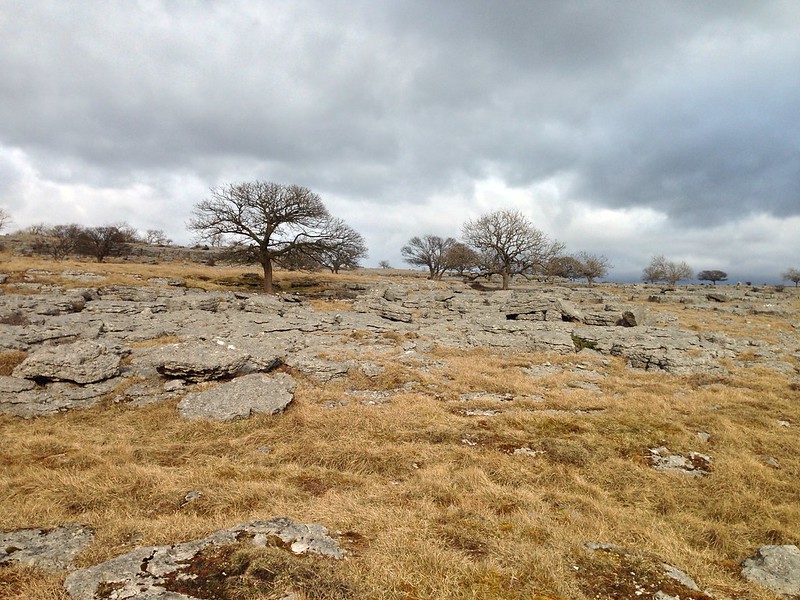
Unfortunately, Little S had fallen on the limestone pavement and skinned his knees, even through his trousers, so we took the most direct route back to where the cars were parked on the Clawthorpe Fell Road.

image

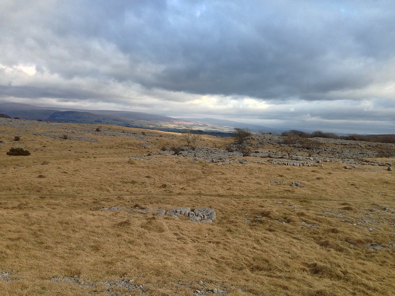
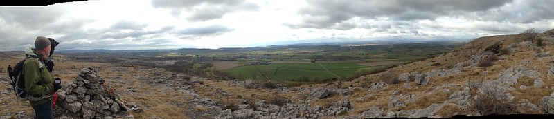
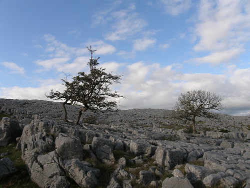
Our route crossed several more areas of limestone pavement and Andy and I were both trying to catch with our cameras the fleeting bursts of sunshine as they passed over the rocks. I wasn’t anywhere near quick enough.

image

I find maps, old or new, endlessly fascinating. You can find the Robert Morden map here. It’s interesting to see what has been included and what left out. It’s no surprise that Silverdale is not there, in 1695, and that Warton is there. The spellings are interesting too: Armside Toure, Helvillin Hill; which is not as big as Farleto Knothill incidentally. It was Robert Morden who published, in 1672, a pack of cards each of which showed a map of one of the counties of England and Wales.

Screen Shot 2018-04-06 at 19.20.56.png

I imagine original 1672 cards are hard to come by, but in 1972 facsimile sets were produced. Over the weekend we played lots of games, though I think it’s fair to say that King Domino was the most popular. I was grateful to TJS though for reminding me how much fun can be had with a few friends and a pack of cards. He introduced us to a game I’ve never played before, but with incredibly complicated variant rules which he remembered in stages as we played and which had me pretty much crying with laughter as had repeatedly said: “Oh, and another thing…”

Farleton Fell – a long awaited encounter.

Hereford Cathedral and the Mappa Mundi

The Wye and Hereford Cathedral in pouring rain

Some days you just have to accept that discretion is the better part of valour. It’s going to rain and it really might be best to admit defeat and stay indoors. Our second day in Herefordshire was just such a day: the forecast said rain, and, boy, did it rain. I was half hoping for an excuse to go and have a look at the Mappa Mundi anyway.

D said he thought the Mappa Mundi was very interesting, but since he had seen it “countless times” he would prefer to stay at home and play on the wii. Aside from A, the other children agreed. Andy offered to “take one for the team” and stay at home too, whilst a select band ventured into a rainy Hereford.

Hereford Cathedral interior 

The Mappa Mundi is on display at Hereford Cathedral, which of course is interesting in it’s own right.

P6072716 

Unsurprisingly, there are a lot of tombs and memorials to the great and the good around the cathedral, but I was particularly taken with this knight.

P6072718 

And his faithful hound.

P6072717

Patient observers of this blog may have noticed that, without knowing anything about them, I’m really quite fond of stained glass windows.

P6072726 

There was an awful lot of it here, so I decided to restrict myself to finding images of St. George and his foe.

P6072737 

Of which, it transpired, there are many.

He doesn’t look much like a Roman soldier here…

P6072738 

It might be interesting to compare the iconographies of all the many countries which have him as their patron saint (there are many).

P6072740 

In this little side chapel, the Stanbury chapel….

Stanbury chapel 

…I broke my self-imposed rule when I found this window….

Stanbury Chapel window 

…which I thought might show Hereford Cathedral and the Wye, but comparing it with the photo above, that seems unlikely.

In the crypt, I found this tomb…

P6072746 

P6072747 

Which was a bit odd, since we were staying with Andrew Jones and his wife, of this parish.

In another small side chapel there are new windows, by Tom Denny, which commemorate the life of Thomas Traherne, a local seventeenth century poet and mystic.

P6072748

And the Mappa Mundi? Well – you aren’t allowed to take photos unfortunately – you’ll have to go and see it for yourself. It’s all I had hoped, absolutely fascinating, and the accompanying exhibition at the cathedral is also very impressive.

I found this snippet of the English translation of the map (which is Latin) on the internet.

Mappa Mundi snippet

The map is peopled with all manner of strange and exotic creatures, some familiar from popular myths and stories, like satyrs, unicorns, centaurs, and the minotaur, complete with labyrinth on Crete, but others less familiar – a race with a single huge foot used like a parasol to ward off the sun, and another race using their huge upper lips in much the same way.

It was gratifying for a yeller belly like me to discover that the map was drawn by ‘Richard of Haldingham or Lafford’ that’s Sleaford today, and that it probably originates from Lincoln Cathedral and was later brought to Hereford – Hereford and Clee Hill were added to the map after the rest had been finished.

So – not much walking today, on this blog “about walking, thinking about walking” etc, but, Thomas Traherne wrote a poem called walking. It’s quite long, but this part seems germane….

To walk is by a thought to go;
To move in spirit to and fro;
To mind the good we see;
To taste the sweet;
Observing all the things we meet
How choice and rich they be.

To note the beauty of the day,
And golden fields of corn survey;
Admire each pretty flow’r
With its sweet smell;
To praise their Maker, and to tell
The marks of his great pow’r.

To fly abroad like active bees,
Among the hedges and the trees,
To cull the dew that lies
On ev’ry blade,
From ev’ry blossom; till we lade
Our minds, as they their thighs.

Observe those rich and glorious things,
The rivers, meadows, woods, and springs,
The fructifying sun;
To note from far
The rising of each twinkling star
For us his race to run.

Hereford Cathedral and the Mappa Mundi

Oolite Now – part III

Fragment of Cotswold Way

So, having become a little obsessed with this strip of limestone which extends across the country I naturally engaged in a little internet research. I found that the Cotswold Way largely follows the scarp along the edge of the limestone. (The chapter in Paddy Dillon’s guide to the National Trails on the Cotswold Way is available on Google Books.)

I found that some people believe that an ancient route, predating the Fosse Way, followed the limestone scarp across the country.

Also that there is an LDP called ‘The Jurassic Way’, mostly in Northamptonshire, running from Banbury in Oxfordshire to Stamford in Lincolnshire. Like the Cotswold Way it’s around 100 miles in length.

I was busy looking at maps of the Cotswold Way when A came to peek over my shoulder.

“What’s that Dad?”

And when I told her…

“I’ll walk it with you.”

She really is very keen.

So then I had a new mission: to find a walk which we could do together over a few days. Not too strenuous and with plenty of interest along the way. I chatted to CJ about it and he had what I thought was an excellent suggestion – in fact something he had walked with his son last year.

So, I have a plan! Not the Cotswold Way – we’ll leave that for another time, but something closer to home, with striking scenery and oodles of history.

Oolite Now – part III

Oolite Now – part II

With my interest in all things geological, and maps in particular, sparked by Garry Hogg’s idea of following the oolitic limestone across England, I remembered that amongst my legions of as yet unread books I had a copy of Simon Winchester’s biography of William Smith – ‘The Map That Changed The World’.

Smith – ‘the father of geology’ –  produced what is widely accepted to be the world’s first geological maps. Most notably this map of England and Wales, published in 1815.

407px-Geological_map_Britain_William_Smith_1815

The oolitic limestone, it transpires, was important to ‘Strata’ Smith – he grew up in Oxfordshire, on the oolite, and his interest in geology began with the fossils he found there as a boy. As a young surveyor he moved to work in the Somerset coal-fields, and to plan a canal to link those coal mines with Bristol. Travelling down mine-shafts and cutting the canal gave him an insight into the complex ways the strata, including oolitic limestone, were folded together in that area. Later he lived in Bath where the iconic buildings are clad in oolitic limestone and the hills to the east of the city are of the same rock.

In the middle of ‘The Map That Changed The World’, Winchester breaks off from telling the story of Smith’s life and discoveries to recount his own journey along the limestone, starting, like Hogg did, at Burton Bradstock.

Small wonder that William Smith found the area around Bath the most congenial for his studies. Not only was it an attractive town, jammed with interesting personalities and lively minds; it was also happily sited at a place in the country’s immense geological mosaic in which the Middle Jurassic rocks outcrop in a blindingly obvious way. The general line of their outcrop, which extends all the way north from Dorset to the Humber in Yorkshire, some 200 miles, is one of the great dividing lines of world geology, once seen, never forgotten. Around Bath, close to where a northbound traveller like me today, Smith two centuries before, first comes across it, it is stupendously memorable.

On the western side of the line are the timid, milquetoast Clays and weakling Shales of the Lias, of the lower Jurassic; on the eastern side are the tough, thick Oolitic Limestones of the Middle Jurassic. On the western side the consequential scenery all is valley and marsh, river course and water meadow, lowing cattle and in high summer, a sticky, sultry heat; on the eastern side, underpinned by the Limestone, everything has changed – there is upland plain and moor, high hills, high wind and flocks of sheep, and in the winters fine white snows blowing on what can seem an endless and treeless expanse.

And on the very line itself, at the point where England has tipped herself up gracefully to expose the Limestones at her core and to reveal the huge physical contrast between their hardness and the silky softness of the Lias Clays below, is a long, high range of hills and cliffs. This line is, for the most part, an escarpment edge that rolls far to the horizon, separating vales and downlands from high plains and uplands.

We see this line in scores of places. Down at the southern end of the country – the Bath end – we see it where Crickley Hill and Birdlip Hill rise hundreds of feet above the town of Cheltenham. We see it where Wooton-under-Edge (a village set on Lias Clay) nestles below the village of Oldbury-on-the-Hill (on Middle Jurassic Limestone). We notice, we feel it, when we drop sharply down from it via a dangerously twisting switchback road as we descend westward from the high plains of Snowshill (on the Middle Jurassic) to the antique shops of the clay-valley town Broadway (on the Lower). We can see it unroll over a dozen miles if we drive along the traffic-clogged roadway of the A46, on the stretch between Bath and Stroud: on going north, everything visible to the left is Lower Jurassic Clay, and hunches low to the horizon; everything to the right is Middle Jurassic Limestone and rises high, its edge topped with oaks from which big black crows take in the view of the grassy fields below.

We see the phenomenon exhibit itself over and over as we rumble northwards across the land – we see it through central Gloucestershire and Warwickshire, through Rutland and Leicestershire, across Nottingham and Lincolnshire – such that when, a day or two after I had left the warmth of Dorset, I found myself in the cold of Lincolnshire coasting along the A15 northbound from Lincoln (where there stands a fine Jurassic cathedral, made of just the same age limestone as that at Wells, down at the far southern end of the outcrop) to Scunthorpe, almost exactly the same held true. To my right rose high limestone plains, buffeted by North Sea winds, dotted with sheep, flat enough and suitably exposed for the building of great Air Force runways and training schools and hangars, To my left, lay a long low valley, thick with farms, populated and cosy. The Middle Jurassic formed the upland landscape to my right; the Lower Jurassic the lowlands to my left.

Better and better. A walker following the western edge of that ‘buttercup-yellow line’ would be teetering along an escarpment edge. High drama!

Now I know the A15 from Lincoln north to Scunthorpe well. I drive it quite often on the way to and from my parent’s house – they live about a mile from that road and from RAF Scampton where the Red Arrows practise. You may feel sceptical about Lincolnshire’s ‘high limestone plains’ and perhaps this should be taken with a sizeable pinch of salt – but I do recognise the description, up to a point. The A15 is another Roman road – Ermine Street – arrow straight. Sensibly it follows a ridge of higher ground (about 60m above sea level so not that high!) ; to the east the land falls away gently but a little way to the west is the Lincoln Edge – two or three closely parallel contours dropping down to a valley which, on the Landranger map, has many adjacent grid squares completely devoid of any contours. Lincoln itself sits on the edge, the Castle and Cathedral atop the edge and the more touristy shopping streets dropping down to newer parts of the city below.

Walking the Lincoln Edge would mainly involve walking along a B-road so perhaps not ideal. But I must admit that Hogg’s idea has certainly kept me happily occupied in spare moments whilst my dodgy ankle, now thankfully on the mend, has precluded the making of more immediate concrete plans.

Oolite Now – part II

Oolite Now – part I

A Limestone Pilgrimage

The third section of Gary Hogg’s ‘And Far Away’ concerns a walk from the Dorset Coast to the Cotswolds which is actually just the first section of an envisaged longer route. Mooching about on the beach near Burton Bradstock he recalls the genesis of the idea for the route:

I remembered how I had first conceived the idea, looking up by chance one morning at the geological map hanging on the wall a yard away from the table in the window at which I write. There it was, that butter-cup yellow streak, slanting away across England from the Dorset coast, north-east-by-east, to vanish at the Humber and reappear again for the last few miles on Pickering Moor in Yorkshire.

Geological map of England

Here the oolitic limestone is 12 (in pale, rather than buttercup, yellow) Follow this link for another lovely old map in which the oolitic limestone is divided into 2, of which one, the lower oolite, is buttercup-yellow.

When I became sufficiently curious to superimpose another map on the geological map that had attracted me I made the interesting discovery that the old Foss Way, the original Roman road from the Dorset coast to the North Sea Lincolnshire coast, followed this line of buttercup-yellow for a very considerable portion of its 180-odd miles. The legend on the map showed me that the colour in question stood for oolitic limestone. If then I mapped out a walk that used the Foss Way as a line for my left flank to rest on I could follow this limestone across England for as far as I liked to walk.

Fosse way map

In fact, the Fosse Way ran from Exeter (Isca Dumnoniorum) to Lincoln (Lindum). And 180 miles seems like a hopelessly inadequate under-estimate. But, let’s not quibble – it’s a lovely idea, which has quite captured my imagination.

Oolite Now – part I

The Best Little Walk?


Not so long ago I was musing on the elements which come together to make a ‘good day on the hoof’. On Saturday just gone I had a day with my friends M and F which must have come pretty close to perfect. Halfway decent weather is clearly a prerequisite: the forecast had been dreadful and the early part of the morning was wet, but fortunately F is very attached to her duvet and by the time we were climbing Gummer’s How the sun was shining and out of the cold wind it was very pleasant. Gummer’s How must get bored with being described as a Lake District mountain in miniature, but ‘the cap fits’, and so it was a little disconcerting to arrive on the top to find a small herd of cows sunning themselves there.


 M and F on Gummer’s How.

The views – south across the Kent estuary, east to the Howgill fells and north along the Lake to the higher fells of the lake District – are stunning.


“a lovely little pool among the hills, long and narrow, beautifully indented with tiny bays and headlands”

Nathanial  Hawthorn on Windermere quoted in ‘The Tarns Of Lakeland Volume 2: East by John and Anne Nuttall

There are many larch trees on the slopes of Gummer’s How and they were flowering, the tiny spiky red flowers looking like miniature pine cones.


Birch Fell, another Birkett, is covered with forestry, we probably found the top – it was hard to tell, and after a bit of forest bashing we found a slight path which follows the boundary of the forest down to a boggy right of way which in turn took us to the road at Lightwood.

On the verge we found large round leaves with flower-stalks between.

It looked rather like butterbur but the flowers were white. I’ve since discovered that there are two introduced species of butterbur with white flowers – white butterbur and giant butterbur. So this will be one of those then…

A fairly long section of road-walking here was justified by the lunch stop which fell roughly in the middle of it – The Mason Arms at Strawberry Bank. Be warned however – the food is quite pricey, and don’t order the baked mushrooms as a main course, as F did, unless you are on a severe diet. What’s special about the Mason Arms is the beer however – a sign outside boasts that they serve 200. I had a couple of very pleasant tipples – I did cause some consternation at the bar when I asked for a Bos Keun*, partly because they didn’t have it, but also because the bar man hadn’t heard of it. I remember having it here a couple of times before – the last of them on my stag weekend almost 10 years ago. Perhaps the pub has changed hands since then?

A short walk from the pub is St. Anthony’s church. Built in 1504 it’s in a secluded spot away from the road. The churchyard was full of daffodils. The roof looks to be almost new and from the outside the great antiquity of the building is only really apparent in the windows.

Inside the old beams in the roof…

…and some of the church furniture are evidently very old. In the photo above you can see two box pews – used, I believe, to help the gentry to keep themselves separate from the hoi polloi – and on the right a triple-decker pulpit dating from 1698 apparently.

This painted panel is very like the ones which B and I saw last spring in the nearby church at Witherslack and I wondered whether they were by the same hand. Perhaps, having had a chance to re-examine the pictures from last year, this is not by the same artist – but it is the same coat of arms, that of Queen Anne – I wonder why she had such a fan club in the Winster valley?

From the church a path took us up across the road and on to the open fellside where a path, not marked on the OS map, takes a steep climb to the excellent viewpoint of Raven’s Barrow.

Looking across the valley to Whitbarrow and Yewbarrow.

The map shows a monument on the top:

It’s a large and very tidy cairn with a built in seat (although you need to be quite petite to sit comfortably). There’s no indication of what this monument might commemorate, but there is a lot of scratched graffiti, some of it quite old, which F is perusing here.

Shortly beyond Raven’s Barrow is Heights Cottage which has an interesting history. All of the doors are padlocked and the building appears to be unused now – but it is also obviously being looked after – it looks like the near right corner of the wall was re-pointed relatively recently for example.

“Used as a Quaker Meeting House until the 1920s, this was built in 1667 to comply with the Five Mile Act, which prevented a Non-conformist preacher from living or teaching within 5 miles of a town.”

from The Tarns Of Lakeland Volume 2: East by John and Anne Nuttall

From here it was a short walk back to the car, passing a couple of small reservoirs. First Middle tarn:

And then Sow How Tarn:

Which even has a boathouse, the roof of which sports a weather-vane with, appropriately, a decorative pig:

And which, this weekend at least, also had a resident pied-wagtail…

So…great weather, great company, great views, nice beer, a bit of history, some stretches of water. Is this ‘The Bestest Little Walk In the Lakes’? Quite possibly not – if you have a suggestion for a better one I’d be very glad to hear it!

Thanks to the Shandy Sherpa I now know how to add maps to my posts.

image

M’s sat-nav said 10km. But it also said 570m of ascent which can’t be true (a lot less then that surely?). Bing maps gave the distance as 6.21 miles. So, about 6 miles, some boggy bits, one bit without a path, a modicum of up and down, free parking. What else could I tell you? Oh – two Birketts, one of which (Gummer’s How) is also an Outlying Fell. And Raven’s Barrow might be an Outlying Fell too.

*I’m not in the habit of drinking 10% beers – I didn’t remember it being so strong and it didn’t taste like a barley wine.

The Best Little Walk?

Hutton Roof

Saturday was again cold and bright (and the weather has remained so despite forecasts to the contrary). With in-laws on hand to child-mind we had long planned to escape for a child free walk in the Lakes. Baby S had his own ideas, however and decided to stay awake most of the night, which meant that we took advantage of the opportunity to have a lie-in and a late breakfast. As a result we chose to stay closer to home and walked from Burton, starting just after midday.

We parked on Vicarage lane, which is the minor road heading for the hamlet of Dalton, and set of along the bridleway named on the OS map Slape Lane. The footpath sign at the beginning told us that we were heading for Burton Fell. Almost immediately we encountered a toposcope giving a guide to the Lakeland fells which were ranged before us. Despite their modest elevation the houses on the edge of the village here have a magnificent view, although it is somewhat marred by the proximity of Holme Park Quarry.

Slape Lane is a narrow path bounded on both sides by hedges. I would guess that it is a byway which has been in use for many, perhaps hundreds of years. About a kilometre along the path, another right of way leads of to the right, crosses a couple of fields and apparently just stops at the edge of a huge field marked on the map as both Pickles Wood and Lancelot Clark Storth. I had a strong feeling that this was a nature reserve and we decided to head that way since it seemed to offer an interesting route to the summit of Hutton Roof Crags. Where the right of way ended we didn’t find the half expected information board or map, but decided to chance it anyway. As it turns out, we found out later that  both this and the areas immediately north and south of it belong to the Hutton Roof Crags nature reserve. There is access to the large area of woodland marked on the map as Storth Wood and Dalton Crags form the road south of Dalton – something which I shall have to investigate in due course. On the east side of Hutton Roof Crags, the hillside and woodland around Cockshot Hill, which I have often admired from the right of way below them, has also been designated as access land.

We followed a good track up through the woods and emerging into more open ground were treated to excellent views. Although it was cold, it was also very still and sunny. We picked a likely spot and enjoyed an al fresco lunch.

Seasoned with fresh air and expansive views, a flask of tea, a cheese and chutney sandwich and a piece of my mother-in-laws Christmas Cake tasted finer than anything the lardi-da cafe at Skelwith Bridge (where we had intended to eat) could possibly have offered.

Paths seem to criss-cross the nature reserve and having stuck close to the north wall of Lancelot Clark Storth, we now picked up a path which crossed limestone pavements to the south east corner where a style gave access to the trig point.  At 274m, Hutton Roof Crags is the highest of the little limestone hills that surround the lower end of the river Kent and its tributaries. Like many small hills it has superb views and it has the added distinction of being a Marilyn.

The views of the Lakes are good but rather distant. Similarly the Bowland Fells. The best views are of the hills across the Lune valley:

Ingleborough.

Crag Hill, Great Coum and Gragareth

Calf Top and the Middleton Fells – which TBH pointed out look quite Croissant like – reminiscent of old volcanoes we climbed in the Auvergne.

Navigation on Hutton Roof crags can be surprisingly difficult. It has a topology quite unlike anywhere else I have been, with humps and hollows, limestone crags, and much of it heavily wooded with thickets of low thorny shrubs and brambles. The nearest comparison I can think of is trying to find your way on Kinder Scout, although that’s not a particularly helpful analogy.

Since TBH had not been here before (have I really not been here for 8 years?) we wanted to explore properly and so took the path that follows the wall down towards the village of Hutton Roof, before following another path through a larger example of the sort of dry valley that is common here. Many of the features here are named – Uberash Plain, the Rakes, Potslacks, Uberash Breast. Is this Blasterfoot Gap?

The trees growing from the cliff gave me another entry for the Crooked Tree Competition:

It was great to be out on a day with such clear blue skies – they are far and few between and normally when they arrive I always seem to be lamenting the fact that I’m stuck at work.

This short-cut brought us to the Limestone Link path (which runs from Kirby Lonsdale to Arnside). With shadows lengthening we followed that round to the road which runs through between Hutton Roof Crags and Farleton Fell.

A short stroll down the road brought us to the far end of Slape Lane which would take us back to Burton. Shortly before rejoining our outward route, we reentered the Hutton Roof Crags nature reserve…

and this time found an information board and a map:

I like the idea of including maps in my posts (but perhaps not with trees and me reflected in them).

As we neared Burton, the sun was setting…

…but not before lighting up some bramble leaves to fuel my latest obsession…

Hutton Roof

Farleton Fell

On Sunday afternoon, Sam and I took advantage of the glorious weather and got out for another walk, this time on Farleton Fell. Well…I went for a walk, and Sam came along for a carry. We have a good view of Farleton Fell from our house, but I haven’t climbed it for ages. Seeing it everyday, I’ve been wanting to revisit for some time.

It’s a small hill, and with places to park on the verges of the narrow road that crosses over from Clawthorpe to Hutton Roof it can be climbed in just over an hour, even at my pace.

Like our walk of the morning, this route is dominated by limestone pavement.

There are far fewer trees growing out of the grykes, presumably because of the sheep. Farleton Fell’s higher but less conspicuous neighbour, Hutton Roof Crag is thoroughly overgrown with thickets of small trees, thorny shrubs and brambles. Since the topography of Hutton Roof Crag is also quite complex it makes for interesting navigation. I was talking to my old friend The Adopted Yorkshireman, when we walked in the White Peak recently, about wooded hills. In the UK the hills are generally pretty bare of trees. I was contending that this is because the woods were cleared for timber, charcoal and to make way for sheep – which may not be right but sounds plausible. The Adopted Yorkshireman opined that this is something we should be thankful for, because it means that we always have a clear view. Now normally, there’s nothing I like more than to pick a fight, especially with The Adopted Yorkshireman who always has an opinion and a cogent argument to back it up. But on this occasion I didn’t rise to the bait. Personally, I’d settle for occasional and partial views if those views were of wide stretches of woodland. Years ago I was walking near Kirby Lonsdale with my friend Valerie. We were ostensibly there to see some of Andy Goldsworthy’s sheep bields, but I was more impressed with the view. Valerie is French, and grew up near to the Pyrenees. When I asked her what she thought of the view, she replied simply: “Where are the trees?”

There are other things growing in the grykes, like this Hart’s Tongue Fern:

Without trees there aren’t so many birds either, but we were taken with this wheatear.

Apparently the name has nothing to do with either wheat or ears, but is actually from old Norse and translates as white-arse.

A board near to the top of Farleton Fell informed that it now belongs to the National Trust and that they call it Holme Park Fell. But I know that on maps dating back as far as the sixteenth and seventeenth centuries it appeared as Farleton Fell or Farleton Knot, so I’ll stick with the old name. On those same maps the hills are shown pictorially as rounded lumps and Farleton Fell is often shown disproportionately large, presumably because it rose so precipitately above the old coach road through Burton, just as it does now above junction 36 on the modern M6. Ironically, from the top there are views in almost every direction to much higher hills – the Lakeland Fells…

…the Forest of Bowland; over Scout Hill to the Howgills…

…and the hills above Barbon and Kirby Lonsdale. Perhaps the best view is of Ingleborough…

…which was also oversized on old maps because for a long time it was thought to be the highest hill in England.

Why am I so well informed about old maps? Because last week I went to a fascinating talk on the subject by Doctor Ian Saunders, who collects antique maps. Most old maps were bound into Atlases or printed on huge unfolded sheets. The first folding maps, recognisably like our modern walking maps, backed onto linen, were produced in 1644 for the parliamentarian forces in the civil war – Dr Saunders had one of those maps with him. The first UK maps to show roads were printed in 1676 on playing cards – because there were 52 counties in England and Wales – each card showed a county. As a lover of both card games and maps – I want a set! Sadly, even single original cards are very expensive.

Hmmm…through the wonders of Google I’ve discovered that I can buy a facsimile set for £10…..

The talk was in the village hall at Yealand, which is practically on the doorstep, but I only found out about it two days before. Dr Saunders is a physicist and the tutor of a friend who told me about the talk whilst accompanying A and I to yet another talk, this time about Einstein, particle physics and the Large Hadron Collider. The talk, given by Professor Brian Foster of Oxford university, was very engaging and was punctuated by astonishing violin playing from Jack Liebeck and the professor himself – the connection being that Einstein was a very keen violinist. They also do a talk with music on Superstrings – if they come to a venue near you I strongly recommend it. Professor Foster has the rare gift of making complex ideas accessible to a lay audience.

Farleton Fell