Great Knoutberry Hill and Wold Fell

PXL_20230702_092807858
Dent Head Viaduct and Packsaddle Bridge over Fell End Gill.

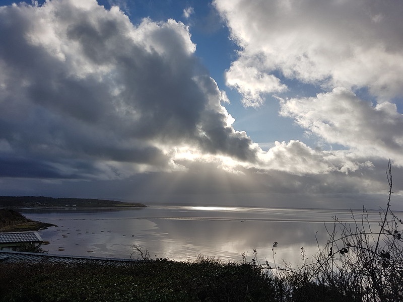
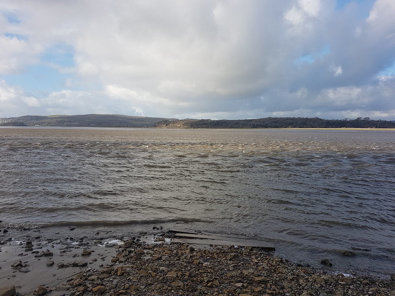
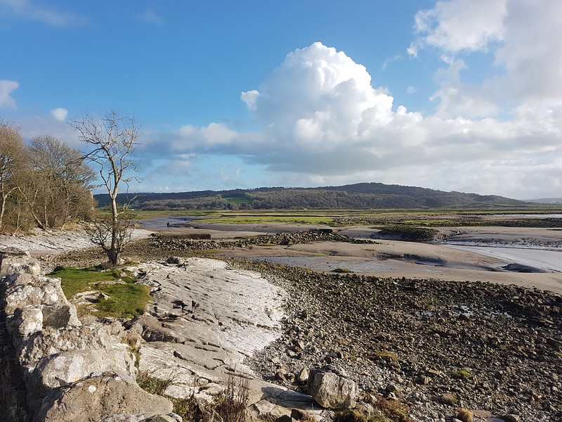
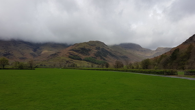
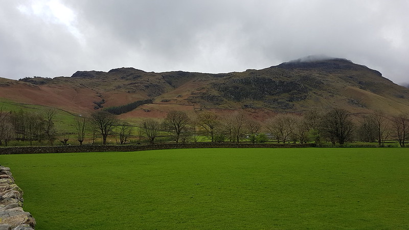
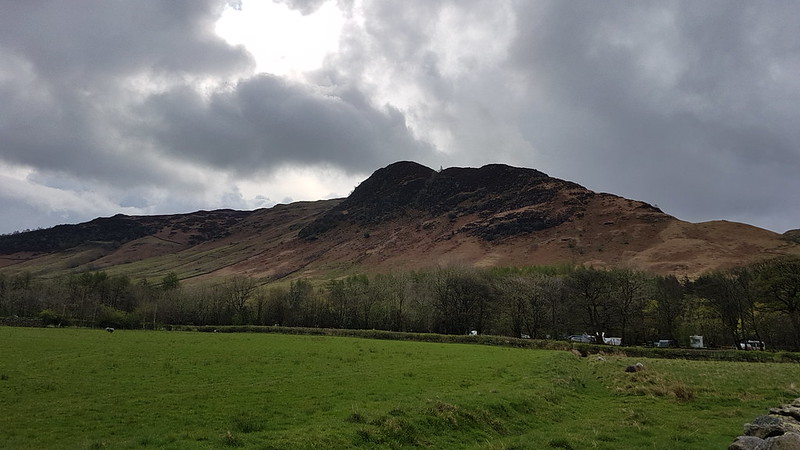
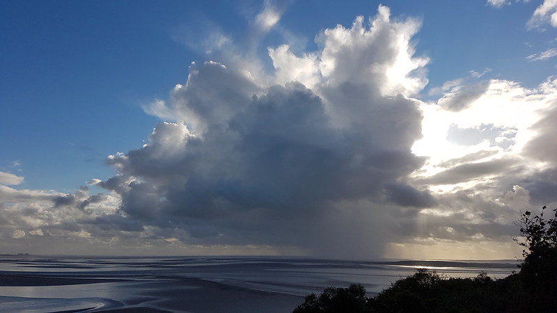
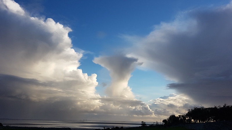
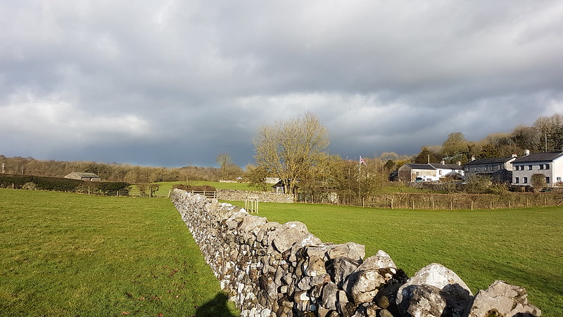
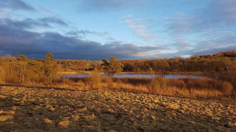
Another Lune Catchment walk, on a day of decidedly mixed weather. I don’t mind a bit of mixed weather, depending, I suppose, on the ratios employed in the recipe: I can stand a bit of rain so long as it isn’t poured with too heavy a hand and if I get some dramatic skies in compensation.

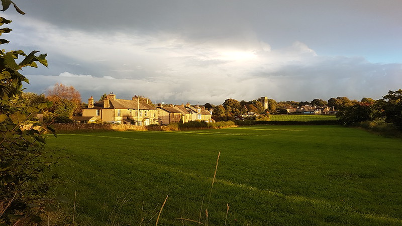
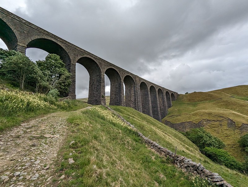
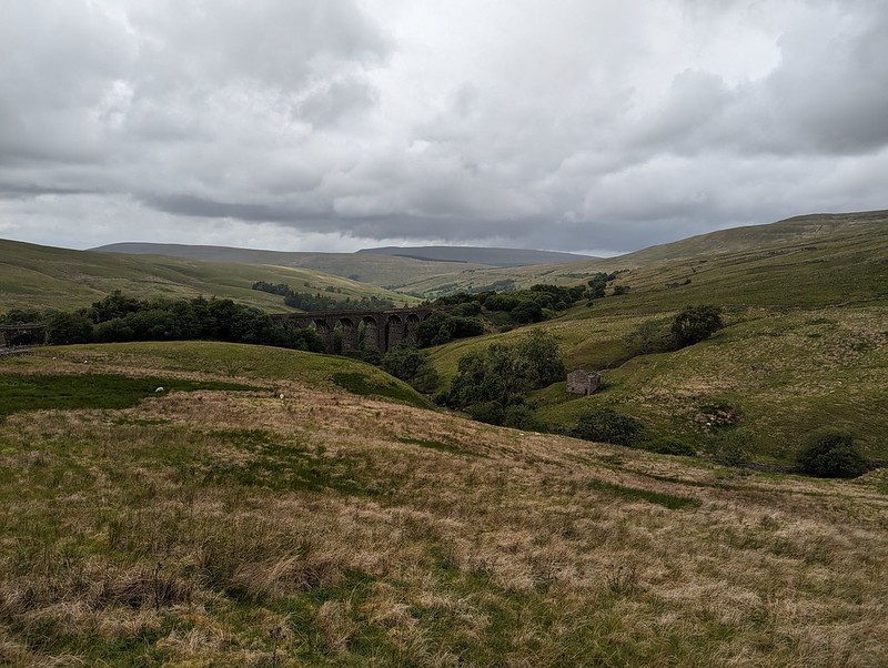
I know that Dentdale is lovely, but curiously, given that it’s not really all that far from home, I haven’t actually visited all that often. I’ve climbed Whernside from Dent on a couple of occasions. We camped here once, in the rain, when the kids were little I think. But I haven’t visited most of the valley, I hadn’t climbed any of the hills to the north or east. All of which is even more odd, given that where I parked, this early July Sunday morning, by the magnificent Dent Head Viaduct, was about a five minute drive from Gearstones Lodge, where we’ve spent a weekend prior to every Christmas for a few years now. In fact, we fairly recently watched the cloud pouring over Great Knoutberry Hill and Wold Fell from the northern end of Whernside during a cloud inversion weekend at Gearstones.

PXL_20230702_093504623
Bridge End Cottage (I think).

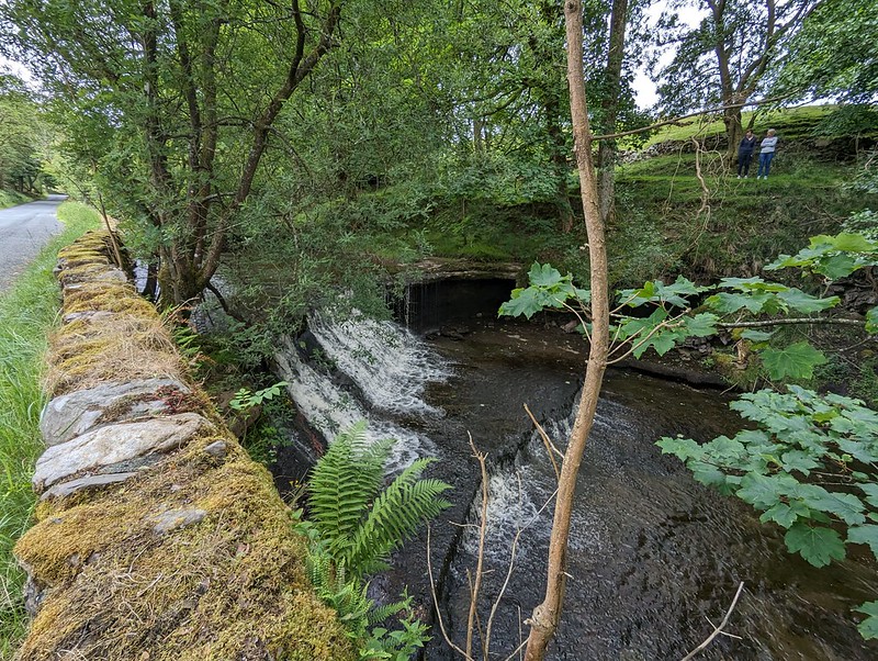
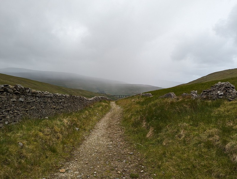
My walk began downhill, along the road – neither of which would usually be my first choice when picking a route, but on this occasion, with the infant River Dee alongside, a mass of wild flowers on the verges and lots of old, listed buildings to admire, I was more than happy. Both the viaduct and the old bridge are listed, along with just about every building in this upper part of the valley it seems. All, perhaps, except this one, if I’m right that this is Bridge End Cottage.
In fact, I might have finished and published this post by now, apart from the fact that I’ve spent a lot of time down the rabbit-hole of reading all of the listings on the Historic England website. I think I enjoy the fact that they are quite clearly dense with information, but simultaneously, make no sense to me whatsoever.

“Rock-faced sandstone in massive blocks, mostly coursed but some snecked, with brick soffits to the arches. Slightly curved line on north-south axis. Ten tall round-headed arches on battered rectangular piers, that in the centre broader than the others and with a broad tapered pilaster; short cavetto-moulded imposts at the springing of the arches, rusticated voussoirs (now with 3 tie-plates to each arch), a moulded string course, and parapets with rounded coping.”

This is the viaduct, for example. Snecked? Soffits? Cavetto? Imposts? At least I know what voussoirs are, after a previous rabbit-hole episode, although I can’t tell you what it means for them to be rusticated; and I’m guessing that, in this context, ‘battered’ has nothing to do with coating in a mixture of flour, egg and beer and then deep-frying? (Although it has probably been tried in Scotland).

PXL_20230702_093839772
The River Dee.
PXL_20230702_094131719
Dee Side House.

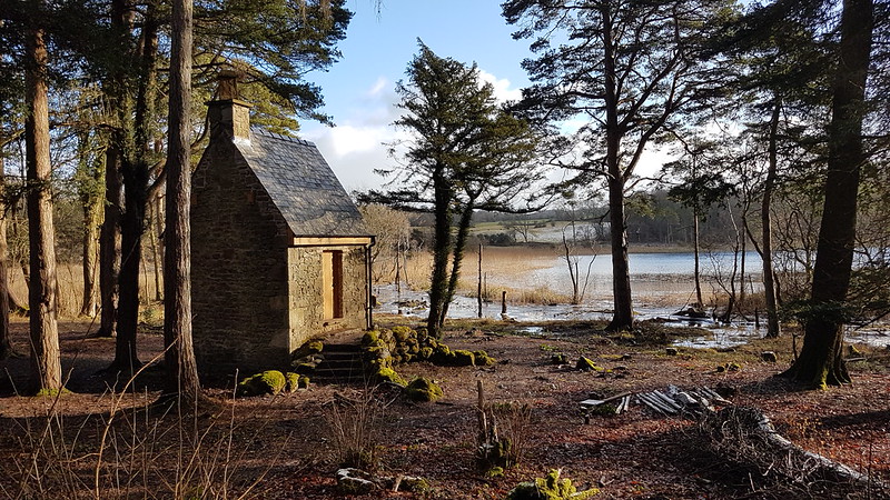
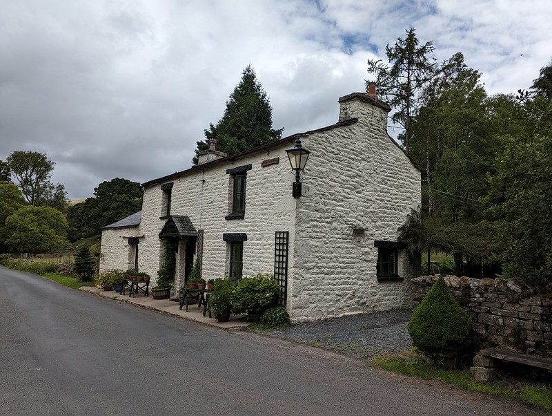
Formerly Dentdale Youth Hostel and before that a hunting lodge; now available as a holiday let. I’ll let you insert here your own rant about the YHA losing its way and selling off so many wonderful remote properties like this one. I’m saddened that I never got around to staying here whilst it was still a hostel, but even more upset that apparently Patterdale Hostel in the Lakes, where I have stayed many, many times, including for several big family get-togethers when I was in my teens, is facing a similar fate.

PXL_20230702_094321869
Common Spotted-orchid.
PXL_20230702_094454400
Scow Force.
PXL_20230702_094354535
Speed up – missed Red Squirrel photo opportunity.

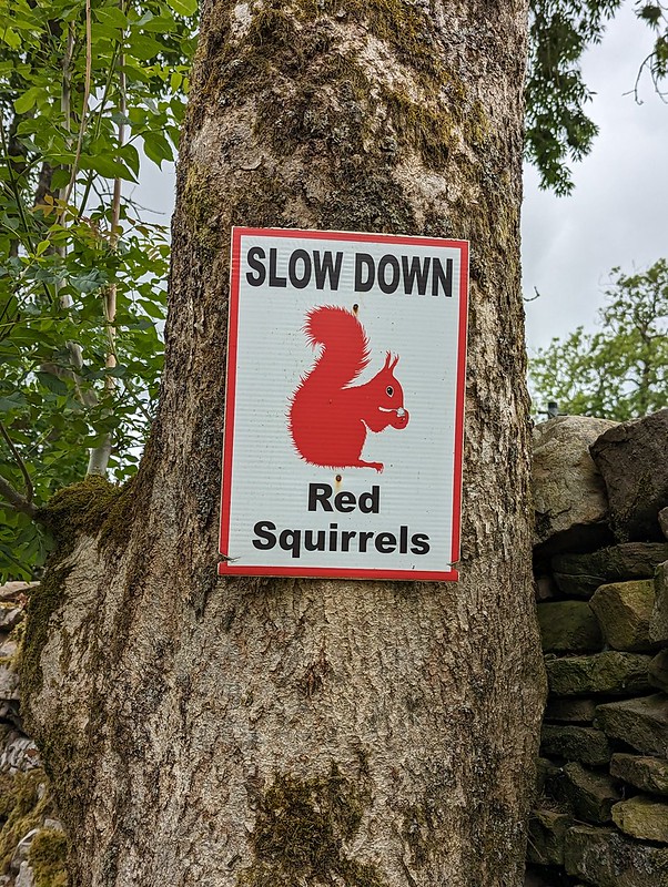
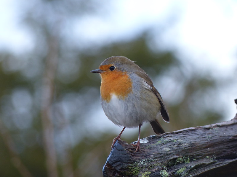
I did see a Red Squirrel, running along the top of a gate, but I was much too slow with my camera to get a photo. I was impressed that somebody has put out these signs in an attempt to save the local squirrels from motorists, but I clearly needed to speed up, not slow down, in response to the presence of squirrels.

PXL_20230702_094625394
Bettony.

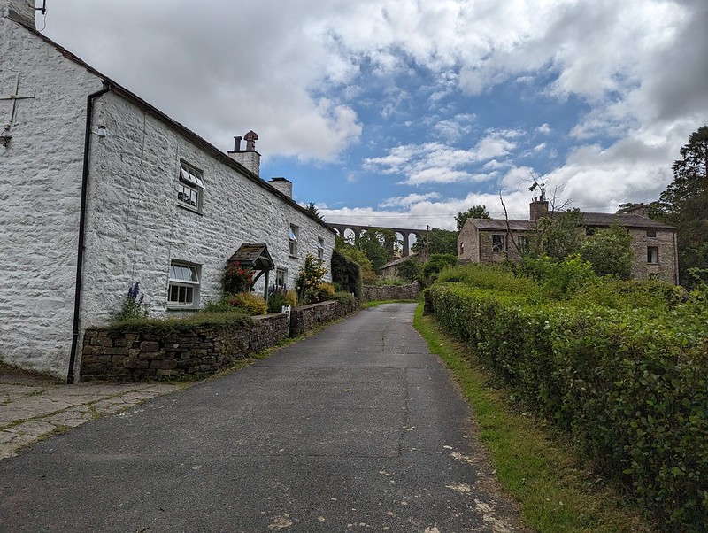
I passed a garden hereabouts which had been decked out as a picnic spot for Dales Way walkers – which seemed like a really generous thing to do and reminded me of the esrtwhile ‘Hiker’s Rest’ near to Beck Head at the southern end of Whitbarrow.

PXL_20230702_094941345
Meadow Crane’s-bill.
PXL_20230702_095326075
The River Dee.
PXL_20230702_095351467
East Stonehouse.
PXL_20230702_095414146
Outbuilding at East Stonehouse.

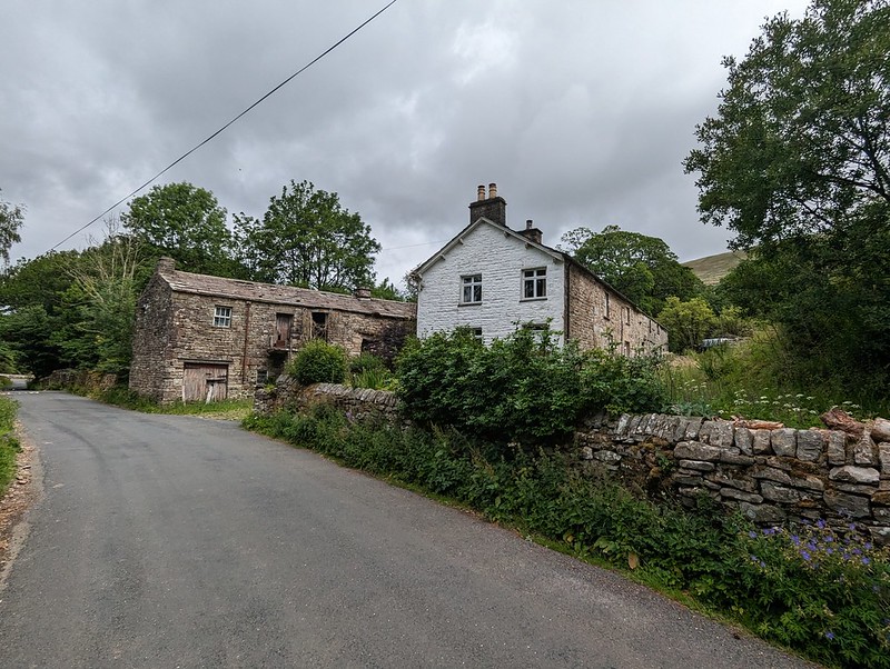
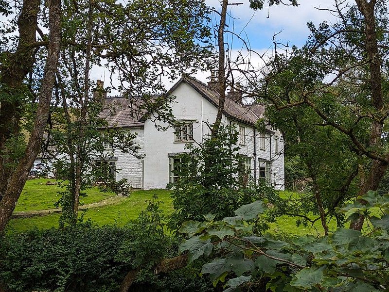
There was something about the higgledy-piggledy design of this building which I found appealing. Higgledy-piggledy is the technical term obviously; I can’t think how else to put it, not asymmetric exactly, most houses aren’t symmetrical after all. It’s something to do with the windows and doors all being different sizes and positioned at different levels, I think. Anyway, I liked it.

PXL_20230702_095654496
West Stonehouse.

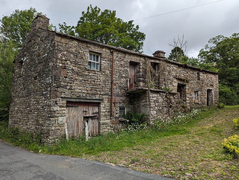
Confusingly, West Stonehouse lies NNE of East Stonehouse. I’m sure it made sense to name them that way to somebody at some time, but it seems very odd now. Here’s a snippet of the Historic England description of West Stonehouse:

“White-painted rubble, the centre portion random, with quoins, and the outer portions coursed, also with quoins; stone slate roof.”

I often bemoan the modern penchant for using the word random, when the desired import is actually ‘arbitrary’; so I was struck by the use of ‘random’ here. Apparently random rubble stone is where undressed or hammer dressed stones are used. Like a dry-stone wall; the stones are all different sizes and fit together like the squares and rectangles in a painting by Piet Mondrian, not in neat, even layers, which would be ‘coursed’. So there you go.

It probably makes more sense with a picture – I shall have to take one.

PXL_20230702_100116987
Arten Gill Viaduct.

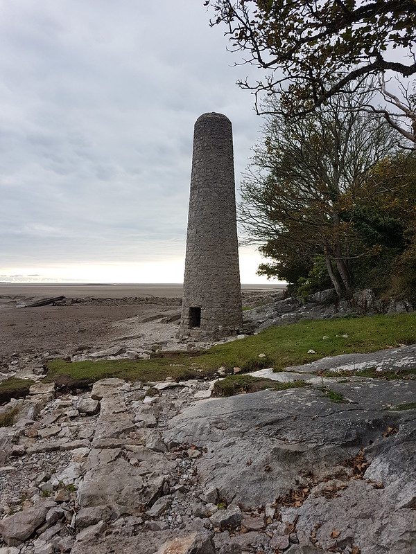
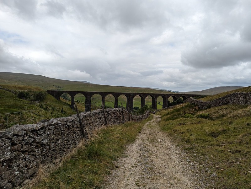
By the track from Stonehouse there was an information board about the mining, or possibly quarrying, or – looking at the map – probably both, which formerly went on in this area. I didn’t take a photo, which is most unlike me, but the area’s industrial past no doubt explains the effort which was expended in creating the cobbled track up towards Arten Gill Viaduct.

PXL_20230702_100145544
Cobbled bridleway.
PXL_20230702_100442692
Arten Gill Viaduct.

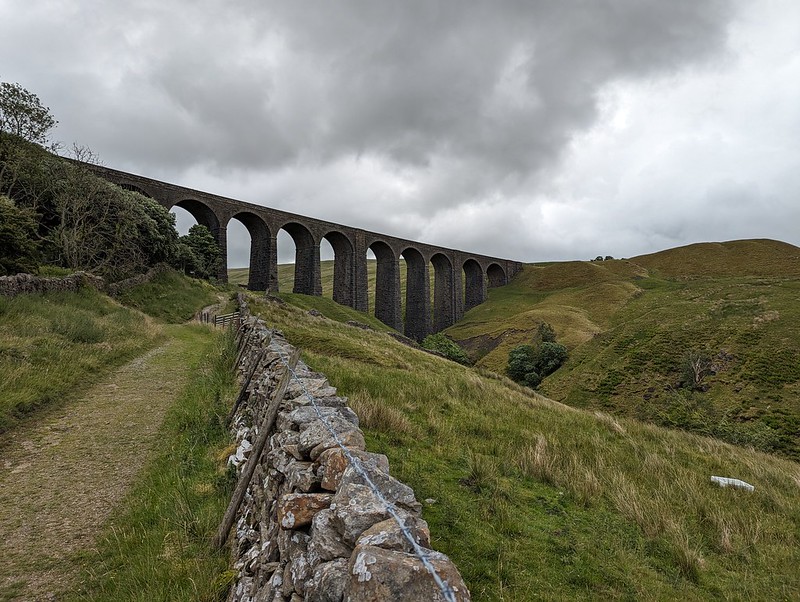
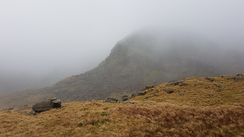
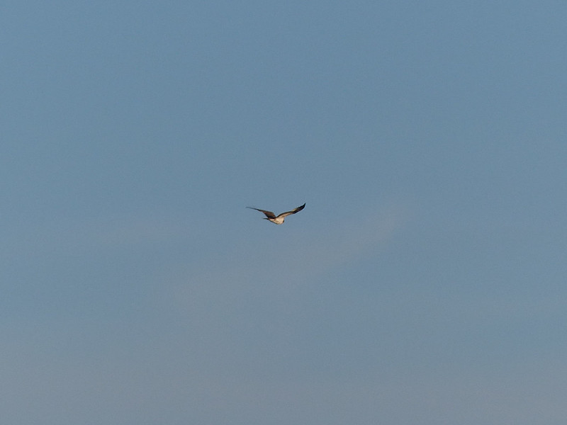
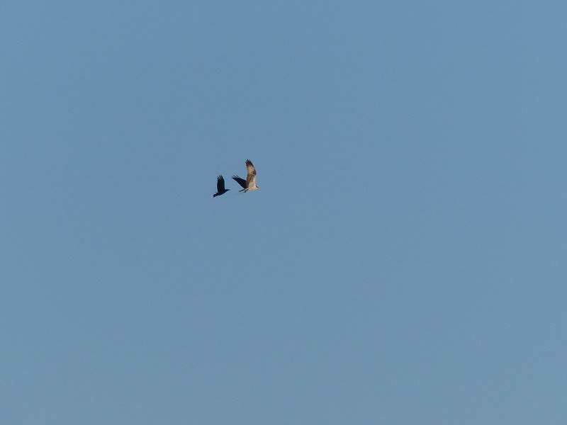
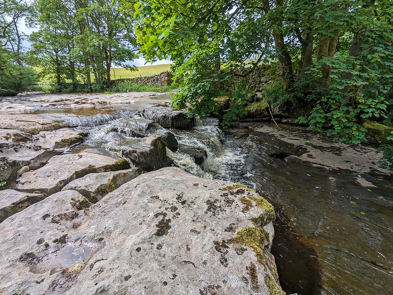
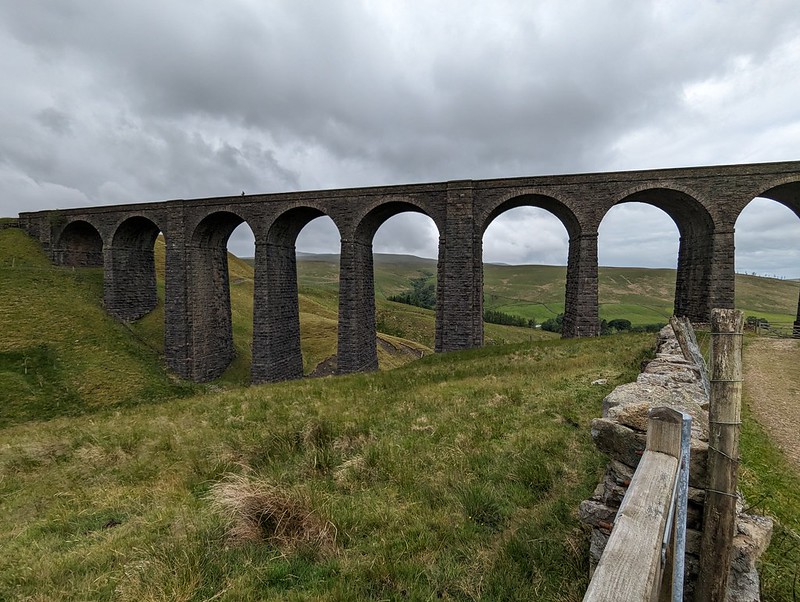
This viaduct was if anything even more attractive than the Dent Head one had been. You’ll have to bear with me, I took lots of photos. On the other hand, I didn’t manage to catch the pair of raptors, I think Kestrels, which were flying in and out of the trees by the viaduct.

PXL_20230702_100641831
Arten Gill Viaduct.

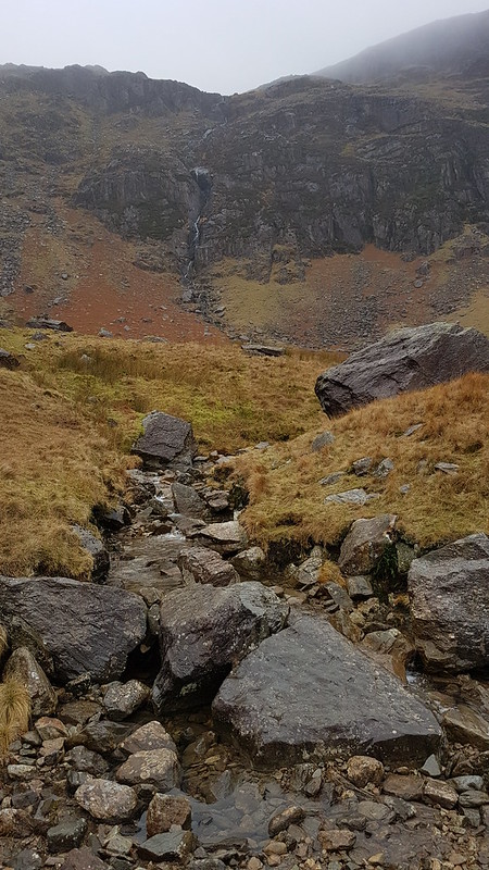
Tautologically, the stream below is labelled, on the map, both as Arten Gill, and as Artengill Beck.

PXL_20230702_101001993
Arten Gill Viaduct.

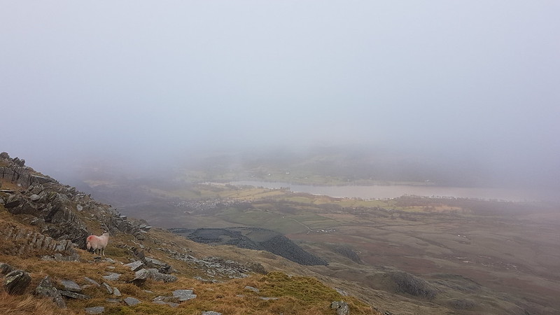
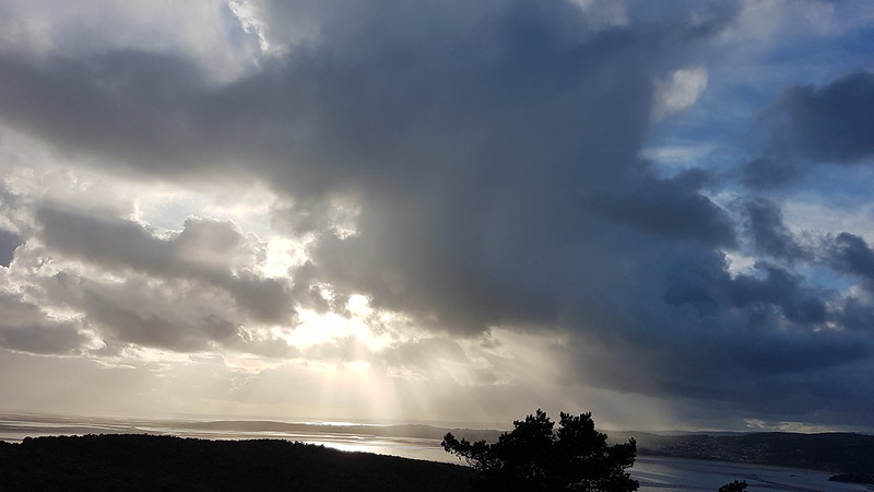
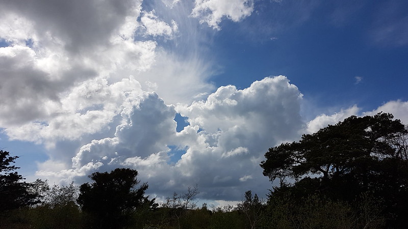
The skies were beginning to build some ominously dramatic looking clouds and I was soon paying for it in the first of several showers. To be fair, the showers were at least short-lived and mostly not too heavy either.

PXL_20230702_101302816
Arten Gill Viaduct.

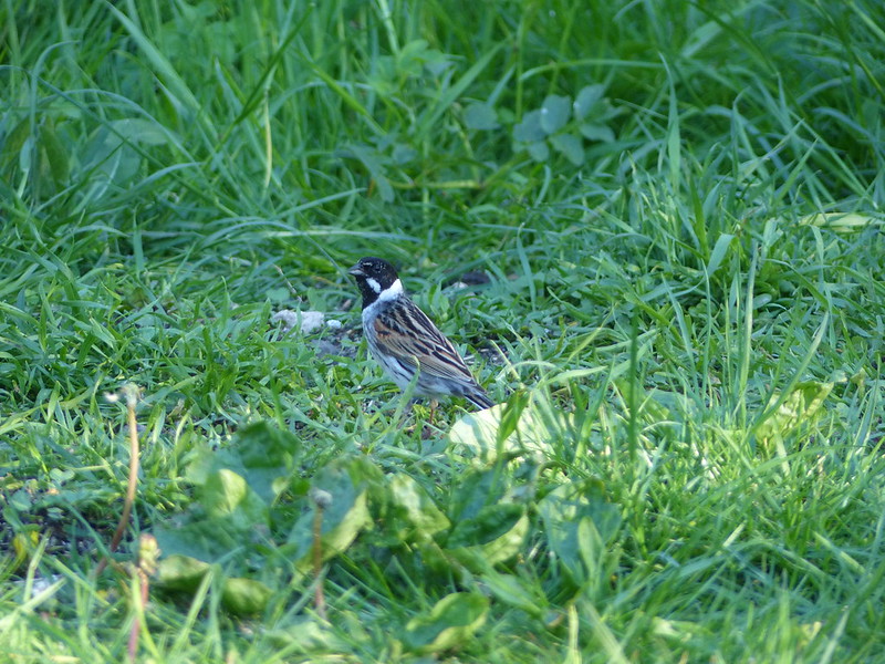
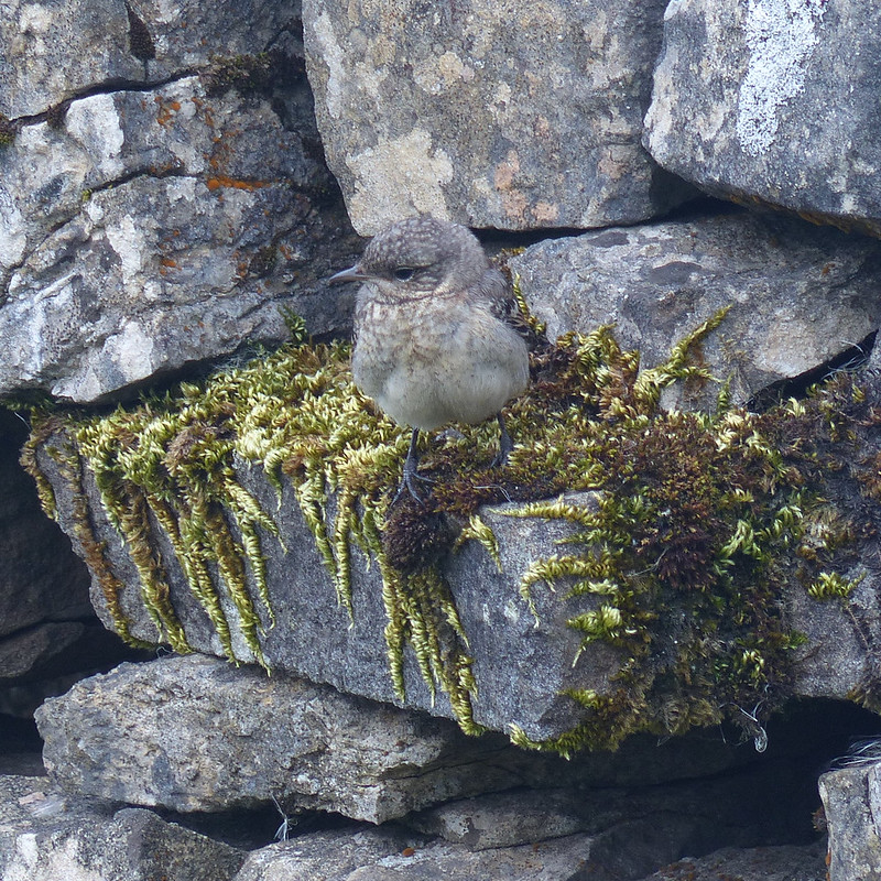
The track rises steadily, without being hard work and so was ideal. There were lots of birds about – Wheatear and Pipits, but most entertainingly Stonechats.

P1390279
Male Stonechat.

A couple of individuals, first one and then later another, took it upon themselves to fly ahead in little short hops and then stop and wait on the fence, allowing me to get very close before scooting on again.

P1390289
Male Stonechat.

Naturally, I took lots of photos.

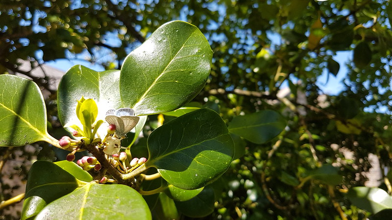
I also got overly excited, during a shower, about what I decided was a Mountain Ringlet, even though I strongly suspected that they are not found in the Dales. Which absence would, of course, make my discovery all the more notable and exciting. When I finally got close enough to get a photo and a close look, it transpired that it was in fact a very small Ringlet, of the plain, old common-or-garden variety.

PXL_20230702_102602807
A sidestream.
PXL_20230702_102838669
And another – being neatly directed across the track.
PXL_20230702_103837106
An excess of weather.

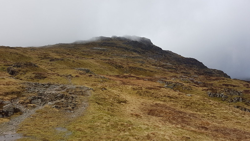
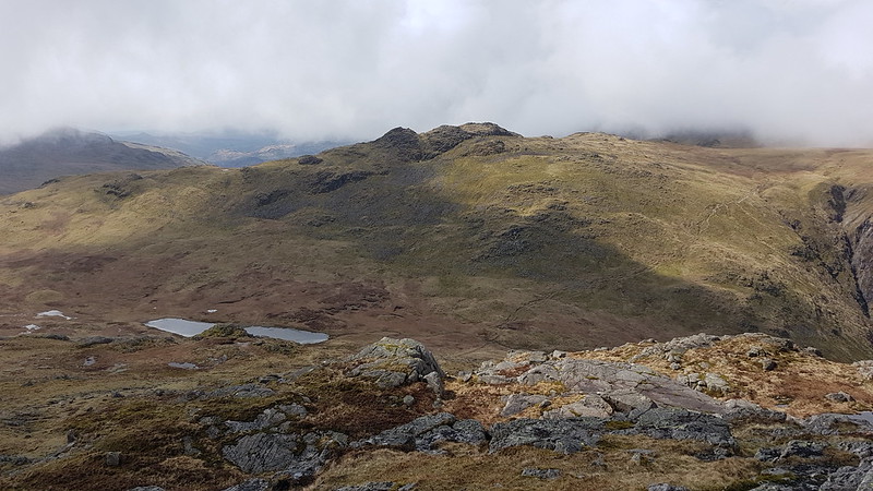
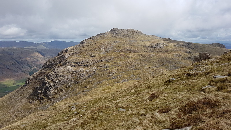
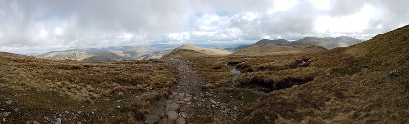
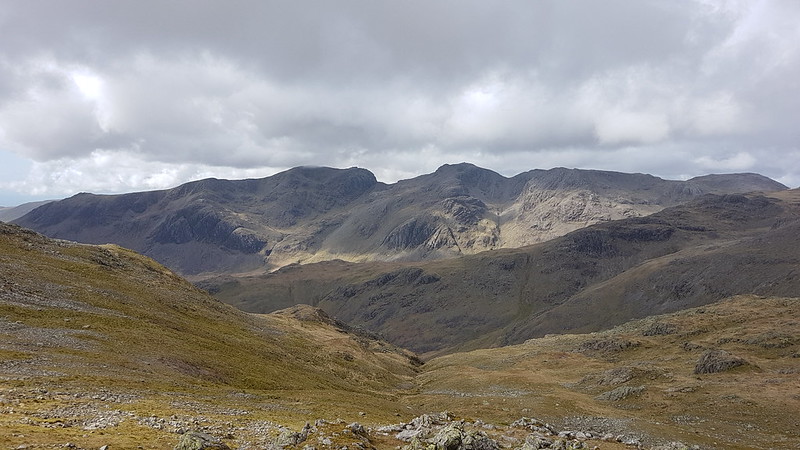
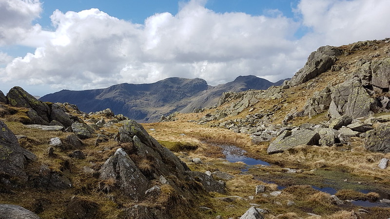
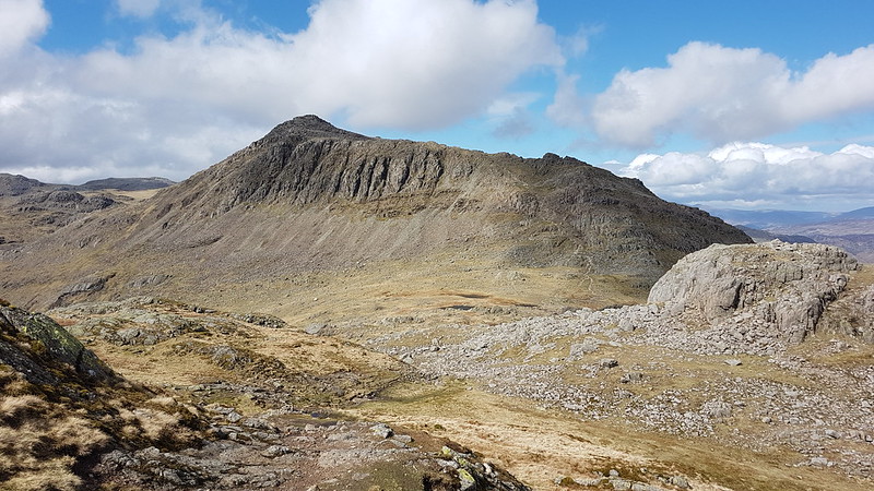
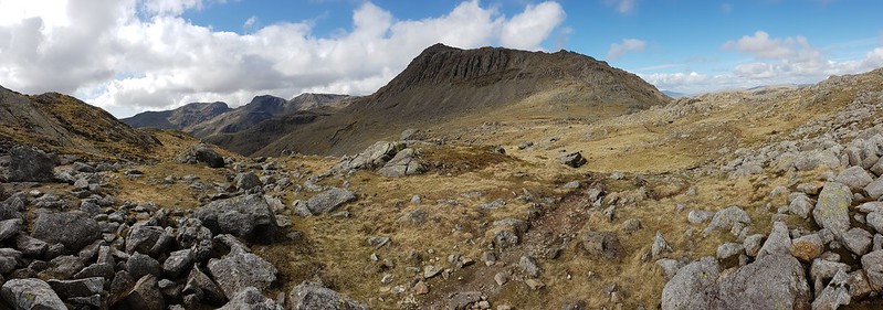
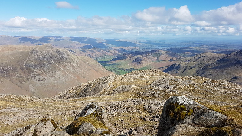
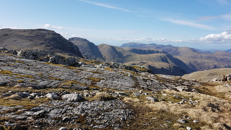
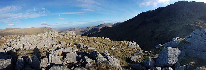
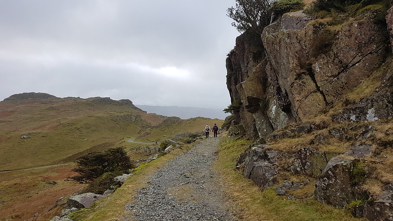
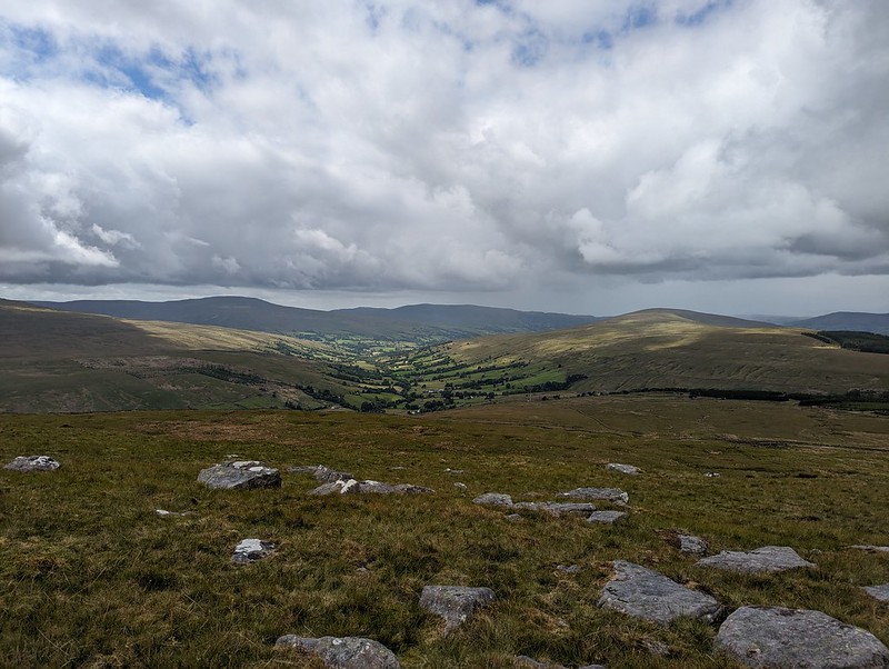
Having reached the top of the pass, I could have taken a direct line up to the top of Great Knoutberry Hill, but I’d done a bit of research online and read great things about the track, Galloway Gate, which contours around the southern and western slopes of the hill.

PXL_20230702_105433978
Whernside from Galloway Gate.
PXL_20230702_110041795
Ingleborough and Whernside and more showers.
PXL_20230702_111302528
Looking down Dentdale.

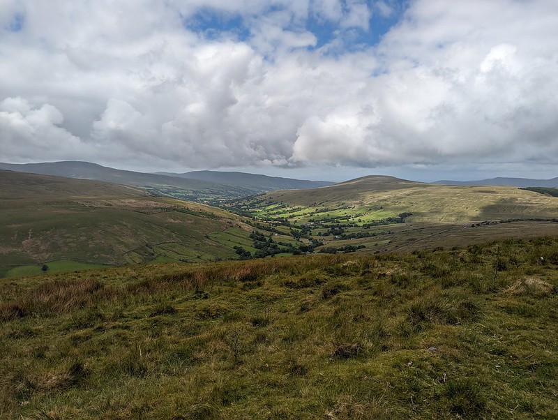
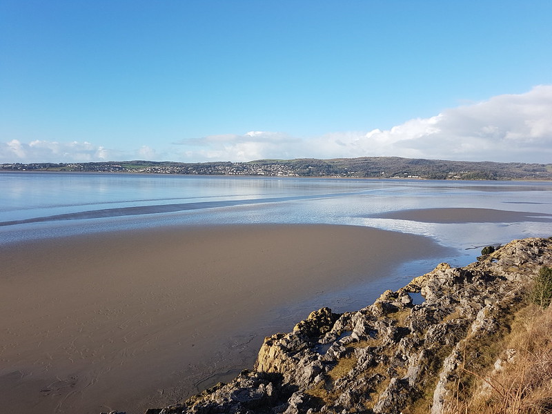
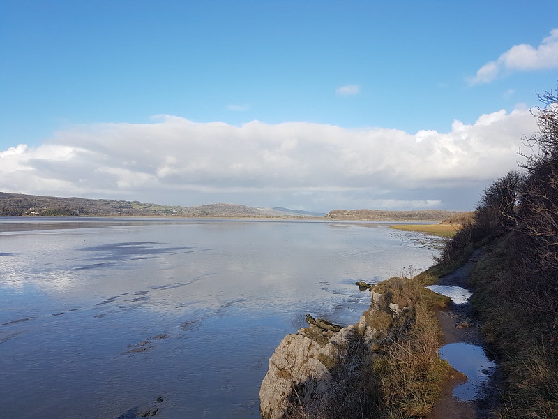
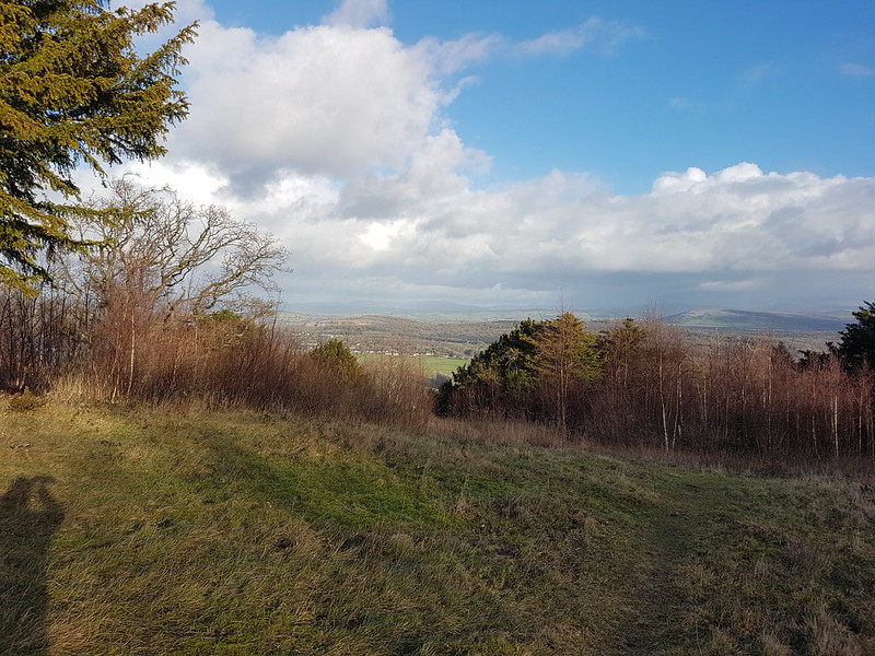
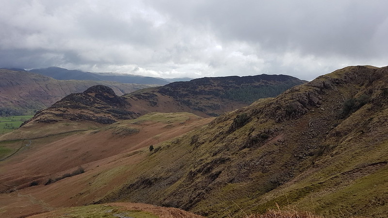
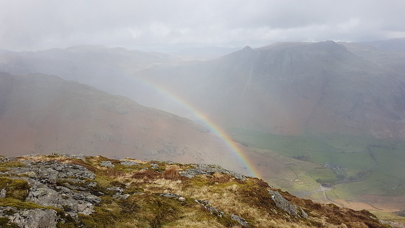
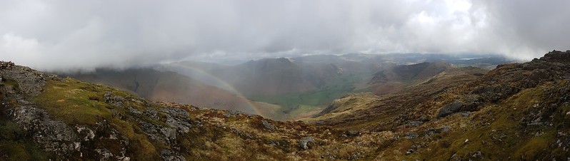
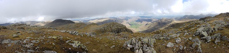
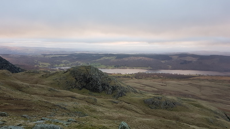
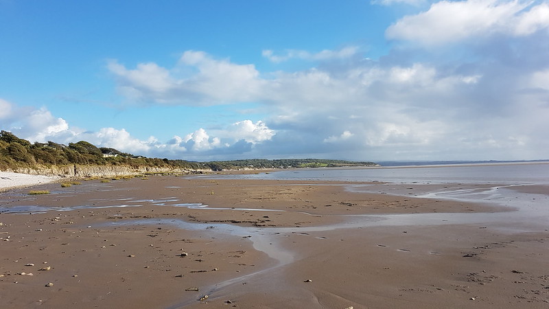
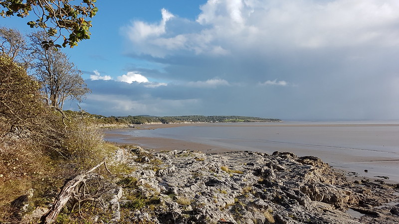
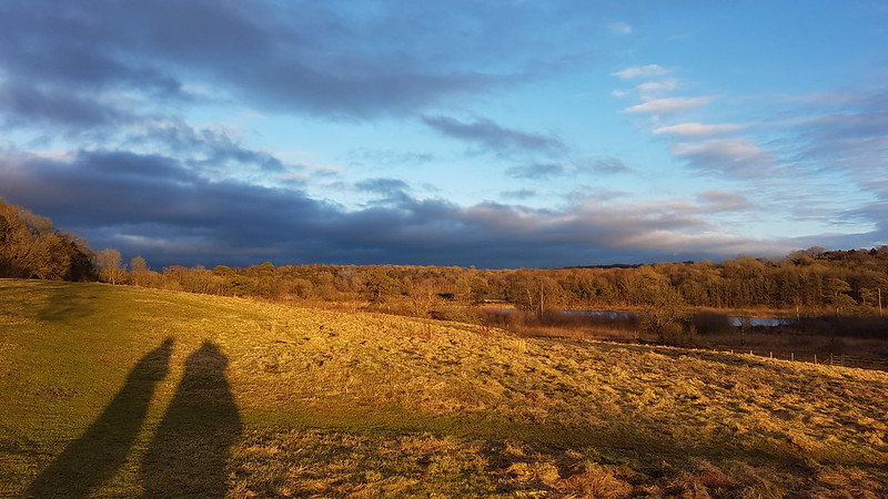
Choosing Galloway Gate turned out to be a good decision – it’s a fine walk which gives great views, particularly down into Dentdale.

PXL_20230702_112406784
Baugh Fell and Wild Boar Fell from Galloway Gate.

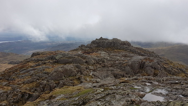
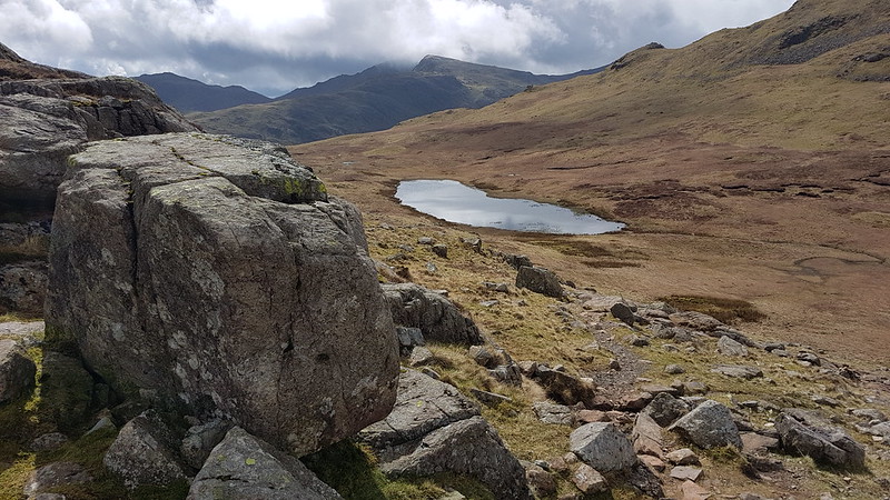
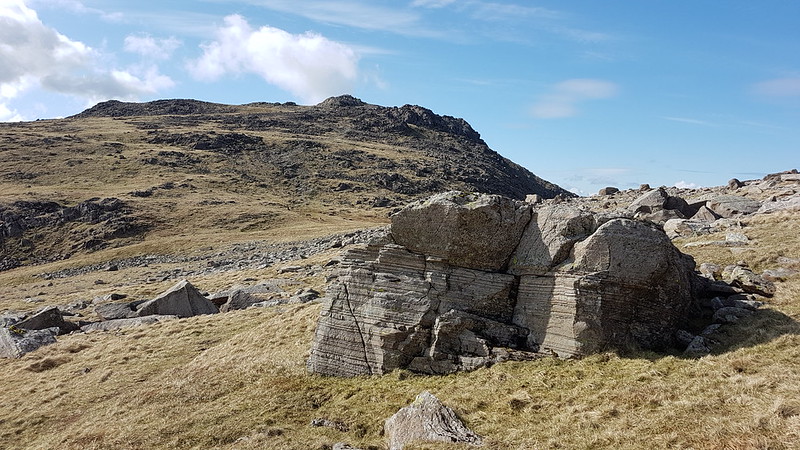
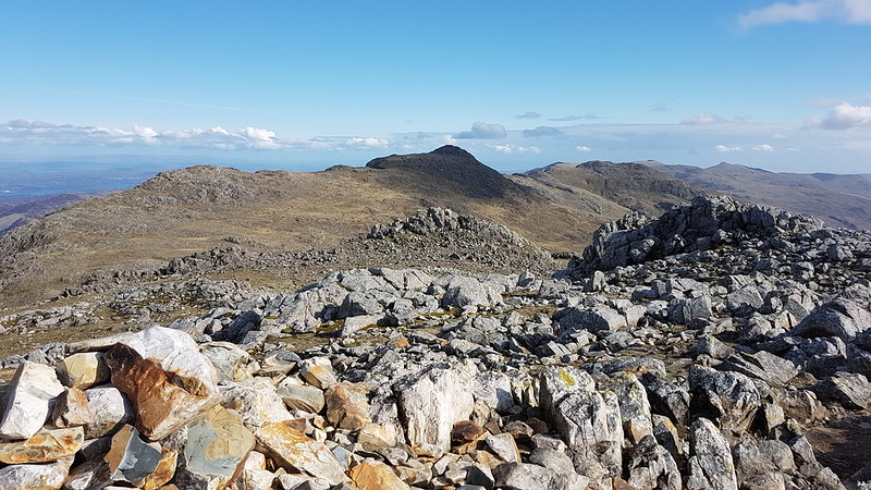
Eventually, I turned right, heading uphill and on to Pikes Edge, where there a number of scattered cairns and even more scattered boulders.

PXL_20230702_114229613
Ingleborough and Whernside from one of the cairns on Pikes Edge.
PXL_20230702_114233650
Looking down Dentdale again.

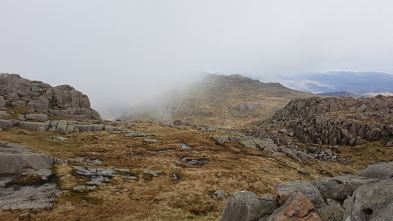
As I approached the summit of Great Knoutberry Hill, I was engulfed in by far and away the heaviest shower of the day – for a while it was really chucking it down. A little annoyingly then, I found that I had unpacked my waterproof trousers from my rucsac, which is something I very rarely bother to do. Since I was wearing shorts anyway, and my waterproof trousers are mostly holes and layers of duct tape patched up with more duct tape, it probably wasn’t that great a loss.
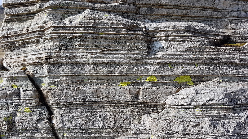
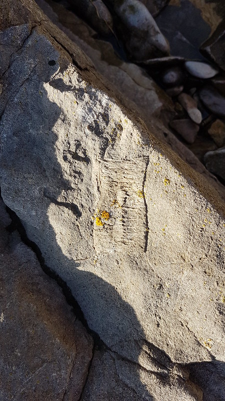
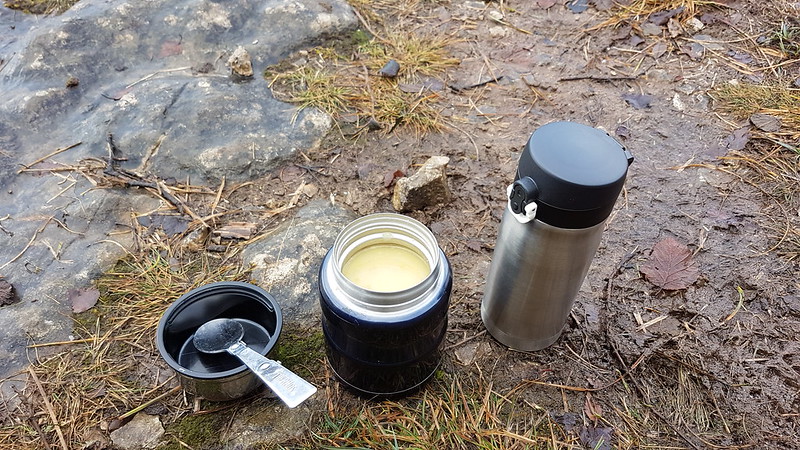
Also, this stone seat, possibly of random rubble, was facing away from the wind…

PXL_20230702_122731302
Stone seat/shelter on Great Knoutberry Hill.
PXL_20230702_120730439
Lunch stop in a Bivvy bag in pouring rain.

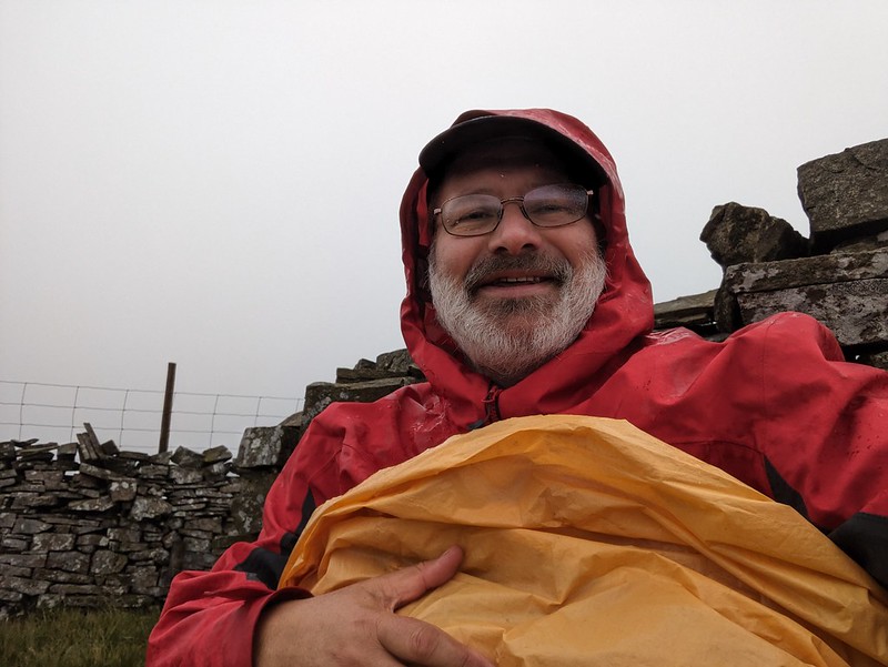
Since the rain was falling horizontally, once I was hunkered down on the seat, and snug inside my bivvy bag, I was able to enjoy my packed lunch and a brew despite the rain.
Anyway, it soon started to clear again.

PXL_20230702_121711910
Ingleborough and Whernside from Great Knoutberry Hill.
PXL_20230702_121944135
Cloudberry – or Knoutberry.

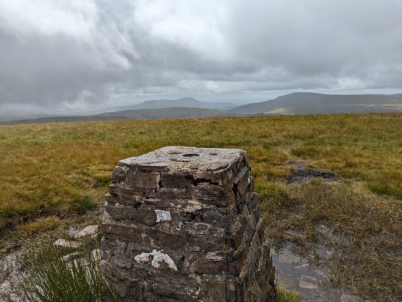
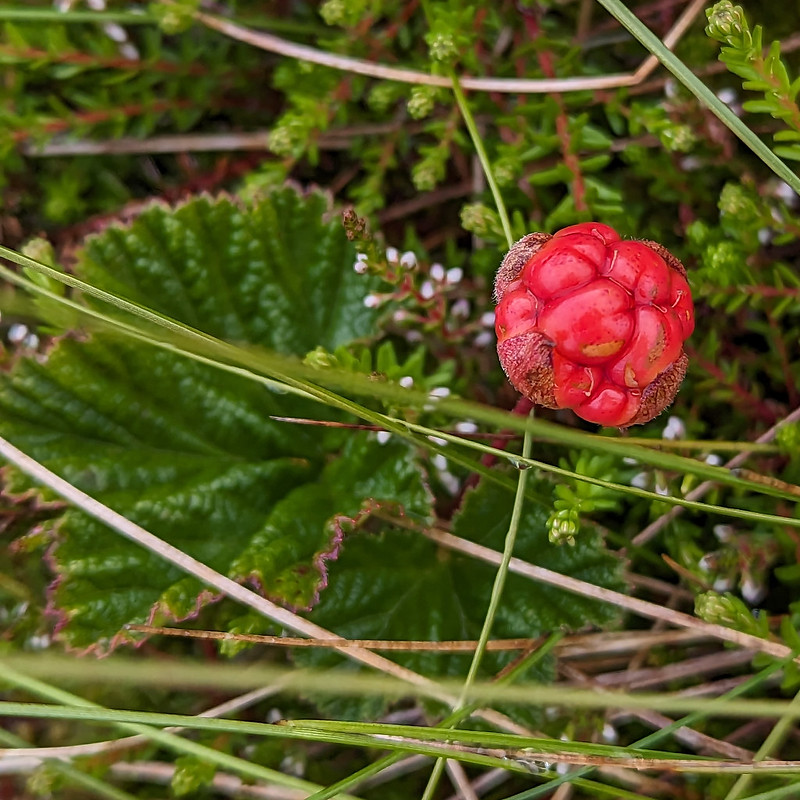
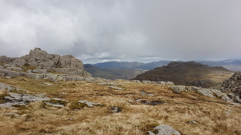
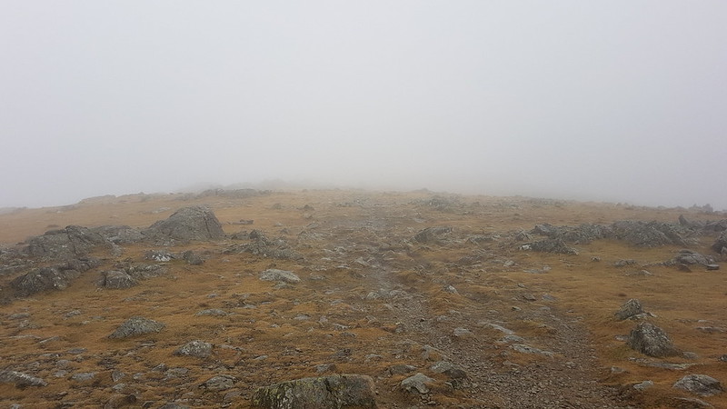
I had a bit of a wander in the vicinity of the trig pillar and found several Cloudberries. I don’t think I’ve ever seen them before, although I shouldn’t have been surprised to find them here, since Knoutberry is apparently a local name for Cloudberries. I also read that they are regarded as somewhat of a delicacy in Scandinavia; that the UK population of plants is predominantly male, so that it’s rare to find fruit; and that this example isn’t ripe, since they turn orange when they’re ripe.

PXL_20230702_121907142
Widdale Tarns.

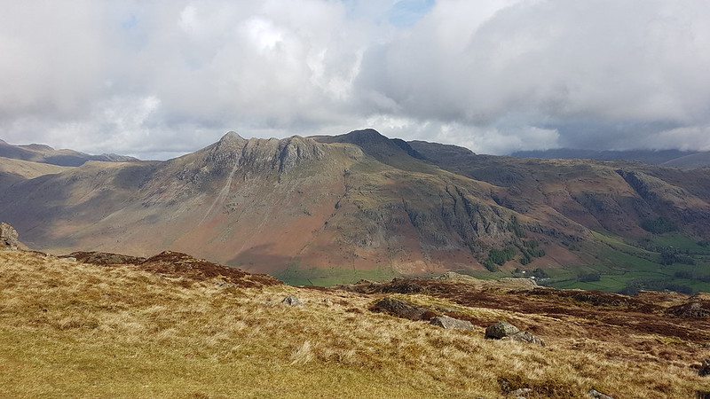
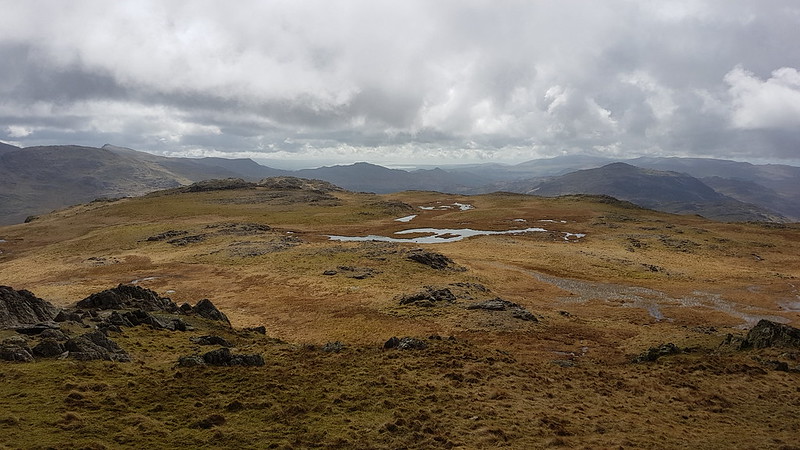
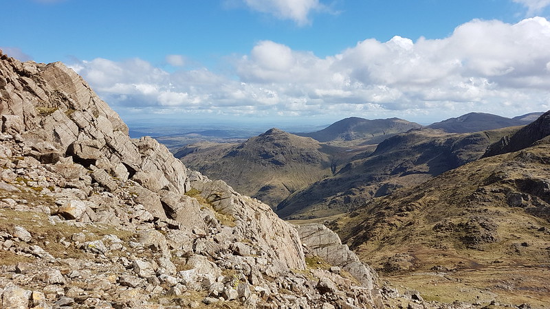
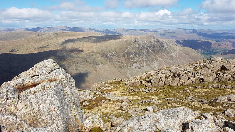
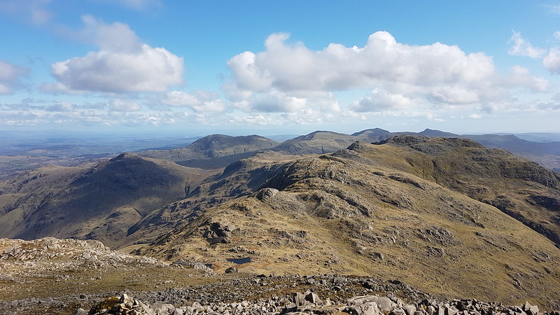
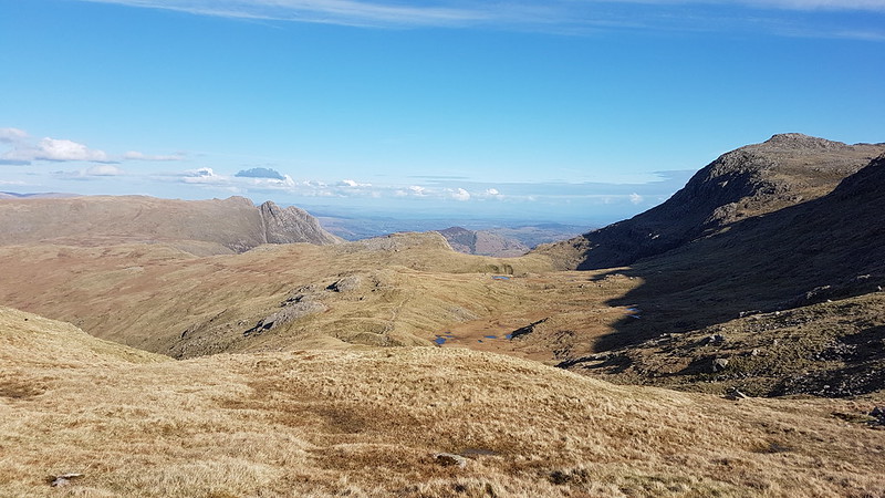
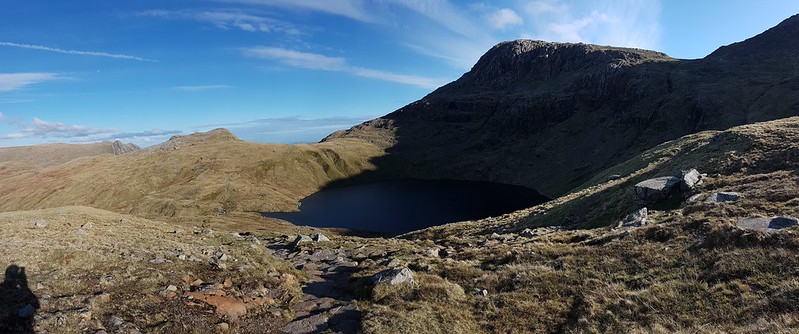
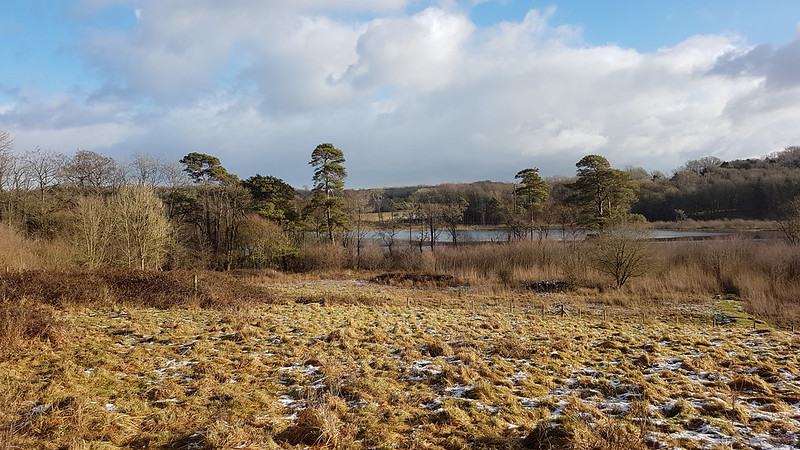
Great Knoutberry Hill is merely the highest point on the huge expanses of Widdale Fell. Beforehand, I had been contemplating a little wander to explore the tarns at least, but based on the area around the summit, I decided that it would be very rough going and that I would leave that for another day.
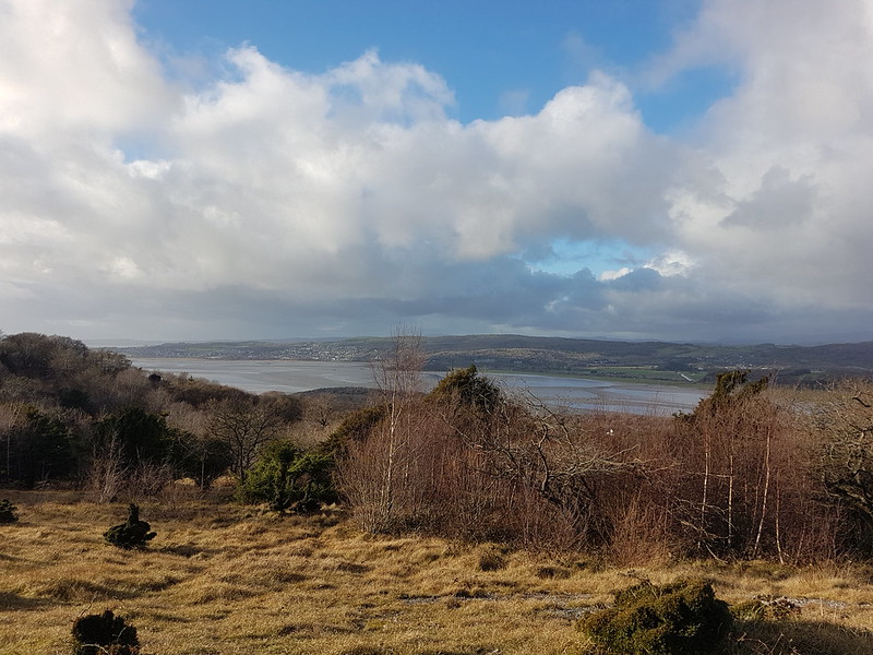
Looking at the map again now, I see that Widdale Fell has an impressive looking edge above Widdale itself, that most of the streams drain either directly into the River Ure or into the Ure via Widdale Beck; but that some of the streams run down into Garsdale and the River Clough – a tributary of the Lune which I haven’t explored at all yet: so I shall need to come back at some point.

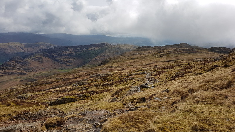
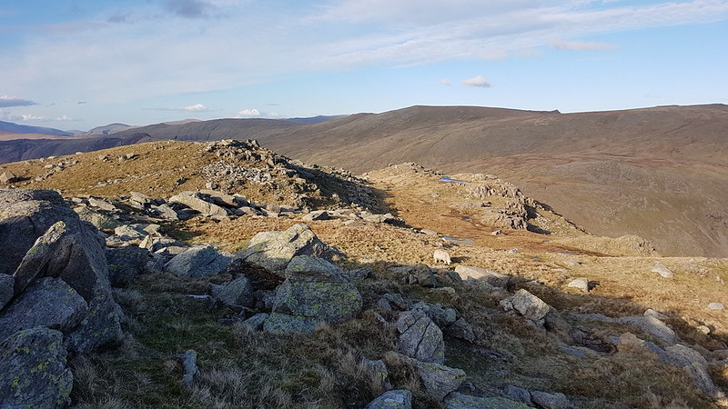
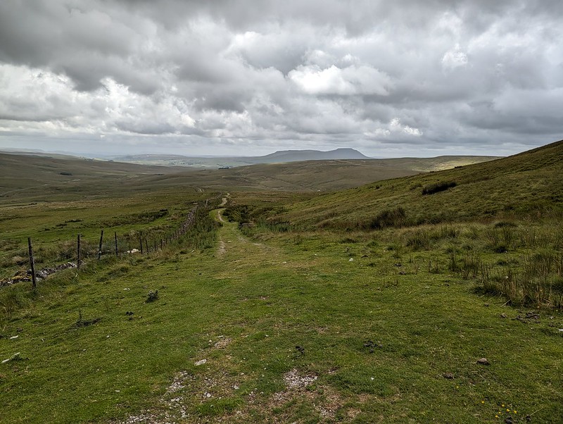
On this occasion I took a more direct route back towards the crossroads between Great Knoutberry Hill and Wold Fell.

PXL_20230702_123550837
Pen-y-ghent, Wold Fell, Ingleborough and Whernside.
PXL_20230702_125258048
Pennine Bridleway signpost.

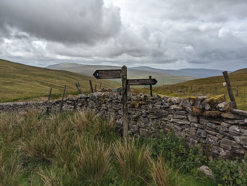
This is the signpost at the crossroads, which I hadn’t photographed when I first passed it because it had been raining at the time. This track is part of the Pennine Bridleway, a route which, like the Dales Way, some of which I also lay on this route, always seems superb wherever I encounter it.

PXL_20230702_130425913
Wold Fell.
P1390299
Juvenile Wheatear.
PXL_20230702_132319399
On Wold Fell, looking back to Great Knoutberry Fell.

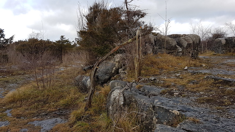
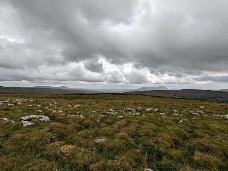
Wold Fell was quite odd: limestone pavement, mostly grassed over, a very flat topped hill – there was a small cairn, as you can see, but it was very difficult to tell whether that was the actual highest point of the fell.

PXL_20230702_133155656
Ingleborough and Whernside from Wold Fell.

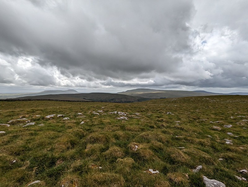
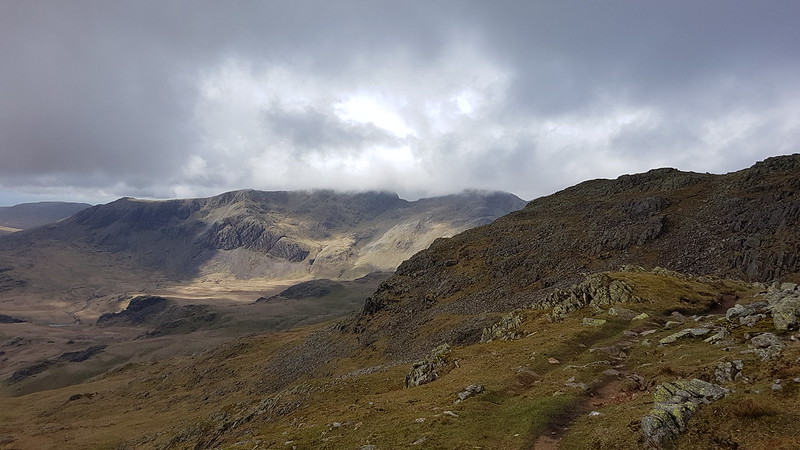
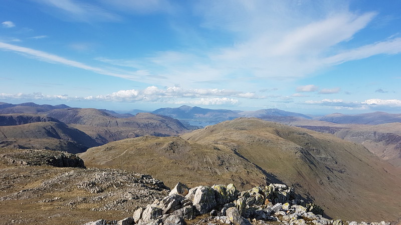
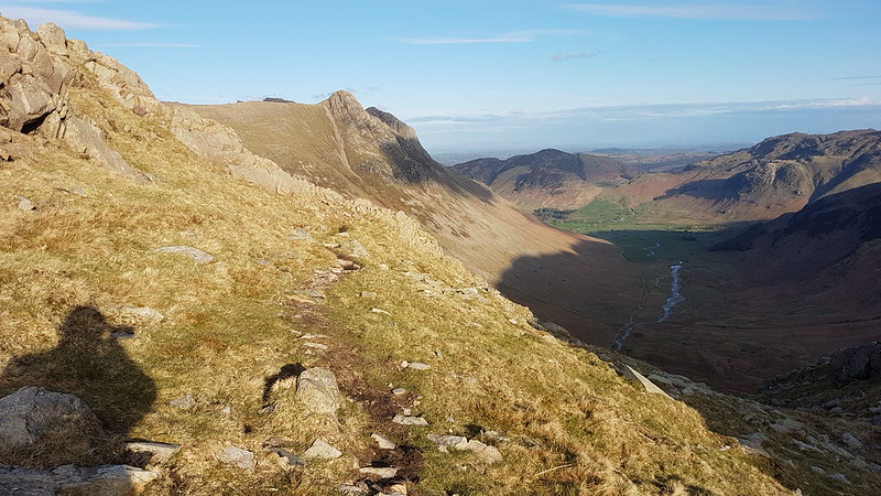
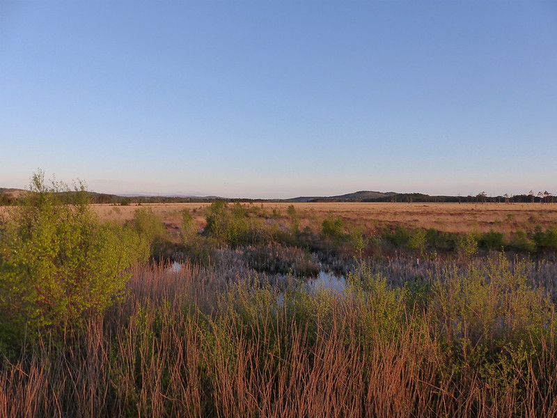
The lump between, and in front of, Ingleborough and Whernside is Blea Moor. I’ve often looked at it, especially when climbing Whernside from Little Dale via Greensett Tarn, but never been up it. I suppose I might get around to it at some point, although the lower slopes above Ribble Head are a bit of-puttingly rough and reed covered.

PXL_20230702_133159341
Pen-y-ghent and Ingleborough from Wold Fell.
PXL_20230702_134528470
Descending towards Ingleborough.

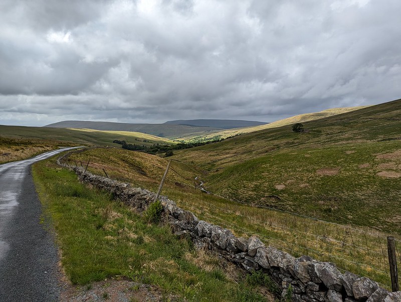
From Wold Fell it was a simple romp down a track and then a minor road, accompanied by a couple more brief showers, back to the car.

PXL_20230702_141620353
Fell End Gill.
PXL_20230702_142315214
Dent Head Viaduct again.
PXL_20230702_142857831
Common Spotted-orchid.

As almost always seems to be the case with my Lune Catchment outings, it was a very satisfying trip, packed with interest, from which I came away with a host of ideas for possible future excursions.

PXL_20230702_184912343
More showers at home – and a double rainbow.

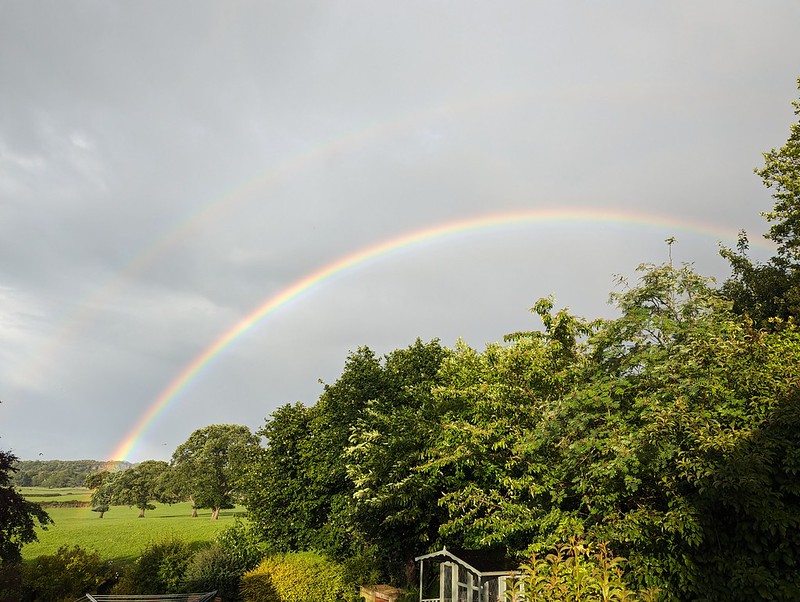
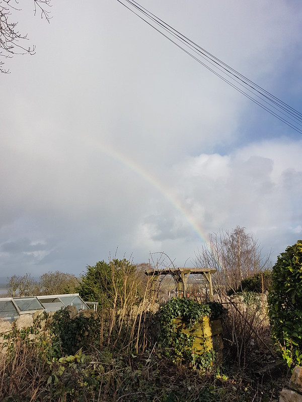
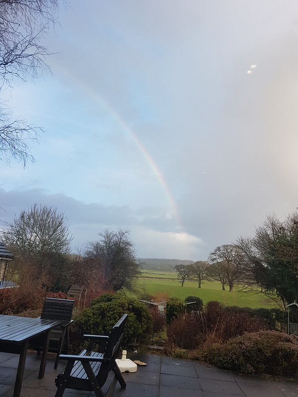
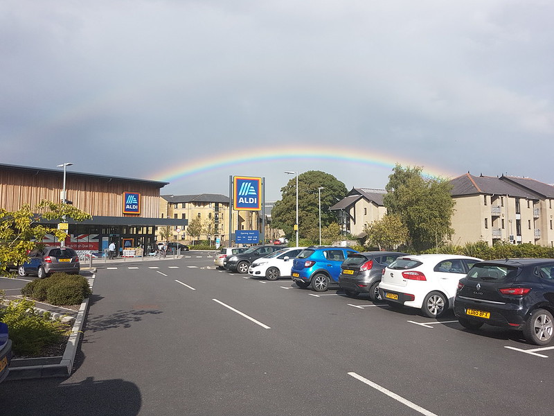
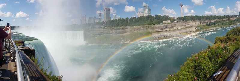
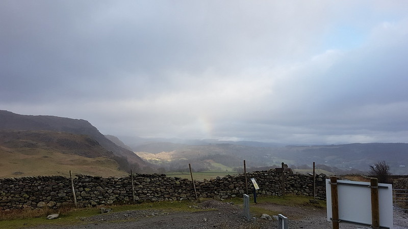
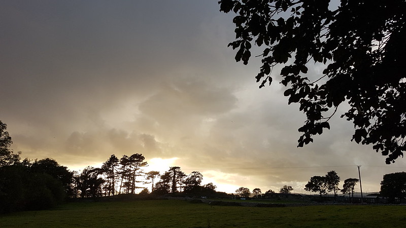
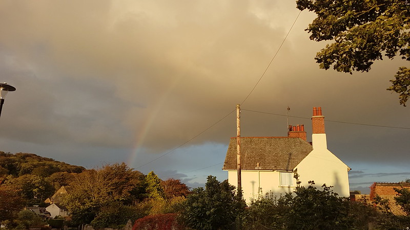
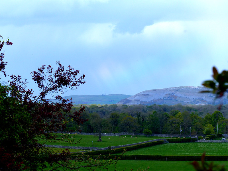
Back at home, there were more showers, and this time an accompanying double rainbow.

Later still, around 10pm, Little S sent me back outside to have a look at the moth which was resting on the plug on the charging cable for our car. It was dark and I’m amazed that my phone managed an image as clear as this…

PXL_20230702_205941092.NIGHT
A Large Yellow Underwing?

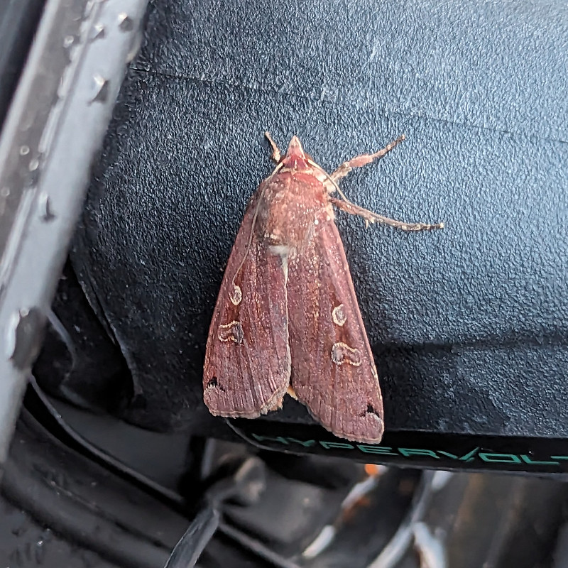
I’m told that this is a Yellow Underwing Moth , although to an untutored eye it also looks very similar to a Square-spot Rustic Moth. I’ll settle for it being a lovely colour, whichever.

Map the first.
Map the second.

MpaMyWalk gives a little shy of ten miles and 485 metres of ascent, which seems about right.

Great Knoutberry Hill and Wold Fell

Lucky Man

20230114_110056
Winter Aconites – not quite flowering, but almost there.

Mid-January. It’s a whole fortnight (and two posts) since I walked around the coast to Arnside and back over the Knott. Better do it again! What’s-more, I was back to it the following day. You have been warned!

Looking back, the first photo I took that day, from almost outside my own front door, had me puzzled for a moment. Then I remembered – it shows a thin strip of blue along the northern skyline – the weather had suddenly and somewhat unexpectedly improved, and the photo was an aide memoire to remind me of that happy change. To the south the skies were still black. Later, I took a picture of a dark, shadowed Arnside Knott with completely blue skies behind it.

Fortunately, rents began to appear in the massed clouds, giving some prospect of sunshine to go with the blue…

20230114_112302
Light show off Know End Point.
20230114_113116
Round the coast again!
20230114_114330
Grange-Over-Sands and Hampsfell.
20230114_114542
Turning the corner into the Kent Estuary.

I like to drop down on to the sands at this point, if not before, but the tide had clearly been high and it looked far too wet to take that option. Which was a shame, because the cliff path itself was extremely muddy and puddled.

20230114_115127
The Salt Marsh at White Creek – inundated.
20230114_120505
Meathop Fell across the Kent – showers beyond?
20230114_121627
From New Barns – Whitbarrow Scar catching the light, hint of a rainbow behind the viaduct.
20230114_122830
Witches Butter – another gelatinous fungi.
20230114_123233
A train crossing the viaduct.

I’m no trainspotter, but a train crossing this, or any viaduct, always has me scrabbling for my phone to take pictures. I can’t explain my disproportionate excitement. Having said that, I also love crossing the viaduct on the train, but I think that’s mostly to do with the views it affords. I really hope the proposed footbridge along the viaduct becomes a reality, but I don’t know how likely that is.

20230114_123336
Whitbarrow still basking in the sun. Yewbarrow in a black shadow.

The Lakeland Fells were mostly missing in the views, hidden in cloud, and it was clear that there were plenty of showers about, and the occasional attendant rainbows. I never tire of watching the play of light and shadows across the landscape on showery days like this one. It helps if the showers are falling elsewhere, on someone else!

20230114_123903
A vicious looking cross-current in the river.

The photo doesn’t really do it justice, but the river here was highly agitated, with waves apparently surging in opposing directions, upstream and down. Maybe the tide was on the turn?

20230114_124321
Now Whitbarrow has lost the sun and it’s the viaduct which is lit-up.
20230114_124314
Arriving on Arnside Promenade.
20230114_130713
A rainbow from High Knott Road.

There are lots of paths up the Knott, but I’ve definitely found a favourite, the path which climbs up from Redhill Woods to the bench on the south side of the summit, on which I don’t think I’ve ever met another walker.

I had company, however, on this occasion – two pairs of Roe Deer which I could see on the slopes below me, but which then darted across the path ahead of me, making their way into the trees towards the trig pillar. Although we often have deer in the garden – there are two there now – I still enjoy seeing them whilst out walking. It’s a bit harder to get good photos in the woods though!

P1360029
Roe Deer – one of a group of four.
20230114_133950
Winter flooding and Silverdale Moss – Ingleborough just about visible.
20230114_134335
Beetham Fell and Farleton Fell from Arnside Knott.
20230114_134508
Reclining Beech.

I wonder how long ago this tree fell into its current position? Before I moved to the area, so quite a while ago. It’s sent up a thicket of branches, each like a separate trunk. Is it the resilience of fallen trees which live on like this which I admire?

I’ve recently finished reading ‘Wild Fell’ by Lee Schofield about the RSPB management of two farms in the Lake District at Haweswater and Swindale, and which I can thoroughly recommend. One astonishing fact I gleaned from it is that there’s a single Aspen in Utah, called Pando for some reason, which occupies over a hundred acres, has 40,000 trunks, is estimated to weigh 6,000 tons and is thought to be several thousand years old. Aspen spread by sending up suckers, so all of the trunks are genetically identical and are thought to share a vast root system. It is, of course, under threat, probably due to overgrazing.

20230114_135605
Looking along the Kent.
20230114_134630
Gummer How – the Fells beyond noticeably absent from the view.
20230114_134625
Grange-Over-Sands and Hampsfell.
20230114_135946
Another free light-show over the Bay.
20230114_142256
Arnside Knott.

I was heading home via Far Arnside and Holgates Caravan Park – using the same paths I had set out along. In stark contrast to earlier, Arnside Knott was now brightly illumined by the sun, but the skies behind were heavily clouded and rather ominous. I could see that a shower was coming, could I beat it home?

20230114_143452
Caught in a sharp shower when almost home.

No! Still, a brief drenching seems a small price to pay for what preceded it.

Alan Price:

The Verve:

Lucky Man

December: All Wrapped Up.

20221120_113655
Warton Crag from near Jenny Brown’s Point.

Another cheating post! (Apparently) Which will bring 2022 to a close on the blog at long last.

Actually, these first two photos are from the tail end of November and one of our regular Jenny Brown’s Point circulars.

20221120_112752
TBH on her way to Jenny Brown’s Point.

Then we jump forward a bit to a snowy weekend in December and a couple of late local wanders.

20221210_145127
A snowy day in Middlebarrow Wood.
20221210_144949
Ice on seedheads.
20221210_145609
Beech leaves.
20221210_150716
Arnside Tower.

The following day, some of the snow had melted in the sunshine, but a little was still clinging on elsewhere…

20221211_151730
Eaves Wood.
20221211_153501
Beech leaves catching the last of the sun.
20221211_154739
Looking towards Clougha from near the Pepper Pot.
20221211_154806
Sunset and Morecambe Bay.
20221211_155028
The Pepper Pot.
20221211_161149
The Cove.
20221211_161756
A layer of ice over mud.

I had high hopes that the ice would hold and keep me out of the mud. It didn’t.

20221211_161803
Morecambe Bay.
20221211_162330
Hampsfell from ‘the beach’.

Just before Christmas, Little S tested positive for Covid. Subsequently, I felt very ill myself, but kept testing negative. Subsequently, my GP has told me that I probably did have Covid.

We still met up at Gearstones just before Christmas with all the usual suspects, but I have no photos to show for it because, still feeling rotten, I generally stayed inside and didn’t brave the snowy weather. It was great to see everyone, none-the-less.

20221225_113406
Christmas Day Roe Deer.

With hindsight, I perhaps shouldn’t have fetched my Mum and Dad to spend Christmas with us, but it was fabulous to see them and I don’t seem to have passed on the lurgy.

20221225_142825
Christmas Day Rainbow.
20221227_152318
Cold and damp on Morecambe Prom.
December: All Wrapped Up.

September: The First Morecambe Poetry Festival

20220907_180203
A tea time visit from a Roe Deer.

September, it turns out, was a very busy month, with some notable highlights, so I have a few more posts to come. But I thought I would mention the poetry festival first. I didn’t take any photos, unfortunately, so I’ve used the opportunity to throw in some other September odds and ends.

20220909_160600
A double rainbow from Aldi’s carpark, just around the corner from work.

Our comedy show in Brooklyn and the Latin band we saw in Saranac Lake stood out as high-spots in our New York holiday and I resolved to make the most of any cultural opportunities which came my way closer to home. So when I saw posts about a poetry festival in Morecambe I bought tickets for both the Friday and Saturday evenings. Given that the line up included Mike Garry, Lemn Sissay, John Cooper Clarke, Henry Normal and Linton Kwesi Johnson, all of whom I’ve seen live before, mostly many years ago when I lived in Manchester, it wasn’t a difficult decision to make. They were all brilliant, as was Joelle Taylor, who was new to me. This year’s festival is scheduled for the end of September again and the line-up so far includes Carol Ann Duffy, Roger McGough, Brian Bilston, Jackie Kay and Henry Normal again. Very exciting! I need to buy a ticket.

20220912_193710
A regular Monday evening appointment with the sunset from the car park by the wind-farm on Caton Moor, after dropping of S at Explorers in the Lune valley. This is a film, but you’ll have to click on it to watch on Flickr.

The festival will once again be based at the Winter Gardens, which I see has just secured a substantial grant for more refurbishment. With that and the Eden Project North and a host of cultural events through the year, things seem to be on the up and up for Morecambe. I lived and worked there for many years and am really chuffed to see it has a potentially rosy future.

20220912_193335
Another sunset shot, with clouds over the Lakeland Fells.

Not a September thing, but I think I forgot to mention that in June TBH and I saw Daniel Bye and Boff Whalley at the Duke’s Theatre in Lancaster in their show ‘These Hills are Ours’. You may remember that I was involved with them in a project of the same name a while ago. This show doesn’t relate to that, but is about a madcap scheme to run from Lancaster to Kinder Scout to celebrate the Mass Trespass. Highly recommended.

This film is not of the show, but is about a tour in Devon, during which Dan and Boff ran between venues, in mostly foul weather, and is worth a watch.

20220919_163154
The Copper Smelting Works chimney near Jenny Brown’s. TBH were still getting out for our local walks.
September: The First Morecambe Poetry Festival

Niagara Falls

20220819_094110
American Rapids

So, inevitably, if you’re in the area, you really have to go and see Niagara Falls. We’d seen the great plume of spray which rises high above the falls the day before – it’s unmissable even from quite a distance away.

We’d had some good advice, from our local guides, about free parking by the river. This meant that we had an opportunity to walk by the river, and the rapids, which were pretty awe inspiring in their own right.

20220819_094519
American Rapids
20220819_094127
American Rapids – this one is a film – click on it to watch it on flickr.
20220819_093729
Route map.

I can’t remember, unfortunately, where I got this map from. I took a screenshot, so still have it on my phone. We parked in the lay-by on the bottom right of the map, followed the riverside paths to the pedestrian bridge then circled the island, anti-clockwise, visiting the Three Sisters Islands, eventually returning to the car for a picnic lunch. After lunch we walked back towards the falls and the Observation Tower in the top right-hand corner of the map, for our final treat of the day.

20220819_102052
A gulp of Cormorants clustered by the river.
20220819_102145
A glimpse of Horseshoe Falls.

The tall buildings are on the Canadian side of the river, which I’m told is ‘tacky’. The US side was, at one time, heavily industrialised, due to all of the free power available, but after a public campaign and subscription, was purchased and turned into a park.

The boats here are Maids of the Mist which offer an excursion right into the cauldron of Horseshoe Falls. On the American boats everybody wears a blue coat – I say coat, but really polythene bag is closer to the truth – whereas the Canadian boats offer their customers red bags. I’m not sure why the colour-coding is deemed necessary.

Because we were relatively early, TBH was convinced that we could avoid having to queue for the Cave of the Winds and she was absolutely right. A lift takes you down to the bottom of the Falls…

20220819_102432
American and Bridal Veil Falls from below.

For this experience, the ponchos are yellow. Here we are before we got thoroughly drenched…

20220819_102509
B almost breaks a smile.
20220819_102523
The base of the Falls.

The noise and the wind are phenomenal.

20220819_102548
Looking toward Horseshoe Falls.
20220819_102608
I can’t say I was entirely convinced about the structural integrity of the rather rickety looking platforms.
20220819_103050
The Hurricane Deck below Bridal Veil Falls.

In places the platforms were awash. The Hurricane Deck was particularly wet. As the name suggests, a powerful blast of wind was driving across the deck, carrying a great deal of water with it. I was happy to watch the others take a cold shower.

20220819_103517
Soaked!

Here they are afterwards. I don’t know if you can tell from the picture, but they were drenched. B was having a wail of a time and almost broke into a smirk.

20220819_104541
TBH with a statue of Nikola Tesla.
20220819_104846
Looking down from Luna Island on the Cave of the Winds platforms. Bridal Veil Falls on the left, American Falls to the right.
20220819_105008
Bridal Veil Falls from above.
20220819_104926
A rainbow below American Falls.
20220819_105233
Looking across American Falls from Luna Island.
20220819_110810
Approaching Horseshoe Falls.
20220819_111011
A rainbow beneath Horseshoe Falls.
20220819_111149
Looking across Horseshoe Falls.
20220819_111106
Horseshoe Falls pano.
20220819_112825
One of the channels between Three Sisters Islands.
20220819_113103
Canadian Rapids.
20220819_124326
Across American Falls to Horseshoe Falls.
20220819_125531
Rainbow International Bridge.

The penny-pinching side of my nature asserted itself and I declared myself satisfied with what I’d seen. Somewhat to my surprise, the DBs agreed. Thankfully, TBH told us we’d wouldn’t be coming back this way any time soon, and that she was going on the Maid of the Mist, with us or without us. We rapidly changed our minds and were soon queueing for a trip. Thank goodness we did.

20220819_131922
American Falls.
20220819_132011
American Falls.

We weren’t very close to the front of the group going on to the boat. Lots of people were rushing to try to get a spot near to the front on the top deck, but hardly anyone was stopping on the lower deck, so I suggested we try that. It was a great choice, there were hardly any people there, we were able to stand right at the front, but also had space to wander about and to find other vantage points.

20220819_132036
The wind turned the ponchos into massive air-bags.
20220819_132122
American Falls and Bridal Veil Falls.
20220819_132304
Approaching Horseshoe Falls.
20220819_132436
Part of Horseshoe Falls.

As we approached the maelstrom of Horseshoe Falls, the the falls themselves disappeared into the drenching mist. The roar of the falls was deafening, the boat swayed on the surging waters. It was chaotic, and my attempts to take photos were doomed to failure, but the immense power of the falls has left a lasting impression.

20220819_132825
Hoseshoe Falls – sort of.

I was amazed to see gulls and diving ducks swimming on the surface of the river – it seemed incredible that anything could survive on or in the river – or that there could be any food there for the birds to find.

When you get off the Maid of the Mist, you have the option to climb a set of stairs at the side of American Falls – you can see them in the photo below. On a fine sunny day, full of very wet and windy experiences, this may well have been the wettest and windiest. Near the top, there was a bit of a queue to climb the last few steps – we decided that we really had now had enough and beat a hasty retreat back down the waiting lift.

20220819_135747
American Falls and Horseshoe Falls.
Niagara Falls

A Langdale Round

20220418_091319
White Stones – The Band. Crinkle Crags and Bowfell hidden in the cloud, but Rossett Pike is clear on the right of the photo.

Easter Monday. The forecast was a bit mixed, but generally for improvement throughout the day. I had big plans, so I’d set off early and was parked up in the National Trust carpark by the Old Dungeon Ghyll Hotel while there was still plenty of room.

20220418_091323
Pike of Blisco.
20220418_091340
Side Pike.

As I walked up the road towards Blea Tarn the cloud lifted off the Langdale Pikes, but it was cold and pretty gloomy.

20220418_092800
Langdale Pikes.

The Langdale Pikes would dominate the view for much of the early part of the walk, and then again towards the end. I took a lot of photographs of the iconic crags.

20220418_092806
Redacre Gill.

My route up Pike O’Blisco curls right behind the stand of trees and then follows the gill into the obvious deep cleft right of centre.

I’ve been thinking a lot recently about the incredible standard of the paths in the Lakes. This was an easy one to follow at a lovely gradient. somebody did a very fine job of making it.

It was spitting with rain now and again and my cag went on and off a few times.

20220418_095652
A well constructed path.
20220418_095835
Kettle Crag, Langale Pikes, Side Pike.

I seem to have stopped taking panorama shots for a while, without really deciding to, but I took loads on this walk. If you click on them, or on any of the other pictures for that matter, you’ll see a larger version on Flickr.

20220418_100532
Side Pike and Lingmoor.
20220418_100733
Side-streams, in often quite deep ravines, with lots of little waterfalls, abounded. This area would definitely repay further exploration.
20220418_102942
Pike O’Blisco.

As I reached the top of the gully and the angle levelled off, the weather turned temporarily a bit grim. I have several photos obviously taken in the rain. Fortunately, it was short-lived, and when the sun appeared once again, it had wet rocks to sparkle on.

20220418_103944
The Langdale Pikes again!
20220418_104633
Lingmoor with Fairfield Horseshoe beyond and a glimpse of Windermere.
20220418_111305
Pike O’Blisco summit.

The wind was blowing from the west, so those large slabs just below the summit offered superb shelter. I settled down, leaning against one of them, poured myself a hot cordial and video-called my Dad to wish him a happy birthday.

20220418_111543
Langdale Pikes and a rainbow.

It was soon raining again, but I had a well-sheltered spot and it didn’t seem to matter too much somehow.

20220418_111634
Rainbow panorama.
20220418_114717
Red Tarn and Cold Pike.

Cold Pike was my next target. I decided to take the path which angles up towards the head of Browney Gill, but then strike left when the angle eased.

20220418_120621
Red Tarn again. Wet Side Edge behind, which is heading up to Great Carrs, hidden in the cloud.
20220418_122943
Looking back to Pike O’Blisco. The broken crags on the left look like they might give a good scrambling route.
20220418_124352
Pike O’Blisco disappearing into the cloud, from near the top of Cold Pike.

I found another sheltered spot on Cold Pike for another quick stop. The clouds blew in once again. The weather was changing very quickly.

20220418_124609
Pike O’Blisco from Cold Pike. The Helvellyn and Fairfield range behind.
20220418_130216
Looking back to Cold Pike.
20220418_131815
Pike O’Blisco and Cold Pike. Wetherlam behind.
20220418_131844
Panorama from the same spot.
20220418_133040
The many tarns of Stonesty Pike. The Duddon Estuary, Harter Fell, Whitfell and Black Combe behind.
20220418_133920
Crinkle Crags.
20220418_134052
Upper Eskdale and the Scafells.
20220418_134148
The ‘Bad Step’. There were a couple of guys standing beneath it, having quite a lengthy discussion before deciding to follow the path around to the left. I went round too. I’ve been both up and down that way in the past and I don’t remember it being all that difficult.
20220418_135318
Bowfell just about out of the cloud.
20220418_135611
Lingmoor and Pike O’Blisco. Windermere beyond.
20220418_135616
The Duddon Valley and Harter Fell.
20220418_135755
Langdale, Lingmoor and Pike o’Blisco.
20220418_135848
Panorama – Scafells, Bowfell, Langdale Pikes, Langdale, Pike O’Blisco, Windermere, Coniston Fells.

There are a lot of ups and downs on Crinkle Crags. The scenery is fantastically rocky, but it does mean you really have to concentrate over where you are putting your feet to avoid taking a tumble.

20220418_142358
Scafells.

If the Langdale Pikes had kept drawing my eye during the early part of the walk, it was now Scafell and Scafell Pike which were hogging my attention.

The weather hadn’t been too bad, but it was getting bluer and brighter…

20220418_144228
Scafells again.
20220418_145114
Bowfell.
20220418_145747
Scafells and Bowfell panorama.
20220418_151807
Pike O’Blisco and Wetherlam.
20220418_152355
Pike O’Blisco, Crinkle Crags and Three Tarns.
20220418_152854
Langdale Pikes from Bowfell. Helvellyn and Fairfield range behind.
20220418_154217
Esk Pike, Grasmoor, Allen Crags, Glaramara, Skiddaw, Blencathra.
20220418_154431
Scafells.
20220418_154619
Langdale Pikes, Langdale, Lingmoor, Windermere.
20220418_155955
Pike O’Blisco, Wetherlam, Coniston Old Man, Crinkle Crags, Dow Crag.
20220418_161954
Esk Pike.

I know that the geology of the Lake District is quite complex, with some igneous rocks, lots of slate, periods when the area was underwater and sedimentary rocks were laid down, three separate periods of orogeny lifting the hills, glaciation etc – but I don’t often feel like I know what I’m looking at. The rocks on this walk seemed to change quite often.This large boulder, in Ore Gap had lots of parallel striations which make me think it must be sedimentary. And yet we’re in the central part of the hills, close to Borrowdale, where I thought the rock would be volcanic?

20220418_162007
Sedimentary, my dear Watson?

I have a book on the shelf in front of me, ‘Lakeland Rocky Rambles’, which I’ve never really dipped in to – hmm, could be a new project.

20220418_164633
Dale Head, Maiden Moor, Allen Crag, Glaramara, Derwentwater, Skiddaw, Blencathra. (And Many more!)
20220418_164639
Looking back to Bowfell and Crinkle Crags from Esk Pike.
20220418_165522
Great End, Great Gable, Green Gable, Grasmoor and more of the North-western fells.
20220418_171745
Langdale Pikes,Rossett Pike, Bowfell.
20220418_174946
Angle Tarn panorama.
20220418_181217
Panorama from Rossett Pike.
20220418_181515
Langdale Pikes, Langdale and Lingmoor from just below the summit of Rossett Pike.
20220418_181510
Buck Pike and Black Pike – my descent route.
20220418_181539
Another panorama.

I think it’s 11 years since I was last on Rossett Pike. Back then, I didn’t get too much of a view, but I did have my one and only (so far) close encounter with a Dotterel. That was also towards the end of a walk, and thinking back, I’m pretty sure that whilst I may not be particularly fit, I am at least fitter now than I was then.

20220418_182433
Buck Pike.
20220418_183910
Pike O’Stickle and Mickleden.

I picked up a path which skirted below Black Crag and kept me in the sun for a bit longer. It was a great way down, never too steep, and deposited me on the path down from Stake Pass which has superb zig-zags. Once down in the valley I followed two walkers, one of whom was barefoot. I met another barefoot walker a couple of weeks later. I quite like the idea, but I think I would probably stub my toes roughly every five minutes.

I wasn’t quite dark when I arrived back at the car, but it wasn’t far off.

Around the head of Langdale.

Some hike stats:

MapMyWalk gives a little over 13 miles (although once again, confusingly, the numbers on the map make it look closer to 25 km i.e. well over 15 miles. Who knows.) The app also suggests 1162m of ascent, which is definitely an underestimate. For a slightly different route, over exactly the same hills, Walking Englishman gives 12 miles and 1466m of ascent. I think the truth, for the climbing at least, lies somewhere between those two figures. The fact that they differ by around a 1000 feet is a bit shicking!

It was far enough, at least, to leave me feeling pleasantly tired by the end.

Despite all the effort, there are ‘only’ six Wainwrights, to wit: Pike O’Blisco, Cold Pike, Crinkle Crags, Bowfell, Esk Pike and Rossett Pike.

There’s lots more Birketts because all of the Crinkles are on the list. And some of the bobbles on the ridge down from Rossett Pike – but I wasn’t very careful about which of either of those I actually visited, so I shan’t list them on this occasion.

Leaving aside all of the stats, it was an absolutely superb day which will live very long in the memory. All day long I was thinking that this area is definitely the best bit of the Lakes. But I was thinking much the same thing when I did the Coledale Horseshoe, so I think all we can conclude is that I’m fickle!

A Langdale Round

The Old Man in the Rain

20220122_085142
Coniston Water.

The forecast was promising: ‘Low cloud, with a strong chance of cloud inversions on larger fells, particularly in the South.’ I was hooked (line and sinker!) and was out early and parked up in the car park at the top of the metalled part of the Walna Scar road. Despite the early hour, not long after eight, the car park was already pretty busy and filling up fast.

The OS map shows a path climbing the southern slopes of The Old Man, skirting the quarry and joining the more popular route above Low Water. In fact, there are lots of minor paths and if you pick one which heads further west you can keep plodding up through interesting terrain to Old Man Breast and then the top.

20220122_090015
Limestone Haws.

I was suspicious of what seemed like quite high cloud for an inversion, but continued to climb hopefully.

20220122_092710
The view begins to disappear.

Once entered, the mist turned out to be the sort of mist which has you soaked through before you’ve fully realised just how wet it is. Still, it remained quite pleasant. I sat by the enormous summit cairn on the Old Man, looking at the lack of view and willing the cloud to clear, whilst I supped a couple of cups of cordial from my flask.

Then I set off along the ridge, over Brim Fell to Swirl How. The weather gradually deteriorated. Not only did the fine mist turn to a heavy downpour, but the wind picked up too so that the freezing cold rain was driven horizontally across the ridge.

20220122_111133
The cairn on Swirl How.

It was all a bit horrible. In different circumstances, I might have done an out-and-back to Great Carrs, and I originally intended to include Wetherlam, but now I just wanted to get off the hill.

20220122_111139
The ‘view’ along the ridge.

Fortunately, once I started to descend Prison Band I dropped out of the worst of the wind, and although it continued to rain, on and off, without the driving wind it didn’t seem so bad.

I chatted to a couple of chaps who asked if they were on Prison Band (I’m not sure where else they could have been?).

“What’s it like on the ridge?”

“Wild.”

“Yep, it was pretty foul on Wetherlam,” they chuckled, before continuing on up.

20220122_120223
Re-emerging from the mist.

From that point, I enjoyed the rest of the walk, rain or no rain. Showers kept sweeping through, but they were less and less frequent.

20220122_120718
Levers Water.

The sharp showers made patterns on the surface of Levers Water and I watched them being driven across the tarn.

20220122_122450
No swimming! No difficulty complying with that injunction on this occasion.
20220122_122952
Levers Water Beck.
20220122_124143
Levers Water Beck again.
20220122_124323
I love these constructed paths, associated with the mine-workings. I followed this one around to Low Water Beck and the Pudding Stone.
20220122_125515
Low Water Beck.

Stepping off the path by Low Water Beck, to let a couple past who were coming the other way and who seemed a bit nervous of the uneven and slippery surface, I skidded on the wet grass and went arse-over-tit. They seemed quite concerned about me, I’m not sure whether that was despite or because of the fact that I was laughing at my own clumsiness.

20220122_130340
Another mine track.
20220122_134329
Sod’s Law in operation – as I sat in my car finishing my flask and eating my lunch, sunshine appeared down in the valley, bringing a feeble rainbow with it.

A surprisingly enjoyable outing, all told. And the fact that I shall need to go back to pick up Dow Crag, Grey Friar etc is not a hardship at all.

The Old Man in the Rain

More Than Enough

20211002_122524

UF was up from Manchester since we had tickets to see Martin Simpson and Martin Taylor at the Brewery Arts in Kendal. I invited TC to bring his dogs out for a walk around the village with us. We started in Eaves Wood with a visit to the Pepper Pot, then walked through Burton Well Wood and across Lambert’s Meadow. The fact that I have no photographs is, I think, a good indication of how poor the weather was. In the photo above, we are at the now decrepit bench at the top of the hill at Myer’s Allotment. Even on a wet day there was a bit of a view over Leighton Moss…

20211002_122458

We dropped down through Fleagarth Wood to Jenny Brown’s Point, where, since it had stopped raining and the sand was reasonably firm, we decided to walk around the coast back to the village.

20211002_134124

It was bracingly windy and rather splendid.

20211003_154108
Ink Caps, I think.

The next morning, a Sunday, UF made an early exit to make a prior engagement. Usually, when he makes a Sunday flit, he’ll be playing snap – the variant that has ‘seven no trumps’ and the like – or watching City play, but, if I remember right, on this occasion he was meeting friends for a walk. It might have been a good one, because the weather was much brighter, with big clouds, plenty of sunshine and heavy showers tracking in off the Bay. Having said that, I didn’t set out for a walk until late afternoon, so it’s possible I’d been waiting for the weather to improve.

20211003_154255
20211003_154402
20211003_154553
20211003_154846

I managed to string a five mile route out over nearly three hours. Tea breaks to sit and watch the showers falling elsewhere were the order of the day.

20211003_160302
20211003_160723

At Far Arnside, I spent some time looking for the fossilised corals in the rocks on the edge of the Bay; something I hadn’t done for quite some time.

20211003_160814
20211003_160823
20211003_161455
20211003_165235
Clougha Pike and Ward’s Stone from Heathwaite.
20211003_170038
20211003_171106
20211003_171521
Kent Estuary and Whitbarrow from Arnside Knott.
20211003_171812
Humphrey Head.

I was surprised to get to the top of Arnside Knott without being caught by any showers. Perhaps I celebrated too soon: as I began to descend, it finally started to rain on me.

20211003_172617

It was short lived though, and brought a rainbow with it.

20211003_174847
Mushroom cloud formation above Heysham Nuclear Power Plant. Hmmm.
20211003_180152
20211003_180806
Late light on the houses of Townsfield.
20211003_181426
Almost home. More rain and another rainbow.

Here’s the two Martins, performing a song from Martin Simpson’s repertoire, written, I think, by his father-in-law. It seems highly appropriate for these ‘Eat or Heat’ times.

More Than Enough

Duke of Burgundies, A Holly Blue, An Osprey, Iridescent Clouds, an Interloper.

20210516_101518
TBH in Bottoms Wood

A post to take me a bit further through May. These first six photos were all taken on the same Sunday. I was out for an early walk with TBH, then took B to rugby training in Kirkby, a chance for another brief wander, and finally had a short stroll, which took a long time, around Gait Barrows.

20210516_115826
River Lune near Kirkby Lonsdale
P1330537
Herb Paris in the woods at Gait Barrows
P1330557
A pair of Duke of Burgundy butterflies

Obviously, Duke of Burgundy butterflies are like buses; I’ve waited years to see one, then two come along at once. Seeing me with my camera, a fellow enthusiast asked if I was looking for Duke of Burgundies? And when I replied; ‘That would be nice’, he pointed out where I could find a pair on one of the ropes which cordoned off the path.

“Hurry,” he said, “I’ve been watching them there for 45 minutes. I don’t know how much longer they’ll stay.”

Long enough for me to take lots of almost identical photos! What surprised me was how tiny they were – this is a really diminutive species of butterfly. Perhaps that’s why I’ve found them so hard to spot? They didn’t move at all, so intent on mating were they, so I didn’t get to see their upperwings. Maybe next May.

Duke of Burgundy butterflies are seriously in decline. Here’s the distribution map:

You can see that our population is very much an isolated North-Western outpost. The wonderful Back On Our Map project (BOOM!) are aiming to reintroduce or spread a number of rare species in the area, including Dormice and possibly Pine Martens. At Gait Barrows huge efforts have been made to encourage Primroses and Cowslips which are the food-plants of the Duke of Burgundy caterpillars.

20210516_153901
Big skies over Gait Barrows
P1330567
Iridescent clouds above Farleton Fell.

Here’s a curious phenomena which I don’t think I’ve ever seen before – rainbow colours in the sky, but not in a rainbow arc. Sadly, none of the photos I took showed the colours very clearly, but you can just about see them here in this enhanced shot. Fascinating to see; due to tiny ice-particles diffracting the light apparently.

P1330572
Another view of Farleton Fell.

One evening whilst A was at a dance lesson, I made a first visit to Hale Moss nature reserve. There were lots of snails and a few Bird’s-eye Primroses dotted about the boggy open ground.

P1330578
Hale Moss.
20210518_130800
Holly Blue butterfly, photographed in the grounds at work.

Not much more to say about that one. Not the first Holly Blue I’ve seen, but the first I’ve seen locally. Probably, I think because they’re another small butterfly, and because they tend to fly quite high in the tree-tops.

P1330586
Reed Bunting at Foulshaw Moss.
P1330608
Male Great-spotted Woodpecker (the females don’t have the red patch on their nape)
P1330639
Two male Redpolls.
P1330664
Foulshaw Moss.

I was standing on the raised platform at Foulshaw Moss which gives great views over the wetland, when a large white bird flew directly overhead from behind me. By the time I’d got my camera pointing in the right direction, the bird had already travelled a long way, but it was still obviously an Osprey.

P1330660
Osprey

The Wildlife Trust had webcams stationed over the nest at Foulshaw and through the spring and early summer I periodically watched the adults and then the chicks. Still special to see the bird ‘in the flesh’ though.

P1330666
Osprey being harried by a Crow.
P1330676
Perched Osprey.
P1330690
Two more views of Foulshaw Moss.
P1330691
P1330674
Sedge Warbler.

This bird was bobbing about in the reeds beneath the platform, singing enthusiastically. I think the prominent eye-stripe makes this a Sedge Warbler. I took lots of photos, but none were quite as sharp as I would have liked.

20210518_205414

And finally, this also flew overhead that same evening whilst I was at Foulshaw Moss – ironically, I think that this is an Osprey too: a Bell Boeing V-22 Osprey. The rotors tilt so that it can take off, land and manoeuvre like a helicopter, but also fly like a plane. But what is an American military aircraft doing flying over Cumbria? Well, RAF Alconbury, RAF Fairford, RAF Lakenheath, RAF Mildenhall, RAF Menwith Hill, RAF Croughton – all US run bases in the UK apparently. None of them are near here, but I guess it must have come from one of them? Good to know that we’re still living in Airstrip One. When will we be ‘taking back control’ of military bases on our ‘sovereign’ territory? Don’t hold your breath.

Duke of Burgundies, A Holly Blue, An Osprey, Iridescent Clouds, an Interloper.

Hanging On Me

20210125_121022

A new traffic light had been installed at Waterslack where a footpath crosses the railway line. I suggested to the Network Rail engineer, who was there testing the lights, that I could claim the privilege of being the first to use the crossing, but he told me that they’d already been on for 20 minutes and that he had crossed several times, which made him first.

He was wrong, obviously.

I realised yesterday that I’ve been writing posts about this January since the start of June. So two months to write up one: this is obviously not sustainable! At this rate, there’ll come a point pretty soon where I’m exactly a year behind and it will seem like I’m strangely in sync. January, as Pilot used to sing, has been hanging on me.

20210125_122027
Hawes Water

Clearly, this won’t do – so back to portmanteau posts. This one winds-up the final week of the month, glossing over a couple of walks when the weather was a bit grim and the light not so suited to taking photos.

20210125_122418
Hawes Water Summer House, newly restored and turned into a visitor centre. At the time it was still locked up and, I realise, I still haven’t been in. I wonder if it’s open yet? Maybe I’ll have a look tomorrow morning!

No such problems on the Monday, when I had another long lunch break walk.

20210125_122606

It was still cold, and the edges of Hawes Water were partially frozen over.

I headed for the ‘top’ of the limestone pavements…

20210125_130351

…and settled down for some soup and a cup of tea (in the insulated mug)…

20210125_130614

I was sitting in a favourite spot of mine, close to a small set of steps which have a rustic handrail…

20210125_131821
P1320940

This Robin seemed intent on joining me for my repast. Sadly, I didn’t have any bread to share.

20210125_133006
A rainbow day.
20210125_133334
Snowy lakeland peaks (just about?) visible behind the trees of Gait Barrows.
20210125_140149
20210125_155547

Later, I was out again and took a turn by The Cove and The Lots.

20210129_160731

On the Friday, after work, TBH and I were out by Hawes Water again and were rewarded by some stunning late-afternoon light.

20210129_160943
Hawes Water.
20210129_162122
20210129_162131
20210129_162202
20210130_161013

I was back that way, on my own, on the Saturday, presumably to capture the obligatory Snowdrops picture.

20210130_170543

It was a walk which finished quite late!

On the Sunday we repeated our usual circuit of Jenny Brown’s Point, but the weather wasn’t up to much. And that’s January dealt with. Oh, oh, oh, it’s magic!


And so to a tune. Something by Pilot? Ex-members of the Bay City Rollers? Not on my watch.

Hanging On Me