Listed Lancaster: Friends Meeting House

image

From a sign on the wall outside the Meeting House, on Meeting House Lane:

“There has been a Meeting House on this site since 1677. The original building was replaced and enlarged in 1708 and forms the core of the present Meeting House, making it Lancaster’s second oldest place of worship after the Priory Church. It was there that George Fox, the founder of Quakerism, preached in 1652 and was stoned through the streets by a hostile mob who objected to his challenging of established religious practices.”

The two-storey porch is a pretty distinctive feature.

I’m always pleased to learn more about George Fox. This was my last encounter with his legacy whilst i was out on a walk:


Listed Lancaster: Friends Meeting House

Listed Lancaster: Mill Hall

image

From the English Heritage listing: “Former mill, now student accommodation. c1800, steam-powered worsted factory, converted into cotton spinning factory by 1828. Heightened by 3 feet and re-roofed, probably c1830, with south-east lift tower added by 1877. Production ceased 1975, and converted into student accommodation 1988-89.”

image

“The worsted mill was built by Thomas Higgin & Co. Thomas was the second son of John Higgin Senior, Governor of the Castle. In 1828 it was recorded as a cotton mill owned by Burrow, Higgin & Co. In 1846 it was purchased by John Greg, who then owned Moor Lane Mill South. In 1861 it was sold to Storey Brothers, who operated it until its closure. The original engine house occupied the north bay of the mill and rose through 4 storeys, and evidence found during conversion work suggested that the mill was designed from the outset to house a beam engine. The engine bay was floored over in 1929.”

image

The (now unused) iron fire escape.

image

It’s good to see old buildings put to new uses like this.

Historic England listing is here.

Listed Lancaster: Mill Hall

Souther Fell, Bannerdale Crags and Bowscale Fell

image

The Tongue and River Glenderamakin.

As I drove through the Tebay Gorge, the cloud was virtually down to the road and it was tipping it down. So I was pleased to arrive in Mungrisdale in sunshine. The rainbow was a forewarning of what was to come, however, and along the ridge of Souther Fell I had first rain, then sleet and finally snow. The view back to Bowscale Fell kept partially clearing but Bannerdale Crags and Blencathra were well hidden by cloud.

image

Bowscale Fell.

image

Souther Fell after the weather had brightened again.

Down in Mungrisdale I’d seen a sign warning of bridges which had been washed away by floods. Almost immediately after I saw the sign, I crossed one of the bridges, which must have been replaced, so I knew that the warning wasn’t necessarily up to date, but it was still a relief to find that this bridge…

image

…over the River Glenderamackin had also been restored. It was raining again at this point, but this was to be the last shower of the day, and it was short-lived.

Wainwright describes this route, via White Horse Bent,  as ‘tedious’ and recommends the East Ridge. It suited me well on this occasion, but I will come back to try the East Ridge when it’s not so likely to be plastered with ice.

image

Bannerdale Crags and Bowscale Fell.

image

image

Bannerdale Crags and it’s East Ridge – looks worthy of a return visit. Note Great Mell Fell catching the sun behind, which it continued to do all afternoon.

I stopped for a cup of tea near the top of Bannerdale Crags. There was little shelter to be had, but I donned every layer I had, so that I was layered up with a thermal, a shirt, two jumpers my cag, a snood and even an old balaclava under my hat. It wasn’t as windy as it had been on Selside Pike, but it was very, very cold. In the end, I kept all of those layers on for almost all of the remainder of the walk. I can’t think when I last felt so cold on the hill.

image

Blencathra threatening to appear.

image

Bowscale Fell.

image

Bannerdale Crags and Blencathra (almost).

image

Bowscale Fell East Top, Carrock Fell behind.

image

Bowscale Tarn.

image

Looking back to Bowscale Fell.

image

The East Ridge of Bowscale Fell.

My descent, by the East Ridge of Bowscale Fell was an absolute delight. Bar one final steep step, it was a pleasant steady route all the way down, and the views of the distant snow-capped Pennines was superb.

image

Time for one last cup of tea stop.

image

Looking past Great Mell Fell to the High Street range.

image

The Pennines over Eycott Hill.

image

St. Kentigern’s Church Mungrisdale.

A quick peek in the church and then back to the car. My photos of the Winter Aconites in the churchyard didn’t come out too well unfortunately.

Screen Shot 2018-02-24 at 14.15.07.png

Screen Shot 2018-02-24 at 14.18.08.png

Souther Fell, Bannerdale Crags and Bowscale Fell

Tea For Two.

image

The Friday after our Selside adventure was much more settled and sunny and much less windy. TBH and I took what’s becoming a habitual wander around the coast to Arnside for lunch. A very late lunch, which is par for the course when we do this. We couldn’t induce any of the kids to join us, they all felt that they needed a rest after the exertions of the previous day. I didn’t take many photos, we were too busy nattering.

When we arrived in Arnside, both the Old Bakery and The Ramblers Cafe were stuffed to bursting. We’d met some friends from the village near New Barns though, who told us that they also make a habit of walking to Arnside, and that the best coffee in the area was served at the new Jazz Cafe near to Arnside Station. I’d already heard about the cafe because Conrad reviewed it on his blog last month.

image

I can’t verify the claims about the coffee, because neither of us drink it, but the teas were excellent, so were the sandwiches and TBH’s cake. We also came away with a loaf of sourdough walnut bread which was delicious. In all, highly recommended.

In his post on the subject, Conrad mentioned this tune…

Which I wasn’t familiar with. I’m posting it here because I know I will forget the title, so now I will know where to find it again.

Tea For Two.

Spindrift on Selside Pike

P1170840

Another snow-hunting expedition. The forecast was once again for mixed weather: wintery showers and maybe some brighter spells, but also for fierce winds. This is our crew shortly after we’d left the cars. We were joined by three of our friends, one of whom long-suffering readers might recognise as The Tower Captain, otherwise known as the Faffmeister, and also by their highly excited dogs.

image

High Street and Kidsty Pike across Haweswater.

We’d had quite a bit of rain and snow on the journey up and as we drove alongside Haweswater it was snowing pretty heavily and settling on the road. But soon after we’d parked we had probably the sunniest spell of the entire day.

Our plan was simple: follow the Old Corpse Road, which crosses between Mardale and Swindale, to its highest point and then divert up Selside Pike, returning by the same route. This had been one of the possibilities I’d considered for the day that we’d been up to the Garburn Pass and, never one to waste things, I’d decided to revivify the idea for this outing.

P1170839

Waterfalls on Hopgill Beck.

P1170844

Rough Crag, High Street and Kidsty Pike.

P1170848

The kids had their small plastic sledges with them again and weren’t long in finding an opportunity to use them. This time, I didn’t wait to watch them, but climbed a little further to…

P1170847

…the small ruined, roofless cottage of High Loup. Although we’d not walked far at all, I had it in mind that this might be our last chance of any kind of shelter from the strong winds and suggested it as a lunch spot.

I didn’t have to twist anybody’s arm.

P1170850

After our stop, we made it too the pass with relative ease, and then found a couple more spots for some sledging. Once on the ridge, I was finding the snow conditions very frustrating: it was the kind of compacted snow which suggests it will hold you, but then collapses when you shift your weight, which is hard work. At least, it was that kind of snow for me. For most of the party it was perfect snow – firm enough to walk on top of, but soft enough to take an edge and give some grip. Little S, however, had the opposite problem to me: he was making no impression on the snow, but the wind was making a huge impression on him. Between the icy snow and the gales he was struggling to stand up. He didn’t complain, but after watching him struggle for a while, it seemed madness to let him continue and I asked him whether he would like to turn back. He would. And the other boys would be very glad to keep him company. I don’t think that they were any of them very impressed with the spindrift which was attacking us. It’s a lovely word ‘spindrift’, but totally inappropriate for the wind-driven ice shrapnel which stings any exposed skin and manages to get inside every garment.

The boys were also keen to put into action their plan to use the sledges as much as possible in their descent. Unfortunately, Little S didn’t keep a tight enough grip on his and it whipped away on the breeze and is probably now lying in a field down in Swindale.

The girls, meanwhile, were keen to carry on to the top. TBH offered to accompany the boys and so I joined King Dilly Dally, and A and S in the summit party.

image

Here’s A sitting on the snowdrift filled summit shelter.

image

The view of the snowcapped Pennines across the Eden Valley was better then this photo suggests, but it was quite difficult to hang on to the phone at this point, never mind hold it steady for a photo.

image

Baron Behindhand on the descent.

image

S and A with poles nicked from their Dads.

P1170852

Rough Crag and Haweswater again.

Screen Shot 2018-02-21 at 21.58.34.png

Screen Shot 2018-02-21 at 22.01.58.png

A modest outing of just 5 miles, but very enjoyable.

I’ve climbed Selside Pike twice before, since I started this blog. Once on another wintery February day, with X-Ray another old friend. Although it was February and very icy, in every other respect this was a very different day:

Selside Pike and Branstree

And once on a mammoth (by my standards anyway) circuit around Haweswater.

A Haweswater Round

We’ve been meaning to get out with the Duke of Delay again ever since his igloo collapsing antics on Wansfell last year:

Grand Designs – An Igloo on Wansfell


Spindrift on Selside Pike

Henry’s Pebble Art

P1170832

The day after our Garburn Pass outing. I had to wait in for a plumber (who embarrassingly, when he eventually turned up, spent about two minutes tightening a nut, or tightening something anyway, barely long enough to drink his cup of tea). But I digress: as I said, I had to be in for the plumber in the early afternoon. In the morning, it rained, but I steeled myself and went for a wander anyway, just around the local lanes. It wasn’t particularly pleasant; one of our friends even took pity on me and stopped his car to offer me a lift, but I enjoyed being out, cocooned in my waterproofs. Eventually, it even slacked off, and then dried up altogether.

Close to the Wolfhouse Gallery, I spotted a Tree-creeper, the first I’ve seen for a while. I even tried to take a photo, but with just the camera phone and the gloomy conditions and a very shy bird, that was always doomed to failure.

These Cyclamen…

image

…flowering on the verge on Lindeth Road were a little more obliging.

By the time our boiler’s leak was fixed, the weather had changed dramatically. I still had time for a turn around Eaves Wood…

P1170809

Silverdale from Castlebarrow. Note the snow on the Bowland Fells.

Before heading down to the Cove, for once, timing it right to arrive shortly before the sunset.

P1170820

Recently, there always seem to have been much the same birds evident on the muddy beaches by the Cove. A group of Shelduck, as many as forty sometimes, but just a couple on this occasion. A large flock of Oystercatchers, sitting in a tight group, in the same spot each time, out along the stream which flows away from the Cove. And some small waders closer in shore, I assume Redshanks.

P1170829

P1170836

This pebble art was on one of the benches on the cliff path above the Cove.

image

I haven’t posted it to FB, because I’ve always hoped that my posts there are private and only accessible to my friends. So I’ve posted it here instead, where perhaps it won’t get the exposure which the obviously talented Henry deserves, but maybe, somehow or other, the images will find their way back to Henry. Feel free to pass them on in any way which you feel is appropriate.


Henry’s Pebble Art

Garburn Pass in the Snow

P1170782

A snow hunting trip. The kids wanted to play in the snow; the forecast was quite good, well half reasonable; so why not? We were all intending to go, but TBH discovered a leak near our boiler just before we set-off and stayed to wait for a plumber (who didn’t materialise until my turn to wait for him the following day). So, it was just me and les enfants terribles.

We parked down near Troutbeck and then followed the long steady climb up the Garburn Road, which is actually a track. We hadn’t walked very far when Little S asked me the time. It was just after midday and we all knew what was coming next: “Can we stop for lunch?”

P1170785

Given that it was pretty windy, and that behind this wall and below the branches of this tree might be the most sheltered spot we were going to see for a while, that actually wasn’t a bad idea. We made ourselves as comfortable as we could and then watched a buzzard circling above the valley before enduring the first of many snow showers of the day. This wasn’t the gently drifting flakes you might imagine, but wind-driven lumps of ice with more than a passing resemblance to hail.

The kids didn’t really care though and were soon engaged in a snowball fight as we continued toward the pass, oblivious of further showers coming in behind us.

P1170789

Untitled

Troutbeck Valley and the hills around its head.

We reached a point close to the top of the pass and climbed a stile giving access to Sallows (a curious name for a hill), but only because we thought we’d spotted a slope with sufficient snow to allow the kids to use the small sledges they’d carried up with them.

The weather was pretty changeable…

image

…this is Yoke in the sunshine.

P1170796

And this is the same ‘view’ moments later.

And again…

P1170802

Once again, the kids weren’t bothered. They sledged…

P1170793

Then built walls…

P1170805

Untitled

When I took this photo we had both sunshine and snowfall at the same time.

image

B helped the other two with their walls, then decided to build one of his own. He didn’t seem deterred by its modest size.

The wall building was a precursor to a spirited snowball fight. I took photos, a good excuse, I thought, for not getting involved this time, but sadly they didn’t come out too well as the weather had deteriorated once again.

Eventually I persuaded the kids that we ought to start heading back to the car.

image

The clouds had come in, and the mountains, and then even the valley sides, disappeared behind us. The light was nice ahead though.

image

Untitled

This is a common sight on one of our family walks – the boys deep in conversation, probably about a computer game.

“Aren’t they cute when they chat like that,” was A’s observation. It’s true, but I’m not sure they’ll thank me for saying so.

Garburn Pass in the Snow

Middlebarrow in Every Kind of Weather.

Untitled

Screen Shot 2018-02-13 at 23.21.21

“The forecast for tomorrow shows every kind of weather, what a cop out.”

This was A, on Saturday evening; she knows how much this symbol winds me up on a long range forecast, suggesting, as it does, some straddling of the fence from the meteorologists. Of course, it could also imply that the weather is destined to be very mixed. That’s exactly how Sunday turned out.

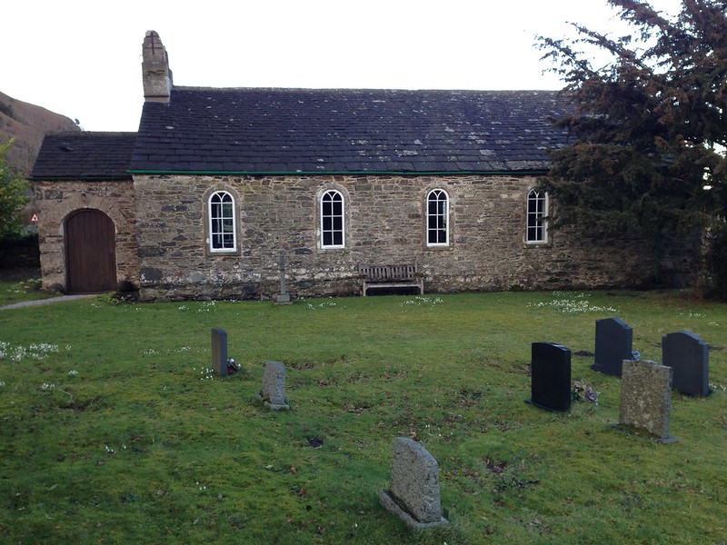
No ‘Listed Lancaster’ posts from last week, not because I didn’t get out for any lunchtime strolls – although I was restricted a little, it was a busy week – but because when I did get out the weather was always gloomy and not really ideal for photographs. I particularly enjoyed my walk on Wednesday, when we had snow, but even the photos I took then are  rather grim and monotone.

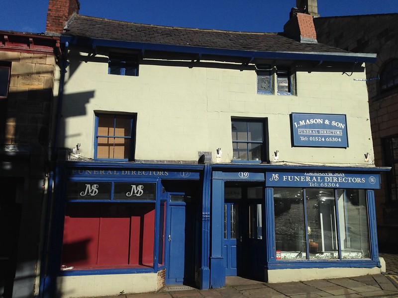
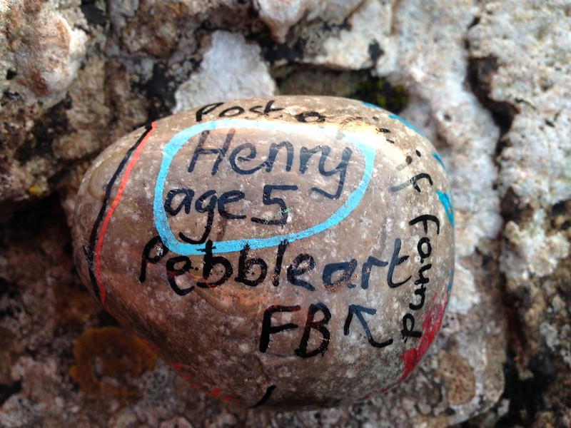
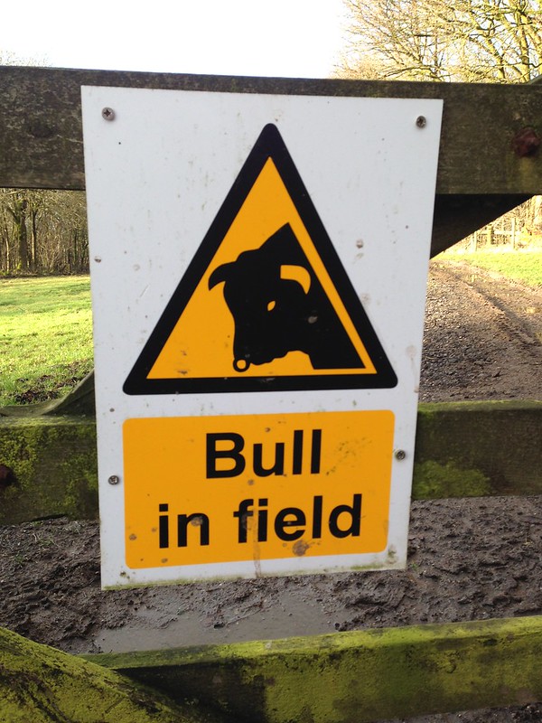
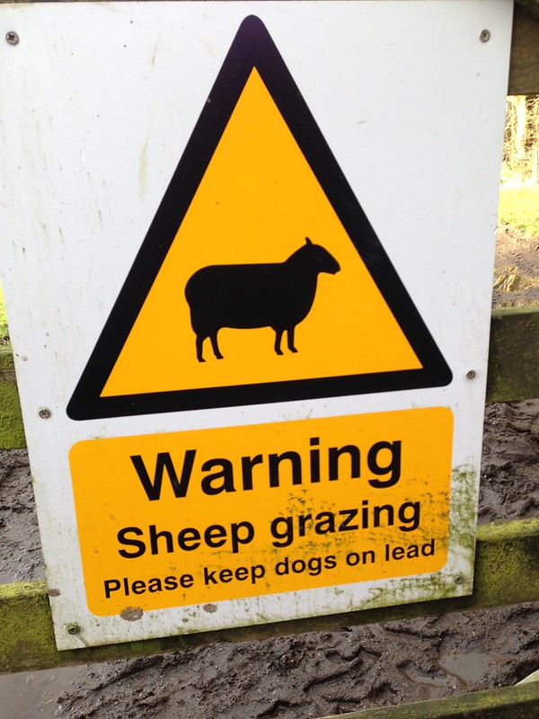
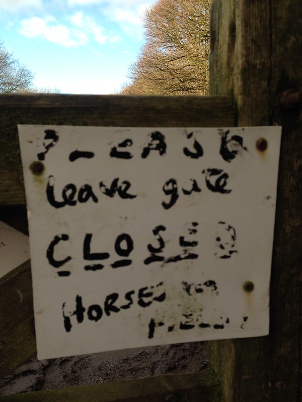
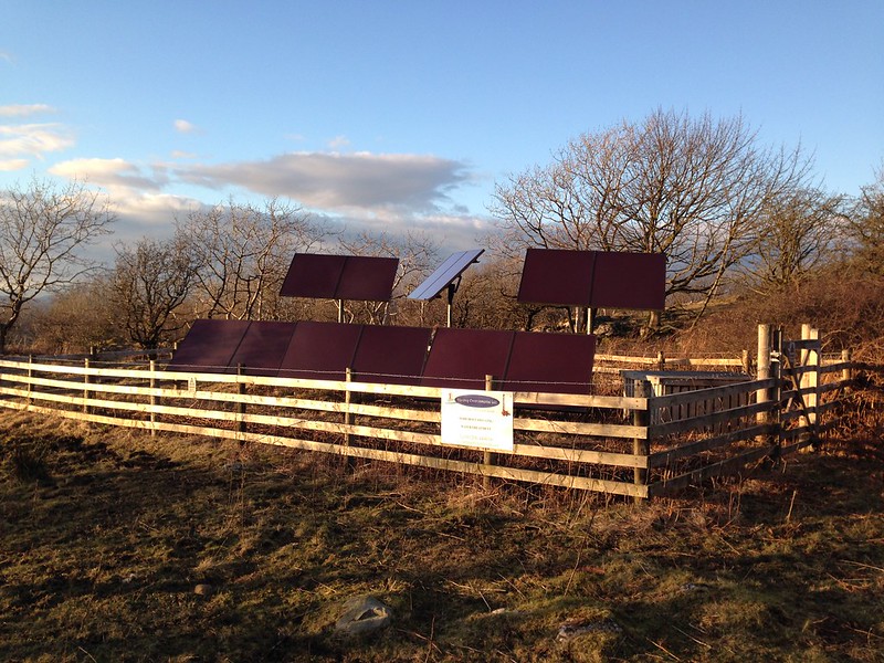
Saturday too was very wet, but it did finally brighten a little late on, and I abandoned the second half of Ireland’s cakewalk against Italy to make the most of it. Not much to show for it in terms of photos of views or leaves or sunsets etc, but every walk seems to throw up something, in this case a wet poster…

Untitled

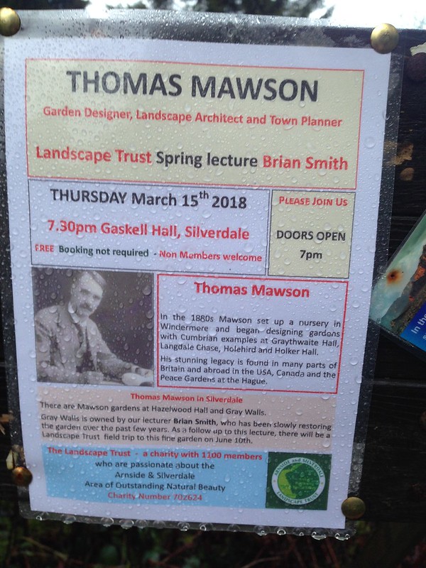
Long-suffering readers will know that I have become quite interested in Thomas Mawson and his gardens, which have featured on this blog a number of times. I’m hoping that I will be free on the evening of this lecture. If not, there were plenty of other things to choose from: a talk on ‘Bees in Your Garden’, another on ‘Sweet Peas’ and a third on ‘An Underwater Safari in Morecambe Bay’, music at the regular ‘Bits and Pieces’ event at the Silverdale Hotel, the John Verity Band appearing soon at the same venue, and, at The Instititute, Lancaster Band The Meter Men, who play Hammond Organ infused funk and are, in my opinion, superb. And that’s just a small selection of the entertainment on offer, seen through the filter of my own interests. Silverdale it seems, like Stacy’s Mom, ‘has got it going on’.

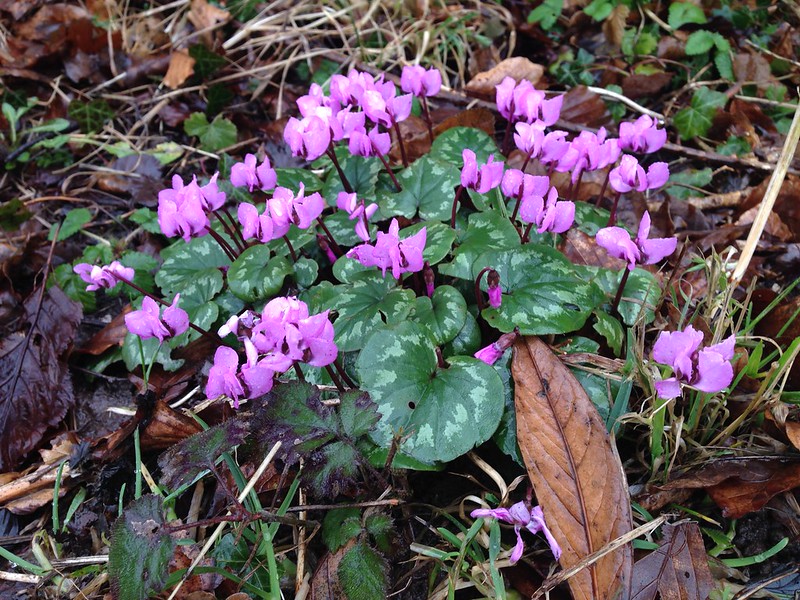
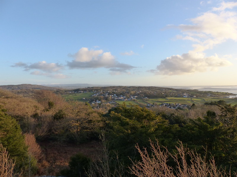
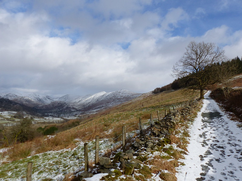
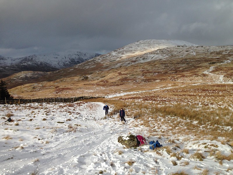
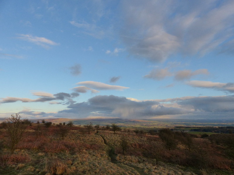
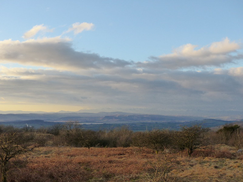
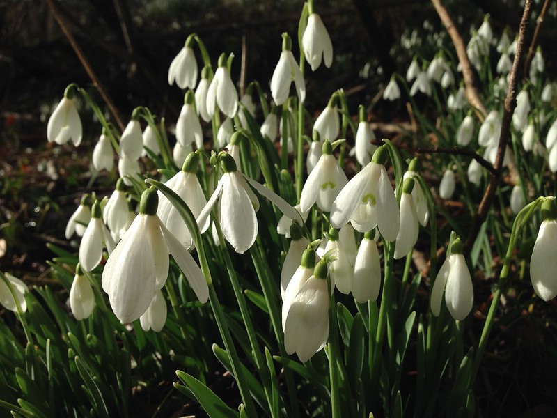
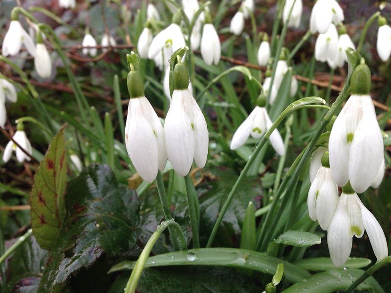
Anyway, back to Sunday: I set off, as I often do, without a clear idea of where I was going. Initially though, I chose to climb to the Pepper Pot on Castlebarrow, to take a look at the clouds racing past. I went via the Coronation path because I knew that would take me past the Snowdrops which featured at the top of the post.

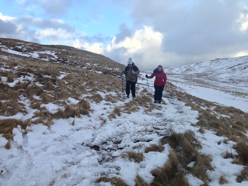
From time to time, new paths seem to appear in Eaves Wood, a reflection, I suppose, of how many people regularly walk there. Whenever I walk past one, I wonder where it goes and resolve that, next time I’m out, I’ll find out. On Saturday I finally acted on that impulse. The first path I followed cut a corner between two paths which I know well. Even so, I felt very pleased to have taken it and I’ve been back and walked it again since.

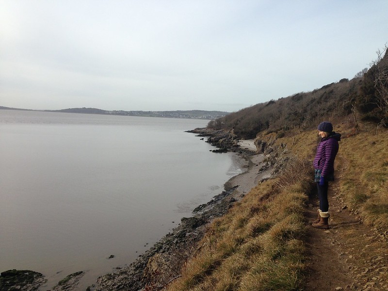
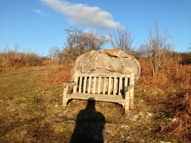
From Castlebarrow I followed the path along the northern edge of Eaves Wood, beside the wall which marks the boundary between Lancashire and Cumbria. I met a couple walking their dog, who emerged from the trees at the side of the path. Looking back from where they’d come I thought I could detect the thinnest of thin trods, a hint of a path. Naturally, I followed it and it brought me to a drystone wall, in a spot where an old ants’ nest against the wall made it easy to scramble over. It was evident that people had climbed the wall here. I could see that just beyond the wall was the rim of Middlebarrow Quarry…

P1170772

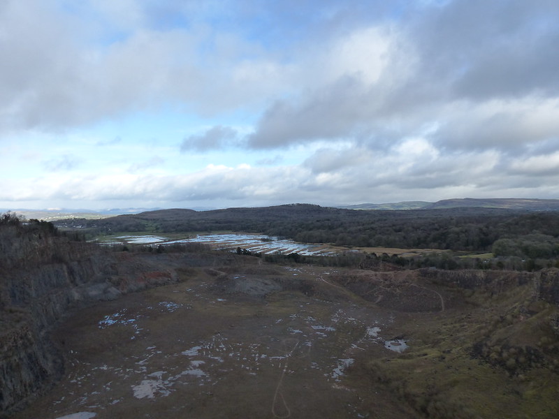
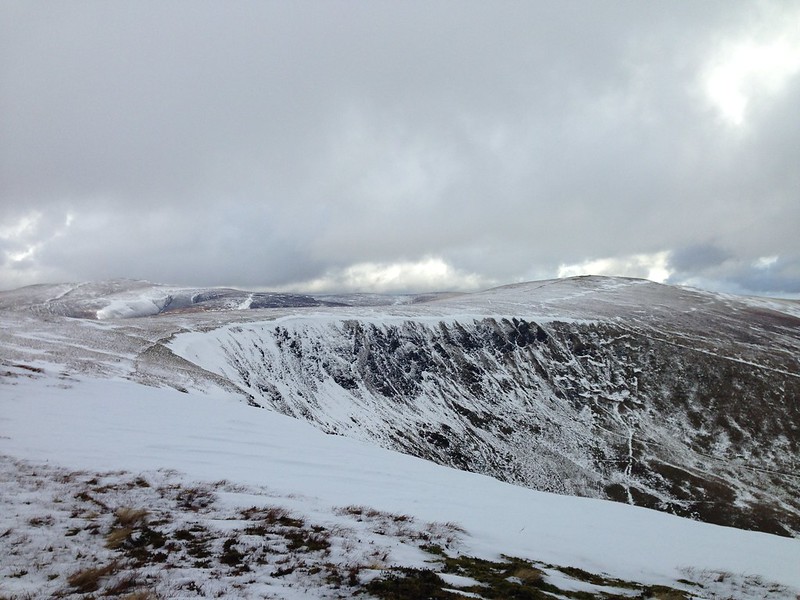
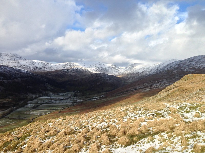
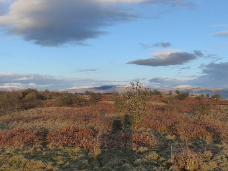
Silverdale Moss, Scout Hill and Farleton Fell from Middlebarrow.

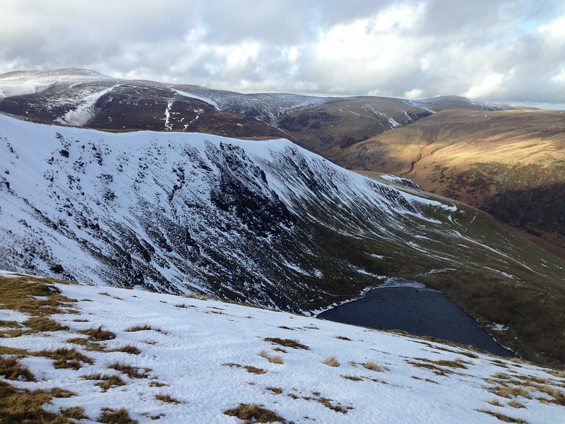
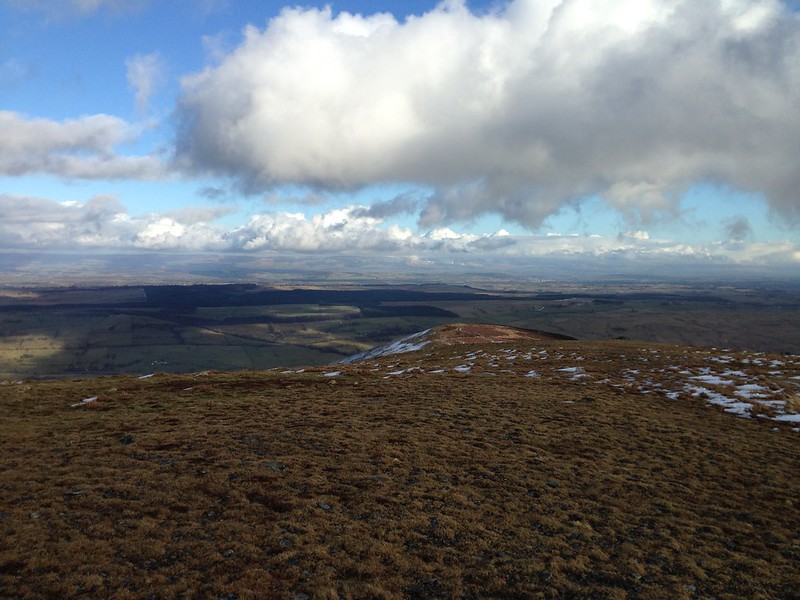
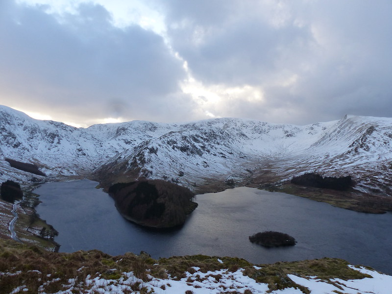
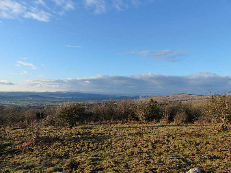
The quarry is huge, but is well concealed from most directions. Again, I thought I could see a path heading along the edge of the quarry. In all the years I’ve been here I’ve never walked around it. It is private land, but it’s not a working quarry anymore and I can’t see what harm could be done by wandering around. So I did.

Untitled

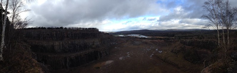
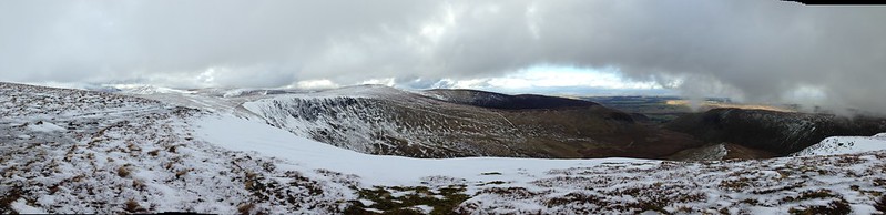
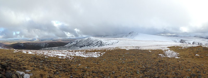
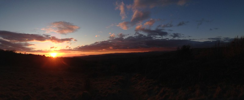
Middlebarrow pano. Click on it to see enlarged version.

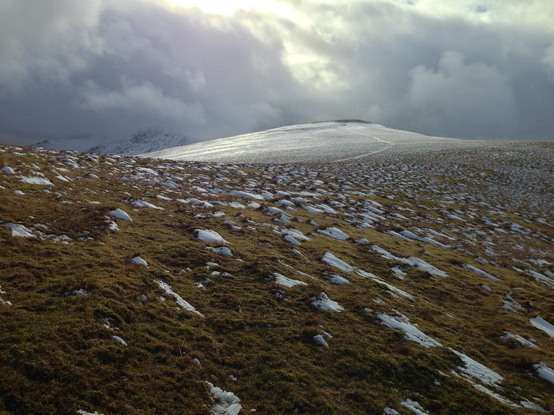
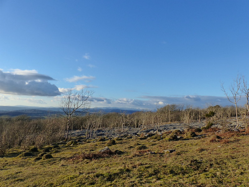
The path turned out to be a bit sketchy in places. And it was easy to lose where there was limestone pavement…

Untitled

Some of the pavements were coated in moss, others had grass growing over them, which made it hard to see the grykes.

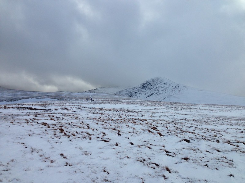
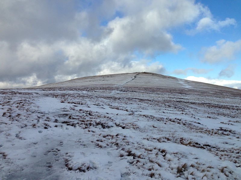
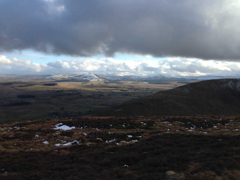
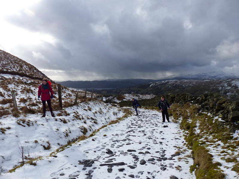
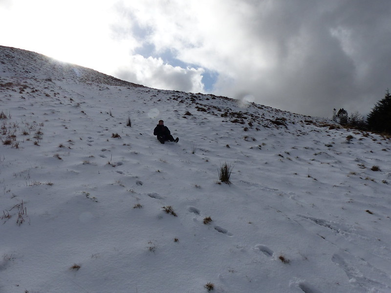
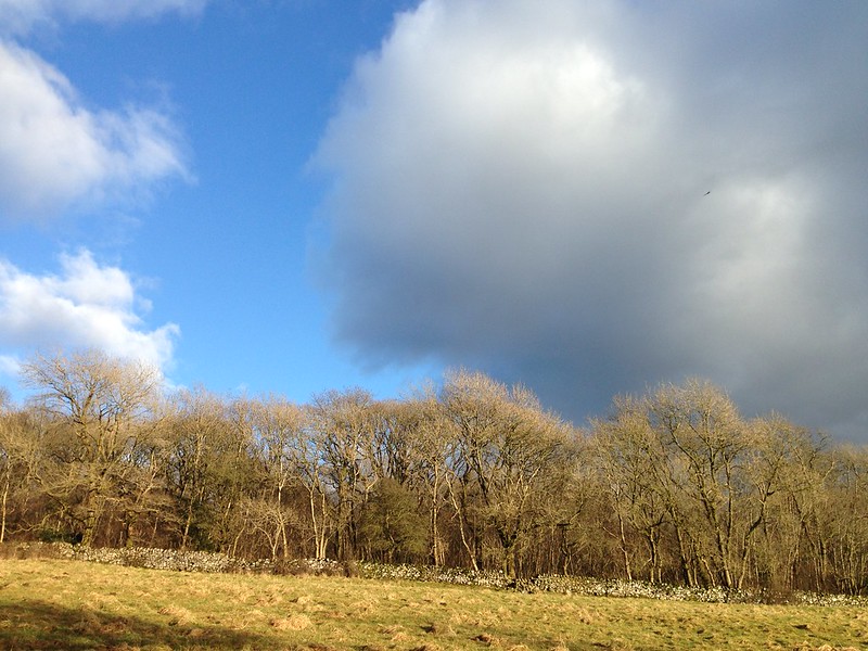
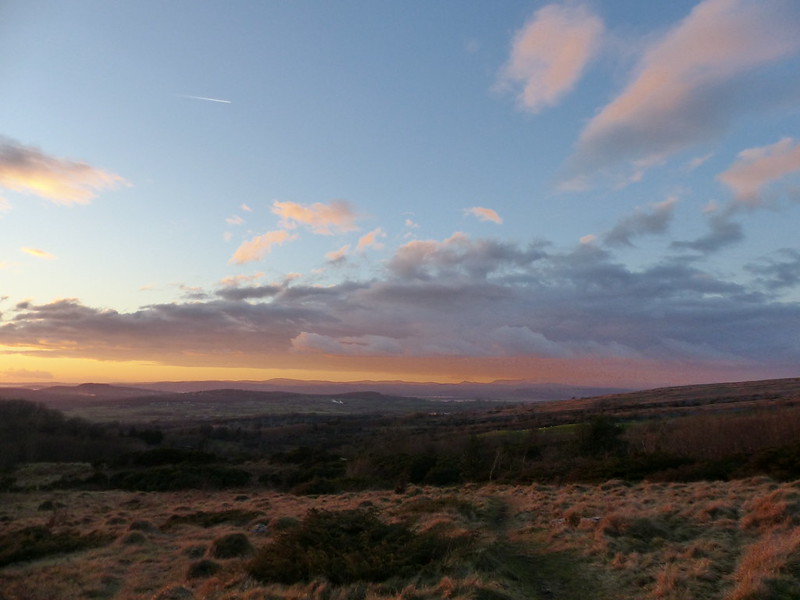
True to form, the weather threw everything at me: rain, sleet, hail, but odd moments of sunshine too.

P1170775

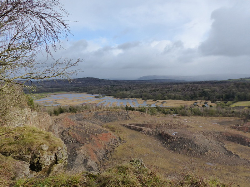
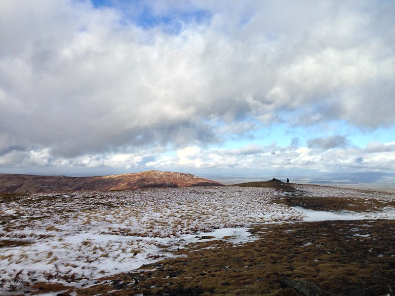
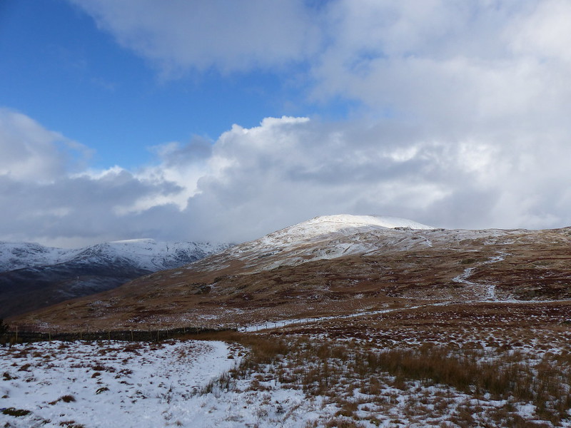
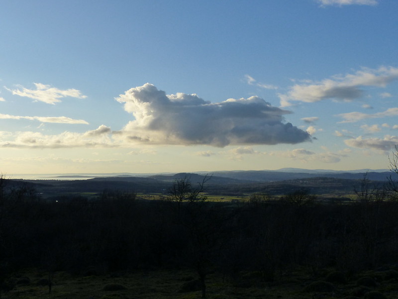
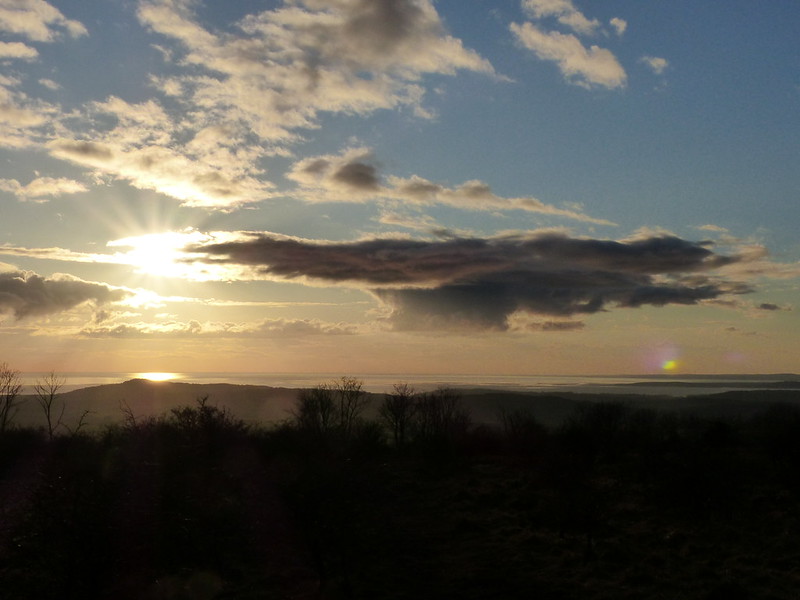
There’s a ninety metre contour somewhere around the rim of the quarry, making it the highest point on the limestone hill on which Eaves Wood sits. It’s certainly a good view point for Silverdale Moss and I shall be back here again.

P1170780

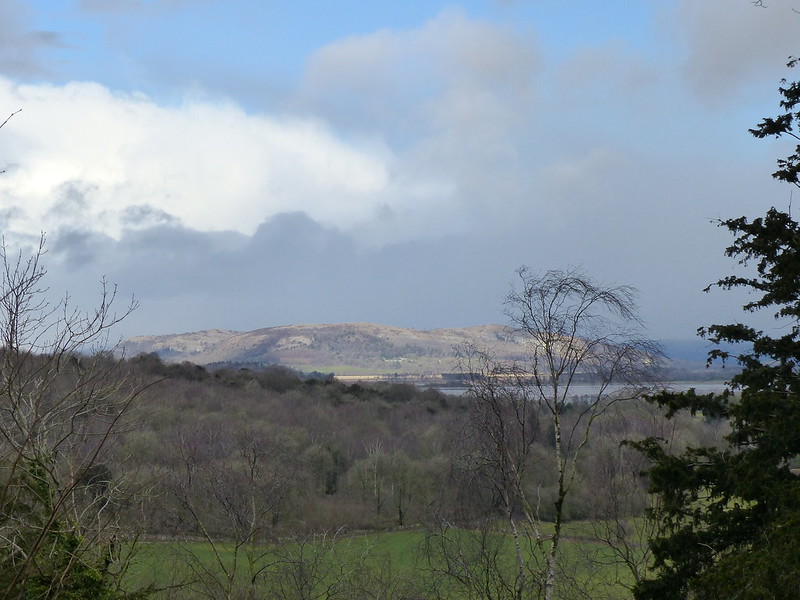
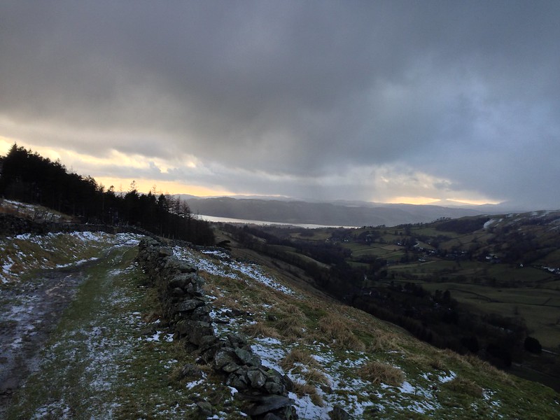
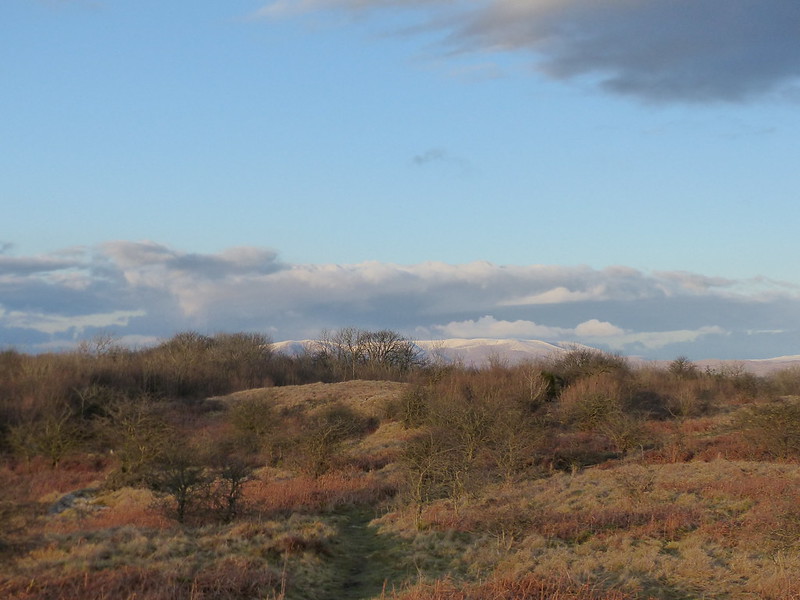
Whitbarrow catching the sun.

Untitled

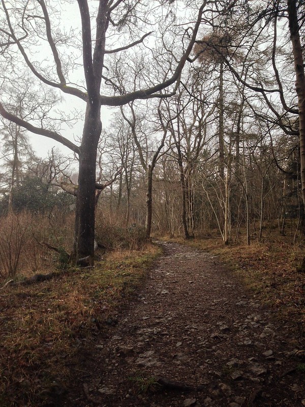
I took this photo in an attempt to show the heavy snow which was falling. You’ll have to take my word for it.

Untitled

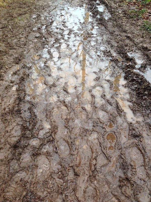
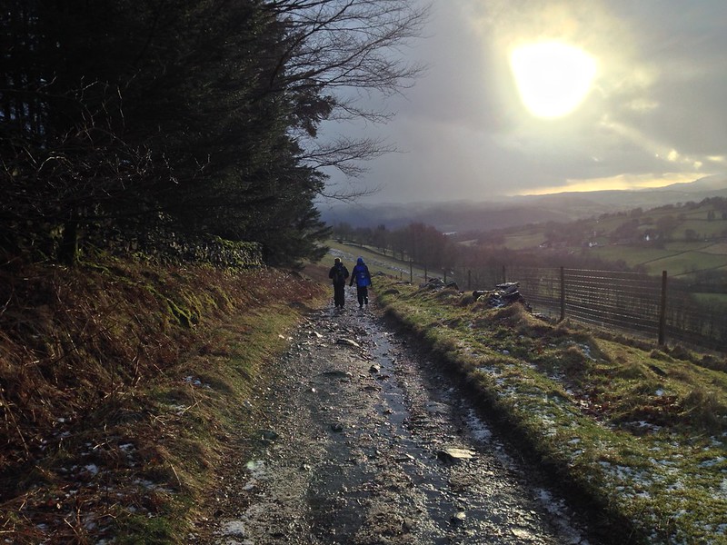
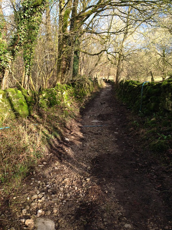
And this one to show the state of many of the paths after the wet weather we’ve endured.

Untitled

By the time I was leaving the woods, the snow had stopped again.

I timed my walk to arrive back to watch England squeak past Wales in the rugby by the finest of margins.

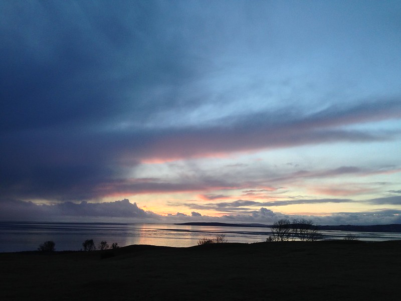
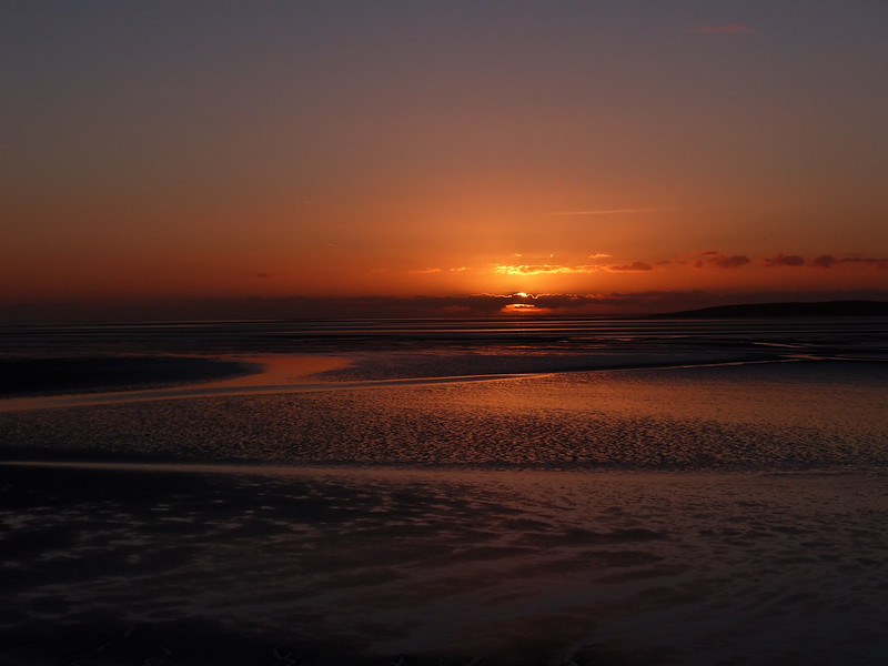
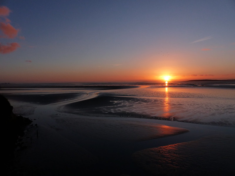
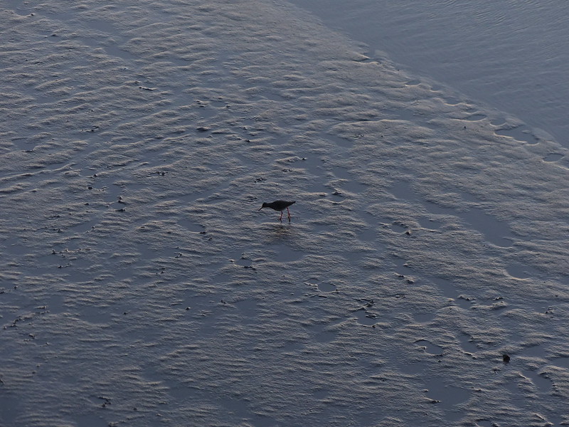
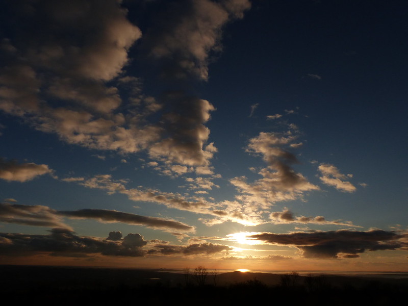
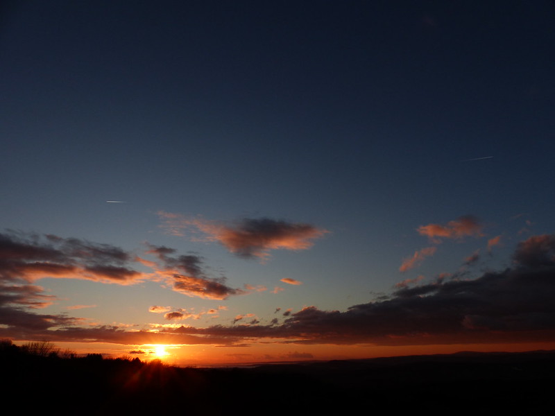
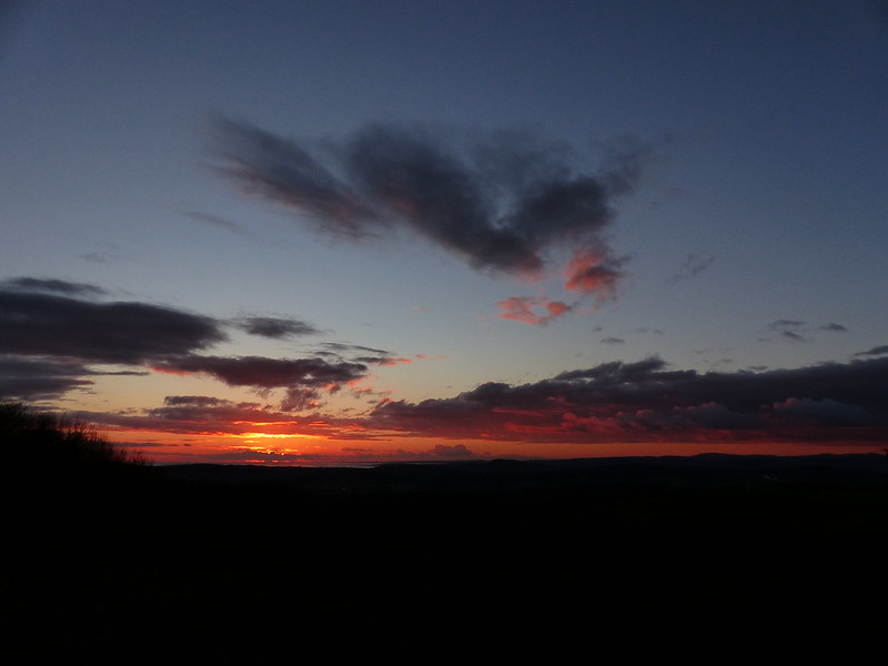
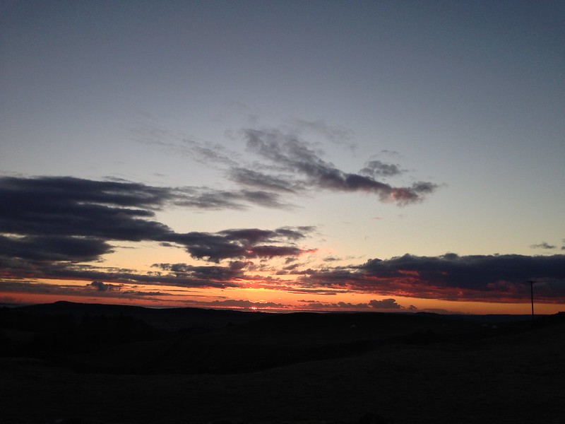
Then I was out again. Since it was still cloudy, and I knew I was too late for the sunset, I only took my ‘new’ phone with me and not my camera.

Untitled

I never learn!

Untitled

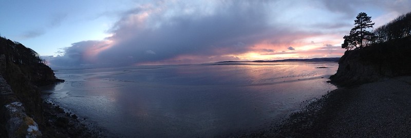
The colours were subtle, pastel shades, but very pleasant none-the-less.

Untitled

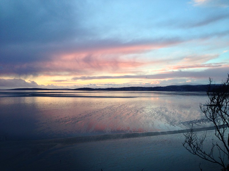
Always good to finish a day (and a post) with a colourful sunset, if you can.

Untitled

Middlebarrow in Every Kind of Weather.

Hutton Roof Crags from Holme

Not ‘Hutton Roof Crags from Home’ which is a post which I shall one day get around to, just as soon as I’ve found time to fit in a walk of that description, but rather an ascent of Hutton Roof from the village of Holme. I’ve added not one, but two maps at the bottom of the post to show my route, but it was, in brief: an overly long wander through Holme (thanks to a daft choice of parking spot); through Curwen Woods and past a house with, I’ve since discovered, gardens designed by Thomas Mawson; through the tiny hamlet of Clawthorpe; up through Lancelot Clark Storth to the top: down across Uberash Plain to pick up the path which skirts the north side of Holme Park Quarry; and finally a road walk in the dark back to the car.

Since this was an afternoon walk, after a Rugby match in the morning, I didn’t set-off until around two-thirty and initially was in no mood to stop to take photos. Until three signs on the one gate had me chuckling…

Untitled

…there was no Bull in the field (there rarely seems to be when there’s a sign), nor…

Untitled

…any sheep, nor…

Untitled

…any horses. Plenty of signs though.

Untitled

Slape Lane.

Untitled

Every time I climb Hutton Roof via Lancelot Clark Storth I seem to follow a different route. This time was no exception.

When I first spotted this…

Untitled

…from below, I thought that it was quite tall, perhaps some sort of tower, but it seemed to shrink as I approached. I assume that it’s a charcoal burners’ kiln.

It’s quite easy to get lost on Hutton Roof and I was glad to spot a series of small signs marking the route of an Audio Trail which I shall have to try some time.

The signs led me to this bench…

Untitled

…which, despite many visits, I’ve never encountered before.

What with the sunshine, and the flask of hot water and makings of a brew in my rucksack, I could hardly resist such an invitation to stop. Especially since the views had opened out behind me…

P1170737

The distant, snowy hills of the Lake District.

P1170742

Humphrey Head, Arnside Knott, Eaves Wood.

P1170743

From a little higher up – the Lakeland Fells again, but also Farleton Fell on the right.

Just short of the top, there’s a small enclosure of solar panels.

Untitled

Does the fence stop them escaping?

Given that this is a nature reserve I can’t imagine that any kind of large scale commercial operation is envisaged, so I wonder what is going on here?

The summit of Hutton Roof Crags has expansive views, despite it’s modest height. On this occasion, the Bowland hills were smothered by very black looking clouds, which looked a bit ominous. Ingleborough was also hidden by clouds. I thought maybe it was raining in that direction…

P1170756

P1170747

The Middleton Fells.

P1170748

Howgills.

P1170749

Lakeland Hills and Whitbarrow Scar.

P1170750

Warton Crag and Morecambe Bay.

The path down towards the Clawthorpe Road dipped into hollows and between stands of shrubs and dense thickets of Gorse. I kept losing my view of the Bay and the sinking sun and rushed between each vantage point, taking photos at every opportunity.

P1170754

More impressive than the sunset itself was the way the underside of the clouds over the Lake District took on a warm orange glow…

P1170758

There’s room for quite a few cars to park around the top of the Clawthorpe Road and many of those spaces were still occupied. I was quite surprised, but then realised that there were a few other people out photographing the sunset. Some had come better prepared than me, with tripods.

P1170760

Heading down the hill, I was thinking that there’s still a lot of this ridge – Hutton Roof and Farleton Fell – that I haven’t explored. So plenty of excuse to come back.

P1170764

The paths had generally been wet and muddy, but the last section of track, with a barbed wire fence on either side, had vast puddles stretching right across it. I had little choice but to splash through them and my feet got a little damp, but it was a small price to pay.

Untitled

Untitled

Screen Shot 2018-02-04 at 21.50.59.png

Slightly under 8 miles with 240m of ascent. Not bad after a late start on a short winter afternoon.

Screen Shot 2018-02-09 at 23.17.14.png


Hutton Roof Crags from Holme