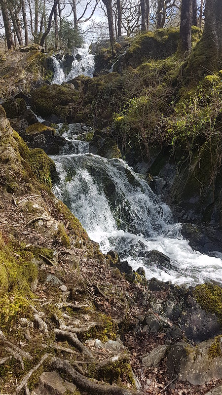
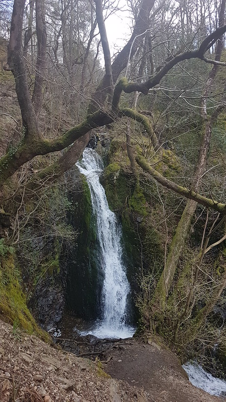
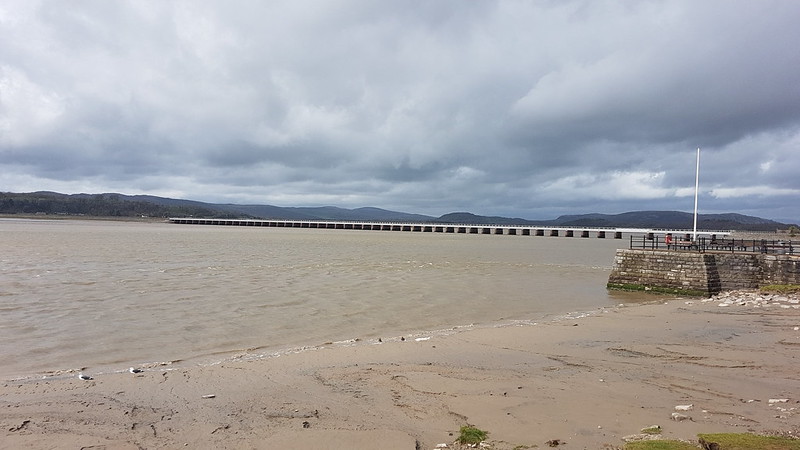
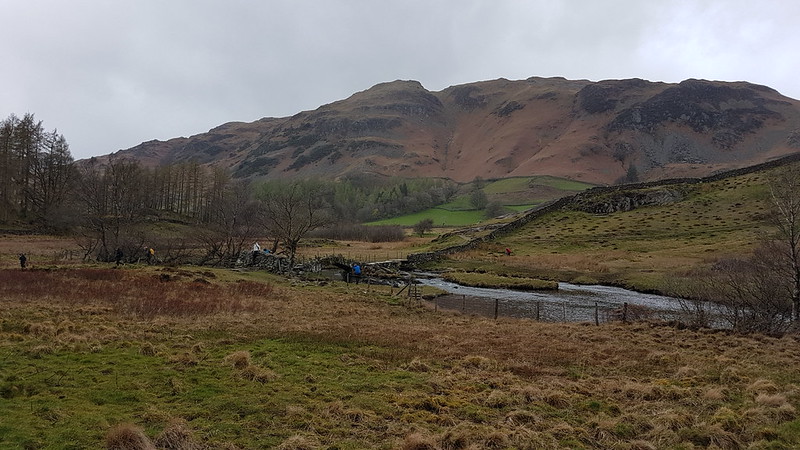
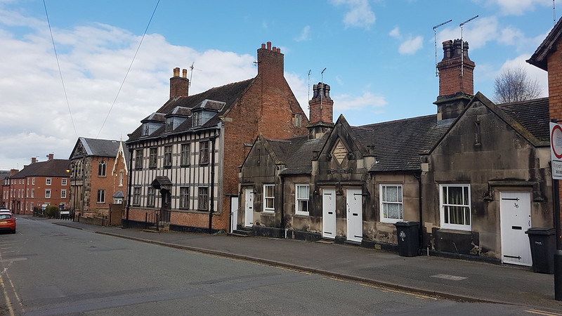
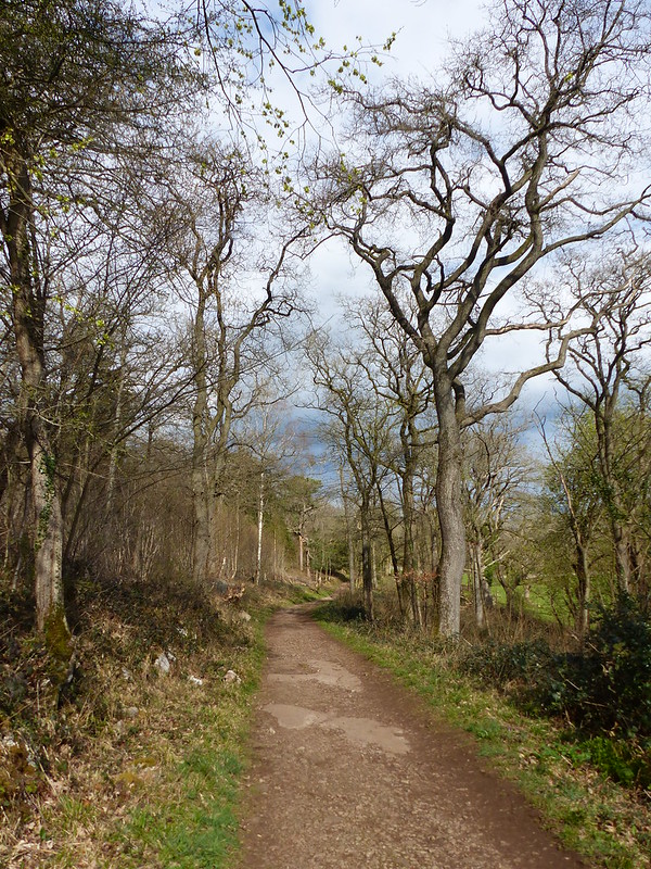
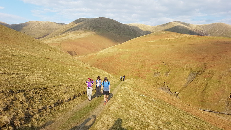
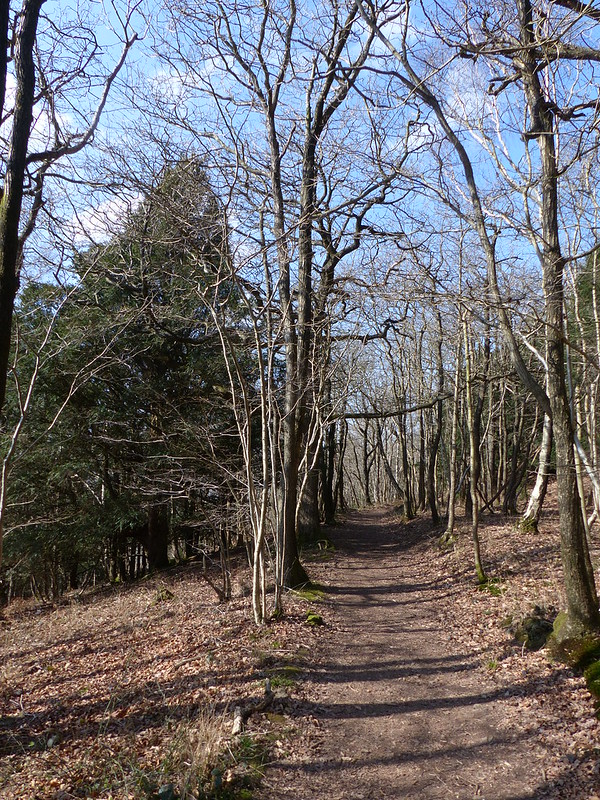
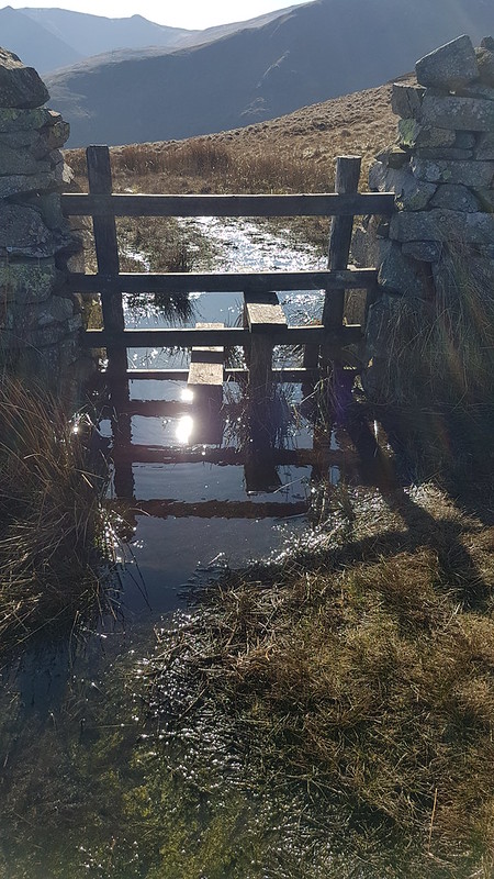
Two days after my birthday, and time to climb some actual hills, although, in truth, quite diddy ones. I can’t remember why, but it was already well after midday when we parked in the car-park just off the busy A593 which runs between Ambleside and Coniston. We were in the little car park near Glen Mary Bridge which has the dual advantage of being a National Trust carpark and of being beside Tom Gill, the stream which drains Tarn Hows.
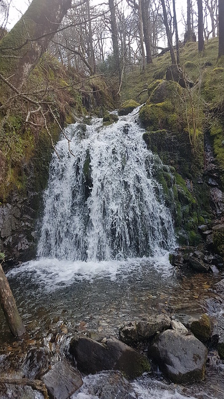
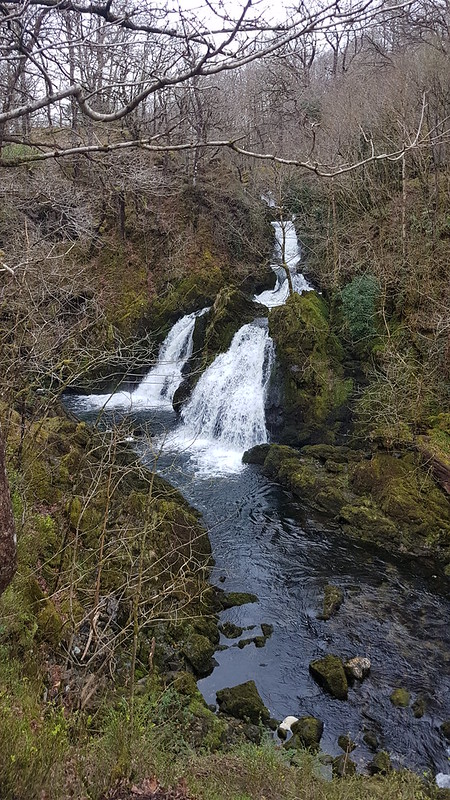
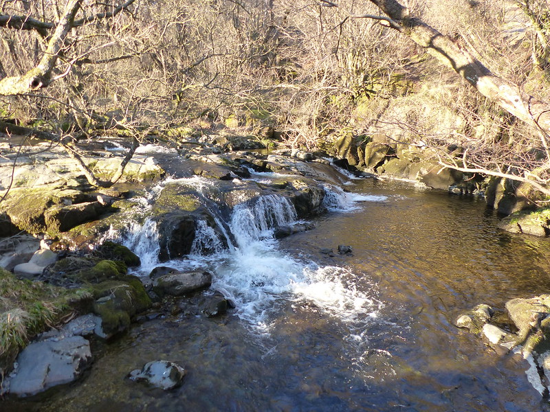
Tom Gill Waterfall
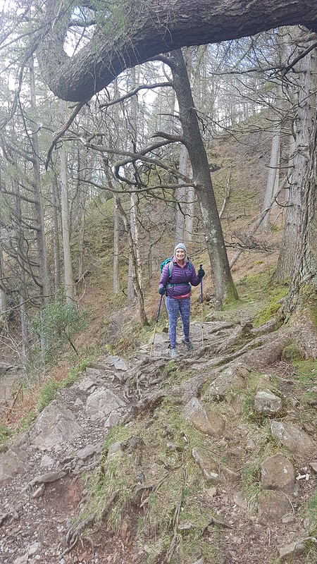
We’ve been this way before, and knew that the walk up through the woods, besides the many waterfalls in Tom Gill would be delightful.
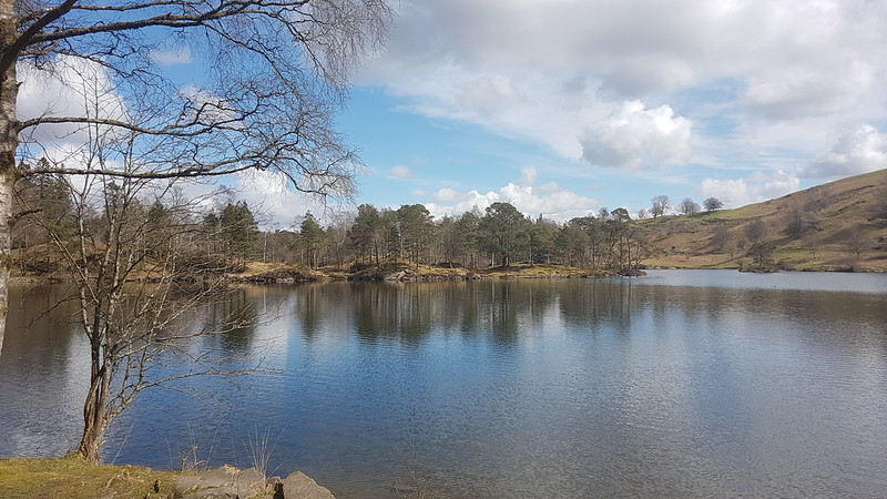
Tom Gill WaterfallIn the woods.Tarn Hows
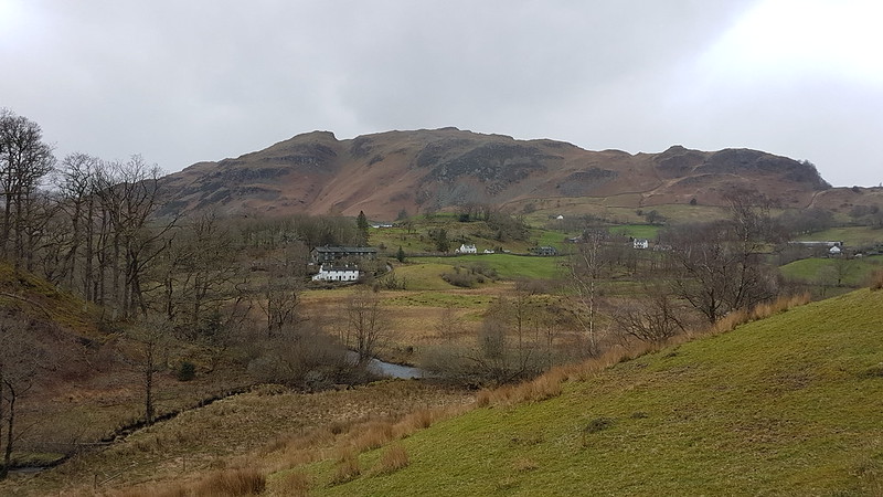
When we arrived at Tarn Hows, the sun was shining and it was really very attractive. I could almost understand why the crowds flock there. It was a bit too cold and a bit too busy to strip off for a swim, so we decided to have a very early, at least in terms of the walk, lunch stop by the shore of the tarn.
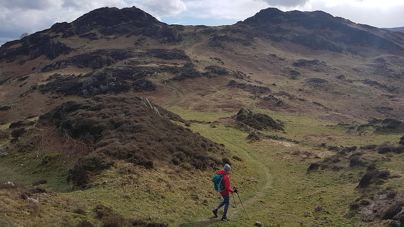
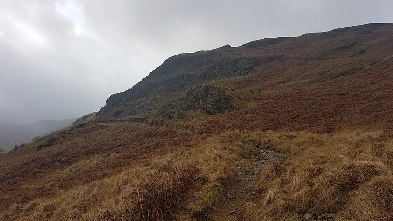
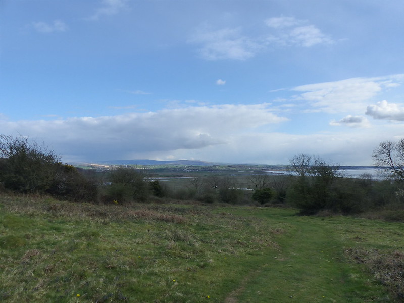
Inevitably, away from the tarn, it was much quieter as we headed steadily up through Iron Keld Plantation towards Black Fell. (The OS have both Black Fell and Black Crag, but since I am currently obsessing about ticking off Wainwrights, I’ll stick with the name the old curmudgeon used.)
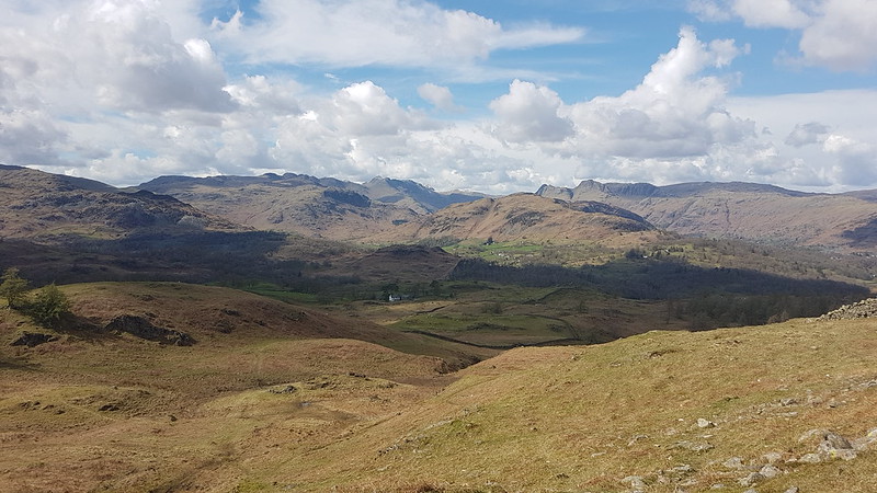
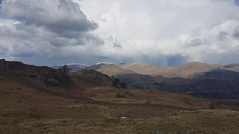
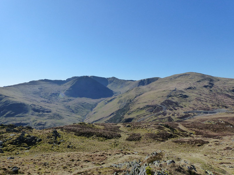
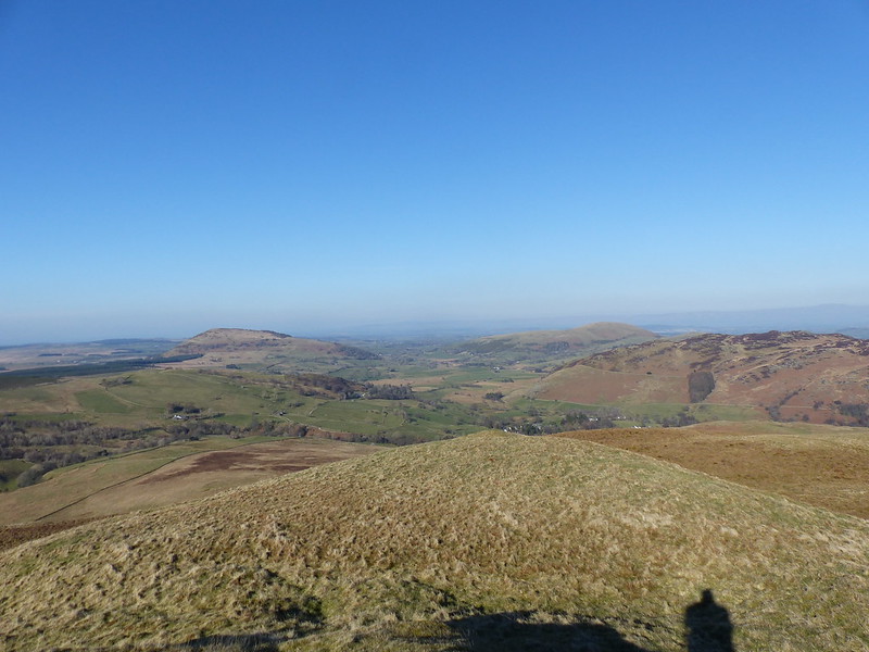
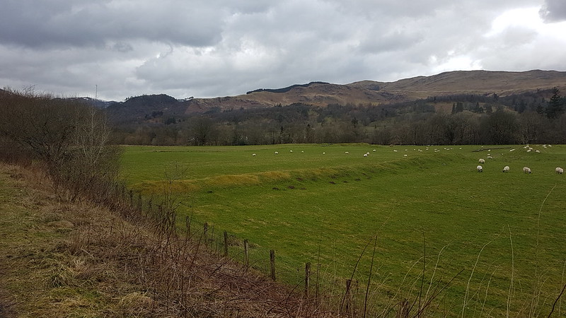
Looking towards the hills around Langdale and Eskdale.
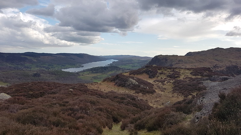
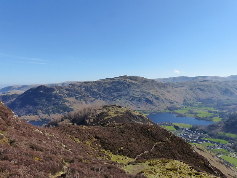
It was no surprise that the views from Black Fell are superb, but fabulous to have such fine conditions to enjoy them. I was disproportionately chuffed that Lingmoor, where I’d been earlier in the week, featured prominently in those views.
Ambleside and the head of Windermere.Wetherlam.Looking towards Helvellyn and Fairfield.
The weather looked a bit grim over the long ridge of hills which runs north-south between Clough Head, the Dodds, Helvellyn, and the Fairfield Horseshoe. It looked grim over those hills all day. Curious how that can happen and how localised the weather in Cumbria can be.
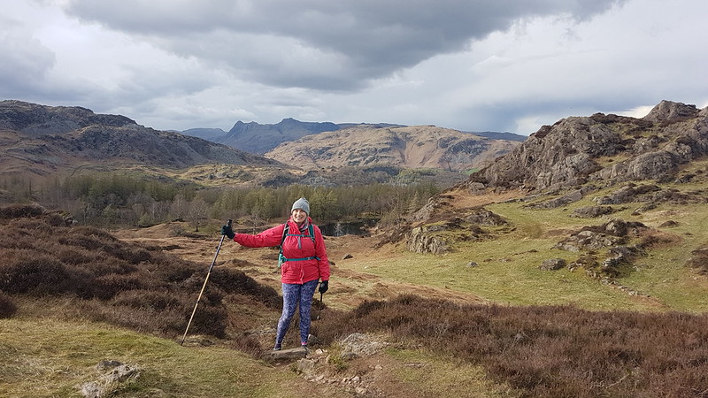
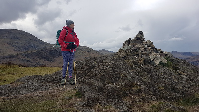
Below the top of of Black Fell there’s a very substantial cairn. We decided to investigate.
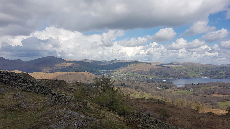
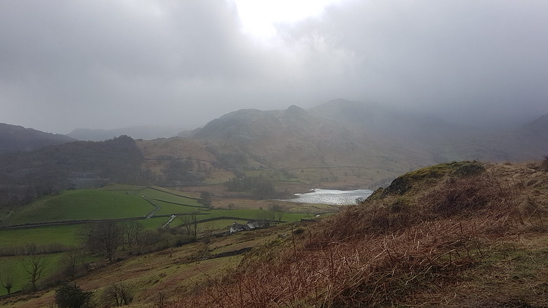
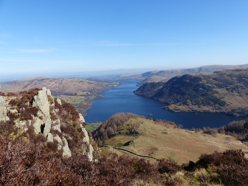
And then decided to have a second lunch stop just below the cairn from where there was an excellent view along Windermere…
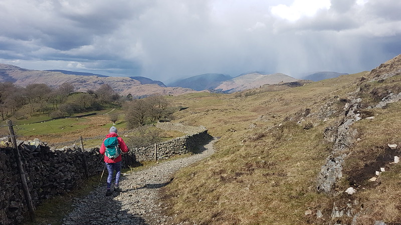
The weather still looks grim towards Helvellyn and Fairfield.On our descent, Coniston Water in the distance.
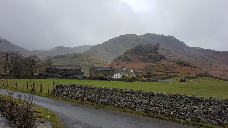
We were on the same path we had followed when we walked from Coniston to Ambleside last summer, although we would divert off to the left fairly soon.
The weather still looks grim towards Helvellyn and Fairfield.Low Arnside Farm. Grade II listed. Property of the National Trust. The gift of Beatrix Potter.
I’m beginning to wonder if there are any old buildings in the Lake District which Beatrix Potter didn’t buy and give to the National Trust.
The weather looks even grimmer towards Helvellyn and Fairfield.
We still had sunshine, but it wouldn’t last much longer. We soon had the first of several short showers, with a little hail mixed in. We didn’t see much sun after that, but it generally stayed fine at least.
Only Lingmoor has the sun.
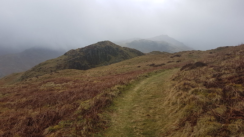
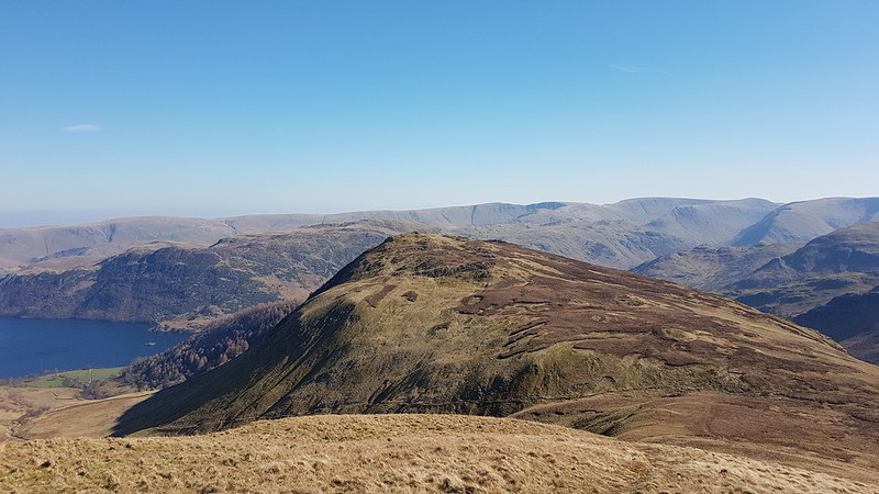
Although I’ve climbed Holme Fell quite a few times over the years, I’ve never used this route before, up the long broad ridge from Oxen Fell via Man Crag. It’s a terrific route which I discovered in one the Aileen and Brian Evans Cicerone ‘Short Walks’ guides.
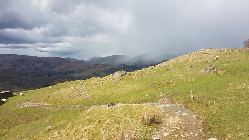
The weather looks marginally less grim towards Helvellyn and Fairfield.Black Fell. Not black. Unlike the skies behind it.Yew Tree Tarn and Coniston Water.
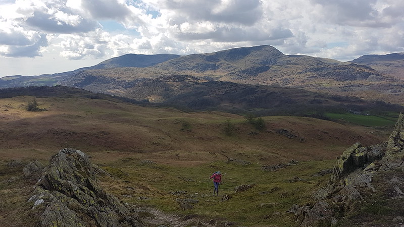
We had another brief drink and snack stop on the ridge, but it had become a bit cold and windy to stop for very long.
This is an extremely lumpy ridge with lots of rocky little knolls. Fortunately, we found a series of little paths which wound around the bumps.
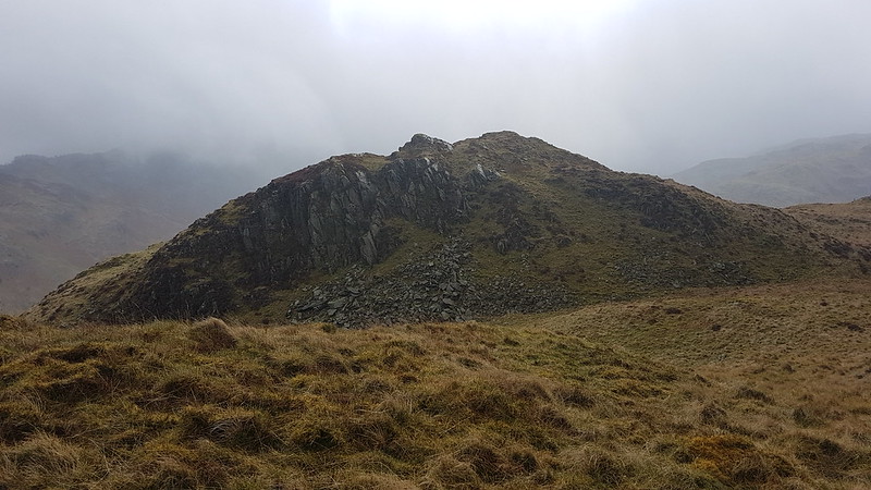
Ivy Crag on the left, the top of Holme Fell on the right.The disused reservoir over TBH’s shoulder is reputed to be a good place to swim. It’s on my list!The top.
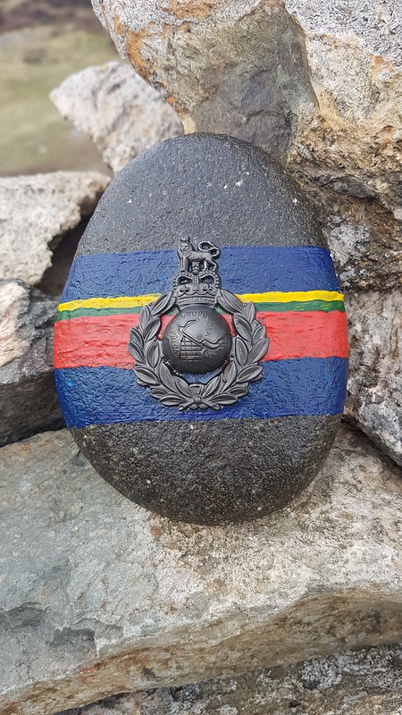
This painted stone was on the summit cairn. I wish I knew what it was commemorating? The writing just says Africa, Europe, Asia, Aust so I’m not sure that helps. Curious that the Americas are omitted.
Coniston Water.On the descent. Holme Fells impressive crags behind.Yew Tree Farm and Barn. Grade II listed. Property of the National Trust. The gift of Beatrix Potter.Inevitably. I liked the open gallery along the front of the barn.
Some stats: MapMyWalk gives 7½ miles and 360m of ascent. The Evans say 6¼ miles, but their (excellent) route drops down from Uskdale Gap and so misses the top of Holme Fell which probably accounts for the difference.
If you’re looking for a half-day walk in the Lakes I reckon you’d be hard-pressed to beat this one for variety and views.
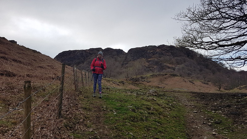
The ‘upper’ path from Far Arnside. Third time running I’d foolowed this path, which I don’t usually use.
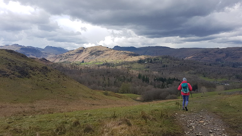
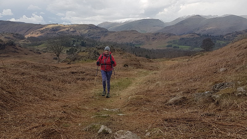
Long-suffering readers will know that on, or close to, my birthday I like to climb a hill to celebrate. This year, my Lingmoor walk was just two days before my birthday and a couple of days later I was back in the Little Langdale area with TBH, so I did pretty well.
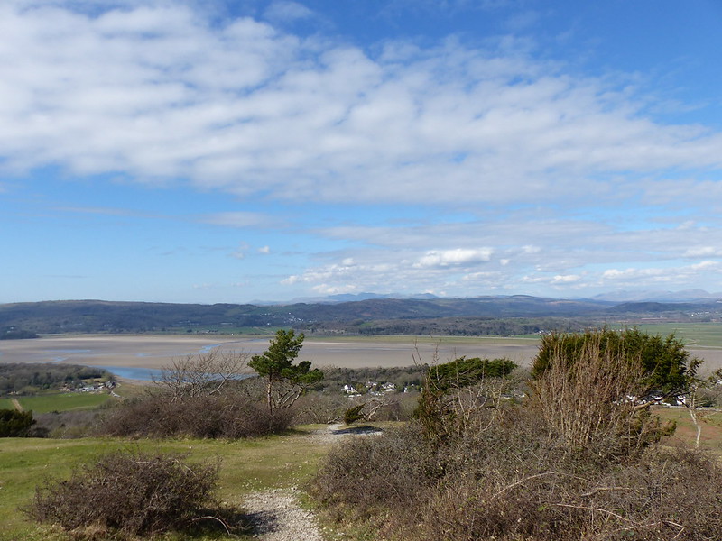
On the actual day, the forecast was pretty ropey. Never-the-less, we managed to persuade the boys to join us for a walk to Arnside over the Knott. Possibly the promise of a pie in Arnside had some influence on their decision.
In Far Arnside, we sheltered behind a tall hedge for the duration of a short, sharp hail shower. It was pretty fierce, but also wind-driven so that in the lea of the hedge it came over our heads and we didn’t do too badly.
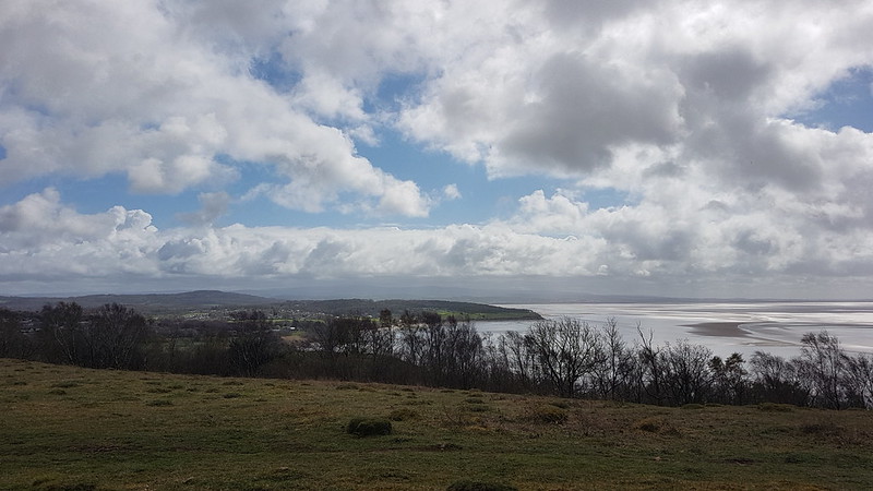
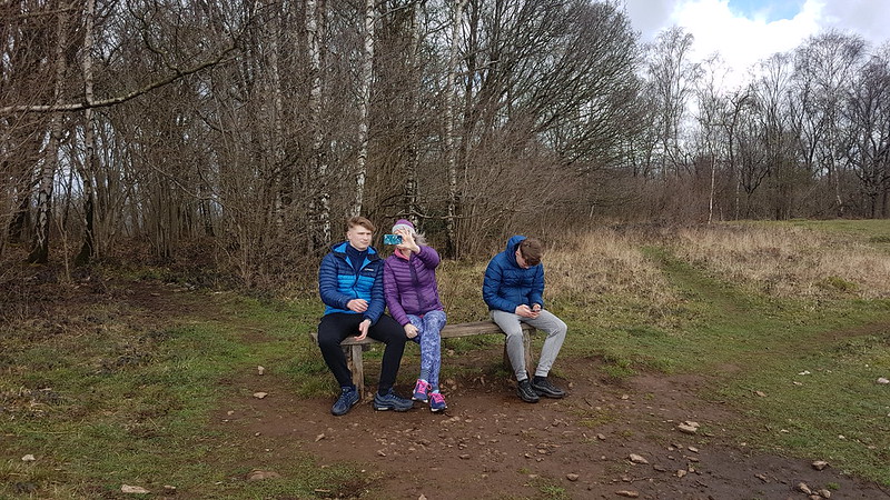
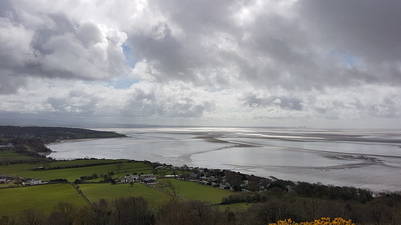
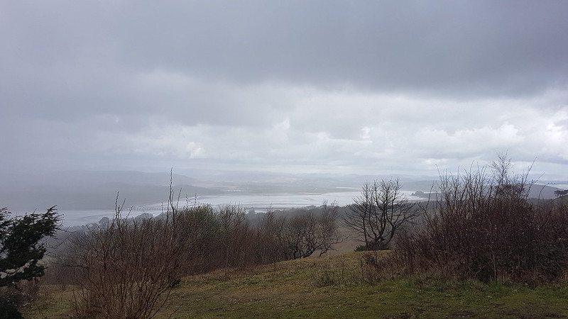
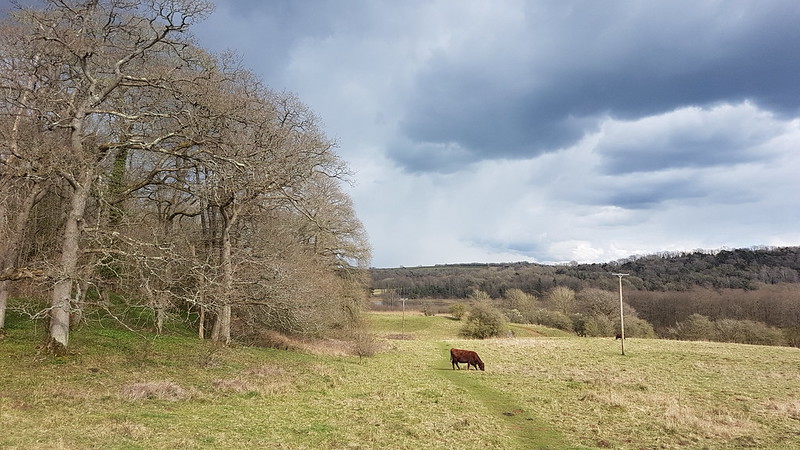
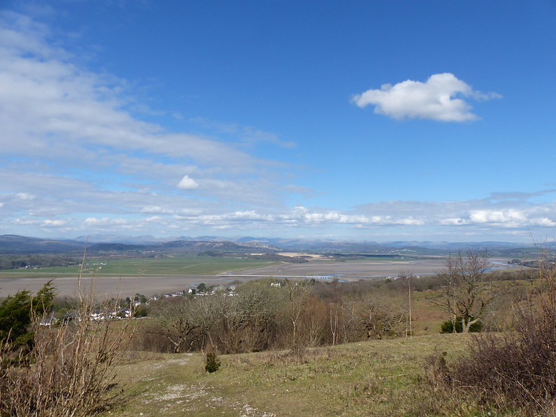
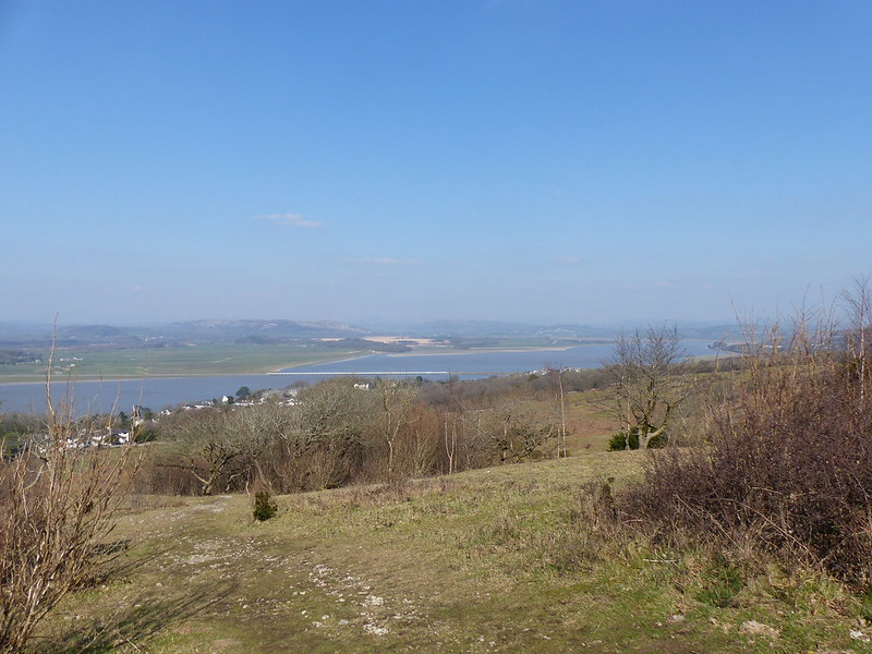
Warton Crag, the Bay and Bowland from Heathwaite. I think you can see showers tracking in off the Bay.Taking a Heathwaite selfie. Not sure why Little S wasn’t included.Far Arnside and The Bay. As we approached the toposcope on the Knott, the heavens opened again.Kent Estuary in the rain.River Kent, Cartmel Fell, Gummer How, Yewbarrow and Whitbarrow Scar – bigger fells beyond conspicuous by their absence.
Fortunately, it was another short-lived shower. And the pies and sausage-rolls at the Old Bakehouse went a long-way as compensation for the changeable weather.
Kent Viaduct. Louring skies.Arnside Tower – blue skies!
As I said – a very changeable day.
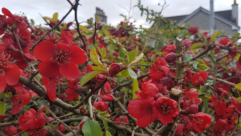
Quince.
A had been working on my birthday and so wanted to go for a walk the following day. The weather was similar to the day before and although we had originally planned to go to Arnside for pies again, A eventually decided that a short Eaves Wood stroll would have to suffice.
TBH and A at the Pepper Pot.
It’s very handy having some little hills on the doorstep to climb when the weather isn’t conducive to a longer expedition!
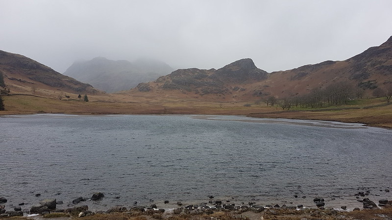
Blea Tarn. Side Pike on the far side and the Langdale Pikes obscured by clouds behind.
B had a shift in the cafe at Brockholes; since I was dropping him off there, I decided to stay in the Lakes and make the most of it, despite a fairly ropey forecast. I had a fine time, even though it rained on and off most of the day.
I parked up by Blea Tarn, another National Trust carpark, although the joy of ‘free’ parking was tempered by high winds and driving rain which weren’t terribly encouraging. I rarely set-off for a walk in full waterproofs, I’m a fair weather walker, as much as I can manage to be.
Looking back towards Blea Tarn. The plug of rock in this photo is Tarnclose Crag.
Fortunately, my route started downhill into Little Langdale and I hadn’t walked far before both the wind and the rain had abated a bit.
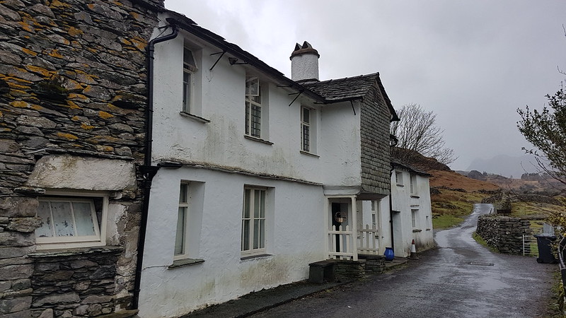
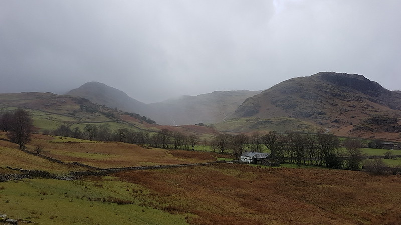
Farmhouse at Fell Foot When the skies are grey and the weather is rotten, I always think the white-washed stone buildings still look attractive. I’ve often thought that the porch over the door here is unusual. Turns out this is a Grade II listed building.
“At the foot of Wrynose Pass. C16 north wing, the main block C17. A long, low house, white-washed stone rubble, flag roof, 2 storeys. The door is under the overhang of a slate-hung upper storey, gabled, and without windows, the timber beam ends showing in the gable.”
This shows the entire farm complex at Fell Foot with Castle Crag behind, itself a scheduled monument because of it’s suspected history as a hill-fort. By the farm there’s the Ting Mound where the Norse inhabitants of the valley had council meetings.
Behind Castle Crag you can see Lingmoor which is out of the cloud and would remain so all day, unlike any of the surrounding higher hills. I assume these very rocky lumps – Side Pike, Tarnclose Crag and Castle Crag are volcanic in origin, but would love to find out more.
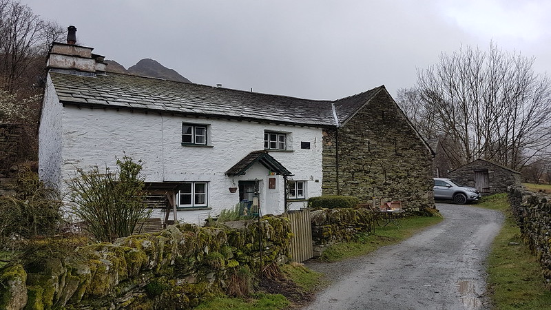
Bridge End Cottage.
The National Trust own both Fell Foot Farm and Bridge End Cottage, in the latter case at least, gifted to them by Beatrix Potter. Bridge End Cottage is another grade II listed building.
I had half an idea that I might be able to bag Holme Fell and Black Crag as well as Lingmoor, but I needed to collect B from Brockholes at the end of his shift, and even I could see that I would be pushing it to manage all that and still arrive on time to pick him up. On the other hand, just climbing Lingmoor would undoubtedly leave me with quite a bit of time to kill, so I decided to extend my walk along Little Langdale as far as Skelwith Bridge and then come back up Great Langdale before bagging Lingmoor.
Lingmoor and Little Langdale Tarn.High Hall Garth – you’ve guessed it, Grade II and property of the National Trust.Low Hall Garth. Owned by the NT, gifted by Beatrix Potter, Grade II. Lingmoor and Slater’s Bridge.
I didn’t divert, as I usually have, to photograph the marvellous Slater’s Bridge – it was very busy. It has appeared on the blog many times before. (Here for example, or here). It’s an amazing structure, in a low-key picturesque sort of way. I’ve never thought to look up it’s protected status before, but it turns out that it trumps the other local properties by being Grade II*.
“Slater’s Bridge II*. Over River Brathay. C17 packhorse bridge of slate and natural boulders. Huge boulder in mid-stream supports segmental arched bridge of 15 ft span with 3 1/2 ft voussoirs, and a flat causeway of a single slab on slate supports.”
Voussoirs? A wedge-shaped or tapered stone used to construct an arch, obviously. Learn a new thing every day! (And forget it the next sadly.)
The obvious knobble on Lingmoor with a prominent gully on its right, is Busk Pike, of which more later.
No sign of any voussoirs at the next bridge down the Brathay, but still quite a handsome footbridge I thought.
Little Langdale and Lingmoor.Colwith Force.
At Chesters, at Skelwith bridge, I managed to buy a nice lunch* from their takeaway counter and then was lucky to get a picnic table under the eaves and so out of the rain. (*Pricey, but very tasty.)
Elter Water. Lingmoor on the left. This should be one of the iconic views of the Langdale Pikes, but they were still lost in the cloud.Bridge over Great Langdale Beck in Elterwater. Rebuilt 1702. Grade II listed of course.
Judging by Historic England’s map, just about every building in the village of Elterwater must be listed. I shall have to come back to investigate some time. Since one of those listed buildings is the Britannia Inn, that should be an enjoyable experience!
I left Elterwater on a steep and stony track and was amused by this cycle route sign at the bottom, since ‘challenging’ seems like a huge understatement to me.
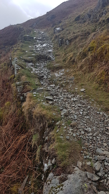
This path leaves that track at around its highest point. I think it must be an old mining track, it has fabulous zig-zags and clearly someone has gone to a lot of effort in constructing it.
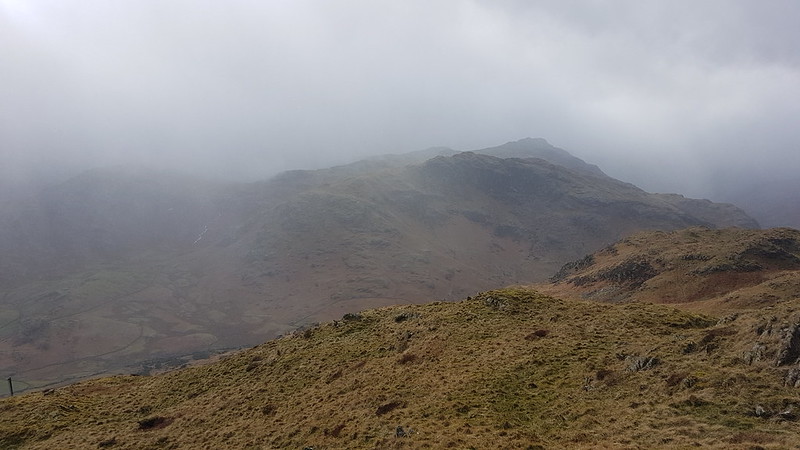
I’ve become a bit obsessed with being able to put a name to every hill, hump and hollow in the view. I blame Andy. The wooded hill in the middle-ground here doesn’t have a name on the OS map and there’s no path to the top, but the wooded slopes on it’s northern and eastern flanks are access land, Fletcher’s Wood, so it would be possible to get at least close to the top. The higher ground to the right, meanwhile, is the end of the Black Crag ridge. TBH and I traversed those slopes on our walk between Coniston and Ambleside last summer.
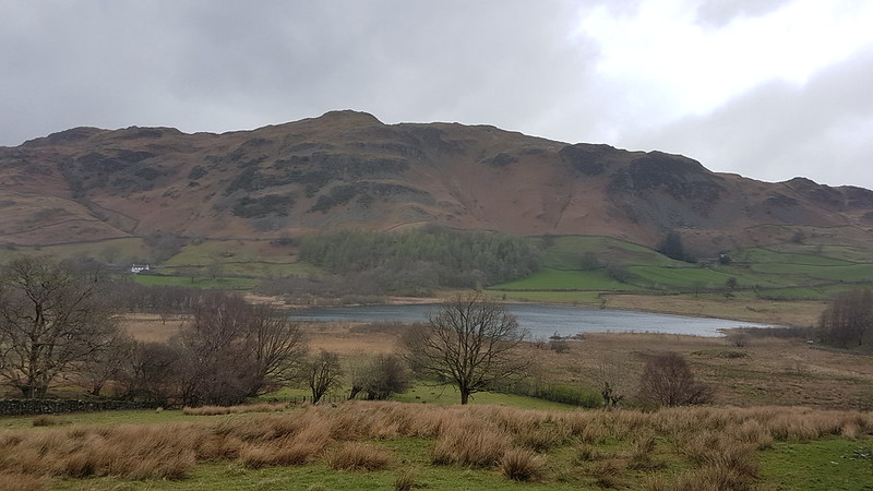
A day of contrasts – the Coniston Fells are lost in what I suspect was foul weather, whilst the sun is trying to shine on Little Langdale Tarn.
The weather had brightened up enough for me to take a short stop and drink some of the contents of my flask. The view was limited by the dense, low clouds, but still pretty good.
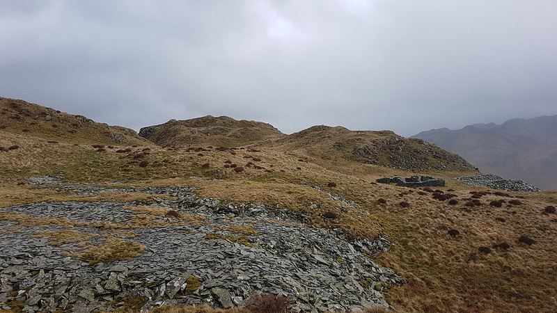
After the initial steep climb, somewhat eased by the marvellous zig-zags, a much steadier ascent ensues. There were still a number of broad grassy tracks, testament to this areas quarrying history. I took the lower path, intending to take in Busk Pike.
Looking down on Little Langdale Tarn. Holme Fell visible through the rain.Spoil heaps and small, tumble-down walled structures like this were dotted about the hillside.Busk Pike.Busk Pike again.
I’d like to revisit Busk Pike when the views are less curtailed by clouds.
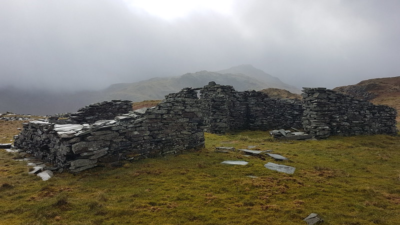
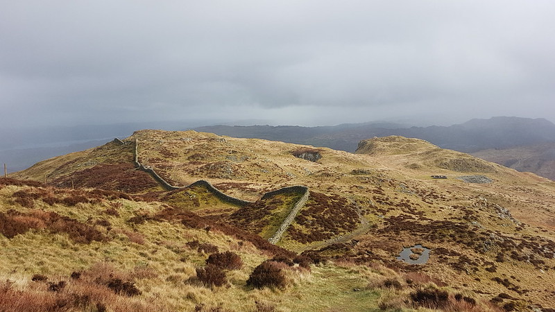
Brown How – the summit of Lingmoor – from Busk Pike. Notice the ruined buildings between the two tops.This was the biggest of the many derelict buildings I saw on Lingmoor. It provided a sheltered spot for another drinks stop. The sun even shone a little, although it also started drizzling again, just in case I was getting complacent about the weather. Looking back to Busk Pike and the the old mine buildings.And again.from a little higher up.
On the summit of Lingmoor, I met a family party of three, the first walkers I’d met since leaving the track near Dale End. We congratulated each other on the fact that it was “Not too bad”. As soon as our conversation ended, I realised that it was indeed ‘too bad’: the weather was back to how it had been when I first set-off from Blea Tarn – a howling gale and very heavy rain. It seemed highly plausible that closer to the higher hills around the head of Langdale, the weather had remained this way all day.
I was keen to get out of these conditions and back to the car, but I did divert slightly to include Lingmoor Tarn on my route…
Side Pike – it had been my intentionto include this on my route, but with the weather now so foul and with time running short, I decided to keep it for another day.MapMyWalk gives a little over 11 miles and 560m of ascent (the latter might be a bit of an overestimate)
B had told me his shift finished at 6.30, but when I arrived to pick him up (and two friends who had also been working at Brockholes that day), it turned out that, because the cafe had been so quiet, they’d been ‘sent home’ an hour early. B was furious that I hadn’t been answering my phone (it had been on flight mode, preserving the battery whilst I probably didn’t have a signal anyway). Unfortunately for B, beggar’s can’t be chooser’s, and he soon calmed down when I offered to leave him behind, if he didn’t like the free taxi-service on offer.
A sunny Sunday at the start of April. The Colts were playing a cup semi-final against Whitchurch in Shropshire. That’s a fair old drive from Kirkby Lonsdale.
Before the match I had time for a brief stroll around the town.
I thought the place looked pretty picturesque and was quite surprised how quiet it was. Most places were shut, it’s obviously off the tourist routes.
I wouldn’t mind coming back for another, more leisurely, look.
I don’t seem to have taken any photos of the rugby, but the boys won. Roll on the final!
(In honesty, it’s already happened, but will have to wait here on the blog!)
Eaves Wood – Inman’s Road – Hawes Water – Moss Lane – The Row – Bank Well – Lambert’s Meadow – Burtonwell Wood – The Green – Clifftop Path – Hollins Lane – Heald Brow – Hollins Lane – Woodwell – Bottom’s Wood – Spring Bank
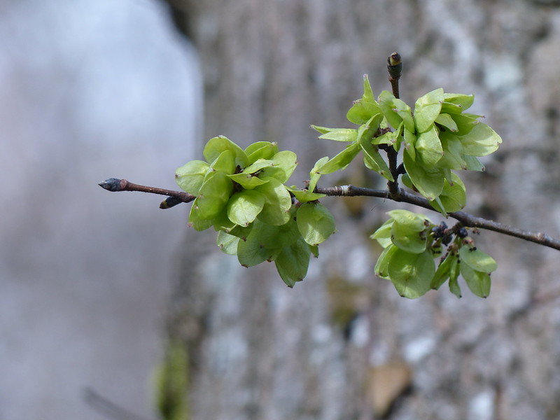
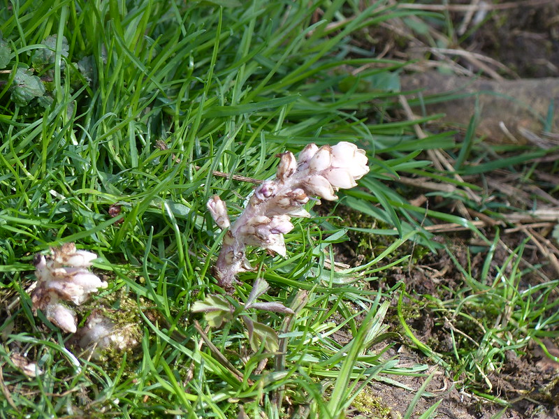
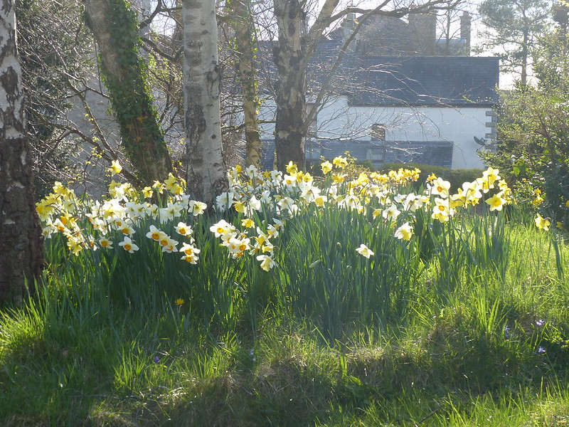
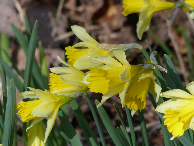
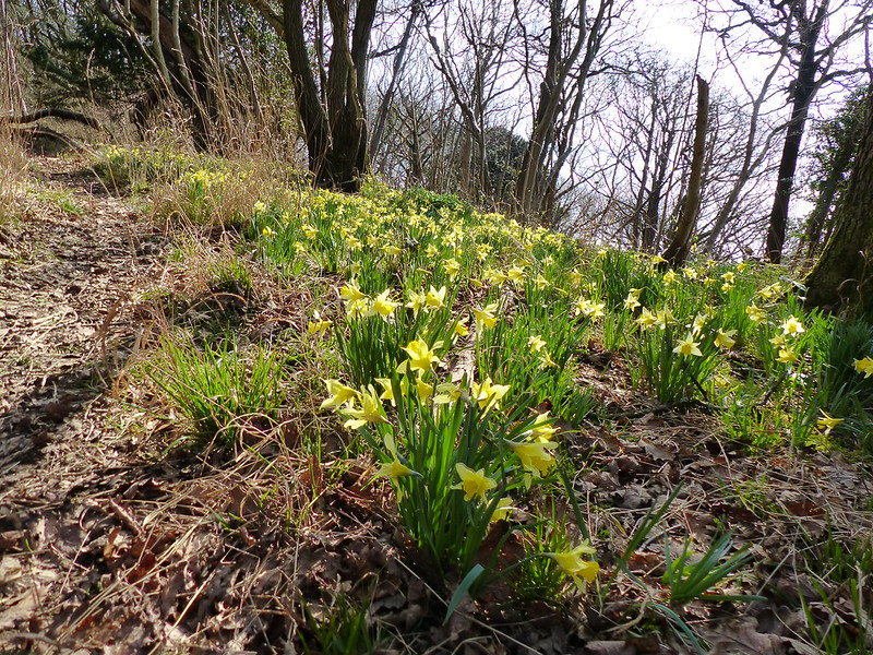
Inman’s Road in Eaves Wood.Wych Elm seeds. I think.Toothwort.Heading down towards Hawes Water.Clougha Pike and Carnforth salt-marsh from Heald Brow.Backlit daffs.New honeysuckle leaves.
The first day of our Easter break and, having overslept, I opted for a local walk rather than heading to the Lakes.
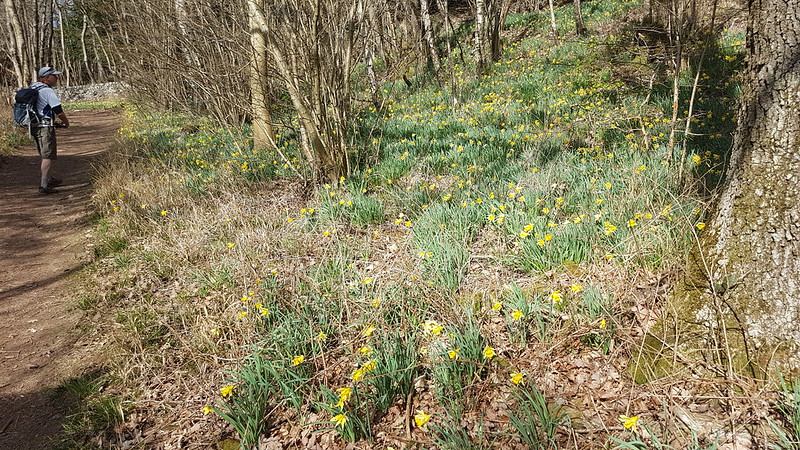
Far Arnside Daffs and an Old FriendConiston Fells from Arnside Knott.Eastern Fells, Kent Estuary, Whitbarrow Scar and Foulshaw Moss from Arnside Knott.
Very nearly the exact same route as the walk in my last but one post, but with better company. I didn’t take many photos, I was probably whittering too much. We only had a brief window, as the Jones clan needed to drop off the Prof and get home; I suggested this route over any others because I knew the daffs at Far Arnside would still be worth seeing. The view from the Knott takes some beating too.
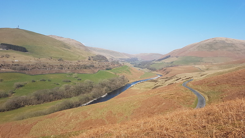
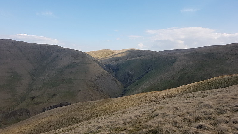
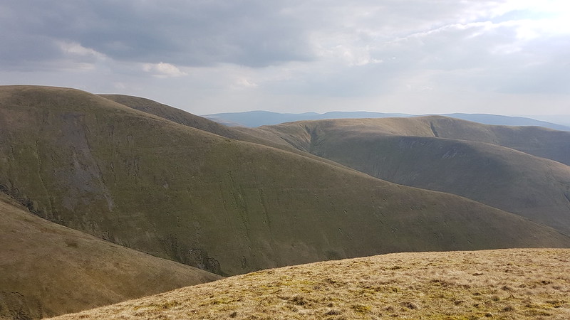
The end of March, and another meet up of our little group of hill-walking friends, expertly organised, as ever, by Andy, even down to finding a perfectly situated little parking area just off the Fair Mile Road in the Lune Gorge. TBH had driven and, as navigator, I had chosen to bring her the most direct way, over the very, very narrow Crook of Lune Bridge*, a choice of which she thoroughly approved, in no way castigating me for my decision or filling the car with invective as she gingerly inched across.
(*Confusingly, there’s another Crook of Lune, near to Caton, much further down the river)
Fell ponies.
Andy had a box-ticking exercise in mind, wanting to visit a couple of tops which were new to him, but fortunately his route was also a very pleasant walk, so we’ll let him off.
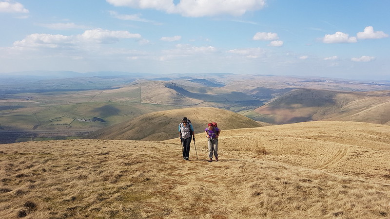
Little S had joined us, mostly, I think, due to the promise of a slap-up meal in Lancaster after the days exertions, and he was appalled by our determination to stop approximately every ten yards for a natter/breather/photo opportunity.
Dillicar Knott and its mast.The Lune Gorge again, from somewhere in the vicinity of Linghaw.
Little S wasn’t overly impressed either with the long stop we had on Linghaw, ostensibly for drinks and snacks, but quickly becoming a sunbathing/snoozing stop.
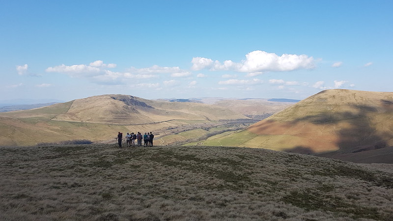
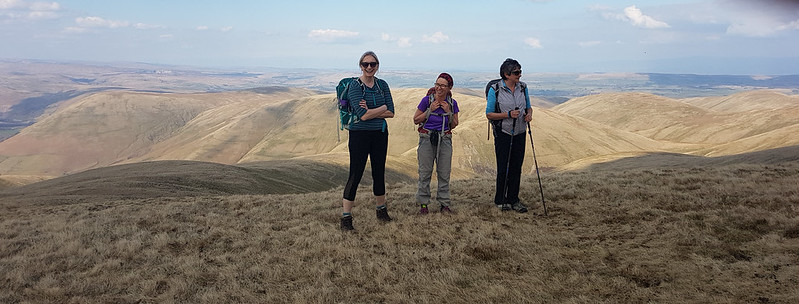
The hill behind our little group here is Grayrigg Forest, which we visited together not so long ago, on what was probably another box-ticking exercise. The weather had been a bit grey that day, but this time we had struck it lucky with plenty of sunshine and blue skies.
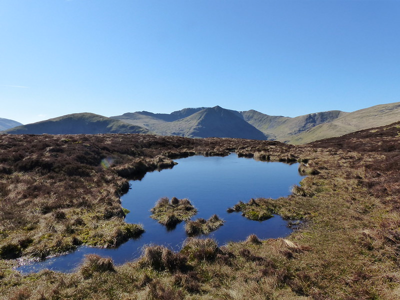
The headwaters of Carlin Gill. Some of us camped just beyond there a few summers ago.I had to crop this photo to remove my finger-end, a bad habit I seem to have recently acquired when using my phone as a camera.On Fell Head.
I think of Fell Head as a favourite spot because it’s a great viewpoint, and I used to bring a packed tea up here after work during the few years I lived in Arnside. In my head, I did this many times, but since I only lived in Arnside for four years and the window when the evenings are light enough is quite short, and because I think of other hills with much the same affection, for the same reasons, I suspect I only actually did it a couple of times.
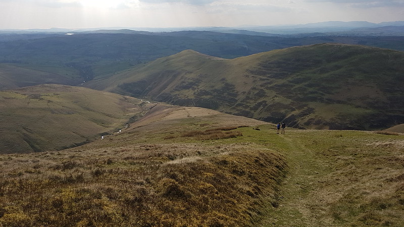
Anyway, back then I would sit and eat my tea, and watch the traffic far below on the M6 and then head back to my car, but we had a ridge to traverse…
The ridge to Breaks Head.
We had an even longer lunch/nap stop on Height of Bush Howe, which was very relaxing, but which had the consequence that, with a table booked in Lancaster, we didn’t have time to include The Calf in our circuit, and we also needed to get our skates on to get back to our cars.
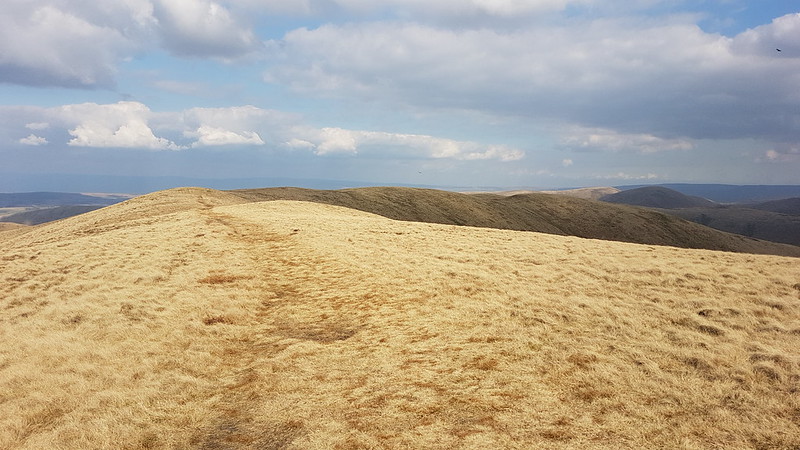
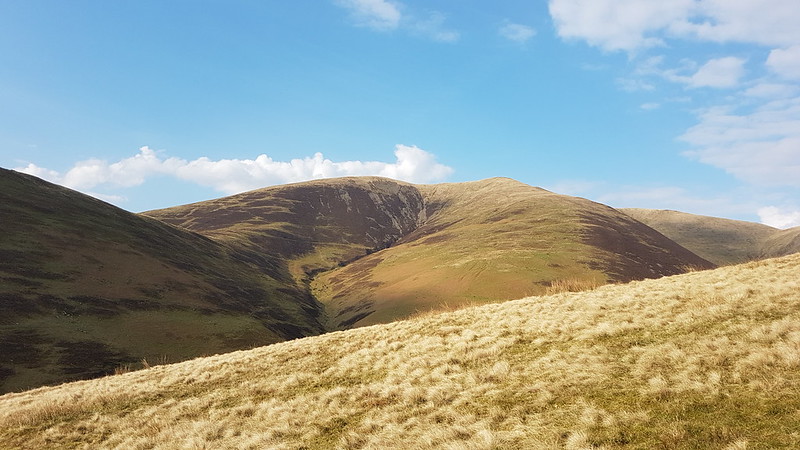
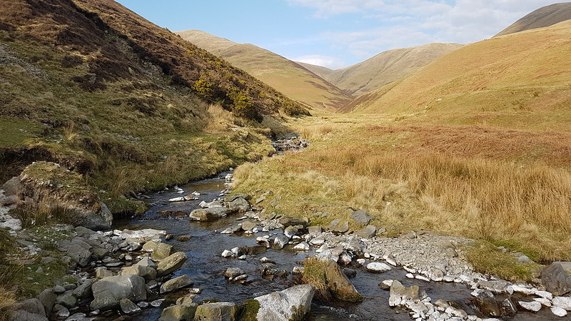
I think that long ridge is our descent route on White Fell, which probably makes the top on the right Arant Haw, but don’t quote me on that.Descending White Fell.Fell Head.Chapel Beck – a Lune tributary.Chapel Beck again. White Fell on the right.Bush Howe, White Fell Head, The Calf, Bram Rigg Top.
A great days walking, in fabulous company. The meal later, at Molly’s in Lancaster, was equally good. The night before, TBH and I had been at a Northern Soul night with our neighbours, and the day after a few of us met for another sunny walk. A perfect weekend!
Here’s our route. As you can see, on the way downhill, I discovered the ability to walk in a perfect straight line. Either that, or I paused the app when we stopped and forgot to start it again.
MapMyWalk tells me that we walked 10.39km, but the map itself seems to be implying more like 12.4 – I’ve noticed discrepancies like this before. Maybe it’s my fault for pausing the app. It also gives 560 metres of ascent, which seems about right.
The day after my outing on Sheffield Pike. More sunshine. A local walk for a change.
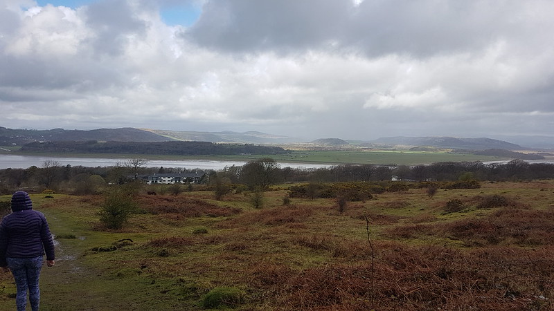
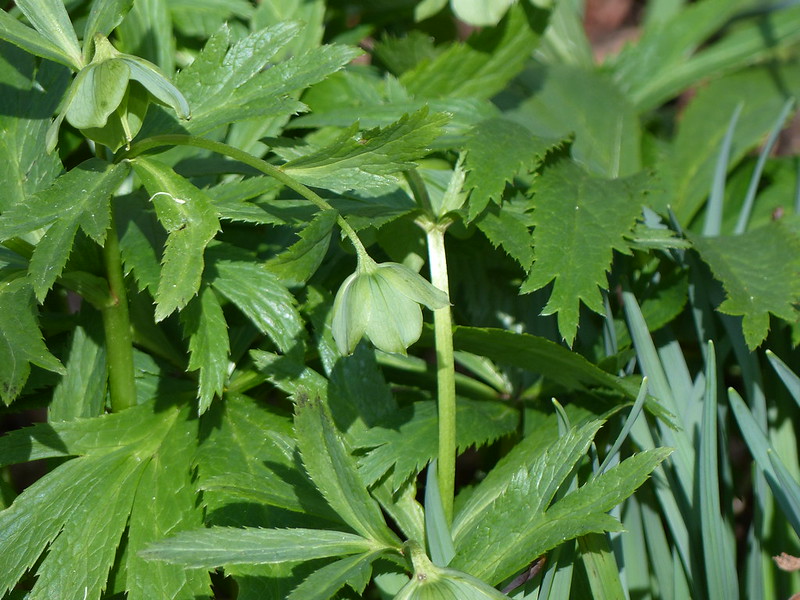
Green Hellebore.I took ‘the top’ path from Far Arnside instead of walking lower down by the shore, I can’t remember why.Heathwaite.Very hazy – no Lake District hills in view.
At Arnside Tower Farm I waited ages for the traffic to clear – the herd were being fetched in for milking and I waited until they’d all passed before crossing the track they were using. A couple of the farms collies joined me as I walked away from the farm. I’ve never owned a dog and have no intention of getting one, but if I ever changed my mind I would want a collie – they seem like such intelligent dogs. I thought this pair would turn back when we passed the Tower, but they didn’t. Maybe they would eventually head back to the farm if I continued down the lane toward the campsite? No.
In the end, I turned back myself and they followed me all the way back to the farmyard, at which point I apparently lost my magnetism and they trotted off to investigate something else.
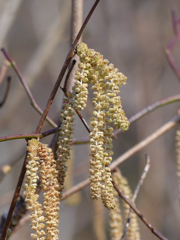
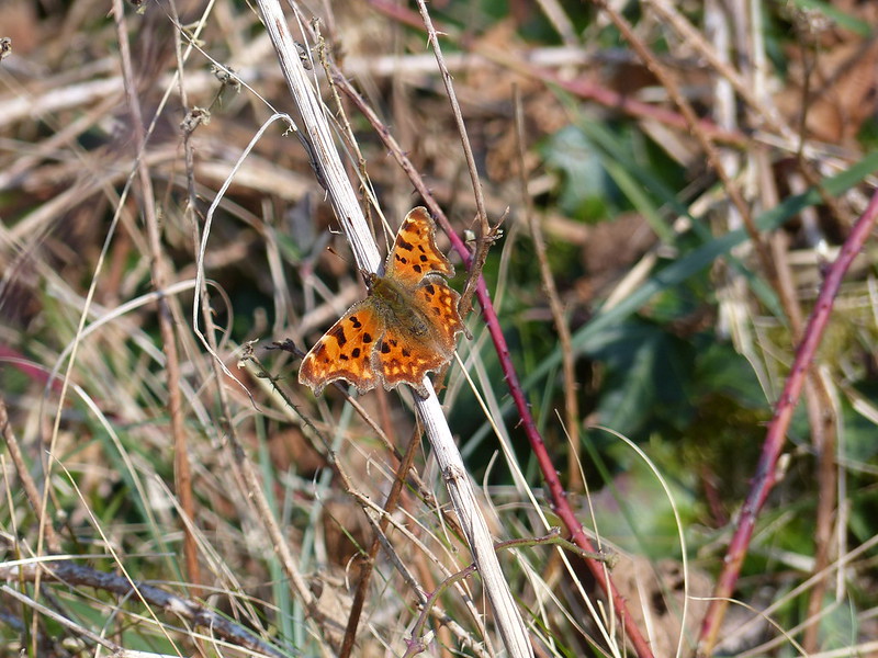
More hellebores……and more daffs on the lane along the perimeter of Holgates campsite.Hazel Catkins – male flowers.Tiny female Hazel flowers.Comma butterfly.Primroses.The Bay from The Cove, from a mid-week post-work walk.
Glencoyne Bay – Mossdale – Glenridding Dodd – Heron Pike – Sheffield Pike – White Stones – Hart Side – Birkett Fell – Brown Hills – Swineside Knott – Watermillock Common – Common Fell – Round How – Bracken How – Aira Force – Glencoyne Bay
The view from Glencoyne Bay – Gowbarrow on the left, part of Place Fell on the right.
This was the weekend after our Scotland trip. Note the blue skies. The week before our weekend at Bridge of Orchy I was in Langdale enjoying splendid weather. The week after by Ullswater: more sunshine. But for our long planned get-together: wild weather. Sod’s Law in action!
I parked at Glencoyne Bay, which, on this sunny Saturday, was surprisingly quiet. Most people there seemed to have water-sports in mind and were unloading canoes from roof-racks or inflating paddle boards. It’s a National Trust car-park, so it’s ‘free’ for members like me, just like the Stickle Barn car park a fortnight before had been, a fact which pleases me out of all proportion to the money saved.
I’d spotted a dotted black line on the map: a path which would take me up Mossdale to the col between Heron Pike and Glenridding Dodd. It climbed steeply through woods at first, and, unusually this spring, I actually felt pretty warm as I climbed.
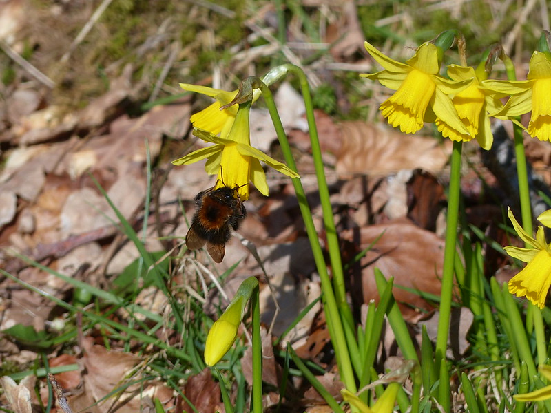
Colt’s-foot.Large bee, small daffodils, or both?
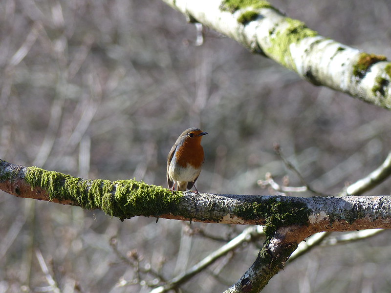
Photos of Robins are a staple of this blog, but have been far and few between of late; here’s a couple to compensate…
Robin. Ragin’ Full-on.
Because the path climbed quite steeply, views quickly opened out behind…
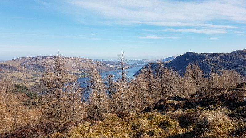
Ullswater.
The route spiralled in on Gelnridding Dodd. I would be coming back to the col to head for Heron Pike before long.
Heron Pike.Nab Crag and Blea Cove on Birkhouse Moor.
There was, inevitably, a cold breeze on the top, but I nestled down in the heather, just off the summit and stopped for a brew with a view…
Gowbarrow, Ullswater and Place Fell from Glenridding Dodd.Nab Crag and Catstye Cam.Looking back to Glenridding Dodd, Place Fell and Glenridding.
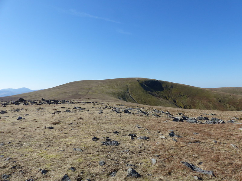
The ascent of Heron Pike is steep and rocky, in complete contrast to the moorland which follows up to Sheffield Pike. Heron Pike, a Birkett, is not really a summit at all, but was a great place to hunker down in the shelter of some crags for a view with an even better view.
Ullswater from Heron Pike.
I’m glad that I stopped there. Out of the wind it was lovely, but as I continued to climb the wind became increasingly bitter and shelter was not always easy to find.
Helvellyn from one of the Heron Pike tarns.Watermillock Common and the Mell Fells beyond from Sheffield Pike.
What made me choose Sheffield Pike from all the other potential hills in the Lakes? A recently retired former colleague had posted photos of Sheffield Pike and Glencoyne on Fakebook, which had me thinking about how very long it must be since I last climbed these hills. It wasn’t far from there to planning a trip to Ullswater.
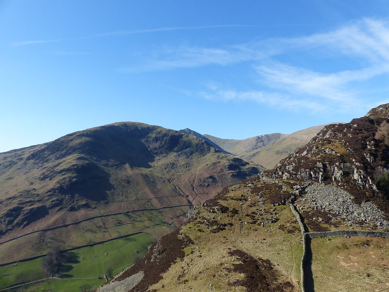
Striding Edge, Helvellyn, Catstye Cam, Lower Man, Whiteside, Raise.My onward route to White Stones. Glencoyne Head on the right.
It doesn’t look, on the map, like Nick Head, the col between Sheffield Pike and White Stones, will offer much shelter, but there’s actually a quite steep-sided little hollow there and I stopped again for another quick sup from my flask. I was torn: my vague plan had been to continue to White Stones, but I was looking at the path which contours around Glencoyne Head. I love paths like that and I was very tempted. While I sat, however, several groups passed, all decked out in day-glo and, like me, shorts, and those life-jacket style rucksacks which seem to be all the rage with fell-runners. There will little posts with arrows by the path too. Clearly, there was some sort of event on, and the groups were all taking the Glencoyne Head path. It had been reasonably quiet up till now, despite the fine weather, and I decided to stick with my original plan on the basis that I’d get more peace that way.
Sheffield Pike. High Street range beyond.Stybarrow Dodd from White Stones.
It would have been easy to bag Stybarrow Dodd from White Stones, but I’m glad I decided not to as the day turned out to be a long one as it was.
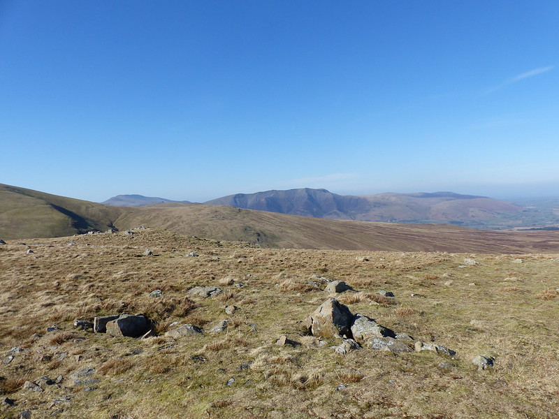
White Stones is not a Wainwright, but Hart Side is. It all seems pretty arbitrary. Both are Birketts, as are a whole host of little pimples between those two and Aira Force. It’s a broad grassy ridge, a tad boggy in places, but I only saw two other people on it, the views were expansive and it made for great walking. Mostly downhill too.
Blencathra from Hart Side.
As I said, it was a bit damp in some spots. For some reason this marooned stile tickled my funny bone.
Place Fell from Swineside Knott.
Talking of arbitrary, Swineside Knott has two whole contours to call its own. It’s a few strides off the path, but Wainwright promises the best view of Place Fell, a hill which is very high in my estimation. Add to the that the fact that Swineside Knott is another Birkett, so another tick to be grabbed and I was persuaded to make the very slight detour. The top is completely underwhelming, but step a few paces more, to the crags below, and the views are indeed superb. Time for one final drinks stop!
Ullswater and Patterdale from Swineside Knott.Swineside Knott. Sheffield Pike behind.Dowthwaite Head and Dowthwaite Crag. Blencathra behind.The Mell Fells and Gowbarrow from Common Fell.
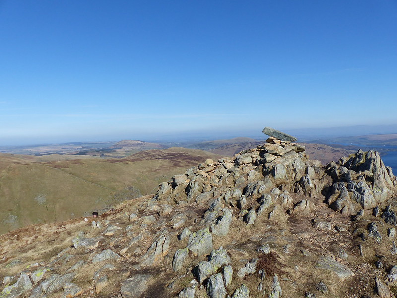
Common Fell, on the other hand, has the feel of a proper hill, if a low one. It’s probably not the best one which Wainwright left out of his books, but I liked it.
Now – there’s a rabbit hole to get lost down – which is the best hill in the Lakes which isn’t a Wainwright? Black Combe? (Although that will be an Outlying Fell).
Round How and Bracken How are also Birketts, and again they seem a bit like pointless pimples on the map, but it turns out that Round How also commands a terrific view of Place Fell and Ullswater. Bracken How has no such redeeming feature, but it doesn’t take much climbing.
Place Fell from Round How.Aira Beck.
No photograph of Aira Force – the paths down to the waterfalls are currently closed after a tree fell and has made the paths dangerous. Walking down through the woods by Aira Beck was very pleasant though. The longish walk back to the car was much nicer than it might have been because there’s a path which keeps you off the busy A592. In fact, I suspect that you can walk from the Aira Force car park all the way into Glenridding without having to walk on the road.
MapMyWalk gives about 11½ miles and 785 metres of ascent. I think the latter is a bit of an underestimate.
Also 3 Wainwrights: Glenridding Dodd, Sheffield Pike and Hart Side.
And 11 Birketts: Glenridding Dodd, Heron Pike, Sheffield Pike, White Stones, Hart Side, Birkett Fell, Brown Hills, Swineside Knott, Common Fell, Round How, Bracken How.
The view east from Bochastle Hill. Is that the Ochils beyond Callander?
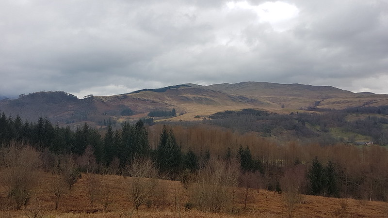
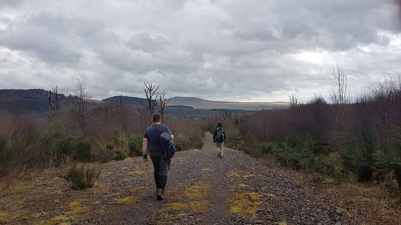
After their exertions of the day before, The Prof and The Tower Captain were both in need of an easier day. Obviously, I was up for another Big Day On The Hills, but felt that they needed my company. Well, okay, I was a bit tired too. I was also put off by a forecast which sounded like the winds would be even fiercer than they had been on the Saturday. I found a circuit on my OS maps app which looked ideal and wasn’t too far out of our way home.
The high ground north of Callander.
We had a little drizzle, but the wind was quite mild, and later in the day, TC and I were both down to just a t-shirt – pretty mild for March!
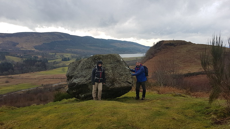
Samson’s Stone, Dunmore Fort, Loch Venachar.
With hindsight, we should have climbed Dunmore Fort which is not only a little higher than Bochastle Hill, but also has some very impressive looking defensive structures on its western side. Next time.
We chatted to one of the marshals who were out on the course for the Callander 10K which would be running later in the day and then walked down a road with a sign declaring it to be ‘a walking and cycling friendly road’. A nice idea, but it’s drivers that need to be friendly, not roads.
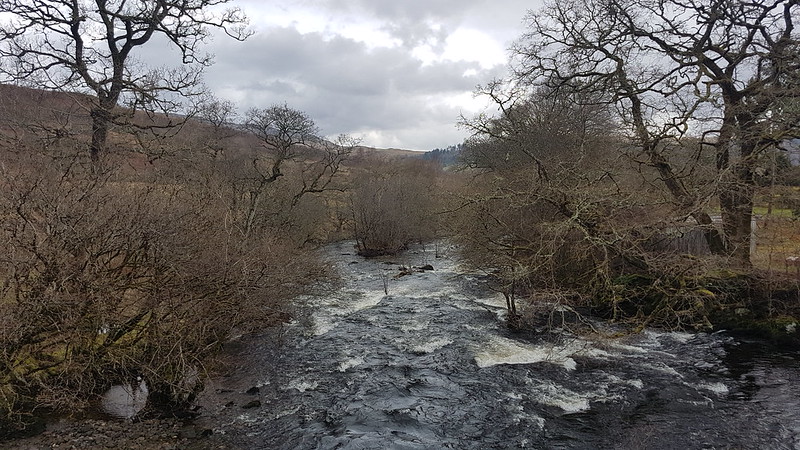
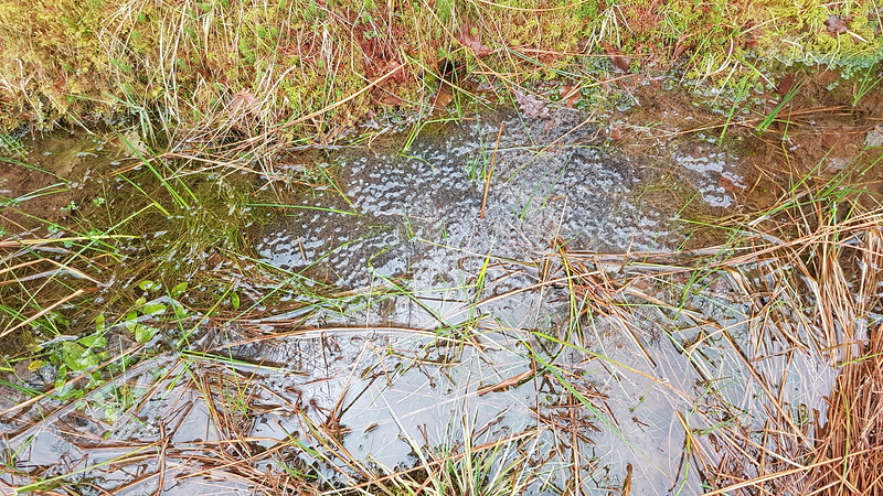
Eas Gobhain.Coilhallan Wood.The ditches by the track were full of frogspawn.
As the track through Coilhallan Wood descended towards Callander, there were tantalising views towards Ben Ledi, always partially obscured by trees…
Ben Ledi.
We climbed Ben Ledi back in 2015, on another day with a ropey forecast, which I enjoyed enormously, despite the forecast proving to be largely correct.
Ben Ledi. Garbh Uisge and Eas Gobhain meet to form the River Teith.
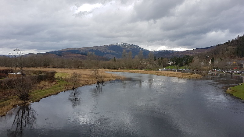
We found a bench on the outskirts of Callander and sat by the river to eat our lunch, and watch runners coming by near the end of their 10K. They were of all shapes and sizes, ages, and speeds. Some were struggling, some clearly very happy. It made me feel quite nostalgic for the days when I used enter races of this kind myself.
Bochastle Roman Fort.
From Callander, we walked back to the car park along the course of the former Callander to Oban railway line. In the field next to the line there are earthworks which betray the site of a Roman Fort. This is even further north than the Antonine Wall which stretched between the Clyde and Forth estuaries. It was built in AD85, which means it predates Hadrian’s Wall.
The next day it was back to work sadly, but at least I had some welcome company during my breakfast…