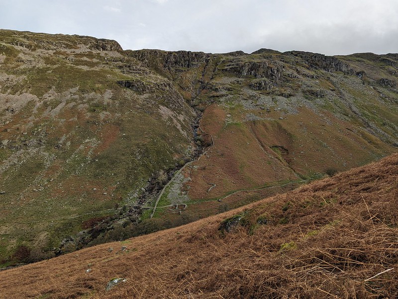
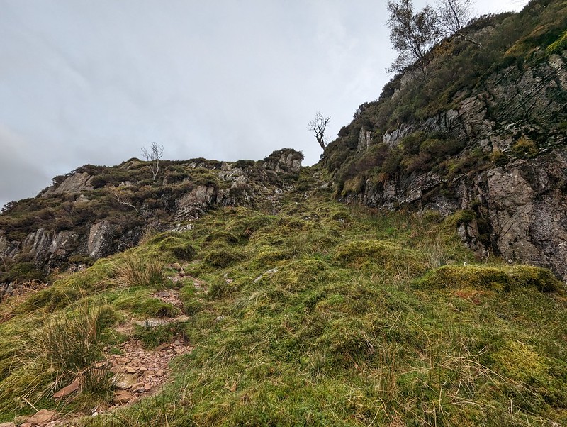
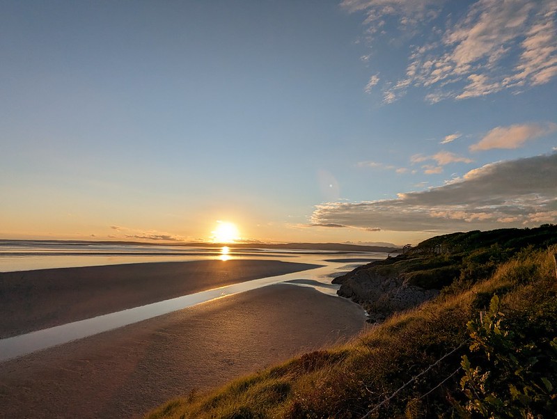
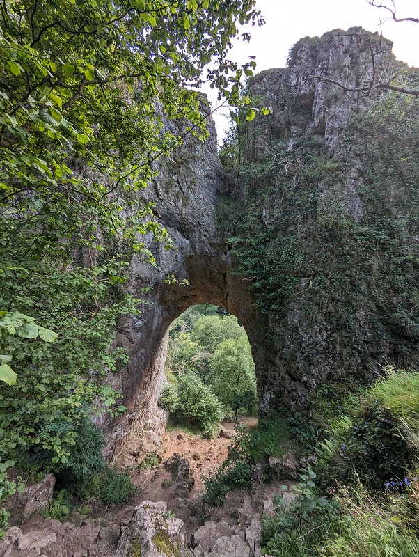
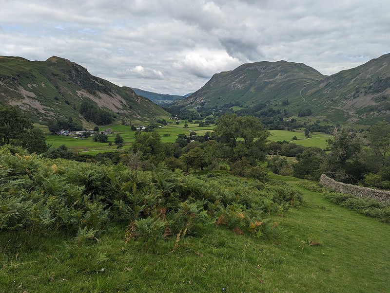
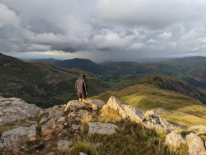
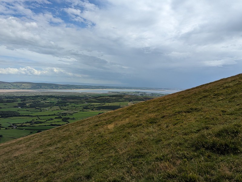
An October outing up two Wainwrights which I’ve never climbed before. Not sure how I’ve managed to avoid them. Anyway, my mistake: they were well worth a visit. In the photo above, you can see that there’s a lot of steep stuff on Eagle Crag and it’s not immediately obvious how you’ll get up there, but fortunately it’s all plain sailing; the path winds round to the left of the first knoll, Bleak How, and then finds a passage through the remaining complexities.
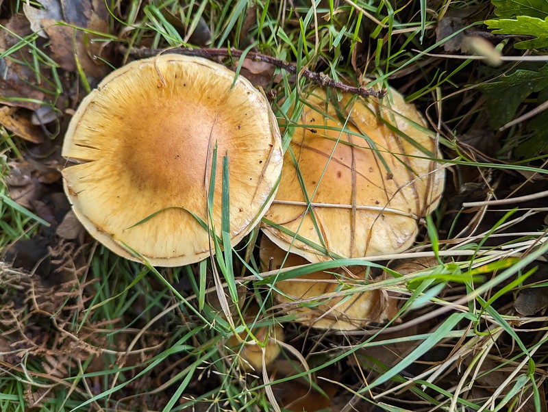
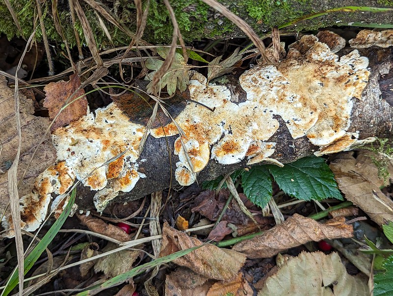
Fungi.
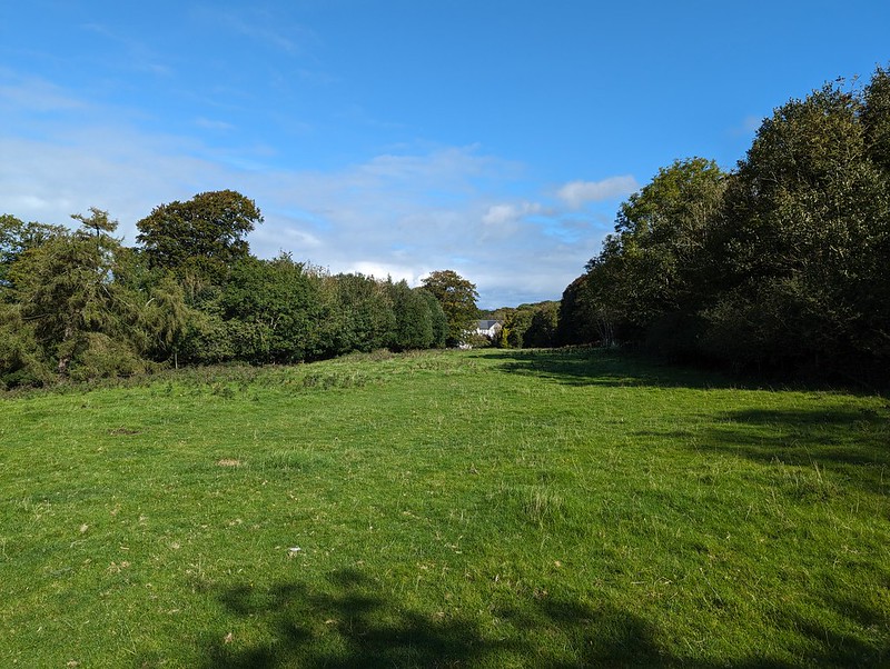
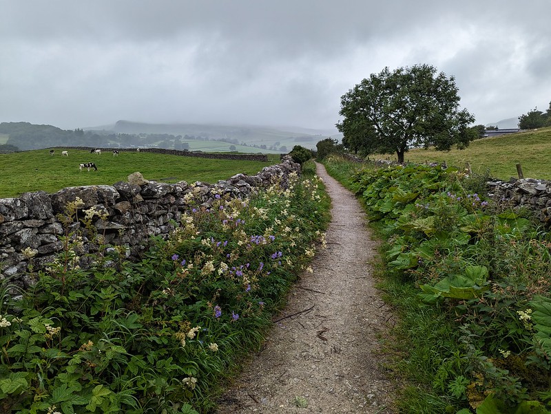
Having said that, after the initial easy plod along Stonethwaite Beck and then a boggy bit of field, I turned away from the valley path either too late or too early and then found myself fighting spiky, crumpled bracken uphill, but eventually managed to reach a sketchy path by the wall which then lead me around the craggy parts of Bleak How and on to the ridge.
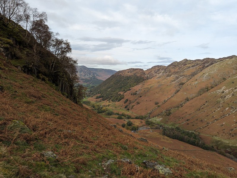
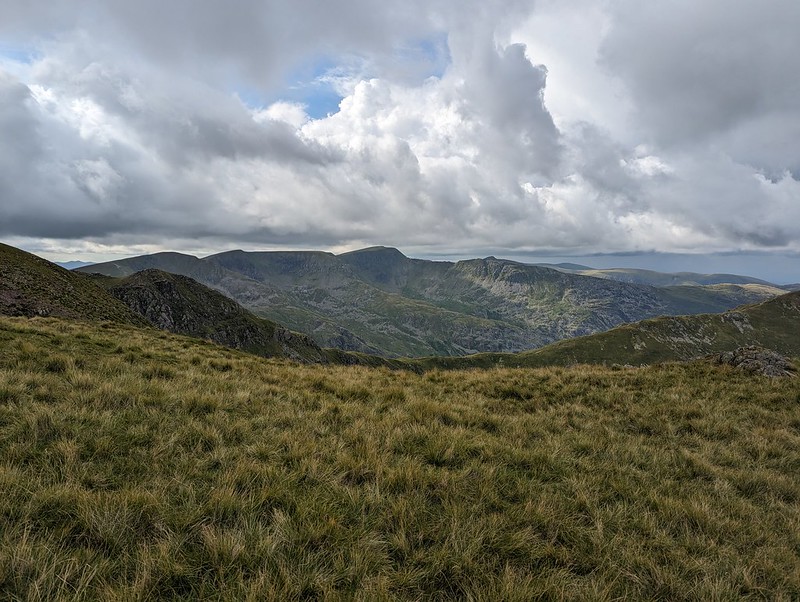
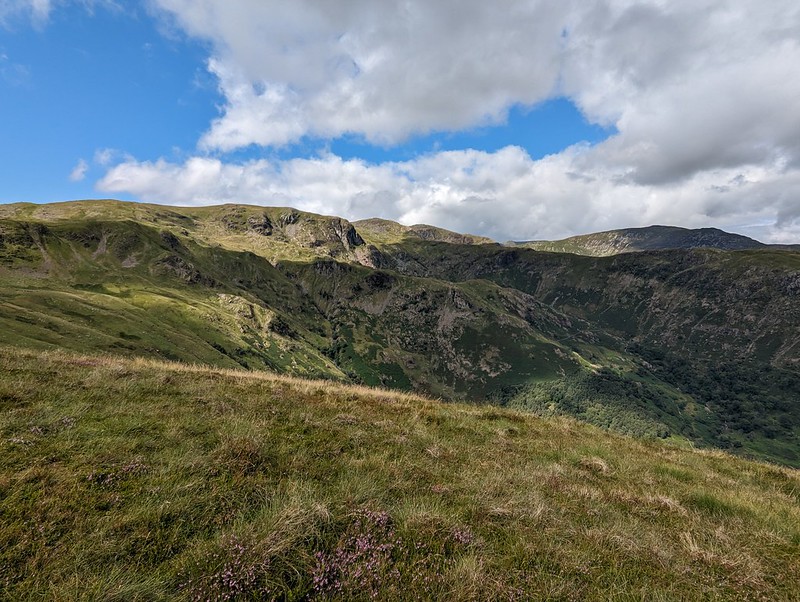
Long Band on Coldbarrow Fell.
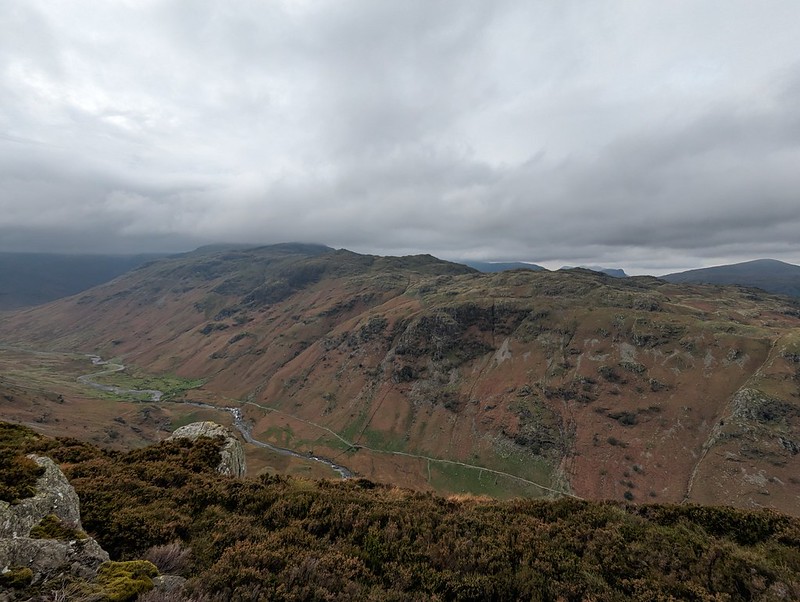
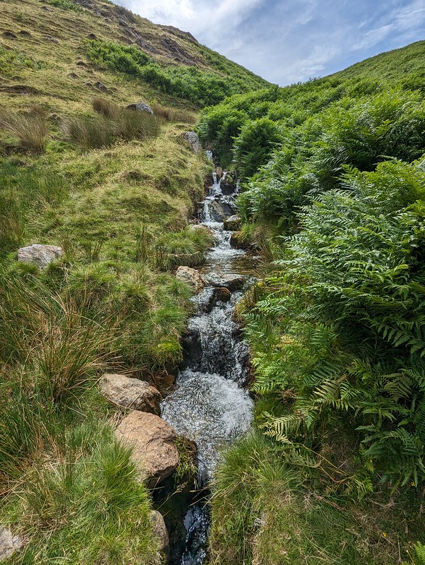
This stream, unnamed on the OS map, has carved quite an impressive looking amphitheatre below Long Band on the opposite fellside and I filed away the idea of having a gander there on a future walk.
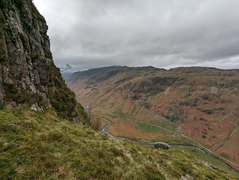
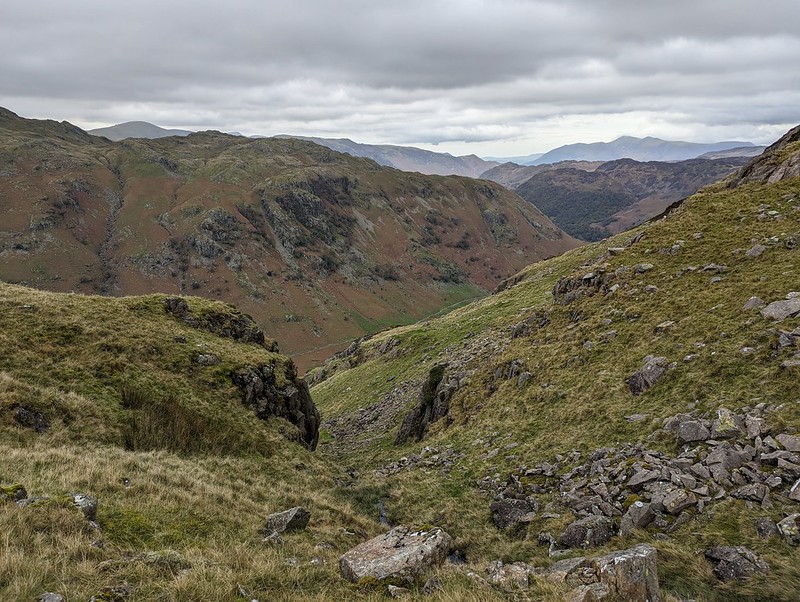
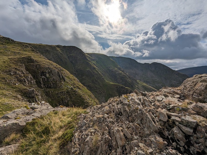
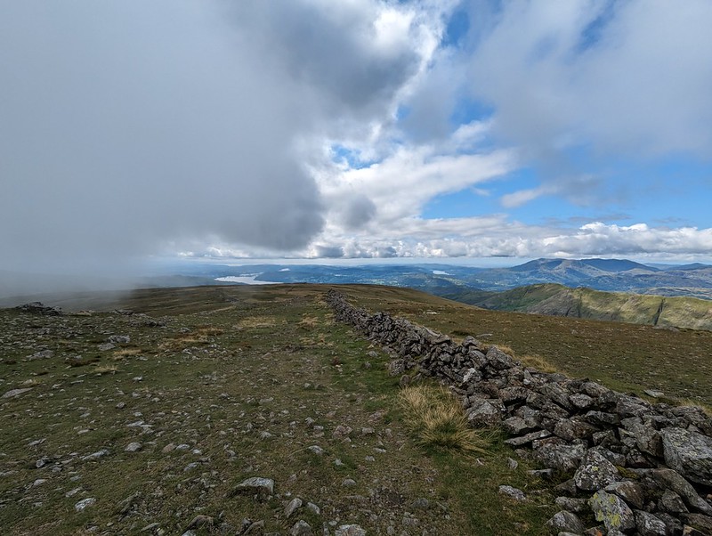
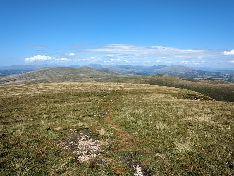
My ascent route, approaching Eagle Crag..Knotts and Great Crag above Stonethwaite.
It was a fairly grey day, with occasionally the odd drop of moisture in the air and the apparent threat of rain, but none-the-less good walking weather.
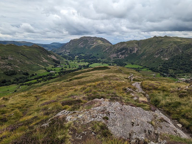
A broad ramp.
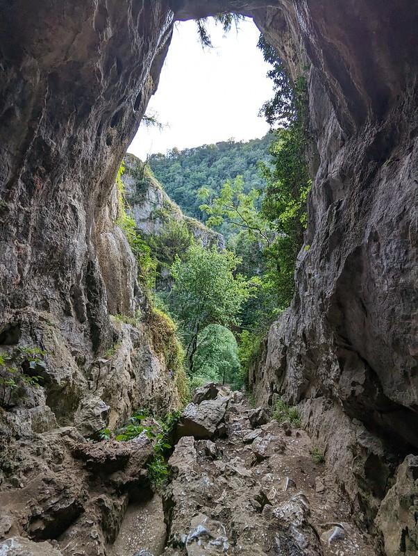
The route follows a resourceful path which finds first a broad ramp with crags above and below, and then switches back up an easy-angled gully through what might have seemed impenetrable cliffs.
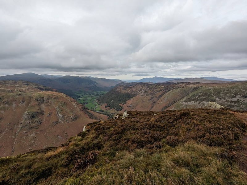
Looking down on Bleak How.Heron Crag and Langstrath.A steepish section.Looking to Sergeant’s Crag
On the last part of the ascent, the path loops drunkenly back and forth following broad ledges separated by short slabby crags. You could probably take a more direct route, but it’s pleasant walking so why bother?
Sergeant’s Crag and Langstrath.Sergeant’s Crag again.
Too many photos of Sergeant’s Crag? I liked the look of it!
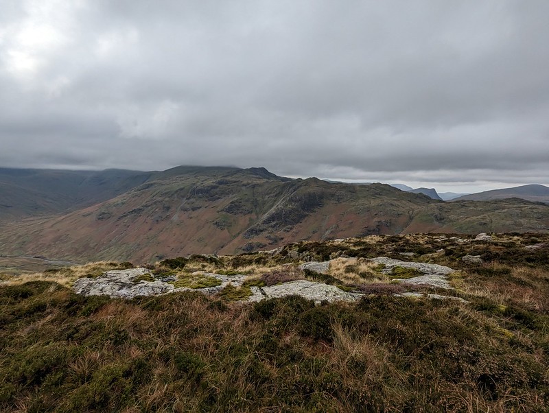
The long Glaramara ridge.Looking north to Skiddaw.
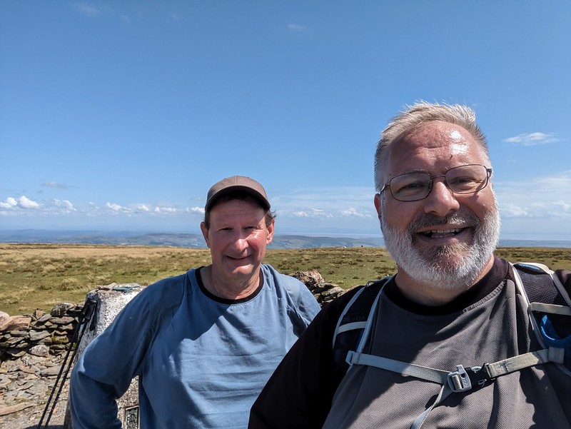
On the top, the inevitable cup of tea, a video-call with my Mum and Dad, and a brief conversation with another walker. I saw surprisingly few that day.
Sergeant’s Crag.Again!Looking back to Eagle Crag.Eagle Crag again.Glaramara.
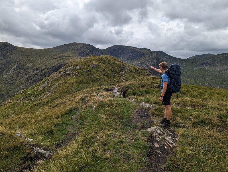
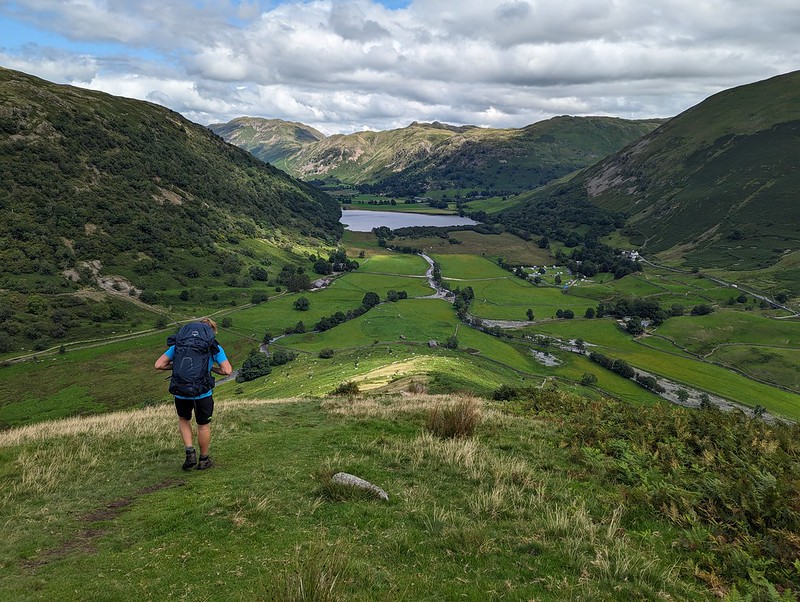
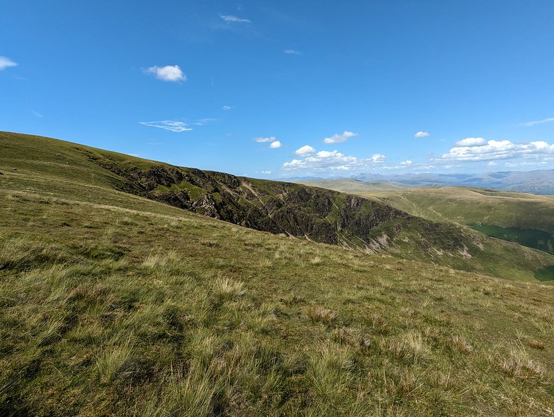
Not much more climbing to attain Sergeant’s Crag and then I took an off-piste route down towards Langstrath, aiming to avoid Bull Crag and Blea Crag and the crags around Lamper Knott. With hindsight, I’m not sure it’s a route I could recommend: there’s a lot of crags and even the grassy parts are liberally sprinkled with boulders and rocks. Still, I enjoyed it immensely.
An off piste descent.Approaching Langstrath Beck.
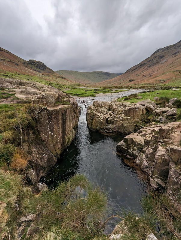
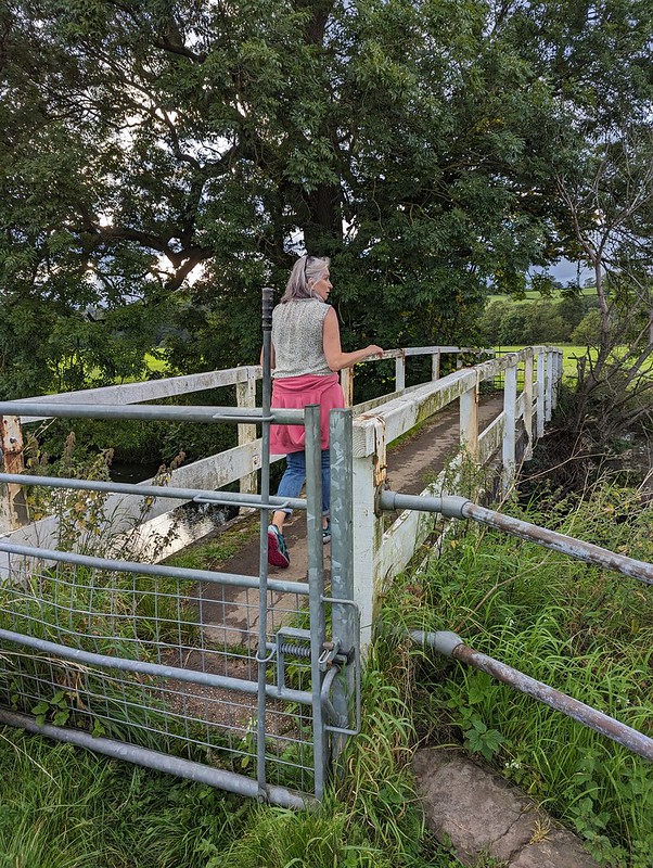
I wanted to come down this way so that I could have a peek at the renowned Black Moss Pot…
Blackmoss Pot.
There were quite a few wet-suited swimmers nearby, the ones who had just finished swimming advising and encouraging another group who had just arrived. I’ve never swum here myself and it’s on my wish-list, although not for a grey day towards the end of October!
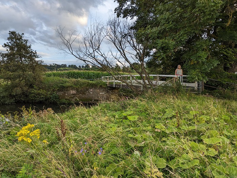
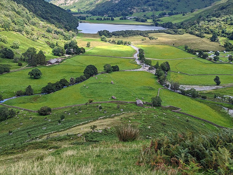
Langstrath Beck.Stonethwaite.Map the first.Around six and a half miles – but there’s a lot packed into that short walk.
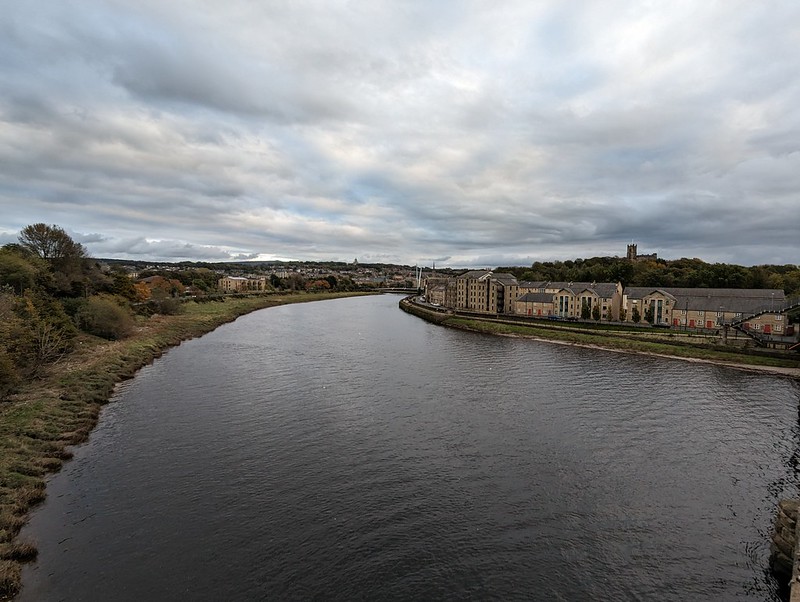
October half-term. On the Saturday I was in Lancaster for some reason. Whatever the reason, I crossed Carlisle bridge, which takes the railway lines over the Lune, but also has a footbridge attached. I like the view of Lancaster from there…
Lancaster from Carlisle Bridge.
On the Sunday, our old neighbour from when we lived on The Row, MM, was visiting his daughter and her family, who are now our neighbours (are you following?) We got chatting and he asked if I’d ever had a wander around Fell End Nature Reserve. Not only had I never visited, I didn’t even know it was there, which, given that it’s pretty close to home is a bit of a surprise.
MM offered to introduce me, drove us over there, lent me a pair of binos and gave me a guided tour. What a star!
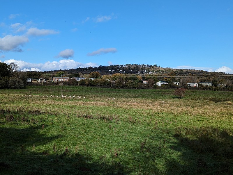
Part of the herd of Fallow Deer at Fell End.
When we’d almost completed our circuit, we bumped into first one, then a second fungi expert, both of whom MM knew, and we set-off together for another turn around the reserve.
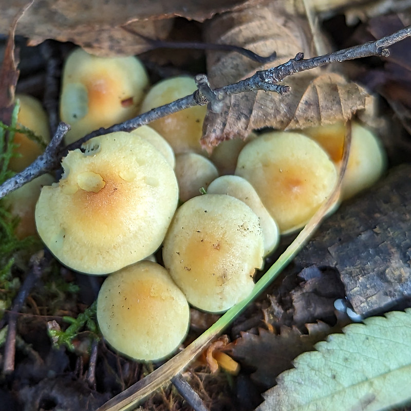
Honey fungus?
MM had been disappointed by the paucity of the fungi on display, but with a couple of knowledgeable tour guides, there was a fair bit to see after-all.
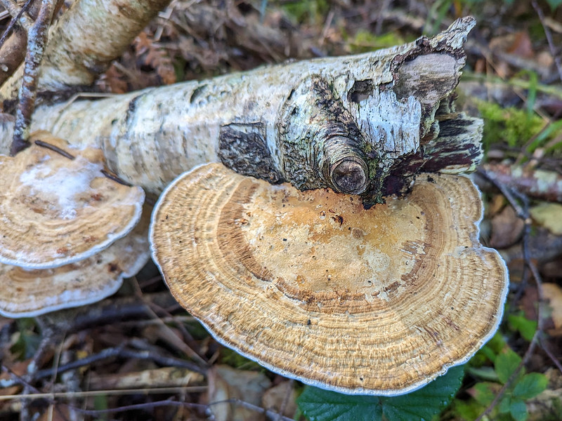
Hinge and Bracket fungus.
You’ll notice that I’ve pretty much given up on any attempt to identify the various brackets and toadstools. Fungi seem incredibly difficult to get to grips with.
Erm..slightly red looking fungus.
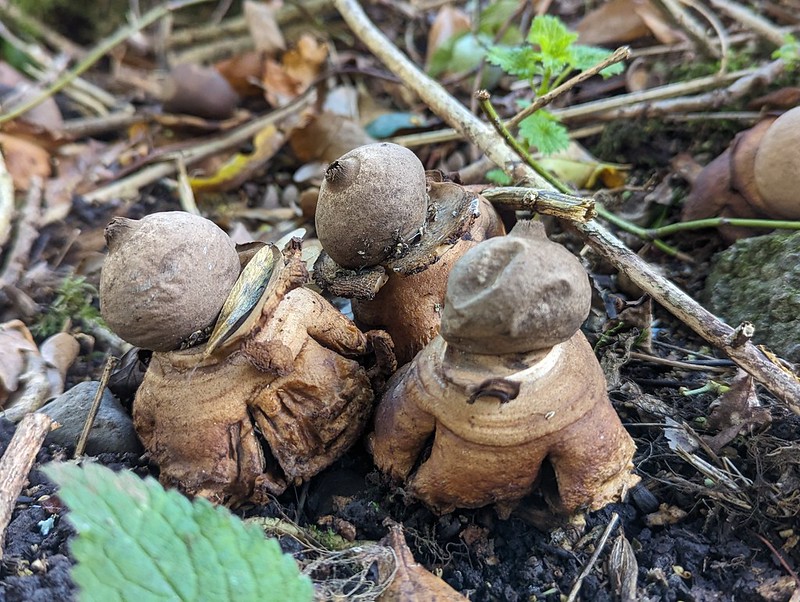
My favourites by far with the little cluster of Earthstars which MM and I had missed the first time around.
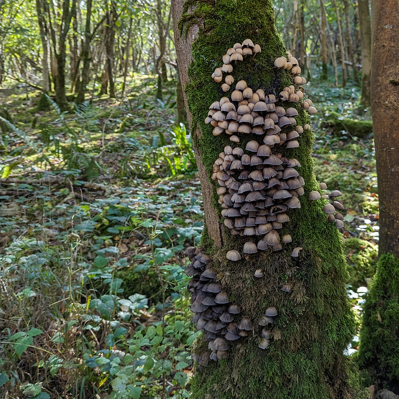
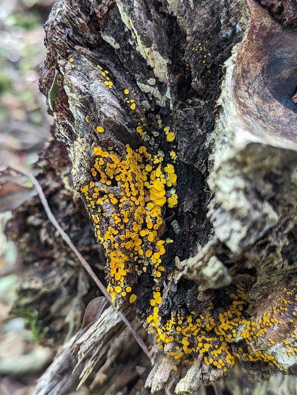
Tree-climbing social fungus.Manky pancake fungus.Yellow disco dot fungus.Teasel seeds sprouting from a teasel seedhead.
Anyway, it was a lovely way to spend a couple of hours and both another visit to the reserve and another walk with MM are long overdue.
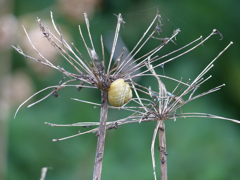
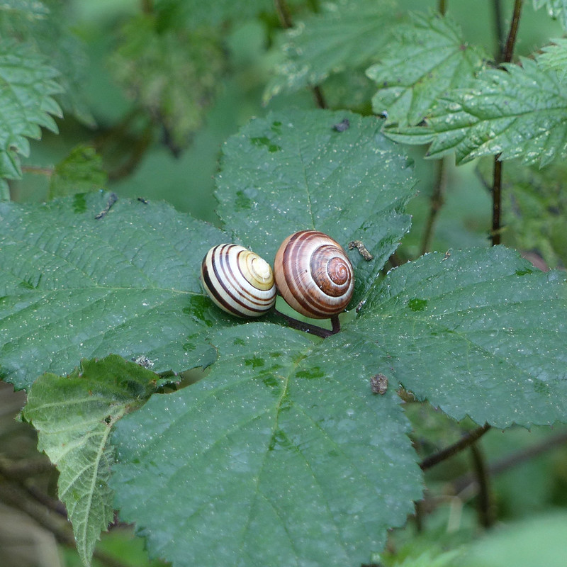
A post to deal with mid-September last year. On a dull Sunday, after a walk around Jenny Brown’s Point with TBH, I went to Lambert’s Meadow and took a few photos of spiders and a lot of photos of snails. Do snails breed in September? I don’t think I’ve ever seen so many in one visit.
More banded snails.Cottage at Silverdale Green.Another cottage at Silverdale Green.
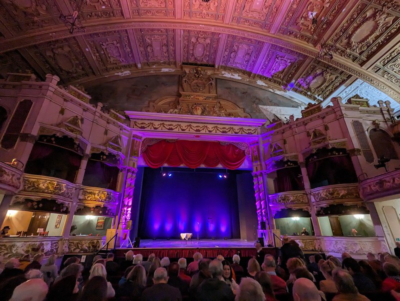
On the following weekend, the second Morecambe Poetry festival took place at the Winter Gardens. This time TBH joined me and we went to see the headline poets on both the Friday and Saturday nights; first Brian Bilston and Henry Normal, then Jackie Kay and Carol Ann Duffy. Fabulous.
Morecambe Winter Gardens.
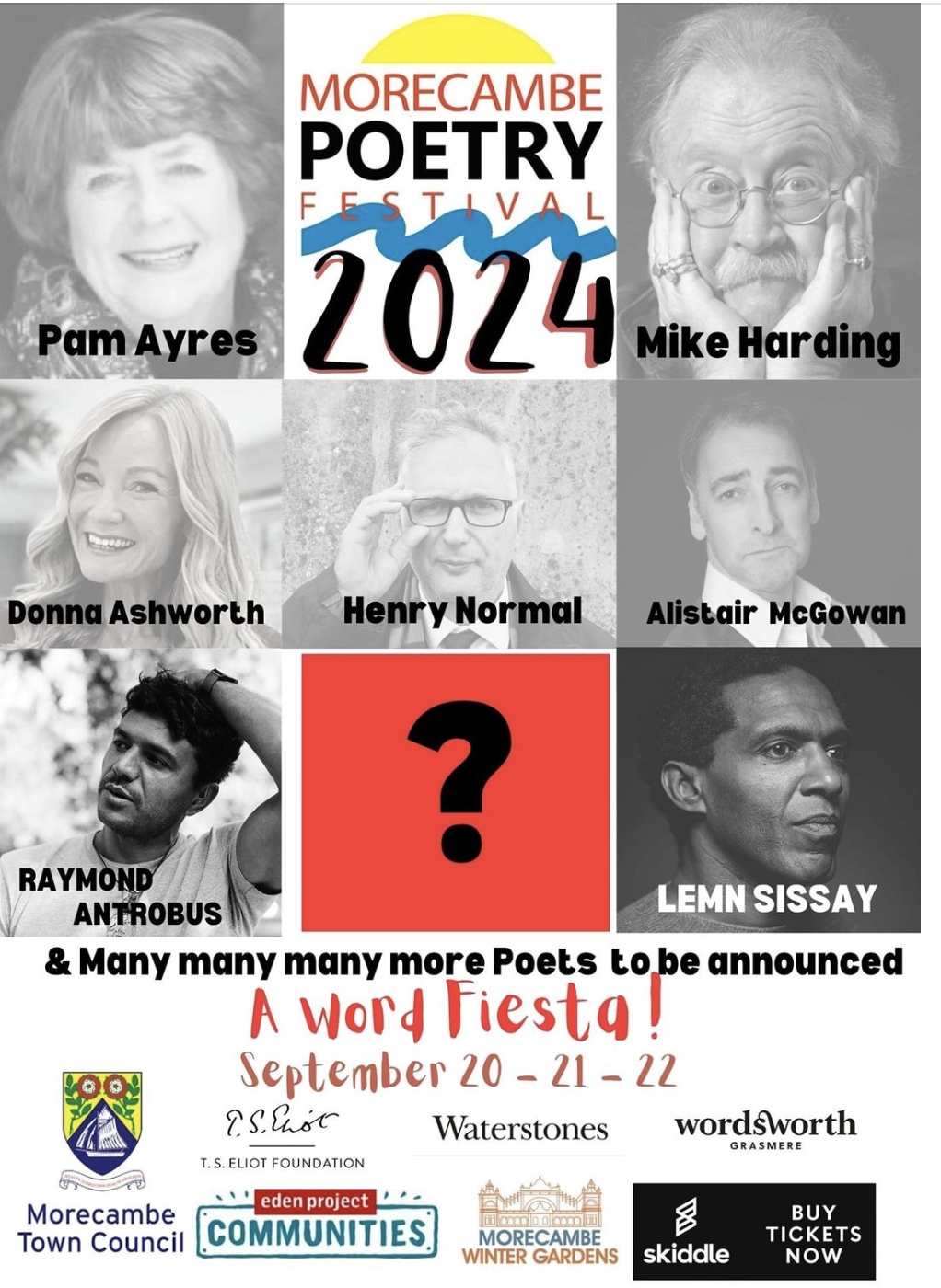
The line up for this year’s festival looks every bit as enticing, hopefully TBH will join me again.
I saw Lemn Sissay at the first festival and years ago when I lived in Manchester and likewise, I saw Mike Harding live several times, but not for a very long time. This time, two BBC programmes – Loose Ends and The Verb – will be broadcast live from the festival. Things are on the up and up, both for Morecambe and for the Winter Gardens.
On the Sunday of that weekend, TBH had a mission to perform.
Hazelwood Hall.
She took me to Heald Brow with a hand drawn map she’d been given by a colleague.
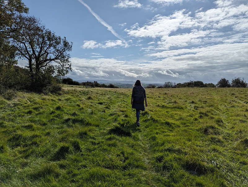
TBH on Heald Brow – Bowland Fells on the horizon.
The map showed the location of…
Heald Brow fossilised Nautiloid.
I’ve heard about this impressive fossil a few times from friends in the village, but have never actually managed to find it. With the aid of TBH’s map, we found it this time almost immediately. It’s hard to spot because it’s generally covered with a piece of turf which you’re supposed to replace, although I’m not sure why.
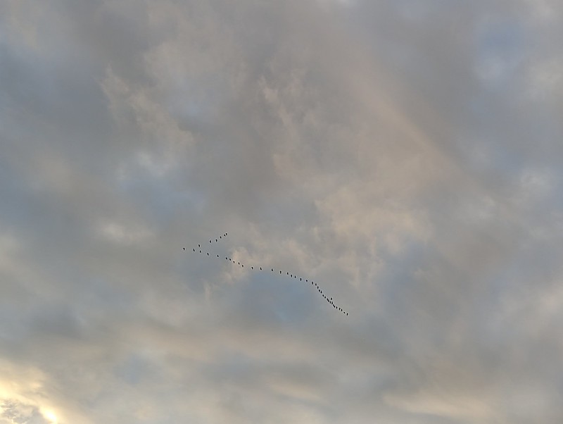
A skein of geese.Post sunset light at The Cove.
Later, I was out again for a wander to the Cove and across the Lots.
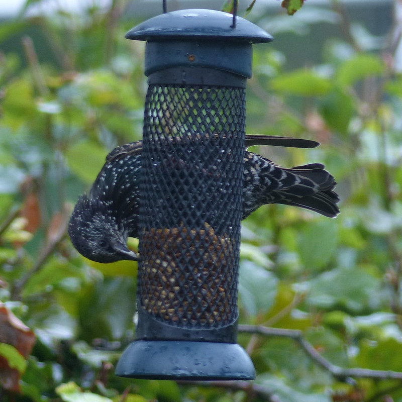
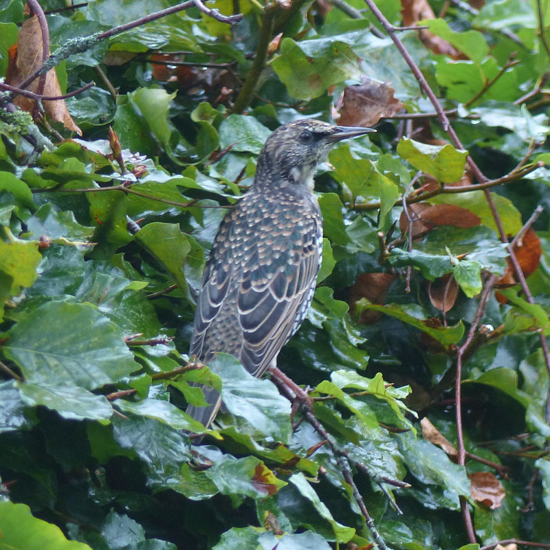
After years of not putting out food for the birds because our cats were a bit too interested, we’ve now realised that our one remaining cat is too old, fat and slow (I sympathise) to do any harm anymore. I snaffled a number of feeders from my parents a while ago and since TBH strung them all up (the feeders, not my parents!) from the Silver Birch by our kitchen window they have been giving me a great deal of pleasure ever since.
Starling eating dried meal-worms.Starling on our beech hedge.
Expect a lot more photos of our very varied visitors as I catch-up (ho ho) with the intervening six-months or so.
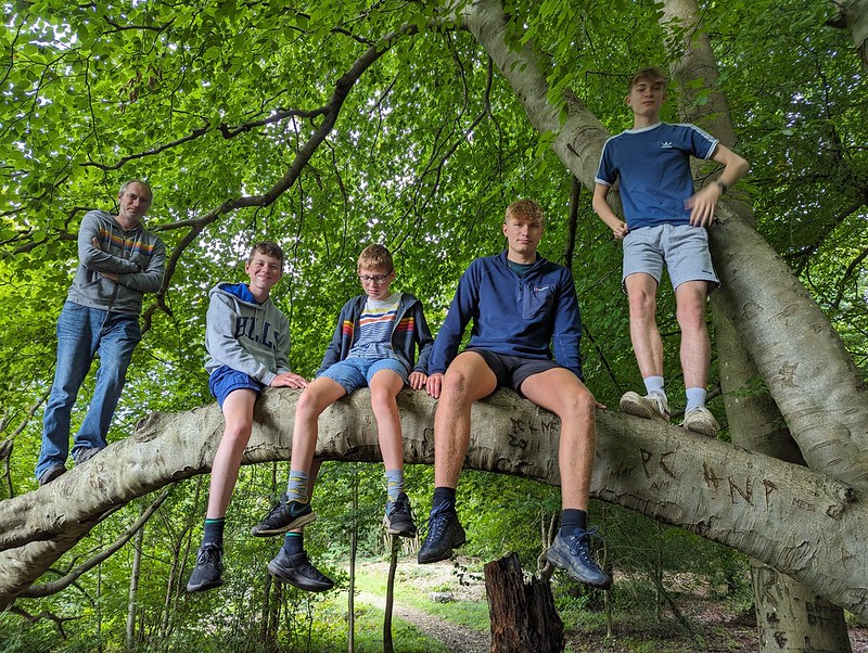
Dr A, W, M, B and S on the Balancing Tree in the Ring of Beeches.
Our Peak District trip was timed to fit in with a visit from my brother-in-law, Dr A and his family. We didn’t have them for long and were keen to pack a lot in. First of all, a walk in Eaves Wood.
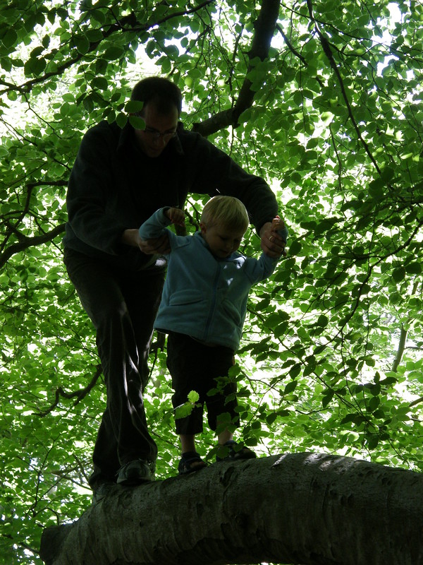
DrA and B on the same branch in 2008. Silverdale from Castlebarrow.TBH and Dr S at The Cove.W has been clambering on the rocks, and swimming in the mud.
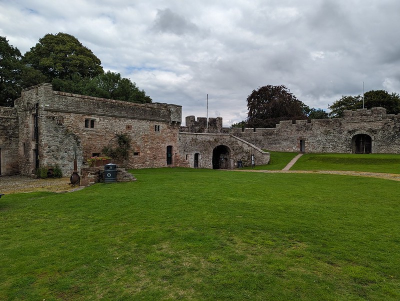
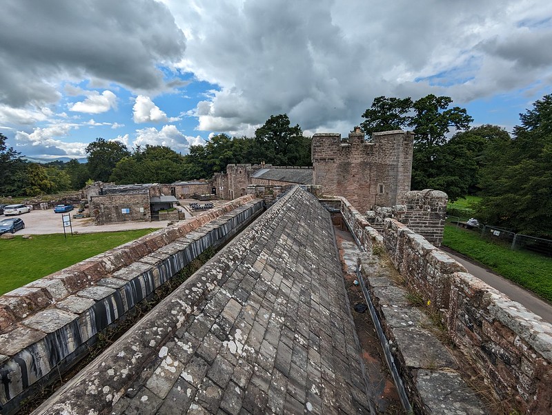
Since our American relatives needed to be back in County Durham, we decided to head that way and to rendezvous by Brougham Castle. Now, note: Brougham Castle, not Brough Castle which is nearby. Since I’d been very careful to point out the similarity of names and locations, we knew as we waited near Brougham Castle that they couldn’t possibly have made the mistake of going to Brough instead. After all, maps are pretty much Dr A’s area of professional expertise.
Brougham Castle and the River Eamont.
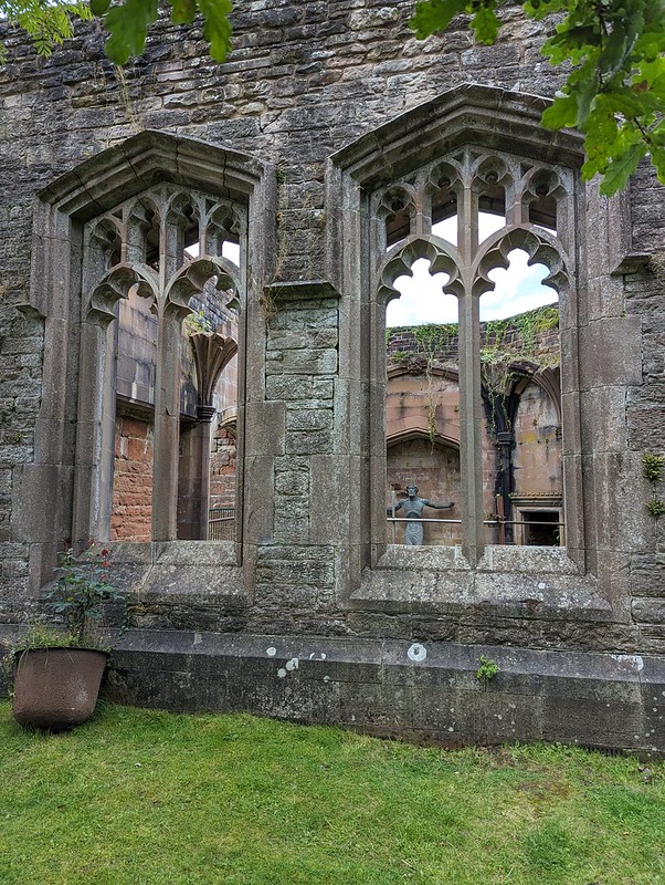
With a little time to kill whilst Dr A drove his family the short distance back from Brough to Brougham, we decided to detour slightly to have a peek around Brougham Hall, which is free and always worth a gander.
Brougham Hall.Brougham Hall.Brougham Hall, the Chancellor’s Den.
There’s more about the Hall and the Castle, and cute photos of the kids when they were little, from a previous visit here.
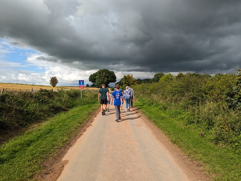
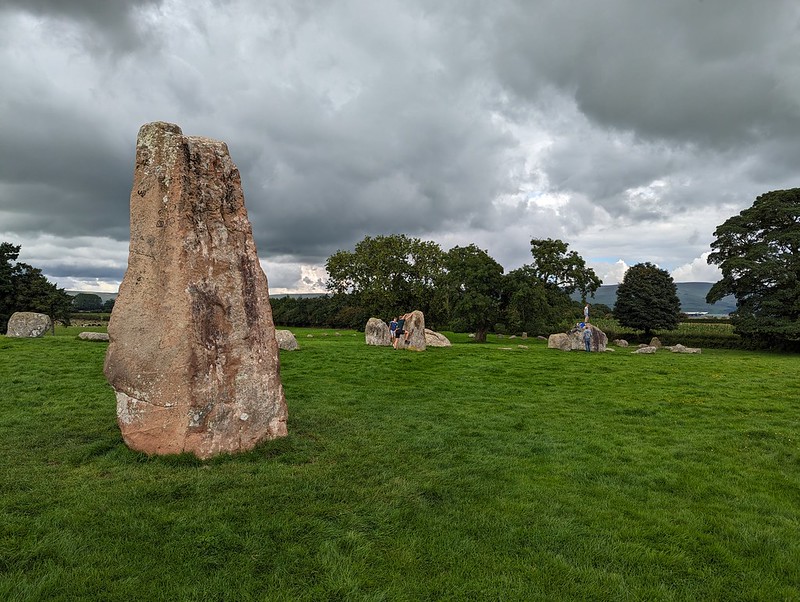
Once we were reunited, we drove to Little Salkeld, intending to have a walk to Lacy’s Caves. The path has been officially closed when we’ve done that walk in the past (one of those walks here). It still is. But now there’s a big sign displayed to that effect, rather than a scrappy bit of paper tacked to a telegraph pole. We decided to head up the road a little way to Long Meg stone circle instead.
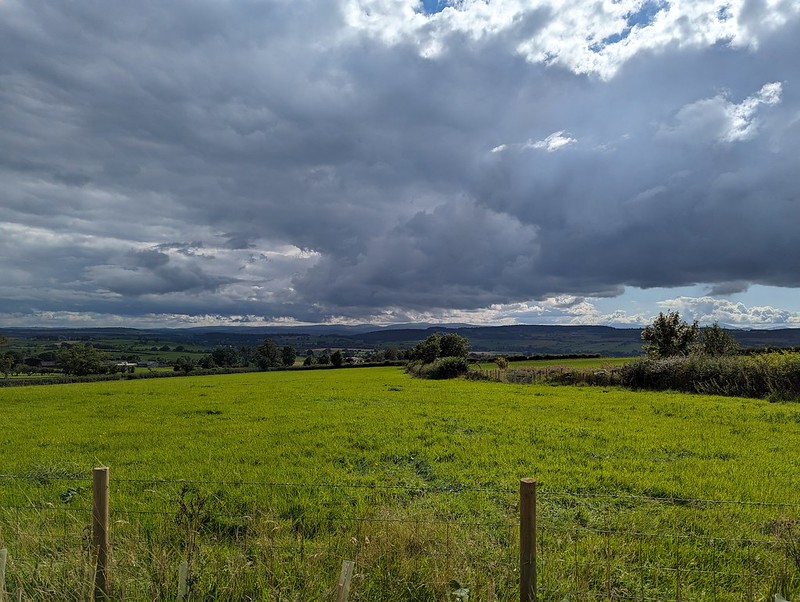
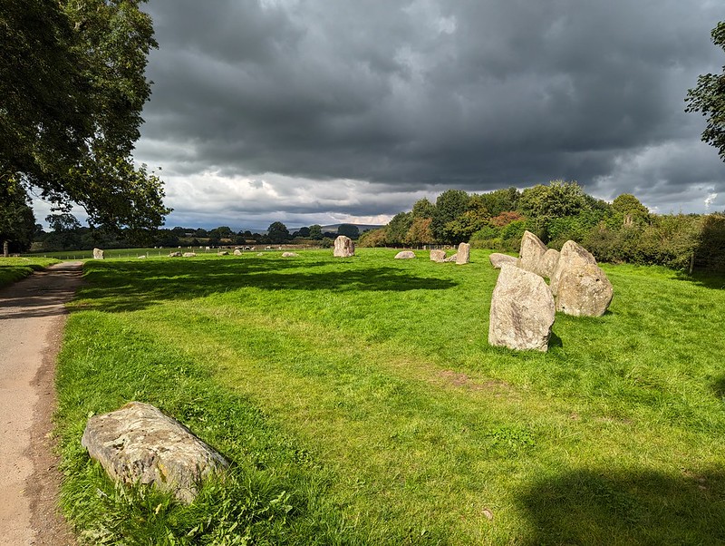
Looking to the Lake District from the new car park by Long Meg and her Sisters.A short walk to the stones.
There may be a new, and quite substantial, car park, but we still had the circle almost to ourselves.
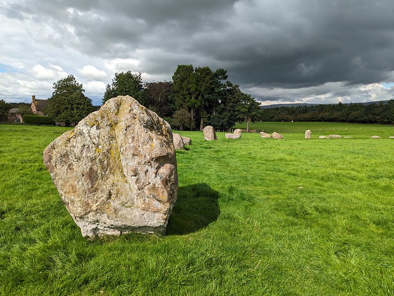
Some of the Sisters.
It’s an amazing place and it astonishes me that it’s not more well known. (There’s more details about the stones in this post from our first visit in 2011.)
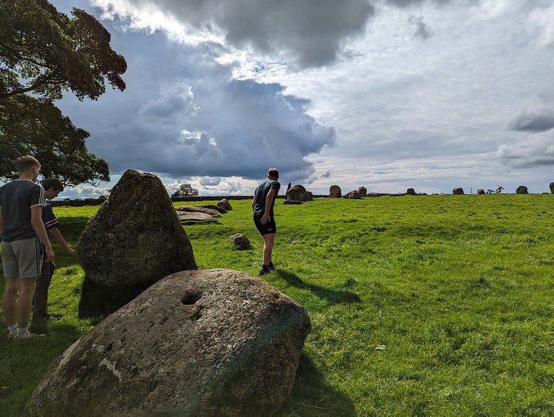
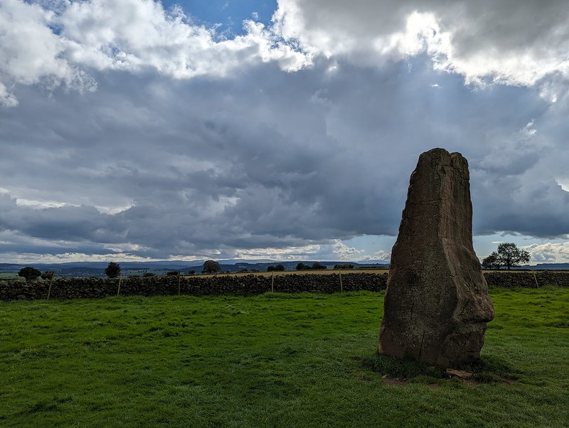
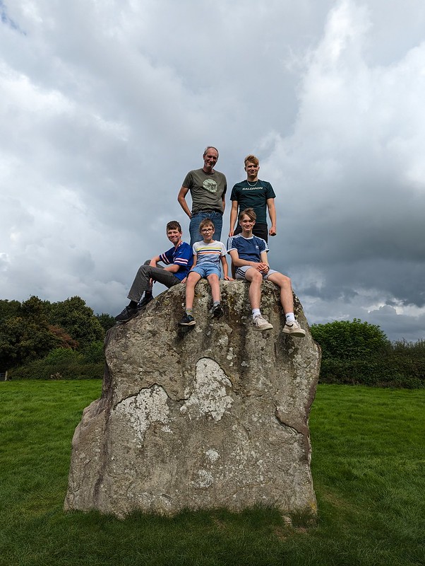
More of the stones...…which clearly need to be climbed on.Long Meg.Cup and ring mark. I think.Long Meg, with her sisters behind.More stones.And more.Dark skies over the Pennines.Another view of the stones.TBH chilling out.Family pose.Heald Brow.
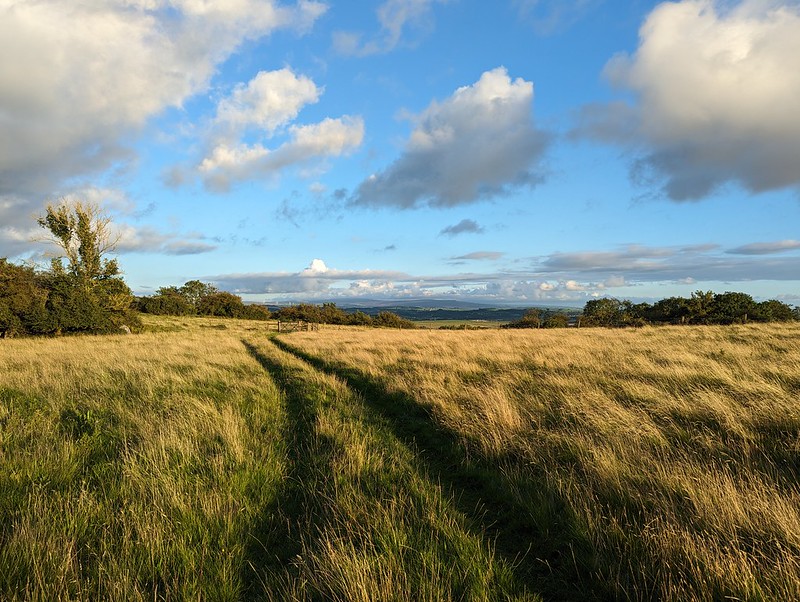
Later, when we were home again, and since it was a nice evening, I was out for a local stroll.
We had one more day in our little cottage in Staffordshire, but Little S was under the weather and B needed a lift to Uttoxeter to catch a train to Manchester where he was meeting friends. Unfortunately, the main road was closed due to an accident, which meant that trip took a lot longer than it ought to have done.
Calwich Park.
So TBH and I finished off our short trip with a wander in the vicinity of the cottage. The countryside was green and rolling and very pleasant.
I’d noticed Calwich Abbey on the map and was keen to take a peek. According to the Historic England website the house is Victorian, but in a Tudor style, and is built on the site of a medieval abbey. It was derelict when the listing was made, in 1984, but was sold in 2015, so hopefully it will be restored?
Calwich Abbey, otherwise known as The House of Usher.Another Ground Beetle. Maybe a Pterostichusspecies?Buzzard, I think.River Dove.TBH by the River Dovenear Norbury.Small scale hydro scheme?
The path through the woods near Norbury were overgrown from the off – nettles, brambles etc; all the obstacles to pleasant country walking in the summer. As we progressed it became more and more impenetrable. We should really have turned back. By the end, a machete was needed, and my habitual choice of shorts had turned out to be a very poor decision. Then it was spitting with rain as we walked along a minor lane for a while.
TBH heading towards the Dove.
At least the last section, over the Dove via the charmingly named Toadhole Footbridge was much more pleasant.
TBH on Toadhole Footbridge.
As we crossed the bridge, we were lucky enough to catch sight of a Kingfisher, my first for some time.
River Dove.TBH on Toadhole Footbridge.Almost back to our accommodation.
Looking at the map, after our walk, it struck me that there is probably quite a bit of scope for decent walks in this area, just outside the National Park. The wooded valley of Ordley Brook looks particularly worth exploring. Another time perhaps. I certainly hope it’s not too long before we come back to the Peak District for another visit – perhaps a slightly longer one next time.
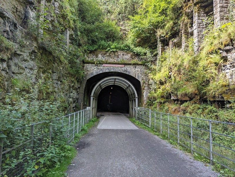
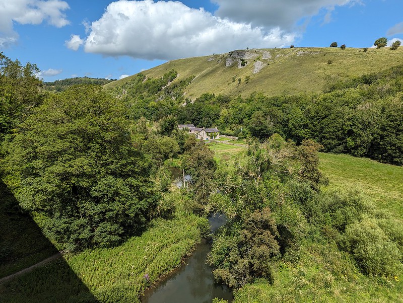
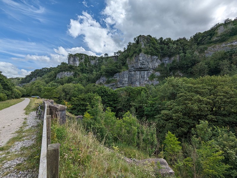
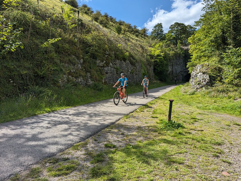
I’ve always considered the view from Monsal Head of the Headstone Viaduct to be one of the iconic scenes in the Peak District. Since the days when I was a regular visitor to the area, the old railway line has been converted into a walking and cycling track, a fact which Andy alerted me to on his blog. We’d brought the DBs bikes with us, and hired bikes at Hassop Station for TBH and myself. I remember that my bike was a Raleigh, but not which model, which is a shame, because it was very comfortable and a pleasure to ride.
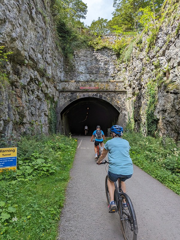
Headstone Tunnel
Hassop is near, but not at, one end of the line. We set-off west to tackle the larger portion of the trail first. There are six tunnels on the route and I seem to have taken photos either of, or in, most of them. I’m not sure why I was so chuffed to be cycling through tunnels, perhaps because I’m still essentially a big kid at heart.
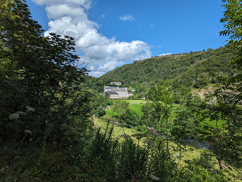
View from the Headstone Viaduct.View the other way from the Headstone Viaduct.Cressbrook Mill.Gorge-ous scenery.One of the dales.
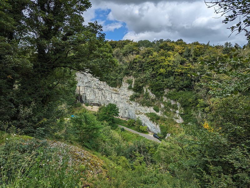
The trail generally follows the valley of the River Wye, but, confusingly, the name of the dale changes along its length: Monsal Dale, Water-cum-Jolly Dale, Millers Dale, Chee Dale, Wye Dale. It’s hard to know where the transitions occur and also hard to remember where each of the photos was taken, so I can’t say which dale each one shows!
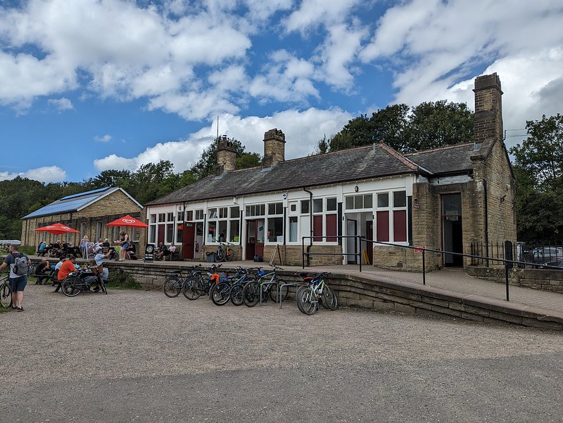
Happy bikers.Looking down on the road.Two viaducts near Miller’s Dale Station.Miller’s Dale Station.
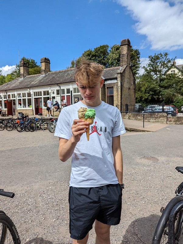
The cafe at Millers Dale station was popular and we probably should have got some lunch there. Little S did get an ice-cream, which for some reason seems to have caused some consternation on his part…
Little S with a suspicious ice-cream.Huge limekiln.Possibly the last of the tunnels.End of the line.
We’d been planning to eat at the cafe at Blackwell Mill, at the western end of the trail, but didn’t, I think it was closed. Either that, or it didn’t have any vegan options, I can’t remember.
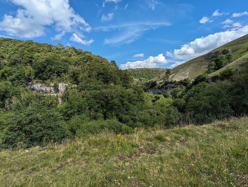
Chee Dale.
I’d chosen to start near the Bakewell end because I’d read online that it would be uphill from there. It must be a very gentle gradient: it hadn’t seemed uphill, but now that we turned around, the difference was really obvious and going the other way was much faster and could be free-wheeled.
Chee Dale from the little spur.
I had noticed a short spur here coming post and took a detour now to have a nose. It was well worth it for the view.
Free-wheeling.One of the Dales!
Back at Hassop station we had a very late lunch in the excellent cafe there, which is highly recommended.
We were running short of time on our bike rentals, so I asked in the shop whether we were okay to cycle to the other end of the line near Bakewell. I was told that it was fine, so long as we were back before closing, but that the return part was uphill and that many people found it challenging.
The other end of the line.Bakewell Station.Hassop Station.
Actually, it was fine and I’m pleased that we managed to fit in the entire route. I was hoping for a view over Bakewell, but whilst we did get some, they were partial and didn’t yield very good photos. The whole trail is 8½ miles, so there and back is only 17, not a very long cycle ride I know, but immensely enjoyable and pretty much flat which is a big selling point as far as I’m concerned.
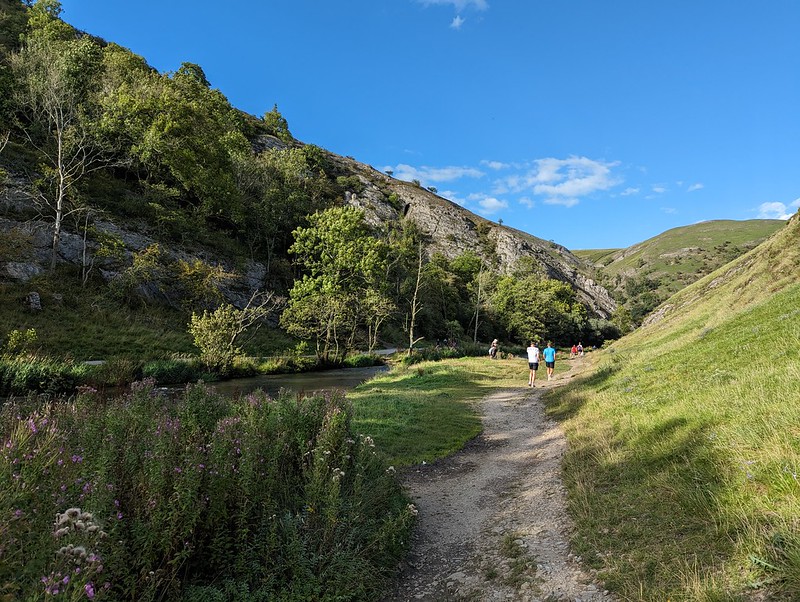
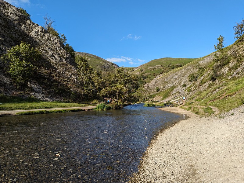
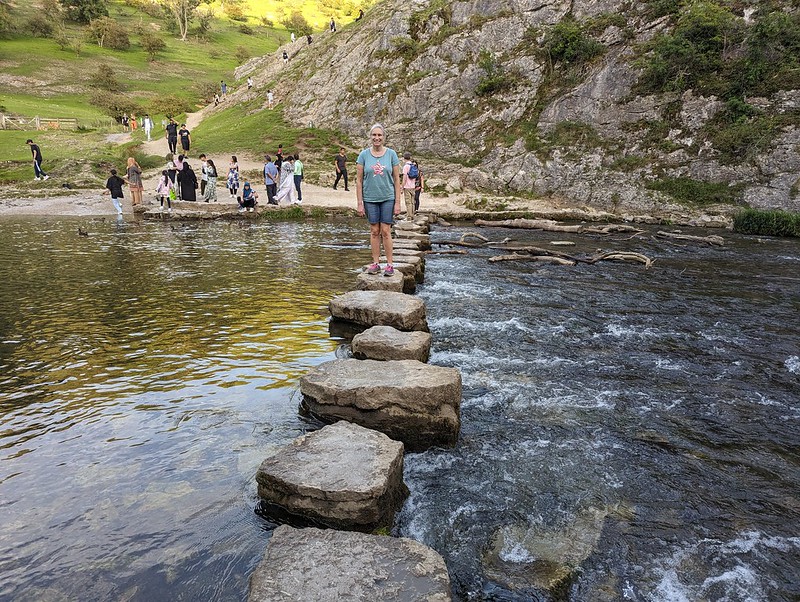
Dove Dale.
From my childhood visits to the Peak District I think three memories stand out: the show caves around Castleton; steaming, overheated cars pulled over on the roadside up Winnats Pass; and the stepping stones and rock scenery of Dove Dale. Since Dove Dale wasn’t far from where we staying, I was determined to fit in a visit whilst we were there and although it was late in the day, we managed to get into the National Trust car park before the entrance was closed for the evening.
River Dove.
Even though it was early evening, the area around the stepping stones was still very busy, with lots of large family groups enjoying picnics. We didn’t have to go far though before it became much quieter.
The Twelve Apostles, well some of them.
I remember, on those early visits, being awed by the natural rock arch above the path, and that it was close to Reynard’s Cave, but I don’t think we ever climbed up to the arch or the cave.
Natural Arch.
Judging by the heavily eroded path, that’s now a very popular activity. It’s pretty steep, more so than this photo suggests.
And from above.And from Reynard’s Cave.TBH in Reynard’s Cave.
Like Thor’s Cave, there’s archeological evidence showing that Reynard’s Cave was occupied, at least sporadically, during the Neolithic through to the Medieval period.
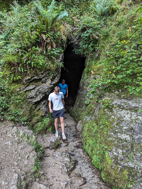
Another cave.
We found another, smaller cave just around the corner from Reynard’s and then an alternative route back to the river which was a little less steep.
Descending from Reynard’s Cave.
Before heading for home we walked a little further upstream so that the DBs could investigate this rather wet cave which had a stream flowing out of it…
Another cave down by the river.The famous stepping stones.
And finally, on the path back to the car park, a couple of interesting insect encounters…
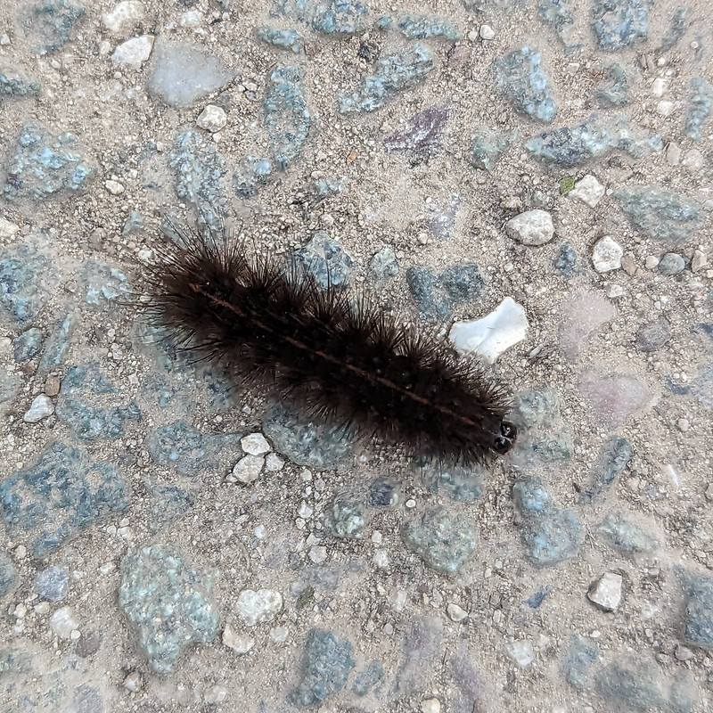
Lesser Stag Beetle (I think).A White Ermine Moth Caterpillar (I think).
This was the last full day of our flying visit to the Midlands. Our trip was short, but packed with interest and I hope it’s not too long before we’re back in the area.
B and I had been discussing various plans for a night or two away somewhere, but dodgy weather and the fact that B was quite busy between work and social commitments had prevented that so far. However, the forecast looked half reasonable, and B could spare me an afternoon and the following morning, so we hastily packed (fortunately my gear had dried out in the day since my wash-out walk from Austwick) and set-out for Patterdale. We parked at Cow Bridge, just north of Brothers Water. I was pleasantly surprised to find that the car park wasn’t full, especially given that it’s free.
Fungi in Deepdale Park.
We used the permission path beside the road through Low Wood. The map shows a much more direct route through the woods on to the Hartsop above How ridge, but I would have been much happier to take the less steep route even if I hadn’t been carrying camping gear. Actually, B had volunteered to carry the tent, so although I had the food, pans and stoves, my pack wasn’t as heavy as it might have been.
Fungi. Possibly Amanita rubescens?Gavel Pike.
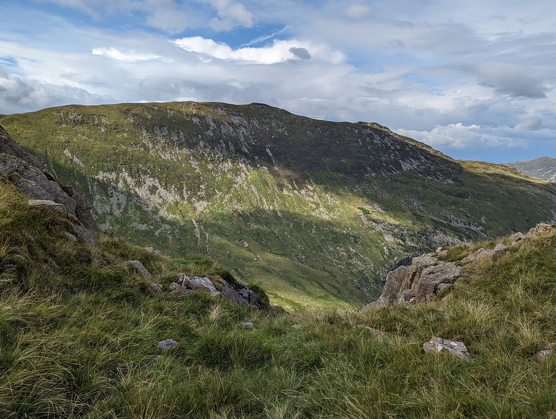
Gavel Pike looks very dramatic from this direction, which is a bit misleading, but it’s a Birkett which is well worth taking a detour to visit when climbing St Sunday Crag.
Arnison Crag and Place Fell either side of Patterdale.Arnison Crag, Great Mell Fell, Place Fell, and Angle Tarn Pikes from Gale Crag or thereabouts.“So, where are we going to camp?”
The long ridge over Hartsop above How is a lovely walk. It gave us lots of opportunity to look ahead to the various potential campsites I’d identified. I let B make the decision and he was most taken with the idea of dropping down into Link Cove, the craggy corrie below Hart Crag and Scrubby Crag. Although I left the choice to B, that was my preferred option too. I’ve visited Link Cove a couple of times before, ascending in to it on the way up Fairfield from Deepdale, with Andy and Uncle Fester years ago and I’d been wanting to return.
B admiring Dove Crag, Hart Crag and Fairfield. Before succumbing to ‘ant attack’.
There were a lot of flying ants about. We’d decided to stop here for a drink and a snack, but this little knoll seemed to be a particular focus of their attention and we were quickly overwhelmed and decided to move on.
Link Cove dead ahead.Link Cove.
There’s no path into Link Cove. We took a line which angled down below the darkly shadowed crag on the left of the photo above, then climbed again onto the small ridge in the middle of the cwm. This was rough going, but I love getting off-piste into dramatic scenery like this.
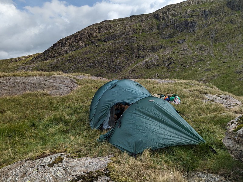
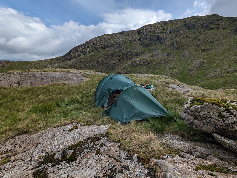
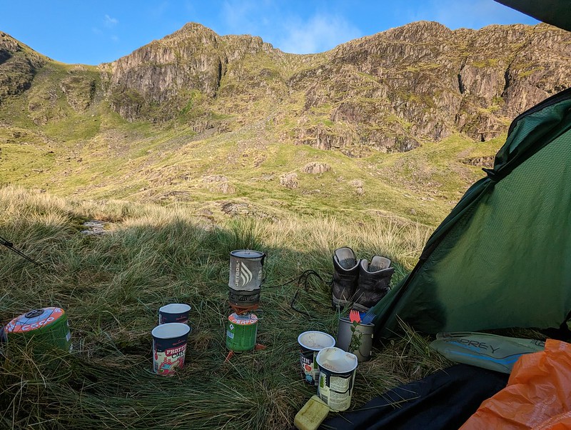
Tent pitched.
It was hard to find any level, dry ground to pitch the tent on. This spot was probably more level than it looks in the photo, but it wasn’t as dry as we might have liked. Then again, after the weather we’d had, it was always going to be hard to find a spot which wasn’t soggy.
Camp in Link Cove.Looking down Deepdale.
Once we were pitched and organised, we left our gear and set-off unencumbered for a circuit of Link Cove. I thought the map suggested that The Step would give a good ascent route and that proved to be the case.
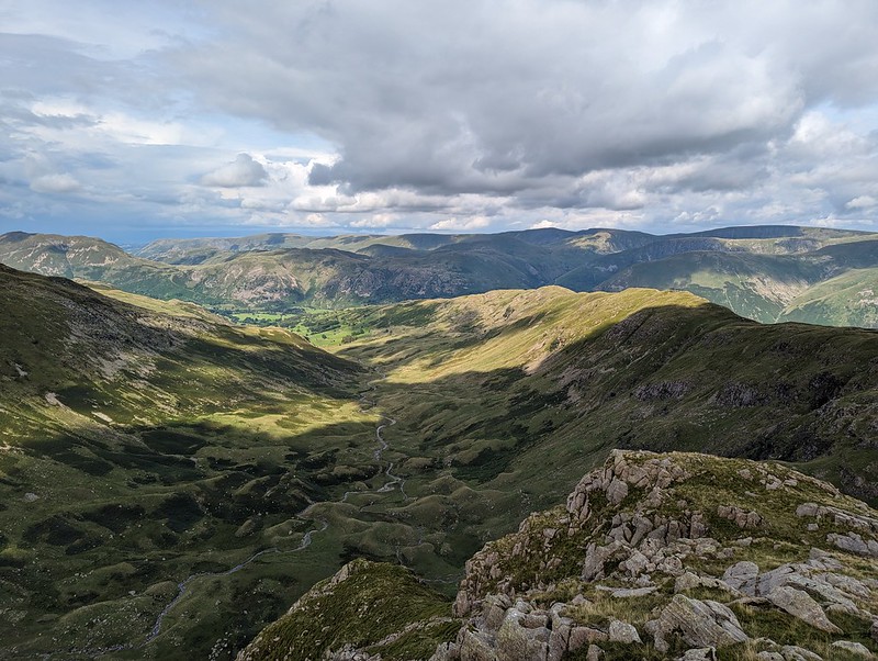
The High Street range from ‘The Step’. Looking across Link Cove to Hart Crag. Our tent is to the right of that short rocky ridge in the cove.St. Sunday Crag.Looking down Deepdale. Hartsop above How ridge on the right.Black Tippet and the northern buttresses of Fairfield. Cofa Pike on the right.
You can’t beat this sort of exploration – we had great views into Link Cove, then suddenly we hit the far side of the ridge and found terrific views of the northern steeps of Fairfield. From Scrubby Crag we decided that a detour to take in the summit of Fairfield was called for.
Dollywaggon Pike, Nethermost Pike, Helvellyn and Striding Edge.Cofa Pike and St. Sunday Crag.
The skies to the east were looking increasingly grey and it was clearly raining not too far away. It would surely be only a matter of time before we got our own shower.
Looking west. Scafells, Gable, Dale Head, Maiden Moor, Northwestern Fells.Rainbow Weather.Looking down Rydal. Great Rigg and Heron Pike on the right. Windermere, Coniston Water and Morecambe Bay in the distance.Link Cove, Deepdale, Hartsop above How. Sunshine and showers.
I thought we could descend, with care, the gully to the south of Scrubby Crag, but B took one look at it and clearly doubted my sanity, so we climbed Hart Crag instead, descended the ridge towards Hartsop above How and then repeated our route down into the cove and back up to our tent.
St Sunday Crag.Descending towards our camp.
Of course, eventually it began to rain and didn’t stop for quite some time, even though the sun was still shining too…
Dove Crag.
We thought we could pick out the path to the cave on Dove Crag which is meant to be a good bivvy spot.
A Link Cove frog.
We were using the tent which we’ve borrowed (seemingly indefinitely) from Andy. It’s not the lightest, but it’s amazingly spacious and the huge porch was superb in the wet – perfect for me to sit in and cook our evening meal (filled pasta, pesto, dried fruit and custard, very satisfying).
Second Day
A breakfast view of Scrubby Crag.
This early morning photo might be a bit misleading. Once again, we seemed to be on the divide as far as the weather was concerned. To the west, all was blue sky and sunshine; to the east, low cloud. And although the wind was, I was sure, blowing from the west, the cloud was sweeping up Deepdale towards us. Still, we at least had sunshine whilst we breakfasted and packed up.
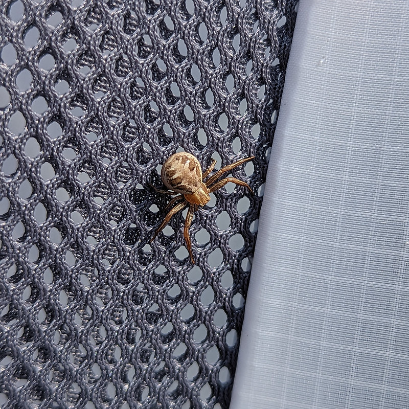
A Crab Spider. Xysticusspecies. I think.Ascending The Step again, with atmospheric clouds.
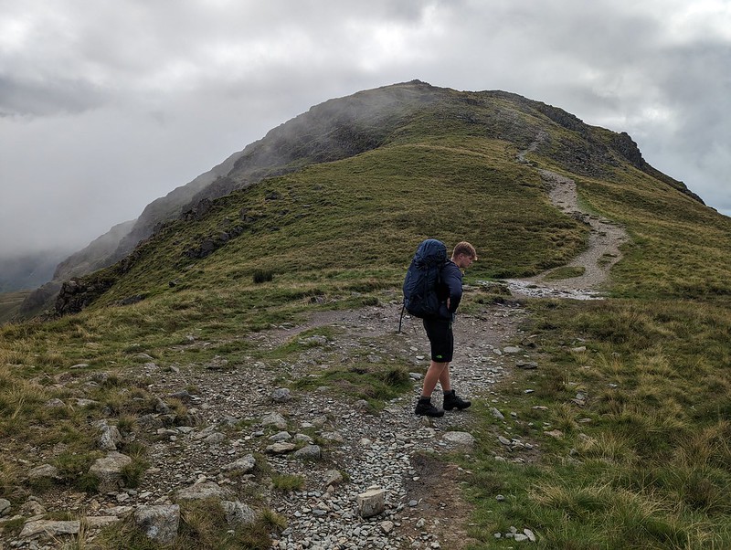
We wanted to regain the main ridge, and could choose to retrace either our ascent or our descent routes of the previous evening. Despite its initial steepness, we agreed that The Step was much the easier going of the two. With the cloud sweeping in across the crags, it was atmospheric too.
Hart Crag.The ‘view’ to the East.And to the West. Coniston and Langdale Fells. Heron Pike and Great Rigg in the foreground.Looking South from Dove Crag. Windermere, Coniston Water and Coniston Fells.
As you can see from the photos, the weather was really odd, but it gradually improved as we wandered over Dove Crag and then Little Hart Crag and finally along another delightful ridge to High Hartsop Dodd.
Middle Dodd, Little Hart Crag and Red Screes.Looking down Scandale. Scandale Tarn in the foreground.
I have several spots in the area earmarked as potential wild-camping locations. Scandale tarn is one of them.
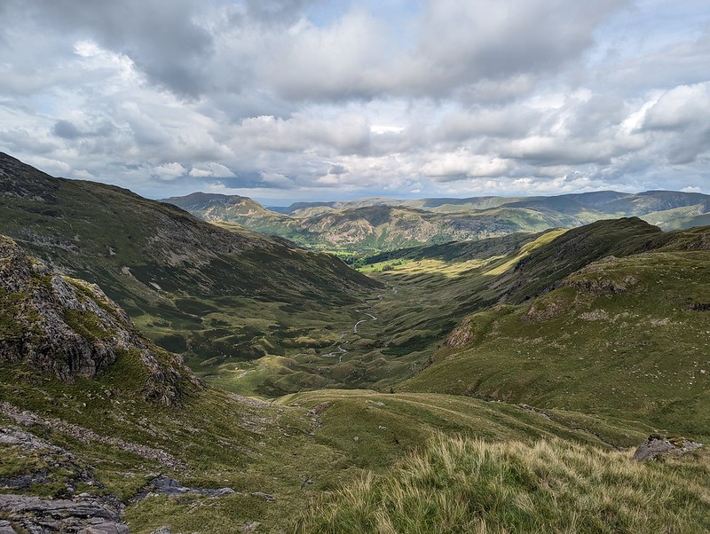
Middle Dodd and Red Screes.The complex terrain at the head of Dovedale.B descending towards Brothers Water.Looking down on the Romano British enclosed stone hut circle.
I’ve waffled on before about this amazing archeological site. Historic England has a thorough physical description, but doesn’t supply much detail about who lived here and how they might have lived.
Another view of the settlement. The knoll on the right is the site of the oval cairn.A final rest stop.Looking up Dovedale.
This was effectively a day’s walk divided in two, which I think is probably a good way to plan an overnighter. We both enjoyed it immensely and were both keen to go again. B also wanted to borrow some gear and take some of his friends wild-camping, but then he got a job pitching and packing-up much bigger tents (marquees) and his availability became severely restricted. Who knows, maybe next summer we’ll get a mutually convenient spell of settled weather and manage to fit some more trips in?
July fizzled out in a welter of wet weather, leaving me stuck at home, perusing my maps and the none too promising forecasts and feeling increasingly stir crazy. When the first of August rolled around, I couldn’t stand it any longer and decided to get out for a walk, come what may. There’s probably an object lesson to be learned from the consequences of that decision, but I’m not entirely decided what the moral of this sorry tale should be. Maybe an inquiry is required, they seem to be in vogue. Here’s the evidence…
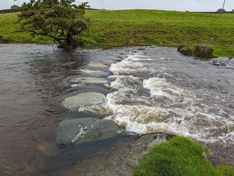
Submerged stepping stones.
I’d plumped for a Lune Catchment wander, and was thinking that Smearsett Scar, at the eastern extreme of the Lune’s Yorkshire Dales reach, would be ideal. Optimistically, I was thinking that, if the weather was a little better than expected, I might extend the route to explore the limestone pavements of Moughton Scar too. In the event, the cloud was so low that even the little wooded heights above Austwick were hidden in the miasma. I hastily adjusted my plans, deciding to head south from the village, away from the hills. Had I taken a little more time and care, I might have noticed the words ‘stepping stones’ on the route I’d chosen and had second thoughts. I did eventually have those second thoughts, but only after I’d walked as far as Austwick Beck and seen the submerged stepping stones.
Oxenber Woods.
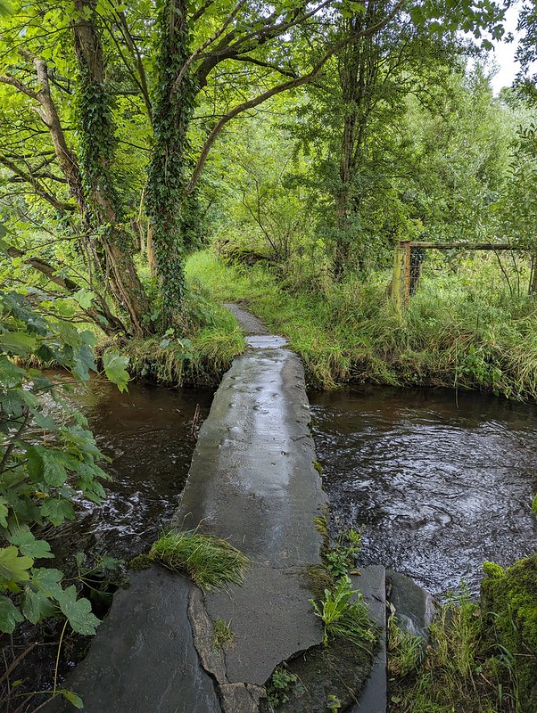
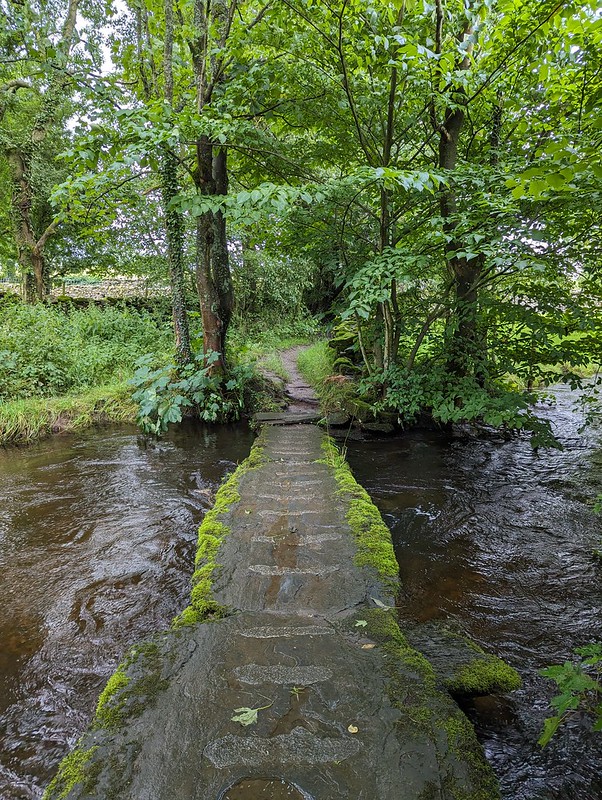
My second attempt to leave Austwick also brought me to Austwick Beck, but a little upstream of the stepping stones where there were two clapper bridges.
Little Bridges, Austwick Beck.Little Bridges, Austwick Beck.
They’re named ‘Little Bridges’ on the OS map. Makes me think of Baloo addressing Mowgli as ‘Little Britches’ in the Disney version of the Jungle Book. (I had an LP of the soundtrack which I listened to obsessively as a kid. Maybe that’s why I’m so happy listening to a playlist of Chet Baker, Sidney Bechet, John Coltrane, Nina Simone, Herbie Hancock and the like as I write?)
After that more auspicious start, the quality of this path quickly nose-dived where it passed between two walls and very quickly became extremely overgrown. This part is the best bit…
An inviting path?
Under the trees it was plagued by low branches and nettles. I’d put my overtrousers on before I plunged into the vegetation, so at least didn’t get stung. I next needed a machete where the path met the A65 road and the stile over the wall was protected, on both sides, by dense thickets of brambles. Which at least brought me into the open. Maybe I was just disheartened by the rain – did I mention that it was, inevitably, raining? – or the heavy going so far, but even walking through this meadow, in knee high wet grass seemed like unduly hard work.
Another inviting path?
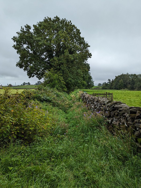
I decided to use minor lanes where possible, and at Lawkland turned right along Graystonber Lane.
Cottages at Lawkland.With an old post box.
Faceache’s algorithm has clearly pigeonholed me as a middle-aged sad-act and keeps suggesting groups like The Dull Men’s Club, The Country Lane Appreciation Society, Bathtubs in Fields, and most recently The Peeling Paint Appreciation Society. To be fair, I think it has me pretty well sussed. But, for some reason, I’ve stopped seeing endless photographs of post boxes, which is a shame, because I do find them appealing – especially the Victorian ones. In fact I like them almost as much as I like a listed building. This one, Lawkland Hall, is a bit special, it’s grade I and those aren’t ten-a-penny. It was restored in 1912, but the oldest part dates back to the Sixteenth Century.
Lawkland Hall.Lawkland Hall.
I might not have known that Lawkland Hall was worth a look, but the miserable weather had at least given me a chance to read a little more of John Self’s marvellous ‘Land of The Lune’ and I’d seen a picture there.
At Lawkland Green I turned left on a path which would take me across several fields back to the A65. They were large fields. One field was home to a small herd of what I assumed were bullocks. They ignored me. Then, when I was half way across, one of them started to walk my way. Then a couple of others decided to investigate. Pretty soon, they were all running full-pelt across the field.
Raging bullocks?
Do they look angry to you? They don’t really do they. But they seemed very aggressive at the time. What’s more, that stream was wider and deeper then it looks in the photo and I got wet feet plodging through it.
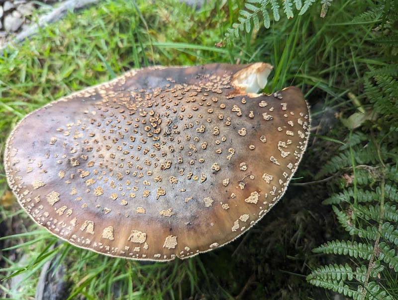
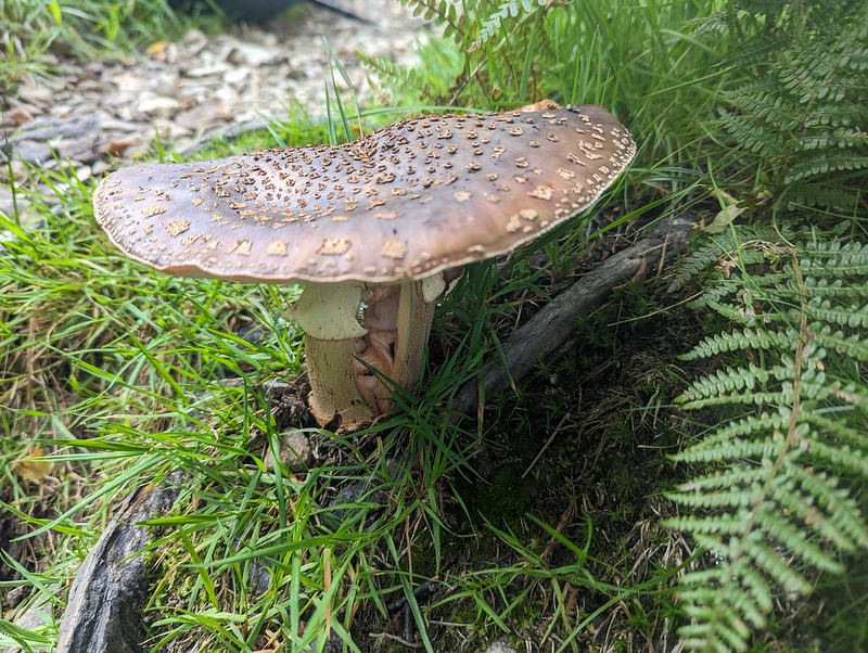
The following field held nothing more threatening than a number of tall, broad mushrooms, which I assumed were Parasol Mushrooms, but I may have been wrong of course (see the comments section in my previous post).
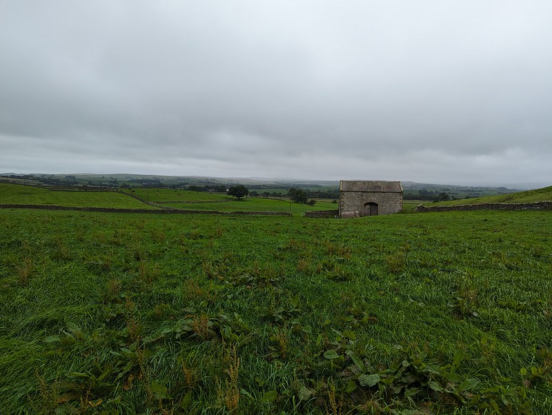
The next section was road walking, but mostly along a very quiet lane. The weather showed some signs of improving: the cloud was lifting a little and the rain was slackening off. As I descended through fields towards the tiny hamlet of Feizor, it even began to look as if Smearsett Scar might emerge from the cloud.
Smearsett Scar. Almost.Smearsett Scar, very nearly clear.
I suppose I might have reinstated my plan to climb the scar, but decided instead to head for the tearoom, which old friend J has been raving about (in an approving way) for ages.
She was quite right. It was lovely. A pot of extra hot water with my Earl Grey without even asking for it – TBH’s test of a tea room’s standard of service. The fact that it was busy late on a wet, mid-week afternoon is probably a good sign too.
Smeatsett Scar – cloud free!Hale Lane.Hale Lane.
After the tea shop, there were longer gaps between the showers. The little ditch by the lane was gurgling away however, brimful of run-off.
Burn Moor – and sunshine?Austwick and Robin Proctor’s Scar.Studrigg Scar and Moughton Scars.Austwick Beck.Austwick Bridge.
‘Probably C18’ according to Historic England.
Austwick Cross and The Church of the Epiphany.
Austwick church is more recent, finished in 1839 according to the same source, originally as a lecture hall and only latterly turned into a church. The pillar is of a similar age, but the base is ‘probably C15’.
In the grounds of the church…
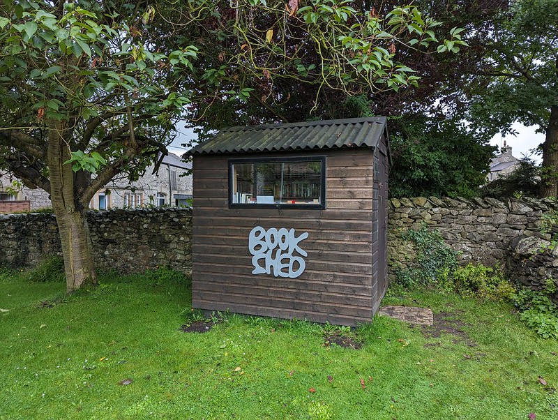
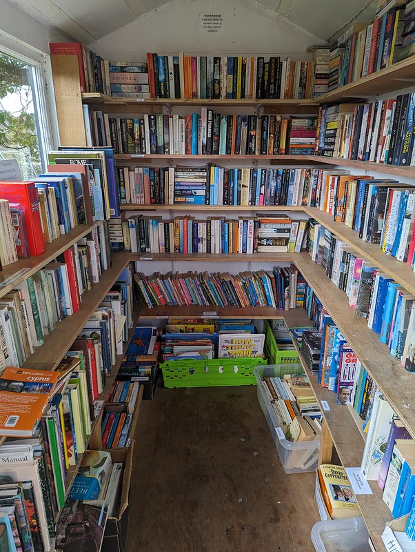
Book shed.Heaven!
I managed to restrain myself and only came away with a couple of books.
So: have you reached a verdict? Is the moral – when the weather is truly awful, best stay at home? Or the opposite? There was definitely an element of what our friend JB calls ‘Type 2 fun’. It was a bit grim at the time, and I got very wet, but there were some good bits too, especially in retrospect. I’ll let you draw your own conclusions.
Old friend GFS was staying at Chapel Stile campsite in Nether Wasdale with his family and had been regularly posting pictures from the fells he’d bagged. I messaged him wondering whether he wanted to meet on the Sunday for a walk. He suggested Black Combe. I was a bit puzzled, since I knew he was enthusiastically ticking off the Wainwrights, as well as the Ethels he would tell me about later in the day, and Black Combe is not on that list. It turned out that he’s using an online list which includes all of the Outlying Fells, so, as far as he was concerned, it is a Wainwright and would add to his tally.
GFS suggested an eleven o’clock rendezvous, which, being jealous of my weekends, especially if the sun is shining, I felt was inordinately late, so I set-off early and drove a little past our prearranged meeting point for a quick swim in the Irish Sea at Silecroft.
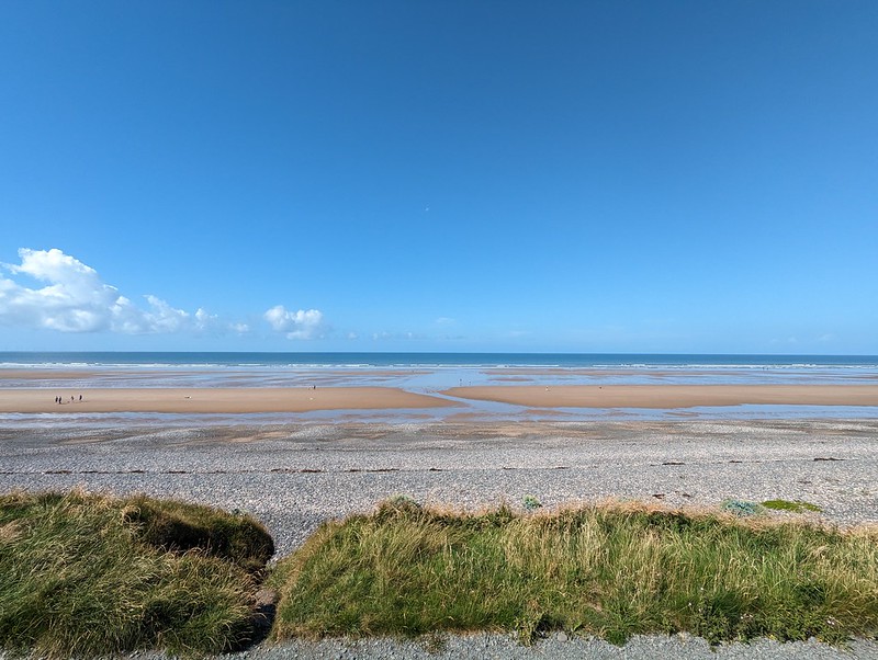
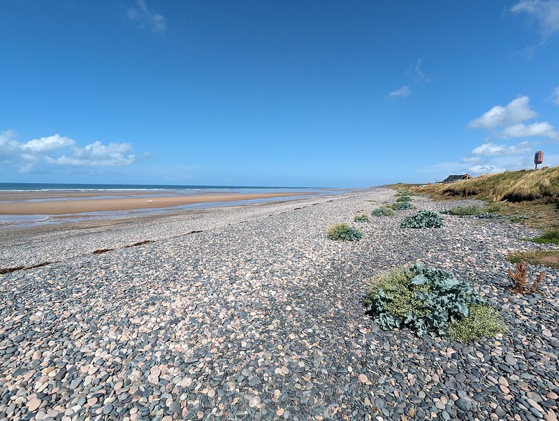
The shingle upper region of Silecroft Beach.
I don’t think that Cumbria is reknowned for its beaches at all, but the one at Silecroft is lovely, and I suspect many others are equally good.
Sea Kale.
My first encounter with the beach here was also in July, over thirty years ago, when I came kayak-surfing here with a group of trainee teachers. It was far from being the first time I’d kayaked, but it was probably my first experience of surfing and it could easily have been my last. We were using some rather battered fibreglass canoes and the cockpit coping on my boat was cracked. I only discovered that my spray-deck was firmly jammed into that crack when I’d capsized and was trying to roll out of the boat in the way we’d been taught in the safe environs of a swimming pool. Of course, I should have been performing an eskimo roll, but I never quite mastered that. After a little confusion followed by some hasty tugging at the spray-deck, I managed to free myself, and was surprised to find myself the centre of attention and a worried looking instructor chest deep in the sea in an effort to rescue me. Reckless youth and adrenaline junkie that I was then, my only regret was that he wouldn’t let me go back out for some more surfing. These days I’ll settle for an intentional swim without the preceding drama. There were a few people on surfboards near where I swam, but the waves looked unpromisingly tiny. Perfect for a swim with a great view however.
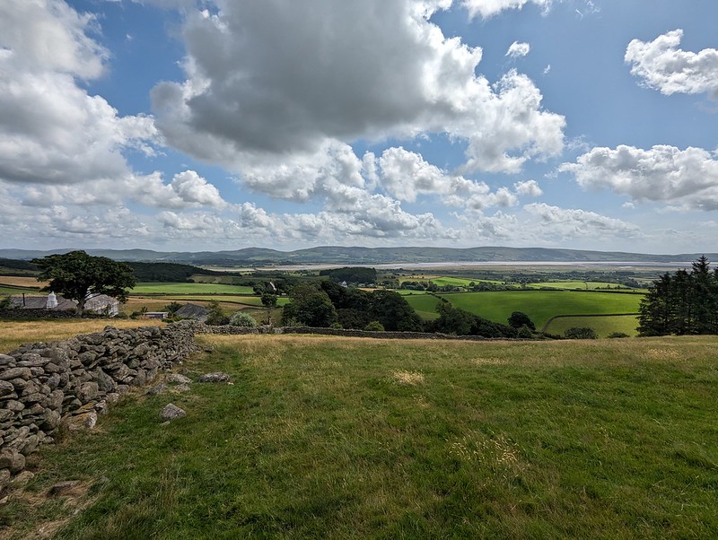
Black Combe.
I’d taken a leaf out of Andy’s book and had been perusing satellite images of the area in search of liking looking parking spots. As a result, I’d suggested a layby just off the main road, opposite the church at Hallthwaite.
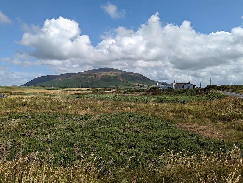
Cinnabar Moth Caterpillars and lots of Soldier Beetles making love not war.The Duddon Estuary from Baystone Bank, Bank House on the left.GFS descending Baystone Bank.
The path which descended Baystone Bank should have alerted us to what was to come – it started out sketchy and quickly disappeared completely in the enveloping bracken.
Stoupdale Beck.
Having reached access land just below Force Knott the plan was to turn sharp left and to follow the path, marked on the OS 1:25,000 map, which follows the intake wall. The idea was to work our way around to Whitecombe Beck and then on to the Horse Back ridge which I have often admired, but never climbed. My plan then extended to a lengthy descent route which would conveniently take in the Swinside stone circle, which has also been on my wish list for a very long time. As Iron Mike famously opined: “Everybody has a plan until they get punched in the face.” In this case, the knuckle sandwich was delivered by the head-high bracken.
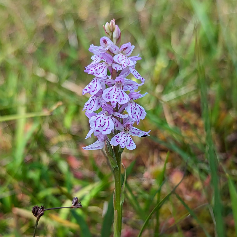
Heath Spotted-orchid.
Sadly, the advertised path simply didn’t exist, at least not in July, and the path which climbed up beside Stoupdale beck, which seemed like the only alternative, briefly lulled us into a false sense of security before also disappearing. Orienteering maps use different colours to indicate the density of the undergrowth, the most extreme being ‘fight’ I think. This was definitely a fight. Fortunately, we eventually climbed above the worst of the bracken and the path returned without a hint of embarrassment or any sign of an apology.
The Duddon Estuary again.
From that point on it was just a steady climb to the top, in glorious sunshine.
GFS in the region of Whitecombe Moss.Looking towards Whitfell, The Scafells and the Coniston Fells.GFS and me by the trig pillar.The huge cairn on the south top.View to Walney Island beyond the mouth of the Duddon. Piel Island can also be picked out.
We sat with our backs to the large cairn, eating our lunch, admiring the extensive views and discussing potential onward routes, since we had already climbed much of my proposed descent route and we were keen to avoid another quarrel with the bracken as much as possible.
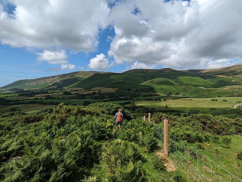
Horse Back ridge.
I had a theory that a route around the southern edge of the actual Blackcombe corrie might be our best bet. I thought the path beside Whitecombe Beck would be bracken free.
Eller Peatpot.
It did turn out to be a good route, with only a modicum of bracken bashing as we approached the track by the stream.
Ominous clouds heading our way.Blackcombe Beck.
Our new route involved a lot of road walking, mostly on quiet lanes which was fine, but from Fox and Goose Cottages to Lanthwaite Bridge along the busy A595. Whilst we were walking that section, TBH rang me to find out whether we were back at our cars yet? She was in Heysham, to pick up Little S, and reported a torrential downpour which had immediately flooded the roads and made driving difficult. We’d been watching showers tracking across the sea in our direction for a while and now the sky was dark and threatening.
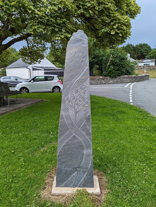
New (2020) Standing Stone at The Green.
I was very taken by this new standing stone, which was carved by Irene Rogan and Danny Clahane. It took a while to find out anything about it, but I eventually turned up a suggested walk taking in this and the Swinside Stone Circle, which I shall have to come back to try at some point.
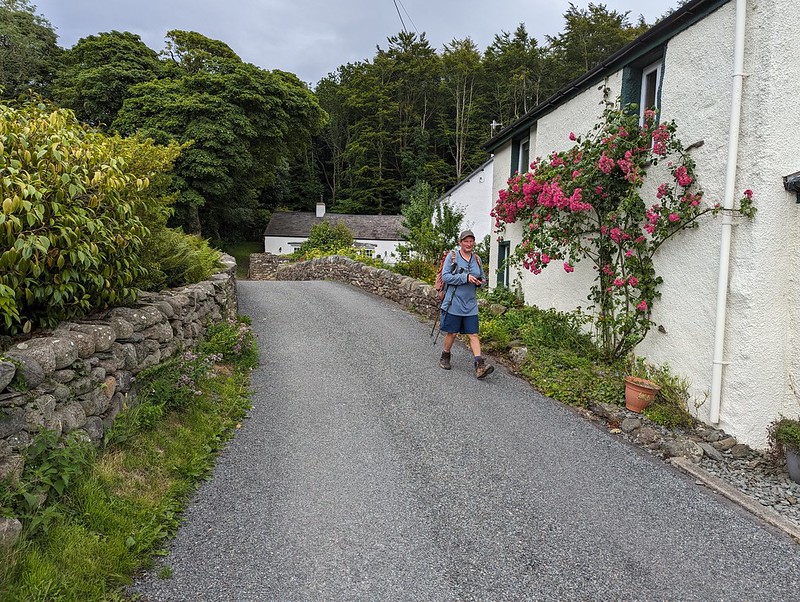
Black Beck at Hallthwaites.GFS in Hallthwaites.
In the event, the first drops of rain only began to fall as we arrived back at our cars and the anticipated heavy showers didn’t materialise at all. Despite the best efforts of the bracken, it was a terrific walk. It’s always interesting to chat with GFS and I remember that we covered a lot of ground in our conversation.
MapMyWalk gives a little under 10 miles and almost exactly 700m of ascent.