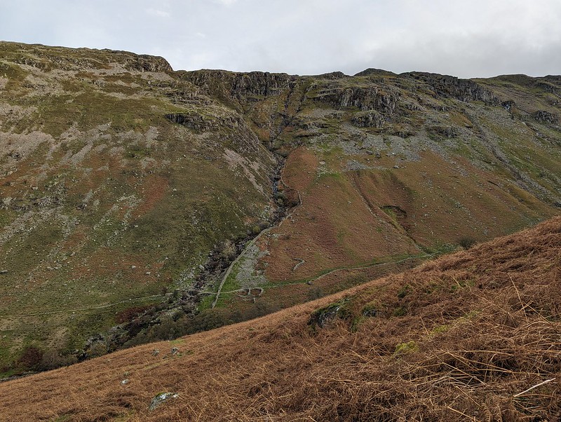
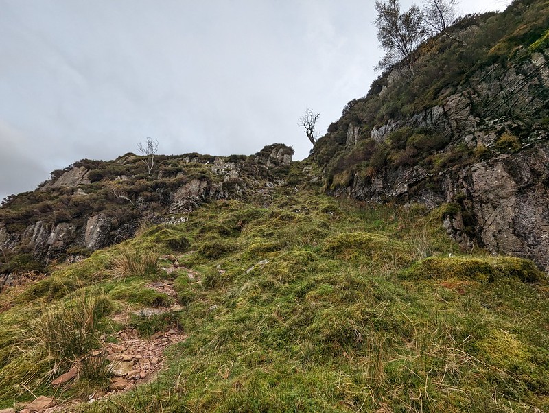
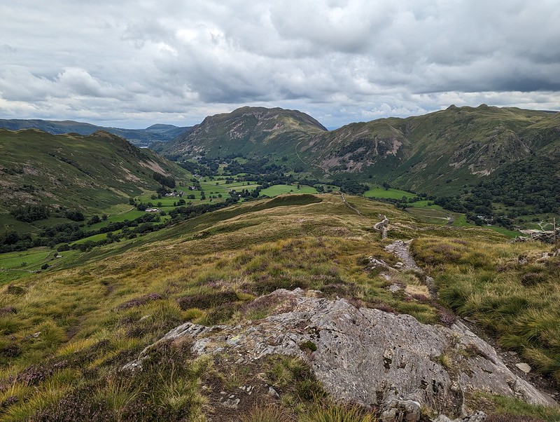
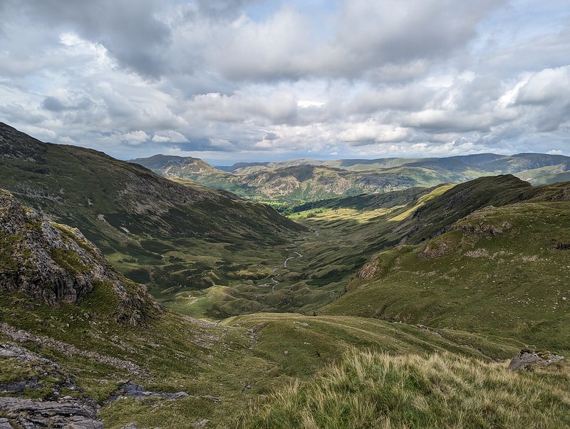
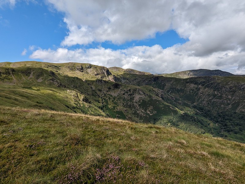
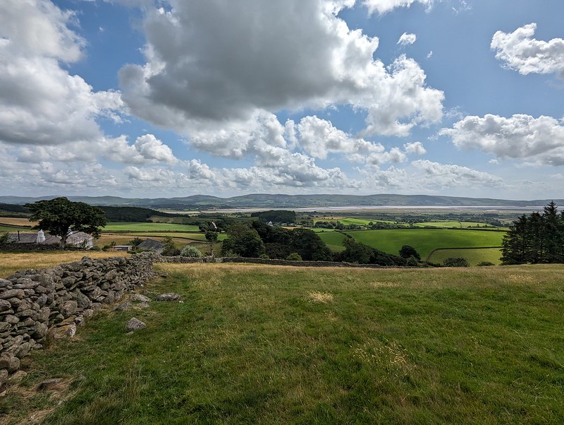
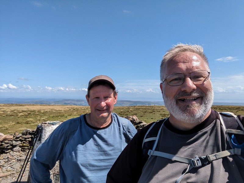
An October outing up two Wainwrights which I’ve never climbed before. Not sure how I’ve managed to avoid them. Anyway, my mistake: they were well worth a visit. In the photo above, you can see that there’s a lot of steep stuff on Eagle Crag and it’s not immediately obvious how you’ll get up there, but fortunately it’s all plain sailing; the path winds round to the left of the first knoll, Bleak How, and then finds a passage through the remaining complexities.
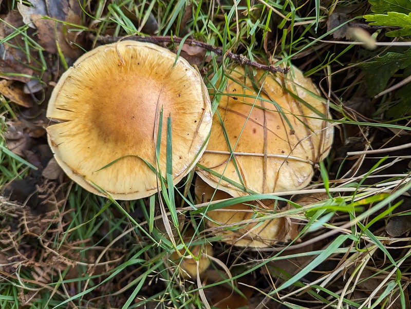
Fungi.
Having said that, after the initial easy plod along Stonethwaite Beck and then a boggy bit of field, I turned away from the valley path either too late or too early and then found myself fighting spiky, crumpled bracken uphill, but eventually managed to reach a sketchy path by the wall which then lead me around the craggy parts of Bleak How and on to the ridge.
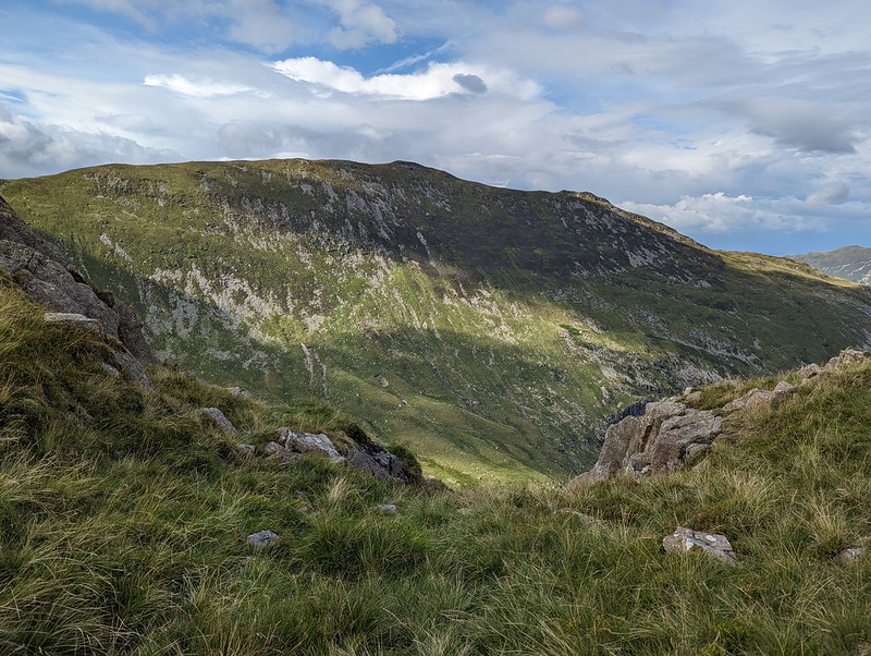
Long Band on Coldbarrow Fell.
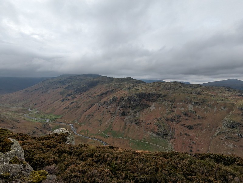
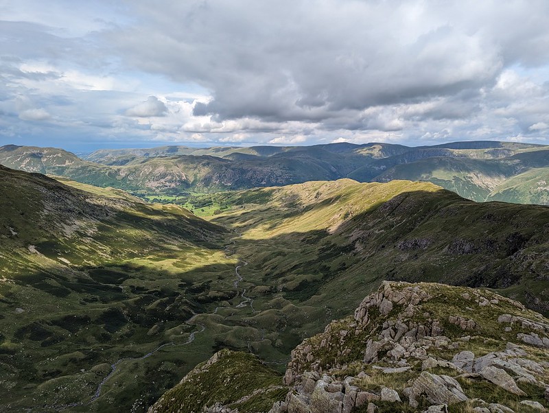
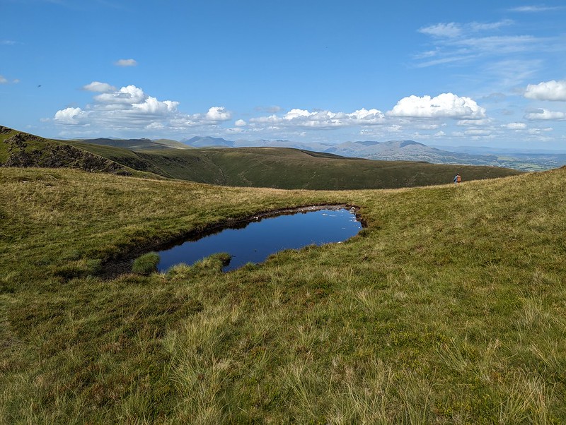
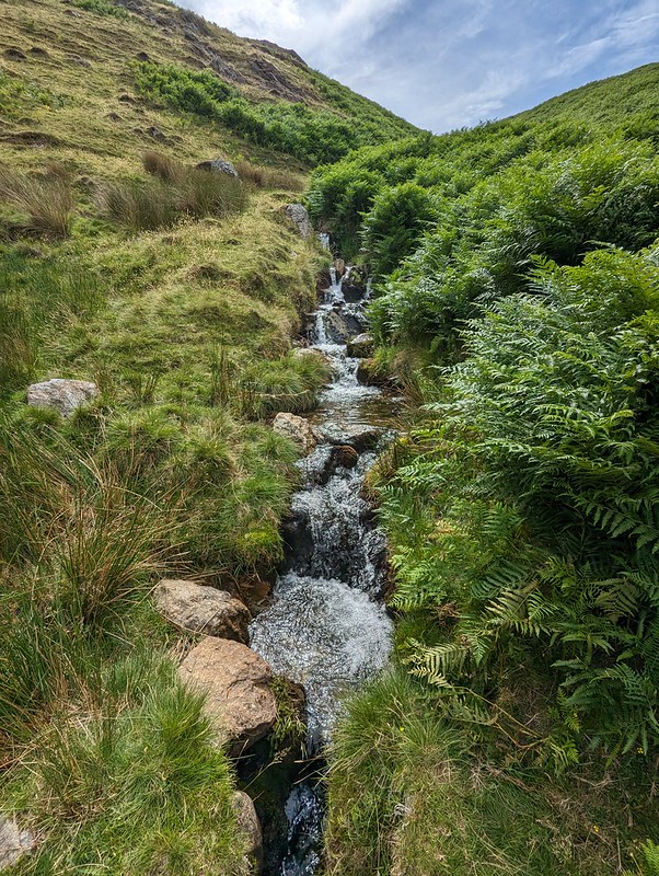
This stream, unnamed on the OS map, has carved quite an impressive looking amphitheatre below Long Band on the opposite fellside and I filed away the idea of having a gander there on a future walk.
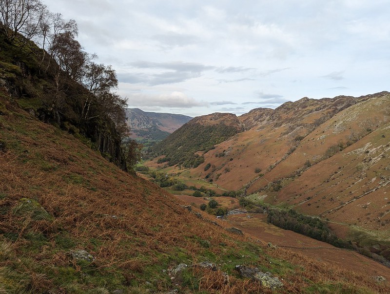
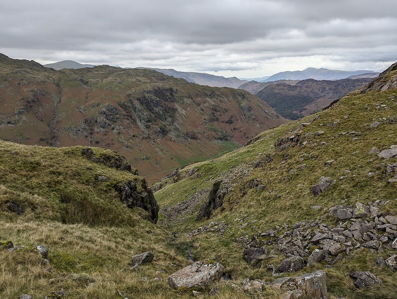
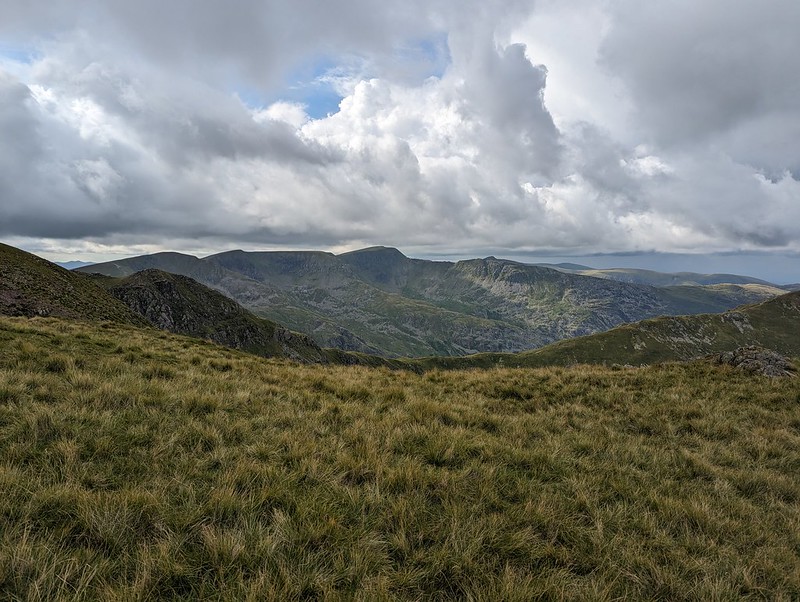
My ascent route, approaching Eagle Crag..Knotts and Great Crag above Stonethwaite.
It was a fairly grey day, with occasionally the odd drop of moisture in the air and the apparent threat of rain, but none-the-less good walking weather.
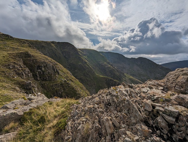
A broad ramp.
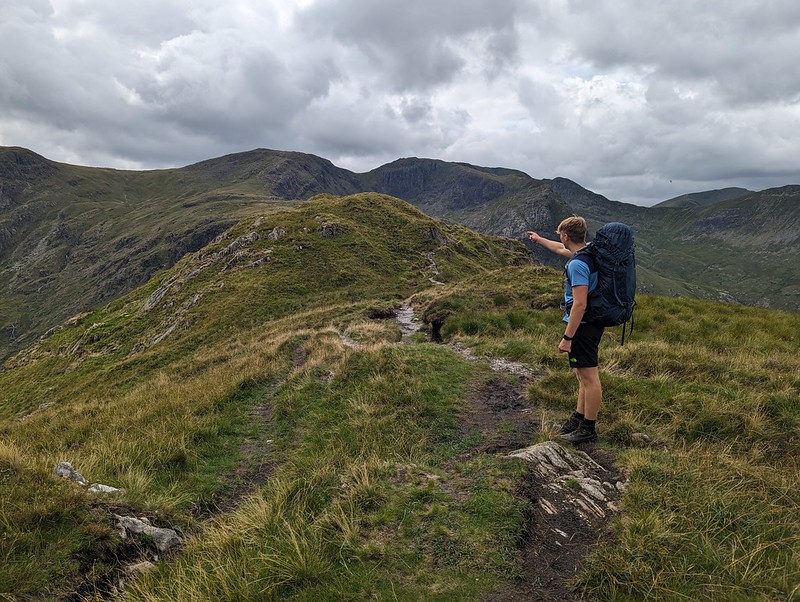
The route follows a resourceful path which finds first a broad ramp with crags above and below, and then switches back up an easy-angled gully through what might have seemed impenetrable cliffs.
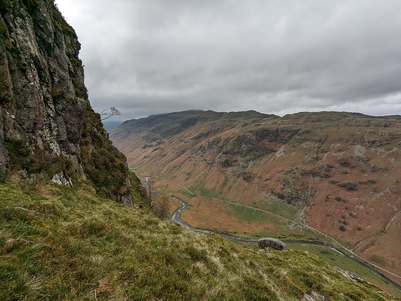
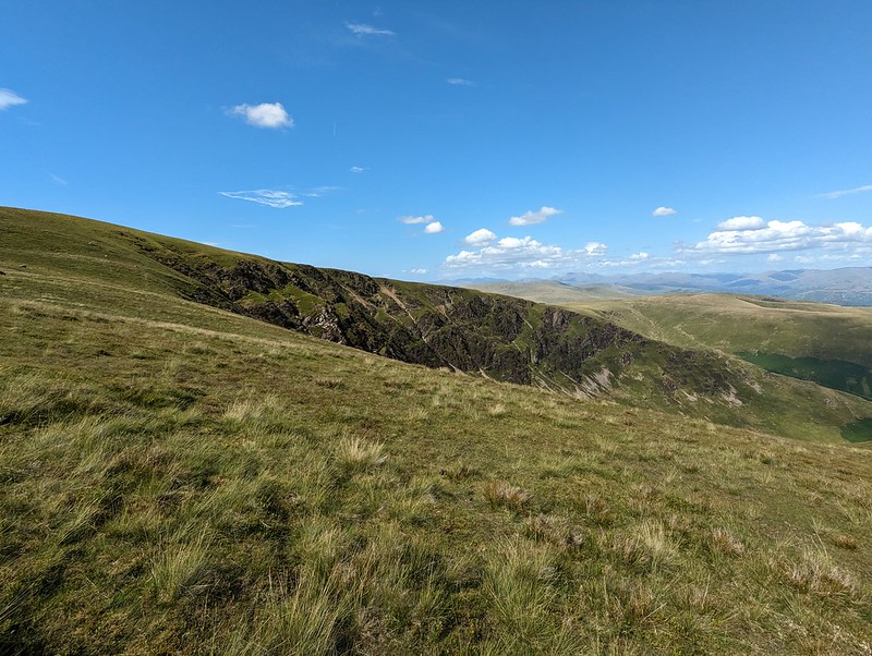
Looking down on Bleak How.Heron Crag and Langstrath.A steepish section.Looking to Sergeant’s Crag
On the last part of the ascent, the path loops drunkenly back and forth following broad ledges separated by short slabby crags. You could probably take a more direct route, but it’s pleasant walking so why bother?
Sergeant’s Crag and Langstrath.Sergeant’s Crag again.
Too many photos of Sergeant’s Crag? I liked the look of it!
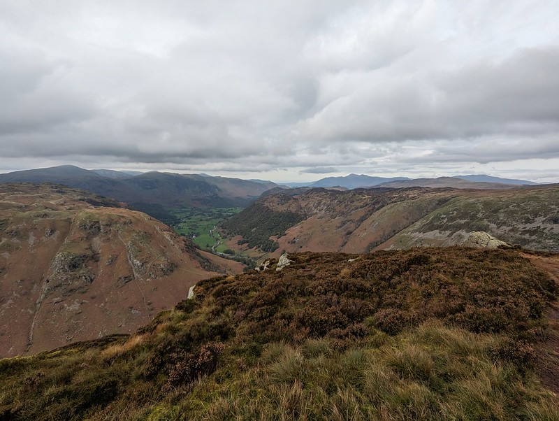
The long Glaramara ridge.Looking north to Skiddaw.
On the top, the inevitable cup of tea, a video-call with my Mum and Dad, and a brief conversation with another walker. I saw surprisingly few that day.
Sergeant’s Crag.Again!Looking back to Eagle Crag.Eagle Crag again.Glaramara.
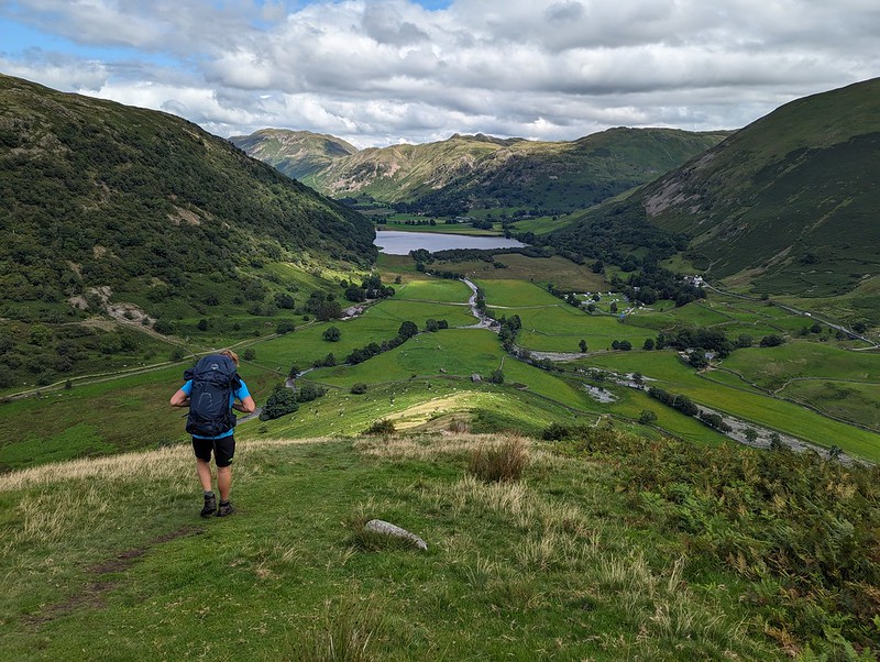
Not much more climbing to attain Sergeant’s Crag and then I took an off-piste route down towards Langstrath, aiming to avoid Bull Crag and Blea Crag and the crags around Lamper Knott. With hindsight, I’m not sure it’s a route I could recommend: there’s a lot of crags and even the grassy parts are liberally sprinkled with boulders and rocks. Still, I enjoyed it immensely.
An off piste descent.Approaching Langstrath Beck.
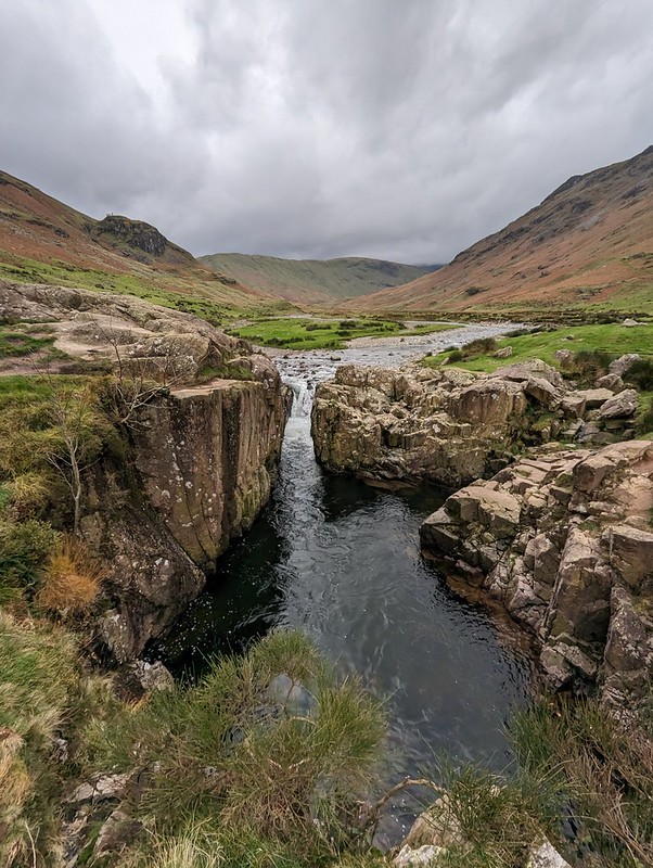
I wanted to come down this way so that I could have a peek at the renowned Black Moss Pot…
Blackmoss Pot.
There were quite a few wet-suited swimmers nearby, the ones who had just finished swimming advising and encouraging another group who had just arrived. I’ve never swum here myself and it’s on my wish-list, although not for a grey day towards the end of October!
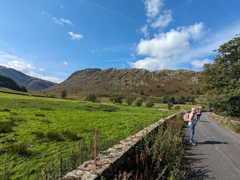
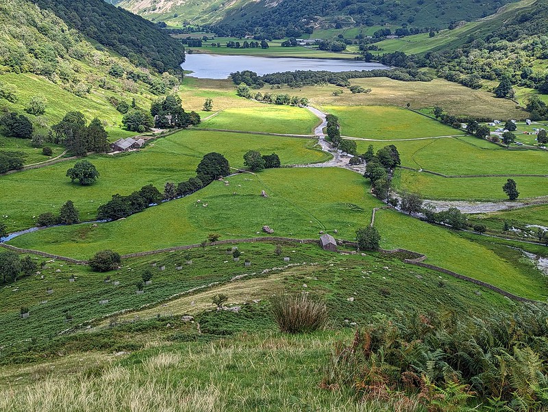
Langstrath Beck.Stonethwaite.Map the first.Around six and a half miles – but there’s a lot packed into that short walk.
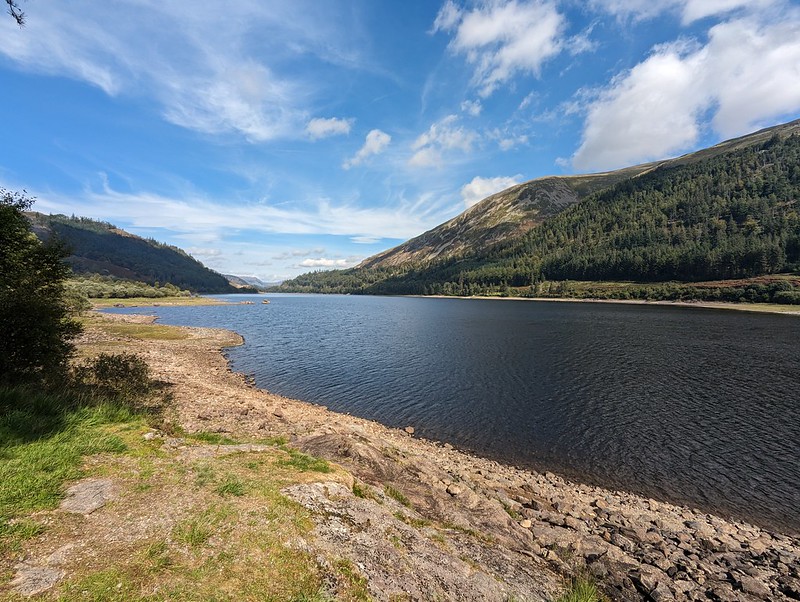
What with Harrop Tarn being my new favourite swimming spot, after my visit last June, I was keen to share it with my nearest and dearest, so when A asked about a potential swim when her boyfriend L was visiting, that was the first suggestion which sprang to mind. The small parking area at Stockhow Bridge was already jam-packed when we arrived, but we were lucky to find some roadside parking close to the junction of the currently closed road around the western side of Thirlmere and the main road.
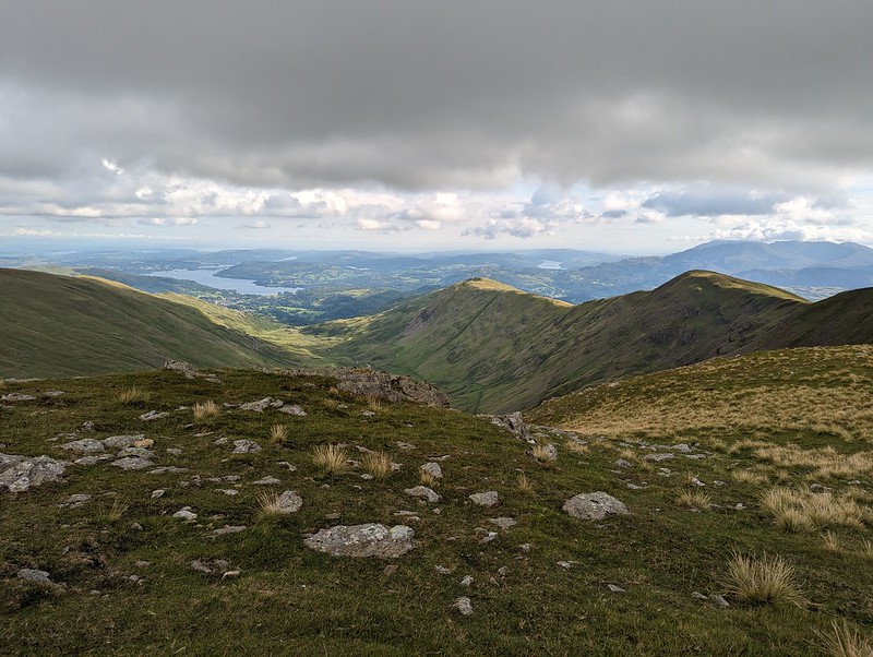
Thirlmere Reservoir.Helvellyn.
It was a beautiful day, quite warm, so the views back across the reservoir to Helvellyn and its satellites gave me frequent welcome excuses to stop for a breather and take photos during the steepish ascent.
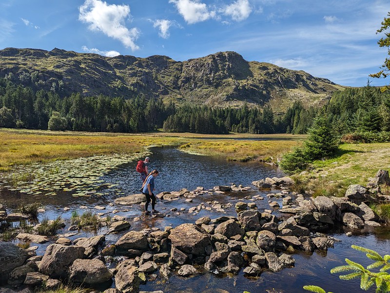
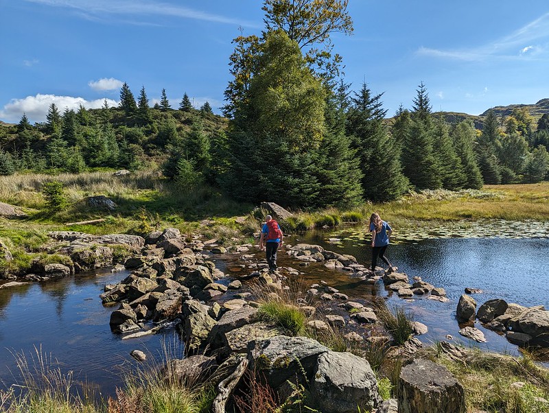
The rocky bowl which holds Harrop Tarn.A and L racing each other on the stepping stones.
There’s a bridge across Dob Gill near the outflow from Harrop Tran, but A insisted on a race across the stepping stones. And then again with a headstart. And again with a more generous headstart, but L is a triathlete and clearly very agile, and no amount of leeway was going to get our A across first.
L was ready and into the water before I’d even undone my laces. Then out again even faster. Apparently the water was cold. He wasn’t wrong. I guess triathletes are used to the luxury of a wetsuit. A is undeniably much hardier than I am: she and her friend S (the Tower Captain’s daughter for long-suffering readers) have instigated a new ‘tradition’ of going for an open water swim on S’s birthday. In March! This year that was in a stream up by Alston in the Pennines (it looked lovely, but A was a bit vague about the exact location). Last year it was in High Dam, with snow still sitting on the banks. Brrr. Never-the-less, on this occasion she took her time getting in and didn’t last much longer in the water than L had.
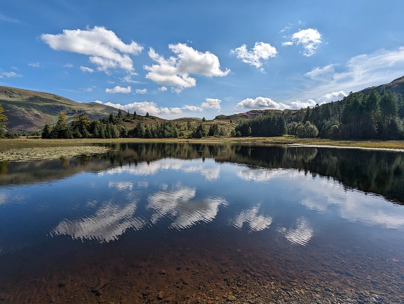
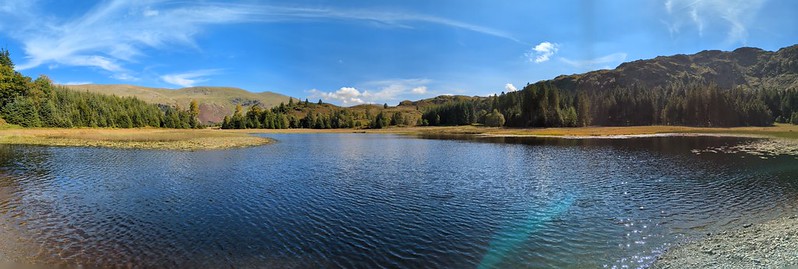
Harrop Tarnpano.
TBH took an absolute age acclimatising herself inch by squealing inch. By the time she was fully immersed I’d almost finished my first circuit of the tarn (like a lot of mammals adapted to cold water I have my own built in insulation). I could see that TBH intended to follow my lead, so I cut a corner and we swam a circuit together. Or almost together – like most people, TBH swims faster than I do.
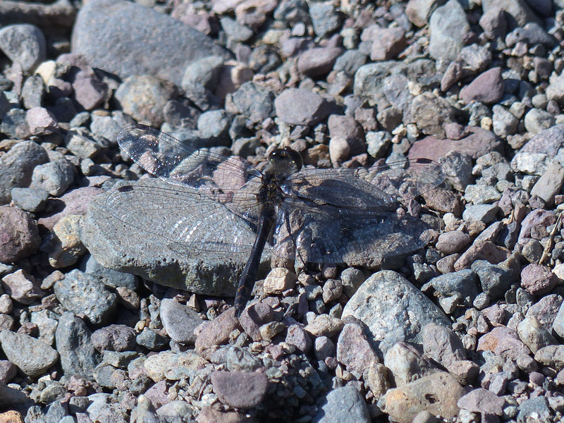
Black Darter.
Not the most attractive dragonfly perhaps, but exciting for me because I’m not aware of having seen one of these before and I certainly haven’t photographed one.
Another stepping stone race. Only ever going to be one winner.Fly agaric?Elephant Hawkmoth Caterpillar.
The first time I saw, and photographed, one of these, was also on a walk with A. And her friend S and the Tower Captain come to that, way back in 2009. One of the photos I took then somehow ended up high on the list of results of an internet image search and for a few years that post would get heavy traffic every July and August when people were trying to work out what it was they’d seen clambering on their Fuschias.
B and I had been discussing various plans for a night or two away somewhere, but dodgy weather and the fact that B was quite busy between work and social commitments had prevented that so far. However, the forecast looked half reasonable, and B could spare me an afternoon and the following morning, so we hastily packed (fortunately my gear had dried out in the day since my wash-out walk from Austwick) and set-out for Patterdale. We parked at Cow Bridge, just north of Brothers Water. I was pleasantly surprised to find that the car park wasn’t full, especially given that it’s free.
Fungi in Deepdale Park.
We used the permission path beside the road through Low Wood. The map shows a much more direct route through the woods on to the Hartsop above How ridge, but I would have been much happier to take the less steep route even if I hadn’t been carrying camping gear. Actually, B had volunteered to carry the tent, so although I had the food, pans and stoves, my pack wasn’t as heavy as it might have been.
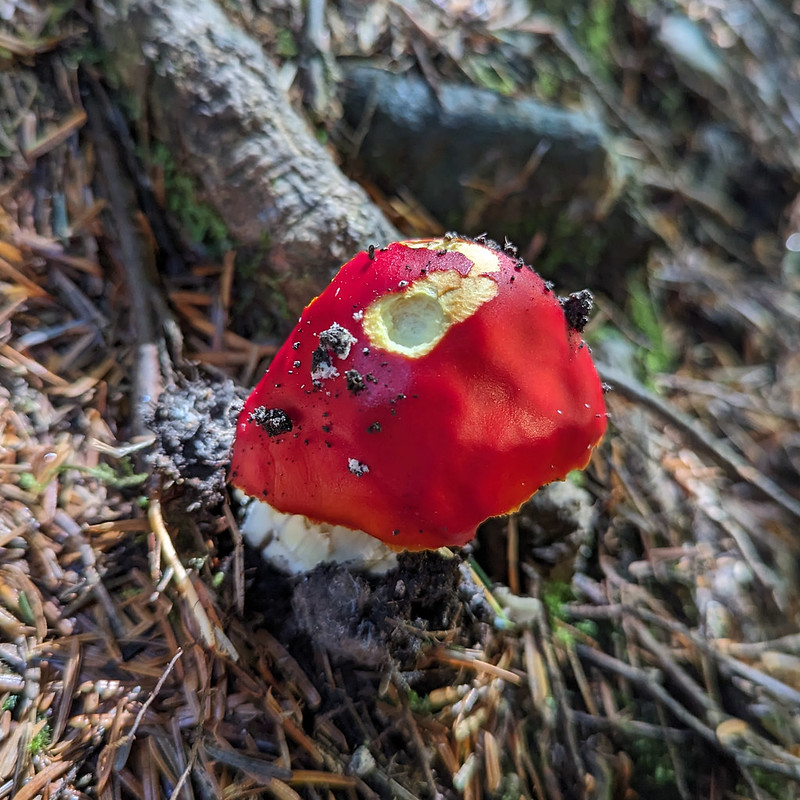
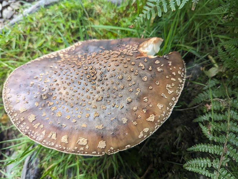
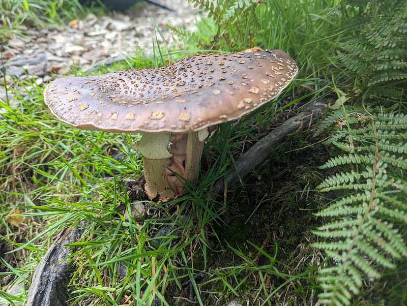
Fungi. Possibly Amanita rubescens?Gavel Pike.
Gavel Pike looks very dramatic from this direction, which is a bit misleading, but it’s a Birkett which is well worth taking a detour to visit when climbing St Sunday Crag.
Arnison Crag and Place Fell either side of Patterdale.Arnison Crag, Great Mell Fell, Place Fell, and Angle Tarn Pikes from Gale Crag or thereabouts.“So, where are we going to camp?”
The long ridge over Hartsop above How is a lovely walk. It gave us lots of opportunity to look ahead to the various potential campsites I’d identified. I let B make the decision and he was most taken with the idea of dropping down into Link Cove, the craggy corrie below Hart Crag and Scrubby Crag. Although I left the choice to B, that was my preferred option too. I’ve visited Link Cove a couple of times before, ascending in to it on the way up Fairfield from Deepdale, with Andy and Uncle Fester years ago and I’d been wanting to return.
B admiring Dove Crag, Hart Crag and Fairfield. Before succumbing to ‘ant attack’.
There were a lot of flying ants about. We’d decided to stop here for a drink and a snack, but this little knoll seemed to be a particular focus of their attention and we were quickly overwhelmed and decided to move on.
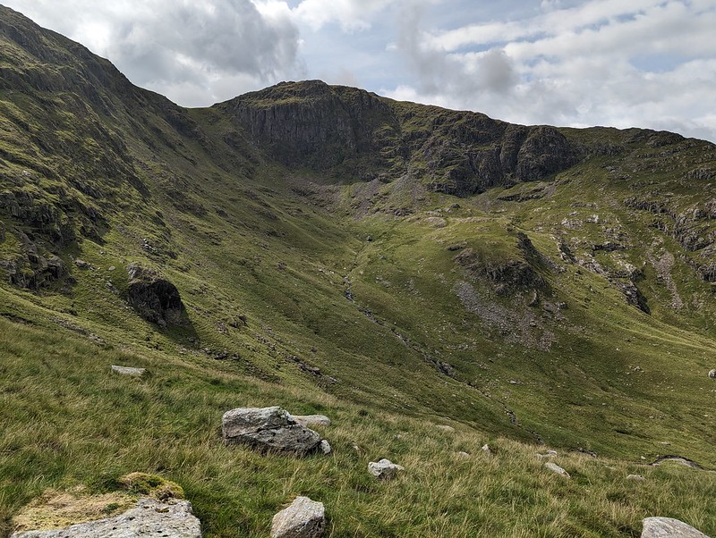
Link Cove dead ahead.Link Cove.
There’s no path into Link Cove. We took a line which angled down below the darkly shadowed crag on the left of the photo above, then climbed again onto the small ridge in the middle of the cwm. This was rough going, but I love getting off-piste into dramatic scenery like this.
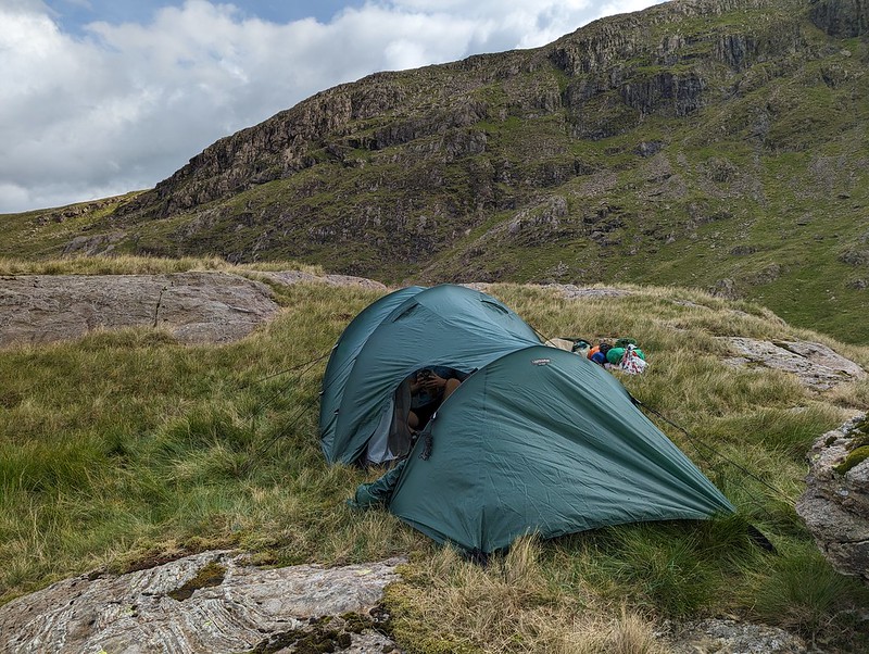
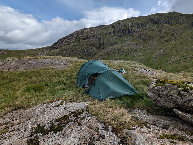
Tent pitched.
It was hard to find any level, dry ground to pitch the tent on. This spot was probably more level than it looks in the photo, but it wasn’t as dry as we might have liked. Then again, after the weather we’d had, it was always going to be hard to find a spot which wasn’t soggy.
Camp in Link Cove.Looking down Deepdale.
Once we were pitched and organised, we left our gear and set-off unencumbered for a circuit of Link Cove. I thought the map suggested that The Step would give a good ascent route and that proved to be the case.
The High Street range from ‘The Step’. Looking across Link Cove to Hart Crag. Our tent is to the right of that short rocky ridge in the cove.St. Sunday Crag.Looking down Deepdale. Hartsop above How ridge on the right.Black Tippet and the northern buttresses of Fairfield. Cofa Pike on the right.
You can’t beat this sort of exploration – we had great views into Link Cove, then suddenly we hit the far side of the ridge and found terrific views of the northern steeps of Fairfield. From Scrubby Crag we decided that a detour to take in the summit of Fairfield was called for.
Dollywaggon Pike, Nethermost Pike, Helvellyn and Striding Edge.Cofa Pike and St. Sunday Crag.
The skies to the east were looking increasingly grey and it was clearly raining not too far away. It would surely be only a matter of time before we got our own shower.
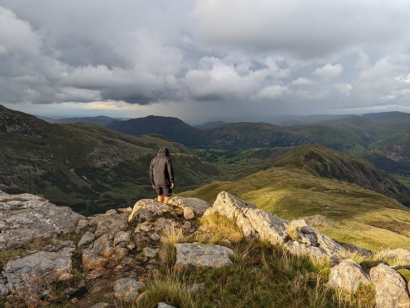
Looking west. Scafells, Gable, Dale Head, Maiden Moor, Northwestern Fells.Rainbow Weather.Looking down Rydal. Great Rigg and Heron Pike on the right. Windermere, Coniston Water and Morecambe Bay in the distance.Link Cove, Deepdale, Hartsop above How. Sunshine and showers.
I thought we could descend, with care, the gully to the south of Scrubby Crag, but B took one look at it and clearly doubted my sanity, so we climbed Hart Crag instead, descended the ridge towards Hartsop above How and then repeated our route down into the cove and back up to our tent.
St Sunday Crag.Descending towards our camp.
Of course, eventually it began to rain and didn’t stop for quite some time, even though the sun was still shining too…
Dove Crag.
We thought we could pick out the path to the cave on Dove Crag which is meant to be a good bivvy spot.
A Link Cove frog.
We were using the tent which we’ve borrowed (seemingly indefinitely) from Andy. It’s not the lightest, but it’s amazingly spacious and the huge porch was superb in the wet – perfect for me to sit in and cook our evening meal (filled pasta, pesto, dried fruit and custard, very satisfying).
Second Day
A breakfast view of Scrubby Crag.
This early morning photo might be a bit misleading. Once again, we seemed to be on the divide as far as the weather was concerned. To the west, all was blue sky and sunshine; to the east, low cloud. And although the wind was, I was sure, blowing from the west, the cloud was sweeping up Deepdale towards us. Still, we at least had sunshine whilst we breakfasted and packed up.
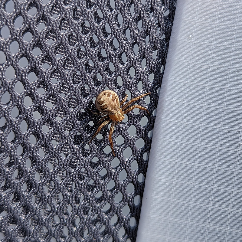
A Crab Spider. Xysticusspecies. I think.Ascending The Step again, with atmospheric clouds.
We wanted to regain the main ridge, and could choose to retrace either our ascent or our descent routes of the previous evening. Despite its initial steepness, we agreed that The Step was much the easier going of the two. With the cloud sweeping in across the crags, it was atmospheric too.
Hart Crag.The ‘view’ to the East.And to the West. Coniston and Langdale Fells. Heron Pike and Great Rigg in the foreground.Looking South from Dove Crag. Windermere, Coniston Water and Coniston Fells.
As you can see from the photos, the weather was really odd, but it gradually improved as we wandered over Dove Crag and then Little Hart Crag and finally along another delightful ridge to High Hartsop Dodd.
Middle Dodd, Little Hart Crag and Red Screes.Looking down Scandale. Scandale Tarn in the foreground.
I have several spots in the area earmarked as potential wild-camping locations. Scandale tarn is one of them.
Middle Dodd and Red Screes.The complex terrain at the head of Dovedale.B descending towards Brothers Water.Looking down on the Romano British enclosed stone hut circle.
I’ve waffled on before about this amazing archeological site. Historic England has a thorough physical description, but doesn’t supply much detail about who lived here and how they might have lived.
Another view of the settlement. The knoll on the right is the site of the oval cairn.A final rest stop.Looking up Dovedale.
This was effectively a day’s walk divided in two, which I think is probably a good way to plan an overnighter. We both enjoyed it immensely and were both keen to go again. B also wanted to borrow some gear and take some of his friends wild-camping, but then he got a job pitching and packing-up much bigger tents (marquees) and his availability became severely restricted. Who knows, maybe next summer we’ll get a mutually convenient spell of settled weather and manage to fit some more trips in?
Old friend GFS was staying at Chapel Stile campsite in Nether Wasdale with his family and had been regularly posting pictures from the fells he’d bagged. I messaged him wondering whether he wanted to meet on the Sunday for a walk. He suggested Black Combe. I was a bit puzzled, since I knew he was enthusiastically ticking off the Wainwrights, as well as the Ethels he would tell me about later in the day, and Black Combe is not on that list. It turned out that he’s using an online list which includes all of the Outlying Fells, so, as far as he was concerned, it is a Wainwright and would add to his tally.
GFS suggested an eleven o’clock rendezvous, which, being jealous of my weekends, especially if the sun is shining, I felt was inordinately late, so I set-off early and drove a little past our prearranged meeting point for a quick swim in the Irish Sea at Silecroft.
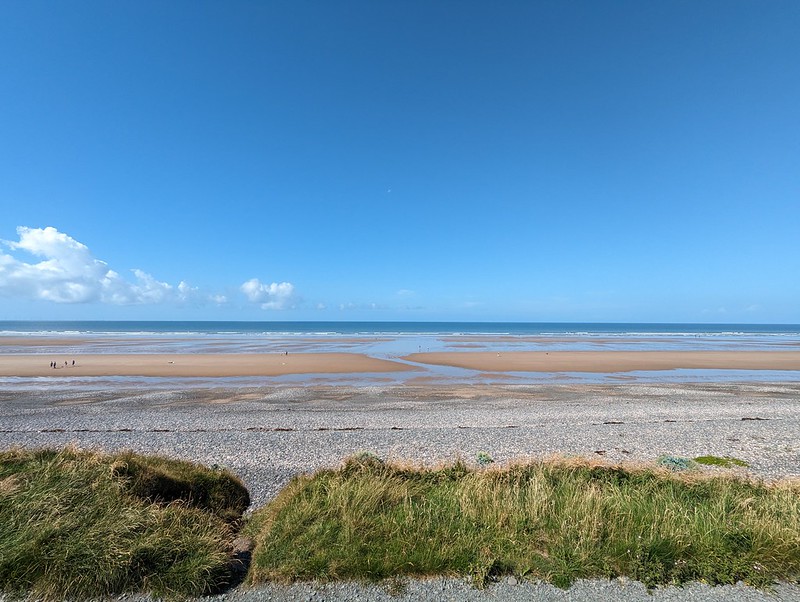
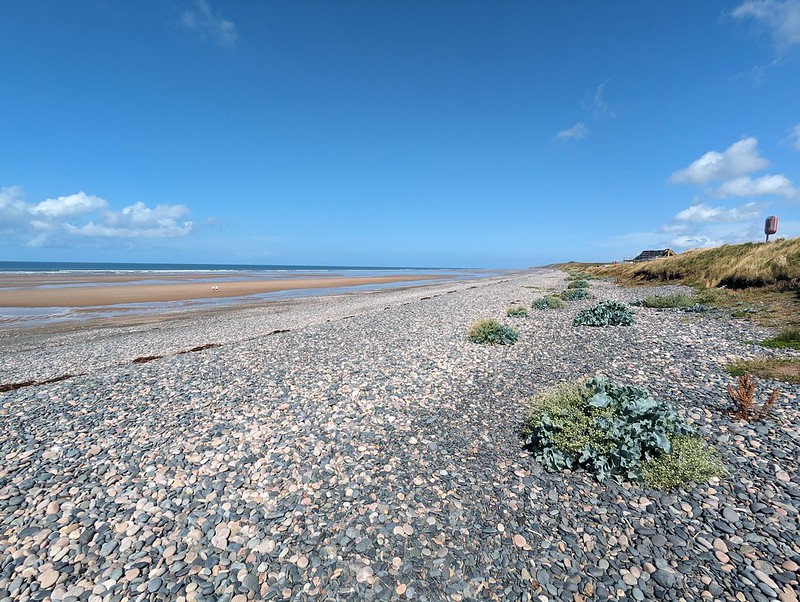
The shingle upper region of Silecroft Beach.
I don’t think that Cumbria is reknowned for its beaches at all, but the one at Silecroft is lovely, and I suspect many others are equally good.
Sea Kale.
My first encounter with the beach here was also in July, over thirty years ago, when I came kayak-surfing here with a group of trainee teachers. It was far from being the first time I’d kayaked, but it was probably my first experience of surfing and it could easily have been my last. We were using some rather battered fibreglass canoes and the cockpit coping on my boat was cracked. I only discovered that my spray-deck was firmly jammed into that crack when I’d capsized and was trying to roll out of the boat in the way we’d been taught in the safe environs of a swimming pool. Of course, I should have been performing an eskimo roll, but I never quite mastered that. After a little confusion followed by some hasty tugging at the spray-deck, I managed to free myself, and was surprised to find myself the centre of attention and a worried looking instructor chest deep in the sea in an effort to rescue me. Reckless youth and adrenaline junkie that I was then, my only regret was that he wouldn’t let me go back out for some more surfing. These days I’ll settle for an intentional swim without the preceding drama. There were a few people on surfboards near where I swam, but the waves looked unpromisingly tiny. Perfect for a swim with a great view however.
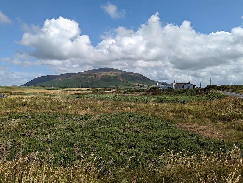
Black Combe.
I’d taken a leaf out of Andy’s book and had been perusing satellite images of the area in search of liking looking parking spots. As a result, I’d suggested a layby just off the main road, opposite the church at Hallthwaite.
Cinnabar Moth Caterpillars and lots of Soldier Beetles making love not war.The Duddon Estuary from Baystone Bank, Bank House on the left.GFS descending Baystone Bank.
The path which descended Baystone Bank should have alerted us to what was to come – it started out sketchy and quickly disappeared completely in the enveloping bracken.
Stoupdale Beck.
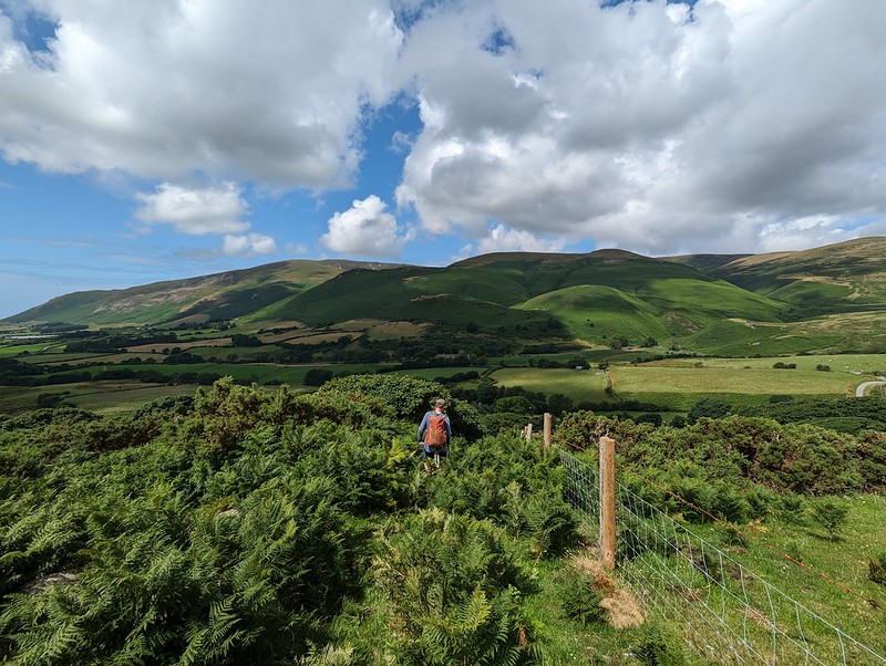
Having reached access land just below Force Knott the plan was to turn sharp left and to follow the path, marked on the OS 1:25,000 map, which follows the intake wall. The idea was to work our way around to Whitecombe Beck and then on to the Horse Back ridge which I have often admired, but never climbed. My plan then extended to a lengthy descent route which would conveniently take in the Swinside stone circle, which has also been on my wish list for a very long time. As Iron Mike famously opined: “Everybody has a plan until they get punched in the face.” In this case, the knuckle sandwich was delivered by the head-high bracken.
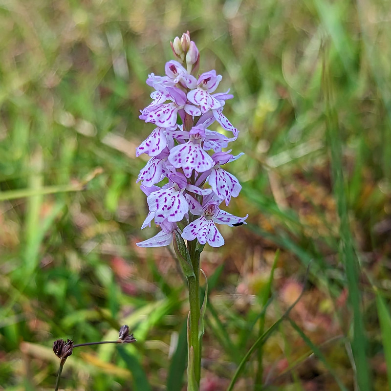
Heath Spotted-orchid.
Sadly, the advertised path simply didn’t exist, at least not in July, and the path which climbed up beside Stoupdale beck, which seemed like the only alternative, briefly lulled us into a false sense of security before also disappearing. Orienteering maps use different colours to indicate the density of the undergrowth, the most extreme being ‘fight’ I think. This was definitely a fight. Fortunately, we eventually climbed above the worst of the bracken and the path returned without a hint of embarrassment or any sign of an apology.
The Duddon Estuary again.
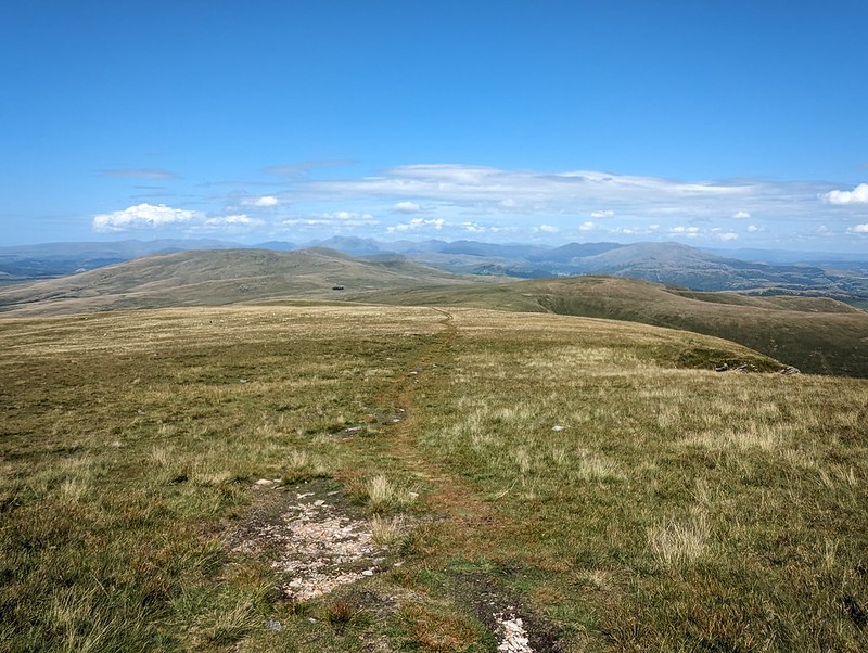
From that point on it was just a steady climb to the top, in glorious sunshine.
GFS in the region of Whitecombe Moss.Looking towards Whitfell, The Scafells and the Coniston Fells.GFS and me by the trig pillar.The huge cairn on the south top.View to Walney Island beyond the mouth of the Duddon. Piel Island can also be picked out.
We sat with our backs to the large cairn, eating our lunch, admiring the extensive views and discussing potential onward routes, since we had already climbed much of my proposed descent route and we were keen to avoid another quarrel with the bracken as much as possible.
Horse Back ridge.
I had a theory that a route around the southern edge of the actual Blackcombe corrie might be our best bet. I thought the path beside Whitecombe Beck would be bracken free.
Eller Peatpot.
It did turn out to be a good route, with only a modicum of bracken bashing as we approached the track by the stream.
Ominous clouds heading our way.Blackcombe Beck.
Our new route involved a lot of road walking, mostly on quiet lanes which was fine, but from Fox and Goose Cottages to Lanthwaite Bridge along the busy A595. Whilst we were walking that section, TBH rang me to find out whether we were back at our cars yet? She was in Heysham, to pick up Little S, and reported a torrential downpour which had immediately flooded the roads and made driving difficult. We’d been watching showers tracking across the sea in our direction for a while and now the sky was dark and threatening.
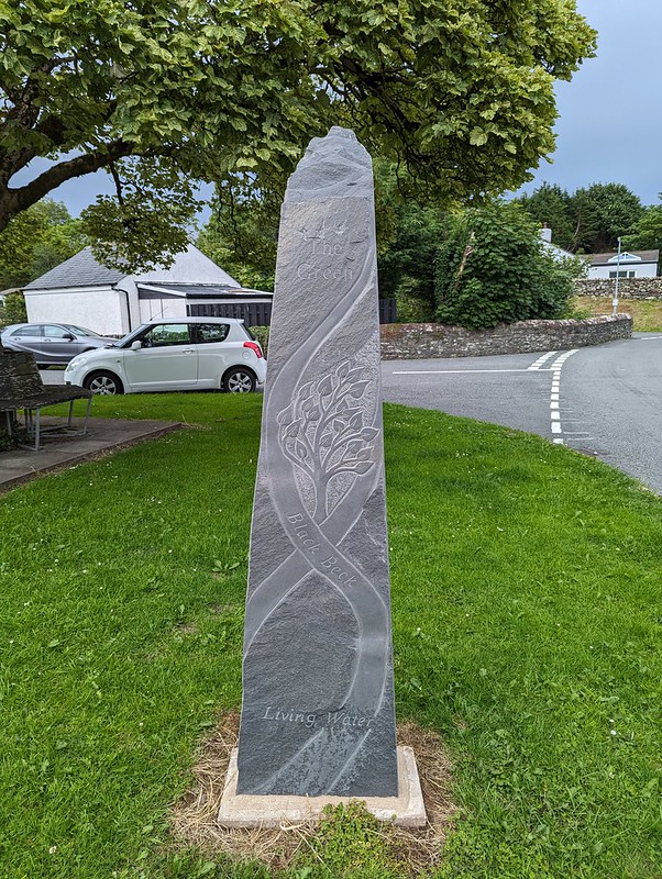
New (2020) Standing Stone at The Green.
I was very taken by this new standing stone, which was carved by Irene Rogan and Danny Clahane. It took a while to find out anything about it, but I eventually turned up a suggested walk taking in this and the Swinside Stone Circle, which I shall have to come back to try at some point.
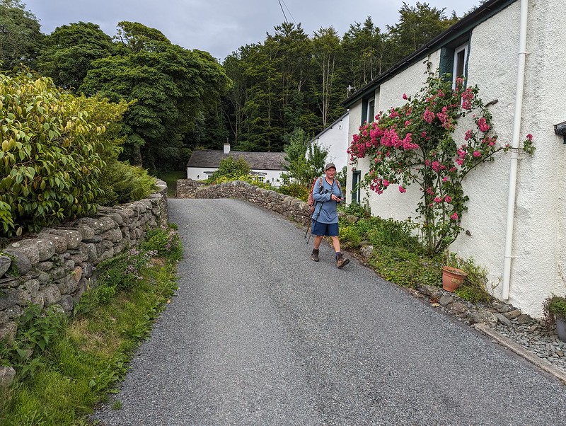
Black Beck at Hallthwaites.GFS in Hallthwaites.
In the event, the first drops of rain only began to fall as we arrived back at our cars and the anticipated heavy showers didn’t materialise at all. Despite the best efforts of the bracken, it was a terrific walk. It’s always interesting to chat with GFS and I remember that we covered a lot of ground in our conversation.
MapMyWalk gives a little under 10 miles and almost exactly 700m of ascent.
After faffing about on the campsite for most of Sunday morning we set off for a short drive down the Newlands valley. Unfortunately, we timed it so that we hit the early stages of the Keswick half marathon. It’s not so many years ago that I ran this race myself, although I’m sure that it wasn’t staged on a bank holiday weekend then. I do remember that the amount of traffic on the narrow roads rather spoiled what should have been an excellent run.
Sam was asleep when we arrived at our parking spot so while the rest of the party embarked across the Newlands valley, I sat in the car with him and listened to the radio. When he woke up we crossed Newlands Beck:
And soon found the rest of the party having their lunch on the slopes of Cat Bells.
The weather was quite odd with sunshine, but also drops of rain in the air. From our picnic stop it was a short walk…
To Hawes End on Derwent Water – a top spot for throwing stones into the lake:
Having a run around:
Or a natter with your Dad:
At Hawes End we caught on of the scheduled launches that circuit the lake. The front of the boat was open and the very front seats were empty. Naturally the kids were very excited and made a beeline for those seats. Nobody thought to warn us why they were empty. Out on the Lake it was windy and choppy and as we hit the wake of another boat a huge wave crashed over the bows and into our laps. On the first leg of the journey we just about managed take it in our strides and laugh off the discomfort, but after picking-up more passengers at Nichol End the waves were bigger and more frequent. The boat was packed and there was no real way to get the kids out of the way of a proper drenching. Some of them were very wet and cold, and Ben in particular was upset, but kids are remarkably resilient and once we were off the boat they were soon racing around the shore and swinging on a barrier.
In Keswick we had a bit of a wander around a park and a quick stop for a snack.
Captions are invited for this photo, my own thoughts were either:
I thought that you had the meths!
Or, perhaps Jane is thinking:
I never was in favour of Care in the Community
Not all of my friends are scruffy, just the oldest and closest ones.
After several hours of trying it finally began to rain in earnest. We boarded another launch to complete our trip around the lake, but this time got seats inside. The rest of the trip was fun, but as we approached Hawes End the rain showed no sign of abating. Angela, Jane and Matt disappeared to fetch the cars and Andy and I were left to try to maintain the spirits of the flagging children. Ben had slept on my lap around the lake, and not surprisingly didn’t appreciate being woken up to be taken out into the rain. I ended up carrying him up the hill to the road. There was a bit of a mix up with the cars but on the whole the children did very well despite the cold and wet and my rendition of several verses of If you’re miserable and you know it. I did bribe them with chocolate biscuits. And a cuckoo serenaded us whilst we waited – the first that I can remember hearing for quite some time. Given recent gloomy reports about the dwindling numbers of migrating birds it was nice to have the opportunity to hear it, even in the pouring rain.
We arrived back at the campsite to see a short-lived but stunning rainbow over Skiddaw and from that point the sky began to clear in preparation for a glorious day on Monday…
Over the long weekend we were away camping at Lane Foot Farm near Thornthwaite in the Lake District. This is an annual get together which has been going on in various venues for over 20 years now, but which in recent years has changed in character due to the addition of ankle-biters.
On Saturday we took the assembled clans for a short walk to Braithwaite in search of a playground. The sun shone and although the gorse has been flowering for months (does it ever stop?), this was the first time this year that it has given off its wonderful coconut scent.
There were butterflies about too: peacocks, orange-tips and what I think was a small blue. It’s extraordinary that these are the first that I’ve seen this year – a testament to how unusually cold March and April have been.
We had to settle for a picnic snack in Braithwaite, but who needs a playground when there are woods to explore on the way home?
Worms and beetles are endlessly fascinating to Ben and here he had a willing accomplice. He also made a fine collection of pine cones. The woodland floor was carpeted with wood sorrel:
The tiny flowers are beautiful and the shamrock like leaves have a pleasant sharp grape-skin flavour.
The path follows the bottom edge of the wood and we had great views across the valley to Skiddaw:
We finally found our playground in the last field that we crossed before arriving back at the farmhouse:
As parents we took it in turns to bite our tongues as the kids vied with each other to climb highest up the tree.
The children had organised their own queuing system so that even the youngest of them had his turn:
He was also discovering challenges nearer the ground, where it seemed as if the root system had been exposed or perhaps several trees in close proximity had cooperated and joined to become one:
Later we enjoyed a barbecue…
…and the evening light on Skiddaw:
The kids took seats into the trees behind our tents and took great delight in eating their hotdogs in their ‘den’.