
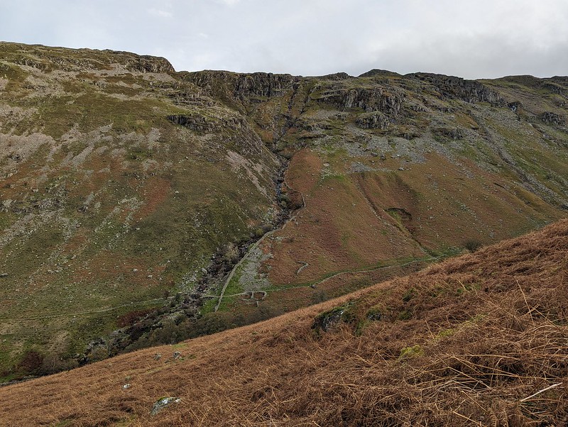
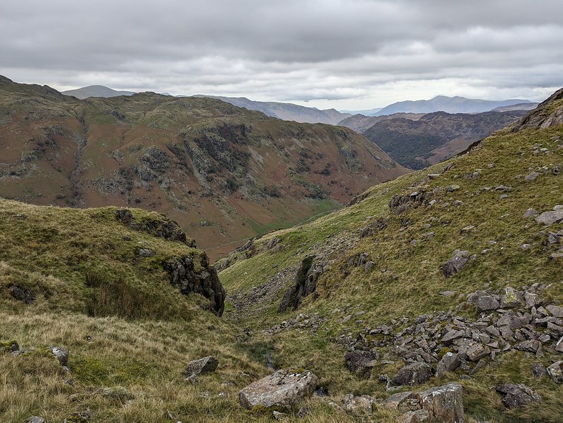
An October outing up two Wainwrights which I’ve never climbed before. Not sure how I’ve managed to avoid them. Anyway, my mistake: they were well worth a visit. In the photo above, you can see that there’s a lot of steep stuff on Eagle Crag and it’s not immediately obvious how you’ll get up there, but fortunately it’s all plain sailing; the path winds round to the left of the first knoll, Bleak How, and then finds a passage through the remaining complexities.
Having said that, after the initial easy plod along Stonethwaite Beck and then a boggy bit of field, I turned away from the valley path either too late or too early and then found myself fighting spiky, crumpled bracken uphill, but eventually managed to reach a sketchy path by the wall which then lead me around the craggy parts of Bleak How and on to the ridge.
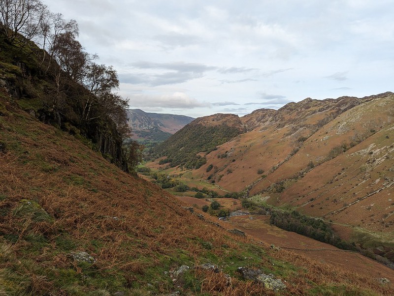
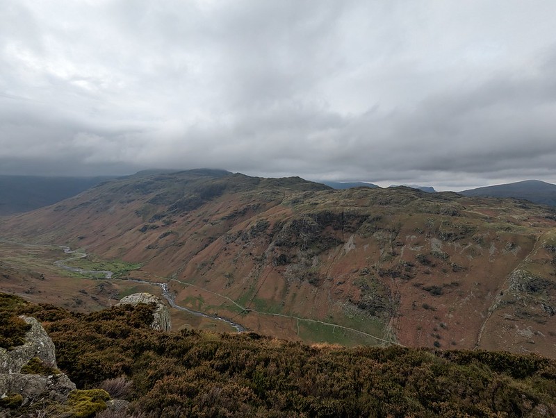
This stream, unnamed on the OS map, has carved quite an impressive looking amphitheatre below Long Band on the opposite fellside and I filed away the idea of having a gander there on a future walk.

It was a fairly grey day, with occasionally the odd drop of moisture in the air and the apparent threat of rain, but none-the-less good walking weather.

The route follows a resourceful path which finds first a broad ramp with crags above and below, and then switches back up an easy-angled gully through what might have seemed impenetrable cliffs.

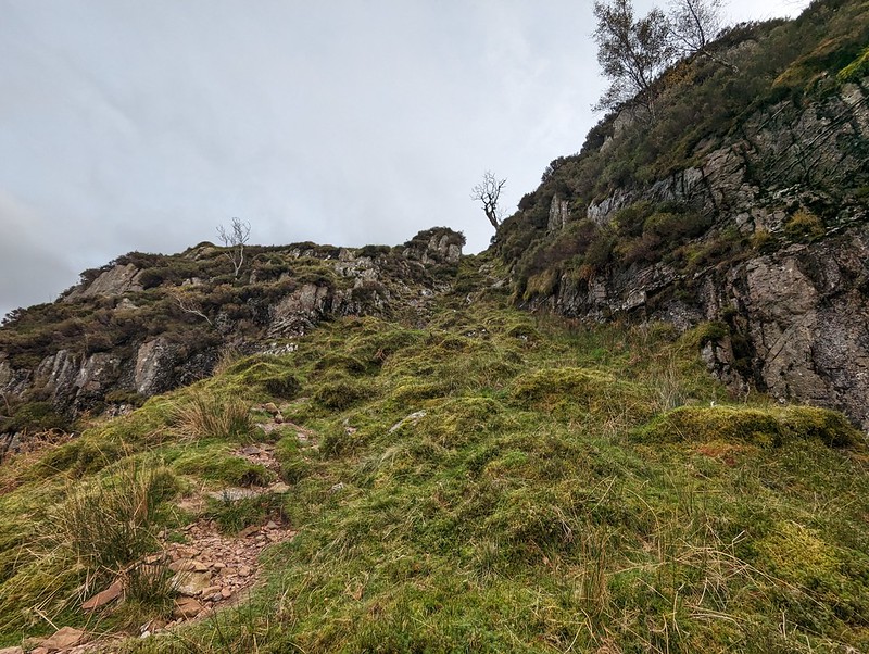

On the last part of the ascent, the path loops drunkenly back and forth following broad ledges separated by short slabby crags. You could probably take a more direct route, but it’s pleasant walking so why bother?


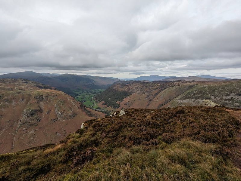
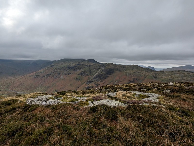
Too many photos of Sergeant’s Crag? I liked the look of it!
On the top, the inevitable cup of tea, a video-call with my Mum and Dad, and a brief conversation with another walker. I saw surprisingly few that day.


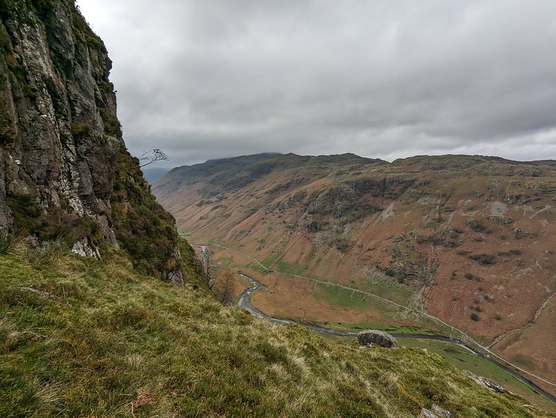
Not much more climbing to attain Sergeant’s Crag and then I took an off-piste route down towards Langstrath, aiming to avoid Bull Crag and Blea Crag and the crags around Lamper Knott. With hindsight, I’m not sure it’s a route I could recommend: there’s a lot of crags and even the grassy parts are liberally sprinkled with boulders and rocks. Still, I enjoyed it immensely.

I wanted to come down this way so that I could have a peek at the renowned Black Moss Pot…
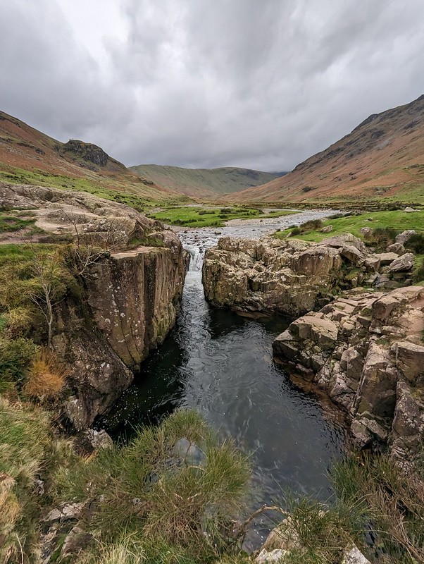
There were quite a few wet-suited swimmers nearby, the ones who had just finished swimming advising and encouraging another group who had just arrived. I’ve never swum here myself and it’s on my wish-list, although not for a grey day towards the end of October!


I made a right dog’s breakfast of the climb up Eagle Crag, missed the first switch back by the rowan tree (on the photo you’ve marked as “a steepish section”), so then missed the easier zigzag route up the shelves of rock. I walked past the rowan tree by about 30 metres to a really nice viewing point (in wainwrights book) and then tried to go straight up from there, not advisable. I loved the view from Eagle Crag though!!
Blimey – I imagine of you miss the main route it would be more than a bit hairy! I remember reading your account, I’ve had it in my mind to do these two ever since.
Looks like a nice walk perfect for summer to wild swim.
Yes, a summer day would be ideal, although I think Blackmoss Pot is very, very popular.
I loved this post. I thought I recognised your first image. A quick check of my 2015 Coast to Coast walk photos, confirmed it. I’m unable to name the peaks, but we walked up this valley to Eagle Craig [I think], entered fog and had difficulty finding the trail towards Grasmere.
Yes, the Coast to Coast follows Stonethwaite Beck and Greenup Gill past Lining Crag on its way to Grasmere. I walked it in about 1990 with my parents and my brother. Happy days!
These are a couple of missing Wainwrights for me in the central party of the NP. Most of my other missing ones are all around the fringes. Looks like a fine ridge. And Blackmoss Pot definitely needs a swim visit.
Me too. The ones I’ve never done are mostly outliers like the ones we ticked off a few weeks ago. I’m as sure as I can be, given my dodgy memory, that I’ve never done these before. I was half-thinking that you would be reminding me of a long-distant time that we had done them together!
Would probably need to do Blackmoss Pot mid-week. Early in the morning. Or in the dark, or some such.
Yeah – I think it’s up there with Tongue Pot as one of the everybody’s wild swim radar. At least we can say we discovered Tongue Pot before the masses did!
We were there first! I don’t think there are many places in the Lakes left to be discovered, judging by the amount of stuff I see on social media about swimming there.